Page 1
University of Louisville University of Louisville
ThinkIR: The University of Louisville's Institutional Repository ThinkIR: The University of Louisville's Institutional Repository
Electronic Theses and Dissertations
9-1948
Distribution of the herpetofauna of Kentucky. Distribution of the herpetofauna of Kentucky.
Symoine Kamin Laufe University of Louisville
Follow this and additional works at: https://ir.library.louisville.edu/etd
Part of the Biology Commons
Recommended Citation Recommended Citation Laufe, Symoine Kamin, "Distribution of the herpetofauna of Kentucky." (1948). Electronic Theses and Dissertations. Paper 1991. https://doi.org/10.18297/etd/1991
This Master's Thesis is brought to you for free and open access by ThinkIR: The University of Louisville's Institutional Repository. It has been accepted for inclusion in Electronic Theses and Dissertations by an authorized administrator of ThinkIR: The University of Louisville's Institutional Repository. This title appears here courtesy of the author, who has retained all other copyrights. For more information, please contact [email protected] .
Page 2
UNIVmSI TY OF LOUISVILLE
DIsmIBUTION OF T.HE HiRPETOFAUNA OF KEN'IDeKY
A Dissertation
&.tbmi tted to the haul ty
or the Graduate Sohool of the University of Louisville
In Partial Fulfilbnent of the
Requirements for the Degree
Of Master or Soience
Department or Biology
By
Sy.moine Kamin Laufe '"
1948
Page 4
-
DIS1RIBUTION OF mE H!RPBTOFAtTNA. OF KENTUCKY
Page 5
TABLE OF CONTENTS
Introduction ••••••••••••••••••••••••••••••••••••••••••••••••• 1
Methods •••••••••••••••••••••••••••••••••••••••••••••••••••••• 2
Faotors Influenoing Faunal D1stribution •••••••••••••••••••••• 3
Physiography ••••••••••••••••••••••••••••••••••••••••••• 3
Soils ••••••••••••••••••••••••••••••••••••••••••••••••• 11
Drainage •••••••••••••••••••••••••••••••••••••••••••••• l5
Climate •••.•••••••••••••••• ~ ••••••••••••••••••••••••••• 17
Bo~ ••••••••••••••••••••••• ~ •••••••••••••••••••••••• 22,
Herpetofauna of Kentucky •••••••••••••••••••••••••••••••••••• 36
State Summary ••••••••••••••••••••••••••••••••••••••••••••••• 36
Faunal Diatr1bution ••••••••••••••••••••••••••••••••••••••••• 42
State Wide Forms •••••••••••••••••••••••••••••••••••••• 42
Regional Distribution ••••••••••••••••••••••••••••••••• 43
Conclusions ••••••••••••••••••••••••••••••••••••••••••••••••• 52
Bibliography •••••••••••••••••••••••••••••••••••••••••••••••• 53
Page 6
"
IN'lRODUC TION
Although the herpetofauna of Kentucky is extensive and
varied. it has received muoh less attention than that of most
other states. Many herpetologists have reported on various phases
of the state's amphibians and reptiles. but for the most part these
reports are discrete. either pertaining to a collection. or a
generic or specific study. Henoe. there is no single adequate work
which aptly desoribes the herpetology of Kentuoky as a whole. ~hen
one realizes the keystone positio~ of Kentucky in relation to nor
thern and southern forms, the need of a zoogeographical summary of
the state becomes even more apparent. 1herefore. the purpose of
this paper is to summarize and oorrelate the herpetofauna with the
natural faotors which influenoe its present distribution in
Kentucky. It is the purpose of this work to present not a detailed
and oomplete studY6 but rather a generalized summary of the avail
able oolleotions and published reports in the hope that it may be
of value not only as a reference but as a stimulus for further
investigation of the zoogeography of the state.
In the oourse of colleoting and organizing
this scattered mass of material, many people have offered
assistance without whioh this work could not have been oompleted.
'lhe author is d-eeply indebted to Dr. William M. Clay of the
Biology Department of the University of Louisville who suggested
this problem and has helped engineer its course. The author would
like to thank Dr. P. A. Davies of the University of Louisville 6
M. Graham Netting of the Carnegie Museun of Pittsburgh, and
Page 7
(2)
Roger Barbour of Morehead State Teachers College for pennission
to examine and use their Kentuoky oollections and data. The author
is grateful to Dr. HarveyB. Lovell who supplied much valuable in
formation pertaining to the botany of the state.
MEnIODS
To ascertain whioh species and subspecies occur in
Kentucky the author has utilized many published lists, handbooks,
generio monographs, reports on speoies and subspecies, and private
collection material. !bese publtoations will be found in the
bibliography. Locality reoords and collection data for each s.peaies
and subspeoies were plotted first on large state maps. It was
originally planned that these maps oould be reduoed and used as an
integral part of the text. However, since no inexpensive method of
repl'Qduotion was available, the distribution of these forms in the
state can only be expressed verbally.
In the attempt to determine those factors that could
poss~bly limit the distribution of the herpetofauna in Kentuoky,
major physiographic, climatic and botanic influences had to be
considered. Fran the vast amount of literature pertaining to
these faotors the author has summarized their major features and
charaoteristics which seam to play an important role in the present
distribution. Same writers (vide infra) have recognized six major
physiographic areal of the state. It seems desirable to employ
these same subdivisions in the following discussion of ecological
faotors.
Page 8
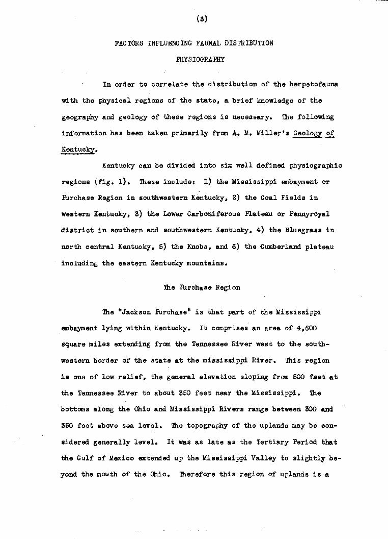
(3)
FACTORS INFLUENCING FAUNAL DISTRIBUTION
mY S IOGRAmY
In order to correlate the distribution of the herpetofauna
with the physical regions of the state, a brief knowledge of the
geography and geology of these regions is necessary. Thefollowing
information has been taken primarily fran A. M. Miller t s Geology.££
Kentucky.
Kentucky can be divided into six well defined physiographic
regions (fig. 1). These include: 1) the Mississippi embayment or
PUrchase Region in southwestern Kentucky, 2) the Coal Fields in
western Kentuoky, 3) the Lower Carboniferous Plateau or Pennyroyal
district in southern and southwestern Kentuoky, 4) the Bluegrass in
north central Kentucky, 5) the Knobs, and 6) the Cumberland plateau
including the east~rn Kentucky mountains.
~e PUrchase Region
The "Jackson Purchase" is that part of the Mississippi
embayment lying within Kentuoky. It comprises an area of 4,600
square miles extending from the Tennessee River west to the south
western border of the state at the mississippi River. This region
i8 one of low relief, the general elevation sloping from 500 f~et at
the Tennessee River to about 350 feet near the Mississippi. the
bottoms along the Ohio and Mississippi Rivers range between 300 and
350 feet above sea level. The topography of the uplands may be oon
sidered generally level. It was as late as the Tertiary Period that
the Gulf of Mexioo extended up the Mississippi Valley to slightly be
yond. the mouth of the Ohio. 'lhereforethis region of uplands is a
-
Page 9
FIG. I PHYSI OGRAPHlC ~[GIONS li~LUEGRASS IPURCHASf
JlWE~N CML FIELDS mp£NNY~YAL
YKN08S
W [ASTERN COAL fIEl-OS
m.Oio·37
Page 10
(4)
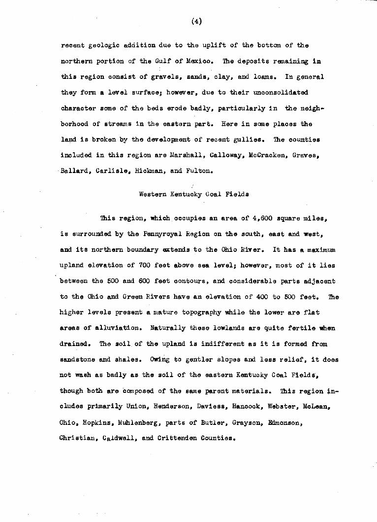
reoent geologic addition due to the uplift of the bottom of the
northern portion of the Gulf of Mexioo. 1118 deposits remaining in
this region consist of gravels, sands, clay, and lO8ms. In general
they fOnI! a level surfaoe; however, due to their unconsolidated
charaoter same of the beds erode badly, partioularly in the neigh
borhood of streams in the eastern part. Here in same plaoes the
land is broken by the developnent of recent gullies. 111e oounties
included in this region are Marshall, Calloway, McCracken, Graves,
Ballard, Carlisle, Hickman, and Fulton.
Western Kentuoky Coal Fields
1his region, which occupies an area of 4,600 square miles,
is surrounded by the Pennyroyal liegion on the south, east and west,
and its northern boundary extends to the Ohio River. It has a maximum
upland elevation of 700 feet above sea level; however, most of it lies
between the 500 and 600 feet oontours, and considerable parts adjacent
to the Ohio and Green Rivers have an elevation of 400 to 500 feet. 1he
higher levels present a mature topography while the lower are flat
areas of alluviation. Naturally these lowlands are quite fertile when
drained. 1he soil of the upland is indifferent as it is formed from
sandstone and shales. OWing to gentler slopes and less relief, it does
not wash as badly as the soil of the eastern Kentucky Coal Fields,
though both are composed of the same parent materials. 1his region ~n
eludes primarily Union, Henderson, Daviess, Hancock, Webster, MoLean,
Ohio, Hopkins, Muhlenberg, parts of Butler, Grayson, Edmonson,
Christian, Caldwell, and Crittenden Counties.
.Q
Page 11
(5)
Pennyroyal Region
the Pennyroyal in Kentuoky occupies a total area of 8,000
square miles. It inoludes, with the exception of the Western Coal
Fields, all of the state lying south of the Knobs, west of the eastern
Kentucky Mountains including the Cumberland plateau, and east of the
Tennessee River. It possesses an altitude of 1,000 to 1,200 feet along
its .northern edge at Muldraugh's Hill, Which is a steep escarpment to-
ward the Bluegrass region. South and west from the escarpnent the
elevation gradually falls to 800 feet, and at the southwest portion of
the area to 600 feet. Fart of this region, which forms a narrow strip
extending from the Ohio River about 35 miles west of Louisville 8outh-
ward to the Temessee border, and around westward to the Cumberland
River, was treeless in the early days and consequently was named the
"Barrens" by the early Kentucky settlers. ~e geologic formations
exposed in this entire region belong to the Mississippian fonnation.
Three Main divisions, Waverly, Cavernous Limestone, and Chester, are
noted and will be discussed in the order named. /'
Waverly_ Ule Waverly formation, the oldest of the three,
composes the surface rook of the Cincinnati antioline through this
region. Ule surface in ge.neral is quite hilly, although level in
Taylor ~ounty. The soil is poor but is better than the region of the
knobs of the same formation because it is not completely devoid of
limestone. Ule counties primarily affected by the outcrop in this
region are Alle~,Monroe, Cumberland, Barren, Metcalf, Adair, Casey,
Taylor, Lewi s, and Rowan.
Cavernous Limestone Area. On ei ther side of the Waverly
outcrop is a belt of cave limestone. In this section the highly
4 ....
Page 12
(6)
soluble limestones have been excavated by underground waters. In same
parts sandstones still form a protective covering over the Limestone,
while in others these have recently been removed. The regions from
which the sandstone capping has been removed are pitted vdth sinks,
forming a karst country. These sinks are former caves and caverns
from which the roofs have been removed. lhe limestone strip south
of the Western Coal Fields is not as typical karst country as the
Green River area. Counties included in this region are Meade, Hardin,
Larue, Hart, ~onson, Barren, Simpson, Logan, Todd, Christian,
Trigg, Lyon, Caldwell, Crittenden, Green, Clinton, Wayne, Russell,
and Pulaski. All except the last four cCDpose the "Barrens".
Chester Area. 2be Chester portion of the Carboniferous
Plateau is composed primarily of sandstones and shales giving it a
rough topography and a poor soil. It constitutes a strip five to
ten miles wide, and is found chiefly surrounding the Western Coal
Fields. This belt, composed primarily of Cypress sandstone, is
marked off from the rest of the carboniferous district by a rise in
the level of the country. 2be Chester terrace stretches from
Breokenridge County through Grayson, Hardin, Hart, warren, Logan,
Todd, Christian, Caldwell, and to the Ohio River again at
Crittenden County
North Central Bluegrass
The Bluegrass Region in its most inclusive sense is bounded
by the Ohio River on the north, and a semicircular belt of knobs on
the east, south, and west. It comprises an area of nearly 8,000
square miles. The Bluegrass Region proper, that limited to the
aM
Page 13
(7)
outorop of Ordevician strata, is a rolling upland, the highest portion
of whioh is on the Jessamine dome of the Cinoinnati uplift. Here, it
reaohes an elevation of 1,050 feet. Blsewhere in the region the
highest portions are about 950 feet; however, in general the upland
level ranges between 800 and 900 feet above sea level.
The Bluegrass Region can be divided into three subordinate
areas based on the differenoes in topography and soil whioh are de
pendent on the underlying formations. 1hese areas suoceed each other
outwardly from the Jessamine dome and the order of outoropping is from
older to younger. ~ese areas en~erated from within outward are the
Lexington (Trenton) - Cynthiana Limestone Area, E:len Shale Belt. and
the Maysville - Richmond Limestone Belt.
Lexington-Gynthiana Limestone ~ (Inner Bluegrass). It is
the outoropping of the Lexington Limestone on and around the Jessamine
dame that gives this area its distinctive topography and soil. ~e
underlying High Bridge limestone also outorops along the Kentucky
River and its main tributaries. but enters in very little to the
oharacter of this area. 1he Lexington region is one of gently
rolling topography and very rioh soil due to the high phosphorus
oontent. 1he area of Lexington outcrop is a thousand square miles.
It includes Harrison, Nicholas, Bourbon, Clark, Madison, Gerrard,
Boyle, Mercer. Anderson, Franklin, Scott. Fayette, Woodford, and
Jessamine Counties. ~e Lexington limestone of this area is a
mildly karst country, pitted with small sinks and having oonsiderable
ulJderground drainage. 1he Cynthiana portion forms mainly the outer
border of the Inner Bluegrass, being widest in Clark, Bourbon,
Nicholas, and Harrison Counties. It exists also as patches and
strips within the Lexington Limestone area. It covers an area of
Page 14
(8)
1,400 square miles. '!he Cynthiana soil is not as rich as the Lax:ington.
Bien Shale.!!!!!. Lying further out on the Jessamine dome the
Btl en Shale is an irregular ring arouDdthe Inner Bluegrass for an area
of 2,500 square miles. It ax:tends five to ten miles on the east aDd
west slopes, ten to thirty on the north slope, and is extremel~ nar
row on the south side because of a very steep dip. Fenneman states
that in topography, soil, culture, and wealth this district and the
Inner Bluegrass are strongly contrasted; only the altitude is
similar. 1 Because of the predominance of shale in thi s region it
has been eroded and as maturely d~ssected by streams as the eastern
plateau. Just east of Lax:ington in Scott aDd Franklin Counties
there are outliers of Eaen Shale in the Inner Bluegrass. One cammon
ly accepted theory of their origin is that they are old buffalo
trails. '!he Bien Shale belt lies in western Meroer, eastern
Washington, Anderson, Shelby, northern and western Franklin, south
eastern Henry, southern Grant, Owen, northern Scott, eastern and
western parts of Pendleton and Harrison, extreme eastern parts of
liobertson, Nicholas and Bourbon, western Montgomery and Madison,
eastern Clark, northern Gerrard, Lincoln and Boyd Counties for
only one mile or so.
Maysville-Riohmond ~ (Outer Bluegraa'). Sucoeeding
the men Shale Belt to form the outer rim of the bluegrass is the
Maysville-Riohmond (Cincinnatian) with ita limestone over shale.
1. Fennaman, N. M., 1938. Fbysiography of Eastern United States,
p. 429.
-....
Page 15
(9 )
lhis portion covers an area of 3,200 square miles. lhe oountry is
more level and resembles the Inner Bluegrass. lhe remaining counties
of the north oentral Bluegrass Region belong to this area.
Knobs
Surrounding the Bluegrass Region from West Point on the
Ohio to Vanceburg on the Ohio is a belt ten or more miles wide
oharacterized by the presence of conical knobs. Geologically these
knobs are formed of sandy aDd shaly members of the Waverly and are
known as knobstone. ille valley floors between the knobs are usually
of Devonian shale and the inner fle.t border which skirts the region
is formed of Devonian sandstone and Niagara limestone and shale.
lhose knobs which are conical in shape are composed of Waverly
sandstones and shales, while those with flat summits are oapped
by Mississippian limestone and basal conglomerate of the coal
measures. ille knobs are outliers of a once more extended formation,
mainly the ~ssissippian, the margin of which, retreating in the
direction of the dip, forms the northward fronting escarpment known
as Muldraugh's Hill. 1he valley floors from which the knobs arise
reach an altitude in some cases of 1,050 feet and the tops of the
knobs reach a height of 1,200 to 1,400 feet above sea level. Knobs
oan be found in Trimble, Oldham, Jefferson, Bullitt, Spencer, Nelson,
Washington, Marion, Boyle, Casey, Linooln, Rookoastle, Gerrard,
Madison, Estill, Powell, Montgomery, Menifee,~: 'Rowan, FIEllling,
and Lewis Counties.
Page 16
(10)
The Cumberland Plateau inoluding the Eastern
Kentuoky Mountains (Eastern Coal Fields)
The indented border stretching from opposite Portsmouth
on the Ohio to the Wayne-Glinton County line at the Tennessee
boundary marks the western boundary of this region.
all of Kentuoky lying east of this arbitrary line.
It inoludes
Geologically
it is known as the eastern ooal fields. Its strata are oomposed of
sandstones and shales. The total area of this region is 10,450
square miles. this maturely disseoted plateau if restored to an
even surface would reach an altitude of 1*000 feet at its northern
11mi t and 2,000 feet at its southern boundary. In the southeast .
portion of this plateau there are true mountains of elevation, the
Pine and CumberlaDd Mountains. These ranges are similar in that
both are oomposed of sharply inclined strata and the summit of eaoh
is formed of a basal ooal measure conglomerate. The dip of the
strata of Pine Mountain is to the southeast, While that of the
Cumberland Range is to the northwest. The latter forms the
Kentucky-Virginia border for a distanoe of 36 miles. These two
mountain ranges are parallel and the distance between them is
about 16 miles. Between the two ranges, as well as throughout the
entire Cumberland Plateau there is an intricate system of watershed
ridges separated by narrow steep-side4 valleys. These plateau ridge.
are highest between the mountain ranges. '.!he highest of these ridges
is known as the Black Mountain of Harlan County. The greatest point
of altitude is 4,160 feet. The highest point on the Pine Mountain
Range is only 3,600 feet above sea level.
,,'*
Page 17
(11)
Along the western border of the plateau the conglanerate
series rises into view. Vertioally trenched by streams, it i8 a yery
rugged border strip. .Dlis strip arerlooks steeply the neighboriag
bluegrass and presents a face inter:mediate in height to the lower
carboniferous plateau. It is a region of pilot knobs, gorges, bold
headlaDds, waterfalls, and natural bridges. Dlis region is sometimes
known as the Pottsville Escarpnent.
SOILS
Dle Purc~se Region
!he soils of the Purchase Region fall into two main soil
groups. Jll of the region, except along the Mississippi and Ohio
Rivers, is part of the Quarternary soil area. Dlis transported soil
is formed of sandy and silt loams aDd loess. Chemically this area
is deficient in phosphorus and nitrogen. !hess naturally are the
limiting faotors. The amount of oalcium and potassium present is
ample. The soil is fairly a01d due to inadequate drainage Which is
poor enough in some areas to produce swamplands. Along the afore
mentioned rivers the soil belongs to the River Alluvium. Here the
vital elements are present in ample quantities and the soil 1s more
alkaline. By and large the entire lUrchase Region is quite productiye
for rann orops.
Western Kentucky eoal Fields
The soil of the Western Coal Fields is made up of two soil
areas. The entire region, nth the exoeption of a narrow strip along
the Ohio River, is a residual soil resulting from diSintegration of
OR
Page 18
(12)
sandstone, conglomerates, shales, and coal. 7his part of the region
is deficient in phosphorus and nitrogen, and consequently these elemEill ts
become the limiting factors. 7he amounts of potassium and calcium pre
sent are ample. 7he poor drainage in this area leads to swampy areas
and naturally fairly acid soil.
7he area alcng the Ohio River possesses river alluvium. 7his
is very fertile transported soil which is well supplied wi tb. phosphorus,
potassium, calcium, and nitrogen, and is not particularly acid. Unlike
other soil areas the subsoil is not ohemically different from the top
soil. It may be noted that, with :the exception of river alluvium, the
parent materials of the Western CoalFields are similar to those of
the Eastern Coal Fields, but that the great difference in relief and
drainage does in some part change the soil pioture of the two regions.
7he Pennyroyal Region
7he soil of this region is divided into four soil areas,
Chester, St. Louis, Waverly, and a narrow border of River .Alluvium
along the Ohio River.
1he Chester area surrounds the Western Coal Fields am
is one of the least productive regions of the state. It is a residual
soil for.med fram Chester sandstone, shale, and limestone parent materials.
1he soil is sandy and extrElllely defioient in phosphorus. Nitrogen may
also be considered a limiting faotor. Caloium and potassium are pre-
sent in ample amounts. 7he soil is very acid with a anall water holding
capacity.
7he St. Louis area follows the oaverncus limestone belt in
south central Kentuoky. Here loams predominate underlayed by red clay
subsoil. 111e 80il is residual in nature resulting fram the
Page 19
(13)
disintegration 'of limestone. Dle area is richer than the Chester in
Ehosphorus and calcium. Potassium is ample but nitrogen and phos
phorus constitute the limiting factors. The land is well drained
and hence not too acid. Because of the underground drainage this
region is subject t. frequent droughts. Most of the soil is ver,y
produotive for cultivated orops.
The Waverly area follows the waverly outcrop. It also
possesses a residual soil ·for;med from sandstones, Shale, and thin
limestone. The soil is very poor, sandy in nature, lacks organic
matter, and washes badly. There ~s a great phosphorus and nitrogen
deficiency, but a good supply of soluble potassium and calcium is
present. The soil possesses a very high acidity.
The few miles of this physiographic region Which borders
the Ohio River possesSes river alluvium. The soil is high in the
necessary elements and has a low acidity.
North Central Bluegrass
The so11 of the Bluegrass Region proper has been divided
into two main soil areas, Trenton and Cincinnatian. The Trenton area
includes the Inner Bluegrass and possesses the most fertile soil of
the state. It is a residual soil resulting from the disintegration
of Lexington limestone. It approaohes a chooolate color and pos.esses
red or yellow subsoils. Usually this land is very well drained, con
sequently the area has the most alkaline soil of the state. The soil
is well supplied with all the vital elements with possibly the ex
ception of nitrogen, which is the only limiting fac.tor. The supply
of phosphorus is so abundant that Averitt states that on the average
Page 20
(14)
it oontains five to six times as much of this element as the other soils
of the state, except small areas of the lower Cinoimlatian.2 As ia to
be expected, this laIld is highly prized for cultivation.
~e Cincinnatian area inoludes the Etlen Shale and Outer
Bluegrass portion of the north central Bluegrass Region. lhis residual
soil is formed fram blue limestone, shale, silioeous mudstone, and
oaloareous.sandstone. Although this area is well drained, the soil,
partioularly the subsoil, is more aoid than that of the Trenton area.
The amount of phosphorus present is about one-fourth that of the Trenton.
The Caloium present, although less than the Trenton, is ample. The soil
possesses a large amount of potassium. As in the Trenton, nitrogen 1s
a liJniting factor. Dle men Shale outorop which surrounds the Trenton
is fairly unproduotive. nus is due to the low water holding capacity
of the soil, together with the great runoff oapacity which sub,jects
this region to frequent droughts. lhe Outer Bluegrass more closely
resembles the Trenton. Along the Ohio River river alluvium is present.
Knobs
The physiographic region of the knobs is composed of two soil
areas, Silurian and pevonian. The Silurian is formed fram impure lime
stones, magnesium limeston~, and shales; While the soils of the Devonian
originate from oherty limestones and black bituminous shales. ihis soil
is deficient in phosphorus and nitr~gen. It is not as well supplied
with potassium as the Trenton and Cincinnatian areas, but the amount
2. Averitt, S. D., 1915. Ky. Agricultural ~perimental Station
Bull. 193., p. 145.
Page 21
m.110·37
FIG. 2. DRAINAGf
Page 22
(15)
present is ample. The quantity of caloium present is sUffioient. The
area is well drained, but the pH is low due to the calcium washing out.
Limiting factors of this Boil are nitrogen and phosphorus. '
Eastern Coal Fields
The soil of this area is formed from sandstone, sha~e,
oonglomerates, and ooal. Generally speaking the land is well drained
and the soil is not too aoid. It is deficient in phosphorus and nitrogen,
therefore these two elements may be oonsidered the limiting faotors.
ihe caloium and potassium oontent, is adequate. Along with the Chester
and Waverly areas the Eastern Coal Fields are one of the'least productive
areas of the state. It is interesting to note that the extreme western
border of this area which is bedded in basal oonglomerates, is much
less fertile than the rest of the area. The amount of the vital elements
present here is markedly less than in the eastern part of this region.
EVen the soil is more aoid.
DRAINAGE OF 'lHE STATE
(Fig. 2.)
The Puro~se Region
The furchase Region is drained by the Ohio, Mississippi,
and Tennessee Rivers. The Tennessee drains the eastern third, the
Mississippi the western third, and the remainder of the region is
drained by the Ohio.
Western Kentuoky Coal Fields
The Western Coal FieJ.d is drained primarily by the Green
River. The northwestern portion is drained by the Ohio, and the
A t IWQ
Page 23
(16)
western third by the Tradewater River.
!be Pennyroyal Region
'lhe extrEme western margin of this region is drained by the
Tennessee River. 'lhe southwestern and southeastern portions are drained
by the Cumberland River. 'lhe Green River drains the extended central
region of the Pennyroyal. 'lhe parts of this region bordering the Ohio
River# espeoia!ly in Meade and Breckenridge Counties# are drained
directly by the Ohio. A small section which borders the southwestern
border of the knobs is drained by the Salt River. 'lhe northeastern
extension of the Pennyroyal is drained by the Ohio# Licking, and
Kentuoky Rivers.
North Central Bluegrass
The Bluegrass Region is drained by four major streams. 'lhe
extreme northern and northwest portions are drained by the Ohio River.
'nle Salt River drains the rEillainder of the western third# the Kentuoky
the centra! third, and the forks of the Licking River drain the
eastern third of this region.
Knobs
1bis narrow belt is drained by the Ohio River along its
northeastern ~ northwestern boundaries. 'nle remainder of the
western portion is drained by the Sait River. 'lhe KentuoJcy River
drains the southern and southeastern portio~s, and the Lioking
River drains the remaining western portion of the knobs. A small
seotion of . the knobs which extends into Casey County is drained by
-
Page 24
(17)
the Green River.
Hutern Coal Fields
Six major streams are important in the drainage of the
Eastern Coal Fields. 1he extreme northern tip whiCh reaohes the Ohio
River is drained by it. The eastern part of the region as far south
as Letoher County is drained by the L1 ttle and Big Sandy Rivers. 111e
major part of the oentral portion is drained by the Kentucky River.
that part of the region lying north of the Kentuoky drainage basin
is drained by the Licking river •. ]he southern portion of the
Eastern Coal Fields inoluding the mountain ranges is drained by
the Cumberland. River.
CLIMATE
Kentuoky possesses a continental olimate of the warm humid
type. It is oonsidered oontinental due to the marked contrast between
winter and surmner, humid because the mean annual preoipitation exceeds
twenty inches (so muoh so, that Kentuoky's average is over forty inohes),
and warm in that the growing season is long and warm enough for corn,
and in the southwestern oounties, long enough for ootton. Throughout
the state there is no drastio oontrast in olimate. However, there are
some appreoiable olimatio ohanges fran north to south and east to w •• t
but these are gradual. One must keep in mind that latitude is signifi
cant beoause the Gulf of Mexioo is a great source of moisture. 'Ihe
following data is estimated from the maps in Visher's "Climate of
Kentuoky" ( figs. 3,4,5,6.).
Page 25
HI' VI:iHER. m.li.o·S7
fl'-.3 MEAN ANNUAL TEMPERJ\TU~
Page 26
(18)
fhe FUrchase Region
fhe Purohase Region has the warmest olimate of the state.
fhe mean anwal temperature ranges from 5SoF. to slightly over oOoF.
in a north to southwest direotion. The average winter temperature
varies from 360 F. in the north t.o slightly more than 37oF. in the
south. ::!he normal minimum temperature is oOF. from north to south,
While the highest reported temperatures range from 107.50 F. in the
east to over 110°F. in the western part of the area. 1he average
annue.l preoipitation varies from 44" in the northwest to 47.5" in
the southeast. Per season the average rainfall in autwnn is 9.5"
to over 10" in an east-west direotion; in winter slightly less .than
II" to nearly 13" in a northwest to southeast direotion; in spring
slightly les8 than 13" to 13.5" in a northwest to southeast direotion;
and in sumner less than 10" to 11" in a west-east direotion. ']he
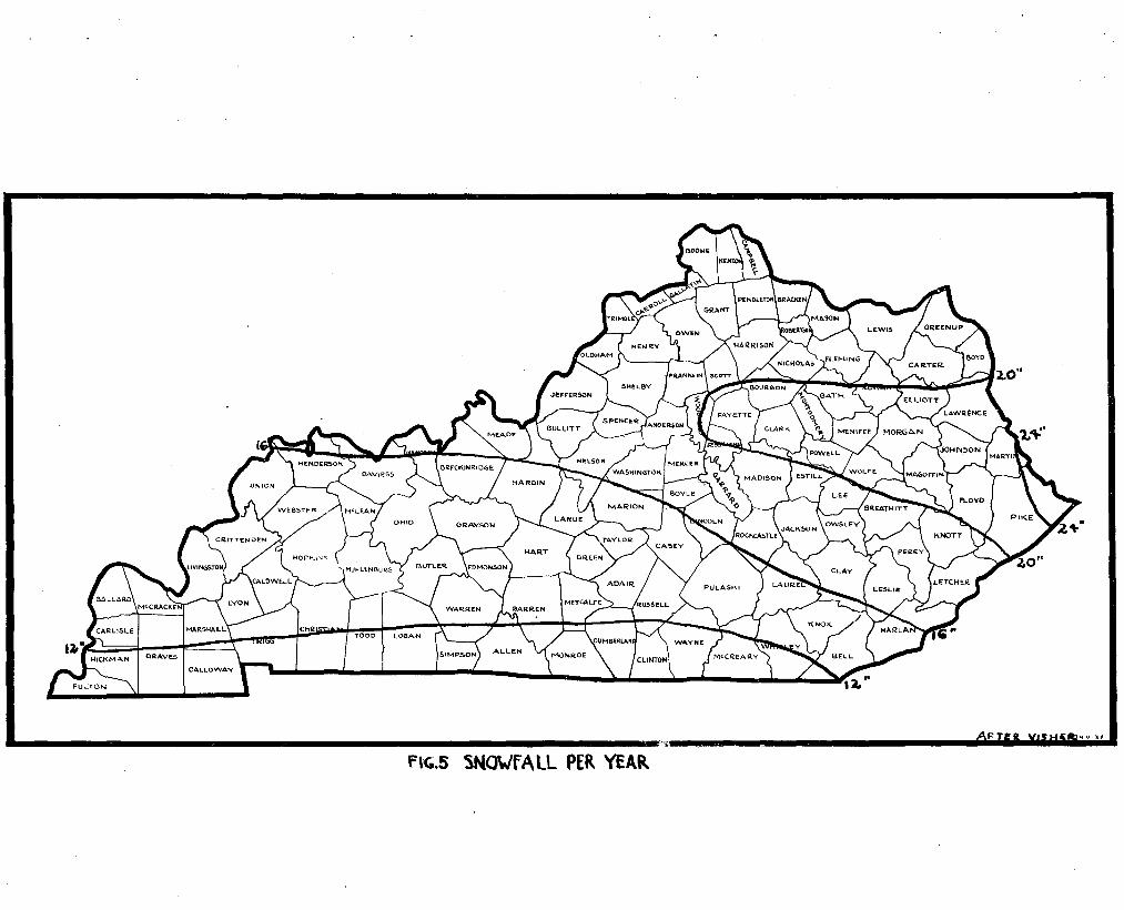
average snowfall per year ranges from 13" in the northern portion of
the region to greater than 12" in the southern portion of the region.
The average length of growing season without frost is 195 to 200 days
fram east to west. 1he first killing frost in the fall ooours about
the 20th of Ootober and the last in the spring about the lOth of
April.
Western Coal Fields
The mean anlUlal ternperature of the Western Coal Fields
varies from 500 F. in the eastern seotion to about 580,. in the
western portion. fhe range of average winter temperature 1s 350F.
in the north to approximately 36.50 F. in the south. ::!he normal
minimum winter temperature ranges from -2.50 F. to _loF. in a
"
Page 27
• ; ... , at [(5 X'a?fs§ m.oH'
FJ'~1-'AVEMGf ANHUAL P"£CIPI1AliON
Page 28
(19)
similar direotion, while the highest recorded temperature varies from
107oF. in the eastern portion to 110oF. in the western portion of th~.
region. 1be average allDU~l preoipitation ranges trom 44" to 46.5" in
a north-south direction. Per season the average rainfall in autumn is
9" to 9.5" in an east to west direction; in winter it is 10" to 12.5"
in a north to south direotion; in spring it is 13" to 13.5"; and in
summer it is 11" to 12" in a west to east direction. 1be average
snowfall per year varies from 16" in the northern section to 13" in
the southern. lhe average length of growing season without frost is
185 days in the east to slightly ~er 190 days in the west. 1be average
first filling frost usually ocours from the 15th to the 20th of Ootober,
and the average last killing frost in the spring ooours around the 15th
or 20th of April.
The Pennyroyal Region
the mean annual temperature of this extensive region is
aooF. in the west to 54.SoF. in the eastern portion. lbe average
winter temperature varies in a ~orth-south direotion from slightly
oolder than 350 F. to 31oF. the nonna1 minium temperature extends
from OOF. in the southern portion to -2oF. in the north, mile the
highest recorded temperature is 101oF. in the east to llOoF. in the
extreme western projection of this region near the Ohio River. 1be
average annual precipitation varies in a north-south direction trom
43.5" to over 50". Per season the autumn raintall is 9" with the
exception of th~ western oorner of Meade County which is 10n; in
winter it is 11" to 13" from north to south; in spring it is 13·
to 15" from north to sou th; and in sUIIlller it is 11" to 13.5" trom
Page 29
>i 0 ·37
(=\c..5 5NO\Jf A Ll PER. YEAk
Page 30
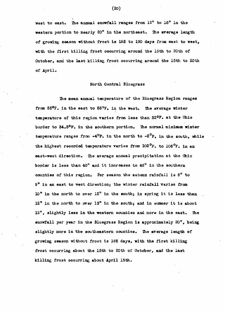
(20)
west to east. 7he annual snowfall ranges from 12" to 16" in the
western portion to nearly 20" in the northeast. 7he average length
of grovdng season wi thoutfrost is 185 to 190 days from. east to west,
wi th the first killing frost occurring arouDd the 15th to 20th of
October, and the last killing frost ocourring around the 15th to 20th
of April.
North Central Bluegrass
7he mean annual temperature of the Bluegrass Region ranges
from 55°F. in the east to 66oF. i~ the west. 7he average winter
temperature of this region varies from less than 320F. at the Ohio
border to M.SoP. in the southern portion. 7he normal minimum winter
temperature ranges from -4oF. in the north to _2oF. in the south, While
the highest recorded temperature varies from l02oF. to 10SoF. in an
east-west direction. 7he average annual preoipitation at the Ohio
border is less than 40" and it inoreases to 4S 11 in the southern
counties of this region. Per season the autumn rainfall is 8" to
9" in an east to west direotion; the winter rainfall varies fram
10" in the north to over 12" in the south; in spring it is less thaI).
12" in the north to over 13" in the south; and. in summer it is about
1211, slightly less in the western oounties and more in the east. 1be
snowfall per year in the Bluegrass Region is approximately 20", bei~
slightly more in the southeastern oounties. 7he average length of'
growing season without frost is 186 days, with the first killing
frost oocurring about the 16th to 20th of Ootober, and the last
killing frost ooourring about April 16th.
Page 31
.J{ g 37
FIG.6 AVEAA(;.[ LE~GTH Of SEASON WiTHOUT FROST
Page 32
(21)
Knobs
Xhis narrow, semicircular belt of hills lacks a distino-
tive or uniform climate" and is best regarded as resembling in
climatic characteristics the parts of the bordering physiographic
regions. Approximations are included" however" to facilitate
oomparisons with other areas of the state. Xhe mean annual
temperature of this region is 550F. to 5SoF." the western half
assuming the higher figure. Xhe average winter temperature varies
fram 330 F. to 340F. in a north-south direc~ion. The normal minimum
temperature is as low as -30F. in/the north to -20F. in the south" while
the highest recorded temperature is a 102oF. in the east and lOSoF. in
the western portion of the region. The average annual preoipitation
varies in a north-south direction from 41" to 4S". Per season the
autumn preoipitation is less than 8" to 9" in an east-west direction;
the winter rainfall is 10" to 12" in a north to south direction; in
spring it is less than 12" to lS" in a north to south direction; and
in summer it is 11" to 13" in a west to southeast direction. Snowfall
per year ranges trom an inoh or two less than 20" in the west to over
20" in the east. The length of growing season without frost is 185
to 180 days from west to east. The average first killing frost occurs
the 15th of October and the last the 16th of April.
Bastern Coal Fields
Xhe mean annual temperature of the Eastern Coal Fields is
54oF. in the southeast to ~50F. in the northwest. A small portion
of the northeastern oounties of Greenup and Boyd near the border
possess a mean annual temperature of SSoF. 'lhe average winter
1M '*'
Page 33
(22)
temperature varies from 330 F. in the north to 36oF. in the south. 1he
nonnal minimum temperature ranges from -3.50 F. to slightly warmer than
OOF. from north to southl · while the highest recorded temperature varies
from less than lOOoF. to 101°F. in an east-west direction. Average
annual precipitation ranges from 41" in the north to over 50" in the
southern mountains. Autumn rainfall is about 8"; winter rainfall is
10.5" in the north to over 13" in the south; in spring rainfall ranges
from 12" in the northern counties to over 15" in the extreme southern
region; and in summer rainfall ranges from 12" in the northwest to over
14" in the southeast. Snowfall per year 18 about 12" in the south to
more than 20" in the north. A small portion of Martin and P.ike Counties
on the extreme eastern border have as muoh as 24" of snowfall per year.
1he average length of season without frost is 170 to 180 days. the
shorter season in the east. 1he first filling frost ooours from the
10th to the 15th of October. the last killing frost from the 20th to
30th of April.
BOTANY
Plants are one of the important features in the environment
of terrestrial animals. Direotly and indirectly they furnish shelter.
sites for homes, nesting ~teriall proteotion from enemies, and food.
Often animals are restrioted to particular vegetation types. Conse
quently the author feels that a:IJY disoussion of animal distribution would
be inoomplete without a sUlIIllary of the plants that occur in the parti
oular region studied.
1he plant life of Kentucky is quite varied. From the discus
sion of climate it is evident that climatio oonditions vary slightly
and too gradually throughout the state to aooount alon:. for the a.brupt
it 4.0..
Page 34
(23)
Changes in plant speoies. Aooording to B. B. MoInteer3, variation
in the factor of 80il rather than those of climate have been the de
tennining oause in the distribution of plants under oonsideration.
However, one must keep in mind that the existenoe of a plant in a
particular region depends not upon a certain faotor but on the ~
total of all the factors.
Beo~use of its geographic location, Kentucky is the meeting
place of northern and southern speoies. This is particularly true in
the Eastern Coal Fields. The northern element is made up of speoies of
general northern range which reaCh their southern limit here and are
unoOlllll.on southward, aDd speoies growing in the north or northeast and
in higher mountains soutb:ward.4 The southern Appalachian element is
made up of species 1IIhose general range is that of the southern Blueridge
provinoe.6 Then too, in wet meadows and swamps or on low knobs there
are EJVen ooastal plain species.6 The distribution of all these forms
may be explained by the geologic history of the area. The western
part of the state exhibits another pio~ure. In the Jaokson FUrchase
and extending to the Western Coal Fields there is a predominance of
southern coastal plain forms. MoInteer 7 notes that in some cases the
southern forms in the Jackson Rtrohase are not the same southern fonns
3. Mclnteer, B. B., 1947. Castanea, vol. 12, no. 1, p. 1.
4. Braun, B. L. t 1937. Rhodora, vol. 39, no.462, p. 205.
5. Ibid p. 204.
6. Ibid p. 203.
7. Mclnteer, B. B., 1944. Castanea, vol. 9, pp. 102-105.
".
Page 35
(24)
that extend into southeastern Kentuoky. 1he latter speoies oannot
extend into southwestern Kentuoky due to the acid soil oonditions
required tor their growth.. It 1s true that the soil in the Jackson
Purchase and western Coal Fields is acid, but this area is surrounded
by a cavernous limestone belt which is less aoid and a Chester sand
stone belt Which is more acid than the region of habitat ot these
plants. 1he remainder ot the state is an area of integradation ot
northern and southern forms.
Following is a sumnary of the flora of Kentucky in relation
to the geological regions of the state, oamposed by B. B. Mc1nteer.8
Here the speoies ~entioned are rated a8 to their abundance and rarity.
1he author feels that those speoies that are rare in a particular
isolated area may be as important in animal distribution as the more
oOJllllon forms. From the sumnary ot the flora one can readily see
that certain species are oommon throughout the state, while others
are limited to partioular areas. In the following table the rela.tive
abundance of the plants is expressed as tollowsl 1 - very rare;
2 - ra.re; 3 - very soaroe; 4 - soarce; 5 - rather common; 6 - oommon;
7 - very oawmon; 8 - rather abundant; 9 - abundant; 10 - very abundant.
8. Mclnteer, B. B., 1941. Ky. Dept. Mines and Min. Sere 8,
Bull. 6, pp. 1-19.
AM
Page 36
(25)
aLul"""SS ,,_as '.NN'I __ "''''' .; • i • ,-..- • on
..~ ~
C • I:i c-i~
" . c iu &. .. !! ~ II !fo c ~ .. I&. .,1/. .. .. It .. - ""- II . - ." sl , ~ .. " ~1 & !. ~ JJ i:- .e .,.
G "oJ v· III.., Acer Box negundo 9 7 1 3 1 1 2 7 6 Elder
Acer Black nigrum 8 7 1 1 1 2 Maple
Acer Striped pennsylvan1cum 2 Maple
Acer Red rub rum 10 9 7 9 9 9 10 Maple
Acer Silver sac char inum 1 1 2 4 2 Maple
.leer Sugar saccharum. 9 10 7 10 10 9 8 9 7 Mapl~
Acer Mountain spicatum 1 Maple
Aesulus Ohio glabra 8 9 1 1 1 1 Buckeye
Aesoulus Yellow octandra 3 2 1 5 1 3 3 Buckeye
Alnus Smooth rugosa 1 6 2 3 Alder
Am elanohier Service canadensis 1 5 3 2 4 6 1 1 Berry
Amorpha Indigo f'ruticosa 2 1 Buah
~pelop.is Pepper arborea 1 V1n,
Aralia Hercules spinosa 6 3 5 4 4 3 6 Club
Aron1a Black melanocarpa 1 1 1 Chokecherry
Arundinaria Southern gigantea 4 1 2 3 3 1 Cane
Page 37
(26)
awl'·~ -.. ~NNJ:""'A'- .; .. • • - Il c1 Ii , ,!' i ' c ~.
c ~ ..... ~ ... ~~ .. ..... .t '1 ~1 " tI-
l .. ~- 111 ..
li ·r· 1 U .., ~i Ii'
6 . ~ u .v 'Iv Asoyrum St. Andrews hypericoides 4 6 6 1 1 Cross
Asimina triloba 7 8 6 9 4 7 5 Pawpaw
Benzoin Spice aestivate 9 5 3 7 6 5 6 4 1 Bush
Betula Sweet lenta 4 Birch
Betula Black nigra 5 7 7 6 ' Birch
Bignonia CroBB oapreolata 7 8 6 9 3 4 7 5 3 vein
Bumelia Southern lyooides 1 Buokthorn
Campsis Trumpet radicanB 3 5 4 3 2 4 1 6 6 Creeper
Carpinus Blue caroliniana 8 8 5 8 2 4 5 6. 7 Beeoh
;Carya Bitternut oordiformia 8 9 6 1 1 1 3 5 Hickory
Cary&. Blaok or Pignut glabra 3 8 9 8 8 8 7 7 7 Hickory
Carya Kingnut laoiniosa 3 7 2 2 5 1 3 3 Hiokory
Carya Shellbark ovata 1 9 4 7 8 8 5 3 Hickory
Carya Pale palada 2 Hiokory
CaryJL pecan 3 3 Pecan
.carya tormentosa 7 6 7 4 5 6 6 Mookernut
Castanea dentata 2 8 7 8 8 1 Chestnut
Page 38
(27)
.LU.""" ••• ~ ...... ., ..... '"-~
I 'H i EJ ~
j H ~t c fj " 'I jJ •
.4i .. ~ :u. -'-! 1 .' 1 : 1 ~f JA &1 u ,~ .., "" Castanea Chinquapin
ptmi1a 2 1 Chestnut
Ceanothus New Jersey amerioanus 1 1 1 2 Tea
Celastrus Amerioan soandens 7 1 7 2 1 1 Bittersweet
Celtis Georgia pumi1a 4 4 2 7 6 Haokberry
Celtis Southern 1aevigata 1 8 8 Haokberry
Celtis Common oooidantalis 9 8 2 3 2 2 2 1 Haokberry
Celphalanthus Camnon oooidentalis 2 1 3 4 8 8 Buttonbush
Cerois oanadensis 9 9 6 7 7 9 6 9 7 Redbud.
Chionathus Fringe virginioa tree
Cladrastis Yellow lutea 1 wood
Clethra Sweet aO umitl4.ta 1 4 Pepperbush
Comus Alternate alternifolia 1 1 2 laved Cornel
Cornua Silky amanum 1 1 Dogwood
Cornua Bough leaved asperifolia 2 5 1 1 Dogwood
Cornu. Flowering flo.rida 4 8 9 , 10 10 9 9 9 9 Dogwood
Comus Panioled raoemosa 1 Dogwood
Page 39
, \
(28)
......... -- ,.,.. .. " AOY"L . • - l! .. .. ~ "II
§! I C t: L ell £! ( ~~ ~ .. • L" .8 ..... ..... ., 1 u· u_ .. - 11 c to: 11'- ~£ 1 "8 J~ ~ u1 u! 8~ v iv
Cornua Stiff striata 1 Dogwood
Corylus Amerioan merioana 5 4 9 7 3 5 8 Hazelnut
Deoodon vertiail- Swamp
lantus 1 Looserbill
Diospyrus virginia 1 1 9 6 8 7 6 7 9 Persimmon
Diroa palustris 2 3 ''1 2 Leatherwood
Bronynn.ts Brook amerioanua 8 3 5 7 lWonymus
B10nymus atropur- Burning
pureus 7 5 1 1 1 3 lUsh
lWonymus Running obova-w.s 6 1WO~8
Fagus grandif'olia 1 6 8 10 8 8 9 7 1 Beech
Forestiera Crooked aO\.minata 1 3 Brush
Forestiera ligustr1na 1
Fraxinus White amerioana 9 9 9 9 8 9 5 9 7 Ash
Frexinu8 Biltmore bil1:anoreana 1. 7 3 2 4 1 2 1 Ash
Fraxinus Green lanoeolata 1 2 3 1 3 2 2 Ash
F,rax:inus Blue quadrangulata 10 7 1 1 Ash
Page 40
(29)
.. u_ ,,_ . P£N ... .", ... 'IA'-. -- ') i ~
If c ~~ :, c I, A c!l tli • !t
.. .. I&. ~lC 'l! U 1 g ~- !J I- .2 :;.1 c:.~ ,tl
FraxillUs ftunpkin tonnentosa 1 2 Ash
Gaylussaoia Highbush buooata 1 1 2 Huckleberry
Gleditsia Honey triacanthos 7 7 1 3 2 3 1 7 7 Looust
Grossularia cynosbati 3 1 Dogberry
Gynooladu. Ky.Coffee dioica 4 2 1 1 Tree
Hamamalis Canmon virginiana 3 1 1 3 1 1 4 witohoobazel
Hydrangea Smooth arboresoens 7 3 1 2 4 2 1 Hydrangea
Hypericum Straggling dolabriforme 1 1 St. Johns Wort
Hyperioum. Shrubby St. prolifioum. 1 1 2 Johns Wort
llex: Possum Haw or deoidua 2 Swamp holly
I lex: Mountain dubia 1 Holly
Ilex JDlerioan opaoa 6 Holly
Ilex: Camnon verticillata 2 1 Winterberry
Itea Virginia virginioa 1 6 Willow
Juglans cinerea 7 5 3 4 5 2 5 Buttermt
Juglans Blaok nigra 9 8 3 5 7 7 6 7 2 Walnut
Page 41
(30)
~ ... ~ .. _". P-..a ... v_"_ . , - 11 f '" :3
U c~
, .. ,!! ,! , J~ 6 ..r ~ ... .. u.
.!
j1 Jl' 1 )1 .. il if , ! 1 v III(J
Juniperus Red Cedar virginiana 9 8 3 8 10 & 3 6 3
Kalmia Mt. latifolia 1 1 8 Laurel
Leiophyllum buxi- Sand folium 1 ' Myrtle
Liquidambar styra- Sw,et ciflua 9 6 6 1 7 8 10 gum
Liriodendron tulip-ifera 1 2 6 9 8 6 8 7 6 Tuliptoe
Lonicera s8lllper- Trumpet virans 1 1 HOI;laysuck1e
Lyonia Male 'Ugustrina 1 Berry
Magnolia Cucumber acuminata 3 6 Tree
Magnolia .Ea.rleaved frageri 2 Magnolia
Magnolia Graa t leavad macrophylla 6 1 Magnolia
Magnolia Umbrella tripetala 1 1 9 tree
Menispennum Moonseed canadeDI' 6 3 2 3 2 2 6 6 Vine
Morus Red Mulberry rubra 7 8 7 8 8 7 6 7 8
Nyssa Black and sylvatica 7 10 9 9 9 9 7 9. sour Gum
Ostrya Hop virginians. 7 8 3 6 1 9 3 6 4 Hornbean
Oxyd end rum arboreum ' 7 7 1 6 9 1 Sourwood
Page 42
'z .....
(31)
1IU'ft.- ,,- _ .. .,S..,AL. - Ii WI \/I
:i :! ., j
, , .. El ,If r k~ !~ " .. It
lj 1 ~ li B~ ! j1 ao ~~ & l .& u..l ~ Paohistima Canby's canby! 1 1ft. Lover
Parthenocissus Virginia quinquefolia 1 1 1 6 7 7 6 6 7 Creeper
Hlysocarpua opulifolius 1 1 1 Ninebark
Pinus Yellow echinata 3 7 :Pine
Pinus Fitch rigida 8 Pine
Pinus White strobus 3 Pine'
Pinus Scrub virginians. 10 3 1 2 1 2 Pine
Platanus Sycamore occidentalis 6 3 1 5 2 4 6 6 7
Populus large tooth grtmdidentata 2 Aspen
Populus Swamp heterophy 11a 6 .cottonwood.
lTunus Wild Red americana 3 2 3 5 2 5 1 Plum
Prunus Perfumed mahaleb 1 1 Cherry
Prunus Wild Blaok serotina 6 7 6 7 7 4 3 1 6 Cherry
Prunus Common virginians. 2 Chokecherry
Ptelia Common trifoliata 3 Hoptree
Pyrularia Buffalo pub era Oilrut
Page 43
',. k4
(32)
~.,_n K_S peNN V A",,,,A>. -- • i -i ~t " C ~~
I !! ~ Cl. 'l i1 i ~~ 1 Jj .8 !- !-" 0 .. &!, f JJ jJ lcl J1 v Quercus White alba 5 9 10 9 lO 10 8 9 10 Oak
,",uercua Swamp VVhi te bioo1or 2 1 Oak
I.luerous Red borealis 9 10 6 8 9 9 6 7 6 Oak
~erous Scarlet coocinea 2 8 ' 3 3 6 2 Oak
Quercus Spanish falcata 7 7 9 8 4 7 10 Oak
Querous Shingle imbrioar1a 5 2 2 3 2 4 6 Oak,
"uerous Overoup lyrata 1 7 Oak
Quercus Bur macrocarpa 3 3 1 Oak
'=tuerous Blaok Jaok marilandioa 3 3 6 4 'l 2 3 Oak u
("l,uercus Chestnut Montana 6 7 1 4 7 Oak
~uerous Chinquapin muh 1 en,perg 11 9 10 6 8 4 2 Oak
Querous Pin palustris 3 1 6 1 9 6 Oak
,",uercus Willow phellos 1 1 Oak
~uercus Cow prinua 1 4 5 Oak
Quercus Post stella 1 9 4 9 7 7 8 Oak
Quercus Black velutina 4 2 8 8 9 10 6 8 8 Oak
Page 44
apzi
(33)
."" ......... ~, ,~~!~.~A~ • . . ,
" f Ij ,1 ,1 f
~ j! i:j ir ~ . 1 . l ii ~~ J 11 J !~ " -·Bhamnos. Carolina
carloniana 8 3 4 6 8 8 1 Buckthorn
Rhamnos lanceleaf lanoaolata 7 1 Buokthorn
Rhodadandron Grea t Laurel maximum 7 Rhododendron
Rhus Fragrant aromatica 7 2 1 2 1 1 Sumac
Rhus Mountain oopallina 9 4 7 7 6 5 6 Sumac
Rhus Smooth glabra 3 6 7 4 5 4 3 2 5 Sumao
Rhus Staghorn typhina 2 Sumao
Rabinia Rose h1spida 1 2 Aoaoia
Rabinia Blaok pseudoaoacia 6 6 1 2 2 1 5 2 lDcust
Rubus Allegheny allagheniansis 6 5 6 7 7 7 7 Blackberry
Rubus flagellaris 1 1 2 1 Dewberry
Rubus Black oco identali B 7 5 3 5 4 Raspberry
Rubus Flowering odoratus 1 Raspberry
Salix Pra:J.,r1e humilis 1 1 Willow
Salix Black nigra 2 3 2 2 2 3 2 2 Willow
Salix Dwarf Pussy tristis 1 2 Willow
Page 45
(34)
ea, .. tr_AU _ ...
P-"'"",.""" j '" . - ~1 3 "
E~ I
i j~ !~ i~ c -it f if if .J 0-
~ ,; j~ IJ (i' a "..7 is
Sambueus Common canadensis 4 2 5 4 3 3 3 6 6 Elderberry
Sambucus Redberry pub ens 2 Elder
Sassafras albidim 4 2 5 4 6 6 ' 6 Sassafrass
Smilax. Fringed bona-nox 8 1 1 1 Greenbrier
ani lex Round leaf rotundifolia 5 8 7 7 5 7 6 2 Greenbri.r
Spiraea tomentosa 1 1 1 Hardhaok
Staphilea Amerioan tripolia 7 5 5 1 1 1 1 2 Bladdernut
Stewartia Mountain pente.gyna 7 5 Stewartla
Symphoroarpos Coralberry, orbiculatus 7 7 4 7 7 1 7 2 Buokbush
Taxodium Bald distichum 7 7 Cypress
Taxus Ground oanadensis 2 Hemlook, Yew
Tilie. American Basswood americana 8 :3 5 6 Linden
Tilia White heterophylla 1 1 Basswood
Tauga Hemlook, Spruoe oanadeDli1s 1 1 1 9 Pine
Ulmus Hinged alate. :3 6 6 1 8 4 3 2 Elm
Ulmus White americana 10 7 2 3 :3 2 1 1 Elm
Page 46
.. -- • 0< .... _
Pe .... .,"'.V ... L --.
iI oj '"
i i:~ I t c!: t~
H i" c
ii ~ " ti j 51 ll' "P i§ l:. .& \1.:; \I Ulmus - SUppery f'ulva 8 9 7 5 6 7 5 8 9 Elm
Ulmus Rock raoemosa 4 4 5 6 3 Elm
Vaccinium arboreum 1 6 5 Farkleberry
Vaccinium Deerberry, Mt. stamineum 2 1 5 Gooseberry
Vaccinium Late low vaeillans 5 Blueberry
Viburnium Maple Leaf' aoerif'olium 1 5 1 5 Viburnum
Viburnum Wild casdnoldes 1 raisin,Witherod
Vlburmlll Blaok Haw prunifolium 7 7 4 1 7 3 2 2
Viburnum Deam's pubescens 1 Viburnum
Viburnum Southern rufidulum 1 1 Blaok Haw
Vitia Summer aestlvalis 2 6 8 3 7 7 6 5 Grape
Vitis Red palmata 1 Grape
Vitis Southern rotuJJdifolia 2 Foxgrape
Vitis Frost vulpine. 7 7 2 1 grape
Zanthoxylium 'Common h-ickly amerioanum 3 Ash
Zanthorrlhiza Shrub Yellow apiifolia 3 Root
Page 47
(36)
H1!RPETOFAUNA OF KEN1U,cKY
lhe remainder of this work is devoted to a presentation
of a state summary of the herpetofauna; a disoussion of the re
gional distributions; and finally an attempted oorrelation of the
ranges of the various forms with the eoologioal faotors previously
discussed. The nomenclature and general range are based upon the
Stejneger and Barbour Cheoklist (1943). with suCh changes, however,
as are required by more reoent studies and aotual locality records.
lhe reader is again reminded that these lists and ranges
cannot be oompletely aoourate fot in many oases the data is incom·
plete and further collecting is necessary.
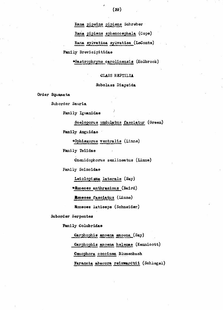
S TA XE SUMMARY
lhe following list is a summary of the 106 speoies and
subspeoies of amphibians and reptiles whioh occur in the state of
Kentucky. Of these, there are 29 salamanders, 2 toads, 16 frogs,
7 lizards, 38 snakes, and 14 turtles. The presenoe of these forms
in Kentuoky is based primarily on aotual looality reoords. For
completeness those forms whose ranges extend into the state but for
which the author has no reoords have been inoluded. »:lese speoies
are denoted by an asterisk.
CUSS AMHUBIA
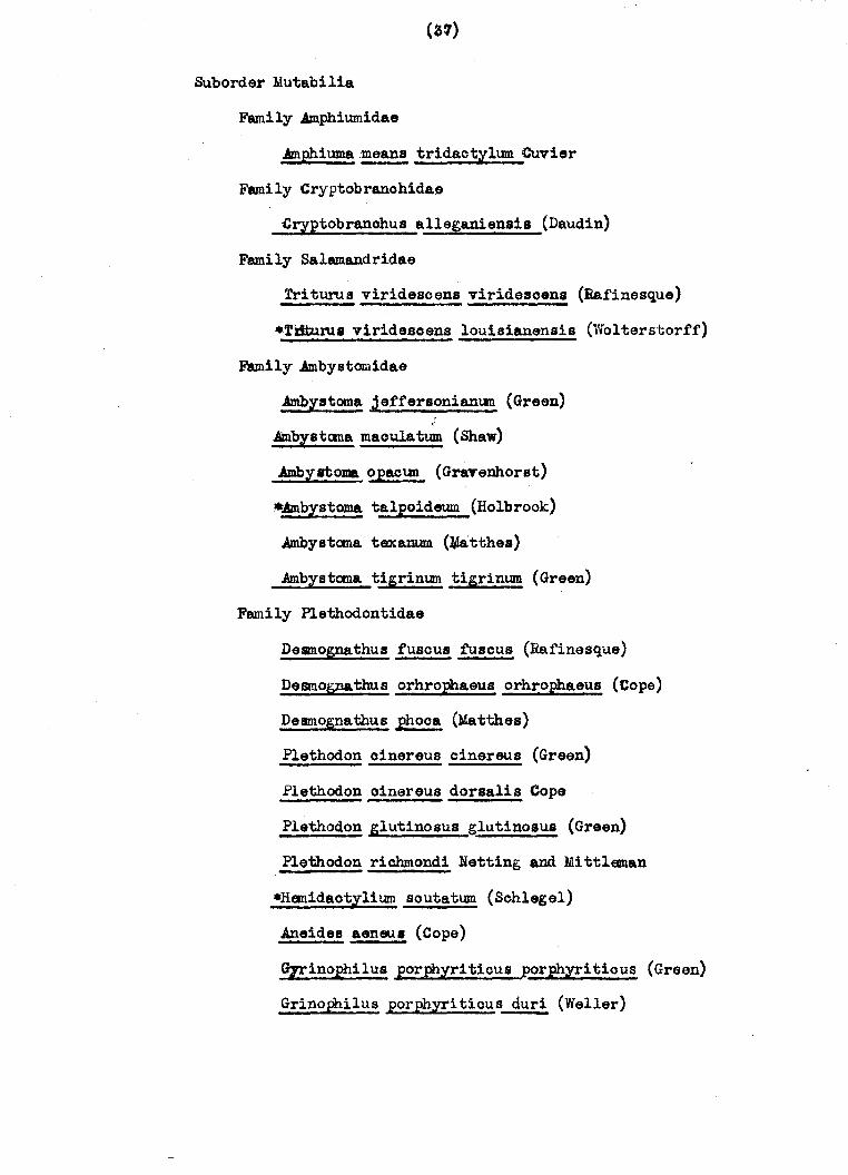
Order Caudata
Suborder Proteida
Family Neoturidae
Necturus maculosus maculosu~ (Rafinesque)
Page 48
Suborder Mutabilia
Family Jmphiumidae
Amphiuma .·means tridaotylum Cuvier
Family Cryptobranohidae
~ryptobranohus alleganiensis (Daudin)
Family Salamandridae
Triturus viridesoens viridesoens (Rafinesque)
.rdbJrus viridescens louiaianensis (Wol terstorff)
Family Jmbystamidae
Ambystoma jeffersonian1.m (Green)
Jmbystana maoulatum (Shaw)
Ambyltoma opaotm (GraTenhorst)
.Ambystama talpoideum (Holbrook)
Ambystana texanum (¥atthes)
Ambystoma tigrinum tigrinum (Green)
Family Plethodontidae
Deanognathus fUBOUS ruBcua (Rafinesque)
Desmognathus orhrophaeus orhrophaeus (Cope)
Deanognathus ehoca (Matthes)
Plethodon cinereus cinereus (Green)
Plethodon cinereus dorsalis Cope
Plethodon glutinosus glutinosus (Green)
Plethodon riChmondi Netting and Mittleman
*Hemidactylium scutatum (Schlegel)
Aneides aeneu8 (Cope)
Gyrinophilus por~riticus porphyritious (Green)
Grinopbilus porphyritious duri (Weller)
Page 49
("a)
Grinophilus danielsi danielsi (Blatchly)
Pseudotriton montanus diastictus Bishop
Pseudotriton ruber ruber (Sonnini) --Blrycea bislineata. bislineata (Green)
Bl~cea longicauda lonicauda (Green)
Blrycea luoituga Rafinesque
Suborder Meantes
Family Sirenidae
Siren intermedia nettingi Goin
Order Salientia
Suborder Linguata
Family Bufonidae
Bufo americanus americanus (Holbrook)
Bufo woodhousii fowleri (Hinokley)
Family Hylidae
~ crepi_~ns Baird
Pseudacris braohYphona (Cope)
Pseudacris nigrita triseriata (Wied)
Hyla avivoca Viosca
Hyla cinerea oinerea (Schneider)
~a~oifer crucifer Wi~
..ayla squirella Latreille
Hyla versicolor versicolor (LeConte)
Family Banidae
Rana area lata ciroulosa Rioe and Davis
Rana catesbeiana Shaw
Rana clamitans Latreille
Rana palustrls 18 Conte
Page 50
~ pipeins pipiens Schreber
RaDa pipiens sphenocephala (Cope)
~ sylvatica sylvatica (LeConte)
Family Brevicipitidae
Order Squamata
.aastrophrYAe c~rolinensis (Holbrook)
CLASS REPTILU
Subolass Diapsida
Suborder Sauria
Family Iguanidae
Sceloporus undulatus fasciatur (Green)
Family Anguidae
*0phisaurus ventralis (Linne)
Family Teiidae
Cnemidophorus sexlineatus (Linne)
Family Scincidae
Leiolopisma laterale (Say)
-BUmeces anthracinus (Baird)
tumeoes fasciatus (Linne)
EUmeces latioeps (Schneider)
Suborder Serpente.
Family Colubridae
Carph0phis amoens &moena (Say)
Carphophis amoens helenae (Kennicott)
Cemophora coccinea J3.1umenbach
Farancia abacura reinwardtii (Schlegel)
Page 51
(40)
Diadophis punctatus edwardsii (Merrem)
Diadophis punctatus strictogenys Cope
Heterodon oontortrix oontortr1x (Linne)
* Heterodon simus (Linne)
Opheodrxs aestivu8 (Linne)
Coluher oonstriotor oonstrictor (Linne)
Eaaphe obsoleta obsoleta (Say)
Elapheobsoleta oonfinis (Baird and Gerard)
Lampropeltis oalligaster (Harlan)
Lampropeltis get~lus niger (Yarrow)
Lampropeltis triangulum triangulum (Laoeped.)
Lampropeltis triangulum elapsoides (Holbrook)
Lampropeltis triangulum syspila (Cope)
Natrix oyolopion oyolopion (Dumeril and Bibron)
Natrix erythrogaster erythrogaster (Forster)
,Natrix kirtlandii (Kennioott)
latr~ rhambifera rhambifera (Hallowell)
.Iatrix septamvittata (Say)
Natr1x sipedon sipedou~ (Linne)
Natrix sipedon oonfluens (Blanchard)
Natrix siped.on pleuralis (Cope)
Pi tuo£his melanoleuoul melanoleuous Daudin
Storeria dekayi (Holbrook)
Storeria ocoiptamaoulata (Storer)
• Haldea valeriae valeriae (Baird and Gerard)
• Haldea valeriae elegans (Kennioott)
Tantilla ooronata ooronata (Baird and Girard)
Page 52
(41)
Thamnophis sauritus sauritus (Linne)
~amnophis sirtalis sirtalis (Linne)
Family Crotalidae
Agkistrodon mokeson mokeson (Daudin)
*Agkistrodon mokeson austrinus Gloyd and Conant
Agkistrodon pisoivorus leucostoma (Troost)
Crotalus horridus horridus (Linne)
*Crotalus horridus atricaudatus (Latreille)
Subclass Synapsida
Order Testudinata
Family Kinosternidae
Sternotherus ordoratus (Latreille)
*Kinosternum sub rub rum subrubrum (Lacepede)
Family Chelydridae
~acroohelys temminokii (Troost)
Chelydra serpe tina ~rpentina (Linne)
Family Testudinidae
Terrapene oarolina carolina (Linne)
Graptemys geographioa (LeSueur)
Graptemys pseudogeographica pseudogeographica (Gr&y)
Chrys!5Ys bellii marginata (Agassiz)
*Chrysemys piota dors!Us (.Agassiz)
P_eudemys concinna heiroglYphica (Holbrook)
Pseudssrs soripta troosti (Holbrook)
Pseudemys elegans (Mad)
Family Trionychidae
_yda mutioa (LeSUeur)
Amyd& Spinifera Spinifera (LeSueur)
xc
Page 53
FAUNAL DISTRIBUTION
S TATE WIDE FORlIS
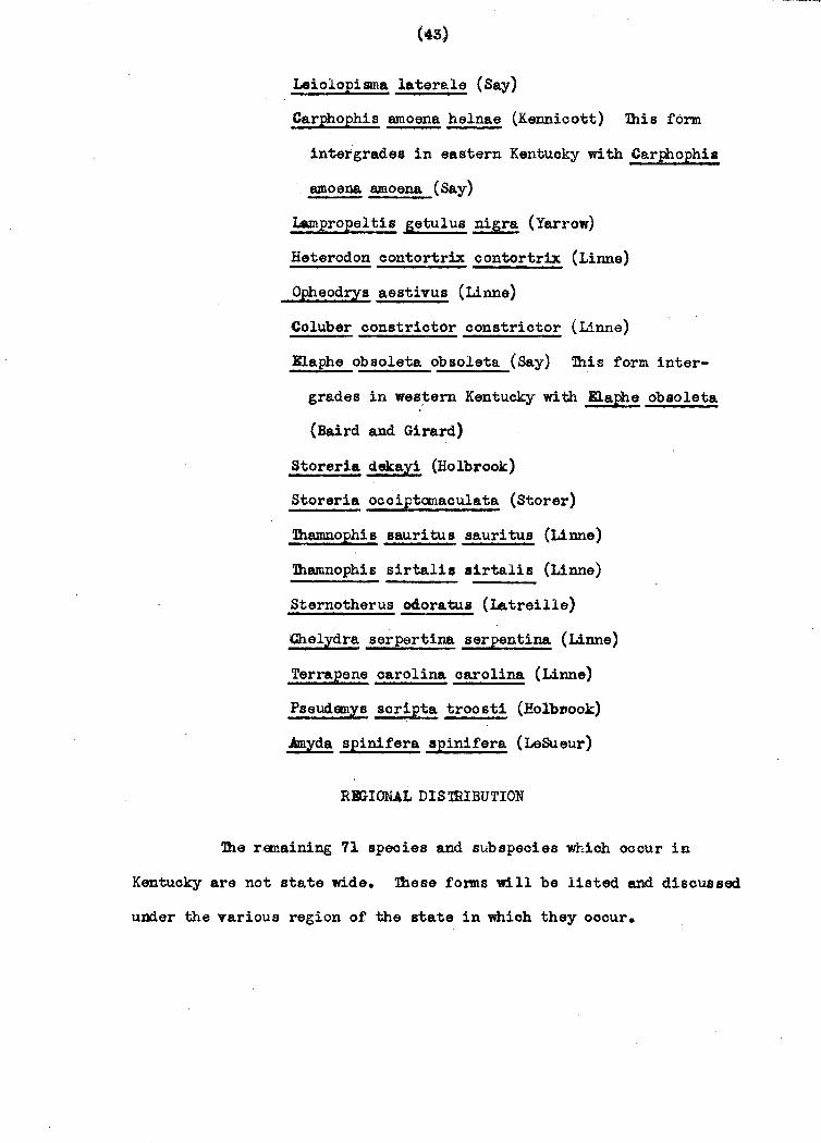
Of the !06 species and subspeoies occurring in Kentuoky 35
fonna have a range which includes 'all of the state. Some these are
of northern origin, others of southern. It is interesting to note
that a few races which are state wide have areas of intergradation
wi thin Kenwcky.
Necwrus maculoBu8 maculosus (Rafinesque)
Ambystama opacum (Graven horst)
P.lethodon glut~posus glutinosus (Green)
lltryoea ~oDgioauda lOD£?icauda (Green)
Bufo amerioanus amerioanus (Holbrook)
Bufo woodhousii towler! (Hinckley)
~s orepitans (Baird)
Pseudaoris nigrita triseriata (Wiad)
Hlla crucifer crucifer Wiad
Eyla versicolor versioolor (LeConte)
Rana oatesbeiana Shaw
Rana clamitans Latreille
Rana Palustria LeConte
~ Pipiens pipiens Schreber
~ pipiens 8phsnocephala (Cope)
Rena sylvatica sylvatica (LeConte)
Sceloporus undulatus fasciatu8 (Green)
BWmeces laticeps (Schneider)
lluneces fauiatus (Linne)
Page 54
Leiolopisma laterale (Say)
Carphophis amoena helnae (Kennicott) Ibis form
intergrades in eastern Kentucky with Carphophis
&moena emoena (Say)
Lampropeltis getulus nigra (Yarrow)
Heterodon contortrix oontortrix (Linne)
Opheodrys aestivus (Linne)
Coluber constrictor oonstriotor (Linne)
Elaphe obsoleta obsoleta (Say) Ibis form inter
grades in wes:tern Kentucky with Elaphe obsoleta
(Baird and Girard)
Storeria dakayi (Holbrook)
Storeria occiptamaoulata (Storer)
1bamnophis sauritus sauritus (Linne)
'lhamnophis sirtal1s sirtalis (Linne)
Sternotherus 040ratua (Latreille)
Chelydra serpertina serpentina (Linne)
Terrapene carolina carolina (Linne)
Pseudanys soripta troosti (HolbDook)
Amyda spinifera spinifera (LeSueur)
RlI.aONAL DIS mIBUTION
'lhe rtDaining 71 species and subspecies which ocour in
Kentucky are not state wide. These for.me will be listed and discussed
under the various region of the state in which they occur.
@Q
Page 55
FUrohase Region
Reoalling the physiography, soils, olimate, drainage and
vegetation of the furchase Region it is easy to predict the herpetotauna
whose ranges extend into and are almost limited to this area in
Kentuoky. As previously mentioned the Purohase Region is that part
of the Mississippi Bnbayment lying within the state, therefore,
Coastal Plain and Mississippi Vall~ reptiles and amphibians enter
into it. Ihelow relief of the land invites these lowland tonus.
Ihe olimate is warm enough for southern raoes to thrive here. It
is interesting to note that this 'region along with extreme southern
Illinois and Indiana is the northern limit of these southern f~s.
As one would expect there is no sharp barrier limi tine; the ranges ot
these races, henoe they do extend into the extreme western portions of
the Western Coal Fields and Pennyroyal Regions.
D1e vegetation oonfonns to this pattern also. The southern
species which are present in this area are Mississippi Vall~ and
Coastal Plain fonus. As the herpetofauna, some of the flora whiCh
appear to be limited to this area extend into the Western Coal Fields.
ihe following 18 fonns are the species and subspecies whose
ranges in Kentucky are almost exclusively limited to the Rlroha.se
Region.
Amphiuma means tridaotylum Cuvier
Triturus viridescens louisianensis (Wolterstortf)
Ambystoma talpoideum (Holbrook)
Siren inter.media nettingi Goin
Hyla avivoca Vi08ca
Page 56
Hyla cinerea cinerea (Scneider)
Byla squirella Latreille
Farancia ab'acura reinwardtii (Schlegel)
Diadophis punctatus stiotogenys Cope
latrix cyclopion cyclopion (Dumeril and Bibron)
Natrix sipedon confluens (Blanchard)
latrix rhambifera rhambifera (Hallowell)
Baldea valeriae elegans (Kennicott)
Agkistrodon mokeson austrinus Gloyd and Conant
~istrodon piscivorous leucostama (Troost)
Crotalus horridus atricaudatus (Latreille)
Chrysemys picta dorsalis (Agassiz)
Macrochelys tamminckii (Troost)
Although Siren intemedia nettingi extends beyond the
PUrchase Region,' it has been included here because it follows the
pattern of the southern forms which extend up the Mississippi into
the Ohio River and then down the Tennessee, Cumberland and Tradewater
Rivers into northwestern Tennessee.
n,.ere are two races of Natrix sipedon which intergrade in the
PUrchase Region. n,.ese are Natrix~. confluens which is a western
Mississippi Valley form and Natrix s. pleuralis which is an inland
southeastern form. Records are available for N. s. pleuralis and
and !. ~. oonf~uens in this region (fig. 7).
Western Kentucky
n,.e following 13 species and subspecies are limited to the
western half of the state. 'lbese forms fall into two categories; those
that extend to the Knobs including the Purchase Region, Western Coal
4 _ ..•.
Page 57
• NATl\lX SIPfOON PLflJ~AU~
o NATRJX SIPfDON SIPfDON
•
........................................................ m ... H .• o.'.7 ... . ~
FlG. 7
Page 58
(46)
Fields and. western half of the i"ennyroyal; and those that oross the
Knobs and oocur in the western half o£ the Bluegrass. These latter
forms might possibly extend throughout tha entire Bluegrass, however,
from the locality records at hand they appear to remain on the western
side of the Cincinnati Antioline. lhese forms are,
Ambystoma tigrinum tigrinum (Green)
Plethodon oinereus dorsalis Cope
Graptamys pseudogeographioa pseudogeographioa (Gray)
This last form is a Mississippi Valley race which ciroumvents
the Kentucky Knobs by follOwing t~e Ohio River Basin to Ohio.
The species and subspecies which extend to the Knobs are
possibly limited in their ranges by the physiography. These are
primarily lowland forms, either ranging from the Mississippi Valley
and Coastal Plains or the Central Plains. Pbssible barriers are
the change in temperature, soil, and the shorter growing season
east of the Knobs. These forms are,
Rana areolata oiroulosa Rioe and Davis
Gastrophryn~ carolinensis (Holbrook)
Ophisaurus ventralis (Linne)
CnomidQWt0rus §oxlineaWs (Linne)
Lampropeltis calligaster (Harlan)
Lampropeltis triangulum syspila (Cope)
Natrix sipedon pleuralis (Cope)
Heterodon sinll s (Li nne)
~ntil1a ooronata ooronata (Baird and Girard)
P.~!!la oonoinna heiroglYphioa (Holbrook)
4l _
Page 59
(41)
Central Kentucky
1he records for the following forms are very inoomplete.
From the available data it seams that these forms occur in 'Central
Kentucky. Further collecting might raveal either eastern or western
range extensions. These forms arel
Natrix sept~ittata (Say)
Kinosternon sub rub rum subrubrum (Laoeped.e)
State Wide EKcept Bastern Mountains
There are three species whose ranges include all of the
state exoept the eastern mountains. 'lhese forms area
Ambystoma maculatum (Shaw)
Elaphe obsoleta confinis (Baird and Girard)
Natrix erythrogaster erythogaster (Forster)
Ambystoma maoulatum has been reported as far east as Floyd
and Cumberland :Counties. It seems not to have been collected in Pine
and Cumberland Mountains. Consequently the author assumes that it
does not occur in the high eastern mountains of the state.
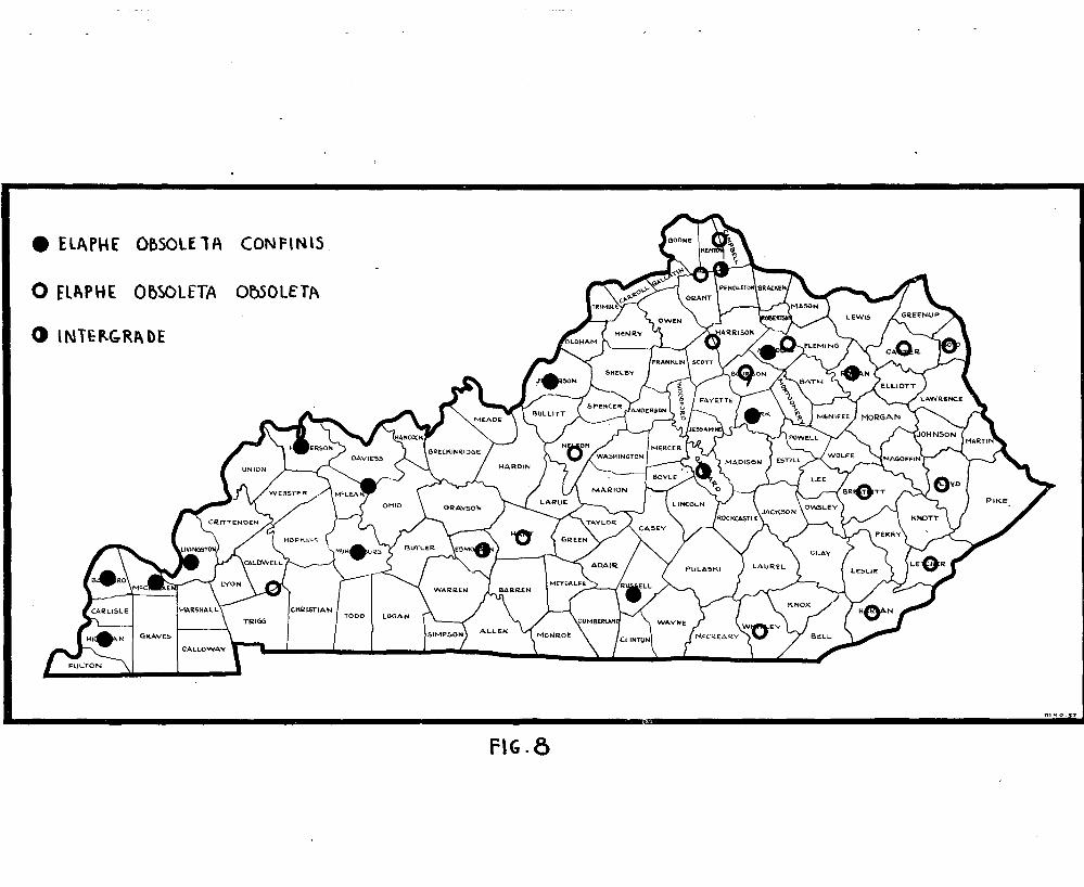
KJ.aphe obsoleta oonfinis has been reported as far east as
Clark and Nioholas Counties and an intergrade with Elaphe~. obsoleta
has been collected in Rowan ~ounty. It is possible that these two
forms intergrade on the western half of the Cumberland Plateau (fig. 8).
Natrix erythrogaster erythrogaster seems not to have been
reported from the Eastern Coal Fields.
Page 60
1he Cumberland Plateau and High Ee.stern Mountains
1here are three species Whose ranges in Kentucky are
limited to the Cumberland Plateau and High eastern mountains. lhese are:
Desmog:cathus ochrophaeus oohrophaeus (Cope)
Aneides aeneus (Cope)
Gyrinophilus daniels1 (Blatchly)
lhe first two forms occur in the Cumberland Plateau and the
Pine and Cumberland Mountain ranges. They are of norther origin and
hence are able to thrive in this highland area. Gyt:inophilus danielsi
has a very limited range in Kentubky, occurring only in the highest
points of the Cumberland 'and Pine Mountain ranges. It prefers, high
mountain streams, therefore, its distribution is restricted to the
high south~rn section of the Blue Ridge Mountains.
Eastern Half of the State
1hereare 13 species and subspecies Whose ranges in Kentucky
are limited to the eastern half of the state. These forms fall into
two categories: those that extend through the eastern half of the
Bluegrass; and those that extend to the Western Coal Fields. For
the former group there are records as far west as Kenton and Campbell
counties. Since there is no obvious barrier these torms might extend
throughout the entire Bluegrass region or even as far west as the
Western Coal Fields. It is highly probable that some of the torms as
Plethodon cinereus cinereus use the Bluegrass as an area of intergradation.
']he forms limited to this part of the state area
Page 61
(G)
Plethodon oinereus oinereus (Green)
P.lethodon riohmondi Netting and Mittleman
Pseudacris brachYphona (Cope)
Raldea valeriae valeriae (Baird and Girard)
- --------------~---
'lhose torms which extend beyond the Bluegrass appear to be
limited by the Western Coal Fields and western Pennyroyal. These
raoes are primarily ot northern origin and are unable to adjust
to the variations in olimate, soil, and physiography Whioh occur
in the western halt of the state. These forms are:
Desmognathus phoca (Matthes)
GXrinophilus porphyritious porphyriticus (Green)
:Ibis form OOOUlT s through eastern Kentuoky
with the exoeption of the high eastern mountains.
Paeudotritonmontanus diasticus Bishop
Pseudotriton ~ ruber (Sonnini)
This form is nearly state wide with the
exoeption at the Western Coal Fields and the
Purchase Region.
Carph0phis amoena amoena (Say)
This torm is limited by the Western Coal Fields but
intergrades with £ • .!.. helenae throughout most at
its range in Kentuoky.
Diadophis l~tatus edwardsii (Merrem)
1his form intergrades with D • .£.. stiotogenys in the
Western Coal Fields.
Page 62
• ElArH[ Oe,SOlE1A (ONPltHS
o flAPHt OflSOLfTA OtlSOLfTA
o 'NTEP-<;'RI\ DE
CHR:ISTIAN TOOD I LOGA.N
m.l1o 37
FIG.8
Page 63
Lampropeltia tria~ulum triangulum (Lacepede)
Natrix dpedon sipedon (Linne)
lhere is one other form occurring in eastern Kentucky which
does not fall into either category. It is:
Lampropeltis triangulum elapsoides (Holbrook)
This is an east coast plain race whiah extends into south
eastern and south central Kentuoky according to available data. lhe
author assumes this form intergrades with L. t. triangulum in the
north-eastern part of the state.
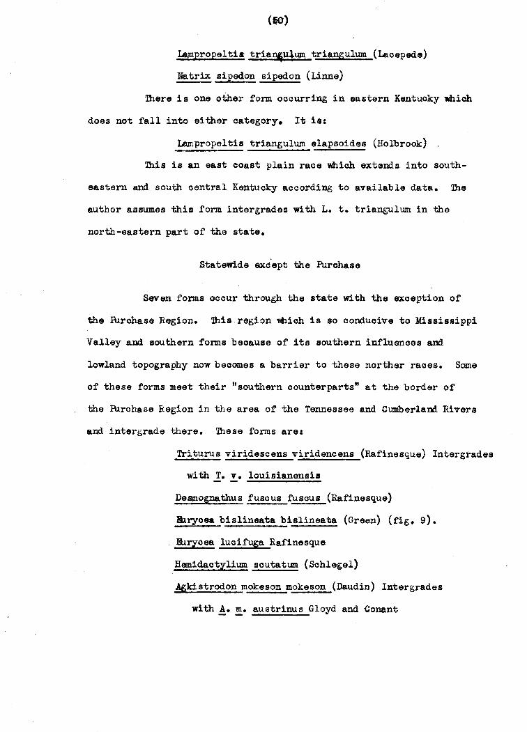
Statewide axdept the Purchase
Seven forms occur through the state with the exoeption of
the PUrahase Region. ~isregion ~ich is so conduoive to Mississippi
Valley and southern forms beoause of its southern influences and
lowland topography now beoomes a barrier to these norther races. Same
of these forms meet their "southern oounterparts" at the border of
the PUrchase Region in the area of the Tennessee and Cumberland Rivers
and intergrade there. These forms are:
T.riturus viridescens viridencens (Rafinesque) Intergrades
with T. v. louisianensia
Desmognathus fuscua fuscua (Rafinesque)
Bb~oea bislineata bislineata (Green) (fig_ 9).
Illrycee. luoifuga Rafinesque
Hamidaotylium soutatum (Schlegel)
Agkistrodon mokeson mokeson (Daudin) Intergrades
with !_ ~. austrinus Gloyd and Conant
Page 64
o [uR)'(fA ()\SUNfATA I)ISLINfA1A
m.lio.:S7
FIG.3
Page 65
(Ili)
Crotalus horridus horridus (Linne) Intergrades
with C. h. atricaudatus (Latreille)
Northern Half of the State
ihere are saven forms Whose ranges in Kentucky are limited
to the northern half of the state. Two species follow the Ohio River
only, and avoid the PUrchase Region. These ares
Cryptogranchus alleganiensis (Daudin)
Chrysemys bellii marginata (Agassiz)
Four species follow th~ Ohio and Mississippi drainage in
Kentuoky and consequently inolude the PUrchase. '1hey area
Ambystoma Texanum (Matthes)
Graptamys geographioa (LeSueur)
Pseudemys elegans (Wied)
Amyda mutioa (LeSueur)
One other form which occurs only in the northeastern corner
of the s tate is:
Gyrinophilus porphyriticus duryi Weller
Misoellaneous
Five species remain which do not fall into any of the above
distribution areas. These are:
Ambystoma jeffersonianum (Green) Reported only fram
Mammoth Cave in Kentuoky
BUmeoes anthracinus (Baird) ~pected to Occur in the
Western Coal Fields.
Camophora coccinea Bltmenback One unpublished reoord.
Page 66
(II)
Natrix kirtlandii (Kennicott) Possibly ocours in
northeastern Kentuoky, however, only reoords
from Jefferson County (Louisville) have been
available.
Pi tuophis melanoleucus melanoleucus Daudin Reported
by Hibbard (1936) fram Mammoth Cave and by Funhouser
(1925) from Corbin and TUrla.
CONClDSION
In stlllDl8.rizing this work one is impressed not only with
the many species and subspecies of amphibians and reptiles ocouring
in the state, but with the diverse environments present in Kentuoky.
!he presence of a rich herpetofauna in the~ate is due to the diphasic
eoology which provides habitats sui table for both northern and southern
forms. !he western portion of the state is a lowland area with a wam
olimate which is oontiguous with the "heart" of the Mississippi Valley.
!herefore, it is feasible that the flora and fauna of the Coastal
Plain and Mississippi Valley regions would thrive here. Conversely the
eastern, portion of the state is a highland area which is part of the
Appalachian Range. !his area has a cooler olimate and a shorter growillg
season which are only conducive to northern or southern mountainous
forms. The remainder of the state is basically a blending of these
opposing influences. In some oases it provides a large area of in
tergradation for those northern subspecies that have southern
oounterparts.
!he author has no doubt that there are other influences whioh
Page 67
FIG. '0 AVENUE~ Of Dl5T(\le,unON
Page 68
(53)
govern distribution in the state; however. these are the most striking
and important. Muoh further investigation is neoessary to clarify
the distributional disorepanoies and the eoological influences Which
the author has been unable to solve with the material available at
this time. It is hoped ttat ~lis work will provide a stimulus for
further study of the distribution of the herpetofauna of the state
of Kentucky.
BIBLIOGRAHiY
Averitt, S.D. 1915. ~e soils of, Kentucky. Kentuoky Agr. BKpt. Sta.
Bull. 193, pp. 129-164.
Bishop, S.S. 1943. Handbook of Salamanders. Ithaoa. N.Y. Comestook
IUblishing Co.
Blanchard, F.N. 1921. Revision of the king snakes;, genus
Lampropeltis. U.S.N.M. Bull. 114, pp. 1-260.
__________ • 1923. 1he snakes of the genus Virginia.
Pap. Mioh. Aoad. Soi., vol. III, pp. 343-365.
_________ 1924. 111e forms of Carphophis. Pap. Mioh.
Acad. Sci., vol. IV, pp. 521-530.
1925. A colleotion of amphibians and reptiles
from southern IBdiana and adjaoent Kentucky. Rap. Mich.
Acad. Soi., vol. V, pp. 361-388.
_________ 1938. Snakes of the gemlS Tantil1a in the United.
States. Zool. Sere Field Mus •• Vol, 20, no. 28, pp. 369-376.
1942. The ring snakes, gneus Diadophis. Bull.
Chi. Acad. S01., vol. 7, no. 1, pp. 1-144.'
Page 69
(5,4)
Braun, E.L. 1937. Same relationships of the flora of the Cumberland
Plateau and Cumberland lIountains of Kentuoky. Rhodora,
Jour. N. lihg. Bot. Club, vol. 39, no. 462, pp. 193-208.
1943. An annotated catalog of the spermatophyte.
of Kentucky. Cincinnati, John S. Swift Co.
Burt, C.g. 1931. A study of the teiid lizards of the genus
enaaldophorus with special reference to their phylogenetic
relationships. U.S.N.M. Bull. 154.
1933. A contribution to the herpetology of
K8Jltuoky. "er. )did. Nat., vol. XIV, no. 6. pp6:69-679 • .
Carr, A.F. 1937. 1he status of Psoudemys soripta and Pseudemys
troosti. Herpetological, vol. 1, no. 3, pp. 14~17.
Clay, W.llf. 1938. A synopsis of the north American water snakes of
the genus Natrix. Copeia, no. 4, pp. 173-182.
Dunn,E. R. 1926. Salamandersot the tamily Plethodontidae. Northampton,
Mass., Smith College Fress.
Dury, R., and R. Williams. 1933. Notes on some Kentucky amphibians
and reptiles. Baker Hunt Found. Mus. Bull. 1.
Dury, R., a~d W. Gessing. 1940. Additions to the herpetofauna of
Kentucky. Herpeto1ogica, vol. 2, no. 21, pp. 31-33.
1940. Notes on Lampropeltis in Kentucky. Copeia,
no. 4, pp. 241-243.
Fenneman, N.M. 1938. lhys10graphy of eastern Un! ted States. New York
and London, MoGr .... Hill Book Co., Inc.
Funkhouser, W.D. 1~25. Wildlife in Kentucky. Ky. Geol. Sur. Series
Series Vi, vol. 16.
Ga~an, H. 1894. A preliminary list of the vertebrate aniuAls of
Kentuoky, Bull. ESsex Inst., vol. 26, no. 1, pp. 1-63.
Page 70
(55)
Gloyd, H.K. 1940. The rattlesnakes, genera Sisturu8 and Crotalus. Chi.
Acad. Sci., sp. Publ. no.4.
Gloyd H.K., and R. Conant. 1943. A synopsis of the Amerioan forms of
Agkistrodon. Bull. Chi. Acad. Sci., vol. 7, no. 2. pp.
147-170.
Hibbard, C.W. 1936. Amphibians and reptiles of Mannoth Cave National
Park. Trans. Kans. Acad. Sci., vol. 39,.pp. 277-281.
Jillson, W.R. 1927. Topography of Kentuoky. Ky. Geol. Sur.,
Series Vi, vol. 30.
Kinoer, J.B. 1922. Precipitatio~ and h~idity. Atlas of American
Agrioulture; Washington D.C., govt. Printing Office.
MoInteer, B.B. 1941. Distribution of the woody plants of KentuCky
in relation of the geologic regions. Dept. Mines and
Min., Series VIII, Bull. 6, pp. 1-19.
1944. Distribution of same southern speoies of
trees and shrubs. Castanea, Jour. So. App. Bot. Club, vol.
IX, pp. 102-105.
1947. Soil preferences of same plants as seen in
Kentuoky. Castanea, Jour. So. App. Bot. ~lub, vol. XII,
no. 1, pp. 1-8.
Marbut, C.F. 1935. S01ls·of the United States. Atlas of Amerioan
Agrioulture. WaShington, D.C., Govt. Printing Offioe.
Marvin, C.F. 1928. Climate. Atlas of Amerioan Agrioulture. Washington,
D.C., Govt. Printing Offioe.
Miller, A.M. 1919. The geology of Kentucky. Dept. of Geol. and
Forrestry, Sere V., Bull. 11, pp. 177-203
Page 71
(ft)
Pope, C. H. 1939. lUrtles of the United states and Canada. New York
and London. A.A. Knopf.
Ruthven, H.E. 1908 Variations and genetic relationships of the garter
snakes. U.S.N.M. Bull. 61, pp. 1-201.
Schmidt, K.P., and D.D. Davis 1941. Field book of snakes of the
United States, and Canada, New York, G.P. FUtnams Sons.
8mi th, HeM. 1946. Handbook of Lizards. Ithaca, Comstock Publishing
Co.
Stejneger, L., and T. Barbour. 1943. A checklist of north American
amphibians and reptiles, 5th ad. Cambridge, Mass., Bull.
Kus. Comp. Zool.
7aylor, B.H. 1935. A taxonomio study of the cosmopolita scincoid
lizards of the genus BUmeoes with an aocount of distribution
and relationShip of its .pecies. Kans. Univ. Soi. Bull.,
vol. XXIII, pp. 1-643.
Visher, S.S. 1929. ~e olimate of Kentucky. The Pleistooene of
Kentucky. Ky. Geol. Sur. Sere VI., vol. 31, pp. 81-168.
Welter, W.A. and K. Carr. 1939. Amphibians and reptiles of north
eastern Kentuoky. Copeia, no. 3, pp. 128-130.
Wright, A.A., and A.H. Wright. 1942. Handbook of frogs and toads.
Ithaoa, Camstoo~ Publishing Company.