23
Doctrine spatial extension Release 2.0.0 Jun 27, 2021

Doctrine spatial extensionRelease 2.0.0
Jun 27, 2021


Contents
1 Contents 31.1 Installation . . . . . . . . . . . . . . . . . . . . . . . . . . . . . . . . . . . . . . . . . . . . . . . . 3
1.1.1 Installation via composer . . . . . . . . . . . . . . . . . . . . . . . . . . . . . . . . . . . . 31.1.2 Installation without composer . . . . . . . . . . . . . . . . . . . . . . . . . . . . . . . . . 31.1.3 Installation to contribute . . . . . . . . . . . . . . . . . . . . . . . . . . . . . . . . . . . . 3
1.2 Configuration . . . . . . . . . . . . . . . . . . . . . . . . . . . . . . . . . . . . . . . . . . . . . . . 41.2.1 Configuration for applications using Symfony framework . . . . . . . . . . . . . . . . . . . 4
1.2.1.1 Declare your geometric types . . . . . . . . . . . . . . . . . . . . . . . . . . . . . 41.2.1.2 Declare a new function . . . . . . . . . . . . . . . . . . . . . . . . . . . . . . . . 4
1.2.2 Configuration for other application . . . . . . . . . . . . . . . . . . . . . . . . . . . . . . . 51.2.2.1 Declare your geometric types . . . . . . . . . . . . . . . . . . . . . . . . . . . . . 51.2.2.2 Declare a new function . . . . . . . . . . . . . . . . . . . . . . . . . . . . . . . . 5
1.3 Create spatial entities . . . . . . . . . . . . . . . . . . . . . . . . . . . . . . . . . . . . . . . . . . . 61.3.1 Example1: Entity with a spatial point . . . . . . . . . . . . . . . . . . . . . . . . . . . . . 61.3.2 Seven examples with each geometric spatial types . . . . . . . . . . . . . . . . . . . . . . . 81.3.3 Four examples with each geographic spatial types . . . . . . . . . . . . . . . . . . . . . . . 8
1.4 Repository . . . . . . . . . . . . . . . . . . . . . . . . . . . . . . . . . . . . . . . . . . . . . . . . 81.5 Glossary . . . . . . . . . . . . . . . . . . . . . . . . . . . . . . . . . . . . . . . . . . . . . . . . . 10
1.5.1 Types . . . . . . . . . . . . . . . . . . . . . . . . . . . . . . . . . . . . . . . . . . . . . . 101.5.1.1 Types described in OGC Standards or in ISO/IEC 13249-3:2016 . . . . . . . . . . 10
1.5.2 Functions . . . . . . . . . . . . . . . . . . . . . . . . . . . . . . . . . . . . . . . . . . . . 111.5.2.1 Functions described in OGC Standards or in ISO/IEC 13249-3:2016 . . . . . . . . 111.5.2.2 Specific functions of the PostgreSql database server . . . . . . . . . . . . . . . . . 121.5.2.3 Specific functions of the MySql database server . . . . . . . . . . . . . . . . . . . 13
1.6 Contributing . . . . . . . . . . . . . . . . . . . . . . . . . . . . . . . . . . . . . . . . . . . . . . . 141.6.1 Documentation . . . . . . . . . . . . . . . . . . . . . . . . . . . . . . . . . . . . . . . . . 141.6.2 Source code . . . . . . . . . . . . . . . . . . . . . . . . . . . . . . . . . . . . . . . . . . . 14
1.6.2.1 How to create a new function? . . . . . . . . . . . . . . . . . . . . . . . . . . . . 141.6.2.1.1 Where to store your class? . . . . . . . . . . . . . . . . . . . . . . . . . 141.6.2.1.2 Which name for your function? . . . . . . . . . . . . . . . . . . . . . . . 141.6.2.1.3 Which method to implements? . . . . . . . . . . . . . . . . . . . . . . . 15
1.6.2.2 How to test your new function? . . . . . . . . . . . . . . . . . . . . . . . . . . . . 151.6.2.2.1 Setup . . . . . . . . . . . . . . . . . . . . . . . . . . . . . . . . . . . . 15
1.6.3 Quality of your code . . . . . . . . . . . . . . . . . . . . . . . . . . . . . . . . . . . . . . 171.7 Test environment . . . . . . . . . . . . . . . . . . . . . . . . . . . . . . . . . . . . . . . . . . . . . 18
1.7.1 How to test library? . . . . . . . . . . . . . . . . . . . . . . . . . . . . . . . . . . . . . . . 18
i

1.7.2 How to test on MySQL? . . . . . . . . . . . . . . . . . . . . . . . . . . . . . . . . . . . . 181.7.3 How to test on PostgreSQL? . . . . . . . . . . . . . . . . . . . . . . . . . . . . . . . . . . 181.7.4 How to test with the three PHP versions? . . . . . . . . . . . . . . . . . . . . . . . . . . . 18
ii

Doctrine spatial extension, Release 2.0.0
Doctrine spatial extension provides spatial types and spatial functions for doctrine. It allows you to manage spatialentity and to store them into your database server.
Currently, doctrine spatial extension provides two dimension general geometric and geographic spatial types, two-dimension points, linestrings, polygon and two-dimension multi-points, multi-linestrings, multi-polygons. Doctrinespatial is only compatible with MySql and PostgreSql. For better security and better resilience of your spatial data, werecommend that you favor the PostgreSql database server because of the shortcomings and vulnerabilities of MySql.
This project was initially created by Derek J. Lambert in 2015. In March 2020, Alexandre Tranchant forked theoriginally project because of unactivity for two years. Feel free to contribute. Any help is welcomed:
• to implement third and fourth dimension in spatial data,
• to implement new spatial function,
• to complete documentation and fix typos, (I’m not fluent in english)
• to implement new abstracted platforms like Microsoft Sql Server.
Contents 1

Doctrine spatial extension, Release 2.0.0
2 Contents

CHAPTER 1
Contents
1.1 Installation
1.1.1 Installation via composer
Add the alexandret/spatial2-doctrine package in your composer.json.
$ composer require alexandret/doctrine2-spatial
Or you can edit directly composer.json file by adding this line on your requirements:
"require": {..."alexandret/doctrine2-spatial": "^2.0"
Be careful, the version 2.0.0 will only be available at the end of march 2020.
1.1.2 Installation without composer
If you’re not using composer, you can download the library. Then copy and paste the lib directory where youstore all libraries of your application.
1.1.3 Installation to contribute
If you want to contribute, do not hesitate. Any help is welcomed. The simplest way is too fork the Github project, thento locally clone your forked project. The contribution page explains how to proceed and how to test your updates.
3

Doctrine spatial extension, Release 2.0.0
1.2 Configuration
1.2.1 Configuration for applications using Symfony framework
To configure Doctrine spatial extension on your Symfony application, you only need to edit your config/doctrine.yaml file. Two steps are sufficient. First step will help you to declare spatial types on DQL. Thesecond step will help you to declare a spatial function.
1.2.1.1 Declare your geometric types
doctrine:dbal:
types:geometry: CrEOF\Spatial\DBAL\Types\GeometryTypepoint: CrEOF\Spatial\DBAL\Types\Geometry\PointTypepolygon: CrEOF\Spatial\DBAL\Types\Geometry\PolygonTypelinestring: CrEOF\Spatial\DBAL\Types\Geometry\LineStringType
Now, you can create an entity with a geometry, point, polygon and a linestring type.
Here is a complete example of all available types. The names of doctrine types are not hardcoded. So if you only wantto use the geometric type, feel free to remove the geometric_ prefixes
doctrine:dbal:
types:geography: CrEOF\Spatial\DBAL\Types\GeographyTypegeography_linestring: CrEOF\Spatial\DBAL\Types\Geography\LineStringTypegeography_point: CrEOF\Spatial\DBAL\Types\Geography\PointTypegeography_polygon: CrEOF\Spatial\DBAL\Types\Geography\PolygonType
geometry: CrEOF\Spatial\DBAL\Types\GeometryTypegeometry_linestring: CrEOF\Spatial\DBAL\Types\Geometry\LineStringTypegeometry_point: CrEOF\Spatial\DBAL\Types\Geometry\PointTypegeometry_polygon: CrEOF\Spatial\DBAL\Types\Geometry\PolygonTypegeometry_multilinestring:
→˓CrEOF\Spatial\DBAL\Types\Geometry\MultiLineStringTypegeometry_multipoint: CrEOF\Spatial\DBAL\Types\Geometry\MultiPointTypegeometry_multipolygon:
→˓CrEOF\Spatial\DBAL\Types\Geometry\MultiPolygonType
I try to maintain this documentation up-to-date. In any case, the DBAL/Types directory contains all geometric and allgeographic available types.
Any help is welcomed to implement the other spatial types declared in the Open Geospatial Consortium standard andin the ISO/IEC 13249-3:2016 like Curve or PolyhedSurface.
1.2.1.2 Declare a new function
orm:dql:
numeric_functions:#Declare functions returning a numeric value#A good practice is to prefix functions with ST when they are issue from
→˓the Standard directory (continues on next page)
4 Chapter 1. Contents

Doctrine spatial extension, Release 2.0.0
(continued from previous page)
st_area: CrEOF\Spatial\ORM\Query\AST\Functions\Standard\StAreastring_functions:
#Declare functions returning a stringst_envelope: CrEOF\Spatial\ORM\Query\AST\Functions\Standard\STEnvelope#A good practice is to prefix functions with SP when they are not issue
→˓from the Standard directorysp_asgeojson: CrEOF\Spatial\ORM\Query\AST\Functions\Postgresql\SpAsGeoJson#You can use the DQL function name you want and then use it in your DQLmyDQLFunctionAlias:
→˓CrEOF\Spatial\ORM\Query\AST\Functions\Standard\StCentroid#SELECT myDQLFunctionAlias(POLYGON(...
Add only the functions you want to use. The list of available function can be found in these sections:
1. list of Functions described in OGC Standards or in ISO/IEC 13249-3:2016 declared in the Open GeospatialConsortium standard,
2. list of Specific functions of the PostgreSql database server which are not already declared in the OGC Standard,
3. list of Specific functions of the MySql database server which are not already declared in the OGC Standard,
Be warned that MySQL spatial functions have a lot of bugs, especially the `Contains` function which returnswrong results. If you want to store geometric data, please considers to use a good database server such as PostgreSQLServer or Microsoft SQL Server. If you want to store geographic data, you have to use PostgreSql server, becauseMySql does not implements geographic data.
Nota: By default, function declared by the Open Geospatial Consortium in the standards of SQL Options are prefixedby ST_, other functions should not be declared with this prefix. We suggest to use the SP_ prefix (specific).
1.2.2 Configuration for other application
1.2.2.1 Declare your geometric types
Doctrine allows you to create new mapping types. We used this functionnality to create spatial types in this extension.You only need to let Doctrine know which type you want to use. Two lines are sufficient to do it. The first line callsthe Type class. The second line, declare a type. In the below example, we declare a geometric point type.
<?php// in your bootstrapping code
// ...
use Doctrine\DBAL\Types\Type;
// ...
// Register types provided by the doctrine2 spatial extensionType::addType('point', 'CrEOF\Spatial\DBAL\Types\Geometry\PointType');
1.2.2.2 Declare a new function
You can register functions of the doctrine spatial extension adding them to the ORM configuration:
1.2. Configuration 5

Doctrine spatial extension, Release 2.0.0
<?php
// in your bootstrapping code
// ...
use Doctrine\ORM\Configuration\Doctrine\ORM\Configuration;
// ...
$config = new Configuration();// This is an example to declare a standard spatial function which is returning a→˓string$config->addCustomStringFunction('ST_Envelope',→˓'CrEOF\Spatial\ORM\Query\AST\Functions\Standard\StEnvelope');// This is another example to declare a standard spatial function which is returning→˓a numeric$config->addCustomNumericFunction('ST_Area',→˓'CrEOF\Spatial\ORM\Query\AST\Functions\Standard\StArea');// This is another example to declare a Postgresql specific function which is→˓returning a string$config->addCustomNumericFunction('SP_GeoJson',→˓'CrEOF\Spatial\ORM\Query\AST\Functions\PostgreSql\SpGeoJson');
1.3 Create spatial entities
It is a good practice to use the most adapted column to store you geometric or geographic data. If your entity haveonly to store points, do not use a “geometry” type, but a “point” type. Use a geometry column only if your entity canstore different types (points and lines as example)
1.3.1 Example1: Entity with a spatial point
Below, you will find an example to declare an entity with a point. Before you need to declare the point type asdescribed in the configuration section.
<?php
// We declare the class of the type we want to use.use CrEOF\Spatial\PHP\Types\Geometry\Point;// We declare the Mapping as usualuse Doctrine\ORM\Mapping as ORM;
/*** Point entity example.
** As you can see we do not change anything in Entity and Table annotations. Feel→˓free to use them as usual.
** @ORM\Entity
* @ORM\Table
*/class PointEntity{
(continues on next page)
6 Chapter 1. Contents

Doctrine spatial extension, Release 2.0.0
(continued from previous page)
/*** @var int The usual Doctrine Identifier
** As you can see we do not change anything in Entity and Table annotations.
→˓Feel free to use it as usual.
** @ORM\Id
* @ORM\GeneratedValue(strategy="AUTO")
* @ORM\Column(type="integer")
*/protected $id;
/*** @var Point
** As you can see we declare a point property of type point.
* point shall be declared in the doctrine.yaml as a custom type.
* Feel free to use options as usual. As example, I declared that point is not→˓nullable. But you can
* set it to nullable=true if you want.
** @ORM\Column(type="point", nullable=false)
*/protected $point;
/*** Get id.
* This is the usual Id getter.
** @return int
*/public function getId(){
return $this->id;}
/*** Get point.
* This is a standard getter.
** @return Point
*/public function getPoint(): Point{
return $this->point;}
/*** Set point.
* This is a fluent setter.
** @param Point $point point to set
** @return self
*/public function setPoint(Point $point): self{
(continues on next page)
1.3. Create spatial entities 7

Doctrine spatial extension, Release 2.0.0
(continued from previous page)
$this->point = $point;
return $this;}
}
1.3.2 Seven examples with each geometric spatial types
The Fixtures directory creates some spatial entities for our tests. Inside this directory, you will find a lot of entitieswhich are implementing geometric properties:
• Entity with a geometric type, download
• Entity with a geometric linestring type, download
• Entity with a geometric multilinestring type, download
• Entity with a geometric multipoint type, download
• Entity with a geometric multipolygon type, download
• Entity with a geometric point type, download
• Entity with a geometric polygon type. download
1.3.3 Four examples with each geographic spatial types
The Fixtures directory creates some spatial entities for our tests. Inside this directory, you will find a lot of entitieswhich are implementing geographic properties:
• Entity with a geographic type, download
• Entity with a geographic linestring type, download
• Entity with a geographic point type, download
• Entity with a geographic polygon type, download
1.4 Repository
When your spatial entity is created, you can add new methods to your repositories. This section will explain you howto add new methods to a standard repository.
In this example, we assume that a building entity was already created. The building entity owns a spatial property tostore polygon. We assume that the entity is named building and that the spatial property is name plan which is apolygon type.
<?php
namespace App\Repository;
use App\Entity\Building; // This is our spatial entityuse Doctrine\Bundle\DoctrineBundle\Repository\ServiceEntityRepository;use Doctrine\Persistence\ManagerRegistry;
(continues on next page)
8 Chapter 1. Contents

Doctrine spatial extension, Release 2.0.0
(continued from previous page)
/*** Building repository.
** These methods inherits from ServiceEntityRepository
** @method Building|null find($id, $lockMode = null, $lockVersion = null)
* @method Building|null findOneBy(array $criteria, array $orderBy = null)
* @method Building[] findAll()
* @method Building[] findBy(array $criteria, array $orderBy = null, $limit = null,→˓ $offset = null)
*/class BuildingRepository extends ServiceEntityRepository{
/*** BuildingRepository constructor.
** The repository constructor of a spatial entity is strictly identic to other
→˓repositories.
** @param ManagerRegistry $registry injected by dependency injection
*/public function __construct(ManagerRegistry $registry){
parent::__construct($registry, Building::class);}
// ...
/*** Find building that have an area between min and max .
** @param float $min the minimum accepted area
* @param float $max the maximum accepted area
** @return Building[]
*/public function findAreaBetween(float $min, float $max): array{
//The query builder is normally retrieved$queryBuilder = $this->createQueryBuilder('b');
//We assume that the ST_AREA has been declared in configurationreturn $queryBuilder->where('ST_AREA(b.plan) BETWEEN :min AND :max')
->setParameter('min', $min, 'float')->setParameter('max', $max, 'float')->getQuery()->getResult()
;}
1.4. Repository 9

Doctrine spatial extension, Release 2.0.0
1.5 Glossary
1.5.1 Types
1.5.1.1 Types described in OGC Standards or in ISO/IEC 13249-3:2016
The ISO/IEC 13249-3 International Standard defines multimedia and application specific types and their associatedroutines using the user-defined features in ISO/IEC 9075. The third part of ISO/IEC 13249 defines spatial user-definedtypes and their associated routines.
In doctrine spatial extensions, some of all normalized spatial user-defined types are implemented.
This section lists them.
Spatial types COORDINATES Implemented MySql PostgreSqlGeometric X, Y YES YES YESPoint X, Y YES YES YESLineString X, Y YES YES YESPolygon X, Y YES YES YESMultiPoint X, Y YES YES YESMultiLineString X, Y YES YES YESMultiPolygon X, Y YES YES YESGeomCollection X, Y NOCurve X, Y NOSurface X, Y NOPolyHedralSurface X, Y NOGeometricZ X, Y, Z NOPointZ X, Y, Z NOLineStringZ X, Y, Z NOPolygonZ X, Y, Z NOMultiPointZ X, Y, Z NOMultiLineStringZ X, Y, Z NOMultiPolygonZ X, Y, Z NOGeomCollectionZ X, Y, Z NOCurveZ X, Y, Z NOSurfaceZ X, Y, Z NOPolyHedralSurfaceZ X, Y, Z NOGeometricM X, Y, M NOPointM X, Y, M NOLineStringM X, Y, M NOPolygonM X, Y, M NOMultiPointM X, Y, M NOMultiLineStringM X, Y, M NOMultiPolygonM X, Y, M NOGeomCollectionM X, Y, M NOCurveM X, Y, M NOSurfaceM X, Y, M NOPolyHedralSurfaceM X, Y, M NOGeometricZM X, Y, Z, M NOPointZM X, Y, Z, M NOLineStringZM X, Y, Z, M NO
Continued on next page
10 Chapter 1. Contents

Doctrine spatial extension, Release 2.0.0
Table 1 – continued from previous pageSpatial types COORDINATES Implemented MySql PostgreSqlPolygonZM X, Y, Z, M NOMultiPointZM X, Y, Z, M NOMultiLineStringZM X, Y, Z, M NOMultiPolygonZM X, Y, Z, M NOGeomCollectionZM X, Y, Z, M NOCurveZM X, Y, Z, M NOSurfaceZM X, Y, Z, M NOPolyHedralSurfaceZM X, Y, Z, M NO
1.5.2 Functions
1.5.2.1 Functions described in OGC Standards or in ISO/IEC 13249-3:2016
The ISO/IEC 13249-3 International Standard defines multimedia and application specific types and their associatedroutines using the user-defined features in ISO/IEC 9075. The third part of ISO/IEC 13249 defines spatial user-definedtypes and their associated routines.
Associated routines of this document are considered as the “Standard functions” for this doctrine spatial extension. Itry to maintain this documentation up-to-date. In any case, you will find under the Functions/Standards directory a setof classes. Each class implement the spatial function of the same name.
The below table shows the defined functions:
Spatial functions Implemented Type MySql PostgreSqlST_Area YES Numeric YES YESST_AsBinary YES String YES YESST_Boundary YES String YES YESST_Buffer YES Numeric NO* YESST_Centroid YES String YES YESST_Contains YES Numeric YES YESST_ConvexHull YES String NO YESST_Crosses YES Numeric YES YESST_Difference YES String YES YESST_Dimension YES Numeric YES YESST_Disjoint YES Numeric YES YESST_Distance YES Numeric NO* YESST_Equals YES Numeric YES YESST_Intersects YES Numeric YES YESST_Intersection YES String YES YESST_IsClosed YES Numeric YES YESST_IsEmpty YES Numeric YES YESST_IsRing YES Numeric NO YESST_IsSimple YES Numeric YES YESST_EndPoint YES String YES YESST_Envelope YES String YES YESST_ExteriorRing YES String YES YESST_GeometryN YES String YES YESST_GeometryN YES String YES YESST_EndPoint YES String YES YES
Continued on next page
1.5. Glossary 11

Doctrine spatial extension, Release 2.0.0
Table 2 – continued from previous pageSpatial functions Implemented Type MySql PostgreSqlST_GeometryType YES Numeric NO* YESST_GeomFromWkb YES String YES YESST_GeomFromText YES String YES YESST_InteriorRingN YES String YES YESST_Length YES Numeric YES YESST_LineStringFromWkb YES String YES YESST_MPointFromWkb YES String YES YESST_MLineFromWkb YES String YES YESST_MPolyFromWkb YES String YES YESST_NumInteriorRing YES String YES YESST_NumGeometries YES String YES YESST_NumPoints YES String YES YESST_Overlaps YES String YES YESST_Perimeter YES String YES YESST_Point YES String YES YESST_PointFromWkb YES String YES YESST_PointN YES String YES YESST_PointOnSurface YES String NO YESST_PolyFromWkb YES String YES YESST_Relate YES String YES YESST_SetSRID YES Numeric YES YESST_StartPoint YES Numeric YES YESST_SymDifference YES String YES YESST_Touches YES Numeric YES YESST_Union YES String YES YESST_Within YES Numeric YES YESST_X YES Numeric YES YESST_Y YES Numeric YES YES
1.5.2.2 Specific functions of the PostgreSql database server
If your application can be used with another database server than PostgreSql, you should avoid to use these functions.It’s a good practice to name function with the SP prefix, but do not forget that you can name all functions as you wantwhen you declare it into your configuration files or in your bootstrap.
Specific PostgreSQL Spatial functions Implemented TypeSp_AsGeoJson YES StringSp_Azimuth YES StringSp_ClosestPoint YES StringSp_Collect YES StringSp_ContainsProperly YES NumericSp_CoveredBy YES NumericSp_Covers YES NumericSp_Distance_Sphere YES NumericSp_DWithin YES NumericSp_Expand YES NumericSp_GeogFromText YES StringSp_GeographyFromText YES String
Continued on next page
12 Chapter 1. Contents

Doctrine spatial extension, Release 2.0.0
Table 3 – continued from previous pageSpecific PostgreSQL Spatial functions Implemented TypeSp_GeomFromEwkt YES NumericSp_GeometryType YES NumericSp_LineCrossingDirection YES NumericSp_LineSubstring YES NumericSp_LineLocatePoint YES NumericSp_LineInterpolatePoint YES StringSp_MakeEnvelope YES StringSp_MakeBox2D YES StringSp_MakeLine YES StringSp_MakePoint YES StringSp_NPoints YES NumericSp_Scale YES NumericSp_Simplify YES NumericSp_Split YES NumericSp_SnapToGrid YES StringSp_Summary YES StringSp_Transform YES NumericSp_Translate YES Numeric
1.5.2.3 Specific functions of the MySql database server
If your application can be used with another database server than MySql, you should avoid to use these functions.
Specific MySQL Spatial functions Implemented TypeSp_Distance YES NumericSp_Buffer YES NumericSp_BufferStrategy YES NumericSp_GeometryType YES NumericSp_LineString YES NumericSp_MBRContains YES NumericSp_MBRDisjoint YES NumericSp_MBREquals YES NumericSp_MBRDisjoint YES NumericSp_MBRIntersects YES NumericSp_MBROverlaps YES NumericSp_MBRTouches YES NumericSp_MBRWithin YES NumericSp_Point YES Numeric
Nota: Since MySql 5.7, a lot of functions are deprecated. These functions have been removed from doctrine spatialextensions, because they are replaced by their new names. As example, the GeomFromText function does no moreexist. It has been replaced by the Standard function ST_GeomFromText since MySql 5.7. So if you was usingGeomFromText, removed it and use the standard function declared in the StGeomFromText class.
1.5. Glossary 13

Doctrine spatial extension, Release 2.0.0
1.6 Contributing
1.6.1 Documentation
This documentation is done with sphinx. All documentation are stored in the docs directory. To contribute to thisdocumentation (and fix the lot of typo), you need to install python, sphinx and the “readthedocs” template.
1. Fork this project,
2. Locally clone your forked project,
3. Edit files in the docs directory
4. Launch the make html
5. Verify that documentation is improved
6. Commit your contribution with an explicit message
7. Push your commit on your forked project,
8. Do a pull request on your forked project to the Alexandre-T/doctrine2-spatial project
1.6.2 Source code
1.6.2.1 How to create a new function?
It’s pretty easy to create a new function with a few lines code is sufficient.
1.6.2.1.1 Where to store your class?
If your function is described in the OGC Standards or in the ISO/IEC 13249-3, the class implementing the functionshall be create in the lib/CrEOF/Spatial/ORM/Query/AST/Functions/Standard directory.
If your spatial function is not described in the OGC Standards nor in the ISO, your class shouldbe prefixed by Sp (specific). If your class is specific to MySql, you shall create it in thelib/CrEOF/Spatial/ORM/Query/AST/Functions/MySql directory. If your class is specific to PostgreSQL, youshall create it in the lib/CrEOF/Spatial/ORM/Query/AST/Functions/PostgreSql directory. If your class is not de-scribed in the OGC Standards nor in the ISO norm, but exists in MySQL and in PostgreSQL, accepts the samenumber of arguments and returns the same results (which is rarely the case), then you shall create it in thelib/CrEOF/Spatial/ORM/Query/AST/Functions/Common directory.
1.6.2.1.2 Which name for your function?
Create a new class. It’s name shall be the same than the function name in camel case prefixed with St or Sp. Thestandards are alive, they can be updated at any time. Regulary, new spatial function are defined by consortium. So, toavoid that a new standardized function as the same name from an existing function, the St prefix is reserved to alreadystandardized function.
If your function is described in the OGC Standards or in the ISO/IEC 13249-3, the prefix shall be St else your classshall be prefixed with SP. As example, if you want to create the spatial ST_Z function, your class shall be named StZin the Standard directory. If you want to create the ST_Polygonize PostgreSql function which is not referenced in theOGC nor in, then you shall name your class SpPolygonize and store them in the PostgreSql directory.
14 Chapter 1. Contents
Doctrine spatial extension, Release 2.0.0
1.6.2.1.3 Which method to implements?
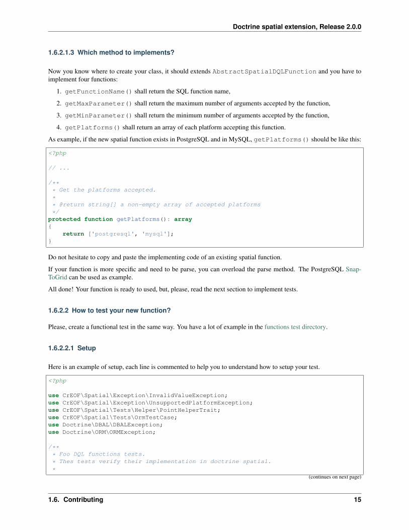
Now you know where to create your class, it should extends AbstractSpatialDQLFunction and you have toimplement four functions:
1. getFunctionName() shall return the SQL function name,
2. getMaxParameter() shall return the maximum number of arguments accepted by the function,
3. getMinParameter() shall return the minimum number of arguments accepted by the function,
4. getPlatforms() shall return an array of each platform accepting this function.
As example, if the new spatial function exists in PostgreSQL and in MySQL, getPlatforms() should be like this:
<?php
// ...
/*** Get the platforms accepted.
** @return string[] a non-empty array of accepted platforms
*/protected function getPlatforms(): array{
return ['postgresql', 'mysql'];}
Do not hesitate to copy and paste the implementing code of an existing spatial function.
If your function is more specific and need to be parse, you can overload the parse method. The PostgreSQL Snap-ToGrid can be used as example.
All done! Your function is ready to used, but, please, read the next section to implement tests.
1.6.2.2 How to test your new function?
Please, create a functional test in the same way. You have a lot of example in the functions test directory.
1.6.2.2.1 Setup
Here is an example of setup, each line is commented to help you to understand how to setup your test.
<?php
use CrEOF\Spatial\Exception\InvalidValueException;use CrEOF\Spatial\Exception\UnsupportedPlatformException;use CrEOF\Spatial\Tests\Helper\PointHelperTrait;use CrEOF\Spatial\Tests\OrmTestCase;use Doctrine\DBAL\DBALException;use Doctrine\ORM\ORMException;
/*** Foo DQL functions tests.
* Thes tests verify their implementation in doctrine spatial.
*(continues on next page)
1.6. Contributing 15

Doctrine spatial extension, Release 2.0.0
(continued from previous page)
* @author Alexandre Tranchant <[email protected]>
* @license https://alexandre-tranchant.mit-license.org MIT
** Please prevers the three above annotation.
** Group is used to exclude some tests on some environment.
* Internal is to avoid the use of the test outer of this library
* CoversDefaultClass is to avoid that your test covers other class than your new→˓class
** @group dql
** @internal
* @coversDefaultClass
*/class SpFooTest extends OrmTestCase{
// To help you to create some geometry, I created some Trait.// use it to be able to call some methods which will store geometry into your
→˓database// In this example, we use a trait that will create some points.use PointHelperTrait;
/*** Setup the function type test.
** @throws DBALException when connection failed
* @throws ORMException when cache is not set
* @throws UnsupportedPlatformException when platform is unsupported
*/protected function setUp(): void{
//If you create point entity in your test, you shall add the line above or→˓the **next** test will failed
$this->usesEntity(self::POINT_ENTITY);//If the method exists in mysql, You shall test it. Comment this line if
→˓function does not exists on MySQL$this->supportsPlatform('mysql');//If the method exists in postgresql, You shall test it. Comment this line if
→˓function does not exists on PostgreSql$this->supportsPlatform('postgresql');
parent::setUp();}
/*** Test a DQL containing function to test in the select.
** @throws DBALException when connection failed
* @throws ORMException when cache is not set
* @throws UnsupportedPlatformException when platform is unsupported
* @throws InvalidValueException when geometries are not valid
** @group geometry
*/public function testSelectSpBuffer(){
(continues on next page)
16 Chapter 1. Contents

Doctrine spatial extension, Release 2.0.0
(continued from previous page)
//The above protected method come from the point helper trait.$pointO = $this->createPointO();//Please do not forget to flush and clear cache$this->getEntityManager()->flush();$this->getEntityManager()->clear();
//We create a query using your new DQL function SpFoo$query = $this->getEntityManager()->createQuery(
'SELECT p, ST_AsText(SpFoo(p.point, :p) FROM→˓CrEOF\Spatial\Tests\Fixtures\PointEntity p'
);//Optionnaly, you can use parameter$query->setParameter('p', 'bar', 'string');//We retrieve the result$result = $query->getResult();
//Now we test the resultstatic::assertCount(1, $result);static::assertEquals($pointO, $result[0][0]);static::assertSame('POLYGON((-4 -4,4 -4,4 4,-4 4,-4 -4))', $result[0][1]);
}
Now, open the OrmTestCase.php file] and declare your function in one of this three methods:
• addStandardFunctions
• addMySqlFunctions
• addPostgreSqlFunctions
You can launch the test. This document helps you how to config your dev environment. Please do not forgot to updatedocumentation by adding your function in one of these three tables:
• Functions described in OGC Standards or in ISO/IEC 13249-3:2016
• Specific functions of the MySql database server
• Specific functions of the PostgreSql database server
1.6.3 Quality of your code
Quality of code is auto-verified by php-cs-fixer, php code sniffer and php mess detector.
Before a commit, launch the quality script:
composer check-quality-code
You can launch PHPCS-FIXER to fix errors with:
composer phpcsfixer
You can launch PHP Code Sniffer only with: .. code-block:: bash
composer phpcs
You can launch PHP Mess Detector only with:
composer phpmd
1.6. Contributing 17

Doctrine spatial extension, Release 2.0.0
1.7 Test environment
If you want to contribute to this library, you’re welcome. This section will help you to prepare your developmentenvironment.
1.7.1 How to test library?
Doctrine library is available for MySQL and PostGreSQL. Be aware that MariaDB spatial functions does not returnsthe same results than MySQL spatial functions. Then tests failed on MariaDB. So do not use MariaDB to test MySQLabstraction.
1.7.2 How to test on MySQL?
I suppose that composer and MySQL are already installed on your dev environment.
1. Create a role that can create database and locally connect with a password,
2. Create a phpunit.mysql.xml file copied from phpunit.mysql.xml.dist file,
3. Edit this phpunit.mysql.xml to change connection parameters.
4. run the command composer test-mysql
1.7.3 How to test on PostgreSQL?
I supposed that composer, PgSQL and its Postgis extension are installed.
1. Create a role that is a superuser because this user will create a database and create postgis extension,
2. Create a phpunit.pgsql.xml file copied from phpunit.pgsql.xml.dist file,
3. Edit this phpunit.pgsql.xml to change connection parameters.
4. run the command composer test-pgsql
1.7.4 How to test with the three PHP versions?
This library is available for PHP7.2, PHP7.3 and PHP7.4 versions. So you have to test library with this three versions.
If you use an IDE like PHPStorm, you can create configurations to launch the six tests suite with the corresponding to:
• MySQL, PHP7.2 and PHPUnit 8.5
• PostgreSQL, PHP7.2 and PHPUnit
• MySQL, PHP7.3 and PHPUnit 9.0
• PostgreSQL, PHP7.3 and PHPUnit
• MySQL, PHP7.4 and PHPUnit 9.0
• PostgreSQL, PHP7.4 and PHPUnit
In this section, I described an easy way to switch PHP version via console. (But there is a lot of ways to do it.)
I suppose you have installed all php versions on your dev environment.
1. Download symfony binary,
18 Chapter 1. Contents

Doctrine spatial extension, Release 2.0.0
2. Verify that PHP7.2,PHP7.3 and PHP7.4 are available:
symfony local:php:list
Version Directory PHP CLI PHP FPM PHP CGI Server→˓ System?
7.1.30 C:\Users\alexandre\Php\php-7.1 php.exe php-cgi.exe PHP→˓CGI7.2.25 C:\Users\alexandre\Php\php-7.2 php.exe php-cgi.exe PHP
→˓CGI7.3.12 C:\Users\alexandre\Php\php-7.3 php.exe php-cgi.exe PHP
→˓CGI7.4.1 C:\Users\alexandre\Php\php-7.4 php.exe php-cgi.exe PHP
→˓CGI *
3. Create a .php-version containing the PHP version to change php version
echo 7.2 > .php-version
Now PHP 7.2 will be used each time you use one of this command:
$ symfony php -vPHP 7.2.26 (cli) (built: Dec 17 2019 15:29:44) ( NTS MSVC15 (Visual C++ 2017) x64 )Copyright (c) 1997-2018 The PHP GroupZend Engine v3.2.0, Copyright (c) 1998-2018 Zend Technologieswith Xdebug v2.9.0, Copyright (c) 2002-2019, by Derick Rethans
$ symfony composer
4. Download PHPUnit.phar for version 8 and version 9: Go on https://phar.phpunit.de
5. You should now have a phpunit-8.phar and a phpunit-9.phar in your directory
6. This script launch the six test-suites:
$ echo 7.2 > .php-version$ symfony php phpunit-8.phar --configuration phpunit.mysql.xml$ symfony php phpunit-8.phar --configuration phpunit.pgsql.xml$ echo 7.3 > .php-version$ symfony php phpunit-9.phar --configuration phpunit.mysql.xml$ symfony php phpunit-9.phar --configuration phpunit.pgsql.xml$ echo 7.4 > .php-version$ symfony php phpunit-9.phar --configuration phpunit.mysql.xml$ symfony php phpunit-9.phar --configuration phpunit.pgsql.xml
1.7. Test environment 19


