2016 REMEDIAL ACTION PLAN UPDATE for the LOWER MENOMINEE RIVER AREA OF CONCERN 03/16/2017 Draft Wisconsin Department of Natural Resources Office of Great Waters Michigan Department of Environmental Quality Office of the Great Lakes Insert photo if desired
Transcript
2016 REMEDIAL ACTION PLAN UPDATE
for the
LOWER MENOMINEE RIVER AREA OF CONCERN
03/16/2017 Draft
Wisconsin Department of Natural Resources Office of Great Waters
Michigan Department of Environmental Quality
Office of the Great Lakes
Insert photo if desired
RAP Update for the Lower Menominee River AOC 03/16/2017 Draft
i
2016 Remedial Action Plan Update for the Lower Menominee River Area of Concern Compiled by Laurel Last, Wisconsin Department of Natural Resources (WDNR) Lower Menominee River Area of Concern (AOC) Coordinator, and Stephanie Swart, Michigan Department of Environmental Quality (MDEQ) Lower Menominee River AOC Coordinator With Input and Contributions From:
Citizens Advisory Committee (CAC) members Mark Erickson, Michigan Committee Co-chair Keith West, Wisconsin Committee Co-chair Becky Berry, UW-Marinette (student) Donna Buechler, Menominee Conservation District Gail Clark, M&M Great Lakes Sport Fishermen John Clark, M&M Great Lakes Sport Fishermen Jim Cox, Tyco International Nancy Douglas, Menominee Business Development Corporation John Groleau, Resolute Forest Products Stephen Kellner, Northern Anglers Fishing Club Jon Kukuk, Nest Egg Marine Trygve Rhude, Chappee Rapids Audubon Society Steve Zander, Past Wisconsin Committee Co-chair Technical Advisory Committee (TAC) members Bureau of Land Management (BLM): Derek Strohl Chappee Rapids Audubon Society: Trygve Rhude Eagle Creek Renewable Energy (ECRE), formerly North American Hydro Holdings (NAH): Rory Alsberg, Paul Radzikinas Lloyd Flanders: Mark Erickson MDEQ: Sharon Baker, Joe Bohr Michigan Department of Natural Resources (MDNR): Craig Albright, Patrick Hanchin, Jennifer Johnson, Darren Kramer, Jessica Mistak U.S. Environmental Protection Agency (USEPA): Mike Bryant, John Perrecone U.S. Fish and Wildlife Service (USFWS): Steve Choy, Betsy Galbraith, Nick Utrup University of Wisconsin-Marinette: Wendel Johnson, Keith West WDNR:
Kendra Axness, Cheryl Bougie, Donalea Dinsmore, Mike Donofrio, David Halfmann, John Huff, Laurel Last, Tammie Paoli, Vic Pappas, Ben Uvaas
Disclaimer The Great Lakes Water Quality Agreement is a non-regulatory agreement between the U.S. and Canada, and criteria developed under its auspices are non-regulatory. The actions identified in this document are needed to meet beneficial use impairment (BUI) removal targets leading to the delisting of the Lower Menominee River AOC. These actions are not subject to enforcement or regulatory actions. Cover Photo: CAC / TAC members tour the island rookery habitat restoration project. Photo by the WDNR.
RAP Update for the Lower Menominee River AOC 03/16/2017 Draft
ii
EXECUTIVE SUMMARY Considerable progress was made in the restoration of the Lower Menominee River Area of Concern (AOC; Figure 1) in 2015 and 2016. In 2015, sand cover was placed at the Ansul/Tyco Arsenic Site and the Menekaunee Harbor Legacy Site, completing the contaminated sediment remediation activities in the AOC. The Rio Vista Slough (RVS) sediment investigation results, along with the Lower Scott Flowage (LSF) results from 2014, confirmed that no additional remediation would be needed in the AOC. These 2015 milestones allowed Wisconsin and Michigan to move forward in 2016 with the process of removing the Degradation of Benthos and the Restrictions on Dredging Activities Beneficial Use Impairments (BUIs). The Wisconsin Department of Natural Resources (WDNR) and Michigan Department of Environmental Quality (MDEQ) completed the removal documentation for the two BUIs, combining the dredge management plan with the Restrictions on Dredging Activities BUI removal document, and engaging stakeholders along the way. The AOC Citizens Advisory Committee (CAC) and Technical Advisory Committee (TAC) supported removal of the two BUIs. The states submitted the Degradation of Benthos and the Restrictions on Dredging Activities BUI removal packages to the U.S. Environmental Protection Agency (USEPA) Great Lakes National Program Office (GLNPO) for concurrence on November 18, 2016. The Michigan Department of Health and Human Services (MDHHS) and the MDEQ conducted a statewide fish consumption advisory assessment that compared fish tissue contaminant levels in all Michigan AOCs, including the Menominee River, to non-AOC reference sites. The MDEQ, MDHHS, and WDNR reviewed the fish tissue assessment results in 2016 to determine impairment status. The agencies determined that the results of the study, along with other lines of evidence, show that the fish consumption advisories in the AOC are likely caused by contamination sources outside of the AOC. Therefore, the WDNR and MDEQ plan to move forward with proposing removal of the Restrictions on Fish Consumption BUI in early 2017. To remove all BUIs, activities beyond the remediation of contaminated sediment sites are required. The 2013 Fish and Wildlife Population and Habitat Management and Restoration Plan Update (Plan; WDNR and MDEQ, 2013a) is the principal document guiding the removal of the Degradation of Fish and Wildlife Populations and Loss of Fish and Wildlife Habitat impairments. The Plan lists the activities, objectives, and goals required to remove these impairments. At this time, all of the activities contributing towards the achievement of objectives have either been completed or are in progress. Four of the five overarching restoration goals and nine of the ten objectives contained in the Plan have been achieved, and only one objective and one goal remain (see Appendix A and Appendix C). Probable significant milestones to be reached in 2017:
• Removal of Degradation of Benthos BUI • Removal of Restrictions on Dredging Activities BUI • Removal of Restrictions on Fish Consumption BUI • Completion of the second year of a three-year monitoring and maintenance period at
Menekaunee Harbor habitat restoration project • Completion of the first year of a three-year monitoring and maintenance period at South Channel
habitat restoration project • Completion of native plantings and monitoring and maintenance of island rookery habitat
restoration All of the management actions required for delisting the Lower Menominee River AOC are now substantially complete. The states proposed two BUIs for removal in 2016, and plan to propose a third in 2017. The AOC could potentially be delisted in 2018, after monitoring confirms that the vegetation objectives of the habitat restoration projects are being met. Continued progress has been possible with the help of many partners who have put a lot of effort into restoring the Lower Menominee River. Great Lakes Restoration Initiative (GLRI) funding has also been a critical component of this effort.
RAP Update for the Lower Menominee River AOC 03/16/2017 Draft
iii
TABLE OF CONTENTS
EXECUTIVE SUMMARY .............................................................................................................................. II TABLE OF CONTENTS .............................................................................................................................. III
RECENT PROGRESS .................................................................................................................................. 5 WISCONSIN PUBLIC SERVICE CORPORATION (WPSC) COAL TAR SITE ........................................ 5 ANSUL/TYCO ARSENIC SITE ................................................................................................................. 5 MENEKAUNEE HARBOR LEGACY SITE ................................................................................................ 5 LOWER SCOTT FLOWAGE (LSF) SEDIMENT CHARACTERIZATION ................................................. 5 RIO VISTA SLOUGH (RVS) SEDIMENT CHARACTERIZATION ............................................................ 5 LOWER MENOMINEE RIVER FISH PASSAGE ...................................................................................... 6 ISLAND ROOKERY HABITAT RESTORATION ....................................................................................... 6 SOUTH CHANNEL .................................................................................................................................... 7 MENEKAUNEE HARBOR HABITAT RESTORATION ............................................................................. 7
STAKEHOLDER ENGAGEMENT AND OUTREACH ................................................................................. 9
BENEFICIAL USE IMPAIRMENT UPDATES ............................................................................................ 11 RESTRICTIONS ON FISH CONSUMPTION .......................................................................................... 11 RESTRICTIONS ON DREDGING ACTIVITIES ...................................................................................... 13 DEGRADATION OF BENTHOS .............................................................................................................. 14 DEGRADATION OF FISH AND WILDLIFE POPULATIONS AND LOSS OF FISH AND WILDLIFE HABITAT ................................................................................................................................................. 15 RESTRICTIONS ON RECREATIONAL CONTACT (BEACH CLOSINGS) ............................................ 17
RAP Update for the Lower Menominee River AOC 03/16/2017 Draft
iv
List of Figures Figure 1. The boundaries of the Lower Menominee River AOC ........................................................ 2 Figure 2. Restoration sites in the Lower Menominee River AOC ………………………………………4 List of Tables Table 1. Current status of BUIs in the Lower Menominee River AOC (Refer to Appendix C for
more detail) ......................................................................................................................... 3 Table 2. Community outreach activities ongoing or completed in 2015-2016…………………...…. 10 List of Appendices Appendix A Acronyms and Initialisms Appendix B Definitions Appendix C Lower Menominee River AOC Tracking Matrix Appendix D Lower Menominee River AOC Sediment Remediation Sites Summary of Goals, Actions,
and Monitoring Appendix E Goals and Objectives Table (Table 1) from 2013 Fish and Wildlife Population and Habitat
Management and Restoration Plan Update, showing progress Appendix F Letter of Support for the 2016 RAP Update from the CAC
RAP Update for the Lower Menominee River AOC 03/16/2017 Draft
1
PURPOSE STATEMENT This Remedial Action Plan (RAP), which updates the 2014 RAP, documents and communicates progress made in the AOC in the last two years and shares the path forward with our partners and stakeholders. The RAP includes a concise summary of BUI status and tracks progress on specific actions that are important for reaching the delisting targets. These “actions” may include on-the-ground restoration projects, monitoring and assessment projects, and stakeholder engagement processes. As the primary agencies with the responsibility to develop and implement the RAP, the WDNR and the MDEQ are committed to making progress in remediating and restoring this AOC. In order to be lasting and effective, the AOC program must be one of continuous improvement, evaluating its course as new information and technology become available. Subsequent RAP updates will be produced as needed to incorporate new information. RAPs are required by Annex 1 of the Great Lakes Water Quality Protocol of 2012,which replaced the 1987 Protocol and 1978 (as amended in 1983) Great Lakes Water Quality Agreement (GLWQA). The 2012 Protocol indicates that RAPs must include the following elements:
1. Identification of beneficial use impairments (BUIs) and causes; 2. Criteria for the restoration of beneficial uses that take into account local conditions and established in
consultation with the local community; 3. Remedial measures to be taken, including identification of entities responsible for implementing these
measures; 4. A summary of the implementation of remedial measures taken and the status of the beneficial use; and 5. A description of surveillance and monitoring processes to track the effectiveness of remedial measures
and confirm restoration of beneficial uses.
RAP Update for the Lower Menominee River AOC 03/16/2017 Draft
2
Figure 1. The boundaries of the Lower Menominee River AOC. Green Island, which was included in the AOC in the 1996 RAP, is not visible on this map, and is located approximately five miles east from Seagull Bar.
For additional information about the history of the AOC and a narrative description of the AOC boundary, please refer to previous RAP documents, which are available online: http://dnr.wi.gov Search “Lower Menominee River AOC”; RAP documents are stored on the “AOC Plans” tab. A listing of previous RAPs, RAP Updates, and important historical documents is included in the References section.
RAP Update for the Lower Menominee River AOC 03/16/2017 Draft
3
Table 1. Current status of BUIs in the Lower Menominee River AOC (Refer to Appendix C for more detail).
Beneficial Use Impairment BUI Status Summary Status
Restrictions on fish consumption Impaired
Results of MDHHS and MDEQ fish consumption advisory assessment and LSF and RVS sediment assessments show that contaminants measured in fish collected from AOC are primarily from sources outside of AOC. The MDEQ and WDNR intend to propose removal of this BUI in early 2017.
Restrictions on dredging activities
Removal in progress
All required actions completed, including four sediment remediation projects, two sediment assessment projects, and dredge management plan. Recommendation to remove impaired status submitted to USEPA GLNPO for concurrence in November 2016. See http://dnr.wi.gov/topic/greatlakes/menominee.html for final removal package.
Degradation of benthos Removal in progress
All required actions completed, including four sediment remediation projects and two sediment assessment projects. Recommendation to remove impaired status submitted to USEPA GLNPO for concurrence in November 2016. See http://dnr.wi.gov/topic/greatlakes/menominee.html for final removal package.
Degradation of fish and wildlife populations and Loss of fish and wildlife habitat
Impaired
Final restoration goals, objectives, and activities are contained in the 2013 Fish and Wildlife Population and Habitat Management and Restoration Plan Update (WDNR and MDEQ, 2013a). Four of five goals have been achieved. All habitat restoration projects are substantially complete. Target fish species are meeting their population goals. These BUIs could be removed as early as 2018 if monitoring confirms vegetation objectives of the habitat restoration projects are being met.
Beach closings Removed Source control was achieved. Recommendation to remove impaired status approved by USEPA GLNPO in March 2011. See http://dnr.wi.gov/topic/greatlakes/documents/MenomineeRiverRecContact.pdf for final removal package with GLNPO letter of concurrence.
RAP Update for the Lower Menominee River AOC 03/16/2017 Draft
4
Figure 2. Restoration sites in the Lower Menominee River AOC. Sediment Cleanup Sites 1. Green Bay Paint Sludge Site (Lloyd Flanders) 2. Wisconsin Public Service Corporation Coal Tar Site 3. Ansul/Tyco Arsenic Site 4. Menekaunee Harbor Legacy Site Wildlife Habitat Restoration Sites 5. Park Mill Dam Downstream Fish Passage 6. Little Blueberry Island 7. Blueberry Island 8. Menominee Dam Fish Passage 9. Boom Island 10. Strawberry Island 11. South Channel Habitat Restoration 12. Menekaunee Harbor Habitat Restoration
RAP Update for the Lower Menominee River AOC 03/16/2017 Draft
5
RECENT PROGRESS Recent progress for specific AOC projects is described below. These projects all contribute toward the removal of BUIs in this AOC. See the AOC Tracking Matrix (Appendix C) for more details on BUIs addressed, status, management, funding sources, and costs for these projects and all of the other actions needed to remove the BUIs and delist the AOC. See Appendix D for a summary of the goals, actions, monitoring, and current status of the four sediment remediation sites. The status of the BUIs is briefly summarized in Table 1.
WISCONSIN PUBLIC SERVICE CORPORATION (WPSC) COAL TAR SITE The WPSC Marinette Manufactured Gas Plant Site is located along the southern bank of the Menominee River in the city of Marinette near Boom Landing (No. 2, Figure 2). While the plant was operating from 1910 to 1960, waste coal tar from the plant was discharged to the river via a former slough, contaminating the river sediments. Negotiations between the USEPA Superfund, WDNR, and WPSC resulted in a decision in 2012 to remove the coal tar contaminated sediments. Site remediation was completed in 2013. Ongoing work includes maintenance and monitoring of the reactive core mat and monitoring of the sand cover, and requires a five-year review in 2018. More information on the WPSC coal tar site remediation is found in Appendix D, previous RAPs, and the USEPA web page https://cumulis.epa.gov/supercpad/cursites/csitinfo.cfm?id=0509952.
ANSUL/TYCO ARSENIC SITE The Ansul/Tyco Arsenic Site is located downstream of the WPSC site along the southern bank of the Menominee River in the city of Marinette, adjacent to the Tyco International facility (No. 3, Figure 2). Arsenic contamination resulted from arsenic salts produced as a byproduct of herbicide manufacturing by the Ansul Chemical Company between 1957 and 1977. The USEPA Resource Conservation and Recovery Act (RCRA)-led remediation project, which required removal of all sediment with arsenic levels at or below 50 parts per million (ppm), was completed in 2014. The final arsenic sediment RCRA remedial action objective of 20 ppm or less was achieved in 2015 by completion of a project under the Great Lakes Legacy Act (GLLA) by USEPA, WDNR, and Tyco. Ongoing work at the Tyco Arsenic Site includes monitoring of the steel barrier wall, upgrades to existing storm water controls, and sediment monitoring. The first five-year review report was submitted in 2013, and the next five-year report is due in 2018. See Appendix D, previous RAPs, or the USEPA web page http://www.epa.gov/region5/cleanup/rcra/ansul/index.html for additional information.
MENEKAUNEE HARBOR LEGACY SITE Menekaunee Harbor is located south of the mouth of the Menominee River at the terminus of the south channel (No. 4, Figure 2). It is owned primarily by the city of Marinette. Sediment quality in the harbor was degraded by elevated levels of metals and polycyclic aromatic hydrocarbons (PAHs) from various historical activities both at the harbor and upstream. The City and the WDNR worked together to remove contaminated and non-contaminated sediment from the harbor in 2014 and 2015, as part of a larger habitat restoration project. See Appendix D, previous RAPs, or the city of Marinette web page http://www.marinette.wi.us/index.php/visitors/menekaunee-harbor-project for additional information.
LOWER SCOTT FLOWAGE (LSF) SEDIMENT CHARACTERIZATION In 2013, the USEPA GLNPO performed a sediment assessment in the LSF (between the Menominee and Park Mill Dams) to determine whether the area was a source of contaminants in the AOC. Parameters analyzed included polychlorinated biphenyls (PCBs), PAHs, pesticides, metals, and sediment physical properties. The final results showed that no contaminants were found at levels requiring remedial action (CH2MHill, 2014).
RIO VISTA SLOUGH (RVS) SEDIMENT CHARACTERIZATION MDEQ Surface Water Assessment Section (SWAS) staff conducted a sediment characterization study of RVS (in Michigan just upstream of the US 41 highway bridge) in 2014. Samples were analyzed for PCBs, heavy metals, and PAHs. The final results showed that no contaminants were found at levels requiring remedial action (MDEQ, 2015).
RAP Update for the Lower Menominee River AOC 03/16/2017 Draft
6
LOWER MENOMINEE RIVER FISH PASSAGE The Menominee Fish Passage Partnership, comprised of state and federal agencies, nonprofit conservation organizations, and a private energy company, has engineered and implemented safe and effective ways for lake sturgeon to move around the Park Mill (a.k.a. Upper Scott; No. 5, Figure 2) and Menominee (a.k.a. Lower Scott or Bridge Street; No. 8, Figure 2) Dams in the AOC. Safe upstream adult lake sturgeon passage and safe downstream passage of adult and juvenile lake sturgeon directly impact the Lake Michigan lake sturgeon population. Eagle Creek Renewable Energy (ECRE), formerly North American Hydro, is the owner/operator of the two hydroelectric dams. Upstream sturgeon passage, accomplished by building a fish elevator into one of the existing empty turbine bays of the Menominee Dam to lift and sort adult lake sturgeon, has been operational since May of 2015. As the sturgeon are sorted, biologists check for fish health and disease, take biological measurements, collect physical samples as needed, and remove any invasive species such as sea lamprey. Adult sturgeon approved for passage are loaded into a truck with trailer for transport to a release point above the Park Mill Dam. Most of the fish passed have been implanted with acoustic transmitters in order to monitor their movements with several stationary receivers distributed over 25 river miles, from the Grand Rapids dam to the Menominee River mouth. Biologists have been testing the fish lift and studying the sturgeon in order to maximize the effectiveness of the upstream passage. While lake sturgeon is the only fish species passed upstream, the fish lift collects a variety of other fish species. Biologists also collect data from the fish not passed upstream before returning them to the river below the Menominee Dam. Downstream fish passage involves the use of surface bypasses and fish guidance systems at each dam, effectively allowing both juvenile and adult fishes to pass safely downstream of the dams. While the surface bypass is all that is needed for passage of adult fish, safe and effective downstream passage of juvenile fish requires modification to the powerhouse intake racks. Downstream fish passage at Park Mill Dam, which was accomplished by installing an angled fish guidance rack in front of the turbine intake to redirect fish moving downstream into a surface bypass leading to the tailrace below, became operational in 2015. Downstream fish passage at the Menominee Dam, which was accomplished by modifying the intake trash rack angle and spacing to redirect fish moving downstream into a surface bypass constructed at the location of an abandoned fish ladder, was completed in 2016. It will only be operational from April through November of each year, so ECRE will begin using the flume in the spring of 2017. The downstream passage structures were designed for lake sturgeon, but project partners expect these structures to be utilized by other fish species as well. Biologists will evaluate downstream movement of all fish species with underwater cameras and computer software at both dams.
ISLAND ROOKERY HABITAT RESTORATION A U.S. Army Corps of Engineers (USACE) project to improve rookery habitat on Little Blueberry, Blueberry, Boom, and Strawberry Islands (Nos. 6, 7, 9, and 10, respectively, Figure 2) has made substantial progress since it began in September 2014. The focus of this three-year project is on controlling invasive plants, restoring native plant communities, and supporting colonial nesting bird populations. Strawberry Island is currently home to a large breeding colony of egrets and herons, while Little Blueberry Island, Blueberry Island, and Boom Island have some potential for providing rookery habitat. Invasive plant species of concern include common buckthorn, glossy buckthorn, common reed (Phragmites australis), and bush honeysuckle. Riverbank grape is native to this region, but it is also a treatment target species of concern for this project. On Strawberry Island, nesting trees have lost crowns and branches due to heavy grapevines. An Invasive Species Control and Management Plan was completed for the islands in February 2015 (Ecology and Environment, Inc., 2015). Two rounds of mechanical and chemical treatment of invasive plants were completed in 2015. At the end of 2015, the majority of the cutting of woody material had been completed, including extensive buckthorn cutting on Little Blueberry Island and riverbank grape on Strawberry Island. The work on Strawberry Island was only performed while the rookery was not active. Nearly half of the cut material on Little Blueberry was chipped, and the rest remained in debris piles. In 2016, the remaining piles on Little Blueberry and Blueberry Islands were chipped, including debris piles
RAP Update for the Lower Menominee River AOC 03/16/2017 Draft
7
on Blueberry Island from a previous control project in 2013. Two to three more rounds of treatment were performed, primarily foliar chemical treatment. In the fall, some initial small-scale restoration plantings were installed, including trees, shrubs, and a sedge meadow seed mix. These plantings will be monitored, and the results will inform plans for larger-scale plantings installed in spring and fall of 2017. Monitoring has been a very important component of this project; the data collected are used to measure project progress and direct future efforts. Bird surveys during spring migration, breeding season, and fall migration have been conducted to monitor bird species diversity, abundance, and habitat use. Rookery surveys, conducted with volunteers from the Chappee Rapids Audubon Society, have been used to monitor nesting activity on Strawberry Island. Vegetation surveys have been used to record the response of both invasive and native species to treatments and to inform future treatments A Year One Monitoring Report summarizes the work and monitoring results from fall 2014 through the end of 2015 (Ecology and Environment, Inc., 2016).
SOUTH CHANNEL The South Channel habitat restoration project (No. 11, Figure 2), being implemented by the city of Marinette and WDNR with funding from a USEPA GLRI grant, is nearly complete. The U.S. Fish and Wildlife Service (USFWS) hired Anderson Engineering of Minnesota, LLC, with sub-consultant Inter-Fluve, Inc., to complete the South Channel habitat design in September 2014. Input from the CAC, TAC, WDNR and MDEQ staff was included to ensure plans were consistent with the 2013 Fish and Wildlife Population and Habitat Management and Restoration Plan Update (Plan; WDNR and MDEQ, 2013a). The final designs and specifications were completed in November 2015. Note that additional GLLA funds for habitat restoration were used for invasive Phragmites australis treatment in the South Channel area prior to the implementation of the habitat restoration project. Treatment occurred in September 2015, and then in November 2015 canes were cut and removed in areas where planting and seeding would later occur as part of the habitat restoration project. In early 2016, the city of Marinette hired Robert E. Lee & Associates, Inc. (REL) to oversee the project. After the initial solicitation for open bids for project implementation, the bids came in too high, primarily due to a 2.5-foot rise in water levels since the project was designed, which made the dewatering required for the placement of sand and soil bars along the southern bank of the river unaffordable. REL revised the plans to make the project more affordable, while still meeting the fish and wildlife goals of the Plan. The City then hired Applied Ecological Services, Inc. (AES) to implement the revised project design. The revised design improved wetland habitat by expanding the area treated for invasive plant species and planted with native species to approximately 30 acres. It enhanced northern pike habitat by providing a channel to improve access to the restored wetlands for spawning. It improved turtle nesting areas and added loafing platforms for turtles, ducks, and other animals. As in the original design, woody structures were installed to improve fish habitat; nesting structures were installed for waterfowl, wading birds, raptors, songbirds, and bats; and rocky material was removed from under the Ogden Street Bridge to improve flows, fish passage, and overall stream connectivity between South Channel and Menekaunee Harbor. The project is now substantially complete, with some additional native plantings planned for spring of 2017. AES will follow the approved Maintenance Plan to perform follow-up invasive plant monitoring and control through 2019 to ensure that native vegetation is established and project and AOC goals are met. In addition, Keith West, PhD UW-Marinette, has volunteered himself and his students to perform monitoring and maintenance at the site to ensure the habitat restoration is successful over the long term. See the city of Marinette web page http://www.marinette.wi.us/index.php/visitors/south-channel-habitat-restoration for additional information.
MENEKAUNEE HARBOR HABITAT RESTORATION The Menekaunee Harbor habitat restoration project (No. 12, Figure 2), also being implemented by the city of Marinette and the WDNR with funding from a USEPA GLRI grant, is substantially complete, except for
RAP Update for the Lower Menominee River AOC 03/16/2017 Draft
8
follow-up monitoring and maintenance through November 2018. Habitat restoration work began in August 2015 and was completed in summer 2016. Since additional funds were available, the restoration area was expanded to the east and south. This work on the additional 6.77 acre area was completed in the latter half of 2016. Restoration activities include the following: control of invasive plant species; planting of native seeds (including wild rice), plants, trees, and shrubs; installation of nesting and roosting structures for birds and bats; and placement of wood structures (logs, brush piles, and “fish sticks”) for fish and wildlife habitat (NES, 2015). The contractors will follow the approved Maintenance Plan for vegetation monitoring and maintenance through November 2018 to assure that the objectives of the project are being met. In addition, Keith West, PhD UW-Marinette, has volunteered himself and his students to perform monitoring and maintenance to ensure the habitat restoration is successful over the long term. See the city of Marinette web page http://www.marinette.wi.us/index.php/visitors/menekaunee-harbor-project for additional information.
RAP Update for the Lower Menominee River AOC 03/16/2017 Draft
9
STAKEHOLDER ENGAGEMENT AND OUTREACH The CAC was formed in 1988 as a means of incorporating stakeholder feedback into the RAP documents and to serve as ambassadors on AOC issues to the Marinette and Menominee communities (WDNR and MDNR, 1990). CAC members help the agencies by identifying local issues, developing local targets and goals, serving as a resource for historical information, and assisting in project implementation when possible. The CAC developed governing bylaws in June 2011, and then revised those bylaws in October 2016, to ensure the committee’s long-term viability and balanced representation of the community. As of December 2016, there are 13 membership positions filled of a possible 26. Dozens more individuals have attended monthly meetings and currently receive meeting minutes and AOC updates through e-mail. The WDNR and MDEQ strongly prefer that requests to remove the impaired designation of a BUI be agreed to by the CAC. The CAC has included a letter of support for this document as Appendix F. The CAC holds around nine to ten regular meetings per year on the University of Wisconsin-Marinette campus, open to all interested parties. Meetings are advertised through the WDNR Public Meetings Calendar (http://dnr.wi.gov/Calendar/Meetings/) and the CAC e-mail distribution list. Participation in meetings is the primary way members of the CAC stay informed and provide input on AOC activities. In addition to attending CAC meetings, the CAC members have been active in the AOC in the following ways: participated in tours of remediation and restoration projects, reviewed documents and provided letters of support for AOC projects, provided local representation or feedback at various state and federal AOC meetings, and hosted and participated in AOC open house events. The informed CAC plays a critical role in conducting community outreach. Table 2 lists community outreach activities ongoing or completed in 2015-2016. Members of the CAC actively manage and present the AOC foldout educational display at community events, including the Menekaunee Old Timers Picnic and local fishing derbies and tournaments. Print copies of the display travel between UW-Marinette, local public libraries, and governmental buildings. Using WDNR capacity grant funding, the display was updated in 2015, along with AOC informational signs posted at local boat launches and other public access points, including Menekaunee Harbor. Additional signs were produced in 2016 to highlight various aspects of the Menekaunee Harbor habitat restoration. Starting in 2015, Michigan Public Advisory Council (PAC) Support Grants have assisted the Menominee Conservation District (MCD) to provide fiduciary, secretariat, and outreach support to the CAC. The MCD is helping the CAC and states with producing meeting agendas and minutes, maintaining and updating an AOC Facebook page and an AOC website, developing and distributing outreach materials, and planning and carrying out community outreach events. Several CAC members have provided interviews for short videos on the Menominee River AOC. Short videos on AOC-related topics are seen as a way to efficiently reach a large, broad audience. Videos can easily be distributed online through agency websites, and shared through social media outlets. New videos produced in 2015 included one on the Menekaunee Harbor restoration project and two on the sturgeon passage project. New videos will be pursued to cover additional topics in the AOC as needed. Existing videos pertaining to the Lower Menominee River AOC are available below as examples:
• Lower Menominee River AOC Video
• Menominee River Sturgeon Passage
• The Sturgeon Passage: Up River Refuge
• The Sturgeon Passage: Getting a Lift
• Menekaunee: Bringing the Harbor to Life
• U.S. Geological Survey Swallow Contaminant Study
• Controlling Phragmites along the Lake Michigan Shoreline
RAP Update for the Lower Menominee River AOC 03/16/2017 Draft
10
Table 2: Community outreach activities ongoing or completed in 2015-2016. MEDIA TARGET AUDIENCE MESSAGES LEAD COLLABORATORS FUNDED BY
Traveling Educational Display and Outreach Materials
General public, tourists, people attending Marinette/Menominee community events
The Lower Menominee River is an AOC. Details on major restoration and cleanup projects. The CAC and how to get involved.
CAC WDNR, UW-Extension, MDEQ
2015 WDNR CAC capacity grant: design printing of updated panels and giveaways for outreach events
Lower Menominee River AOC Videos
General public, internet users
Many partners have worked together to restore the Lower Menominee River. Focus on fish passage and Menekaunee Harbor.
WDNR CAC, City of Marinette, Harbor Town Marine, ECRE, MDNR, USFWS, USEPA, UW-Extension
2014 and 2015 WDNR CAC capacity grants
AOC Boat Launch and Menekaunee Harbor Signs
General public, tourists, canoeists, kayakers, boaters, anglers
The Lower Menominee River is an AOC. Details on major restoration and cleanup projects. This work benefits everyone.
CAC WDNR, UW-Extension, MDEQ
2015 and 2016 WDNR CAC capacity grants: design printing of updated signs
AOC Facebook Page and Website
General public, CAC members, internet users
The Lower Menominee River is an AOC. Details and updates on restoration projects. The CAC and how they can get involved.
CAC MCD, WDNR, MDEQ 2016 MI PAC grant: MCD time to maintain and update sites
Open House Event (September 2016)
General public Great progress has been made in restoring the AOC. Details on major restoration and cleanup projects. The CAC and how they can be involved.
CAC WDNR, UW-Marinette, MDEQ
2016 WDNR CAC capacity grant: refreshments; 2016 MI PAC grant: MCD time for planning and participation
Waterfront Cleanup Event (September 2015)
General public, waterfront cleanup volunteers
The Lower Menominee River is an AOC. They can help by pitching in to clean it up. The CAC and how they can be involved.
CAC WDNR, Nestegg Marine, UW-Marinette
2015 WDNR CAC capacity grant: volunteer supplies; 2015 MI PAC grant: MCD time for planning and participation
Next action(s) needed CAC/PAC capacity grant funding will be sought in 2017 from the MDEQ and WDNR to continue to build community understanding, interest, and involvement in the AOC through the delisting process and promote ongoing citizen-led stewardship to help this area achieve its full potential. Priorities for 2017 include conducting an AOC-focused volunteer waterfront cleanup, holding a public event to mark the removal of BUIs and completion of AOC management actions, creating and installing additional signs highlighting AOC restoration projects, and creating another short video showing recent AOC habitat restoration progress.
RAP Update for the Lower Menominee River AOC 03/16/2017 Draft
11
BENEFICIAL USE IMPAIRMENT UPDATES
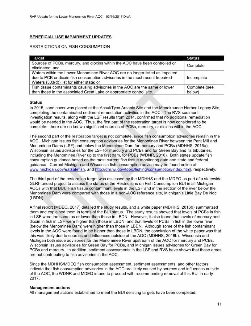
RESTRICTIONS ON FISH CONSUMPTION Target Status Sources of PCBs, mercury, and dioxins within the AOC have been controlled or eliminated; and Complete
Waters within the Lower Menominee River AOC are no longer listed as impaired due to PCB or dioxin fish consumption advisories in the most recent Impaired Waters (303(d)) list for either state; or
Incomplete
Fish tissue contaminants causing advisories in the AOC are the same or lower than those in the associated Great Lake or appropriate control site.
Complete (see below)
Status In 2015, sand cover was placed at the Ansul/Tyco Arsenic Site and the Menekaunee Harbor Legacy Site, completing the contaminated sediment remediation activities in the AOC. The RVS sediment investigation results, along with the LSF results from 2014, confirmed that no additional remediation would be needed in the AOC. Thus, the first part of the restoration target is now considered to be complete: there are no known significant sources of PCBs, mercury, or dioxins within the AOC. The second part of the restoration target is not complete, since fish consumption advisories remain in the AOC. Michigan issues fish consumption advisories for the Menominee River between the Park Mill and Menominee Dams (LSF) and below the Menominee Dam for mercury and PCBs (MDHHS, 2016a). Wisconsin issues advisories for the LSF for mercury and PCBs and for Green Bay and its tributaries, including the Menominee River up to the first dam, for PCBs (WDNR, 2016). Both states update fish consumption guidance based on the most current fish tissue monitoring data and state and federal guidance. Current Michigan and Wisconsin fish consumption advice may be found online at www.michigan.gov/eatsafefish, and http://dnr.wi.gov/topic/fishing/consumption/index.html, respectively. The third part of the restoration target was assessed by the MDHHS and the MDEQ as part of a statewide GLRI-funded project to assess the status of the Restrictions on Fish Consumption BUI in all Michigan AOCs with that BUI. Fish tissue contaminant levels in the LSF and in the section of the river below the Menominee Dam were compared with those in a non-AOC reference site, Michigan’s Little Bay De Noc (LBDN). A final report (MDEQ, 2017) detailed the study results, and a white paper (MDHHS, 2016b) summarized them and explained them in terms of the BUI status. The study results showed that levels of PCBs in fish in LSF were the same as or lower than those in LBDN. However, it also found that levels of mercury and dioxin in fish in LSF were higher than those in LBDN, and that levels of PCBs in fish in the lower river (below the Menominee Dam) were higher than those in LBDN. Although some of the fish contaminant levels in the AOC were found to be higher than those in LBDN, the conclusion of the white paper was that this was likely due to sources and influences outside of the AOC (MDHHS, 2016b). Wisconsin and Michigan both issue advisories for the Menominee River upstream of the AOC for mercury and PCBs. Wisconsin issues advisories for Green Bay for PCBs, and Michigan issues advisories for Green Bay for PCBs and mercury. In addition, sediment assessments in the LSF and RVS have shown that these areas are not contributing to fish advisories in the AOC. Since the MDHHS/MDEQ fish consumption assessment, sediment assessments, and other factors indicate that fish consumption advisories in the AOC are likely caused by sources and influences outside of the AOC, the WDNR and MDEQ intend to proceed with recommending removal of this BUI in early 2017. Management actions All management actions established to meet the BUI delisting targets have been completed:
RAP Update for the Lower Menominee River AOC 03/16/2017 Draft
12
• Remediation of Green Bay paint sludge/sediment completed and meeting targets • Remediation of WPSC coal tar sediment completed and meeting targets • Remediation of Ansul/Tyco arsenic sediment completed and meeting targets • Remediation of Menekaunee Harbor sediment completed and meeting targets • LSF sediment characterization showed that LSF sediment is not a significant source of PCBs,
mercury, or dioxins to the AOC • RVS sediment characterization showed that RVS sediment is not a significant source of PCBs,
mercury, or dioxins to the AOC See the “RECENT PROGRESS” section for a detailed account of the status of these activities.
RAP Update for the Lower Menominee River AOC 03/16/2017 Draft
13
RESTRICTIONS ON DREDGING ACTIVITIES Target Status All remediation actions for known contaminated sediment sources are completed and monitored according to the approved remediation plans and the remedial action goals have been achieved; and
Complete
An AOC dredge management plan is developed by the communities and agencies that includes an evaluation of:
o Restrictions that must remain in place to protect human health and the environment
o Restrictions that must remain in place due to RCRA requirements that are based upon state and federal law
o Priority areas for navigational use o Priority areas for utility dredging, e.g., utility crossings o Identify costs and funding options for removing dredging restrictions in
priority areas
Complete
Status In 2015, sand cover was placed at the Ansul/Tyco Arsenic Site and the Menekaunee Harbor Legacy Site, completing the contaminated sediment remediation activities in the AOC. The RVS sediment investigation results, along with the LSF results from 2014, confirmed that no additional remediation would be needed in the AOC. Thus, the first part of the restoration target is now considered to be complete. The WDNR and MDEQ developed dredge management plan documentation, which was incorporated into the BUI removal package. The states completed the BUI removal package, engaging stakeholders along the way, including posting the document online for public review and providing an opportunity for in-person document review, questions, and comments at an AOC open house event hosted by the AOC CAC. Both the CAC and the TAC supported removal of the BUI. The states submitted the BUI removal package to the USEPA GLNPO for concurrence on November 18, 2016. As of December 31, 2016, the USEPA GLNPO was reviewing the document. See http://dnr.wi.gov/topic/greatlakes/menominee.html for the final BUI removal package. Management actions All management actions established to meet the BUI delisting targets have been completed:
• Remediation of Green Bay paint sludge/sediment completed and meeting targets • Remediation of WPSC coal tar sediment completed and meeting targets • Remediation of Ansul/Tyco arsenic sediment completed and meeting targets • Remediation of Menekaunee Harbor sediment completed and meeting targets • LSF sediment characterization showed no remediation needed • RVS sediment characterization showed no remediation needed
See the “RECENT PROGRESS” section for a detailed account of the status of these activities.
RAP Update for the Lower Menominee River AOC 03/16/2017 Draft
14
DEGRADATION OF BENTHOS Target Status All remediation actions for known contaminated sediment sources are completed and monitored according to the approved plan and have met their remedial action goal.
Complete
Status In 2015, sand cover was placed at the Ansul/Tyco Arsenic Site and the Menekaunee Harbor Legacy Site, completing the contaminated sediment remediation activities in the AOC. The RVS sediment investigation results, along with the LSF results from 2014, confirmed that no additional remediation would be needed in the AOC. Thus, the restoration target is now considered to be complete. The WDNR and MDEQ developed the BUI removal package, engaging stakeholders along the way, including posting the document online for public review and providing an opportunity for in-person document review, questions, and comments at an AOC open house event hosted by the AOC CAC. Both the CAC and the TAC supported removal of the BUI. The states submitted the BUI removal package to the USEPA GLNPO for concurrence on November 18, 2016. As of December 31, 2016, the USEPA GLNPO was reviewing the document. See http://dnr.wi.gov/topic/greatlakes/menominee.html for the final BUI removal package. Management actions All management actions established to meet the BUI delisting targets have been completed:
• Remediation of Green Bay paint sludge/sediment completed and meeting targets • Remediation of WPSC coal tar sediment completed and meeting targets • Remediation of Ansul/Tyco arsenic sediment completed and meeting targets • Remediation of Menekaunee Harbor sediment completed and meeting targets • LSF sediment characterization showed no remediation needed • RVS sediment characterization showed no remediation needed
See the “RECENT PROGRESS” section for a detailed account of the status of these activities.
RAP Update for the Lower Menominee River AOC 03/16/2017 Draft
15
DEGRADATION OF FISH AND WILDLIFE POPULATIONS AND LOSS OF FISH AND WILDLIFE HABITAT Target Status A local fish and wildlife habitat management and restoration plan has been developed and implemented for the Lower Menominee River AOC that:
o Defines the causes of fish and wildlife population and habitat impairments within the AOC
o Establishes site specific habitat and population objectives for fish and wildlife species within the AOC
o Identifies fish and wildlife population restoration programs and activities within the AOC and establishes a mechanism to assure coordination among states and programs for assessment monitoring, implementation activities and associated monitoring; and
Development complete, implementation in progress
o The programs and actions necessary to accomplish the recommendations are identified in the fish and wildlife management and restoration plan are implemented; and
Incomplete, in progress
o Monitoring conducted according to the Fish and Wildlife Plan shows consistent improvement in the quality and quantity of habitat or populations identified in the plan
Incomplete, in progress
Please note: o Removal of this BUI will be based on achievement of implementation of
actions in the steps above, including monitoring conducted according to site plans and showing consistent improvement in quantity or quality of habitat or populations addressed in the criteria.
o Habitat values and populations need not be fully restored prior to delisting, as some may take many years to recover after actions are complete.
o Actions already implemented in AOCs may be reported and evaluated as long as the reports contain all the elements above.
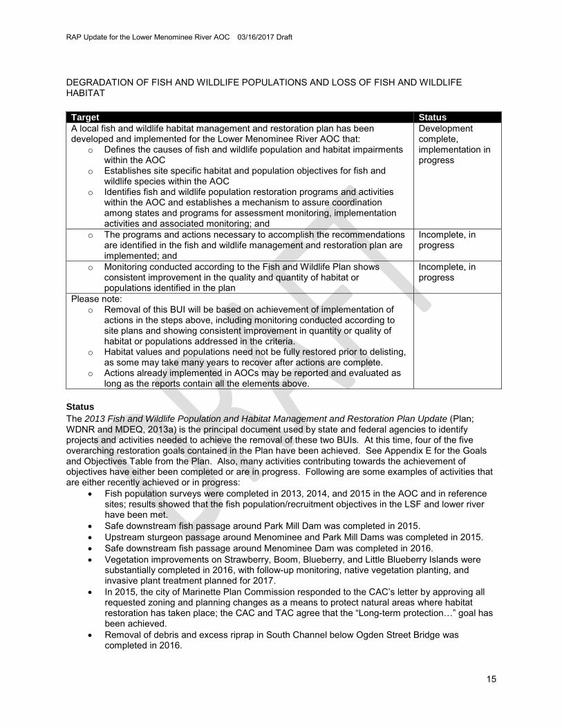
Status The 2013 Fish and Wildlife Population and Habitat Management and Restoration Plan Update (Plan; WDNR and MDEQ, 2013a) is the principal document used by state and federal agencies to identify projects and activities needed to achieve the removal of these two BUIs. At this time, four of the five overarching restoration goals contained in the Plan have been achieved. See Appendix E for the Goals and Objectives Table from the Plan. Also, many activities contributing towards the achievement of objectives have either been completed or are in progress. Following are some examples of activities that are either recently achieved or in progress:
• Fish population surveys were completed in 2013, 2014, and 2015 in the AOC and in reference sites; results showed that the fish population/recruitment objectives in the LSF and lower river have been met.
• Safe downstream fish passage around Park Mill Dam was completed in 2015. • Upstream sturgeon passage around Menominee and Park Mill Dams was completed in 2015. • Safe downstream fish passage around Menominee Dam was completed in 2016. • Vegetation improvements on Strawberry, Boom, Blueberry, and Little Blueberry Islands were
substantially completed in 2016, with follow-up monitoring, native vegetation planting, and invasive plant treatment planned for 2017.
• In 2015, the city of Marinette Plan Commission responded to the CAC’s letter by approving all requested zoning and planning changes as a means to protect natural areas where habitat restoration has taken place; the CAC and TAC agree that the “Long-term protection…” goal has been achieved.
• Removal of debris and excess riprap in South Channel below Ogden Street Bridge was completed in 2016.
RAP Update for the Lower Menominee River AOC 03/16/2017 Draft
16
• South Channel habitat restoration was substantially completed in 2016, with follow-up monitoring and invasive plant treatment planned for 2017, 2018, and 2019.
• Menekaunee Harbor habitat restoration was completed in 2016, with invasive plant monitoring and treatment planned for 2017 and 2018.
• Larval lake whitefish monitoring was completed in 2015, with a final report in 2016. All that remains is follow-up monitoring and treatment of invasive vegetation at the South Channel, Menekaunee Harbor, and island rookery habitat restoration sites, and some planting of native vegetation at the South Channel and island sites. The MDEQ and WDNR intend to assess the status of these sites in 2018, in order to determine whether the final restoration goal for a healthy and diverse vegetation community has been achieved. These BUIs could be removed in 2018. Management actions All management actions required for BUI removal are substantially complete. This includes the following projects:
• Menekaunee Harbor Restoration • South Channel Habitat Restoration • Island Rookery Habitat Restoration • Upstream and downstream safe fish passage at the Park Mill and Menominee Dams
See the “RECENT PROGRESS” section and the AOC Tracking Matrix in Appendix C for more details on the above projects and other activities required for removal of these BUIs.
RAP Update for the Lower Menominee River AOC 03/16/2017 Draft
17
RESTRICTIONS ON RECREATIONAL CONTACT (BEACH CLOSINGS) Target Status No waterbodies within the AOC are included on the list of non-attaining waters due to contamination with pathogens from combined sewer overflows in the most recent Clean Water Act Water Quality and Pollution Control in either states: Section 303(d) and 305(b) Integrated Report (Integrated Report), which are submitted to the USEPA every two years; or
In cases where the waterbodies within the AOC are on the list of non-attaining waters due to the presence of Combined Sewer Overflows (CSOs) or are impacted by upstream CSOs, this BUI will be considered restored when CSOs have been eliminated or are being treated; or
Completed
In cases where CSOs still exist and significant progress has been made towards their elimination or treatment, this BUI will be considered restored when:
1. All known sources of bacterial contamination to the AOC originating in the AOC and tributary watersheds have been controlled or treated to reduce exposures; and
2. No unpermitted sanitary sewer overflows have occurred within the AOC during the previous five year period as a result of a less than 25-year precipitation event or snow/ice melt conditions; and
3. Marinette, WI and Menominee, MI have adopted and are implementing storm water reduction programs, including an illicit discharge elimination program.
Completed using option 3
Status This BUI was removed in 2011. Management actions This BUI has been removed; therefore, no further actions are needed.
RAP Update for the Lower Menominee River AOC 03/16/2017 Draft
18
REFERENCES CH2MHill, 2014. Final Site Characterization Report: Assessment of Contaminated Sediments in the
Lower Scott Flowage in the Menominee River Area of Concern Site. Prepared for USEPA. U.S. Environmental Protection Agency, 77 West Jackson Boulevard, Chicago, IL 60604.
Ecology and Environment, Inc., 2015. Invasive Species Control and Management Plan Aquatic Plant
Control for Rookery Habitat Menominee River Area of Concern Menominee, Wisconsin, and Michigan. Prepared for United States Army Corps of Engineers. February 2015.
Ecology and Environment, Inc., 2016. Year 1 Monitoring Report for the Menominee River Area of
Concern (AOC) Aquatic Plant Control for Rookery Habitat Aquatic Plant Control Research Program (APCRP). Prepared for United States Army Corps of Engineers Buffalo District. July 2016.
GLWQA, 1987. Agreement on Great Lakes water quality, 1978, with annexes and terms of reference.
Signed at Ottawa November 22, 1978. Entered into force November 22, 1978. 30 UST 1383; TIAS 9257; 1153 UNTS 187. Amendments: October 16, 1983 (35 UST 2370; TIAS 10798), November 18, 1987 (TIAS 11551; 2185 UNTS 504).
GLWQA, 2013. Agreement on Great Lakes water quality, 1978, with annexes and terms of reference.
Signed at Ottawa November 22, 1978. Entered into force November 22, 1978. 30 UST 1383; TIAS 9257; 1153 UNTS 187. Amendments: October 16, 1983 (35 UST 2370; TIAS 10798), November 18, 1987 (TIAS 11551; 2185 UNTS 504), September 7, 2012 (TIAS 13-212), last amendment entered into force February 12, 2013. http://www.epa.gov/glnpo/glwqa/20120907-Canada-USA_GLWQA_FINAL.pdf.
MDEQ, 2015. Sediment Chemistry of Rio Vista Slough, Menominee River Area of Concern, Menominee
County, Michigan, June 24, 2014. MI/DEQ/WRD-15/023. Keiper, W. MDEQ-Water Resources Division, 525 W. Allegan, P.O. Box 30242, Lansing, MI 48909-7742
MDEQ, 2017. Staff Report: Status of Fish Contaminant Levels in the Lower Menominee Area of
Concern. MI/DEQ/WRD-16/005, Revised March 8, 2017. Bohr, J. Attachment in http://www.michigan.gov/documents/mdhhs/MENOMINEE_RIVER_AOC_FISH_BUI_WHITE_PAPER_-_FINAL_2016-08_002_547090_7.pdf
MDHHS, 2016a. Eat Safe Fish Guide: Upper Peninsula 2016.
August 10, 2015. NES Ecological Services, 1250 Centennial Centre Boulevard, Hobart, WI 54155. Pp. 250-301 in https://drive.google.com/file/d/0B2gzvflVdaq1aGF3ZmFkTkNzUHc/view
WDNR, 2016. Choose Wisely-2016: A health guide for eating fish in Wisconsin. PUBL-FH-824 2016.
RAP Update for the Lower Menominee River AOC 03/16/2017 Draft
19
WDNR and MDEQ, 2013a. 2013 Fish and Wildlife Population and Habitat Management and Restoration
Plan Update for the Lower Menominee River Area of Concern. Wisconsin Department of Natural Resources, 101 South Webster Street, Madison, WI 53707. http://dnr.wi.gov/topic/greatlakes/documents/Menominee2013FishAndWildlifePlan.pdf
WDNR and MDNR, 1990. The Lower Menominee River Remedial Action Plan: Stage One Report.
Previous RAPs, Updates, and other important historical documents: (Not cited in the document)
WDNR, 1996. The Lower Menominee River Remedial Action Plan Update. PUBL WR-410 96.
http://dnr.wi.gov/topic/greatlakes/documents/MenomineeRiverRAP1996.pdf. WDNR and MDEQ, 2008. Lower Menominee River AOC Beneficial Use Impairment Restoration Targets.
http://dnr.wi.gov/topic/greatlakes/documents/MenomineeRiverDelistingTargets2008.pdf. WDNR and MDEQ, 2011. Stage 2 Remedial Action Plan for the Lower Menominee River Area of
Concern. http://dnr.wi.gov/topic/greatlakes/documents/Stage2RAPLowerMenomineeRiver.pdf. WDNR and MDEQ, 2013b. 2012 Stage 2 Remedial Action Plan Update for the Lower Menominee River
Area of Concern. http://dnr.wi.gov/topic/greatlakes/documents/RAP-UpdateLMR2012final.pdf WDNR and MDEQ, 2014. 2013 Remedial Action Plan Update for the Lower Menominee River Area of
Concern. http://dnr.wi.gov/topic/greatlakes/documents/Menominee2013RAPUpdate.pdf WDNR and MDEQ, 2015. 2014 Remedial Action Plan Update for the Lower Menominee River Area of
Concern. http://dnr.wi.gov/topic/greatlakes/documents/Menominee2014RAPUpdate.pdf WDNR and MDEQ, 2016. 2015 Remedial Action Plan Status Report for the Lower Menominee River
Area of Concern. http://dnr.wi.gov/topic/greatlakes/documents/Menominee2015RAPUpdate.pdf
RAP Update for the Lower Menominee River AOC 03/16/2017 Draft
20
APPENDICES Appendix A – Acronyms and Initialisms Appendix B – Definitions Appendix C – Lower Menominee River AOC Tracking Matrix Appendix D – Lower Menominee River AOC Sediment Remediation Sites Summary of Goals, Actions,
and Monitoring Appendix E – Goals and Objectives Table (Table 1) from 2013 Fish and Wildlife Population and Habitat
Management and Restoration Plan Update, showing progress Appendix F – Letter of Support for the 2016 RAP Update from the Citizens Advisory Committee
RAP Update for the Lower Menominee River AOC 03/16/2017 Draft
(page intentionally left blank)
RAP Update for the Lower Menominee River AOC 03/16/2017 Draft
Appendix A
List of Acronyms and Initialisms AES Applied Ecological Services, Inc. AOC Area of Concern BLM Bureau of Land Management of the U.S. Department of the Interior BUI Beneficial Use Impairment CAC Citizens Advisory Committee CSO Combined Sewer Overflow ECRE Eagle Creek Renewable Energy GLLA Great Lakes Legacy Act GLNPO Great Lakes National Program Office GLRI Great Lakes Restoration Initiative GLWQA Great Lakes Water Quality Agreement LSF Lower Scott Flowage MCD Menominee Conservation District MDEQ Michigan Department of Environmental Quality MDHHS Michigan Department of Health and Human Services MDNR Michigan Department of Natural Resources PAC Public Advisory Council PAH Polycyclic Aromatic Hydrocarbon PCB Polychlorinated Biphenyls ppm parts per million RAP Remedial Action Plan RCM Reactive Core Mat REL Robert E. Lee & Associates, Inc. RCRA Resource Conservation and Recovery Act ROD Record of Decision RVS Rio Vista Slough TAC Technical Advisory Committee TEC Threshold Effect Concentration USACE U.S. Army Corps of Engineers USEPA U.S. Environmental Protection Agency USFWS U.S. Fish and Wildlife Service UW University of Wisconsin WDNR Wisconsin Department of Natural Resources WPSC Wisconsin Public Service Corporation
RAP Update for the Lower Menominee River AOC 03/16/2017 Draft
(page intentionally left blank)
RAP Update for the Lower Menominee River AOC 03/16/2017 Draft
Appendix B
Definitions Activity – In the 2013 Fish and Wildlife Population and Habitat Management and Restoration Plan Update (Plan; WDNR and MDEQ, 2013a), a specific action or project that will contribute toward the achievement of one or more objectives upon completion. Details regarding who will do the work, how it will be done, costs, location, and timeframe should also be included. Activities are listed in Table 2 of the Plan. Area of Concern (AOC) - Defined by Annex 2 of the 1987 Protocol to the U.S.-Canada Great Lakes Water Quality Agreement (GLWQA, 1987) as “geographic areas that fail to meet the general or specific objectives of the Agreement where such failure has caused or is likely to cause impairment of beneficial use or of the area’s ability to support aquatic life.” These areas are, or were, the “most contaminated” areas of the Great Lakes, and the purpose of the AOC program is to bring these areas to a point at which they are not environmentally degraded more than other comparable areas of the Great Lakes. When that point has been reached, the AOC can be removed from the list of AOCs in the Annex, or “delisted.” The GLWQA can be found at http://www.ijc.org/rel/agree/quality.html Beneficial Use Impairment (BUI) - Defined by the QLWQA as a reduction in the chemical, physical, or biological integrity of the waters of the Great Lakes sufficient to cause impairment to a designated use (GLWQA, 2013). The Lower Menominee River AOC has five BUIs remaining including: restrictions on fish and wildlife consumption; restrictions on dredging activities; degradation of benthos; degradation of fish and wildlife populations; and loss of fish and wildlife habitat. Beneficial use(s) are ways that a water body can improve the quality of life for people or for fish and wildlife. For example, providing habitat for fish and wildlife is a beneficial use of a water body. If a beneficial use is suppressed or unavailable due to environmental problems, like loss of habitat, then that beneficial use is considered impaired. The International Joint Commission provided a list of 14 possible beneficial use impairments in the 1987 amendments to the GLWQA. Colonial Waterbirds - A term referring to a wide variety of birds that gather in large assemblies called colonies or rookeries during the nesting season and are dependent on the water for food (fish or aquatic invertebrates). Examples include terns, gulls, pelicans, herons, and egrets. Fish Consumption Advisory - Some fish from certain waterbodies contain harmful chemicals. These chemicals build up in the fish over time, and can build up in people when they eat the fish. The WDNR and MDEQ routinely test fish and issue recommendations typically to “eat no more than” or “eat up to,” on how much fish a person could eat based on protecting human health from contaminants which may be found in fish. Current Wisconsin and Michigan fish consumption advisories are available online at http://dnr.wi.gov/topic/fishing/consumption/ and www.michigan.gov/eatsafefish. Great Lakes Restoration Initiative (GLRI) - A federal program that provides unprecedented funding for protection and restoration efforts on the five Great Lakes. State and local governments and non–profit organizations are eligible to receive grants from the U.S. Environmental Protection Agency (USEPA) for projects addressing toxic substances, invasive species, non–point source pollution, habitat protection and restoration or accountability, monitoring, evaluation, communication, and partnership building. Goal - In the 2013 Fish and Wildlife Population and Habitat Management and Restoration Plan Update (Plan; WDNR and MDEQ, 2013a), goals are broad ideas that may take a long time to achieve. They usually don’t change significantly over the life of a project. An example goal statement is, “Nesting populations of a diverse array of wetland-dependent and riparian-associated birds are consistently present within the AOC.” The delisting targets for the impairments may also be considered the goal statements (in some cases they may be objectives).
RAP Update for the Lower Menominee River AOC 03/16/2017 Draft
Natural Areas - A "natural area" is an area that currently has value as fish and wildlife habitat or has the potential to be restored so that it has value as fish and wildlife habitat. Natural areas can be publically or privately held, and can include wetlands or riparian lands within the AOC. Natural areas are not necessarily formally designated State Natural Areas. Objective - In the 2013 Fish and Wildlife Population and Habitat Management and Restoration Plan Update (Plan; WDNR and MDEQ, 2013a), objectives are the detailed and quantitative components of a goal. They are important because they provide a means of measuring progress toward achieving a goal. Objectives should be SMART: Specific, Measurable, Achievable, Realistic, and Time-Constrained. An example objective is, “Invasive, non-native species comprise no more than 33% of the vegetation community in protected natural areas of the AOC.” Polychlorinated Biphenyls (PCBs) - A group of more than 200 compounds, PCBs have been manufactured since 1929 for uses including electrical insulation, hydraulics, fluorescent lights, and carbonless paper, to name a few. In 1979, PCBs were banned because of their persistence in the environment and tendency to magnify up the food chain. They have been linked to reproductive problems in wildlife and are suspected of causing developmental problems in human infants. Polycyclic Aromatic Hydrocarbons (PAHs) - Chemicals commonly associated with oils, greases, and other components derived from petroleum. Some PAH compounds have been identified as cancer or mutation causing. Protected - A parcel may be considered “protected” by any agreement, ordinance, easement, or management which significantly limits the degradation of that parcel’s value as fish or wildlife habitat for an approved length of time. Remedial Action Plan (RAP) - A RAP is developed for each AOC to identify the status of BUIs and their sources, document restoration targets, and list actions needed to reach those targets. RAPs are updated periodically to report progress toward achieving the restoration targets. This Plan, along with the most current RAP Update for the Lower Menominee River AOC, constitutes a complete strategy for removing all BUIs in the Lower Menominee River AOC. Restoration Target - Specific goals and objectives established to track restoration progress of beneficial use impairments. Once targets have been met, the beneficial use is no longer considered impaired. Targets should be locally derived. Working with the Lower Menominee AOC CAC, delisting targets were developed in partnership with the WDNR and MDEQ. Wisconsin and Michigan use different criteria when assessing BUIs. The agencies and CAC agreed to implement the most restrictive criteria from either state when developing the Menominee AOC specific delisting targets.
Appendix C: Lower Menominee River AOC Tracking Matrix 2016
Fish
& W
ildlif
e C
onsu
mpt
ion
Fish
& W
ildlif
e Po
pula
tions
Deg
rada
tion
of
Bent
hos
Res
trict
ions
on
Dre
dgin
g
Fish
& W
ildlif
e H
abita
t
Aquatic Vegetation Survey X X Fish and Wildlife Assessment Reporting Completed 2010 2010 $15,690 USEPA (GLRI) WDNR
Assessment of Benthos and Plankton in Wisconsin's Lake Michigan Areas of Concern-2013
X Fish and Wildlife Assessment Reporting In Progress 2013 2017 $414,300 USGS (GLRI) USGS
Benthos & Plankton BUIs Evaluation in Wisconsin's Lake Michigan Areas of Concern-2011
X Fish and Wildlife Assessment Reporting Completed 2011 2016 $451,500 USGS (GLRI) USGS
Fish Consumption Advisory Assessment X Fish and Wildlife Assessment Reporting Completed 2011 2016 $500,000 USEPA (GLRI) MDEQ
Fisheries Data Roundup X X Fish and Wildlife Assessment Reporting Completed 2012 2013 $3,321 USEPA (GLRI) WDNR
Fisheries Data Roundup - Reference Site Monitoring X X Fish and
Wisconsin Public Service Corporation (former manufactured gas plant) Coal Tar – PAHs
Terrestrial Limited Soil Removal During Construction of Wastewater Treatment Plant and Road Construction
• None at this Time • Developing Record of Decision
(ROD)
Ongoing Evaluation Removal documented and developing ROD to determine next steps.
Ongoing Maintenance and Monitoring
Ground Water Contamination plume defined • None at this Time • Developing ROD
Ongoing Evaluation Verified Feasibility Study Report 2016 ROD to determine next steps.
Ongoing monitoring
Sediment <22.8 ppm 13 Priority PAHs
• Dredge 15,221 CY • 10” Sand Cover Areas >22.8
ppm • Reactive Core Mat (RCM)
Complete (Non-Time Critical Removal Action)
Verified 2013 and 2015 • Core Sampling • Bathymetry ROD to determine continuing obligations for Sand Cover and RCM
Ongoing Maintenance and Monitoring • Reactive Core Mat • Sand Cover • 2018 Five-Year Review
RAP Update for the Lower Menominee River AOC 03/16/2017 Draft
(page intentionally left blank)
RAP Update for the Lower Menominee River AOC 03/16/2017 Draft
Appendix E: Goals and Objectives Table (Table 1) from the 2013 Fish and Wildlife Population and Habitat Management and Restoration Plan, with additional notes showing completed objectives and estimated completion dates. The achievement of goals is dependent on achieving corresponding objectives.
GOALS Long-term protection is in place for natural areas and wetlands within the AOC, including Seagull Bar and riverine islands.
Nesting populations of a diverse array of wetland-dependent and riparian- associated birds are consistently present within the AOC.
The lake sturgeon population is enhanced.
Diverse and functional native fish and mussel assemblages are present in the AOC that sustain natural recruitment.
A healthy and diverse native vegetation community has been restored.
OBJECTIVES
Long-term protections deemed acceptable by the WDNR, MDEQ, TAC, and CAC have been established for all natural areas where habitat improvement work has taken place and contributes to achieving one or more BUI removal objectives.
Maintain or enhance habitat conducive to colonial water bird rookery activity on known or prospective rookeries.
Provide additional spawning and juvenile rearing habitat for lake sturgeon by providing passage upstream of both Menominee and Park Mill Dams (U.S. Fish and Wildlife Service, 2012).
There is evidence of recruitment within segments 2-8 for the following fish species: lake sturgeon walleye, yellow perch, muskellunge, smallmouth bass, largemouth bass, and northern pike.
In Progress (2018) Invasive, non-native species comprise no more than 33% of the vegetation community in protected natural areas of the AOC.
There is evidence of recruitment in segment 1 for the following fish species: walleye, rock bass, bluegill smallmouth bass, largemouth bass, and northern pike.
Monitor the rookery activity of known or prospective rookeries.
Provide a means for fish to pass safely downstream of both Menominee and Park Mill Dams (USFWS, 2012).
There is evidence of recruitment within the AOC for native mussel species.
Monitor for larval lake whitefish to determine necessity of future habitat improvements.
RAP Update for the Lower Menominee River AOC 03/16/2017 Draft
(page intentionally left blank)
RAP Update for the Lower Menominee River AOC 03/16/2017 Draft
Appendix F
Letter of Support for the 2016 RAP Update from the CAC