LAFAYETTE, IN SUSTAINABLE NEIGHBORHOOD ASSESSMENT May 14 - May 16, 2012 SUSTAINABLE NEIGHBORHOOD ASSESSMENT USING LEED-ND Through the Sustainable Neighborhood Assessment Tool developed by Global Green USA, public officials and local government staff are using the LEED for Neighborhood Development (LEED-ND) rating system to determine ways that future development in their communities can achieve high levels of environmental, economic, and social sustainability. LEED-ND integrates the principles of smart growth, walkable urbanism and green building into the first national rating system for neighborhood design. In Lafayette, IN, the Global Green team used the assessment tool to evaluate existing conditions, and plans for the City’s Historic Centennial Neighborhood- building upon efforts already underway, to increase sustainability. E NVIRONMENTAL P ROTECTION A GENCY Technical Assistance provided by Global Green USA with Agora Group and the US Green Building Council to the City of Lafayette was made possible through funding from the US EPA’s Office of Sustainable Communities Building Blocks for Sustainable Communities Grant Program. Contents Assessment Process P. 1 Neighborhood Background P. 2 Catalytic Projects P. 3 Preserve Character P. 4 Improve Connections P. 6 Meeting Place P. 9 Environmental Performance P.11 LEED-ND Checklist P.13 Workshop Notes P.17 Assessment Area 340 ft 0 ft 850 ft HISTORIC CENTENNIAL NEIGHBORHOOD Co nt e As As A A A A A A s se s se s se se ss s m e nt P r ocess Ne N Ne e e Ne Ne e e e Ne Ne e e e Ne e Ne e e e Ne Ne Ne e e e Ne N i g g ig ig ig g ig ig g i i g g i g i hb h h hb hb hb hb hb b h h h h hb hb b b b b or or r r or r r r or o r r o h h ho ho o o od od B ack g roun d Ca C Ca C Ca ta ta l y ti c Pro j ects Pr Pr Pr P Pr r Pr Pr es es es e e e e e er ve C haracter Im m Im pr pr pr pr r p p p ov o e C o nnections M e et in g Place E E E En En En n En n n n n n n En E En n n n E n n n n n n n n E n n n En v v vi i i v i ro o o ro o ro o r r r o ro ro o ro r ro o o o n nm n nm nm nm m m nm n n nm n n n n m n n n e e en en e e ta ta t l P e r fo rm a n ce P LE LE LE LE LE E E L L L E L E ED ED ED E E -N D C hecklist P W Wo Wo W rk r sh op Notes P
Transcript
LAFAYETTE, INS U S TA I N A B L E N E I G H B O R H O O D A S S E S S M E N T
May 14 - May 16, 2012
SUSTAINABLE NEIGHBORHOOD
ASSESSMENT USING LEED-ND
T h r o u g h t h e S u s t a i n a b l e
N e i g h b o r h o o d A s s e s s m e n t
To o l d e v e l o p e d b y G l o b a l
G r e e n U S A , p u b l i c o f f i c i a l s
a n d l o c a l g o v e r n m e n t s t a f f
a r e u s i n g t h e L E E D f o r
N e i g h b o r h o o d D e v e l o p m e n t
( L E E D - N D ) r a t i n g s y s t e m
t o d e t e r m i n e w a y s t h a t
f u t u r e d e v e l o p m e n t i n t h e i r
c o m m u n i t i e s c a n a c h i e v e
h i g h l e v e l s o f e n v i r o n m e n t a l ,
e c o n o m i c , a n d s o c i a l
s u s t a i n a b i l i t y. L E E D - N D
i n t e g r a t e s t h e p r i n c i p l e s
o f s m a r t g r o w t h , w a l k a b l e
u r b a n i s m a n d g r e e n b u i l d i n g
i n t o t h e f i r s t n a t i o n a l r a t i n g
s y s t e m f o r n e i g h b o r h o o d
d e s i g n . I n L a f a y e t t e , I N , t h e
G l o b a l G r e e n t e a m u s e d t h e
a s s e s s m e n t t o o l t o e v a l u a t e
e x i s t i n g c o n d i t i o n s , a n d
p l a n s f o r t h e C i t y ’ s H i s t o r i c
C e n t e n n i a l N e i g h b o r h o o d -
b u i l d i n g u p o n e f f o r t s a l r e a d y
u n d e r w a y, t o i n c r e a s e
s u s t a i n a b i l i t y.
E N V I R O N M E N T A L P R O T E C T I O N
A G E N C Y
Technical Assistance provided
by Global Green USA with Agora
Group and the US Green Building
Council to the City of Lafayette
was made possible through
funding from the US EPA’s Office
of Sustainable Communities
Building Blocks for Sustainable
Communities Grant Program.
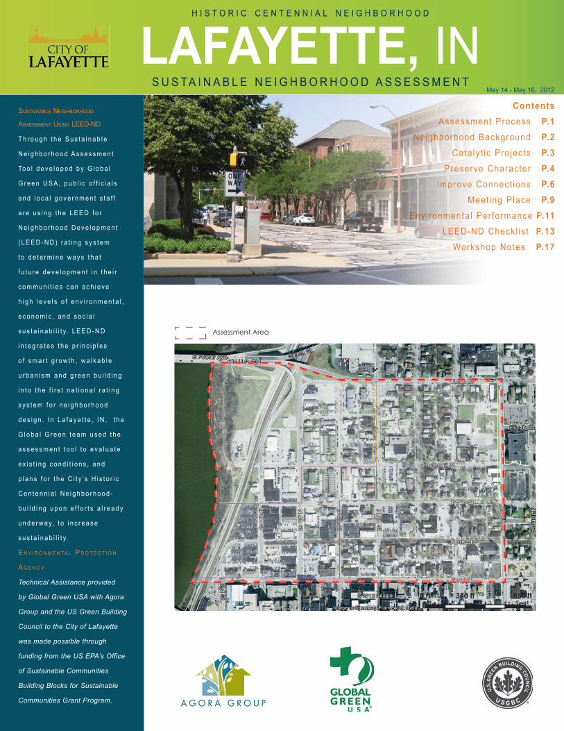
ContentsAssessment Process P.1
Neighborhood Background P.2Catalyt ic Projects P.3
Preserve Character P.4Improve Connect ions P.6
Meeting Place P.9Environmental Performance P.11
LEED-ND Checkl ist P.13Workshop Notes P.17
Assessment Area
340 ft0 ft 850 ft
H I S T O R I C C E N T E N N I A L N E I G H B O R H O O D
ConteAsAsAAAAAA ssessessesesss ment Process
NeNNeeeNeNeeeeNeNeeeeNeeNeeeeNeNeNeeeeNeNeeiggigigiggigiggiiggigigghbhhhbhbhbhbhbbhhhhhbhbbbbbororrrorrrrororro hhhohoooodod Background CaCCaCCatatalyt ic Projects
PrPrPrPPrrPrPreseseseeee eerve Character ImmImprprprprrppp ovo e Connect ions
Meet ing Place EEEEnEnEnEnEnnnnnnnEnEEnnnnEnnnnnnnnEnnnEnvvviiiv i rooorooroorrrororoororroroooonnmnnmnmnmmmnmnnnmnnnnmnnnmeeenenee tatat l Performance P
LELELELELEEELLLEL EEDEDEDEE -ND Checkl ist PWWoWoW rkr shop Notes P
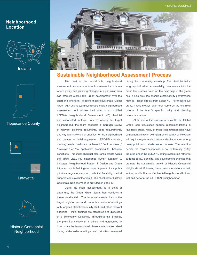
The goal of the sustainable neighborhood
assessment process is to establish several focus areas
where policy and planning changes in a particular area
can promote sustainable urban development over the
short and long term. To define these focus areas, Global
Green USA and its team use a sustainable neighborhood
assessment tool whose backbone is a modified
LEED-for Neighborhood Development (ND) checklist
and associated metrics. Prior to visiting the target
neighborhood, the team conducts a thorough review
of relevant planning documents, code requirements,
and city and stakeholder priorities for the neighborhood
and creates an initial augmented LEED-ND checklist,
marking each credit as “achieved,” “not achieved,”
“unknown,” or “not applicable” according to baseline
conditions. This initial checklist also ranks credits within
the three LEED-ND categories (Smart Location &
Linkages, Neighborhood Pattern & Design and Green
Infrastructure & Building) as they compare to local policy
which is intended to promote neighborhood stabilization
and preservation, as well as compatible revitalization.
The plan will ultimately be adopted as an amendment
to the City/County Comprehensive Plan. This plan will
serve as decision-making guidance for the Area Plan
Commission, the City Council, and the local development
community among others. The plan may also lead to the
establishment of zoning modifications by the Area Plan
Commission.
NATURAL AMENITIES
Neighborhood Background Neighborhood Highlights
INSTITUTIONS
TRANSIT SERVICE
ARTS
Quality of New DevelopmentCategory: Neighborhood Pattern & Design
Walkable Streets (prerequisite 1 & credit 1)
Category: Green Infrastructure & Building
Building Energy Efficiency (prerequisite 2 & credit 2)
Building Water Efficiency (prerequisite 3 & credit 3)
Historic Preservation and Adaptive Reuse (credit 6)
Proximity and AccessCategory: Smart Location & Linkages
Bicycle Network and Storage (credit 4)
Category: Neighborhood Pattern & Design
Walkable Streets (prerequisite 1 & credit 1)
Connected and Open Community (prerequisite 3)
Transit Facilities (credit7)
Access to Civic & Public Space (credit 9)
Access to Recreation Facilities (credit 10)
Access to FoodCategory: Neighborhood Pattern & Design
Walkable Streets (prerequisite 1 & credit 1)
Mixed-Use Neighborhood Centers (credit 3)
Reduced Parking Footprint (credit 5)
Access to Civic & Public Space (credit 9)
Access to Recreation Facilities (credit 10)
Green Building and InfrastructureCategory: Green Infrastructure & Building
Building Energy Efficiency (prerequisite & credit 2)
Building Water Efficiency (prerequisite & credit 3)
Stormwater Management (credit 8)
Infrastructure Energy Efficiency (credit 13)
FOCUS AREAS Related LEED-ND Credits
3
Three upcoming projects create opportunities
for synergy with the Historic Centennial Neighborhood
assessment and the ability to integrate strategies from
the LEED-ND.
The first is the creation of a new public transportation
transfer station on the southwest corner of the Centennial
Neighborhood. Currently, Lafayette’s Big Four Depot,
house facilities for Amtrak, Greyhound Bus, and CityBus
transportation services. Currently, CityBus provides about
5 million rides per year and is planning to expand services
and facilities. To provide better service and promote
transportation oriented development in the vicinity of
downtown, CityBus is planning a new bus transfer station.
The new CityBus facility is expected to be the anchor for
the Centennial Village Transit Oriented Development plan
that is envisioned for the 3rd and 4th Street corridor. The
proposed Centennial Village Transit Plaza will consist
of a new transit hub, plaza, and mixed-use facilities
for residential, secondary education class space, and
business/retail uses. The Transit Village will connect the
corridor and the Lafayette-West Lafayette communities
via public and alternate transportation systems.
A second important project is Centennial
townhomes, a project spearheaded by neighborhood
residents to redevelop the vacant, underutilized Midwest
Rentals site located between Brown and Cincinnati
Streets, east of 5th Street. The project is being conducted
as a partnership among the Centennial Neighborhood
Investment Group (CNIG), the Lafayette Urban Enterprise
Association, and the City of Lafayette Redevelopment
Commission. The vision is to create owner occupied
townhomes that are designed in the historic context of the
neighborhood, similar to an earlier development nearby
on 5th Street..
The third catalytic project is the planned
reconstruction of North Street to serve as a stormwater
retention area, as part of the City’s overall efforts to
address combined sewage overflow (CSO) issues. The
historic brick paving on North Street will be removed and
new brick pavers will be installed to maintain the historic
character while providing infiltration opportunities that
will clean stormwater before it percolates into the ground
water.
Historic Centennial Neighborhood benefits from
several attributes including the large number of historic
resources, the mix of land uses, proximity to downtown
Lafayette, and proximity to the Wabash River and
Purdue University. There is also an active neighborhood
organization that is engaged in preserving and enhancing
existing assets as well as promoting high-quality new
development. The City and the Area Plan Commission
are currently in the process of approving the Historic
Centennial Neighborhood Plan. In an effort to integrate
the LEED-ND assessment into this existing policy and
planning framework, the Global Green team revised the
HCN Plan. The suggested edits to the Plan provide
additional metrics for implementation and set the ground
work for converting the plan into an ordinance. The
following recommendations go beyond the purview of
the Historic Centennial Neighborhood Plan and are
developed based on the LEED-ND checklist review, site
visit notes, stakeholder input, and review of best practices
for similar communities.
Catalytic Projects
Recommendation Overview
LEED-ND encourages the preservation
and enhancement of historic character within a
neighborhood through various credits. They include
the adaptive reuse of historic buildings and cultural
landscapes which represent significant embodied
energy and cultural value, in a manner that preserves
historic materials and character defining features.
Historic urban form is often synonymous with new
urbanism, which emphasizes the pedestrian and the
over all walkability of a neighborhood. This traditional
pattern of development within the public realm is
encouraged through credits known as Walkable
Streets, and Tree-Lined and Shaded Street within
the Neighborhood Pattern & Design credit category.
The historic buildings, mature trees, and
vintage street, curb, and sidewalk design are some of
the most unique and attractive aspects of the Historic
Centennial Neighborhood. It is critical that efforts to
continue to document and preserve these features.
However, it also clear that some of the historic fabric
has been lost to insensitive new development and the
adoption of car-based land use patterns.
To halt further erosion of the historic qualities
and enhance these assets over the long-term, it
is essential that design standards be put in place
such that new development can compliment the
neighborhood both in terms of use, design, and
architectural details. In the interim, steps should be
taken to better maintain existing resources and to
implement cost-effective methods to minimize the
impact of unused buildings and surface parking lots.
4
Preserve and Enhance Historic Character
Incompatible development pattern with historical context
Historic townhouse renovated and preserved
R E S P O N S I B L E D E PA RT M E N TEngineering Department, Area Plan Commission, & Economic Development
Preserve and Enhance Historic Character
5
1. Institute an annual or biannual inspection of all
rental properties to ensure that dwelling units
are maintained to be consistent with the building
code and that properties meet basic standards
of maintenance. Include a review of energy
and water saving measures in the evaluation
protocol.
2. Provide incentives for landscaping at perimeter of
surface parking lots and tree planting in surface
parking lots.
3. Provide incentives such as expedited permit
processing or reduced fees for projects that
incorporate preservation or restoration of historic
resources.
4. Develop a form-based code for Historic
Centennial Neighborhood that emphasizes
addresses issues related to maintaining
and enhancing the historic qualities of the
neighborhood. The form-based code should
augment the Historic Centennial Neighborhood
Master Plan by providing standards for building
location, massing, form, and architectural details
that reflect the historic styles present in the
neighborhood. The code should be applicable
to new construction and additions to existing
structures.
5. Explore modifying the Purdue Commuter Parking
policy, in order to reduce the incentive for new
development with high rates of off-street parking.
Given the high level of transit access and
planned pedestrian and bicycle improvements,
a commuter-based policy should not apply to
Historic Centennial Neighborhood.
Recommendations:Short-Term Long-Term
Lacking landscaped perimeter on surface lot, which diminishes traditional street enclosure and increase surface
runoff during storm events.
Illustrations of form-based code used to identify the historic urban form to be preserved in future development
Improve Connections Within and Outside the Neighborhood
6
The largest category within LEED-ND,
in terms of points, is Neighborhood Pattern &
Design (NPD). This credit category emphasizes the
creation of compact, walkable, vibrant, mixed use
neighborhoods with connections to nearby assets.
These attributes are vital to creating a sustainable
neighborhood by using infrastructure and land more
effi ciently, therefore reducing driving while promoting
local businesses.
The Historic Centennial Neighborhood
has many of these assets already in place and its
street system meets many of the requirements that
are fundamental to creating walkable and bikable
streets, namely high levels of connectivity due to
short block lengths, and neighborhood streets that
are designed for motor vehicles to travel at speeds
of 25 mph or less.
While the street grid and degree of
connection within the neighborhood is quite good,
and the transition to the Downtown area is seamless,
the neighborhood suffers from poor connections to
surrounding areas. Most signifi cantly access across
the Wabash River to Purdue University is diffi cult,
cumbersome, or dangerous. Access to the trails
along the Wabash River is also limited, thus reducing
the value of this resource to the neighborhood.
The presence of these fundamental assets
allows the City to focus policy and development
efforts on accessing the river and the regional
trail and connectivity to West Lafayette, as well
as improving the overall bikability of the Historic
Centennial Neighborhood. The recommendations
on the following page are derived from the standards
within the Neighborhood Pattern & Design, and
Smart Location & Linkages credit categories.
R E S P O N S I B L E D E PA RT M E N TEngineering Department
Slow moving streets throughout the neighborhood create a more walkable and bikable environment
Transit shelter on the northwest corner of 9th and Union Streets. The Historic Centennial Neighborhood
has no known transit shelters
Improve Connections Within and Outside the Neighborhood
7
1. Paint a sharrows on 6th Streets and stripe bike
lanes on 3rd, 4th, 9th, and Union Streets per the
Bike Lane dimensions on the Recommended
Performance Metrics table on page 8. Ensure
that suffi cient right of way is earmarked for
dedicated on-street bike lanes on 3rd and 4th
Streets during any future street reconfi guration.
2. Provide bus shelters at bus stops on 4th, 6th, and
Brown Streets per the transit shelter standards in
the Recommended Performance Metrics table on
page 8.
3. Establish a car share station at the CityBus
tranfer center to meet the needs of downtown and
Historic Centennial Neighborhood residents. Car
Share companies targeting university adjacent
neighborhoods may be ideal companies to target
to complete the new multi-modal transit hub.
4. Increase both the actual and perceived
connection to Purdue University and West
Lafayette by constructing the Brown Street
pedestrian and bicycle bridge and market the
proximity of Historic Centennial Neighborhood to
graduate students at Purdue University.
5. Better connect the trail system along the Wabash
River in order to provide Historic Centennial
Neighborhood residents with access to a
signifi cant open space resource.
Recommendations:Short-Term Long-Term
Diminished access to regional trail
Limited bicycle access to West Lafayette and the regional trail due to the elevator/stairs found at Reiehle Plaza’s
entrance to the John T. Myers Pedestrian bridge
Improve Connections Within and Outside the Neighborhood
8
Planned Occupancy: minimum planned occupancy for multiunit residential buildings is 1 person for a studio unit, 1.5 persons for a 1 bed-
room unit, and 1.25 persons per bedroom for a 2 bedroom or larger unit (LEED-ND Reference Guide; pg 471)
*Recommended but not a LEED-ND standard
8 feet on retail or mixed-use blocks4 feet on all other blocks (widths
are inclusive of planter strips
Sum of recycled content equals 50% or more of the total mass
used for new sidewalks
High albedo reflective material
(reflective coefficient or whiteness)
Striped 5 feet (on street lanes or one way path or trail), or 8 feet (off-street two-way path or trail)
Designate streets with a design speed of 25 mph or slower as part
of the bike network
DIM
EN
SIO
NS
SIDEWALKS
TAN
DA
RD
S
R E C O M M E N D E D P E R F O R M A N C E M E T R I C S *
BIKE PARKINGBIKE LANES
N/A
Mutliunit Residential: 1 enclosed storage space per occupant for 30% of planned occupancy. Visitor: 1
space per 10 du.
Retail: 1 enclosed storage space per new retail worker for 10% of retail worker planned occupancy.
Visitor/Customer: 1 space per 5,000 sf.
Nonresidential other than retail: 1 enclosed storage space per new occupant for 10% of planned
occupancy. Visitor: 1 space per 10,000 sf. of new commercial non-retail space.
Shower & Changing Facility: Provide one on-site shower and changing facility for developments with 100 or more new workers and at least 1 additional
shower for every 150 new workers thereafter.
Intervals averaging 40 feet on center (excluding driveways and utility vaults)
Noninvasive species, soil volume, root medium
and well width
N/A
Covered shelter, with lighting and seating
Trash receptacles (including recycling)
Bulletin for posting transit information
N/A
15% annual energy reduction below conventional infrastructure items
*Outlet for event lighting
STREET LIGHTINGTRANSIT SHELTERS STREET TREES
DIM
EN
SIO
NS
STA
ND
AR
DS
Provide Neighborhood Meeting Places
9
R E S P O N S I B L E D E PA RT M E N TEconomic and Community Development Departments
A topic that emerged during the
stakeholder meetings and the community workshop
is the shortage of spaces where the long-term
residents and short-term student renters are
able to meet and establish stronger links to the
neighborhood and each other.
LEED-ND provides standards for formal
or informal neighborhood meeting space such as
community centers, plazas, recreation centers, and
parks as means to facilitate social networking, civic
engagement, and physical activity. For example the
minimum size of a civic or public space is defi ned as
one-sixth of an acre, an outdoor recreation facility
is one acre, and an indoor facility is at least 25,000
square feet.
While the YWCA and the Imagination
Station all provide indoor neighborhood meeting
space, Centennial Park is the sole outdoor gathering
space for residents to congregate, especially those
with small children. The park is approximately
.4 acres which meets the LEED-ND criteria for
a civic space, but even there, options for sports
are limited. Centennial Park offers basketball
courts for recreation, but residents engaged in
sports that require a larger fi eld, such as soccer,
baseball, and softball, typically use facilities in
adjacent neighborhoods. Sports facilities are also
limited to the several schools located around the
Historic Centennial Neighborhood, often occurring
on the asphalt parking lots associated with the
neighborhood churches.
A grocery store was also identifi ed by
numerous stakeholders as a missing element
in the neighborhood. While the weekly farmer’s
market does provide access to food proximate
to the neighborhood, a local grocery store would
add signifi cant value to the neighborhood and
further support walking and biking while reducing
automobile trips.
The downtown farmer’s market provides an informal gathering space and access to locally grown foods for
residents
Only formal community gathering space located in the Historic Centennial Neighborhood
10
Recommendations:Short Term Long Term
Provide Neighborhood Meeting Places
Rendering of the expanded Centennial Park from the Historic Centennial Neighborhood Plan
1. Conduct an assessment of the feasibility of
creating a sports fi eld or dog park, possibly by
consolidating surface parking lots. This would
require an assessment of parking needs by the
churches, schools, and institutions.
2. Explore the feasibility of establishing a grocery
store to serve the residents in the Centennial
Neighborhood. Many of the otherwise positive
aspects of the neighborhood’s compactness,
walkability, and cohesion are undermined by the
lack of this signifi cant neighborhood resource. A
grocery store also provides an informal place for
residents to meet each other and foster stronger
ties to the community.
3. Complete the plans to expand Centennial Park to
Cincinnati Street in order to provide playing fi elds
and other informal gathering space for residents.
d d CiCinccinnnaai tit
m Dennsity ys ReResidentntiaial oveverlookokking ded Cententenninial al Park k
es
Existing surface parking lots that could serve dual functions outside of traditional use hours
What is Form-Based Code?
The regulations and standards
in form-based codes, presented
in both diagrams and words,
are keyed to a regulating plan
that designates the appropriate
form and scale (and, therefore,
character) of development rather
than only distinctions in land-
use types. Form-based codes
typically address the relationship
between building facades and
the public realm, the form and
mass of buildings in relation to
one another, and the scale and
types of streets and blocks. The
regulating plan also defi nes a set
of street frontages from which
the code is organized. This is in
contrast to conventional zoning’s
focus on the segregation of
land-use types, permissible
property uses, and the control of
development intensity through
simple numerical parameters
(e.g., fl oor area ratio, dwellings
per acre, height limits, setbacks,
parking ratios, etc.)
dd
Several options exist to increase resource
conservation and environmental responsibility
in Historic Centennial Neighborhood. Buildings
and infrastructure in urbanized areas account for
over 40% of energy consumption and represent
significant investments in materials and the associated
embodied energy. Development also typically
changes hydrological patterns and results in higher
ambient temperatures through the urban heat island
effect. Local environmental quality, vitality of regional
ecosystems, and the well being of residents can all be
negatively impacted.
LEED-ND addresses these issues, primarily
in the Green Infrastructure & Building category, through
credits related green building, energy and water
efficiency, stormwater management, landscape water
use reduction, heat island reduction, infrastructure
energy and materials efficiency, and solid waste and
recycling.
For the Historic Centennial Neighborhood,
environmental performance measures should
address buildings through weatherization and energy
standards, upgrades to heating and cooling systems
and plumbing fixture replacement. Standards should
also be established for the repair and replacement
of public infrastructure. Combined, the building and
infrastructure measures can reduce waste, energy,
water use, and costs, and aid the City’s overall
efforts to address combined sewer overflow, as well
as augment the existing green attributes of the
neighborhood.
Improve the Neighborhood’s Environmental Performance
11
Existing recycling bins in the public right of way and on non-residental streets helps the City increase its waste
diversion rate
The TA team and City Staff standing outside of a LEED Certifi ed City Building
R E S P O N S I B L E D E PA RT M E N TEngineering Development, and Sanitation Department
Improve the Neighborhood’s Environmental Performance
12
1. Explore the adoption of an energy effi ciency
standard, such as Energy Star, for new
construction and major remodeling projects.
Encourage participation by qualifying property
owners in the weatherization programs.
2. Require that new construction and major
remodels include stormwater retention features
such as drywells, swales, rain gardens, and
permeable paving.
3. Encourage the removal of impermeable surfaces
and installation of low-impact development (LID)
features on private property by allowing for
reductions in the total number of required parking
spaces.
4. Expand City run recycling to provide services for
multi-family properties over 4 units.
5. Establish standards for recycled content for street
paving, sidewalks, and streetscape features and
energy effi ciency standards for street lights and
traffi c signals.
Recommendations:
Providing recycling may reduce the concerns of existing dumpster conditions for multifamily
Future development site ripe for LID features and reduced parking requirements
13
Sustainabi l i ty Assessment The Project Assessment Checklist below is an annotated LEED-ND checklist created by Global
Green. It is a key component of the tool used to document and compare the assessment area against
the LEED-ND prerequisites and credits. Each credit within the three credit categories (Smart Location &
Linkage, Neighborhood Pattern & Design, and Green Infrastructure & Building) is marked as “achieved,”
“not achieved,” “unknown,” or “not applicable” under baseline conditions. Additional analysis has been done
based on local planning policy, regulatory support, technical feasibility, market support and stakeholder
input. The preliminary checklist analysis was edited and augmented during our site visit, stakeholder
meetings, and the community workshop. This information was then translated into an overall assessment
of sustainable neighborhood performance.
Checkl ist
LEED for Neighborhood Development: Project Assessment Checklist
HISTORIC CENTENNIAL NEIGHBORHOOD- LAFAYETTE, IN
Lafayette, Indiana 1 5/14/2012
LEED for Neighborhood Development: Project Assessment Checklist
HISTORIC CENTENNIAL NEIGHBORHOOD- LAFAYETTE, IN
LegendAchieved UnkownNot AchievedDoes not exist/ NAExplicit support/ no technical issuesLack of explicit support/ minor technical issuesOpposition/ signficant technical issuesNot Applicable
Smart Location and Linkage
P 1 Smart Location
P 2 Imperiled Species and Ecological Communities
P 3 Wetland and Water Body Conservation
P 4 Agricultural Land Conservation
P 5 Floodplain Avoidance
C 1 Preferred Locations
C 2 Brownfield Redevelopment
C 3 Locations with Reduced Automobile Dependence
C 4 Bicycle Network
C 4 Bicycle Storage 0.5
C 5 Housing and Jobs Proximity
C 6 Steep Slope Protection
C 7 Site Design for Habitat or Wetland and Water Body Conservatio
C 8 Restoration of Habitat or Wetlands and Water Bodies
C 9 Long-Term Conservation Management of Habitat or Wetlands a
Neig
hbor
hood
Nee
d/ S
take
hold
er In
put
Tech
nica
l fea
sibilit
y
Base
line C
ondi
tions
Loca
l/Reg
iona
l Plan
ning
Prio
rity
Regu
lator
y Sup
port
Mark
et S
uppo
rt
Total Points
Required
Required
Required
Required
Required
10
2
7
0.5
3
1
1
1
1
14
Sustainabi l i ty AssessmentCheckl ist
LEED for Neighborhood Development: Project Assessment Checklist
HISTORIC CENTENNIAL NEIGHBORHOOD- LAFAYETTE, IN
Lafayette, Indiana 2 5/14/2012
LegendAchieved UnkownNot AchievedDoes not exist/ NAExplicit support/ no technical issuesLack of explicit support/ minor technical issuesOpposition/ signficant technical issuesNot Applicable
Neighborhood Pattern and Design
P 1 Walkable Streets- Principal Entries
P 1 Walkable Streets- Building Height to Street Width Ratio
P 1 Walkable Streets-Continuous Sidewalks
P 1 Walkable Streets-Garage and Service Bays
P 2 Compact Development
P 3 Connected and Open Community
C 1a Walkable Streets : Facades and Entries
C 1b Walkable Streets: Ground-Level Use and Parking
C 1c Walkable Streets:Design Speed for Safe Ped and Bike Travel
C 1d Walkable Streets: Sidewalk Intrusions
C 2 Compact Development
C 3 Mixed-Use Neighborhood Centers
C 4 Mixed-Income
C 4 Diverse Communities
C 5 Reduced Parking Footprint
C 6 Street Network
C 7 Transit Facilities
C 8 Transportation Demand Management
C 9 Access to Civic and Public Spaces
C 10 Access to Recreation Facilities
C 11 Visitability and Universal Design
C 12 Community Outreach and Involvement
C 13 Local Food Production
C 14 Tree-Lined and Shaded Streets
C 15 Neighborhood Schools
Base
line C
ondi
tions
Loca
l/Reg
iona
l Plan
ning
Prio
rity
Regu
lator
y Sup
port
Tech
nica
l fea
sibilit
yMa
rket
Sup
port
Neig
hbor
hood
Nee
d/ S
take
hold
er In
p
Required
Required
Required
Required
Required
Required
15
Sustainabi l i ty AssessmentCheckl ist
LEED for Neighborhood Development: Project Assessment Checklist
HISTORIC CENTENNIAL NEIGHBORHOOD- LAFAYETTE, IN
Lafayette, Indiana 3 5/14/2012
LegendAchieved UnkownNot AchievedDoes not exist/ NAExplicit support/ no technical issuesLack of explicit support/ minor technical issuesOpposition/ signficant technical issuesNot Applicable
Green Infrastructure and Buildings
P 1 Certified Green Building
P 2 Minimum Building Energy Efficiency
P 3 Minimum Building Water Efficiency
P 4 Construction Activity Pollution Prevention
C 1 Certified Green Buildings
C 2 Building Energy Efficiency
C 3 Building Water Efficiency
C 4 Water-Efficient Landscaping
C 5 Existing Building Use
C 6 Historic Resource Preservation and Adaptive Reuse
C 7 Minimized Site Disturbance in Design and Construction
C 8 Stormwater Management
C 9 Heat Island Reduction
C 10 Solar Orientation
C 11 On-Site Renewable Energy Sources
C 12 District Heating and Cooling
C 13 Infrastructure Energy Efficiency
C 14 Wastewater Management
C 15 Recycled Content in Infrastructure
C 16 Solid Waste Management Infrastructure
C 17 Light Pollution Reduction
Neig
hbor
hood
Nee
d/ S
take
hold
er In
p
Base
line C
ondi
tions
Loca
l/Reg
iona
l Plan
ning
Prio
rity
Regu
lator
y Sup
port
Tech
nica
l fea
sibilit
yMa
rket
Sup
port
Required
Required
Required
Required
16
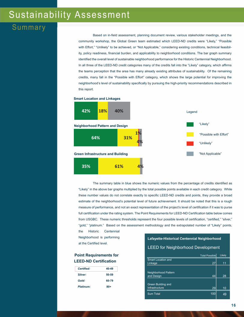
Smart Location and Linkages
“Likely”
“Possible with Effort”
“Unlikely”
Legend
The summary table in blue shows the numeric values from the percentage of credits identifi ed as
“Likely” in the above bar graphs multiplied by the total possible points available in each credit category. While
these number values do not correlate exactly to specifi c LEED-ND credits and points, they provide a broad
estimate of the neighborhood’s potential level of future achievement. It should be noted that this is a rough
measure of performance, and not an exact representation of the project’s level of certifi cation if it was to purse
full certifi cation under the rating system. The Point Requirements for LEED-ND Certifi cation table below comes
from USGBC. These numeric thresholds represent the four possible levels of certifi cation, “certifi ed,” “silver,”
“gold,” “platinum.” Based on the assessment methodology and the extrapolated number of “Likely” points,
the Historic Centennial
Neighborhood is performing
at the Certifi ed level.
Based on in-fi eld assessment, planning document review, various stakeholder meetings, and the
community workshop, the Global Green team estimated which LEED-ND credits were “Likely,” “Possible
with Effort,” “Unlikely” to be achieved, or “Not Applicable,” considering existing conditions, technical feasibil-
ity, policy readiness, fi nancial burden, and applicability to neighborhood conditions. The bar graph summary
identifi ed the overall level of sustainable neighborhood performance for the Historic Centennial Neighborhood.
In all three of the LEED-ND credit categories many of the credits fall into the “Likely” category, which affi rms
the teams perception that the area has many already existing attributes of sustainability. Of the remaining
credits, many fall in the “Possible with Effort” category, which shows the large potential for improving the
neighborhood’s level of sustainability specifi cally by pursuing the high-priority recommendations described in
this report.
Sustainabi l i ty AssessmentSummary
“Not Applicable”
42% 18% 40%
Neighborhood Pattern and Design
64% 31% 1%
4%
Green Infrastructure and Building
35% 61% 4%
Certifi ed: 40-49
Silver: 50-59
Gold: 60-79
Platinum: 80+
Point Requirements for LEED-ND Certifi cation
Lafayette-Historical Centennial Neighborhood
LEED for Neighborhood Development
Likely
Smart Location and Linkage 27 11
Neighborhood Pattern and Design 44 28
Green Building and Infrastructure 29 10
Sum Total 100 50
Total Possible
49
Workshop Notes
17
This Page Is Intentionally Left Blank
Greenurbanism program
2218 Main StreetSecond FloorSanta Monica, CA 90405310.581.2700 ph310.581.2702 faxwww.globalgreen.org