113
Draft Environmental Impact Statement Guidelines Site C Clean Energy Project BC Hydro March 1, 2012 Presentation to the Advisory Working Group
Draft Environmental Impact Statement GuidelinesSite C Clean Energy Project
BC Hydro
March 1, 2012
Presentation to the Advisory Working Group
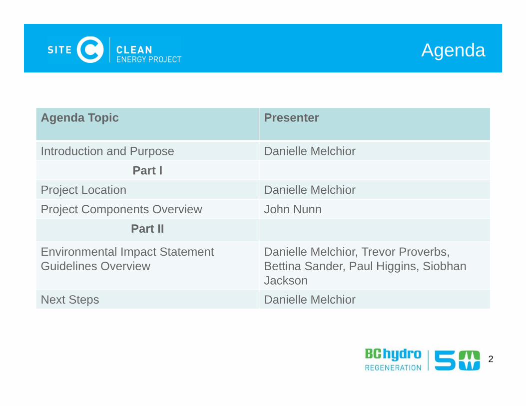
Agenda Topic Presenter
Introduction and Purpose Danielle MelchiorPart I
Project Location Danielle MelchiorProject Components Overview John Nunn
Part II
Environmental Impact Statement Guidelines Overview
Danielle Melchior, Trevor Proverbs,Bettina Sander, Paul Higgins, Siobhan Jackson
Next Steps Danielle Melchior
2
Agenda
Introduction and PurposeEIS-G Section 1 (pg 1)
3
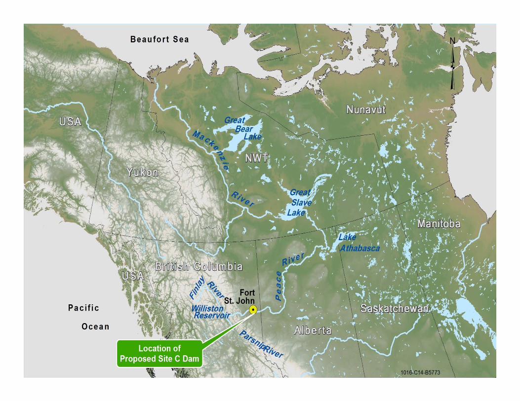
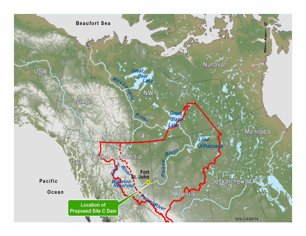
Project LocationEIS-G Section 3 (pg 4)
4
55
6
77
Overview of Project Components and Activities
EIS-G Section 3 (pg 3)
8
9
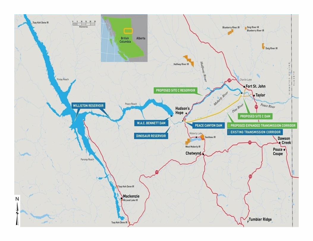
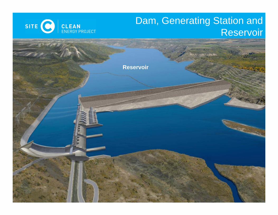
Dam, Generating Station and Reservoir
Reservoir
10
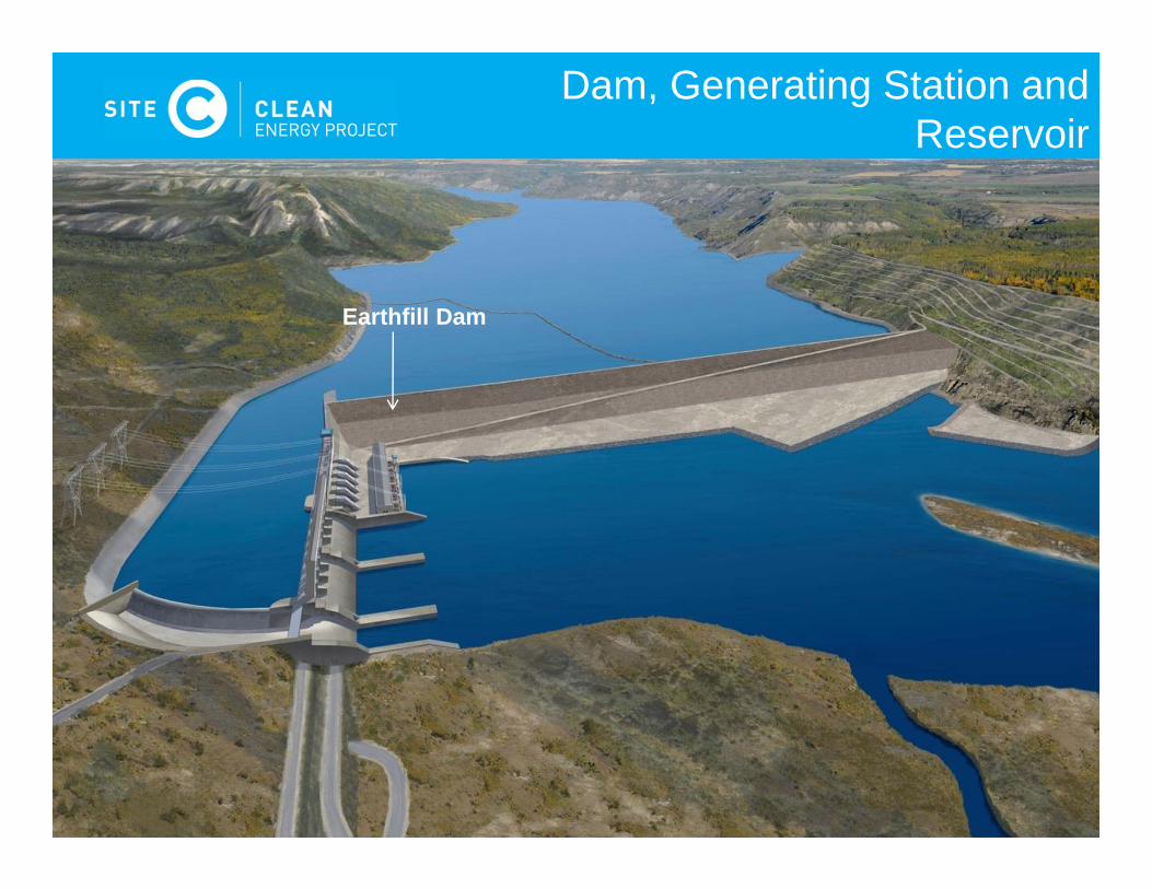
Earthfill Dam
Dam, Generating Station and Reservoir
11
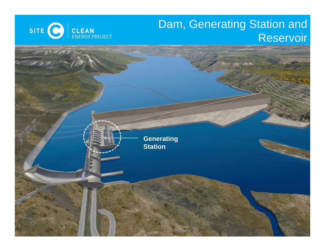
Generating Station
Dam, Generating Station and Reservoir
12
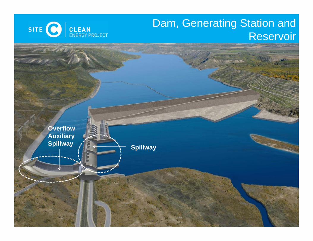
Spillway
Overflow Auxiliary Spillway
Dam, Generating Station and Reservoir
13
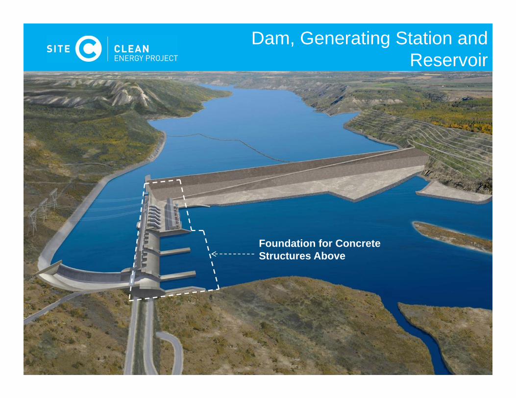
Foundation for Concrete Structures Above
Dam, Generating Station and Reservoir

14
Approach Channel
Dam, Generating Station and Reservoir
15
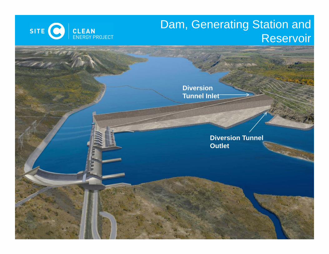
Diversion Tunnel Outlet
Diversion Tunnel Inlet
Dam, Generating Station and Reservoir
16
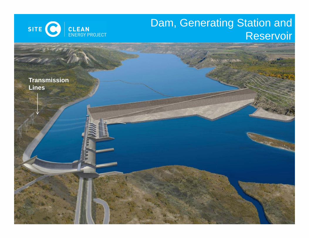
Transmission Lines
Dam, Generating Station and Reservoir
17
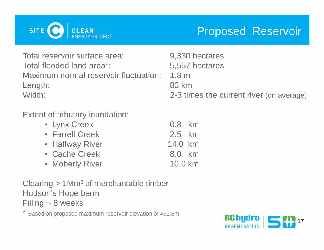
Proposed Reservoir
17
Total reservoir surface area: 9,330 hectaresTotal flooded land area*: 5,557 hectaresMaximum normal reservoir fluctuation: 1.8 mLength: 83 kmWidth: 2-3 times the current river (on average)
Extent of tributary inundation:• Lynx Creek 0.8 km• Farrell Creek 2.5 km• Halfway River 14.0 km• Cache Creek 8.0 km• Moberly River 10.0 km
Clearing > 1Mm3 of merchantable timber Hudson’s Hope berm Filling ~ 8 weeks * Based on proposed maximum reservoir elevation of 461.8m
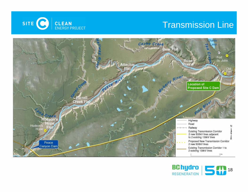
Transmission Line
18
Lynx Creek
Farrell Creek
Halfway River Cache CreekFort St. John
Highway 29
Proposed Dam
Jackfish Lake Road
Transmission Line
Highway 29 Realignment
19
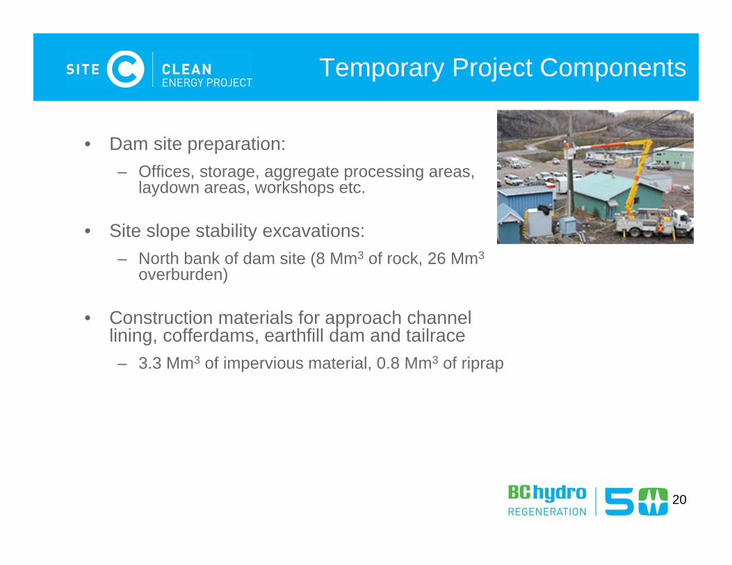
• Dam site preparation:– Offices, storage, aggregate processing areas,
laydown areas, workshops etc.
• Site slope stability excavations:– North bank of dam site (8 Mm3 of rock, 26 Mm3
overburden)
• Construction materials for approach channel lining, cofferdams, earthfill dam and tailrace – 3.3 Mm3 of impervious material, 0.8 Mm3 of riprap
Temporary Project Components
20
21
Worker Accommodations
• Dam site construction camps– North bank – South bank
• Regional camps – Highway 29 Realignment– Jackfish Lake Road
• Local in-community housing
Draft Environmental Impact Statement (EIS) Guidelines
22
23
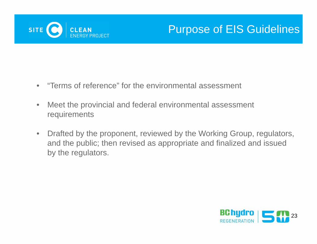
Purpose of EIS Guidelines
• “Terms of reference” for the environmental assessment
• Meet the provincial and federal environmental assessment requirements
• Drafted by the proponent, reviewed by the Working Group, regulators, and the public; then revised as appropriate and finalized and issued by the regulators.
24
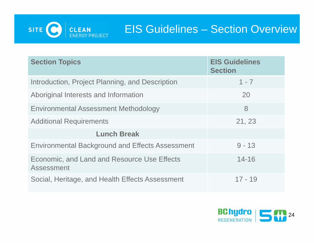
EIS Guidelines – Section Overview
Section Topics EIS GuidelinesSection
Introduction, Project Planning, and Description 1 - 7
Aboriginal Interests and Information 20
Environmental Assessment Methodology 8
Additional Requirements 21, 23
Lunch Break Environmental Background and Effects Assessment 9 - 13
Economic, and Land and Resource Use Effects Assessment
14-16
Social, Heritage, and Health Effects Assessment 17 - 19
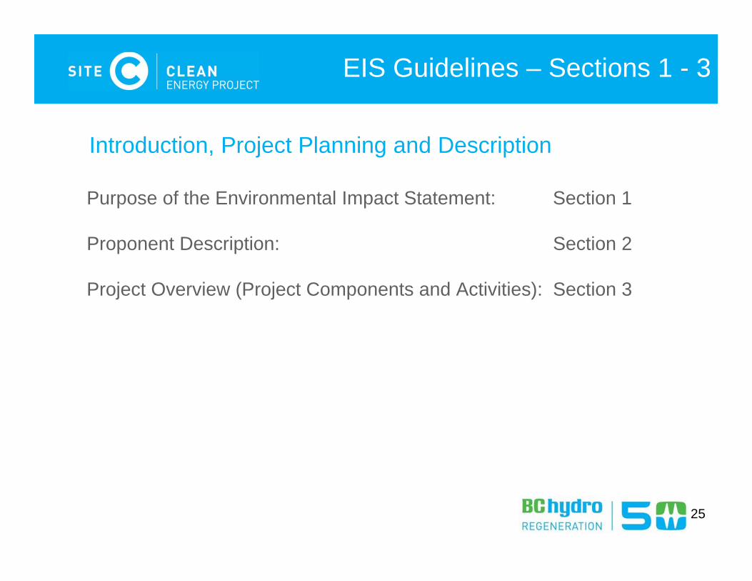
Purpose of the Environmental Impact Statement: Section 1
Proponent Description: Section 2
Project Overview (Project Components and Activities): Section 3
25
Introduction, Project Planning and Description
EIS Guidelines – Sections 1 - 3
Need for, Alternatives to, Purpose of, and Alternative Means of Carrying out the Project
EIS-G Section 4 (pg 11)
26
• The provincial policy context
• Load-resource balance
• Forecasted electricity demand
• Mandate of BC Hydro
27
Need for the Project
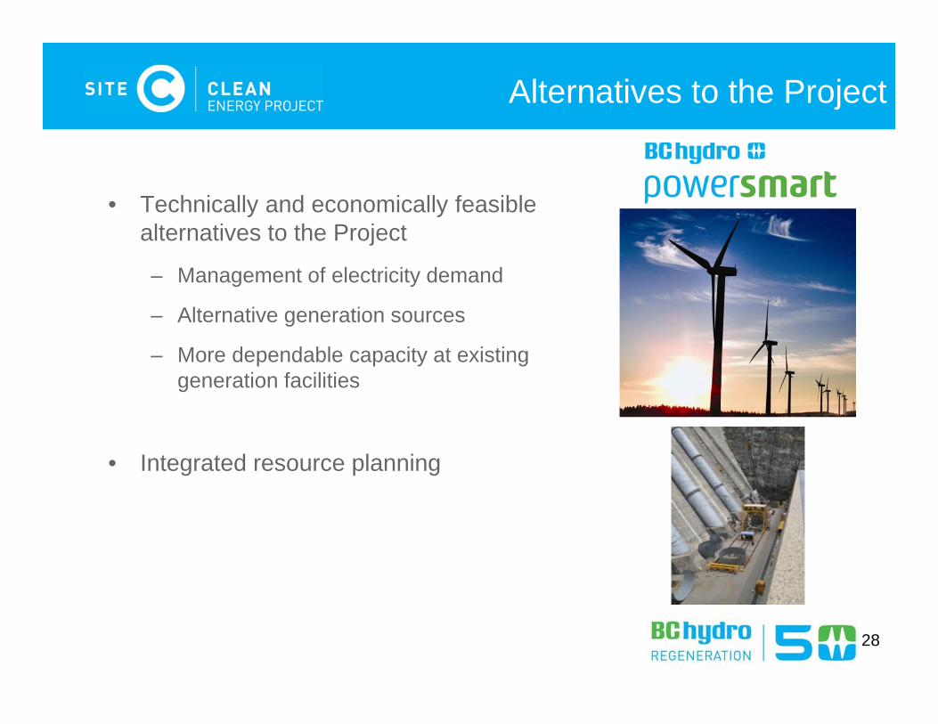
• Technically and economically feasible alternatives to the Project
– Management of electricity demand
– Alternative generation sources
– More dependable capacity at existing generation facilities
• Integrated resource planning
28
Alternatives to the Project
29
Integrated Resources Planning
1. How much electricity will BC need over the next 20 years?
2. What is the gap between existing supply and forecast electricity demand?
3. How can BC Hydro close the gap?
30
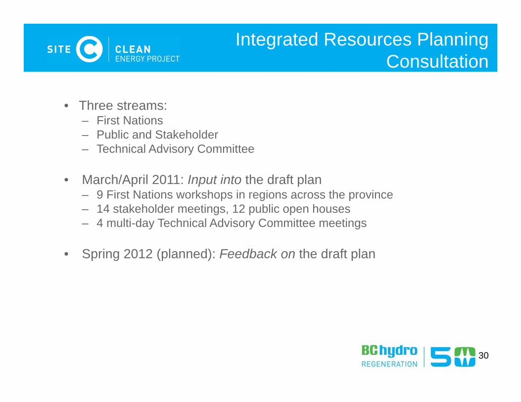
Integrated Resources Planning Consultation
• Three streams:– First Nations – Public and Stakeholder– Technical Advisory Committee
• March/April 2011: Input into the draft plan– 9 First Nations workshops in regions across the province– 14 stakeholder meetings, 12 public open houses– 4 multi-day Technical Advisory Committee meetings
• Spring 2012 (planned): Feedback on the draft plan
• The “purpose of” the Project is defined as what is to be achieved by carrying out the Project
31
Purpose of the Project
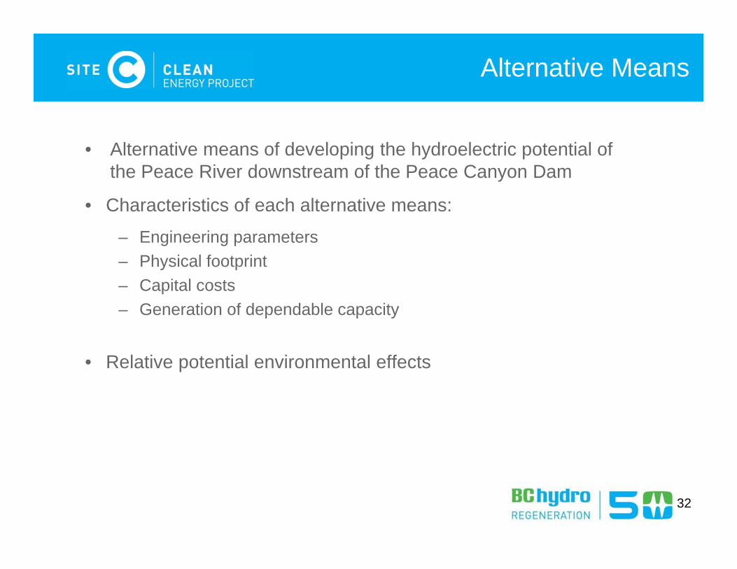
• Alternative means of developing the hydroelectric potential of the Peace River downstream of the Peace Canyon Dam
• Characteristics of each alternative means:
– Engineering parameters– Physical footprint– Capital costs– Generation of dependable capacity
• Relative potential environmental effects
32
Alternative Means

Project Benefits
EIS-G Section 5 (pg 14)
33
• Financial benefits
• Economic development benefits for Aboriginal groups and non-Aboriginal groups
• Social benefits
• Sustainable development
34
Project Benefits
Assessment Process
EIS-G Section 6 (pg 16)
35
36
Assessment Process
• Provincial agencies, departments and organizations
• Federal responsible authorities and federal authorities
• Cooperative Review Process
• Permitting
Information Distribution and Consultation
EIS-G Section 7 (pg 16)
37
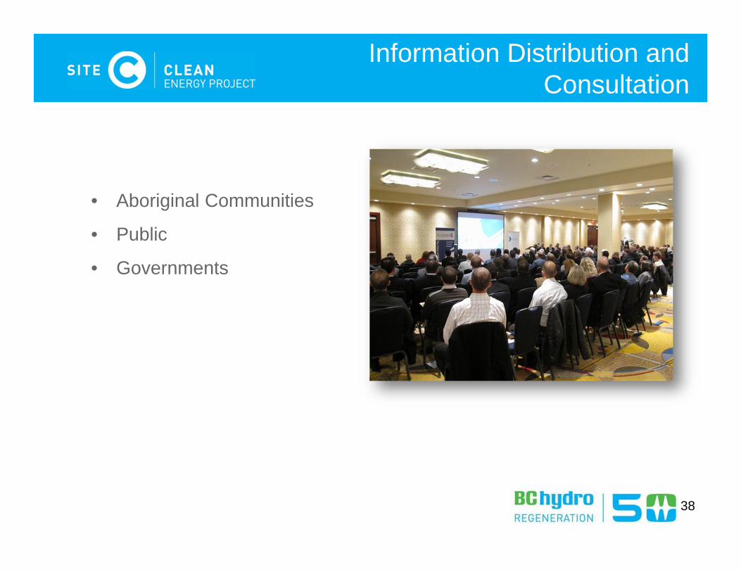
• Aboriginal Communities
• Public
• Governments
38
Information Distribution and Consultation
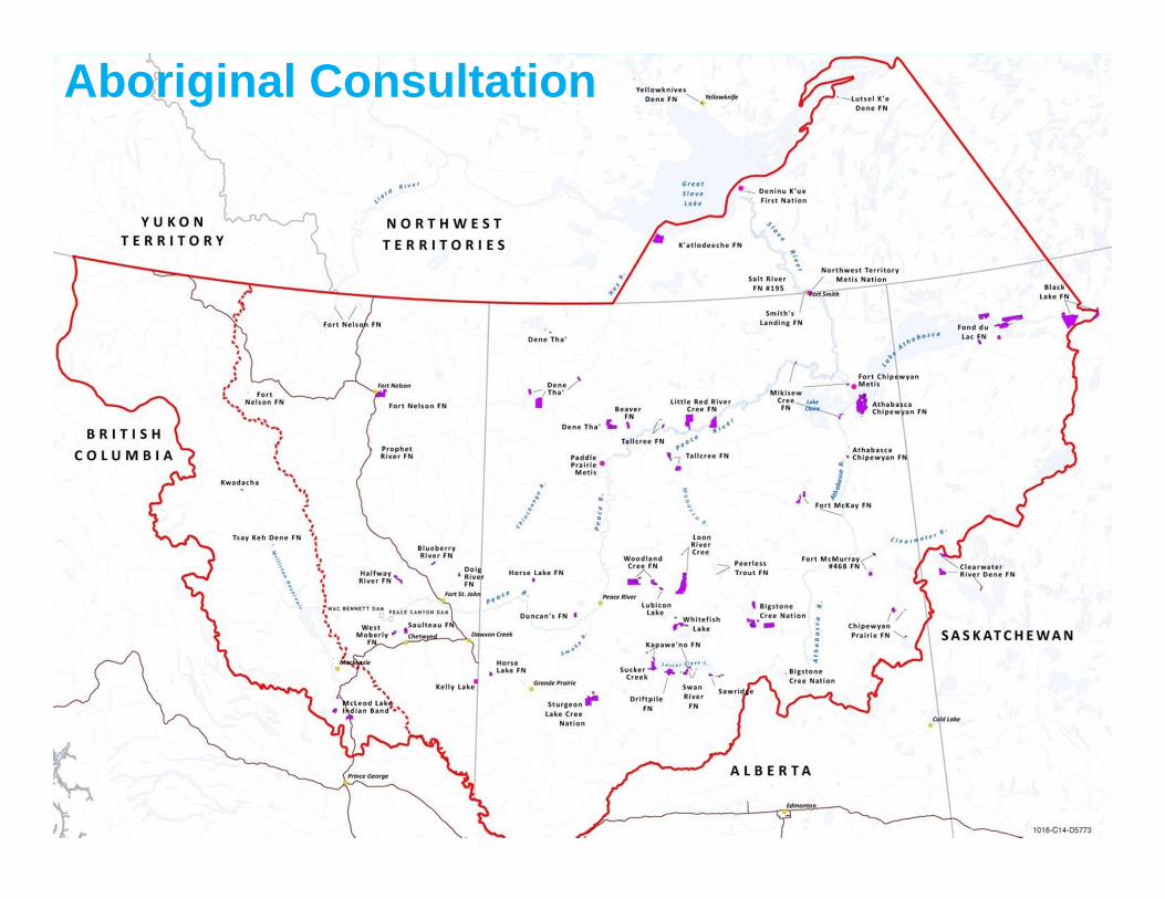
Aboriginal Consultation
40
Aboriginal Interests and Information Requirements
• Identify interested Aboriginal groups, with the guidance of the governments of British Columbia and Canada, and provide background information
• BC Hydro’s understanding Aboriginal and treaty rights
• Provide BC Hydro’s understanding of the overlap of the Project on current use of lands and resources for traditional purposes
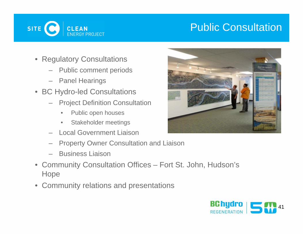
Public Consultation
• Regulatory Consultations– Public comment periods– Panel Hearings
• BC Hydro-led Consultations– Project Definition Consultation
• Public open houses• Stakeholder meetings
– Local Government Liaison – Property Owner Consultation and Liaison– Business Liaison
• Community Consultation Offices – Fort St. John, Hudson’s Hope
• Community relations and presentations
41
Environmental Assessment Methodology
EIS-G Section 8 (pg 20)
42
43
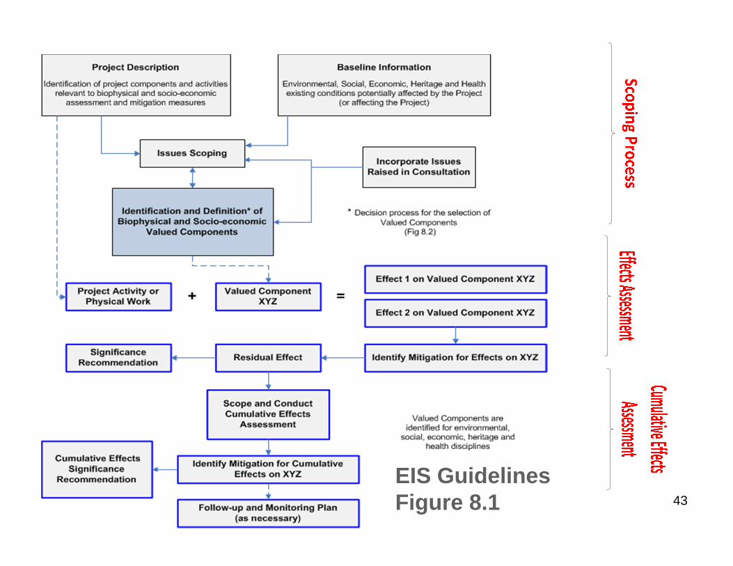
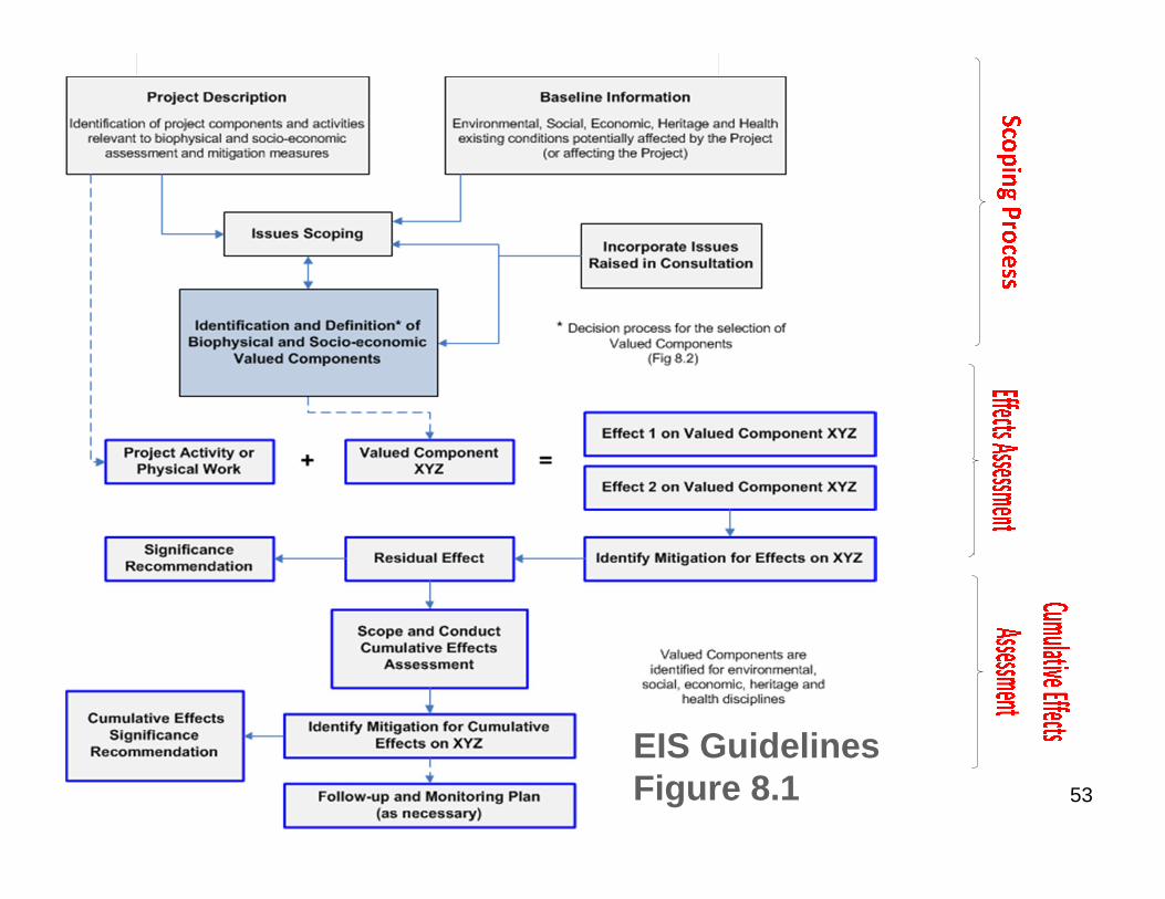
Assessment Process
EIS Guidelines Figure 8.1
44
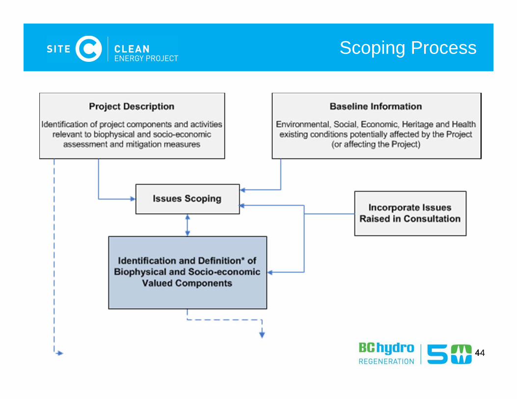
Scoping Process
45
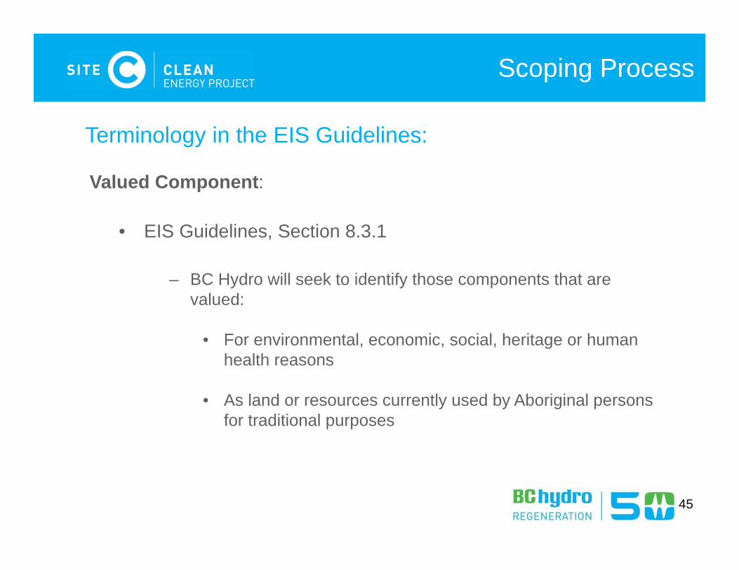
Scoping Process
Terminology in the EIS Guidelines:
Valued Component:
• EIS Guidelines, Section 8.3.1
– BC Hydro will seek to identify those components that are valued:
• For environmental, economic, social, heritage or human health reasons
• As land or resources currently used by Aboriginal persons for traditional purposes
46
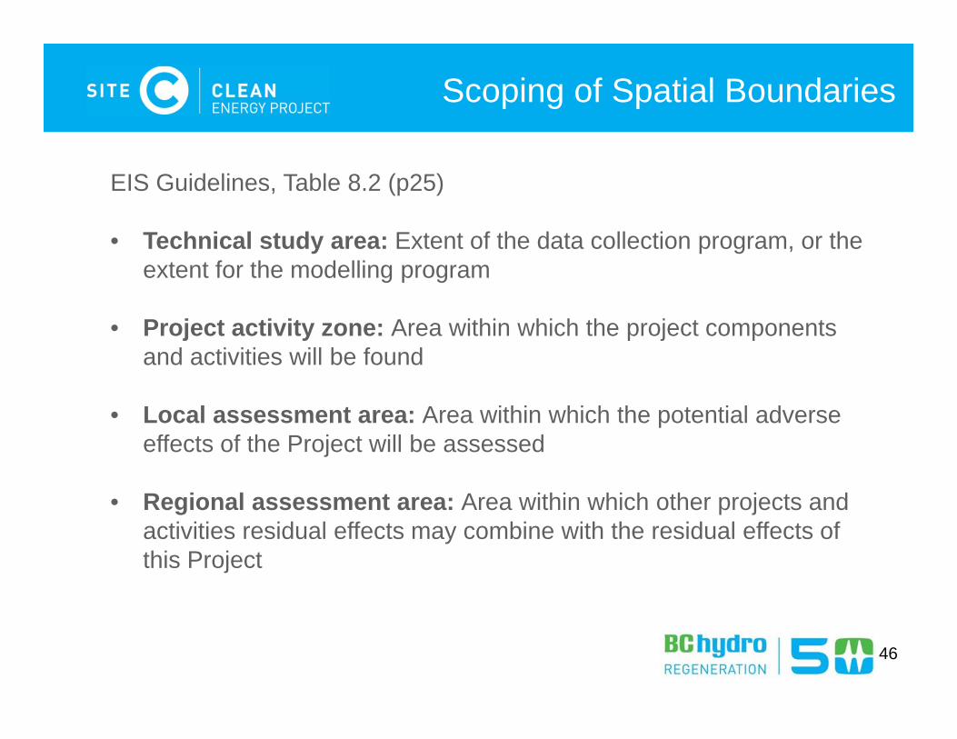
Scoping of Spatial Boundaries
EIS Guidelines, Table 8.2 (p25)
• Technical study area: Extent of the data collection program, or the extent for the modelling program
• Project activity zone: Area within which the project components and activities will be found
• Local assessment area: Area within which the potential adverse effects of the Project will be assessed
• Regional assessment area: Area within which other projects and activities residual effects may combine with the residual effects of this Project
47
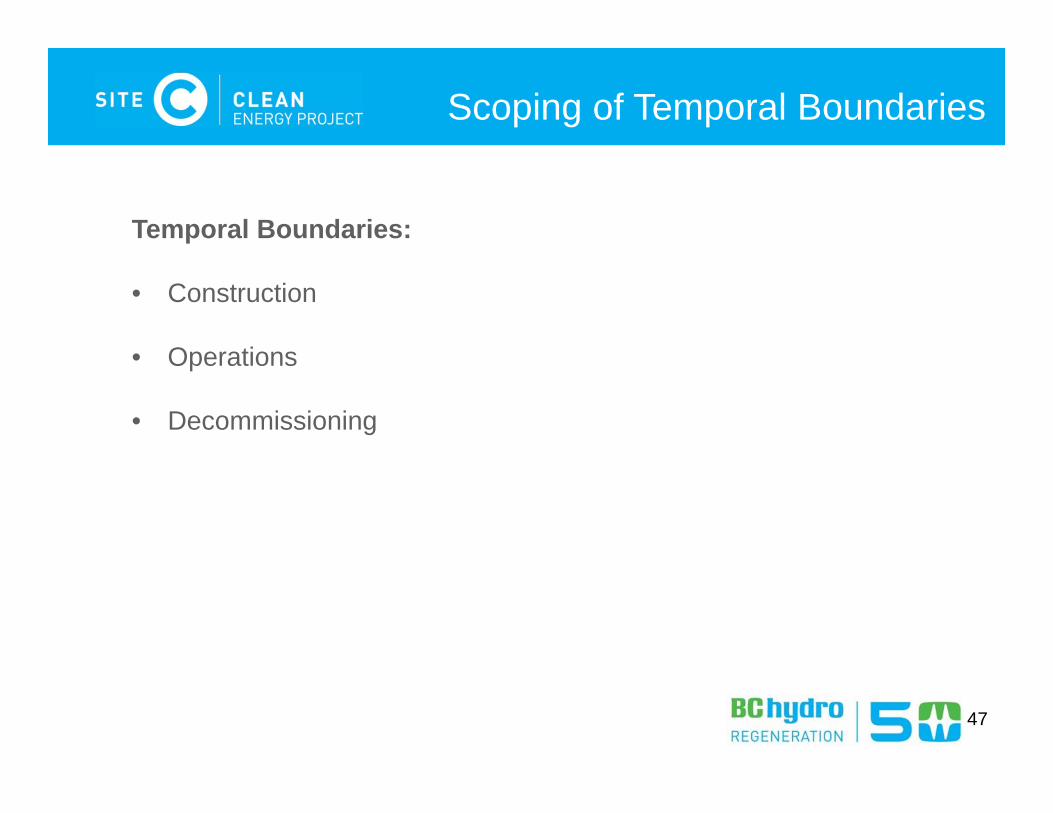
Scoping of Temporal Boundaries
Temporal Boundaries:
• Construction
• Operations
• Decommissioning
48
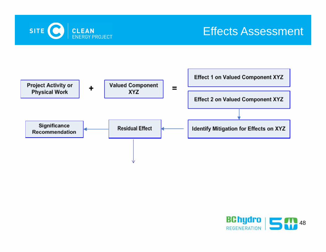
Effects Assessment
49
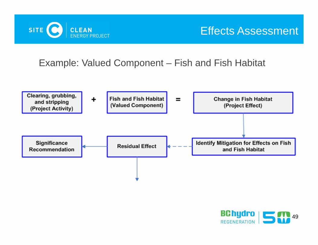
Effects Assessment
Example: Valued Component – Fish and Fish Habitat
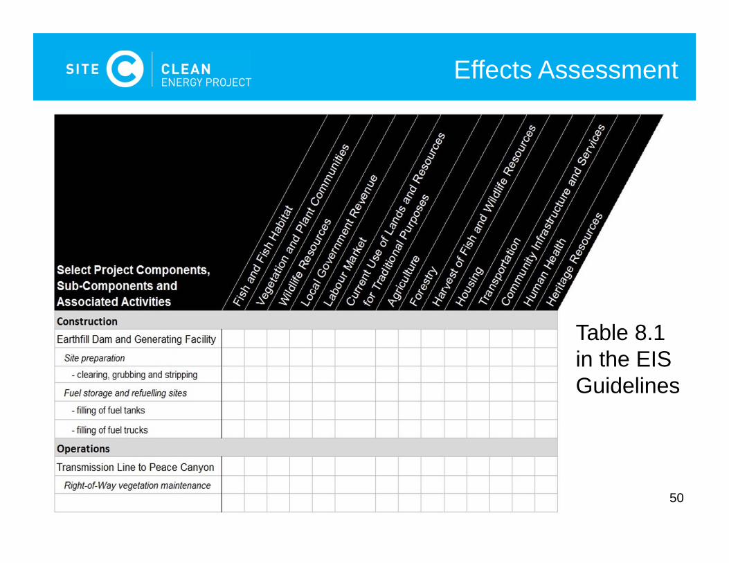
50
Effects Assessment
Table 8.1 in the EIS Guidelines
51
Effects Assessment
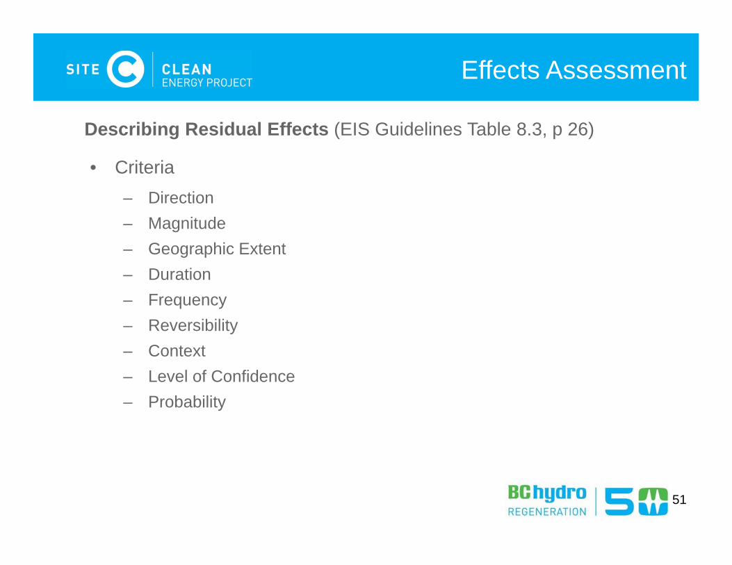
Describing Residual Effects (EIS Guidelines Table 8.3, p 26)
• Criteria– Direction– Magnitude– Geographic Extent– Duration– Frequency– Reversibility– Context– Level of Confidence– Probability
52
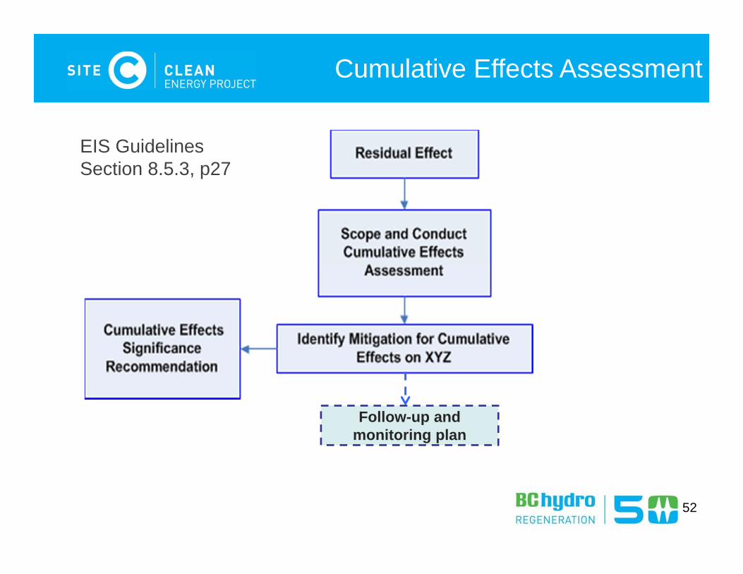
Cumulative Effects Assessment
Follow-up and monitoring plan
EIS GuidelinesSection 8.5.3, p27
53
Assessment Process
EIS Guidelines Figure 8.1
54
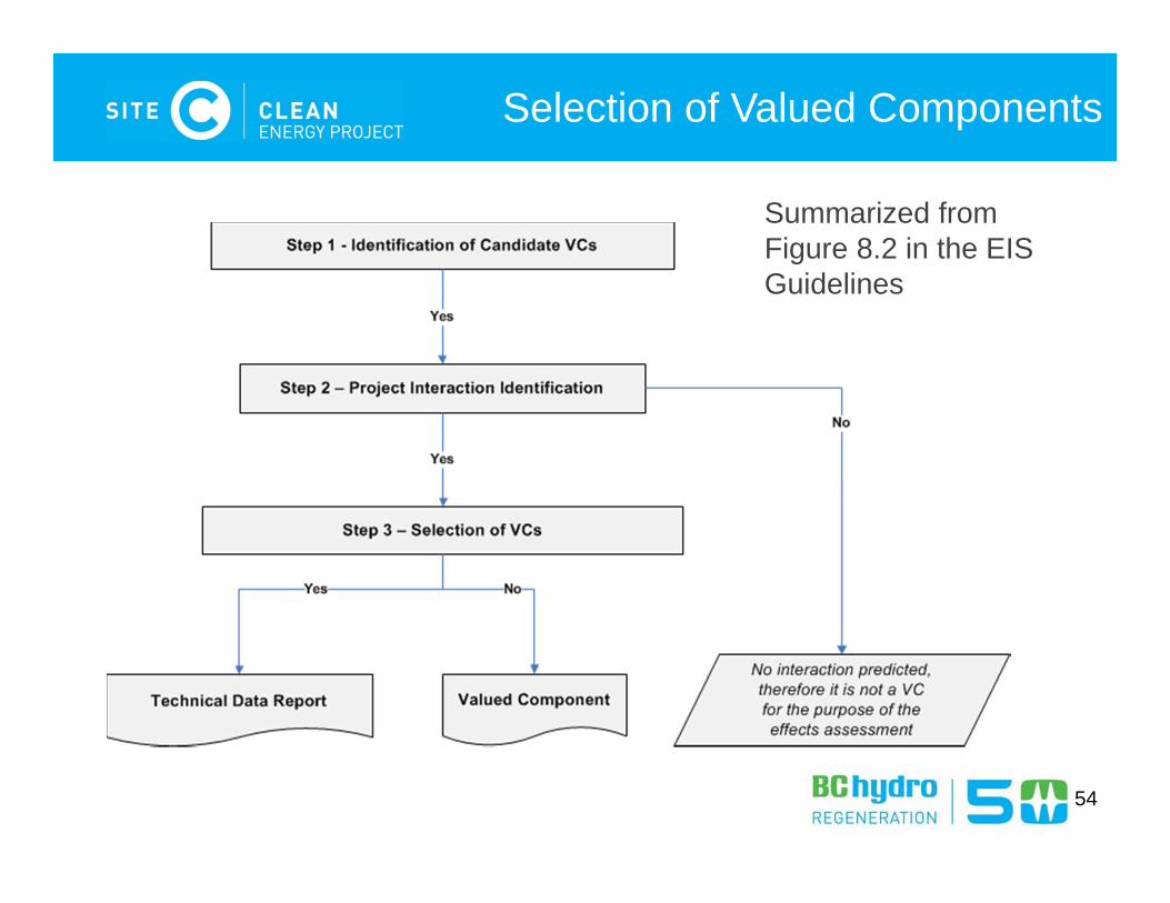
Selection of Valued Components
Summarized from Figure 8.2 in the EIS Guidelines
55
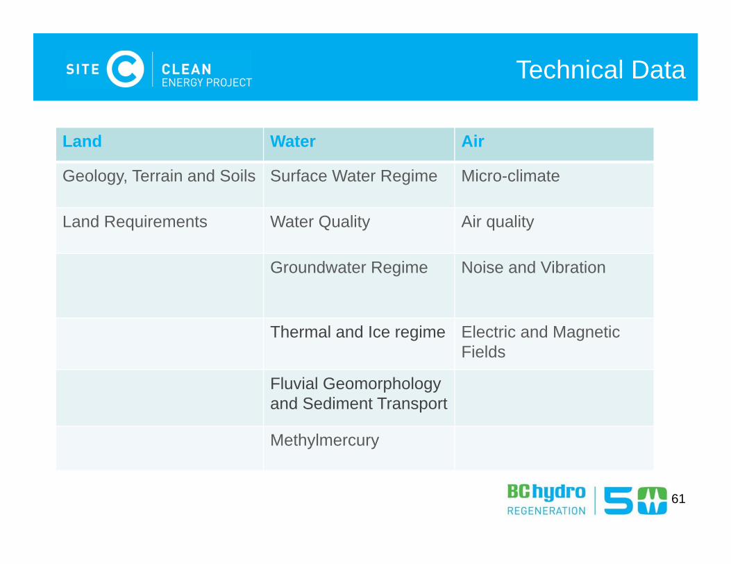
Technical Data
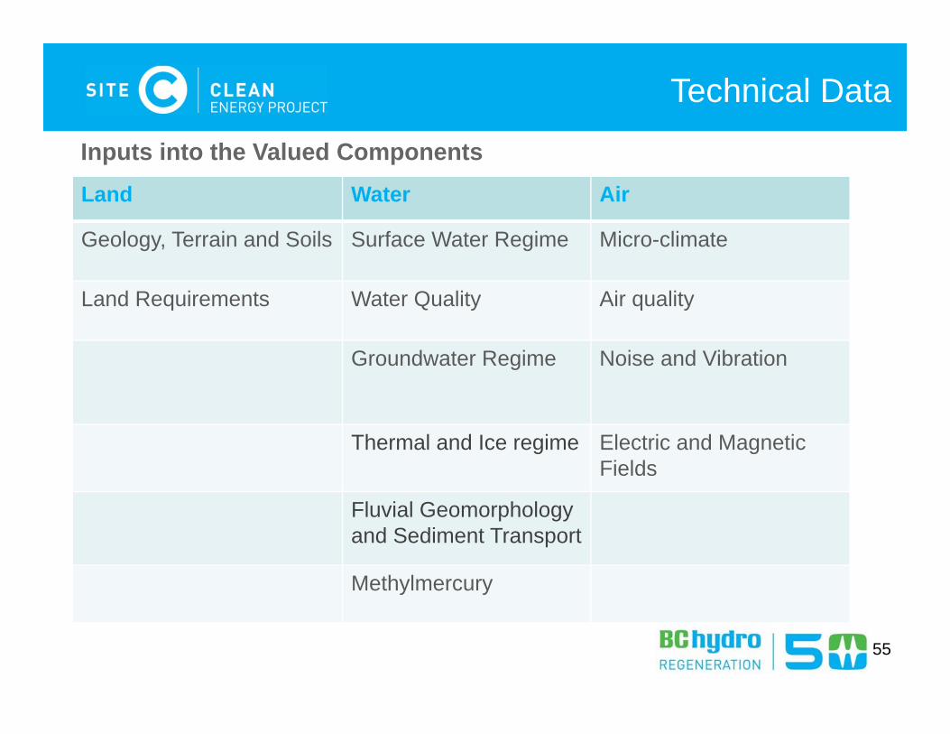
Land Water Air
Geology, Terrain and Soils Surface Water Regime Micro-climate
Land Requirements Water Quality Air quality
Groundwater Regime Noise and Vibration
Thermal and Ice regime Electric and MagneticFields
Fluvial Geomorphology and Sediment Transport
Methylmercury
Inputs into the Valued Components
56
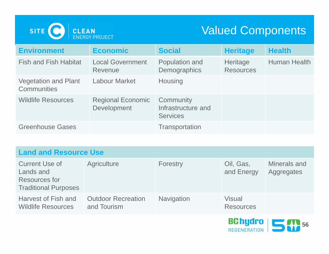
Valued ComponentsEnvironment Economic Social Heritage Health Fish and Fish Habitat Local Government
RevenuePopulation and Demographics
HeritageResources
Human Health
Vegetation and Plant Communities
Labour Market Housing
Wildlife Resources Regional Economic Development
Community Infrastructure and Services
Greenhouse Gases Transportation
Land and Resource UseCurrent Use of Lands and Resources for Traditional Purposes
Agriculture Forestry Oil, Gas,and Energy
Minerals andAggregates
Harvest of Fish and Wildlife Resources
Outdoor Recreation and Tourism
Navigation Visual Resources
57
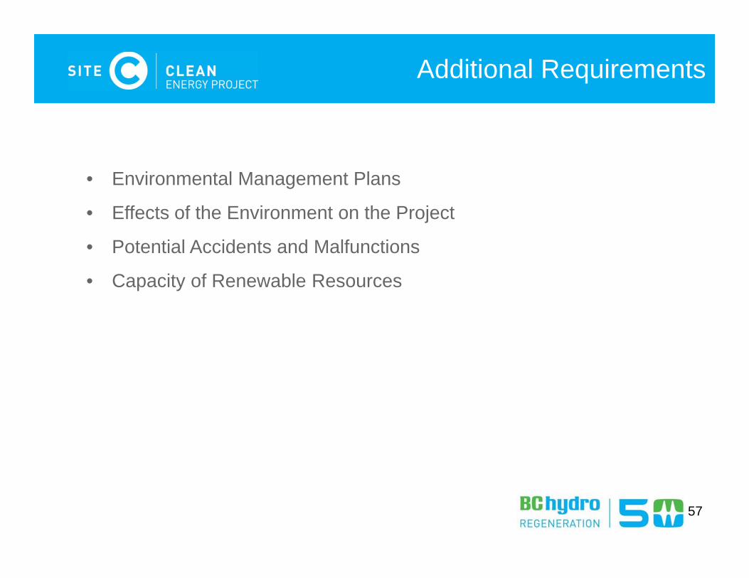
Additional Requirements
• Environmental Management Plans
• Effects of the Environment on the Project
• Potential Accidents and Malfunctions
• Capacity of Renewable Resources

Questions?
58

Lunch
59
Technical Data – Environmental Background
EIS-G Section 9 (pg 30)
60
61
Technical Data
Land Water Air
Geology, Terrain and Soils Surface Water Regime Micro-climate
Land Requirements Water Quality Air quality
Groundwater Regime Noise and Vibration
Thermal and Ice regime Electric and MagneticFields
Fluvial Geomorphology and Sediment Transport
Methylmercury
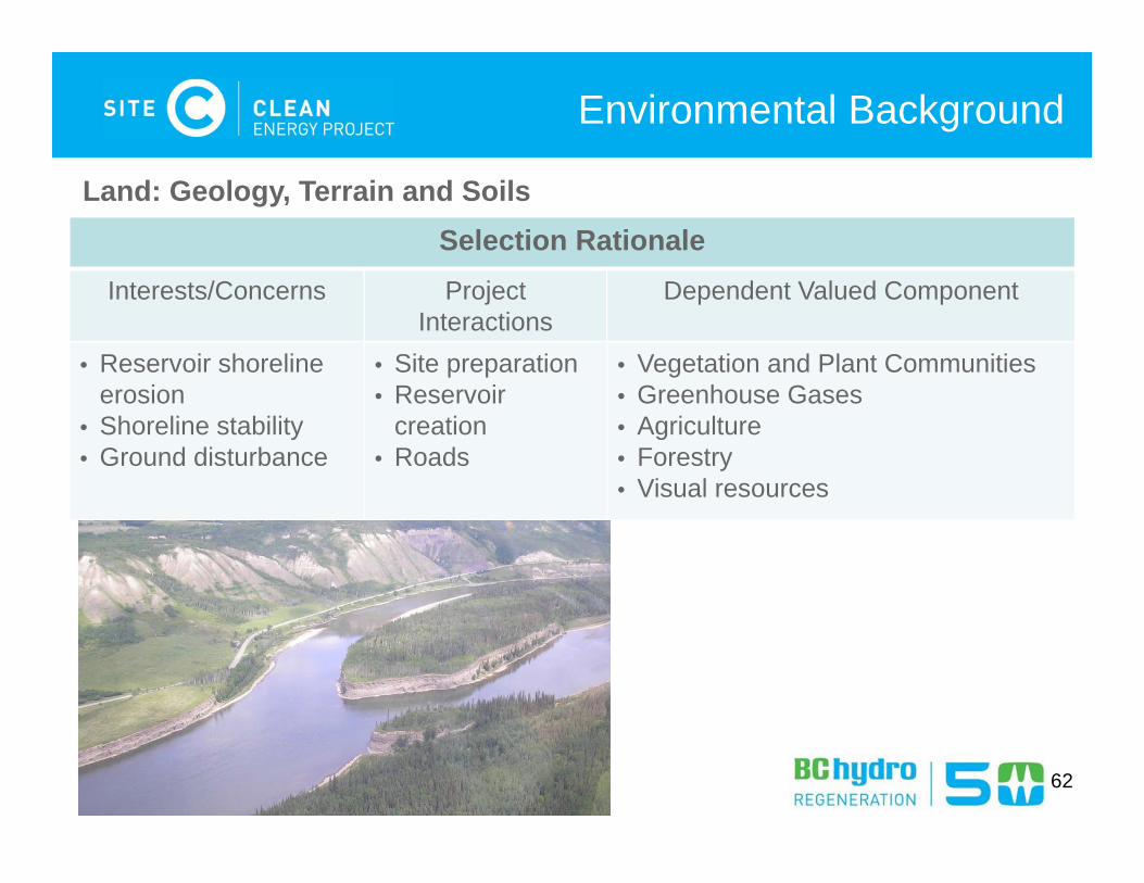
Environmental Background
Selection Rationale Interests/Concerns Project
InteractionsDependent Valued Component
• Reservoir shoreline erosion
• Shoreline stability• Ground disturbance
• Site preparation • Reservoir
creation • Roads
• Vegetation and Plant Communities • Greenhouse Gases• Agriculture • Forestry • Visual resources
Land: Geology, Terrain and Soils
62
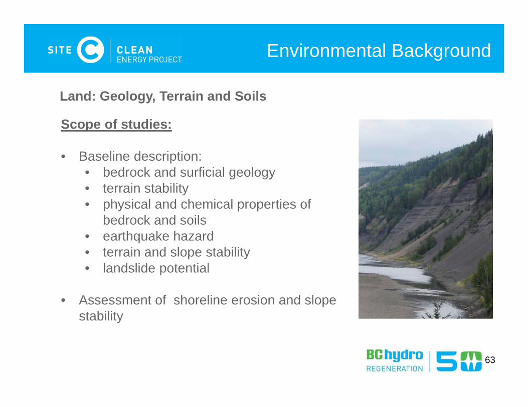
Environmental Background
Land: Geology, Terrain and Soils
Scope of studies:
• Baseline description:• bedrock and surficial geology• terrain stability• physical and chemical properties of
bedrock and soils• earthquake hazard• terrain and slope stability• landslide potential
• Assessment of shoreline erosion and slope stability
63
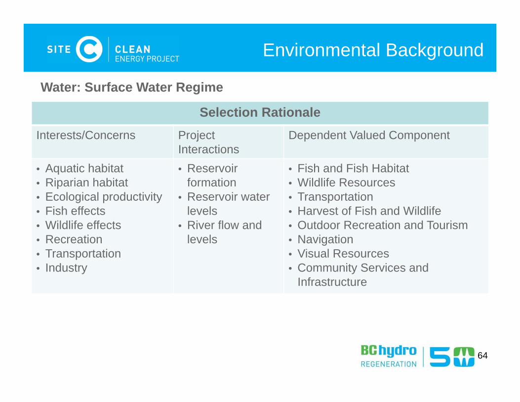
Environmental Background
Selection Rationale Interests/Concerns Project
InteractionsDependent Valued Component
• Aquatic habitat• Riparian habitat• Ecological productivity• Fish effects• Wildlife effects• Recreation• Transportation• Industry
• Reservoir formation
• Reservoir water levels
• River flow and levels
• Fish and Fish Habitat• Wildlife Resources• Transportation• Harvest of Fish and Wildlife • Outdoor Recreation and Tourism• Navigation• Visual Resources• Community Services and
Infrastructure
Water: Surface Water Regime
64
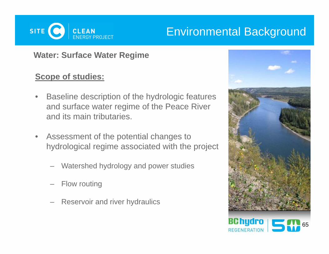
Environmental Background
Water: Surface Water Regime
Scope of studies:
• Baseline description of the hydrologic features and surface water regime of the Peace River and its main tributaries.
• Assessment of the potential changes to hydrological regime associated with the project
– Watershed hydrology and power studies
– Flow routing
– Reservoir and river hydraulics
65
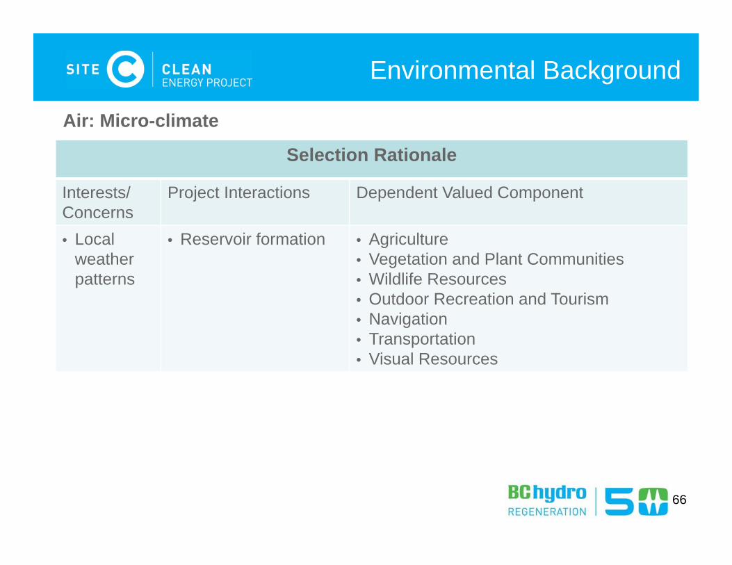
Environmental Background
Selection Rationale
Interests/ Concerns
Project Interactions Dependent Valued Component
• Local weather patterns
• Reservoir formation • Agriculture • Vegetation and Plant Communities• Wildlife Resources• Outdoor Recreation and Tourism• Navigation• Transportation• Visual Resources
Air: Micro-climate
66
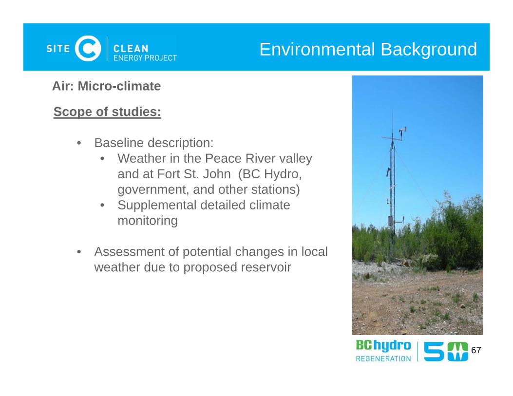
Environmental Background
Air: Micro-climate
Scope of studies:
• Baseline description:• Weather in the Peace River valley
and at Fort St. John (BC Hydro, government, and other stations)
• Supplemental detailed climate monitoring
• Assessment of potential changes in local weather due to proposed reservoir
67

Environmental Valued Components and
Effects Assessments EIS-G Section 10-13 (pg. 38-51)
68

69
Valued ComponentsEnvironment Economic Social Heritage Health Fish and Fish Habitat Local Government
RevenuePopulation and Demographics
HeritageResources
Human Health
Vegetation and Plant Communities
Labour Market Housing
Wildlife Resources Regional Economic Development
Community Infrastructure and Services
Greenhouse Gases Transportation
Land and Resource UseCurrent Use of Lands and Resources for Traditional Purposes
Agriculture Forestry Oil, Gas,and Energy
Minerals andAggregates
Harvest of Fish and Wildlife Resources
Outdoor Recreation and Tourism
Navigation Visual Resources

70
Environment Valued Components
Selection Rationale
Interests/Concerns Project Interactions Valued Component
• Ecosystem Health• Subsistence/cultural uses,
Recreation uses,• Fisheries Act, BC Water
Act
• Construction activities in or around water
• Reservoir formation• Dam operation
Fish and Fish Habitat
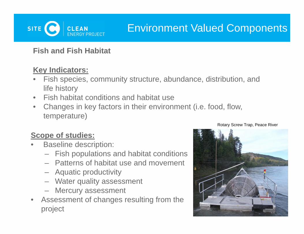
Fish and Fish Habitat (EIS Guidelines, Section 10, p38)
71
Environment Valued Components
Fish and Fish Habitat
Key Indicators:• Fish species, community structure, abundance, distribution, and
life history• Fish habitat conditions and habitat use• Changes in key factors in their environment (i.e. food, flow,
temperature)
Scope of studies:• Baseline description:
– Fish populations and habitat conditions– Patterns of habitat use and movement– Aquatic productivity – Water quality assessment – Mercury assessment
• Assessment of changes resulting from the project
Rotary Screw Trap, Peace River
72
Environment Valued Components
Selection Rationale
Interests/Concerns Project Interactions Valued Component
• Wildlife habitat quality• Medicinal plants/ food
gathering• Recreation • Biodiversity• Species at Risk Act
• Land Clearing• Reservoir formation• Operational activities
Vegetation and Plant Communities
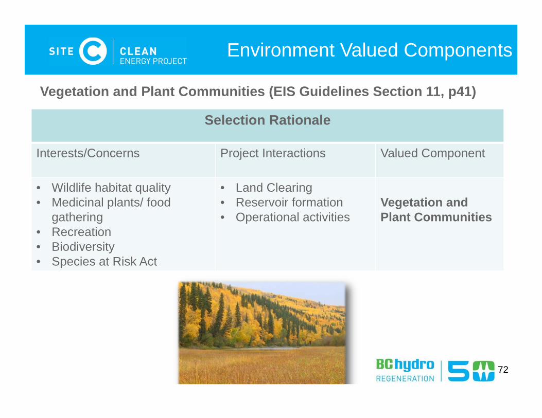
Vegetation and Plant Communities (EIS Guidelines Section 11, p41)
73
Environment Valued Components
Key Indicators:• Area and structural stage of each
ecosystem type• Number of unique ecosystems and their
distribution• Number and distribution of rare plant
species observed
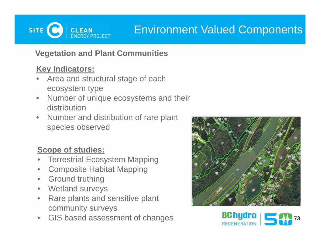
Vegetation and Plant Communities
Scope of studies:• Terrestrial Ecosystem Mapping• Composite Habitat Mapping• Ground truthing• Wetland surveys• Rare plants and sensitive plant
community surveys• GIS based assessment of changes
74
Environment Valued Components
Selection Rationale
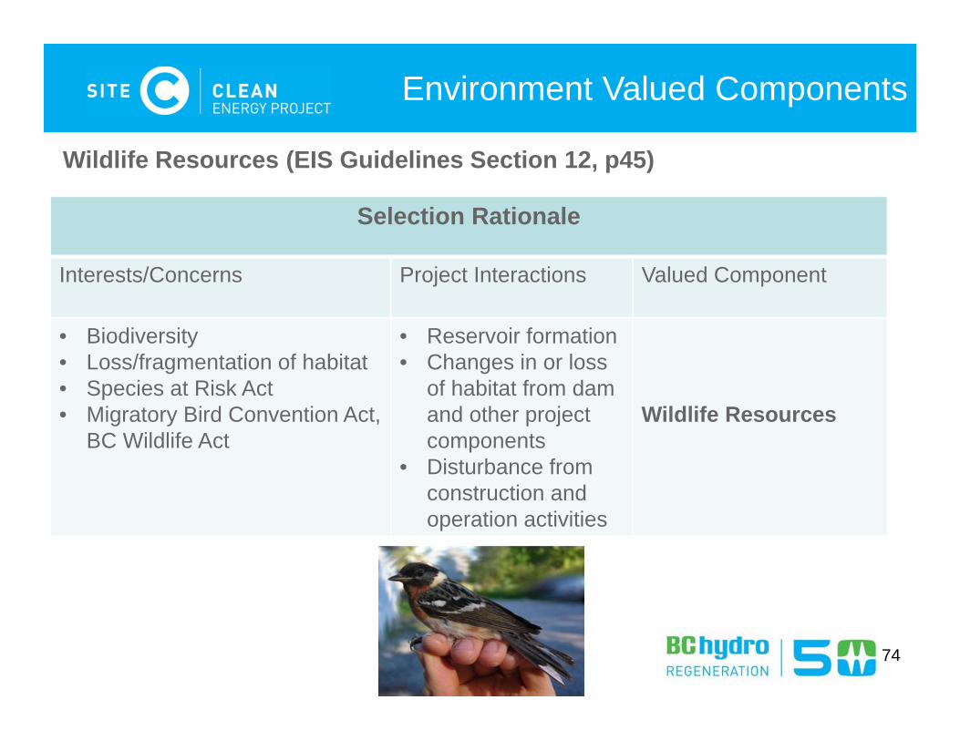
Interests/Concerns Project Interactions Valued Component
• Biodiversity • Loss/fragmentation of habitat• Species at Risk Act• Migratory Bird Convention Act,
BC Wildlife Act
• Reservoir formation• Changes in or loss
of habitat from dam and other project components
• Disturbance from construction and operation activities
Wildlife Resources
Wildlife Resources (EIS Guidelines Section 12, p45)

75
Environment Valued Components
Key Indicators:• Habitat alteration and fragmentation• Displacement or disturbance• Individual mortality
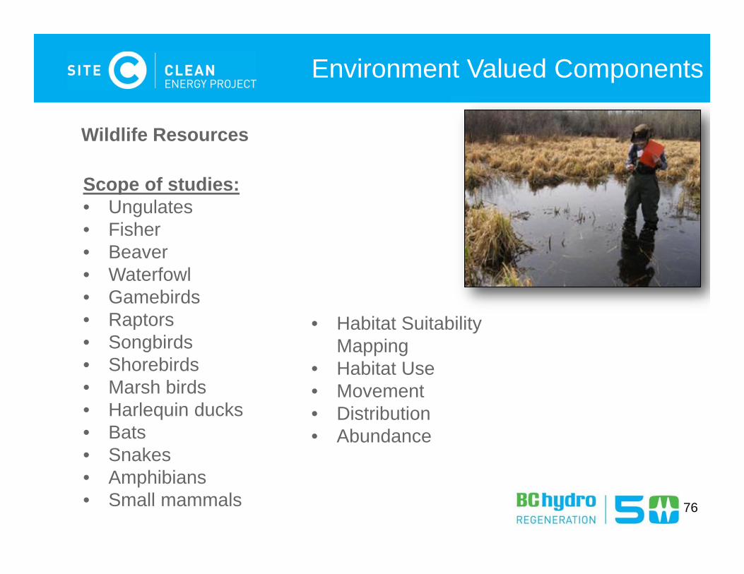
Wildlife Resources
Key Species Groups • Ungulates• Furbearers• Migratory birds• Non-migratory birds• Raptors• Amphibian and reptiles• Bats• Butterflies and dragonflies
76
Environment Valued Components
Wildlife Resources
Scope of studies:• Ungulates• Fisher • Beaver • Waterfowl• Gamebirds • Raptors• Songbirds• Shorebirds• Marsh birds• Harlequin ducks• Bats• Snakes• Amphibians• Small mammals
• Habitat Suitability Mapping
• Habitat Use• Movement• Distribution• Abundance
77
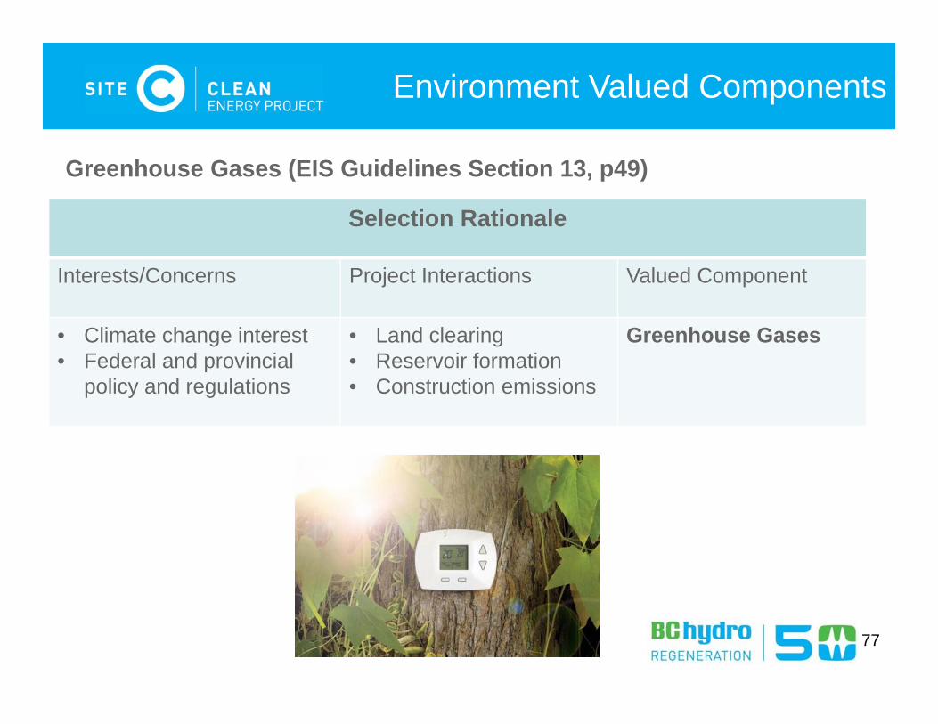
Environment Valued Components
Selection Rationale
Interests/Concerns Project Interactions Valued Component
• Climate change interest• Federal and provincial
policy and regulations
• Land clearing• Reservoir formation• Construction emissions
Greenhouse Gases
Greenhouse Gases (EIS Guidelines Section 13, p49)
78
Environment Valued Components
Key Indicators:
• Estimated net change in greenhouse gases emissions
Greenhouse Gases
Scope of studies:
• Baseline estimation of net GHG emission from current conditions
• Multi-year greenhouse gases emission profile from constructing and operating the Project

Questions?
79

80
Valued ComponentsEnvironment Economic Social Heritage Health Fish and Fish Habitat Local Government
RevenuePopulation and Demographics
HeritageResources
Human Health
Vegetation and Plant Communities
Labour Market Housing
Wildlife Resources Regional Economic Development
Community Infrastructure and Services
Greenhouse Gases Transportation
Land and Resource UseCurrent Use of Lands and Resources for Traditional Purposes
Agriculture Forestry Oil, Gas,and Energy
Minerals andAggregates
Harvest of Fish and Wildlife Resources
Outdoor Recreation and Tourism
Navigation Visual Resources
Economic Valued Components and
Effects Assessments EIS-G Section 14 (pg 52)
81
82
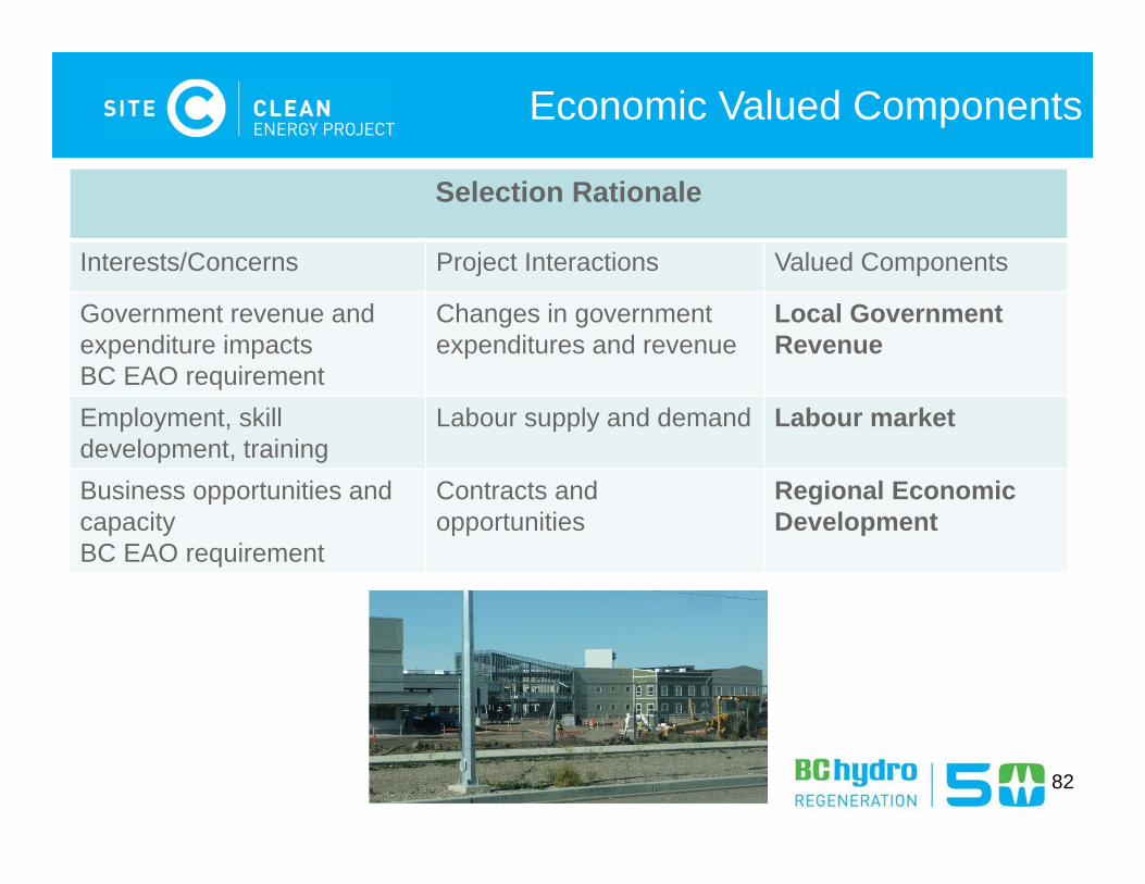
Economic Valued Components
Selection Rationale
Interests/Concerns Project Interactions Valued Components
Government revenue and expenditure impactsBC EAO requirement
Changes in governmentexpenditures and revenue
Local Government Revenue
Employment, skill development, training
Labour supply and demand Labour market
Business opportunities and capacityBC EAO requirement
Contracts and opportunities
Regional Economic Development
83
Economic Valued Components
Key Indicators
Local Government Revenue• Local government expenditures• Local government revenue
Labour Market• Local labour force by occupation, industry, skills• Non-resident workers in region’s labour force, • Employment rates• Skill shortages and surpluses
Regional Economic Development• Regional business and contracting profile, capabilities and capacity
84
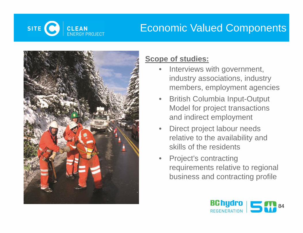
Economic Valued Components
Scope of studies:• Interviews with government,
industry associations, industry members, employment agencies
• British Columbia Input-Output Model for project transactions and indirect employment
• Direct project labour needs relative to the availability and skills of the residents
• Project’s contracting requirements relative to regional business and contracting profile
Land Use Valued Components and
Effects Assessments EIS-G Section 15 and 16 (pg 59-73)
85
86
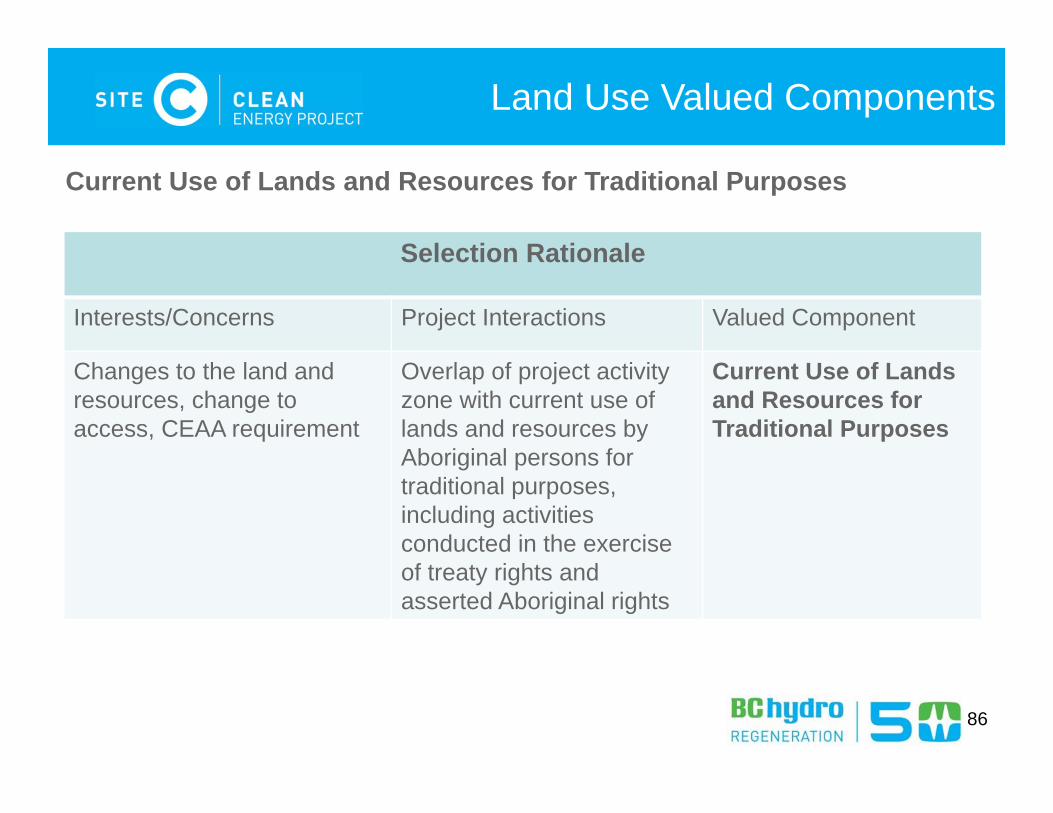
Land Use Valued Components
Selection Rationale
Interests/Concerns Project Interactions Valued Component
Changes to the land and resources, change to access, CEAA requirement
Overlap of project activity zone with current use of lands and resources by Aboriginal persons for traditional purposes, including activities conducted in the exercise of treaty rights and asserted Aboriginal rights
Current Use of Lands and Resources for Traditional Purposes
Current Use of Lands and Resources for Traditional Purposes
87
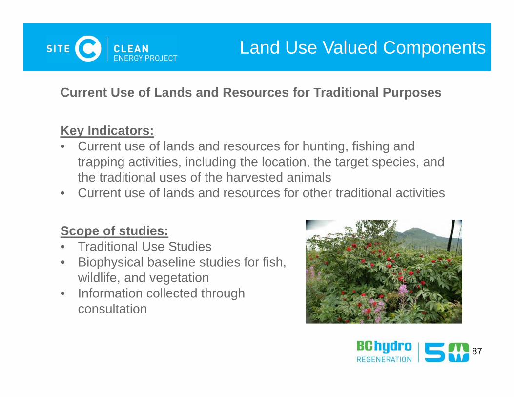
Land Use Valued Components
Current Use of Lands and Resources for Traditional Purposes
Key Indicators:• Current use of lands and resources for hunting, fishing and
trapping activities, including the location, the target species, and the traditional uses of the harvested animals
• Current use of lands and resources for other traditional activities
Scope of studies:• Traditional Use Studies• Biophysical baseline studies for fish,
wildlife, and vegetation• Information collected through
consultation
88
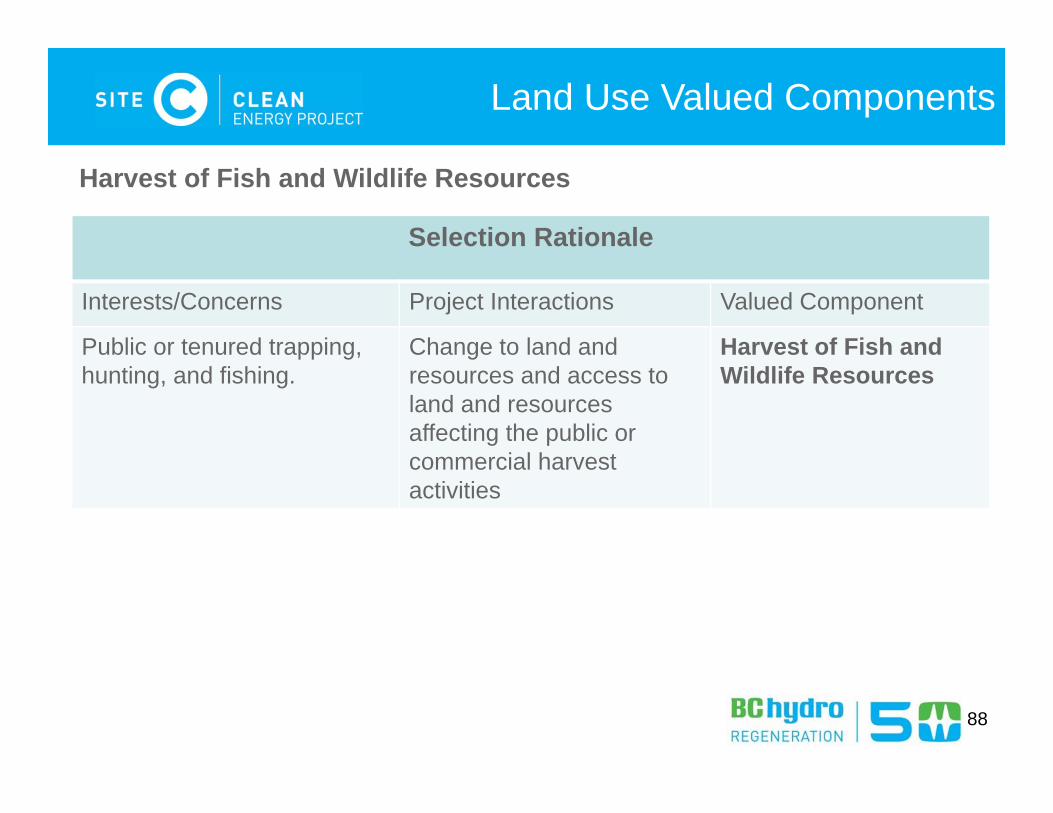
Land Use Valued Components
Selection Rationale
Interests/Concerns Project Interactions Valued Component
Public or tenured trapping, hunting, and fishing.
Change to land and resources and access to land and resources affecting the public or commercial harvest activities
Harvest of Fish and Wildlife Resources
Harvest of Fish and Wildlife Resources
89
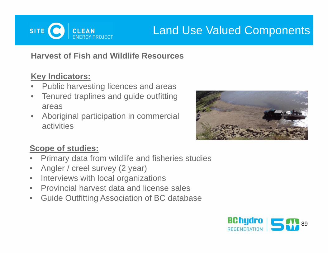
Land Use Valued Components
Harvest of Fish and Wildlife Resources
Key Indicators:• Public harvesting licences and areas• Tenured traplines and guide outfitting
areas• Aboriginal participation in commercial
activities
Scope of studies:• Primary data from wildlife and fisheries studies• Angler / creel survey (2 year)• Interviews with local organizations• Provincial harvest data and license sales• Guide Outfitting Association of BC database
90
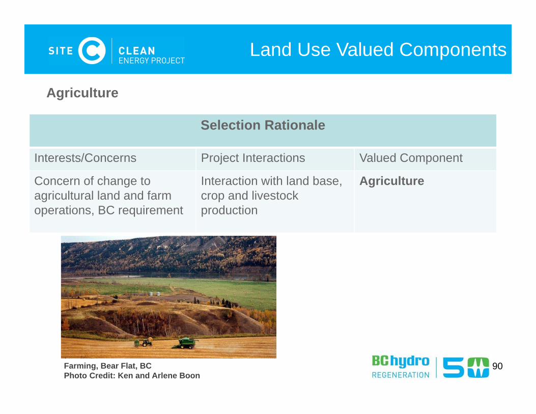
Land Use Valued Components
Selection Rationale
Interests/Concerns Project Interactions Valued Component
Concern of change to agricultural land and farm operations, BC requirement
Interaction with land base, crop and livestock production
Agriculture
Agriculture
Farming, Bear Flat, BCPhoto Credit: Ken and Arlene Boon
91
Land Use Valued Components
Agriculture
Key Indicators:
• Agricultural land capability, crop suitability
• Agricultural utility (e.g. usability and access)
• Agricultural / grazing tenures
• Current and expected future agricultural operations
• Local and regional agricultural economic activity
• Local and regional food production and consumption
92
Land Use Valued Components
Agriculture
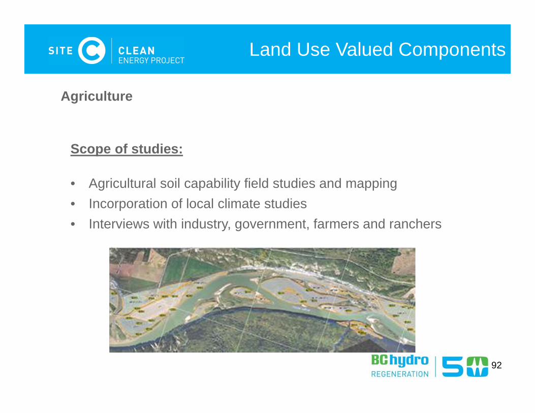
Scope of studies:
• Agricultural soil capability field studies and mapping• Incorporation of local climate studies• Interviews with industry, government, farmers and ranchers
93
Land Use Valued Components
Selection Rationale
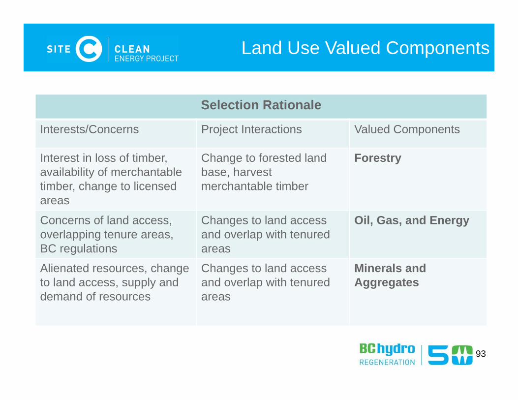
Interests/Concerns Project Interactions Valued Components
Interest in loss of timber, availability of merchantabletimber, change to licensed areas
Change to forested land base, harvest merchantable timber
Forestry
Concerns of land access, overlapping tenure areas, BC regulations
Changes to land access and overlap with tenured areas
Oil, Gas, and Energy
Alienated resources, change to land access, supply and demand of resources
Changes to land access and overlap with tenured areas
Minerals and Aggregates
94
Land Use Valued Components
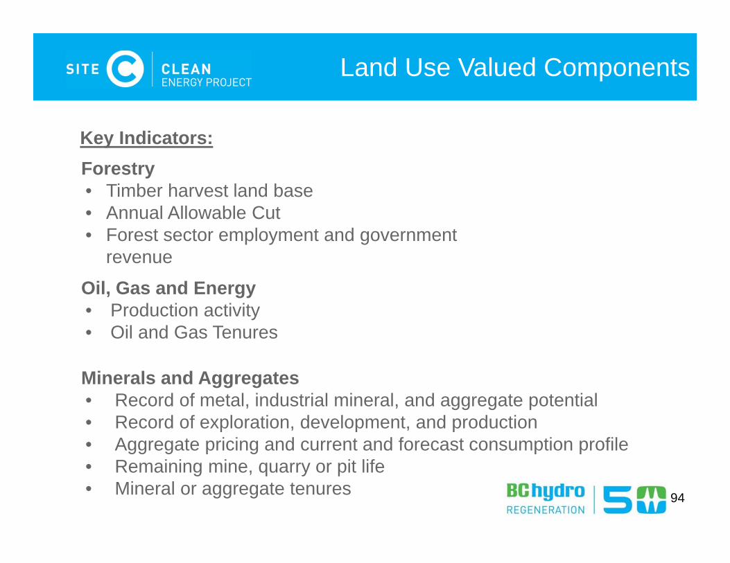
Key Indicators:Forestry• Timber harvest land base• Annual Allowable Cut• Forest sector employment and government
revenue
Oil, Gas and Energy• Production activity• Oil and Gas Tenures
Minerals and Aggregates• Record of metal, industrial mineral, and aggregate potential• Record of exploration, development, and production• Aggregate pricing and current and forecast consumption profile• Remaining mine, quarry or pit life• Mineral or aggregate tenures
95
Land Use Valued Components
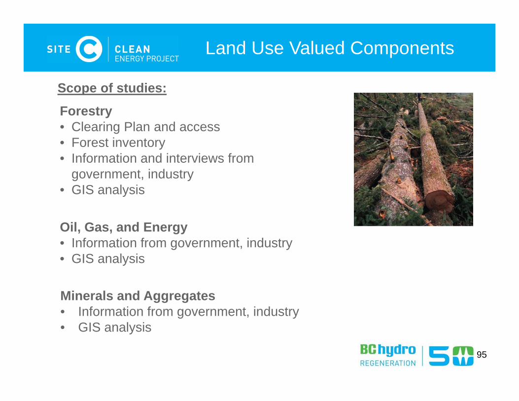
Oil, Gas, and Energy• Information from government, industry• GIS analysis
Minerals and Aggregates• Information from government, industry• GIS analysis
Forestry• Clearing Plan and access• Forest inventory• Information and interviews from
government, industry• GIS analysis
Scope of studies:
96
Land Use Valued Components
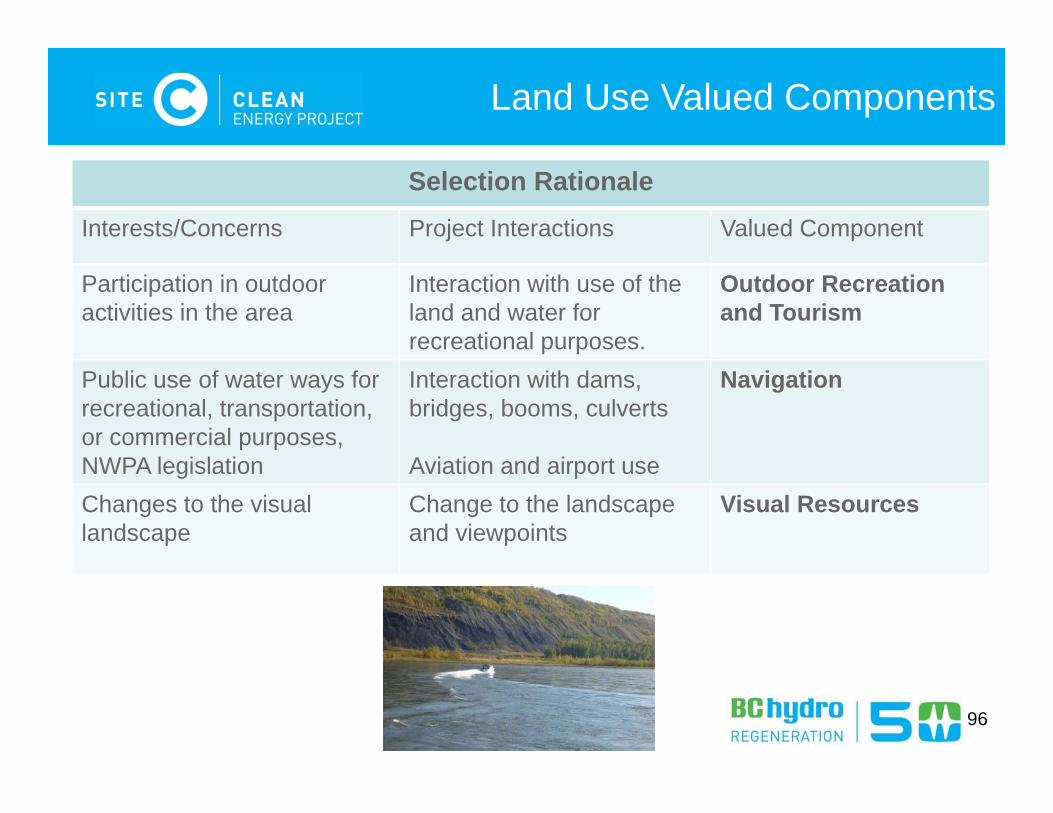
Selection Rationale Interests/Concerns Project Interactions Valued Component
Participation in outdooractivities in the area
Interaction with use of the land and water for recreational purposes.
Outdoor Recreation and Tourism
Public use of water ways for recreational, transportation, or commercial purposes, NWPA legislation
Interaction with dams, bridges, booms, culverts
Aviation and airport use
Navigation
Changes to the visual landscape
Change to the landscape and viewpoints
Visual Resources
97
Land Use Valued Components
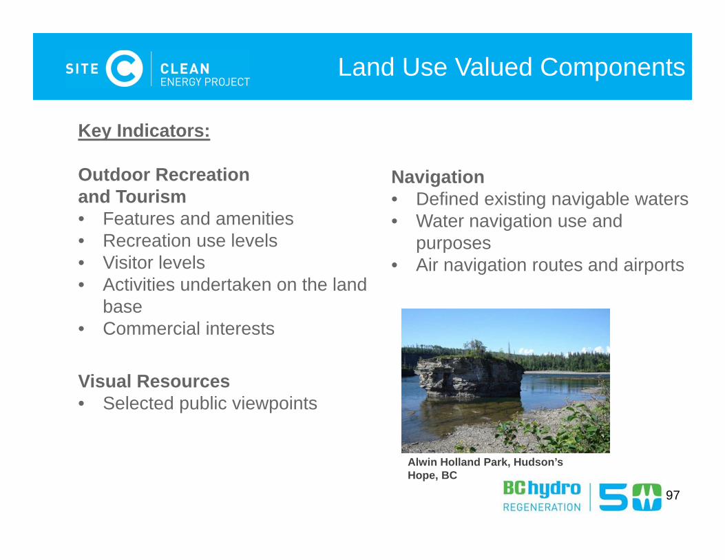
Key Indicators:
Outdoor Recreation and Tourism• Features and amenities • Recreation use levels• Visitor levels• Activities undertaken on the land
base• Commercial interests
Navigation• Defined existing navigable waters • Water navigation use and
purposes• Air navigation routes and airports
Visual Resources• Selected public viewpoints
Alwin Holland Park, Hudson’s Hope, BC
98
Land Use Valued Components
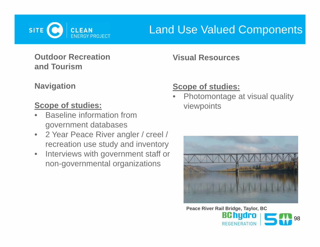
Outdoor Recreation and Tourism
Navigation
Scope of studies:• Baseline information from
government databases• 2 Year Peace River angler / creel /
recreation use study and inventory• Interviews with government staff or
non-governmental organizations
Visual Resources
Scope of studies:• Photomontage at visual quality
viewpoints
Peace River Rail Bridge, Taylor, BC
Questions?
99
Social Valued Components and
Effects Assessments EIS-G Section 17 (pg 74)
100
101
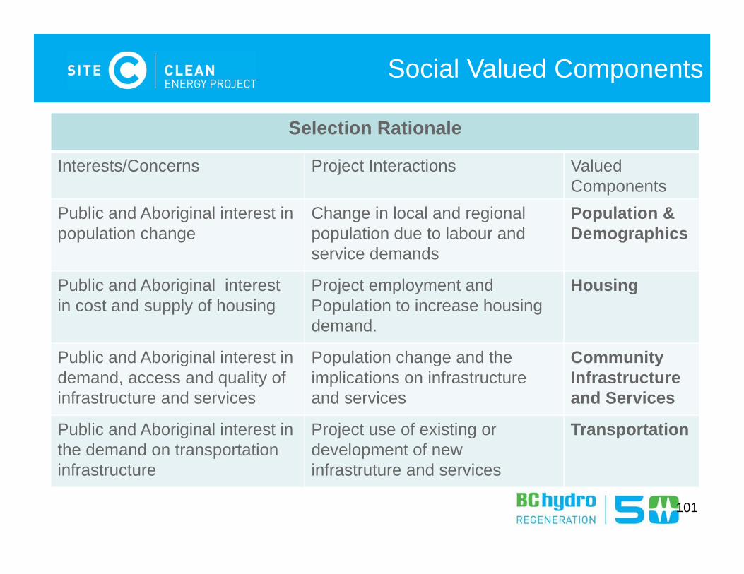
Social Valued Components
Selection Rationale
Interests/Concerns Project Interactions Valued Components
Public and Aboriginal interest in population change
Change in local and regional population due to labour and service demands
Population & Demographics
Public and Aboriginal interest in cost and supply of housing
Project employment andPopulation to increase housingdemand.
Housing
Public and Aboriginal interest in demand, access and quality of infrastructure and services
Population change and the implications on infrastructure and services
CommunityInfrastructure and Services
Public and Aboriginal interest in the demand on transportation infrastructure
Project use of existing or development of new infrastruture and services
Transportation
102
Social Valued Components
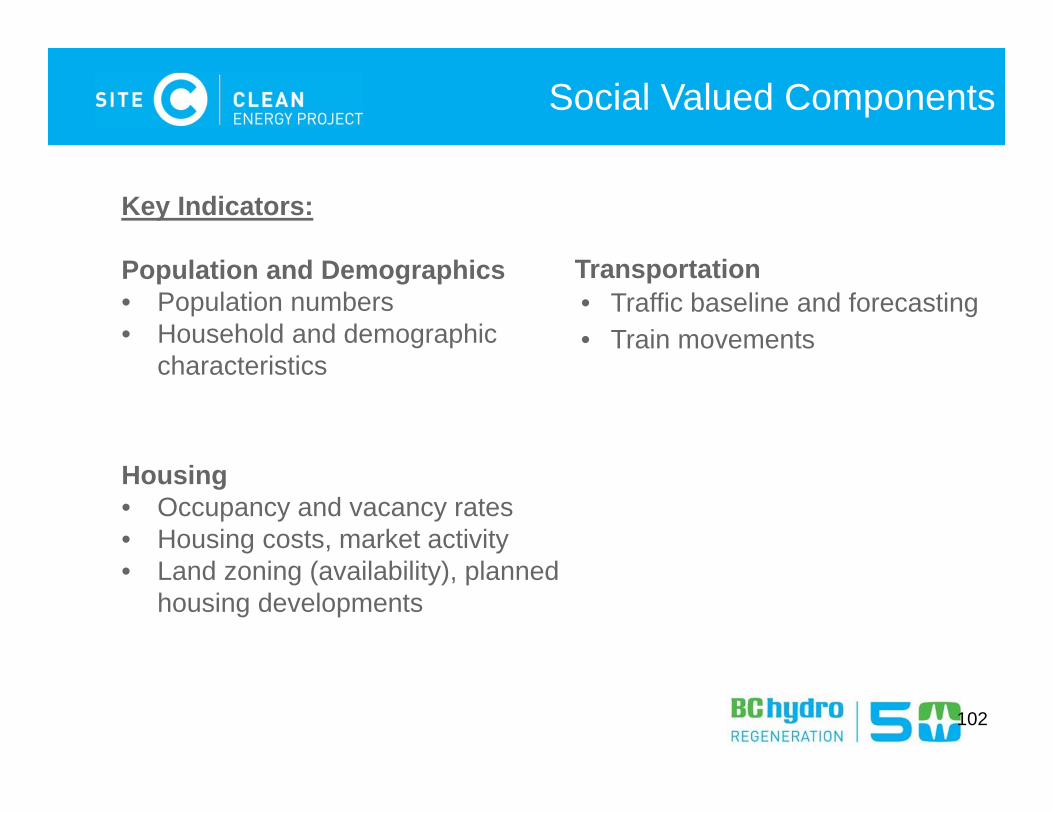
Key Indicators:
Population and Demographics• Population numbers • Household and demographic
characteristics
Housing• Occupancy and vacancy rates• Housing costs, market activity• Land zoning (availability), planned
housing developments
Transportation• Traffic baseline and forecasting• Train movements
103
Social Valued Components
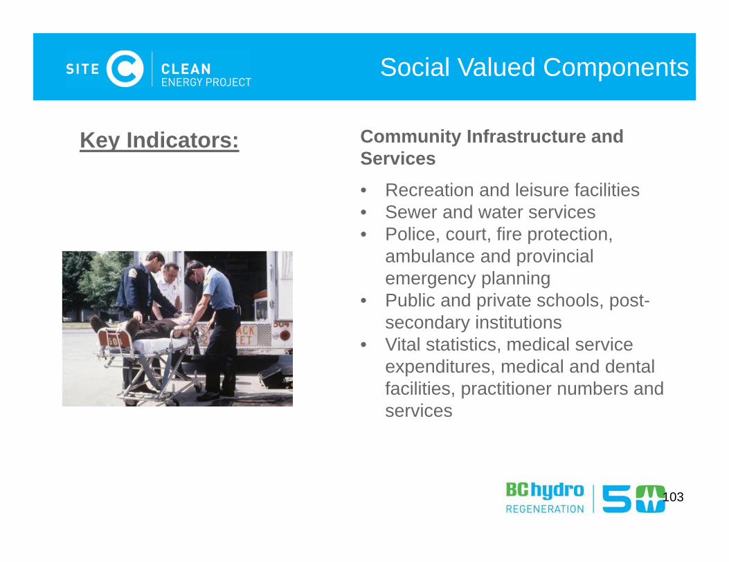
Community Infrastructure and Services• Recreation and leisure facilities• Sewer and water services• Police, court, fire protection,
ambulance and provincial emergency planning
• Public and private schools, post-secondary institutions
• Vital statistics, medical service expenditures, medical and dental facilities, practitioner numbers and services
Key Indicators:
104
Social Valued Components
Scope of studies:• Previous studies and recent consultation review• Research and data gathering including:
– Discussions with local government on infrastructure and services – Discussions with agencies and service providers on community,
emergency, education, and health social services and facilities. – Development of infrastructure inventory– Discussions with local government and Ministry of Transportation and
Infrastructure on transportation and traffic forecasting– Traffic count program– Use of results from Labour Market assessment to assess effects on
population

Health Valued Component and
Effects Assessments EIS-G Section 19 (pg 82)
105
106
Health Valued Component
Selection Rationale
Interests/Concerns Project Interactions Valued Component
Public and Aboriginal interest in changes to air and water quality, and methylmercury in foods
BC / CEAA requirement
Construction and operational effects on biophysical inputs that may affect human health
Human Health
Human Health
107
Health Valued Component
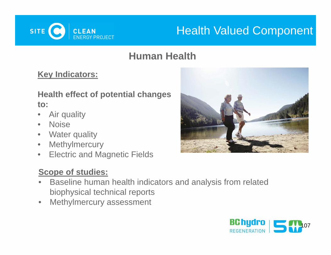
Human Health
Key Indicators:
Health effect of potential changes to:• Air quality• Noise • Water quality• Methylmercury• Electric and Magnetic Fields
Scope of studies:• Baseline human health indicators and analysis from related
biophysical technical reports• Methylmercury assessment
Heritage Valued Component and
Effects Assessments
EIS-G Section 18 (pg 80)
108
109
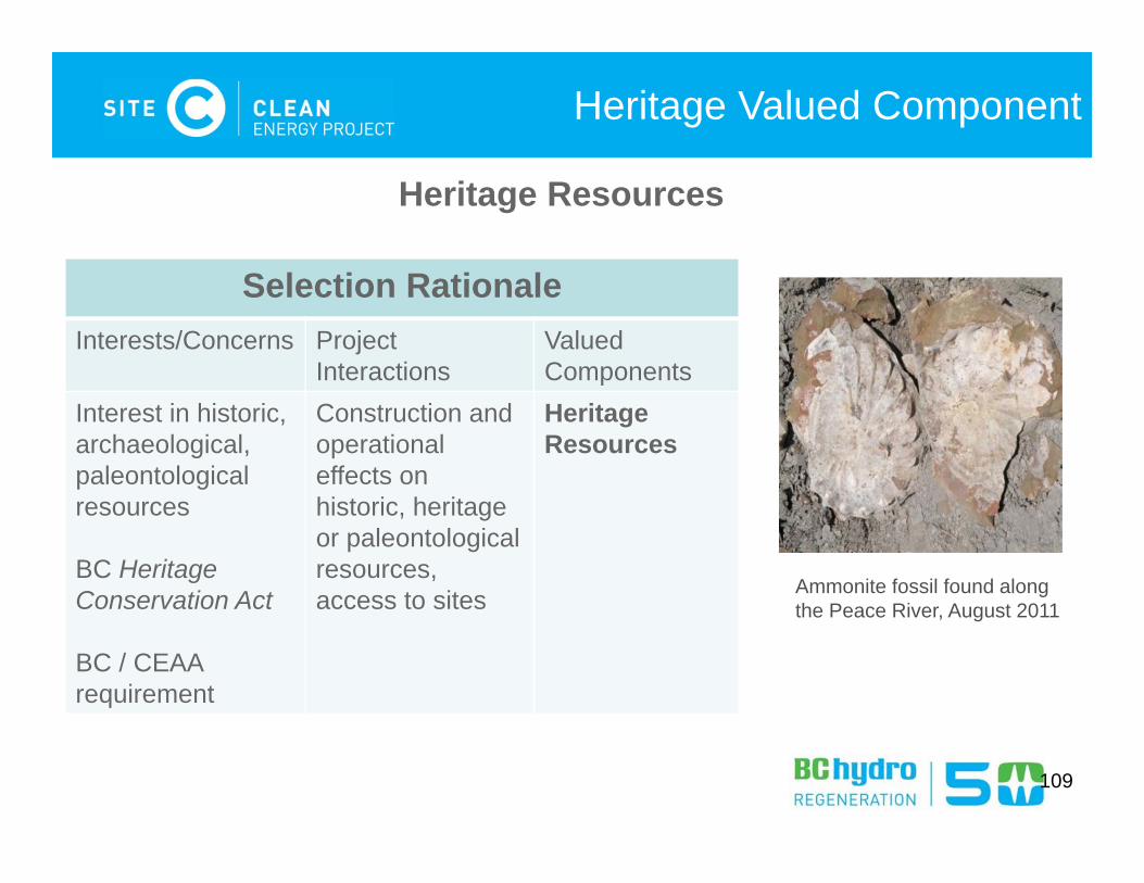
Heritage Valued Component
Selection Rationale Interests/Concerns Project
InteractionsValued Components
Interest in historic,archaeological,paleontological resources
BC Heritage Conservation Act
BC / CEAA requirement
Construction and operationaleffects on historic, heritage or paleontological resources, access to sites
Heritage Resources
Heritage Resources
Ammonite fossil found along the Peace River, August 2011
110
Heritage Valued Component
Heritage Resources
Key Indicators:• Historic, archaeological, and palaeontological sites; artifacts;
fossils; features
Scope of studies:• Literature review and research to inform field studies / potential• Field inventory for archaeological sites• Field inventory for historic sites• Field inventory for palaeontological sites

Questions?
111

Next Steps
112
113
For More Information
Principal Contact for the Environmental Assessment:
Danielle MelchiorDirector, Site C Environmental Assessment and RegulatoryPhone: 604 699-7344Fax: 604 623-4333Email: [email protected]: www.bchydro.com/sitec
Thank you
Questions?


