22
Drainage Area & Discharge Determination Bridges (February 2017) Bill P. Schmidt, Hydraulics Engineer Email:[email protected] (317) 232-5148
Drainage Area & Discharge Determination
Bridges(February 2017)
Bill P. Schmidt, Hydraulics Engineer
Email:[email protected]
(317) 232-5148

Determining Drainage Area
Digital Elevation Modeling (DEM) USGS Quadrangle Topographic Maps USGS Streamstats L-THIA (Purdue) Field Investigation & Plans Drainage Areas of Indiana Streams

Digital Elevation Modeling (DEM) http://www.indianamap.org/
resources.php
Uses LiDAR information from planes flying the state
Based on 5 ft pixel size
Can build customized contours using software such as ARC-GIS
Currently the most common method used by INDOT for delineation

USGS Quadrangle Maps Topographical maps of
the state (originally paper)
Generally in 5 or 10 ft contour increments
Works well in hilly areas, but has limitations in flatter areas
Previously preferred delineation method of INDOT

USGS StreamStats https://water.usgs.gov/
osw/streamstats/indiana.html
Point and Click determination
Delineates the watershed for the location selected
Determines a discharge
Check for errors
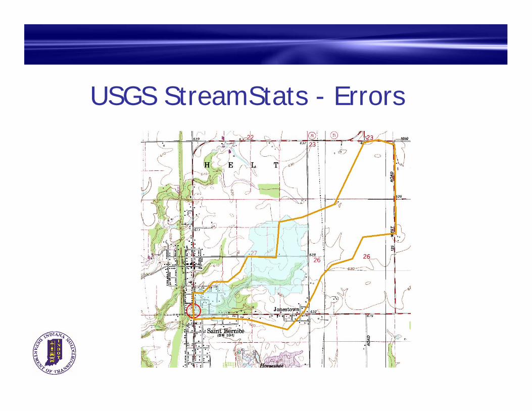
USGS StreamStats - Errors

USGS StreamStats - Errors

USGS StreamStats - Errors
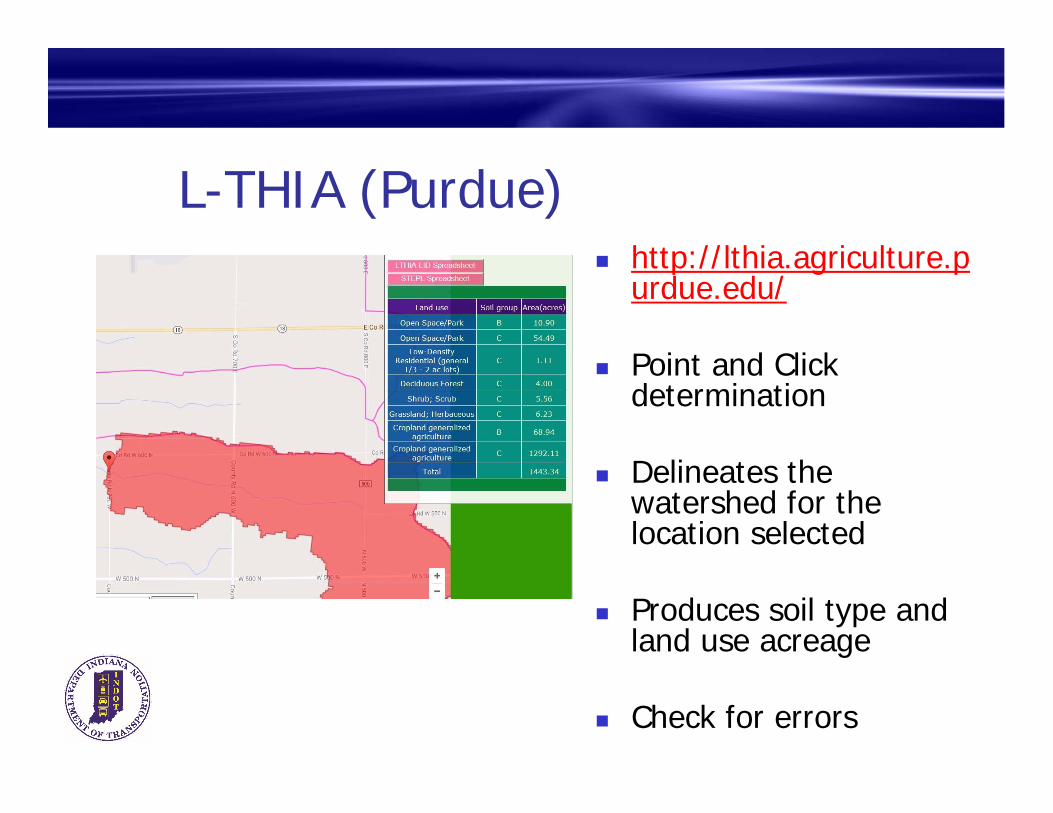
L-THIA (Purdue) http://lthia.agriculture.p
urdue.edu/
Point and Click determination
Delineates the watershed for the location selected
Produces soil type and land use acreage
Check for errors
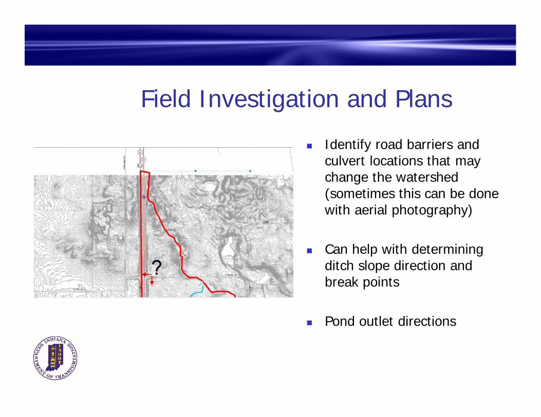
Field Investigation and Plans
Identify road barriers and culvert locations that may change the watershed (sometimes this can be done with aerial photography)
Can help with determining ditch slope direction and break points
Pond outlet directions
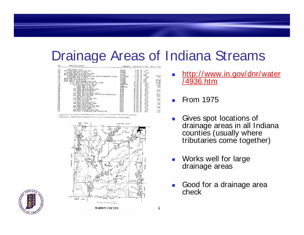
Drainage Areas of Indiana Streams http://www.in.gov/dnr/water
/4936.htm
From 1975
Gives spot locations of drainage areas in all Indiana counties (usually where tributaries come together)
Works well for large drainage areas
Good for a drainage area check
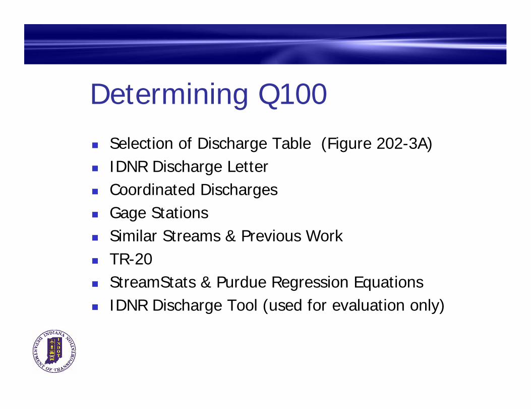
Determining Q100 Selection of Discharge Table (Figure 202-3A) IDNR Discharge Letter Coordinated Discharges Gage Stations Similar Streams & Previous Work TR-20 StreamStats & Purdue Regression Equations IDNR Discharge Tool (used for evaluation only)
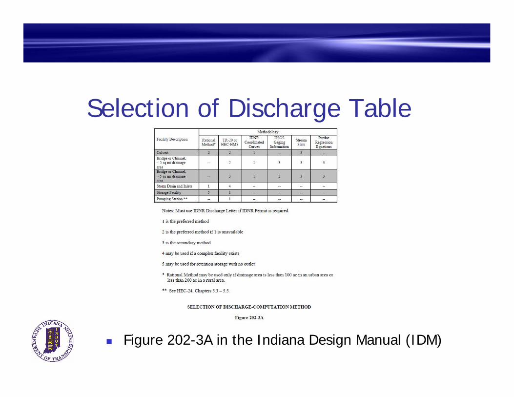
Selection of Discharge Table
Figure 202-3A in the Indiana Design Manual (IDM)
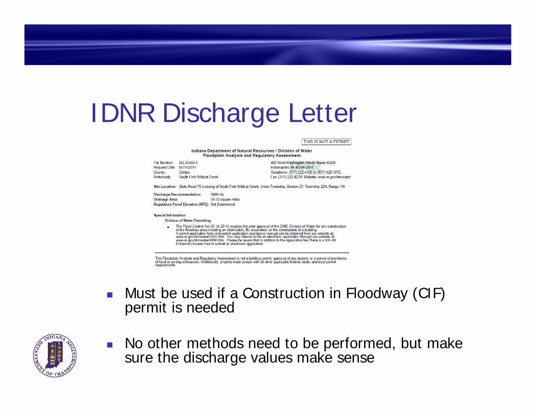
IDNR Discharge Letter
Must be used if a Construction in Floodway (CIF) permit is needed
No other methods need to be performed, but make sure the discharge values make sense

IDNR Coordinated Discharges http://www.in.gov/dnr/water/48
98.htm
Easy to use, preferred by IDNR
Recent studies tend to be more realistic than older ones
Extrapolation within reason is acceptable
Can use studies from different streams if they are deemed to be similar
Make sure results seem realistic
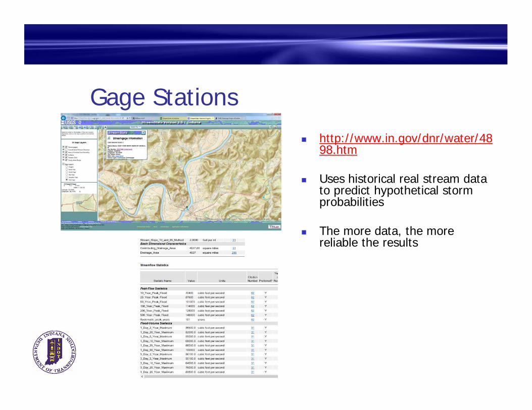
Gage Stations http://www.in.gov/dnr/water/48
98.htm
Uses historical real stream data to predict hypothetical storm probabilities
The more data, the more reliable the results

Similar Streams and Previous Work
Can look at previously completed work of similar watershed or nearby areas
Create a regression line to help predict discharge at site of interest

TR-20 https://www.nrcs.usda.gov/wps
/portal/nrcs/detailfull/null/?cid=stelprdb1042793
Software from USDA - NRCS
For bridges, use only with smaller watersheds (say < 5 square miles)
Requires Drainage Area, Curve Number (Soil Information), and Time of Concentration
Requires multiple hydrographs to determine peak discharge
Use Huff methodology for rainfall distributions

StreamStats and Purdue Regression Equations
Can have a large variable range
Do not use by itself
Requires checking with other methods to determine validity

IDNR Discharge Tool Great for Regression Analysis
Uses most of the methods preferred by INDOT
Do not accept blindly
Eliminate inputs that don’t relate to the site of interest
Add additional inputs as needed

IDNR Discharge Tool Use plot to see if there are
outliers or adjustments to be made
http://dnrmaps.dnr.in.gov/appsphp/dischargecalc/
See website for details on how to use
IDNR will be giving a presentation on the tool at Road School in March
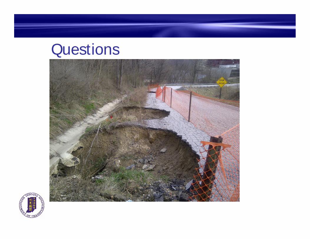
Questions


