24
DRAINAGE CLASSIFICATION & RECLASSIFICATION December 9, 2016 ARCHITECTURE + ENGINEERING + ENVIRONMENTAL + PLANNING

DRAINAGE CLASSIFICATION & RECLASSIFICATION December 9, 2016
ARCHITECTURE + ENGINEERING + ENVIRONMENTAL + PLANNING

PRESENTATION OUTLINE
What is Classification & Reclassification?When and Why Reclassification?
Guidelines for Commissioners
Methodology for Classification

WHAT IS CLASSIFICATION?
What is Classification - Iowa Code Section 468:Procedures established under the Iowa Drainage Code to classify the lands to
provide for a equitable distribution of drainage benefits per parcel within a drainagedistrict watershed.
How to Classify – Section 468.38:When a levee or drainage district has been located and finally established or
otherwise provided by law, or extend any of the ditches, laterals, settling basins, ordrains of a district, or required proceedings have been taken to annex additionallands to a district …., the board shall appoint three commissioners to assessbenefits and classify the lands affected by the improvement.
Directions for Classifications – Sections 468.38 – 468.41: 468.38 Commissioners to Classify 468.39 Duties – Time for Performance – Scale of Benefits 468.40 Rules of Classification 468.41 Assessment for Lateral Ditches – Reclassification of Benefited Lands
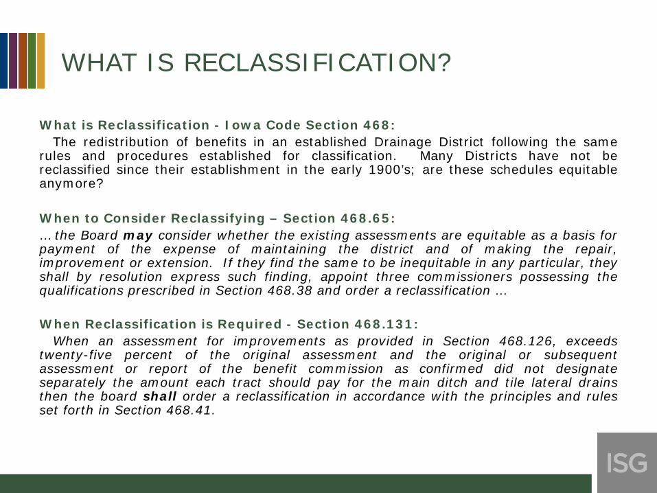
WHAT IS RECLASSIFICATION?
What is Reclassification - Iowa Code Section 468:The redistribution of benefits in an established Drainage District following the same
rules and procedures established for classification. Many Districts have not bereclassified since their establishment in the early 1900’s; are these schedules equitableanymore?
When to Consider Reclassifying – Section 468.65:… the Board may consider whether the existing assessments are equitable as a basis forpayment of the expense of maintaining the district and of making the repair,improvement or extension. If they find the same to be inequitable in any particular, theyshall by resolution express such finding, appoint three commissioners possessing thequalifications prescribed in Section 468.38 and order a reclassification …
When Reclassification is Required - Section 468.131:When an assessment for improvements as provided in Section 468.126, exceeds
twenty-five percent of the original assessment and the original or subsequentassessment or report of the benefit commission as confirmed did not designateseparately the amount each tract should pay for the main ditch and tile lateral drainsthen the board shall order a reclassification in accordance with the principles and rulesset forth in Section 468.41.
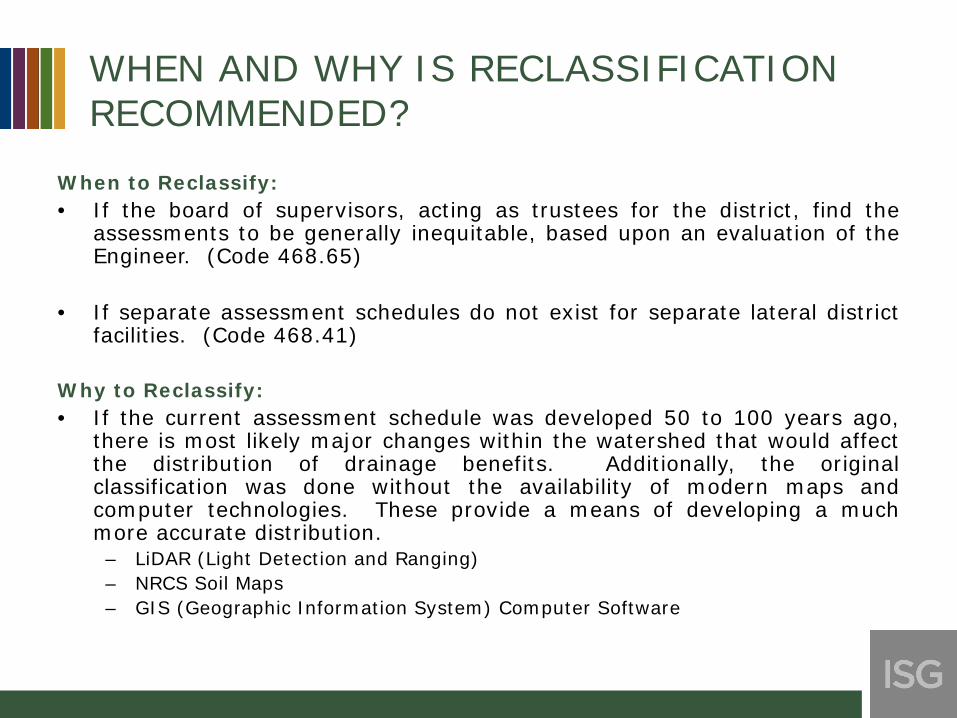
WHEN AND WHY IS RECLASSIFICATION RECOMMENDED?
When to Reclassify:• If the board of supervisors, acting as trustees for the district, find the
assessments to be generally inequitable, based upon an evaluation of theEngineer. (Code 468.65)
• If separate assessment schedules do not exist for separate lateral districtfacilities. (Code 468.41)
Why to Reclassify:• If the current assessment schedule was developed 50 to 100 years ago,
there is most likely major changes within the watershed that would affectthe distribution of drainage benefits. Additionally, the originalclassification was done without the availability of modern maps andcomputer technologies. These provide a means of developing a muchmore accurate distribution.
– LiDAR (Light Detection and Ranging)– NRCS Soil Maps– GIS (Geographic Information System) Computer Software

WHEN AND WHY IS RECLASSIFICATION RECOMMENDED?
Additional Reasons to Reclassify:• A change in landscape has occurred such as an abandonment or
construction of a roadway or railway.
• Over the years land usage has changed such as farm ground permanentlyremoved from production. Therefore assessments should be determinedbased on the existing conditions that affect the need for drainage. This isespecially significant with partial or full urban districts.
• Landowners should only be responsible for the maintenance and repair offacilities which they receive benefits from. If lateral facilities have notbeen separated on to individual schedules the board of supervisors actingas trustees for the district should direct them to be.
• If an improvement to the district facilities are planned or constructed;such as a parallel relief tile or an extension to the open ditch. Thedistribution of the benefits will change due to these improvements.
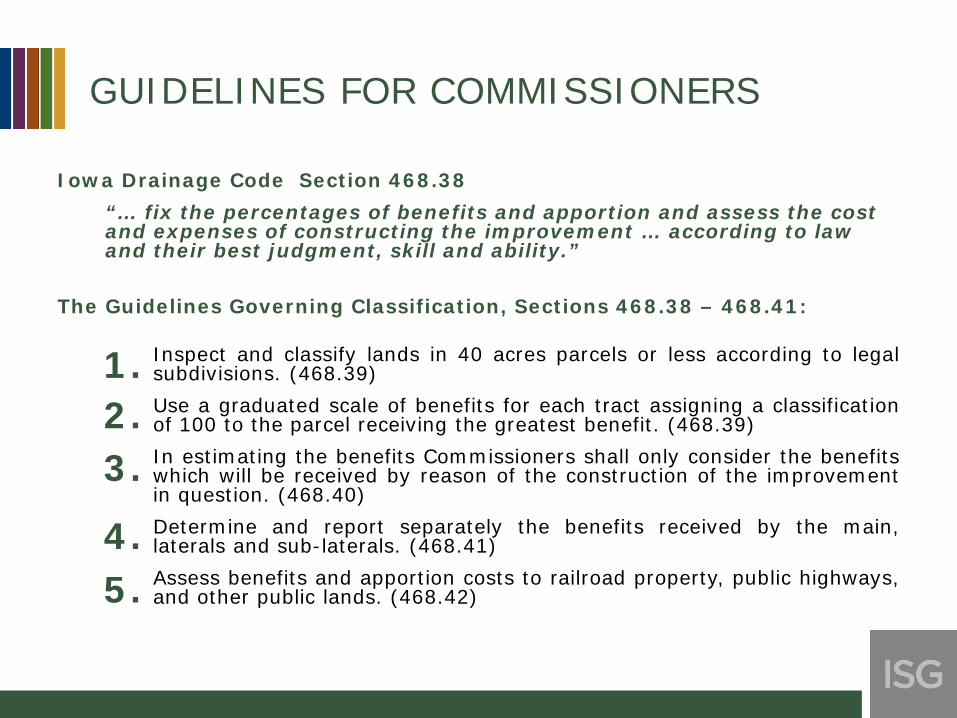
GUIDELINES FOR COMMISSIONERS
Iowa Drainage Code Section 468.38“… fix the percentages of benefits and apportion and assess the cost and expenses of constructing the improvement … according to law and their best judgment, skill and ability.”
The Guidelines Governing Classification, Sections 468.38 – 468.41:
Inspect and classify lands in 40 acres parcels or less according to legalsubdivisions. (468.39)Use a graduated scale of benefits for each tract assigning a classificationof 100 to the parcel receiving the greatest benefit. (468.39)In estimating the benefits Commissioners shall only consider the benefitswhich will be received by reason of the construction of the improvementin question. (468.40)Determine and report separately the benefits received by the main,laterals and sub-laterals. (468.41)Assess benefits and apportion costs to railroad property, public highways,and other public lands. (468.42)
1.2.3.
4.5.
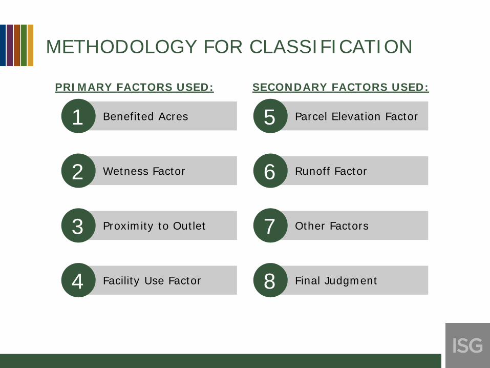
METHODOLOGY FOR CLASSIFICATION
1
2
3
4
5
6
7
8
Benefited Acres
Wetness Factor
Proximity to Outlet
Facility Use Factor
Parcel Elevation Factor
Runoff Factor
Other Factors
Final Judgment
PRIMARY FACTORS USED: SECONDARY FACTORS USED:

BENEFITED ACRES
WITHIN THE WATERSHED OF THE FACILITY
LANDS THAT RECEIVE
BENEFIT FROM SUBSURFACE
FLOWS
THOSE PROTECTED
FROM OVERFLOW
WITHIN THE WATERSHED OF THE FACILITY

CATCHMENTS AND FLOW PATHS

WETNESS FACTOR
• Inherent drainage need of the soils on the parcel– Use county soil survey drainage classification
CATEGORY DRAINAGE CLASSIFICATION FACTOR (TYPICAL)
SLOUGH VPD 100
WET PD 75
LOW SPD – SWD 50
HIGH WD 25
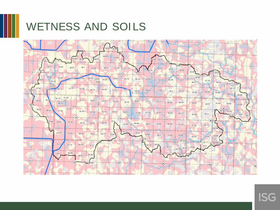
WETNESS AND SOILS
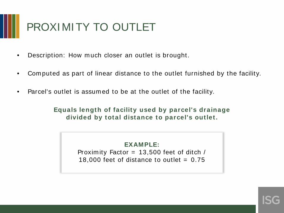
PROXIMITY TO OUTLET
• Description: How much closer an outlet is brought.
• Computed as part of linear distance to the outlet furnished by the facility.
• Parcel's outlet is assumed to be at the outlet of the facility.
Equals length of facility used by parcel's drainagedivided by total distance to parcel's outlet.
EXAMPLE:Proximity Factor = 13,500 feet of ditch /18,000 feet of distance to outlet = 0.75

PROXIMITY BY PARCEL

FACILITY USE FACTOR
• Description: Portion of the facility through which the drainage from thatparcel flows.
• Begins at zero at the outlet and always increases along the length of thefacility.
Computed as percent of original total ditch excavation completed – or as percent of original total cost of drain tile required to construct the
facility –downstream of point of water entry.
EXAMPLE:Facility Use Factor = (30,000 CY Original Downstream
Excavation / 50,000 CY Original Total Excavation)X 100% = 60%

USE BY PARCEL

OTHER ADJUSTMENTSAdjustments for situations not typical of agricultural land in the district
• RUNOFF FACTOR:– Urban areas, roads, railroads and
others with greater runoff potential• POND FACTOR:
– Permanent retention areas such asMunicipal waste treatment lagoons,gravel pits, lakes and farm ponds
• SURFACE/SUBSURFACE FACTOR:– Areas tiled across divide into or out
of district • OTHER FACTORS ASSIGNED BY
COMMISSIONERS
EXAMPLES:
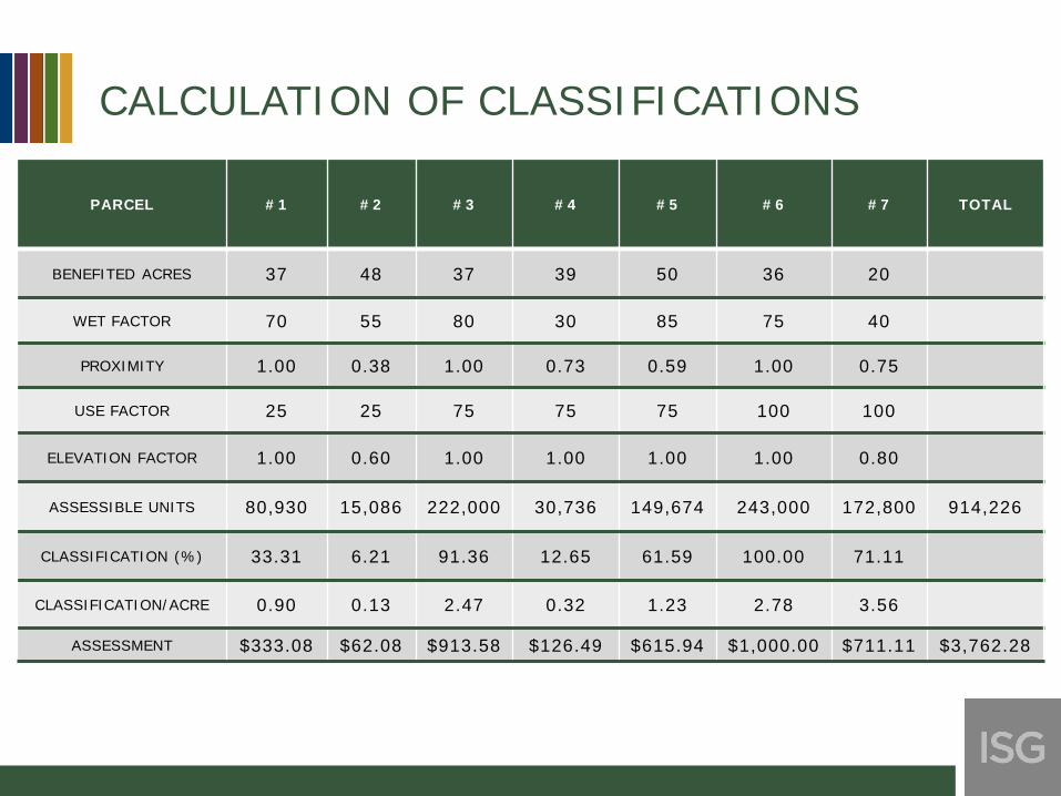
CALCULATION OF CLASSIFICATIONS
PARCEL #1 #2 #3 #4 #5 #6 #7 TOTAL
BENEFITED ACRES 37 48 37 39 50 36 20
WET FACTOR 70 55 80 30 85 75 40
PROXIMITY 1.00 0.38 1.00 0.73 0.59 1.00 0.75
USE FACTOR 25 25 75 75 75 100 100
ELEVATION FACTOR 1.00 0.60 1.00 1.00 1.00 1.00 0.80
ASSESSIBLE UNITS 80,930 15,086 222,000 30,736 149,674 243,000 172,800 914,226
CLASSIFICATION (%) 33.31 6.21 91.36 12.65 61.59 100.00 71.11
CLASSIFICATION/ACRE 0.90 0.13 2.47 0.32 1.23 2.78 3.56
ASSESSMENT $333.08 $62.08 $913.58 $126.49 $615.94 $1,000.00 $711.11 $3,762.28
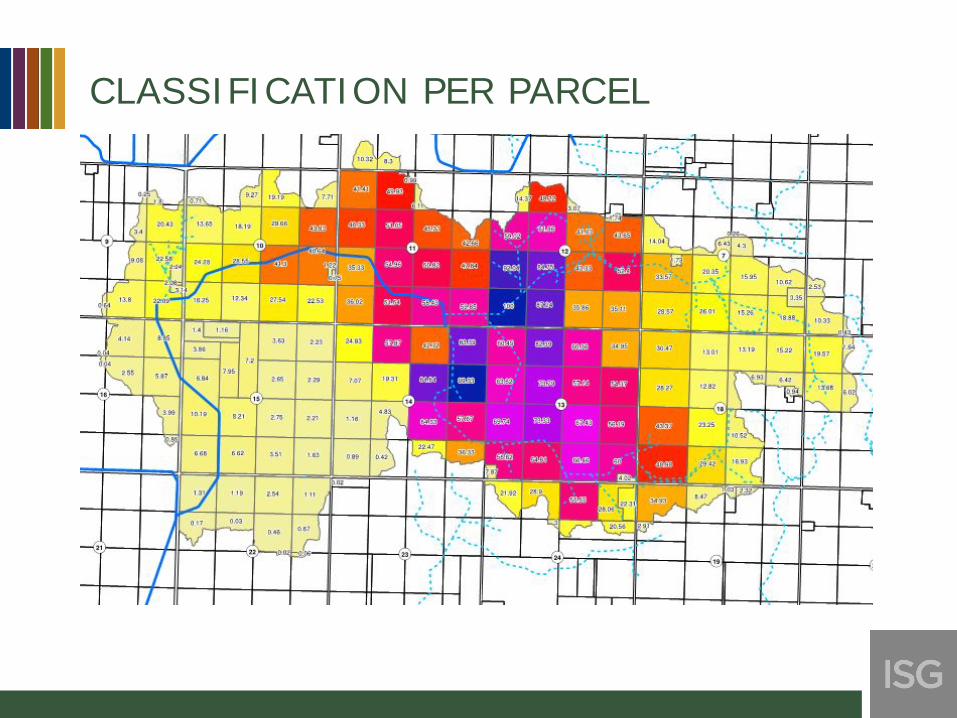
CLASSIFICATION PER PARCEL

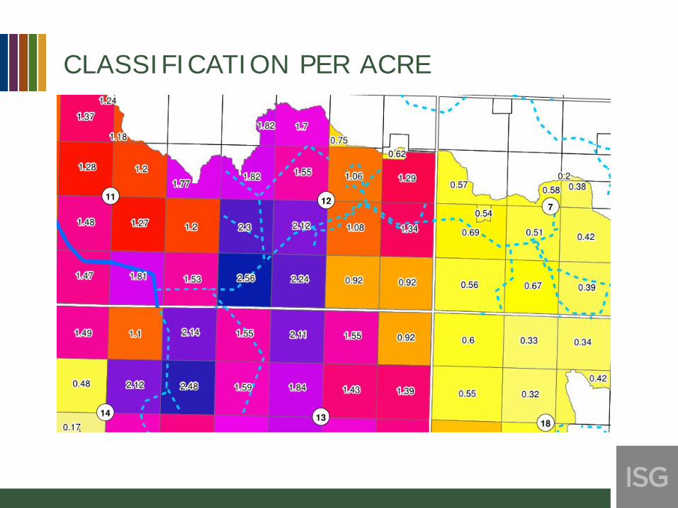
CLASSIFICATION PER ACRE
CLASSIFICATION PER ACRE

ASSESSMENT PER ACRE

FINAL JUDGMENT
• Methodology provides the commissioners with an understandable,defensible way to individually consider and account for the many factorswhich affect relative benefits in a drainage district.
• Results in fair and equitable treatment of all landowners regardless oflocation in the district.
But, it only yields a set of numbers!
• The final and most important step is for the commission to judge theequity of those numbers
• Best method is to place a map of the district classification per acre foreach parcel and take, with all supporting calculations, to the field. Thisallows the commission to best judge parcel-to-parcel fairness and overallequity.


