32
EDINA Geoservices: …the view from the Digimap Helpdesk January 21 st 2015 Tom Armitage EDINA, Geoservices Support
| Date post: | 08-Aug-2015 |
| Category: |
Education |
| Upload: | tom-armitage |
| View: | 42 times |
| Download: | 0 times |
EDINA Geoservices:…the view from the Digimap
HelpdeskJanuary 21st 2015
Tom ArmitageEDINA, Geoservices Support
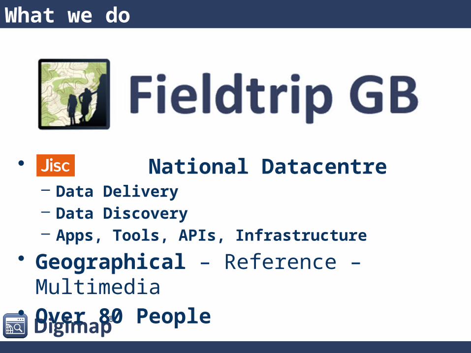
What we do
• National Datacentre– Data Delivery– Data Discovery– Apps, Tools, APIs, Infrastructure
• Geographical – Reference – Multimedia• Over 80 People
What we do
• National Datacentre– Data Delivery– Data Discovery– Apps, Tools, APIs, Infrastructure
• Geographical – Reference – Multimedia• Over 80 People
What we do
• National Datacentre– Data Delivery– Data Discovery– Apps, Tools, APIs, Infrastructure
• Geographical – Reference – Multimedia• Over 80 People
What we do
• National Datacentre– Data Delivery– Data Discovery– Apps, Tools, APIs, Infrastructure
• Geographical – Reference – Multimedia• Over 80 People
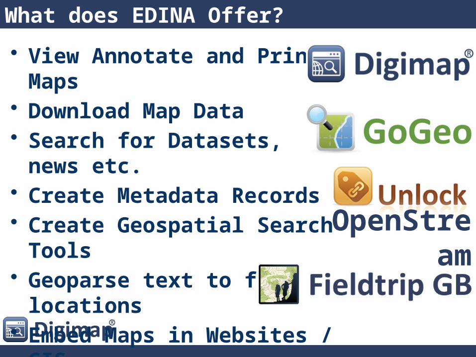
What does EDINA Offer?
• View Annotate and Print Maps• Download Map Data• Search for Datasets, news etc.• Create Metadata Records• Create Geospatial Search Tools • Geoparse text to find locations• Embed Maps in Websites / GIS• Record Data in the Field• Crowdsource Data
OpenStream
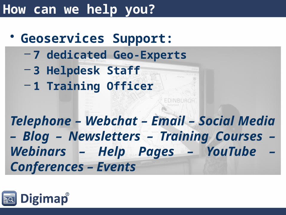
How can we help you?
• Geoservices Support:– 7 dedicated Geo-Experts– 3 Helpdesk Staff– 1 Training Officer
Telephone – Webchat – Email – Social Media – Blog – Newsletters – Training Courses – Webinars – Help Pages – YouTube – Conferences – Events
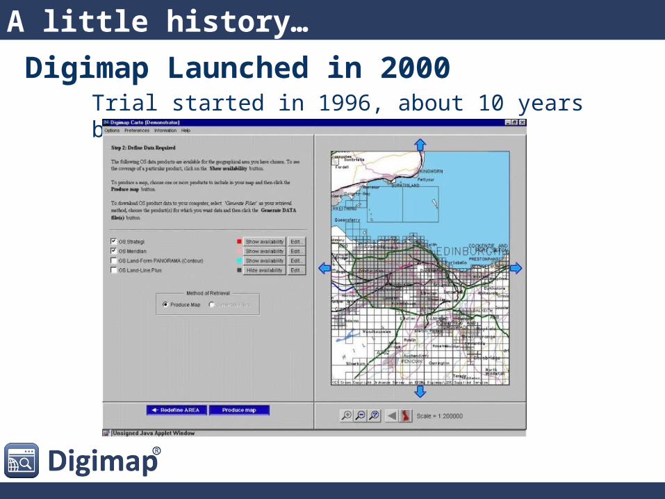
Digimap Launched in 2000Trial started in 1996, about 10 years before Google Maps
A little history…
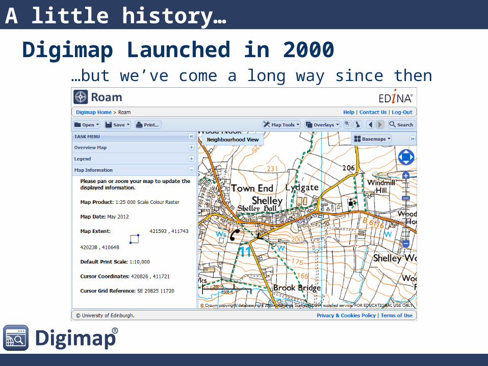
Digimap Launched in 2000…but we’ve come a long way since then
A little history…
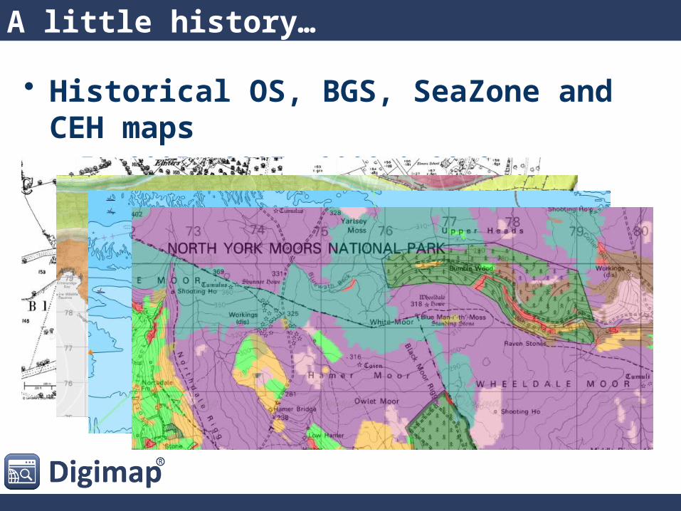
A little history…
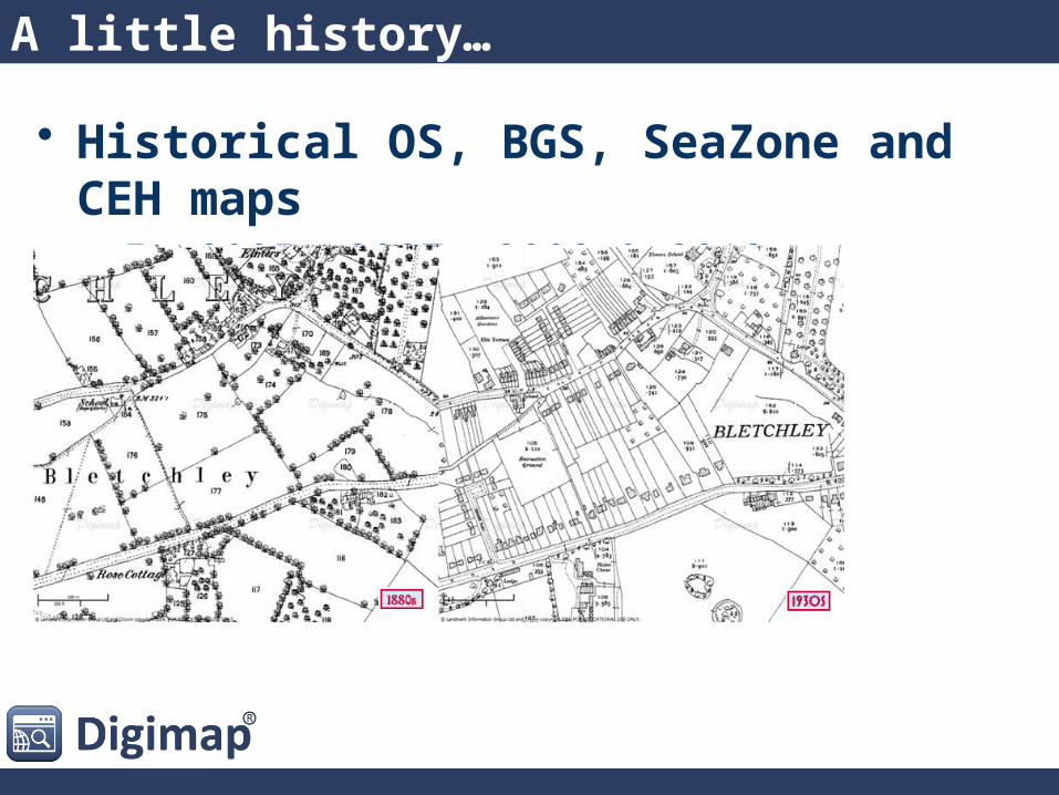
• Historical OS, BGS, SeaZone and CEH maps– In 2005, 2007, 2008 & 2013
A little history…
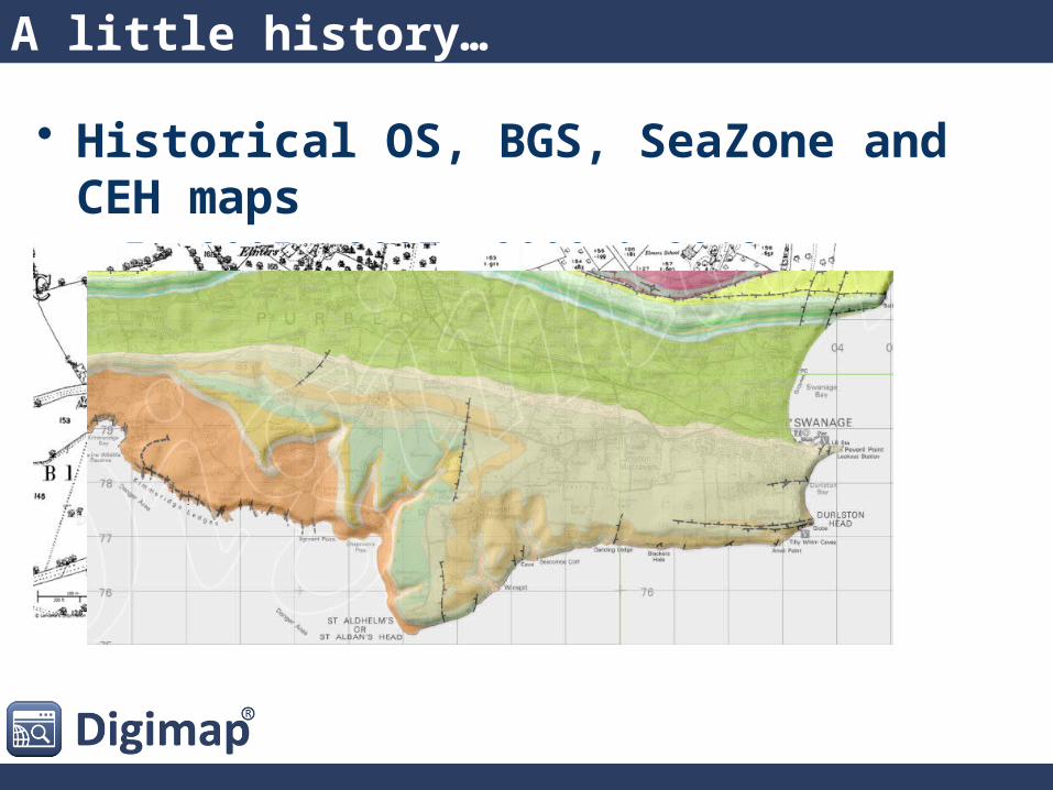
• Historical OS, BGS, SeaZone and CEH maps– In 2005, 2007, 2008 & 2013
A little history…
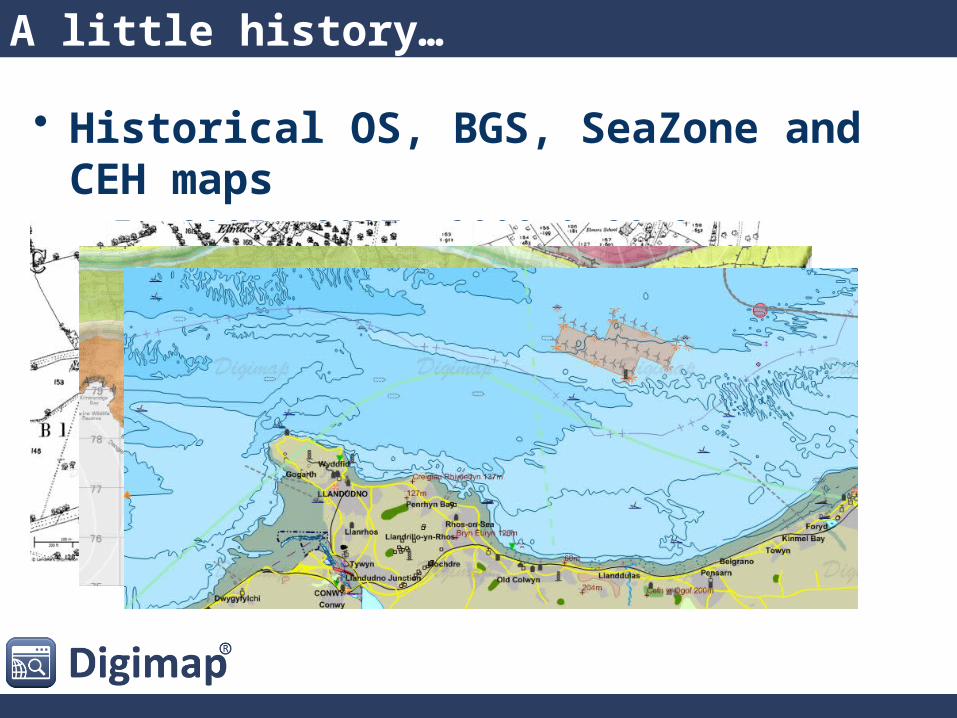
• Historical OS, BGS, SeaZone and CEH maps– In 2005, 2007, 2008 & 2013
A little history…
• Historical OS, BGS, SeaZone and CEH maps– In 2005, 2007, 2008 & 2013

Some Numbers
• Around 10,000 different people use Digimap every month
• 42mpm (maps per minute, 21m in 2013-14)
• Nearly 500,000 user registrations since 2000
• £107,305,359 The commercial value of the data and PDFs downloaded from Digimap in 2013-14
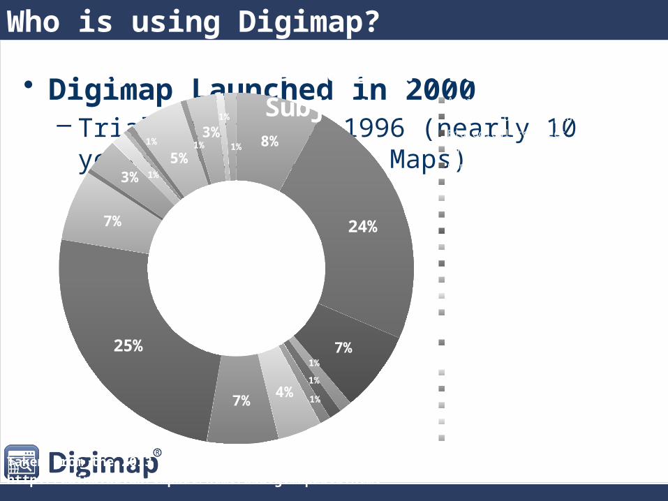
Who is using Digimap?
• Digimap Launched in 2000– Trial started in 1996 (nearly 10 years before Google
Maps)8%
24%
7%1%
1%
1%4%7%
25%
7%
3% 1%
1%
5%1%
3%1%
1%
Digimap OS Collection: Users by SubjectAgriculture, food, and forestry
Architecture and planning
Biological sciences
Business and management studies
Communication and media studies
Creative and performing arts
Education and research methods
Engineering
Geography and environment
Humanities
Law
Mathematics and computer science
Medicine including dentistry
Modern languages and area studies
Nursing, midwifery and allied health
Physical sciences
Psychology
Social sciences
Veterinary medicine
Other
Taken from the 2013 User Satisfaction Survey, see the full report here: http://edina.ac.uk/impact/html/osdigimap2013.html

What do people use Digimap For?
24%
9%
10%
22%
7%
8%
10%
12%
Digimap OS Collection: Service Use
Coursework
Undergraduate thesis
Postgraduate thesis
Research
Teaching materials in a general subject
Teaching the use of maps, spatial data or GIS
Supporting students' use of maps, spatial data or GIS
Personal interest
Other
Taken from the 2013 User Satisfaction Survey, see the full report here: http://edina.ac.uk/impact/html/osdigimap2013.html
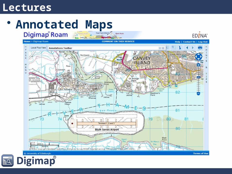
Lectures• Annotated Maps
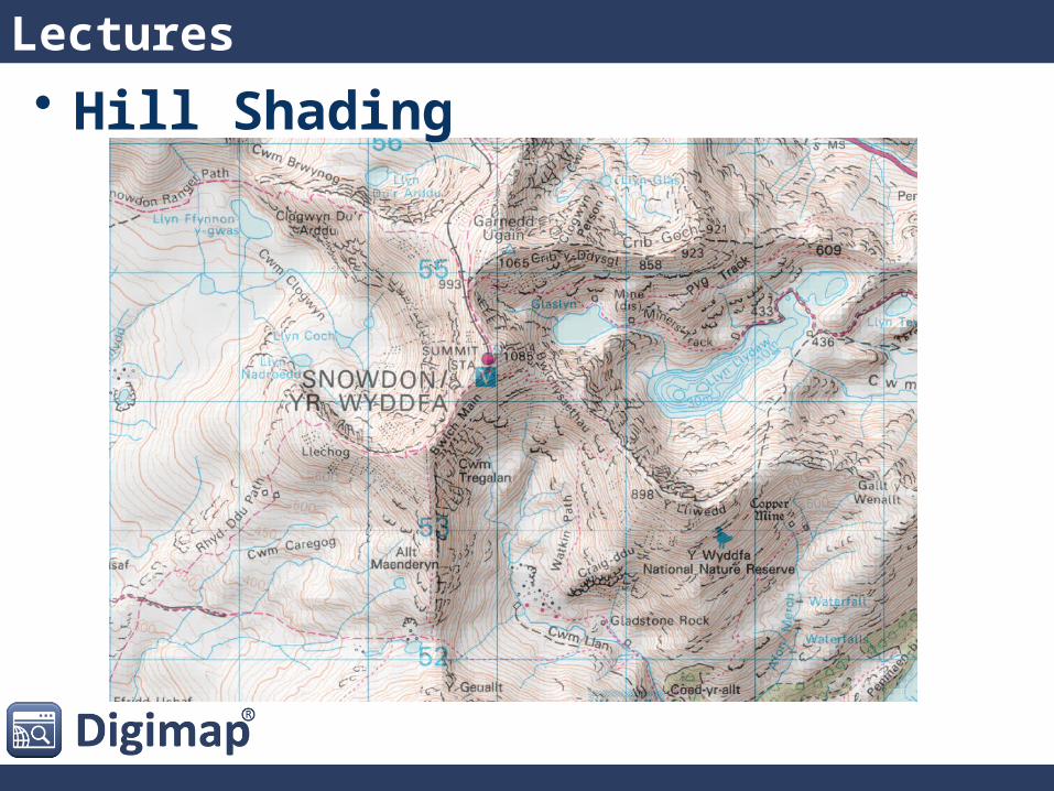
Lectures• Hill Shading
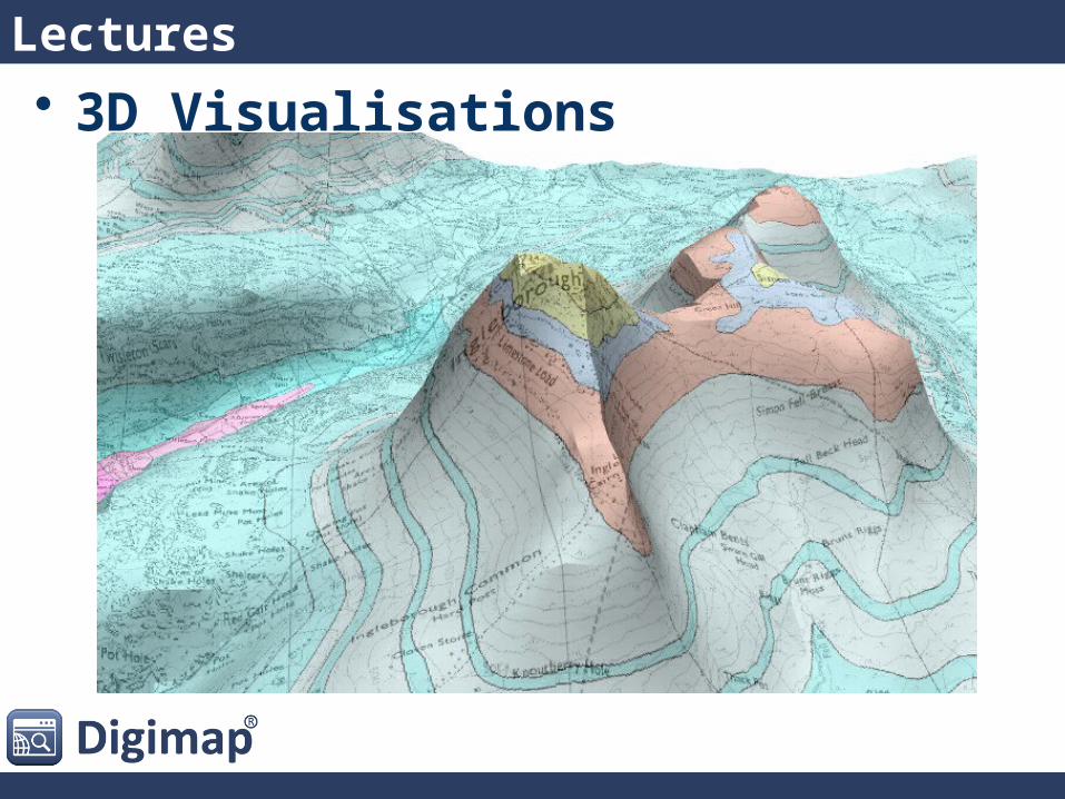
Lectures• 3D Visualisations
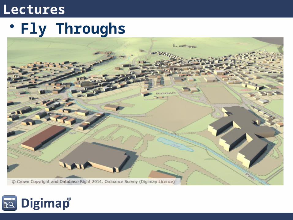
Lectures• Fly Throughs
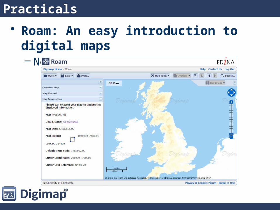
Practicals
• Roam: An easy introduction to digital maps– No specialist software needed
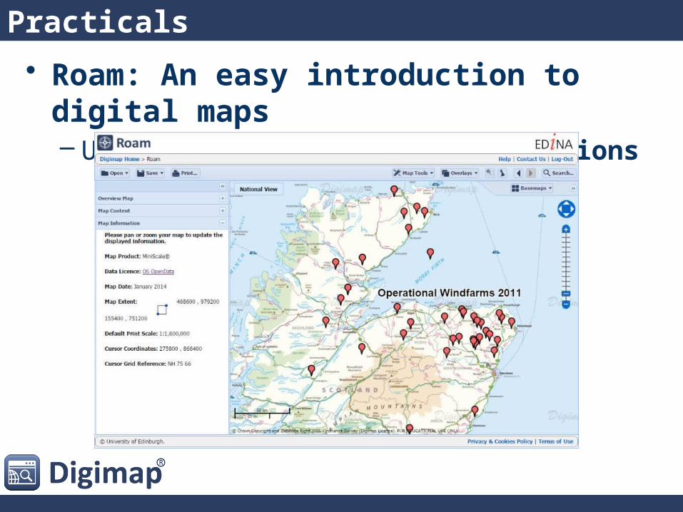
Practicals
• Roam: An easy introduction to digital maps– Upload your own data as Annotations
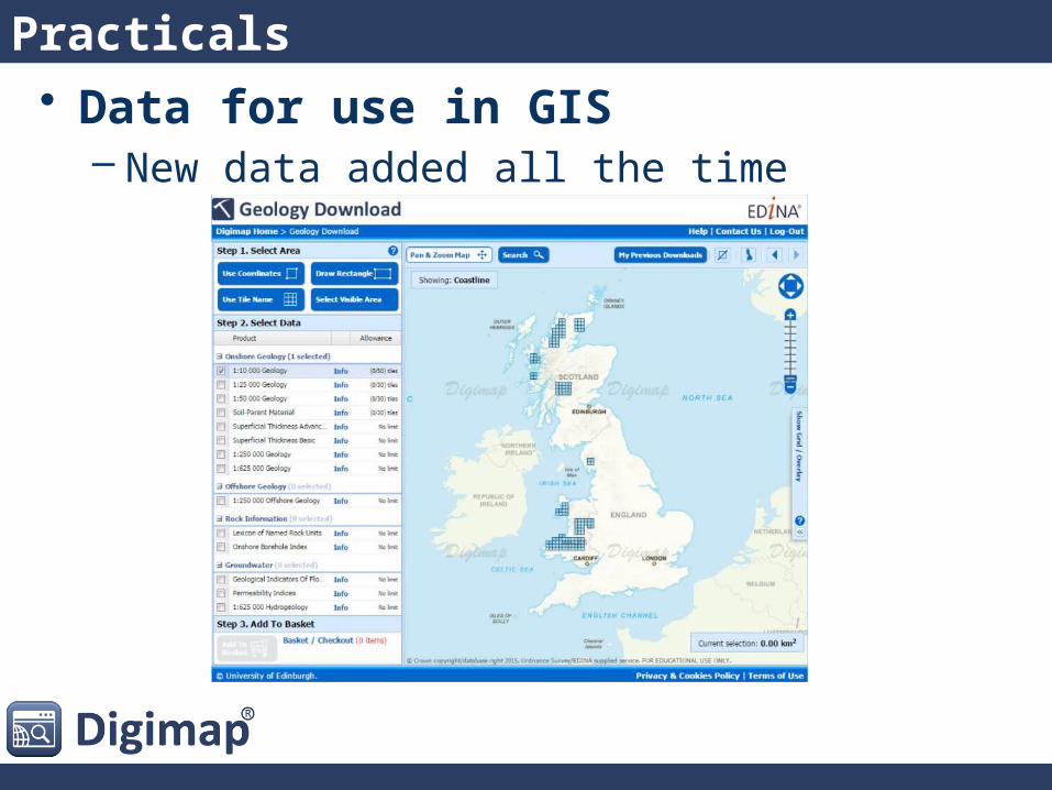
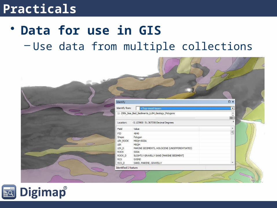
Practicals• Data for use in GIS
– New data added all the time
Practicals
• Data for use in GIS– Use data from multiple collections
Practicals
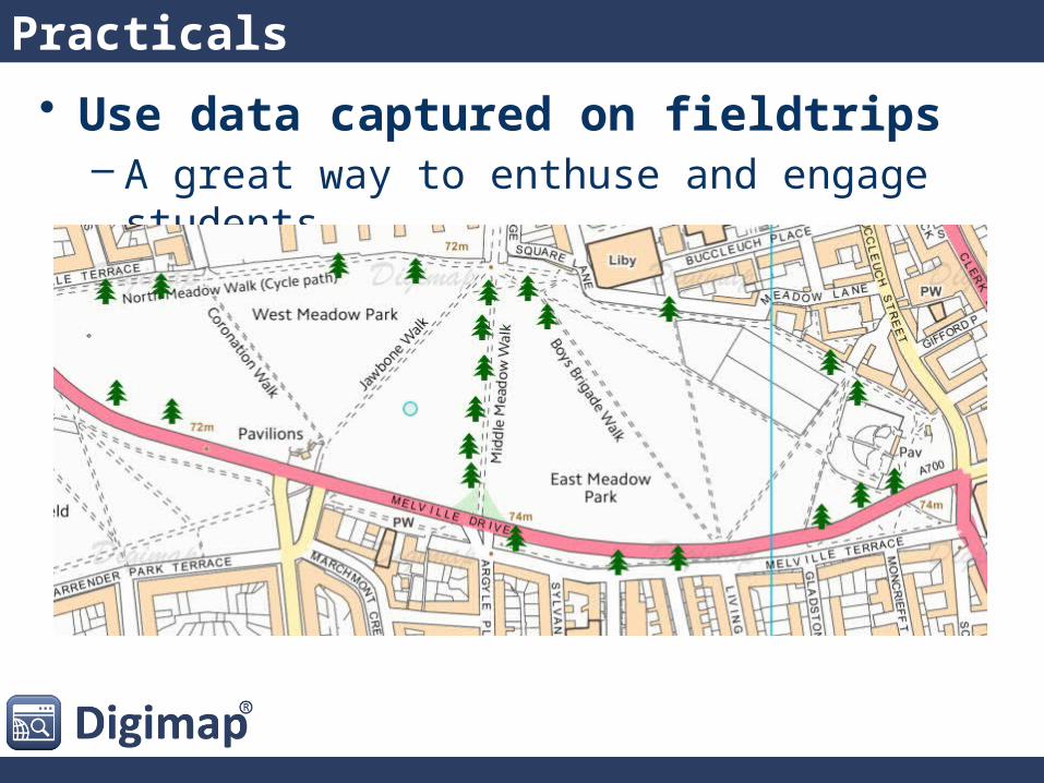
• Use data captured on fieldtrips– A great way to enthuse and engage students
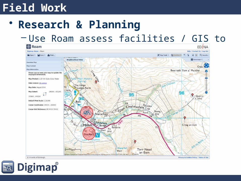
• Research & Planning– Use Roam assess facilities / GIS to identify locations
Field Work
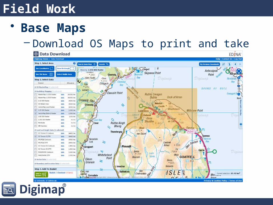
• Base Maps– Download OS Maps to print and take into the field
Field Work
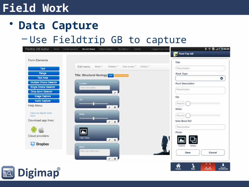
• Data Capture– Use Fieldtrip GB to capture information
Field Work
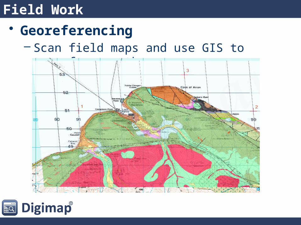
• Georeferencing– Scan field maps and use GIS to georeference them
Field Work
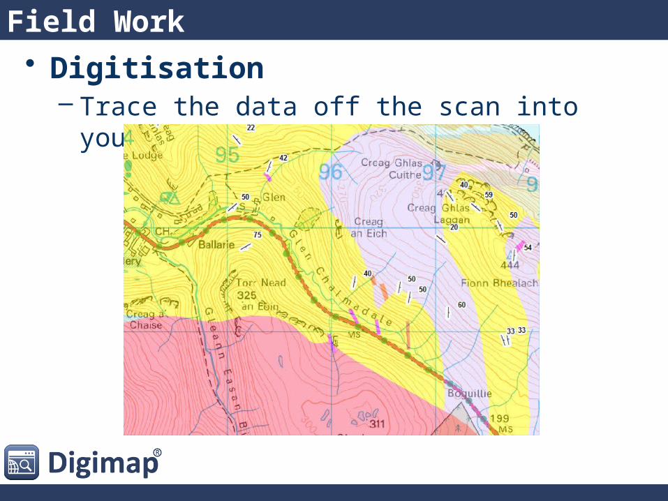
• Digitisation– Trace the data off the scan into your GIS
Field Work

Fieldtrip GB: Crowd Sourcing
http://fieldtripgb.blogs.edina.ac.uk/
• Get a new Dropbox account to share with your team• Download Fieldtrip GB to your devices1.Before you start• Log into the Authoring Tool• Create a custom form and save it2. Design your form• Get the team to log into the Dropbox account • Use Sync to get the form on their devices3. Share the form• Collect data using the form• Manually correct remote points or in urban canyons4. In the field• Connect to WiFi• Get the team Sync to upload the data5. Back indoors• Log into Authoring Tool• Filter by form name and edit points if needed6. Manage your data• Export to a KML file, GeoJSON, CSV or WMS• Map the points in Google Earth, OpenLayers or a GIS 7. View the results
Any Questions?
Email: [email protected]: 0131 651 3302
Blog: http://digimap.blogs.edina.ac.uk/Twitter: @EDINA_Digimap
http://digimap.edina.ac.uk/webhelp/resources/
Tom ArmitageEDINA, Geoservices Support


