192
p 1

p
1

2

Environmental hazards
Environmental hazard' is the state of events which has the potential to threaten the surrounding natural environment and adversely affect people's health. This term incorporates topics like pollution and natural disasters such as storms and earthquakes.
Environmental hazard
3
Environmental hazards
Hazards can be categorized in five types:
1. Chemical
2. Physical
3. Mechanical
4. Biological
5. Psychosocial
4

Environmental hazards
Chemical hazards and toxic substances pose a wide range of health hazards (such as irritation, sensitization, and carcinogenicity) and physical hazards (such as flammability, corrosion, and reactivity).
5

Environmental hazards
Chemical hazards are defined in the globally harmonized system and in the European union chemical regulations. They are caused by chemical substances causing significant damage to the environment The label is particularly applicable towards substances with aquatic toxicity.
A physical hazard is a type of occupational hazard that involves environmental hazards that can cause harm with or without contact.
6

Environmental hazards
Biological hazards, also known as biohazards, refer to biological substances that pose a threat to the health of living organisms, primarily that of humans. This can include medical waste or samples of a microorganism, virus or toxin (from a biological source) that can affect human health
7
DISASTER MANGEMENT AND MITIGATION
Environmental hazard' is the state of events which has the potential to threaten the surrounding natural environment and adversely affect people's health. This term incorporates topics like pollution and natural disasters such as storms and earthquakes.
8

Environmental hazards
9

Environmental hazards
10

Environmental hazards
11
DISASTER MANGEMENT AND MITIGATION
Environmental Stress
Stressors that are found in our surroundings are called environmental stressors. Everyday life is full of environmental stressors that cause minor irritations. If you use an alarm clock to wake up, the loud noise from your alarm is an environmental stressor. Extreme temperatures are also environmental stressors and can lead to discomfort.
Environmental Stress
12
Environmental hazards
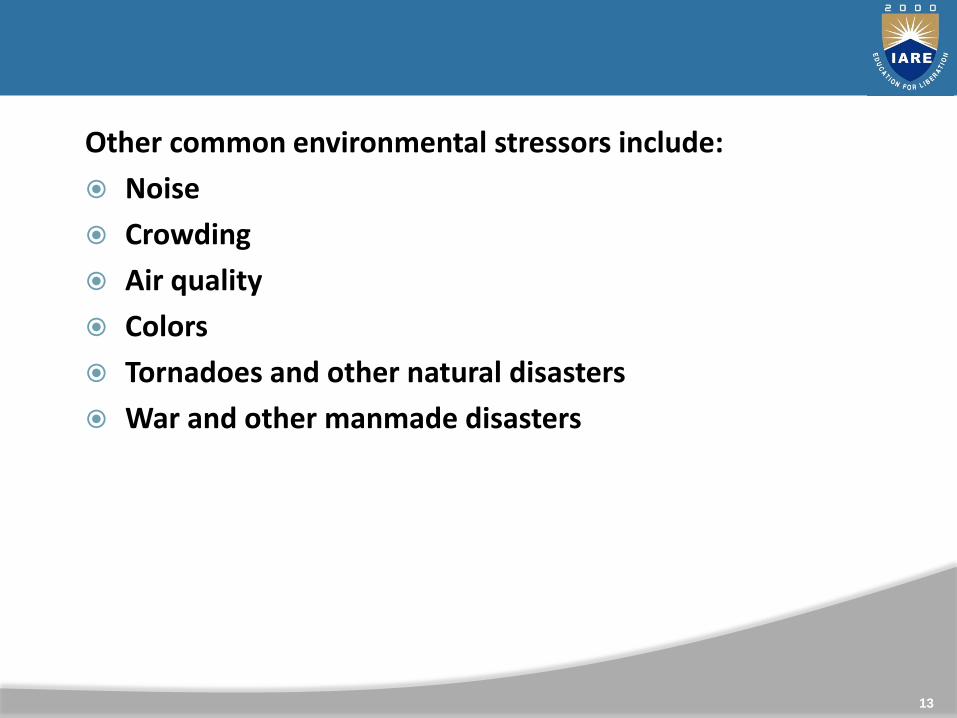
Other common environmental stressors include:
Noise
Crowding
Air quality
Colors
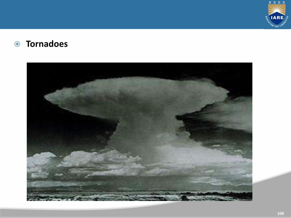
Tornadoes and other natural disasters
War and other manmade disasters
13

Environmental hazards
Environmental stressors can be grouped into the following categories:
Physical stress refers to brief but intense exposures to kinetic energy. This is a type of ecological disturbance because of its acute, episodic nature. Examples include volcanic eruptions, windstorms, and explosions.
Wildfire is also a disturbance, during which much of the biomass of an ecosystem is combusted, and the dominant species may be killed.
Thermal stress occurs when releases of heat influence ecosystems, as happens in the vicinity of natural hot-water vents on the ocean floor, and near industrial discharges of heated water.
14

Environmental hazards
Environmental stressors can be grouped into the following categories:
Physical stress refers to brief but intense exposures to kinetic energy. This is a type of ecological disturbance because of its acute, episodic nature. Examples include volcanic eruptions, windstorms, and explosions.
Wildfire is also a disturbance, during which much of the biomass of an ecosystem is combusted, and the dominant species may be killed.
Thermal stress occurs when releases of heat influence ecosystems, as happens in the vicinity of natural hot-water vents on the ocean floor, and near industrial discharges of heated water.
15

Concept of Environmental Hazards
Environmental disaster is defined as a specific event caused by human activity that results in a seriously negative effect on the environment. Sometimes a natural disaster can become an environmental disaster, but that is a topic to be discussed elsewhere.
16

Environmental hazards
Environmental stressors can be grouped into the following categories:
Physical stress refers to brief but intense exposures to kinetic energy. This is a type of ecological disturbance because of its acute, episodic nature. Examples include volcanic eruptions, windstorms, and explosions.
Wildfire is also a disturbance, during which much of the biomass of an ecosystem is combusted, and the dominant species may be killed.
Thermal stress occurs when releases of heat influence ecosystems, as happens in the vicinity of natural hot-water vents on the ocean floor, and near industrial discharges of heated water.
17

Environmental hazards
Environmental stressors can be grouped into the following categories:
Physical stress refers to brief but intense exposures to kinetic energy. This is a type of ecological disturbance because of its acute, episodic nature. Examples include volcanic eruptions, windstorms, and explosions.
Wildfire is also a disturbance, during which much of the biomass of an ecosystem is combusted, and the dominant species may be killed.
Thermal stress occurs when releases of heat influence ecosystems, as happens in the vicinity of natural hot-water vents on the ocean floor, and near industrial discharges of heated water.
18

Environmental stress
In most cases environmental disasters are caused by human error, accident, lack of foresight, corner cutting during industrial processes, greed, or by simple incompetence. In other words without some kind of human intervention they would never have happened. They are also often characterised by firm authoritative denials that anything serious has even happened.
19

Environmental hazards
Environmental stressors can be grouped into the following categories:
Physical stress refers to brief but intense exposures to kinetic energy. This is a type of ecological disturbance because of its acute, episodic nature. Examples include volcanic eruptions, windstorms, and explosions.
Wildfire is also a disturbance, during which much of the biomass of an ecosystem is combusted, and the dominant species may be killed.
Thermal stress occurs when releases of heat influence ecosystems, as happens in the vicinity of natural hot-water vents on the ocean floor, and near industrial discharges of heated water.
20
Environmental hazards
Environmental stressors can be grouped into the following categories:
Physical stress refers to brief but intense exposures to kinetic energy. This is a type of ecological disturbance because of its acute, episodic nature. Examples include volcanic eruptions, windstorms, and explosions.
Wildfire is also a disturbance, during which much of the biomass of an ecosystem is combusted, and the dominant species may be killed.
Thermal stress occurs when releases of heat influence ecosystems, as happens in the vicinity of natural hot-water vents on the ocean floor, and near industrial discharges of heated water.
21

Environmental stress
Lack of foresight is a common cause of an environmental disaster. In agriculture a classic example of is the increasing salinity of soils in hot climates. With the need to produce more food, a warm climate seems ideal for European-style agriculture, once the existing vegetation has been cleared. The one proviso is that there must be plenty of water.
Environmental disaster is defined as a specific event caused by human activity that results in a seriously negative effect on the environment. Sometimes a natural disaster can become an environmental disaster, but that is a topic to be discussed elsewhere.
22

Environmental stress
Steps of the landscape approach:
The seven steps of the landscape approach:
• Carry out an initial assessment of the risk landscape.
• Conduct an in-depth stakeholder analysis and power mapping.
• Stimulate multi-stakeholder processes and create groups of the willing.
23

Environmental stress
• Conduct a collaborative, in-depth problem and solution analysis.
• Carry out collaborative (action) planning.
• Organise collaborative implementation.
• Promote adaptive management.
24

Environmental stress
Carry out an initial assessment of the risk landscape:
• Find common concerns as an entry point.
• Understand drivers of risk, capacities and assets of communities and the wider social and natural environment.
• Understand the hydrology (when disaster risks are water related).
25

Landscape Approach
Landscape approach :
Applying the landscape approach helps to overcome barriers by sector and contributes to effect risk management by connecting all stakeholders involved, starting with the communities at risk in the landscape.
The seven steps of the landscape approach:
• Carry out an initial assessment of the risk landscape.
• Conduct an in-depth stakeholder analysis and power mapping.
• Stimulate multi-stakeholder processes and create groups of the willing.
26

Landscape Approach
Ecosystem approach : The ecosystem approach is a strategy for the integrated management of land, water and living resources that promotes conservation and sustainable use in an equitable way.
Ecosystem approach
27

Environmental stress
Perception approach
Perception : perception is a reality.
Perception: the mental process of identifying, sorting & arranging stimulus data into meaningful patterns.
The process of gathering sensory information and assigning meaning to it.
Perception approach
28

Landscape Approach
Human ecology & its application in geographical researches:
HUMAN ECOLOGY:
Human ecology is a study of the relationship between humans and their natural, social, and built environments.
Human ecology has been defined as a type of analysis applied to the relations in human beings that was traditionally applied to plants and animals in ecology. Toward this aim, human ecologists (which can include sociologists) integrate diverse perspectives from a broad spectrum of disciplines covering "
Human ecology
29

30

Landscape Approach
Types of Environmental hazards & Disasters:
A natural disaster is a major adverse event resulting from natural processes of the Earth; examples include floods, volcanic eruptions, earthquakes, tsunamis, and other geologic processes.
Types of Environmental hazards & Disasters
31

A natural disaster can cause loss of life or property damage, and typically leaves some economic damage in its wake, the severity of which depends on the affected population's resilience, or ability to recover.
An adverse event will not rise to the level of a disaster if it occurs in an area without vulnerable population. In a vulnerable area, however, such as San Francisco, an earthquake can have disastrous consequences and leave lasting damage, requiring years to repair.
32

Environmental stress
In 2012, there were 905 natural catastrophes worldwide, 93% of which were weather-related disasters. Overall costs were US$170 billion and insured losses $70 billion. 2012 was a moderate year.
45% were meteorological (storms), 36% were hydrological (floods), 12% were climatologically (heat waves, cold waves, droughts, wildfires) and 7% were geophysical events (earthquakes and volcanic eruptions). Between 1980 and 2011 geophysical events accounted for 14% of all natural
33

Environmental stress
Earthquakes
An earthquake is the result of a sudden release of energy in the Earth's crust that creates seismic waves. At the Earth's surface, earthquakes manifest themselves by vibration, shaking and sometimes displacement of the ground.
34

Volcanoes can cause widespread destruction and consequent disaster in several ways. The effects include the volcanic eruption itself that may cause harm following the explosion of the volcano or the fall of rock. Second, lava may be produced during the eruption of a volcano.
35

Landscape Approach
Man induced hazards & Disasters
Anthropogenic hazards or human-made hazards can result in the form of a human-made disaster. In this case, anthropogenic means threats having an element of human intent, negligence, or error; or involving a failure of a human-made system.
36

This is as opposed to natural hazards that cause natural disasters. Either can result in huge losses of life and property as well as damage to peoples' mental, physical and social well-being.
An adverse event will not rise to the level of a disaster if it occurs in an area without vulnerable population. In a vulnerable area, however, such as San Francisco, an earthquake can have disastrous consequences and leave lasting damage, requiring years to repair.
37

Environmental stress
Anthropogenic hazards and disasters are of three types:
(i) Physical hazards (land slides, soil erosion, Earthquakes)
(ii) Chemical hazards and disasters (sudden out break of lethal poisonous gases from industries, nuclear explosion, leakage of radioactive elements.
38
Environmental stress
Endo-genic Hazards
Hazards which originate inside the surface of the earth are termed as endogenic hazards. E.g. Volcanic, Earthquake
Exo-genic Hazards
Hazards which originate above the surface of the earth (in the atmosphere) are called exogenic hazards.
Endo-genic Hazards & Exo-genic Hazards
39
Environmental stress
Earthquakes
An earthquake is the result of a sudden release of energy in the Earth's crust that creates seismic waves. At the Earth's surface, earthquakes manifest themselves by vibration, shaking and sometimes displacement of the ground.
40

Volcanoes can cause widespread destruction and consequent disaster in several ways. The effects include the volcanic eruption itself that may cause harm following the explosion of the volcano or the fall of rock. Second, lava may be produced during the eruption of a volcano.
41

Planetary Hazards/ Disasters Natural hazards are further subdivided into two categories:
(i) Planetary hazards and
(ii) Extraplanetary hazards and disasters.
42

Environmental stress
Anthropogenic hazards and disasters are of three types:
(i) Physical hazards (land slides, soil erosion, Earthquakes)
(ii) Chemical hazards and disasters (sudden out break of lethal poisonous gases from industries, nuclear explosion, leakage of radioactive elements.
43

44

Environmental stress
Endo-genic Hazards
Hazards which originate inside the surface of the earth are termed as endogenic hazards. E.g. Volcanic, Earthquake
Exo-genic Hazards
Hazards which originate above the surface of the earth (in the atmosphere) are called exogenic hazards.
45
Environmental stress
An earthquake is the result of a sudden release of energy in the Earth's crust that creates seismic waves. At the Earth's surface, earthquakes manifest themselves by vibration, shaking and sometimes displacement of the ground.
Earthquakes
46

Volcanoes can cause widespread destruction and consequent disaster in several ways. The effects include the volcanic eruption itself that may cause harm following the explosion of the volcano or the fall of rock. Second, lava may be produced during the eruption of a volcano.
Volcanoes
47

. Atmospheric Hazards
Natural hazards that originate in the atmosphere of the earth are called atmospheric hazards. These include cyclones, tornadoes, droughts, thunderstorms etc. Drought, Rainfall, Snowfall, Winds, Hailstorm
B. Hydrospheric Hazards
Those natural hazards that are related to water in the atmosphere are termed as hydrospheric hazards. Wave Currents, Tsunamis, Floods
48

Lithospheric hazards are those natural hazards that occur near to the surface of the earth. It includes the following hazards: Landslides, weathering, erosion, shifting, avalanches, sink Holes
Calcium carbonate inside the surface of the earth is dissolved by the underground running water and taken away with it, creating holes. This causes the earth to become hollow and eventually the earth above it settles down under load.
Lithospheric Hazards
49

(i) Physical hazards (land slides, soil erosion, Earthquakes)
(ii) Chemical hazards and disasters (sudden out break of lethal poisonous gases from industries, nuclear explosion, leakage of radioactive elements,
(iii) Biological hazards and disaster (sudden rise in population of species in a given habited).
50
EARTHQUAKE HAZARDS IN INDIA
Seismic zonation map shows that India is highly vulnerable for earthquake hazards. India has witnessed more than 650 earthquakes of Magnitude >5 during the last hundred years and earthquake disaster is increasing alarmingly here.
EARTHQUAKE HAZARDS IN INDIA
51

In addition to very active northern and northeastern seismicity, the recent events in Killari (Maharastra) and Jabalpur (Madhya Pradesh) in the Peninsular India have raised many problems to seismologists.
The occurrence of earthquakes can be explained with the concept of "Plate Tectonics" Based on this three broad categories of earthquakes can be recognised. 1) those occurring at the subduction/collision zones (Inter-plates),
2) those at mid-oceanic ridges .
3) those at intra-plates (Acharrya, 1999). Seismic events in India mainly belong to the first category though a few third category events are also known.
52

EARTHQUAKE PREDICTION
Research on earthquake prediction started since early sixties. Intensive work is going on all over the world in this regard involving expenditure of billions of dollars. The precise prediction of seismic events remains elusive and unattainable goal as yet in spite of these efforts.
The MSK (Medvedev-Sponheuer-Karnik) intensity broadly associated with the various seismic zones is VI (or less), VII, VIII and IX (and above) for Zones 2, 3, 4 and 5, respectively, corresponding to Maximum Considered Earthquake (MCE).
53
EARTHQUAKE HAZARD ZONATION, RISK EVALUATION AND MITIGATION The importance of seismological studies lies in the fact that information generated can be used to mitigate the earthquake hazards. Preparation of seismotectonic/seismic zonation maps is the first step in this direction.
54

The basic data required for the preparation of these maps are (i) A carefully compiled earthquake catalogue incorporating details about magnitude, location of epicenter, depth of focus etc.,
55

(ii) Delineation of seismic source zones from all possible sources like recurrence relation, tectono-geological consideration, palaeoseismicity etc.,
(iii) Estimation of upper bound magnitude through statistical procedure, cumulative seismic energy release, active fault length etc. and
56

These are also useful for planning human settlements that would remain safe during the occurrence of an earthquake.
Seismic risk evaluation is also possible from these maps.
Several types of volcanic Eruptions
Several types of volcanic eruptions—during which lava, tephra (ash, lapilli, volcanic bombs and blocks), and assorted gases are expelled from a volcanic vent or fissure have been distinguished by volcanologists.
57
volcanoes
58

volcanoes
These are often named after famous volcanoes where that type of behavior has been observed. Some volcanoes may exhibit only one characteristic type of eruption during a period of activity, while others may display an entire sequence of types all in one eruptive series.
59

Volcanoes
Harmful effects o volcanic erruptions
Volcanoes affect people in many ways, some are good, some are not. Some of the bad ways are that houses, buildings, roads, and fields can get covered with ash. As long as you can get the ash off (especially if it is wet), your house may not collapse, but often the people leave because of the ash and are not around to continually clean off their roofs. If the ashfall is really heavy it can make it impossible to breathe.
60

61

Volcanoes can cause widespread destruction and consequent disaster in several ways. The effects include the volcanic eruption itself that may cause harm following the explosion of the volcano or the fall of rock. Second, lava may be produced during the eruption of a volcano.
62

Volcanic Eruptions
How Are Earthquakes and Volcanoes Distributed?
Volcanoes Distributed all over the world in different countries and continents but are not found it every country.
Found mostly on the coastline
Especially on tectonic plate boundaries
63

volcanoes
64

volcanoes
Volcano prone areas:
'The Ring of Fire'
Around the Pacific plate.
Across the North and South Atlantic ocean
There are still anomalies - Hot spots
65
Volcanoes
Harmful effects o volcanic erruptions
Volcanoes affect people in many ways, some are good, some are not. Some of the bad ways are that houses, buildings, roads, and fields can get covered with ash. As long as you can get the ash off (especially if it is wet), your house may not collapse, but often the people leave because of the ash and are not around to continually clean off their roofs. If the ashfall is really heavy it can make it impossible to breathe.
66
Earthquakes Millions of tiny earthquakes happen everyday, but we only manage to notice the bigger, major ones.
Found on mainland and coastlines
Especially tectonic plate boundaries
67

Earthquake prone areas:
Around Pacific Ocean
Along the Indo-Australian pate boundary
Eastern side of Eurasian plate
Western side of North American plate
68

Volcanic Eruptions
How Are Earthquakes and Volcanoes Distributed?
Volcanoes Distributed all over the world in different countries and continents but are not found it every country.
Found mostly on the coastline
Especially on tectonic plate boundaries
69
volcanoes
70

volcanoes
Volcano prone areas:
'The Ring of Fire'
Around the Pacific plate.
Across the North and South Atlantic ocean
There are still anomalies - Hot spots
71

Volcanoes
Harmful effects o volcanic erruptions
Volcanoes affect people in many ways, some are good, some are not. Some of the bad ways are that houses, buildings, roads, and fields can get covered with ash. As long as you can get the ash off (especially if it is wet), your house may not collapse, but often the people leave because of the ash and are not around to continually clean off their roofs. If the ashfall is really heavy it can make it impossible to breathe.
72

Earthquakes Millions of tiny earthquakes happen everyday, but we only manage to notice the bigger, major ones.
Found on mainland and coastlines
Especially tectonic plate boundaries
73

Earthquake prone areas:
Around Pacific Ocean
Along the Indo-Australian pate boundary
Eastern side of Eurasian plate
Western side of North American plate
74

volcanoes
Some of the good ways that volcanoes affect people include producing spectacular scenery, and producing very rich soils for farming.
Gases
Water vapor, the most common gas released by volcanoes, causes few problems. Sulfur dioxide, carbon dioxide and hydrogen are released in smaller amounts. Carbon monoxide, hydrogen sulfide, and hydrogen fluoride are also released but typically less than 1 percent by volume.Gases pose the greatest hazard close to the vent where concentrations are greatest. Away from the vent the gases quickly become diluted by air3
75

EARTHQUAKE
CAUSES OF EARTHQUAKE:
Earthquakes are one of the most dangerous natural disasters on Earth. This is because they strike with little or no warning, and can cause catastrophic damage. All that shaking comes from deep underground, but as you know, the surface shakes a lot too, which is where all the damage occurs. Buildings fall down, roads and bridges collapse, and land and mud come sliding down from hillsides.
76

EARTHQUAKE
Faults and Elastic Rebound
The place where the bumping and sliding occurs along the plate boundaries is called a fault. Plate boundaries can have many faults, and most of the world's earthquakes occur along plate boundaries for this reason.
The 'Ring of Fire' is an area where most of the world's earthquakes occur because it lines up with many of the plate boundaries.
77

EARTHQUAKE
78

EARTHQUAKE
The theory of elastic rebound explains that faults slip during an earthquake and cause ground shaking.
The theory also explains what happens to the land around the fault once it does slip. The ground slowly gets deformed as it sticks, and then 'rebounds' back into shape once it breaks free.
79

EARTHQUAKE
Tectonic plates are what make up the earth's crust, its outermost layer. These plates fit together like puzzle pieces but they don't stay in one place. They're always moving because the part of the earth underneath them is like a fluid
80

EARTHQUAKE
81

EARTHQUAKE
The theory of elastic rebound explains that faults slip during an earthquake and cause ground shaking.
The theory also explains what happens to the land around the fault once it does slip. The ground slowly gets deformed as it sticks, and then 'rebounds' back into shape once it breaks free.
82

EARTHQUAKE
83

EARTHQUAKE
84

85

Exo-genic Hazards
Exo-genic Hazards
Hazards which originate above the surface of the earth (in the atmosphere) are called exogenic hazards. These can be further sub-divided into the following categories:
86

Exo-genic Hazards
Atmospheric Hazards
Natural hazards that originate in the atmosphere of the earth are called atmospheric hazards. These include cyclones, tornadoes, droughts, thunderstorms etc. Drought, Rainfall, Snowfall, Winds, Hailstorm
87

Exo-genic Hazards
Hydrospheric Hazards
Those natural hazards that are related to water in the atmosphere are termed as hydrospheric hazards. Wave Currents, Tsunamis, Floods
C. Lithospheric Hazards
Lithospheric hazards are those natural hazards that occur near to the surface of the earth. It includes the following hazards: Landslides, weathering, erosion, shifting, avalanches, sink Holes
88

Exo-genic Hazards
ATMOSPHERIC HAZARDS
Atmospheric hazards include things such as oxygen deficiencies, dusts, chemical vapors, welding fumes, fogs, and mists that can interfere with the body’s ability to transport and utilize oxygen, or that have negative toxicological effects on the human body.
89

Exo-genic Hazards
Exo-genic Hazards
Hazards which originate above the surface of the earth (in the atmosphere) are called exogenic hazards. These can be further sub-divided into the following categories:
90

Exo-genic Hazards
Atmospheric Hazards
Natural hazards that originate in the atmosphere of the earth are called atmospheric hazards. These include cyclones, tornadoes, droughts, thunderstorms etc. Drought, Rainfall, Snowfall, Winds, Hailstorm
91

Exo-genic Hazards
Hydrospheric Hazards
Those natural hazards that are related to water in the atmosphere are termed as hydrospheric hazards. Wave Currents, Tsunamis, Floods
C. Lithospheric Hazards
Lithospheric hazards are those natural hazards that occur near to the surface of the earth. It includes the following hazards: Landslides, weathering, erosion, shifting, avalanches, sink Holes
92

Exo-genic Hazards
ATMOSPHERIC HAZARDS
Atmospheric hazards include things such as oxygen deficiencies, dusts, chemical vapors, welding fumes, fogs, and mists that can interfere with the body’s ability to transport and utilize oxygen, or that have negative toxicological effects on the human body.
93

Exo-genic Hazards
Hydrospheric Hazards
Those natural hazards that are related to water in the atmosphere are termed as hydrospheric hazards. Wave Currents, Tsunamis, Floods
C. Lithospheric Hazards
Lithospheric hazards are those natural hazards that occur near to the surface of the earth. It includes the following hazards: Landslides, weathering, erosion, shifting, avalanches, sink Holes
94

Cyclones
The most intense extratropical cyclones cause widespread disruption and damage to society, such as the storm surge of the North Sea flood of 1953 which killed 2251 people in the Netherlands and eastern England, the Great Storm of 1987 which devastated southern England and France and the Columbus Day Storm of 1962which struck the Pacific Northwest.
95

Cyclones
As with tropical cyclones, they are known by different names in different regions (Nor'easter, Pacific Northwest windstorms, European windstorm, East Asian-northwest Pacific storms, Sudestada and Australian east coast cyclones).
96
Cyclones
The most intense extratropical cyclones cause widespread disruption and damage to society, such as the storm surge of the North Sea flood of 1953 which killed 2251 people in the Netherlands and eastern England, the Great Storm of 1987 which devastated southern England and France and the Columbus Day Storm of 1962which struck the Pacific Northwest.
97

Hailstorms are falls of rain drops that arrive as ice, rather than melting before they hit the ground. A particularly damaging hailstorm hit Munich, Germany, on July 12, 1984, causing about 2 billion dollars in insurance claims.
99

Heat waves
A heat wave is a period of unusually and excessively hot weather. The worst heat wave in recent history was the European Heat Wave of 2003.
A summer heat wave in Victoria, Australia, created conditions which fuelled the massive bushfires in 2009. Melbourne experienced three days in a row of temperatures exceeding 40°C (104°F) with some regional areas sweltering through much higher temperatures. The bushfires, collectively known as "Black Saturday", were partly the act of arsonists.
100
The 2010 Northern Hemisphere summer resulted in severe heat waves, which killed over 2,000 people. It resulted in hundreds of wildfires which causing widespread air pollution, and burned thousands of square miles of forest.
Heat waves can occur in the ocean as well as on land with significant effects (often on a large scale) e.g. coral bleaching.
101

An exceptionally clearly developed single-cell Cumulonimbus incus Big displaying the classic anvil shape; associated gusts may occur from the direct proximity to several times the height of the cloud.
103

Hailstorms are falls of rain drops that arrive as ice, rather than melting before they hit the ground. A particularly damaging hailstorm hit Munich, Germany, on July 12, 1984, causing about 2 billion dollars in insurance claims.
105

Heat waves
A heat wave is a period of unusually and excessively hot weather. The worst heat wave in recent history was the European Heat Wave of 2003.
A summer heat wave in Victoria, Australia, created conditions which fuelled the massive bushfires in 2009. Melbourne experienced three days in a row of temperatures exceeding 40°C (104°F) with some regional areas sweltering through much higher temperatures. The bushfires, collectively known as "Black Saturday", were partly the act of arsonists.
106

The 2010 Northern Hemisphere summer resulted in severe heat waves, which killed over 2,000 people. It resulted in hundreds of wildfires which causing widespread air pollution, and burned thousands of square miles of forest.
Heat waves can occur in the ocean as well as on land with significant effects (often on a large scale) e.g. coral bleaching.
107

An exceptionally clearly developed single-cell Cumulonimbus incus Big displaying the classic anvil shape; associated gusts may occur from the direct proximity to several times the height of the cloud.
109

Drought is unusual dryness of soil, resulting in crop failure and shortage of water for other uses, caused by significantly lower rainfall than average over a prolonged period. Hot dry winds, high temperatures and consequent evaporation of moisture from the ground can contribute to conditions of drought.
111

Well-known historical droughts include:
1900 India killing between 250,000 to 3.25 million.
1921–22 Soviet Union in which over 5 million perished from starvation due to drought
1928–30 Northwest China resulting in over 3 million deaths by famine.
1936 and 1941 Sichuan Province China resulting in 5 million and 2.5 million deaths respectively.
112

The 1997–2009 Millenium Drought in Australian led to a water supply crisis across much of the country. As a result many desalination plants were built for the first time (see list).
In 2006, Sichuan Province China experienced its worst drought in modern times with nearly 8 million people and over 7 million cattle facing water shortages.
113

12-year drought that was devastating southwest Western Australia, southeast South Australia, Victoria and northern Tasmania was "very severe and without historical precedent".
In 2011, the State of Texas lived under a drought emergency declaration for the entire calendar year. The drought caused the Bastrop fires.
114

A heat wave is a period of unusually and excessively hot weather. The worst heat wave in recent history was the European Heat Wave of 2003.
A summer heat wave in Victoria, Australia, created conditions which fuelled the massive bushfires in 2009. Melbourne experienced three days in a row of temperatures exceeding 40°C (104°F) with some regional areas sweltering through much higher temperatures. The bushfires, collectively known as "Black Saturday", were partly the act of arsonists.
115

Droughts
Drought is unusual dryness of soil, resulting in crop failure and shortage of water for other uses, caused by significantly lower rainfall than average over a prolonged period. Hot dry winds, high temperatures and consequent evaporation of moisture from the ground can contribute to conditions of drought.
117

Droughts
Well-known historical droughts include:
1900 India killing between 250,000 to 3.25 million.
1921–22 Soviet Union in which over 5 million perished from starvation due to drought
1928–30 Northwest China resulting in over 3 million deaths by famine.
1936 and 1941 Sichuan Province China resulting in 5 million and 2.5 million deaths respectively.
118

Droughts
The 1997–2009 Millenium Drought in Australian led to a water supply crisis across much of the country. As a result many desalination plants were built for the first time (see list).
In 2006, Sichuan Province China experienced its worst drought in modern times with nearly 8 million people and over 7 million cattle facing water shortages.
119

12-year drought that was devastating southwest Western Australia, southeast South Australia, Victoria and northern Tasmania was "very severe and without historical precedent".
In 2011, the State of Texas lived under a drought emergency declaration for the entire calendar year. The drought caused the Bastrop fires.
120

A heat wave is a period of unusually and excessively hot weather. The worst heat wave in recent history was the European Heat Wave of 2003.
A summer heat wave in Victoria, Australia, created conditions which fuelled the massive bushfires in 2009. Melbourne experienced three days in a row of temperatures exceeding 40°C (104°F) with some regional areas sweltering through much higher temperatures. The bushfires, collectively known as "Black Saturday", were partly the act of arsonists.
121

Floods
Flood control methods are used to reduce or prevent the detrimental effects of flood waters.
Flood relief methods are used to reduce the effects of flood waters or high water levels.
Some methods of flood control have been practiced since ancient times.These methods include planting vegetation to retain extra water, terracing hillsides to slow flow downhill, and the construction of floodways (man-made channels to divert floodwater)Other techniques include the construction of levees, lakes, dams, reservoirs, retention ponds to hold extra water during times of flooding.
122

Floods
Dams
Many dams and their associated reservoirs are designed completely or partially to aid in flood protection and control. Many large dams have flood-control reservations in which the level of a reservoir must be kept below a certain elevation before the onset of the rainy/summer melt season to allow a certain amount of space in which floodwaters can fill.
123

Floods
Diversion canals
Main article: Flood control channel
Floods can be controlled by redirecting excess water to purpose-built canals or floodways, which in turn divert the water to temporary holding ponds or other bodies of water where there is a lower risk or impact to flooding. Examples of flood control channels include the Red River Floodway that protects the City of Winnipeg (Canada) and the Manggahan Floodway that protects the City of Manila (Philippines).
124

Floods
Flood plains and groundwater replenishment
Excess water can be used for groundwater replenishment by diversion onto land that can absorb the water. This technique can reduce the impact of later droughts by using the ground as a natural reservoir. It is being used in California, where orchards and vineyards can be flooded without damaging crops,or in other places wilderness areas have been re-engineered to act as floodplains.
125

River defences
In many countries, rivers are prone to floods and are often carefully managed. Defenses such as levees, bunds, reservoirs, and weirs are used to prevent rivers from bursting their banks.
A weir, also known as a lowhead dam, is most often used to create millponds, but on the Humber River in Toronto, a weir was built near Raymore Drive to prevent a recurrence of the flood damage caused by Hurricane Hazel in October 1954.
126

Coastal defenses
Coastal flooding has been addressed with coastal defences, such as sea walls, beach nourishment, and barrier islands.
Tide gates are used in conjunction with dykes and culverts. They can be placed at the mouth of streams or small rivers, where an estuary begins or where tributary streams, or drainage ditches connect to sloughs. Tide gates close during incoming tides to prevent tidal waters from moving upland, and open during outgoing tides to allow waters to drain out via the culvert and into the estuary side of the dike. The opening and closing of the gates is driven by a difference in water level on either side of the gate.
127

Floods
Flood control methods are used to reduce or prevent the detrimental effects of flood waters.
Flood relief methods are used to reduce the effects of flood waters or high water levels.
Some methods of flood control have been practiced since ancient times.These methods include planting vegetation to retain extra water, terracing hillsides to slow flow downhill, and the construction of floodways (man-made channels to divert floodwater)Other techniques include the construction of levees, lakes, dams, reservoirs, retention ponds to hold extra water during times of flooding.
128

Floods
Dams
Many dams and their associated reservoirs are designed completely or partially to aid in flood protection and control. Many large dams have flood-control reservations in which the level of a reservoir must be kept below a certain elevation before the onset of the rainy/summer melt season to allow a certain amount of space in which floodwaters can fill.
129

Floods
Diversion canals
Main article: Flood control channel
Floods can be controlled by redirecting excess water to purpose-built canals or floodways, which in turn divert the water to temporary holding ponds or other bodies of water where there is a lower risk or impact to flooding. Examples of flood control channels include the Red River Floodway that protects the City of Winnipeg (Canada) and the Manggahan Floodway that protects the City of Manila (Philippines).
130

Floods
Flood plains and groundwater replenishment
Excess water can be used for groundwater replenishment by diversion onto land that can absorb the water. This technique can reduce the impact of later droughts by using the ground as a natural reservoir. It is being used in California, where orchards and vineyards can be flooded without damaging crops,or in other places wilderness areas have been re-engineered to act as floodplains.
131

River defences
In many countries, rivers are prone to floods and are often carefully managed. Defenses such as levees, bunds, reservoirs, and weirs are used to prevent rivers from bursting their banks.
A weir, also known as a lowhead dam, is most often used to create millponds, but on the Humber River in Toronto, a weir was built near Raymore Drive to prevent a recurrence of the flood damage caused by Hurricane Hazel in October 1954.
132

Coastal defenses
Coastal flooding has been addressed with coastal defences, such as sea walls, beach nourishment, and barrier islands.
Tide gates are used in conjunction with dykes and culverts. They can be placed at the mouth of streams or small rivers, where an estuary begins or where tributary streams, or drainage ditches connect to sloughs. Tide gates close during incoming tides to prevent tidal waters from moving upland, and open during outgoing tides to allow waters to drain out via the culvert and into the estuary side of the dike. The opening and closing of the gates is driven by a difference in water level on either side of the gate.
133
Soil Erosion
Soil Erosion
When things erode, they wear away due to some force acting on them. Just look at any coastline, and you will notice how the constant pounding force from wind and waves causes erosion of the rocky structures, leaving behind all kinds of interesting cliffs, caves and structures. Soil is not immune to erosion, and like rocks along a coastline, soil can erode due to the effects of forces, such as water, wind and farming practices. In this lesson, we will learn about soil erosion and the factors that cause it.
134

Soil Erosion
Soil is naturally created when small pieces of weathered rocks and minerals mix with organic materials from decaying plants and animals. Soil creation is a slow process, taking many years. However, the soil that is created is constantly subjected to natural and manmade forces that disrupt it.
135

Soil Erosion Soil erosion is defined as the wearing away of topsoil.
Topsoil is the top layer of soil and is the most fertile because it contains the most organic, nutrient-rich materials. Therefore, this is the layer that farmers want to protect for growing their
crops and ranchers want to protect for growing grasses for their cattle to graze on.
136

Soil Erosion
Water Erosion and Surface Water Runoff
One of the main causes of soil erosion is water erosion, which is the loss of topsoil due to water. Raindrops fall directly on topsoil. The impact of the raindrops loosens the material bonding it together, allowing small fragments to detach. If the rainfall continues, water gathers on the ground, causing water flow on the land surface, known as surface water runoff. This runoff carries the detached soil materials away and deposits them elsewhere.
137

Sheet Erosion
There are different types of soil erosion caused by water.
Sheet erosion is erosion that occurs fairly evenly over an area. As raindrops loosen soil, the surface water runoff can transport topsoil in a uniform fashion, almost like a bed sheet sliding off of a bed. This can be so subtle that it might not even be noticed until much of the valuable, nutrient-rich topsoil has already been washed away. If a farmer heads out to his field and sees an accumulation of soil and crop residue at one end of his field, he should be worried about sheet erosion.
138

Rill Erosion
Rill erosion is erosion that results in small, short-lived and well-defined streams. When rainfall does not soak into the soil, it can gather on the surface and run downhill, forming small channels of water called rills. You can use this fact as a memory jogger if you remember that 'a little rill will run downhill.' A rill will dry up after the rainfall, but you may still see the stream bed that was created by the temporary stream.
139

140

Emerging approaches Emerging approaches in Disaster Management-
Three Stages
1. Pre- disaster stage (preparedness)
2. Emergency Stage
3. Post disaster stage rehabilitation.
141

Pre- disaster stage (preparedness)
The first phase is focused on taking precautionary measures before an actual disaster or emergency takes place to reduce its scope. Prevention includes the process of danger identification, assessment of life and property threat in order to limit potential causalities, and adverse impact of natural and technological hazards.
142
Emerging approaches
The goal of emergency preparedness programs is to achieve a satisfactory level of readiness to respond to any emergency situation through programs that strengthen the technical and managerial capacity of governments, organizations, and communities.
These measures can be described as logistical readiness to deal with disasters and can be enhanced by having response mechanisms and procedures, rehearsals, developing long-term and short-term strategies, public education and building early warning systems.
143

Emerging approaches
Preparedness can also take the form of ensuring that strategic reserves of food, equipment, water, medicines and other essentials are maintained in cases of national or local catastrophes. During the preparedness phase, governments, organizations, and individuals develop plans to save lives, minimize disaster damage, and enhance disaster response operations.
144

Preparedness measures include preparedness plans; emergency exercises/ training; warning systems; emergency communications systems; evacuations plans and training; resource inventories; emergency personnel/contact lists; mutual aid agreements; and public information/education.
145

As with mitigations efforts, preparedness actions depend on the incorporation of appropriate measures in national and regional development plans.
In addition, their effectiveness depends on the availability of information on hazards, emergency risks and the countermeasures to be taken, and on the degree to which government agencies, non-governmental organizations and the general public are able to make use of this information.
146

Emerging approaches Emergency stages of disaster management
Emergency Stage:
The aim of emergency response is to provide immediate assistance to maintain life, improve health and support the morale of the affected population. Such assistance may range from providing specific but limited aid, range from providing specific but limited aid, such as assisting refugees with transport, temporary shelter, and food, to establishing semi-permanent settlement in camps and other locations.
147

Emerging approaches
It also may involve initial repairs to damaged infrastructure. The focus in the response phase is on meeting the basic needs of the people until more permanent and sustainable solutions can be found. Humanitarian organizations are often strongly present in this phase of the disaster management cycle.
148

Emerging approaches
Unlike prevention and preparation phases, response is undertaken during a disaster situation. The aim of the response procedures is to save lives, reduce victims’ suffering and alleviate economical losses. Crucial for this phase is the implementation of the plans formulated and prepared prior to the event in the preparation phase
149
Emerging approaches
Crucial for this phase is the implementation of the plans formulated and prepared prior to the event in the preparation phase. Numerous organisations, such as state emergency units, police forces, fire brigades and ambulances, are deployed to combat the immediate effects of the catastrophe.
150

Emerging approaches
Disaster management plan geared towards this stage should include:
Reducing the possibility of further damage or injuries
Accelerating recovery activities
Assisting emergency services
Returning systems to ordinary levels
151

Emerging approaches Pos-t disaster stage rehabilitation
During a recovery phase, which takes place after an incident had occurred, affected community is assisted in restoration of concerned area. The phase comprises initial rehabilitation during which services are restored to their regular order, so local governments and responsible agencies regain the ability to manage the ongoing recovery processes and repair of social, physical and economic damage.
152

Emerging approaches
As the emergency is brought under control, the affected population is capable of undertaking a growing number of activities aimed at restoring their lives and the infrastructure that supports them.
There is no distinct point at which immediate relief changes into recovery and then into long-term sustainable development. There will be many opportunities during the recovery period to enhance prevention and increase preparedness, thus reducing vulnerability.
153

Emerging approaches
Ideally, there should be a smooth transition from recovery to on-going development. Recovery activities continue until all systems return to normal or better.
Recovery measures, both short and long term, include returning vital life-support systems to minimum operating standards; temporary housing; public information; health and safety education; reconstruction; counselling programs; and economic impact studies.
154

Emerging approaches
Recovery Targets and Actual Progress
The government planned the reconstruction and rehabilitation phase to be spread over three to five years (GOSL, 2005c). Nevertheless, there were pronouncements at the political level that all permanent housing needs would be met within a year. Over time, it has become clear that these were optimistic pledges.
155

Emerging approaches
In fact, housing needs, for example, had not been met fully even by the end of 2006, while reconstruction of damaged schools and hospitals, and rehabilitation of roads, bridges, etc. is likely to take longer than envisaged.
156

DISASTER MANAGEMENT- AN INTEGRATED APPROACH An integrated approach for disaster preparedness:
The State Plan for preparedness and mitigation attempts to protect the lives and properties of the people of Delhi from potentially devastating hazards by the implementation of an effective long term Delhi Disaster Management Policy. The initiatives under this plan lay down certain objectives and suggest definitive strategies leading to the achievement of goals in a set time frame.
157

The strategies for hazard loss reduction aim at reducing losses in the event of a future occurrence of a hazard. Mitigation measures need to be considered in land use and site planning activities. Necessary mitigation measures need to be built into the design and costing of development projects.
158

Disaster Preparedness
Preparedness and focuses on plans to respond to a disaster threat or occurrence. It takes into account an estimation of emergency needs and identifies the resources to meet these needs. It also involves preparation of well-designed plans to structure the entire post-disaster response, and familiarising the stakeholders, particularly the communities through training and simulation exercises.
159

Preparedness has to be supported by the necessary legislation. means a readiness to cope with disasters or similar emergencies which cannot be avoided. The first objective of preparedness is to reduce the disaster impact through appropriate actions and improve the capacity of those who are likely to be affected most
160

The first phase is focused on taking precautionary measures before an actual disaster or emergency takes place to reduce its scope.
Prevention includes the process of danger identification, assessment of life and property threat in order to limit potential causalities, and adverse impact of natural and technological hazards.
Improving environmental policies, raising people’s awareness through education and carrying out correct risk assessments all constitute for primary objectives of this stage.
161

The goal of emergency preparedness programs is to achieve a satisfactory level of readiness to respond to any emergency situation through programs that strengthen the technical and managerial capacity of governments, organizations, and communities.
These measures can be described as logistical readiness to deal with disasters and can be enhanced by having response mechanisms and procedures, rehearsals, developing long-term and short-term strategies, public education and building early warning systems
162

163

Role of Meteorological observatory:
Role of Meteorological observatory:
Meteorological observatory department undertakes observations, communications, forecasting and weather services.
In collaboration with the Indian Space Research Organisation, the Meteorological observatory department also uses the IRS series and the Indian National Satellite System (INSAT) for weather monitoring of the Indian subcontinent.
Meteorological observatory department was the first weather bureau of a developing country to develop and maintain its own satellite system.
164

Role of Meteorological observatory:
Indian Meteorological observatory department is one of the 6 worldwide Regional Specialised Meteorological Centres of the Tropical Cyclone Programme of the World Weather Watch of the World Meteorological Organization.
It is regional nodal agency for forecasting, naming and disseminating warnings about tropical cyclone in the Indian Ocean north of the Equator.
165

Role of seismological observatory
1. To collect seismogram readings from station networks throughout the world in cooperation with other seismological data centers and organizations.
2. To edit and preserve the readings for analysis in computer-readable form.
3. To compute focal coordinates and magnitudes for each event for which adequate data are available and to publish monthly a bulletin containing the fullest possible listing of original data and the parameters derived there from.
166

Role of seismological observatory
4. To prepare and publish a regional catalog of earthquakes.
5. To undertake such research and development efforts as may be relevant to improving the execution of the abovementioned tasks, and which are within the terms of these statutes
167

Role of seismological observatory
6. To provide such other services to institutions or individual scientists and engineers throughout the world as are compatible with the execution of the abovementioned tasks, and with the data and facilities available within the Centre.
7. To undertake such other relevant activities as may be approved by the Governing Council on its own motion or on the recommendation of the Executive Committee.
168

Role of volcanology institution
Volcanology (also spelled vulcanology) is the study
of volcanoes, lava, magma, and related geological,
geophysical and geochemical phenomena. The
term volcanology is derived from the Latin word
Vulcan. Vulcan was the ancient Roman god of fire.
169

Role of volcanology institution
A volcanologist is a geologist who studies the eruptive activity and formation of volcanoes, and their current and historic eruptions.
Volcanologists frequently visit volcanoes, especially active ones, to observe volcanic eruptions, collect eruptive products including tephra (such as ash or pumice), rock and lava samples.
One major focus of enquiry is the prediction of eruptions; there is currently no accurate way to do this, but predicting eruptions, like predicting earthquakes, could save many lives.
170

Role of volcanology institution
the first volcanological observatory, the Vesuvius Observatory, was founded in the Kingdom of the Two Sicilies.
Seismic observations are made using seismographs deployed near volcanic areas, watching out for increased seismicity during volcanic events, in particular looking for long period harmonic tremors, which signal magma movement through volcanic conduits.
171

Role of volcanology institution
Surface deformation monitoring includes the use of geodetic techniques such as leveling, tilt, strain, angle and distance measurements through tilt meters, total stations and EDMs. This also includes GNSS observations and InSAR. Surface deformation indicates magma upwelling: increased magma supply produces bulges in the volcanic center's surface
172

Role of volcanology institution
Gas emissions may be monitored with equipment including portable ultra-violet spectrometers (COSPEC, now superseded by the miniDOAS), which analyzes the presence of volcanic gases such as sulfur dioxide; or by infra-red spectroscopy (FTIR). Increased gas emissions, and more particularly changes in gas compositions, may signal an impending volcanic eruption.
173

Role of hydrology laboratory
Floods and droughts are recurrent hydrological phenomenon causing huge losses to lives, livelihood, properties and infrastructure due to non-uniformly distributed rainfall both in time and space leading to the dimensionally opposite problems of flood and drought in different parts of the country.
Out of 3290 lakh hectares geographical area, 40 million hectares is prone to floods which show high risk, vulnerability and is one of the most common hydrologic extremes frequently experienced by our country.
174

Role of hydrology laboratory
drought and flood problems in India are highlighted along with some of the important management issues requiring immediate attention. Furthermore, it presents the recently developed non-structural techniques for flood forecasting, flood plain zoning, glacial lake outburst modeling and decision support system.
175

Role of hydrology laboratory
Hydrological disasters
A violent, sudden and destructive change either in the quality of earth's water or in the distribution or movement of water on land below the surface or in the atmosphere.
176

Role of hydrology laboratory
Floods:
A flood is an overflow of water that 'submerges' land. The EU Floods Directive defines a flood as a temporary covering by water of land which is usually not covered by water.
In the sense of 'flowing water', the word may also be applied to the inflow of the tides. Flooding may result from the volume of water within a body of water, such as a river or lake, which overflows causing the result that some of the water escapes its usual boundaries
177

Role of hydrology laboratory
Limnic eruptions
A limnic eruption occurs when a gas, usually CO2, suddenly erupts from deep lake water, posing the threat of suffocating wildlife, livestock and humans. Such an eruption may also cause tsunamis in the lake as the rising gas displaces water.
178

Role of hydrology laboratory
Tsunami
A tsunami also known as a seismic sea wave or as a tidal wave, is a series of waves in a water body caused by the displacement of a large volume of water, generally in an ocean or a large lake. Tsunamis can be caused by undersea earthquakes such as the 2004 Boxing Day tsunami, or by landslides such as the one in 1958 at Lituya Bay, Alaska, or by volcanic eruptions such as the ancient eruption of Santorini. On March 11, 2011, a tsunami occurred near Fukushima, Japan and spread through the Pacific.
179

Role of hydrology laboratory
Floods and droughts are recurrent hydrological phenomenon causing huge losses to lives, livelihood, properties and infrastructure due to non-uniformly distributed rainfall both in time and space leading to the dimensionally opposite problems of flood and drought in different parts of the country.
Out of 3290 lakh hectares geographical area, 40 million hectares is prone to floods which show high risk, vulnerability and is one of the most common hydrologic extremes frequently experienced by our country.
180

Role of hydrology laboratory
drought and flood problems in India are highlighted along with some of the important management issues requiring immediate attention. Furthermore, it presents the recently developed non-structural techniques for flood forecasting, flood plain zoning, glacial lake outburst modeling and decision support system.
181

Role of hydrology laboratory
Hydrological disasters
A violent, sudden and destructive change either in the quality of earth's water or in the distribution or movement of water on land below the surface or in the atmosphere.
182

Role of hydrology laboratory
Floods:
A flood is an overflow of water that 'submerges' land. The EU Floods Directive defines a flood as a temporary covering by water of land which is usually not covered by water.
In the sense of 'flowing water', the word may also be applied to the inflow of the tides. Flooding may result from the volume of water within a body of water, such as a river or lake, which overflows causing the result that some of the water escapes its usual boundaries
183

Role of hydrology laboratory
Limnic eruptions
A limnic eruption occurs when a gas, usually CO2, suddenly erupts from deep lake water, posing the threat of suffocating wildlife, livestock and humans. Such an eruption may also cause tsunamis in the lake as the rising gas displaces water.
184

Role of hydrology laboratory
Tsunami
A tsunami also known as a seismic sea wave or as a tidal wave, is a series of waves in a water body caused by the displacement of a large volume of water, generally in an ocean or a large lake. Tsunamis can be caused by undersea earthquakes such as the 2004 Boxing Day tsunami, or by landslides such as the one in 1958 at Lituya Bay, Alaska, or by volcanic eruptions such as the ancient eruption of Santorini. On March 11, 2011, a tsunami occurred near Fukushima, Japan and spread through the Pacific.
185

Geographical information system:
GIS database include following information which is beneficial in disaster management.
Use of different satellite imageries (Remote Sensing data) ex. Quickbird, SPOT, IKONOS for GIS data creation.
Preparation of base map of different themes using satellite imageries.
Thematic maps such as hydro geomorphologic map, slope map, terrain map, and DEM generation in GIS. It is used for disaster planning.
186

Geographical information system:
Macro and micro level maps used for identifying vulnerability and threat condition
Identification of safe locations and zones for rehabilitation
Road and location maps used for finding alternate routes, shelters and locations
187

Planning of evacuation and operation
Management of Rehabilitation and post-disaster reconstruction.
Suitable locations identifying scientifically for construction of houses and shelters
No construction areas identified and rehabilitation of existing people can be done.
188

Geographical information system:
GIS solutions for different hazards:
1. Earthquake
GIS can be useful for monitoring historical sites of earthquake also to Response & data management for recovery.
It’s also useful for Impact assessment.
189

Geographical information system:
Flood
Flood mapping from Macro level to Micro level.
Flood Zone mapping.
Detecting Potential Site of Flood in reference with rainfall
Elevation Mapping
Preparing Response map in response to manage after flood situations
190

world meteorological organizations
world meteorological organizations:
The World Meteorological Organization (WMO) is an intergovernmental organization with a membership of 191 Member States and Territories. It originated from the International Meteorological Organization (IMO), which was founded in 1873.
191

192