Page 1
1
G. Director T. Director Officer
Preparatory Survey Report for Grant Aid Project
Date 2010/9/20
1. Title of the Cooperation Project
1-1 Title of the Cooperation Project
The Project for Improvement of Tazara Intersection in the United Republic of Tanzania
2. Categorization and its reason
2-1 Categorization: Category B
2-2 Reason
(1) Several adverse impacts (rating B) are expected due to the project during planning,
construction and operation stage on environmental items such as involuntary resettlement, air
pollution, noise, waste, etc.
(2) According to the Environmental Management Act, 2004 (EMA) and Environmental Impact
Assessment Guidelines and Procedure (2007), project for construction and expansion or
upgrading of roads are requiring EIA.
3. Outline of the Location (Maps, Environmental and Social Condition, Problems and so on)
3-1 The Project areas
Tazara intersection is located in southwestern part of the Dar es Salaam City and accommodates two
major trunk roads (Nyerere Road and Nelson Mandela Road).
Nyerere Road is the only major road providing direct access to the international airport and flanked
almost continuously by industrial activities and various companies in the project area. Nelson
Mandela Road is pronounced importance as a corridor of seaport cargo movement to inland areas of
Tanzania, and as an international corridor to other inland countries such as Burundi, Rwanda an
Uganda, D. R. Congo, Zambia and Malawi.
From the intersection the Nyerere Road is bound for the Dar es Salaam City Centre with eastward
and for International Airport with westward, whereas the Nelson Mandela Road is bound for
Ubungo intersection with northward and Dar es Salaam Port with southward.
3-2 Social environment
(1) Administrative structure
The Project site is located in the Dar es Salaam City (hereinafter referred to as “the City”). The
City is one of the 27 regions of the United Republic of Tanzania. The total surface area of the
City is 1,800 km2, comprising of 1,393 km
2 of land mass with eight offshore islands, which is
about 0.19% of the entire Tanzania Mainland’s area.
The City has three districts, namely Ilala, Temeke and Kinondoni District. Hierarchy of
administrative structure is composed of District, Division, Ward, Streets, Village and Hamlet.
Page 2
2
(2) Area and Population
The City area is 1,393 km2 and estimated population of the city is about 3 million (2007).
Among three Districts Temeke District is the largest in area and Kinondoni District is largest
in population as shown in Table 1.
Table 1 Area and population of the city and 3 Districts
District Area Population (persons) lation Population density (2007)
(km2) 2002 2007 (person/km
2)
Ilala 210 634,924 783,687 3,732
Temeke 652 768,451 948,498 1,455
Kinondoni 531 1,083,913 1,337,875 2,520
Dar es Salaam City 1,393 2,487,288 3,070,060 2,204
Source:Dar es Salaam City Council Profile 2004
(3) Land use
In parallel to the expansion of the City, the light industry area has been formed along the
Nyerere Road. Thus, industrial area is spread along a corridor 300m wide on each side of the
Road.
On the other hand, residential houses of low income group and commercial activities by small
shops and street vendors spread over for both sides of Nelson Mandela Road in Buguruni Ward,
which is located the area more than 300m northward from the intersection as shown in Map 2.
(4) Income level and poverty situation
The City is Tanzania’s most important city for business. About one half of Tanzania’s
manufacturing employment is located in the City despite the fact that the City holds only 10 %
of Tanzania’s population. Majority of the industrial establishments (64%) are located in
Temeke District, 29% are in Kinondoni District and 7% in Ilala Distrct.
Based on the 2002 statistics, the GDP of the City was 16% of the national GDP. The survey
indicates GDP per capita for the City to be Tshs 584,086 with 35% of the population earning an
average low income of Tshs 387,319 per year.
Based on statistics for 2002, unemployment in the City was 46.5% while in other urban areas it
was 25.5% and in rural areas it was 18%.
Although the poverty rates of the city are much lower than the rest of the country, the poverty
remains high despite the interventions which have been put in place to check on poverty. The
Household Survey 2000/2001 showed 7.5% of the city population as being unable to get
adequate food (food poverty) and 17.6 % unable to get basic needs (basic needs poverty).
(5) Transportation
For passenger transport in the City public transport service is dominated by small buses
called “Daladala”, because their fare is cheaper than city bus and their transport networks
spread over the city. The service offered, however, is poor due to overloading and overcrowded
buses particularly during peak hours. In addition, reckless driving, route shortening, and
frequent getting on and off passengers at shorter intervals are main cause of traffic congestions
Page 3
3
and accidents. On the other hand, for cargo transport the services are mostly carried out by
heavy vehicles including trailer trucks, especially for roads connecting Dar es Salaam
Port and inland country area. Cargo transport also gives rise to traffic congestion and
vehicle air pollution due to overloading and poor maintenance of exhaust emission.
As for railway transport, the current service frequency is very limited at five runs a day,
although the service covers both passenger and cargo.
(6) Social services
1) Water supply
Among three Districts, ratio of the population served clean and safe water is 68% for Temeke
District and 52 % for Ilala District, and the remaining population have no direct access.
2) Sewerage system
Less than 55% of the City population is served by the sewer collection system. The rest
of population depends on site disposal systems, particularly septic tanks and pit
latrines.
3) Storm water drainage
Storm water drainage is established space between main road and service road.
Because of lack of regular maintenance, the drainage system frequently gets blocked
and flooding can occur even in relatively high area.
4) Power supply
Power distribution to the city is generally well spread covering all of the City. However,
power failures are very frequent and significantly affect business activities.
5) Others
Regarding infrastructure improvement, western part of Buguruni Ward, roads, footpaths,
drainage, sanitation, solid waste, street lightning and public toilets are improving through the
community Infrastructure Upgrading Program (CIUP).
(7) Education System
The education system in Tanzania is divided into stages, starting from pre-primary education to
the tertiary education. Pre-primary education lasts for one to two years and pupils are enrolled at
the age of five to six years.
Primary education follows the pre-primary education and mandatory. However, average primary
enrolment is 360,000 in 3,000 classrooms giving an average of overcrowded 120 pupils per
classroom. In addition, many pupils cannot access the teacher due to high pupil to teacher ratio
of more than 50.
(8) Public health
The status of health services in the City is very poor as found in the fact that the ratio of
population to physician is more than of 18,000. The quality of service is reflected in long
queues to see doctors, congestion in hospital wards and poor facilities in general. In addition the
number of hospitals is too small especially by compared to the city population.
In the City malaria and water-borne diseases are the most commonly reported illness and
Page 4
4
malaria is the leading cause of death for both children under the age of five and the rest of
population. Malaria is of particular concern, both because of high rates of incidence and because
of the potential for the development of drug resistance. Water-borne diseases most present are
typhoid and schisitosomiasis.
3-3 Natural environment
(1) Climate
The City experiences a modified type of equatorial climate. It is generally hot and
humid throughout the year with an average temperature of 29ºC. The hottest
season is from October to March during which temperatures can raise up to 35ºC.
It is relatively cool between May and August, with temperature around 25ºC.
There are two main rain seasons; a short rain season from October to December
and a long rain season between March and May. The average rainfall is 1,000mm
(the lowest 800mm and highest 1,300mm).
(2) Geomorphology and geotechnical conditions
The City is subdivided into two main units known as the Upland and the Coastal Plain. The
Uplands is an uplifted block elevated at 40 - 200m above sea level with slopes between 5 - 15%
and 15 - 30%.
Geological base of the area is uplifted coral limestone of late Pleistocene of the geological era.
According to geotechnical data the foundation has N-value of more than 50 and is very stiff as a
bearing layer for pile foundation.
(3) River and stream
The Msimbazi River is a major river in the City and has a very large flood plain. Flooding is a
chronic problem in many parts of the City and generally occurs in lower regions. However, there is
neither river nor minor streams crossing or flowing along the road in the project area.
(4) Plants, animals and eco-system
The vegetation of the City is characterized by a varied mosaic of vegetation with shaded trees, laws,
hedges and planted gardens, mostly of exotic nature, with almost all the natural vegetation having
been lost. No precious species of plants and animal are found.
3-4 Environmental pollution
(1) Air quality
Rapid growth of the urban economy of the City led to the rapid deterioration of environmental
conditions. Vehicle traffic is the major source of air pollution in the City .The situation of poor air
quality caused by vehicle traffic is due to following reasons:
i) Huge number of used vehicles with poor fuel combustion system
ii) Poor fuel quality
iii) Poor town panning
iv) Abundance of unpaved streets
Page 5
5
(2)Water pollution
Rivers in the City are heavily polluted due to untreated domestic wastewater and industrial
wastewater. In the residential area of Buguruni Ward, in rainy season stagnation of water and
flooding often occur, which may cause water-borne diseases due to mixed human waste, because of
lack of proper drainage system.
(3) Waste
Currently, the City generates about 3,000 tons of solid waste per day (2002). About 40% to 45% of
the amount generated is being collected and disposed-off at the dumpsite.
4. Legal framework of Environmental and Social Considerations
4-1 Laws and regulations relevant to Environmental Impact Assessment (EIA)
(1) The Environmental Management Act (EMA), No. 20.
The Environmental Management Act (EMA), No. 20, which was established in 2004, governs
environmental management issues including Environmental Impact Assessment (EIA) requirements
in Tanzania. The Act stipulates that any developer of a project to which EIA is required shall
undertake at his own cost EIA before commencement of the project.
(2) Projects required EIA
For the projects relevant to construction and expansion or upgrading of roads, EIA is required as
mandatory in the Third Schedule of EMA, 2004, and in Environmental Impact Assessment
Guidelines and Procedure (Vice President’s Office, 2007)
(3) Procedures for EIA approval
Procedures for EIA approval is shown in Figure 1.
Page 6
6
(Proponent)
(NEMC action)
(Proponent)
(NEMC action)
(Minister: Decision)
(Proponent)
(Environmental Monitoring Report)
(NEMC action)
(Environmental Audting Report)
(Decommissioning Report)
Project Plan
Registration with Project Brief
Screening
EIA is not required (full) EIA required
Preparation of TOR for EIA Study
Conduct EIA Study (by EIA
Experts)
Prepare Environmental Impact
Statement (EIS)
Submit Revised EIS Submit EIS
Preliminary Assessment
required
Scoping Report (SR) Environmental ScopingPreliminary Environmental
Report (PER)
Decommission of the project
Revision of EIS Finalize EIS/PER/SR
Submit PER
Review
Public Hearing (Public Hearing
Report)
Comment/Advice on Permit
Decision
EIS/PER not approved
Submit to Minister
Certificate issued by Minister
Project implementation
Environmental Monitoring
Environmental Auditing
Page 7
7
Figure 1 Procedures for EIA Approval in Tanzania
(4) Institutional framework
Among the institutional set-up for environmental management from national level to village
level National Environmental Management Council (NEMC) is the main regulatory body for
EIA in Tanzania.
(5) Time frame of EIA approval
The total period for the determination of an all stages by NEMC is at most 150 working days
(Screening - 30 days, Approval of EIA TOR - 30 days, Review - 60 days including 21 days for
public views) and issuance of Provisional Environmental permit - 15 days.
The above time frame does not include the period a proponent takes to fill a registration form,
prepare Preliminary Environmental Report or Environmental Impact Statement nor does it
include time for Public Hearing.
(3) Competent Agency
Competent agency to evaluate, review the Project and the Environmental Impact Statement and
issue EIA Certificate is National Environment Management Council (NEMC). It was established
under the EMA as the principal agency of government. Organization in charge of EIA issues is
Department of Environmental Planning and Auditing in Directorate of Environmental Impact
Assessment as shown in Figure 2.
National Environmental Management Council
Regional OfficeLegal Division Internal Audit
Director General
Mnonitoring &
Compliance
Information
Management
Manpower
Development
Administration
Finance
Environmental
compliance
&Enforcement
Environmenta
l Information,
Communicati
on &
Administratio
n & Finance
Chemical
Management
Environmenta
l Impact
Assesment*
Environmental
Planning and
Auditing*
Inspection
Monitoring and
and Auditing
Environemntal
Planning and
Research
Reasearch &
Planning
(Terrestreal)
Research &
Planning
(Aquatic)
Environmental
Sanitation
Education &
Awareness
Page 8
8
Note: * Department of Environmental Planning and Auditing, Directorate of Environmental Impact Assessment is
in charge of EIA matters
Figure 2 Organization chart of National Environment Management Council (NEMC)
4-2 Legislation relevant to Involuntary Resettlement
The principal legislation that provides the legal basis for compensation and resettlement in
Tanzania relevant to the road development are as follows:
-Land Act, 1999, Cap. 113 R.E. 2002
-Village Land Act, 1999, Cap 114 R. E. 2002
-Land Acquisition Act, 1967, Cap. 118 R. E. 2002
-Road Act, 2007
-Urban Planning Act, 2007
In addition, the Land Act is supplemented by a number of pieces of subsidiary legislation that
are relevant to compensation and resettlement.
4-5 Information Disclosure and Public Participation
According to the Part XIV (Public participation in environmental decision making) and Part VI
(Environmental Impact Assessment and other assessment) in EMA, information disclosure and the
public participation are pre-requisite to all the projects to provide different stakeholders with an
opportunity to share the information and to raise their concerns from the project scoping stage to
the approval of EIA Certificate by proper information disclosure, public consultation and public
hearing.
5. Outline of relevant Agency and Institution which implement Project, EIA so on.
5-1 Name of the Project Proponent
-The Responsible Agency (Lead Agency) is the Ministry of Infrastructure Development (MOID).
-The Implementing Agency (Proponent) is Tanzania National Roads Agency (TANROADS).
- Organization chart of both agencies are shown in Figure 3 and 4.
Page 9
9
Safety and
Environment
Division
(Director) *
Technical Service
Division
(Director)
Transportation
Services Division
(Director)
Transport
Infrastructure
Division
(Director)
Air Transport
Management &
Meteorology
Section
Environemnt
Management
Section*
Public Buildings
Section
Maritime
Trasnport
Management
Section
Regional Roads
Section
Railways Section
Infrastructure and
Transport Safety
Management
Section
Electrical and
Mechanical
Section
Surface Transport
Management
Section
Trunk Roads and
Port Section
Airports and
Aerodomes
Section
Legal Services Unit (Principal Legal Officer)
Permanent Secretary
Finance and Accountants Unit (Chief
Accountant)
Internal Audit Unit (Chief Internal Auditor)
Information, Education & communication Unit
(Principal Information Officer)
ManagmentInformation Systems Unit (Principal
Computer Systems Analyst)
Administration & Human Resources
Management Division (Director)
Minister
Policy and Planning Division (Director)
Procurement Management Unit (Principal
Supplies Officer)
Supplies and Services Division
Executive Agencies (TAA, TGFA,TMA,
TANROADS, TBA, TEMESA)
Note: * In charge of EIA and Compensation & Resettlement
Figure 3 Organization Chart of Ministry of Roads (MOID)
Page 10
10
(Ministry of Infrastructure and Development)
Permanent Secretary
Minister
Ministrial Advisory Board (MAB)
Chief Execuitve
Internal Audit (Chief
Internal Auditor)
Legal Services Unit
(Principal Legal
Counsel)
Directorate of
Planning
(Director)*
Directorate of
Procurement &
Contracts
(Director)
Directorate of
Projects (Director)
Directorate of
Maintenance
(Director)
Directorate of
Busines Support
(Director)
Planning Goods & WorksGovernment of
Tanzania
Monitor & Support
for Lake Zone
Administration &
Human Resources
Managmenet
Regional Office
Monitor & Support
for Weighbridge
Operation
Research &
Materials
Consultancy
ServicesMultilateral
Monitor & Support
for central ZoneFinance
Contracts ControlSafety &
Environment*
Design & Standards
Management
Information &ICT
Public relations
Bilateral
Public/Private
Partnership
Monitor & Support
for Southern
Highlands Zone
Monitor & Support
for Coastal Zone
Note: * In charge of EIA and Compensation & Resettlement
Figure 4 Organization Chart of Implementation Agency (TANROADS)
6. Outline of the Project and Analysis of Alternatives
6-1 Outline of the Project
The objective of the Project is to meet increasing transportation demand and contribute to reduction
of traffic congestion, especially in the central Area of Dar es Salaam City, through the improvement
of Tazara intersection.
6-2 Analysis of Alternatives
(1) Comparison of five project alternatives
As for the project plans for improvement of Tazara intersection, there are four project alternatives
Page 11
11
as shown in Table 3.
Table 3 Four project alternatives for the improvement of Tazara intersection
Alternatives Outline R
equ
este
d
(1) 4 lane
flyover
・ Requested plan by Government
of Tanzania.
・ A 4-lane bridge in accordance
with forecast traffic demand of
2030.
A
dd
itio
nal
Alt
ern
ativ
es (2) 2 lane
flyover
・ A 2-lane bridge in accordance
with forecast traffic demand of
2015.
・ Possibility of widening to 4-lane
in the future.
(3) At-grade
improveme
nt
・ Improvement of lane configuration including increase in number of lanes for
right or left turns.
(4) Traffic
Signal
Optimizati
on
・ Optimization of signal timings (phasing, cycle length and split).
For analysis of alternatives five project options including without the project (zero option) were
evaluated in terms of various items such as technical (capacity of road to comply with future
increasing traffic volume, ease of construction work, etc.), economic (construction cost, beneficial
impact, etc.) and environmental criteria.
Out of the above evaluation, the result of comparison in view of environmental and social
considerations is shown in Table 4.
Table 4 Comparison of five alternatives in terms of environmental and social
considerations
Alternative Evaluation* Planning Stage** Construction Stage Operation Stage
(1) 4- lane
flyover
Δ In order to secure
ROW (60m
width) for the
project,
occurrence of
involuntary
resettlement is
expected because
there are found
encroachments of
some facilities,
structures and
business
activities within
the ROW.
Adverse impacts such
as air pollution,
noise, waste,
inconvenience to
business and living
activities are
expected to be the
largest among
alternatives.
Significant improvement
of traffic congestion is
expected. However,
there is awareness that
reduction air pollution
and noise is not expected
due to the resulted
increase of traffic
volume and poor exhaust
emission maintenance of
running vehicles is
remained unchanged.
Page 12
12
(2) 2- lane
flyover
Δ In order to secure
ROW (60m
width) for the
project,
occurrence of
involuntary
resettlement is
expected because
there are found
encroachments of
some facilities,
structures and
business
activities within
the ROW.
Adverse impacts such
as air pollution,
noise, waste,
inconvenience to
business and living
activities are
expected to be the
second largest among
alternatives.
Considerable
improvement of traffic
congestion is expected.
However, there is
awareness that reduction
air pollution and noise is
not expected due to the
resulted increase of
traffic volume and poor
exhaust emission
maintenance of running
vehicles is remained
unchanged.
(3) At Grade
Improveme
nt
△ In order to
secure ROW
(60m width) for
the project,
occurrence of
involuntary
resettlement is
expected because
there are found
encroachments of
some facilities ,
structures and
business
activities within
the ROW.
Adverse impacts such
as air pollution,
noise, waste,
inconvenience to
business and living
activities are
expected to be the
third largest among
alternatives..
Some improvement of
traffic congestion is
expected. However,
there is awareness that
reduction air pollution
and noise is not expected
due to the resulted
increase of traffic
volume and poor exhaust
emission maintenance of
running vehicles is
remained unchanged.
(4) Traffic
Signal
Optimization
о In order to conduct
traffic signal
optimization, it is
not necessary to
secure ROW.
Thus the
occurrence of
involuntary
resettlement is
not expected.
Construction work is
expected to be
minimum scale.
Some improvement of
traffic congestion is
expected. However,
there is awareness that
reduction air pollution
and noise is not expected
due to the resulted
increase of traffic
volume and poor exhaust
emission maintenance of
running vehicles is
remained unchanged.
(5) Zero
Option
о No involuntary
resettlement because
of no action.
No impact, because
of no action.
Present situation of
traffic congestion will be
worsened due to
expected increasing
traffic volume.
Page 13
13
Note 1: *о- adverse impact is negligible, △- adverse impacts is expected but not significant
Note 2: ** It is necessary to secure ROW (60 m width) except (4) traffic signal optimization plan
In case of zero option and traffic signal optimization plan, only negligible adverse impact is
expected. Thus, they are more recommendable in terms of environmental and social considerations.
On the contrary, in case of other three project plans adverse impacts are expected considerably,
although not significantly.
The result of overall evaluation, however, plan of 4-lane flyover construction is selected as the first
priority, because the plan is expected to have enough capacity for proper handling of increasing
traffic volume in future and to be able to materialize reduction of traffic congestion most effectively,
although the plan is a little inferior or the same level to other plans in view of technical feasibility,
construction cost and environmental and social considerations.
(2) Comparison of two roads for 4-lane flyover construction plan
Regarding selection of road over which 4-lane flyover will be constructed, there are two options.
One is 4-lane flyover over Nelson Mandela Road and another is that over Nyerere Road.
Through comparison of two options in terms of environmental and social considerations, 4-lane
flyover construction over Nyerere Road is preferable to that over Nelson Mandela Road as shown
in Table 5.
This conclusion is the same as the result of overall evaluation with various items such as capability
of coping with future traffic congestion, project cost, ease of construction work including
environmental and social considerations.
Table 5 Comparison of flyover construction plans in terms of environmental and social
considerations
Flyover Evaluat
ion* Involuntary resettlement/land acquisition **
(1) Flyover
bridge
on
Nelson
Mandela
Road
++ Involuntary resettlement is expected due to encroachment on ROW by
facilities and structures and small business activities with more than
100 Project Affected Persons (PAPs).
Adverse impacts except involuntary resettlement by construction of the
flyover are expected as the same level on both roads.
(2) Flyover
bridge
on
Nyerere
Road
+ Involuntary resettlement is also expected due to encroachment on ROW
by facilities and structures and small business activities with about 20
PAPs. Thus, Expected scale of compensation and/or resettlement is less
than that of Nelson Mandela Road.
Adverse impacts except involuntary resettlement by construction of the
flyover are expected as the same level on both roads.
Note: * Extent of adverse impact. (++) - significant, (+) - not significant
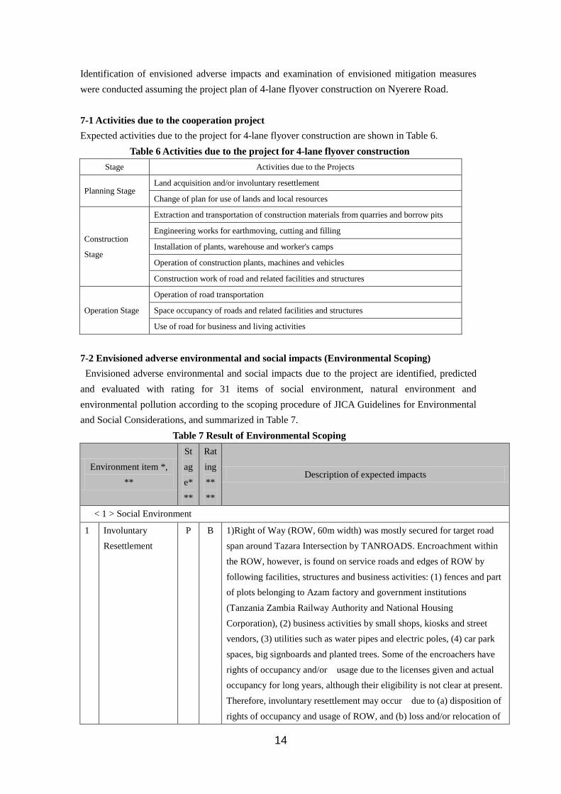
7. Adverse Environmental and Social Impacts
Page 14
14
Identification of envisioned adverse impacts and examination of envisioned mitigation measures
were conducted assuming the project plan of 4-lane flyover construction on Nyerere Road.
7-1 Activities due to the cooperation project
Expected activities due to the project for 4-lane flyover construction are shown in Table 6.
Table 6 Activities due to the project for 4-lane flyover construction
Stage Activities due to the Projects
Planning Stage Land acquisition and/or involuntary resettlement
Change of plan for use of lands and local resources
Construction
Stage
Extraction and transportation of construction materials from quarries and borrow pits
Engineering works for earthmoving, cutting and filling
Installation of plants, warehouse and worker's camps
Operation of construction plants, machines and vehicles
Construction work of road and related facilities and structures
Operation Stage
Operation of road transportation
Space occupancy of roads and related facilities and structures
Use of road for business and living activities
7-2 Envisioned adverse environmental and social impacts (Environmental Scoping)
Envisioned adverse environmental and social impacts due to the project are identified, predicted
and evaluated with rating for 31 items of social environment, natural environment and
environmental pollution according to the scoping procedure of JICA Guidelines for Environmental
and Social Considerations, and summarized in Table 7.
Table 7 Result of Environmental Scoping
Environment item *,
**
St
ag
e*
**
Rat
ing
**
**
Description of expected impacts
< 1 > Social Environment
1 Involuntary
Resettlement
P B 1)Right of Way (ROW, 60m width) was mostly secured for target road
span around Tazara Intersection by TANROADS. Encroachment within
the ROW, however, is found on service roads and edges of ROW by
following facilities, structures and business activities: (1) fences and part
of plots belonging to Azam factory and government institutions
(Tanzania Zambia Railway Authority and National Housing
Corporation), (2) business activities by small shops, kiosks and street
vendors, (3) utilities such as water pipes and electric poles, (4) car park
spaces, big signboards and planted trees. Some of the encroachers have
rights of occupancy and/or usage due to the licenses given and actual
occupancy for long years, although their eligibility is not clear at present.
Therefore, involuntary resettlement may occur due to (a) disposition of
rights of occupancy and usage of ROW, and (b) loss and/or relocation of
Page 15
15
encroached sites, facilities and structures, and business activities within
ROW, although actual displacements of houses and people are not
expected.
P C Procurement of construction materials can be attained by purchasing
them from domestic suppliers, because the scale of construction work is
not large. Thus, utilization of quarries and borrow pits is not necessary.
P C Land secured for construction office, warehouse and worker's camp: It
depends on the plan.
2 Local economy
such as
employment and
livelihood etc.
C B 1) People of small shops, kiosks and street vendors, who encroached into
ROW will lose the jobs due to site clearance for construction of the
flyover. 2) Employment of local people will be generated for
construction work.
O D Smooth access to offices and working places, and increase of
convenience to social services such as hospitals, schools, churches, etc.
are expected due to the improvement of the traffic condition.
3 Land use and
utilization of local
resources
P C There is some possibility of change in land use for housing and business
activities due to the project.
C B Water use for construction work including worker's camp may compete
with the community water supply.
4 Social institutions
such as social
infrastructure and
local
decision-making
institutions
T B If information disclosure regarding the project plan are not properly
conducted, anxieties and complaints may spread over the people and
communities resulting in difficulties for obtaining thorough
understanding of the project and consensus with them.
5 Existing social
infrastructures
and services
T B 1) Construction works may give rise to temporary traffic congestion and
inconvenience for accessibility to social services. 2) Utilities such as
electric lines, water pipes, telecommunication lines and sewer lines are
established on and/or underneath the road. Thus, relocation might be
necessary depending on design of plan and construction work.
6 The poor,
indigenous ethnic
people
T B Construction work may disturb living conditions of people in the project
area and small-business activities of street vendors and kiosks in the
ROW and along the roadside.
7 Misdistribution of
benefits and
damage
T B If information of the project plan including construction work is not
adequately disclosed to local people and road users from an earlier stage,
and proper compensation and support for all PAPs are not properly
implemented, misdistribution of benefit and damage is likely to occur.
8 Local conflict of
interests
T B If information of the project plan including construction work is not
adequately disclosed to local people and road users from an earlier stage,
and proper compensation and support for all PAPs are not properly
implemented, local conflict of interests is likely to occur.
9 Cultural property C C There is some possibility of disturbance to access to cultural property and
Page 16
16
and heritage sites heritage sites due to construction work. However, distribution of these
sites is unknown at present.
10 Water usage or
Water rights and
Rights of
Common
P C Water rights, fishery rights and rights of common are not known in the
area. However, activities such as water intake and fishing are not
operated in ROW.
11 Public health and
Sanitation
C B Air pollutants such as dust, SPM, NOx, SOx emitted from construction
vehicles and machines and construction work may cause some adverse
effect to respiratory organs.
O B Air pollution due to increase of traffic volume may cause some adverse
effect to respiratory organs.
12 Infectious
diseases such as
HIV/AIDS
C B Infection with HIV/AIDS and venereal disease was reported at worker's
camps during road construction in other African countries.
13 Hazards (cyclone,
drought, etc.) and
risk
C C No additional risk of disaster or security is expected due to road
improvement. However, there is anxiety of increase in crime incidence
due to inflow of construction workers.
14 Accidents C B Traffic accidents are likely to increase due to an increase of vehicles for
construction work.
O B Improvement of traffic congestion may give raise to an increase in the
number of vehicles travelling Nelson Mandela and Nyerere Road. This
may also result in an increased number of traffic accidents if proper
traffic management and upgrading up of traffic manners of both drivers
and pedestrians are not improved.
< 2 > Natural Environment
15 Topography and
Geology
C C Construction of the flyover may give rise to some topographical and
geological alteration, although only on a small scale. Thus a detailed
geological survey is necessary for the Outline Design Study.
16 Soil erosion C C No large-scale land cutting or filling are expected. However, if improper
cutting or filling it is undertaken it is likely to cause soil erosion in the
rainy season.
17 Groundwater C C A large scale exploitation of groundwater is not expected. However,
there is some possibility of utilizing groundwater, if water for
construction works is not provided by the city water supply.
18 Hydrological
situation/Drainage
pattern
C C
Construction of roadside gutters may result in some changes in the
hydrological situation of drainage including disturbance of the local
drainage system.
O C There is some possibility of partial road inundation due to poor drainage
of road surface run-off water.
19 Coastal zone P D Dar es Salaam City is situated on the East Indian Ocean coast. However,
the project area is not located in a coastal zone.
20 Fauna, Flora and C B No rare, endangered or endemic terrestrial plant or animal species are
Page 17
17
Biodiversity expected. However, planted trees such as Jakaranda and Neem species
and greens along the road contribute to the amenity of the area.
Increase in air pollutants due to increase in the number of vehicles may
cause adverse impacts on planted trees and greens.
Fauna, Flora and
Biodiversity
O B Removal and/or transplantation of road side trees and greens are
expected due to earthmoving and construction works.
21 Landscape O C Appearance of the flyover and removal and/or relocation of trees and
greens in the ROW may result in some deterioration of the roadside
landscape.
22 Meteorology P D No large-scale topographical alteration are expected.
Global Warming C C Generation of greenhouse gases such as CO2 is expected due to
construction vehicles and machines. However, extent of impact is
unknown.
O C Increase in greenhouse gases such as CO2 is expected due to increase of
traffic volume. However, extent of impact is unknown.
< 3 > Environmental Pollution
24 Air pollution C B Roadside air pollution is expected due to emission of air pollutants such
as dust, NOx, SOx from construction vehicles and machines, and
earthmoving and construction work.
O B Improvement of traffic congestion may give rise to an increase in the
number of vehicles traveling. This may also result in an increase in
emission of air pollutants such as SO2, NOx, from the exhaust
particulates. In addition, poor emission control of many vehicles due to
insufficient maintenance and inspection may accelerate to emission of
bad smells and black smoke along the road.
25 Water pollution C B Water pollution due to inflow of soil and sand from construction work
and wastewater from workers’ camps is expected somewhat.
26 Soil
contamination
C B Toxic materials such as asphalt emulsifiers utilized for road construction
may give rise to soil contamination. However, extent of impact is
unknown.
27 Bottom sediment C D No reclamation or dredging work is expected.
28 Waste C B Generation of soil, sand and construction waste is expected at quarry,
borrow pits, road construction work and workers' camp, etc.
29 Noise and
Vibration
C B Generation of noise and vibration from construction machines and
vehicles is expected.
O B Increase in generation of noise and vibration due to increase in traffic
volume is expected.
30 Ground
Subsidence
C D No major earth moving or reclamation is expected.
31 Offensive odors C C There is some possibility of bad smells spreading over and along the road
due to poor emission control of construction machines and vehicles.
Page 18
18
O C There is some possibility of bad smell spreading over along the road due
to poor emission control of heavy trucks.
Note 1: * Environmental items in the scoping are based on the JICA Guidelines for Environmental Considerations
(2004) with some modifications as referred to the Environmental Guidelines for Infrastructures Projects by JICA
(1992).
Note 2: ** Concerns regarding the impacts on "Gender" and "Children's Right" might be related to all items of the
Social Environment.
Note 3: *** P - Planning stage, C - Construction stage, O - Operation stage, T – whole stages.
Note 4: **** Rating - No project (No action) and Project (4 lane flyover plan requested by Government of
Tanzania). In general, both beneficial and adverse impacts are expected due to the project activities. However,
only adverse impacts are the subject.
(1) Result of re-examining for project categorization
1) Expected major adverse impacts
a) Planning stage
- Involuntary resettlement is expected and it may affect two types of Project Affected Persons
(PAPs) (a) land owners by land acquisition and (b) people having premise and/or structures
and/or activities in the ROW.
b) Construction stage
- Environmental pollution due to air pollutants, water pollutants, noise and wastes are
somewhat expected due to operation of construction vehicles, machines and construction
plants, and earthmoving and construction work as well as workers’ camps.
c) Operation stage
- Improvement of traffic congestion may give rise to an increase in the number of vehicles
travelling. This may also result in increases in emission of air pollutants and noise from
vehicles, especially heavy trucks. In addition, poor emission control of many vehicles due to
insufficient maintenance and inspection may accelerate to them.
d) Whole stage
If information disclosure regarding the project plan, and procedures and public participation
are not properly conducted, anxieties and complaints may spread over the people and
communities resulting in difficulties for obtaining thorough understanding of the project and
consensus with them. properly conducted for throughout whole stages, anxieties and
complaints may spread over the people and communities resulting in difficulties for obtaining
thorough understanding of the project and consensus with them. In addition, delay or standstill
of the project implementation may occur, if fully considerations are not taken to minimize
misdistribution of benefits and damage, and to avoid local conflict of interest.
2) Categorization of the project
Therefore, proposed project for construction of flyover and approach roads on the Nyerere Road is
classified as category B as a result of re-examination by the survey in Tanzania.
Page 19
19
8. Envisioned mitigation measures and monitoring
The above mentioned adverse impacts should be fully taken into considerations to conduct further
necessary baseline survey and examine the mitigation measures including avoidance and
monitoring as much as possible as shown in Table 8.
Baseline survey will be done to make further understanding of existing environment and the effects
expected to be caused by the project activities.
Mitigation measures will minimize the adverse impact to an acceptable level through the planning,
construction and operation phases. Monitoring is required to ensure that the specified mitigation
measures are properly carried out through construction and operation stages.
Table 8 Necessary baseline survey and envisioned mitigation measures and monitoring
Environment item *, ** Stag
e***
Rati
ng*
***
Further necessary baseline study Mitigation measures and monitoring
< 1 > Social Environment
1 Involuntary
Resettlement
P B 1) Inventory survey on encroachment by
land, facilities, structures and business
activities) in ROW and rights of
occupancy and usage. 2) Identify the
occurrence and features of involuntary
resettlement and expected PAPs. 3)
Examine difference in involuntary
resettlement policy between Tanzanian
laws and JICA Guidelines. 4) Confirm
situation of information dissemination
and holding stakeholdes meeting. 5)
Confirm requirement of EIA and
procedure for EIA approval by NEMC.
1) From an early stage of the plan, provide adequate
information to PAPs and consult with stakeholders
including PAPs to reach an agreement or thorough
understanding of the issues as much as possible. 2) In case
of involunatry resettlement, identify PAPs, evaluate the
eligibility of PAPs and provide necessary compensation
and support measures complying with both both Tanzanian
Laws and JICA Guidelines. 3) Formulate CRP
(Compensation and Resettlement Plan) accompanying the
EIA study. 4) Monitor and evaluate result of
implementation of the CRP.
C Confirm procurement plan for
construction materials.
To be confirmed at Outline Design Study.
C Secure necessary sites for construction
work such as office, workers' camp,
storage and disposal.
To be confirmed at Outline Design Study.
2 Local economy
such as
employment and
livelihood etc.
C B Survey on livelihood of people and
business activities of small shops, kiosks
and street vendors, who encroached
into ROW.
Give local residents preference to have a chance to engage
in road construction work.
O D Monitor materialization of traffic congestion improvement
and upgrading convenience for living and business
Page 20
20
activities
3 Land use and
utilization of local
resources
P C Survey of existing land and water
resources (surface water and
groundwater) use and regulation.
Promote an adequate land and water resource development
plan. O C
4 Social institutions
such as social
infrastructure and
local
decision-making
institutions
T B Survey on community structures,
procedure of decision-making and
opinion leaders in the Project area.
Information disclosure and public participation should be
fully considered for all the stakeholders from early stage of
planning for obtaining thorough understanding and
consensus of the people and communities.
5 Existing social
infrastructures
and services
T B (1) Survey on water supply and utilities
along road and in ROW. (2) Survey of
distribution and usage of existing social
infrastructure and services around the
project site.
1) Promote cooperation with development plansof other
social infrastructure and services. 2) Consider how to
minimize temporary traffic congestion in the construction
work plan. 3) Consult with community and the Municipalty
to obtain consensus regarding water use, if necessary. 4)
Consult with owners/users of utilities to obtain consent for
removal or re-installation of utility lines at proper place, if
necessary.
6 The poor,
indigenous ethnic
people
C B (1) Survey on living conditions including
road use of vulnerable social groups such
as the poor, women and children and
indigenous ethnic people.
If the poor and indigenous ethnic people are expected to
become PAPs, their rights in relation to land and resources
must be respected and efforts should be made to obtain
their consent with fully considerations to compensate
properly or support to restore the present living condition.
7 Misdistribution of
benefits and
damage
T B Survey on past experiences and causes
which may give rise to the
misdistribution of benefit and damage in
the communities.
Consultation with stakeholders including PAPs and
community organizations, should be planned from an early
stage to obtain understanding and consent among the
stakeholders in order to share equally benefits and damage.
8 Local conflict of
interests
T B Survey on the causes and solutions of
local conflicts of interests in the Project
area.
Consultation with stakeholders including PAPs and
community organization, should be planned from early
stage to obtain understanding and consent among the
stakeholders in order to avoid or minimize local conflict of
interests.
9 Cultural property
and heritage sites
C C Inventory survey on cultural, historical
and religious property in the Project area.
Avoid alignments close to sites of cultural property and
heritage in the project plan.
10 Water usage or
Water rights and
Rights of
Common
P D Survey on water rights and rights of
commons in the area.
11 Public health and C B Survey on (1) prevalence and cause of 1) Measures for improvement of vehicle exaust emission.
Page 21
21
Sanitation O B respiratory diseases, (2) medical
facilities, (3) medical examination in the
City.
2) Periodical medical examiniation.
12 Infectious
diseases such as
HIV/AIDS
C B 1) Survey on existing cases and cause of
HIV/AIDS in the project area. 2) Survey
on cases of infectious diseases such as
HIV/AIDS during road construction
work.
1) Monitoring cases of HIV/AIDS before and after the
construction phase. (2) Enlightenment and campaign of
prevention and cure of HIV/AIDS.
13 Hazards and risk
(security)
C C Survey on crime incidences and cause
of crime in the City, especially during
road construction work.
14 Accidents C B Collect and analyze data regarding
accidents due to construction work.
Suitable planning and management of road construction
work to prevent and minimize the accidents..
O B Collect and analyze data regarding traffic
accidents
Suitable planning and management of road traffic operation
to prevent and minimize the accidents.
< 2 > Natural Environment
15 Topography and
Geology
C C Detailed geological survey. 1) Avoid areas of unstable ground conditions. 2) Measures
for prevention of landslide at the construction site
16 Soil erosion C C Survey on the areas susceptible to soil
erosion
(1) Avoid the sites susceptible to soil erosion, (2) Measures
for prevention of soil erosion at the construction site.
17 Groundwater C C Survey on groundwater (capacity,
quality, aquifer materials etc.)
Measures to prevent penetration of polluted water to
underground.
18 Hydrological
situation/Drainage
pattern
C C Detailed survey on hydrological features
of rivers and drainages in the area.
Measures for preventing spill over of soil and other
construction materials due to earthmoving work.
19 Coastal zone P D
20 Fauna, Flora and
Biodiversity
C B 1) Detailed survey on protected and/or
precious plant and animal species in the
Project area. (2) Survey on distribution
and owner/user of roadside vegetation.
Permission and/or compensation for cutting
down/removal/replanting trees are not required legally
because these trees are under ownership of TANROADS.
However, it is desirable to get consent from the
Municipality prior to treatment. According to the slogan by
President Nyerere, it is necessary to plant more than two
trees, if one tree is cut down.
O B
21 Landscape O C Survey on important landscape in the
Project area.
Measures for roadside greening to harmonize with
surrounding landscape.
22 Meteorology P D
Survey on cases of change in
microclimate by flyover construction.
23 Global Warming C D Rough estimation of expected
greenhouse gas emission.
Proper management for control of vehicle exhaust emission
and establish inspection system for exhaust gas emission O D
< 3 > Environmental Pollution
Page 22
22
24 Air pollution C B 1) Inventory survey on major air
pollution sources. 2) Collect and analyze
data on present air quality and regulation.
Control of emission of air pollutants (dust, NOx etc.) from
construction machines and vehicles due to construction
work.
O B 1) Proper management for control of vehicle exhaust
emission and establish inspection system for exhaust gas
emission. 2) Air quality monitoring along the road.
25 Water pollution C C 1) Inventory survey on major water
pollution sources. 2) Collect and analyze
data on present water quality and
regulation.
Proper treatment of water pollutants generated from
construction work to comply with water quality regulation.
26 Soil
contamination
C C Survey on present situation of soil
contamination in the Project area.
1) Prevent accumulation of toxic materials in soil during
construction and operation phase. 2) Monitoring of soil
contamination around the sites of earth moving and
construction work sites.
27 Bottom sediment C C Survey on present situation of bottom
sediment pollution in the project area.
1) Monitoring of bottom sediment pollution in rivers, if
necessary.
28 Waste C B Survey on present situation and
institutional structures of waste
management system in the Project area.
1) Consider ways to minimize waste generation in the
construction work plan. 2) Proper treatment and disposal of
wastes generated from construction work.
29 Noise and
Vibration
C B 1) Inventory survey on source of noise
and vibration. 2) Collect data on present
noise and vibration and regulation.
(1) Use low-noise and vibration equipment. (2) Examine
daily and weekly construction schedule to minimize
impacts. (3) Installation of soundproof walls and buffer
zones.
P B 1) Prevent overloading of heavy vehicles. 2) Equip with
devices which generate lower noise and vibration to
vehicles.
30 Ground
Subsidence
C D Survey on geotechnical and geological
condition around Tazara intersection.
31 Offensive odors C C 1) Survey on complaints regarding on
offensive odors in the project area. 2)
Survey on condition of vehicle
exhaust emission control.
1) Monitoring of offensive odor. 2) Proper management for
control of vehicle exhaust emission and establish
inspection system for exhaust emission. O C
Note: *, **, ***, **** Same as those in Table 7.
9. Consultation
9-1 Stakeholder meeting on IEE and involuntary resettlement issue
The meeting was held in the course of Preliminary Study. Participants were peoples of
Implementing Agency (TANROADS) and MOID.
9-2 Items of discussions
(1) Identification of major impacts due to the cooperation project and mitigation measures
Some adverse impacts are expected for environmental items of involuntary resettlement (and/or
Page 23
23
land acquisition), air pollution, water pollution, noise and vibration etc. Among them involuntary
resettlement is a matter of main concern. Thus further efforts should be conducted to confirm ROW
to be surely secured and encroachments into ROW for identifying PAPs, and prepare Compensation
and Resettlement Action Plan by TANROADS and MOID.
(2) EIA Approval by NEMC
It is necessary to follow the progress in EIA approval for the project by at first. Then it is also
necessary to confirm if additional EIA and/or environmental and social considerations for the
cooperation project are required or not.
The Team explained the outline of JICA Guidelines for Environmental and Social Considerations to
the Tanzanian side. The Tanzanian side agreed to take JICA Guidelines fully into considerations
when they would conduct EIA study of the Project and get EIA approval from responsible
authorities in accordance with the Tanzanian laws and regulations.
Regarding the resettlement and compensation issues, the Tanzanian side agreed to abide the
compensation and resettlement policy of the Government and the JICA Guidelines. Tanzanian side
also agreed to secure the appropriate budget for the resettlement and compensation for the project
Affected Persons (PAPs), to be allocated before implementation of the Project. In this regard, a
Complementation and Resettlement Plan (CRP) will be prepared properly.
10. Social Acceptability in case of involuntary Resettlement and Land Acquisition
1) Gaps between donors’ policy and the policy of Government of Tanzania
In Road Sector Compensation and Resettlement Guidelines (Ministry of Infrastructure
Development, 2009.2) compensation and resettlement requirements by donors were compared with
those of Government of Tanzania. There are several differences in eligibility, valuation and
compensation payment methods. For example, resettlement assistance to illegal occupants for
eligibility and non-depreciated value of structures and assets for valuation are included in the World
Bank policy, while there are no such considerations for compensation measures in Tanzanian laws.
2) Matters in considerations
Therefore, following matters should be taken into considerations to facilitate social acceptability.
(1) Sufficient compensation should be given to PAPs with taking the above mentioned gap into
consideration. If there is any difference of involuntary resettlement policy between
Government of Tanzania and JICA, that of JICA should be fully considered.
(2) Participation by PAPs and their communities must be promoted in the planning,
implementation, and monitoring of involuntary resettlement plans and measures against the
loss of their means of livelihood via the disclosure of information from an early stage.
(3) If PAPs are vulnerable social groups such as the poor, women, children, elderly and ethnic
minority appropriate consideration should be given.
11. Important Notice on Outline Design Study
In the Outline Design Study it is necessary to confirm the following matters to the Tanzanian side.
(1) Requirement of EIA and EIA approval by NEMC
Page 24
24
According to result of re-examination of IEE, it is expected that several adverse impacts such as
involuntary resettlement in planning stage, air pollution and noise in construction and operation
stage. TANROADS should submit finalized project plan including the project brief to NEMC for
EIA screening. According to EMA, if a full EIA study is required, TANROADS should make TOR
for EIA to comply with both Tanzanian laws and JICA Guidelines, conduct EIA study and prepare
Environmental Impact Statement for obtaining EIA certificate from NEMC and the concerned
Minister according to procedure of EIA approval in Tanzania as shown in Figure 1.
The team should keep watch the progress and support TANROADS as the following matters:
1) EIA requirement by NEMC
2) Contents of TOR for EIA
Contents of EIA study report should comply with both Tanzanian laws and JICA Guidelines.
In the EIA study environmental monitoring plan should be prepared for items of air quality and
noise, compensation and resettlement, and reduction of traffic congestion.
3) Result of EIA study
4) Approval of EIA by NEMC and concerned Minister
(2) Identification of PAPs and preparation of CRP
To confirm ROW to be surely secured and encroachments into the ROW for identifying PAPs, and
prepare Compensation and Resettlement Plan (CRP), if involuntary resettlement occurs.
(3)To revise the result of IEE and Environmental Checklist for road sector prepared in the
Preparatory Survey
Incorporating further information, results of EIA study and progress in procedure for EIA approval,
to revise the result of the IEE fill in the Environmental Checklist for road sector by consultation
with stakeholders.
(4) To arrange consultants in charge of Environmental and Social Considerations to Outline
Design Study Team
It is necessary to arrange environment consultant(s) in the Team confirm the results of further
studies, re-examine the IEE study mentioned in Table X and keep watch a Compensation and
Resettlement Plan comply with JICA Guidelines.
(5) To fulfill the Gaps between donors’ policy and the policy of Government of Tanzania
As described above (10.1) ), it is necessary to fill the Gaps between donors’ policy and the policy
of Government of Tanzania
13. Other relevant Information
13-1 References
- JICA (2008.6): Dar es Salaam Transport Policy and System Development Master Plan,
Pre-Feasibility Study Report, Vol. II Tazara Intersection Improvement Project.
- Ministry of Infrastructure and Development (2009): Road Sector Compensation and Resettlement
Guidelines
Page 25
25
- Dar es Salaam City Council (2004): Dar es Salaam City Profile
- Prime Minisrer's Office for Regional Administration and Local Government, The Dar es Salaam
City Council (2007): Consultancy Services for the Conceptual Design of a Long Term Integrated
Dar es Salaam BRT System and Detailed Design for the Initial Corridor - Resettlement Policy
Framework/Environmental and Social Impact Assessment.