12
ERDAS APOLLO Your Geospatial Business System for Managing and Serving Information GEOSPATIAL
| Date post: | 20-Feb-2018 |
| Category: |
Documents |
| Upload: | hoangxuyen |
| View: | 217 times |
| Download: | 0 times |
ERDAS APOLLOYour Geospatial Business System for Managing and Serving Information
GE
OS
PA
TIA
L


3
ERDASAPOLLODo you have large volumes of data, a geographically- distributed user base and rapidly changing data holdings? Do you need a single, integrated enterprise-class, spatial data infrastructure? If you are delivering imagery, is the performance fast enough for you?
ERDAS APOLLO is a comprehensive data management, analysis and
delivery system. It enables an organization to organize and deliver
massive volumes of both file-based and web-enabled data, including
imagery, feature data, terrain and virtually any digital object in the
enterprise. ERDAS APOLLO consistently delivers geospatial data
faster and with less hardware than competing server-based products.
An interoperable OGC/ISO-based application that implements an
out-of-the-box service-oriented architecture (SOA), ERDAS APOLLO
can be customized and extended to satisfy both your geospatial and
business process requirements.
4
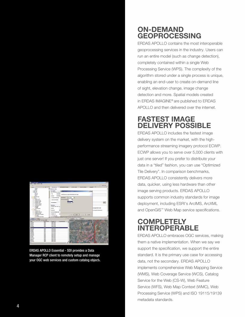
ERDAS APOLLO Essential - SDI provides a Data Manager RCP client to remotely setup and manage your OGC web services and custom catalog objects..
ON-DEMAND GEOPROCESSING ERDAS APOLLO contains the most interoperable
geoprocessing services in the industry. Users can
run an entire model (such as change detection),
completely contained within a single Web
Processing Service (WPS). The complexity of the
algorithm stored under a single process is unique,
enabling an end-user to create on-demand line
of sight, elevation change, image change
detection and more. Spatial models created
in ERDAS IMAGINE® are published to ERDAS
APOLLO and then delivered over the internet.
FASTEST IMAGE DELIVERY POSSIBLEERDAS APOLLO includes the fastest image
delivery system on the market, with the high-
performance streaming imagery protocol ECWP.
ECWP allows you to serve over 5,000 clients with
just one server! If you prefer to distribute your
data in a “tiled” fashion, you can use “Optimized
Tile Delivery”. In comparison benchmarks,
ERDAS APOLLO consistently delivers more
data, quicker, using less hardware than other
image serving products. ERDAS APOLLO
supports common industry standards for image
deployment, including ESRI’s ArcIMS, ArcXML
and OpenGIS™ Web Map service specifications.
COMPLETELY INTEROPERABLEERDAS APOLLO embraces OGC services, making
them a native implementation. When we say we
support the specification, we support the entire
standard. It is the primary use case for accessing
data, not the secondary. ERDAS APOLLO
implements comprehensive Web Mapping Service
(WMS), Web Coverage Service (WCS), Catalog
Service for the Web (CS-W), Web Feature
Service (WFS), Web Map Context (WMC), Web
Processing Service (WPS) and ISO 19115/19139
metadata standards.
4

5

6
SEAMLESSLY INTEGRATES ERDAS APOLLO seamlessly integrates with
GIS environments. In addition, ERDAS APOLLO
leverages existing business systems, such as
the Oracle database for persisting intelligent
metadata and application specific information.
Proven IT standards such as JavaEE and REST
integrate ERDAS APOLLO into existing business
environments, also meeting an organization’s
security requirements. In ERDAS APOLLO,
almost any kind of data input is supported
(including ArcSDE & Oracle). Legacy and third-
party data may also be used together in a single
environment. ERDAS APOLLO simplifies the
complexity of geospatial data, easily managing
and distributing this information to a large
audience. Many software applications support
ECWP, our high-speed streaming imagery
protocol, including MapInfo and Bentley
Microstation. Where an application does not
support ECWP “out-of-the-box,” we provide free
plug-ins. For example, we have very popular free
plug-ins for ArcGIS® and AutoCAD®.
SECURELY COLLABORATE AND SHARE DATAThe permission-based data distribution system
in ERDAS APOLLO enables users to easily
make their geospatial data available to others
while retaining digital ownership rights. ERDAS
APOLLO is both a static data management
solution and a means to securely share desktop
datasets that are routinely modified or created.
Users in a network can create sharable data and
content mashups, all within a 3D virtual globe.
Find, filter, export and edit vector data through the ERDAS APOLLO Web Client.
6

7
FLEXIBLE OFFERING Available in three product tiers, ERDAS APOLLO
suits a wide spectrum of organizations –
from those that simply need a very low-cost,
remarkably fast image server to those requiring
a comprehensive data management system.
All three tiers offer remarkably fast performance,
even when handling massive data archives and
many users.
Serving a 5TB image over the internet is not a problem for ERDAS APOLLO-Image Web Server.
Vectors are served with lightning speed with ERDAS APOLLO-Image Web Server.

8
ERDAS APOLLO Essentials—SDIFor organizations that require interoperable
cataloging and delivery of imagery, terrain and
vector data through OGC Web Services to any
client application, ERDAS APOLLO Essentials—
SDI is appropriate. This offering provides an
entry-level, best-of-breed enterprise solution
to quickly implement an OGC standard Spatial
Data Infrastructure meeting cataloging (CS-W)
and dissemination (WFS, WCS, WMS,
WMC) requirements.
ERDAS APOLLO Essentials—Image Web ServerGovernment organizations with geospatial data
that needs to be shared via a public access
website can easily do this with ERDAS APOLLO
Essentials—Image Web Server. This unique,
low-cost product provides high-speed access
to large volumes of imagery on a minimum
hardware set. Image Web Server requires very
little server administration, leveraging the
unmatched power of ECWP and Optimized
Tile Delivery to ensure images are delivered
very quickly.
ERDAS APOLLO AdvantageOrganizations that need to manage massive
amounts of geospatial data need ERDAS APOLLO
Advantage. The data may be redundant and
distributed across multiple departments or offices.
Often, this data needs to be rapidly delivered to
users based on their role and permissions in
the enterprise.
Broadcast one search query across multiple ERDAS APOLLO Catalogs and ERDAS APOLLO Collaboration networks, and visualize results in the ERDAS TITAN Viewer 3D globe.
8

9
APOLLO Professional supports server-side geoprocessing. Previously published and cataloged spatial models are accessible and executable by users on demand from 2D and 3D clients.
The APOLLO Web Client allows users to search, browse, discover, style, visualize and download imagery and vector data. Imagery geoprocessing and vector data editing are also available to complete these workflows.

10
Organizations may be spending a lot of money
on hardware, but users still cannot find what
they need. Organizations that benefit from
ERDAS APOLLO Advantage include national
mapping agencies and large federal organizations,
police forces, Defense, DOT/infrastructure,
surveillance, disaster/emergency response
and homeland security.
ERDAS APOLLO Advantage can deliver the raw
data as well as a single, homogenous dataset
without creating multiple service layers (supporting
the same data types as ERDAS IMAGINE®).
ERDAS APOLLO Advantage provides automated
data and metadata harvesting, crawling, indexing
and schedulers, with a secured hierarchical data
model. ERDAS APOLLO Advantage also includes
desktop data sharing and collaboration, allowing
users to publish their data, specifying permissions.
Using a 3D virtual globe, users create sharable
data and content mashups with each other. Users
can also search, discover and visualize data in
a variety of applications.
ERDAS APOLLO PROfESSIOnALFor users that need to manage data, as well as
perform on-demand spatial analysis to extract
information, ERDAS APOLLO Professional is
appropriate. ERDAS APOLLO Professional offers
a powerful geoprocessing (WPS) component,
unrivaled in complex algorithms. ERDAS APOLLO
Professional enables server-side geoprocessing
of geospatial data contained within a Spatial
Data Infrastructure (SDI). This end-to-end
workflow is designed so that end-users executing
geoprocesses may do so with very little
domain knowledge.
New geometry tool for searching and filtering.
10

11
The workflow begins with ERDAS IMAGINE,
which provides a rich environment for creating
new and complex spatial models. Using ERDAS
IMAGINE, geospatial analysts create custom
models and publish them to the APOLLO catalog.
Security credentials are managed by APOLLO
administrators who make cataloged spatial
models accessible to users per role.
Published and cataloged spatial models are then
accessible and executable by consumer users,
on demand, from 2D and 3D clients like the
ERDAS APOLLO Web Client, and the ERDAS
TITAN Viewer 3D virtual globe. In this scenario
users are working from one collective data pool,
extending the utilization of geospatial information
to others in an organization.
Search ERDAS APOLLO to discover raster, vector and KML data. Visualize in the TITAN Viewer 3D globe.

www. in tergraph.com www.erdas .com
Intergraph, the Intergraph logo, and ERDAS IMAGInE are registered trademarks of Intergraph Corporation. Other brands and product names are trademarks of their respective owners. Intergraph believes the information in this publication is accurate as of its publication date. Such information is subject to change without notice.
©2012 Intergraph Corporation 4/12 GEO-US-0010A-EnG


