38
Evolution of the Global Observing System: a Vision for 2025 John Eyre and Jérôme Lafeuille Met Office, UK WMO ITSC-16, Angra dos Reis, Brazil; 7-13 May 2008
Evolution of the Global Observing System:
a Vision for 2025
John Eyre and Jérôme Lafeuille
Met Office, UK WMO
ITSC-16, Angra dos Reis, Brazil; 7-13 May 2008
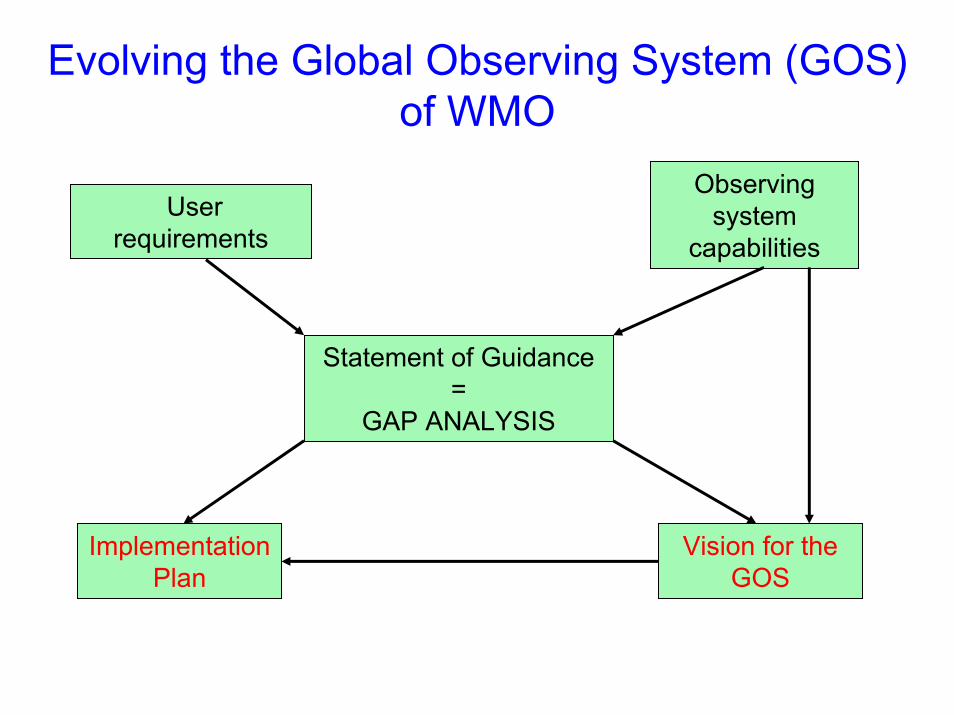
Evolving the Global Observing System (GOS) of WMO
Observing system
capabilitiesUser
requirements
Statement of Guidance=
GAP ANALYSIS
Implementation Plan
Vision for the GOS
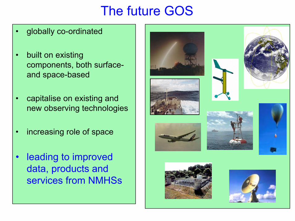
The future GOS• globally co-ordinated
• built on existing components, both surface-and space-based
• capitalise on existing and new observing technologies
• increasing role of space
• leading to improved data, products and services from NMHSs
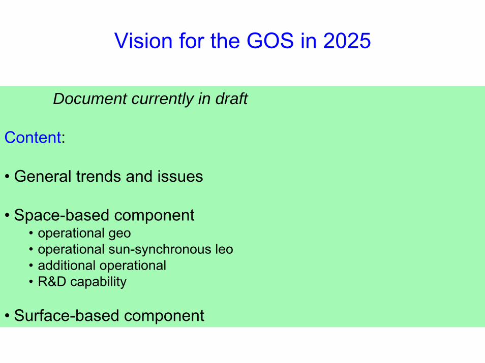
Document currently in draft
Content:
• General trends and issues
• Space-based component• operational geo• operational sun-synchronous leo• additional operational• R&D capability
• Surface-based component
Vision for the GOS in 2025
• Response to user needs
• Integration - WIGOS
• Expansion
• Automation
• Consistency and homogeneity
General trends and issues

• 6 operational GEOs, all with multi-spectral imager (IR/VIS); some with hyper-spectral sounder (IR)
• 4 operational LEOs optimally spaced in time, all with multi-spectral imager (MW/IR/VIS/UV), all with sounder (MW), 3 with hyper-spectral sounder (IR), 2 with altimeter, 3 with conical-scan MW or scatterometer
• Several R&D satellites: constellation of small satellites for radio occultation (RO), LEO with wind lidar, LEO with active and passive microwave precipitation instruments, LEO and GEO with advanced hyper-spectral capabilities, GEO lightning
• Improved inter-calibration and operational continuity
Space-based GOS: current Vision to 2015
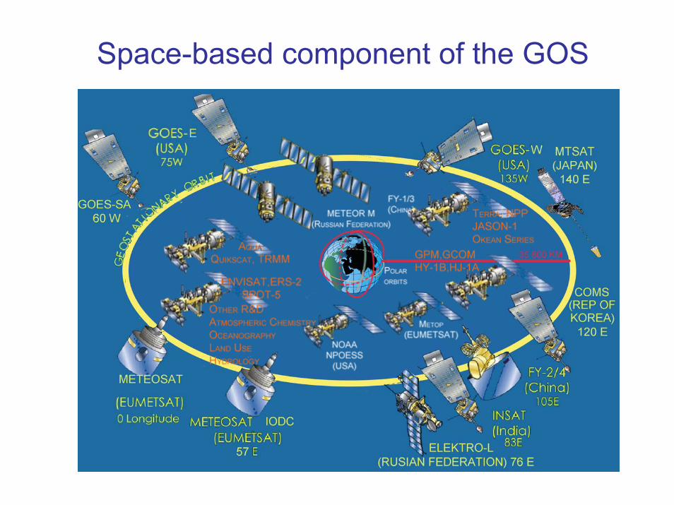
Space-based component of the GOS

Proposed developments of space-based GOSunder the draft Vision for 2025
Main themes:
• Optimize current geostationary constellation
• Optimize current sun-synchronous orbit sounding missions
• Implement operational radio occultation sounding constellation
• Review ocean altimetry observation strategy
• Refine ocean surface wind vector observation strategy
• Make additional missions operational, e.g. for GCOS ECVs
-80
-50
-20
10
40
70
-180 -160 -140 -120 -100 -80 -60 -40 -20 0 20 40 60 80 100 120 140 160 180
Longitude
Latit
ude
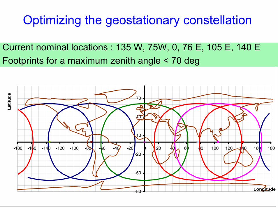
Current nominal locations : 135 W, 75W, 0, 76 E, 105 E, 140 EFootprints for a maximum zenith angle < 70 deg
Optimizing the geostationary constellation

-80
-50
-20
10
40
70
-180 -160 -140 -120 -100 -80 -60 -40 -20 0 20 40 60 80 100 120 140 160 180
Longitude
Latit
ude
Optimizing the geostationary constellation
Recommendation: at least 6 satellites separated by < 60°longitude with multispectral imager & hyperspectral IR sounder
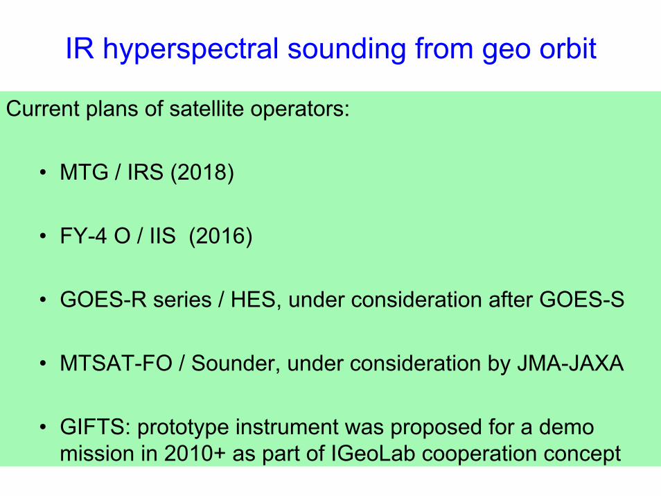
IR hyperspectral sounding from geo orbit
Current plans of satellite operators:
• MTG / IRS (2018)
• FY-4 O / IIS (2016)
• GOES-R series / HES, under consideration after GOES-S
• MTSAT-FO / Sounder, under consideration by JMA-JAXA
• GIFTS: prototype instrument was proposed for a demo mission in 2010+ as part of IGeoLab cooperation concept

LST: 06h
LST:
00h
LST: 18h
LST:
12h
Optimizing sun-synchronousIR/ MW sounding missions
Afternoon orbits
Morning orbits
North pole
Current baseline Large gap neardawn-dusk
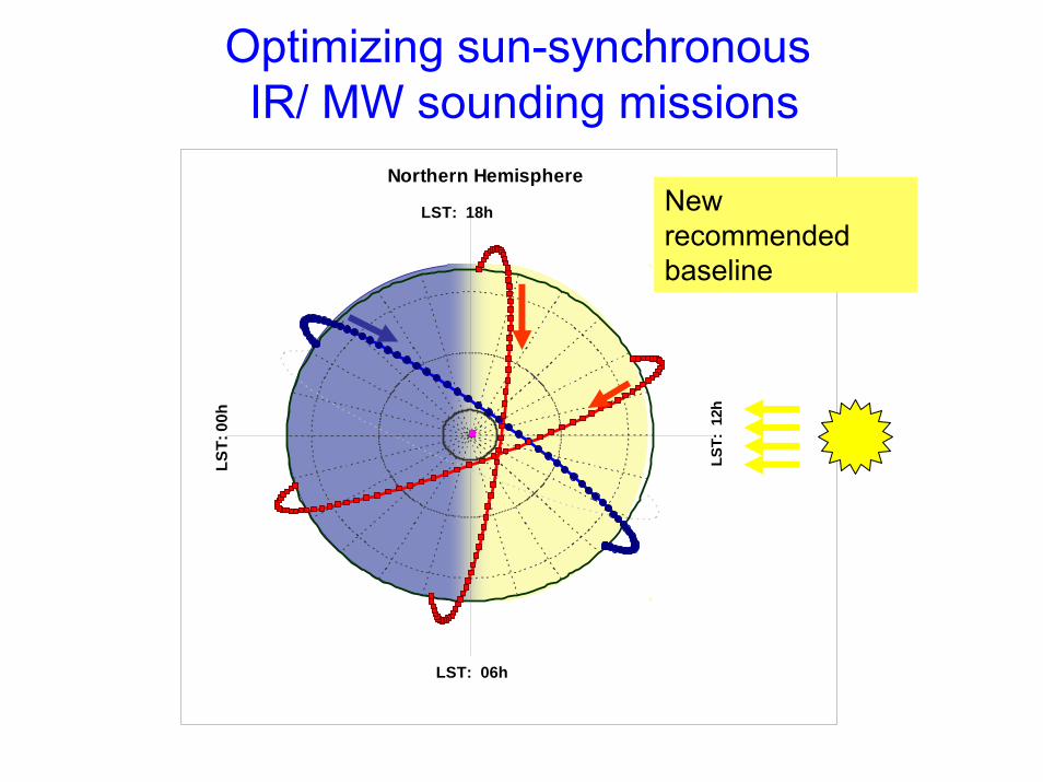
Optimizing sun-synchronousIR/ MW sounding missions
Northern Hemisphere
LST: 06h
LST:
00h
LST: 18h
LST:
12h
New recommended baseline
LST:
00h
LST:
12h
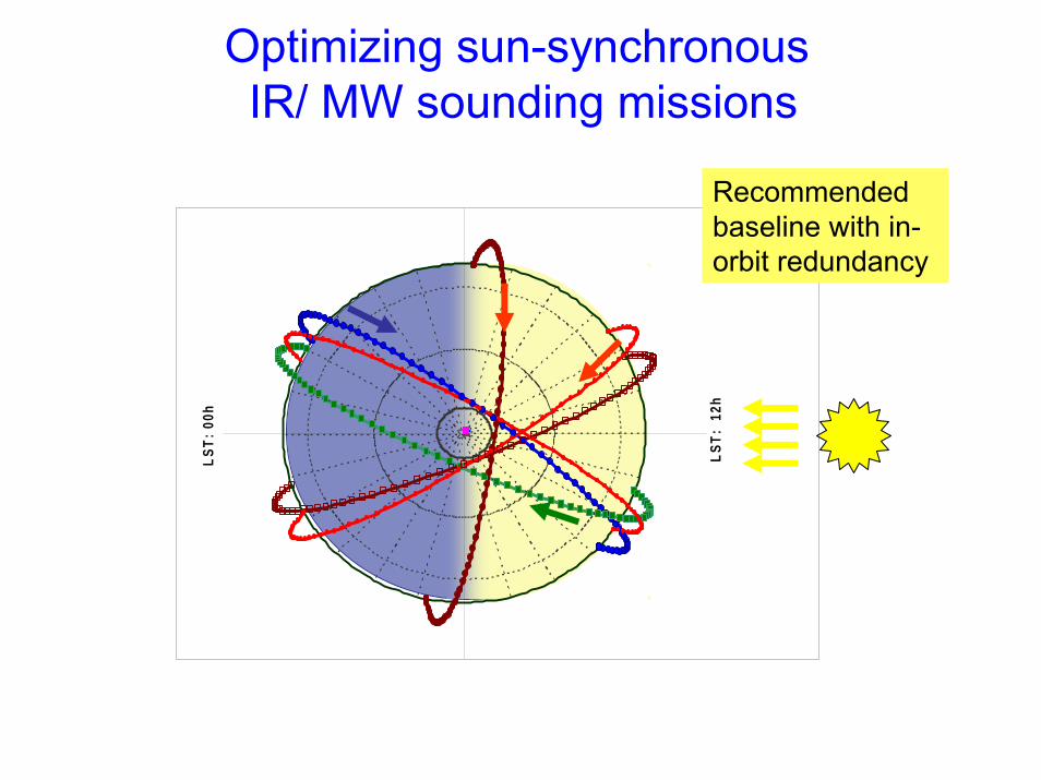
Optimizing sun-synchronousIR/ MW sounding missions
Recommended baseline with in-orbit redundancy
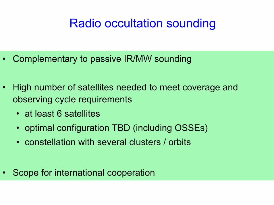
Radio occultation sounding
• Complementary to passive IR/MW sounding
• High number of satellites needed to meet coverage and observing cycle requirements• at least 6 satellites • optimal configuration TBD (including OSSEs) • constellation with several clusters / orbits
• Scope for international cooperation
Salinity
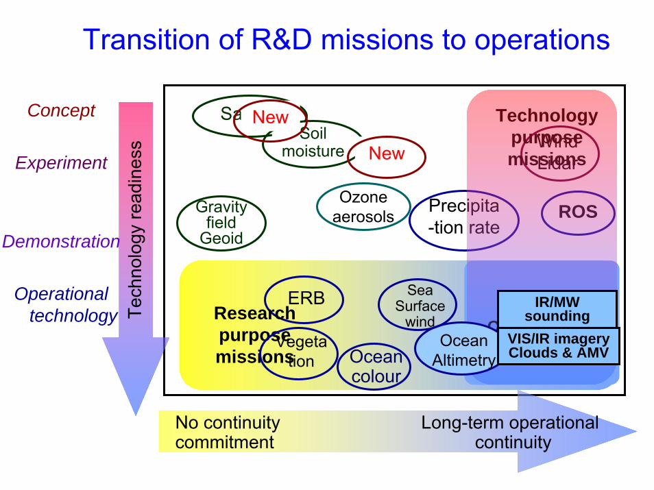
Transition of R&D missions to operations
Tech
nolo
gy re
adin
ess
Precipita-tion rate
Ocean colour
OPERATIONAL MISSIONS
Wind Lidar
ROS
ERB
No continuity Long-term operational commitment continuity
Concept
Experiment
Demonstration
Operationaltechnology Research
purposemissions
Technologypurposemissions
Ocean Altimetry
VIS/IR imagery Clouds & AMV
IR/MW sounding
Sea Surface
windVegeta
tion
Soil moisture
Gravity field
Geoid
New
New
Ozone aerosols

Vision for the space-based GOS in 2025: Summary (1)
At least 6 operational geostationary satellites:
• All with IR/VIS multi-spectral imager• All with IR hyper-spectral sounder• With no more than 60°longitude difference between neighbouring locations
Operational polar-orbiting sun-synchronous satellites on 3 orbital planes:
• All with IR/VIS multi-spectral imager• All with MW sounder • All with IR hyper-spectral sounder
Additional operational missions in appropriate orbits:
• 2 sun-synch. sats with scatterometer• 2 sun-synch. sats with conically-scanning polarimetric MW imager• 2 sun-synch. sats with narrow-band VIS/NIR imagers for ocean colour + veg.• Constellation of high-resolution VIS/IR imagers for land surface imaging• Constellation for radio occultation• Constellation for altimetry: 2 in sun-synch orbits and 1 high-precision ref. • Constellation of LEO satellites for precipitation measurements: combined use
of active instrument in low-inclination orbit and passive microwave instruments in several high-inclination orbits
• Constellation of sensors for Earth radiation budget: including at least 1 broad-band multi-angle viewing radiometer in LEO, and 1 total solar irradiance sensor, together with auxiliary LEO measurements and geo sensors
• Constellation of instruments/missions to address atmospheric composition
Vision for the space-based GOS in 2025: Summary (2)
Vision for the space-based GOS in 2025: Summary (3)
Several R&D satellites and operational pathfinders including:
• LEO with Doppler wind lidar• LEO Low-frequency MW radiometer addressing salinity and soil moisture• GEO microwave
Considered as optional:• Satellites in highly elliptical orbit (HEO) ensuring polar region coverage• Geostationary lightning detection
Improved availability, timeliness, and intercalibration through operational cooperation among agencies.

Developing a new Vision – who’s involved?WMO
• Expert Team on Evolution of the GOS (requirements for space+surface obs)
• ET on Satellite Utilization & Products
• ET on Satellite Systems
• ET on Automatic Weather Stations
• Implementation/Coordination Team on Integrated Observing Systems (ICT-IOS)
• Commission for Basic Systems (CBS)
• Optimizationworkshops
• CGMS
• CEOS
• Other stakeholders
Developing a new Vision – schedule
July 2007 – Dec 2008Discussion of draft within WMO Expert Teams and with other stakeholders
*** COMMENTS WELCOME! ***
Early 2009Adoption by WMO Commission for Basic Systems

Thank you for your attention
Ocean surface topography
The community (including CEOS Ocean Surface Topography Constellation) has recommended 2 components:
• One high-precision reference altimeter system with orbit and coverage avoiding tidal aliasing (e.g. Jason)
• Two complementary altimetry systems on higher inclination orbits to maximize global coverage(e.g. GFO, ENVISAT or Sentinel-3 )
covering from oceanic mesoscale to basin-wide scale andaddressing ocean weather and climate applications
Ocean surface wind vector
• 2 scatterometers• 2 full-polarization MW imagers
• other MWI (dual polarization) contribute to additional wind speed data

New missions required onlong-term basis for GCOS ECVs
• Global precipitation measurement (GPM concept)• Earth Radiation Budget (to be refined)
• TSI and TOA upcoming SW-LW• Contextual parameters (cloud, aerosols, WV)• Geostationary multi-spectral imagery for diurnal cycle
• Atmospheric composition constellation (to be refined)• for O3, GHG, aerosols, and air quality in lower troposphere
• Specific imaging missions for ocean colour and vegetation
• Serving broader objectives - step towards WIGOS• Enhanced and diversified capabilities• More commitments to long-term continuity• Requires more resources
Possible with wider community of GOS contributorsNeed enhanced cooperation to optimize global effort Ensuring data exchange and consistent data quality
Vision of the GOS to 2025Forward looking but affordable
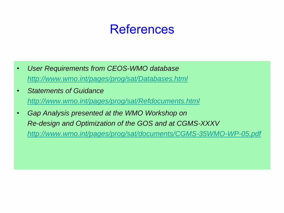
References
• User Requirements from CEOS-WMO databasehttp://www.wmo.int/pages/prog/sat/Databases.html
• Statements of Guidancehttp://www.wmo.int/pages/prog/sat/Refdocuments.html
• Gap Analysis presented at the WMO Workshop on Re-design and Optimization of the GOS and at CGMS-XXXVhttp://www.wmo.int/pages/prog/sat/documents/CGMS-35WMO-WP-05.pdf
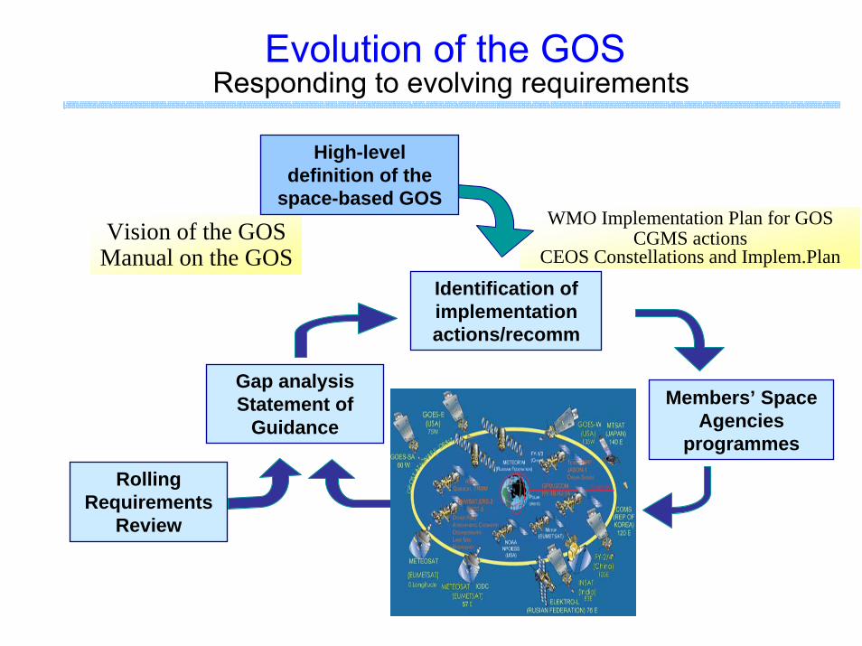
Evolution of the GOSResponding to evolving requirements
RollingRequirements
Review
Vision of the GOS Manual on the GOS
Identification of implementation actions/recomm
WMO Implementation Plan for GOSCGMS actions
CEOS Constellations and Implem.Plan
Members’ Space Agencies
programmes
Gap analysisStatement of
Guidance
High-level definition of the
space-based GOS

Evolution of the GOS
RollingRequirements
Review
Identification of implementation actions/recomm
Members’ Space Agencies
programmes
Gap analysisStatement of
Guidance
Updating the long-term vision
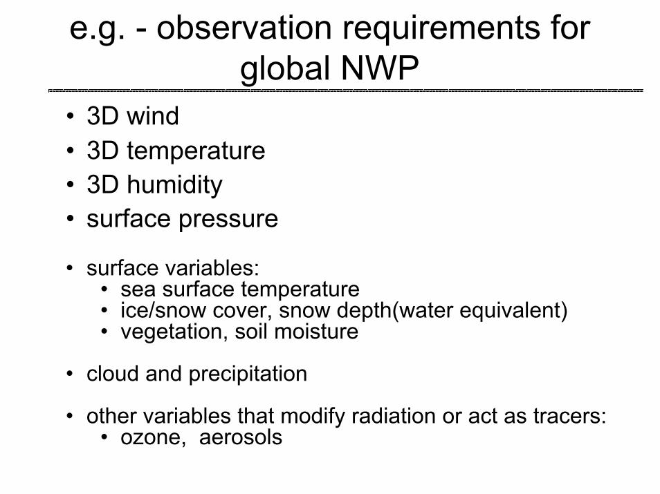
e.g. - observation requirements for global NWP
• 3D wind• 3D temperature• 3D humidity• surface pressure
• surface variables:• sea surface temperature• ice/snow cover, snow depth(water equivalent)• vegetation, soil moisture
• cloud and precipitation
• other variables that modify radiation or act as tracers: • ozone, aerosols
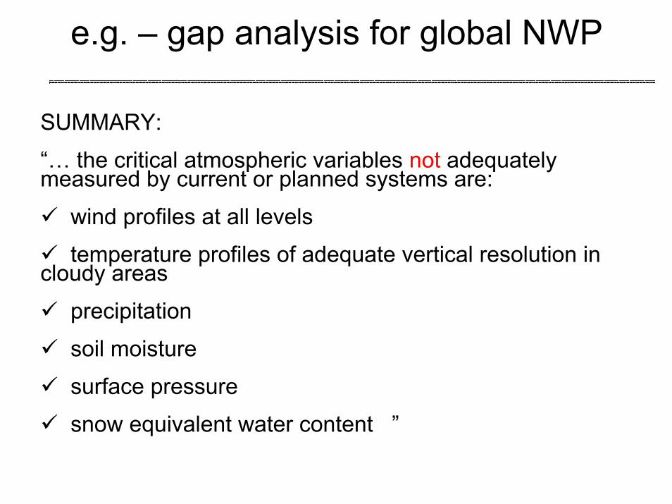
SUMMARY:
“… the critical atmospheric variables not adequately measured by current or planned systems are:
wind profiles at all levels
temperature profiles of adequate vertical resolution in cloudy areas
precipitation
soil moisture
surface pressure
snow equivalent water content ”
e.g. – gap analysis for global NWP

• at least 6 spacecraft • separated by ≤ 60 deg longitude for a “global” coverage
• VIS/IR multi-purpose imagery • IR hyperspectral sounding
• contribution to Earth Radiation Budget monitoring• TBD, complement to LEO
• contribution to Atmospheric Chemistry • TBD, complement to LEO
• optional: lightning detection• complement to ground-based systems
Evolution of the GOSoperational geostationary component
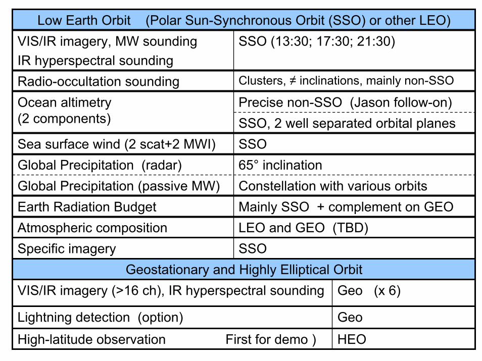
Low Earth Orbit (Polar Sun-Synchronous Orbit (SSO) or other LEO)VIS/IR imagery, MW soundingIR hyperspectral sounding
SSO (13:30; 17:30; 21:30)
Radio-occultation sounding Clusters, ≠ inclinations, mainly non-SSO
Precise non-SSO (Jason follow-on)Ocean altimetry(2 components) SSO, 2 well separated orbital planesSea surface wind (2 scat+2 MWI) SSOGlobal Precipitation (radar) 65° inclinationGlobal Precipitation (passive MW) Constellation with various orbitsEarth Radiation Budget Mainly SSO + complement on GEOAtmospheric composition LEO and GEO (TBD)Specific imagery SSO
Geostationary and Highly Elliptical OrbitVIS/IR imagery (>16 ch), IR hyperspectral sounding Geo (x 6)
GeoLightning detection (option)High-latitude observation First for demo ) HEO
User Requirements and Gap Analysis
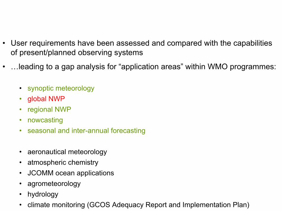
• User requirements have been assessed and compared with the capabilities of present/planned observing systems
• …leading to a gap analysis for “application areas” within WMO programmes:
• synoptic meteorology• global NWP• regional NWP• nowcasting• seasonal and inter-annual forecasting
• aeronautical meteorology • atmospheric chemistry• JCOMM ocean applications• agrometeorology• hydrology• climate monitoring (GCOS Adequacy Report and Implementation Plan)
WMO Rolling Review of Requirements (RRR) process
• RRR addresses the question:• how well do present/planned/proposed observing
systems meet user requirements (URs) for each “application area” within WMO programmes?
• Aims of RRR• to inform WMO members how well their
requirements for observations are or will be met• to provide material to aid dialogue of WMO and its
members with “observing system providers”(member states and space agencies)
RRR is intended to provide general guidance - it

The RRR processCREATE
ANDUPDATE
CREATE AND
UPDATE
CRITICALREVIEW
GENERATE STATEMENT OF
GUIDANCE
Statement of Guidance
Observing system
capabilities database
User requirements
databaseCR output
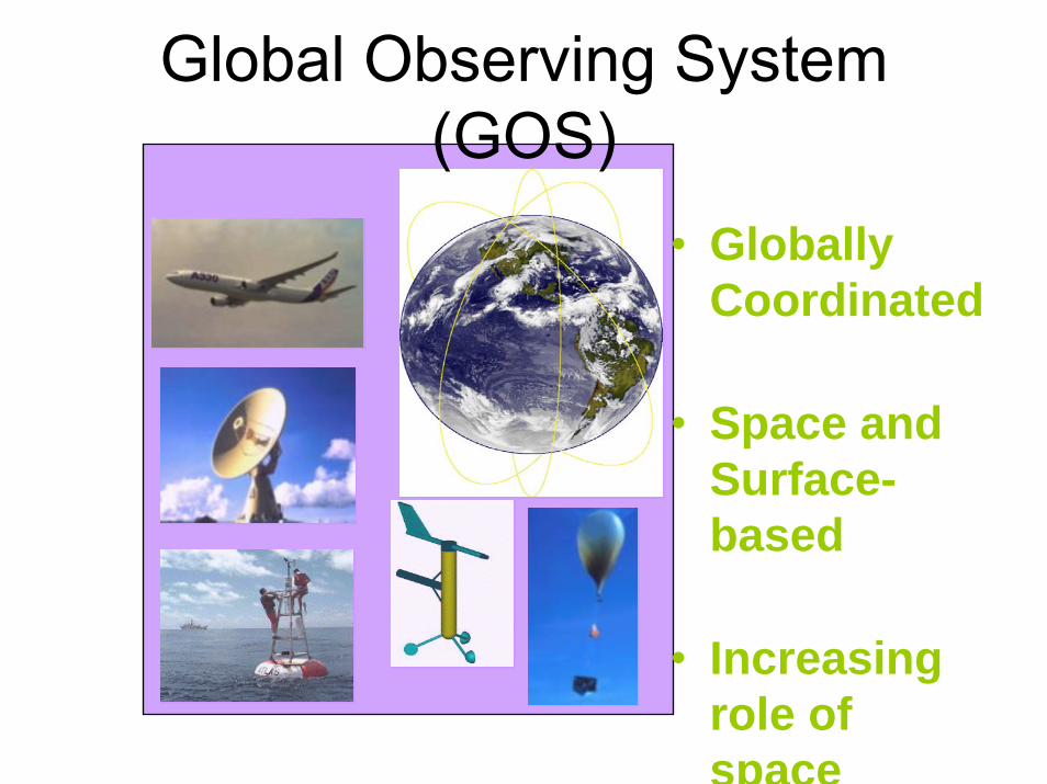
Global Observing System (GOS)
• Globally Coordinated
• Space and Surface-based
• Increasing role of space
• Improved calibration
• Improved data access and data timeliness
• Consider the possibility of targeted observations
• Sustainability through transition of a number of R&D missions to operational status
Evolution of the GOS(7) Cross-cutting aspects


