M u n n i s u n k B r o o k Mu n n i s u n k B r o o k 1 2 Granby Simsbury F i e ld D r Howard St Laurie Joe Way Tim Clark Cir County Rd Tuller Simsbury Pines Centerwood Rd Willard St Gordon St W e s cot t R d Litchfield Dr H opm ead ow S t Be rk s h i r e Way M u n nisu nk D r Munnisunk Dr Be rk s h i re W ay Brett onwo o d Dr Kn ol l w o od C i r H02/403/003 H02/403/000B G02-405-000 H02/403/000A I03/427/000 H03-403-005A G03-403-005B G02-403-000 H0340313A-E H03-403-002 H02-403-006 Tobacco Valley Solar Simsbury, Connecticut Open Space Adjacent to Project Area Page 1 of 3 Source: VHB, CT DEEP, ArcGIS Online, Town of Simsbury, CT Graphic and Property Information Application i 0 400 800 200 Feet October 26, 2017 \\NHBEDATA\checkin\42256.00\GIS\Project\May2017\Interrogatory Help\Open Space Adjacent to Project Area.mxd Existing Eversource ROW Property Boundary Town Boundary Adjacent Parcels Stream Approximate Stream Farm Ponds Project Area to be Left in Natural State Open Space Land Town Open Space Local Government, Public Facilities Quasi Public School Transportation & Utilities Exhibit B
Transcript
Mun nisunk B rook
Munnis
unk B
rook
1
2
3
GranbySimsbury
Field Dr
Howa
rd St
Laurie Joe Way
Tim Clark Cir
County Rd
Tuller
Simsbury Pines
Centerwood Rd
Willard St
Gordon St
Wescott Rd
Litchfield Dr
Hopmeadow St
Berkshire Way
MunnisunkDr
Munn
isunk
Dr
Berkshire Way
Brettonwood Dr
Knollwood Cir
H02/403/003
H02/
403/
000B
G02-405-000
H02/403/000AI03/427/000
H03-403-005A
G03-403-005B
G02-403-000
H0340313A-E
H03-403-002
H02-403-006
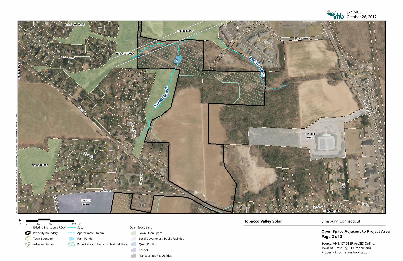
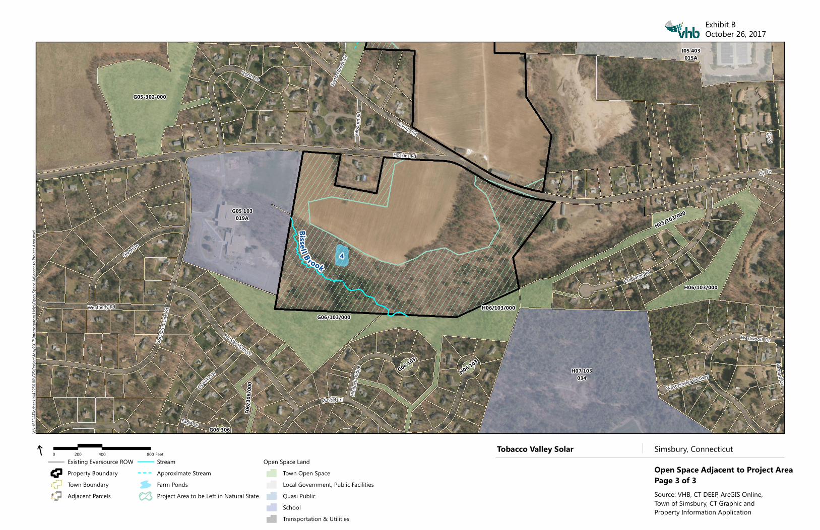
Tobacco Valley Solar Simsbury, Connecticut
Open Space Adjacent to Project AreaPage 1 of 3Source: VHB, CT DEEP, ArcGIS Online, Town of Simsbury, CT Graphic and Property Information Application


![O · 2018. 4. 4. · =`qvsab`o rszzo b]aqo\o 4]\r] /\r`so boqqvw. =`qvsab`o rszzo b]aqo\o 4]\r] /\r`so boqqvw. =`qvsab`o rszzo b]aqo\o 4]\r] /\r`so boqqvw](https://static.documents.pub/doc/80x56/6129f0f2f0b6560cb8570017/o-2018-4-4-qvsabo-rszzo-baqoo-4r-rso-boqqvw-qvsabo-rszzo-baqoo.jpg)


