45
Explanatory notes to the Geological Base Map of the Czech Republic at 1: 25 000 scale czech geological survey Pavel Hanžl et al.
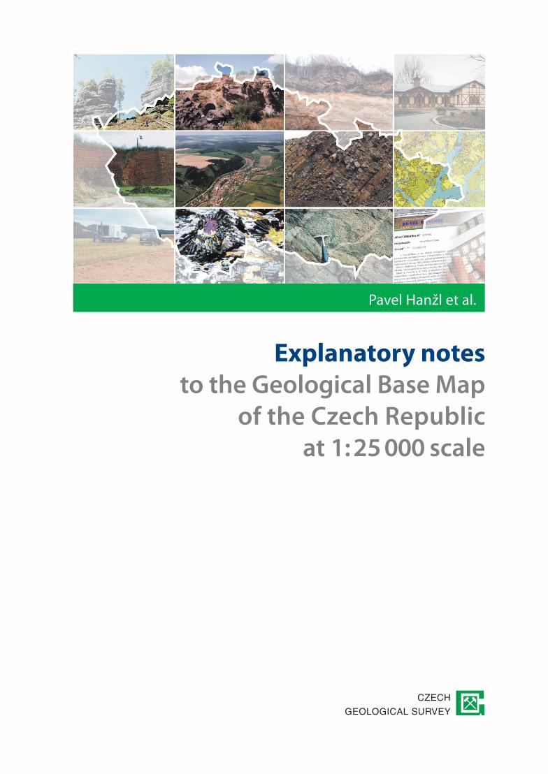
Explanatory notesto the Geological Base Map
of the Czech Republic at 1: 25 000 scale
czech
geological survey
Pavel Hanžl et al.


Explanatory notesto the Geological Base Map
of the Czech Republic at 1:25 000 scale
P. Hanžl et al.
S. Čech, J. Čurda, Š. Doležalová, K. Dušek,
P. Gürtlerová, Z. Krejčí, P. Kycl, O. Man,
D. Mašek, P. Mixa, O. Moravcová, J. Pertoldová,
Z. Petáková, A. Petrová, P. Rambousek,
Z. Skácelová, P. Štěpánek, J. Večeřa, V. Žáček
Translated and edited by
J. Hak, C. Halls
CZeCH GeOlOGiCAl SuRVey
2011

The regulation for compilation of the Geological Base Map of the Czech Republic at a scale of 1:25 000
P. HanžlS. Čech, J. Čurda, Š. Doležalová, K. Dušek, P. Gürtlerová, Z. Krejčí, P. Kycl, O. Man, D. Mašek, P. Mixa, O. Moravcová, J. Pertoldová, Z. Petáková, A. Petrová, P. Rambousek, Z. Skácelová, P. Štěpánek, J. Večeřa, V. Žáček
Published by the Czech Geological SurveyPrague 2011Translation: Jaroslav Hak, Chris HallsGraphic layout by Oleg Man
First edition, 45 pp.Printed by the Czech Geological Survey, Klárov 3, Praha 103/9 446-408-11
iSBN 978-80-7075-765-9
Obsah
55
PART I
Basic provisions . . . . . . . . . . . . . . . . . . . . . . . . . . . . . . . . . . . . . . . . . . . . . . . . . . . . . . . . . . . . . . . . 7
The aim and definition of the Regulation . . . . . . . . . . . . . . . . . . . . . . . . . . . . . . . . . . . . . . . . . . . . . 7
PART II
Basic geological mapping . . . . . . . . . . . . . . . . . . . . . . . . . . . . . . . . . . . . . . . . . . . . . . . . . . . . . . . . 9
General provisions . . . . . . . . . . . . . . . . . . . . . . . . . . . . . . . . . . . . . . . . . . . . . . . . . . . . . . . . . . . . . . . 9
The aims of basic geological mapping. . . . . . . . . . . . . . . . . . . . . . . . . . . . . . . . . . . . . . . . . . . . . . . . 9
Geological Base Map of the Czech Republic at 1:25 000 scale and its integral parts. . . . . . . . . . . 10
PART III
Geological map at 1:25 000 scale with graphic appendices
and special purpose (thematic) maps . . . . . . . . . . . . . . . . . . . . . . . . . . . . . . . . . . . . . . . . . . . . . . 11
Basic provisions . . . . . . . . . . . . . . . . . . . . . . . . . . . . . . . . . . . . . . . . . . . . . . . . . . . . . . . . . . . . . . . . 11
Geological map at 1:25 000 scale and obligatory information to be placed
on the margin of the map . . . . . . . . . . . . . . . . . . . . . . . . . . . . . . . . . . . . . . . . . . . . . . . . . . . . . . . . 12
legend to the geological map with Quaternary cover . . . . . . . . . . . . . . . . . . . . . . . . . . . . . . . . . . . 12
The lithostratigraphic column . . . . . . . . . . . . . . . . . . . . . . . . . . . . . . . . . . . . . . . . . . . . . . . . . . . . . 13
The geological cross-section . . . . . . . . . . . . . . . . . . . . . . . . . . . . . . . . . . . . . . . . . . . . . . . . . . . . . . 13
Summary of the contributors to the geological mapping. . . . . . . . . . . . . . . . . . . . . . . . . . . . . . . . . 14
Summary of the geological units . . . . . . . . . . . . . . . . . . . . . . . . . . . . . . . . . . . . . . . . . . . . . . . . . . . 14
index map. . . . . . . . . . . . . . . . . . . . . . . . . . . . . . . . . . . . . . . . . . . . . . . . . . . . . . . . . . . . . . . . . . . . . 14
Optional separate supplements to the geological base map. . . . . . . . . . . . . . . . . . . . . . . . . . . . . . . 14
Special purpose (thematic) maps . . . . . . . . . . . . . . . . . . . . . . . . . . . . . . . . . . . . . . . . . . . . . . . . . . . 15
PART IV
Explanatory notes to the Geological Base Map of the Czech Republic
at 1:25 000 scale . . . . . . . . . . . . . . . . . . . . . . . . . . . . . . . . . . . . . . . . . . . . . . . . . . . . . . . . . . . . . . . 19
Basic provisions . . . . . . . . . . . . . . . . . . . . . . . . . . . . . . . . . . . . . . . . . . . . . . . . . . . . . . . . . . . . . . . . 19
Abstract . . . . . . . . . . . . . . . . . . . . . . . . . . . . . . . . . . . . . . . . . . . . . . . . . . . . . . . . . . . . . . . . . . . . . . 19
introduction . . . . . . . . . . . . . . . . . . . . . . . . . . . . . . . . . . . . . . . . . . . . . . . . . . . . . . . . . . . . . . . . . . . 20
Geology . . . . . . . . . . . . . . . . . . . . . . . . . . . . . . . . . . . . . . . . . . . . . . . . . . . . . . . . . . . . . . . . . . . . . . 20
Geophysics . . . . . . . . . . . . . . . . . . . . . . . . . . . . . . . . . . . . . . . . . . . . . . . . . . . . . . . . . . . . . . . . . . . 22
Geochemistry . . . . . . . . . . . . . . . . . . . . . . . . . . . . . . . . . . . . . . . . . . . . . . . . . . . . . . . . . . . . . . . . . . 23
Mineral resources. . . . . . . . . . . . . . . . . . . . . . . . . . . . . . . . . . . . . . . . . . . . . . . . . . . . . . . . . . . . . . . 24
Hydrogeology . . . . . . . . . . . . . . . . . . . . . . . . . . . . . . . . . . . . . . . . . . . . . . . . . . . . . . . . . . . . . . . . . 26

� �
Summary of engineering geological conditions . . . . . . . . . . . . . . . . . . . . . . . . . . . . . . . . . . . . . . . 28
environmental geofactors . . . . . . . . . . . . . . . . . . . . . . . . . . . . . . . . . . . . . . . . . . . . . . . . . . . . . . . . 30
Geologically important localities. . . . . . . . . . . . . . . . . . . . . . . . . . . . . . . . . . . . . . . . . . . . . . . . . . . 31
Geological development of the mapped area. . . . . . . . . . . . . . . . . . . . . . . . . . . . . . . . . . . . . . . . . . 31
list of references and maps used . . . . . . . . . . . . . . . . . . . . . . . . . . . . . . . . . . . . . . . . . . . . . . . . . . . 32
Specialist Appendices . . . . . . . . . . . . . . . . . . . . . . . . . . . . . . . . . . . . . . . . . . . . . . . . . . . . . . . . . . . 32
PART V
Documentation used in the compilation of the Geological Base Map
at 1:25 000 scale . . . . . . . . . . . . . . . . . . . . . . . . . . . . . . . . . . . . . . . . . . . . . . . . . . . . . . . . . . . . . . . 33
Basic provisions . . . . . . . . . . . . . . . . . . . . . . . . . . . . . . . . . . . . . . . . . . . . . . . . . . . . . . . . . . . . . . . . 33
Graphic illustrations. . . . . . . . . . . . . . . . . . . . . . . . . . . . . . . . . . . . . . . . . . . . . . . . . . . . . . . . . . . . . 33
Written documentation. . . . . . . . . . . . . . . . . . . . . . . . . . . . . . . . . . . . . . . . . . . . . . . . . . . . . . . . . . . 34
Documented geological samples . . . . . . . . . . . . . . . . . . . . . . . . . . . . . . . . . . . . . . . . . . . . . . . . . . . 34
information stored in the NGMD . . . . . . . . . . . . . . . . . . . . . . . . . . . . . . . . . . . . . . . . . . . . . . . . . . 35
PART VI
Procedure for compilation of the Geological Base Map at 1:25 000 scale,
thematic maps and explanatory notes . . . . . . . . . . . . . . . . . . . . . . . . . . . . . . . . . . . . . . . . . . . . . 37
Basic provisions . . . . . . . . . . . . . . . . . . . . . . . . . . . . . . . . . . . . . . . . . . . . . . . . . . . . . . . . . . . . . . . . 37
Responsibility for the stages of compilation of the manuscript of the geological base map. . . . . . 37
Responsibility for digitization of the manuscript version of the geological base map,
compilation of thematic maps and explanatory notes . . . . . . . . . . . . . . . . . . . . . . . . . . . . . . . . . . . 38
The procedure for approval of the Geological Base Map at 1:25 000 scale . . . . . . . . . . . . . . . . . . 38
Outputs. . . . . . . . . . . . . . . . . . . . . . . . . . . . . . . . . . . . . . . . . . . . . . . . . . . . . . . . . . . . . . . . . . . . . . . 39
PART VII
Professional competence of the individuals responsible for compilation
of the Geological Base Map at 1:25 000 scale . . . . . . . . . . . . . . . . . . . . . . . . . . . . . . . . . . . . . . . 41
Basic provisions . . . . . . . . . . . . . . . . . . . . . . . . . . . . . . . . . . . . . . . . . . . . . . . . . . . . . . . . . . . . . . . . 41
Geology . . . . . . . . . . . . . . . . . . . . . . . . . . . . . . . . . . . . . . . . . . . . . . . . . . . . . . . . . . . . . . . . . . . . . . 41
Geographic information System . . . . . . . . . . . . . . . . . . . . . . . . . . . . . . . . . . . . . . . . . . . . . . . . . . . 43
PART VIII
Final provisions . . . . . . . . . . . . . . . . . . . . . . . . . . . . . . . . . . . . . . . . . . . . . . . . . . . . . . . . . . . . . . . 45
Validity of the Regulation . . . . . . . . . . . . . . . . . . . . . . . . . . . . . . . . . . . . . . . . . . . . . . . . . . . . . . . . 45

PART I
Basic provisions
ARTiCle 1.1
The aim and definition of the Regulation
The regulation for compilation of the Geological Base Map of the Czech Republic at a scale of 1:25 000 (hereafter described as the Regulation) is obligatory for compilation of the Geological Base Map of the Czech Republic at 1:25 000 scale (116.8 km2) carried out by the Czech Geological Survey (hereafter described as CGS). The Regulation defines the individual parts that are required for compilation of the base map according to a unified standard.
This manual replaces the earlier Regulation issued by the Czech Geological Survey in 2003 to govern the compilation of the Geological Base Map of the Czech Republic at a scale of 1:25 000. in general, it is derived from Act No.62/1988 Coll. of the Act on Geological Works, and all subsequent amendments (hereafter defined as the “Act”). Further legislative norms used for the formulation of the Regulation are given in the individual articles below.
The CGS reserves the right to make additional provisions and modifications to this Regulation governing basic geological mapping of the Czech Republic.
�


PART II
Basic geological mapping
ARTiCle 2.1
General provisions
Geological mapping forms the basis for regional geological research on the territory of the Czech Republic. The statutory duties of the CGS are defined in § 17 of the Act as follows: collection, processing and interpretation of geological data from the territory of the country, compilation of data on protection and utilization of natural mineral resources and groundwater resources and data on geological hazards. under the terms of the Act, an essential part of these activities is the compilation of the Geological Base Map at 1:25 000 scale that is to be published and made available to the public.
ARTiCle 2.2
The aims of basic geological mapping
The objectives of basic geological mapping are to describe and depict the geological composition and structure of the territory of the Czech Republic, including mineral occurrences and the prognostic evaluation of mineral raw materials, resources of ground water and geological hazards and of geological factors affecting the environment. The outcome should be a comprehensive knowledge of the geology of the country. in order to fulfill these objectives, the Czech Geological Survey makes use of data stored in archives, field surveys, laboratory analyses and knowledge acquired from other geological disciplines.
The data gathered and the maps compiled are intended to serve the requirements of the state and public administration, in particular for making decisions when planning civil works, and formulating policies on energy, minerals and environmental protection. These data are also made available for use by educational establishments, museums, foundations, and public service organizations, as well as by the private sector. For example, the data gathered may be used for:
• creation of the National Geological Mapping Database (hereafter described as NGMD),
• geological exploration, search for and protection of mineral wealth, groundwater resources and exploitation of geothermal energy,
• assessment of geofactors and their effects on the environment and in regional planning of land-use and the design of strategy for use of the landscape and natural resources,
• resolution of ecological problems,
• assessment of geological conditions required for major civil engineering works and evaluation of the impacts of such constructions on the adjacent rock environment,
• compilation of synoptic and thematic geological maps, and derived maps used for specific purposes that form a basis for special and detailed geological investigations,
• resolution of theoretical and applied problems leading to advances in geology and the earth sciences in general,
• teaching geology and related disciplines,
• popularization of geology and related disciplines.
�

ARTiCle 2.3
Geological Base Map of the Czech Republic at 1:25 000 scale and its integral parts
The Geological Base Map of the Czech Republic at a scale of 1:25 000 is a comprehensive work that consists of three parts: the map itself, an explanatory text and related documentary materials:
• Geological map 1:25 000 with graphic appendices and special purpose (thematic) maps,
• explanatory notes to the Geological Base Map of the Czech Republic 1:25 000,
• Documentation and data related to the Geological Base Map of the Czech Republic 1:25 000.
The components of the Geological Base Map of the Czech Republic at a scale of 1:25 000 listed above are an integral part of the MGMD. For the purpose of compiling the Geological Base Map at 1:25 000 scale, a topographic base map produced by the Czech Geodetic and Cadastral Office at 1:25 000 scale and based on the S-JTSK projection (the co-ordinate system of the uniform cadastral triangulation network) is used. The topographic base used for compilation of the original geological map must be identical with the digital version of the topographic map.
10 10 Explanatory notEs to thE GEoloGical BasE Map of thE czEch rEpuBlic at 1:25 000 scalE

PART III
Geological map at 1:25 000 scale with graphic appendices and special purpose (thematic) maps
ARTiCle 3.1
Basic provisions
The graphic part of the Geological Base Map of the Czech Republic at 1:25 000 scale consists of the geological map, special purpose (thematic) maps and graphic appendices to them.
The geological map at 1:25 000 scale comprises the geological map itself, including Quaternary formations (drift). it is supplemented by the following obligatory information to be placed to one side of the map. This must include:
• number and name of map sheet
• legend to the geological map
• lithostratigraphic scheme
• geological cross-section
• summary of geological mapping
• synoptic description of regional geological units
• index map
According to requirements, the map can be supplemented by other optional appendices such as geophysical, stratigraphic or lithological schemes, a 3D model of the relief, etc., placed on one side of the map:The special purpose (thematic) maps include:
• map of documentation points
• map of bedrock
• structural geological map
• geophysical map
• geochemical map
• map of mineral resources
• hydrogeological map
• map of engineering-geological zoning
• map of geodynamic phenomena-geomorphological map
• map of environmental geofactorsThis geological map as compiled at 1:25 000 scale forms an obligatory and integral part of the
Geological Base Map of the Czech Republic. The map of documentation points is also obligatory and constructed at a scale of 1:25 000. Other special purpose (thematic) maps are an optional supplement to the base map and are compiled at 1:25 000 or 1:50 000 scale to meet the special demands of individual projects. if necessary, a number of versions of thematic maps with different contents can be compiled.
Synoptic maps (schemes) are compiled basing on materials for construction of special purpose maps and stored in the NGMD. These schemes are an integral part of individual chapters of explanatory notes even in case when the special purpose maps were not compiled.
1111

ARTiCle 3.2
Geological map at 1:25 000 scale and obligatory information to be placed on the margin of the map
The geological map at 1:25 000 scale depicts and interprets the geological structure of the earth’s surface, including sediments forming the Quaternary cover and anthropogenic deposits. it is a compilation of lithologic, stratigraphic and structural observations of the bed rocks, and the overlying Quaternary deposits, supplemented by selected tectonic, paleontological, hydrogeological, and geodynamic data, together with information concerning mineral resources.
Information depicted on the geological map at 1:25 000 scale includes:
• Areas of rocks and units defined in terms of lithostratigraphy, chronostratigraphy, petrology or tectonics, and of Quaternary deposits, and the geological contacts between them,
• Anthropogenic deposits,
• The lines of faults and other tectonic elements on the earth’s surface,
• Major structures marking the boundaries of geological units,
• Zones of contact metamorphism and hydrothermal alteration,
• important zones of eluvium and products of fossil weathering,
• important geodynamic phenomena,
• Active and abandoned surface mine workings and adits and shafts of underground mines,
• important springs of fresh ground and mineral waters,
• Sites of important paleontological finds,
• Significant boreholes,
• important geological localities,
• lines of geological cross-sections.
CoMPIlATIon oF ThE GEoloGICAl BAsE MAP AT 1: 25 000 sCAlE
Geological observations and documentation made when mapping are first plotted on a topographic base map at a scale of 1:10 000 (field map) or, if required, even on topographic maps of larger scale. in areas covered by Quaternary deposits it is recommended that location of the concealed geological boundaries be confirmed by geotechnical and/or geophysical methods. Objects depicted on the geological map must be supported by geological documentation. The recommended minimum number of documentation points is 4 per sq.km. Only features with an area greater than 5 mm2 or with a width greater than 1mm at 1:25 000 scale are shown on the map. The map is compiled so that features depicted correspond with the same features on the adjacent map sheets.
ARTiCle 3.3
legend to the geological map with Quaternary cover
The legend must include all features shown on the geological map at 1:25 000 scale, the geological cross-section and the lithostratigraphic column. if some of these features appear only in the lithostratigraphic column or in the geological cross-section, then this should be indicated in the text describing the individual items of the legend.
Explanatory notEs to thE GEoloGical BasE Map of thE czEch rEpuBlic at 1:25 000 scalE12
The legend is divided according to regional-geological and chronostratigraphic principles. Classification of separate groups of units within individual chronological sequences or in regional geological units is indicated by headings above the respective groups.
individual items in the legend are indicated by consecutive numbers that will be the same as those given to the appropriate paragraphs in the explanatory notes. The units in the legend are arranged in order of age from the youngest to the oldest. The key to geological symbols forms an integral part of the legend. This is shown below the last rock unit.
lithostratigraphic units, rocks and other geological features depicted in the legend are distinguished by a combination of color, hatching, indices and symbols. The symbols and colors used must follow the standards established by the CGS (see CGS Guidlines). Graphic depiction of individual items in the legend is supplemented by basic stratigraphic and petrographic descriptions.
Names of rocks and their regional geological, chronostratigraphic and lithostratigraphic classification are based on international standards and the terminology established in the CGS that forms an integral part of the NGMD. The names given to rocks in the legend, in the lithostratigraphic column and in the explanatory notes must be the same.
ARTiCle 3.4
The lithostratigraphic column
The lithostratigraphic column shows the stratigraphic (chronostratigraphic) sequence of lithostratigraphic units observed at the surface or, based on drilling data and geophysical measurements, inferred to be present on the map sheet down to a depth of approximately 1km, even if these units do not appear at surface on the map or in the geological cross-section. As a rule, the lithostratigraphic column includes only sedimentary, low-grade metamorphic and extrusive rocks arranged according to their relative ages and the law of superposition. in areas with a complex tectonic structure it is desirable to compile a separate lithostratigraphic column for each tectonic unit.
lithostratigraphic units are arranged in the column according to stratigraphic sequence in accord with the international Stratigraphic Chart of the international Commission on Stratigraphy (2004). if the local lithostratigraphic units cannot be correlated with chronostratigraphic units of the international Stratigraphic Chart, then reference can be made to a published regional stratigraphic column.
A separate geochronological column can be compiled for intrusive, metamorphic and penetratively deformed rocks.
ARTiCle 3.5
The geological cross-section
A geological cross-section without vertical exaggeration is constructed to depict the inferred geological structure to a depth of 1 km. This will vary depending on the characteristic features of the geological structure of the mapped area. in the case of incomplete map sheets, it may not be appropriate to compile a cross-section.
if possible, the line chosen for the geological cross-section should run perpendicular to the strike of the principal structures and rock units shown on the map sheet, passing through important elevations and boreholes. The section can be bent to pass through chosen points or significant topographic features, but unnecessary bends in the line of section should be avoided. The total length of the geological cross-section must not be longer than the length of a diagonal of the given map sheet. All
GEoloGical Map at 1:25 000 scalE with Graphic appEndicEs and spEcial purposE (thEMatic) Maps13

rocks, geological boundaries of units and tectonic structures crossed by the line of the section should be depicted. The Quaternary cover is only shown when thick enough to be depicted at the scale of the cross-section.
ARTiCle 3.6
summary of the contributors to the geological mapping
The names of the geologists who have contributed to the original mapping of the sheet are shown, together with the areas for which they are responsible. Sectors newly mapped, updated or taken from other sources should be distinguished. The individual areas are numbered. under each of these numbers, the name of the contributor and the period during which the mapping was done are shown in the accompanying legend.
ARTiCle 3.7
summary of the geological units
The defined regional geological units and important faults shown on the map sheet and the terms used should match those used in the legend to geological base map at 1:25 000 scale.
ARTiCle 3.8
Index map
The index map consists of two parts. The first part depicts the distribution of map sheets at 1:100 000 scale within the territory of the Czech Republic showing the map sheet on which the given base map of 1:25 000 scale lies. The second part shows the position of the given 1:25 000 map within the 1:100 000 scale map sheet.
ARTiCle 3.9
optional separate supplements to the geological base map
Depending on the geological character of the mapped area, the geological base map can be supplemented by the following:
• geophysical maps (e.g., gravity, aeromagnetic, gamma spectrometry),
• synoptic map of bedrock,
• structural-geological scheme,
• engineering-geological zoning,
• hydrogeological map,
• map of mineral occurrences and deposits,
• interpretation of satellite imagery of the area,
• 3D model of the terrain.
E x p l a n ato r y n ot E s to t h E G E o lo G i c a l B a s E M a p o f t h E c z E c h r E p u B l i c at 1 : 2 5 0 0 0 s c a l E14

ARTiCle 3.10
special purpose (thematic) maps
Depending on the requirements of the given project, thematic maps with appropriate legends are compiled at 1:25 000 or 1:50 000 scales. The graphics and terms on these maps must correspond with the relevant features depicted on the geological base map including Quaternary cover, and also with the appropriate databases of the information System of the CGS. Correspondence with adjacent map sheets must be checked. if need be, the individual maps may also differ in their contents.
1. MAP oF DoCuMEnTATIon PoInTs
The map of documentation points depicts the distribution of the points across the mapped area. The locations of the points should be cross-checked against the information held in the CGS databases.
The map depicts:
• the positions and numbers of individual documentation points,
• sites at which samples were collected,
• legend.
2. GEoloGICAl MAP oF BEDRoCk
The geological map of bedrock (solid) depicts the pre-Quaternary geological units in the area mapped. The compilation of geological maps of bedrock is governed by the same regulations and procedures as those applied to construction of geological map including Quaternary deposits (drift).
The map contains:
• depiction of the pre-Quaternary geological units and their contacts cropping out at surface and their extension beneath the Quaternary cover,
• depiction of structures and tectonic features exposed at surface and their projection beneath cover.
3. sTRuCTuRAl-GEoloGICAl MAP
This map shows the orientation and character of tectonic features governing the geological structure of the mapped area.
The map depicts:
• litho-tectonic units,
• tectonic boundaries,
• positions and orientations of planar and linear structural elements,
• legend.
4. GEoPhysICAl MAP
This map incorporates the results of geophysical surveys covering the whole area of the map sheet, as well as data stored in archives and databases, including petrophysical data.
The map depicts:
• areal and point geophysical anomalies,
15GEoloGical Map at 1:25 000 scalE with Graphic appEndicEs and spEcial purposE (thEMatic) Maps
15

• lines of geophysical profiles, if required,
• sites from which rock samples were collected for petrophysical measurements,
• legend.
5. GEoChEMICAl MAP
This map summarizes geochemical data covering the mapped area and reflects the chemical properties of the rock environment based on chemical analyses of the bedrock, soils, recent stream sediments in rivers, lakes and water reservoirs and other relevant data.
The map incorporates:
• geological units derived from the geological base map at 1:25 000 scale, and the geochemical properties of major rock types,
• concentrations of selected chemical elements and compounds in the rock environment relative to selected standards,
• areal and point geochemical anomalies,
• location of the analytical data used,
• legend.
6. MAP oF MInERAl DEPosITs
This map depicts and summarizes the mineral occurrences and deposits known in the area at the time of compilation of the map (as of a specific date). information is derived from current mining activity and surface exposures, supplemented by historical records of mining and mineral exploration and data stored in archives. This will take account of possible future exploitation of known or predicted mineral resources.The map depicts:
• mineral deposits,
• sites and facilities that have been constructed in connection with mineral exploration, mining and mineral processing,
• mineral showings,
• lines of sections, if relevant,
• legend.
7. hyDRoGEoloGICAl MAP
This map provides comprehensive information about the hydrogeological pattern of the mapped area. it depicts the regime and circulation of ground waters in hydrogeological structures, their relation to geological units and tectonic features, spatial distribution of aquifers and aquicludes, their hydraulic properties and permeability, groundwater levels and important hydrogeological bodies and their properties.
The physical and chemical properties of ground waters form an integral part of the hydrogeological map. in particular, these include the distribution of hydrochemical types of waters, concentrations of individual elements in waters, physical-chemical parameters of waters (total dissolved solids, pH, temperature, etc.)
The map depicts:
• hydrogeological units defined and based on the permeability of the rock environment,
• positions of important hydrogeological objects,
E x p l a n ato r y n ot E s to t h E G E o lo G i c a l B a s E M a p o f t h E c z E c h r E p u B l i c at 1 : 2 5 0 0 0 s c a l E1�

• point information about selected hydrogeological parameters,
• information about physical-chemical properties of ground waters,
• localization of sources of pollution of waters,
• legend.
8. MAP oF EnGInEERInG-GEoloGICAl zonInG
The map depicts the distribution of engineering-geological zones, that is to say, areas having similar or identical properties essential for the purpose of planning land-use, design and construction of civil works, engineering geology and geotechnics in general. The zones are defined and derived from the geological map.
The map contains:
• areas of defined engineering-geological zones,
• geodynamic phenomena (unless a special map is compiled),
• schematic sections of individual zones,
• location of sites with known geotechnical parameters,
• legend.
9. MAP oF GEoDynAMIC PhEnoMEnA
The map depicts the effects of recent and sub-recent geological processes that significantly change the composition, properties and state of the rock environment. in areas exploited by human beings, this can endanger technical works and even human lives. The map supplements the map of engineering-geological zoning, and a separate map of geodynamic phenomena will be compiled only in cases where geodynamic phenomena are particularly intense.
The map depicts:
• point, linear and areal geodynamic phenomena,
• legend.
10. MAP oF EnVIRonMEnTAl GEoFACToRs
The map summarizes geological parameters and processes, which affect the environment. The map is based on the interpretation of the data and map layers of the NGMD acquired during compilation of the geological base map at 1:25 000 scale, the related thematic maps and the relevant chapters of explanatory notes, partly also on new observations. Materials needed for compilation of the map of environmental geofactors are supplemented by data from public and administrative sources.
The map contains:
• selected geofactors,
• protected natural objects and sites,
• legend.
1�GEoloGical Map at 1:25 000 scalE with Graphic appEndicEs and spEcial purposE (thEMatic) Maps
1�


PART IV
Explanatory notes to the Geological Base Map of the Czech Republic at 1:25 000 scale
ARTiCle 4.1
Basic provisions
The explanatory notes (hereafter described as notes) provide fundamental information about the geology depicted on the map sheet. All the important geological features identified during geological mapping are summarized in these notes. They enable the user to understand the significance of the features that are depicted on the map and described in the legend. Geological data are supplemented by information acquired through applied research (geochemistry, mineral resources, hydrogeology, engineering geology) and other geoscientific data that are essential for protection of nature and the environment.
The text of the explanatory notes should be clear and understandable and of a high scientific standard so that the information contained will be accessible to interested persons from other disciplines and to the public. it is recommended that the text be accompanied by appropriate photographs, drawings, sketches or diagrams.
The explanatory notes to the Geological Base Map of the Czech Republic at 1:25 000 scale must contain the following sections:Abstract 1. introduction 2. Geology 3. Geophysics 4. Geochemistry 5. Mineral resources 6. Hydrogeology 7. engineering-geological pattern 8. environmental geofactors 9. important geological localities10. Geological development of the mapped area11. list of references and maps usedSpecialists supplements
ARTiCle 4.2
Abstract
The abstract provides a brief and appropriate summary of the geology of the given map sheet including important topics from individual chapters. The length of the abstract should not exceed two pages and is to be written in a Czech and an english version.
1�1�

ARTiCle 4.3
Introduction
This chapter consists of two sub-chapters:
1. GEnERAl ChARACTERIsTICs oF ThE AREA CoVERED By ThE GIVEn MAP shEET
The sub-chapter briefly defines the geographic position of the map sheet, and its position relative to the administrative divisions of the country. it contains the following items:
• position within administrative division of the country, important settlements, infrastructure of the area (roads, railways, etc.), industrial activities, agriculture,
• geographic and topographic characteristics of the area covered by the map sheet,
• basic hydrological and climatic characteristics, etc.
With the exception of map sheets lying within a single geomorphological unit, the text should contain a synoptic map at 1:75 000 scale showing the geomorphological units within the mapped area.
2. suMMARy oF ThE REGIonAl GEoloGy
This summary provides information about the presence and distribution of the main regional geological units depicted on the map sheet and a brief description of their characteristics. The text should also contain a geological scheme of the broader area with the position of the given map sheet marked.
ARTiCle 4.4
Geology
The chapter describes and supplements the geological map at 1:25 000 scale. The text summarizes new data acquired during field mapping in relation to information already published on the area and also data stored in archives. The chapter consists of five sub-headings:
1. suMMARy oF PREVIous GEoloGICAl InVEsTIGATIons AnD suRVEys
under this sub-heading, a summary is given of previous geological investigations and mapping specifically concerned with the area covered by the map sheet. When referring to these earlier studies in the text, attention should be drawn to the specific contributions made to the understanding of the geology of the map sheet. Outlines of geophysical, hydrogeological, engineering geological and of mineral resource investigations are provided as an introduction to specific chapters. The results of interpretation of these investigations are also included in the sub-chapter. Only papers that significantly contribute to the present understanding of the geology of the map sheet are quoted. Specific observations can be included in paragraphs describing the individual regional geological units and lithostratigraphic formations, or added at the end of paragraphs describing particular rock types.
2. METhoDs oF GEoloGICAl MAPPInG
This sub-chapter contains a brief description of the methods used to compile the geological base map at 1:25 000 scale and the structural geological map. The text should explain the concept of
Explanatory notEs to thE GEoloGical BasE Map of thE czEch rEpuBlic at 1:25 000 scalE20

regional geological divisions used by the author of the map. it is also necessary to specify which parts of the area were newly mapped, and which parts were taken from other sources or updated. The method used for documentation and data storage is to be explained briefly. Techniques used for preparation and laboratory analysis of geological materials that were used to provide results relevant to the interpretation of the geology should also be defined in this sub-heading. if satellite or airborne imagery has been used in compilation of the map, then the sources and types of data should also be briefly described.
3. suMMARy oF ThE REGIonAl GEoloGy
This summary provides information about the identity and distribution of the main regional geological units depicted on the map sheet. A brief description of the individual units and their mutual relationships in time and space should be provided. The summary should also contain a synoptic map at a scale of 1:75 000 on which the major regional geological units are depicted. The content of this synoptic map should match the summary of geological units given as a graphic supplement to the geological base map at 1:25 000 scale.
4. GEoloGICAl AnD PETRoloGICAl ChARACTERIsTICs
oF InDIVIDuAl unITs
This sub-heading describes individual units depicted in the legend to the geological base map at 1:25 000 scale. The structure follows the form of the legend and consists of paragraphs describing the character and types of rocks composing the geological units and formations found in the area of the map sheet. individual units are described in chronological order, starting with the oldest and proceeding to the youngest. This is the reverse of the sequence shown in the legend. Bodies of rock that could not be depicted on the map because of their small dimensions should be described under the heading of the main unit in which they occur.
it is useful to include basic data for the main regional geological units such as the constituent types of rock, their geological age, the area of outcrop, their metamorphic state, etc. before proceeding to the characteristics of individual formations.
The descriptions of individual units in the legend should include the following structured information:
• name – number and full name of the rock or group of rocks. This will be the same as that given in the legend of the geological map,
• geographic extension – distribution of the rock type on the map sheet with reference to the topographic map at 1:25 000 scale,
• type locality – (borehole) characteristic of the given rock type within the map sheet defined in the legend,
• shape and thickness – and geometry of bodies formed by the individual rock units defined in the legend,
• boundaries – description of relationships to adjacent rocks, geological formations or lithostrati-graphic units for which the footwall and hanging wall boundaries (if known) are to be defined,
• lithology – macroscopic and microscopic description of the rocks given in the legend (see commentary), taking account of variations in rock facies or lithostratigraphic units that cannot be depicted on the map sheet because of their small dimensions.
• age of rock or lithostratigraphic unit – including reference to geochronological data and/or important biostratigraphic results,
• origin – summary of ideas concerning the origin and development of the rocks, character of the sedimentary environment, etc.
Explanatory notEs to thE GEoloGical BasE Map of thE czEch rEpuBlic at 1:25 000 scalE21

essential observations from specialist reports can be incorporated, but these should fall within the scope of the explanatory text. Detailed reports by specialists that are quoted in the text should be deposited in the archive of the Czech Geological Survey.
5. TECTonICs
in this chapter the tectonic features of the map sheet, their geometrical relationships and their evolution over time are described. The description will incorporate observations of structure at all scales ranging from the microstructures in thin sections to folds and faults at map scale.
A sketch at 1:75 000 scale showing the outlines of major lithotectonic units and structural features can be incorporated in this chapter. it should consist of three parts:
Characteristics of lithotectonic unitsThis paragraph describes the regional and stratigraphic extent and mutual relations of individual lithotectonic units that play an important role in geological structure of the region. The types of regional structures, the contacts between lithotectonic units and the type of tectonics are defined (fold structure, block faulting, nappe structure, etc.)
Description of structural geological elementsHere, the properties of all structures, ranging from microstructures in thin sections up to structures at map scale are described. They include:
• size and shape of structures,
• geometry and orientation of the given structures together with senses of movement involved,
• mutual relations of structures and their relationships to the rock bodies they affect.
Structures should be described in terms of individual lithotectonic units making reference to typical localities at which the structures were observed.
The primary structural elements and the ductile and brittle features of the tectonic framework are described separately. Brittle and ductile structures should be classified in appropriate groups with a discussion of their relationships as appropriate.
A sketch at 1:75 000 scale based on the digital model of the terrain used to show the interpretation of airborne or satellite imagery can be included in this chapter. The sketch should be accompanied by a text giving the sources of the data and briefly describing the major structures identified by remote sensing and their relationship to the geological evolution of the area.
Tectonic developmentReconstruction of the tectonic history is made in relation to the sequence of sedimentary, igneous and metamorphic events that have contributed to the tectonic evolution of the mapped area. individual tectonic events (stages of deformation) are defined in order from the oldest to the youngest and their characteristics are given. As far as possible, the defined stages of deformation are supplemented by observations on metamorphic events and their ages.
ARTiCle 4.5
Geophysics
This chapter provides an assessment of geological units or rock types in terms of their physical parameters based on geophysical surveys and laboratory measurements. it makes use of archival as
Explanatory notEs to thE GEoloGical BasE Map of thE czEch rEpuBlic at 1:25 000 scalE22

well as new measurements obtained by airborne, ground and laboratory geophysics. Petrophysical, regional gravimetric measurements, airborne geophysics (magnetometry and radiometry and/or gamma spectrometry) and detailed ground measurements (gravimetry, magnetometry, gamma spectrometry, seismics, geoelectric methods) are all used for the purpose of geological interpretation. A sketch map at 1:75 000 scale summarizes and depicts geophysical anomalies described in the text. The chapter should consist of three sub-chapters:
1. InTRoDuCTIon
in this section an account is given of the geophysical measurements so far made in the area of the map sheet and adjacent areas (regional studies), including the organizations responsible and the archives where the data are stored.. in the case of new data obtained during the geological mapping of the area, the geophysical procedures and methods used are described here, together with new geological interpretations resulting from them.
2. ETRoPhysICAl ChARACTERIsTICs oF GEoloGICAl unITs
AnD RoCk CoMPlExEs
in this sub-chapter, the physical parameters of rocks occurring in the area of the map sheet and its environs that influence the physical field of the earth are listed. if such data exist, they should be compiled in a table and accompanied by a commentary.
3. GEoPhysICAl InTERPRETATIon oF GEoloGICAl sTRuCTuREs
under this sub-heading an interpretation is given of the geophysical fields measured across the mapped area. it takes account of geophysical patterns at regional and local scale reflecting the lithology and structure of geological units, and the mineralization in the area, as well as hydrogeological and geodynamic phenomena, etc. The use of specific colors in a synoptic diagram to indicate the areas of the map sheet covered by different geophysical methods will be useful. A commentary on radon risk based on radiometric measurements (radon maps) should also be included. A definite hierarchy in the interpretation of geophysical anomalies is desirable, beginning with the most significant large anomalies and proceeding to local small anomalies. in this context even the results of detailed measurements on small areas that are important from the viewpoint of geological mapping can also be presented. Relevant graphs and diagrams can be added to support the text.
ARTiCle 4.6
Geochemistry
in this chapter an account of the geochemical features of individual types and groups of rocks occurring on the map sheet will be given. Particular attention should be paid to the influence of rock geochemistry on the environment. Both existing archived data and new analyses obtained from samples collected during the mapping program are used for this purpose.
Whole rock analyses, including determination of organic matter, are used for characterization and classification of rock units depicted on the map. A combination of analyses of rocks, soils and stream sediments is used to assess the influence of lithology on the environment. The relationship between the geochemistry of individual rocks types and sequences and surface geochemical anomalies, if any, form the basis for interpretation of geological data. The chapter is supplemented by a synoptic map
23Explanatory notEs to thE GEoloGical BasE Map of thE czEch rEpuBlic at 1:25 000 scalE
23

at 1:75 000 scale depicting the basic rock types classified according to their geochemical parameters and showing important geochemical anomalies
The strategy of sampling, the analytical methods used and the processing of data are chosen to suit the geology of the area.
The chapter consists of three sub-headings:
1. InTRoDuCTIon
in this sub-chapter a summary is given of the sources of the geochemical data used. it should contain a list of earlier geochemical studies, published papers and accessible archived reports containing analyses that can be used for geochemical characterization of the area mapped. it should also contain a description of the methods used in sampling, laboratory analysis and data processing and their interpretation. New analytical results should be given in separate tables, supported by the necessary information on sampling procedures and analytical methods.
2. GEoChEMICAl ChARACTERIsTICs oF RoCk CoMPlExEs
This sub-heading is aimed at characterization of the chemical composition of the rocks placing special emphasis on aspects of classification and genetic interpretation that govern their geochemistry. The sub-chapter is arranged in paragraphs describing individual rock types and their regional geological position. Attention should be drawn to geochemical similarities between rock types from different geological units.
3. AssEssMEnT oF ThE InTERACTIon BETwEEn RoCk GEoChEMIsTRy
AnD BIoloGICAl PRoCEssEs
The final sub-heading is based on accessible data from archives and new analyses. Particular attention is paid to the toxic effects on the biological domain resulting from the geochemistry of rocks, soils, stream sediments and recent sediments in water reservoirs and waters. The following aspects are considered:
• assessment of rock geochemistry in terms of the content of alkalis, trace elements and elements essential for biological processes (biogenic elements),
• characterization of particular geochemical anomalies,
• comparison of concentrations of toxic elements responsible for organic contamination in relation to the defined standards,
• assessment of the contamination of soils and recent sediments in streams and water reservoirs in relation to the chemistry of the bedrock and contributions from anthropogenic sources set against natural background values.
ARTiCle 4.7
Mineral resources
in this chapter a summary of known mineral occurrences, deposits, inferred mineral resources and showings lying within the mapped area is given. it also contains brief information concerning the main mining and mineral processing facilities and also data on mining operations and production available at the date of compilation. The chapter also provides a basic geological description of any
Explanatory notEs to thE GEoloGical BasE Map of thE czEch rEpuBlic at 1:25 000 scalE24

new discoveries and recently inferred mineral resources. A synoptic map of mineral deposits at a scale of 1:75 000 forms an integral part of the explanatory text. if there is a high density of mineral deposits occurring on the map sheet, these can be depicted in several maps at appropriate scales.
The recommended structure of the chapter is as follows:
1. InTRoDuCTIon
Here, the sources of information and a summary of published papers on mineral resources occurring on the map sheet are given. if, during the geological survey, new work directed at exploration for mineral resources was undertaken, the methods used should be described.
2. ChARACTERIsTICs oF MInERAl DEPosITs
This section provides information about individual mineral resources occurring on the map sheet. This will include their genetic classification, details of historical and current mining operations, their state of exploitation and inferred mineral resources. Attention should also be drawn to the importance of mineral resources in the area of the map sheet from the viewpoint of regional geology and from the viewpoint of the history and current status of mining in the country.
3. suMMARy oF MInERAl REsouRCEs
This sub-heading is divided into sections as follows:
• Metallic minerals,
• Fossil Fuels,
• Humolites (peat, humic coal),
• Non-metallic minerals,
• industrial minerals and rocks.
each type of mineral raw material should be described separately in this sub-chapter. Mineral resources consisting of several commodities (e.g., clays, kaolins, bentonites, limestones), should be described separately, preferably in individual paragraphs. The following structure of this sub-heading is recommended:
• geological setting and mode of formation,
• quantitative parameters of the mineral resource,
• uses and potential uses of the mineral raw material.
individual mineral deposits are arranged in the text according to their size and economic importance. The deposits or occurrences recorded in the mineral resources register of the CGS – Geofond are indicated by a number in the SuriS (Czech Mineral Resources information System). This number should be used in the description.
4. oBsERVATIons MADE DuRInG GEoloGICAl MAPPInG
AnD FIElD REConnAIssAnCE oF MInERAl oCCuRREnCEs on ThE MAP shEET
When describing newly found mineral resources, the following procedure should be followed:
• brief assessment of new observations or reinterpretation of archived mineral showings or deposits,
• newly discovered mineral showings of prospective and non-traditional mineral resources with suggestions for future exploration,
25Explanatory notEs to thE GEoloGical BasE Map of thE czEch rEpuBlic at 1:25 000 scalE
25

• basic characteristics of the newly registered inferred mineral resources,
• summary of old mine workings and other remains of mining and mineral exploration.
ARTiCle 4.8.
hydrogeology
in this chapter the important characteristics of all hydrogeological units and other hydrogeological phenomena occurring in the mapped area are given. in addition to specific hydrogeological data, this chapter provides technical information of practical use as well as for environmental protection. The chapter contains a synoptic map at 1:75 000 scale, which is based on data used for the compilation of the hydrogeological map and depicts the spatial distribution of hydraulic parameters, the location of important hydrogeological and water management facilities and protected zones. The scope of this chapter is determined by the importance of the mapped area from the hydrogeological viewpoint.
The structure recommended for this chapter is as follows:
1. nATuRAl ConDITIons GoVERnInG ThE hyDRoGEoloGICAl REGIME
• atmospheric precipitation,
• important streams,
• relation of the area mapped to the major drainages,
• course of groundwater divides,
• water discharge conditions in surface streams, lakes, ponds, water reservoirs, and the quality of rivers and reservoirs in relationship to ground waters,
• presence of Protected Areas of natural accumulations of water, water reservoirs.
2. suMMARy oF hyDRoGEoloGICAl ConDITIons
This sub-heading provides a general description of the hydrogeological features in the area of the map sheet, particularly:
• hydrogeological function of rocks, major aquifers and aquicludes,
• definition of the main types of hydrogeological environment (types of aquifers and aquicludes), regional hydrogeological classification (hydrogeological massif, basin), water-bearing systems,
• hydrogeological zoning based on existing legislation.
3. ThE lEVEl oF knowlEDGE ConCERnInG ThE loCAl hyDRoGEoloGy
• summary of the existing knowledge of local hydrogeology,
• summary of hydrogeological studies undertaken so far,
• list of hydrogeological, water management or other maps with explanatory notes, published papers and archived reports and reviews supported by text and commentary, if required.
4. hyDRAulIC PARAMETERs oF ThE RoCks
This sub-heading includes general information on quantitative hydrogeological patterns in the area of the map sheet derived from interpretation and assessment of available archived reports. it should provide a summary of rock properties in the environment of infiltration, transmission, accumulation
Explanatory notEs to thE GEoloGical BasE Map of thE czEch rEpuBlic at 1:25 000 scalE2�

and drainage of groundwater. Here, the chief types of hydrogeological environment are classified in terms of the individual lithostratigraphic (petrographic) units. This sub-heading should contain the following information:
• prevailing and extreme values of hydraulic parameters of the major aquifers,
• spatial distribution of transmissivity and permeability values,
• other hydraulic parameters,
• characteristics of major aquicludes.
5. MIGRATIon AnD GRounD wATER REGIME
• characteristics of groundwater flow in various hydrogeological environments, the main patterns and rates of groundwater circulation on the regional scale, and the times of retention in the given rock environment,
• possible effects of human activities on groundwater circulation,
• definition of aquifers, relationship between surface and ground waters,
• information about the depth and fluctuations of the groundwater table in various environments,
• types of important springs.
6. QuAlITy oF GRounD wATERs
The chemical composition and physical parameters of ground waters are assessed in relation to the requirements of the existing legislation, and the groundwater is classified from the viewpoint of its treatability. This sub-heading should include the following information:
• chemical and physical parameters of ground waters, basic chemical categories and total dissolved solids, important properties and the presence of natural components that restrict the use of ground waters,
• anthropogenic contamination of ground waters,
• comparison of the quality of ground waters with quantitative criteria set by legislation.
7. MInERAl AnD ThERMAl wATERs
• occurrences of mineral and thermal waters and gases, their chemical and physical characteristics,
• migration and regime of mineral waters, their origin and chemistry, relationships to fresh ground waters,
• balneological exploitation of natural curative waters and other natural curative sources, bottling plants of table mineral waters, protected zones of natural curative resources,
• possibilities for future utilization of mineral waters and gases,
• present status and possibilities for use of thermal waters.
8. MInE wATERs
• brief description of hydrogeological parameters related to mineral deposits on the map sheet,
• summary of underground and open cast mine waters and their effect on circulation and regime of fresh ground and mineral waters,
• volumes of inflow and outflow and/or extracted mine waters and their chemistry.
9. ExPloITATIon oF GRounDwATER REsouRCEs
This sub-heading is based on the assessment of hydrogeological conditions given above. Prospective
Explanatory notEs to thE GEoloGical BasE Map of thE czEch rEpuBlic at 1:25 000 scalE2�

and deficient areas on the map sheet are defined in relation to the extraction of fresh ground waters in particular. The following information should be included:
• the present status of exploitation of ground waters, plants for bottling table and infant waters, important consumption of surface waters, protected zones,
• natural groundwater resources, their reserves approved by the Commission for classification of reserves, estimates of exploitable volumes of groundwater within the area of the map sheet,
• prospects for exploitation of ground waters from the qualitative and quantitative viewpoint, possibilities of artificial infiltration and creation of induced groundwater resources.
10. sTATuToRy PRoTECTIon oF GRounD wATERs
under this sub-heading the general and specific regulations for the qualitative and quantitative protection of resources of fresh ground and mineral waters on the mapped sheet are summarized.
11. ConFlICTs oF InTEREsT FRoM ThE VIEwPoInT
oF GRounDwATER PRoTECTIon
This sub-chapter summarizes the risks of groundwater contamination and other negative impacts in groundwater regimes. it should contain the following information:
• existing conflicts of interest and possible future conflicts affecting the existing hydrogeological conditions,
• precautions to be introduced in order to avoid possible conflicts of interest.
When necessary, the text should be supplemented with tables and synoptic diagrams (sketches and cross-sections) showing, for example:
• tables of quantitative data, particularly hydraulic parameters, prevailing extreme values in single aquifers based on statistically treated data,
• results of physical-chemical analyses of ground waters,
• piezometric parameters,
• cartograms of groundwater quality,
• hydrogeological and hydrochemical sections through basins,
• synoptic sketch depicting the location of important hydrogeological and water management facilities, protected zones, and spatial distribution of hydraulic parameters.
ARTiCle 4.9
summary of engineering geological conditions
in this chapter, the rock environment is classified according to the properties that are important for engineering geology and geotechnical works. Rocks with similar engineering-geological properties are placed together in zones for the purposes of geotechnical work.
in this chapter a general description is given of the engineering geological conditions in the area of the map sheet. Particular attention is paid to engineering geological zones, information on engineering geological conditions at construction sites, geodynamic phenomena and human activities. This information is important for the purpose of planning land-use, design and construction works. The chapter also contains a synoptic map depicting the spatial distribution of individual engineering geological zones at a scale of 1:75 000. The recommended structure of this chapter is as follows:
Explanatory notEs to thE GEoloGical BasE Map of thE czEch rEpuBlic at 1:25 000 scalE28

1. InTRoDuCTIon
This contains a brief summary of the current state of engineering geological knowledge, drawing attention to any negative factors affecting construction, if these exist.
2. ChARACTERIsTICs oF EnGInEERInG GEoloGICAl zonEs oCCuRRInG
on ThE MAP shEET
The Geological Base Map at 1:25 000 scale provides the basis for the definition of engineering geological zones. Zones of hard and semi-hard rocks are distinguished.
The description of hard and semi-hard rocks should include:
• their spatial distribution and basic lithological characteristics,
• data on the grain size, the degree and depth of weathering or alteration, character of products of weathering and their physical parameters,
• data on their geological engineering properties,
• classification of rocks according to their workability, problems connected with the excavation of foundations or trenches,
• important properties of hard and semi-hard rocks arranged in tables, their classification,
• weathering products of the regolith and pre-Quaternary soils characterized in terms of their grain-size, compactness, coherence and other geotechnical parameters,
• an assessment of the suitability of rocks as construction materials,
• an assessment of the suitability or unsuitability of such rocks for foundations.
in the description of individual engineering zones the following information should be included:
• their spatial distribution, thickness and basic lithological characteristics,
• physical and mechanical properties of soils,
• classification of rocks arranged in tables,
• disintegration characteristics of rocks and associated problems,
• suitability for constructions above-ground,
• an assessment of their suitability for foundations.
3. hyDRoGEoDynAMIC ConDITIons
A brief paragraph describing only those hydrogeological phenomena that are specifically related to engineering geology, e.g., chemically aggressive waters and their effects on concrete, metal and other constructions, demarcation of flooded and wet areas, quicksands, depth of groundwater table, assessment of capacity for infiltration, etc.
4. GEoDynAMIC PhEnoMEnA
The phenomena described under this heading include recent and sub-recent geological processes that substantially change the composition and properties of the rock environment that may endanger civil constructions and human lives in inhabited areas. The following geodynamic phenomena should be described in particular:
• the areal distribution and extent of slope instabilities, types of failure, their origin and causes, their age, degree of deformation, and the disturbance or damage caused to civil constructions. The stabilization of landslides and other instabilities and an assessment of the efficacy of the measures taken, together with warnings about sites at risk from existing and future landslides or slope failures,
Explanatory notEs to thE GEoloGical BasE Map of thE czEch rEpuBlic at 1:25 000 scalE2�

• type, distribution and description of erosional features with an assessment of erosion in terms of topography, lithology and climate,
• suffosion, quicksands and collapsibility of loess,
• karst phenomena and processes – surface and sub-surface phenomena,
• classification of the mapped area from the viewpoint of seismicity based on the map of seismic zones of the Czech Republic,
• faults having an important effect on engineering geology.
5. huMAn InTERVEnTIons In ThE RoCk EnVIRonMEnT
information about all undermined areas and excavations is incorporated under this sub-heading. Basic facts concerning the characteristics, extent, distribution and composition of material are given for areas of mines, quarries, old dumps, tailings ponds, industrial plants, waste disposal sites, etc. taking account of their possible impacts on the rock environment.
6. EnGInEERInG GEoloGICAl ConDITIons AFFECTInG ConsTRuCTIon woRks
This section briefly assesses the principal types of construction works in terms of the prevailing engineering geological and geotechnical conditions. This assessment will be based on experience gathered during construction works undertaken in the given area. emphasis should be placed on:
• geological conditions unfavorable for construction and other technical works,
• rock types and areas with high radon risk,
• brief classification of areas from the viewpoint of their suitability for construction.
ARTiCle 4.10
Environmental geofactors
in this chapter geological phenomena and human activities that have an impact on the development of the landscape and the environment are summarized. This will be derived from the individual chapters of explanatory notes, maps and data layers of the NGMD and will be supplemented by updated environmental information from public and state administrative sources. Attention should be paid to the identification of sites where there is an accumulation of risk geofactors, and to factors affecting protection of nature and natural resources. A synoptic map at a scale of 1:75 000 depicting the most significant geofactors affecting the area of the map sheet should form an integral part of this chapter. it is recommended that the following sub-headings are included:
1. InTRoDuCTIon
Here, the sources from which the information used to compile the chapter are listed. The character of the landscape and the factors governing the development of the area should be given.
2. ThE MAIn GEoFACToRs AnD ThEIR ChARACTERIsITICs
• properties of the rock environment, • topography • hydrogeological and hydrological phenomena, • geodynamic phenomena,
Explanatory notEs to thE GEoloGical BasE Map of thE czEch rEpuBlic at 1:25 000 scalE30
• geochemical phenomena, • mineral resources.
3. huMAn ACTIVITIEs AnD ThEIR IMPACTs on ThE RoCk EnVIRonMEnT
• sites of existing and historical mining and their impacts,
• sources of contamination, ecological burdens,
• constructions involving large-scale movement of ground.
ARTiCle 4.11
Geologically important localities
The purpose of this chapter is to inform the user of the geological map about geologically important sites and features occurring on the map sheet. each locality is identified by its own number and is depicted on the geological map as well as on the key map of documentation points.
The description of each locality should include:
• the name of the locality (topographic name and simple geological definition of the phenomenon),
• location (position of the locality in the field including a description of the access road or path, reference to the appropriate documentation point number or points in the central database),
• type of geological object,
• regional geological and stratigraphic context,
• description of the locality, its geological importance, the degree of statutory protection.
The text should be supplemented by drawings or photographs. each geologically important locality must be registered in the NGMD.
This chapter should also include a synoptic map at 1:75 000 scale that depicts the position of the localities and their numbers.
ARTiCle 4.12
Geological development of the mapped area
in this chapter, a simple description of the geological history of the mapped area is given. The development of the different geological units should be described in order, starting with the oldest formations and proceeding to the Recent. Some discussion of the origin and distribution of mineral resources, aquifers, geomorphology and geodynamic phenomena should be included. Data from earlier studies will be integrated with the results of the new geological survey.
The chapter is to be divided into sub-headings or paragraphs in which the geological development of the mapped area is progressively reconstructed. endogenic and exogenic processes including sedimentation and development of basin fills, tectonic deformation and metamorphism, and the succes-sion of magmatic events should be described in chronological order. The sources of geochronological and paleontological ages for magmatic, tectono-metamorphic and sedimentary events must be listed. if the PT conditions for metamorphic assemblages in the area of the map sheet have been determined, these should be included and, if appropriate, a PTt path for the metamorphic history of the mapped area can be constructed Attention should be drawn to gaps in information essential for reconstruction
Explanatory notEs to thE GEoloGical BasE Map of thE czEch rEpuBlic at 1:25 000 scalE31

of certain stages of geological development of the mapped area and its environs. it is not the purpose of this sub-heading to discuss the wider questions of regional geological evolution. if some units occurring on the mapped sheet are not sufficiently characterized, stratigraphically classified and/or dated outside the mapped area, this should be taken into account.
ARTiCle 4.13
list of references and maps used
This chapter should contain a list of all published papers and unpublished reports or manuscripts and maps used in compiling the map and the accompanying explanatory notes. A standard format should be used for compilation of this list (see CGS Guidlines).
ARTiCle 4.14
specialist Appendices
This part of the explanatory notes contains essential data and information that could not be included under appropriate chapters or paragraphs.
Explanatory notEs to thE GEoloGical BasE Map of thE czEch rEpuBlic at 1:25 000 scalE32

PART V
Documentation used in the compilation of the Geological Base Map at 1:25 000 scale
ARTiCle 5.1
Basic provisions
The term documentation is understood to include all materials that were used in the compilation of the Geological Base Map at 1:25 000 scale, including special purpose (thematic) maps, and data from information systems. Documentation consists of the following: graphic illustrations (photographs diagrams and sketches), field and laboratory notes, rock specimens and fossils (registered with the respective department or laboratory), and numerical information deposited in databases.
ARTiCle 5.2
Graphic illustrations
The graphic illustrations used in mapping at 1:25 000 scale are understood to be:
1. ThE FIElD MAP
The field map is a topographic map on which are marked the geological traverses, documentation points and initial notes made in the field. A copy of the original field map sheet is submitted.
2. AuThoR’s MAnusCRIPT GEoloGICAl MAP
The author’s manuscript geological map is a compiled geological map including all the appendices specified in Article 3.1. This is approved by the regional editor and the Principal editor before being submitted for technical processing.
3. BAnDs oF oVERlAP
The bands of overlap show the geological structure of the adjacent map sheets and are submitted even in those cases where the edge of the mapped sheet adjoins a sheet that has not yet been mapped.
4. AuThoR’s oRIGInAl CoPy oF ThE GEoloGICAl MAP
The author’s original copy is a digitized version of the author’s manuscript map in printed form submitted to the Review Board for the defense procedure.
5. AuThoR’s oRIGInAl CoPy oF sPECIAl (ThEMATIC) MAPs
The author’s original copy of a special map is a thematic map (see Article 3.1) that is a digitized version based on the author’s manuscript copy of the geological map and/or forms an independent output.
33

6. MAPs oF DoCuMEnTATIon
A documentation map depicts the geographic position of observed phenomena on the same topographic base map as the geological map with Quaternary cover. The map is compiled using the data stored in the NGMD. The submission of a printed map showing all the documented points taken from the database is essential for the defense procedure. The map of documentation depicts:
• author’s own documentation – all the phenomena observed and documented during geological mapping,
• borrowed documentation – existing documentation taken from archives and used for compilation of the geological and thematic maps,
• geologically important localities,
• position of samples collected for processing and laboratory analysis, together with those borrowed from other sources,
• sites at which special measurements were made in the field.
The map of documentation can be printed in several versions, depending on the character and density of documentation. The number of each documented point depicted on the map must be unique and this number must be used in all references to it.
ARTiCle 5.3
written documentation
This documentation should include:
• summary of boreholes, undermined areas, geodynamic phenomena and other technical works undertaken in the mapped area,
• reports by specialists (detailed descriptions and procedures used in compilation of the map, which could not be stored in the databases of the CGS),
• author’s field drawings, sketches, synoptic maps and similar materials borrowed from other sources to support the documentation of points on the map.
This written documentation is stored in digital and printed form, if necessary even in printed form in the archive of the CGS.
ARTiCle 5.4
Documented geological samples
This category of documentation includes all geological samples collected and thin sections prepared from them. The collection is confined to representative specimens of individual rock types, selected paleontological and mineralogical samples and, in addition, samples that were submitted for chemical analysis or the thin or polished sections made from them. The numbers given to documented samples must be the same as those used to identify the documentation points. Within six months after completion of the project, at the latest, all documented rock, mineral and fossil material must be deposited in the store of the Czech Geological Survey, accompanied by a written record of the transfer.
Explanatory notEs to thE GEoloGical BasE Map of thE czEch rEpuBlic at 1:25 000 scalE34

ARTiCle 5.5
Information stored in the nGMD
The data and information acquired during field mapping, as well as those borrowed from other sources, are compiled in the NGMD in the form of thematic layers that are used for the compilation of the geological base map itself, and also for special (thematic) maps and/or for compilation of tables and diagrams to accompany individual chapters of explanatory notes. The layers contain all the basic information about individual phenomena observed in the field and depicted on the map. The key to this database is given by the unique number of each documented point.
All information, data and measurements undertaken during field mapping are recorded in the appropriate databases.
The documentation used for the creation of special (thematic) chapters, in the compilation of maps or diagrams and stored in appropriate databases, all forms an integral part of the NGMD.
The databases are created continuously during the process of mapping in co-ordination with the administrator of the relevant database so that all data can be made available for compilation of the digital geological map, the map of documentation and related thematic maps.
The data are stored in the NGMD in form of three basic groups:
1. DATABAsE oF DoCuMEnTATIon PoInTs
This database includes author’s documented points and those borrowed from other sources. it also contains essential information and references to special measurements, sampling and analyses, including descriptions of shallow holes drilled for the purpose of mapping.
The database of documented points is progressively compiled in the course of mapping and is submitted together with the author’s manuscript of the geological base map. Statistical evaluation of the database of documented points forms an integral part of the material submitted for the defense procedure.
2. DATABAsEs lInkED To DoCuMEnTED PoInTs
Databases related to documented points contain the results of analyses and field operations, which are recorded in description of individual documentation points.
3. sEPARATE DATABAsEs oF ThE CEnTRAl DATA sToRE oF ThE CGs
in these databases is stored information concerning special works, measurements, sampling and analyses related to specific chapters of explanatory notes. They also contain separate databases created independently during applied geological investigations.
docuMEntation usEd in thE coMpilation of thE GEoloGical BasE Map at 1:25 000 scalE35


PART VI
Procedure for compilation of the Geological Base Map at 1:25 000 scale, thematic maps and explanatory notes
ARTiCle 6.1
Basic provisions
The procedure for compilation of the Geological Base Map at 1:25 000 scale can be divided into three basic stages:1. Creation and compilation of the manuscript geological map,2. Digitization of the manuscript geological map, compilation of thematic maps and explanatory
notes,3. The procedure for approval of the submitted maps, the defense procedure and final publication.
Stages 1 and 2 are more or less interactive depending on the types of thematic maps and diagrams involved.
Types of maps and schematic diagrams:
• geological base map with Quaternary cover,
• geological map of bedrock (map of solid geology),
• map of documentation,
• synoptic map of structural geology,
• synoptic map of geochemical anomalies,
• synoptic map of engineering geological zones and geodynamic phenomena,
• hydrogeological map,
• map of mineral deposits,
• map of environmental geofactors.
ARTiCle 6.2
Responsibility for the stages of compilation of the manuscript of the geological base map
1. literature search and evaluation of archived data, saving of relevant data and their storage in the information system, providing iS support for mapping. Responsible persons: regional mapping project manager, editor of the map sheet, GiS specialist,
2. Compilation of the working version of geological legend for the area. Responsible persons: regional mapping project manager, GiS specialist, Principal editor of geological maps and explanatory notes,
3. Field mapping – geological survey, acquisition of data for other thematic maps, field documentation, sample collection, laboratory work, remote sensing of the earth. Responsible persons: editor of the map sheet, editors of thematic maps, specialists,
4. Office work – compilation of the geological base map and graphic illustrations prescribed by the Regulation. Responsible person: editor of the map sheet,
3�

5. Submission of author’s original manuscript of the geological map for approval. Responsible person: editor of the map sheet,
6. Review of the author’s manuscript of the geological map. Responsible persons: regional mapping project manager, GiS specialist, Principal editor of geological maps and explanatory notes, project manager,
7. Corrections of the map sheet. Responsible person: editor of map sheet,8. Approval and submission of author’s manuscript of the geological base map for digitization
according to the recommended procedure. Responsible persons: project manager, Principal editor of geological maps and explanatory notes,
9. Compilation of the working versions of legends for special thematic maps of the area. Responsible persons: regional mapping project manager, GiS specialist, Principal editor of geological maps and explanatory notes.
ARTiCle 6.3
Responsibility for digitization of the manuscript version of the geological base map, compilation of thematic maps
and explanatory notes
1. Vectorization of the geological base map. Responsible persons: GiS specialist, editor of map sheet, Chief technical editor and Principal editor of geological maps and explanatory notes,
2. Corrections and more precise compilation of the geological map based on data stored in the information system. Responsible persons: GiS specialist, editor of map sheet,
3. Compilation of author’s originals of thematic maps based on data and information stored in the information system and/or other relevant data from the central data store of the CGS. Responsible persons: editors of thematic maps, GiS specialist,
4. Review and finalization of geological and thematic maps in the iS environment. Responsible persons: editor of the map sheet, editors of thematic maps, GiS specialist, regional editor, Chief technical editor, Principal editor of geological maps and explanatory notes,
5. Compilation of the manuscript of explanatory notes. Responsible person: editor of the map sheet,6. Review and corrections of explanatory notes, binding them with the Geological Base Map and with
thematic maps. Responsible person: regional mapping project manager,7. Printing of drafts for defense procedure. Responsible person: GiS specialist,8. Submission of drafts for review procedure. Responsible person: regional mapping project manager.
ARTiCle 6.4
The procedure for approval of the Geological Base Map at 1:25 000 scale
1. Review of all drafts for completeness in preparation for review procedure. Responsible person: Secretary of the Review Board,
2. Handover of drafts to reviewers and other critics. Responsible person: Secretary of the Review Board,
3. Review procedure: Responsible person: Head of the Review Board,4. Corrections of all drafts according to recommendations of the review procedure. Responsible
person: editor of the map sheet,
Explanatory notEs to thE GEoloGical BasE Map of thE czEch rEpuBlic at 1:25 000 scalE38

5. Checking corrections made and approval of the final version of drafts, preparation for printing. Responsible person: regional mapping project manager.
The final drafts of the maps and explanatory notes will be approved by the Review Board of the CGS.
ARTiCle 6.5
outputs
The Geological Base Map is a product of the CGS that reserves all rights of access, prescribed otherwise by the customer.
The Geological Base map at 1:25 000 scale is published in printed and digital versions.
The outputs are stored in the archive of the CGS, CGS – Geofond and the customer.
procEdurE for coMpilation of thE GEoloGical BasE Map at 1:25 000 scalE, thEMatic Maps and Explanatory notEs3�

PART VII
Professional competence of the individuals responsible for compilation of the Geological Base Map
at 1:25 000 scale
ARTiCle 7.1
Basic provisions
The creation of the Geological Base Map at 1:25 000 scale is a process that ends with the acceptance of the submitted map and explanatory notes by the Review Board of the CGS and by printing them. Numerous specialists in the fields of earth sciences and information technology participate in compilation of the geological base map. Geological mapping is undertaken as part of the statutory duties of the CGS and is carried out systematically in defined areas. The hierarchy of those responsible for the production of the geological base map is as follows:
Geology: GIs:Geologist (mapping geologist, specialist) GiS operatorMap editorRegional editor GiS specialistPrincipal editor of geological maps and explanatory notes Chief technical editor
ARTiCle 7.2
Geology
GEoloGIsT (MAPPInG GEoloGIsT, sPECIAlIsT)
• is responsible for professional and technical compilation of his chapters and maps,
• is responsible for meeting the deadlines for submission of respective outputs,
• is responsible for the methodology of observation and geological mapping,
• is responsible for entering data correctly in the appropriate databases.
EDIToR oF ThE MAP shEET
• is responsible for compilation of the geological base map, including graphic illustrations, legends and the explanatory notes to a high professional standard,
• is responsible for entering data into the respective databases of the NGMD,
• is responsible for meeting the deadlines for submission of required outputs,
• is responsible for the methodology of observation and geological mapping,
• is responsible for technical processing of outputs in harmony with recommended procedures,
• is responsible for carrying out corrections suggested by the Review Board of the CGS,
• Has the right to make recommendations to respective managers concerning measures to be taken when rules for compilation of specialists chapters are broken,
41
• Has the right to recommend to respective managers the award of bonuses for outstanding professional contributions to the creation of specialist chapters.
REGIonAl EDIToR
• is responsible for the overall geological concepts in the region and the scientific content of the outputs from the area mapped,
• ensures the uniformity of standards applied by individual editors and specialists in the given region according to the established regulations,
• is responsible for meeting the deadlines for submission of required outputs,
• is responsible for the creation of a unified legend for the area,
• is responsible for the correspondence of geological units and boundaries depicted on neighboring map sheets within the region,
• Has the right to suggest to the Review Board of the CGS that the geological base map and explanatory notes are not approved,
• Has the right to make recommendations to the respective managers concerning measures to be taken when rules for compilation of the geological map are broken. He may also suggest the award of bonuses for outstanding professional contributions in the compilation of geological maps.
PRInCIPAl EDIToR oF GEoloGICAl MAPs AnD ExPlAnAToRy noTEs
• is responsible for creating uniform standards for geological mapping by the CGS,
• is responsible for the continuous updating of the unified legend to geological maps of the Czech Republic in accordance with § 5, Article 5 of the Decree No. 368/2004 Coll.,
• Checks the standard of geological maps, including thematic maps and graphic illustrations during the whole process of their creation,
• Checks the layout of the map legend, including the terminology and symbols used, and their relation to the geology of the area mapped,
• Checks the correlation of geological units and boundaries depicted on areas of adjacent map sheets,
• Checks the correspondence between geological and thematic maps, explanatory notes and graphic illustrations,
• Participates in the development of the geological information system,
• Makes supervisory visits to the mapped areas,
• Prepares expert opinions for the Review Board and Probation Committee of the CGS,
• Supervises corrections and map compilation after discussions with the Review Board and Probation Committee of the CGS,
• Co-operates with the Chief technical editor,
• Co-operates with the Publication Department in preparation of the map prior to printing and approves the final version for printing,
• Has the right to recommend that the Review Board rejects the geological map and explanatory notes,
• Has the right to recommend to the respective managers that measures be taken when regulations for compilation of the geological map are broken, and otherwise to recommend bonuses for outstanding professional contributions in the compilation of geological maps,
• When there is a conflict of opinion between the map editor and regional editor or if there are intractable disputes between the Principal editor and other individuals involved in the process of map compilation, recommendations are made by the Review Board and the final decision is taken by the Director General of the CGS,
• there is controversy between the map editor and regional editor concerning geological interpretation,
Explanatory notEs to thE GEoloGical BasE Map of thE czEch rEpuBlic at 1:25 000 scalE42

then the map editor has the right to ask the Review Board to review the matter under debate. The Head of the Review Board will decide, following discussion with the Principal editor, whether the question will be raised for discussion.
ARTiCle 7.3
Geographic Information system
GIs oPERAToR
• Processes newly acquired and archived data used for the purpose of compilation of the map series,
• Co-operates with editors of map sheets and specialists,
• Consults on work undertaken within the GiS.
GIs sPECIAlIsT
• Takes part in creating the NGMD in connection with mapping projects carried out by the CGS,
• is an administrator of that part of the NGMD related to a specific region and is responsible for preparation of data and information required for compilation of the relevant map series,
• Co-operates continuously with the regional editor and/or map sheet editor during compilation of the map series,
• undertakes consulting and educational activities as part of the team responsible for processing data related to the mapped area,
• Co-ordinates the work of GiS operators,
• is responsible within the NGMD for ensuring that the data related to individual mapped regions contained in the relevant part of the NGMD are correct and complete according to the Regulation governing the compilation of the Geological Base Map,
• Has the right to recommend to respective managers the measures to be taken in case the regulations governing the completeness of data and information relating to the map series contained in the iS are broken.
ChIEF TEChnICAl EDIToR
• is responsible for the creation and development of the NGMD in connection with mapping projects carried out by the CGS,
• Co-operates with the Principal editor of geological maps during the whole process of map compilation,
• Co-ordinates the activities of GiS specialists (including those involved with remote sensing of the earth and iT provided by external contractors),
• undertakes a review of the integrity of the data and information contained in the iS relating to the completed map series for the Review Board.
• Co-operates with the Publication Department during preparation prior to printing of the map series,
• is responsible, within the NGMD, for ensuring a uniform standard for the methods used in geological mapping of the Czech Republic and for compliance with the Regulation governing the compilation of the Geological Base Map and related procedures,
• is responsible for cartographic compilation of geological and thematic maps submitted to the Probation Committee of the CGS,
• Has the right to recommend to the Review Board of the CGS that the geological base map and explanatory notes be rejected,
profEssional coMpEtEncE of thE individuals rEsponsiBlE for coMpilation of thE GEoloGical BasE Map at 1:25 000 scalE43

• Has the right to recommend to the respective managers the measures to be taken if the regulations for compilation of the geological map are broken or, otherwise, to recommend the award of bonuses for outstanding professional contributions to the compilation of geological maps with respect to the integrity of data contained in the information System.
Explanatory notEs to thE GEoloGical BasE Map of thE czEch rEpuBlic at 1:25 000 scalE44

PART VIII
Final provisions
ARTiCle 8.1
Validity of the Regulation
The Regulation comes into effect on the date of approval by the Director General of the Czech Geological Survey.
suPPlEMEnT
list of abbreviations used in the textCGS Czech Geological SurveyPANAW Protected area of natural accumulation of watersiT information technologiesiS information SystemNGMD National Geological Mapping DatabaseGiS Geographic information SystemS-JTSK Co-ordinate system of the uniform cadastral triangulation network SuriS Mineral Resources information System
4545


