36
FEBRUARY 13, 2020 1
FEBRUARY 13, 2020
1

Technical Support Questions
Click here to submit a tech support question, view the Q&A, or hide the Q&A panel. You will only be able to see questions you submitted, and questions/answers that the organizers have made “public.”
2
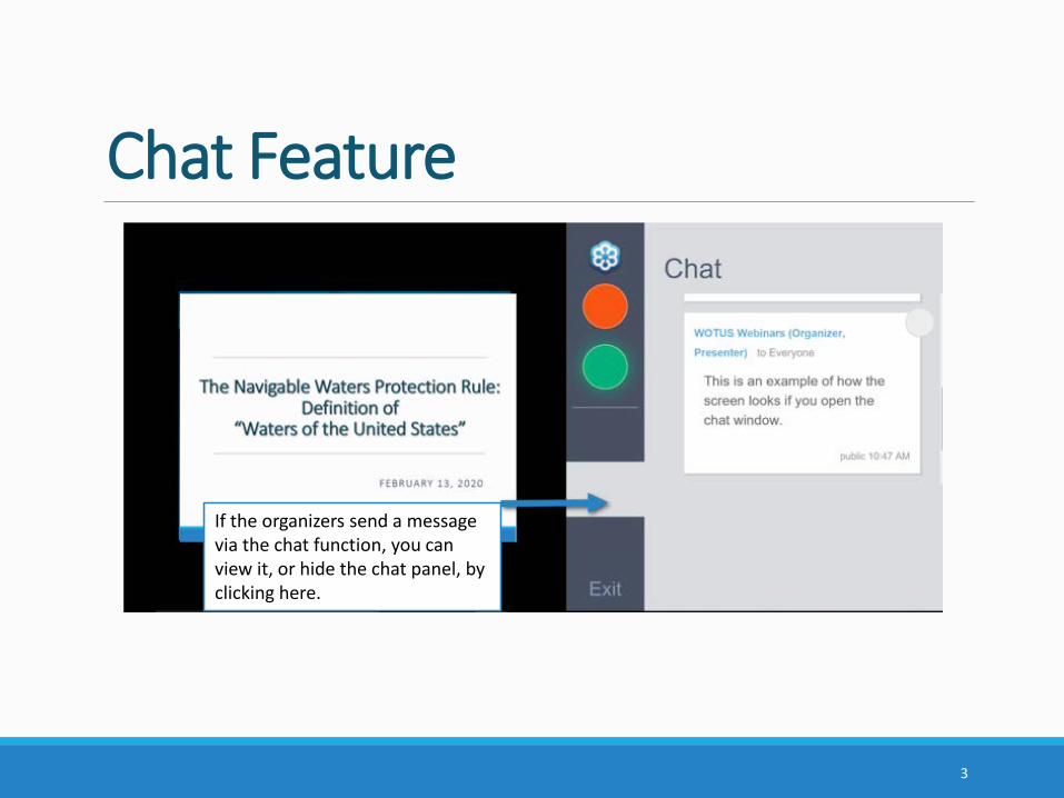
Chat Feature
If the organizers send a message via the chat function, you can view it, or hide the chat panel, by clicking here.
3
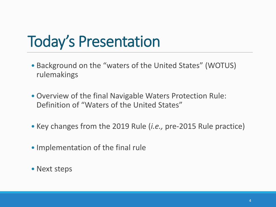
Today’s Presentation• Background on the “waters of the United States” (WOTUS)
rulemakings
• Overview of the final Navigable Waters Protection Rule: Definition of “Waters of the United States”
• Key changes from the 2019 Rule (i.e., pre-2015 Rule practice)
• Implementation of the final rule
• Next steps
4
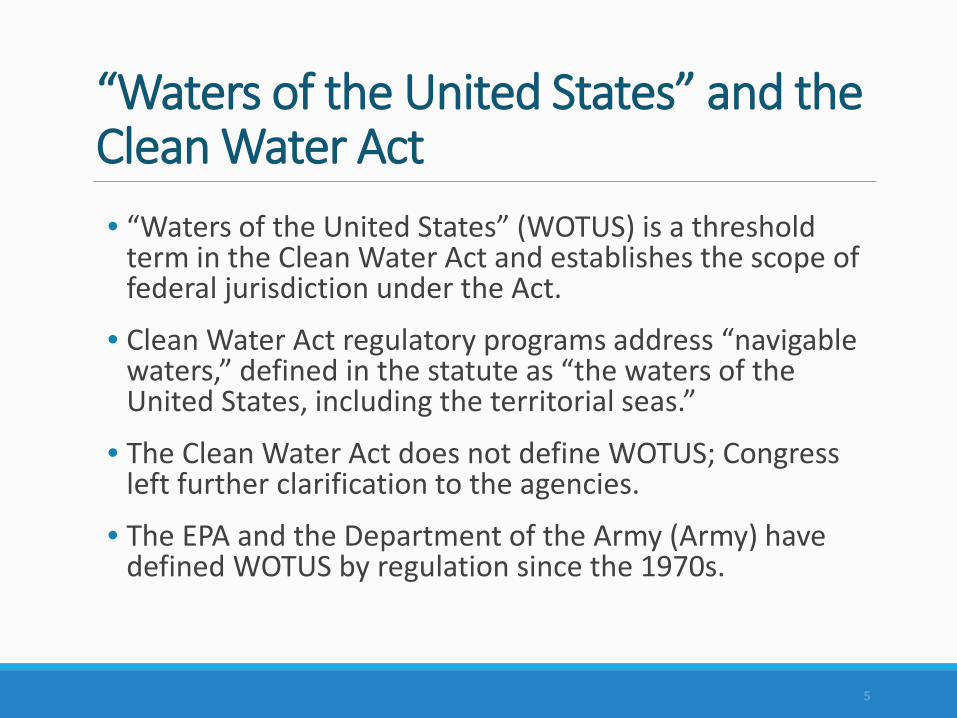
“Waters of the United States” and the Clean Water Act• “Waters of the United States” (WOTUS) is a threshold
term in the Clean Water Act and establishes the scope of federal jurisdiction under the Act.
• Clean Water Act regulatory programs address “navigable waters,” defined in the statute as “the waters of the United States, including the territorial seas.”
• The Clean Water Act does not define WOTUS; Congress left further clarification to the agencies.
• The EPA and the Department of the Army (Army) have defined WOTUS by regulation since the 1970s.
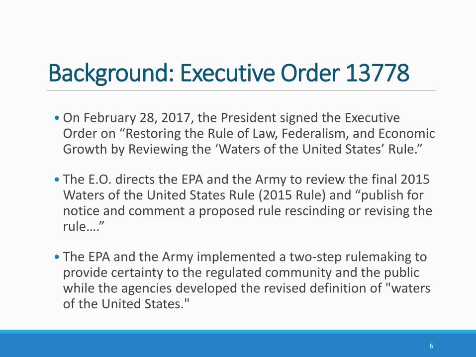
Background: Executive Order 13778
• On February 28, 2017, the President signed the Executive Order on “Restoring the Rule of Law, Federalism, and Economic Growth by Reviewing the ‘Waters of the United States’ Rule.”
• The E.O. directs the EPA and the Army to review the final 2015 Waters of the United States Rule (2015 Rule) and “publish for notice and comment a proposed rule rescinding or revising the rule….”
• The EPA and the Army implemented a two-step rulemaking to provide certainty to the regulated community and the public while the agencies developed the revised definition of "waters of the United States."
6
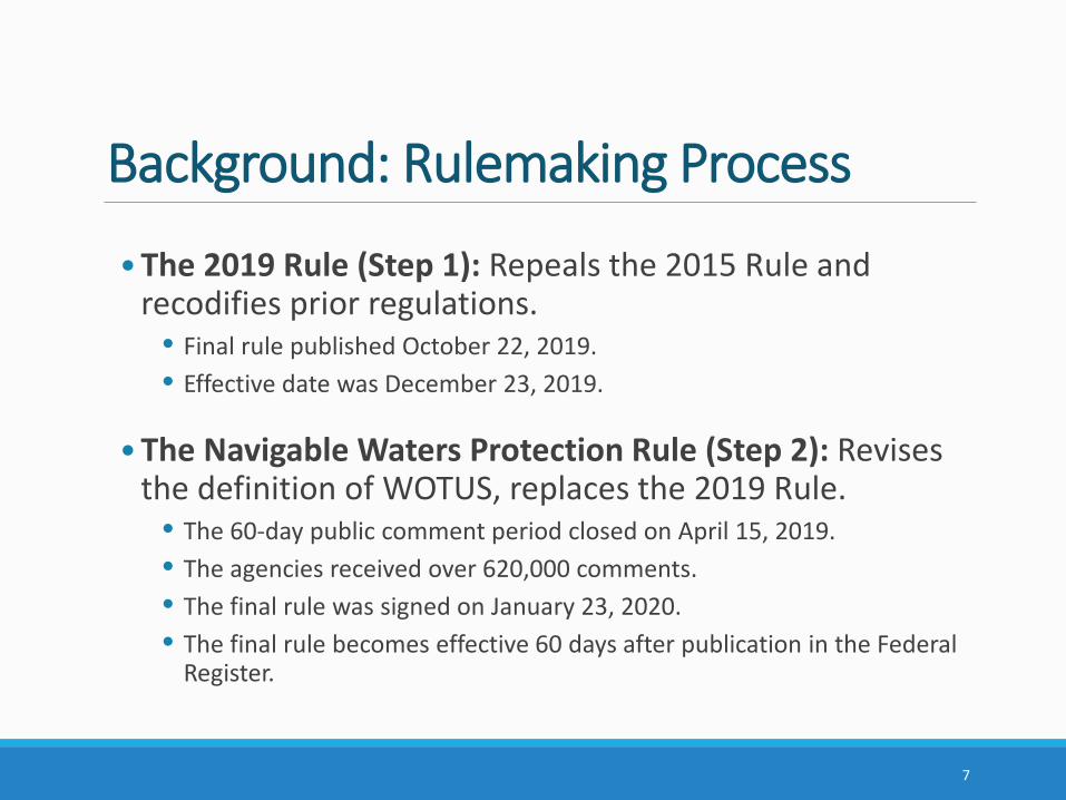
Background: Rulemaking Process
•The 2019 Rule (Step 1): Repeals the 2015 Rule and recodifies prior regulations.
• Final rule published October 22, 2019.• Effective date was December 23, 2019.
•The Navigable Waters Protection Rule (Step 2): Revises the definition of WOTUS, replaces the 2019 Rule.
• The 60-day public comment period closed on April 15, 2019.• The agencies received over 620,000 comments.• The final rule was signed on January 23, 2020. • The final rule becomes effective 60 days after publication in the Federal
Register.
7
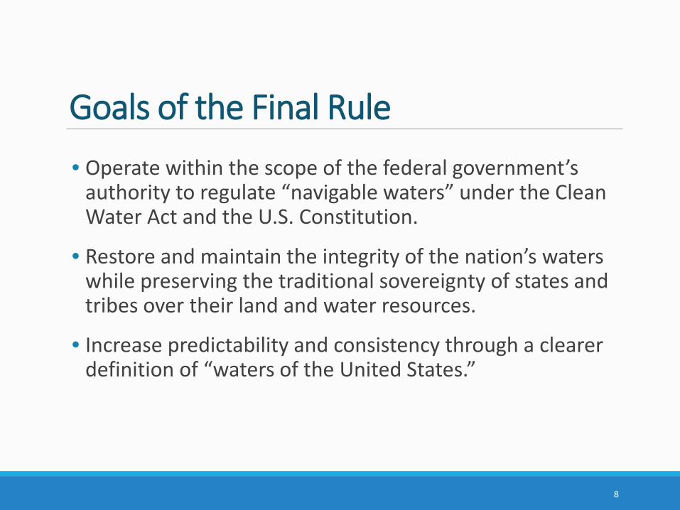
Goals of the Final Rule• Operate within the scope of the federal government’s
authority to regulate “navigable waters” under the Clean Water Act and the U.S. Constitution.
• Restore and maintain the integrity of the nation’s waters while preserving the traditional sovereignty of states and tribes over their land and water resources.
• Increase predictability and consistency through a clearer definition of “waters of the United States.”
8
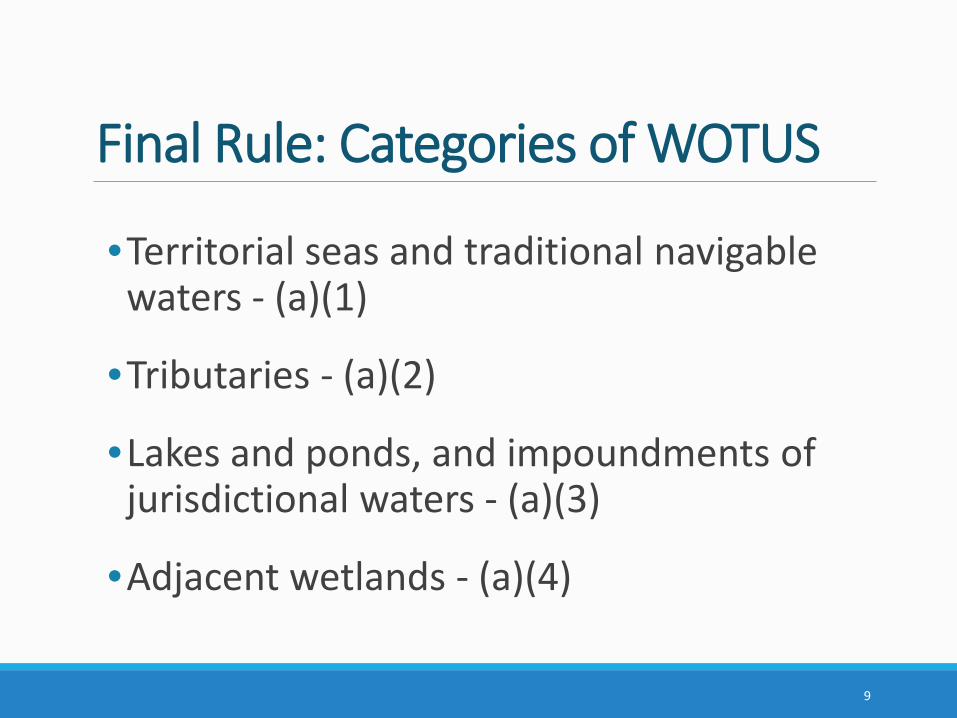
Final Rule: Categories of WOTUS
•Territorial seas and traditional navigable waters - (a)(1)
•Tributaries - (a)(2)
•Lakes and ponds, and impoundments of jurisdictional waters - (a)(3)
•Adjacent wetlands - (a)(4)
9
Key ChangesKey changes from the 2019 Rule (i.e., pre-2015 Rule practice):
• Four categories of jurisdictional waters and twelve categories of excluded waters/features.
• Combines the categories of traditional navigable waters and territorial seas.
• No standalone interstate waters category.
• No case-specific significant nexus analysis.
• New category of lakes, ponds, and impoundments of jurisdictional waters.
10
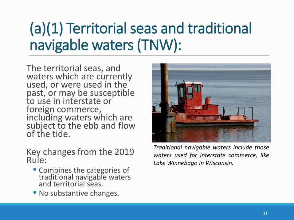
(a)(1) Territorial seas and traditional navigable waters (TNW):
The territorial seas, and waters which are currently used, or were used in the past, or may be susceptible to use in interstate or foreign commerce, including waters which are subject to the ebb and flow of the tide.
Key changes from the 2019 Rule:
• Combines the categories of traditional navigable waters and territorial seas.
• No substantive changes.
11
Traditional navigable waters include thosewaters used for interstate commerce, likeLake Winnebago in Wisconsin.
(a)(2) Tributaries:• “Tributary” means a naturally occuring surface water channel that
contributes surface water flow to a paragraph (a)(1) water in a typical year either directly or through one or more paragraph (a)(2)-(4) waters. A tributary must be perennial or intermittent in a typical year.
• A tributary does not lose its jurisdictional status if it contributes surface water flow to a downstream jurisdictional water in a typical year through a channelized non-jurisdictional surface water feature, through a subterranean river, through a culvert, dam, tunnel, or similar artificial feature, or through a debris pile, boulder field, or similar natural feature.
• The alteration or relocation of a tributary does not modify its jurisdictional status as long as it continues to satisfy the flow conditions of the definition.
• The term tributary includes a ditch that either relocates a tributary, is constructed in a tributary, or is constructed in an adjacent wetland as long as the ditch satisfies the flow conditions of this definition.
12
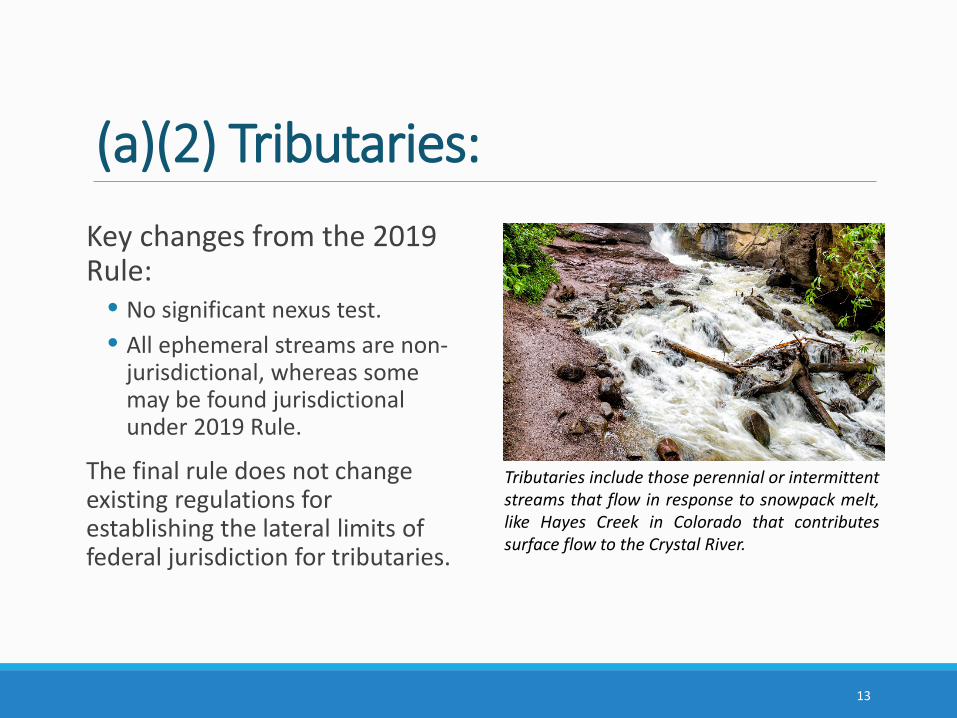
(a)(2) Tributaries: Key changes from the 2019 Rule:
• No significant nexus test.• All ephemeral streams are non-
jurisdictional, whereas some may be found jurisdictional under 2019 Rule.
The final rule does not change existing regulations for establishing the lateral limits of federal jurisdiction for tributaries.
13
Tributaries include those perennial or intermittentstreams that flow in response to snowpack melt,like Hayes Creek in Colorado that contributessurface flow to the Crystal River.
Key Definitions in the Final RulePerennial:• The term perennial means surface water flowing continuously year-round.
Intermittent:• The term intermittent means surface water flowing continuously during
certain times of the year and more than in direct response to precipitation (e.g., seasonally when the groundwater table is elevated or when snowpack melts).
Ephemeral:• The term ephemeral means surface water flowing or pooling only in direct
response to precipitation (e.g., rain or snow fall).
Snowpack:• The term snowpack means layers of snow that accumulate over extended
periods of time in certain geographic regions or at high elevation (e.g., in northern climes or mountainous regions).
14
(a)(3) Lakes and ponds, and impoundments of jurisdictional waters:• The term means standing bodies of open water that contribute
surface water flow to a paragraph (a)(1) water in a typical year either directly or through one or more paragraph (a)(2)-(4) waters.
• A lake, pond, or impoundment does not lose its jurisdictional status if it contributes surface water flow to a downstream jurisdictional water in a typical year through a channelized non-jurisdictional surface water feature (e.g., an ephemeral stream, non-jurisdictional ditch), through a culvert, dam, tunnel, or similar artificial feature, or through a debris pile, boulder field, or similar natural feature.
• A lake, pond, or impoundment is also jurisdictional if it is inundated by flooding from a paragraph (a)(1)-(3) water in a typical year.
15
(a)(3) Lakes and ponds, and impoundments of jurisdictional waters:
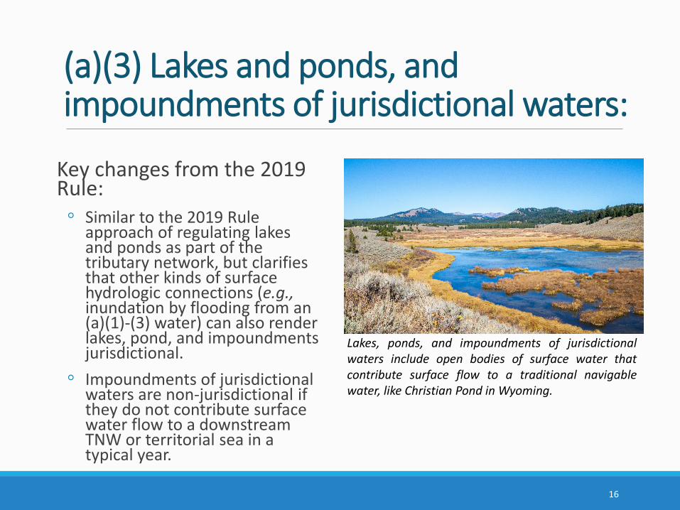
Key changes from the 2019 Rule:◦ Similar to the 2019 Rule
approach of regulating lakes and ponds as part of the tributary network, but clarifies that other kinds of surface hydrologic connections (e.g.,inundation by flooding from an (a)(1)-(3) water) can also render lakes, pond, and impoundments jurisdictional.
◦ Impoundments of jurisdictional waters are non-jurisdictional if they do not contribute surface water flow to a downstream TNW or territorial sea in a typical year.
16
Lakes, ponds, and impoundments of jurisdictionalwaters include open bodies of surface water thatcontribute surface flow to a traditional navigablewater, like Christian Pond in Wyoming.
(a)(4) Adjacent wetlands:The term means wetlands that: • abut, meaning to touch at least at one point or side of, a paragraph
(a)(1)-(3) water; • are inundated by flooding from a paragraph (a)(1)-(3) water in a typical
year;• are physically separated from a paragraph (a)(1)-(3) water only by a
natural berm, bank, dune, or similar natural feature; or• are physically separated from a paragraph (a)(1)-(3) water only by an
artificial dike, barrier, or similar artificial structure so long as that structure allows for a direct hydrologic surface connection in a typical year through a culvert, flood or tide gate, pump, or similar artificial feature.
An adjacent wetland is jurisdictional in its entirety when a road or similar artificial structure divides the wetland, as long as the structure allows for a direct hydrologic surface connection through or over that structure in a typical year.
17
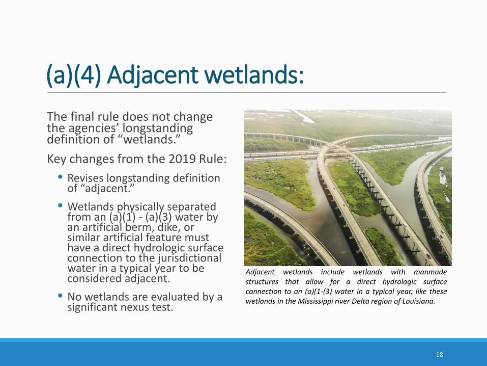
(a)(4) Adjacent wetlands:The final rule does not change the agencies’ longstanding definition of “wetlands.” Key changes from the 2019 Rule:
• Revises longstanding definition of “adjacent.”
• Wetlands physically separated from an (a)(1) - (a)(3) water by an artificial berm, dike, or similar artificial feature must have a direct hydrologic surface connection to the jurisdictional water in a typical year to be considered adjacent.
• No wetlands are evaluated by a significant nexus test.
18
Adjacent wetlands include wetlands with manmadestructures that allow for a direct hydrologic surfaceconnection to an (a)(1-(3) water in a typical year, like thesewetlands in the Mississippi river Delta region of Louisiana.
DitchesThe term ditch means a constructed or excavated channel used to convey water.
Ditches are not an independent category of WOTUS; ditches are jurisdictional where they are:
• TNWs, including those subject to the ebb and flow of the tide (i.e., are(a)(1) waters);
• Either constructed in or relocate a tributary, or are constructed in an adjacent wetland, and satisfy the flow conditions of the tributary definition (i.e., are (a)(2) waters); or
• Constructed in an adjacent wetland and develop wetland characteristics (i.e., are (a)(4) waters).
Key changes from the 2019 Rule: • Codifies that ditches constructed in upland (other than TNWs and
rerouted tributaries), certain ditches constructed in wetlands, and ditches with ephemeral flow are not jurisdictional.
19
Definition of “Typical Year”The term typical year means: “when precipitation and other climatic variables are within the normal periodic range (e.g., seasonally, annually) for the geographic area of the applicable aquatic resource based on a rolling thirty-year period.”
“Typical year” is a key concept for establishing jurisdiction based on surface water flow between a relatively permanent body of water (i.e., a perennial or intermittent surface water channel, a standing body of open water) and TNWs, and between wetlands and other jurisdictional waters.
Application of the typical year concept ensures that the hydrologic flows and surface water connections necessary to establish jurisdiction are characterized based on normal climatic conditions (i.e., neither too wet or too dry).
When determining whether climatic conditions are typical, the period of time examined may be a year, or a shorter or longer time period, depending on factors relevant to the water resource of interest.
20
Waters/Features Excluded from Final WOTUS Definition• Waters not listed as WOTUS• Groundwater• Ephemeral features• Diffuse stormwater run-off• Ditches not identified as WOTUS• Prior converted cropland (PCC)• Artificially irrigated areas• Artificial lakes and ponds • Water-filled depressions incidental to mining or construction activity• Stormwater control features• Groundwater recharge, water reuse, and wastewater recycling structures• Waste treatment systems
21
Key Elements of ExclusionsUpland: • The term upland means any land area that under normal circumstances does not satisfy
all three wetland factors (i.e., hydrology, hydrophytic vegetation, hydric soils) identified in paragraph (c)(16) and does not lie below the ordinary high water mark or the high tide line of a jurisdictional water.
• Features constructed or excavated in upland or in non-jurisdictional waters must be constructed/excavated wholly in upland or non-jurisdictional waters to meet applicable exclusions.
Exclusions as surface water connections:• Certain excluded features may convey surface water flow to a downstream jurisdictional
water in a typical year, thereby serving as a connection for upstream and downstream jurisdictional tributaries, lakes, ponds, and impoundments. This does not include groundwater or diffuse stormwater runoff/overland sheet flow.
• Excluded features that convey surface water flow between jurisdictional waters in a typical year do not become WOTUS themselves.
22
Waters/Features Excluded from Final WOTUS Definition(b)(1) Waters not listed as WOTUS:
• Categorically excludes all waters not listed as WOTUS in paragraph (a) of the regulation.
• Clarifies that a feature is not jurisdictional just because it is not explicitly excluded in paragraph (b).
• Intended to avoid confusion caused by features being called different names across the country.
• No change in practice, effectively how the 2019 Rule is implemented.
(b)(2) Groundwater:• Excludes groundwater, including groundwater drained through subsurface
drainage features.
• The agencies have never interpreted WOTUS to include groundwater, and the approach is unchanged from the 2019 Rule.
23
Waters/Features Excluded from Final WOTUS Definition(b)(3) Ephemeral features, including ephemeral streams, swales, gullies, rills, and pools:
• Emphasizes that ephemeral streams and other ephemeral features are not WOTUS under the final rule. These features may serve as connections between upstream relatively permanent waters and downstream jurisdictional waters that maintain jurisdiction of upstream waters.
• No categorical exclusion for ephemeral features in the 2019 Rule; some ephemeral streams were found jurisdictional as tributaries under 2019 Rule following a significant nexus test.
(b)(4) Diffuse stormwater run-off and directional sheet flow over upland:• Clarifies that diffuse run-off and directional sheet flow over upland are excluded.
These features cannot serve as connections to enable upstream perennial and intermittent waters to be jurisdictional.
• No specific exclusion for diffuse run-off or sheet flow in the 2019 Rule, but effectively how the 2019 Rule is implemented.
24
Waters/Features Excluded from Final WOTUS Definition
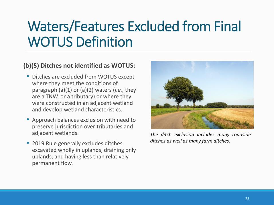
(b)(5) Ditches not identified as WOTUS:
• Ditches are excluded from WOTUS except where they meet the conditions of paragraph (a)(1) or (a)(2) waters (i.e., they are a TNW, or a tributary) or where they were constructed in an adjacent wetland and develop wetland characteristics.
• Approach balances exclusion with need to preserve jurisdiction over tributaries and adjacent wetlands.
• 2019 Rule generally excludes ditches excavated wholly in uplands, draining only uplands, and having less than relatively permanent flow.
25
The ditch exclusion includes many roadsideditches as well as many farm ditches.
Waters/Features Excluded from Final WOTUS Definition
(b)(6) Prior converted cropland (PCC):
• The term prior converted cropland means any area that, prior to December 23, 1985, was drained or otherwise manipulated for the purpose, or having the effect, of making production of an agricultural product possible.
• An area is no longer considered prior converted cropland for purposes of the Clean Water Act when the area is abandoned and has reverted to wetland. Abandonment occurs when prior converted cropland is not used for, or in support of, agricultural purposes at least once in the immediately preceding five years.
The final rule only uses the abandonment principle, and no longer considers “change in use” which was implemented under the 2019 Rule.
26
Waters/Features Excluded from Final WOTUS Definition(b)(7) Artificially irrigated areas:• Excludes artificially irrigated areas, including fields flooded for agricultural production,
that would revert to upland should application of irrigation water to that area cease.
(b)(8) Artificial lakes and ponds:• Excludes artificial lakes and ponds, including water storage reservoirs and farm,
irrigation, stock watering, and log cleaning ponds, constructed or excavated in upland or in non-jurisdictional waters, so long as those artificial lakes and ponds are not impoundments of jurisdictional waters.
(b)(9) Water-filled depressions incidental to mining or construction activity:• Excludes water-filled depressions constructed or excavated in upland or in non-
jurisdictional waters incidental to mining or construction activity, and pits excavated in upland or in non-jurisdictional waters for the purpose of obtaining fill, sand, or gravel.
27
Waters/Features Excluded from Final WOTUS Definition(b)(10) Stormwater control features:• Excludes stormwater control features constructed or excavated in upland or
non-jurisdictional waters to convey, treat, infiltrate, or store stormwater run-off.
• Exclusion helps to avoid disincentives to environmentally beneficial practices such as green infrastructure for controlling stormwater.
(b)(11) Wastewater recycling structures:• Excludes groundwater recharge, water reuse, and wastewater recycling
structures, including detention, retention, and infiltration basins and ponds, constructed or excavated in upland or in non-jurisdictional waters.
• Exclusion helps to avoid discouraging, or creating barriers to, water reuse and recycling projects.
28
Waters/Features Excluded from Final WOTUS Definition(b)(12) Waste treatment systems:• The term waste treatment system includes all components, including
lagoons and treatment ponds (such as settling or cooling ponds), designed to either convey or retain, concentrate, settle, reduce, or remove pollutants, either actively or passively, from wastewater prior to discharge (or eliminating any such discharge).
• Waste treatment systems have been excluded from the definition of WOTUS since 1979. The final rule defines waste treatment systems and the components of the exclusion in the regulation for the first time.
29
Implementation of the Final Rule
30
Determining contribution of flow downstream:• May use, for example, USGS maps, state and local maps, aerial
photography, or other remote sensing information or models that have been verified to be reliable to assess a feature’s flow path.
• A trace analysis in a Geographic Information System (GIS), can be used to trace the flow path from a user selected point on a map, downstream along the stream network until the network ends. The USGS StreamStats application incorporates such a tool called the “Flow (Raindrop) Path,” available at: https://streamstats.usgs.gov/ss/.
Implementation of the Final Rule
31
Determining perennial or intermittent flow:• May use a combination of the best available mapping sources,
including the NHD* or local maps, as well as other remote tools and datasets such as aerial photographs, NRCS hydrologic tools and soil maps, NOAA snow maps, desktop tools that estimate the discharge sufficient to generate intermittent or perennial flow, or modeling tools.
• Site visits may be needed to perform on-site observations of hydrology or collect indicators of perennial or intermittent flow.
• Where available, streamflow duration assessment methods (SDAMs) that use physical and biological indicators to determine the flow duration class of a stream reach in a single site visit may be used.
* As described in the Resource and Programmatic Assessment for the final rule, the agencies note that NHD at High Resolution does not distinguish intermittent from ephemeral features in most parts of the country and may not accurately identify on-the-ground flow conditions.
Implementation of the Final RuleSources of information used to evaluate surface flows and surface water connections should be interpreted within the context of the “typical year” concept (i.e., based on normal climatic conditions that are neither too wet or too dry).
Determining surface flow and surface water connections that occur in a typical year:
• The agencies have developed an Antecedent Precipitation Tool (APT) that collects NOAA precipitation from nearby weather stations and compares precipitation from the time period of interest with precipitation data from the past 30 years, that may be used to determine whether precipitation conditions fall within the normal range.
• Other data sources and tools that may be used to inform whether hydrologic flows or surface water connections occur under normal climatic conditions include: drought indices, water-budget models, snow telemetry data, continuous flow monitor data, physical and biological indicators of typical flow conditions, or remote sensing data and hydrologic models.
32
Implementation of the Final RuleDetermining adjacency:
• A variety of remote tools and resources may be used to inform a wetland jurisdictional determination, including, federal, state and local maps, aerial photography and satellite imagery.
• The agencies will continue to use existing resources, methods, and practices to verify the presence of wetlands and to delineate wetland boundaries (e.g., the Corps’ 1987 Wetland Delineation Manual).
• Natural berms, banks, dunes, or similar natural features that physically separate wetlands from jurisdictional waters may in certain instances be identified through on-site observations or remotely using aerial photography and satellite imagery, or other remote sensing information.
• Artificial structures that allow for a direct hydrologic surface connection (e.g., through a culvert, tide gate, pump, or similar artificial feature) may in certain instances be identified through on-site observations or remotely using construction design plans, permitting data, state and local information, or levee or drainage district information.
33
Implementation of the Final RuleDetermining inundation by flooding:• May use a combination of remote tools and datasets such as USGS stream
gage records, recurrence intervals of peak flows, wetland surface water level records, flood records, aerial photography and satellite imagery, or inundation modeling techniques and tools.
• The Corps’ Hydrologic Engineering Center’s River Analysis System (HEC-RAS) software allows users to perform inundation mapping and create inundation depth datasets. The HEC-RAS software is available for download at: https://www.hec.usace.army.mil/software/hec-ras/.
• Site visits may be needed to perform on-site observations of hydrology or field-based indicators of recent inundation (e.g., the presence of water marks, sediment and drift deposits, water-stained leaves, or algal mats).
34

Next Steps• Upon publication in the Federal Register, additional supporting documents (e.g., the agencies’ Response to Comments document) will be available in the public docket, identified by Docket ID No. EPA-HQ-OW-2018-0149, to the Federal eRulemaking Portal: https://www.regulations.gov.
• A beta-version of the Antecedent Precipitation Tool (APT) will be made publicly available for download on the EPA’s website in the near future.
• Regionally-specific SDAMs will be released over time and opportunities for the public to provide comment on the use of these methods will be provided. Additional tools may be developed in the future.
• New guidance may be developed, or existing guidance may be updated, if and as necessary, to facilitate implementation of the final rule.
35
For Further Information
Visit https://www.epa.gov/nwpr for more information about the final rule, including the pre-publication copy, supporting analyses, and fact sheets.
Additional questions may be directed to the EPA at: [email protected] or to the Corps at: [email protected].
36


