McChesney 29 Figure 10 — The Tract, Kenneth Hahn Park and the Inglewood Oil Fields (Google Earth) The 1,463 active wells in the IOF make up 28% of total wells in LA County (Liberty Hill 2015). According the report “Drilling Down: oil extraction in urban Los Angeles,” within 1500 feet of the Inglewood Oil Field, 79 percent of the population are people of color, 55 percent are living in poverty and 30 percent have less than a high school diploma (Liberty Hill 2015). According to the “Drilling Down” report: Residents in Los Angeles communities living near oil wells routinely report symptoms of dizziness, nosebleeds, headaches, and exacerbated asthma… There is a growing literature linking unconventional oil and gas drilling with increased air pollution, water contamination, noise pollution, and stress. Environmental Justice… communities often suffer from the cumulative effects of poverty, lack of access to adequate health care, and illnesses that can leave individuals more vulnerable to the toxic effects of pollution… In the Los Angeles area, poor air quality is an ongoing problem for low-income communities of color, who are disproportionately exposed to air toxics. (Liberty Hill 2015) In 2006, Culver City residents had to be evacuated on two separate occasions for noxious odors produced by the IOF. Plains Exploration & Production (PXP), the IOF operator at the time, said this was a “once-in-a-lifetime event” and that the odors were “nonhazardous,” which really only meant non-explosive. At the same time, PXP released plans to drill 1,000 new wells over the coming decades; previously, community members made a plan to turn the area into One Big Park. The Greater Baldwin Hills Alliance (GBHA) was formed “to represent the 50,000 households living immediately adjacent to the oil field.” GHBA included Community Health Councils, the City Project, neighborhood associations and block clubs. Pushed by the GBHA, LA County eventually prohibited new drilling and developed an ordinance to better regulate the IOF. (Liberty Hill 2015) In 2008, after a number of public meetings and hours of public comment, the Los Angeles County Board of Supervisors adopted the Baldwin Hills Community Standards District (CSD). The CSD provided community protection carrying the force of law. It limited new drilling to 600 wells and “required a landscaping plan, the formation of a community advisory board and multi-agency coordination council, and the installation of new air quality equipment among more than 62 pages of regulations.” Four lawsuits were filed due to shortcomings of the
Transcript
McChesney 29
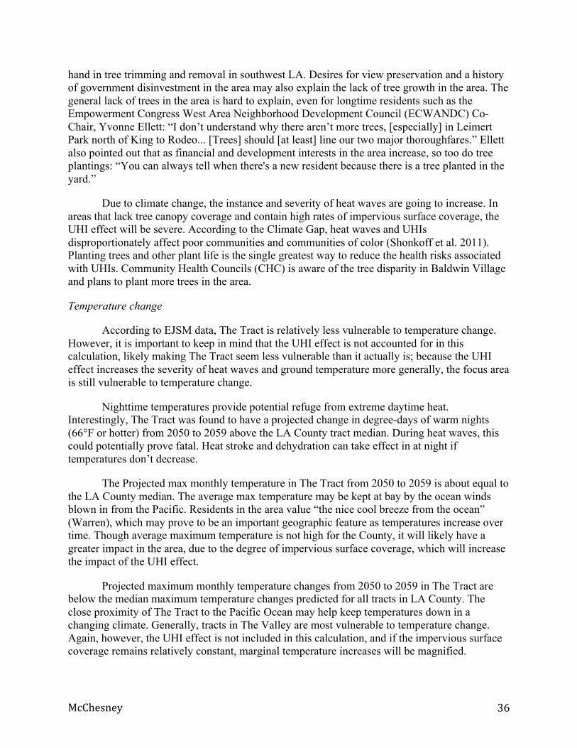
Figure 10 — The Tract, Kenneth Hahn Park and the Inglewood Oil Fields (Google Earth)
The 1,463 active wells in the IOF make up 28% of total wells in LA County (Liberty Hill
2015). According the report “Drilling Down: oil extraction in urban Los Angeles,” within 1500 feet of the Inglewood Oil Field, 79 percent of the population are people of color, 55 percent are living in poverty and 30 percent have less than a high school diploma (Liberty Hill 2015). According to the “Drilling Down” report:
Residents in Los Angeles communities living near oil wells routinely report symptoms of dizziness, nosebleeds, headaches, and exacerbated asthma… There is a growing literature linking unconventional oil and gas drilling with increased air pollution, water contamination, noise pollution, and stress. Environmental Justice… communities often suffer from the cumulative effects of poverty, lack of access to adequate health care, and illnesses that can leave individuals more vulnerable to the toxic effects of pollution… In the Los Angeles area, poor air quality is an ongoing problem for low-income communities of color, who are disproportionately exposed to air toxics. (Liberty Hill 2015)
In 2006, Culver City residents had to be evacuated on two separate occasions for noxious odors produced by the IOF. Plains Exploration & Production (PXP), the IOF operator at the time, said this was a “once-in-a-lifetime event” and that the odors were “nonhazardous,” which really only meant non-explosive. At the same time, PXP released plans to drill 1,000 new wells over the coming decades; previously, community members made a plan to turn the area into One Big Park. The Greater Baldwin Hills Alliance (GBHA) was formed “to represent the 50,000 households living immediately adjacent to the oil field.” GHBA included Community Health Councils, the City Project, neighborhood associations and block clubs. Pushed by the GBHA, LA County eventually prohibited new drilling and developed an ordinance to better regulate the IOF. (Liberty Hill 2015)
In 2008, after a number of public meetings and hours of public comment, the Los Angeles County Board of Supervisors adopted the Baldwin Hills Community Standards District (CSD). The CSD provided community protection carrying the force of law. It limited new drilling to 600 wells and “required a landscaping plan, the formation of a community advisory board and multi-agency coordination council, and the installation of new air quality equipment among more than 62 pages of regulations.” Four lawsuits were filed due to shortcomings of the
McChesney 30
CSD, which resulted in “significantly strengthened restrictions by further reducing the number of new wells allowed, increasing air quality monitoring, setting more stringent noise limits, and requiring recurring health and environmental justice assessments.” With these provisions, The CSD is now seen as “a model approach for how health-protective and community-responsive mechanisms can be required of oil operations.” Studies showed that the PXP expansion plans would have “worst-case health risk associated with future operations exceeded applicable health risk criteria for individual cancer risk and acute non-cancer risk,” however, with the CDS regulations in place, “health risk impacts would be considered to be less than significant.” (“Drilling Down” 2015)
Background on development and the New Community Plan
New developments are on the horizon for The Tract and surrounding area. The Baldwin-Hills Crenshaw Plaza is a historic community hub that has recently received attention and large investments (LA Times 2015). Marlton Square off MLK Jr Blvd was formerly an apartment complex; after decades of development woes, Kaiser Permanente has purchased the land and is constructing a large new healthcare facility (Sharp 2014 b). New Metro light rail lines – specifically the Metro Expo Line (opened in 2012) and Crenshaw/LAX Line (construction started, opens in 2019) – are ushering new development interest and community fears. New developments and Metro expansion are discussed in detail in the Findings section.
The Tract and peripheral area fall under purview of the West Adams-Baldwin Hills-Leimert Community Plan (The Plan), which has not been updated in over 30 years. The Plan will make a number of zoning changes in the surrounding area, but none directly in The Tract. The stated goal of the plan is “to shape positive community change by harmonizing the Plan Area’s unique character through encouraging sustainable land use patterns as introduced through citywide policies and regional initiatives.” The Plan continues to acknowledge the cultural and historical significance of this place: “The Baldwin Hills neighborhoods stretching from Leimert Park to Culver City, for instance, are collectively identified as the largest geographically contiguous, middle and upper-income African-American area in the United States” (“Draft Plan” 2012). The Plan is discussed in detail in the Findings and Recommendations sections.
McChesney 31
Findings
I investigated LA County’s most climate vulnerable tract area (tract 2362.02, as identified by the CCPVST) in order to gain a better understanding of what climate vulnerability means, how it occurs and what can be done about it. Over the course of eight interviews with community members, four interviews with government officials, attendance of four public meetings and three days of field observation, I found the following. The tables below will be referenced throughout the Findings section. The tables were created using data collected with the help of principal investigators from the EJSM and CCPVST and complied by the author. For justification of the CCPVST and EJSM indicators, see Appendix 1.
Tables
Climate Change Population Vulnerability Screening Tool
The Tract (2362.02)
Rank compared to LA County
(1 = low; 5 = high)
Households without a car 60% 5
Households elderly (over 65) living alone 10% 5
Unique transit routes 0 3
A/C ownership (percent of households) 1% 5
Tree canopy coverage (average percent of land coverage)
0% 2
Impervious surface coverage (average percent of land coverage)
73% 5
Sea-rise risk 0 1
Flood risk 1.51 4
Fire risk 2.45 4
* CCPVST acquired data, compiled by McChesney
McChesney 32
Climate Vulnerability Indicators (EJSM) The Tract (2362.02)
LA County (average)
No vehicle 32% 10%
Elderly (over 65) living alone 3.1% 2.6%
Tree canopy coverage (as a percentage of total land coverage)
2.4% 2.2%
Impervious surface coverage (as a percentage of total land coverage)
76% 59%
Max temperature change 79% 84%
Average maximum temperature 299.5 301.5
Warm nights change 95% 86%
* EJSM acquired data, compiled by McChesney
Social and Health Vulnerability Indicators (EJSM) The Tract (2362.02)
LA County (average)
Population density (per square mile) 6192 4187
Non-Anglo (PoP) 99% 72%
Renters (PoP) 98% 50%
Linguistic isolation (percent of households with no English speakers)
20% 14%
Poverty (twice the federal level) 27% 60%
Less than highschool education (percent of population) 38% 25%
Median home value $123,100 $454,578
Adverse births (PoP) 17% 12%
Young people under the age of 5 (PoP) 10% 6%
Elderly people over the age of 65 (PoP) 10% 16%
Voter turnout (PoP) 48% 58%
* EJSM acquired data, compiled by McChesney
McChesney 33
Hazard Proximity and Land Use Indicators (EJSM) The Tract (2362.02)
LA County (average)
Population with sensitive land uses 0.20 0.5
Hazardous site 0.0 0.47
Population with sensitive land use and hazardous site 0.20 0.52
Population with close proximity to hazardous site 0.28 1.03
Population with close proximity to hazardous site and with sensitive land use
0.48 1.09
Population with traffic proximity 0.16 0.20
Population with close proximity to hazardous site, sensitive land uses and traffic
0.64 1.29
* EJSM acquired data, compiled by McChesney
Health Risk and Exposure Indicators (EJSM) The Tract (2362.02)
LA County (average)
Particulate matter (PM25) 11.6 11.6
Ozone 0.01 0.07
Pesticides 0.0 6.4
Toxic concentration 2,233 4,610
Cancer risk 0.001 0.001
Respiratory hazard 4.7 5.3
* EJSM acquired data, compiled by McChesney
McChesney 34
Ecological Vulnerability: Historical Disinvestment in the Built Environment
• 76% of land coverage is impervious, while only 2% is tree canopy • “I don’t understand why there aren’t more trees” • “People don’t have AC because we get a nice cool breeze from the ocean, so we don’t
really need them here.”
Impervious surface coverage
Impervious surfaces cover over three quarters of the total landmass in The Tract, while The County tract average closer to one half. Impervious surfaces retain heat and exacerbate the threat of heat waves through what is known as the “urban heat island effect” (UHI). The disparity can be partly explained by two existing features of the built environment: first, a large plot of commercial land that sits in the northwestern corner of the tract where two major thoroughfares, La Brea and Rodeo, meet; second, the nature of high density of multi-family unit apartment buildings that make up the residential community. Impervious surfaces dominate the general landscape of the surrounding area as well; the many multi-lane thoroughfares and the Inglewood Oil Fields significantly add to the degree of impervious surface coverage in the area.
Inglewood Oil Fields
Compacted urban soils are considered a highly impervious surface. Urban oil fields are one example of impervious soil. Covering over 1,000 acres of land, the Inglewood Oil Field (IOF) is the largest urban oil field in the country. In 2008, community members came together to sue the Inglewood Oil Field, and eventually, the Baldwin Hills Community Standards District (CSD) was born. Community members continue to meet monthly at the Kenneth Hahn Community Center for CSD meetings. The oil field has been restricted to a size that is justifiable by science and law, 1,000 acres, but community members still feel that the IOF is detrimental to the community. At the CSD meetings, a spectrum of land value ideologies is undeniably apparent:
0%
20%
40%
60%
80%
The Tract LA County
76% 59%
Impervious surface coverage
McChesney 35
While the oil companies perpetually want to expand drilling and subsequent profiting, the community leaders want to abolish extraction entirely and reclaim the land as public space.
The CSD meeting is a metaphor for the current confinement of the IOF — community leaders want to further regulate and eventually eliminate the oil field, while the IOF operators, Freeport Marine Oil & Gas (FMOG) and PxP before them, are engaged in a adamant defense of their economic liberty. The County is the intermediary between these two opposing forces. One County attorney has attended almost every single CSD meetings for the past eight years, and he said that the same arguments have arisen at every meeting.
FMOG rejected my request for a tour of the IOF and was unresponsive to my requests for an interview. Community members continue to experience the visual and olfactory impact of living proximate to a massive oil field. Community members and visitors alike have the opportunity to see the sprawling fields and inhale the fumes from the vistas of Kenneth Hahn Regional Park. As a giant impervious surface — not to mention the GHG emission impact — the IOF is a significant driver of climate vulnerability in the area. Community members and activists categorize the IOF with other health disparities in the built environment. “I live in the 90008 zip code… we are located next to the largest urban oil fields in the country, the area is park poor, and also has very few supermarkets and access to fresh vegetables,” said Irma Munoz, Founder and Director of Mujeres de la Tierra, a community organization focused on environmental health. While the community at large hopes for the expansion of Kenneth Hahn for creation of One Big Park, the oil company hopes to drill 1,000 new wells. At the present moment, the ambitions of both sides have been quelled, and the IOF sits in a state of perpetual drilling confined to current boundaries.
Tree canopy coverage
Tree canopy only covers between 0 percent (according to CCPVST data) and 2.4 percent (according to EJSM data) of total landmass in The Tract. Of that small percentage, most trees are concentrated in the southern corner of The Tract on the grounds of the Jim Gilliam Recreation Complex. As a raw percentage, The Tract surface coverage is about the same as the median LA County tract rate; however, the County average is dismally low and the percentage for The Tract needs to be interrogated further. There are a number of factors and hypothesis that contribute to the lack of tree canopy coverage in The Tract and surrounding area.
Overall, there are many documented and hypothesized reasons why there is a severe lack of trees in the area. Metro, LAPD and the Endeavour Space Shuttle parade may all have had a
McChesney 36
hand in tree trimming and removal in southwest LA. Desires for view preservation and a history of government disinvestment in the area may also explain the lack of tree growth in the area. The general lack of trees in the area is hard to explain, even for longtime residents such as the Empowerment Congress West Area Neighborhood Development Council (ECWANDC) Co-Chair, Yvonne Ellett: “I don’t understand why there aren’t more trees, [especially] in Leimert Park north of King to Rodeo... [Trees] should [at least] line our two major thoroughfares.” Ellett also pointed out that as financial and development interests in the area increase, so too do tree plantings: “You can always tell when there's a new resident because there is a tree planted in the yard.”
Due to climate change, the instance and severity of heat waves are going to increase. In areas that lack tree canopy coverage and contain high rates of impervious surface coverage, the UHI effect will be severe. According to the Climate Gap, heat waves and UHIs disproportionately affect poor communities and communities of color (Shonkoff et al. 2011). Planting trees and other plant life is the single greatest way to reduce the health risks associated with UHIs. Community Health Councils (CHC) is aware of the tree disparity in Baldwin Village and plans to plant more trees in the area.
Temperature change
According to EJSM data, The Tract is relatively less vulnerable to temperature change. However, it is important to keep in mind that the UHI effect is not accounted for in this calculation, likely making The Tract seem less vulnerable than it actually is; because the UHI effect increases the severity of heat waves and ground temperature more generally, the focus area is still vulnerable to temperature change.
Nighttime temperatures provide potential refuge from extreme daytime heat. Interestingly, The Tract was found to have a projected change in degree-days of warm nights (66°F or hotter) from 2050 to 2059 above the LA County tract median. During heat waves, this could potentially prove fatal. Heat stroke and dehydration can take effect in at night if temperatures don’t decrease.
The Projected max monthly temperature in The Tract from 2050 to 2059 is about equal to the LA County median. The average max temperature may be kept at bay by the ocean winds blown in from the Pacific. Residents in the area value “the nice cool breeze from the ocean” (Warren), which may prove to be an important geographic feature as temperatures increase over time. Though average maximum temperature is not high for the County, it will likely have a greater impact in the area, due to the degree of impervious surface coverage, which will increase the impact of the UHI effect.
Projected maximum monthly temperature changes from 2050 to 2059 in The Tract are below the median maximum temperature changes predicted for all tracts in LA County. The close proximity of The Tract to the Pacific Ocean may help keep temperatures down in a changing climate. Generally, tracts in The Valley are most vulnerable to temperature change. Again, however, the UHI effect is not included in this calculation, and if the impervious surface coverage remains relatively constant, marginal temperature increases will be magnified.
McChesney 37
Air conditioning ownership
According to CCPVST data, only 1 percent of households in The Tract own an air conditioning (AC) unit, a low number for LA County. Owning a central air conditioner reduces, if not completely eliminates the risk of heat waves. Specifically in The Tract, AC ownership is severely limited. This may be partly due to the coastal proximity of the area and partly because of financial limitations. According to Edmond Warren, Treasure of the ECWANDC, “People don’t have AC because we get a nice cool breeze from the ocean, so we don’t really need them here. Plus they’re expensive. I mean, whose responsibility would it be, the landlord or the tenant? That’s a big investment for the building owner.” The perception of cool ocean winds, though accurate, is potentially troublesome if people assume they do not need AC, or, even more dangerous, if people think the breeze will protect them from heat waves.
Private residences are not the only way to access AC. Public spaces are commonly used as locations for respite from extreme heat. The Jim Gilliam Recreation Center is an asset in the community — a public facility with air conditioning, a senior citizen center and childcare center. Warren observed, “People went to the mall when the last heat wave hit. The [ECWA] Neighborhood Council encourages people to go there during hot conditions.” The mall Warren refers to is the Baldwin Hills Crenshaw Plaza; although it is a privately owned piece of property, it is considered an important community space. According to Ellett, “it was the first mall of its kind in California.” It has changed significantly over the years, going through numerous ups and downs that reflect the circumstances of the surrounding communities. In 2004, new capital partners bought the mall and now plans to create new retail, market-rate housing, office space and a hotel are underway. The Crenshaw Plaza, regardless of expansion plans, will continue to be an air conditioned community resource for local residents, an especially important one during heat waves, which will increase significantly due to climate change.
Sensitive populations
Very young and elderly populations are hyper-vulnerable to a variety of health risks. This includes environmental health stresses that will increase in severity due to climate change. The percent of children under the age of five in The Tract is higher than that of The County; for people over the age of 65, The Tract percentage is 6 percent less. Overall, 22 percent of Tract residents are in vulnerable age groups.