Flagstaff Regional Plan 2030 – Proposed Text Amendments as Directed by the City Council from the December 6, 2013 Retreat During the City Council’s December 6 th Retreat on the Regional Plan in which the ‘parking lot’ was reviewed and discussed, as well as in response to comments provided at the December 10 th Council work session, staff has developed proposed text amendments based on Council’s direction. This document describes each of the proposed text amendments throughout the Regional Plan. It is organized by chapter, and for each proposed amendment a page number and the ‘parking lot’ item number are provided. Where the proposed amendment is located within a paragraph, the whole paragraph is included so that the context of the amendment may be better understood. PREAMBLE The Regional Plan is a planning document that serves as a roadmap to implement the community’s vision. This plan is not intended to require or preclude any particular action and does not provide specific criteria. Development criteria and standards are located in other documents such as the Flagstaff Zoning Code. This plan should be viewed as a guide to better understand the community’s future vision for the area. The goals, policies, maps, and illustrations within this plan do not preclude any property owner from exercising their private development rights. ITEM 10: Policy WR.5.5. Give preference to regional detention facilities that are designed in conjunction with smaller low-impact development features, rather than numerous smaller dispersed basins. Encourage Require regional detention basins to incorporate natural watershed characteristics as well as offering recreational components. ITEM 15: Policy LU.3.1. Confine Encourage development patterns to the designated growth boundaries to sustain efficient infrastructure projects and maintenance. ITEM 14: Policy CC.3.1. Require Encourage neighborhood design to be respectful of traditional development patterns and enhance the overall community image. ITEM 16: Policy LU.4.3. Provide for Encourage new mixed-use neighborhoods in appropriate locations within the growth boundary. ITEM 17: Policy LU.13.5. Provide an attractive, high - quality employee envi ronment in new and renovated employment center design.
Transcript
Flagstaff Regional Plan 2030 – Proposed Text Amendments as Directed by the City Council from the December 6, 2013 Retreat During the City Council’s December 6th Retreat on the Regional Plan in which the ‘parking lot’ was reviewed and discussed, as well as in response to comments provided at the December 10th Council work session, staff has developed proposed text amendments based on Council’s direction. This document describes each of the proposed text amendments throughout the Regional Plan. It is organized by chapter, and for each proposed amendment a page number and the ‘parking lot’ item number are provided. Where the proposed amendment is located within a paragraph, the whole paragraph is included so that the context of the amendment may be better understood. PREAMBLE The Regional Plan is a planning document that serves as a roadmap to implement the community’s vision. This plan is not intended to require or preclude any particular action and does not provide specific criteria. Development criteria and standards are located in other documents such as the Flagstaff Zoning Code. This plan should be viewed as a guide to better understand the community’s future vision for the area. The goals, policies, maps, and illustrations within this plan do not preclude any property owner from exercising their private development rights. ITEM 10: Policy WR.5.5. Give preference to regional detention facilities that are designed in conjunction with smaller low-impact development features, rather than numerous smaller dispersed basins. Encourage Require regional detention basins to incorporate natural watershed characteristics as well as offering recreational components. ITEM 15: Policy LU.3.1. ConfineEncourage development patterns to the designated growth boundaries to sustain efficient infrastructure projects and maintenance. ITEM 14: Policy CC.3.1. Require Encourage neighborhood design to be respectful of traditional development patterns and enhance the overall community image. ITEM 16: Policy LU.4.3. Provide for Encourage new mixed-use neighborhoods in appropriate locations within the growth boundary. ITEM 17: Policy LU.13.5. Provide an attractive, high-quality employee environment in new and renovated employment center design.
CITY COUNCIL Meeting December 17, 2013 Updated 12/13/2013
Page 2 ParkingLotEdits_TrackChanges2013Dec12.docx
INTRODUCTION CHAPTERS II-8 – ITEM 1: People who live and work in the area see the cumulative effects of the region’s growth. For many, growth is seen as positive for the expansion of economic, educational, cultural, and medical opportunities, while for others growth is increasingly being associated with negative impacts such as traffic congestion, air and water pollution, loss of open space and traditional agricultural uses, limited housing choices for the work force, and loss of the “small town feel.” While it is true that there are different community perceptions toward growth, this plan realizes that growth is probable and good for our economy and overall community prosperity; therefore, we must acknowledge the following challenges we must face in accommodating this growth. III-1 – ITEM 2: A plan of this complexity inevitably contains conflicting goals and policies. When the goals and policies conflict and cannot be reconciled, it is the responsibility of the elected officials and their appointees to such groups as the City and County Planning and Zoning Commissions to recognized potential conflicts and to make choices based on their priorities. “General Plans are not static documents; they recognize growth as a dynamic process, which may require revisions to the plan as circumstances or changes warrant.” I-3 – ITEM 3: To attain the vision of the Flagstaff Regional Plan, the plan adopts eight guiding principles to help promote future development. These eight guiding principles represent our collective community values, and their achievement over time depends on putting into effect specific, carefully framed policies. II-5 – ITEM 4: Flagstaff also has a substantial seasonal population, with Census data indicating that second homes make up approximately 10 percent of the total housing stock in the City; however, other analysis suggests a higher percentage (15 to 18 percent) with Census data and City of Flagstaff Housing studies indicating that second homes make up approximately 10 – 18% of the total housing stock in the city. In addition, there are over 6 million visitors to the area annually… I-0 – ITEM 7: Flagstaff thrives when development invests in contextual design and thoughtful preservation of buildings as assets to our community character. We strive to integrate land use, growth, and transportation systems holistically with our natural environment. Regional policy makers are committed to careful decision making to manage the cost of development to support fair, predictable, and cost-effective growth. It is also essential to manage consider government services and facility needs as a means to collaboratively coordinate public safety. I-0 – ITEM 8: Providing qQuality housing and vibrant walkable neighborhoods for people of all income levels is vital for a successful community. This plan promotes a healthy economic climate by encouraging existing employment center growth and reusing underutilized, vacant, or obsolete commercial and industrial spaces for future use. Mixed land uses increase property values and revenues by creating attractive activity centers. Regional recreational opportunities are highly valued resources and will be accessible to our residents and visitors.
CITY COUNCIL Meeting December 17, 2013 Updated 12/13/2013
Page 3 ParkingLotEdits_TrackChanges2013Dec12.docx
I-4 – ITEM 10: While the plan serves many purposes, it is important to distinguish what the plan is, and what it is not. Specifically, the Flagstaff Regional Plan is:
• a collaborative community vision • a collection of goals and policies to achieve that vision • a tool for decision makers, developers, businesses, and citizens • a framework for specific general planning
III-9 – ITEM 19: Under Major Amendment: Suburban to urban greater than 5 10 acres See attached PDF of complete revised Amendment Process Table III-9 – ITEM 20: Under Major Amendment: Extension of a corridor or great street more than a 1/4 mile in length Under Minor Amendment: Relocation of an activity center within the same general area See attached PDF of complete revised Amendment Process Table CHAPTER IV – ENVIRONMENTAL PLANNING & CONSERVATION IV-9 – Item 2: [Delete the box at the bottom of the page] Why do we buy, build, and choose to live and work in the Flagstaff area? Because of our unique natural and cultural resources! IV-12 – Item 4: Policy E&C.2.1. Reduce fossil-fuel generated all energy consumption in public, commercial, industrial, and residential sectors. IV-13 – Item 5: These goals can be realized by: 1) restricting economic “activity centers” in any area designated as Lighting Zone 1 enacted to protect astronomical institutions; 21) addressing non-conforming lighting currently exempted by ‘grandfathered’ regulations; and 32) developing tighter control of so-called “trespass” lighting that allows involuntarily impacts on properties beyond on-site uses. Policy E&C.5.3. Enforce dark sky ordinances. IV-10 – Item 6: During the past decade, the Flagstaff region realized growth that increased air pollution-generating activities, such as on- and off- road vehicle emissions; rail traffic; residential, commercial, and industrial development; and wood-burning fireplaces. In addition to growth impacts, upwind stationary sources such as electrical power plants, mining operations, and other industries emit air pollutants that may affect our region. More than a dozen facilities operate within or adjacent to Coconino County that produce significant amounts of carbon monoxide, nitrogen oxides, volatile organic compounds, sulfur dioxide, particulate matter, or ammonia. Violations of National Ambient Air Quality Standards have not occurred in Coconino County. However, on some days, perceptible reductions in visibility do occur. IV-12 – Item 7: For the purposes of the Flagstaff Regional Plan, how we develop land and transition to compact development and walkable communities appropriately and effectively will have the biggest impact on
CITY COUNCIL Meeting December 17, 2013 Updated 12/13/2013
Page 4 ParkingLotEdits_TrackChanges2013Dec12.docx
our reduction of greenhouse gas emissions and mitigating mitigation of climate change through local action. IV-11 – Item 9: Recent warming in the Southwest has resulted in declines in spring snowpack and Colorado River flow. Key issues that the American Southwest, including the Flagstaff region, must address include the following:
• Adverse iImpacts on the region’s unique tourism and recreation opportunities IV-12 – Item 12: Policy E&C.2.2. Promote investments that strengthen climate resilience and discourage those that heighten climate vulnerability. IV-12 – Item 16: Policy E&C.4.2. Develop water use policies that attempt to integrate current best projections of climate change effects on the Colorado Plateau’s water resources, and emphasize conservation. and rainwater harvesting, and minimize the energy-intensive transport and pumping of water. IV-13 – Item 17: Policy E&C.5.3. Enforce dark sky ordinances. IV-15 – Item 18: Policy E&C.6.3. Promote protection, conservation, and ecological restoration of the region’s diverse ecosystem types and associated animals, especially rare, sensitive, threatened and endangered species on both public and private lands in a landscape context. IV-15 – Item 21: Policy E&C.6.7. Use best environmental practices to control the spread of exotic and invasive plants, weeds, and animals, and eradicate where possible. IV-16 – Item 23: Policy E&C.7.2. Favor the use of all available mechanisms at the City and County level for the preservation of environmentally sensitive lands, including but not limited to public acquisition, conservation easements, transfer of development rights, or clustered development with open space designations. CHAPTER V – OPEN SPACES 7. Zoning: Within the City tThe Public Lands Forest (PLF) Zone applies to areas of the city
designated as National Forest while the Public Open Space (POS) Zone may be applied to areas that are appropriate for designation as public open space to allow for resource protection in an essentially undeveloped state, State Trust lands classified as “suitable for conservation purposes,” county, and municipal permanent open space/ preserve lands. Once a parcel is purchased, traded, or donated for open space in the Ccity, a zoning change to POSLF status should occur needs to recognize the new designation. The County Zoning Ordinance also includes an Open Space and Conservation Zone for the purpose of zoning open space.
CITY COUNCIL Meeting December 17, 2013 Updated 12/13/2013
Page 5 ParkingLotEdits_TrackChanges2013Dec12.docx
[From Chapter IV – ITEM 1] New description of a CLS to be included in the list on page V-6: 9. Conservation Land System (CLS): A CLS is a set of lands managed or set aside for conservation
purposes including areas of biological, cultural, and historical significance. Conservation can be achieved through a variety of means including acquisition, conservation easement, transfer of development rights, conservation- based ordinances and guidelines, and intergovernmental agreements A Conservation Lands System is intended to be a combined city/county system that includes the FUTS, City and County parks, natural areas and open space, and the different organizations administering or connecting to those areas (e.g. City and County, Forest Service, Museum of Northern Arizona, etc.). Participation of the City and County in the Conservation Lands System is essential to its success. The purpose of the system is to coordinate the different types of uses and organizations so that they work together for public benefit. Examples of where coordination has been accomplished or is ongoing are the connection of FUTS to the County trail system at Fort Tuthill County Park with connectivity to the Flagstaff Loop Trail and US Forest Service Trails and connecting Thorpe Park to the FUTS which may connect through Observatory Mesa to Forest Service trails.
CHAPTER VI – WATER RESOURCES VI-8 – ITEM 1: New Policy: WR.2.3. Develop programs to minimize lost and unaccounted for water to acceptable levels. [Note: Specific thresholds will be included in the City’s water policy.] VI-13 – ITEM 3: Policy WR.3.6. Golf courses will use reclaimed water for irrigation purposes. All large turf areas (e.g. schools, parks, golf courses, etc.) should use reclaim water or other approved rain harvesting techniques for irrigation purposes. CHAPTER VII – ENERGY VII-5 – ITEM 1: Policy E.2.4. Pursue, promote, and reward Encourage small-scale renewable energy production and use on the local level on individual appropriate residential, commercial, and industrial parcels. VII-3 – ITEM 2: Policy E.1.5. Promote and encourage the expansion and use of energy-efficient modes of transportation:
a. Public transportation b. Bicycles (Flagstaff Urban Trails System, bike lanes, bicycle parking) c. Pedestrians (sidewalk grid, crosswalks, street planting strips and medians, underpasses)
VII-3 – ITEM 3: Policy E.1.6. Develop land use regulations promoting land use patterns that increase energy efficiency in the building and transportation sectors. VII-3 – ITEM 5: Policy E.1.8. Incorporate alternative energy conservation and renewable energy systems in zoning and building applicable codes.
CITY COUNCIL Meeting December 17, 2013 Updated 12/13/2013
Page 6 ParkingLotEdits_TrackChanges2013Dec12.docx
VII-5 – ITEM 6: Policy E.2.3. Develop City and County Promote renewable energy pilot programs as a showcase to educate the public and the development community. CHAPTER VIII – COMMUNITY CHARACTER ITEM 1: New Policy: CC.4.9. Develop appropriate tools to facilitate the undergrounding of existing overhead utility lines, especially in established viewsheds and in reinvestment areas. VIII-3 – ITEM 4: Policy CC.1.3. Protect the region’s topographical features, such as mountains, canyons, and forested settings from development. Policy CC.1.5. Design development patterns to maintain the open character of rural areas, protect open lands, and protect and maintain sensitive environmental areas like mountains, canyons, and forested settings. [Renumber following policies.] VIII-20 – ITEM 6: Many residents celebrate the historic neighborhoods, those of the pre-Route 66 era, in which walkability, front porches, and street trees are pointed to as “favorite characteristics.” Future neighborhood design can very well emulate the characteristics of these existing places, using traditional neighborhood design as the basis. The drivable suburban context is improved when it borrows heavily from the pedestrian connectivity character of or our urban areas. VIII-23 – ITEM 7: Policy CC.4.1. Design streetscapes to be context sensitive and transportation systems to reflect the desired land use while balancing the needs of all modes for traffic safety and construction and maintenance costs. VIII-23 – ITEM 8: Policy CC.4.4. Design streets and parking lots to de-emphasize balance automobile facilities, recognize human-scale and pedestrian needs, and accentuate the surrounding environment. VIII-26 – ITEM 9: Policy CC.5.3. Encourage the integration of Integrate art into public and private development projects. VIII-26 – ITEM 10: Policy CC.6.1. Support growth of the Southwest culture in the visual and performing arts. Policy CC.6.2. Develop a business plan for an annual Native American Pow-Wow. VIII-26 – ITEM 11: New Policy: CC.2.6. Expand a program to educate the owners of historic resources of the heritage value of their properties. New Policy CC.2.7. Protect existing historic districts from encroachment by land uses that compromise the historic characteristics of the district.
CITY COUNCIL Meeting December 17, 2013 Updated 12/13/2013
Page 7 ParkingLotEdits_TrackChanges2013Dec12.docx
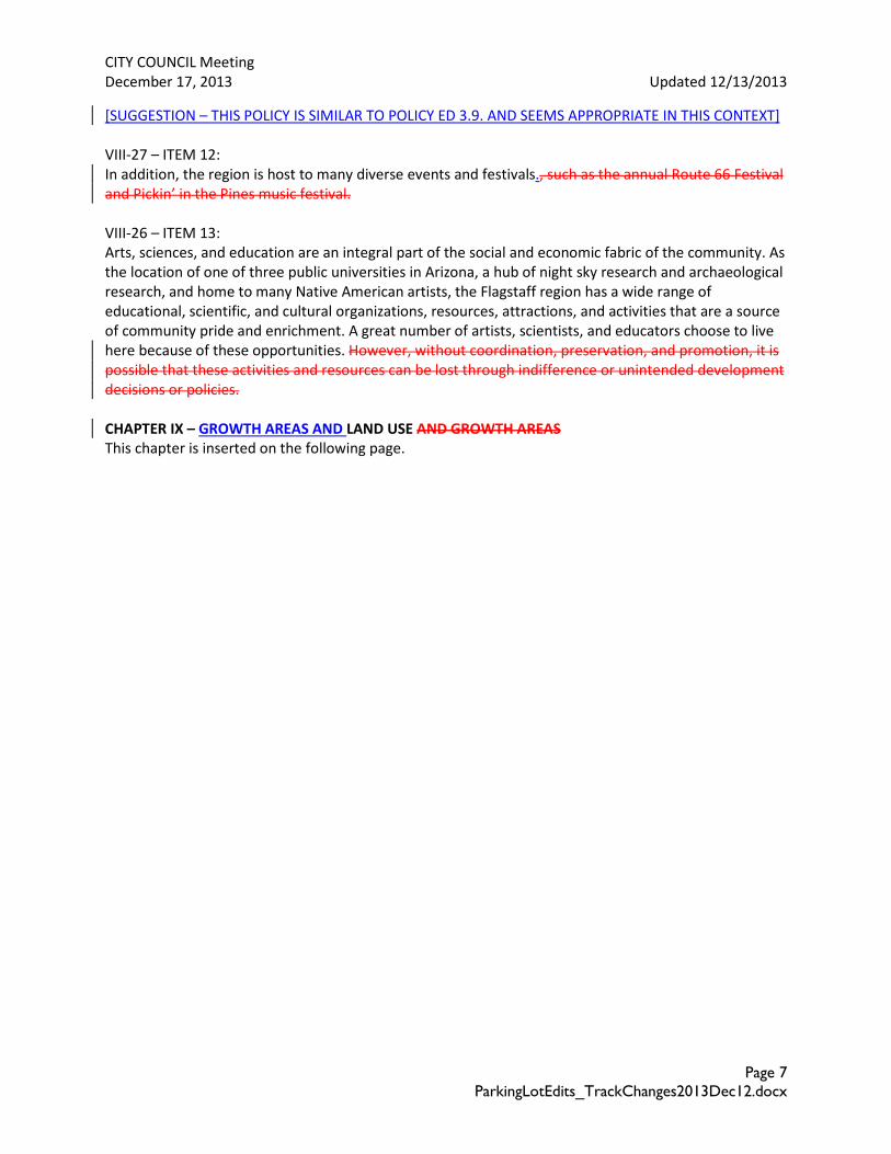
[SUGGESTION – THIS POLICY IS SIMILAR TO POLICY ED 3.9. AND SEEMS APPROPRIATE IN THIS CONTEXT] VIII-27 – ITEM 12: In addition, the region is host to many diverse events and festivals., such as the annual Route 66 Festival and Pickin’ in the Pines music festival. VIII-26 – ITEM 13: Arts, sciences, and education are an integral part of the social and economic fabric of the community. As the location of one of three public universities in Arizona, a hub of night sky research and archaeological research, and home to many Native American artists, the Flagstaff region has a wide range of educational, scientific, and cultural organizations, resources, attractions, and activities that are a source of community pride and enrichment. A great number of artists, scientists, and educators choose to live here because of these opportunities. However, without coordination, preservation, and promotion, it is possible that these activities and resources can be lost through indifference or unintended development decisions or policies. CHAPTER IX – GROWTH AREAS AND LAND USE AND GROWTH AREAS This chapter is inserted on the following page.
LAND USE Track Changes2013Dec11.docx Page 1
CHAPTER IX -– GROWTH AND LAND USE AND GROWTH AREAS In response to the Friday, December 6th retreat with specific reference to Council’s direction to address compact development, staff has rearranged this chapter so that it is easier to follow. An outline is provided below (note that the page numbers refer to the current draft Plan and will revised): Inside this Chapter: EXI ST ING LAND SUPPLY Existing Land Ownership Map #16 Development Potential of V acant Parcels Map #18 Future Growth I llustration - FMPO Scale #19 Future Growth I llustration - City Scale #20 GROW T H Reinvestment Areas I X-57 Transitions Map #23 Public Utilities & Activity Centers Map #24 Greenfield Development I X-65 AREA T YPES Urban I X-22 Suburban I X-33 Rural IX-39 Employment I X-46 Special Planning Areas IX-48 PLACE T YPES Activity Centers & Corridors I X-49 Activity Centers & Corridor Map #22 Neighborhoods I X-56 GROW T H Reinvestment Areas I X-57 Transitions Map #23 Public Utilities & Activity Centers Map #24 Greenfield Development I X-65 IX-1 The Land Use and Growth component of the Flagstaff Regional Plan is a community vision of how land use in the region should occur for the next 20 years. It also sets the legal framework for more specific planning and guiding zoning regulations. It is important to recognize that this is a diverse community that demands land use options while recognizing private property rights. To promote a balanced land use pattern, consideration will be given to the region will consider the following concepts: Area Types This chapter is organized around three area types: urban, suburban and rural. Flagstaff enjoys existing urban, suburban, and rural areas as neighborhoods, shopping areas, roadways, and other spaces. Within
The text provided in this document has been copied from the final draft Regional Plan previously provided to the City Council. Please note that in copying this text from one software program to another, the formatting of the original document has been lost. This is especially true of the tables in this chapter. The original formatting and look of the document will be recreated in the final version of the Flagstaff Regional Plan prepared for possible Council adoption.
Note: As explained below, the “GROWTH” section of this chapter has been moved from the end of the chapter to the beginning. As a result all goals and policies in this chapter will be renumbered in the final version of the Regional Plan.
LAND USE Track Changes2013Dec11.docx Page 2
each area type, there are distinct areas called place types. Employment Centers can exist within all place types, but along with Special Planning areas, they need special consideration. Place Types Place types include activity centers, neighborhoods, and corridors, and provide the framework around which our communityies isare built. Land uses that occur within the different place types are further designated into categories such as residential, commercial, and institutional, which define the type of use and zoning for those place types. The land uses appropriate for each activity center are listed on the urban, suburban, and rural area character tables. Employment Centers can exist within all place types, but along with Special Planning areas, they need special consideration Growth Future growth will be concentrated in reinvestment areas and will include a balance of infill and redevelopment in existing neighborhoods, as well as the development of “greenfields” within the growth boundary.
Our Vision for the Future
In 2030, our community continues to grow in a smart and connected way, making as compact development makes investments in efficient infrastructure, alternative travel modes, and
promoting housing choiceimage while seeking to reduce sprawl. The land use decisions made in the region promote a healthy lifestyle and quality of life desired by many.
IX-2 Context of Land Uses
Flagstaff ’s historical pattern of land uses was driven by the early economics of the railroad, sawmills, the university, and ranching. New development should strive needs to be contextually sensitive to fulfill the Flagstaff Regional Plan’s guiding principles and provide lifestyle choices for the community. Within each area type are groups of place types – all working together to complete and connect homes with jobs, school, activities, and shopping. The community vision is to focus infrastructure investments where they will have the most impact – in reinvestment areas of activity centers and corridors, as well as preservation of existing neighborhoods, and to make walking and bicycling from and to all place types an opportunity for residents and visitors. This chapter covers land designations for future growth patterns, and the Future Growth Illustrations (Maps #19 and #20) identifyies the area types of urban, suburban, and rural character. It is expected that more detailed plans, activity center and civic spaces specific plans for activity centers, public facility planning, and neighborhood plans will define the context and particulars for development, reinvestment, and conservation in any given specific vicinity.
IX-2 How Land is Evaluated
Land Use versus Zoning – Policy versus Ordinance. Land use refers to the general activity that occurs on land. Zoning regulates building size, bulk, density, and in every case, the land use. Land use is regulated
LAND USE Track Changes2013Dec11.docx Page 3
through the City’s adopted Zoning Code zoning ordinance which . The adoption of ordinance is guided through policy language adopted in the Flagstaff Regional Plan. This is a policy document intended to help decision makers evaluate new ordinance.
IX-5 Local Trends
• Geography and the Northern Arizona climate greatly influence development. The ownership patterns of private and public lands and topography also played a significant role in determining the development patterns.
• Growth areas in the past 10 years have been significant single-family subdivisions (for example, Boulder Pointe, Ponderosa Trails, and Anasazi Ridge) with recent multi-family residential additions. This reflects the needs of the university and demographic shifts. The metro-area regional market is reflected in the fact that housing has generally followed retail development.
• Growth boundaries have been established by Flagstaff to reduce sprawl development and where possible, to promote a more compact development pattern withand efficient infrastructure within the Ccity. Rural Growth Boundaries in county areas have been are established while in respecting of public and private land ownership.
• Mixed-use development promotes a more compact, walkable urban form, and can be seen locally in Flagstaff ’s historic downtown and more recently around the University campus. Mixed-use opportunities also exist in this region where planned activity centers host a significant amount of growth in office space, retail business, and multi-family housing.
• Public spaces are one of the most important design aspects of a city, they serve as is its collective commons—the shared public spaces where people gather, including streets, squares, parks, markets, playgrounds, or sports facilities. The Flagstaff region hosts a number of public spaces, yet the population desires more designed public spaces. As Heritage Square in the downtown attests, good public spaces are well produce a lot of used. This plan reflects on how those spaces interact with homes and businesses as well as how they are connected together.
• Regulations – Zoning codes, building codes, fire codes, health codes, and engineering standards are regulatory documents intended to promote the goals and policy for Flagstaff. These rRegulations are in place to serve the greater good of public health and safety, and to promote a well-planned community.
Reinvestment areas implement the goals for revitalization, redevelopment, and infill to promote activity centers and walkable neighborhoods. Many of these areas require utility upgrades and infrastructure to be provided as incentives for private investment. As the private and public sectors continue to work together, parcel assemblage and infrastructure needs will need to be met to assist in enhanced reinvestment projects. Some examples of revitalization projects in the urban and suburban context are: Sawmill at Aspen Place, a 40-acre commercial infill and brown field redevelopment project; the Lumberyard Brewery adaptive-reuse and historic preservation; and Barnet Dulaney Perkins Eye Surgical Center redevelopment on Switzer Canyon Drive.
LAND USE Track Changes2013Dec11.docx Page 4
Why Compact Development? Successful compact development
for the region features the following,
respecting the Flagstaff region’s scale
and design traditions:
• Well connected access for pedestrians, bicyclists, cars, and transit • Pedestrian-, bicycle-, and transit- friendly design • Concentrations of population and/ or employment • Medium to high densities appropriate to context • Smaller housing choices on small lots and multi-family options with shared amenities • A mix of uses • Interconnected streets • Innovative and flexible approaches to parking • Access and proximity to transit
Compact development can be built anywhere, and can be adapted to the urban, suburban and rural context. It encompasses residential and commercial development.
IX-6 ITEM 4: Transportation options are more complex than creating a bus route, building sidewalks, or striping a bike lane (even though those are all important). Expanding transportation choices demands a shift in our land use patterns and the way we locate and shape future development. To complement land use changes, we must challenge our current notions of space and how we get from Point A to Point B on a daily basis. Public and private traffic engineers should can design streets according to “Complete Street” principles to balance for pedestrian and bicyclist safety and the needs of transit and all other vehiclesexperience first, automobile driver experience second, transit options next, and auto capacity and speed last. This will be a paradigm shift from the current automobile-only focus..
Formerly IX-57 – ITEM 3: GROWTH [MOVED UP AFTER MAP 16 where it is more appropriately located than at the end of the chapter] THE DISCUSSION ON Compact Development NOW MOVED INTO THE BEGINNING OF THE GROWTH SECTION
Formerly IX-57 – ITEM 3: Historically, growth areas in the Flagstaff region have clustered around jobs, from the earliest railroad stop and lumberyards, to the University and downtown Flagstaff. Within the region, the City of Flagstaff is surrounded by public lands, and thus the supply of private land for development is somewhat limited. For these reasons, and because Flagstaff residents value the protection of the natural forests and public lands surrounding the City, planning in Flagstaff for the last 25 years has encouraged (but not mandated) development in more central areas, thereby preserving more of the outer areas of the region and reducing sprawl. This concept of “compact development” was included in the Flagstaff Growth Management Guide 2000 adopted in April 1987 and continued within the former Flagstaff Regional Land Use and Transportation Plan adopted in November 2001. Both of these documents included goals and policies in support of the principles of reduced sprawl and compact development, while also allowing for many developments to occur under existing zoning and land entitlements.
LAND USE Track Changes2013Dec11.docx Page 5
The principle of compact development may be viewed and described in three tiers.
1. Citywide: At the city-wide scale compact development can encourage infill and reinvestment in existing urban, suburban, and rural area types, thereby allowing for the preservation of open space and natural resources toward the periphery.
2. Activity centers and neighborhoods: At the local level, such as in activity centers and within neighborhoods, compact development allows for increased intensity and density of residential, commercial, or mixed-use activities through creative and intensive site design within activity centers at urban, suburban and rural contexts, and along corridors. Typical residential densities in compact developments are higher than in adjoining areas and encompasses residential and commercial development, and single-family houses, townhomes, apartments, and live-work units so that residents have a choice in the type of housing they desire. In commercial areas, two and three story buildings are typical, with building fronts right up to the sidewalk, and parking arranged behind and to the side of buildings. A range of housing and transportation options are supported, with an emphasis on improving pedestrian and bicycle circulation within a complete street, reducing necessary additional vehicle trips. Civic spaces are typically included, providing opportunities for civic participation, shopping, recreation, and socializing outdoors in all seasons. Employment centers also provide important opportunities for compact development.
3. Cluster development: Within a development site, residential and commercial uses may be
clustered closer together as a means of preserving natural resources and open space and minimizing infrastructure costs.
Support for the concept of more compact growth does not, and has not, precluded new suburban development from occurring away from the center of the city, such as, the Ponderosa Trails subdivisions. It does, however, speak to a desire to encourage some future development to be more inwardly focused while ensuring freedom of choice for developers to satisfy market demand for various housing types. The future will focus investments and development potential to urban areas and compact growth as growth management strategies. The discussion of growth areas is paramount in reducing sprawl, protecting open space, and promoting efficiencies in infrastructure and services. Where Should Growth Occur?
The Flagstaff region will accommodate residential, commercial, institutional, and public space growth needs by focusing infrastructure and incentives for: • Revitalization of the urban core, particularly existing and under- utilized activity centers • Infill of the vacant lots in urban, suburban, and rural neighborhoods
LAND USE Track Changes2013Dec11.docx Page 6
THIS IS THE COMPACT DEVELOPMENT BOX: Why Compact Development? Encouraging the option of compact development for the region allows for the following to be achieved while still respecting Flagstaff’s scale, character, and design traditions:
o Support economic vitality o Well connected access for pedestrians, bicyclists, cars, and transit o Appropriate multi-modal thoroughfare design o Concentrations of population and/ or employment o Medium to high densities in appropriate contexts o Provision of a range of housing options including smaller housing types on small lots and multi-
family housing options with shared amenities o A mix of uses, i.e. several types of housing, commercial, and office space are located in close
proximity with civic spaces to provide vibrant commercial spaces, quality places for people to live, and to support infill and reinvestment of existing developed areas.
o Interconnected streets o Innovative and flexible approaches to parking o Access and proximity to transit o Reduction of sprawl on the periphery of the region o Support of conservation and open space goals as well as watershed protection o Minimize traffic congestion o Reduced miles of streets and utility infrastructure resulting in lowered future City operating and
maintenance costs.
[Move land use tool box from Page IX-11 to here. Also, add more photographs.]
Land Use Tool Box MOVED HERE Formerly IX-11 – ITEM 5 Activity Centers are mixed-use areas where there is a concentration of commercial and other land uses typically defined by a pedestrian shed. The activity centers are encompassed by 1/4 mile pedestrian shed, which indicates appropriate location for higher-density residential development, live-work units and home-based businesses, and the need for a high-degree of pedestrian and bicycle connectivity to the center or commercial core of the activity center.
Formerly IX-11 – ITEM 3, 5, &31 Pedestrian Shed is the basic building block of walkable neighborhoods. A pedestrian shed is the area encompassed by the walking distance from an town or activity center, and is . Pedestrian sheds are often defined as the area covered by a 5-minute walk (about 1/4 mile, 1,320 feet, or 400 meters). They may be drawn as perfect circles, but in practice pedestrian sheds have irregular shapes because they cover the actual distance walked, not the linear (as-the-crow- flies) distance. Linear Pedestrian Shed – extends for a 1/4 mile radius along a pedestrian-oriented In practice, it is common for people to walk greater distances than a ¼ mile to access and activity center.street (corridor and/or Great Street).
Formerly IX-57 Reinvestment Areas A community reinvests in an area through revitalization, redevelopment, infill, brownfield redevelopment, and historic preservation, all of which play a vital role in improving the quality of life for those living in and traveling to the City of Flagstaff and the region. Reinvestment promotes the
LAND USE Track Changes2013Dec11.docx Page 7
resurgence of existing activity centers and walkable neighborhoods in areas suffering from lack of maintenance, and within activity centers and corridors and their respective pedestrian shed. More detailed planning, such as specific plans or corridor plans will be required as these areas resume or begin more active roles within the community. Activity centers and corridors as “Great Streets” have high are the biggest reinvestment potential, as these are located in areas of greatertest return on investment. Refer to Chapter VIII - Community Character for a full discussion. Many of the region’s existing areas need utility upgrades and improvements as incentives to attract reinvestment and development. As the private and public sectors continue to work together, parcel assemblage and infrastructure needs must be met to assist in enhanced revitalization projects. Map 24 shows public utilities in the Flagstaff region over 50 years old that could benefit from upgrades. Refer to Public Utilities & Activity Centers Map #24, pg. IX-61. Reinvestment, redevelopment, and infill at the neighborhood scale results in the lates to look and functionality aesthetic treatment of the existing developed area. Examples of this include repairing what is already in place, remodeling, fixing-up and adding-on; addressing the need for neighborhood retail, bus stops, social spaces, green spaces, sidewalks, crosswalks, and public art, while preserving community integrity, character, safety, and livability. Refer to Transitions Map #23. ITEM 34 & 36 While reinvestment in a neighborhood or community has obvious advantages as described above, the needs and values of existing residents must be carefully considered in redevelopment and reinvestment projects to mitigate the negative results that might occur from gentrification. It is important, therefore, to ensure that policies are established to ensure broad participation in decision making processes, and to mitigate the possible displacement of existing residents and businesses by the developer. Formerly IX-57: Helpful Terms:
Reinvestment Areas - Infill, redevelopment, brown field redevelopment, preservation, and adaptive re-use are all ways to revitalize areas of our community.
Greenfield Development - Areas that exist mostly on the periphery of the city, within or contiguous with the urban growth service boundary, can be considered for Greenfield development. [Note to staff – Word Search to ensure consistency – use “urban growth boundary”]
Formerly IX-64 REINVESTMENT GOALS AND POLICIES Goal LU.18. Invest in existing neighborhoods and activity centers for the purpose of developing complete and connected places. Policy LU.18.1. Plan for and support reinvestment within the existing city centers and neighborhoods for increased employment and quality of life. Policy LU.18.2. Develop reinvestment plans with neighborhood input, identifying the center, mix of uses, connectivity patterns, public spaces, and appropriate spaces for people to live, work, and play. Policy LU.18.3. Promote reinvestment at the neighborhood scale to include infill of vacant parcels, redevelopment of underutilized properties, aesthetic improvements to public spaces, remodeling of
LAND USE Track Changes2013Dec11.docx Page 8
existing buildings and streetscapes, maintaining selected appropriate open space, and programs for the benefit and improvement of the local residents. Policy LU 18.4. Attract private investment by reinvesting in transportation infrastructure improvements as well as public utilities infrastructure for desired development size. Policy LU.18.5. Maintain and upgrade existing infrastructure and invest in infrastructure to make redevelopment and infill an attractive and more financially viable development option. Policy LU.18.6. Establish greater flexibility in development standards and processes to assist developers in overcoming challenges posed by redevelopment and infill sites. Policy LU.18.7. Consider creative policy and planning tools (such as transfer of develop rights or transfer of development obligations) as a means to incentivize redevelopment and infill. ITEM 30: Policy LU.18.8. Encourage and invest in voluntary land assemblage in an effort to create better utilization and opportunities for development. Policy LU.18.9. Provide public education regarding the sustainability and beneficial economics of redevelopment and infill. Policy LU.18.10. Consider adaptive reuse possibilities when new big box developments are proposed. ITEM 37: Policy LU 18.11 Ensure that there is collaboration between a developer and residents and property owners in existing neighborhoods where redevelopment and reinvestment is proposed so that they are included, engaged, and informed. ITEM 38: Policy LU 18.12 Ensure the fair and proper relocation of existing residents and businesses in areas affected by redevelopment and reinvestment, where necessary. ITEM 38: New Policy LU 18.3 Consider and integrate plans for formal relocation or informal eviction through rent increases into proposed redevelopment and infill plans where existing residents may be impacted. Greenfield Development
While suburban retrofits, urban infill, and activity center redevelopment projects are encouraged as a prioritytake precedence, Greenfield development is will likely continue to be an important component of the community’s growthstill an option. The relevant goal and policies apply to state land parcels identified for development in the Growth Illustration Map as well as larger, vacant tracts of private land, much of it south of I-40 between Woody Mountain Road and Fourth Street. Important opportunities for Greenfield development may exist in the Bellemont area. Flagstaff patterns of growth have been primarily subdivisions of single family houses. This form of development forces residents to travel by automobile for daily needs, and makes it difficult to stay within
LAND USE Track Changes2013Dec11.docx Page 9
the same neighborhood when they need a different type or size of housing. This plan discourages development of this type and promotes a preferred pattern of development for new neighborhoods. Outward expansion may be a demonstrated growth need in balance with infill redevelopment. State land parcels and privately owned tracts within the growth boundaries are excellent locations for such expansion. Formerly IX-19 What We Have VS. Where We Are Going
Whether new development occurs in the urban, suburban, rural, or employment context, the following set of goals and policies are applicable to all projects. In addition, the goals and policies for the specific area type (urban, suburban, or rural) must also be applied. APPLICABLE TO ALL LAND USES - GOALS AND POLICIES Goal LU.1. Continue to enhance the region’s unique sense of place within the urban, suburban, and rural context. Policy LU.1.1. Within the urban, suburban, and rural context, use neighborhoods, activity centers, corridors, public spaces, and connectivity as the structural framework for development. Policy LU.1.2. Coordinate land use, master planning, and recreational uses, when feasible, with local, state, and federal land management agencies and tribal land owners. Policy LU.1.3. Protect sensitive cultural and environmental resources with appropriate land uses and buffers. Policy LU.1.4. Promote transitions between urban, suburban, and rural areas with an appropriate change in development intensity, connectivity, and open space. Note: The Community Character and Economic Development chapters of this plan include further policies regarding Flagstaff ’s unique sense of place. Also refer to the Neighborhoods, Housing, and Urban Conservation chapter for existing neighborhoods policies. ITEM 13: Policy LU.1.5. Allow and encourage urban agriculture including home gardens, community gardens, urban farms, chickens, greenhouses, on-site sales of produce, and farmer’s markets within urban, suburban, and rural contexts and in selected open space parcels. Goal LU.2. Balance housing and employment land uses with the preservation and protection of our unique natural and cultural setting. ITEM 8: Policy LU.2.1. Develop neighborhood plans, specific plans, area plans, and master plans for all neighborhoods, activity centers, corridors, and gateways, as necessary. Policy LU.2.2. Utilize the following as guidance in the development process: Natural Environment maps, Environmental Planning and Conservation policies, Considerations for Development, Cultural Sensitivity, and Historical Preservation maps, and Community Character policies, while respecting private property rights.
LAND USE Track Changes2013Dec11.docx Page 10
Goal LU.3. EncourageApply compact development principles to achieve efficiencies and open space preservation. Note: For more information, refer to “Tools for Conservation” in the Open Space chapter. Policy LU.3.1. EncourageConfine development patterns to the designated growth boundaries to sustain efficient infrastructure projects and maintenance. Policy LU.3.2. Promote infill development over peripheral expansion to conserve environmental resources, spur economic investments, and reduce the cost of providing infrastructure and services. Policy LU.3.3. Promote compact development appropriate to and within the context of each area type: urban, suburban, and rural. ITEM 10: New Policy LU 3.4. Encourage development to be clustered in appropriate locations as a means of preserving natural resources and open space, and to minimize service and utility costs, with such tools as Transfer of Development Rights (TDR). Policy LU.3.54. Plan for and promote compact commercial development as activity centers with mixed uses, allowing for efficient multi-modal transit options and infrastructure. Policy LU.3.65. Encourage the distribution of density within neighborhoods in relationship to relate to the access of associated activity centers and corridors, infrastructure, transportation, and natural constraints, such as like slopes and drainages. ITEM 11: Policy LU.3.76. Encourage the placement of Place institutional and civic public buildings centrally within a compact neighborhood to promote walkability and multi-use recreation spaces. Policy LU.3.87. Require any Forest Service land trades within the planning area to be consistent with the Regional Plan. Goal LU.4. Provide for a mix of land uses. Policy LU.4.1. Consider a variety of housing types and employment options when planning new development and redevelopment projects. Policy LU.4.2. Consider commercial core areas, corridors, activity centers, employment centers, research and development parks, special planning areas, and industrial uses as appropriate place types and area types for employment opportunities. ITEM 16: Policy LU.4.3. EncourageProvide for new mixed-use neighborhoods in appropriate locations within the growth boundary. Policy LU.4.4. Provide appropriate recreational and cultural amenities to meet the needs of residents.
LAND USE Track Changes2013Dec11.docx Page 11
Goal LU.5. Provide for public services and infrastructure. Policy LU.5.1. Concentrate urban development in locations that use land efficiently, and are served by roads, water, sewer, and other public facilities and services and that; support transit, reduced vehicle trips, and conservation of e energy and water. Policy LU.5.2. Require unincorporated properties to be annexed prior to the provision of city services, or that a pre-annexation agreement is executed when deemed appropriate. Policy LU.5.3. Require development proposals to address availability of adequate public services. Goal LU.6. Balance future growth with available water resources. Note: Refer to Water Resources Goals & Policies. Policy LU.6.1. Available water resources should be a consideration for all major development and subdivision applications. Policy LU.6.2. Impacts on the city’s water delivery infrastructure should be a consideration for all residential and nonresidential development proposals. Formerly IX-21: AREA AND PLACE TYPES The following pages contain a series of development standards for new projects. These standards are broken down according to area type: urban, suburban, and rural. The character within each area type is different, therefore development standards will vary depending where development is taking place. The three area types (urban, suburban, and rural) have several tables that describe the place types within each: neighborhoods, activity centers, and corridors. Activity centers occur in many parts of the city and county- they are not exclusive to the most urbanized places. Since activity centers are encouraged in any area type, they can take the role of a regional or neighborhood activity center, as the graphic shows. The Regional Plan uses this hierarchy of area and place types to better categorize the eventual look of a place. Activity centers, corridors, and neighborhoods are encouraged in all area types, whether they are urban, suburban, or rural. Formerly IX-22: Urban Flagstaff ’s historic urban neighborhoods were primarily developed prior to the 1920s in the heart of Flagstaff surrounding the Downtown, and include Southside, La Plaza Vieja, Flagstaff Townsite, and Northside. These neighborhoods developed in a traditional compact urban pattern where a person could live with limited reliance on the automobile. They were conducive to walking and cycling for daily needs such as groceries, retail shopping, and entertainment.
Many of these walkable characteristics are still evident today as these urban areas are still supported through a network of interconnected tree-lined streets laid out in a grid pattern with small block sizes,
LAND USE Track Changes2013Dec11.docx Page 12
on-street parking, and a diversity of housing types. These areas also support public transit due to their compact nature. Unfortunately, neighborhood-serving commercial uses are now limited in many of these historic neighborhoods by larger grocery stores which developed later in the peripheral corridors that are not within walking distance. The historic neighborhoods average 3.6-8 units per acre. Most of Flagstaff ’s residents and visitors agree that Flagstaff ’s unique historic urban areas contribute to defining the local character and identity, and are strong proponents of protecting and preserving this special urban form and character.
Walkable urban development can be integrated into older, less walkable neighborhoods to create new urban neighborhoods and centers. This walkability could be achieved through a variety of reinvestment activities, and establishment of densities supportive of alternative transportation modes and through greater connectivity. Formerly IX-24 ITEM 5:
Formerly IX-28: URBAN AREAS GOALS AND POLICIES
ITEM 15: Goal LU.7. Focus reinvestments, partnerships, regulations, and incentives on developing or redeveloping central urban areas.
ITEM 15: Policy LU.7.1. ReIinvest in urban areas.
Goal LU.8. Increase the proportion of urban neighborhoods to achieve walkable, compact growth.
Policy LU.8.1. Prioritize connectivity within all urban neighborhoods and activity centers. Policy
LU.8.2. Support on-street parking, shared lots, and parking structures.
Policy LU.8.3. Value the traditional neighborhoods established around downtown by maintaining and improving their highly walkable character, transit accessibility, diverse mix of land uses, and historic building form.
Policy LU.8.4. Develop specific plans for each urban neighborhood and activity center to foster desired scale and form.
Policy LU.8.5. Consider vacant and underutilized parcels within the City’s existing urban neighborhoods as excellent locations for contextual redevelopment that adds housing, shopping, employment, entertainment, and recreational options for nearby residents and transit patrons.
URBAN ACTIVITY CENTER CHARACTERISTICS An area within a ¼ mile walking radius (the pedestrian shed) typically located at the intersection on two main thoroughfares. Urban activity
centers include mixed-use,
LAND USE Track Changes2013Dec11.docx Page 13
ITEM 17: Policy LU.8.6. In mixed use developments eEncourage residential usesspaces located above and behind commercial uses within urban areas centers as well as a variety of housing types in the urban context, where appropriate. ITEM 17: Policy LU.8.7. Commercial and office uses within mixed-use development will occupy the first floor of multistory buildings.
Policy LU.8.78. Invest in infrastructure and right-of-way enhancements as an incentive for private investment in urban neighborhoods and activity centers.
Policy LU.8.89. Include institutional uses, including schools, within the urban context.
Policy LU.8.910. Civic spaces must be well designed, accessible, and central to the urban fabric.
The arrival of the railroad in the small community of Flagstaff in 1882 ensured the downtown area as the business center for northern Arizona. Within this region a wide variety of activity was pursued, including lumbering, transportation, education, cattle and sheep ranching, tourism, and later scientific research – all centered on this transportation hub. This strong economic base resulted in consistent growth throughout most of Flagstaff ’s history. In response to this economic prosperity and frequent destructive fires, buildings were increasingly well constructed of substantial materials, such as stone and brick.
Planning for Downtown Suburban Areas in the Context of Form
Downtown Flagstaff is an acknowledged urban design treasure with a rich architectural and cultural heritage. Shared investment by property owners and the City resulted in the 1997 update to the downtown’s streetscape, creating appealing public and civic gathering spaces. This vibrant urban fabric supports an engaging mix of retail, restaurant, entertainment, civic, and office uses. Downtown Flagstaff is remarkably intact, with most of the historic buildings standing and the traditional street grid in place providing the highest quality pedestrian environment in the city.
While downtown is unique, it functions as the focus point of a larger core area anchored by Northern Arizona University to the south and the Flagstaff Medical Center’s campus to the north. The downtown has long been a popular shopping destination for visitors and as an entertainment center for local residents, with parades, marathons, First Fridays events, and New Years Eve celebrations. With a solid anchor of government offices, tThe downtown remains the main regional urban center of Northern Arizona. It and competes well for sales and interest with much newer auto-oriented development along the corridors and on the periphery of the city, and includes a solid anchor of government offices,. Zoning within downtown is illustrated on the Downtown Regulating Plan, Map #21.
LAND USE Track Changes2013Dec11.docx Page 14
ITEM 2: While downtown is unique (it is defined on the Zoning Map with the Commercial Business (CB) zoning designation), it functions as the focus point of a larger core area anchored by Northern Arizona University to the south and the Flagstaff Medical Center’s campus to the north. This is generally what is known as the Flagstaff Central District as mapped in the Zoning Code. Most of this area has been designated with optionally-applied transect zones as illustrated in Map #21, Downtown Regulating Plan, includes a number of historic neighborhoods such as Flagstaff Townsite, North End, Southside, and parts of La Plaza Vieja. As these historic neighborhoods are highly valued by Flagstaff residents, appropriate goals and polices to support their preservation are included in Chapter VIII, Community Character.
Formerly IX-30: DOWNTOWN GOALS AND POLICIES
ITEM 19: Goal LU.9. Prioritize the continual reinvigoration of downtown Flagstaff, whose strategic location, walkable blocks, and historic buildings will continue to be a vibrant destination for allof culture, civics, and the arts. Policy LU.9.1. All businesses and community services on the ground floor should be pedestrian accessible directly from a public space, such as a street, alley, square, plaza, or interior corridor.
Policy LU.9.2. Encourage new multi-story mixed-use buildings to have windows and doors facing the sidewalks. Policy LU.9.3. Design new downtown buildings to have a majority of the total linear frontages of mixed-use and nonresidential building facades built to the sidewalk.
Policy LU.9.4. Encourage various housing types that appeal to a diverse range of ages and income.
Policy LU.9.5. Encourage adaptive re-use of historic structures for a variety of commercial spaces and housing options. Policy LU.9.6. Strive for a wide variety of activities in downtown to create a healthy mix of housing, employment, shopping, cultural, and civic uses.
Policy LU.9.7. Include new and improved civic buildings and civic spaces into downtown redevelopment strategies.
Policy LU.9.8. Maintain and enhance Heritage Square and Wheeler Park as critical civic space for social gathering and community well-being.
Goal LU.10. Accommodate pedestrians, bicyclists, transit riders, and private cars to supplement downtown’s status as the best-served and most accessible location in the region.
Note: For more information, refer to the Transit section of the Transportation chapter as well as related transit plans listed in Appendix A.
Policy LU.10.1. Invest in downtown’s streets and sidewalks so that they remain Flagstaff ’s premiere public spaces.
LAND USE Track Changes2013Dec11.docx Page 15
Policy LU.10.2. Create a downtown parking strategy plan that continues to utilize and improve upon on-street parking, public parking lots and garages, and shared private parking spaces, with clear signage for way finding and to inform the public of all parking options.
Policy LU.10.3. Locate public and private parking facilities, lots, and garages carefully, screening parking from streets, squares, and plazas.
Policy LU.10.4. Incorporate liner buildings and larger mixed-use projects into parking facilities.
Policy LU.10.5. Maintain rear alleys for access to mid-block parking spaces to provide an out-of-sight location for utility equipment, and to allow the fronts of buildings to be free of driveways and parking garage entrances.
Policy LU.10.6. Revise parking regulations to encourage shared parking between various uses within existing structures.
Policy LU.10.7. Provide multiple routes and pathways for vehicular and pedestrian movement.
ITEM 22: Policy LU.10.8. Provide for strong connections from the Flagstaff Medical Campus to the Northern Arizona University campus via pedestrian paths, bicycle connections, streets, and transit service. ITEM 21: Policy LU.10.9. As defined in the FUTS Master Plan, include downtown trail access points, bicycle parking, and bicycle facilities.
Policy LU.10.10. Seek opportunities to improve ADA accessibility in downtown.
ITEM 35: Policy LU10.11 Develop a residential parking program to address the impacts of on-street parking in the downtown and surrounding areas.
Formerly IX-32 – ITEM 5 SUBURBAN ACTIVITY CENTERS CHARACTERISTICS An are areas typically within a ¼ mile walking radius (the pedestrian shed) located at the intersection of on two collectors / neighborhood streets, with vertical or horizontal of mixed-use (mix of any: businesses, retail, residential, offices, medical, services, etc.) vertical or horizontal, serving the surrounding neighborhoods. A suburban activity center can serve a include REGIONAL COMMERCIAL or NEIGHBORHOOD COMMERCIAL scale.
Formerly IX-38 SUBURBAN AREAS GOALS AND POLICIES
Goal LU.11. Increase the variety of housing options and expand opportunities for employment and neighborhood shopping within all suburban neighborhoods.
LAND USE Track Changes2013Dec11.docx Page 16
Policy LU.11.1. Prioritize connectivity for walking, biking, and driving within and between surrounding neighborhoods.
Policy LU.11.2. Consider public transit connections in suburban development.
Policy LU.11.3. Consider retro-fitting suburbs for walkability and mixed-use.
Policy LU.11.4. Plan suburban development to include a variety of housing options.
Policy LU.11.5. Encourage developers to consider at least one floor of apartments or offices over commercial development in commercial cores of mixed-use and activity centers and corridors.
Policy LU.11.6. Include a mix of uses and access to surrounding neighborhoods in new suburban commercial development.
Policy LU.11.7. Include employment opportunities in all suburban activity centers.
Policy LU.11.8. Locate civic spaces, parks, and institutional uses within neighborhood pedestrian sheds.
Policy LU.11.9. Use open space and FUTS trails to provide walking and biking links from residential uses to employment, shopping, schools, parks, and neighborwoods.
Policy LU.11.10. Protect wildlife corridors where appropriate.
Policy LU.11.11 Promote cluster development as an alternative development pattern in appropriate locations as a means of preserving rural resources and to minimize service and utility costs. [STAFF SUGGESTION – THIS POLICY IS IN RURAL AREAS AND SEEMS APPROPRIATE IN SUBURBAN AREA TYPES AS WELL]
Formerly IX-47 EMPLOYMENT AREAS GOALS AND POLICIES
Goal LU.13. Plan for and encourage employee-intensive uses throughout the area as activity centers, corridors, research and development offices, business parks, and light industrial areas to encourage efficient infrastructure and multimodal commuting.
LAND USE Track Changes2013Dec11.docx Page 17
Policy LU.13.1. Encourage the grouping of medical and professional offices, light industrial, research, and skill training with other necessary workforce services and transportation options. Policy LU.13.2. Consider the compatible integration of residential uses and proposed employment centers to reduce vehicle trips and commute times. Policy LU.13.3. Incorporate neighborhood/support retail and other commercial uses, including childcare facilities, within new and renovated employment centers.. Policy LU.13.4. Accommodate safe and convenient walking, biking, and transit facilities in existing and proposed employment centers. ITEM 17: Policy LU.13.5. Provide an attractive, high-quality employee environment in new and renovated employment center design.
Goal LU.14. Establish heavy industrial areas that provide for the manufacturing of goods, flexible space, and intermodal facilities that are well maintained, attractive and compatible with adjoining nonindustrial uses. Other related policies: Policy ED.3.9 in the Economic Development chapter.
ITEM 24: Policy LU.14.1. Encourage the continued intensification, expansion, and protection of existing industrial, warehousing, and distribution uses from encroachment, where appropriate. Policy LU.14.2. Ensure new industrial areas are compatible with surrounding areas. ITEM 25: Policy LU.14.3. Locate new industrial areas near the rail line, major highways or interstate, and ensure they are designed to be compatible with surrounding uses and gateway features. Policy LU.14.4. Limit the impacts of truck traffic on residential areas. Policy LU.14.5. Consider all health impacts on the community in the design of new industrial uses, such as wastewater treatment, traffic safety, noise, and other impacts.
Formerly IX-49 Activity Centers
Flagstaff has many existing activity centers (Map #22), which this plan identifies, along with a number of potential future activity centers. With a focus of investments and development to the urban core as a growth management strategy, activity centers are vital in producing the compact urban form nodes necessary for efficient infrastructure, transit, walkability, job creation, and protection of our natural resources. By promoting activity centers and mixed- use development in the Flagstaff region, the community will benefit from: • Places for people to shop, eat, and entertain
LAND USE Track Changes2013Dec11.docx Page 18
• Sites for community events, activities, and celebrations • A range of housing types and configurations • New destinations within a short distance of existing neighborhoods • Opportunities to increase walking, biking, and transit use • More efficient use of existing public infrastructure • Opportunity to foster vibrant, walkable communities • Incubators for art, community, or non-profit enter prises • Activity centers with anchors that appeal to locals, not just visitors • Active, healthier lifestyles • Conservation of land by accommodating more people in less space • Preservation of open space • A range of transportation alternatives • Reduced congestion • Lower infrastructure costs for communities, families, and individuals • Reduced household expenses related to transportation and energy • Added convenience by putting destinations closer together
Activity Centers and Corridors: Mixed- use centers that vary by scale and activity mix depending on location. They include commercial, retail, offices, residential, shared parking, and public spaces. This plan identifies existing and potentially new activity centers throughout the planning area, including urban, suburban, and rural centers.
Neighborhoods: Includes both geographic (place-oriented) and social (people-oriented) components, and may be an area with similar housing types and market values, or an area surrounding a local institution patronized by residents, such as a church, school, or social agency.
A Vision for Our Activity Centers
Existing activity centers have great potential for increased activities, densities and mixed-use with focused reinvestment by both the public and private sectors. These are ideal locations for optimal transit connectivity, increased pedestrian and bicycle use, and infrastructure improvements . For example, activity centers around Northern Arizona University could also meet the demand for more multi-family housing units, and student- oriented services and goods. Potential new activity centers have been located where the future road network intersects, and future development has been proposed. This plan is encouragesing that future development to be focused on, and planned around activity centers. Every activity center works at its own scale, serving the needs of the surrounding community. That scale is directly related to the road types serving the center and surrounding development. Regional centers – the biggest centers – are located at the intersection of major roads and have multiple large residential developments with direct access to it. Neighborhood centers are typically established at the intersections of circulation and access roads, but not all of these intersection types establish centers. An urban activity center holds the greatest densities of housing and intensities of commercial and retail space, yet it is still appropriately designed for the region, contextual in scale and form, and architecturally compliments the environment and views. Even the most urban areas of Flagstaff host the most amazing views of the mountains, and respecting the views will maintain our unique sense of place. Higher
LAND USE Track Changes2013Dec11.docx Page 19
densities and maintaining views may seem like a contradiction, but it is a matter of thoughtful and sensitive design. Urban activity centers create the densities that make transit work and provide the intense creative places and social interactions desired by today’s and tomorrow’s workforce. Suburban activity centers provide the node for a neighborhood’s schools, parks, local restaurants, and grocery stores and are located next to higher- density residential development easily accessible by walking or biking. They may provide an opportunity for medium-density mixed-use. Rural activity centers are appropriate in scale to the rural community and may be two or three stores in height, in which one additional activity is considered “growth..” These are strategically located to provide convenience for those living in the rural areas. Formerly IX-55 ACTIVITY CENTERS AND CORRIDORS GOALS AND POLICIES Goal LU.16. Develop well designed activity centers and corridors with a variety of employment, business, shopping, civic engagement, cultural opportunities, and residential choices.
LAND USE Track Changes2013Dec11.docx Page 20
Policy LU.16.1. Design activity centers and corridors appropriate to and within the context of each area type: urban, suburban, or rural. Policy LU.16.2. Strive for activity centers and corridors that are characterized by contextual and distinctive identities, derived from history, environmental features, a mix of uses, well-designed public spaces, parks, plazas, and high-quality design. Policy LU.16.3. Redevelop underutilized properties, upgrade aging infrastructure, and enhance rights-of-way and public spaces so that existing activity centers and corridors can realize their full potential. Note: Refer to Cost of Development Chapter XI, especially for the potential of public-private partnerships. Policy LU.16.4. Encourage activity centers and corridors to provide housing of various types and price points, especially attached and multi-family housing. ITEM 4 & 27: Policy LU.16.5. Plan for and support multi-modal activity pedestrian and transit friendly centers and corridors with an emphasis on pedestrian and transit friendly design. Policy LU 16.6. Support increased densities within activity centers and corridors.
Policy LU.16.7. Concentrate commercial, retail, services, and mixed use within the activity center commercial core. Policy LU.16.8. Increase residential densities, live-work units, and home occupations within the activity center’s pedestrian shed. ITEM 28: Policy LU 16.9. Adopt traffic regulations to prioritize pedestrian oriented design for all activity centers. Policy LU.16.9.10. Plan activity centers and corridors appropriate to their respective regional or neighborhood scale with adequate vehicle access. Policy LU.16.101. Corridors should increase their variety and intensity of uses as they approach activity centers. Policy LU.16.1211. Land use policies pertaining to a designated corridor generally apply to a depth of one parcel or one and one- half blocks, whichever is greater. Policy LU.16.123. Corridors should focus commercial development to the corridor frontage and residential to the back. Policy LU.16.134. Promote higher density development in targeted areas where economically viable and desired by the public. Policy LU.16.145. Endorse efficiency of infrastructure with compact development within targeted activity centers. Policy LU.16.156. Actual pedestrian-shed boundaries will be established considering opportunities and constraints posed by natural and man-made barriers like terrain or the interstate, road networks, and existing development patterns.
LAND USE Track Changes2013Dec11.docx Page 21
Goal LU.17. Develop a manageable evolution of the main corridors into contextual place makers. Policy LU.17.1. Develop a specific plan for each “Great Street” corridor. Policy LU.17.2. Establish the context and regional or neighborhood scale of each corridor prior to design with special consideration for those intended to remain residential or natural in character. Policy LU.17.3. Enhance the viewsheds and frame the view along the corridors through design. Policy LU.17.5. Balance automobile use, parking, bicycle access, while prioritizing pedestrian safety along all corridors. Note: Refer to the discussion of “Great Streets” in the Community
CITY COUNCIL Meeting December 17, 2013 Updated 12/13/2013
Page 8 ParkingLotEdits_TrackChanges2013Dec12.docx
CHAPTER X – TRANSPORTATION X-21 – ITEM 5: Policy T.1.8. Plan for development to provide on-site, publicly owned transportation improvements and provide adequate parking. X-10 – ITEM 7: Policy T.6.3. Educate bicyclists and motorists about bicyclist safety through education programs, targeted enforcement, and detailed crash analyses. X-19 – ITEM 9: Policy T.8.3. Design neighborhood streets using appropriate traffic calming techniques and street widths to sustain quality of life while maintaining traffic safety . X-19 – ITEM 19: New Policy: T8.5. Maintain the City’s street infrastructure in a cost effective manner to ensure the safety and convenience of all users. CHAPTER XI – COST OF DEVELOPMENT No suggested changes CHAPTER XII – PUBLIC FACILITIES & SAFETY XII-10 – ITEM 1: Policy PF.2.4. Support Enhanced quality Ccivic Ddesign for all public facilities. XII-6 – ITEM 2: Policy PF.1.3. Support evidence-based, ongoing assessment of the region’s vulnerability and risk to changes in local climate. Incorporate future climate projections and historic data into emergency operations and hazard mitigation planning efforts. CHAPTER XIII – NEIGHBORHOODS, HOUSING, & URBAN CONSERVATION XIII-3 – ITEM 1: Northern Arizona University students currently make up approximately 25 percent of our population, and their continued demand for student housing impacts cost and availability of housing in the region, resulting in a higher demand for multi-family housing, or housing affordable for single-incomes or multiple low incomes (students). Housing developments catering specifically to Northern Arizona University (NAU) students may also have negative impacts on existing neighborhoods, especially those closest to the university campus. These impacts may include for example, parking and noise concerns, and the need to ensure new student housing projects are appropriately designed and situated with regard to neighborhood character and scale. It is, therefore, important to continue to foster close work relations with NAU, and to adopt and implement appropriate tools and programs to mitigate these impacts. Add new Policy NH1.7. Develop appropriate programs and tools to ensure the appropriate placement, design, and operation of new student housing developments consistent with neighborhood character and scale.
CITY COUNCIL Meeting December 17, 2013 Updated 12/13/2013
Page 9 ParkingLotEdits_TrackChanges2013Dec12.docx
XIII-10 – ITEM 2: Policy NH.6.1. Promote quality redevelopment and infill projects that are contextual with surrounding neighborhoods. When planning for redevelopment, the needs of existing residents should be addressed as early as possible in the redevelopment process. XIII-5: The Flagstaff MSA has the highest FMRs in the state, reflective of the high rental costs in the community. In addition, median home prices are the second highest in the state. The City of Flagstaff Housing Section provides Landlord Tenant Act and Fair Housing Act education and referral information. In addition, every five years, the City completes an Analysis of Impediments to Fair Housing Choice, a document that analyses housing conditions within the City of Flagstaff and establishes goals to help reduce the impediments. XIII-9 – ITEM 3: Policy NH.1.2. Respect traditions, identifiable styles, proportions, streetscapes, relationships between buildings, yards, and roadways; and use historically appropriate and compatible building and structural materials when making changes to existing neighborhoods, especially in historic neighborhoods. XIII-9 – ITEM 4: Policy NH.1.4. Foster central points of activities, services, increased densities, and transit connections in urban and suburban neighborhoods. XIII-7 – ITEM 5 (From Public Facilities section): Although “enhancing neighborhoods” appears as a good overall objective and fosters pride of place, it also raises concerns of gentrification and affordability. While many Flagstaff neighborhoods will experience change over time, existing neighborhood values and character, as well as cultural diversity, must should be considered during the redevelopment process. Efforts to stabilize certain neighborhoods during redevelopment may also be necessary. One example of this balancing act will be the Southside neighborhood after the Rio de Flag flood control project is complete. With the threat of potential flooding eliminated, the neighborhood will be ripe for redevelopment and infill development that could push out its long-time residents and businesses. In an effort to manage potential transformation and preservation, the neighborhood created The Southside 2005 Plan to guide its future. XIII-9 – ITEM 5: Use traditional neighborhood design (TND) standards for new and revitalized urban neighborhoods, implementing the SmartCode in conjunction with neighborhood plans, specific plans or master plans. XIII-10 – ITEM 7: Goal NH.4. All housing is decent, safe, and sanitary. XIII-10 – ITEM 8: Policy NH.4.2. Eliminate Reduce substandard housing units by conserving and rehabilitating existing housing stock to minimize impacts on existing residents.
CITY COUNCIL Meeting December 17, 2013 Updated 12/13/2013
XIII-9 – ITEM 34: (From Land Use section) New Policy: NH.1.7. Prioritize the stabilization of a neighborhood’s identity and maintain existing cultural diversity as new development occurs. CHAPTER XIV – ECONOMIC DEVELOPMENT XIV-12 – Parking Garage ITEM 1: New policy: ED.5.6. Support Southwest culture in the visual and performing arts, including for example, an annual Native American Pow-Wow. XIV-4 – ITEM 3: Policy ED.1.3. Provide an accurate and up-to-date procedural guide for business development. XIV-4 – ITEM 5: Policy ED.1.7. Actively recruit diverse cultural representation for all committee vacancies. XIV-10 – ITEM 6: (Moved under the new Tourism Section) Policy ED.3.2. Support and promote the diversification and specialization of the tourism sector, including but not limited to heritage-, eco-, and adventure-tourism. Policy ED.6.1 Support and promote the diversification and specialization of the tourism sector, including but not limited to heritage-, eco-, and adventure-tourism. XIV-10 – ITEM 7: Policy ED.3.9. Protect existing business and industrial land areas use from encroachment and to allow for their expansion. XIV-11 – ITEM 9: Policy ED.4.6. Develop Encourage development of specific area plans for targeted industrial, and business park land, which have been identified as major employment centers in the Flagstaff Regional Plan. XIV-11 – ITEM 10: Policy ED.4.8. When planning for future growth, consider tribal, cultural, and natural resources in balance with community needs. XIV-7 – ITEM 14: Add to end of second paragraph: Economic Collaborative of Northern Arizona (ECoNA) reports that the annual economic impact of NAU on the Flagstaff region is approximately $1.6 billion. Add to end of third paragraph: ECoNA reports that CCC contributes approximately $167 million annually to the economy of the Flagstaff region. XIV-4 – ITEM 19: New section before Responsive Government: Economic Impact of Native American Tribes Residents from the Hopi Tribe and Navajo Nation spend over $200 million annually in the Flagstaff region. Residents of the Hualapai, Yavapai-Apache, and Havasupai Tribes also contribute to the Flagstaff region’s economy, but this contribution is a much smaller amount. No data is available on the economic
CITY COUNCIL Meeting December 17, 2013 Updated 12/13/2013
impact of the new Twin Arrows Casino, which opened in 2013, however, any approved development expansion of the casino will add future jobs for Flagstaff residents. XIV-8/9 – ITEMS 20 and 40: Workforce Training Organizations -Chamber of Commerce -City of Flagstaff -Coconino Community College -Coconino County Career Center -Economic Collaborative of -Northern Arizona (ECoNA) -Flagstaff Unified School District -Goodwill Industries of Northern Arizona -Health Care and Allied Health -Northern Arizona Center for Entrepreneurship and Technology (NACET) -Northern Arizona University -Sustainable Economic Development Initiative (SEDI) XIV-1 – ITEM 22: The region’s economy, while independent, also influences and is influenced by the greater context of the global community. By continuing to be adaptable to the global economy and supportive with strategic investmentstargeted investments in economic development, the region will be able to increase business diversity and opportunities, supply local needs, increase exports, and build a broad tax base. Understanding that the purpose of economic development is to improve overall community prosperity, the region’s residents and businesses support collaborative economic development activities resulting in balanced growth. XIV-1 – ITEM 23: This chapter focuses on three priority areas of public and private investment:
1. Educational partnerships. Maintaining and expanding infrastructure to support and promote economic development.
2. Balanced and diverse industries. Concentrating development for higher efficiencies. 3. Responsive government attuned to the need of job creation and retention. Maintaining and
enhancing our community’s image. Refer to Chapter IX – Land Use for further discussion of gentrification issues in existing neighborhoods.
XIV-2 – ITEM 25: Helpful Terms “Community vitality” refers to the overall well-being of residents and the economic strength and stability of the region. The “livability index” is a means to quantitatively measure “quality of life” in a particular city. The number is based upon various factors, such as average wage, cost of living, pollution, social services, cultural opportunities, job growth, and diversity. XIV-2 – ITEM 26: Flagstaff is home to a highly educated population, which presents the potential for increased business diversity and wage growthwages as time goes on.
CITY COUNCIL Meeting December 17, 2013 Updated 12/13/2013
XIV-3 – ITEM 27: Due to its geographically remote location, the region requires economic security and self-sufficiency in the way of a responsive education system to effectively train a workforce for future needs, industrial land served by infrastructure, efficient communication and high-speed internet, a culture of healthy idea-exchange, affordableaccessible housing options, efficient transportation, and protection of the existing high quality of life. XIV-12 – ITEM 28: [Insert new Flagstaff Pulliam Airport section] Flagstaff Pulliam Airport The Pulliam Airport is located on 795 acres on the southwest side of the City, just off I-17 with a traffic interchange, at an elevation of 7,011 feet above sea level. The airport was constructed in 1949 on United States Forest Service land deeded to the City through the Federal Airport Act. The federal government structured the land deed around the airport to support sustainable revenue streams, which are to support airport facilities and operations. Thus, land leasing and appropriate land use are important elements to future planning efforts for an Airport Business Park. An existing Pulliam Airport Master Plan governs the operations of the airport, with federal airport regulations and guidelines for airport expansion and growth. An Airport Business Park Plan (as an Activity Center) would guide and encourage appropriate use, infrastructure for business growth, and gateway opportunities outside of and around the actual airport land. The land currently surrounding the airport - which is not federal forest land - is currently zoned for industrial uses, and could support approximately 11 million square feet of commercial/business development, yet lacks the infrastructure (road, water, sewer, power and data) to support that growth. As a first step, APS is building a new substation in 2014. FLAGSTAFF PULLIAM AIRPORT Goals and Policies Goal ED. 5. The Pulliam Airport will continue to serve the Nothern Arizona region fo air transportation, multimodal connectivity and business growth potential. Policy ED.5.1. Develop an Airport Business Park Specific Plan, outlining potential for connectivity, business and light industrial growth, and gateway opportunities. Policy ED.5.2. Provide a clear process for becoming a business park lease. XIV-12 – ITEM 28: [Insert new Tourism section] Tourism Flagstaff prospers from its proximity to all the cultural and natural wonders of our region, including national parks, Route 66, Ponderosa pine forest, and tribal lands. These factors have led to healthy growth in our economy, with over four million visitors coming through Flagstaff each year. This visitation has created over 390 million visitors coming through Flagstaff each year. It is in our shared interest to increase tourism by offering a wider range of activities and attractions, along with the necessary amenities to support them. Expanding opportunities in eco-tourism, adventure tourism, and heritage-tourism have great potential to increase the existing visitor base. Northern Arizona’s extensive trail systems and high altitude are prime conditions for hosting special athletic events and establishing athletic training facilities for both domestic and international athletes. Furthermore, continued development of seasonal recreation activities strengthens year-round visitation to the Flagstaff area. Our Dark Sky designation is another unique attraction with possibilities for educational- and science-
CITY COUNCIL Meeting December 17, 2013 Updated 12/13/2013
based tourism activities. Continued efforts to evolve downtown amenities, special events programming, area attractions, and access among different modes of travel will contribute to a heightened travel experience, resulting in greater economic prosperity for Flagstaff and the region. TOURISM Goals and Policies Goal ED. 6. Tourism will continue to provide a year-round revenue source for the community, while expanding specialized tourist resources and activities. Policy ED.6.1 Support and promote the diversification and specialization of the tourism sector, with heritage-, eco-, and adventure-tourism. Policy ED.6.2. Encourage cultural tourism with the advancement of heritage sites and special events. Policy ED.6.3. Develop a business plan for an annual regional rodeo. Policy ED.6.4. Continue to advance high-altitude athletic training and “extreme sport” events and programs. Policy ED.6.5. Encourage business education about the importance of tourism and its positive impacts on our region. XIV-4 – ITEM 29: A responsive government is one that goes beyond providing basic services; it understands the community vision and develops policies and procedures to create a healthy and sustainable business environment. Good government processes lead to transparency and consistent decision making. This is attractive to the businesses of tomorrow looking for a particular quality of life and a predictable business environment. Governing agencies can collaborate with regional economic development partners and use available economic development tools to identify ways to advance strategic targeted investments in infrastructure, encourage private investment, create jobs, and encourage ensure better planned new development and reinvestment. This leads to overall increased community prosperity and economic vitality. XIV-5 – ITEM 30: Flagstaff boasts a highly educated population (based on 2010 Census data, 39.4 percent of residents hold university degrees, compared to the national average of 24.4 percent). In addition, workforce training is a priority. Since our future workforce will focus on research/development and innovative thinking, rRegional efforts for education and training should provide for the full range of jobs, including all service industries, high-tech industries, manufacturing, customer service, innovative thinking, and creative problem-solving and entrepreneurship. A high-quality labor force is essential in attracting a new business, as it is a primary factor in determining a new business location as well as a local business’ ability to expand. A well-trained, well-compensated, and diversified labor force contributes to a healthy local economy and positive community image. New Policy: ED.1.8. Establish policy and tools to consider the impacts of redevelopment on local residents.
CITY COUNCIL Meeting December 17, 2013 Updated 12/13/2013
XIV-5 – ITEM 31: The chart showing Flagstaff employment and average wages will be removed. Insert - For more information about the local workforce, employment, and average wages, please visit wwww.ChooseFlagstaff.com. XIV-6 - ITEM 33: (Incomplete – the list will be expanded in the final document) Charter Schools BASIS FALA Montessori School of Flagstaff Mountain School Northland Prep Academy Pine Forest Star Charter ITEM 34: CollegeAmerica — CollegeAmerica, a private non-profit institution was established in 1964 and acquired a location in Flagstaff in 2001. CollegeAmerica offers Associates, Bachelors and Masters degrees in the healthcare, business, information technology and graphic arts fields. SOURCE: Flagstaff Convention & Visitors Bureau XIV-7 – ITEM 37: High-quality educational opportunities at all levels are essential to sustain a healthy, diverse economy. As quality employers and employees demand high-quality K-12 / pre-school through university education for their children and future workforce, the region’s educational institutions are incorporating the STEM Initiative, making Flagstaff America’s first self-appointed STEM community. Our regional education partners can build on this success. XIV-7 – ITEM 38: Policy ED.2.2. Support collaborative workforce training efforts by high schools secondary schools, Coconino Community College, Northern Arizona University, and regional economic development partners. XIV-10 – ITEM 41: Examples of Flagstaff’s Largest Employers Manufacturing - IML Manufacturing - Joy Cone -Nestle-Purina - Prent Thermoforming - W.L. Gore & Associates Healthcare - Flagstaff - North Country
Medical Center
Research - Lowell Observatory - Naval Observatory - Northern Arizona University
CITY COUNCIL Meeting December 17, 2013 Updated 12/13/2013
- Machine Solutions - TGen North - United States Geological Survey Public - AZ Department of Transportation - City of Flagstaff - Coconino Community College - Coconino County - Flagstaff Unified School District - Grand Canyon Trust Center - Northern Arizona University - United States Forest Service Tourism Little America Pulliam Airport Snowbowl *For more information about employers in the Flagstaff area, please visit: www. ChooseFlagstaff.com XIV-10 - ITEM 43: Policy ED.3.9. Protect existing business and industrial land uses areas from encroachment to allow for their expansion. XIV-11 – ITEM 44: The Flagstaff region emphasizes a diverse local economy, welcoming all industry sectors to help create a strong economic base. Strategic recruitment of targeted industry sectors will expand and diversify the economic base, benefiting the community as a whole. Economic development partners are encouraged to will work together to develop and manage a strong, singular marketing message. Public private partnerships are needed to invest in the necessary infrastructure. Attraction efforts should focus on high-skill, high-wage, and low-impact jobs as evidenced in Flagstaff’s current growth sectors and emerging technologies. XIV-12 – ITEM 47: Goal ED.4. Support efforts to recruit diverse new businesses and industries compatible with the region. XIV-12 – ITEM 48: Policy ED.4.7. Prioritize attraction of companies that contribute to low-impact and livable wage jobs. XIV-12 – ITEM 50 Policy ED.7.2. Coordinate and manage community branding to effectively position the region for global marketing. CHAPTER XV – RECREATION No suggested changes
CITY COUNCIL Meeting December 17, 2013 Updated 12/13/2013
IMPLEMENTATION Annual Report - Appendix D to be edited and presented to Council for review (See attached). The amendments to the annual report reflect the data that is currently maintained by staff (or that could be with minimal effort), and that specifically relate to the implementation of the Regional Plan. GENERAL ITEM 2: The list of goals and policies now in the beginning of the Plan will be moved to Appendix B. All strategies now in Appendix B will be moved to a separate document. Appendix B - Goals and Policies Preamble: While all the goals and policies in the Plan are directed to future needs and accomplishments, it is important to understand that many of them also reflect ongoing programs, initiatives, and actions already implemented by City, County, and other policy and decision makers. Goals and Policies in this document do not override the community’s ability or inability to fund the recommended actions. Community Contributors to the Regional Plan Revisit contributors to the Regional Plan – delete the “Flagstaff Tea Party” from the list at their request. Insert the following before the list of community contributors:
The Flagstaff Regional Plan 2030 reflects the contributions of many community organizations, and individuals too numerous to mention, that have participated in the creation of this Plan. Listed here are many of those organizations. Their inclusion on this list is only to appreciate their contribution, and does not indicate endorsement of this Plan in its final form.
GLOSSARY Chapter IV – ITEM 1: Conservation Land System (CLS): A Conservation Land System is an integrated system of public land (in this case City and County lands, linked to National Forest lands by trails) intended for the benefit of residents, and visitors, providing passive and active recreation, natural and scenic areas, non-motorized trails (FUTS), and cultural and historical preservation. Conservation can be achieved through a variety of means, including but not limited to acquisition, conservation easement, transfer of development rights, intergovernmental agreements or conservation agreements.
Chapter IX – ITEM 3: Compact Development - development that uses land efficiently through creative and intensive site, neighborhood, and district design. development that takes place within a defined, concentrated or central area, sometimes designated by an urban growth boundary.Compact Development: Chapter IX – ITEM 34 & 36: Gentrification – is a shift in an urban community toward wealthier residents and/or businesses and increasing property values, often at the expense of the poorer residents of the community. This is a result of the process of renewal and rebuilding.
CITY COUNCIL Meeting December 17, 2013 Updated 12/13/2013
The list of goals and policies now in the beginning of the Plan will be moved to Appendix B. All strategies now in Appendix B will be moved to a separate document.
• Amendments to the table on Page III-9, Regional Plan Amendment Processes • Amendments proposed in Chapter IX, Growth Areas and Land Use (Inserted after Page 7) • Proposed Amendments to Appendix D, Annual Report Template
INTRODUCTION | How This Plan Works III-9
Proposed Regional Plan Amendment Processes
Major Amendment Minor Amendment
Proposed Change to Urban Growth Boundary
Any expansion of the urban growth bound-ary that requires an expansion of utility infrastructure as determined in an utility analysis
Any expansion of the urban growth boundary if there is no expansion of utility infrastruc-ture as determined in an utility analysis
Proposed Change to Area Types
Protect employment areasAny change to the boundaries of employ-ment areas to urban, suburban, or rural area types
Any change from urban, suburban, or rural area types to employment area type
Expanding or changing the boundaries of one area type to another area type within the specified acreage thresholds
Urban to suburban greater than 10 acres Urban to suburban less than or equal to 10 acres
Urban to rural of any size
Suburban to urban greater than 5 10 acres Suburban to urban less than or equal to 10 acres
Suburban to rural less than or equal to 5 acres
Rural to suburban greater than 20 acres Rural to suburban less than or equal to 20 acres
Rural to urban of any size
Proposed Change to Open Space
Open Space is publicly owned land dedi-cated for conservation
Any reduction to the boundary of land purchased for conservation
Any expansion of land for conservation(Assuming no regional plan amendment fee)
Proposed Change to *Activity Centers & Corridors
Expansion of activity centers and corridors
Any commercial activities proposed outside of the activity center and along a corridor that is not contiguous to the activity center
Any commercial activities proposed outside of the activity center that are contiguous to the activity center
Any commercial activities proposed outside of the activity center that are not contiguous to the activity center but are located on a great street or corridor
**All activity center or corridor Illustrative Plans; Administrative review process
Addition of a new activity center; Specific Plan needed, see Map 22
Specific Plan for existing activity center or corridor
Relocation of an activity center within the same general area
Addition of a corridor or great streetSpecific Plan needed, see Map 14.
Minor adjustments to an activity center or corridor pedestrian shed
Extension of a corridor or great street more than a 1/4 mile in length
Extension of a corridor or great street 1/4 mile in length or less
Other Proposed Changes
Proposed policy (text) changes to the General Plan and other land use plans, such as Open Space Plan, Parks & Recreation Plan, etc.
* See discussion of activity centers in Land Use chapter**See definition of Illustrative Plan in Land Use chapter page IX-58
Appendix D_2013Dec12.docx Page 1
Appendix D Annual Report Template
The purpose of an Annual Report is to monitor how the Flagstaff Regional Plan continues to reflect core community values and to evaluate how new developments have been approved in compliance with the plan. It is a “progress report” on the Regional Plan’s implementation that highlights progress made by all City departments and partnering agencies, as well as identifying and addressing barriers To achieve this, department directors will provide the City Manager and City Council an Annual Report of Regional Plan-related activities prior to the initiation of the budget process each year.
Objectives for an Annual Report
• Measure the City and County’s success in achieving plan goals and policies through metrics that indicate progress toward or away from a resilient communitythe region’s future vision, ; such as measuring on an annual and per-project basis how indicators have been achieved (see metrics below).
• Identify appropriate strategies to achieve priority goal and policies be pursued under the coming year’s budget
• Identify unlisted strategies to be pursued under the coming year’s budget • Document growth trends and compare those trends to plan objectives [MARK L.] • List development actions that affect the plan’s provisions • Explain difficulties in implementing the plan • Review community indicators (following three pages) • Review any outside agencies’ actions affecting the plan [MARK L.]
Data for Annual Report
• Community Survey – This consists of aas the community outreach component of the annual report conducted every 5 years. It is used to capture the perspective on the livability of the City from those who live and/or work in the region.
• Livability Index – This consists of several indicators and data points that will be used to measure the Regional Plan’s success over time in achieving the Plan’s vision to be a resilient city and a good steward of this unique environment.
• Implementation Program – a “progress report” on the Regional Plan’s implementation – highlight progress made by all departments and partnering agencies, as well as identifying and addressing barriers.
• Development Activity and Infill – a summary of the development that has occurred in the prior year, and how it has impacted the overall community.
• Arizona Growing Smarter report -
Examples of Metrics To Be Calculated Annually Indicators of Overall Community Well Being:
• Population and demographic characteristicsgrowth rate (from federal and state census updates)
• Population by age • Number of civic/neighborhood organizations
Appendix D_2013Dec12.docx Page 2
• Income characteristics growth(every 5 years or as available) • Income inequality • Voter turnout after local elections
• Educational attainment (HS, GED, Industry Certifications, Associates, Bachelors, Mastersbased on census updates)
• Uninsured adults • Access to healthy foods
Environmental and Conservation Planning / Open Space
• Renewable resources used / total natural resources used per year (e.g., renewable power used / all electricity used)
• Quantity of natural capital (timber, water, energy – solar and wind productivity and potential)
• Percentage of development projects in compliance with Dark Sky requirements • Wildlife corridors and habitat land consumed or preserved by development (Arizona
Game and Fish Department-designated) • Concentration of natural resources, conservation priority areas, open space acres
protected through conservation easement, purchase, re-zone, etc. (when available) • Biodiversity – birds, plants, amphibians, fish, mammals, reptiles – total species count –
Arizona Game and Fish Department data (when available) Water Resources
• Water usages rates per capita • Gallons and cost per thousand persons of treated influent • Gallons of reclaimed water produced and – purchased • Production vs. total capacity – peak day • Water quality – number of nonconforming properties brought into compliance with
stormwater regulations • Water quality violations due to BPA failing
Energy
• Number of renewable energy installations put into operation annually (residential / commercial)
• Renewable energy generation in MWh • Community energy consumption in MWh • Community fuel consumption in gallons • Community GHG emissions; Cumulative reduction in GHG emissions in pounds • Average energy use for the City of Flagstaff (government buildings and operations) • Community garden acerage under cultivation and garden participantsproduction in pounds • Green buildings built – residential/commercial
Community Character
• Heritage resources saved, preserved, demolished, inventoried (Cultural Resource Survey) • Percent of development projects abide by Community Design guidelines
Appendix D_2013Dec12.docx Page 3
• Percent of City public budget (local/state) for education, art and science – facilities and programs
Land Use and Growth Areas
• Land use zoning distribution in acres: commercial, industrial, public, open space, residential, institutional
• Regional building footprint/City building footprint (how much is actually built upon/total acres)
• Residential Housing permits issuedauthorized – number of units • Commercial, industrial etc. permits issued – square foot • Amount of commercial and industrial space added or lost • Number of mixed-use development projects • 100-year water demand studies per project – City only (Utilities Division updates) • Total number of infill projects per year – residential/commercial • Total number of brownfield redevelopment projects per year – residential/commercial • Quantity and cost of additional infrastructure maintenance and repair in downtown
Transportation
• Walkability index (data available annually) • Mode share numbers – type of trip by walk, bike, transit, ride-share, drive alone (when
available – typically 5 years) • Number of pedestrian/car accidents (data available annually) • Number of bicycle/car accidents (data available annually) • Access to public transit: percentage of population within ¼ mile and ½ mile of public transit
(data available annually) • Miles of FUTS/bike lanes installed (data available annually) • Complete/incomplete sidewalk grid • Miles Percentage of road improvements remodeling (diets / complete streets /
redevelopment / etc.repaving, utility replacement, sidewalk replacement, etc.) • Amount of pedestrian access points per commercial or industrial development • Connectivity of roadways – meaure in intersections per square mile (future FMPO metric) • Vehicle Miles Traveled (VMT) - average per resident (now available every 3-4 years; in
long term annually) Cost of Development
• In annual prioritization for infrastructure: o Percent is allocated for road maintenanceactivity centers o Percent is allocated for ‘Great Streets’ corridors utility maintenance (water,
reclaimed water, and sewer) o Percent is allocated for other City capital projectsneighborhood enhancements
• Number of collaborative development projects per year – grants, public/private partnerships, shared resources, etc.
o Total number o Percent in redevelopment projects
Appendix D_2013Dec12.docx Page 4
Public Facilities
• AmountPounds of municipal solid waste delivered to the Cinder Lake Landfill and remaining usable life
• Tons of recycling collected and waste diversion rate • Linear feet of water/sewer mains built new vs. linear feet of water/sewer mains replaced • Percent of cCity budget for infrastructure needs in the (CIP) – of that:
o Percent for reinvestment areas – activity centers and corridors o Percent for new research & development offices, business parks and industrial
land • Budget deficiencies for equipment acquisition for emergencies • Percent of total city budget / regional partners allocated to telecommunications
infrastructure • Response time – fire/police/Sheriff
Neighborhoods and Housing
• Affordability index – annual incomes, monthly income, monthly average housing payment (rent/own) (when available)
• Number Percent of affordable housing per residential projects • Percent of homes/apartments on the market the average income can afford. • Median wage to median housing price (when available) • Median housing price for a single-family three-bedroom homes
• Median rents for a two-bedroom apartment • Housing Mix: single family, apartments, townhomes • Rental / Oownership ratio • Allocation of CDBG funding • Number of neighborhood / area / specific/illustrative plans completed per year • Number of development projects which consulted neighborhood / area / specific plans • Quantity of public investment in neighborhoods: Grants, Budget allocations, bonding • Number of complaints and violations of dangerous buildings (1997 Housing Code)unsafe
housing conditions
Economic Development
• Total employment per industry sector (when available) • Labor Productivity (exports) • Labor Distribution by Industry Sector • Per capita income (when available) • Growth comparisons: population to workforce (when available) • Diversity of educational attainment: college certificates, associate degrees and industry
certifications in sectors / jobs in sectors – match? • Impact of NACET Business Incubator (graduate businesses)
Appendix D_2013Dec12.docx Page 5
• Quarterly updates to online information: • Development processes, development and incentives forms, demographic data, current
projects • Risk assessment for funding mechanisms, life-cycle accounting • Median wage of companies attracted per year • Percent of population living below the poverty level (city/county in FMPO) (when available) • Percent of population on public assistance (city/county in FMPO) • Number of total visitors per year • Public dollars allocated to parks and recreational venues • Public dollars allocated to beautification of public areas • Public dollars allocated to business attraction and retention
Recreation
• Percentage of population within ¼ mile to passive and active parks; ½ mile • Acres added to parks systems • Dollars invested in park and recreation facilities – maintenance, improvement, additions • Programming of recreational events and activities • Percent of collaborative projects
This list was derived from an extensive program Alex Wright developed for the City of Flagstaff’s Annual Performance Indicators for the Regional Plan 2014. The suggested measurements have been extracted here, the full 44-page report Alex prepared for NAU and the City of Flagstaff is available for review upon request.