2801 West Durango Street Phoenix, Arizona 85009 Contact: Patti Thoemke Phone: 602-506-4708 April 13, 2017 Flood Control District of Maricopa County PRESENTERS: Bill Wiley Chief Engineer/General Manager Mark Frago Planner Kelli Sertich Policy/Planning & Coordination Branch Manager Tom Loomis Special Projects Branch Manager Don Rerick Planning/Project Management Division Manager ~2017~ MEETING SCHEDULE • February 9 • April 13 • June 08 • August 10 • October 12 • December 07 The Flood Stakeholder Group will meet the second Thursday of every other month unless otherwise indicated. Flood Stakeholder Group Adobe Conference Room 2:00 – 3:30 pm 1. Welcome and Comments (Bill Wiley) 2. Floodplain Regulations (Mark Frago) 3. Federal Actions (Kelli Sertich) 4. Gila River Flow Study (Tom Loomis) - USGS N-Value Measurement Project 5. Project Updates (Don Rerick) 6. Round Table (All)
Transcript
2801 West Durango Street Phoenix, Arizona 85009 Contact: Patti Thoemke Phone: 602-506-4708
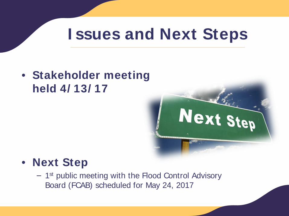
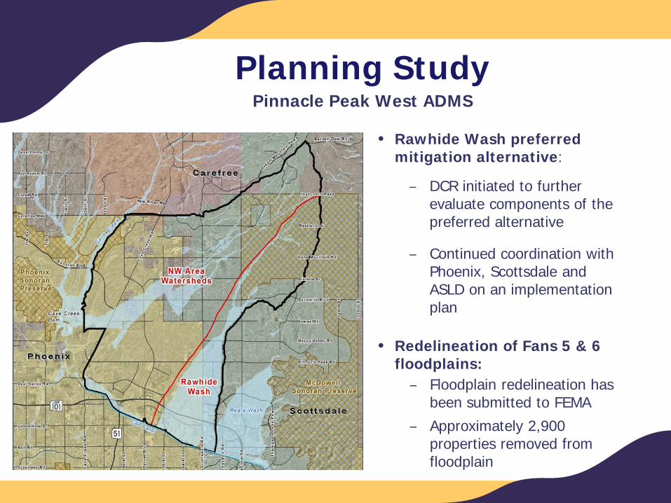
• Next Step− 1st public meeting with the Flood Control Advisory
Board (FCAB) scheduled for May 24, 2017
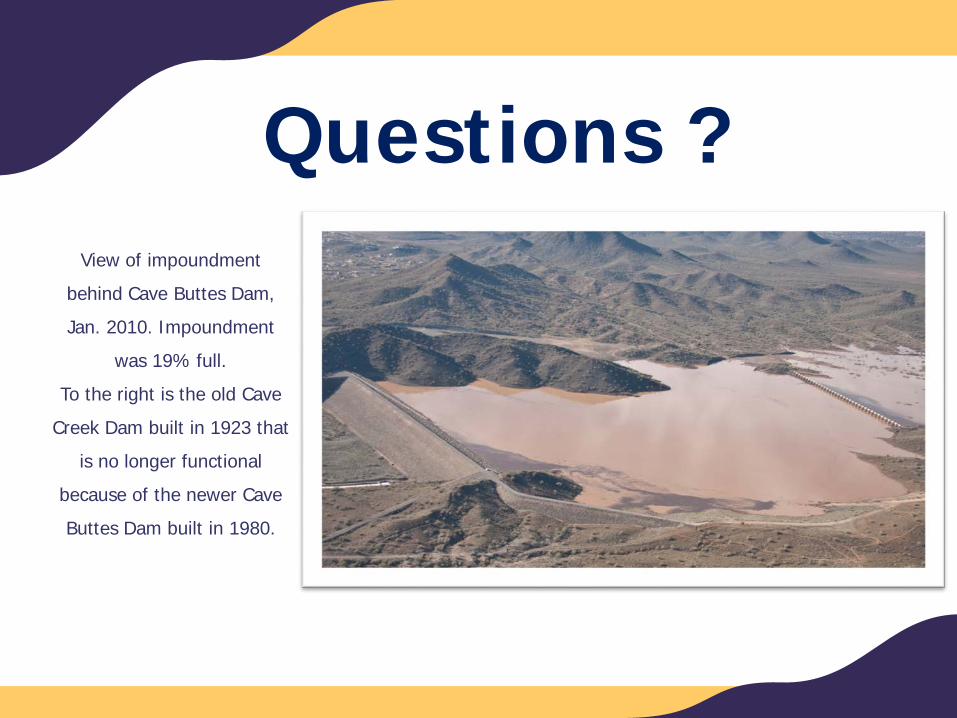
Questions?
Kelli A. Sertich, AICP, CFMBranch Manager
Policy, Planning & Coordination
Federal Actions
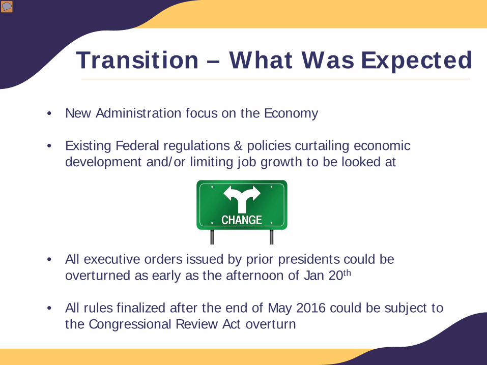
Transition – What Was Expected
• New Administration focus on the Economy
• Existing Federal regulations & policies curtailing economic development and/or limiting job growth to be looked at
• All executive orders issued by prior presidents could be overturned as early as the afternoon of Jan 20th
• All rules finalized after the end of May 2016 could be subject to the Congressional Review Act overturn
Presenter
Presentation Notes
From December FSG – recap of plans and the 8 items FCD submitted to Gov’t relations
What’s Happened So Far
• 23 Executive Orders
• 20 Memorandum
• Important to FCD− Hiring Freeze (Memorandum)− Expediting Environmental Reviews− Reducing Regulation & Controlling Regulatory Costs− Enforcing Regulatory Reform− WOTUS Rule− Reorganizing the Executive Branch
Presenter
Presentation Notes
90 day freeze ended last week – wait and see Did freeze affect expediting reviews? WOTUS waiting on agencies to put info out Waiting on reorg for staffing contacts
Federal Legislation
3,497 Bills Introduced
Important to FCD− NFIP Reauthorization – 7 bills likely rolled into one
− Number of bills about more transparency for EPA, Endangered Species
− Water Infrastructure Improvements for the Nation (WIIN); signed by POTUS 12/16/2016
Policy/Regulation in Process
• E.O. 13690 Federal Flood Risk Management Standards (FFRMS) –response due on USACE Guidelines
• WOTUS Rule – Expectation to have done by end of year
• Reauthorize & Reform the NFIP –hearings in process
• EO13777 – Reg Reform – EPA RRM –May 15
Presenter
Presentation Notes
EO 13690 was to be rolled into one of the climate change EO’s but that was pulled back. FFRMS still in play so need to send response on USACE WOTUS – agencies told to have something out by end of year. Concerns expressed over rushing and not doing enough studies so that Rule doesn’t end up in litigation. However, Rule in litigation since approved in 2015. NFIP – Committee wants to achieve 5-7 reauthorization and continue the program reform. Possibly looking at more privatization, risk based. Previous bills and reauthorization have been tweaked to address what was rolled out that didn’t work.
Waiting On Action
• Continuing Resolution for current FY expiring; need action to fund Federal government after April 28, 2017
• Next FY Budget in process
• Funding Bills not appearing yet
− Farm Bill
− WRDA/WIIN (passed 2016)
− FEMA Grant Notice of Funding
Presenter
Presentation Notes
short-term Continuing Resolution (CR) (H.R. 2028) to prevent a government shutdown and continue funding for federal programs and services until April 28, 2017. The legislation also contains funding for emergency disaster relief. Length and Level of Funding – The CR extends funding for operations for most federal agencies, programs and services until April 28, 2017. It maintains the current budget cap level of $1.07 trillion put into place under the Budget Control Act of 2011.
Questions?
Tom Loomis, P.E., RLS, CFMSpecial Projects Branch Manager
Engineering and Permitting Division
Gila River Flow Studyn-value Measurement Project
Drainage Design Manual (DDM)
DDM On-Going Maintenance/Updating
• Hydrology Manual
• Hydraulics Manual
Presenter
Presentation Notes
From December FSG – recap of plans and the 8 items FCD submitted to Gov’t relations
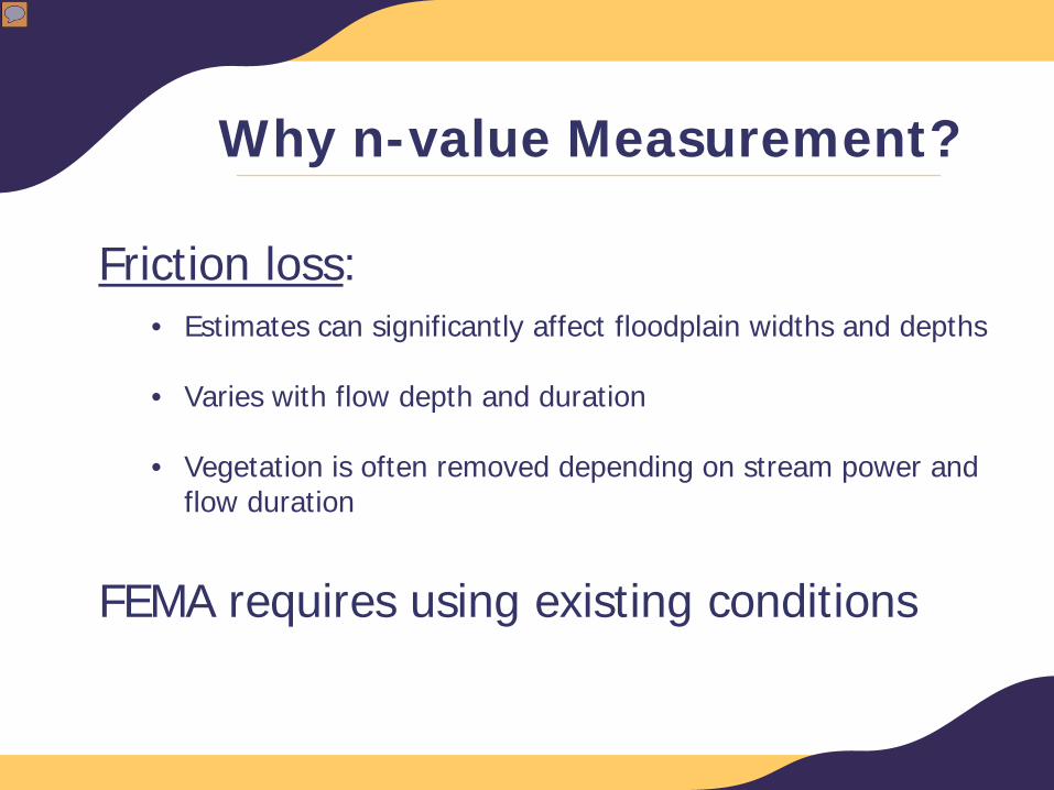
Why n-value Measurement?
Friction loss:• Estimates can significantly affect floodplain widths and depths
• Varies with flow depth and duration
• Vegetation is often removed depending on stream power and flow duration
FEMA requires using existing conditions
Presenter
Presentation Notes
From December FSG – recap of plans and the 8 items FCD submitted to Gov’t relations
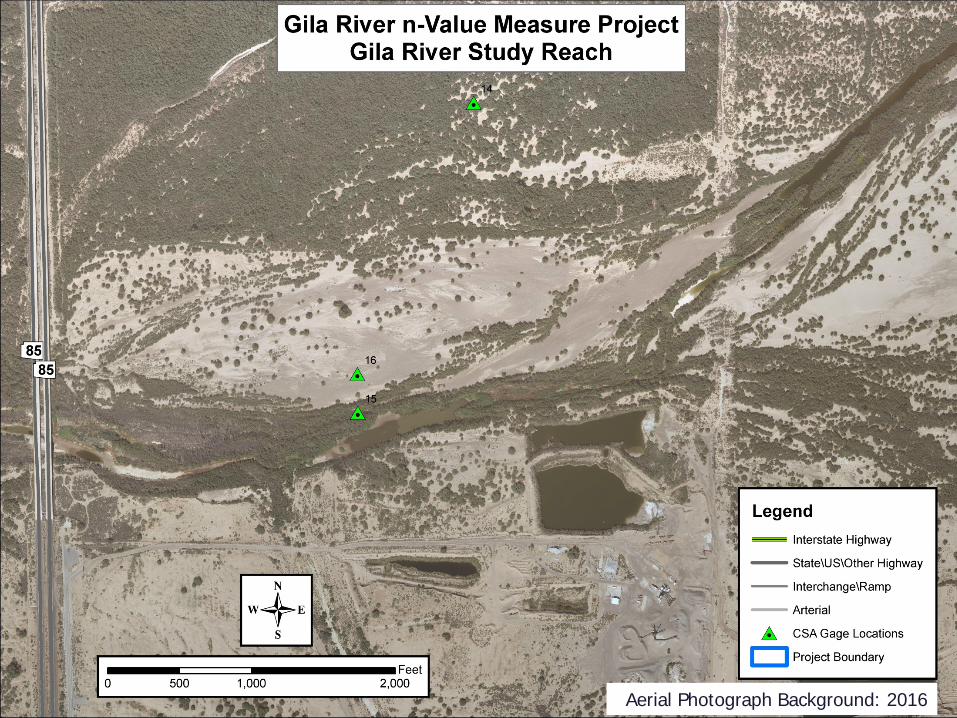
Aerial Photograph Background: 2016
Aerial Photograph Background: 1991
Aerial Photograph Background: 1993
Presenter
Presentation Notes
From December FSG – recap of plans and the 8 items FCD submitted to Gov’t relations
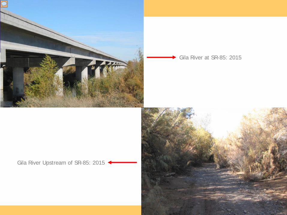
Aerial Photograph Background: 2016
Gila River at SR-85: 2015
Gila River Upstream of SR-85: 2015
Presenter
Presentation Notes
From December FSG – recap of plans and the 8 items FCD submitted to Gov’t relations
Technology Being Applied
• LIDAR topographic mapping and aerial photographs (pre- and post-flood)
• Two-dimensional hydraulic modeling
• Continuous Slope Area Gages
• Particle tracking from videos
Presenter
Presentation Notes
From December FSG – recap of plans and the 8 items FCD submitted to Gov’t relations
Goals
• Use new technologies to more accurately delineate flood hazard areas
• Develop guidelines for applying depth-variable n-values for flood studies
• Obtain acceptance by FEMA
• Update DDM Hydraulics Chapter 7
Presenter
Presentation Notes
From December FSG – recap of plans and the 8 items FCD submitted to Gov’t relations
Where To Go To Learn Moren-value Measurement
– Continuous Slope Area gages and measurements:https://www.usgs.gov/media/videos/continuous-slope-area-method-sycamore-creek-az