31
Flood Risk Review (FRR) Meeting Madison County, Virginia and Incorporated Communities Web Meeting and Conference Call February 5, 2018, 3 PM – 4 PM
Flood Risk Review (FRR) Meeting
Madison County, Virginia and Incorporated CommunitiesWeb Meeting and Conference CallFebruary 5, 2018, 3 PM – 4 PM
1
3 Reasons We Are Here Today
▸ To preview and discuss updated Flood Insurance Study
(FIS) report and Flood Insurance Rate Maps (FIRMs)
for Madison County, Virginia and Incorporated
Communities.
▸ To examine the new study areas, discuss how the
analysis and mapping have changed since previous
FIRMs, and work collaboratively to ensure that the needs
of the community and its partners are met. BECAUSE
THE EARLIER YOU KNOW THE BETTER!
▸ To present a timeline of next steps.
2
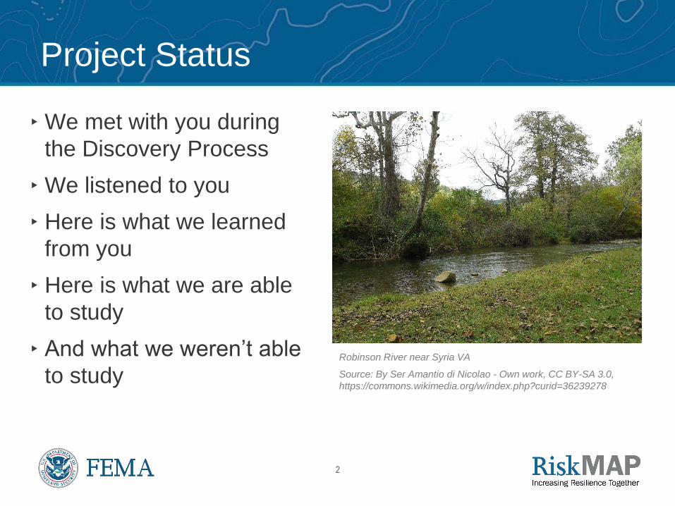
Project Status
▸We met with you during
the Discovery Process
▸We listened to you
▸ Here is what we learned
from you
▸ Here is what we are able
to study
▸ And what we weren’t able
to studyRobinson River near Syria VA
Source: By Ser Amantio di Nicolao - Own work, CC BY-SA 3.0,
https://commons.wikimedia.org/w/index.php?curid=36239278

3
Project Timeline
Discovery Meeting
6/4/2014
Flood Risk
Review Meeting
2/5/2018
Preliminary Flood
Insurance Rate Maps
(FIRMs) Issued
Community Consultation
(CCO) Meeting
Appeal/Protest Period
90 Days (starts after second
posting in the Federal Register)
LFD (start of 6-month ordinance adoption/
compliance period
Effective
Maps

4
How to Read a Flood Plain Map
What Does a Flood Plain Map Tell You?
5
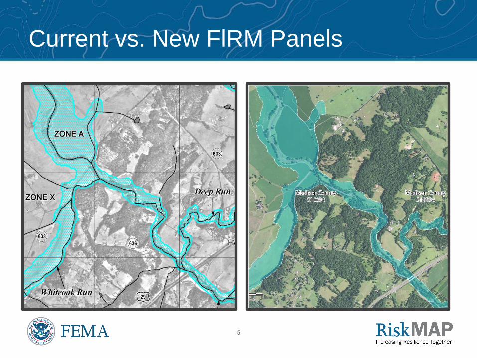
Current vs. New FlRM Panels
6
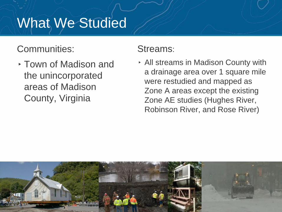
What We Studied
Streams:
▸ All streams in Madison County with
a drainage area over 1 square mile
were restudied and mapped as
Zone A areas except the existing
Zone AE studies (Hughes River,
Robinson River, and Rose River)
Communities:
▸ Town of Madison and
the unincorporated
areas of Madison
County, Virginia

7
Flood Study Data Collection
▸ Elevation and Bathymetric Data:
• The USGS LiDAR collection titled USGS Shenandoah Valley was
collected in 2014 and was used for this update
▸ Hydrologic modeling:
• Historical gage station data was used to estimate flows on portions of
the Rapidan River and Robinson River using date from the following
gage stations
▪ USGS 01666500 - Robinson River near Locust Dale, VA
▪ USGS 01665500 - Rapidan River near Ruckersville, VA
▪ USGS 01667500 - Rapidan River near Culpeper, VA
• National Landcover Dataset 2011 was used to compute the percent
urbanization of each watershed

8
Hydrologic Analysis
▸ Statistical analysis of historical gage station data was used to estimate
flows on portions of Rapidan River and Robinson River
▸ USGS regression equations described in Scientific Investigations
Report 2011-5144, Peak flow characteristics of Virginia Streams and
Scientific Investigations Report 2014-5090, Methods and Equations for
Estimating Peak Streamflow Per Square Mile in Virginia’s Urban Basins

9
Hydrologic Analysis

10
Hydraulic Analysis
▸ USACE HEC-RAS Version 5.0.3 was used for hydraulic modeling for
all studied stream
▸ Updated flood hazard data for all the streams within the study area
with a drainage area of 1 square mile or greater. Streams that have
previously been mapped using detailed methods were not included in
these analyses
▸ Culpeper, Greene, Orange, and Rappahannock Counties have
recently had their Zone A flooding sources restudied using similar
methods to this study. Page County has not yet been updated.
▸ Modeling Notes
• Models do not include bridges or culverts and the hydraulic impact of
structures may not be fully represented by the models
• Models do include the impact of inline structures (eg. dams), but
information is based on LiDAR or estimates from aerial photography
11
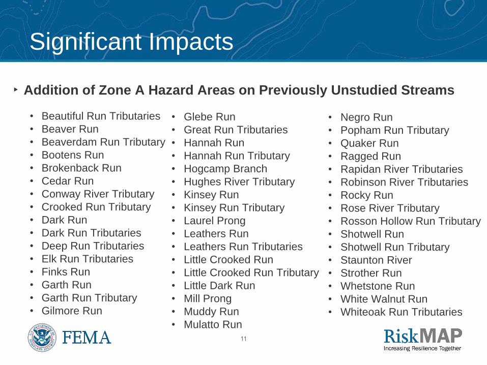
Significant Impacts
▸ Addition of Zone A Hazard Areas on Previously Unstudied Streams
• Beautiful Run Tributaries
• Beaver Run
• Beaverdam Run Tributary
• Bootens Run
• Brokenback Run
• Cedar Run
• Conway River Tributary
• Crooked Run Tributary
• Dark Run
• Dark Run Tributaries
• Deep Run Tributaries
• Elk Run Tributaries
• Finks Run
• Garth Run
• Garth Run Tributary
• Gilmore Run
• Glebe Run
• Great Run Tributaries
• Hannah Run
• Hannah Run Tributary
• Hogcamp Branch
• Hughes River Tributary
• Kinsey Run
• Kinsey Run Tributary
• Laurel Prong
• Leathers Run
• Leathers Run Tributaries
• Little Crooked Run
• Little Crooked Run Tributary
• Little Dark Run
• Mill Prong
• Muddy Run
• Mulatto Run
• Negro Run
• Popham Run Tributary
• Quaker Run
• Ragged Run
• Rapidan River Tributaries
• Robinson River Tributaries
• Rocky Run
• Rose River Tributary
• Rosson Hollow Run Tributary
• Shotwell Run
• Shotwell Run Tributary
• Staunton River
• Strother Run
• Whetstone Run
• White Walnut Run
• Whiteoak Run Tributaries

12
Significant Impacts
▸ Extension of Zone A Hazard Upstream of Previous Study Limits
• Beautiful Run
• Beaverdam Run
• Conway River
• Crooked Run
• Deep Run
• Great Run
• Hughes River
• Popham Run
• Rapidan River
• Robinson River
• Rose River
• Rosson Hollow Run
• Whiteoak Run
13
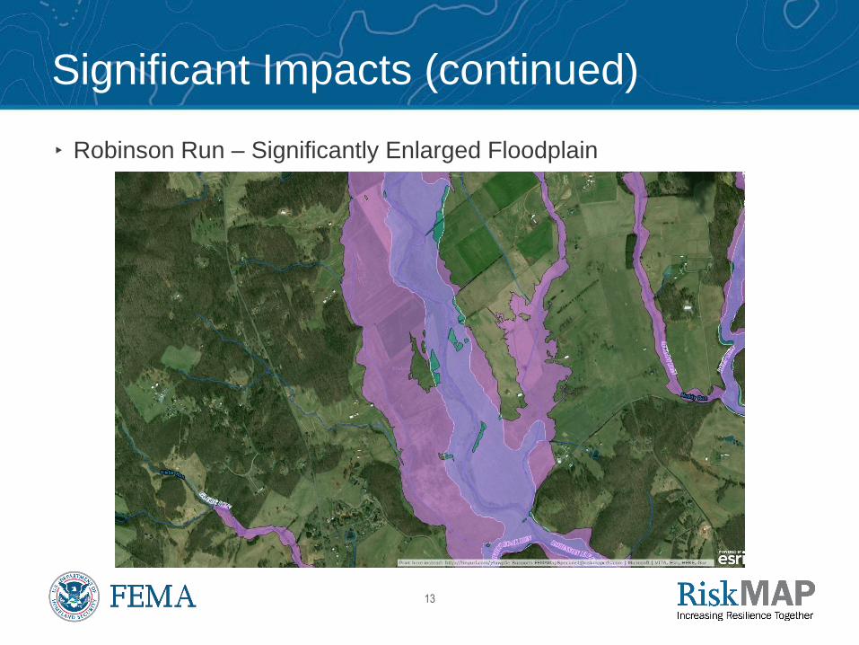
Significant Impacts (continued)
▸ Robinson Run – Significantly Enlarged Floodplain
14
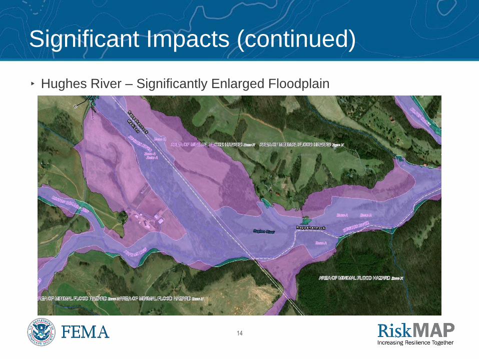
Significant Impacts (continued)
▸ Hughes River – Significantly Enlarged Floodplain

15
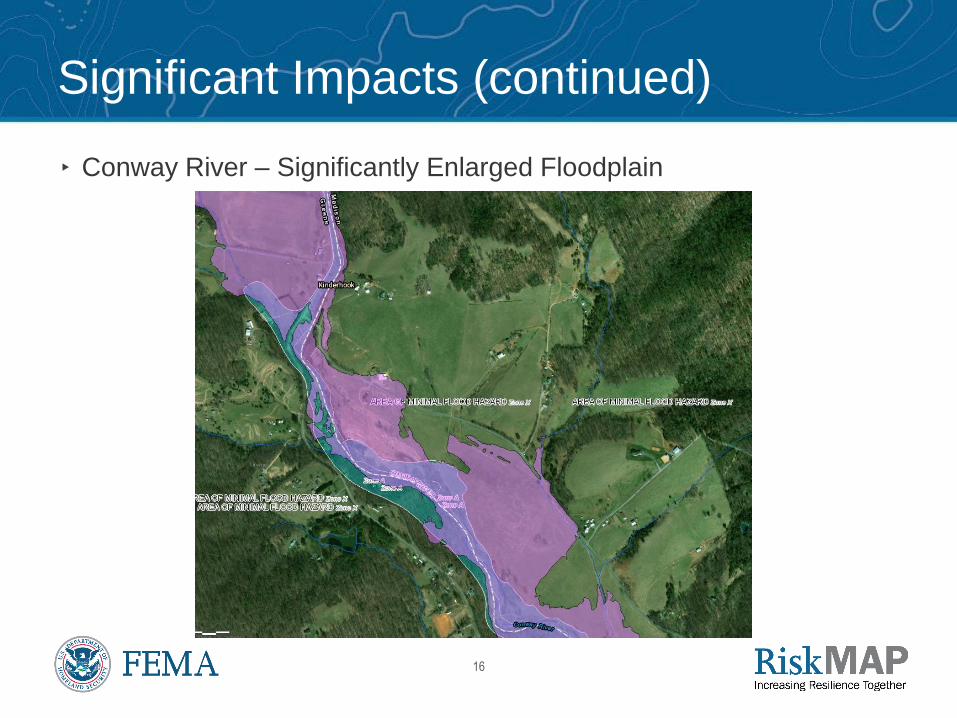
Significant Impacts (continued)
▸ Conway River – Significantly Enlarged Floodplain
16
Significant Impacts (continued)
▸ Conway River – Significantly Enlarged Floodplain

17
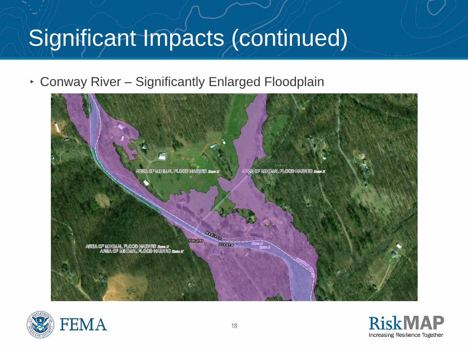
Significant Impacts (continued)
▸ Conway River – Significantly Enlarged Floodplain
18
Significant Impacts (continued)
▸ Conway River – Significantly Enlarged Floodplain
19
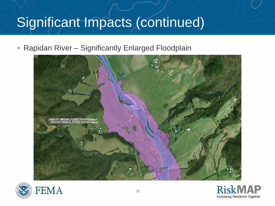
Significant Impacts (continued)
▸ Rapidan River – Significantly Enlarged Floodplain

20
Significant Impacts (continued)
▸ Rapidan River – Significantly Enlarged Floodplain

21
How Did the Floodplain Map Change?
FEMA GeoPlatform CSLF Map Viewer for Madison County, Virginia:
http://arcg.is/1njbv8
Change in Floodplain
Extents:
Red – Increase
Blue – Still Floodplain
Green - Decrease
22
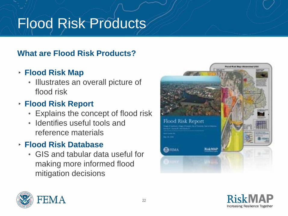
Flood Risk Products
What are Flood Risk Products?
▸ Flood Risk Map
• Illustrates an overall picture of
flood risk
▸ Flood Risk Report
• Explains the concept of flood risk
• Identifies useful tools and
reference materials
▸ Flood Risk Database
• GIS and tabular data useful for
making more informed flood
mitigation decisions
23
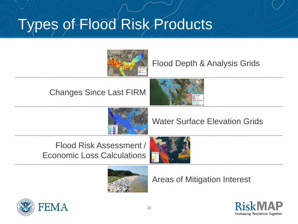
Types of Flood Risk Products
Flood Depth & Analysis Grids
Changes Since Last FIRM
Water Surface Elevation Grids
Flood Risk Assessment /
Economic Loss Calculations
Areas of Mitigation Interest
25
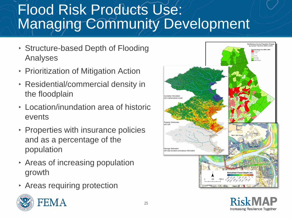
Flood Risk Products Use: Managing Community Development
▸ Structure-based Depth of Flooding
Analyses
▸ Prioritization of Mitigation Action
▸ Residential/commercial density in
the floodplain
▸ Location/inundation area of historic
events
▸ Properties with insurance policies
and as a percentage of the
population
▸ Areas of increasing population
growth
▸ Areas requiring protection
26
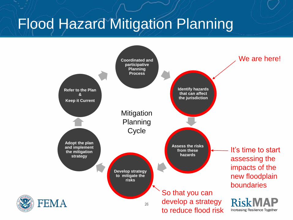
Flood Hazard Mitigation Planning
Coordinated and participative
Planning Process
Identify hazards that can affect the jurisdiction
Assess the risks from these
hazards
Develop strategy to mitigate the
risks
Adopt the plan and implement the mitigation
strategy
Refer to the Plan &
Keep it Current
Mitigation
Planning
Cycle
We are here!
It’s time to start
assessing the
impacts of the
new floodplain
boundariesSo that you can
develop a strategy
to reduce flood risk
27
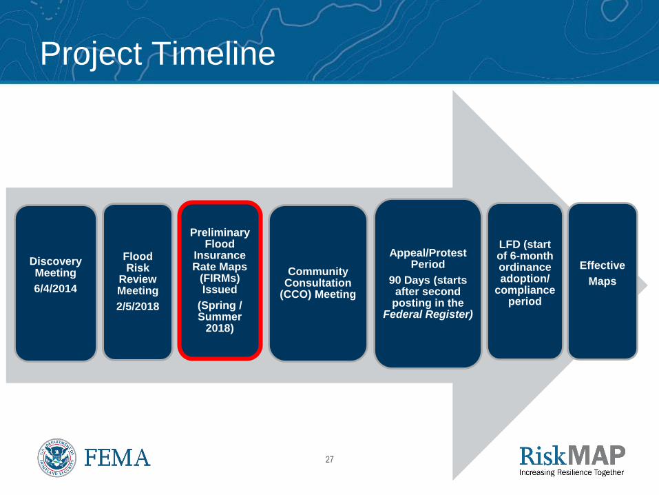
Project Timeline
Discovery Meeting
6/4/2014
Flood Risk
Review Meeting
2/5/2018
Preliminary Flood
Insurance Rate Maps
(FIRMs) Issued
(Spring / Summer
2018)
Community Consultation
(CCO) Meeting
Appeal/Protest Period
90 Days (starts after second
posting in the Federal Register)
LFD (start of 6-month ordinance adoption/
compliance period
Effective
Maps

28
Give Us Your Comments
We want to hear from you!
▸ 30 day comment period
▸ Changes Since Last FIRM viewer located at: http://arcg.is/1njbv8
▸ Review the materials we sent previously
▸ We are available to answer questions
▸ Talk about mitigation actions in your community
Thank you for your participation!
29
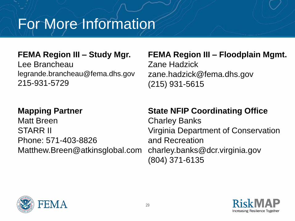
For More Information
FEMA Region III – Study Mgr.
215-931-5729
FEMA Region III – Floodplain Mgmt.
Zane Hadzick
(215) 931-5615
Mapping Partner
Matt Breen
STARR II
Phone: 571-403-8826
State NFIP Coordinating Office
Charley Banks
Virginia Department of Conservation
and Recreation
(804) 371-6135

30


