54
additional reading of the icane Camille event: Photo: Tom Gathright
| Date post: | 04-Jan-2016 |
| Category: |
Documents |
| Upload: | collin-powell |
| View: | 217 times |
| Download: | 0 times |

For additional reading of theHurricane Camille event:
Photo: Tom Gathright


THE ROLE OF DEBRIS FLOWS IN LONG TERM DENUDATION AND LANDSCAPE EVOLUTION
OF THE CENTRAL APPALACHIANS
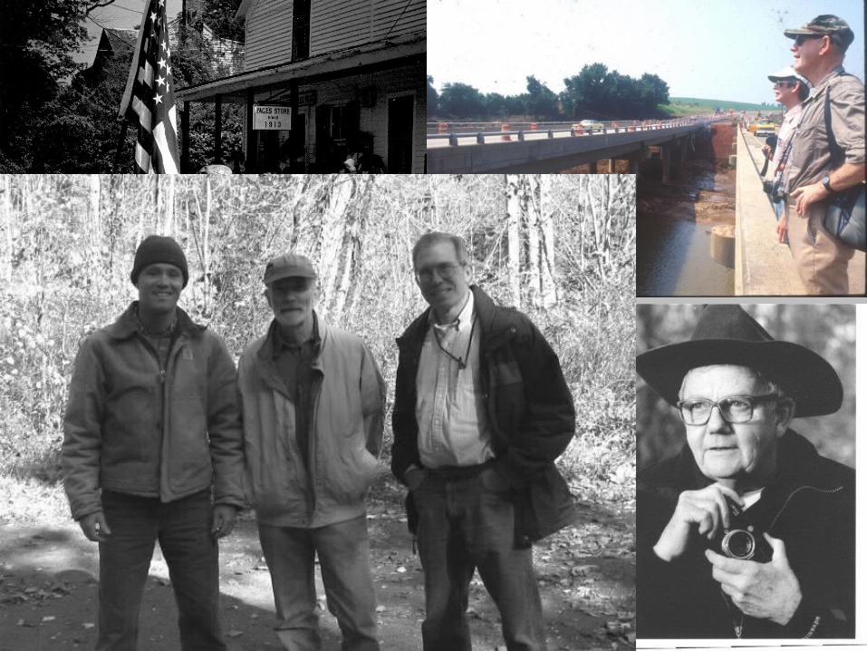
L. Scott Eaton, Ph.D.L. Scott Eaton, Ph.D.Department of Geology and Environmental Department of Geology and Environmental
ScienceScienceJames Madison UniversityJames Madison University
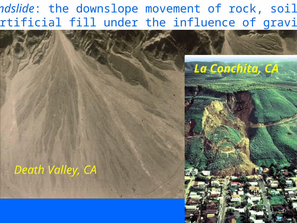
Death Valley, CA
La Conchita, CA
Landslide: the downslope movement of rock, soil, or artificial fill under the influence of gravity.

Venezuela, 1999
Photos: Matt Larsen, USGS

Blue Ridge Mountains, central Virginia


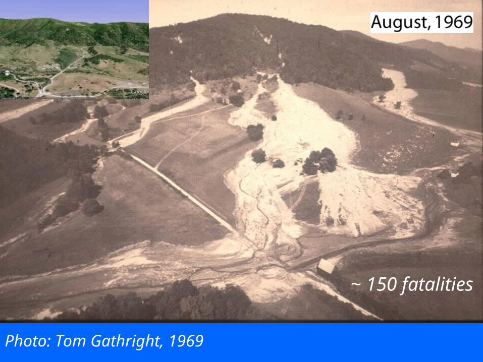
~ 150 fatalities
Photo: Tom Gathright, 1969


C C
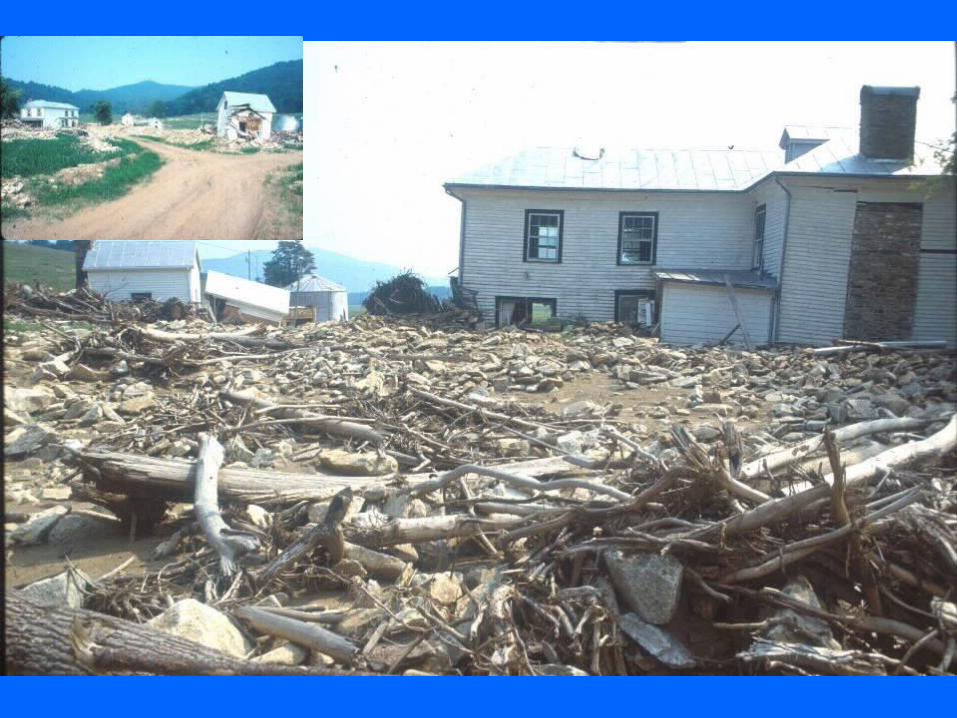
Madison County, Virginia
Rapidan Storm,June, 1995

775 mm,ppt


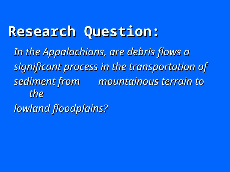
Research Question:Research Question:
In the Appalachians, are debris flows a In the Appalachians, are debris flows a
significant process in the significant process in the transportation of transportation of
sediment from sediment from mountainous terrain to mountainous terrain to thethe
lowland floodplains?lowland floodplains?

What is the frequency of debris flows in the What is the frequency of debris flows in the Appalachians?Appalachians?
How much sediment is transported during an event?How much sediment is transported during an event?
What are the long term erosion (denudation) rates in What are the long term erosion (denudation) rates in the central Appalachians?the central Appalachians?
What are the dominant geomorphic processesWhat are the dominant geomorphic processesoperating within the basin?operating within the basin?

Frequency of debris flowsFrequency of debris flows

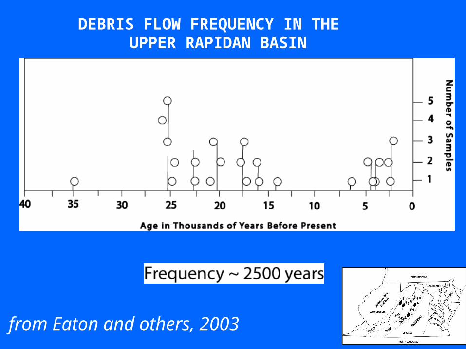
DEBRIS FLOW FREQUENCY IN THE UPPER RAPIDAN BASIN
from Eaton and others, 2003

Nelson County

Sediment Transport and Denudation(from Springer, Shroyer, and Eaton, 1997)

0.398 km2


Before After
? ?
?

13, 364 m3
0.398 km2

Volume = 13, 364 m3
Area 0.398 km2 or 398,000 m2 = 0.034 m
= 3.4 cm

Summary of Basin Denudation of Blue Ridge Systems
Event
BasinBasin Area (km2)
Volume ofSediment Eroded
(m3)
Mean Basin
Denuda-tion (cm)
HurricaneCamilleNelson Co.
Willis Cove
4.08 173,488 4.3
HurricaneCamille,Nelson Co.
Ginseng Hollow
1.75 88,727 5.1
HurricaneCamille,Nelson Co.
Polly Wright Cove
2.47 87,707 3.6
Rapidan Flood,Madison Co.
Jenkins Hollow
0.398 13,364 3.4
Rapidan Flood
Teal Hollow 0.123 2,492 2.0


Long Term and Episodic Denudation
0
1
2
3
4
5
6
7
8
9
10
Nelson County Madison County
Den
ud
atio
n (
cm) Long Term
Episodic
3,500 Years 1 Day
2,500Years 1 Day
HurricaneCamille
RapidanStorm

Dominant geomorphic processes….Dominant geomorphic processes….


~ 2 m
From Ballantyne and Harris,1994
Solifluction Deposits and Landforms

From Ballantyne and Harris,1994


One model of Appalachian landscape evolution and sediment transport…..

BEFORE…..

BEFORE…..

AFTER…..
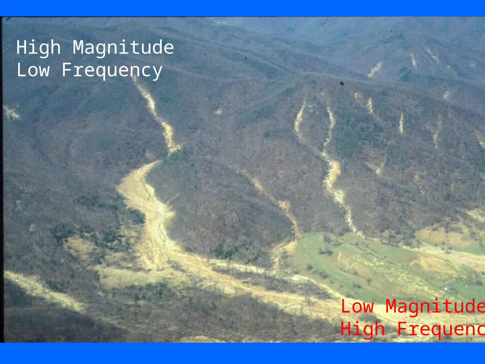
High MagnitudeLow Frequency
Low MagnitudeHigh Frequency
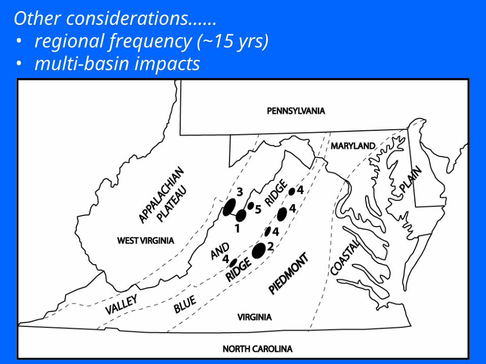
Other considerations……• regional frequency (~15 yrs)• multi-basin impacts


