Hermann Drewes Frequent epoch reference frames instead of instant station positions and constant velocities Deutsches Geodätisches Forschungsinstitut Technische Universität München (DGFI-TUM) SIRGAS Symposium, Mendoza, Argentina, 27-29 November 2017 Deutsches Geodätisches Forschungsinstitut Technische Universität München (DGFI-TUM)
Transcript
Hermann Drewes
Frequent epoch reference frames instead of instant station positions and constant velocities
Deutsches Geodätisches Forschungsinstitut
Technische Universität München
(DGFI-TUM)
SIRGAS Symposium, Mendoza, Argentina, 27-29 November 2017
Deutsches Geodätisches Forschungsinstitut
Technische Universität München (DGFI-TUM)
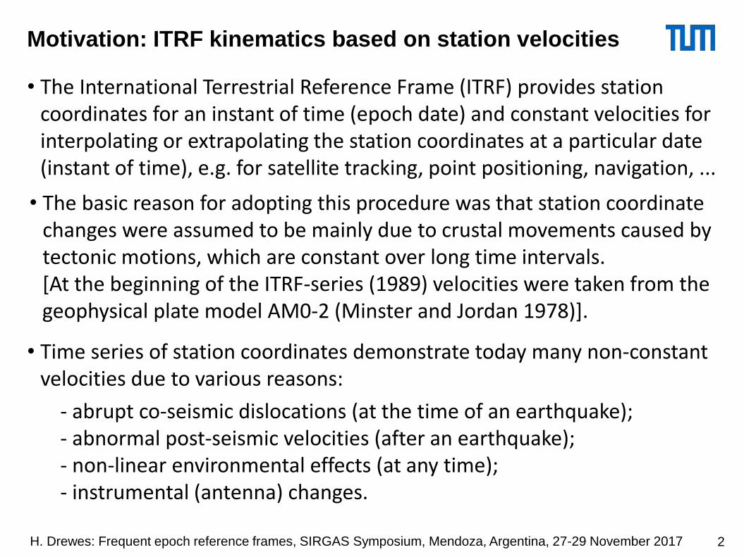
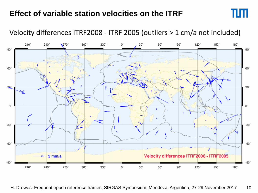
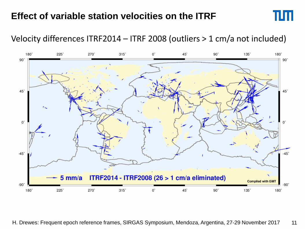
Motivation: ITRF kinematics based on station velocities
• The International Terrestrial Reference Frame (ITRF) provides station coordinates for an instant of time (epoch date) and constant velocities for interpolating or extrapolating the station coordinates at a particular date (instant of time), e.g. for satellite tracking, point positioning, navigation, ...
• Time series of station coordinates demonstrate today many non-constant velocities due to various reasons:
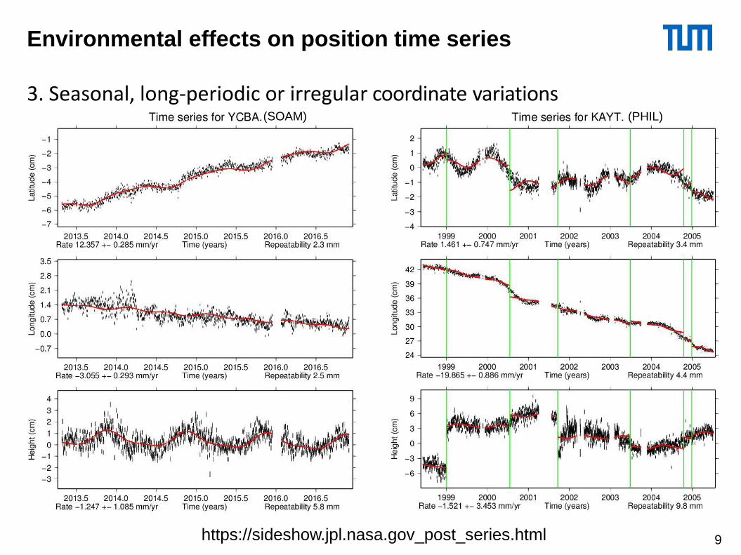
- abrupt co-seismic dislocations (at the time of an earthquake);- abnormal post-seismic velocities (after an earthquake);- non-linear environmental effects (at any time);- instrumental (antenna) changes.
• The basic reason for adopting this procedure was that station coordinate changes were assumed to be mainly due to crustal movements caused by tectonic motions, which are constant over long time intervals.[At the beginning of the ITRF-series (1989) velocities were taken from the geophysical plate model AM0-2 (Minster and Jordan 1978)].
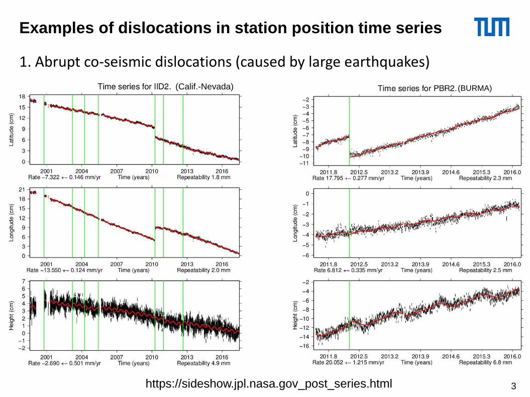
Examples of dislocations in station position time series
1. Abrupt co-seismic dislocations (caused by large earthquakes)
https://sideshow.jpl.nasa.gov_post_series.html
(Calif.-Nevada) (BURMA)
3
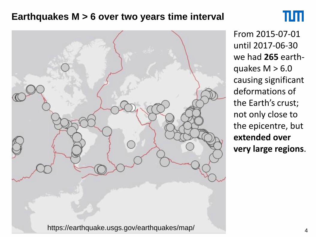
From 2015-07-01 until 2017-06-30 we had 265 earth-quakes M > 6.0 causing significant deformations of the Earth’s crust; not only close to the epicentre, but extended over very large regions.
Earthquakes M > 6 over two years time interval
https://earthquake.usgs.gov/earthquakes/map/ 4
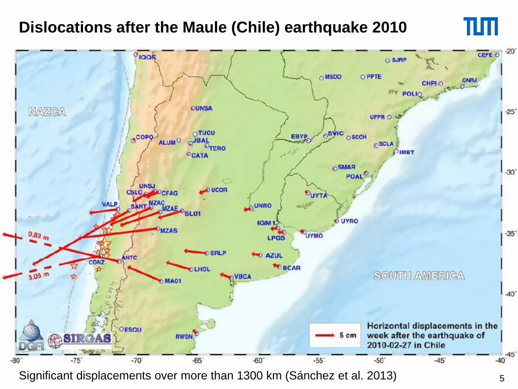
Dislocations after the Maule (Chile) earthquake 2010
Significant displacements over more than 1300 km (Sánchez et al. 2013) 5
6
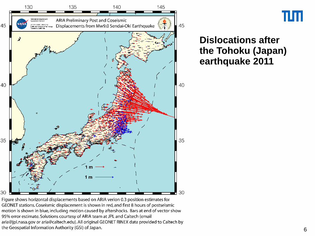
Dislocations after the Tohoku (Japan) earthquake 2011
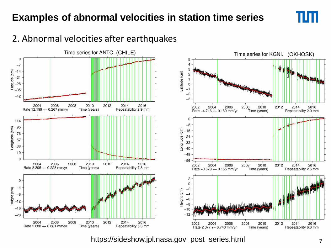
Examples of abnormal velocities in station time series
2. Abnormal velocities after earthquakes
https://sideshow.jpl.nasa.gov_post_series.html
(CHILE) (OKHOSK)
7
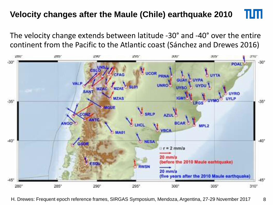
Velocity changes after the Maule (Chile) earthquake 2010
The velocity change extends between latitude -30° and -40° over the entire continent from the Pacific to the Atlantic coast (Sánchez and Drewes 2016)
• Satellite orbit determination: - satellite orbit is independent of crustal movements, tracking stations not;- tracking station coordinates must refer to the actual (real) position;–> e.g., missing seasonal effects falsify sea level estimates of satellite
altimetry.
• Geodynamics and global change studies:- studies are based on time-dependent station coordinates (deformation);–> seismic precursors and effects of climate change (e.g. sea-level rise) are
at the mm-level.
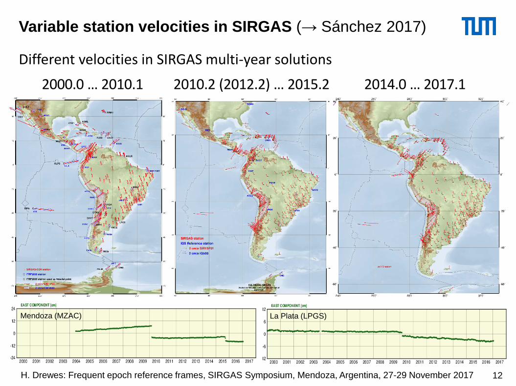
• Precise point positioning, e.g. cadastre, engineering (tubes, power lines), precise navigation: - actual station coordinates are required to relocate the positions ;–> e.g., Japan and Chile could not use the ITRF after the 2010 earthquakes.
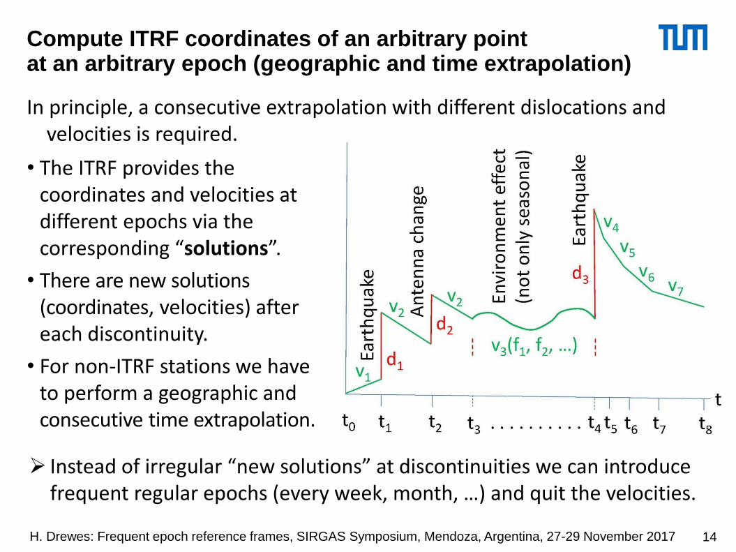
Geographical and temporal inter- / extrapolation is required.
Requirements of regular ITRF epoch reference frames
Epoch reference frames must fulfil the IERS conventions, in particular:• They must be geocentric at any time (without “geocentre motion”);
(“geocentre motion” is its motion relative to the varying ITRF positions)- it is realised by SLR if we don’t add any constraint (e.g. NNR, NNT).
• There must be no global rotation of stations (over the entire Earth’s crust); (present ITRFs rotate ~0.06 mas/a (max. 1.8 mm/a) due to rotating NUVEL-1A);- it can be realised by integrating an epoch grid over all the Earth surface.
• They must be consistent with the ICRF (EOP determined by VLBI);- the present time resolution might not be sufficient;- sub-daily EOP are already in discussion.
• The time resolution of epoch reference frames should be 1 month;- this is necessary for precise geocentric realisation (SLR);- it is sufficient because maximum velocities are ~ 10 cm/a.
• For global accessibility they should include continental reference frames;- AFREF, APREF, EUREF, NAREF, SIRGAS refer to the ITRF;- It can be done by decentralised data processing.
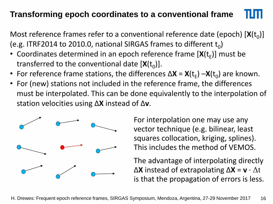
Transforming epoch coordinates to a conventional frame
Most reference frames refer to a conventional reference date (epoch) [X(t0)](e.g. ITRF2014 to 2010.0, national SIRGAS frames to different t0)• Coordinates determined in an epoch reference frame [X(tE)] must be
transferred to the conventional date [X(t0)].• For reference frame stations, the differences ΔX = X(tE) –X(t0) are known.• For (new) stations not included in the reference frame, the differences
must be interpolated. This can be done equivalently to the interpolation of station velocities using ΔX instead of Δv.
For interpolation one may use any vector technique (e.g. bilinear, least squares collocation, kriging, splines). This includes the method of VEMOS.
The advantage of interpolating directly ΔX instead of extrapolating ΔX = v · Δtis that the propagation of errors is less.
Transforming epoch coordinates to a conventional frame
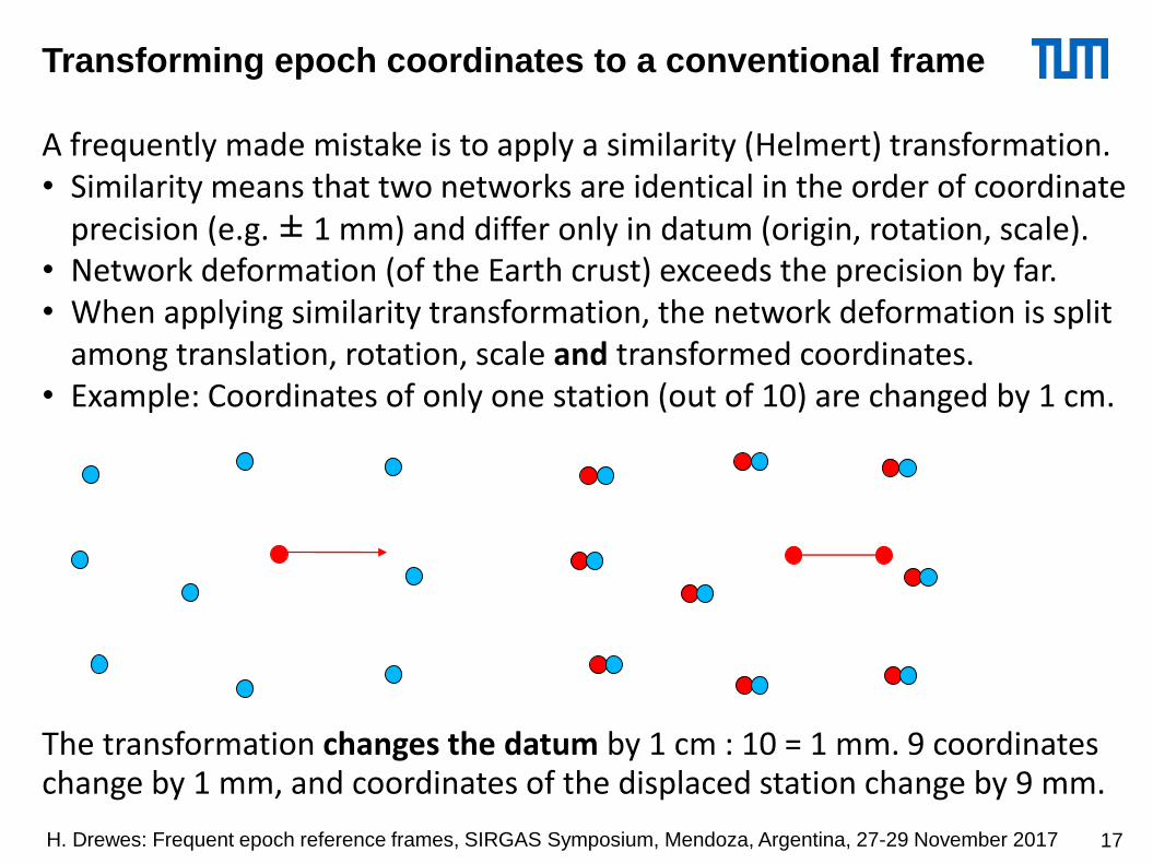
A frequently made mistake is to apply a similarity (Helmert) transformation.• Similarity means that two networks are identical in the order of coordinate
precision (e.g. ± 1 mm) and differ only in datum (origin, rotation, scale).• Network deformation (of the Earth crust) exceeds the precision by far.• When applying similarity transformation, the network deformation is split
among translation, rotation, scale and transformed coordinates.• Example: Coordinates of only one station (out of 10) are changed by 1 cm.