51
GPS Multipath Kristine M. Larson Department of Aerospace Engineering Sciences University of Colorado Friend or Foe?

GPS Multipath
Kristine M. Larson Department of Aerospace Engineering Sciences
University of Colorado
Friend or Foe?

Outline
• Multipath as Foe• Some background on GPS
multipath• Multipath as Friend:
– Soil Moisture– Snow Depth – Vegetation Water Content

Larson, Bilich, and Axelrad, Improving high-rate GPS precision, JGR. 2007
Multipath as foe:

correct multipath today by using “yesterday”

!! !" !# $ # " !!"
!#
$
#
"
%&'()*&+,()-./)'&+01(*
,'
2344)35&6&+78)29*&1&9+)-*1&'71(*)!):951;
Larson, unpublished 1-Hz GPS records from the Parkfield earthquake
can also be critical for 1-hz positions

!! !" !# $ # " !!"
!#
$
#
"
%&'()*&+,()-./)'&+01(*
,'
2344)456&7&(6)8&6(9(:;;<)=&;1(9(6)>?:&+)!)@591A
Agnew and Larson, Finding the Repeat Times of the GPS Constellation, GPS Solutions, 2007
1-hz time series with multipath removed

152004 2008200720062005 20102009
source: PBO website
But if precision is better than a mm without modeling multipath...

Multipath Depends On
• reflector geometry (elevation angle and antenna height) and GPS transmit frequency
• the reflector characteristics (dielectric constant, smoothness)
• the gain pattern of the antenna

Multipath I
cartoon credit: Bilichtheta is the elevation angle
antenna height
reflected
direct
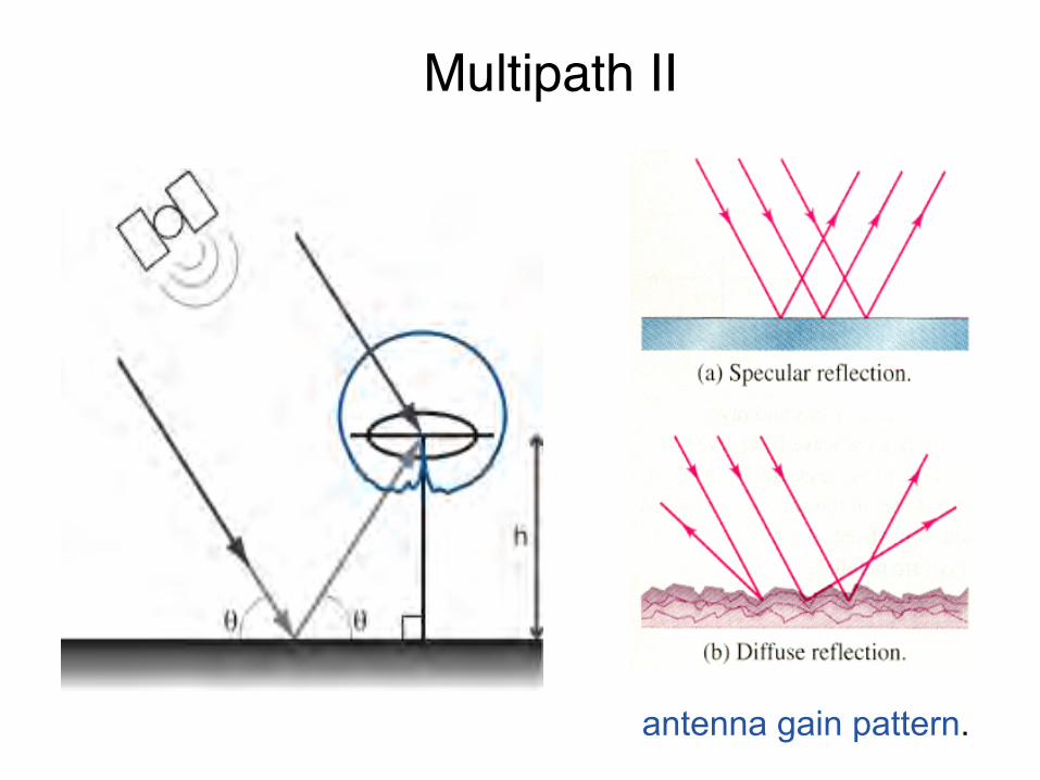
Multipath II
antenna gain pattern.

Figures courtesy of Felipe Nievinski
Right-Hand Circularly Polarized Left-Hand Circularly Polarized
Multipath III

How Multipath Appears in GPS Observables

The oscillations in the Direct and Reflected Signals behave like an interferometer.

The oscillations in the Direct and Reflected Signals behave like an interferometer.

The frequency of multipath oscillations are determined by the antenna height and the GPS frequency; surface & antenna gain pattern determine amplitude
The oscillations in the Direct and Reflected Signals behave like an interferometer.

Map view of GPS footprint
60 40 20 0 20 40 60
60
40
20
0
20
40
60
meters
met
ers
First Fresnel Zones For GPS Site in North America
5o
10o
20o
30o

0 50 100 1500
100
200
300
400
500
600
700including antenna gain pattern
minutes
SNR
[V]
0 50 100 15040
30
20
10
0
10
20
30
Simulated SNR for specular reflector with antenna ht 1.9 meters
Direct Signal
Reflected Signal

0.1 0.2 0.3 0.4 0.5 0.6 0.70
100
200
300
400
500
600
700Simulated SNR data with gain pattern
sin(elevation angle)
SNR
[V]
0.1 0.2 0.3 0.4 0.5 0.6 0.740
30
20
10
0
10
20
30
SNR as function of sine (elevation angle)

0.1 0.2 0.3 0.4 0.5 0.6 0.70
100
200
300
400
500
600
700Composite SNR Signal
sine(elevation angle)
SNR
[V]

11 12 13 14 15 1630
35
40
45
50
55Observed Composite Signal
dBH
z
hours (UTC)
What is observed?

11 12 13 14 15 160
50
100
150
200
250
300
350
400Observable S2 Linear Scale
SNR
(V)
hours (UTC)
SNR - Linear Scale

0.1 0.15 0.2 0.25 0.3 0.35 0.4 0.45 0.550
40
30
20
10
0
10
20
30
40
50Observed Multipath Signal
sine(elevation angle)
SNR
(V)
the reflected signal
Changes in these oscillations (frequency, amplitude) are related to changes in the reflectors.

three scientific targets (so far)
vegetationsnowsoil moisture

How else do they measure soil moisture content?
high-tech low-tech
water content reflectometers

relation between volumetric water content and multipath phase
0 0.05 0.1 0.15 0.2 0.25 0.3 0.35 0.4230
235
240
245
250
255
260
265
VWC (cm3/cm3)
(deg
rees
)PRN 29

initial results
Larson, Small, Gutmann, Braun, Zavorotny, and Bilich, Use of GPS receivers as a soil moisture network for water cycle studies, Geophys. Res. Lett., 2008

Water Content Reflectometers GPS
Larson, Small, Gutmann, Braun, Zavorotny, and Bilich, GPS Multipath and Its Relation to Near-Surface Soil Moisture Content, IEEE J-STARS, 2010

GPS Snow Sensing

How else do you measure snow depth?
high-tech low-tech
ultrasonic snow depth sensors

0.1 0.2 0.3 0.460
30
0
30
60
sin(elevation angle)
B.
volts
/vol
ts
Modeled GPS SNR Data
0.1 0.2 0.3 0.460
30
0
30
60Observed GPS SNR Data
volts
/vol
ts
A. no snow
35 cm ofnew snow
Larson, Gutmann, Braun, Zavorotny, Williams, and Nievinski, Can we measure snow depth with GPS receivers?, Geophys. Res. Lett., 2009
295 297 299 301 303 305 307 3095
0
5
10
15
20
25
30
35
40
45
50hand measurements
GPS satellitesultrasonic snow sensors
day of year (2009)
snow
dep
th (c
m)
Plate Boundary Observatory Site P041

Plate Boundary Observatory Site P360

2009.85 2009.95 2010.05 2010.150
0.1
0.2
0.3
0.4
0.5
0.6
0.7
0.8
0.9
1
year
snow
dep
th (m
)
Preliminary Results for p360
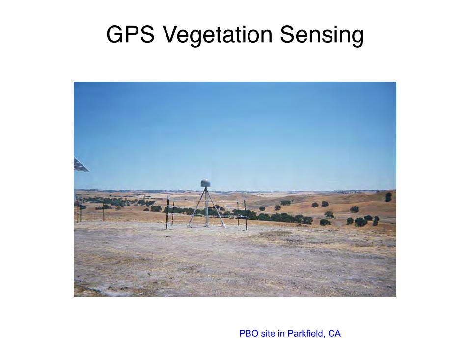
GPS Vegetation Sensing
PBO site in Parkfield, CA

4 months later
photo courtesy of John Langbein
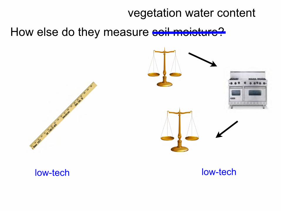
How else do they measure soil moisture?
low-tech low-tech
vegetation water content

5 10 15 2060
40
20
0
20
40
60
volts
grass cut
70 cm grass
elevation angle
Munson Hay Site
Munson Grass Site
Vegetation Effects in SNR Data

problem: L2 SNR data quality is poor for most PBO sites
(one) solution: multipath can also be observed in MP1

Example of MP1 time series - single satellite, single station
MP1 usually reported as the mean of the RMS for each satellite.
10 20 30 40 50 60 70 802
1.5
1
0.5
0
0.5
1
1.5
2P422 2008 July 1
elevation angle
MP1
(m)

2007 2007.5 2008 2008.5 20090.2
0.25
0.3
0.35
0.4
0.45
0.5
0.55
0.6
0.65
years
cmMP1 P070
how do people typically use mean RMS MP1?


10 20 30 40 50 60 70 802
1.5
1
0.5
0
0.5
1
1.5
2P422 2008 July 1
elevation angle
MP1
(m)
10 20 30 40 50 60 70 802
1.5
1
0.5
0
0.5
1
1.5
2P422 2008 April 1
elevation angle
MP1
(m)
Any evidence that MP1 varies during the year - as vegetation would?

10 15 20 25 30 35 40 45 50 55 60 65 70 750
10
20
30
40
50
60
70
80
elevation angle
stan
dard
dev
iatio
n (c
m)
P0422 MP1 PRN17
SpringSummer

What can we compare MP1 variations to?
ratio of spectral reflectance in the near-infrared and red regions, i.e. how green it is.
NDVI: Normalized Difference Vegetation Index
NDVI MODIS: every 16 days, 250 m by 250 m pixel

Foothill, Idaho P422
2007 2008 2009 2010
44
40
36
32
28
MP1
(cm
)p422
2007 2008 2009 20100.1
0.3
0.5
0.7
0.9
ND
VI
Small, Larson, and Braun, Sensing Vegetation Growth With Reflected GPS Signals, Geophys. Res. Lett., in review.

Battle Mountain, Nevada P085
58
54
50
46
42
38
MP1
(cm
)
p085
0.1
0.3
0.5
ND
VI
2007 2008 2009 20100
50
100
perc
ent
average
annual accumulated precipitation
year

low-tech low-tech
Does MP1 correlate with standard measures of vegetation water content?

Munson Farms

50
45
40cm
MP1 (low elevation only)
140 160 180 200 220 2400
1
2
3
4
kg/m
/m
Vegetation Water Content
day of year
comparison with in situ data
Small, Larson, and Braun, Sensing Vegetation Growth With Reflected GPS Signals, Geophys. Res. Lett., in review.

Value to NSF
• expand the use of an existing GPS network to new communities (hydrology, ecology, atmospheric sciences, cryosphere, water management)
• provide data products to improve weather prediction and climate studies (outreach and broader impacts).
Value to NASA• potential validation network and supplementary sensor (i.e.
vegetation) for new environmental satellite missions, especially SMAP, Desdyni.

Conclusions!
• Locating your GPS antenna in a corn field is an effective multipath suppressant.
• GPS multipath is sensitive to soil moisture, snow, and vegetation water content.
• More studies are needed to calibrate multipath data so that they can be assimilated into land surface/atmospheric/hydrological models.

Acknowledgements
• NSF AGS and EAR (0740515 and 0935725)• Eric Small and John Braun • Ethan Gutmann, Mark Williams, Valery Zavorotny,
Felipe Nievinski, Andria Bilich, Penina Axelrad, and Bob Munson
• Plate Boundary Observatory, esp. Fred Blume and Mike Jackson.
• UNAVCO, esp. Chuck Meertens, Jim Normandeau, Dave Maggert, Lou Estey, and Sarah Doelger.
• CU Interdisciplinary Seed Grants


