1 From Prairie to Destination: The Story of South Grand Approaching the intersection of Grand and Arsenal from the north today is a journey through several phases of historical development. From the medical campus of St. Louis University, one passes a wide range of interesting residential, commercial, and institutional buildings that speak to the prominence of the route in the history of the city, and the ways in which it has been used by past residents. Healthcare has been a part of the story for nearly a century. In 1930 Firmin and Lydia Desloge donated the money to build the iconic French Gothic revival tower of Desloge Hospital to St. Louis University and the Sisters of St. Mary, and in 1923, the Missouri Pacific Railway built a hospital for its employees (today’s Anheuser Busch Institute) at 1755 S. Grand. The route of Grand in this area is situated on a high ridge and the elevation of the land made it a natural choice for the placement of the Compton Hill Reservoir with its stunning standpipe tower (designed by Harvey Ellis and completed in 1899). In earlier decades, Grand was a posh residential address as evidenced by the 1888 Mansion designed by Theodore Link for timber magnate Erastus Warner (MO Division of Mental Health). While the home predates much of its surrounding neighborhoods, the earliest surviving residence on this stretch of South Grand is the Greek revival mansion built for Rene’ Beauvais at the northwest corner of Magnolia and Grand in 1867 (today’s Beauvais Manor). Only briefly occupied by the Beauvais family, by the 1880s the building was being used by the Women’s Christian Association to care for indigent women, many of whom were widows of the Civil War. The Beauvais home was a logical choice for such a use considering its proximity to the tranquility of Tower Grove Park. Donated to the city in 1868 by philanthropist Henry Shaw, the park is a National Historic Landmark
Transcript
1
From Prairie to Destination: The Story of South Grand
Approaching the intersection of Grand and Arsenal from the north today is a journey
through several phases of historical development. From the medical campus of St. Louis
University, one passes a wide range of interesting residential, commercial, and institutional
buildings that speak to the prominence of the route in the history of the city, and the ways
in which it has been used by past residents. Healthcare has been a part of the story for
nearly a century. In 1930 Firmin and Lydia Desloge donated the money to build the iconic
French Gothic revival tower of Desloge Hospital to St. Louis University and the Sisters of St.
Mary, and in 1923, the Missouri Pacific Railway built a hospital for its employees (today’s
Anheuser Busch Institute) at 1755 S. Grand.
The route of Grand in this area is situated on a high ridge and the elevation of the
land made it a natural choice for the placement of the Compton Hill Reservoir with its
stunning standpipe tower (designed by Harvey Ellis and completed in 1899).
In earlier decades, Grand was a posh residential address as evidenced by the 1888
Mansion designed by Theodore Link for timber magnate Erastus Warner (MO Division of
Mental Health). While the home predates much of its surrounding neighborhoods, the
earliest surviving residence on this stretch of South Grand is the Greek revival mansion
built for Rene’ Beauvais at the northwest corner of Magnolia and Grand in 1867 (today’s
Beauvais Manor). Only briefly occupied by the Beauvais family, by the 1880s the building
was being used by the Women’s Christian Association to care for indigent women, many of
whom were widows of the Civil War. The Beauvais home was a logical choice for such a
use considering its proximity to the tranquility of Tower Grove Park. Donated to the city in
1868 by philanthropist Henry Shaw, the park is a National Historic Landmark
2
characterized by the country’s best collection of Victorian pavilions, beautiful landscape
design and an outstanding variety of ancient trees and botanical specimens.
While largely rural until the early 20th century, by the 1910s South Grand as we
know it today was beginning to take shape. A stroll through the South Grand business
district today requires some imagination to conjure the area’s history, but the buildings
will tell you a lot of the story if you know how to listen. The neighborhood still offers
abundant amenities housed in the multistory commercial buildings that line the street for
blocks. While some newer buildings from the end of the 20th century intrude, the historic
commercial corridor is largely intact and the surrounding residential areas remain a
showplace of late 19th and early 20th century homes. Evenings along South Grand are
particularly vibrant as people from the surrounding neighborhoods (among the city’s most
densely populated and diverse) and from across the region flock to the district’s one-of-a-
kind restaurants and specialty stores. While the streetcars that once formed the backbone
of neighborhood transit are gone, the Metro Bus route through the district is the city’s
busiest. Public transit, pedestrian traffic and even automobiles in the South Grand business
district have maintained a constant presence for well over a century.
While many other areas of St. Louis lost enormous numbers of people to exurban
flight in the second half of the 20th century, South Grand and the surrounding community
was largely insulated from this trend. The relative stability the neighborhood enjoys has
allowed its physical fabric to remain remarkably intact. Because the neighborhood still
retains the appearance of a middle class streetcar suburb of the turn of the 19th century, it
is both comprised of—and surrounded by—buildings that are listed in the National
Register of Historic Places. The quality of the area’s architecture is celebrated by the Shaw,
3
Tower Grove Heights, Tower Grove Heights East, Tower Grove East, and Crittenden Place
historic districts to name a few. Within the business district itself, both the Dickmann
Building and the Hamiltonian Federal Savings & Loan Building—have been individually
listed on the national register.
But while the South Grand area in many ways has shown remarkable consistency
over the last century, in its early years it was the scene of very rapid change. A streetcar
approaching the business district in 1915 was approaching a bustling shopping center.
That same streetcar fifteen years earlier was pulling into a remote outpost where real
estate speculators and farmers still eyed each other over split rail fences. Indeed prior to
the large scale electrification of the city’s streetcar system in the 1890s, if you came to the
area at all you were probably arriving in a horse-drawn omnibus and were bound for a
destination such as the rural campus of St. Elizabeth’s Academy, Christopher Schiller’s
vineyard, the Old Picotte (Pickers) Cemetery where Roosevelt High School is today, or the
isolated retreat of Tower Grove Park.
An omnibus line had run along Arsenal to the area since the 1860s, mostly to serve
recreational visitors to Tower Grove Park.1 Grand Avenue had been surveyed by the
middle of the 19th century, though for decades it remained a dirt track running along an
isolated ridge. If one takes a moment to ponder the area’s geography today, you will note
that the elevation of the land falls away to the west of Grand. Proposed in the early 1850s,
Grand Avenue as a formal thoroughfare was intended to divide several Colonial Era
common fields while essentially ringing the new city limits from north to south. In the area
of the South Grand business district, the street divided the St. Louis Common on the east
1 NiNi Harris, A Grand Heritage: A History of the Southside Neighborhoods and Citizens, 21.
4
from the Prairie des Noyers on the west. 2 Originally lands that were set aside for
commonunal use, the City began sales of the property in the 1830s though it was still
mostly used for agricultural purposes and as country estates until the late 19th century.3
In the early land sales, several prominent citizens acquired substantial tracts of the
commons. Among them was successful merchant and visionary public benefactor Henry
Shaw. From much of the land he purchased in the former Prairie des Noyers, Shaw created
both the Missouri Botanical Garden and Tower Grove Park; the latter he donated to the City
in 1868.4 Despite the fact that both of these institutions were located beyond the city limits
when created, they would eventually play a role in defining the identity of a large section of
urban St. Louis and help to position the South Grand area for later residential and
commercial development.5
The neighborhoods surrounding Tower Grove and what would become the South
Grand Business District remained largely undeveloped throughout the 1860s, 1870s and
1880s, owing primarily to its distance from downtown. The city limits were expanded to
the south with the annexation of Carondelet in 1870, and then to their current boundaries
far to the west in 1876. Still, the current South Grand area remained largely undeveloped
aside from some country estates and mining activities such as Oak Hill to the west where
James Russell ran coal and clay mining operations.6
2 Eric Sandweiss, St. Louis: The Evolution of an American Urban Landscape, 71-72; Norbury L. Wayman, History of St. Louis Neighborhoods: Shaw. 3 Sandweiss,73-74. 4 Harris, 14. 5 Sally F. Schwenk, Cathy Ambler, and Kerry Davis. South St. Louis Historic Working- and Middle-Class Streetcar Suburbs, Sec. E, 19. 6 Norbury L. Wayman, History of St. Louis Neighborhoods: Oak Hill.
5
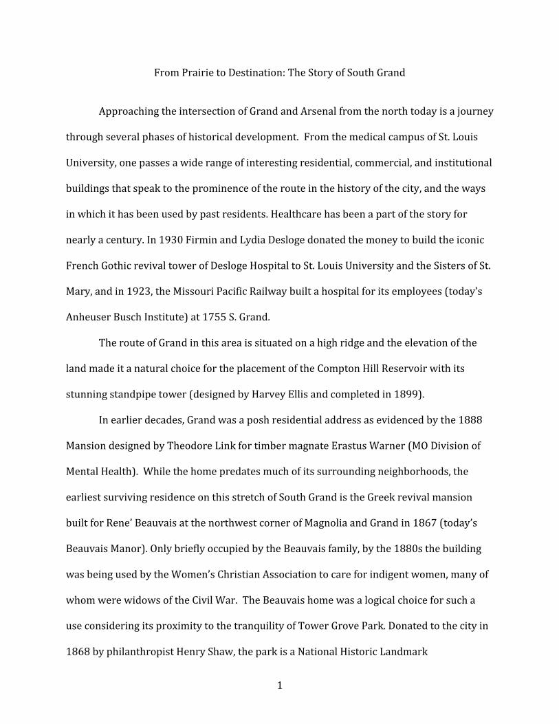
The 1875 Pictorial St. Louis map provides an excellent view of the South Grand area
prior to major development.7
Figure 1: Grand & Arsenal c. 1875. Source: Pictorial St. Louis, Plate 65.
St. Louis was growing rapidly in the last third of the 19th century. The population increased
by more than 150,000 residents between 1860 and 1870 alone and it was becoming
apparent that more space would soon be needed. Looking into the near future, real estate
companies and developers began to see great opportunities along South Grand. One
developer, William Switzer, borrowed more than $500,000 (an enormous sum at the time)
from the Connecticut Mutual Life Insurance Company to purchase lands in the area, but
passed away before he had the chance to realize his plans to create a new residential
7 Compton & Dry, Pictorial St. Louis, Plates 62 and 65.
6
district. The land reverted to Connecticut Mutual in 1878, which then created a subsidiary
known as the Connecticut Realty Company to pursue Switzer’s vision.8
Starting with nothing but empty land, much like a modern suburban developer, the
company first had to subdivide lots, survey and pave streets, and install utilities before it
could break ground on its first home.9 Of course, access to the area remained an issue, but
things were poised to change quickly.
In 1889, the Grand Avenue Viaduct was completed clearing the way for the route to
become the major north-south artery of transit it remains today.10 Prior to its completion,
movement between north and south St. Louis along Grand had been hampered by the
difficulty of crossing the busy rail yards in the Mill Creek Valley north of Chouteau.11 With
this problem solved, a concerted effort to pave the route and its collector streets was
undertaken with participation by both municipal authorities and developers who stood to
profit from road improvements. For example, Connecticut Realty paid for the paving of
Hartford, Juniata, Connecticut, and Wyoming, among others.12
With arrival of the electric streetcar, the area was given the last piece of the
development puzzle. Across the United States, the introduction of the electric streetcar
after 1887 revolutionized intra-urban travel. The convenience and relative speed of the
streetcar changed everything from the areas where people could live and shop to how
space was organized. 13
8 Lynn Josse, Tower Grove Heights Historic District, Sec. 8, 197 9 Sandweiss, 134-135 10 Schwenk, South St. Louis Historic Working- and Middle-Class Streetcar Suburbs, Sec. E, 24. 11 Ibid., Sec. E, 20. 12 Sandweiss, 176-177. 13 Schwenk, South St. Louis Historic Working- and Middle-Class Streetcar Suburbs Sec. E, p.4-5
7
Prior to the era of the electric streetcar, only the upper classes had the means to
access suburban areas surrounding the city center by railway because this form of
commuting was simply too expensive for working- and middle-class residents. While
horse-drawn omnibuses were more accessible, they traveled too slowly to be a convenient
option for commutes of any substantial distance. As a result, prior to the arrival of the
electric streetcar, most people resided in close proximity to their places of employment. By
dramatically reducing travel time from urban centers to cheaper mostly undeveloped land
on their outskirts, and doing so at an affordable rate, electric streetcars allowed the
working- and middle-classes of St. Louis the ability to live in new “suburban” environments
miles from the central business district.
As noted by the President of the Southwestern Mercantile Association in a 1908
promotional booklet that touted the advantages of the South Grand area, “[t]he rapid
growth of this section is latterly due, of course, in no small measure, to the extension of our
splendid street railway system.” He continued “[A]nd when it is remembered that the
horse and mule held sway until the year of 1887, and that the speed of the cable line then
opened was limited to eight miles per hour west of Garrison Avenue, this extension and
improvement in the system itself is an achievement of which any city might well be
proud.”14 Because of the streetcar’s affordability and efficiency, development began to
expand throughout the City as never before. 15
The South Grand area we know today was a product of this new era of mobility. In
addition to facilitating the development of new residential and business districts, the
streetcar also made other amenities more accessible. Destinations such as Tower Grove
14 Southwest Saint Louis, p. 1. 15 Jackson, 112.
8
Park no longer took the better part of a day to reach, even for those residents who still lived
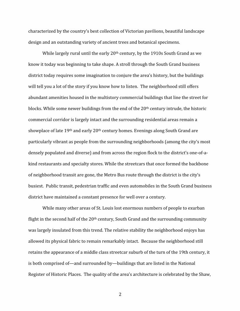
in the older parts of the city. As such, some entrepreneurs in the South Grand area catered
to tourists and residents alike. A good example can be found in Leonard Priester’s saloon
and “summer garden” at 3106 South Grand (southeast corner of Grand and Arsenal) in the
first decade of the 20th Century.16
Figure 2: Leonard Priester's summer garden in 1907. Priester occupied the space as early as 1903. Source: South Grand Ave. Review
Interestingly, in the heart of what is today the South Grand business district,
residences and not commercial buildings were the earliest properties to be developed.
While most of these early buildings were replaced by later commercial infrastructure, some
evidence of these early days can be found on the west side of Grand between Juniata and
Connecticut. A two-flat residence (3159-61 South Grand) was constructed in 1894 and then
later turned into commercial storefronts on the ground floor. Two other residences were
16 “Mr. L. Priester,” South Grand Avenue Review.
9
constructed in 1896 and 1897, at 3169 and 3167 South Grand, respectively. All three of
these buildings stand today. The next earliest extant building in the business district is
3157 South Grand, which was constructed in 1901.
10
Figure 3: Little development had occurred along South Grand by 1903, with just a few buidlings present. Note block between Juniata and Connecticut Streets; each number ends in "A." Source: Sanborn Fire Insurance Maps,
#65 and #63. University of Missouri Digital Collections
At the turn of the century, development was poised to begin in earnest. Connecticut
Realty held successful lot auctions in the early 1900s, which were then followed by the
rapid construction of entire blocks of new homes between 1904 and 1909.17
The change wrought by the activities of this one company was dramatic, as noted in
1908 in the promotional book, Southwest Saint Louis. James M. Rollins, president of the
Tower Grove Heights Improvement Association noted: “[F]our years ago when the
Connecticut Realty Company placed upon the market the property which had been sub-
divided, at a public auction, it was an uncertain problem as to what would be the outcome.
No one could have imagined the results that immediately followed. Within this short period
of time, thousands of homes and business houses have been erected, millions of dollars
have been invested, and more than five thousand citizens, most of whom own their own
17 Josse, Tower Grove Heights Historic District, Sec. 7, 5.
11
homes, now live within the district.”18 Of course, this kind of transformation was
apparently expected of the booming city of St. Louis, but, Rollins noted, “[H]ad the
improvements and accomplishments taken place in an Oklahoma district (for example), the
facts would have been heralded forth to all the world as a phenomenal accomplishment in
the building of a city in a day.”19
Commercial businesses soon followed the construction of homes and the large influx
of new middle class residents. One of the earliest commercial buildings constructed in the
area was a drug store run by pharmacist Francis Hemm at the southwest corner of Grand
and Arsenal in October 1902. Boosters noted, “When this corner was first opened at that
time it was practically the only business house in ‘Tower Grove’ District and was on the
part of the proprietor of the business an apparently risky venture.” Then, “Hardly two years
after the opening of the business, the great World’s Fair came along …and in another year
there followed a boom in this district like none ever was witnessed in St. Louis. Today,
where four years ago was prairie for fourteen square blocks, now stands solidly built up,
beautiful streets with fine and artistic residences.”20
Patrons need not head to downtown anymore, boosters claimed. “Rows upon rows
of fine stores of every description, thoroughly equipped with first-class, up-to-date goods
and pertaining to every line of trade, are now in evidence; and every day new enterprises
are being started,” the President of the Southwest Mercantile Association proclaimed.
“Some of these enterprises are of an astonishing magnitude, and… compare favorably with
18 Southwest Saint Louis, p. 7. 19 Southwest Saint Louis, p. 7. 20 Southwest Saint Louis, p. 49.
12
many of the more pretentious up-town establishments; so that shoppers are now no longer
compelled to waste time and car-fare because of the necessity to patronize these last.”21
Otto Karbe, the first vice president of the Southwestern Mercantile Association,
noted, “Today, one finds in these outlying districts splendid marts of every description,
conducted by wideawake (sic), up-to-date proprietors, where is to be had any class of
goods of as fine a quality, and as cheap in price as those that appear in the display windows
of a Broadway or Washington Avenue merchant.”22
Figure 4: Bergstermann Floral in 1908 (both one- and two story buildings). Note open land to the west (behind the buildings) and Kleekamp Bros. Piano Co. to the south. The two Bergstermann buildings are where the
Dickmann Building is today. Source: Southwest Saint Louis.
Another early commercial building was the two-story home of Bergstermann Floral
constructed in 1904.23 An early photo of the building shows open land behind it to the west
and a one-story storefront that appears to be attached to a greenhouse. Next door to the 21 Southwest Saint Louis, p. 1. 22 Southwest Saint Louis, p. 2. 23 Harris, 59.
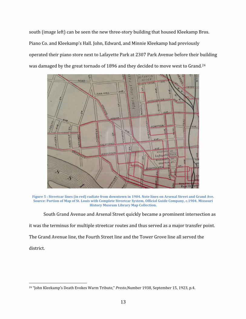
13
south (image left) can be seen the new three-story building that housed Kleekamp Bros.
Piano Co. and Kleekamp’s Hall. John, Edward, and Minnie Kleekamp had previously
operated their piano store next to Lafayette Park at 2307 Park Avenue before their building
was damaged by the great tornado of 1896 and they decided to move west to Grand.24
Figure 5 : Streetcar lines (in red) radiate from downtown in 1904. Note lines on Arsenal Street and Grand Ave. Source: Portion of Map of St. Louis with Complete Streetcar System, Official Guide Company, c.1904. Missouri
History Museum Library Map Collection.
South Grand Avenue and Arsenal Street quickly became a prominent intersection as
it was the terminus for multiple streetcar routes and thus served as a major transfer point.
The Grand Avenue line, the Fourth Street line and the Tower Grove line all served the
district.
24 “John Kleekamp’s Death Evokes Warm Tribute,” Presto,Number 1938, September 15, 1923, p.4.
14
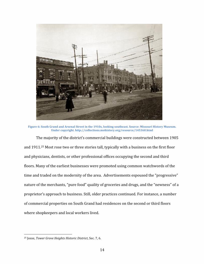
Figure 6: South Grand and Arsenal Street in the 1910s, looking southeast. Source: Missouri History Museum. Under copyright. http://collections.mohistory.org/resource/145360.html
The majority of the district’s commercial buildings were constructed between 1905
and 1911.25 Most rose two or three stories tall, typically with a business on the first floor
and physicians, dentists, or other professional offices occupying the second and third
floors. Many of the earliest businesses were promoted using common watchwords of the
time and traded on the modernity of the area. Advertisements espoused the “progressive”
nature of the merchants, “pure food” quality of groceries and drugs, and the “newness” of a
proprietor’s approach to business. Still, older practices continued. For instance, a number
of commercial properties on South Grand had residences on the second or third floors
where shopkeepers and local workers lived.
25 Josse, Tower Grove Heights Historic District, Sec. 7, 6.
15
One such example was umbrella merchant Louis Onimus who constructed sn
umbrella shop at 3127 S. Grand with a residence for his family above.26 Of course, many
merchants and professionals that operated along South Grand lived in the Tower Grove
Heights subdivision or other nearby areas.
Figure 7: Louis Onimus and his family lived above his umbrella shop at 3127 South Grand. Source: Southwest Saint Louis.
For many years Onimus had owned a shop at 2214 South Broadway, but then his
customers started moving westward. “Mr. Onimus tried for some time to prevail upon them
to still patronize his store,” noted Southwest Saint Louis, “but [he] finally came to the
conclusion that his shop was too far out of the way of his former customers.” So, “Mr.
Onimus then decided to locate in their midst. . .” Interestingly, Onimus is representative of a
26 Southwest Saint Louis, 70.
16
larger pattern of migration from the older business district along South Broadway to the
South Grand neighborhood.
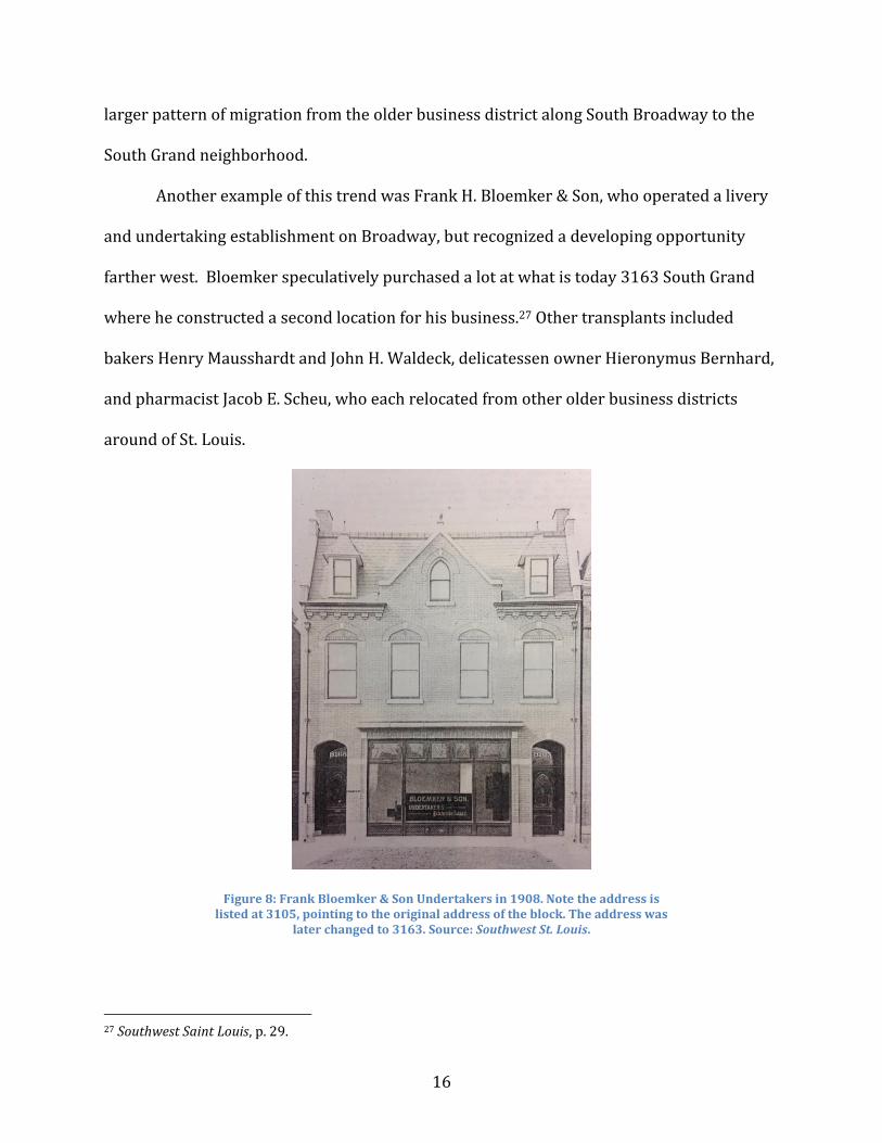
Another example of this trend was Frank H. Bloemker & Son, who operated a livery
and undertaking establishment on Broadway, but recognized a developing opportunity
farther west. Bloemker speculatively purchased a lot at what is today 3163 South Grand
where he constructed a second location for his business.27 Other transplants included
bakers Henry Mausshardt and John H. Waldeck, delicatessen owner Hieronymus Bernhard,
and pharmacist Jacob E. Scheu, who each relocated from other older business districts
around of St. Louis.
Figure 8: Frank Bloemker & Son Undertakers in 1908. Note the address is listed at 3105, pointing to the original address of the block. The address was
later changed to 3163. Source: Southwest St. Louis.
27 Southwest Saint Louis, p. 29.
17
In addition to previously established businesses, the area attracted entrepreneurs
who were ready to start businesses of their own. After working for his father, 24-year-old
graduate pharmacist Henry F. Sum opened a drug store in 1907 at Grand and Wyoming.28
E.J. Fuess had worked in the dry goods business in Milwaukee as well as three different dry
goods stores in St. Louis before opening his own shop at 3122 S. Grand.29 Alex Stengel left
his family’s grocery business, Stengel Bros., and opened his own shop on South Grand.
By the end of World War I the district was packed with establishments offering
every imaginable kind of goods and services. With the opening of the 600-plus seat Grand-
Arsenal Theater, local residents had the opportunity to view the same motion pictures that
played in the downtown nickelodeons. Within a year, the Juniata Theater opened down the
street, and following a brief closure of the Grand-Arsenal the two operated simultaneously
for many years.30
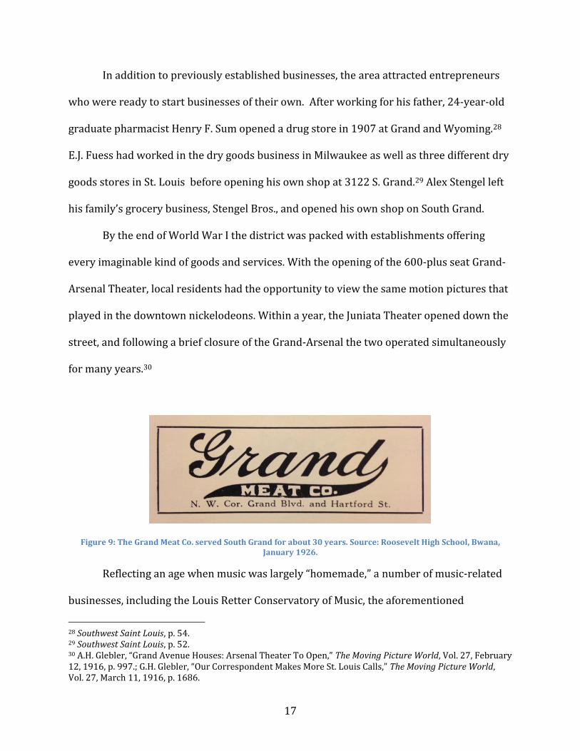
Figure 9: The Grand Meat Co. served South Grand for about 30 years. Source: Roosevelt High School, Bwana, January 1926.
Reflecting an age when music was largely “homemade,” a number of music-related
businesses, including the Louis Retter Conservatory of Music, the aforementioned
28 Southwest Saint Louis, p. 54. 29 Southwest Saint Louis, p. 52. 30 A.H. Glebler, “Grand Avenue Houses: Arsenal Theater To Open,” The Moving Picture World, Vol. 27, February 12, 1916, p. 997.; G.H. Glebler, “Our Correspondent Makes More St. Louis Calls,” The Moving Picture World, Vol. 27, March 11, 1916, p. 1686.
18
Kleekamp Brothers Piano Co., and Kleekamp’s Hall, a performance and meeting space,
along with several music teachers operated in the business district. The larger landscape of
music-related halls and societies located nearby on Grand included the Strassberger
Conservatory (south east corner of Grand and Shenandoah) and the Liederkranz Club
(formerly at 2700 S. Grand) which centered around a German choral society.31 Residents of
German extraction represented the largest single ethnic group in the area, which explains
why the Tower Grove Turnverein (a German athletic club), was constructed in 1906 at the
southeast corner of South Grand and Juniata Street (today the parking lot north of Jay
International Foods).32
The 1920s along South Grand would reflect the economic prosperity and optimism
that characterized the country at large, despite the restrictions imposed by Prohibition. It
was during this time that national chain stores began to make their appearance in the
district including the Great A&P Tea Co., Piggly Wiggly, Kroger and Woolworth’s.
In reaction to increasing demand for commercial space, and an absence of available
land, the Dickmann Realty Co. tore down several smaller buildings to construct the six-
story Dickmann Building in 1926. With South Grand already known as a destination for
health-related services, the Dickmann Building became a focal point of this industry
housing the offices of at least 26 physicians, dentists, or chiropractors, and the C.F. Knight
Drug Store by the end of the decade.
Real estate and loan-offices also thrived in the district, reflecting the fact that homes
were still being constructed in the surrounding neighborhoods. As the area matured, the
31 Harris, 51-54; 56-57. 32 Stacy Stone, Lynn Josse, and Carolyn Hewes Toft, Tower Grove Heights Historic District (Boundary Increase), Section 8, p. 163.
19
Tower Grove Heights Improvement Association was formed. Founded by affluent residents
and businessmen, the Association tasked itself with positive neighborhood development
and protection against “undesirable” outside influences.
Wanting to keep pace with changing times, some buildings in the district updated
their appearance as the 20th century progressed. In keeping with the “Modernize
Mainstreet” movement of the 1930s, Hesselberg Drugs at the southwest corner of Grand
and Hartford updated their storefront with the addition of Art Deco-inspired round
windows and maroon-colored Vitrolite glass.
Always a dynamic economic environment a selection of advertisements displays the
variety of groceries, barber shops, beauty shops, tailors, delicatessens, and shoe and
clothing stores that could be found on South Grand prior to World War II.
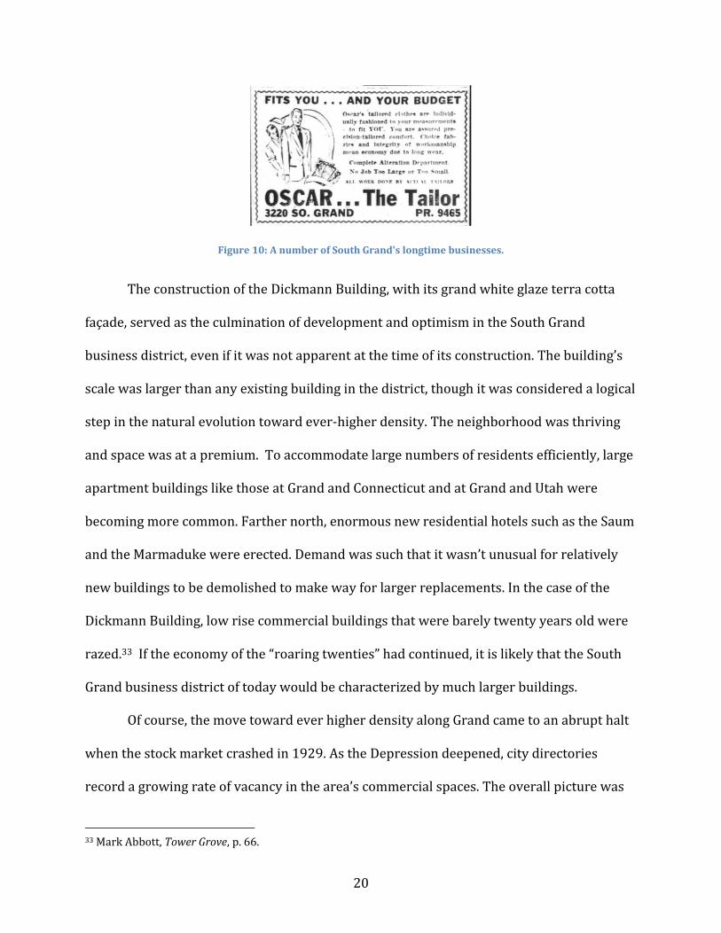
20
Figure 10: A number of South Grand's longtime businesses.
The construction of the Dickmann Building, with its grand white glaze terra cotta
façade, served as the culmination of development and optimism in the South Grand
business district, even if it was not apparent at the time of its construction. The building’s
scale was larger than any existing building in the district, though it was considered a logical
step in the natural evolution toward ever-higher density. The neighborhood was thriving
and space was at a premium. To accommodate large numbers of residents efficiently, large
apartment buildings like those at Grand and Connecticut and at Grand and Utah were
becoming more common. Farther north, enormous new residential hotels such as the Saum
and the Marmaduke were erected. Demand was such that it wasn’t unusual for relatively
new buildings to be demolished to make way for larger replacements. In the case of the
Dickmann Building, low rise commercial buildings that were barely twenty years old were
razed.33 If the economy of the “roaring twenties” had continued, it is likely that the South
Grand business district of today would be characterized by much larger buildings.
Of course, the move toward ever higher density along Grand came to an abrupt halt
when the stock market crashed in 1929. As the Depression deepened, city directories
record a growing rate of vacancy in the area’s commercial spaces. The overall picture was
33 Mark Abbott, Tower Grove, p. 66.
21
mixed, however, with a strong business community still evident. Ads of the era may have
emphasized thrift and value at times, but the availability of radios, new clothing, and other
goods indicate a middle class community that was holding on at least enough to keep local
stores from closing. During the Depression, a branch store of the local chain Worth’s sold
women’s clothing at 3103 South Grand, and Ida Wetzel sold hosiery across the street at
3106. Eugene Ganz operated a women’s clothing shop and William Huning even managed
to sell jewelry. Werner Boot Shop, Senst Restaurant, Hoell Dry Goods, and Florene Shoppe
all remained open as did the offices of doctors and dentists whose services remained
critical regardless of economic conditions.
Figure 11: The on the right comes from 1925, displaying leisure, while the ad on the left, emphasizing value, comes from 1930 at the beginning of the Great Depression. Source: Roosevelt High School, Bwana, 1925 and
1930.
22
Following the end of Prohibition in 1933, liquor stores and taverns reappeared,
although in some cases they had managed to stay in business throughout the “Dry Times.”
Laurence Meyer’s saloon was constructed in 1911 at 3232 S. Grand. During Prohibition, the
business remained open selling non-alcoholic drinks, before returning to liquor sales in the
1930s. The space remained a tavern or lounge into the 1970s.
Of note considering South Grand’s reputation today as a destination for ethnic
restaurants, the district’s first Chinese restaurant, “Oriental Kitchen” opened its doors at
3189 ½ South Grand in 1934. Followed shortly thereafter by Hing’s Café, by the 1940s
Despite the Depression, in 1935 the buildings that had been demolished in the
1920s between Juniata and Connecticut (3172-76 South Grand) were replaced with the
much larger, extant building that today houses Jay Asian Grocery. Reflecting the rising
popularity and accessibility of the automobile in American society, Weber Implement &
23
Automobile Company (an ancestor of today’s Weber Chevrolet) opened a dealership in the
large space.
As early as the late 1930s, the beginning of the end of the streetcar era was coming
into focus and transit companies across the nation were suffering from the effects of bad
management, rising costs not addressed by fixed fares, aging infrastructure, and
competition from the automobile. Capitalizing on the flexibility of the latter, and influenced
by the power of industrial giants like General Motors, cities nationwide began replacing
streetcars with new buses.34 The declining fortunes of the mass transit system that had
allowed the South Grand area to develop in the first place are poignantly illustrated by
public agitation for the removal abandoned streetcar tracks on Arsenal between Grand and
Gravois as early as 1936.35
Also reflective of changing times, an old Standard Oil filling station at Grand and
Connecticut Street was replaced with a stylish new Mission Revival brick building (the
current BP Station) in 1934 reflecting the growing importance of the automobile.
Facilitated by the automobile, St. Louis’ population shifted ever westward in the
1930s though South Grand remained a strong center of commerce at the start of World
War II and the area remained a destination for healthcare. Of the approximately 60 health-
related offices located within the business district, 36 were housed in the Dickmann
Building alone. Many more were located across the street in the (now demolished) Tamm
Building. Despite a few storefront vacancies, the district was dense with business activity.
Ice cream and candy shops, hat stores, restaurants, dress shops, and even a pet shop lined
the street.
34 Jackson, 168-171. 35 “Arsenal St. Track Removal Sought,” South St. Louis Neighborhood News, Vol. 16, No. 9, March 15, 1937, 1.
24
At the outset of the War, a selective service office opened at 3165 South Grand
where men registered for the draft. The office was located in a building that also housed
the offices of doctors and dentists presumably in an effort to streamline the medical
component of the registration process. In an ugly and perhaps largely forgotten chapter in
St. Louis’ history, South Grand’s first Chinese restaurant, the aforementioned Oriental
Kitchen, was among other Asian-owned businesses across the city that were closed and
guarded by the police for a time due to misplaced xenophobic paranoia following the
Japanese bombing of Pearl Harbor.36
Figure 13: Like many business, Tower Grove Bank & Trust used advertisements to aid the war effort. Source: South Side Journal, September 8, 1943.
36 Huping Ling, Chinese St. Louis: From Enclave to Cultural Community, p. 124-125.
25
Following the end of the War, South Grand was home to companies that reflected
the growth of the real estate market as new federal housing programs for returning G.I.’s
were implemented. While Tower Grove Bank had been in the district since 1911, financial
institutions such as savings and loan associations (which provided building and home loans
to stock members) became more prevalent in the Post War period. Among these were the
Tower Grove Savings & Loan Association at 3539 Arsenal and the Hamiltonian Federal
Savings & Loan Association at 3142 S. Grand. Realty companies also had a strong presence
in the area. The combination of the Baby Boom and federal housing insurance enabled
these companies to do a brisk business putting soldiers and their families into homes both
old and new. At least seven of these companies were located in the business district in the
years following the War.
By the 1950s, the age of the automobile had fully arrived. Between the Grand-
Gravois business district, the growing Kingshighway business district, the emerging
Hampton Avenue business district, and the numerous growing centers of population and
commercial activity in St. Louis County, South Grand faced strong competition. From the
old days, Plotz Flowers and Hoell’s Dry Goods remained. Both a pharmacy and a baker
remained at the southwest corner of Grand and Hartford. Now run by different proprietors,
the uses of the storefronts hadn’t changed since the building was constructed. La Merite
Bridal Shop was still a popular destination. New businesses Tevis Radio & Appliance Co.
(3191 South Grand), Spector’s Bootery (3104 South Grand), and Grace Yaeger Dresses
(3171 South Grand) had opened in recent years, as had a number of branch or chain
locations including St. Louis’ own Mavrakos Candy, Nine-O-Five Liquors, and Dixie Cream
Donuts.
26
Despite the fact that the Hamiltonian Federal Savings & Loan Association invested
in the area with the construction of an International Style modern branch in 1961 (today’s
Rooster) the 1960s were a decade of decline on South Grand. St. Louisans were leaving the
city in droves for the new suburbs in St. Louis County, and the age of the neighborhood
shopping district was giving way to the age of the strip center and self contained shopping
mall. The combination of vacancy, disinvestment and an increased need for parking in the
second half of the 20th century, resulted in the demolition of some buildings including the
original home of Francis Hemm’s pharmacy, the longtime home of La Merite Bridal Shop
(the business moved to the suburbs), a few buildings on Arsenal (including Albrecht Hall, a
fraternal meeting place in the 1940s and 1950s), the New Tower Grove Bank Building at
3143 South Grove (the original building at 3157 remains), the Ritz Theater, and later even
Tower Grove Turnverein succumbed after a fire.
Of course, the area has been defined by both change and continuity. For example, a
barber shop can still be found at 3192 South Grand as it could a century ago, and a person
transported from 1915 to today could still find a pharmacy at the corner of Grand and
Hartford. The Orpheum Cleaners has been around since the 1940s, and establishments like
Jay International Foods, the King & I Restaurant, CBGB, Mangia Italiano, and New Dawn
Natural Foods are becoming institutions in their own right with each having been in
operation for 25 years or more.
Today a destination neighborhood known for ethnic food, nightlife and eclectic
shopping, South Grand has recovered its vibrancy from the downturn of the late 20th
century. Its surrounding historic housing stock is once again highly desirable as is its
proximity to Tower Grove Park. Recent improvements to the sidewalks and streets have
27
made the area more accommodating to pedestrians and amenities such as rain gardens and
the Ritz “pocket park” improve the appearance and functionality of formerly debilitated
spaces. As modern populations increasingly seek out mixed-use, walkable environments
defined by unique buildings, the merits of the South Grand business district are once again
being recognized. Of course, in order to fully appreciate South Grand, modern residents
should have some sense of its history. By looking back at how South Grand came to be, it
becomes easier to see ourselves as part of the story. Today we are simply writing a new
chapter in the history of one of St. Louis’ greatest streets.
Bibliography Directories Gould’s Red-Blue Book Gould’s City Directory Polk’s City Directory Haines’ Criss-Cross City-County Directory Books Abbott, Mark, with Kerri Bonasch,.Tower Grove. St. Louis: Reedy Press, 2009.
28
Dry, Camille N. and Rich J. Compton. Pictorial St. Louis. 1875. Harris, NiNi. A Grand Heritage: A History of the St. Louis Southside Neighborhoods and Citizens. St. Louis: DeSales Community Housing Corporation, 1984. Jackson, Kenneth. Crabgrass Frontier: The Suburbanization of the United States. New York: Oxford University Press, 1985. Ling, Huping. Chinese St. Louis: From Enclave to Cultural Community. Philadelphia: Temple University Press, 2004. Roosevelt High School. Bwana. Various years. Sandweiss. Eric. St. Louis: The Evolution of An American Urban Landscape. Philadelphia: Temple University Press, 2001. Southwestern Mercantile Association. Southwest Saint Louis: Its Mercantile Interests and Prominent Citizens. St. Louis: 1908. Wayman, Norbury L. History of St. Louis Neighborhoods: Oak Hill. St. Louis: St. Louis Community Development Agency, 197_. Wayman, Norbury L. History of St. Louis Neighborhoods: Shaw. St. Louis: St. Louis Community Development Agency, 197_. Documents & National Register of Historic Places Nominations St. Louis City Plan Commission. History: Physical Growth of the City of Saint Louis. St. Louis: City Plan Commission, 1969. Derrington, Lindsey. Kieselhorst Piano Company Building. 2007. Schwenk, Sally F., Cathy Ambler, and Kerry Davis. South St. Louis Historic Working and Middle Class Streetcar Suburbs. Josse, Lynn. Tower Grove Heights Historic District. 2001. Stone, Stacy, Lynn Josse, and Carolyn Hewes Toft. Tower Grove Heights Historic District (Boundary Extension). 2003. Weil, Andrew B. Tower Grove East Historic District Crittenden Place Historic District Dickmann Building
29
Hamiltonian Federal Savings & Loan Building Newspapers South Side Journal South St. Louis Neighborhood News Articles “John Kleekamp’s Death Evokes Warm Tribute,” Presto. Number 1938. September 15, 1923, p.4. Retrieved August 21, 2015. http://presto.arcade-museum. com/PRESTO-1923-1938/PRESTO-1923-1938-04.pdf South Grand Ave. Review. “The South Side and Its Progressive People.” St. Louis: November, 1907. A.H. Glebler, “Grand Avenue Houses: Arsenal Theater To Open,” The Moving Picture World, Vol. 27, February 12, 1916, p. 997. New York: Chalmers Publishing Co., 1916. https://books.google.com/books?id=saMbAQAAMAAJ&pg=PA997&lpg=PA997&dq=gl+loeffler+st.+louis+grand&source=bl&ots=GcpbXkrfVQ&sig=Dn--GUdUawtLVUAsS5v8MaDu_rk&hl=en&sa=X&ved=0CCAQ6AEwAWoVChMItsfp5qryxgIVyjo-Ch3a5Qbb#v=onepage&q&f=false. Accessed 8/25/15. G.H. Glebler, “Our Correspondent Makes More St. Louis Calls,” The Moving Picture World, Vol. 27, March 11, 1916, p. 1686. New York: Chalmers Publishing Co., 1916. https://books.google.com/books?id=saMbAQAAMAAJ&pg=PA1686&lpg=PA1686&dq=gl+loeffler+st+louis&source=bl&ots=GcpbXkrfRR&sig=_eXYnWOzxg8DJ58cfQ5tNPhaFco&hl=en&sa=X&ved=0CEUQ6AEwB2oVChMI8sap1KryxgIVTDg-Ch0iCADe#v=onepage&q&f=false. Accessed 8/25/15.