48
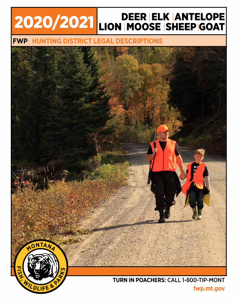
2020/2021 DEER ELK ANTELOPE LION MOOSE SHEEP GOAT FWP HUNTING DISTRICT LEGAL DESCRIPTIONS TURN IN POACHERS: CALL 1-800-TIP-MONT fwp.mt.gov
2020/2021 DEER ELK ANTELOPELION MOOSE SHEEP GOAT
FWP HUNTING DISTRICT LEGAL DESCRIPTIONS
TURN IN POACHERS: CALL 1-800-TIP-MONTfwp.mt.gov
Antelope Hunting District Legal Descriptions.......................................................................................... 4
Bighorn Sheep Hunting District Legal Descriptions........................................................... ................... 10
Deer, Elk, & Mountain Lion Hunting District Legal Descriptions. ....................................................... 14
Moose Hunting District Legal Descriptions. ............................................................................................ 34
Mountain Goat Hunting District Legal Descriptions.................................................................... ......... 42
Contacts............................................................................................................................................................. 46
Regulations are adopted by the Fish & Wildlife Commission
These Hunting District Boundaries were adopted by the F&W Commission on February 13, 2020, under the authority granted in MCA 87-1-301 and are valid March 1, 2020, through February 28, 2021. The F&W Commission reserves the authority to amend the Hunting District Boundaries herein if deemed necessary for wildlife management purposes. Martha Williams, Director.
Discrimination Prohibited – State and Federal laws, Title VI of Civil Rights Act of 1964, Section 504 of the Rehabilitation Act of 1973, Title II of the Americans with Disabilities Act of 1990, the Age Discrimination Act of 1975, and Title IX of the Education Amendments of 1972, prohibit discrimination on the basis of race, color, sex, age, religion, national origin, or disability. Anyone believing he or she has been discriminated against (as described above) in any FWP program, activity, or facility may write to FWP Human Resources, 1420 East Sixth Avenue, PO Box 200701, Helena, MT 59620-0701 or the office of Equal Opportunity, U.S. Department of the Interior, Washington, D.C. 20240. Any changes made to this printed publication can be found on the FWP website or by inquiring at any local FWP office.
Table of Contents by Subject
Turn In Poachers. Enough is Enough! Make the call: 1-800-TIP-MONT (1-800-847-6668)2

215 East Deer Lodge: Those portions of Deer Lodge, Silver Bow and Powell Counties lying within the following described boundary: Beginning at Garrison Junction, then in an easterly direction along US Highway 12 to the Continental Divide at MacDonald Pass, then in a southerly direction along said divide to Interstate 15, then in a southerly direction along said interstate to its junction with Interstate 90 at Butte, then west and north along said interstate to Garrison Junction, the point of beginning.
291 East Garnet Range: That portion of Powell County lying within the following-described boundary: Beginning at the junction of State Route 271 (Drummond-Helmville Road) and Interstate 90, then easterly along said interstate to its junction with US Highway 12 at Garrison, then easterly along said route to its junction with State Route 141 at Avon, then north along said route to its junction with Cottonwood Meadows Road (1/4 mile northwest of Nevada Lake), then northwest on said road to its junction with Braziel Creek Road (BLM Road 2864), then south on said road to the northern boundary of BLM Section 22, T12N, R10W, then west along said section line to the southeast corner of Section 16, T12N, R10W, then north along the eastern boundary of said section to its northeast corner, then west along the northern boundaries of Sections 16, 17, and 18 to the northwest corner of Section 18, T12N, R10W, then south along said section boundary to the northeast corner of Section 24, T12N, R11W, then west along said section’s northern boundary to its northwest corner, then south along said section’s boundary to its southwest corner, then west along the northern boundary of Section 26, T12N, R11W, to its junction with Cottonwood Creek, then north along said creek to its junction with Route 271, then south along said route to its junction with Interstate 90, the point of beginning.
300 Medicine Lodge-Upper Horse Prairie: That portion of Beaverhead County lying within the following-described boundary: Beginning at Clark Canyon Dam, then westerly along Route 324 to USFS Road 3909 (Trail Creek-Lemhi Pass Road), then westerly along said road to the Montana-Idaho border, then southerly and easterly along said border to the Pine Creek-W.F. Little Sheep Creek Divide northeast of Bannock Pass (Medicine Lodge Pass), then northerly down said divide to the head end of Four Eyes Canyon, then northwesterly down said canyon to its junction with the Big Sheep Creek County Road, then easterly and northerly along said road to Interstate 15 at Dell, then northwesterly along said highway to Clark Canyon Dam, the point of beginning.
301 Lima Peaks: That portion of Beaverhead County lying within the following-described boundary: Beginning at Dell, then southeasterly along Interstate 15 to the Montana-Idaho border near Monida, then southerly and westerly along said state line to the Pine Creek-W.F. Little Sheep Creek Divide northeast of Bannock Pass (Medicine Lodge Pass), then northerly down said divide to the head end of Four Eyes Canyon,
then northwesterly down said canyon to its junction with Big Sheep Creek County Road, then easterly and northerly along said road to Interstate 15 at Dell, the point of beginning.
310 Pioneers: Those portions of Beaverhead, Silver Bow and Madison Counties lying within the following-described boundary: Beginning at the junction of Grasshopper-Wise River Road with Route 278, then northerly along said road to Route 43 at Wise River, then easterly along said route to Interstate 15 at Divide, then southerly along said interstate to the point directly opposite the confluence of Grasshopper Creek with the Beaverhead River, then westerly along Grasshopper Creek to the Bannack-Grant Road, then northerly along said road to Route 278, then westerly along said route to the junction of the Grasshopper-Wise River Road, the point of beginning.
311 Lower Gallatin-Madison-Horseshoe Hills: Those portions of Madison, Park, Gallatin, Jefferson, and Broadwater Counties lying within the following-described boundary: Beginning at the mouth of Sixteenmile Creek, then easterly up said creek to the Middle Fork of Sixteenmile Creek, then easterly up said Middle Fork to the South Fork of Sixteenmile Creek, then southerly up said South Fork to the Bridger Mountain Divide near Flathead Pass, then southerly along said divide to Ross Peak, then easterly and southerly along the Yellowstone-Gallatin Divide including Bangtail Ridge to Bozeman Pass and the intersection with Interstate 90, then westerly along said interstate to the Trail Creek Road, then southeasterly up said road to the Goose Creek Road, then southerly on said road to its intersection with Gallatin-Yellowstone River divide including Hyalite Peak to Eaglehead Mountain, then in a westerly direction along the Portal-Porcupine and Levinski-Porcupine Creeks Divide to the West Gallatin River near the mouth of West Fork, then south up the Gallatin River to Buck Creek, then up said creek to the Madison-Gallatin Divide, then northerly along said divide and the Madison-Cherry Creek Divide to the head of Trail Creek near Red Knob Mountain, then down Trail Creek to the Madison River, then northerly down the west shore of said river to Route 84, then westerly along said route to US Highway 287, then southerly along said highway to North Meadow Creek, then westerly up said creek to Mount Bradley and the Madison-Ruby Divide, then northerly along said divide and the Jefferson-Ruby Divide to Noble Peak and the head of the South Boulder River, then northerly and easterly down said river to Route 359, then northerly along said route to Interstate 90, then easterly along said interstate to the Jefferson River near Three Forks Junction, then northerly and easterly down the south shore of said river to the Missouri River, then northerly down the east shore of said river to Sixteenmile Creek, the point of beginning.
313 Upper Yellowstone: Those portions of Gallatin and Park Counties lying within the following-described boundary: Beginning at the junction of the Yellowstone River and Interstate 90, then westerly along said interstate to the Trail Creek Road, then southeasterly up said road to the Goose Creek Road, then southerly on said road to
its intersection with Gallatin-Yellowstone River divide, then southerly down said divide to the Yellowstone National Park boundary, then southerly, easterly and northerly along said boundary to the intersection with the Yellowstone River, then northerly down said river to its junction with Interstate 90, the point of beginning.
318 Big Hole: HD 318-Big Hole-Those portions of Beaverhead and Deer Lodge Counties lying within the following-described boundary: Beginning at Wise River, then southerly along the Wise River Scenic Byway (Route 73) to its junction with Route 278, then west along said route to Jackson, then south and west along the Jackson-Skinner Meadows Road to the Big Hole-Bloody Dick Divide, then westerly along said divide to the Montana-Idaho border and Continental Divide, then northerly and northeasterly along said divide to its junction with Route 569 (Mill Creek Road), then southerly along said route to its junction with Route 43, then southeasterly along said route to Wise River, the point of beginning.
319 Fleecer-High Rye: Those portions of Silver Bow and Deer Lodge Counties lying within the following-described boundary: Beginning at the junction of Interstate 90 and Interstate 15 west of Butte, then southerly along Interstate 15 to Route 43, then westerly along said route to Route 274, then northerly along said route to Route 1, then easterly along said route to Interstate 90, then easterly along said interstate to Interstate 15, the point of beginning.
320 Tobacco Roots: Those portions of Madison, Jefferson, and Silver Bow Counties lying within the following-described boundary: Beginning at Virginia City, then westerly and northerly along Montana Highway 287 to Route 41, then northerly to Route 55 and Interstate 90, then easterly along said interstate to the South Boulder River, then southerly up said river to Noble Peak and the Jefferson-Ruby Divide, then southerly along said divide and the Madison-Ruby Divide to Montana Highway 287, then westerly along said route to Virginia City, the point of beginning.
321 Ruby-Blacktail: Those portions of Beaverhead and Madison Counties lying within the following-described boundary: Beginning at Dillon and Route 41, then northeasterly along said route to Route 287, then southeasterly along said route to Virginia City and Alder Gulch, then southerly up said gulch to Baldy Mountain and the Ruby-Madison Divide, then southeasterly along said divide to Gravelly Range Road, then southerly along said road and the Eureka Basin-Ruby Road to the Ruby-Centennial Divide, then westerly along said divide and continuing northwesterly along the Centennial-Blacktail and Sage Creek-Blacktail Divides to the head of Clark Canyon, then westerly down said canyon to Interstate 15, then northerly along said interstate to Route 41 at Dillon, the point of beginning.
329 Horse Prairie North: HD 329-Horse Prairie North-That portion of Beaverhead County lying within the following-described boundary: Beginning at Clark Canyon Dam, then westerly along Route 324 to the Trail Creek-Lemhi Pass Road, then westerly along said road to the Montana-Idaho border at Lemhi Pass, then
Ant
elop
e Antelope Hunting Districts –Legal Descriptions
Turn In Poachers. Enough is Enough! Make the call: 1-800-TIP-MONT (1-800-847-6668)4
northerly along said border to the Bloody Dick-Big Hole Divide, then easterly along said divide to the Skinner Meadows-Jackson Road, then northerly along said road to Route 278, then easterly along said route to the Bannack-Grant Road, then southerly along said road to Grasshopper Creek, then easterly along said creek to Interstate 15, then southerly along said interstate to Clark Canyon Dam, the point of beginning.
330 Centennial Sage: Those portions of Beaverhead and Madison Counties lying within the following-described boundary: Beginning at the Montana-Idaho border on Interstate 15, then easterly and northerly along said border (Continental Divide) to the Madison River-Red Rock Creek Divide, then westerly along said divide through Lone Tree Pass and westerly over Deer Mountain to Elk Lake at the Limestone Creek confluence, then northerly along the east shores of Elk, Hidden, Cliff and Wade Lakes and connecting trails and roads to Lake Creek, then north along Lake Creek to the West Fork of the Madison River, then westerly up said river to the Centennial-Ruby Divide, then westerly along said divide and Centennial-Blacktail Divide and continuing northwesterly along said divide and Sage Creek-Blacktail Divide to Clark Canyon, then westerly down Clark Canyon to Interstate 15, then southerly along said interstate to the Montana-Idaho border, the point of beginning.
NOTE: The Red Rock Lakes National Wildlife Refuge is not closed to antelope hunting by the Montana Fish & Wildlife Commission however, portions of the refuge may be closed to trespass by the U.S. Fish and Wildlife Service. Hunters are asked to check with the Refuge Manager before hunting on the refuge - Area Map and Rules available at 406-276-3536 or http://www.fws.gov/redrocks/Index.htm.
338 Shield River North: Those portions of Gallatin, Meagher and Park Counties lying within the following-described boundary: Beginning at the confluence of Sixteenmile and Middle Fork of Sixteenmile Creeks, then easterly up said Middle Fork to the South Fork of Sixteenmile Creek, then southerly up said South Fork to the Bridger Mountain Divide near Flathead Pass, then southerly along said divide to Ross Peak, then easterly and southerly along the Yellowstone-Gallatin Divide, including Bangtail Ridge to Bozeman Pass and Interstate 90, then easterly along said interstate to the bridge over the Yellowstone River at Livingston, then northeasterly down the Yellowstone to the bridge on US Highway 89, then northerly along said highway to its intersection with Cottonwood Creek near Clyde Park, then easterly and northerly up said creek to Crazy Mountain Divide near Conical Peak, then northerly along said divide to Sixteenmile Creek, then southwesterly down said creek to the Middle Fork of Sixteenmile Creek, the point of beginning.
339 Shields River South: Those portions of Park and Sweet Grass Counties lying within the following-described boundary: Beginning at the bridge on the Yellowstone River on US Highway 89 just north of the intersection of said highway with Interstate 90, east of Livingston, then northerly along US Highway
89 to its intersection with Cottonwood Creek near Clyde Park, then easterly and northerly up said creek to the Crazy Mountain Divide near Conical Peak, then southerly along said divide to Fairview Peak, then southerly to the head of the West Fork of Duck Creek, then southeasterly down said creek to the Yellowstone River, then westerly up said river to the bridge on US Highway 89, the point of beginning.
340 West Boulder: Those portions of Park and Sweet Grass Counties lying within the following-described boundary: Beginning at the mouth of the Boulder River at Big Timber, then southerly along said river to the Gallatin National Forest boundary south of McLeod Basin, then westerly, northerly, westerly and southerly along said boundary to Suce Creek, then westerly along said creek to the Yellowstone River, then northerly and easterly along said river to the mouth of the Boulder River, the point of beginning.
341 Highlands: Those portions of Beaverhead, Madison, Jefferson and Silver Bow Counties lying within the following-described boundary: Beginning at Dillon, then northerly along Route 41 to its junction with Route 55, then northwesterly along said route to its junction with Interstate 90 at Whitehall, then westerly along said interstate to its junction with Interstate 15, west of Butte, then southerly along said interstate to Dillon, the point of beginning.
350 Whitetail: Those portions of Silver Bow and Jefferson Counties lying within the following-described boundary: Beginning at Butte, then northeasterly along Interstate 15 to its junction with Route 69 at Boulder, then southerly along said route to its junction with the Boulder-Whitetail Road, then southerly along said road to the Boulder-Whitetail Divide, then southerly along said divide to Interstate 90, then westerly along said interstate to Butte, the point of beginning.
360 Madison: Those portions of Madison and Beaverhead Counties lying within the following-described boundary: Beginning at Norris, then easterly along Route 84 to the Madison River, then up the west shore of the Madison River to Trail Creek, then up said creek to the Madison-Cherry Creek Divide, then southerly along said divide to the Madison-Gallatin Divide near Red Knob Mountain, then southerly along said divide to the Beaverhead-Gallatin National Forest boundary, then southerly along said boundary to Rock Creek, then southeasterly down said creek to Earthquake Lake, then easterly along the north shore of said lake to the Madison-Gallatin County line, then south along the said line to the Montana-Idaho border on the Continental Divide, then westerly and southerly along said divide to the Madison River-Red Rock Creek Divide, then westerly along said divide through Lone Tree Pass and westerly over Deer Mountain to Elk Lake at the Limestone Creek confluence, then northerly along the east shores of Elk, Hidden, Cliff and Wade Lakes and connecting trails and roads to Lake Creek, then north along said creek to the West Fork of the Madison River, then southerly and westerly along the West Fork to Gravelly Range Road, then northerly along
said road and the Madison-Ruby Divide to Baldy Mountain and the head of Alder Gulch, then northerly down said gulch to Virginia City, then easterly along Route 287 to the Madison-Ruby Divide, then northerly along said divide to Mount Bradley and the head of North Meadow Creek, then easterly down said creek to US Highway 287, then northerly along said highway to Norris, the point of beginning.
370 Boulder Valley: That portion of Jefferson County lying within the following-described boundary: Beginning at Boulder, then southerly along Route 69 to the Boulder-Whitetail Road, then southerly along said road to the Boulder-Whitetail Divide, then southerly along said divide to Interstate 90, then easterly along said interstate to the intersection with the Boulder River, then northerly up said river to the intersection with Route 69, then northerly along said route to Boulder, the point of beginning.
371 Radersburg: Those portions of Broadwater and Jefferson Counties lying within the following-described boundary: Beginning at the Jefferson River Bridge on Interstate 90 west of Three Forks, then northerly down the Jefferson River to the Missouri River, then northerly down said river to the Missouri River Bridge north of Townsend, then westerly on the Indian Creek Road to Hassel, then westerly on USFS Road 4031 to USFS Road 405, then southerly on said road to the South Fork of Crow Creek, then westerly up said creek to the Boulder-Missouri Divide, then westerly along said divide to Interstate 15, then southerly along said interstate to Boulder, then southerly along Route 69 to the intersection with the Boulder River, then southerly down said river to Interstate 90, then easterly along said Interstate to the Jefferson River Bridge on Interstate 90 west of Three Forks, the point of beginning.
380 Winston Flats: Those portions of Broadwater, Lewis and Clark, and Jefferson Counties lying within the following-described boundary: Beginning at the Missouri River bridge north of Townsend, then westerly on Indian Creek Road to Hassel, then westerly on USFS Road 4031 to USFS Road 424, then southerly to South Crow Creek, then westerly up said creek to the Boulder-Missouri Divide near Crow Peak, then westerly along said divide to Interstate 15, then northerly along said interstate to Route 518 at Montana City, then easterly and northerly along said route to US Highway 12-287 at East Helena, then easterly along said highway to Route 284, then northerly and easterly along said route to Canyon Ferry Dam, then southerly along the east shore of Canyon Ferry Reservoir and the Missouri River to the Missouri River bridge at Townsend, the point of beginning.
381 Hilger Valley-Silver City: That portion of Lewis and Clark County lying within the following-described boundary: Beginning at the junction of County Route 602 (also known as Williams Street on the west edge of Helena) and US Highway 12 and continuing west along US Highway 12 to MacDonald Pass, then northerly along the Continental Divide beyond Flesher Pass, approximately four miles to the head of the North Fork of Lyons Creek, then southeasterly down Lyons Creek
Antelope
Legal Descriptions Visit fwp.mt.gov 5

to Little Prickly Pear Creek, then northeasterly along said creek to the Missouri River, then up the west shore of said river to Hauser Dam, then southerly along Hauser Dam Road to its junction with Countryside Road, then westerly along said road to its junction with Mountain Meadows Road, then westerly along said road to where it becomes Snowdrift Road, then west along said road to its junction with Collins Drive, then north along Collins Drive to the north boundary of Section 4, T11N, R3W, then west along the north boundary of Sections 4 and 5 to Interstate 15, then northerly along said interstate approximately two miles to the north boundary of Section 31, T12N, R3W, at the north end of the split median of Interstate 15, then following the north boundary of Section 31, westerly to the northeast corner of Section 36, T12N, R4W, then southerly along the east boundary of Section 36, then west along the south boundary of Section 36 to Green Meadow Drive, then south along Green Meadow Drive to its junction with Woodland Hills Road, then west on Woodland Hills Road to its junction with Lone Mountain Road, then south along Lone Mountain Road to Highway 279 (Lincoln Road West), then westerly on Highway 279 to County Road 602 (Birdseye Road), then southerly along County Road 602 to US Highway 12, the point of beginning.
388 Tenmile-Prickly Pear Valley: Those portions of Lewis and Clark and Jefferson Counties lying within the following-described boundary: Beginning at the north end of the split median of Interstate 15, on the north boundary of Section 31, T12N, R3W, then southerly along Interstate 15 for approximately two miles to the north boundary of Section 5, T11N, R3W, then east along the north boundary of Sections 5 and 4 to Collins Drive, then south along Collins Drive to its junction with Snowdrift Road, then easterly along Snowdrift Road until Snowdrift Road becomes Mountain Meadows Road, then easterly along Mountain Meadows Road to a junction with Countryside Road, then southeasterly along Countryside Road to Hauser Lake, then southerly along the western shore of said lake and across the entrance of the Causeway Arm and continuing in a southerly direction along the west shore of said lake to Canyon Ferry Dam and Route 284, then westerly and southerly along said route to the junction with US Highway 12-287, then westerly along US Highway 12-287 to Route 518 at East Helena, then southerly along said route to the junction with Interstate 15, then across Interstate 15 to Montana City and the Jackson Creek Road, then west along the Jackson Creek Road to its junction with the Hill Brothers Road, then west along said route to its junction with the Holmes Gulch Road, then west along said route to the national forest boundary, then northerly along the national forest boundary along the west edge of Sections 7 and 6, T9N, R3W, then west along the south boundary of Section 36, then north along the west boundary of Section 36, then west along the south boundary of Section 26, then north along the west boundary of Section 26 to LeGrande Cannon Boulevard, then in a westerly and northerly direction along LeGrande Cannon Boulevard to US Highway 12, then across US Highway 12 onto County Route 602 (also known as Williams Street and then the Birdseye Road), then northerly along
said route to State Highway 279, then easterly along State Highway 279 to its junction with Lone Mountain Road, then northerly along said road for two miles to the junction with Woodland Hills Road, then east on said road to Green Meadow Road, then north on said road to the southwest corner of Section 36, then east along the south boundary of Section 36, then northerly along the east boundary of Section 36, then easterly along the south boundary of Section 30 to its intersection with Interstate 15, the point of beginning.
NOTE: Area outside the Weapons Restriction Area of HD 388: Those portions of Lewis and Clark and Jefferson Counties lying within the following-described boundary: Beginning at the junction of the Causeway Arm with Hauser Lake and continuing in a southerly direction along the west shore of said lake to Canyon Ferry Dam and Route 284, then westerly and southerly along said route to US Highway 12-287, then westerly along US Highway 12-287 and the junction with Lake Helena Drive, then northerly along Lake Helena Drive to the Causeway, then in a northerly and easterly direction along the south shore of the Causeway Arm to Hauser Lake, the point of beginning.
390 South Belts: Those portions of Broadwater, Lewis and Clark and Gallatin Counties lying within the following-described boundary: Beginning at the mouth of Cave Gulch at Cave Bay, then northerly up Cave Gulch to Hedges Mountain, then northeasterly along the Trout Creek-Magpie Creek Divide to the Lewis and Clark-Broadwater County line, then northerly and easterly along said line to the Meagher-Broadwater Line, then southeasterly along said line to Sixteenmile Creek, then westerly down said creek to the Missouri River, then northerly down said river and the east shore of Canyon Ferry Reservoir to the mouth of Cave Gulch at Cave Bay, the point of beginning.
401 Sweetgrass Hills: Those portions of Liberty, Toole and Glacier Counties lying within the following-described boundary: Beginning at the junction of US Highway 2 and the Hill-Liberty County line east of Chester, then northerly along said line to the Canadian border, then westerly along said border to the Blackfeet Indian Reservation boundary, then south along said boundary to US Highway 2 near Cut Bank, then east along said highway through Shelby to the Hill-Liberty Line, the point of beginning.
404 Teton-Marias: Those portions of Glacier, Toole, Pondera, Teton, Cascade, Liberty, Chouteau and Hill Counties lying within the following-described boundary: Beginning at Choteau, then northerly along US Highway 89 to the Blackfeet Indian Reservation boundary (Birch Creek), then east and north along said boundary to Cut Bank, then easterly along US Highway 2 through Shelby to the Hill-Liberty County line, then southerly along said line to the Marias River, then east and south down the Marias River to the Missouri River, then southwesterly up said river to Great Falls, then westerly along US Highway 89 through Fairfield to Choteau, the point of beginning.
413 Sand Coulee: That portion of Cascade County lying within the following-described boundary: Beginning at Great Falls, then southeast along US Highway 87 to Armington Junction, then south along US Highway 89 to King’s Hill then westward along the Cascade-Meagher County line to the Smith River, then north down said river to the Missouri River, then eastward down said river to Great Falls, the point of beginning.
420 South Fergus: Those portions of Fergus, Petroleum, Musselshell, and Golden Valley counties lying within the following-described boundary: Beginning at Lewistown, then easterly along State Route 200 to Winnett, then southwesterly along Route 244 to US Highway 87, then northerly along said highway to Flatwillow Creek, then westerly along said creek to the South Fork of Flatwillow Creek, then westerly along said creek to the Red Hill Road, then southerly along said road to the Snowy Mountains Divide, then westerly along said divide to the head of Meadow Creek, then westerly down said creek to its junction with US Highway 191 near Garneil, then north and east along said highway to Lewistown, the point of beginning.
430 Buffalo: Those portions of Judith Basin, Fergus and Cascade Counties lying within the following-described boundary: Beginning at Stanford, then southeast along US Highway 87 to US Highway 191, then south along said highway to the Judith-Musselshell River Divide, then west along said divide and the Judith-Smith River Divide to Kings Hill, then northwest along US Highway 89 to Armington Junction, then east along US Highway 87 to Stanford, the point of beginning.
440 Birdtail Hills: Those portions of Lewis and Clark and Cascade Counties lying within the following-described boundary: Beginning at the Continental Divide at the summit of Rogers Pass on State Route 200, then south along said divide to the North Fork of Lyons Creek, then easterly down said creek to Little Prickly Pear Creek, then down said creek to the Missouri River, then northerly down said river to Great Falls, then northwesterly along Interstate 15 to its junction with US Highway 89, then west along said highway to its junction with State Route 200, then south and west along said route to Rogers Pass and the Continental Divide, the point of beginning.
441 North Fork Birch Creek-Teton: Those portions of Pondera and Teton Counties lying within the following-described boundary: Beginning at the Blackfeet Indian Reservation boundary on US Highway 89, then southerly on said highway to the junction of County Road 144 near Choteau, then westerly on said road to West Fork Teton and USFS Trail 114, then westerly along said trail to Teton Pass on the Continental Divide, then northerly along said divide to Badger Pass and USFS Trail 121, then easterly along said trail to Swift Dam, then north and east along the Blackfeet Indian Reservation boundary to US Highway 89, the point of beginning.
444 Teton - Hwy 200: Those portions of Lewis and Clark, Teton and Cascade Counties lying within the following-described boundary: Beginning at the Continental Divide on State Route 200 at the summit of Rogers Pass, then
Ant
elop
e
Turn In Poachers. Enough is Enough! Make the call: 1-800-TIP-MONT (1-800-847-6668)6

northerly along said divide to the Lewis and Clark National Forest boundary approximately one quarter mile north of Cadotte Pass, then northerly along said boundary to the Teton Canyon Road, then easterly along said road to US Highway 89, then southeasterly along said highway to its junction with State Route 200, then south and west along said route to the summit of Rogers Pass and the Continental Divide, the point of beginning.
450 Hound Creek: Those portions of Cascade and Meagher Counties lying within the following-described boundary: Beginning at the mouth of the Smith River, then southerly up the west bank of said river to the mouth of Two Creek, then westerly up said creek to the divide between Trout Creek and Black Canyon/Rock Creek, then westerly along said divide to the Hound Creek-Rock Creek divide then westerly along said divide to the Beaver Creek-Hound Creek divide (Meagher and Lewis and Clark County line), then westerly along said line to the Cascade-Lewis and Clark County line, then west and north along said line to the Missouri River, then northeasterly down said river to the mouth of the Smith River, the point of beginning.
455 Ming Bar: That portion of Lewis and Clark County lying within the following-described boundary: Beginning at the junction of the Cascade County-Lewis and Clark County line and the Missouri River, then southerly along the said river to Holter Lake, then southerly along the east shoreline of Holter Lake to the mouth of Willow (Elkhorn) Creek, then north and east up Willow Creek to the Cascade-Lewis and Clark County line, then north and west along said line to its junction with the Missouri River, the point of beginning.
471 Highwoods/Denton: Those portions of Cascade, Chouteau, Fergus and Judith Basin Counties lying within the following-described boundary: Beginning at Missouri River at Great Falls, downstream along said river to its junction with the mouth of the Judith River, then southerly up said river to its junction with US Highway 87 at Hobson, then northwesterly along said highway to its junction with the Missouri River at Great Falls, the point of beginning.
480 North Fergus: That portion of Fergus County lying within the following-described boundary: Beginning at Lewistown, then westerly on US Highway 87 to the Judith River, then northerly down said river to the Missouri River, then easterly down said river to the Robinson Bridge at US Highway 191, then southerly along said highway to State Route 19 at Bohemian Junction, then southerly along said route to State Route 200 near Grass Range, then westerly along said route to Lewistown, the point of beginning.
481 Petroleum: Those portions of Fergus, Judith Basin and Petroleum Counties lying within the following-described boundary: Beginning at Mosby, then westerly along State Route 200 to State Route 19 near Grass Range, then northerly along said route to US Highway 191 at Bohemian Junction, then northerly along said highway to the Robinson Bridge, then easterly down the Missouri River to the Musselshell River, then southerly up said river to Mosby, the point of beginning.
490 West Meagher: That portion of Meagher County lying within the following-described boundary: Beginning at King’s Hill, then south along US Highway 89 through White Sulphur Springs to Sixteenmile Creek near Ringling, then westerly down said creek to the Broadwater-Meagher County line (Big Belt Mountains hydrological divide), then northwest along said line to the Meagher-Lewis and Clark County line, then northwest along said line to its intersection with USFS Rd #4143, then westerly along said road to the Beaver Cr. Road (USFS Rd #138), then northwesterly along said road to the northwest corner of Section 26 (T13NR1W), then north along the USFS property boundary to the northeast corner of section 10 (T13NR1W), then west along said section line to the posted Beartooth WMA Boundary fence, then north along said fence to the Hound Creek-Beaver Creek divide, then easterly along said divide to the Hound Creek - Rock Creek divide, then easterly along said divide to the divide between Trout Creek and Black Canyon/Rock Creek, to Two Creek, then easterly along said creek to the mouth of Two Creek at the Smith River, then northerly down said river to the Cascade-Meagher County line, then eastward along said line to Kings Hill, the point of beginning.
491 East Meagher: That portion of Meagher County lying within the following-described boundary: Beginning at King’s Hill, then southeast along the Meagher-Judith Basin County line to USFS Road 274, then southward along said road to US Highway 12, then easterly along said highway to its junction with State Highway 294, then south and west along said highway to US Highway 89, then north along said highway (through White Sulphur Springs) to King’s Hill, the point of beginning.
500 West Wheatland: Those portions of Meagher and Wheatland Counties lying within the following-described boundary: Beginning at Harlowton, then westerly along US Highway 12 to USFS Road 274 (Spring Creek Road-Whitetail Cabin Road), then northerly along said road to its intersection with USFS Road 189 (Willow Park Road), then easterly along said road to its intersection with USFS Trail 603, then easterly along said trail to the Mt. High Lookout Tower, then easterly along USFS Road 382 to a permanent boundary marker (Wheatland-Judith Basin County line), then northeasterly along the Wheatland County line to US Highway 191, then southerly along said highway to Harlowton, the point of beginning.
501 East Wheatland: Those portions of Fergus, Golden Valley, and Wheatland Counties lying within the following-described boundary: Beginning at Harlowton, then northerly along US Highway 191 to its junction with Meadow Creek near Garneil, then northeasterly along said creek to the Snowy Mountain Divide, then easterly along said divide to its intersection with the Red Hill Road, then southerly along said road to the Rothiemay Road, then southerly along said road to Ryegate and US Highway 12, then westerly along said highway to Harlowton, the point of beginning.
510 Big Timber: Those portions of Sweet Grass and Park Counties lying within the following-described boundary: Beginning at the Yellowstone Bridge at Big Timber, then westerly along the north bank of the Yellowstone River to Duck Creek, then northerly along said creek to the West Fork of Duck Creek, then northerly along said fork to Crazy Mountain Divide, then northerly along said divide to Sweet Grass Creek, then easterly and southerly along said creek to the Yellowstone River, then westerly along the north bank of the Yellowstone River to Big Timber, the point of beginning.
511 Hardin: Those portions of Big Horn and Yellowstone Counties lying within the following-described boundary: Beginning at the Yellowstone River Bridge at Custer, then westerly up the north bank of the Yellowstone River to US Highway 87 at Billings, then east on said highway to Old US Highway 87 (Old Hardin Road), then southeast along said road to the Crow Indian Reservation boundary, then east along said boundary to the east bank of the Bighorn River, then north along said east bank to Interstate 94, then west along said interstate to Custer, then north on the Custer-Melstone Road to the Yellowstone River Bridge, the point of beginning.
512 Stillwater: Those portions of Carbon, Stillwater and Sweet Grass Counties lying within the following-described boundary: Beginning at the Yellowstone River Bridge at Columbus, then southwesterly along State Route 78 to Absarokee, then westerly along Route 420 to the first bridge crossing the Stillwater River, then north and easterly along said river (1/4 mile) to the mouth of Trout Creek, then up said drainage in a northwesterly direction to the headwaters of said drainage at the Gallatin-Custer National Forest boundary, then westerly and southerly along said boundary to the headwaters of the Dry Fork of the East Boulder River, then northwesterly along said fork to its junction with the East Boulder River, then northerly and westerly along said river to its junction with the Main Boulder River, then northerly and easterly along said river to its junction with the Yellowstone River, then easterly and southerly along the north bank of said river to the Yellowstone River Bridge at Columbus, the point of beginning.
513 Willow Creek: Those portions of Fergus, Golden Valley, Musselshell and Petroleum Counties lying within the following-described boundary: Beginning at Roundup, then westerly along US Highway 12 to Ryegate, then north along the Rothiemay Road to the Red Hill Road, then north along said road to the South Fork-Flatwillow Creek, then easterly along said creeks to Flatwillow Creek, then easterly along said creek to US Highway 87, then southerly along said highway to Roundup, the point of beginning.
514 Rock Creek: 514 Rock Creek: Those portions of Carbon, Stillwater and Yellowstone Counties lying within the following described boundary: Beginning at the Yellowstone River Bridge at Columbus, then east down the north bank of the Yellowstone River to US Highway 87 at Billings, then east on said highway to Old US Highway 87 (Old Hardin Road), then
Antelope
Legal Descriptions Visit fwp.mt.gov 7

south along said road to the Crow Indian Reservation Boundary, then south and east along said boundary to its intersection with Sage Creek near Sage Creek Campground, then southeasterly up Sage Creek to the Sage Creek/Crooked Creek divide, then south down Crooked Creek to the Montana-Wyoming border, then west along said border to US Highway 212, then north along said highway to its junction with State Highway 78 at Red Lodge, then westerly and northerly along said highway to the Yellowstone River Bridge the point of beginning.
530 Flatwillow-Willow Creek: Those portions of Musselshell and Petroleum Counties lying within the following-described boundary: Beginning at Roundup, then northerly along US Highway 87 to Route 244, then northeasterly along said route to State Route 200 at Winnett, then easterly along said route to the Musselshell River Bridge at Mosby, then southerly up said river to US Highway 12, then westerly on said highway to the Custer-Melstone road, then southerly along said road to the Musselshell River, then westerly up said river to US Highway 87, then northeast along said highway to Roundup, the point of beginning.
540 Bull Mountains: Those portions of Musselshell and Yellowstone Counties lying within the following-described boundary: Beginning at Billings, then northerly along US Highway 87 to the Musselshell River, then easterly down said river to the Melstone-Custer road near Melstone, then in a southerly direction along said road to the Yellowstone River, then westerly along the north bank of said river to Billings, the point of beginning.
550 Billings: Those portions of Golden Valley, Musselshell and Yellowstone Counties lying within the following-described boundary: Beginning at Billings, then northwesterly along State Route 3 (Billings-Lavina Road) to US Highway 12, then easterly on said highway to US Highway 87, then southerly along said highway to Billings, the point of beginning.
560 Molt-Broadview: Those portions of Golden Valley, Stillwater and Yellowstone Counties lying within the following-described boundary: Beginning at Billings, then westerly along the north bank of the Yellowstone River to the Yellowstone River Bridge at Columbus, then westerly to the Columbus-Rapelje-Ryegate Road, then northerly along said road to US Highway 12 at Ryegate, then easterly along said highway to State Route 3 (Billings-Lavina Road), then southeasterly along said route to Billings, the point of beginning.
570 Fish Creek-Big Coulee: Those portions of Golden Valley, Sweet Grass, Stillwater and Wheatland Counties lying within the following described boundary: Beginning at Harlowton then southeast on US Highway 12 to Ryegate, then south along the Rapelje-Ryegate road to Rapelje, continuing south along US Highway 308 to the Yellowstone River Bridge at Columbus, then westerly along the north bank of the Yellowstone River to Sweet Grass Creek, then northwest up said creek to US Highway 191, then north on said highway to Harlowton, the point of beginning.
590 Twodot: Those portions of Wheatland, Sweet Grass, Meagher and Park Counties lying within the following-described boundary: Beginning at Harlowton, then southerly along US Highway 191 to Sweet Grass Creek, then westerly along said creek to Crazy Mountain Divide, then north and west along said divide to the head of Sixteenmile Creek, then west along said creek to US Highway 89, then north along said highway to Route 294, then east along said route to US Highway 12, then east along said highway to Harlowton, the point of beginning.
600 North Hill-Blaine: Those portions of Hill and Blaine Counties lying within the following-described boundary: Beginning at a point where the Hill-Liberty County Line meets the Canadian border, then southerly along Hill-Liberty County Line to US Highway 2, three miles west of Inverness, then east along US Highway 2 to State Route 241 (Harlem-Turner Road) at Harlem, then northeasterly along said route to the Canadian border at the Port of Turner, then west along the Canadian border to the Hill-Liberty County Line, the point of beginning.
NOTE: Rookery WMA (as posted) restricted to ArchEquip, shotgun, traditional handgun, muzzleloader or crossbow only.
620 South Phillips: Those portions of Phillips and Valley Counties lying within the following-described boundary: Beginning at a point west of Dodson where US Highway 2 crosses the east boundary of the Fort Belknap Indian Reservation, then southerly, westerly, and northerly along said boundary to Little Suction Creek on the western boundary of the Fort Belknap Indian Reservation, then northwesterly along said creek to Suction Creek, then southwesterly along said creek to Cow Creek, then south along said creek to the Missouri River, then easterly downstream on said river and Fort Peck Reservoir to Timber Creek, then northerly along said creek to the Saco Road at Bill Anderson Ranch, then north along said road to US Highway 2 at Saco, then westerly along said highway to the east boundary of the Fort Belknap Indian Reservation, the point of beginning.
NOTE: The following-described area is closed to all hunting: Slippery Ann Station, Section 36, T22N, R24E and Section 31, T22N, R25E, as posted.
630 South Valley: Those portions of Phillips and Valley Counties lying within the following-described boundary: Beginning at a point where the Saco-Bill Anderson Road joins US Highway 2 at Saco, then south along said road to Timber Creek at Bill Anderson Ranch, then south along said creek to Ft. Peck Reservoir and the Missouri River, then down the north shore of said reservoir and river to the Milk River, then north along said river to Porcupine Creek, then north up said creek to US Highway 2, then west along said highway to Saco, the point of beginning.
640 Northeast Montana: Those portions of Daniels, Sheridan, Roosevelt and Valley Counties lying within the following-described boundary: Beginning at a point where State Route 24 crosses the Canadian border, then southerly along said route to the Fort Peck
Indian Reservation boundary, then easterly along said boundary to Big Muddy Creek, then southerly along said creek to the Missouri River, then easterly down the Missouri River to the North Dakota border, then north along said border to the Canadian border, then westerly along said border to State Route 24, the point of beginning.
650 McCone-Richland: Those portions of McCone, Garfield, Dawson,and Richland Counties lying within the following-described boundary: Beginning at the Fort Peck Powerhouse on the Missouri River, then easterly downstream along said river to the North Dakota border, then south along said border to State Route 200 at Fairview, then southwest and westerly along said route to Little Dry Creek, west of Brockway, then north down said creek to Fort Peck Reservoir, then northerly along east shore of said reservoir to the Fort Peck Reservoir to the Fort Peck Powerhouse, the point of beginning.
670 North Phillips-Valley: Those portions of Blaine, Phillips, and Valley counties lying within the following-described boundary: Beginning at a point where the Harlem-Turner Road (Route 241) joins the Canadian line, then southerly along said road to US Highway 2 at Harlem, then east and south along said highway to the Milk River Bridge at the Fort Belknap Indian Agency, then easterly along the Milk River to the Milk River Bridge on US Highway 2 west of Dodson, then easterly along said Highway to Nashua, then northerly along Porcupine Creek to the West Fork of Porcupine Creek, then northerly along said creek until the north boundary of the Fort Peck Indian Reservation, then easterly along said boundary until MT Highway 24, then northerly along said highway to the Canadian border, and then westerly until Harlem-Turner Road (Route 241), the point of beginning.
690 South Hill, Blaine, and North Chouteau: Those portions of Hill, Blaine, and Chouteau Counties lying within the following-described boundary (excluding the Rocky Boy Indian Reservation and portions of the Fort Belknap Indian Reservation lying within the exterior boundaries of HD 690): Beginning at a point where US Highway 2 meets the Hill-Liberty County line east of Joplin, then south along said line to the Marias River, then southerly downstream on said river to the Missouri River near Loma, then easterly downstream along said river to Cow Creek, then northerly along said creek to Suction Creek, then northeasterly along said creek to Little Suction Creek, then southeasterly along said creek to the Fort Belknap Reservation line, then north along said line to the Milk River, then southeasterly along said river to the Milk River Bridge on Highway 2, then westerly along said highway to the Hill-Liberty County line east of Joplin, the point of the beginning.
700 Missouri Breaks-Prairie: Those portions of Garfield and McCone Counties lying within the following-described boundary: Beginning at the Musselshell River Bridge near Mosby on State Route 200, then north down the Musselshell River to the Missouri River, then east and north down the said river to the Fort Peck Powerhouse, then south along the east
Ant
elop
e
Turn In Poachers. Enough is Enough! Make the call: 1-800-TIP-MONT (1-800-847-6668)8
shore of the Fort Peck Reservoir to Big Dry Creek, then south up said creek to Little Dry Creek, then up said creek to State Route 200, then west along said route to the Musselshell River Bridge, the point of beginning.
701 Sagebrush Prairie: Those portions of Prairie, Custer, Rosebud, Treasure, Yellowstone, Musselshell, Garfield and McCone counties lying within the following-described boundary: Beginning at the junction of Interstate 94 and Route 253 at Terry, then west along said interstate to its junction with the Custer-Melstone Road at Custer, then north along said road to its junction with US Highway 12 at Melstone, then east on said highway to the Musselshell River, then north down said river to its intersection with State Route 200 near Mosby, then east on said route to Brockway, then southeast on Route 253 to Terry, the point of beginning.
702 Yellowstone Pine Hills: Those portions of Treasure, Big Horn, Rosebud and Custer Counties lying within the following-described boundary: Beginning at the Bighorn River Bridge on Interstate 90 near Hardin, then northwest along said interstate to State Route 47, then north along said route to its intersection with Interstate 94, then northeast along said interstate to its intersection with State Route 59 near Miles City, then south along said route to Route 332, then south along said road to the Northern Cheyenne
Reservation boundary, then west along said boundary to the Crow Reservation boundary, then north and west along said boundary to the east bank of the Bighorn River, then north down said east bank to its intersection with Interstate 90, the point of beginning.
703 Grassland-Agriculture: Those portions of Prairie, McCone, Dawson, Richland, Wibaux, Fallon and Custer Counties lying within the following described boundary: Beginning at the intersection of Route 253 and Interstate 94 at Terry, then north along said route to its intersection with State Route 200 at Brockway, then northeasterly along said route through Sidney to the Montana-North Dakota border, then south along said border to its intersection with US Highway 12 east of Baker, then west along said highway to its intersection with O’Fallon Creek, then northwest down said creek to its intersection with Interstate 94, then west along said interstate to its intersection with Route 253 at Terry, the point of beginning.
704 Powder Pine Hills: Those portions of Big Horn, Custer, Fallon, Powder River, Prairie and Rosebud Counties lying within the following-described boundary: Beginning at the junction of the Montana-Wyoming border and the east boundary of the Crow Reservation, then north along said boundary to the Northern Cheyenne Reservation boundary, then east along said boundary to the Tongue River,
then north down said river to the northeast corner of the Northern Cheyenne Reservation boundary, then west along said boundary to Route 332, then north on said route to State Route 59, then north on said route to its junction with Interstate 94, then north along said interstate to O’Fallon Creek, then southeast up said creek to US Highway 12, then west along said highway to its junction with the Powder River Road at Locate, then south on said road to Broadus, then south along the Broadus-Moorhead Road to the Montana-Wyoming border, then west along said border to its intersection with the Crow Reservation boundary, the point of beginning.
705 Prairie/Pines-Juniper Breaks: Those portions of Carter, Custer, Powder River and Fallon Counties lying within the following described boundary: Beginning at the intersection of the Montana-Wyoming border and the Broadus-Moorhead Road, then north on said road to the Broadus-Powderville Road at Broadus, then north on said road on the west side of the Powder River to Powderville, and continuing to its intersection with US Highway 12 at Locate, then east along US Highway 12 to the Montana-North Dakota border, then south along said border to its intersection with the Montana-South Dakota-Wyoming borders junction, then west along the Montana-Wyoming border to its intersection with the Broadus-Moorhead Road, the point of beginning.
When purchasing your fishing, hunting and recreation licenses you have the option to donate to different programs. Below is a description of each.
Wolf Mitigation Donations will be used by the Montana Department of Livestock to contract for wolf management with the U.S. Department of Agriculture’s Wildlife Services for flight time, collaring and lethal control of wolves.
Warm Water Fisheries EnhancementThis program supports projects that improve Montana’s warm water fisheries and habitats.
Hunters Against Hunger Donations to this program help cover the cost of processing and distributing the meat that hunters donate to feed hungry Montanans. There will be no cost or processing fees to hunters who drop meat off at participating processors. For a list of processors visit mfbn.org/hunters-against-hunger/.
MT-PLANThis DNRC grant program facilitates collaboration among recreationists, private landowners, and land management agencies to enhance public access throughout the state.
Donation Options
Bigh
orn
Shee
p
100 Kootenai Falls: That portion of Lincoln County lying within the following-described boundary: Beginning where the Kootenai River meets the Idaho border, then northerly along said border to the Canadian border, then easterly along said border to the west shore of Lake Koocanusa (Kootenai River), then southerly along said shore to Libby Dam and the west shore of the Kootenai River, then southerly and westerly along that shore of the Kootenai River to the Idaho border, the point of beginning.
102 Galton Range: That portion of Lincoln County lying within the following described boundary: Beginning at the junction of the Stillwater River Road 900 and U. S. Highway 93, then northerly along said highway to the Canadian Border, then easterly along said border to the Lincoln-Flathead County line, then southerly along said line to USFS Road 379 (Russky Creek), then southerly along said road to Stillwater River Road 900, then southwesterly along said road to U. S. Highway 93, the point of beginning.
121 North Clark Fork: Those portions of Sanders, Lincoln and Flathead Counties lying within the following-described boundary: Beginning where U.S. Highway 2 joins the Thompson River County Road, then southerly along said road to Shroder Creek Road, then southeasterly along said road and Shroder Creek to USFS Trail 245, then along said trail to the Flathead Indian Reservation boundary, then southerly along said boundary to State Route 28, then southwesterly along said route to State Route 200, then down Boyer Creek to the north shore of the Clark Fork River, then westerly along said shore to County Road 154 (Vermilion River), then easterly along said road to the Willow Creek Road, then northerly along said road to the East Fork Fisher Creek Road, then westerly along said road to County Road 148 (Silver Butte), then northeasterly along said road to U.S. Highway 2, then easterly along said highway to the Thompson River County Road, the point of beginning.
123 Cabinet Mountains: Those portions of Lincoln and Sanders Counties lying within the following-described boundary: Beginning on the south shore of the Kootenai River at the Idaho border, then southeasterly along said river shore to Libby and Route 37, then southerly on said route to U. S. Highway 2, then southerly along said highway to USFS Road 054 (Silver Butte), then southwesterly along said road to the USFS Road 154 (East Fisher Creek), then easterly and southerly along said road over the East Fisher-Vermilion River divide and down Willow Creek and the Vermilion River westerly along said road to State Route 200, then westerly along said route to the Idaho border, then north along said border to the south shore of the Kootenai River, the point of beginning.
124 Paradise: That portion of Sander County lying within the following-described boundary: Beginning at the Flathead Indian Reservation boundary on State Route 28, then southwesterly along said route to State Route 200, then down Boyer Creek to the north shore
of the Clark Fork River, then southeasterly along said shore to the north shore of the Flathead River, then southeasterly along said shore to the Flathead Indian Reservation boundary near Knowles Creek, then northerly along said boundary to State Route 28, the point of beginning.
203 Grave Creek Range: Those portions of Missoula and Mineral Counties lying within the following-described boundary: Beginning at Lolo, then westerly along U.S. Highway 12 to USFS Road 343 (Fish Creek Road), then north along said road to Interstate 90, then east along said interstate to the second Interstate 90 bridge east of Alberton, then easterly up the Clark Fork River to Harper’s Bridge and County Route 30 (Big Flat Road), then southerly along said road to its junction with U.S. Highway 93, then south on said highway to Lolo, the point of beginning.
210 John Long Range: Those portions of Missoula and Granite Counties lying within the following-described boundary: Beginning at the Rock Creek interchange of Interstate 90, then 15 miles easterly along said interstate to Harvey Creek, then about 13 miles southwesterly up said creek to Otter Creek, then southwesterly up Otter Creek to USFS Road 4308 (near the Rock Creek-Harvey Creek Divide), then south along said road to USFS Road 16118, then southwest along said road to USFS Trail 206 (Chico Gulch), then westerly along said trail to USFS Trail 65 (Ranch Creek), then northwesterly along said trail to USFS Road 4296 (Ranch Creek Road), then northwesterly along said road to Rock Creek Road, then southwesterly along said road to USFS Trail 225 (Welcome Creek), then northwesterly along said trail to USFS Trail 313 (Rock Creek-Bitterroot Divide), then northerly along said trail to Eightmile Saddle and USFS Road 4243, then northeasterly along said road to USFS Road 502 (Swartz Creek), then northeasterly along said road to the Clark Fork River, then southeasterly up said river to Rock Creek Road, then north on said road to Interstate 90, the point of beginning.
212 Garrison: Those portions of Granite and Powell Counties lying within the following-described boundary: Beginning at the junction of US Highway 12 and Interstate 90 (I-90) at Garrison, then west along I-90 to Drummond, then south along State Route 1 to Philipsburg, then northeasterly along National Forest (NF) Road 8445 to Stewart Lake, then continuing northeast along NF Trail 35 to the intersection with NF Road 1553, then northeast along NF Road 1553 to the intersection with NF Road 676 (Boulder Creek), then southeast along NF Road 676 to the intersection with NF Road 8501 (Little Gold Creek), then northeast along NF Road 8501 to the intersection with NF Road 78452, then southeasterly along NF Road 78452 to the intersection with NF Trail 53, then easterly along NF Trail 53 to Rock Creek Lake, then northeasterly along NF Road 78428 to the intersection with NF Road 168, then east along NF Road 168 to the intersection with the Old Stage Road, then southeasterly along the Old Stage Road to the town of Deer Lodge, then northerly along I-90 to the junction of US Highway 12 and I-90 at Garrison, the point of beginning.
214 South Flint Range: Those portions of Granite, Powell and Deer Lodge Counties lying within the following-described boundary: Beginning at the junction of the Red Lion Road and State Route 1 at Georgetown Lake, then in a northeasterly direction along Red Lion Road and Trail to Race Track Lake, then in an easterly direction along Race Track Creek to the bridge on Interstate 90, then along said interstate in a southerly direction to its junction with State Route 1, then along said route in a westerly direction to its junction with State Route 274 (Mill Creek Road), then in a southwesterly direction along said route to the Continental Divide, then in a westerly direction along said divide to the Page Creek Trail, then northwesterly down said trail to its junction with the East Fork of Rock Creek Trail, then northerly along said trail to the road above East Fork Reservoir, then northwest and north along the East Fork Road to its junction with State Route 38, then northeast along said route to its junction with State Route 1 at Porters Corner, then east along State Route 1 to its junction with the Red Lion Road, the point of beginning.
216 West Rock Creek-Quigg Peak : Those portions of Granite and Missoula Counties lying within the following-described boundary: Beginning at Skalkaho Pass, then northerly along the Bitterroot-Rock Creek divide to USFS Trail 215 (Rock Creek-Burnt Fork), then easterly along said trail to Rock Creek Road, then northerly along said road to Ranch Creek Road, then southerly along USFS Trail 65 (Ranch Creek) to USFS Trail 206 (Chico Gulch), then easterly along said trail to Sandstone Ridge, then northerly along said ridge to its junction with the Slide Rock-Upper Willow Creek Road, then southeasterly along said road to its junction with the Rock Creek-Phillipsburg Road, then easterly along said road to the range boundary between R15W and R14W, then southerly along said range section line to Antelope Creek, then westerly along said creek to Rock Creek, then southerly along said creek to Route 38, then westerly along said route to Skalkaho Pass, the point of beginning.
250 West Fork Bitterroot: That portion of Ravalli County lying within the following-described boundary: Beginning at the junction of Tin Cup Creek and U.S. Highway 93 at Darby, then southerly along said highway to the Montana-Idaho border, then southwesterly and northerly along said border to Tin Cup Creek Headwaters, then easterly down Tin Cup Creek to its junction with U.S. Highway 93, the point of beginning.
Portion of HD 250 South of Nez Perce Road and West Fork Road: That portion of Ravalli County lying within the following described boundary:Beginning at the junction of the West Fork Road 473 and U.S. Highway 93, then southeasterly along said highway to the Montana-Idaho state line, then westerly and northerly along the state line to Nez Perce Road 468, then northeasterly along said road to West Fork Road 473, then northeasterly along Road 473 to its junction with U.S. Highway 93, the point of beginning.
261 Skalkaho: That portion of Ravalli County lying within the following described boundary: Beginning at the junction of the East Side
Bighorn Sheep Hunting Districts Legal Descriptions
Turn In Poachers. Enough is Enough! Make the call: 1-800-TIP-MONT (1-800-847-6668)10
Bighorn SheepHighway 269 and Burntfork Creek, then easterly along said creek to Dome Shaped Mountain and the Sapphire Divide, then southerly along said divide to the junction of USFS Trail 102, then westerly along said trail to Moose Meadows and the junction of the Rye Creek Road (USFS Road 75), then westerly along said road to the junction of US Highway 93, then northerly along said highway to Hamilton and the junction of East Side Highway 269, then northerly along said highway to the junction of Burntfork Creek, the point of beginning.
270 East Fork Bitterroot: That portion of Ravalli County lying within the following-described boundary: Beginning at the junction of US Highway 93 and the Rye Creek Road (FS Road 75), then easterly along said road to Moose Meadow Trail Number 102, then easterly along said trail to the Sapphire Divide, then southerly along said divide to the junction of the Continental Divide, then westerly along said divide to the Montana-Idaho border, then westerly along said border to US Highway 93, then northerly along said highway to its junction with the Rye Creek Road (FS Road 75), the point of beginning.
300 Gallatin-Yellowstone: Those portions of Gallatin and Park Counties lying within the following-described boundary: Beginning at the intersection of Big Creek and the Yellowstone River, then southerly along said river to the Tom Miner Creek-Sphinx Creek divide, then southwesterly up said divide to Black Mountain, then southwesterly along the Tom Miner Creek-Cinnabar Basin divide to Shooting Star Mountain on the north boundary of Yellowstone National Park, then northwesterly along said boundary to the intersection of U.S. Highway 191, then northerly along said highway to the intersection with Moose Creek, then southeasterly up said creek to the Yellowstone-Gallatin divide at the head of Bark Cabin Creek, then southeasterly down said creek to its intersection with Big Creek, then easterly down said creek to its intersection with the Yellowstone River, the point of beginning.
301 Spanish Peaks: Those portions of Gallatin and Madison Counties lying within the following-described boundary: Beginning at the intersection of U.S. Highway 191 and Route 84 west of Bozeman, then southerly along U.S. Highway 191 to its intersection with Taylor’s Fork, then westerly up said fork to Cache Creek, then northwesterly up said creek to the Gallatin-Madison River divide at the head of Indian Creek, then westerly down said creek to U.S. Highway 287, south of Cameron, then northerly along said highway to its intersection with Route 84 at Norris, then easterly along said route to its intersection with U.S. Highway 191, the point of beginning.
302 Hilgards: Those portions of Gallatin and Madison Counties lying within the following-described boundary: Beginning at the junction of Taylor’s Fork and U.S. Highway 191, then southerly along said highway to its intersection with the Yellowstone National Park boundary, then southerly along said boundary to the Montana-Idaho border, then northwesterly along said border to Route 87, then northerly along said route to U.S. Highway
287, then northerly along said highway to its junction with Indian Creek, south of Cameron, then easterly up Indian Creek to the Madison-Gallatin River divide, then easterly to Cache Creek of Taylor’s Fork, then southeasterly down said creek to Taylor’s Fork, then easterly down said fork to U.S. Highway 191, the point of beginning.
303 South Absaroka : That portion of Park County lying within the following-described boundary: Beginning at the point where US Highway 89 leaves Yellowstone National Park at Gardiner, then northerly along said highway to the intersection with State Highway 540 (East River Road), then northeasterly on said highway to the intersection of Sixmile Creek Road, then southerly on said road to the intersection with the westerly branch of Sixmile Creek in the NE1/4 Section 29, T6S, R8E, then southerly up said creek to the North Fork of Sixmile Creek to Monitor Peak, then easterly and northerly along the Mill Creek-Bear and Hellroaring Creeks divide to Mount Wallace, then easterly and northerly along the Mill Creek-Hellroaring Creek divide to Crow Mountain, then southerly along the Hellroaring Creek-Bridge Creek divide to the saddle between Crow Mountain and Bridge Mountain in Section 3, T11E, R7S, then southerly from this saddle down the West Fork of Hellroaring Creek to Hellroaring Creek, then southerly down said creek to the Yellowstone National Park boundary, then westerly along said boundary to US Highway 89 at Gardiner, the point of beginning.
304 Hyalite: Those portions of Gallatin and Park Counties lying within the following-described boundary: Beginning at the intersection of U.S. Highway 191 and Route 84 west of Bozeman (Four Corners), then easterly along U.S. Highway 191 to Bozeman and its intersection with Interstate 90, then easterly along said interstate to Livingston and the intersection of U.S. Highway 89, then southerly along said highway to its intersection with Big Creek, then westerly up said creek to the mouth of Bark Cabin Creek, then northwesterly up said creek to the Gallatin-Yellowstone divide at the head of Moose Creek, then northwesterly down said creek to its intersection with U.S. Highway 191, then northerly along said highway to its intersection with Route 84 west of Bozeman, the point of beginning.
330 Greenhorn Mountains: Those portions of Madison and Beaverhead Counties lying within the following described boundary: Beginning at the intersection of State Highways 41 and 287 at Twin Bridges, then southwesterly along State Highway 41 to Dillon, then southeasterly along the Blacktail Road to its intersection with the North Centennial Road, then easterly along the North Centennial Road to its intersection with the Long Creek Road, then northerly along the Long Creek Road to its intersection with USFS Road 347, then easterly along USFS Road 347 to its intersection with USFS Road 290, then Northerly along USFS Road 290 to its intersection with USFS Road 324, then easterly along USFS Road 324 to its intersection with US Highway 287, then northerly along US Highway 287 to its intersection with State Highway 287 at Ennis, then westerly along State Highway 287 to its
intersection with State Highway 41 at Twin Bridges.
340 Highland : Those portions of Beaverhead, Madison, Jefferson and Silver Bow Counties lying within the following-described boundary: Beginning at Dillon, then northerly along Route 41 to Route 55, then northeasterly along said route to Interstate 90, then westerly along said interstate to Interstate 15 one mile west of Rocker, then southerly along said interstate to Route 43 at Divide, then westerly along said route to its junction with Wise River Road, then southerly along said road to its junction with Elkhorn Creek, then southerly along said creek to its junction with Jacobson Creek, then easterly up said creek to Mt. Tahepeia, then easterly down Rock Creek to its intersection with Interstate 15 near the Glen interchange, then southerly along said interstate to Dillon, the point of beginning.
380 Radersburg : Those portions of Jefferson, Broadwater and Lewis and Clark Counties lying within the following-described boundary: Beginning at Boulder, then southerly along Route 69 to the Interstate 90 bridge, then easterly along Interstate 90 to the Jefferson River Bridge near Three Forks, then northerly down said river to the Missouri River, then northerly down the east bank of said river and the east shoreline of Canyon Ferry Reservoir to the Canyon Ferry Dam, then northerly and westerly along the west shoreline of Hauser Lake to the Causeway at Lake Helena, then westerly along Route 453 (Lincoln Road), to the intersection of Interstate 15, then southerly along said interstate to Boulder, the point of beginning.
421 Deep Creek: Those portions of Teton County lying within the following-described boundary: Beginning at Choteau, then southward along U.S. Highway 287 to its intersection with Deep Creek, then up said creek to the confluence of its north and south forks, then up the South Fork of Deep Creek to the intersection of USFS Trails 128 and 223 at the mouth of Erosion Creek, then westerly and northerly along USFS Trail 128 to the confluence of Miners Creek and Biggs Creek, then westerly and southerly down Biggs Creek to the North Fork of the Sun River, then up said fork along the eastern border of the Sun River Game Preserve to Sun River Pass, then east and north along the Continental Divide to Teton Pass, then down the West Fork of the Teton River to Teton Canyon County Road 144, then eastward along said road to U.S. Highway 89, then south along said highway to Choteau, the point of beginning.
422 Castle Reef: Those portions of Teton County lying within the following-described boundary: Beginning at the intersection of Deep Creek and U.S. Highway 287, then up said creek to the confluence of its north and south forks, then up the South Fork of Deep Creek to the intersection of USFS Trails 128 and 223 at the mouth of Erosion Creek, then south along USFS Trail 223 (through Blacktail Gulch) to the Sun Canyon Road, then south along said road to the Sun River, then easterly down said river to its intersection with U.S. Highway 287, then north along said highway to Deep Creek, the point of beginning.
Legal Descriptions Visit fwp.mt.gov 11
Bigh
orn
Shee
p423 Gibson Lake North: That portion of Teton County lying within the following-described boundary: Beginning at the intersection of the Sun River and Sun Canyon Road, then north along said road to USFS Trail 223, then north along said trail (through Blacktail Gulch) to its intersection with USFS Trail 128 at the mouth of Erosion Creek, then westerly and northerly along said trail to the confluence of Miners Creek and Biggs Creek, then west and south down Biggs Creek to the North Fork of the Sun River, then southerly down said fork along the eastern boundary of the Sun River Game Preserve to the confluence of the North and South Forks of the Sun River, then east along the north shore of Gibson Lake to Gibson Dam, then down the Sun River to its intersection with Sun Canyon Road, the point of beginning.
424 Ford Creek: That portion of Lewis and Clark County lying within the following-described boundary: Beginning at the intersection of the Sun River and U.S. Highway 287, then southward along said highway to Augusta, then up Elk Creek to the Lewis and Clark National Forest boundary, then south along said boundary to Steamboat Mountain, then westerly along the Elk Creek-Dearborn River-Straight Creek divide to Scapegoat Mountain, then northwest along the Continental Divide to the Sun River Game Preserve, then down the South Fork of the Sun River along the east boundary of the Sun River Game Preserve to the North Fork of the Sun River, then easterly along the south bank of Gibson Lake to Gibson Dam, then east along the Sun River to U.S. Highway 287, the point of beginning.
441 North Fork Birch Creek-Teton: Those portions of Pondera and Teton Counties lying within the following-described boundary: Beginning at the Blackfeet Indian Reservation boundary on U.S. Highway 89, then southerly on said highway to the junction of County Road 144 near Choteau, then westerly on said road to West Fork Teton and USFS Trail 114, then westerly along said trail to Teton Pass on the Continental Divide, then northerly along said divide to Badger Pass and USFS Trail 121, then easterly along said trail to Swift Dam, then north and east along the Blackfeet Indian Reservation boundary to U.S. Highway 89, the point of beginning.
455 Beartooth WMA-Gates of the Mountains Wilderness Area: Those portions of Cascade and Lewis and Clark Counties lying within the following-described boundary: Beginning at the mouth of Beaver Creek on the Missouri River, then northeasterly up said creek to the Martein-Hump Cabin Road, westerly along said road to the Beartooth Wildlife Management Area boundary fence, then north and west along said boundary fence to Tyrel Creek, northeasterly downstream along said creek to the East Fork of Hound Creek, easterly down said creek to Hound Creek, northerly down said creek to the West Fork of Hound Creek, westerly up said creek to Adel Road, northerly along said road to 330 Road, westerly along said road to the Missouri River, southerly upstream along east bank of said river to the mouth of Beaver Creek, the point of beginning.
NOTE: Gates of the Mountains Game Preserve closed to all hunting.
482 Fergus: That portion of Fergus County lying within the following-described boundary: Beginning at U. S. Highway 191 and the Missouri River at James Kipp Recreation Area, then west along said river to Arrow Creek, then south up said creek to Route 80, then southeast along said route to Route 81, then east along said route to U. S. Highway 191, then northeast along said highway to the Missouri River at James Kipp Recreation Area, the point of beginning.
500 Boulder: Those portions of Park and Sweet Grass Counties lying within the following described boundary: Beginning at the intersection of the Yellowstone National Park boundary and Hellroaring Creek, then northerly up said creek to the Hellroaring Creek-Bridge Creek divide in the saddle between Bridge Mountain and Crow Mountain, then easterly down Bridge Creek to the Main Boulder River, then northerly down said river to East Chippy Creek, then easterly up said creek to the divide at the head of Forge Creek, then easterly down Forge Creek to the East Boulder River, then southerly up said river to the divide at Divide Creek, then southerly down Divide Creek to the West Fork of the Stillwater River, then easterly down said river to Saderbalm Creek, then southerly up said creek to the East Fork of Saderbalm Creek, then up said creek to the divide near the Sweet Grass-Stillwater County line and the headwaters of unnamed creek, then southeasterly down said creek to its confluence with the Stillwater River just north of Sioux Charlie Lake, then southerly up said river to Horseshoe Creek, then westerly up said creek to the Horseshoe Creek-Wounded Man Creek divide, then westerly down Wounded Man Creek to Slough Creek, then southerly down said creek to the Yellowstone National Park boundary, then westerly along said boundary to its intersection with Hellroaring Creek, the point of beginning.
501 Beartooth Mountains: Those portions of Carbon, Park and Stillwater Counties lying within the following described boundary: Beginning at the intersection of the Yellowstone National Park boundary and Slough Creek, then northerly up Slough Creek to the mouth of Wounded Man Creek, then easterly up Wounded Man Creek to the Wounded Man Creek-Stillwater divide at the head of Horseshoe Creek, then easterly down Horseshoe Creek to the Stillwater River, then northerly down the Stillwater River to the mouth of Flume Creek, then easterly up said creek to the Stillwater River-Little Rocky Creek divide, then northerly along said divide to the head of Burnt Creek, then northerly down said creek to the Stillwater River, then easterly along said river to its confluence with the Rosebud River, then southerly up said river to the mouth of East Rosebud Creek, then northerly up said creek to its headwaters and the headwaters of Russel Creek at Bald Knob, then southerly down Russel Creek to its intersection with Forest Service Trail 567 (Russel Creek Trail), then westerly along said trail to its intersection with the Kersey Lake Trail, then southerly along the Kersey Lake Trail to its intersection with US Hwy 212 at Colter Pass, then westerly along said highway to the Yellowstone National Park
Boundary, then northerly and westerly along said boundary to its intersection with Slough Creek, the point of beginning.
502 Hellroaring: Those portions of Carbon, Park, and Stillwater Counties lying within the following described boundary: Beginning at Belfry, then southerly along State Route 72 to the Wyoming border, then westerly along said border to the Yellowstone National Park boundary and its intersection with US Highway 212, then easterly along said highway to its intersection with the Kersey Lake Trail at Colter Pass, then easterly up the Kersey Lake Trail to its intersection with Forest Service trail 567 (Russel Creek Trail), then easterly and northerly up said trail to where it crosses Russel Creek, then northerly up Russel Creek to the headwaters of East Rosebud Creek at Bald Knob, then northerly down East Rosebud Creek to its intersection with State Route 78 at Roscoe, then easterly along said route to its intersection with State Route 308 at Red Lodge, then easterly along said route to Belfry, the point of beginning.
503 Pryor Mountains: That portion of Carbon County lying within the following-described boundary: Beginning at a point where U.S. Highway 310 crosses the Montana-Wyoming State Line, then northerly along said highway to Warren, then northerly along the Warren-Pryor Road to the Carbon County-Bighorn County Line, then easterly along said line to Bighorn Lake (Yellowtail Reservoir), then southwesterly along the west shore of said lake to the Montana-Wyoming State Line, then westerly along said line to U.S. Highway 310, the point of beginning.
620 Little Rockies: Those portions of Phillips County lying within the following-described boundary: Beginning at the junction of US Highway 191 and Route 66 (DY Junction), then northeasterly along Highway 191 to the Fort Belknap Indian Reservation west of Coburn Butte, then westerly along said boundary to Route 66, then southerly along said route to its junction with US Highway 191, the point of beginning.
622 Middle Missouri Breaks : Those portions of Valley and Phillips Counties lying within the following-described boundary: Beginning at the Bone Trail Boat Ramp on Fort Peck Reservoir then northeasterly along said reservoir to CMR Road 516, then northwest along said road to Murray Road, then northerly along said road to Willow Creek Road, then northeasterly along said road to Stonehouse Road, then northwesterly along said road to Ridge Road, then north up said road to the Triple Crossing Road, then west on said road to the Larb Creek-Content Road, then northwesterly along said road to Content Road, then southwesterly along said road to Sun Prairie Road, then southerly along said road to the First Creek Hall Road, then northwesterly along said road to First Creek Hall, then westerly along said road to Midale Road, then southerly along said road to CMR Boundary Road 212, then easterly along said road to CMR Road 201, then southeasterly along said road to CMR Road 219, then southwesterly along said road to Fort Peck Reservoir, then easterly along said reservoir to the Bone Trail Boat Ramp, the point of beginning.
Turn In Poachers. Enough is Enough! Make the call: 1-800-TIP-MONT (1-800-847-6668)12

Bighorn Sheep680 Chouteau-Blaine-Phillips: Beginning at Coal Banks Landing along the Missouri River, then southeasterly along the northern boundary of Upper Missouri River Breaks National Monument (UMRBNM) boundary to the intersection with Montana Highway 236 north of Judith Landing, then northwest along Highway 236 to the Eagleton Road, then northeast along the Eagleton Road to its junction with the Cow Island Trail, then east along the Cow Island Trail to the junction with the Lloyd Road, then north along the Lloyd Road to Cow Creek, then southeast along Cow Creek to Suction Creek, then northeast along Suction Creek to Little Suction Creek, then east along Little Suction Creek to the Fort Belknap
Indian Reservation boundary, then south and east along said boundary to the intersection with Montana Highway 66, then south along Highway 66 to the junction with US Highway 191, then southwest along Highway 191 to its intersection with the Missouri River, then northwest along the Missouri River to Coal Banks Landing, the point of beginning.
NOTE: Submarginal lands adjacent to the Ft. Belknap Indian Reservation shall be closed to all hunting. For more information contact Ft. Belknap Community Council, Box 349, Harlem, MT 59529.
Portion of HD 680 East of Stafford Ferry (Lloyd) Rd: That portion of HD 680 east of the
following boundary: From the intersection of Cow Island Trail and Lloyd Road, then south on Lloyd road to the Missouri River at McClelland-Stafford Ferry.
Portion of HD 680 West of Stafford Ferry (Lloyd) Rd : That portion of HD 680 west of the following boundary: From the intersection of Cow Island Trail and Lloyd Road, then south on Lloyd road to the Missouri River at McClelland-Stafford Ferry.
Legal Descriptions Visit fwp.mt.gov 13
100 North Kootenai: That portion of Lincoln County lying within the following-described boundary: Beginning where the Kootenai River meets the Idaho border, then northerly along said border to the Canadian border, then easterly along said border to the east shore of Lake Koocanusa (Kootenai River), then southerly along said shore to Libby Dam and the east shore of the Kootenai River, then southerly and westerly along said shore of the Kootenai River to the Idaho border, the point of beginning.
Libby CWD Management Zone: Those portions of Lincoln county lying within the following described boundary: Beginning at the junction of Fisher River Rd and Hwy 37, head west on Hwy 37 to the bridge crossing the Kootenai River, then upstream along the Kootenai River to Libby Dam, then across Libby Dam to the West shore of Lake Koocanusa, then north along the west shore to Barron Creek Road (USFS Rd #615) and the Barron Creek Forest Service Boating Recreation Site, then westerly along Barron Creek Road to Pipe Creek Road (Rd #68), then northerly along said road to the Seventeen Mile Creek Road (USFS #471), then westerly along said road to the Big Foot Creek Rd (USFS #4681) and around Huson Peak to the divide Trail #13, then westerly along said trail to the Ranger District boundary and Trail #706, then southerly along the Ranger District Boundary to Cable Creek, then downstream to Bear Creek, then downstream to Libby Creek, then northeasterly along said creek to its intersection with US Highway 2 and the southern edge of township T29N R30W, then easterly along said township line to the south edge of township T29N R29W, then easterly along said township line to the Fisher River Rd (USFS #763), then north along said road to the Fisher River Rd (USFS#4652) and the intersection with US Highway 37, the point of the beginning.
101 Eureka: Those portions of Lincoln and Flathead Counties lying within the following-described boundary: Beginning near Koocanusa Marina where USFS Road 835 (Cripple Horse Creek Road) meets the east shore of Lake Koocanusa, then northerly along said shore to the Canadian border, then easterly along said border to US Highway 93, then southerly along said highway to the Kootenai-Flathead Forest boundary at Spring Creek Campground, then southwesterly along said boundary to USFS Road 3500 near Bowen Lake, then westerly along said road to USFS Road 36, then south along said road to USFS Road 835, then westerly along said road to the east shore of Lake Koocanusa, the point of beginning.
Portion of HD 101 Tobacco Plains: That portion of HD 101 north of the following boundary: From the junction of US Highway 93 and State Route 37 near Eureka, then westerly along State Route 37 to the north shore of the Tobacco River, then westerly along said shore to Lake Koocanusa
Portion of HD 101 outside Tobacco Plains: That portion of HD 101 south of the following boundary: From the junction of US Highway 93 and State Route 37 near Eureka, then westerly along State Route 37 to the north shore of the Tobacco River, then westerly along said shore to Lake Koocanusa.
102 Tally Lake: Those portions of Lincoln and Flathead counties lying within the following-described boundary: Beginning on the Flathead National Forest Boundary at Spring Creek Campground on US Highway 93, then in a southerly and westerly direction along said boundary to the divide between Sunday and Martin Creeks, Tepee Mtn, Sanders Mtn, and Grubb Mtn to USFS Road 6799 (Elbow Creek Road), then southerly along said road to County Road 543 (Little Bitterroot Lake/Pleasant Valley Road), then southerly along said road to US Highway 2, then easterly along said route to junction with West Spring Creek Road, then north on said road to Farm-to-Market Road, then north on said road to junction of US Highway 93, then along US Highway 93 to the Flathead National Forest boundary at the Spring Creek Campground, the point of beginning.
103 East Fisher-Pleasant Valley: Those portions of Lincoln and Flathead Counties lying within the following-described boundary: Beginning where State Route 37 crosses the south shore of the Kootenai River at Libby, then southerly along said route to US Highway 2 in Libby, then southerly and easterly along said highway to Marion and USFS Road 543 (Little Bitterroot Lake Road), then northwesterly along said road to Elbow Creek and USFS Road 6799, then northerly up said road to the Kootenai-Flathead National Forests boundary, then northerly along said boundary through Grubb Mtn, Sanders Mtn, Teepee Mtn, Sheppard Mtn, Brush Creek Divide and Elk Mountain to USFS Road 3500 near Bowen Lake, then westerly along said road to USFS Road 36 (Wolf Creek Road) near Twin Meadows, then southwesterly along said road to USFS Road 835 (Cripple Horse Creek Road), then westerly along said road to the mouth of Cripple Horse Creek and the east shoreline of Lake Koocanusa, then southerly along said shoreline to Libby Dam and the east shoreline of the Kootenai River, then south and west along said shoreline to State Route 37 Bridge at Libby, the point of beginning.
Libby CWD Management Zone: Those portions of Lincoln county lying within the following described boundary: Beginning at the junction of Fisher River Rd and Hwy 37, head west on Hwy 37 to the bridge crossing the Kootenai River, then upstream along the Kootenai River to Libby Dam, then across Libby Dam to the West shore of Lake Koocanusa, then north along the west shore to Barron Creek Road (USFS Rd #615) and the Barron Creek Forest Service Boating Recreation Site, then westerly along Barron Creek Road to Pipe Creek Road (Rd #68), then northerly along said road to the Seventeen Mile Creek Road (USFS #471), then westerly along said road to the Big Foot Creek Rd (USFS #4681) and around Huson Peak to the divide Trail #13, then westerly along said trail to the Ranger District boundary and Trail #706, then southerly along the Ranger District Boundary to Cable Creek, then downstream
to Bear Creek, then downstream to Libby Creek, then northeasterly along said creek to its intersection with US Highway 2 and the southern edge of township T29N R30W, then easterly along said township line to the south edge of township T29N R29W, then easterly along said township line to the Fisher River Rd (USFS #763), then north along said road to the Fisher River Rd (USFS#4652) and the intersection with US Highway 37, the point of the beginning.
Portion of HD 103 North Fisher: Those portions of Lincoln County lying with the following-described boundary: Beginning at the intersection of Highway 37 and the Fisher River Road. Then southerly and easterly following the Fisher River Road to the junction of the Wolf Creek Road (USFS Road 36). Then northerly following the Wolf Creek Road to the junction of the Cripple Horse Creek Road (USFS 835). Then westerly along the Cripple Horse Creek Road to the mouth of Cripple Horse Creek and the eastern shoreline of Lake Koocanusa. Then along the eastern shoreline of Lake Koocanusa to the Libby Dam and the eastern shoreline of the Kootenai River, then south and along said shoreline to Highway 37 and the Fisher River Road, the point of beginning.
104 Cabinets: That portion of Lincoln County lying within the following-described boundary: Beginning where the Kootenai River meets the Montana-Idaho border, then south along said border to the Lincoln-Sanders County Line, then easterly along said county through Silver Butte Pass and Willow Creek Pass and continuing easterly, then northerly along said county line (Hydrologic Divide) through Davis Peak, then northerly along said Hydrologic Divide, T26N, R27W, S30, to USFS Road 6769, T26N, R28W, S12, then northeasterly along said road to USFS Road 9991, (the road running on the south side of Middle and Lower Thompson Lakes, also known as the South ACM Road), then northerly along said road to US Highway 2, then westerly and northerly along said highway to State Route 37 in Libby, then north on said route to the south shore of the Kootenai River in Libby, then westerly along said shoreline to the Montana-Idaho Border, the point of beginning.
Libby CWD Management Zone: Those portions of Lincoln county lying within the following described boundary: Beginning at the junction of Fisher River Rd and Hwy 37, head west on Hwy 37 to the bridge crossing the Kootenai River, then upstream along the Kootenai River to Libby Dam, then across Libby Dam to the West shore of Lake Koocanusa, then north along the west shore to Barron Creek Road (USFS Rd #615) and the Barron Creek Forest Service Boating Recreation Site, then westerly along Barron Creek Road to Pipe Creek Road (Rd #68), then northerly along said road to the Seventeen Mile Creek Road (USFS #471), then westerly along said road to the Big Foot Creek Rd (USFS #4681) and around Huson Peak to the divide Trail #13, then westerly along said trail to the Ranger District boundary and Trail #706, then southerly along the Ranger District Boundary to Cable Creek, then downstream to Bear Creek, then downstream to Libby Creek, then northeasterly along said creek to its intersection with US Highway 2 and the
Dee
r, El
k &
Lion
Deer, Elk & Mountain Lion Hunting Districts – Legal Descriptions
Turn In Poachers. Enough is Enough! Make the call: 1-800-TIP-MONT (1-800-847-6668)14

southern edge of township T29N R30W, then easterly along said township line to the south edge of township T29N R29W, then easterly along said township line to the Fisher River Rd (USFS #763), then north along said road to the Fisher River Rd (USFS#4652) and the intersection with US Highway 37, the point of the beginning.
109 Ten Lakes: That portion of Lincoln County lying within the following-described boundary: Beginning at the junction of the USFS Road 900 (Stillwater River Road) and US Highway 93, then northerly along said highway to the Canadian border, then easterly along said border to the Lincoln-Flathead County Line, then southerly along said line to Russky Creek Road 379, then southerly along said road to the USFS Road 900 (Stillwater River Road), then southwesterly along said road to US Highway 93, the point of beginning.
110 North Fork: Those portions of Flathead and Lincoln Counties lying within the following-described boundary: Beginning at the mouth of the North Fork of the Flathead River, then northerly up the river to the Canadian border, then westerly along said border to the divide between Weasel Creek and the North Fork of the Flathead River, then southerly along said divide to the Russky Creek Road, then westerly along said road to Stillwater Road 900, then southerly along said road to US Highway 93 at Stryker then southerly along said highway to junction of East 2nd Street, then easterly and northerly to East Edgewood Drive, then easterly along said drive to Tamarack Lane, then easterly along said lane to 12th Ave NW, then southerly along said avenue to US Highway 2, then easterly along said highway to the Flathead River, then northerly along said river to the mouth of the North Fork of the Flathead River, the point of beginning.
120 Blacktail: Those portions of Flathead and Lincoln Counties lying within the following-described boundary: Beginning where the Thompson River County Road meets US Highway 2, then southerly along the Thompson River County Road to Shroder Creek Road and USFS Trail 137, then easterly along said road and trail to USFS Trail 132, then southeasterly to USFS Trail 290, then along said trail to the Flathead Indian Reservation Boundary, then easterly along said boundary to Flathead Lake, then northerly and easterly along the shore of said lake to Somers Fishing Access site and US Highway 93, then northerly along said highway to Rocky Cliff Road, then westerly along said road to Foys Canyon Road, then southerly, westerly and northerly along said road to Whalebone Drive then westerly to Dern Road to US Highway 2, then westerly along said highway to the Thompson River County Road, the point of beginning.
121 West Clark Fork: That portion of Sanders County lying within the following-described boundary: Beginning where the Sanders-Lincoln County line intersects the Idaho border, then south and southeasterly along said border to the Kootenai-Lolo National Forest boundary in Section 34, T22N, R32W, then easterly along said boundary through Emma Peak, Helwick Peak and Mosquito Peak to USFS Trail 635, then easterly along said trail to the Mosquito Creek Road, then
easterly along said road to State Route 200, then southeasterly along said route through Thompson Falls to the Thompson Falls River Bridge, then northeasterly up the Thompson River to USFS Trail 433, then northerly up said trail to Marmot Peak, then westerly along said trail to Mt. Headley and USFS Trail 528, then northerly up said trail to the Vermillion River Divide, then northerly along said divide to the Sanders-Lincoln County Line in Section 19, T25N, R28W, then westerly along said county line to the Idaho border, the point of beginning.
Portion of HD 121 Heron Flats: Beginning where the Idaho/Montana State line intersects the south shore of the Cabinet Gorge Reservoir, then southeasterly along said shore to where the power-lines cross the reservoir in Section 5, Township 26 N, Range 33 W, then westerly along said power-lines to USFS Road 2229 (Lower River Road), then southerly along said road to the Upper River County Road ,then westerly along said road to Elk Creek, then southwesterly along said creek to the Elk Creek Road at Pew Gulch in Section 16, Township 26 N, Range 34 W, then northeasterly and northerly up said road to USFS Road 2295, then westerly up said road to the Idaho/Montana State Line, then northerly up said line to where the Idaho/Montana State Line intersects the south shore of the Cabinet Gorge Reservoir, the point of beginning.
122 Thompson River: Those portions of Flathead, Sanders and Lincoln Counties lying within the following-described boundary: Beginning where the Thompson River County Road meets US Highway 2, then southerly along said highway to the Shroder Creek Road and USFS Trail 137, then easterly along said road and trail to USFS Trail 132, then southeasterly to USFS Trail 290, then along said trail to the Flathead Indian Reservation Boundary, then southerly along said boundary to the Sanders County line, then westerly along said line to the Clark Fork-Ninemile Divide, then westerly along said divide to the USFS Trail 242, then northerly along said trail to the Clark Fork River, then easterly and northerly along the eastern shore of the Clark Fork River to the confluence of the Flathead River, then westerly along the northern shore of the Clark Fork River to the Thompson River, then northeasterly up said river to USFS Trail 433, then northerly up said trail to Marmot Peak, then westerly along said trail to Mt. Headley and USFS Trail 528, then northerly up said trail to the Vermilion River Divide, then northerly along said divide to the Lincoln-Sanders County Line in Section 19, T25N, R28W, then northeasterly along said county line (Hydrological Divide) through Davis Peak, then northerly along said Hydrologic Divide T26N, R27W, S30 to USFS Road 6769, T26N, R28W, S12, then northeasterly along said road to USFS Road 9991, then northerly along said road to US Highway 2, then easterly along said highway to the Thompson River County Road, the point of beginning.
123 Clark Mountain: That portion of Sanders County lying within the following-described boundary: Beginning where State Route 200 meets the Mosquito Creek Road, then westerly along said road at USFS Trail 635, then westerly along said trail to Mosquito
Peak, then westerly from said peak through the Helwick, Emma, Beaver Peak divide to the Montana-Idaho border in Section 34, T22N, R23W, then southerly along said border to the Sanders-Mineral County line, then easterly along said line to Greenwood Hill and the junction of USFS Trail 398, then northerly on said trail to Penrose Peak, then northerly from said peak along the Penrose-Cherry Peak divide to the junction of USFS Trail 1130, then northerly along said trail to Eddy Mountain, then northerly from said mountain along the Outlaw Lake Trail to Outlaw Creek, then northerly down said creek to the Clark Fork River, then westerly along the northern shore of said river to the Thompson River, then up said river to the Thompson River Bridge and State Route 200, then westerly along said route through Thompson Falls to the Mosquito Creek Road, the point of beginning.
124 Arvilla: That portion of Sanders County lying within the following-described boundary: Beginning at the confluence of the Flathead River and the Clark Fork River, then southwesterly up said river to USFS Trail 1714, then northerly along said trail to USFS Road 7592, then north and westerly along said road to USFS Trail 404, then westerly along said trail through Combest Peak to the Sanders-Mineral County line, then westerly along said line to Greenwood Hill and the junction of USFS Trail 398, then northerly on said trail to Penrose Peak, then northerly from said peak along the Penrose-Cherry Peak divide to the junction of USFS Trail 1130, then northerly along said trail to Eddy Mountain, then northerly from said mountain along the Outlaw Lake Trail to Outlaw Creek, then northerly down said creek to the Clark Fork River, the easterly along the northern shore of the Clark Fork River to the confluence of the Flathead River and the Clark Fork River, the point of beginning.
130 Swan: Those portions of Lake and Missoula Counties lying within the following-described boundary: Beginning at Swan Lake and the confluence of Groom Creek, then northeasterly along said creek to USFS Trail 61, then northerly along said trail to the Swan Divide, then southerly along said divide to Wolverine Peak and the Clearwater River/Swan River Divide, then southwesterly along said divide (Flathead NF/Lolo NF boundary) to the Flathead Indian Reservation Boundary, then westerly and northerly along said boundary to the head of Lime Creek in T25N, R18W, Section 31, then west along the USFS Boundary to the lake shore of Flathead Lake, then northerly to confluence of Hunger Creek, then follow said creek northeasterly to USFS Boundary, then northerly along said boundary to T26N, R19W, Section 8, then westerly along USFS Boundary and then southeasterly along said boundary to Lake Shore of Swan Lake, then cross the lake to the east to opposite shoreline, then follow lakeshore to the confluence of Groom Creek, the point of beginning.
Portion of HD 130 Mission Mtns Wilderness portion of Flathead Natl Forest: Those portions of Lake and Missoula counties lying within the following described boundary: Beginning at the junction of Swan River and the USFS Mission Mountains Wilderness boundary (near Lindbergh Lake), then southerly, westerly,
Deer, Elk & Lion
Legal Descriptions Visit fwp.mt.gov 15

northerly, easterly, and southerly along said wilderness boundary to the junction, the point of beginning.
140 Lower South Fork: That portion of Flathead County lying within the following-described boundary: Beginning at Inspiration Point on the Swan Divide and the Middle Fork Creek/Inspiration Creek Divide, then northeasterly along said creek divide to USFS Trail 218, then southerly along said trail to USFS Trail 226 (Picture Peak Trail), then easterly along said trail to USFS Trail 107 near Picture Peak, then northerly along said trail to the south side of Sarah Peak, then easterly along the main creek starting southeast of Sarah Peak to the South Fork Flathead River and the mouth of Mid Creek/USFS Trail 103, then northeasterly along said trail to USFS Trail 89 at Mid Mtn., then easterly and northerly along said trail to USFS Trail 83 (near Silvertip Cabin), then northwesterly along said trial to USFS Trail 43, then northwesterly along said trail to USFS Trail 327 east of Whitcomb Peak, then northwesterly along said trail to USFS 81 and the South Fork Flathead River/Middle Fork Flathead River Divide, then northwesterly along said divide (Twin Mtn., Prospector Mtn., Great Northern Mtn.) to USFS Trail 331, then northwesterly along said trail to US Highway 2, then westerly on said highway to Ousel Creek, then northerly along said creek to the Middle Fork Flathead River, then westerly along said river to the Flathead River at the confluence of the North Fork Flathead River, then southerly along said river to the South Fork Flathead River, then westerly along the Flathead River to Badrock Canyon Fishing Access Site, then southerly to Highway 2 and the USFS Boundary in T30, R20, Section 11, then follow the USFS boundary southerly to the confluence of Groom Creek and Swan Lake, then follow Groom Creek northeasterly along said creek to USFS Trail 61, then northerly along said trail to the Swan Divide, then southerly along said divide to Inspiration Point, the point of the beginning.
141 Lower Middle Fork: That portion of Flathead County lying within the following-described boundary: Beginning at the Glacier National Park Boundary and the Continental Divide (near Marias Pass), then southerly along said divide to USFS Trail 179 (east of Big Lodge Mtn.), then southerly and southwesterly along said trail to USFS Trail 154, then southwesterly along said trail to USFS Trail 155, then westerly along said trail to USFS Trail 81, then southerly along said trail to the South Fork Flathead River/Middle Fork Flathead River Divide (near Whitcomb Peak), then northwesterly along said divide (Twin Mtn, Prospector Mtn, Great Northern Mtn) to USFS Trail 331, then northwesterly along said trail to US Highway 2, then westerly on said highway to Ousel Creek, then northerly along said creek to the Middle Fork Flathead River and the Glacier National Park Boundary, then southeasterly and northeasterly along said boundary to the Continental Divide, the point of beginning.
150 Upper South Fork: Those portions of Flathead, Missoula and Powell Counties lying within the following-described boundary: Beginning at Inspiration Point on the Swan Divide and the Middle Fork Creek/Inspiration Creek Divide, then northeasterly along said
creek divide to USFS Trail 218, then easterly along said trail to USFS Trail 226 (Picture Peak Trail), then easterly along said trail to USFS Trail 107 near Picture Peak, then northerly along said trail to the south side of Sarah Peak, then easterly along the main creek to the South Fork Flathead River and the mouth of Mid Creek/USFS Trail 103, then northeasterly along said trail to USFS Trail 89 at Mid Mtn, then northeasterly along said trail to the Silvertip Creek/Mid Creek Divide, then northerly along said divide to USFS Trail 89, then easterly and northerly along said trail to USFS Trail 83, then northwesterly along said trail to USFS Trail 43, then northwesterly along said trail to USFS Trail 327 east of Whitcomb Peak, then westerly along said trail to USFS Trail 81, then northerly along said trail to USFS Trail 155, then easterly along said trail to USFS Trail 154, then northeasterly along said trail to USFS Trail 179, then easterly and northerly along said trail to the Continental Divide to the Lolo NF/Flathead NF Boundary at Triple Divide Peak, then westerly along said boundary to the Swan Divide at Wolverine Peak, then northerly along said divide to Inspiration Point, the point of beginning.
170 Flathead River: That portion of Flathead County lying within the following-described boundary: Beginning where State Route 35 bridge crosses the Swan River, then southerly along the lakeshore of Flathead Lake to the confluence of Hunger Creek and then northeasterly along said creek to USFS boundary, then northerly along said boundary to T26N, R19W, Section 8, then west long USFS Boundary and then southeasterly along said boundary to the lakeshore of Swan Lake. Cross the lake shore to the east to opposite shoreline, then follow shoreline southerly to USFS boundary south of the confluence of How Creek, then follow USFS Boundary northerly to US Highway 2, then westerly along said highway to 12th Avenue West, Columbia Falls, then northerly to Tamarack Lane, then westerly to East Edgewood Drive and continue westerly to East 2nd Street, Whitefish, then south and westerly to US Highway 93, then west and northerly along said highway to Farm-to-Market Road, then southerly along said road to West Spring Creek Road across US Highway 2 on to Dern Road then east on Whalebone Drive to Foys Lake Road, then southerly onto Foys Canyon Road to Rocky Cliff Road, then easterly to US Highway 93, then southerly along said highway to the Somers Fishing Access Site and the north shore of Flathead Lake, then easterly along said shore to the Swan River, then easterly along the north shore of said river to State Route 35 Bridge, the point of beginning.
200 North St. Regis: Those portions of Mineral and Sanders Counties lying within the following-described boundary: Beginning at St. Regis, then in a northwesterly direction along Interstate 90 to the Montana-Idaho border, then northerly along said border to the Mineral-Sanders County Line, then in an easterly and southerly direction along said county line (C-C Divide) to USFS Trail 404 near Combest Peak, then easterly on said trail to the Miller Creek Loop USFS Road 7592, then easterly on said road to its junction with USFS Trail 1714, then southerly on said trail to the Clark Fork River, then upstream to Interstate
90 bridge at St. Regis, the point of beginning.
Portion of HD 200 Mullan Gulch Area: That portion of Mineral County lying within the following-described boundary: Beginning in St. Regis at the junction of Interstate 90 and Montana State Highway 135, then northeasterly on State Route 135 to USFS Road 4227 (the Mayo Gulch Road), then northwesterly along Mayo Gulch Road to USFS Trail 218, then northwesterly along said trail to USFS Road 3800 (Camel’s Hump Road), then to Lookout and USFS Road 3800, then southwesterly on said road to the Old Mullan Road, then westerly on the Old Mullan Road to Twelvemile Creek Road and USFS Road 352, then southwesterly on the Old Mullan Road/Twelvemile Creek Road to the Henderson Exit of Interstate 90, then southeasterly on Interstate 90 to St. Regis and junction with State Route 135, the point of beginning.
Portion of HD 200 Mullan Gulch Area: That portion of Mineral County lying within the following-described boundary: Beginning in St. Regis at the junction of Interstate 90 and Montana State Highway 135, then northeasterly on State Route 135 to USFS Road 4227 (the Mayo Gulch Road), then northwesterly along Mayo Gulch Road to USFS Trail 218, then northwesterly along said trail to USFS Road 3800 (Camel’s Hump Road), then to Lookout and USFS Road 3800, then southwesterly on said road to the Old Mullan Road, then westerly on the Old Mullan Road to Twelvemile Creek Road and USFS Road 352, then southwesterly on the Old Mullan Road/Twelvemile Creek Road to the Henderson Exit of Interstate 90, then southeasterly on Interstate 90 to St. Regis and junction with State Route 135, the point of beginning.
201 Ninemile-North Superior: Those portions of Mineral, Missoula and Sanders Counties lying within the following-described boundary: Beginning at the Flathead Indian Reservation Boundary near Evaro, then south along US Highway 93 to its junction with Interstate 90, then northwesterly along said route to the first bridge over Clark Fork River west of Frenchtown (second bridge east of Alberton), then northwest along Clark Fork River to St. Regis, then easterly along said river downstream to Cascade Campground, then south along USFS Trail 242 to Ninemile-Seigel Creek Divide (Sanders-Mineral County Line), then easterly along said divide crossing Seigel Pass to the Flathead Indian Reservation Boundary, then south easterly along said reservation boundary and divide to Evaro, the point of beginning.
Portion of HD 201 Four Mile Area: That portion of Mineral County lying within the following-described boundary: Beginning at St. Regis where Interstate 90 crosses the Clark Fork River, then northeasterly along said river to the Bonneville Powerline, then southeasterly along said powerline to the Sloway (Slowey) Gulch Road 389, then southwesterly along said road to old Highway 10 (frontage road north of Interstate 90), then westerly along said highway to Interstate 90, then southeast along Interstate 90 to the Clark Fork River, then northwesterly along said river to Interstate 90 at St. Regis, the point of beginning.
Dee
r, El
k &
Lion
Turn In Poachers. Enough is Enough! Make the call: 1-800-TIP-MONT (1-800-847-6668)16
202 South Superior: Those portions of Missoula and Mineral Counties lying within the following-described boundary: Beginning at Superior, then south east along the west and south side of the Clark Fork River to Fish Creek, then east along said creek to USFS Road 344, then east along said road to USFS Road 343, then south along said road to the Lolo Creek-Fish Creek Divide, then south along USFS Road 343 to US Highway 12, then west along said highway to the Montana-Idaho border (Lolo Pass), then northwest along said border to Lookout Pass, then east on Interstate 90 to St. Regis and the Clark Fork River, then southeast along the Clark Fork River to Superior, the point of beginning.
Portion of HD 202 Between Trout Creek and Quartz Creek: That portion of Mineral County lying within the following described boundary: Beginning at where Quartz Creek joins the Clark Fork River, then northerly along said river to Trout Creek, then westerly along Trout Creek to the bridge where USFS Road 344 crosses said creek, then northerly along said road to its junction with USFS Road 250, then southwesterly along said road to its junction with USFS Road 450, then easterly along said road to Windfall Creek, then southeasterly up said creek to Ohio Creek, then westerly up Ohio Creek to USFS Road 7789, then south on said road to the road that winds southeasterly through the northeast quarter of Section 33, T15N, R26W, then southeasterly along said winding road to Forty-six Creek Trail 1115, then westerly along said trail to Quartz Creek, then easterly along the northern bank of said creek to the Clark Fork River, the point of beginning.
203 Grave Creek Range: Those portions of Missoula and Mineral Counties lying within the following-described boundary: Beginning at Lolo, then westerly along US Highway 12 to USFS Road 343 (Fish Creek Road), then north along said road to USFS Road 344 then west along said road to Fish Creek, then west along said creek to the Clark Fork River, then east along the west and south side of said river to the second bridge on Interstate 90 east of Alberton (first bridge west of Frenchtown), then easterly along the west and south side of said river to the old Harpers Bridge and County Road 30 (Big Flat Road), then southerly along said road to its junction with the Blue Mountain Road, then south along said road to its junction with US Highway 93, then south along said highway to Lolo, the point of beginning.
Portion of HD 203 East: That portion of Missoula County lying within the following described boundary: Beginning at Lolo, then westerly along US Highway 12 to County Road 489 (Grave Creek and Petty Creek Roads), then north along said road to the Clark Fork River, then east along the west and south side of said river to the second bridge on Interstate 90 east of Alberton (first bridge west of Frenchtown), then easterly along the west and south side of said river to the old Harpers Bridge and County Road 30 (Big Flat Road), then southerly along said road to its junction with the Blue Mountain Road, then south along said road to its junction with US Highway 93, then south along said highway to Lolo, the point of beginning.
204 North Sapphire: Those portions of Ravalli, Granite, and Missoula Counties lying within the following-described boundary: Beginning at Missoula, then east along Interstate 90 to the Rock Creek Interchange, then south along the Rock Creek Road to the Eagle Creek cable crossing, then west along USFS Trail 215 to the Bitterroot-Rock Creek Divide, then northerly along said divide to USFS Trail 146 (Cutoff Gulch Trail), then southwest down said trail to the South Burnt Fork Road, then northwest along said road to its split into the South and Middle Burnt Fork Roads, then northwest along the Middle Burnt Fork Road to its junction with the Bitterroot Irrigation District Canal (BRID, a.k.a. Big Ditch), then briefly northerly along said ditch to its junction with Iron Cap Drive, then northeast along said drive to its intersection with Iron Cap Creek, then west along said creek to its intersection with the BRID, then northerly along said ditch to its junction with the Threemile Creek drainage, then northeast along said drainage to its junction with the Miller Creek Number 4 to Hamilton Heights double H-frame power line, then northwest along said power line to its junction with North Woodchuck Creek, then west along said creek to its end at the easternmost bank of the Bitterroot River, then north on said bank to a point directly west of the intersection of Oral Zumwalt Way and Trails End Road, then easterly and northerly along Trails End Road to the Miller Creek Road, then northerly along said road to US Highway 93, then north along said highway through Missoula to Interstate 90, the point of beginning.
210 John Long Range: Those portions of Missoula and Granite Counties lying within the following-described boundary: Beginning at Drummond, then southerly along State Route 1 to the junction with State Route 38 near Porter’s Corner, then westerly along said route to the main Rock Creek Road, then north along said road to State Route 348, then northerly along said route to the Slide Rock-Upper Willow Creek Road, then northerly and westerly along said road to the Main Rock Creek Road, then northerly along said road to Interstate 90, then easterly along said interstate to Drummond, the point of beginning.
211 Upper Rock Creek-Georgetown Lake: That portion of Granite County lying within the following-described boundary: Beginning at Skalkaho Pass, then east along State Route 38 to its junction with Hiway 1, then southeasterly to the junction with Storm Lake Road, then southwesterly along Storm Lake Road to Storm Lake, then follow the Storm Lake Trail east then south to Storm Lake Pass, and to its junction with the Continental Divide, then along the Continental Divide in a southwesterly direction to the Bitterroot River-Rock Creek Divide, then along said divide in a northerly direction to State Route 38, the point of beginning.
212 West Flint Range: Those portions of Granite County lying within the following described boundary: Beginning at the junction of State Route 1 and FS Road 676 (Maxville Road, becomes Princeton Road) at Maxville, then southeasterly on said road to FS Road 1544, then southeast on said road until it intersects with the Flint Creek Mountain
watershed divide at Eureka Ridge Road (FS 1500), then follow the divide south and east until it intersects with the Red Lion Road and Trail just west of Racetrack Lake, then southwesterly down said road to its junction with State Route 1 at Georgetown Lake, then northerly along said route to FS Road 676 at Maxville, the point of beginning.
213 East Flint Range: Those portions of Granite, Powell, and Deer Lodge Counties lying within the following described boundary: Beginning at the junction of the Red Lion Road and State Route 1 at Georgetown Lake, then in a northeasterly direction along Red Lion Road and Trail until it intersects with the Flint Creek Mountain watershed divide just west of Racetrack Lake. Follow the divide until meeting the Eureka Ridge Road (FS 1500), then northeasterly on said road to FS Road 1544, then southeast on said road immediately to FS Road 636 (Gold Creek Lakes Road), then northeasterly on said road to Gold Creek Road, until it reaches interstate 90, then along said interstate in a southerly direction to its junction with State Route 1, then along said route in a westerly direction to its junction with Red Lion Road the point of beginning.
Portion of HD 213 Outside of the National Forest Boundary: That portion of HD 213 that is outside of the National Forest Boundary.
214 Mill Creek-Storm Lake: That portion of Deer Lodge County lying within the following-described boundary: Beginning at the junction of State Route 1 and State Route 274 (Mill Creek Road), then in a southwesterly direction along said route to the Continental Divide, then in a westerly direction along said divide to Storm Lake Pass, then northerly down Storm Lake trail to Storm Lake Road, then northerly along said road until the junction with State Route 1, then east and along State Route 1 to its junction with State Route 274, the point of beginning.
215 East Deer Lodge: Those portions of Deer Lodge, Silver Bow and Powell Counties lying within the following-described boundary: Beginning at Garrison Junction, then in an easterly direction along US Highway 12 to the Continental Divide at MacDonald Pass, then in a southerly direction along said divide to Interstate 15, then in a southerly direction along said interstate to its junction with Interstate 90 at Butte, then west and north along said interstate to Garrison Junction, the point of beginning.
Portion of HD 215 East of Brown’s Gulch: Starting at the intersection of I-90 and Palmer Street near Ramsey, Montana, follow I-90 westerly towards the Brown’s Gulch Creek overpass, then follow Brown’s Gulch Creek northeasterly until it crosses under road number 276/674 (North Brown’s Gulch Road). Follow said road northerly past the Telegraph Gulch and the Flume Gulch Road junctions, keeping east at both. Continue easterly on Brown’s Gulch Road until the American Gulch Road junction, then turn northwesterly to follow American Gulch Road to the junction with Four Corners Road, then follow Four Corners Road to the Continental Divide. Then in a southerly direction along said divide to Interstate 15, then in a southerly direction along said interstate to its junction with Interstate
Deer, Elk & Lion
Legal Descriptions Visit fwp.mt.gov 17

90 at Butte, then west and north along said interstate to its intersection with Palmer Street near Ramsey, the point of beginning.
216 West Rock Creek-Quigg Peak: Those portions of Granite and Missoula Counties lying within the following-described boundary: Beginning at Skalkaho Pass, then northerly along the Bitterroot-Rock Creek Divide to USFS Trail 215, then easterly along said trail to the Rock Creek Road at Eagle Creek-Cable Crossing, then north along said road to the Slide Rock-Upper Willow Creek Road at Brewster Creek, then southeasterly along said road to its junction with the Rock Creek-Philipsburg Road, then westerly along said road to the main Rock Creek Road, then south along said road to its junction with State Route 38, then westerly along said route to Skalkaho Pass, the point of beginning.
217 Northwest Flint Range: Those portions of Granite and Powell Counties lying within the following described boundary: Beginning at the junction of Interstate 90 and State Route 1 near Drummond, then south on said route to FS Road 676 (Maxville Road, becomes Princeton Road) at Maxville, then southeasterly on said road to FS Road 1500 (Princeton Gulch Road), then northeasterly on said road to FS Road 1544, then southeast on said road immediately to FS Road 636 (Gold Creek Lakes Road), then northeasterly on said road to Gold Creek Road, then northeast on said road until it reaches interstate 90, then northwesterly on said Interstate to its junction with State Route 1 near Drummond, the point of beginning.
240 West Bitterroot: Those portions of Missoula and Ravalli Counties lying within the following described boundary: Beginning at Lolo at the junction of US Highway 12 and US Highway 93, then south on said highway to its junction with Bowman Road (County Road 5800) near the river bridge north of Hamilton, then west along said road to its junction with Ricketts Road (County Road 6200), then southerly along said road to its junction with County Road 531, then southerly along said road (West Bridge Road west to Westside Road, then south) to the Roaring Lion Road, then east along said road to its junction with US Highway 93, then south along said highway to its junction with the Conner Cutoff Road (Road 9830) south of Conner, then west along said road to its junction with the West Fork Bitterroot Road, then southwest on said road to its junction with Trapper Creek, then northwest and west up said creek to the Montana-Idaho border, then northward along said border to US Highway 12 at Lolo Pass, then easterly along said highway to its junction with US Highway 93 at Lolo, the point of beginning.
Portion of HD 240 South of Mormon Creek and outside of the National Forest Boundary Portion of HD240 South of Mormon Creek and Outside of the National Forest Boundary: That portion of HD 240 east of the following boundary: From the intersection of Sleeman Creek and US Highway 12, then south on said Creek to Lolo Creek, then east on Lolo Creek to Mormon Creek, then south on Mormon Creek to the USFS boundary, then south on said boundary to the West Fork Bitterroot Road.
Portion of HD 240 Inside the wilderness boundary: That portion of HD 240 west of the following boundaries: From the intersection of the Selway Bitterroot wilderness boundary and Trapper Creek, then north on said boundary to the Montana- Idaho border; And from the intersection of Selway Bitterroot wilderness boundary and the hydrologic divide between Roaring Lion Creek and Lost Horse Creek, then east, north and west on said boundary to the Montana- Idaho border.
250 West Fork Bitterroot: That portion of Ravalli County lying within the following-described boundary: Beginning at the junction of US Highway 93 and County Road 98 near Conner, then west along said road to its junction with the West Fork Bitterroot Road, then southwest on said road to its junction with the ridgeline between the Spade Creek and Piquette Creek drainages (along the boundary between the West Fork and Darby Ranger Districts), then up said ridgeline to USFS Trail 601 and Shook Mountain, then south on said trail to Medicine Point and USFS Trail 56, then south on said trail to the headwaters of Base Creek, then southeast down said creek to its junction with Wiles Creek, then east down said creek to its junction with Warm Springs Creek, then southeast up said creek to its junction with Porcupine Creek, then southeast up said creek and along the headwaters in Sections 24 and 25, Township 1 South, Range 20 West, to the ridgeline between Camp Creek and Shields Creek, then south on said ridgeline to the Montana-Idaho border, then in a southwesterly and northerly direction along said border to its junction with the Trapper Creek headwaters, then east and southeast down said creek to its junction with the West Fork Bitterroot Road, then northeast along said road to its junction with County Road 98, then east on said road to its junction with US Highway 93 near Conner, the point of beginning.
260 Bitterroot-Clark Fork Archery District: Those portions of Missoula and Ravalli Counties lying within the following-described boundary: Beginning at Lolo, then north on US Highway 93 to the Blue Mountain Road, then west and northerly along said road to Big Flat Road (Missoula County Route 30), then northerly along said road to Harper’s Bridge, then westerly down the west shoreline of said river to the first Interstate 90 bridge west of the Ninemile Interchange, then easterly along Interstate 90 to its intersection with US Highway 93 at Missoula, then southerly along said route to the Miller Creek Road, then south on said road to the Trails End Road, then southerly and westerly on said road to Oral Zumwalt Way, then follow a line directly West to the easternmost bank of the Bitterroot River, then south along said bank to its junction with Woodchuck Creek, then east along said creek to the Lower Woodchuck/Eightmile Creek Road, then south along said road to its junction with the eastside Highway (State Routes 203, 268, and 269), then south on said highway to its junction with US Highway 93 at Hamilton, then south on said highway to its junction with Skalkaho Highway (State Route 38), then south along said route to its junction with Sleeping Child Road (State Route 501), then south along said route to its
junction with Old Darby Road (County Road 87), then south along said road to its junction with US Highway 93 at Como, then north along said highway to its junction with the Roaring Lion Road, then west along said road to its junction with Westside Road (County Road 531), then northerly along said road (north to West Bridge Road, then east) to its junction with Ricketts Road (County Road 6200), then northerly along said road to its junction with Bowman Road (County Road 5800), then east along said road to its junction with US Highway 93 near the river bridge north of Hamilton, then north along said highway to Lolo, the point of beginning.
Portion of HD 260 in Ravalli County and east of Hwy 93 in Missoula County: That portion of HD 260 in Ravalli County and east of Hwy 93 in Missoula County
261 East Bitterroot: That portion of Ravalli County lying within the following-described boundary: Beginning at Skalkaho Pass, then westerly along State Route 38 (Skalkaho Road) to its junction with the Bitterroot Irrigation District Canal (a.k.a. Big Ditch), then north along said ditch to its intersection with Hamilton Heights Road, then east along said road to its intersection with Gray Fox Lane, then north along said lane to its intersection with the Miller Creek Number 4 to Hamilton Heights double H-frame power line, then northeast along said power line to its intersection with Willow Creek Road, then west along said road to its intersection with the BRID, then north along said ditch to its intersection with the west border of state land in T8NR19WS (across from Pine Hollow Road), then north along said border to its intersection with South Sunset Bench Road, then east along said road to its junction with La Fontaine Lane, then east and north along said lane to its junction with South Burnt Fork Road, then southeast along said road to USFS Trail 146 (Cutoff Gulch Trail), then northeast up said trail to the Bitterroot-Rock Creek Divide, then southerly along said divide to Skalkaho Pass, the point of beginning.
Portion of HD 261 Outside of the National Forest Boundary: That portion of HD 261 west of the following boundary: From the intersection of South Burnt Fork Road and the Bitterroot National Forest Boundary, then south on said boundary to State Route 38 (Skalkaho Road).
262 Bitterroot Farmlands: Those portions of Missoula and Ravalli Counties lying within the following-described boundary: Beginning near Florence at the junction of Eastside Highway (County Road 203) and Lower Woodchuck Road, then north along said road to its junction with North Woodchuck Creek, then east along said creek to the Miller Creek Number 4 to Hamilton Heights double H-frame power line, then southeast along said power line to its junction with the Threemile Creek drainage, then southwest along said drainage to its junction with the Bitterroot Irrigation District Canal (BRID, a.k.a. Big Ditch), then south along said ditch to its junction with Iron Cap Creek, then east along said creek to its junction with Iron Cap Drive, then southwest along said drive to its junction with the BRID, then briefly along said ditch to
Dee
r, El
k &
Lion
Turn In Poachers. Enough is Enough! Make the call: 1-800-TIP-MONT (1-800-847-6668)18

its junction with the Middle Burnt Fork Road, then east and southeast along said road to its junction with the South Burnt Fork Road, then west along said road to its junction with La Fontaine Lane, then west and south along said lane to its junction with South Sunset Bench Road, then west along said road to its intersection with the west border of state land in T8NR19WS (across from Pine Hollow Road), then south along said border to the BRID, then south along said ditch to its intersection Willow Creek Road, then east along said road to its intersection with the double H-frame power line, then south along said power line to its intersection with Gray Fox Lane, then south along said lane to its intersection with Hamilton Heights Road, then west along said road to its intersection with the BRID, then south along said ditch to its intersection with State Route 38 (Skalkaho Road), then west along said route to its junction with US Highway 93, then north along said highway to Eastside Highway in Hamilton (now County Road 269), then north along said highway to its intersection with Lower Woodchuck Road, the point of beginning.
270 East Fork Bitterroot: That portion of Ravalli County lying within the following described boundary: Beginning in Darby, then south along US Highway 93 to its junction with the Conner Cutoff Road (County Road 9830) south of Conner, then west along said road to its junction with the West Fork Bitterroot Road, then southwest on said road to its junction with the ridgeline between the Spade Creek and Piquette Creek drainages (along the boundary between the West Fork and Darby Ranger Districts), then southeast up said ridgeline to USFS Trail 601, then east and south along said trail past Shook Mountain and Medicine Point to USFS Trail 56, then west on said trail to the headwaters of Base Creek, then southeast down said creek to Wiles Creek, then east down said creek to Warm Springs Creek, then southeast up said creek to Porcupine Creek, then southeast up said creek and along its headwaters in Section 30, Township 1 South, Range 19 West, to the ridgeline between Camp Creek and Shields Creek, then south on said ridgeline to the Montana-Idaho border, then easterly along said border to the Continental Divide, then in a northeasterly direction along said divide to the Bitterroot-Rock Creek Divide, then in a northerly direction along said divide to its junction with State Route 38 (Skalkaho Road), then westerly down said road to Sleeping Child Road (State Route 501), then south along said road to Old Darby Road (County Road 87), then south along said road to US Highway 93, then south along said highway to Darby, the point of beginning.
Portion of HD 270 East Fork/West Highway 93: That portion of HD 270 south of the following boundary: Beginning at the intersection of US Highway 93 and Rye Creek Road, then east on said road to its junction with USFS Road 75, then east and north along road to its junction with the Darby/Sula Ranger District boundary line, then northeast/north along said boundary to the Bitterroot-Rock Creek divide.
Portion of HD 270 North of Rye Creek: Those portions of Ravalli County lying within the following described boundary: Beginning at
Darby, then north on US Highway 93 to its junction with State Route 85 at Como, then north along said route to its junction with State Route 501, then north along said route to its junction with State Route 38 (Skalkaho Road), then easterly along State Route 38 to the Bitterroot-Rock Creek divide at Skalkaho Pass, then south along said divide to its junction with the Darby/Sula Ranger District boundary line (Rooster Comb), then south/southwest along said boundary to its junction with USFS road 75, then south and west along said road to its junction with US Highway 93, then north on said highway to Darby, the point of beginning.
280 North Blackfoot: Those portions of Powell and Lewis and Clark Counties lying within the following described boundary: Beginning on Monture Creek Trail 27 at its junction with Falls Creek Trail 16, then north along Monture Creek Trail 27 to Center Creek Trail 463, then west along said trail to Center Creek Trail 246, then west along the watershed divide to Youngs Pass and the Flathead-Blackfoot Divide, then northeast along said Divide to Triple Divide Mountain and the Continental Divide, then southeasterly along said Divide to Falls Creek (of the Landers Fork of the Blackfoot River), then southwest along said creek to the Landers Fork, then up said river to Heart Lake Trail 478, then southerly along said trail to its intersection with Trail 481 at Heart Lake, then westerly along Trail 481 to Red Mountain-Ringeye Creek Trail 423, then southwesterly along said trail to Red Mountain, then southwesterly along the Scapegoat Wilderness Boundary (divide between Copper and Beaver Creeks on the south and East Fork of North Fork Blackfoot River on the north) to Arrastra Mountain then northwest along Scapegoat Wilderness Boundary to North Fork Blackfoot Trail 32, then southwesterly along said trail to North Fork Blackfoot Trailhead and Lake Creek Trail 61, then northwest along said trail to its junction with Trail 16 near Lake Otatsy, then northwesterly along said trail through Camp Pass to Monture Creek Trail 27, the point of beginning.
281 Upper Blackfoot: Those portions of Powell and Lewis and Clark Counties lying within the following described boundary: Beginning at Rogers Pass on State Route 200, then southwest on said route to the Landers Fork River Bridge, then northeasterly up Landers Fork to its intersection with the Great Falls to Ovando powerline, then westerly along said powerline to its intersection with the Beaver Creek Road, then southerly along said road to State Route 200, then west along said route to Monture Creek Road 89, then north on said road to the Monture Creek Campground, then north on Monture Creek Trail 27 to Falls Creek Trail 16, then easterly along said trail through Camp Pass to Lake Creek Trail 61 near Lake Otatsy, then southeasterly along said trail to the North Fork Blackfoot Trailhead, then north on North Fork Blackfoot Trail 32 to the Scapegoat Wilderness Boundary, then southeast along said boundary to Arrastra Mountain, then northeasterly along Scapegoat Wilderness Boundary to Red Mountain, then northeasterly on Red Mountain-Ringeye Creek Trail 423 to its junction with Webb Lake Trail 481, then east along said trail to its junction with Heart Lake-Bighorn Creek Trail 478 near
Heart Lake, then north along said trail to Landers Fork River, then southeasterly along said river to Falls Creek (of the Landers Fork River), then northeasterly along said creek to the Continental Divide, the southeast along said divide to Rogers Pass, the point of beginning.
282 Blackfoot-Clearwater WMA: Those portions of Missoula and Powell Counties lying within the following described boundary: Beginning at the junction of State Routes 200 and 83 (Seeley Lake Road), then seven miles north on State Route 83 to Woodworth Road (Tote Road), then east on the Woodworth Road to its junction with the Cottonwood Lakes Road at Cozy Corners, then one mile east on the Woodworth Road to Cottonwood Creek, then north along Cottonwood Creek to the Seeley-Monture Road (USFS Road 477), then four miles southeast on the Seeley-Monture Road to the posted eastern boundary of the Blackfoot-Clearwater Wildlife Management Area Section 28 NE 1/4, T16N, R13W, then south 1.5 miles along this posted boundary, then west 0.5 miles along posted boundary, then south 0.5 miles along posted boundary, then west 0.4 miles along posted boundary to the Woodworth Road, then south on the Woodworth Road to State Route 200, then six miles west on said route to its junction with State Route 83, the point of beginning.
283 Lower Blackfoot: That portion of Missoula County lying within the following described boundary: Beginning at Missoula, then northwest along Interstate 90 to US Highway 93, then north on said highway to the Flathead Indian Reservation boundary near Evaro, then northeast along said boundary to the Gold Creek-Boles Creek divide Section 11 NE 1/4, T15N, R17W, then southeast along said divide to Gold Creek Peak, then northeast along the Boles Creek-Belmont Creek divide to Game Ridge, then southeast along said ridge (Clearwater-Blackfoot Divide) to Blanchard Pt., then northeast and southeast along Blanchard-Woodchuck Divide to State Route 200, Section 8 NW 1/4, T14N, R14W, then west along said route to its junction with Interstate 90 near Milltown, then west along said interstate to Missoula, the point of beginning.
Portion of HD 283 Rattlesnake Wilderness: That portion of Missoula County lying within the following described boundary: Beginning at the junction of USFS Road 2120 (Mineral Peak Road) and the Rattlesnake Wilderness Boundary in Section 5, T14N, R17W, then westerly/southwesterly along said road to Forest Service Trail 511, then southerly along said trail to its junction with Trail 514, then westerly along said trail to its junction with USFS Road 99 (Rattlesnake Road), then southwesterly along said road to its junction with the South Zone Boundary (no firearms zone), then northwesterly along said zone boundary to the northwestern corner of Section 14, T13N, R19W and the Rattlesnake Wilderness Boundary, then northerly along said Wilderness Boundary to its junction with the Flathead Indian Reservation Boundary, then easterly along said boundary to the hydrologic divide between Gold Creek and Rattlesnake Creek (west of Gold Creek Lake), then southeasterly along said divide to the junction with Trail 504, then southerly along
Deer, Elk & Lion
Legal Descriptions Visit fwp.mt.gov 19
said trail to its junction with USFS Road 99 (Rattlesnake Road), then southerly along said road to its junction with Trail 52, then easterly along said trail to the Rattlesnake Wilderness Boundary, then southeasterly along said boundary to Forest Road 2120 (Mineral Peak Road) in Section 5, T14N, R17W, the point of beginning.
Portion of HD 283 West of Rattlesnake Creek & Rattlesnake Wilderness/Recreation Area: Those portions of Missoula County lying within the following described boundary: Beginning in Missoula where Rattlesnake Creek crosses Interstate 90, then northwest along said interstate to US Highway 93, then north on said highway to the Flathead Indian Reservation boundary near Evaro, then northeast along said boundary to the Rattlesnake Wilderness boundary, then south on said boundary to the South Zone boundary (no firearms zone), then west and southerly along said boundary to Rattlesnake Creek, then southwesterly along said Creek to Interstate 90, the point of beginning.
284 Lincoln Archery District: That portion of Lewis and Clark County lying within the following-described boundary: Beginning at State Route 200 at its intersection with the section line between Sections 28 and 29, T14N, R9W, then easterly up State Route 200 to its intersection with the Beaver Creek Road, then northerly along said road to its intersection with the Great Falls to Ovando powerline, then easterly along said powerline to its intersection with the Landers Fork of the Blackfoot River, then southwesterly down the Landers Fork to its confluence with the Blackfoot River, then westerly down said river to the section line between Sections 20 and 21, T14N, R8W, then southerly along said line to the southeast corner of Section 20, then westerly along the southern boundary of Sections 20 and 19 to its intersection with the Stemple Pass-Poorman Creek Road, then south along said road to the northeast corner of Section 1, T13N, R9W, at the junction with the Herrin Lakes Road, then northwesterly along said Herrin Lakes Road to its intersection with the Dalton Mtn Road, then northwesterly along said road to its junction with the Sauerkraut Road; then westerly along said road to the section line between Sections 28 and 29, T14N, R9W, then north along said section line to its intersection with State Route 200, the point of beginning.
NOTE: Within the above-described boundary Section 24, T14N, R9W, is closed to big game hunting.
285 Monture: Those portions of Missoula and Powell Counties lying within the following-described boundary: Beginning at the junction of State Route 83 and State Route 200, then southwest along State Route 200 to the Woodchuck-Blanchard Divide, Section 8 SW 1/4, T14N, R14W, then northwest along said divide to Blanchard Pt. and Game Ridge, then northwest along said ridge to the Boles Creek- Belmont Creek Divide, then southwest along said divide to Gold Creek Peak, then northwest along the Boles Creek-Gold Creek Divide to the Flathead Indian Reservation boundary, Section 11 NE 1/4, T15N, R17W, then north along said boundary to the Swan-Clearwater Divide, then northeast along said divide, crossing State Route 83, to Wolverine
Peak, then southeast along the Flathead-Blackfoot River Divide to Youngs Pass then east along the watershed divide to Center Creek Trail 463, then east along said trail to Monture Creek Trail 27, then south along said trail to the Monture Creek Campground, then south along Monture Creek Road 89 to State Route 200, then approximately 6 miles west along said route to its junction with the Woodworth Road, then 4.5 miles north on said road to the southern edge of T16N (where the boundary of the Blackfoot-Clearwater WMA crosses Woodworth Road), then east 0.4 miles along said posted boundary, then north 0.5 miles along said posted boundary, then east 0.5 miles along said posted boundary, then north 1.5 miles along said posted boundary to the Seeley-Monture road (USFS Road 477), then four miles northwest on said road to Cottonwood Creek, then south along said creek to Woodworth Road (near the Missoula-Powell County line), then west on said road to its junction with State Route 83, then south on said route to its junction with State Route 200, the point of beginning.
290 Helmville-Ovando Archery District: Those portions of Powell County lying within the following-described boundary: Beginning at the junction of State Route 200 and the Helmville-Ovando County Road, then south along said road to its junction with Route 271 at Helmville, then east along said route to its junction with State Route 141, then north along said route to its junction with State Route 200, then west along said route to the point of beginning.
291 East Garnet Range: That portion of Powell County lying within the following-described boundary: Beginning at the junction of State Route 271 (Drummond-Helmville Road) and Interstate 90, then easterly along said interstate to its junction with US Highway 12 at Garrison, then easterly along said route to its junction with State Route 141 at Avon, then north along said route to its junction with Cottonwood Meadows Road (1/4 mile northwest of Nevada Lake), then northwest on said road to its junction with Braziel Creek Road (BLM Road 2864), then south on said road to the northern boundary of BLM Section 22, T12N, R10W, then west along said section line to the southeast corner of Section 16, T12N, R10W, then north along the eastern boundary of said section to its northeast corner, then west along the northern boundaries of Sections 16, 17, and 18 to the northwest corner of Section 18, T12N, R10W, then south along said section boundary to the northeast corner of Section 24, T12N, R11W, then west along said section’s northern boundary to its northwest corner, then south along said section’s boundary to its southwest corner, then west along the northern boundary of Section 26, T12N, R11W, to its junction with Cottonwood Creek, then north along said creek to its junction with Route 271, then south along said route to its junction with Interstate 90, the point of beginning.
292 West Garnet Range: Those portions of Missoula, Granite, and Powell Counties lying within the following described boundary: Beginning at the junction of Route 271 (Drummond-Helmville Road) and the Powell/Granite County Line, then northwest on said County Line to its intersection with Bureau of
Land Management (BLM) boundary in Section 9 (T12N, R13W), then east along said boundary to the southeast corner of the SW 1/4 Section 12 (T12N, R13W), then generally northeast along the BLM /private land boundary to the northeast corner of Section 15 (T13N, R12W), then west and north along said boundary (including a small portion of private land in Section 17, T13N, R12W) to the southwest corner of Section 19 (T14N, R12W) and the MT Dept. of Natural Resources and Conservation (DNRC)/ private land boundary, then east, north and northwest along the DNRC/ private land boundary to Lobe Creek, then northwest down said creek to its confluence with the Blackfoot River, then generally northwest down said river to Scotty Brown Bridge and the County Road, then north on said road to its junction with State Route 200, then west along said route to its junction with Interstate 90 near Milltown, then east along said Interstate to its junction with Route 271, then north along said Route to the point of beginning.
Portion of HD 292 within the Blackfoot watershed: That portion of HD 292 north of the following boundary: From the intersection of Interstate 90 and the hydrologic divide between the Blackfoot River drainage and the Clark Fork River drainage (upstream of the mouth of the Blackfoot River), then on said divide east to its junction with the south boundary of Bureau of Land Management (BLM) Section 9 (T12N, R13W).
293 South Lincoln-Nevada Creek: Those portions of Powell and Lewis and Clark Counties lying within the following-described boundaries: Beginning at Rogers Pass, then south along the Continental Divide to MacDonald Pass,then west along US Highway 12 to Avon, then northwest along State Route 141 to its junction with the Ogden Mountain Road (USFS Road 1163), then north along said road to its junction with State Route 200, then east along said highway to its intersection with the section line between Sections 28 and 29, T14N, R9W, then south along said section line to its junction with the Sauerkraut Road, then easterly along said road to its junction with the Dalton Mountain Road,then southeasterly along said road to its junction with the Herrin Lakes Road, then southeasterly along said Herrin Lakes Road to its intersection with Stemple Pass-Poorman Creek Road, then northerly along said road to its intersection with the southern boundary of Section 19, T14N, R8W, then east along the southern boundary of Sections 19 and 20 to the southeast corner of Section 20,then north along the boundary of Sections 20 and 21 to the Blackfoot River, then easterly up the Blackfoot River to its confluence with the Landers Fork, then northeasterly up said river to the bridge at State Route 200, then northeasterly to Rogers Pass, the point of beginning.
Portion of HD 293 South: Those portions of Powell and Lewis and Clark Counties lying within the following described boundary: Beginning at the junction of State Route 141 and the Ogden Mountain Road (USFS Road #1163), then north along said Road appx. 1 mile to the US Forest Service ownership boundary, then south and east along said boundary to Ophir Creek Road (USFS #136), then northeast
Dee
r, El
k &
Lion
Turn In Poachers. Enough is Enough! Make the call: 1-800-TIP-MONT (1-800-847-6668)20
along said Road to the Continental Divide, then south along the Continental Divide to Highway 12 at MacDonald Pass, then west along said highway to State Route 141, then northwest along said route to the Ogden Mountain Road (USFS Road #1163), the point of beginning.
298 Ovando-Helmville: Those portions of Powell County lying within the following described boundary: Beginning at the junction of Route 271 (Drummond-Helmville Road) and the Powell/Granite County Line, then northwest on said County Line to its intersection with Bureau of Land Management (BLM) boundary in Section 9 (T12N, R13W), then east along said boundary to the southeast corner of the SW 1/4 Section 12 (T12N, R13W), then generally northeast along the BLM /private land boundary to the northeast corner of Section 15 (T13N, R12W), then west and north along the said boundary (including a small portion of private land in Section 17, T13N, R12W) to the MT Dept. of Natural Resources and Conservation DNRC)/ private land boundary, then east, north and northwest along the DNRC/ private land boundary to Lobe Creek, then northwest down said creek to its confluence with the Blackfoot River, then northwest down said river to Scotty Brown Bridge and the County Road, then north on said Road to its junction with State Route 200, then east on said Route to its junction with the Helmville-Ovando County Road, then southeast along said road to its junction with Route 271 at Helmville, then east along said route to its junction with State Route 141, then north along said route to its junction with State Route 200, then east along said route to its junction with the Ogden Mountain Road (USFS Road #1163), then south along said Road to its junction with Route 141, then southeast along said Route to its junction with Cottonwood Meadows Road (1/4 mile northwest of Nevada Lake), then northwest on said Road to its junction with Braziel Creek Road (BLM Road #2864), then south on said Road to the northern boundary of BLM Section 22 (T12N, R10W), then generally west along the northern boundary of BLM land (including DNRC section 16) to its junction with Cottonwood Creek (along the north boundary of BLM Section 26, T12N, R11), then northwest down said Creek to its junction with Route 271, then southwest along said Route to the point of beginning.
300 Lima Peaks-Nicholia: That portion of Beaverhead County lying within the following-described boundary: Beginning at the junction of Interstate 15 and the Big Sheep Creek Road south of Dell, then southwesterly along said road to Meadow Creek, then westerly along said creek to the Montana-Idaho border, then southeasterly along said border to Italian Peak, then northeasterly along said border to Interstate 15 at Monida, then northerly along said interstate to the junction with the Big Sheep Road south of Dell, the point of beginning.
301 Hyalite-Portal: Beginning at Bear Canyon Interchange/Interstate 90, easterly along Interstate 90 to Trail Creek Road, then southerly up said road to the Goose Creek Road, then southerly up said road to the
Gallatin-Yellowstone Divide near the Old Cooper Reservoir, then south along said divide to Eaglehead Mountain, then in a northerly and westerly direction along the Portal-Porcupine Creeks and the Porcupine-Levinski Creeks divide to the Gallatin River near the mouth of the West Fork, then northerly down the Gallatin River to Gallatin Gateway, then east on Gallatin Gateway Road to US Highway 191, then south on US Highway 191 to Cottonwood Road, then southeast to intersection of Cottonwood and Enders Roads, continuing southeast from that intersection along Cottonwood Rd, north to South 19th, then east on South 19th to Nash Rd, then east on Nash Rd to Sourdough Canyon Rd, then south on Sourdough Canyon Rd. to the national forest boundary, then east along said boundary to boundary of State Land Sections 4, 3, 34, 35 and 1 to Bear Canyon Rd, then northerly on Bear Canyon Road, to point of beginning.
302 Tendoys: That portion of Beaverhead County lying within the following-described boundary: Beginning at the junction of Route 324 and Interstate 15, then westerly along said route to the Medicine Lodge-Big Sheep Road, then southerly along said road to Hildreth Creek, then westerly along said creek to the Montana-Idaho border, then southerly along said border to the headwaters of Meadow Creek, then easterly along said creek to the Medicine Lodge-Big Sheep Road, then northeasterly along said road to Interstate 15 at Dell, then northerly along said interstate to its junction with Route 324, the point of beginning.
309 Gallatin Valley Weapons Restriction Area: That portion of Gallatin county beginning at the intersection of Cottonwood Road and Enders Road, continuing southeast from that intersection along Cottonwood Road, north to South 19th, then east on South 19th to Nash Road, then east on Nash Road to Sourdough Canyon Road, then south on Sourdough Canyon Road, to the national forest boundary, then east along said boundary to boundary of State Lands Sections 4, 3, 34, 35 and 1 to Bear Canyon Road, then northerly on Bear Canyon Road to the Bear Canyon Interchange with Interstate 90, then northerly to Rocky Creek, northwesterly along Rocky Creek to L Street, then north on L Street to Story Mill Road, then north on Story Mill Road to Deer Creek Drive, northeast on Deer Creek Drive to Lookfar Way, north on Lookfar Way to Rolling Hills Drive, north on Rolling Hills Drive to Sypes Canyon Road, northwesterly on Sypes Canyon Road to Summer Cuttoff Road, then Saddle Mountain Road, then east on Saddle Mountain Road to Bostwick Road, then north along Bostwick Road to Baseline East Road, then west on Baseline East Road to Walker Road, then north on Walker Road to Penwell Bridge Road, then west on Penwell Bridge Road to Wes Davis Road, then north and west on Wes Davis Road to Hamilton Road, then west and south on Hamilton Road to its intersection with Weaver Road at Highway 290, then west on Weaver Road to Highway 10, then northwesterly on Highway 10 to Heeb Road, then south on Heeb Road to Amsterdam Road, east on Amsterdan Road, to Linney Road, south on Linney Road to Cameron Bridge Road, then east on Cameron
Bridge Road to River Road, then south on River Road to Highway 84, then east on Highway 84 to Shedds Bridge, then south up western most channel of the Gallatin River to Gallatin Gateway Bridge, then east on Gallatin Gateway Road to US Highway 191, then south on US Highway 191 to Cottonwood Road, to point of beginning.
NOTE: Sourdough Exclusion Zone from SWRA within HD 309: Beginning at the intersection of Nash and Sourdough Canyon Road, then south on Sourdough Canyon Road to the USFS boundary, then east, north and east along said boundary in Section 8, then along said boundary in Section 8 to the intersection with State Lands in Section 9, then north along the section line of Sections 4 and 5, then west along section line of Sections 5 and 32 to the intersection with Sourdough Road, then south on Sourdough Road, then west on Nash Road, the point of beginning.
310 Upper Gallatin: Those portions of Gallatin and Madison Counties lying within the following-described boundary: Beginning at the intersection of Buck Creek and the Gallatin River, then up Buck Creek to the Madison-Gallatin Rivers divide, then south and east along said divide to the Yellowstone National Park Boundary, then northerly along said boundary to its intersection with the Gallatin-Yellowstone Rivers divide, then in a northerly direction along said divide to Eaglehead Mountain, then in a westerly and northerly direction along the Portal Creek-Porcupine Creek divide and along the Porcupine Creek-Levenski Creek divide to the Gallatin River near the mouth of West Fork of the Gallatin River, then southerly up the Gallatin River to Buck Creek, the point of beginning.
NOTE: The Gallatin Special Management Area (Bacon Rind and Buffalo Horn Units) are closed to all deer and elk hunting except Elk hunting by special permit only.
Portion of HD 310 Gallatin Special Management Area: The Gallatin Special Management Area is a combination of the old Bacon Rind/Lodgepole and Buffalo Horn/Lodgepole Units. Those portions of Madison and Gallatin Counties lying within the following boundary description: Beginning at the intersection of US Highway 191 and the north boundary of Yellowstone National Park, then in a northerly direction along said boundary to USFS Trail 57 at Dailey Pass, then in a northwesterly direction along said trail to the headwaters of the South Fork of Buffalo Horn, then down said creek to a posted line that goes along the south side of Cow Flats to its intersection with Buffalo Horn Creek, then down said creek to the Gallatin River, then up said river to Snow Flake Springs and the toe of Snowflake Ridge, then southerly along said ridge and the Sage Creek-Monument Creek Divide, then along Sage Creek-Snowslide Creek Divide and the Sage Creek-Bacon Rind Divide to the Gallatin Madison Rivers Divide at Redstreak Peak, then southeasterly along said divide to the Yellowstone National Park boundary, then northerly along said boundary to the point of beginning.
Deer, Elk & Lion
Legal Descriptions Visit fwp.mt.gov 21
311 Lower Gallatin: Those portions of Madison, Gallatin, Jefferson and Broadwater Counties lying within the following-described boundary: Beginning at the intersection of US Highway 287 and Route 84 at Norris, then northerly along said highway to Interstate 90 near Three Forks, then southeasterly along said interstate to Heeb Road, then south on Heeb Road to Amsterdam Road, then east on Amsterdam Road to Linney Road, then south on Linney Road to Cameron Bridge Road, east on Cameron Bridge Road to River Road, south on River Road to Highway 84, east on Highway 84 to Shedds Bridge, south along the Gallatin River, along its western most channels to its intersection with Dudley Creek-West Fork Gallatin divide near Big Sky junction (US Highway 191 and Route 64), then northwesterly up said divide to Wilson Peak, then northwesterly along Hellroaring Creek-West Fork Gallatin-Spanish Creek divide, then along the Madison-Gallatin Rivers divide and the Madison River-Cherry Creek divide to Red Knob Mountain, then westerly down Trail Creek to the intersection with the Montana Power Canyon Road in Beartrap Canyon, then southerly along said road to its intersection with the North Shore County Road (at Ennis Lake), then west along said county road to its intersection with US Highway 287 at McAllister, then northerly along said highway to its intersection with Route 84 at Norris, the point of beginning.
Portion of HD 311 North of Highway 84: That portion of HD 311 north of the following boundary: From the intersection of River Road and Highway 84, then west on said highway to its intersection with Highway 287 at Norris
312 West Bridger: Those portions of Gallatin County lying within the following described boundary: Beginning at the junction of Sixteen Mile Creek and the Missouri River, then southerly up the east bank of said river to the Jefferson River, then southerly up the east bank of said river to its intersection with Interstate 90 near Three Forks, then southeasterly along said interstate to its junction with Heeb Road, east on Heeb Road to Highway 10, southeasterly along Highway 10 to Weaver Road, then east on Weaver Road to its intersection with Hamilton Road at Highway 290, then east and north on Hamilton Road to Wes Davis Road, then east and south on Wes Davis Road to Penwell Bridge Road, then east on Penwell Bridge Road to Walker Road, then south on Walker Road to East Baseline Road, east on Baseline East Road to Bostwick Road, south on Bostwick Road, to Saddle Mountain Road, west on Saddle Mountain Road to Summer Cuttoff Road, south on Summer Cuttoff Road to Sypes Canyon Road, southeasterly on Sypes Canyon Road to Rolling Hills Road, south on Rolling Hills Road to Lookfar Way, south on Lookfar Way to Deer Creek Drive, south on Deer Creek Drive to Story Mill Road, south on Story Mill Road to Route 86, then easterly and northerly along said route to its junction with the Flathead Pass Road, then westerly along said road to Flathead Pass and the Bridger Range Divide, then northerly and westerly along said divide to Blacktail Mountain, then westerly down Olie Canyon to the Rocky Mountain Road, then northerly along said road to Blacktail Divide Road, then one mile westerly along said
road to Brammer Creek Road, then northerly along said road to the Dry Creek Road, then northerly along said road to Maudlow, then easterly along the Maudlow-Ringling Road to the bridge over Sixteen Mile Creek, then westerly down said creek to the Missouri River, the point of beginning.
Portion of HD 312 East of Springhill/Rocky Mtn Road: That portion of HD 312 east of the following boundary: From the intersection Olie Canyon and the Rocky Mountain/Springhill Road, then southeasterly along said road to its junction with Penwell Bridge Road.
Portion of HD 312 West of Springhill/Rocky Mtn Road: That portion of HD 312 west of the following boundary: From the intersection Olie Canyon and the Rocky Mountain/Springhill Road, then southeasterly along said road to its junction with Penwell Bridge Road.
313 Gardiner: That portion of Park County lying within the following-described boundary: Beginning at the intersection of the Yellowstone River and the north boundary of Yellowstone National Park near Gardiner, then northwesterly along said boundary to Shooting Star Mountain, then northeasterly along the Tom Miner-Cinnabar Basin divide to Black Mountain, then northeasterly to the West Fork of Sphinx Creek, then northeasterly down Sphinx Creek to its junction with the Yellowstone River, then north along said river to its junction with Sixmile Creek, then up said creek to the intersection with State Highway 540 (East River Road), then northeasterly on said highway to the intersection of Sixmile Creek Road, then southerly on said road to the intersection with the westerly branch of Sixmile Creek in the NE1/4 Section 29, T6S, R8E, then southerly up said creek to the North Fork of Sixmile Creek, then easterly up the North Fork of Sixmile Creek to Monitor Peak, then southeasterly along the Mill-Hellroaring-Bear Creek divide to Ash Mountain, then southerly along the divide between Crevice and Cottonwood Creek and Hellroaring Creek to the Yellowstone National Park boundary, then westerly along said boundary to its intersection with the Yellowstone River, the point of beginning.
NOTE: “No Shooting Zone” posted around the town of Gardiner.
Portion of HD 313 North of Dome Mountain WMA: The private lands within HD 313 lying within the following described boundary: Beginning at the intersection of the Yellowstone River with Sixmile Creek, following said creek to the intersection with State Highway 540 (East River Road), then northeasterly on said highway to the intersection of Sixmile Creek Road, then southerly on said road to the intersection with the westerly branch of Sixmile Creek in the NE 1/4 section 29, T6S, R8E, then southerly up said creek to the intersection with Bureau of Land Management property in the NW 1/4 section 32, T6S, R8E, then following the boundary of said property westerly then southerly to the boundary of Montana State Lands at the NE corner Section 6, T7S, R8E, then westerly and northerly along said boundary to the intersection with State Highway 540 (East River Road), then westerly in a straight line to the Yellowstone River, then northeasterly along said river to
the intersection with Sixmile Creek, the point of beginning.
314 Upper Yellowstone West: Those portions of Gallatin and Park Counties lying within the following-described boundary: Beginning at the junction of the Yellowstone River and Interstate 90, then westerly along said interstate to the Trail Creek Road, then southeasterly up said road to the Goose Creek Road, then southerly on said road to its intersection with Gallatin-Yellowstone River divide, then southerly down said divide to Shooting Star Mountain, then northeasterly along the Tom Miner-Cinnabar Basin divide to Black Mountain, then northeasterly to the West Fork of Sphinx Creek, then northeasterly down said creek to its junction with the Yellowstone River, then northerly down said river to its junction with Interstate 90, the point of beginning.
Portion of HD 314 North of Big Creek: That portion of HD 314 north of the following boundary: From the intersection of Big Creek and the Yellowstone River, then west up said creek to its headwaters, then west to Eaglehead Mountain.
Portion of HD 314 South of Big Creek : That portion of HD 314 south of the following boundary: From the intersection of Big Creek and the Yellowstone River, then west up said creek to its headwaters, then west to Eaglehead Mountain.
315 West Slope Crazy Mountains: Those portions of Meagher, Park and Sweet Grass Counties lying within the following-described boundary: Beginning at US Highway 89 and the Yellowstone River east of Livingston, then northerly along said highway to Sixteen Mile Creek, then easterly up said creek to the Crazy Mountain Divide, then southerly along said divide to the West Fork of Duck Creek near Fairview Peak, then easterly down the West Fork of Duck Creek to Duck Creek, then southerly down said creek to the Yellowstone River, then westerly up said river to US Highway 89, the point of beginning.
316 Absaroka: Those portions of Carbon, Sweet Grass and Park Counties lying within the following-described boundary: Beginning at the junction of the Montana-Wyoming border and the Custer-Gallatin National Forest boundary southeast of Albino Lake, then northerly and westerly along said boundary to Granite Mountain, then north one-half mile to the Stillwater County Line, then west along said county line to the Custer-Gallatin National Forest Boundary near Timberline Mountain, then northerly along said boundary to the Slough Creek-Boulder River Divide near Columbine Pass, then southwesterly along the Boulder River-Slough Creek Divide and northwesterly along the Boulder River-Buffalo Fork Divide and the Hellroaring Creek-Boulder River Divide to the Hellroaring-Mill Creeks Divide near Crow Mountain, then southwesterly along the Mill-Hellroaring Creeks Divide to the Bear-Hellroaring Creeks Divide to Ash Mountain, then southerly along the Crevice-Hellroaring Creeks Divide to the Crevice-Cottonwood Creeks Divide, then southerly along the Crevice-Cottonwood Creeks Divide to the Yellowstone National Park Boundary, then easterly and southerly along said
Dee
r, El
k &
Lion
Turn In Poachers. Enough is Enough! Make the call: 1-800-TIP-MONT (1-800-847-6668)22

boundary to the Montana-Wyoming border, then easterly along said border to the Custer-Gallatin National Forest boundary southeast of Albino Lake, the point of beginning.
NOTE: Backcountry - Remote location, access difficult.
317 Upper Yellowstone East: That portion of Park County lying within the following-described boundary: Beginning at the junction of the Yellowstone River and Interstate 90, then south along said river to the mouth of Sixmile Creek, then southerly up said creek to its intersection with State Highway 540 (East River Road), the northeasterly on said highway to its intersection with Sixmile Creek Road, then southerly on said road to its intersection with Sixmile Creek in the NE 1/4 Section 29, T6S, R8E, then up said creek to the North Fork of Sixmile Creek, then southerly up said fork to the Sixmile-Cedar-Mill Creeks Divide near Monitor Peak, then easterly and northerly along the Mill-Hellroaring Creeks and Mill Creek-Boulder River Divides to Mount Cowen, then northerly along the Yellowstone River-West Boulder River Divide to Elephant Head Mountain, then northerly down Mission Creek to the Yellowstone River, then westerly up said river to Interstate 90, the point of beginning.
318 Butte-Basin: Those portions of Jefferson County lying within the following -described boundary: Beginning at the junction of the Jefferson County line and Interstate 15 at Elk Park Pass, then northeasterly along said interstate to the Boulder-Prickly Pear Divide north of Boulder, then westerly along said divide to the Boulder River-Ten Mile Creek Divide, then westerly along said divide to the Jefferson County Line, then southwesterly along said county line to Interstate 15, the point of beginning.
319 Fleecer: Those portions of Silver Bow and Deer Lodge Counties lying within the following-described boundary: Beginning at the junction of Interstate 15 and Route 43, then westerly along said route to a point directly opposite the confluence of Pintlar Creek with the Big Hole River (Deer Lodge-Beaverhead County line), northwesterly along the Deer Lodge-Beaverhead County line to the Continental Divide at West Pintlar Peak then northeasterly along the Continental Divide to Route 274, then southerly along said route to American Creek, then southeasterly up said creek to the Continental Divide, then easterly along said divide to Fleecer Ridge at Burnt Mountain, then southerly along Fleecer Ridge to USFS Road 96 (Divide Creek Road) then easterly along said road to Interstate 15, then southerly along said interstate to its junction with Route 43, the point of beginning.
320 South Tobacco Root Mountains: Those portions of Madison and Silver Bow Counties lying within the following-described boundary: Beginning at the junction of Montana Highway 287 and South Meadow Creek near McAllister, then southerly on said highway to Ennis, then westerly along same highway to Twin Bridges, then northerly along Route 41 and Route 55 to the intersection of the Waterloo-Parsons Road, then southeasterly along said road to the Mill Canyon Road, then easterly on said road and Mill Canyon Trail (USFS Trail 89) to the South Boulder-Jefferson River Divide, then southerly
and easterly along said divide and the South Boulder-Ruby Divide and the Madison-Ruby Divide to Ramshorn Mountain, then easterly down South Meadow Creek to the junction of Montana Highway 287, the point of beginning.
321 West Big Hole: That portion of Beaverhead County lying within the following-described boundary: Beginning at Wisdom and Route 278, then southerly along said route to the Jackson-Skinner Meadows Road, then southerly along said road to the Big Hole-Bloody Dick Divide, then westerly along said divide to the Montana-Idaho border and Continental Divide, then northerly along said divide to Route 43, then easterly along said route to Route 278 at Wisdom, the point of beginning.
322 Lower Ruby: Those portions of Beaverhead and Madison Counties lying within the following-described boundary: Beginning at the junction of Route 41 and the Sweetwater Road, then easterly along said road to the Ruby River Road, then northerly down said road to Montana Highway 287 at Alder, then northwesterly along said highway to Route 41 at Twin Bridges, then southerly along said route to the junction of the Sweetwater Road, the point of beginning.
323 Wall Creek: That portion of Madison County lying within the following-described boundary: Beginning at the junction of the Madison River and the West Fork of the Madison River, then southwesterly up the West Fork of the Madison River to Elk River, then northwesterly up said river to the Gravelly Range Road, then northerly along said road to the Johnny Ridge-Talc Mine Road, then easterly along said road to the east bank of the Madison River, then southerly up the east bank of said river to the West Fork of the Madison River, the point of beginning.
324 Snowcrest-Lower Ruby: Those portions of Beaverhead and Madison Counties lying within the following-described boundary: Beginning at the junction of the Rock-Robb-Ledford Creek Road and Ruby River Road, then southerly along Ruby River Road to Warm Springs Road, then easterly along said road to Gravelly Range Road, then southerly along said road to Ruby River-Long Creek Road, then southerly along Long Creek Road to Clover-Blacktail Road, then northerly along said road to Rock-Robb-Ledford Creek Road, then easterly-northeasterly along said road to the junction of the Ruby River Road, the point of beginning.
325 Blacktail Ridge-Sage Creek: Those portions of Beaverhead and Madison Counties lying within the following-described boundary: Beginning at Lima and Interstate 15, then northerly along said interstate to the junction of Blacktail Road, then southeasterly along said road and Clover Creek Road to the north side Centennial Road, then southerly and westerly along said road to Lima and Interstate 15, the point of beginning.
326 Sweetwater: Those portions of Beaverhead and Madison Counties lying within the following-described boundary: Beginning at the junction of Route 41 and Sweetwater Road, then easterly along said road to Ruby River Road, then southeasterly along said road to the Rock-Robb-Ledford Creek Road,
then southwesterly-westerly along said road to the Blacktail Road, then northwesterly along said road to its junction with Route 41, then northeasterly along said route to its junction with the Sweetwater Road, the point of beginning.
327 West Fork Madison-Centennial: Those portions of Beaverhead and Madison Counties lying within the following-described boundary: Beginning at Lima and the north side Centennial Road, then easterly along said road to the Ruby River-Long Creek Road, then northerly along said road to the Gravelly Range Road, then northerly along said road to Elk River, then southeasterly down said river to the West Fork of the Madison River, then northeasterly down said river to the Madison River, then southerly up said river to Route 87, then southerly along said route to the Montana-Idaho border at Reynolds Pass, then westerly along said border to Interstate 15, then northerly along said Interstate to Lima, the point of beginning.
328 Medicine Lodge-Horse Prairie: That portion of Beaverhead County lying within the following-described boundary: Beginning at the Montana-Idaho Border at Lemhi Pass, then easterly along the Lemhi Pass Road to Route 324, then easterly along said route to Medicine Lodge-Big Sheep Road, then southerly along said road to Hildreth Creek, and then westerly along said Creek to the Montana-Idaho border, then northwesterly along said border to Lemhi Pass, the point of beginning.
329 Horse Prairie-Bannack: That portion of Beaverhead County lying within the following-described boundary: Beginning at the junction of Route 324 and Interstate 15, then westerly along Route 324 to Lemhi Pass Road, then westerly along said road to the Montana-Idaho border at Lemhi Pass, then northerly along said border to the Bloody Dick-Big Hole Divide, then easterly along said divide to the Skinner Meadows-Jackson Road, then northerly along said road to Route 278 near Jackson, then easterly along said route to Interstate 15, then southerly along said interstate to Route 324, the point of beginning.
Portion of HD 329 North: That portion of HD 329 north of the following boundary: From the intersection of Route 278 and the Big Hole Divide at Big Hole Pass, then south on said Divide to USFS Road 919, then south on said road to Eunice Creek, then west on said creek to the Montana-Idaho border.
330 Greenhorn Range: Those portions of Beaverhead and Madison counties lying within the following-described boundary: Beginning at the junction of Montana Highway 287 and Ruby River Road at Alder, then southwesterly along said road to the Warm Springs-Gravelly Range-Johnny Ridge-Sierra Talc Mine Road, then easterly along said road to the east bank of the Madison River, then northerly along the east bank of said river to Montana Highway 287 at Ennis, then westerly along said highway to the junction of Ruby River Road at Alder, the point of beginning.
331 Pioneer Mountains: Those portions of Beaverhead, Silver Bow and Madison Counties lying within the following-described boundary: Beginning at the junction of Grasshopper-
Deer, Elk & Lion
Legal Descriptions Visit fwp.mt.gov 23
Wise River Road and Route 278, then northerly along Grasshopper -Wise River Road to Route 43 at Wise River, then easterly along said route to Interstate 15 at Divide, then southerly along said interstate to Route 278, then westerly along said route to Grasshopper-Wise River Road, the point of beginning.
332 East Big Hole: Those portions of Beaverhead, Silver Bow and Deer Lodge Counties lying within the following-described boundary: Beginning at Wise River, then southerly on the Wise River-Grasshopper County Road to Route 278, then westerly on said route to Route 43 at Wisdom, then northerly and easterly along said route to Wise River, the point of beginning.
333 North Tobacco Root Mountains: Those portions of Madison, Gallatin and Jefferson Counties lying within the following-described boundary: Beginning at the junction of Interstate 90 and Route 55 at Whitehall, then southerly along said route to its intersection with the Waterloo Parson’s Bridge Road (also known as Guy George Bridge), then southeasterly along said road to the Mill Canyon Road, then easterly on said road and USFS Trail 89 (Mill Canyon Trail) to the South Boulder-Jefferson River Divide, then southerly and easterly along said divide and South Boulder-Ruby River Divide and Madison-Ruby River Divide to Ramshorn Mountain, then easterly down South Meadow Creek to its junction with US Highway 287, then northerly along said highway to its junction with Interstate 90 (near Three Forks), then westerly along said interstate to its junction with Route 55 at Whitehall, the point of beginning.
334 Mussigbrod: That portion of Beaverhead County lying within the following described boundary: Beginning at Wisdom and Route 43, then westerly along Route 43 to the Continental Divide, then northerly and northeasterly along said divide to the Beaverhead-Deer Lodge County line at West Pintler Peak, then southeasterly along said line to a point on Route 43 directly opposite the confluence of Pintler Creek with the Big Hole River, then southerly along Route 43 to Route 278 at Wisdom, the point of beginning.
335 Helena-South: Those portions of Lewis and Clark and Jefferson Counties lying within the following-described boundary: Beginning at the junction of Interstate 15 and the Montana City exit, then south along said interstate to the Prickly Pear Creek-Boulder River Divide, then westerly along said divide to its junction with the Continental Divide, then northerly along said Divide to US Highway 12, then east along said highway to its junction with LeGrande Boulevard, then along said boulevard in a southerly direction to Section 26, then south along the west boundary of said section to the north boundary of Section 35, then east along said section to the west boundary of Section 36, then south along the west boundary of said section, then east along the south boundary of Section 36 along the national forest boundary, then south along the west boundary of Section 6 and 7 T9N R3W, then easterly along the Holmes Gulch Road to its junction with Hill Brothers Rd, then easterly to its junction with Jackson Creek Road, then easterly along said road to Montana City and Interstate 15, the point of beginning.
339 Sieben-Sleeping Giant: That portion of Lewis and Clark county lying within the following-described boundary: Beginning at the bridge over Rock Creek on Interstate 15, (approximately three miles northeast of Wolf Creek), then southeasterly along Rock Creek approximately one mile to its confluence with the Missouri River, then southerly up the west bank of the Missouri River to Hauser Dam, then southerly along Hauser Dam Road to its junction with Country Side Road, then westerly along said road to its junction with Mountain Meadows Road, then westerly along said road to where it becomes Snowdrift Road, then west along said road to its junction with Collins Drive, then north along Collins Drive to the north boundary of Section 4, T11N, R3W, then west along the north boundary of Section 4 and Section 5 to Interstate 15, then northerly along said Interstate approximately two miles to the north boundary of Section 31, T12N, R3W, at the north of the split median of Interstate 15, then following the north boundary of Section 31 westerly to the northeast corner of Section 36, T12N, R4W, then southerly along the east boundary of Section 36, then west along the south boundary of Section 36 to Green Meadow Drive, then south along Green Meadow Drive to its junction with Woodland Hills Road, then west on Woodland Hills Road to its junction with Lone Mountain Road, then south along Lone Mountain Road to Highway 279 (Lincoln Road West), then westerly and northerly along said route to Flesher Pass, then northwesterly along the Continental Divide to the North Fork Lyons Creek, then southeasterly down said creek to Interstate 15, then north along said interstate to Rock Creek Bridge, the point of beginning.
340 Highlands: Those portions of Beaverhead, Madison, Jefferson and Silver Bow Counties lying within the following-described boundary: Beginning at Dillon, then northerly along Route 41 to its junction with Route 55, then northwesterly along said route to its junction with Interstate 90 at Whitehall, then westerly along said interstate to its junction with Interstate 15 west of Butte, then southerly along said interstate to Dillon, the point of beginning.
341 High Rye: Those portions of Silver Bow and Deer Lodge Counties lying within the following-described boundary: Beginning at the junction of Interstate 90 and Interstate 15 near Rocker, then southerly along said Interstate to its junction with USFS Road 96 (Divide Creek Road), then westerly along said road to Fleecer Ridge, then northerly along said ridge to the Continental Divide at Burnt Mountain, then westerly along said divide to the head of American Creek, then northwesterly down said creek to Route 274, then northerly along said route to Route 1, then easterly along said route to Interstate 90, then easterly along said interstate to Interstate 15, the point of beginning.
343 Helena-North: That portion of Lewis and Clark County lying within the following-described boundary: Beginning at Flesher Pass, then southerly along State Route 279 to its intersection with County Route 602 (the Birdseye Road, also known as Williams Street), then southerly along said route to the north boundary of Section 15, T10N, R4W, and
the intersection with the property owned and administered by the Department of Defense and known as Fort Harrison in Section 15, T10N, R4W, then along the boundary of all property owned and administered by the Department of Defense known as Fort Harrison in Sections 15, 16, 17, 18, 19, 20, 21, and 22, T10N, R4W, to the intersection with County Route 602 (the Birdseye Road, also known as Williams Street) in Section 22, T10N, R4W, then southerly along said route to its intersection with US Highway 12, then westerly along said route to MacDonald Pass and the Continental Divide, then along said divide in a northerly direction to Flesher Pass, the point of beginning.
350 Whitetail: Those portions of Silver Bow and Jefferson Counties lying within the following-described boundary: Beginning at Butte, then northeasterly along Interstate 15 to its junction with Route 69 at Boulder, then southerly along said route to its junction with the Boulder-Whitetail Road, then southerly along the said road to its junction with Interstate 90 at Whitehall, then westerly along said interstate to its junction with Interstate 15 at Butte, the point of beginning.
360 North Madison: That portion of Madison and Gallatin Counties lying within the following-described boundary: Beginning at the intersection of Indian Creek and the Madison River, then following the east bank of said river to the bridge at Ennis on US Highway 287, then northerly along said highway to its intersection with the North Shore County Road (at Ennis Lake) at McAllister, then easterly along said county road to the mouth of Beartrap Canyon and the Montana Power Canyon Road, then northerly along said road to Trail Creek, then up Trail Creek in an easterly direction to Red Knob Mountain and the Madison-Cherry Creek Divide, then southerly along said divide and the Madison-Gallatin Rivers Divide to the Spanish Creek-West Fork Gallatin-Hellroaring Creek Divide, then easterly along said divide to Wilson Peak, then southeasterly down the Dudley Creek-West Fork Gallatin divide to the Gallatin River, then southerly up said river to the intersection with Buck Creek, then up said creek in a westerly direction to the Madison-Gallatin Rivers Divide, then southerly along said divide to Shedhorn ridge (mountain), then northwesterly down the toe of Shedhorn Ridge to Indian Creek, then westerly down said creek to its intersection with the Madison River, the point of beginning.
361 Hebgen-Upper Madison: Those portions of Madison and Gallatin Counties lying within the following-described boundary: Beginning where the western boundary of Yellowstone National Park intersects the Montana-Idaho border, then northerly along the Yellowstone National Park Boundary to its intersection with US Highway 191, then southerly along said highway to its junction with US Highway 287 at the Duck Creek Y, then westerly along said highway to Grayling Creek, then down said creek to Hebgen Lake, then westerly along the north shore of Hebgen Lake to Hebgen Lake Dam, then westerly along the north shore of the Madison River and Earthquake Lake to Route 87, then southerly along said route to the Montana-Idaho border then southeasterly along said border to the intersection of the Yellowstone National Park Boundary, the point
Dee
r, El
k &
Lion
Turn In Poachers. Enough is Enough! Make the call: 1-800-TIP-MONT (1-800-847-6668)24

of beginning.
362 South Madison: Those portions of Madison and Gallatin Counties lying within the following-described boundary: Beginning at the mouth of Indian Creek and the east bank of the Madison River, then southerly along the east and north bank of said river and Earthquake Lake to Hebgen Lake Dam, then easterly along the north shore of Hebgen Lake to Grayling Creek, then up said creek to US Highway 287, then easterly along said highway to its junction with US Highway 191 at the Duck Creek Y, then northerly along US Highway 191 to its intersection with the Yellowstone National Park boundary, then northerly along said boundary to its intersection with the Madison-Gallatin River divide, then westerly and northerly along said divide through Sentinel and Imp Peaks to the Shedhorn Ridge (mountain), then northwesterly down the toe of said ridge to Indian Creek, then westerly down said creek to the point where the mouth of Indian Creek and the east bank of the Madison River meet, the point of beginning.
370 Bull Mountains: That portion of Jefferson County lying within the following-described boundary: Beginning on Interstate 90 at Whitehall, then easterly along said interstate to the Route 69 bridge, then northerly along said Route 69 to the Whitetail-Boulder Road, then southerly along said road to Interstate 90 at Whitehall, the point of beginning.
380 Radersburg: Those portions of Jefferson, Broadwater, and Lewis and Clark Counties lying within the following-described boundary: beginning at Boulder, then southerly along Route 69 to Interstate 90, then easterly along said route to the Jefferson River Bridge west of Three Forks, then northeasterly down the east bank of the Jefferson River to the Missouri River, then northerly down the east bank of said river and the east shore of Canyon Ferry Reservoir to Canyon Ferry Dam and Route 284, then southerly along said route to US Highway 12-287, then westerly along said highway to Route 518 at East Helena, then southerly along said route to the junction with Interstate 15, then southerly along said interstate to Boulder the point of beginning.
Portion of HD 380 North: Those portions of Jefferson, Broadwater, and Lewis and Clark Counties lying within the following described boundary: Beginning at Canyon Ferry Dam, then southerly along the west shoreline of Canyon Ferry Reservoir to Beaver Creek, then westerly up said Creek to the intersection of USFS trail 115 and 116, then westerly along trail 115 to its intersection with trail 113, then southwesterly along said trail to USFS road 4032, then southerly along said road to USFS road 164, then westerly along said road to Interstate 15, then northerly along said Interstate to Route 518 at Montana City, then northeasterly along said route to the junction with Highway 12-287, then easterly along said route to the intersection of Route 284, then northerly and easterly along said route to Canyon Ferry Dam, the point of beginning.
Portion of HD 380 South: Beginning at the east bank of the Missouri River at the Highway Bridge at Toston, then south and west along US Highway 12 and 287 to the junction with the Radersburg Road (County Road 285), then
west along said road through Radersburg, then north and west along said road which becomes USFS Road 424 to the National Forest Boundary, then south and west along the National Forest Boundary to the junction with Johnny’s Gulch Road (Forest Service Road 621), then northwesterly up said road to the Helena-Lewis & Clark and Beaverhead-Deerlodge National Forest boundary, then northerly along said boundary to Crow and Elkhorn Peak, then westerly along the Boulder- Missouri River divide to the National Forest Boundary, then north along said boundary to the Prickly Pear Creek Road (USFS Road #164), then northwesterly along said road to Interstate 15, then southerly along Interstate 15 to the junction with Route 69, then south and east along said route to the Interstate 90 bridge, then easterly along Interstate 90 to the Jefferson River Bridge near Three Forks Junction, then northeasterly down said river to the Missouri River, then northerly down the east bank of said river to Toston, the point of beginning.
Portion of HD 380 Outside the National Forest Boundary: That portion of HD 380 outside of the National Forest Boundary.
Portion of HD 380 Canyon Ferry Wildlife Management Area: That portion of HD 380 within the Canyon Ferry WMA Boundary.
388 Tenmile - Prickly Pear Valley: Those portions of Lewis and Clark and Jefferson Counties lying within the following-described boundary (does not include any national forest lands): Beginning at the north end of the split median of Interstate 15, on the north boundary of Section 31 (T12N, R3W), then southerly along Interstate 15 for approximately two miles to the north boundary of Section 5, T11N, R3W, then east along the north boundary of Sections 5 and 4 to Collins Drive, then south along Collins Drive to its junction with Snowdrift Road, then easterly along Snowdrift Road until Snowdrift Road becomes Mountain Meadows Road, then easterly along Mountain Meadows Road to a junction with Countryside Road, then southeasterly along Countryside Road to Hauser Lake, then southerly along the western shore of said lake and across the entrance of the Causeway Arm and continuing in a southerly direction along the west shore of said lake to Canyon Ferry Dam and Route 284, then westerly and southerly along said route to the junction with US Highway 12-287, then westerly along US Highway 12-287 to Route 518 at East Helena, then southerly along said route to the junction with Interstate 15, then across Interstate 15 to Montana City and the Jackson Creek Road, then westerly along the Jackson Creek Road its junction with the Hill Brothers Road, then west along said route to its junction with the Holmes Gulch Road, then westerly along said route to the national forest boundary, then northerly along the national forest boundary along the west edge of Sections 7 and 6, T9N, R3W, then west along the south boundary of Section 36, then north along the west boundary of Section 36, then west along the south boundary of Section 26, then north along the west boundary of Section 26 to LeGrande Cannon Boulevard, then in a westerly and northerly direction along LeGrande Cannon Boulevard to US Highway 12, then across US Highway 12 onto County
Route 602 (also known as Williams Street and then the Birdseye Road), then northerly along said route to the intersection with the property owned and administered by the Department of Defense and known as Fort Harrison in Section 22, T10N, R4W, then along the boundary of all property owned and administered by the Department of Defense known as Fort Harrison in Sections 22, 21, 20, 19, 18, 17, 16, and 15, T10N, R4W, to the intersection with County Route 602 (also known as the Birdseye Road) at the north boundary of Section 15, T10N, R4W, then northwesterly along said route to State Highway 279, then easterly along State Highway 279 to its junction with Lone Mountain Road, then northerly along said road for two miles to the junction with Woodland Hills Road, then east on said road to Green Meadow Road, then north on said road to the southwest corner of Section 36, then east along the south boundary of Section 36, then north along the east boundary of Section 36, then east along the north boundary of Section 31 to its intersection with Interstate 15, the point of beginning.
Portion of HD 388 Outside Weapons Restriction Area: That portion of HD 388 east of the following boundary: From the intersection of US Highway 12-287 and Lake Helena Drive, then north on said drive to the south shore of the Causeway Arm, then north and east on said shore to Hauser Lake.
390 Sixteenmile Creek: Those portions of Broadwater, Gallatin and Meagher Counties lying in the following-described boundary: Beginning at the mouth of Sixteenmile Creek and the east bank of the Missouri River, then northerly along the east bank of said river to the mouth of Greyson Creek, then easterly up said creek to its junction with the Ridge Road, then south and east along the Ridge Road to the junction of the Dry Creek Road cutoff, then southerly to the Dry Creek Road, then easterly along the Dry Creek Road to the Meagher-Broadwater County line, then southerly along said line to the Meagher-Gallatin County line, then east along said line to Sixteenmile Creek, then northeasterly along said creek to Ringling, then southerly and westerly along the Ringling-Maudlow Road to its junction with Dry Creek Road and Sixteenmile Creek at Maudlow, then westerly along said creek to the east bank of the Missouri River, the point of beginning.
Portion of HD 390 East: That portion of HD 390 east of the following boundary: From the intersection of Dry Creek Road and the east boundary of Section 1 (T5N, R4E) east of Daniels Cow Camp, then south on said boundary to the southeast corner of section 1, then west on the south boundary of sections 1, 2 and 3 to the northeast corner of section 9, then south on the east boundary of sections 9 and 16 (T5N, R4E) to the main ridge on Sixmile Mountain, then south on said ridge to Sixteenmile Creek.
Portion of HD 390 West: That portion of HD 390 west of the following boundary: From the intersection of Dry Creek Road and the east boundary of Section 1 (T5N, R4E) east of Daniels Cow Camp, then south on said boundary to the southeast corner of section 1, then west on the south boundary of sections 1, 2 and 3 to the northeast corner of section 9,
Deer, Elk & Lion
Legal Descriptions Visit fwp.mt.gov 25

then south on the east boundary of sections 9 and 16 (T5N, R4E) to the main ridge on Sixmile Mountain, then south on said ridge to Sixteenmile Creek.
391 Dry Creek-Avalanche: Those portions of Broadwater and Lewis and Clark counties lying within the following-described boundary: Beginning at the intersection of the Missouri River and US Highway 12 and U.S. Highway 287 north of Townsend, then northerly along the east bank of said river and the east shoreline of Canyon Ferry Reservoir to the mouth of Magpie Creek, then northeastly along said creek to the USFS (Helena National Forest) boundary, then south and east along the USFS boundary to the Avalanche Creek Road (USFS Road #359), then northeasterly along said road to the Nary Time Gulch Trail (USFS Trail #234), then northeasterly along said trail to the Broadwater-Meagher County line, then south along said line to its junction with the Dry Creek Road, then westerly along said road to its junction with the Ridge Road, then northerly and westerly along said road to Greyson Creek, then westerly along said creek to the east bank of the Missouri River, then northwesterly and easterly along the east bank of said river to its junction with US Highway 12-287, the point of beginning.
Portion of HD 391 Canyon Ferry Wildlife Management Area: That portion of HD 391 within the Canyon Ferry WMA Boundary
392 Avalanche-Gates of the Mountains: Those portions of Broadwater and Lewis and Clark Counties lying within the following described boundary: Beginning at the mouth of Meriwether Canyon on the Missouri River, then northeasterly up the Meriwether Canyon-Mann Gulch Divide to the Meriwether Canyon-Willow Creek Divide, then northeasterly along said divide to Willow Mountain, then southeasterly along the Slip Gulch-Meriwether Canyon-Big Log Gulch Divide to Bear Prairie, then northeasterly along the Candle Gulch-Hunters Gulch Divide to Candle Mountain, then easterly along the Willow Creek-Hunters Gulch-Moors Creek Divide to Moors Mountain, then northeasterly along the Willow Creek-Elkhorn Creek-Porcupine Creek Divide to the posted Beartooth Wildlife Management Area-Gates of the Mountains Wilderness Area boundary, then then east, south and east along the Gates of the Mountains Wilderness Area and national forest boundary to the Beaver Creek Road (USFS Rd #138) in Section 23, then easterly along said road to the Lewis and Clark-Meagher County Line, then southerly and easterly along said county line to the Meagher-Broadwater County line, then southerly along said line to the Nary Time Gulch Trail (USFS Trail #234), then southwesterly along said trail to the Avalanche Creek Road (USFS Road #359), then southwesterly along said road to the USFS (Helena-Lewis & Clark National Forest) boundary, then north and west along said boundary to Magpie Creek, then southwesterly along said creek to the east shoreline of Canyon Ferry Reservoir, then northerly along said shoreline and the east bank of the Missouri River to the mouth of Meriwether Canyon the point of beginning.
393 East Bridger: Those portions of Park, Gallatin and Meagher Counties lying within
the following-described boundary: Beginning at the junction of Interstate 90 and the Yellowstone River at Livingston, then easterly down said river to its junction with US Highway 89, then northerly along said highway to Ringling, then southerly and westerly along the Ringling-Maudlow Road to its junction with the Dry Creek Road at Maudlow, then southerly along said road to the Brammer Creek Road, then southerly along said road to the Blacktail Divide Road, then easterly along said road to Rocky Mountain Road, then southerly along said road to Olie Canyon, then easterly up said canyon to Blacktail Mountain, then easterly and southerly along the Bridger Range divide to Flathead Pass, then easterly along the Flathead Pass Road to its junction with Route 86, then southerly and westerly along said route to Story Mill Road, then southeasterly on Story Mill Road to L Street, then south on L Street to its intersection with Rocky Creek, then southeasterly along Rocky Creek, then southerly to Bear Canyon-Interstate 90 Interchange, then easterly along Interstate 90 to the Yellowstone River at Livingston, the point of beginning.
Portion of HD 393 South of Willow Creek South of Willow Creek: Those portions of Park County within the following described boundary: Beginning at the junction of Interstate 90 and the Yellowstone River at Livingston, then easterly down said river to its junction with US Highway 89, then northerly along said highway to the junction with Willow Creek, then westerly up said Creek to the junction of South Fork Willow Creek, then southwesterly up said Creek to the junction with the National Forest boundary at the Willow Creek-Fleshman Crek divide, then westerly and southerly along said boundary to the headwaters of Area(O’Rea)Creek at the Area(O’Rea)Creek-Fleshman Creek divide, then southeasterly down said creek to the intersection with Interstate 90, then easterly along Interstate 90 to the Yellowstone River at Livingston, the point of beginning.
400 Lower Marias River: Those portions of Toole, Pondera, Liberty and Chouteau Counties lying within the following-described boundary: Beginning at Shelby, then east along US Highway 2 to the Hill-Liberty county line, then south along said line to the Marias River, then east and south down said river to the Missouri River, then southwesterly up said river to Route 80 at Fort Benton, then northwesterly along said route to Route 223, then northwesterly along said route to its intersection with Route 564, then north and west along said route to Interstate 15 at Brady, then northerly along said interstate to US Highway 2 at Shelby, the point of beginning.
401 Sweet Grass Hills: Those portions of Toole and Liberty Counties lying within the following-described boundary: Beginning at the Port of Sweetgrass and its junction with Interstate 15 on the Canadian border, then east on said border to the Liberty-Hill County line, then south on said line to US Highway 2, then west along said highway to Shelby and Interstate 15, then north along said interstate to Sweetgrass, the point of beginning.
403 Cut Bank: Those portions of Glacier and Toole Counties lying within the following-described boundary: Beginning on the
Canadian Border at Sweetgrass, then south on Interstate 15 to Shelby, then west on US Highway 2 to Cut Bank, then north along the eastern boundary of the Blackfeet Indian Reservation to the Canadian border, then east along said border to Sweetgrass, the point of beginning.
404 Lower Teton River: Those portions of Teton, Pondera, Chouteau, and Cascade Counties lying within the following-described boundary: Beginning at the intersection of US Highway 89 and Route 219 at Pendroy, then northeasterly along said route to its intersection with Interstate 15 at Conrad, then southeasterly along said interstate to Route 365 at Brady, then easterly along said route to the junction of Route 564, then north and east along said route to the junction of Highway 223, then southerly along said route to US Highway 87 at Fort Benton, then southwesterly along said highway to Interstate 15 at Great Falls, then north and westerly along said interstate to Highway 200 at Vaughn, then westerly along said Highway to its junction with Highway 89, then westerly and northerly along said Highway through Fairfield and Choteau to Route 219 at Pendroy, the point of beginning.
405 Carter: Those portions of Cascade and Chouteau Counties lying within the following described boundary: Beginning at Fort Benton, then northwesterly along Route 223 to Highway 87, then southwesterly along said highway to Great Falls, then southeasterly along Highway 87 and 89 to Belt Creek, then northerly down said creek to Route 228 near Highwood, then northeasterly along said route to Highway 80 near Ft. Benton then northwesterly along said route to Route 223 at Fort Benton, the point of beginning.
406 Upper Marias-Dupuyer: Those portions of Glacier, Toole, Pondera, and Teton Counties lying within the following-described boundary: Beginning at Conrad on Interstate 15 north to Shelby, then west on US Highway 2 to the Blackfeet Indian Reservation boundary near Cut Bank, then south and west along said boundary to US Highway 89, then south on said highway to the junction of Route 219, then easterly through Pendroy to Conrad on said route the point of beginning.
410 Missouri River Breaks: Those portions of Fergus and Petroleum Counties lying within the following-described boundary: Beginning at Winnett, then west on State Highway 200 to its junction with US Highway 87 and State Highway 19, approximately 1 mile north of Grass Range, then northerly on State Highway 19 to its junction with US Highway 191, then northerly on said highway to the Missouri River, then easterly down said river to the mouth of the Musselshell River, then southerly up said river to State Highway 200, then west on said highway to Winnett, the point of beginning.
411 Snowy Mountains: Those portions of Golden Valley, Fergus, and Judith Basin Counties lying within the following-described boundary: Beginning at Lewistown, then east on State Highway 200 to Winnett, then southwesterly on the Winnett to Roundup Road (FAS244) to its junction with US Highway 87, then north on said highway approximately four miles to Flat Willow Creek, then westerly up said creek
Dee
r, El
k &
Lion
Turn In Poachers. Enough is Enough! Make the call: 1-800-TIP-MONT (1-800-847-6668)26
to the South Fork of Flat Willow Creek, then westerly up said creek to Red Hill Road, then south along said road to the Snowy Mountain Divide, then westerly along said divide to the head of Meadow Creek, then westerly down said creek to US Highway 191, then northerly along said highway to US Highway 87, then on said highway to Lewistown, the point of beginning.
412 Judith and Moccasin Mountains: That portion of Fergus County lying within the following-described boundary: Beginning at Lewistown, then easterly along US Highway 87 (State Route 200), to its junction with State Highway 19 at Grass Range, then north along said highway to its junction with US Highway 191 at Bohemian Corner, then westerly along US Highway 191 to Hilger, then north on the Winifred Road (FAS236) approximately three miles to the junction of Salt Creek Road, then northwesterly along said road to the Plum Creek Road, then southwesterly along said road to State Route 81, then westerly along said route to the Judith River, then southerly along said river to US Highway 87, then easterly along said Highway to Lewistown, the point of beginning.
413 Northwest Little Belt Mountains: Those portions of Cascade and Meagher Counties lying within the following-described boundary: Beginning at Ulm, then following Interstate 15 northeasterly to US Highways 87 and 89 at Great Falls, then southeast along said highways to Armington Junction US Highway 89 and 87 separate), then south on US Highway 89 to its junction with Harley Creek (two miles north of Neihart), then westerly along Harley Creek to its junction with USFS Road 839, then south on said road to its junction with USFS Road 586, then westerly along said road past Onion Park, Williams Park and Eagle Park to where said road intersects with USFS Road 6424 (South Fork Tenderfoot Creek Road), then westerly on said road and down the South Fork Tenderfoot Creek to forks of Tenderfoot Creek, then westerly down the main Tenderfoot Creek to its confluence with the Smith River, then north and down said river to Ulm, the point of beginning.
Portion of HD 413 Outside the National Forest Boundary: That portion of HD 413 outside the National Forest Boundary.
415 Summit-North Fork Birch Creek: Those portions of Pondera and Glacier Counties lying within the following-described boundary: Beginning at Summit on Marias Pass, then northeast along the Glacier Park Boundary to the Blackfeet Indian Reservation boundary, then southeasterly along said boundary to USFS Trail 121 (North Fork of Birch Creek Trail), then westerly along said trail to Badger Pass, then northwesterly along the Continental Divide to Summit, the point of beginning.
416 Little Belt Mountains: Southwest: Those portions of Cascade and Meagher Counties lying within the following-described boundary: Beginning at White Sulphur Springs, then northwest along Route 360 (Fort Logan-Millegan Road) to junction of said route with the Smith River, then north and downstream said river to its confluence with Tenderfoot
Creek, then easterly up said creek to fork with South Fork Tenderfoot Creek, then easterly on South Fork Tenderfoot Creek, and then continuing on USFS Road 6424 (South Fork Tenderfoot) to intersection of said road with the main county road (Road 586 on Forest Service travel plan map), then easterly on said road past Eagle Park, Williams Park, and Onion Park to its junction with USFS Road 839, then north on said road to its junction with Harley Creek, then easterly along Harley Creek to its junction with US Highway 89 (two miles north of Neihart), then south on said highway to White Sulphur Springs, the point of beginning.
417 Armells Creek: Those portions of Fergus County lying within the following-described boundary: Beginning at Hilger, then easterly and northerly on US Highway 191 to the Missouri River, then westerly up said river to the Stafford Ferry Road, then south on said road to the Knox Ridge Road, then westerly on said road to Route 236 at Winifred, then south on said route to US Highway 191 at Hilger, the point of beginning.
418 South Judith Basin: Those portions of Judith Basin and Fergus Counties lying within the following-described boundary: Beginning at the junction of US Highway 87 and State Highway 239 near Windham, then south and east along said route to Utica, then southwesterly following the Judith River Road-South Fork Judith River Road (USFS Road 487) to the mouth of Dry Pole Canyon, then up the main fork of the stream course in Dry Pole Canyon to the Mount High Lookout location, then easterly along the USFS Road 382 (Mount High Lookout-Jellison Guard Station Road) to the permanent boundary marker (Wheatland-Judith Basin County line) on said road, then east on said line to its confluence with US Highway 191 (one mile north of Judith Gap), then north on said highway to its junction with US Highway 87 (Eddie’s corner), then west on said highway to its junction with State Highway 239 near Windham, the point of beginning.
419 Stanford: Those portions of Judith Basin and Fergus Counties lying within the following-described boundary: Beginning at Geyser, then north on the Geyser-Geraldine Road to Arrow Creek, then down said creek to Route 230, then south along said route to Route 81, then easterly along said route through Denton to the Judith River, then southwesterly up said river to US Highway 87 (near Hobson), then northwesterly along said highway to Geyser, the point of beginning.
420 Judith River WMA-Sage Creek: That portion of Judith Basin County lying within the following-described boundary: Beginning at the junction of the Judith River Road and the bridge over the Middle Fork of the Judith River, then westerly along said fork to its confluence with Yogo Creek, then northwesterly along said creek to Bear Gulch Road, then up said road and trail to Bear Park, then northerly and easterly along the Bear Park Road to the Sage Creek Road, then easterly along said road to its junction with the Windham-Utica Road, then easterly along said road to Utica, then along the Judith River Road to the junction of said road and the Middle Fork of the Judith River, the point of beginning.
421 Birdtail Hills: Those portions of Cascade and Lewis and Clark Counties lying within the following-described boundary: Beginning at Cascade, then west along the Missouri River to Rock Creek, then northwesterly up said creek to Interstate 15 then southerly along said Interstate to the junction with US Highway 287, then northerly along said highway to State Route 200 at Bowman’s Corner, then northeast along said state route to Interstate 15 at Vaughn, then south and west along said Interstate to Cascade, the point of beginning.
422 North Dearborn: That portion of Lewis and Clark county lying within the following-described boundary: Beginning at the Continental Divide at Rogers Pass, then northwesterly along said divide to the head of the South Fork of the Sun River, then northerly down said river to USFS trail 248, then easterly along said trail to USFS trail 212, then southeasterly along said trail to USFS trail 232 (Crown Creek trail), then easterly along said trail to USFS Trail 270 (Crown Mountain trail), then northerly along said trail to Ford Creek, then down Ford Creek to the USFS boundary, then northerly along said boundary to the Benchmark road, then northerly and easterly along said road to Augusta and FAS 434, then southerly along said road to the Dearborn River approximately two miles southeast of Bean Lake, then southeasterly along said river to State Route 200 approximately seven miles southwest of Bowmans Corner, then southwesterly along said route to the Continental Divide at Rogers Pass, the point of beginning.
423 South Dearborn: That portion of Lewis and Clark County lying within the following-described boundary: Beginning at the intersection of US Highway 287 and State Route 200 at Bowman’s Corner, then southerly along US Highway 287 to Interstate 15, then south on said interstate to the bridge over Lyons Creek, then up said creek and the North Fork of Lyons Creek to the Continental Divide, then northwest along said divide to State Route 200 at Roger’s Pass then northeasterly along said route to its intersection with US Highway 287, the point of beginning.
424 Benchmark: That portion of Lewis and Clark county lying within the following-described boundary: Beginning at the junction of Cutrock Creek and the crest of Lime Ridge, then southerly and westerly along the divide between Beaver Creek and Willow Creek to Fairview Mountain, then northerly and westerly along said divide to Renshaw Mountain, then northerly along the divide between the Lange Creek drainage and the Bighead-Benchmark Creek drainages to the divide between Bighead Creek and Windfall Creek, then westerly along said divide immediately south and west of Windfall Creek to the South Fork of the Sun River, then south along the east bank of the South Fork of the Sun River (the eastern border of the Sun River Game Preserve) to USFS trail 248, then easterly along said trail to USFS trail 212, then southerly along said trail to USFS 232 (Crown Creek trail), then easterly along said trail to USFS Trail 270 (Crown Mountain trail), then northerly along said trail to Ford Creek, then down Ford Creek to the USFS boundary,
Deer, Elk & Lion
Legal Descriptions Visit fwp.mt.gov 27

then northerly along said boundary to the Benchmark road, then northerly along said road to the junction with the Beaver/Willow road, then westerly along Beaver/Willow road approximately 1/3 of a mile to the USFS boundary, then northerly along said boundary to the crest of Lime Ridge, then northerly along said crest to Cutrock Creek, the point of beginning.
425 Sun River WMA: That portion of Lewis and Clark County lying within the following-described boundary: Beginning at Augusta, then north and east along US Highway 287 to the Sun River, then westerly along said river to the USFS boundary, then south along said boundary to crest of Sawtooth Mountain, then along the crest of Sawtooth Mountain to Cutrock Creek, then westerly up said creek to the crest of Lime Ridge, then south along the crest of Lime Ridge to the USFS boundary, then south along said boundary to the Benchmark Road, then easterly along said road to Augusta, the point of beginning.
Portion of HD 425 outside the Sun River WMA: That portion of HD 425 outside the Sun River Wildlife Management Area
426 Winifred: Those portions of Fergus and Judith Basin Counties lying within the following-described boundary: Beginning at Suffolk, then north following the Winifred Road (FAS 236) to Winifred, then northeasterly on the DY Trail to the Stafford Ferry Road, then northerly on said road to the Missouri River, then up said river in a westerly direction to the mouth of Arrow Creek, then up said creek to State Route 80, then south on said route to State Route 81, then easterly along said route near Denton to the Plum Creek County Road, then northerly and easterly along said road to the Salt Creek Road, then southeasterly along the Salt Creek Road to its junction with the Winifred Road (FAS 236) approximately three miles north of Hilger, then north on the Winifred Road to Suffolk, the point of beginning.
432 Otter Creek: Those portions of Cascade and Judith Basin counties lying within the following-described boundary: Beginning at the junction of US Highways 89 and 87 at Armington Junction, then southerly along US Highway 89 to its junction with USFS Road 487 at King’s Hill Pass, then east on USFS Road 487 to its junction with USFS Road 251, then northeasterly along USFS Road 251/Judith Basin County Road 101 (Dry Wolf Creek Road) past Slide Rock Point and Yogo Peak and down Dry Wolf Creek to its junction with US Highway 87 near Stanford, then northwesterly along said highway to Armington Junction, the point of beginning.
441 North Fork Birch Creek-Teton: Those portions of Pondera and Teton Counties lying within the following-described boundary: Beginning at the Blackfeet Indian Reservation boundary on US Highway 89, then southerly on said highway to the junction of County Road 144 near Choteau, then westerly on said road to West Fork Teton and USFS Trail 114, then westerly along said trail to Teton Pass on the Continental Divide, then northerly along said divide to Badger Pass and USFS Trail 121, then easterly along said trail to Swift Dam, then north and east along the Blackfeet Indian
Reservation boundary to US Highway 89, the point of beginning.
Portion of HD 441 Bob Marshall Wilderness: That portion of HD 441 west of the following boundary: From the intersection of the Continental Divide and Bob Marshall Wilderness Boundary east of Badger Pass, then east, south and west along said boundary to the intersection of USFS Trail 114.
Portion of HD 441 within the National Forest Boundary : That portion of HD 441 within the National Forest Boundary.
442 Sun River: Those portions of Lewis and Clark and Teton Counties lying within the following-described boundary: Beginning at the intersection of the Sun River and the Forest Service boundary below Diversion Dam, then southerly along said boundary to the crest of Sawtooth Mountain, then southerly along said crest to Cutrock Creek, then westerly up said creek to the crest of Lime Ridge and the divide between Beaver Creek and Willow Creek, then southerly and westerly along said divide to Fairview Mountain, then northerly and westerly along the divide to Renshaw Mountain, then northerly along the divide between Lange Creek Drainage and the Bighead-Benchmark Creek drainages to the divide between Bighead Creek and Windfall Creek, then westerly along said divide immediately south and west of Windfall Creek to the South Fork of the Sun River, then north along the east bank of the South Fork of the Sun River (the eastern border of the Sun River Game Preserve) to its confluence with the North Fork of the Sun River, then north along the east bank of the North Fork of the Sun River (the eastern border of the Sun River Game Preserve) to Sun River Pass, then easterly and northerly along the Continental Divide to Teton Pass, then easterly down USFS Trail 114 (West Fork of the Teton Trail) to the Teton River Road, then southeasterly along said road to South Fork Teton Road turnoff, then southerly along said road to Bellview Road, then easterly along said road to Deep Creek Road, then southerly along said road to Deep Creek, then westerly along Battle Creek Road to the first road turning in a southerly and easterly direction to the bridge on the Pishkun Supply Canal (two miles west of the Pishkun Reservoir, then in a westerly direction along the Pishkun Supply Canal Road to the bridge over the Sun River below Diversion Dam, then along the Sun River to USFS boundary, the point of beginning.
444 Lower Sun River: Those portions of Cascade, Lewis and Clark and Teton Counties lying within the following-described boundary: Beginning at Simms, then east along Highway 200 to it’s junction with US Highway 89, then westerly and northerly along said highway to Choteau and US Highway 287, then southerly along said highway to Augusta and FAS 434, then southerly along said road to the intersection with the Dearborn River approximately two miles southeast of Bean Lake, then southerly along said river to State Route 200 approximately seven miles southwest of Bowman’s Corner, then northeasterly and east along said route to Simms, the point of beginning.
445 Hound Creek: Those portions of Cascade, Lewis and Clark, and Meagher Counties lying within the following-described boundary: Beginning at Ulm, then southeasterly down the south bank of the Missouri River to the mouth of the Smith River, then southerly up the west bank of said river to the mouth of Two Creek, then westerly up said creek to the divide between Trout Creek and Black Canyon/Rock Creek, then westerly along said divide to the Hound Creek-Rock Creek divide then westerly along said divide to the Beaver Creek-Hound Creek divide (Meagher and Lewis and Clark County line), then westerly along said divide to the posted Beartooth WMA boundary fence near Hump Cabin, then north and west along said WMA boundary fence, or posted HD boundary, to Holter Lake, then down said lake and the east bank of the Missouri River to the Missouri River Bridge in Cascade, then west and north through Cascade to the Interstate 15 interchange, then northeasterly along said interstate to Ulm, the point of beginning.
446 Northeast Big Belt Mountains: Those portions of Meagher and Lewis and Clark Counties lying within the following-described boundary: Beginning at White Sulphur Springs, then northwest on Fort Logan-Milligan Road (Route/County Road 360) to the junction of said road with the Smith River, then north and downstream along the west bank of said river to its confluence with Two Creek, then westerly up said creek to the divide between Trout Creek and Black Canyon/Rock Creek, then westerly along said divide to the Hound Creek - Rock Creek divide then westerly along said divide to the Beaver Creek-Hound Creek divide (Meagher and Lewis and Clark County line), then westerly along said divide to the posted Beartooth WMA boundary fence near Hump Cabin, then south along said fence to the Gates of the Mountains Wilderness Area boundary, then east, south and east along the Gates of the Mountains Wilderness Area and national forest boundary to the Beaver Creek Road (USFS Rd #138) in Section 23, then easterly along said road to USFS Rd #4143, then easterly along said road to the Lewis and Clark - Meagher County line, then southerly along said line to the Meagher-Broadwater County line (Big Belt Mountains hydrological divide), then southerly along said line to where said line intersects with US Highway 12, then easterly on said highway to junction with US Highway 89, then north on said highway to White Sulphur Springs, the point of beginning.
447 Belt-Square Butte: Those portions of Cascade, Chouteau and Judith Basin Counties lying within the following-described boundary: Beginning at Highway 87 at Geyser, then northwesterly along said highway to Belt Creek, then northerly down said creek to Route 228 near Highwood, then northeasterly along said route to Highway 80 near Ft. Benton, then southerly along said highway to Arrow Creek, then southwesterly up said creek to the Geyser- Geraldine Route 551, then south along said route to Geyser, the point of beginning.
448 North Judith Basin-Central Little Belts: Those portions of Cascade, Judith Basin and Meagher Counties lying within the following-described boundary: Beginning at the junction of U.S. Highway 89 and USFS Road 487 at King’s Hill Pass, then south on U.S. Highway 89
Dee
r, El
k &
Lion
Turn In Poachers. Enough is Enough! Make the call: 1-800-TIP-MONT (1-800-847-6668)28

highway to USFS Road 837 (Deadman Creek Road), then east on said road to Spur Park, then southeast on USFS Road 487 (Memorial Way-South Fork Judith River Road) to its junction with USFS Road 274 (Spring Creek Road) near the mouth of Corral Creek, then south on said road to its junction with USFS Road 189 near Clyde and Willow parks, then easterly on said road (toward the Mount High area) to the junction with USFS Trail 603, then easterly along said trail to the Mount High Lookout location, then north down the main fork of the stream course in Dry Pole Canyon to its mouth and the South Fork Judith River Road (USFS Road 487), then northeasterly along said road to where it crosses the Middle Fork Judith River, then up said fork to the confluence with Yogo Creek, then northwest up said creek to the mouth of Bear Gulch, then northwesterly on the Bear Gulch Road and Trail to Bear Park, then northeasterly along the Bear Park Road and Sage Creek Road to its junction with State Highway 239, then north on said route to its junction with U.S. Highway 87 near Windham, then northwesterly on said highway to its junction with USFS Road 251/Judith Basin County Road 101 (Dry Wolf Creek Road) one mile west of Stanford, then southwesterly on said road up Dry Wolf Creek, up Lyon Gulch, past Yogo Peak and Slide Rock Point to its junction with USFS Road 487, then west on USFS Road 487 to U.S. Highway 89 at Kings Hill Pass, the point of beginning.
450 Choteau: That portion of Teton County lying within the following-described boundary: Beginning at Choteau then westerly along US Highway 89 to its junction with the Teton River Road, then westerly along said road to its junction with the Bellview School Road, then southerly along said road to Deep Creek Road, then southerly along said road to Deep Creek and Old Battle Creek Road, then southwesterly along said road to Battle Creek, then southeasterly to the bridge across the Pishkun Canal, two miles west of Pishkun Reservoir, then westerly along the Canal Road to the bridge over the Sun River, then down said river to the bridge on US Highway 287, then northerly on said highway, to Choteau, the point of beginning.
451 Southeast Big Belt Mountains: That portion of Meagher County lying within the following-described boundary: Beginning at the intersection of US Highways 12 and 89 south of White Sulphur Springs, then southerly along Highway 89 to Sixteen-Mile Creek (near Ringling), then southwesterly along said creek to the Meagher-Gallatin County line, then west along said line to the Broadwater-Meagher County Line, then northerly along said line (Big Belt Mountains hydrological divide) to where said line intersects with US Highway 12, then northeasterly on said highway to junction with US Highway 89, the point of beginning.
452 Castle Mountains: That portion of Meagher County lying within the following-described boundary: Beginning at the intersection of US Highways 89 and 12 northeast of White Sulphur Springs, then easterly on US Highway 12 to its intersection with Route 294 north of Martinsdale, then southwesterly along said route to its intersection with US Highway 89 north of Ringling, then northerly along said highway through White Sulphur Springs to its
intersection with US Highway 12, the point of beginning.
454 Little Belt Mountains-Southeast: Those portions of Meagher and Judith Basin Counties lying within the following-described boundary: Beginning at the junction of US Highways 89 and 12 east of White Sulphur Springs, then east along US Highway 12 to the Spring Creek-Whitetail Cabin Road, then northerly along said road to the junction with the South Fork of the Judith River-Hoover Springs-Deadman Creek Road, then northwesterly along said road to US Highway 89, then southerly on said highway to US Highways 89 and 12 junction, the point of beginning.
455 Beartooth WMA: Those portions of Cascade and Lewis and Clark Counties lying within the following-described boundary: Beginning at the mouth of Meriwether Canyon on the east side of the Missouri river, then northeasterly up the Meriwether Canyon-Mann Gulch divide to the Meriwether Canyon-Willow Creek divide, then northeasterly along said divide to Willow Mountain, then southeasterly along Slip Gulch-Meriwether Canyon-Big Log Gulch divide to Bear Prairie, then northeasterly along Candle Gulch-Hunters Gulch divide to Candle Mountain, then easterly along Willow Creek-Hunters Gulch-Moors Creek divide to Moors Mountain, then northeasterly along the Willow Creek-Elkhorn Creek-Porcupine Creek divide to the Beartooth Wildlife Management Area boundary, then east along said boundary to the east boundary fence of the Beartooth Wildlife Management Area near Hump Cabin, then north and west along said boundary fence, or posted HD boundary, to Holter Lake, then southerly up said lake and the east shore of the Missouri River to the mouth of Meriwether Canyon, the point of beginning.
471 Geraldine: Those portions of Chouteau and Fergus Counties lying within the following-described boundary: Beginning at the Missouri River at Fort Benton, then northerly and easterly down the Missouri River to the mouth of Arrow Creek, then southerly and westerly up said creek to State Route 80, then northwesterly along said route through Geraldine to the Missouri River at Fort Benton, the point of beginning.
500 Hailstone-Painted Robe: Those portions of Golden Valley, Stillwater, Sweet Grass, Wheatland and Yellowstone Counties lying within the following-described boundary: Beginning at Columbus, then north along Route 306 to Rapelje, then west approximately 18 miles on the Gibson Road to its junction with South Shawmut Road, also signed as 12E116S, then north along South Shawmut Road to Shawmut, then east along US Highway 12 to Lavina, then south along State Route 3 to Interstate 90 at Billings, then west along said interstate to Columbus, the point of beginning.
502 Crow Line: Those portions of Carbon and Yellowstone Counties lying within the following-described boundary: Beginning at Billings, then southeasterly along the Old Hardin Road (old Highway 87) to the Crow Reservation Boundary, then southwesterly along said boundary to Bowler-Sage Creek Road, then westerly and southerly along said road to Bowler-Bridger Road, then northwesterly along said road to its junction
with US Highway 310, then northwesterly along said highway to its junction with State Route 72 south of Bridger, then southerly along said route to Belfry, then westerly along Route 308 to Red Lodge, then northerly and easterly along US Highway 212 to Laurel, then easterly along Interstate 90 to Billings, the point of beginning.
510 Pryor Mountains: That portion of Carbon County lying within the following-described boundary: Beginning at Belfry, then south along State Route 72 to its junction with the Clarks Fork Yellowstone River, then south along the east bank of said river to the Wyoming border, then east along said border to Bighorn Lake (Yellowtail Reservoir), then northeast along the west shore of Bighorn Lake to the Carbon County-Bighorn County line, then west along said line to the Bowler-Sage Creek Road, then west and south along said road to the Bowler-Bridger Road, then west and north along said road to US Highway 310, then northwest along said highway to State Route 72 south of Bridger, then south along said route to Belfry, the point of beginning.
Portion of HD 510 west of Highway 310: That portion of HD 510 west of the following boundary: From the intersection of the Wyoming Border and Highway 310, then northerly along said highway to its junction with the Bowler-Bridger Road
511 South Big Snowy Mountains: Those portions of Wheatland, Fergus, and Golden Valley Counties lying within the following-described boundary: Beginning at Harlowton, then northerly along US Highway 191 to its junction with Meadow Creek near Garneil, then northeasterly along Meadow Creek to the Snowy Mountain Divide, then easterly along said divide to its intersection with the Red Hill Road, then southerly along said road to Rothiemay Road, then southerly along said road to Ryegate and US Highway 12, then westerly along said highway to Harlowton, the point of beginning.
520 Beartooth Face: Those portions of Carbon, Stillwater and Sweet Grass Counties lying within the following described boundary: Beginning at Belfry, then west along Route 308 to Red Lodge, then northwest along State Route 78 to its intersection with Route 419, then southwest along said route to its intersection with Route 425, one mile southwest of Fishtail, then south along Route 425 to the Fiddler Creek (Bedford School) Road then west and north along said road to its intersection with Route 419 at Dean, then west along said route to the Main Stem Stillwater River, then northeast down said river to the Spring Creek Road bridge, then north and west along the Spring Creek Road 1.1 mile to the Stockade Road, the northwesterly along said road to the Main Bridger Creek Road, then southwest up said road to the Gallatin National Forest boundary, then south along said boundary approximately one-half mile to the boundary between the Gallatin and Custer National Forests, then south along said boundary to the Park County line approximately one mile southeast of Timberline Mountain, then east along the Park County line to a point one-half mile north of Granite Peak, then south to Granite Peak on the Custer-Gallatin National Forest boundary, then southerly and easterly
Deer, Elk & Lion
Legal Descriptions Visit fwp.mt.gov 29

along said boundary to the Montana-Wyoming border, then east along said border to the east bank of the Clark’s Fork Yellowstone River, then north along the east bank of the Clark’s Fork to State Route 72, then north along said route to Belfry, the point of beginning.
Portion of HD 520 east of the West Fork of Rock Crk: That portion of HD 520 east of the following boundary: From the intersection of the Custer-Gallatin National Forest Boundary and the headwaters of the West Fork of Rock Creek at Castle Mountain, then northerly and easterly down said creek to its confluence with main Rock Creek, then northerly down said creek to its intersection with State Route 308 at Red Lodge
Portion of HD 520 west of the West Fork of Rock Crk: That portion of HD 520 west of the following boundary: From the intersection of the Custer-Gallatin National Forest Boundary and the headwaters of the West Fork of Rock Creek at Castle Mountain, then northerly and easterly down said creek to its confluence with main Rock Creek, then northerly down said creek to its intersection with State Route 308 at Red Lodge
Portion of HD 520 East of Highway 212: That portion of HD 520 east of Highway 212.
Portion of HD 520 West of Highway 212: That portion of HD 520 west of Highway 212.
530 Little Snowies-Flatwillow Creek: Those portions of Fergus, Golden Valley, Musselshell and Petroleum Counties lying within the following-described boundary: Beginning at Ryegate, then north along the Rothiemay Road to Red Hill Road, then north along said road to South Fork Flatwillow Creek, then easterly along said creek to Flatwillow Creek, then easterly along said creek to US Highway 87, then southerly along said highway to Route 244, then northerly along said route to Winnett, then east along State Route 200 to the Musselshell River, then south along the east bank of said river to US Highway 12, then west along said highway to Ryegate, the point of beginning.
540 South Little Belt Mountains: Those portions of Meagher and Wheatland Counties lying within the following-described boundary: Beginning at Harlowton, then westerly along US Highway 12 to Spring Creek-Whitetail Cabin Road (USFS Road 274), then northerly along said road to its intersection with the Willow Park Road (USFS Road 189), then easterly along said road to its intersection with USFS Trail 603, then easterly along said trail to the Mt. High Lookout Tower, then easterly along USFS Road 382 to a permanent boundary marker (Wheatland/Judith Basin county line) then northeasterly along the Wheatland County line to US Highway 191, then southerly along said highway to Harlowton, the point of beginning.
560 Boulder River-Deer Creeks: Those portions of Park and Sweet Grass Counties lying within the following-described boundary: Beginning at Big Timber, then east along Interstate 90 to the Bridger Creek Road, then south along said road past West Bridger, East Bridger and Blind Bridger Creeks, continuing up Main Bridger Creek Road to the Gallatin National Forest boundary, then south along
said boundary approximately one-half mile to the boundary between the Gallatin and Custer National Forests, then west and south along said boundary to the Slough Creek-East Fork Boulder Divide near Columbine Pass, then southwest along said divide and northwest along the Boulder River-Buffalo Fork Divide through Boulder Pass, then northwest along the Boulder-Hellroaring Creek Divide past Crow Mountain, then north and west along the Boulder-Mill Creek Divide to Mt. Cowan, then north along the Yellowstone River-West Boulder River Divide to Elephant Head Mountain, then north down Mission Creek to the Yellowstone River, then east down the north bank of said river to US Highway 191, then south along said highway to Interstate 90 at Big Timber, the point of beginning.
Portion of HD 560 Main Boulder River drainage south of Falls Crk: That portion of HD 560 lying within the following described boundary: Beginning at the mouth of Falls Creek on the Main Boulder River, then west and south up said Creek to its headwaters at the Main Boulder River-West Boulder River divide, then south along said divide to Boulder Mountain, then south along the Main Boulder River-Mill Creek divide through Silver Pass and The Pyramid to Crow Mountain, then south and east along the Main Boulder River-Hellroaring Creek divide through Boulder Pass and Sheepherder Peak, then south and east along the Main Boulder River-Buffalo Fork divide, then north and east along the East Fork of the Main Boulder River-Slough Creek divide to Columbine Pass and the boundary between the Gallatin and Custer National Forests, then north along said boundary to the head of the East Boulder River, then north along the East Boulder River-Main Boulder River divide to the north end of Contact Mountain, then south and west off said Mountain to the Main Boulder River bottom at a point across the River from Falls Creek, the point of beginning.
570 Sweet Grass: Those portions of Golden Valley, Stillwater, Sweet Grass and Wheatland Counties, lying within the following-described boundary: Beginning at Harlowton, then east along US Highway 12 to Shawmut, then south along the South Shawmut Road, also signed as 12E116S, to the Gibson Road, then east along said road (approximately 18 miles) to Rapelje, then south along Route 306 to Columbus, then west along Interstate 90 to Big Timber, then north along US Highway 191 to Harlowton, the point of beginning.
575 Absarokee: Those portions of Carbon, Stillwater, Sweet Grass and Yellowstone Counties lying within the following-described boundary: Beginning at Laurel, then south along US Highway 212 to Red Lodge, then northwest along State Route 78 to its intersection with Route 419, then southwest along said route to its intersection with Route 425, one mile southeast of Fishtail, then south along said route to the Fiddler Creek (Bedford School) Road. then west and north along said road to its intersection with Route 419 at Dean, then west along said route to the Main Stem Stillwater River, then northeast down the Stillwater River to the Spring Creek Road bridge, then north and west along the Spring Creek Road 1.1 mile to the Stockade Road, then northwesterly along said road to
the Main Bridger Creek Road, then north along said road to Interstate 90, then east along said interstate to Laurel, the point of beginning.
580 East Slope Crazy Mountains: Those portions of Meagher, Park, Sweet Grass and Wheatland Counties lying within the following-described boundary: Beginning at the junction of Sixteenmile Creek and US Highway 89 at Ringling, then north along said highway to Route 294, then east along said route to US Highway 12, then east along said highway to Harlowtown, then south along US Highway 191 to the north bank of the Yellowstone River, then west up the north bank of said river to Duck Creek, then north up said creek to the West Fork of Duck Creek, then northwest up said creek to Crazy Mountain Divide near Fairview Peak, then north and west along said divide to the head of Sixteenmile Creek, then west along said creek to US Highway 89, the point of beginning.
Portion of HD 580 North of Sweet Grass Crk: That portion of HD 580 north of the following boundary: From the intersection of US Highway 191 to Sweet Grass Creek, then westerly up said creek to the confluence of the Middle Fork and South Forks of Sweet Grass Creek, then southerly and westerly up the Middle Fork of Sweet Grass Creek to the point where the creek crosses USFS Trail 123, then following USFS Trail 123 to the Crazy Mountain divide above Campfire Lake
Portion of HD 580 South of Sweet Grass Crk: That portion of HD 580 south of the following boundary: From the intersection of US Highway 191 to Sweet Grass Creek, then westerly up said creek to the confluence of the Middle Fork and South Forks of Sweet Grass Creek, then southerly and westerly up the Middle Fork of Sweet Grass Creek to the point where the creek crosses USFS Trail 123, then following USFS Trail 123 to the Crazy Mountain divide above Campfire Lake
Portion of HD 580 between Big Timber Crk and West Fork Duck Crk: That portion of Hunting District 580 lying between Big Timber Creek and the West Fork of Duck Creek. Beginning at the point where Big Timber Creek crosses US Highway 191, then up said creek its headwaters and the Crazy Mountain divide above Twin Lakes, then southerly along the Crazy Mountain divide to the headwaters of the West Fork of Duck Creek, then southerly and easterly down said creek to its junction with the East Fork of Duck Creek, then southerly and easterly down Duck Creek to the north bank of the Yellowstone River, then westerly along the north bank of the Yellowstone River to US Highway 191, then north up said highway to where it crosses Big Timber Creek, the point of beginning.
Portion of HD 580 between Sweet Grass Crk and Big Timber Crk.: That portion of Hunting District 580 lying between Sweet Grass Creek on the north and Big Timber Creek on the south. Beginning at the point where Big Timber Creek crosses US Highway 191 thence up said creek its headwaters and the Crazy Mountain divide above Twin Lakes, thence proceeding west and north along said divide to the point above Campfire Lake where USFS trail 123 crosses the Crazy Mountain divide, then easterly down USFS Trail 123 to the Middle
Dee
r, El
k &
Lion
Turn In Poachers. Enough is Enough! Make the call: 1-800-TIP-MONT (1-800-847-6668)30
Fork of Sweet Grass Creek at Moose Lake, then northerly down said creek to its junction with Sweet Grass Creek, then easterly down Sweet Grass Creek to US Highway 191 thence south along said highway to its junction with Big Timber Creek, the point of beginning.
590 Bull Mountains-Pine Ridge: Those portions of Big Horn, Golden Valley, Musselshell and Yellowstone Counties lying within the following described boundary: Beginning at Billings, then northerly along State Highway 3 to US Highway 12 just north of Lavina, then easterly along said highway to Melstone, then southerly along the Melstone-Custer Road to its junction with State Route 310, then southerly along said route to Interstate 94 near Custer, then easterly along said interstate to its intersection with the Bighorn River, then southerly along the east shore of the Bighorn River to the Crow Indian Reservation Boundary, then west and south along the reservation boundary to Old Highway 87 (the Old Hardin Road) at the northwest corner of the reservation, then northerly along said road to Billings, the point of beginning
Portion of HD 590 north of Yellowstone River: That portion of HD 590 north of the following boundary: From the intersection of State Route 310 and the Yellowstone River at Custer Bridge, then westerly along the north shore of the Yellowstone River to State Highway 3 at Billings.
Portion of HD 590 south of Yellowstone River: That portion of HD 590 south of the following boundary: From the intersection of State Route 310 and the Yellowstone River at Custer Bridge, then westerly along the north shore of the Yellowstone River to State Highway 3 at Billings.
600 North Hill-Blaine: Those portions of Hill and Blaine Counties lying within the following-described boundary: Beginning at a point where the Hill-Liberty County Line meets the Canadian border, then southerly along Hill-Liberty County Line to US Highway 2, three miles west of Inverness, then east along US Highway 2 to State Route 241 (Harlem-Turner Road) at Harlem, then northeasterly along said route to the Canadian border at the Port of Turner, then west along the Canadian border to the Hill-Liberty County Line, the point of beginning.
620 South Phillips: Those portions of Phillips and Valley Counties lying within the following-described boundary: Beginning at a point west of Dodson where US Highway 2 crosses the east boundary of the Fort Belknap Indian Reservation, then continuing southerly and westerly along said boundary to US Highway 191, then southwest along said highway to the Dry Fork Road, then easterly along said road to the Second Creek School, then north and easterly to First Creek Hall, then southeasterly to the Sun Prairie Road, then northerly along said road to Content Road, then northeasterly along said road to the Content-Larb Creek Road, then southeasterly along said road to Larb Creek Road, then northerly along said road to US Highway 2 at Saco, then westerly along said highway to the Fort Belknap Indian Reservation eastern boundary, the point of beginning.
621 Upper Missouri Breaks-West: That portion of Blaine and Phillips Counties lying within the following described boundary: Beginning at the confluence of the Missouri River and Cow Creek, then north along said creek to Suction Creek, then northeast along said creek to Little Suction Creek, then southeast along said creek to the Fort Belknap Indian Reservation boundary, then south and east along said boundary to US Highway 191, then southwest along said highway to the junction with the Dry Fork Road, then east along said road to Second Creek School, then south on County Road to the CMR National Wildlife Refuge (CMR) Road 212, then easterly along CMR Road 201, then south on CMR Road 219 to the Missouri River/Fort Peck Reservoir, then westerly along said reservoir and river back to the mouth of Cow Creek, the point of beginning.
NOTE: The Slippery Ann Elk Viewing Area is closed to all hunting: portions of Section 36, T22N, R24E and Sections 31 and 32, T22N, R25E, as posted.
622 Middle Missouri Breaks: Those portions of Valley and Phillips Counties lying within the following-described boundary: Beginning at the mouth of Timber Creek on Fort Peck Reservoir, then north up Timber Creek to the Bill Anderson Ranch, then north along the Saco-Bill Anderson Road to the Larb Creek-Content Road, then northwesterly along said road to Content Road, then southerly along said road to Sun Prairie Road, then southerly along said road to First Creek Hall Road, then northwesterly along said road to First Creek Hall, then westerly along said road to the Midale Road, then southerly along said road to the Charles M. Russell National Wildlife Refuge (CMR) Boundary Road 212, then easterly along said road to CMR Road 201, then southeasterly along said road to CMR Road 219, then southwesterly along said road to Fort Peck Reservoir, then easterly along said reservoir to the mouth of Timber Creek, the point of beginning.
630 South Valley: Those portions of Phillips and Valley Counties lying within the following-described boundary: Beginning at a point where the Larb Creek Road joins US Highway 2 at Saco, then south along said highway to Triple Crossing Road, then easterly along said road to Ridge Road, then southerly on said road to Stonehouse Road, then southeasterly along said road to Willow Creek Road, then northeast along said road to State Route 24, then southeasterly along said route to the Missouri River at Fort Peck Dam, then northeasterly down said river to the Milk River, then north along said river to Porcupine Creek, then north up said creek to US Highway 2, then northwesterly along said highway to the Larb Creek Road at Saco, the point of beginning.
631 Lower Missouri Breaks-West: That portion of Valley County lying within the following-described boundary: Beginning at the junction of Triple Crossing and Saco-Bill Anderson Road, then easterly along Triple Crossing Road to the Ridge Road, then southerly on said road to the Stonehouse Road, then southeasterly on said road to Willow Creek Road, then southwesterly along said road to Murray Ranch Road (Wittmayer), then southerly along said road to the Charles M. Russell
National Wildlife Refuge (CMR) boundary and CMR Road 513, then southeasterly along said road to the Fort Peck Reservoir, then westerly along north shore of said reservoir to Timber Creek, then north along said creek to the Saco-Bill Anderson Road, then north along said road to the Triple Crossing Road, the point of beginning.
632 Lower Missouri Breaks-East: That portion of Valley County lying within the following described boundary: Beginning at Fort Peck Dam and State Route 24, then northwesterly along said route to Willow Creek Road, then westerly along said road to Murray Ranch Road (Wittmayer), then southerly along said road to the Charles M. Russell National Wildlife Refuge (CMR) boundary and CMR Road 513, then southeasterly along said road to the Fort Peck Reservoir, then easterly along north shore of said reservoir to the Fort Peck Dam and State Route 24, the point of beginning.
NOTE: That portion of the Charles M. Russell National Wildlife Refuge (CMR) in Valley County lying east of the road leading to the Duck Creek Recreational Area shall be closed to all big game hunting.
640 Northeast Montana: Those portions of Daniels, Sheridan, Roosevelt and Valley Counties lying within the following-described boundary: Beginning at a point where State Route 24 crosses the Canadian border, then southerly along said route to the Fort Peck Indian Reservation boundary, then easterly along said boundary to Big Muddy Creek, then southerly along said creek to the Missouri River, then easterly down the Missouri River to the North Dakota border, then north along said border to the Canadian border, then westerly along said border to State Route 24, the point of beginning.
650 McCone-Richland: That portion of McCone,Richland and Dawson Counties lying within the following-described boundary: Beginning at Circle, then northeast along State Route 200 to the North Dakota Border, then northerly along said border to the Missouri River, then westerly along the Missouri River to the Fort Peck Dam, then easterly along the north shore of Fort Peck Reservoir to the Fort Peck Dam Spillway, then southerly along State Route 24 to State Route 200, then easterly along said route to Circle, the point of beginning.
652 McCone-Garfield: Those portions of McCone and Garfield Counties lying within the following-described boundary: Beginning at Fort Peck Dam Spillway, then southerly along the east shore of Fort Peck Reservoir to Big Dry Creek, then southerly along said creek to Little Dry Creek, then southerly along said creek to State Route 200, then easterly along said route to State Route 24, then northerly along said route to the Fort Peck Dam Spillway, the point of beginning.
670 North Phillips-Valley: Those portions of Blaine, Phillips, and Valley counties lying within the following-described boundary: Beginning at a point where the Harlem-Turner Road (Route 241) joins the Canadian line, then southerly along said road to US Highway 2 at Harlem, then east and south along said highway to the Milk River Bridge at the Fort Belknap Indian Agency, then easterly along
Deer, Elk & Lion
Legal Descriptions Visit fwp.mt.gov 31
the Milk River to the Milk River Bridge on US Highway 2 west of Dodson, then easterly along said Highway to Nashua, then northerly along Porcupine Creek to the West Fork of Porcupine Creek, then northerly along said creek until the north boundary of the Fort Peck Indian Reservation, then easterly along said boundary until MT Highway 24, then northerly along said highway to the Canadian border, and then westerly until Harlem-Turner Road (Route 241).
690 South Hill-Blaine-Chouteau: Those portions of Hill, Blaine and Chouteau Counties lying within the following-described boundaries (excluding the Rocky Boys Indian Reservation and portions of the Fort Belknap Indian Reservation lying within the exterior boundaries of HD 690): Beginning at a point where the Hill-Liberty County Line meets US Highway 2, three miles west of Inverness, then south along said county line to the Marias River, then southerly along said river to the Missouri River, then east along said river to Cow Creek, then north along said creek to Suction Creek, then northeast along said creek to Little Suction Creek, then along said creek to the Fort Belknap Indian Reservation Boundary, then north along said boundary to the Milk River, then east along said river to US Highway 2 at Fort Belknap Indian Agency, then north and west along said highway to the Hill-Liberty County line three miles west of Inverness, the point of beginning.
700 Missouri Breaks-Prairie: Those portions of Garfield and McCone Counties lying within the following-described boundary: Beginning at the Musselshell River Bridge near Mosby on State Route 200, then north down the Musselshell River to the Missouri River, then east and north down the Missouri River to the Fort Peck Powerhouse, then south along the east shore of the Fort Peck Reservoir to Big Dry Creek, then south up Big Dry Creek to Little Dry Creek, then up Little Dry Creek to State Route 200, then west along said route to the Musselshell River Bridge, the point of beginning.
701 Sagebrush Prairie: Those portions of Prairie, Custer, Rosebud, Treasure, Yellowstone, Musselshell, Garfield, and McCone Counties lying within the following-described boundary: Beginning at the junction of US Interstate 94
and Route 253 at Terry, then west along said interstate to its junction with the Custer-Melstone Road at Custer, then north along said road to its junction with US Highway 12 at Melstone, then east on said highway to the Musselshell River, then north down said river to its intersection with State Route 200 near Mosby, then east on said route to Brockway, then southeast on Route 253 to Terry, the point of beginning.
Portion of HD 701 south of Hwy 12 and west of Sumatra-Hysham roads: Those portions of Yellowstone, Musselshell, Rosebud and Treasure Counties lying within the following described boundary: Beginning at the north shore of the Yellowstone River at its junction with County Road 310, the Musselshell Trail Road, north of Custer, then north along said road to its junction with Melstone-Custer Road, then north along said road to its junction with US Highway 12 at Melstone, then east along said highway to its junction with County Road 1 (Sumatra-Hysham Road) at Sumatra, then south along said road to the north shore of the Yellowstone River at Meyers Bridge, then westerly along the north shore of the Yellowstone River to its junction with County Road 310, the Musselshell Trail Road, north of Custer, the point of beginning.
702 Yellowstone Pine Hills: Those portions of Treasure, Big Horn, Rosebud and Custer Counties lying within the following-described boundary: Beginning at the intersection of Interstate 90 and the Crow Reservation boundary near Hardin, then north and east along the Crow Reservation boundary to the intersection of the Bighorn River, then north along east bank of the Bighorn River to its intersection with Interstate 94, then northeast along said interstate to its intersection with State Route 59 near Miles City, then south along said route to Route 332, then south along said road to the Northern Cheyenne Reservation boundary, then west along said boundary to the Crow Reservation boundary, then north and west along said boundary to the point of beginning.
703 Grassland-Agriculture: Those portions of Prairie, McCone, Dawson, Richland, Wibaux, Fallon and Custer Counties lying within the following-described boundary: Beginning at the intersection of Route 253 and Interstate
94 at Terry, then north along Route 253 to its intersection with State Route 200 at Brockway, then northeasterly along said route through Sidney to the Montana-North Dakota border, then south along said border to its intersection with US Highway 12 east of Baker, then west along said highway to its intersection with O’Fallon Creek, then northwest down said creek to its intersection with Interstate 94, then west along said interstate to its intersection with Route 253 at Terry, the point of beginning.
704 Powder Pine Hills: Those portions of Big Horn, Custer, Fallon, Powder River, Prairie and Rosebud counties lying within the following-described boundary: Beginning at the junction of the Montana-Wyoming border and the east boundary of the Crow Reservation, then north along said boundary to the Northern Cheyenne Reservation boundary, then east along said boundary to the Tongue River, then north down said river to the northeast corner of the Northern Cheyenne Reservation boundary, then west along said boundary to Route 332, then north on said route to State Route 59, then north on said route to its junction with Interstate 94, then north along said interstate to O’Fallon Creek, then southeast up said creek to US Highway 12, then west along said highway to its junction with Powder River Road at Locate, then south on said road to Broadus, then south along the Broadus-Moorhead Road to the Montana-Wyoming border, then west along the said border to its intersection with the Crow Reservation boundary, the point of beginning.
705 Prairie/Pines-Juniper Breaks: Those portions of Carter, Custer, Powder River and Fallon Counties lying within the following described boundary: Beginning at the intersection of the Montana-Wyoming border and the Broadus-Moorhead Road, then north on said road to the Broadus-Powderville Road at Broadus, then north on said road on the west side of the Powder River to Powderville, continuing to its intersection with US Highway 12 at Locate, then east along said highway to the Montana-North Dakota border, then south along said border to its intersection with the Montana-South Dakota-Wyoming junction, then west along the Montana-Wyoming border to its intersection with the Broadus-Moorhead Road, the point of beginning.
Dee
r, El
k &
Lion
Turn In Poachers. Enough is Enough! Make the call: 1-800-TIP-MONT (1-800-847-6668)32

Just because you can get there, doesn’t meanyou should go there.
KNOW BEFORE YOU GO:Montana offers abundant opportunities to hunt, fish, and ride your ATV. Enjoy your public lands responsibly. Know where you are and what rules apply.n Stay on legally designated roads and trailsn Be sure of land ownership and what activities are permitted n Prevent habitat damage and the spreading of noxious weedsn You must get permission to access private land n Contact the Bureau of Land Management at (406) 896-5004
for maps and to learn more about Montana public landsn Please contact U.S. Forest Service for forest maps at (406) 329-3024n Questions regarding ATV rules and regulations, call Montana Fish, Wildlife
& Parks at (406) 444-7317n Report ATV violations by calling 1-800-TIP-MONT, 1-(800) 847-6668
This message brought to you in partnership by:
OHVad2019_Layout 1 5/14/19 9:35 AM Page 1
Moo
seMoose Hunting District Legal
Descriptions100 West Yaak: That portion of Lincoln County lying within the following described boundary: Beginning where the Kootenai River meets the Idaho border, then northerly along said border to the Canadian Border, then easterly along said border to the North Fork Yaak River, then southerly along said river to Yaak River Road 508, then southerly along said road to its junction with USFS Road 68 (Pipe Creek Road), then south along said road to Route 37, then southwest along said route to the south shore of the Kootenai River, then northwesterly along that shoreline to the Idaho border, the point of beginning.
101 Purcell: That portion of Lincoln County lying within the following-described boundary: Beginning near Libby where the south shoreline of the Kootenai River meets Route 37, then northerly along said route to USFS Road 68 (Pipe Creek Road), then northerly along said road to USFS Road 508 (Yaak River Road), then northerly along said road to the North Fork Yaak River, then northerly along said river to the Canadian border, then easterly along said border to the east shore of Lake Koocanusa, then southerly along said shore to Libby Dam and the east shore of the Kootenai River, then southerly and westerly along same shore of the Kootenai River to Route 37 near Libby, the point of beginning.
102 Eureka: Those portions of Lincoln and Flathead Counties lying within the following-described boundary: Beginning near Koocanusa Marina where USFS Road 835 (Cripple Horse Creek Road) meets the east shore of Lake Koocanusa, then northerly along said shore to the Canadian border, then easterly along said border to U.S. Highway 93, then southerly along said highway to the Kootenai-Flathead Forest boundary at Spring Creek Campground, then southwesterly along said boundary to USFS Road 3500 near Bowen Lake, then westerly along said road to USFS Road 36, then south along said road to USFS Road 835, then westerly along said road to the east shore of Lake Koocanusa, the point of beginning.
103 Ten Lakes: That portion of Lincoln County lying within the following-described boundary: Beginning at the junction of the USFS Road 900 (Stillwater River Road) and U.S. Highway 93, then northerly along said highway to the Canadian border, then easterly along said border to the Lincoln-Flathead County Line, then southerly along said line to Russky Creek Road 379, then southerly along said road to the USFS Road 900 (Stillwater River Road), then southwesterly along said road to U.S. Highway 93, the point of beginning.
104 West Cabinet Mountains: That portion of Lincoln County lying within the following-described boundary: Beginning near the south end of Bull Lake where Route 56 intersects the Lincoln-Sanders County Line, from that point southwesterly along said line to the Montana-Idaho border, then northerly along said border to the south shore of the Kootenai River, then southeasterly along said shore to a point just north of the junction of U.S. Highway 2 and Route 56, then south along said route to the
Lincoln-Sanders County Line, the point of beginning.
105 East Cabinet Mountains: That portion of Lincoln County lying within the following-described boundary: Beginning where the Lincoln-Sanders County line intersects Route 56 just south of Bull Lake, then north along said route to a point along the south shore of the Kootenai River just north of the junction of U.S. Highway 2 and Route 56, then southeasterly along the south shore of the Kootenai River to Route 37 near Libby, then south on said route to U.S. Highway 2, then southeasterly along said highway to the Lincoln-Sanders County line near Lower Thompson Lake, then westerly along said line to Route 56, the point of beginning.
106 Fisher River: Those portions of Lincoln and Flathead Counties lying within the following-described boundary: Beginning near Libby at the junction of U.S. Highway 2 and Route 37, then northeasterly along said route to the south shore of the Kootenai River, then northeasterly along said shore to USFS Road 835 (Cripple Horse Creek Road), then easterly along said road to USFS Road 36 (Wolf Creek Road), then north along said road to USFS Road 3500, then easterly along said road to the Kootenai-Flathead National Forest boundary, then southeasterly along said boundary through Elk Mtn., Tepee Mtn., Sanders Mtn. and Grubb Mtn. to USFS Road 6799 (Elbow Creek Road), then south along said road to USFS Road 543 (Little Bitterroot Lake Road), then southeasterly along said road to U.S. Highway 2 then northwesterly along said highway to the junction with Route 37, the point of beginning.
110 North Fork: Those portions of Flathead and Lincoln Counties lying within the following-described boundary: Beginning at the mouth of the North Fork of the Flathead River, then northerly up the river to the Canadian border, then westerly along said border to the divide between Weasel Creek and the North Fork of the Flathead River, then southerly along said divide to Russky Creek Road 379, then westerly along said road to USFS Road 900 (Stillwater River Road), then southerly along said road to U.S. Highway 93 at Stryker, then southerly along said highway to Route 40, then easterly along said route and U.S. Highway 2 to the Flathead River, then northerly along said river to the mouth of the North Fork of the Flathead River, the point of beginning.
111 Tally Lake: Those portions of Lincoln and Flathead Counties lying within the following-described boundary: Beginning on the Flathead National Forest boundary at Spring Creek Campground on U.S. Highway 93, then in a southerly and westerly direction along said boundary to the divide between Sunday and Martin Creeks, then in a southerly direction along said divide to Elk Mountain, Tepee Mtn., Sanders Mtn., Grubb Mtn., and USFS Road 6799 (Elbow Creek Road), then southerly along said road to Pleasant Valley Road, then easterly along said road Little Bitterroot Lake Road, then southerly along said road to U.S. Highway 2, then easterly along said road and Route 35 to the Flathead River, then up said river to U.S. Highway 2, then westerly on
said highway and Route 40 to U.S. Highway 93, then northerly on said highway to the Flathead National Forest boundary, the point of beginning.
112 Blacktail: Those portions of Flathead and Lake Counties lying within the following-described boundary: Beginning where the Thompson River County Road meets U.S. Highway 2, then southerly along the Thompson River Road to Shroder Creek Road and USFS Trail 137, the easterly along said road and trail to USFS Trail 132, then southeasterly to USFS Trail 290, then along said trail to the Flathead Indian Reservation boundary, then easterly along said boundary to Flathead Lake, then northerly and easterly along the shore of said lake to the Flathead River, then northerly along said river to Route 35, then westerly along said route and U.S. Highway 2 to the Thompson River County Road, the point of beginning.
121 West Clark Fork: That portion of Sanders County lying within the following-described boundary: Beginning where the Sanders-Lincoln County line meets the Idaho border, then easterly along said line to Vermilion River-Fishtrap Creek Divide, then southerly along said divide and Graves Creek-Fishtrap Creek Divide to USFS Trail 528 (in Section 14, T23N, R29W), then southerly along said trail to Mt. Headley and USFS Trail 433, then easterly along said trail to the Thompson River, then southerly along the western bank to the Thompson River Bridge on State Highway 200, then westerly along said route to the Idaho border, then northerly along said border to the Sanders-Lincoln County line, the point of beginning.
122 Thompson River: Those portions of Flathead and Sanders County lying within the following-described boundary: Beginning where the Thompson River County Road meets U.S. Highway 2, then southerly along said road to Shroder Creek Road and USFS Trail 137, then easterly along said road and trail to USFS Trail 132, then southeasterly to USFS Trail 290, then along said trail to the Flathead Indian Reservation boundary, then southerly along said boundary to State Route 200, then westerly along said route to the Thompson River Bridge, then northeasterly up the western bank of the Thompson River to USFS Trail 433, then westerly along said trail to Mt. Headley and USFS Trail 528, then northerly along said trail to the Graves Creek-Fishtrap Creek Divide (in Section 14, T23N, R29W), then northerly along the Vermillion River-Fishtrap Creek Divide to the Sanders-Lincoln County line, then easterly along said line to U.S. Highway 2, then easterly along said highway to the Thompson River County Road, the point of beginning.
125 Black Peak: That portion of Sanders County lying within the following-described boundary: Beginning where State Route 200 meets the Idaho border, then easterly along said route to the Prospect Creek Road (USFS Road 7), then westerly along said road to the Montana-Idaho border at Thompson Pass, then northerly along said border to State Route 200, the point of beginning.
126 CC Divide: That portion of Sanders and Mineral Counties lying within the following-
Turn In Poachers. Enough is Enough! Make the call: 1-800-TIP-MONT (1-800-847-6668)34

Moose
described boundary: Beginning where State Highway 200 meets the Prospect Creek Road (USFS Road 7), then westerly along Prospect Creek Road to the Montana/Idaho Border at Thompson Pass, then southerly along said border to Interstate 90 at Lookout Pass, then southeasterly along said Interstate to the Clark Fork River Bridge at St. Regis, then downstream (easterly) along the eastern shore of said river to the confluence of the Flathead River and Clark Fork River, then westerly along the northern shore of the Clark Fork River to the Thompson River, then upstream along the eastern shore of said river to the Thompson River Bridge and State Highway 200, then westerly along said highway through Thompson Falls to Prospect Creek Road (USFS Road 7), the point of beginning.
140 Lower South Fork: That portion of Flathead County lying within the following-described boundary: Beginning at Inspiration Point on the Swan Divide, then northeasterly along ridge to USFS Trail 218, then in an easterly direction down Gorge Creek to USFS Trail 226, then southeast along said trail to USFS Trail 107, near Picture Peak, then northerly along said trail and ridge to the south side of Sarah Peak, then east down the main creek to the mouth of Mid Creek and USFS Trail 103, then up said trail to USFS Trail 89 on Silvertip Creek, then northerly on said trail to the Silvertip Cabin and USFS Trail 83, then northwesterly along said trail to USFS Trail 43, then northwesterly along said trail to USFS Trail 237 near Gunsight Lake, then northwesterly along said trail to its junction with USFS Trail 81 (Miner Creek Trail), then northwesterly to the divide between the South and Middle Forks of the Flathead River through Horseshoe Peak, Prospector Mtn., Mt. Baptiste, Red Sky Mtn., Unawah Mtn., Felix Peak, Mt. Cameahwait, Mt. Adams, Mt. Liebeg, Mt. Grant, Great Northern Mtn., Nyack Mtn., Mt. Penrose, Great Bear Mtn., to USFS Trail 388, then northerly to Ousel Peak and USFS Trail 331 (Ousel Creek Trail), then down said trail to U.S. Highway 2, then westerly along said highway to Ousel Creek, then northerly down said creek to the Middle Fork of the Flathead River and Glacier National Park boundary, then westerly along said boundary to the North Fork of the Flathead River, then down the said river to the South Fork of the Flathead River, then up the said fork to Frank Creek, then up said creek to USFS Trail 51, then up said trail to Doris Mtn. on the Swan Divide, then southerly along said divide to Inspiration Point, the point of beginning.
141 Middle Fork: That portion of Flathead County lying within the following-described boundary: Beginning on the Continental Divide at the junction of USFS Trail 179 (Lodgepole Creek Trail), then northerly along said divide to Glacier National Park boundary at Marias Pass, then westerly along said boundary to Ousel Creek, then southerly up said creek to U.S. Highway 2, then easterly along said highway to the USFS Trail 331 (Ousel Creek Trail), then up said trail past Ousel Peak and along USFS Trail 388 to the divide between the South and Middle Forks of the Flathead River, then southeasterly along said divide through Great Bear Mtn., Mt. Penrose, Nyack Mtn., Great Northern Mtn., Mt. Grant, Mt.
Liebeg, Mt. Adams, Mt. Cameahwait, Felix Peak, Unawah Mtn., Red Sky Mtn., Mt. Baptiste, Prospector Mtn., Twin Peak, and Horseshoe Peak to USFS Trail 81 (Miner Creek Trail) near Whitcomb Peak, then southerly along said trail to USFS Trail 237 then southerly along said trail and USFS Trail 43 past Gunsight Peak to the divide between Schafer Creek and Dean Creek, then easterly and southerly along said divide and USFS Trail 333 (Elk Ridge Trail) to USFS Trail 359, then easterly along said trail to the junction of USFS Trail 173, then in a southeasterly direction along the Middle Fork-South Fork Divide over Pentagon Mountain to Switchback Pass and Kevan Mountain, then northerly along the Continental Divide to USFS Trail 179 (Lodgepole Creek Trail), the point of beginning.
150 Upper South Fork: That portion of Flathead, Lewis and Clark, Missoula and Powell Counties lying within the following-described boundary: Beginning at Inspiration Point on the Swan Divide, then northeasterly along said divide to USFS Trail 218, then easterly along said trail to USFS Trail 226 (Picture Peak Trail), then easterly along said trail to USFS Trail 107 near Picture Peak, then northerly along said trail to the south side of Sarah Peak, then easterly along the main creek to South Fork Flathead River and the mouth of Mid Creek/USFS Trail 103, then along said trail to USFS Trail 89 at Mid Mountain, then easterly and northerly along said trail to USFS Trail 83 (near Silvertip Cabin), then northwesterly along said trail to USFS Trail 43, then northwesterly along said trail to the Dean Creek/Schafer Creek Divide, then northeasterly along said divide to USFS Trial 189 and Elk Ridge, then southeasterly along said ridge to USFS Trial 359, then easterly along said trail to USFS Trail 173 junction on the Middle Fork Flathead River/Spotted Bear River Drainage Divide, then easterly and southeasterly along said divide over Pentagon Mountain and Switchback Pass to the Continental Divide (Kevan Mountain area), then southerly along said divide to the Lolo National Forest boundary at Triple Divide Peak, then westerly along said national forest boundary to the Swan Divide at Wolverine Peak, then northerly along said divide to Inspiration Point, the point of beginning.
210 Lower Rock Creek-Schwartz Creek: Those portions of Missoula and Granite Counties lying within the following-described boundary: Beginning at Drummond, then southerly along State Route 1 to the junction with Route 38 near Porter’s Corner, then westerly along said route to the Rock Creek-Bitterroot Divide, then northerly along said divide to the Clark Fork-Bitterroot Divide, then northwesterly along said divide to the head of Crystal Creek, then northerly along Crystal Creek to its junction with County Route 46 near Turah, then northeasterly along said route to its junction with Interstate 90, then easterly along said interstate to Drummond, the point of beginning.
211 Upper Rock Creek: That portion of Granite County lying within the following-described boundary: Beginning at the point where Route 38 crosses the Bitterroot-Rock Creek Divide, then east along said route to its junction with the East Fork of Rock Creek Road, then south and southeast along said road to its junction
with the East Fork of Rock Creek Trail above the East Fork Reservoir, then southerly up said trail to its junction with the Continental Divide near Mt. Tiny, then southwesterly along said divide to the Bitterroot River-Rock Creek Divide then northerly along said divide northerly to Route 38, the point of beginning.
213 Flint Creek Range: Those portions of Deer Lodge, Granite and Powell Counties lying within the following-described boundary: Beginning at Anaconda, then west and north along State Route 1 to Drummond and Interstate 90, then east and south along said interstate to its junction with State Route 1 at Opportunity, then west along said route to Anaconda, the point of beginning.
214 Mill Creek-Georgetown Lake: Those portions of Deer Lodge and Granite Counties lying within the following-described boundary: Beginning at the junction of State Route 1 and Route 274 (Mill Creek Road), then southwesterly along said route to the Continental Divide, then westerly along said divide to the Page Creek Trail, then northwesterly down said trail to its junction with the East Fork of Rock Creek Trail, then northerly along said trail to the road above East Fork Reservoir, then northwest and north along the East Fork Road to its junction with Route 38, then northeast along said route to its junction with State Route 1 at Porter’s Corner, then east along said route to its junction with Route 274, the point of beginning.
215 East Deer Lodge: Those portions of Powell and Deer Lodge Counties lying within the following-described boundary: Beginning at Garrison Junction, then in an easterly direction along U.S. Highway 12 to the Continental Divide at MacDonald Pass, then in a southerly direction along said divide to its junction with Interstate 15, then southerly along said interstate to its junction with Interstate 90, then northerly along said interstate to Garrison Junction, the point of beginning.
220 South Superior: Those portions of Mineral County lying within the following-described boundary: Beginning at Superior, then southeast along the Clark Fork River to Quartz Creek, then southwest along said creek to USFS Trail 176T, then south along said trail to Quartz Creek-North Fork Fish Creek Divide, then west along said divide to USFS Trail 620W, then south along said trail to the Montana-Idaho border, then northwest along said border to Lookout Pass, then east on Interstate 90 to Superior, the point of beginning.
230 Lolo-Fish Creek: Those portions of Mineral, Missoula and Ravalli Counties lying within the following-described boundary: Beginning at the junction of U.S. Highway 93 and Carlton Lake Road, then westerly along said road to Carlton Lake, then westerly to Lolo Peak, then southwesterly following the divide between the South Fork of Lolo Creek and the Bitterroot River to the Montana-Idaho border, then along said border westerly and northerly to USFS Trail 620W, then north along said trail to Quartz Creek-North Fork Fish Creek Divide, then east along said divide to USFS Trail 176T, then north along said trail to Quartz Creek, then northeast along said creek to the Clark Fork River, then east along
Legal Descriptions Visit fwp.mt.gov 35
Moo
sesaid river to Interstate 90, then southeast along said interstate to the Reserve Street Exit at Missoula, then south along Reserve Street to U.S. Highway 93, then southwest along said highway to Carlton Lake Road the point of beginning.
240 West Bitterroot: Those portions of Ravalli and Missoula Counties lying within the following-described boundary: Beginning at Florence, then south along U.S. Highway 93 to Tin Cup Creek, then westerly along said creek to the Montana-Idaho border, then north along said border to the Lolo Creek-Bitterroot River Divide, then northeast along said divide to Lolo Peak, then east to Carlton Lake, then east along Carlton Lake Road to U.S. Highway 93, then south along said highway to Florence, the point of beginning.
250 West Fork Bitterroot: That portion of Ravalli County lying within the following-described boundary: Beginning at the junction of Tin Cup Creek and U.S. Highway 93 at Darby, then southerly along said highway to the Montana-Idaho border, then southwesterly and northerly along said border to Tin Cup Creek headwaters, then easterly down Tin Cup Creek to its junction with U.S. Highway 93, the point of beginning.
261 East Bitterroot: Those portions of Ravalli and Missoula Counties lying within the following-described boundary: Beginning at Hamilton, then north on Route 269 to U.S. Highway 93 at Florence, then northerly along said highway to its junction with Interstate 90, then easterly along said interstate to its junction with County Route 46 near Turah, then southwest along said route to Crystal Creek, then south along said creek to its head at the Clark Fork-Bitterroot Divide, then south along said divide to the Bitterroot-Rock Creek divide, then south along said divide to Route 38 east of Hamilton, then westerly along said route to U.S. Highway 93, then north along said highway to Hamilton, the point of beginning.
270 East Fork Bitterroot: That portion of Ravalli County lying within the following-described boundary: Beginning at the junction of U.S. Highway 93 and Route 38 (Skalkaho Road), then easterly along said route to Bitterroot-Rock Creek Divide, then southerly along said divide to its junction with the Continental Divide, then southwesterly along said divide to the Montana-Idaho border, then westerly along said border to U.S. Highway 93, then northerly along said highway to its junction with Route 38 (Skalkaho Road), the point of beginning.
280 North Blackfoot: Those portions of Powell and Lewis and Clark Counties lying within the following-described boundary: Beginning on Monture Creek Trail 27 at its junction with Falls Creek Trail 16, then north along Monture Creek Trail 27 to Center Creek Trail 463, then west along said trail to Center Ridge Trail 246, then west along said trail to Youngs Pass and the Flathead-Blackfoot Divide, then northeast along said divide to Triple Divide Mountain and the Continental Divide, then southeasterly along said divide to Falls Creek, then southwest along said creek to Landers Fork, then up said river to Heart Lake Trail 478, then southerly along said trail to its
intersection with Trail 481 at Heart Lake, then westerly along said Trail 481 to Red Mountain Trail 423 then southwesterly along said trail to Red Mountain, then southwesterly along the Scapegoat Wilderness Boundary (divide between Copper and Beaver Creeks on the south and East Fork of the Blackfoot on the north to Arrastra Mountain), then northwest along Scapegoat Wilderness Boundary (divide between the North and East Forks of the Blackfoot River) to Windy Pass Trail 484, then southwest along said trail to the Bear Creek-North Fork Blackfoot Trail 17, then north along said trail to its intersection with North Fork Blackfoot Trail, then southwest along said trail to Lake Creek Trail 61, then northwest along said trail to its junction with USFS Trail 1404, then northerly along said trail to its junction with Falls Creek USFS Trail 16, then westerly along said trail to the Monture Creek Trail 27, the point of beginning.
285 Lower Blackfoot: That portion of Missoula and Powell Counties lying within the following-described boundary: Beginning at Missoula, then northwest along Interstate 90 to US Highway 93, then north on said highway to the Flathead Indian Reservation boundary near Evaro, then northeast along said boundary to the Gold Creek-Boles Creek divide (T15N R17W S11 NE1/4), then north along said boundary to the Swan-Clearwater divide, then northeast along said divide, crossing State Route 83, to Wolverine Peak, then southeast along the Flathead-Blackfoot River divide to USFS Trail 246 (Youngs Pass), then east along said trail to Center Creek Trail 463, then east along said trail to Monture Creek Trail 27, then south along said trail to the Monture Creek Campground, then south along Monture Creek Road 89 to State Route 200, then approximately 6 miles west along said route to its junction with the Woodworth Road, then 4.5 miles north on said road to the southern edge of T16N (where the boundary of the Blackfoot-Clearwater WMA crosses Woodworth Road), then east 0.4 miles along said posted boundary, then north 0.5 miles along said posted boundary, then east 0.5 miles along said posted boundary, then north 1.5 miles along said posted boundary to the Seeley-Monture Road (USFS Road 477), then four miles northwest on said road to Cottonwood Creek, then south along said creek to the Woodworth Road (near the Missoula-Powell County line), then west on said road to its junction with State Route 83, then south on said route to its junction with State Route 200, then west on said route to its junction with Interstate 90 near Milltown, then west along said interstate to Missoula, the point of beginning.
291 East Garnet Range: Those portions of Granite and Powell Counties lying within the following described boundary: Beginning at Helmville, then southeast along the old county road to Nevada Creek Dam, then across the dam to State Route 141, then southeast along said route to Avon, then westerly along US Highway 12 to Garrison, then westerly on Interstate 90 to Route 271 (Drummond-Helmville Road), then northerly on said road to Helmville, the point of beginning.
292 West Garnet: Those portions of Missoula, Granite and Powell Counties lying within the
following-described boundary: Beginning at Milltown, then east along State Route 200 to Ovando, then southeast along the county road to Helmville, then southerly along Route 271 to Interstate 90, then westerly along said Interstate to Milltown, the point of beginning.
293 Upper Blackfoot: Those portions of Powell and Lewis and Clark Counties lying within the following-described boundary: Beginning at Rogers Pass, then south along the Continental Divide to McDonald Pass, then west along US Highway 12 to Avon, then northwest along State Route 141 to State Route 200, then west on said route to Monture Creek Road 89, then north on said road to the Monture Campground, then north on Monture Creek Trail 27 to Falls Creek Trail 16, then northeast along said trail to Camp Pass and its junction with Trail 1404 near Camp Lake, then southeasterly along said trail to its junction with Lake Creek Trail 61, then southeasterly along said trail to the North Fork of Blackfoot Trailhead, then north on North Fork Blackfoot Forest Trail 32 to Trail 17, then southeasterly along said trail to its intersection with Windy Pass Trail 484, then northeasterly along said trail to Windy Pass, then southeasterly along the Scapegoat Wilderness Boundary (divide between the North and East Forks of the Blackfoot River to Arrastra Mountain), then northeasterly along the Scapegoat Wilderness Boundary (divide between Copper and Beaver Creeks on the south and East Fork of the Blackfoot on the north) to Red Mountain, then northeasterly on Red Mountain-Ringeye Creek Trail 423 to its junction with Webb Lake Trail 481, then east along said trail to its junction with Heart Lake-Bighorn Creek Trail 478 near Heart Lake, then north along said trail to Landers Fork, then southeasterly down said river to Falls Creek, then northeast up said creek to the Continental Divide, then southeast along said divide to Rogers Pass, the point of beginning.
NOTE: Section 24, T14 N, R9W, shall be closed to all big game hunting. This comprises the area around the town of Lincoln.
300 Medicine Lodge-Lima Peaks: That portion of Beaverhead County lying within the following-described boundary: Beginning at the Junction of Interstate 15 and Route 324 at Clark Canyon Dam, then westerly and southerly along said route to the Montana-Idaho border (Bannack Pass) at the head of Horse Prairie Creek, then easterly and southeasterly along said line to Interstate 15 at Monida Pass, then westerly and northerly along said interstate to Route 324 at Clark Canyon Dam, the point of beginning.
301 Horse Prairie: That portion of Beaverhead County lying within the following-described boundary: Beginning at the junction of Interstate 15 and Route 278 south of Dillon, then southerly along said route to Route 324, then westerly and southerly along said route to the Montana-Idaho border (Bannack Pass) at the head of Horse Prairie Creek, then northwesterly along said border to the Bloody Dick-Big Hole Divide, then northeasterly along said divide and the Big Hole-Selway Creek Divide to Bloody Dick Peak, then northerly from said peak along the Big Hole-Grasshopper Creek Divide (Big Hole Divide) to
Turn In Poachers. Enough is Enough! Make the call: 1-800-TIP-MONT (1-800-847-6668)36

Moose
Pass it on.Share your passion for hunting by becoming a Montana hunter or bowhunter education instructor. It’s a great way to give back
and be part of the community of volunteer instructors.
Contact your nearest FWP office for more information on how to become an instructor or contact program coordinator
Wayde Cooperider at 406-444-9947 or [email protected]
Be safe and enjoy your hunting season!
Route 278, then easterly along said route to Interstate 15, the point of beginning.
302 East Big Hole: Those portions of Beaverhead, Deer Lodge and Silver Bow Counties lying within the following-described boundary: Beginning at Wisdom and Route 43, then northeasterly along said route to the Bryant access road at Dickey Bridge, then westerly along said road to the divide between Teddy Creek and Bryant Creek, then southwesterly up said divide and the Foolhen Divide between Bryant and Alder Creeks to Foolhen Mountain, then southerly from said mountain along the Big Hole-Wise and Big Hole-Grasshopper Divides to Route 278 (Big Hole Pass), then northwesterly along said route to Route 43, at Wisdom, the point of beginning.
303 Crazy Mountains: Those portions of Meagher, Park, Sweetgrass and Wheatland Counties lying within the following-described boundary: Beginning at U.S. Highway 89 and the Yellowstone River east of Livingston, then northerly along said highway to State Route 294, then east along said route to U.S. Highway 12, then east along said highway to Harlowton, then south along U.S. Highway 191 to Interstate 90, then west along said interstate to U.S. Highway 89 east of Livingston, the point of beginning
308 West Fork - Hellroaring: Those portions of Madison and Gallatin Counties beginning at the junction of Buck Creek and the Gallatin River, then westerly up Buck Creek to the Madison-Gallatin Divide, then northerly along said divide to Spanish - Hellroaring - West Fork Divide, then easterly along said divide and the Dudley Creek-West Fork Divide to the Gallatin River, then Southerly along said river to the junction with Buck Creek, the point of beginning.
309 Cabin Creek: Those portions of Madison and Gallatin Counties lying within the following-described boundary: Beginning at the junctions of U.S. Highway 287 and U.S. Highway 191 at Duck Creek Y, then northerly along U.S. Highway 191 to the Yellowstone National Park boundary, then northerly along said boundary approximately 5.5 miles to the Gallatin-Madison Divide, then westerly along said divide to the Beaverhead-Gallatin National Forest boundary (1.5 miles north of Expedition Pass), then southerly along said boundary to Rock Creek, then down Rock Creek to north shore of Earthquake Lake, then easterly along shore of Earthquake Lake and the north shore of the Madison River to Hebgen Lake, then easterly along the north shore of Hebgen Lake to Grayling Creek, then up said creek to U.S. Highway 287, then easterly along said highway to its junction with U.S. Highway 191 at the Duck Creek Y, the point of beginning.
310 Upper Gallatin: Those portions of Gallatin and Madison Counties lying within the following-described boundary: Beginning at the intersection of Buck Creek and the Gallatin River, then up Buck Creek to the Madison-Gallatin Rivers divide, then south and east along said divide to Redstreak Peak, then north along the Sage Creek-Bacon Rind Divide and the Sage Creek-Snowslide Creek Divide and the Sage Creek-Monument Creek
Divide, and northerly along said divide to the toe of Snowflake Ridge and Snowflake Springs to its intersection with the Gallatin River, then down said river to its intersection with Buffalo Horn Creek, then up said creek to a posted line that goes along the south side of Cow Flats, then in an easterly direction to USFS Trail 57, then along said trail to the Buffalo Horn-Dailey Creek Divide at Daly Pass, then easterly along said divide to the Gallatin-Yellowstone Rivers divide, then in a northerly direction along said divide to Eaglehead Mountain, then in a westerly and northerly direction along the Portal Creek-Porcupine Creek divide and along the Porcupine Creek-Levenski Creek divide to the Gallatin River near the mouth of West Fork of the Gallatin River, then southerly up the Gallatin River to Buck Creek, the point of beginning.
311 Hyalite-Portal: Those portions of Gallatin and Park Counties lying within the following-described boundary: beginning at the toe of Levinski Ridge and the Gallatin River, then easterly up the Levinski Creek-Porcupine Creek Divide and the Portal-Porcupine Divide to Eaglehead Mountain, then northerly along the Gallatin-Yellowstone Divide to the Hyalite-Bozeman Creek Divide, then northwesterly along said divide to the Hodgman Canyon-Leverich Creeks Divide, then northwesterly along said divide to Hyalite Road (South 19th), then northerly along said road to U.S. Highway 191, then westerly along said highway and Route 84 to Shedds Bridge on the Gallatin River, then southerly up east shore of said river to Levinski Ridge, the point of the beginning.
312 Bridger: Those portions of Gallatin, Meagher and Park Counties lying within the following-described boundary: Beginning at
the junction of Interstate 90 and U. S. Highway 89 at Livingston, then northerly along said highway to Sixteenmile Creek, then westerly along said creek to the Missouri River then southerly up the east shore of said river to the Jefferson River, then southwesterly up the east shore of said river to Interstate 90, then easterly along said interstate to the junction with U.S. Highway 89, at Livingston, the point of beginning.
313 Spanish Peaks: Those portions of Madison, Gallatin, Jefferson and Broadwater Counties lying within the following-described boundary: Beginning at the intersection of the West Fork Gallatin-Dudley Creek Divide and the Gallatin River, then down said river in a northerly direction to Shedds Bridge and Route 84, then easterly along said route and U.S. Highway 191 to its intersection with Interstate 90, near Bozeman, then westerly along said interstate to U.S. Highway 287, then southerly along said highway to the Madison River near Ennis, then northerly along the east shore of the Madison River and the east shore of Ennis Lake to Trail Creek, then up said creek in a southeasterly direction to the Madison-Cherry Creek Divide near Red Knob Mountain, then southerly along said divide to the Gallatin-Madison Divide, then southeasterly along said divide to the Spanish Creek-West Fork Gallatin-Hellroaring Creek Divide, then easterly along said divide to Wilson Peak, then easterly down the Dudley Creek-West Fork Gallatin Divide to the Gallatin River, the point of beginning.
314 Upper Yellowstone-West: Those portions of Gallatin and Park Counties lying within the following-described boundary: Beginning at the confluence of Eight Mile Creek and
Legal Descriptions Visit fwp.mt.gov 37
Moo
sethe Yellowstone River, then westerly up said creek to the North Fork of Eight Mile Creek, then up said fork to the Gallatin-Yellowstone Divide, then southerly along said divide to the Yellowstone National Park boundary, then easterly along said boundary to the Yellowstone River, then northerly down said river to its confluence with Eight Mile Creek, the point of beginning.
315 Bear Canyon-Trail Creek: Those portions of Gallatin and Park Counties lying within the following-described boundary: Beginning at the intersection of Interstate 90 and U. S. Highway 191 in Bozeman, then westerly along said highway to Hyalite Road (South 19th), then southerly along said road to Hodgman Canyon-Leverich Creeks Divide, then southeasterly along said divide to Bozeman-Hyalite Creeks Divide, then southeasterly along said divide to the Gallatin-Yellowstone Divide, then down the North Fork of Eight Mile Creek to Eight Mile Creek, then down said creek to the Yellowstone River, then down said river northerly to Interstate 90 at Livingston, then westerly along said interstate to its intersection with U. S. Highway 191 in Bozeman, the point of beginning.
319 Fleecer: Those portions of Silver Bow and Deer Lodge Counties lying within the following-described boundary: Beginning at the junction of Interstate 15 near Divide and Route 43, then westerly along said route to Route 274 (Mill Creek Highway), then northerly along said route to American Creek, then southeasterly up said creek to the Continental Divide, then easterly along said divide to Fleecer Ridge at Burnt Mountain, then southerly along Fleecer Ridge to USFS Road 96 (Divide Creek Road) then easterly along said road to Interstate 15, then southerly along said interstate to its junction with Route 43, the point of beginning.
320 Tobacco Roots: Those portions of Madison, Silver Bow, Gallatin and Jefferson Counties lying within the following-described boundary: Beginning at Ennis, then westerly and northerly along State Route 287 to Route 41 at Twin Bridges, then northerly along said route to Route 55, then northeasterly along said route to Interstate 90, then easterly along said interstate to US HWY 287, then southerly along said route to State Route 287 at Ennis, the point of beginning.
322 Upper Stillwater: That portion of Park County lying within the following-described boundary: Beginning on the Slough Creek-Stillwater River Divide at Wolverine Peak, then northerly along said divide to the Park County Line near Timberline Mountain, then east and south along said line to the Montana-Wyoming border, then west along said border to the Yellowstone National Park boundary, then northerly along said boundary to the Slough Creek-Stillwater River Divide at Wolverine Peak, the point of beginning.
323 South Big Hole: That portion of Beaverhead County lying within the following-described boundary: Beginning at the junction of Twin Lakes Road and Route 278, then westerly along said road to its junction with the divide between Dry Creek and Big Lake Creek drainages, then westerly along said divide to the Montana-Idaho border, then southerly
along said border to the Bloody Dick-Big Hole Divide, then easterly along said divide and the Big Hole-Horse Prairie Divide to the Big Hole-Grasshopper Divide, then northerly along said divide to Route 278 at Big Hole Pass (Carroll Hill), then westerly and northerly along said route to its junction with the Twin Lakes Road (3.5 miles south of Wisdom), the point of beginning.
324 Wise River-Grasshop: Those portions of Beaverhead, Silver Bow and Madison Counties lying within the following-described boundary: Beginning at the junction of Interstate 15 and Route 278 south of Dillon, then westerly along said route to Big Hole Pass on the Big Hole-Grasshopper Divide, then northerly along said divide and the Wise River-Big Hole Divide to Foolhen Mountain and the Bryant Creek-Alder Creek Divide, then northeasterly down said divide (Foolhen Ridge) and the Bryant Creek-Teddy Creek Divide to the Bryant Creek Access Road, then easterly along said road to Route 43, then easterly along said route to Interstate 15 at Divide, then southerly along said interstate to its junction with Route 278, the point of beginning.
Portion of HD 324 Grasshopper Drainage: That portion of HD 324 west of the following boundary: From the intersection of U.S. Highway 278 and Buffalo Creek, then north on said creek to Grasshopper Creek, then east on said creek to Dyce Creek, then north on said creek to the East Fork of Dyce Creek, then north on said creek to the Grasshopper Creek Divide at Baldy Mountain, then north on said divide (between the Grasshopper Creek drainage and Rattlesnake Creek, Birch Creek, Wise River drainages) to the Grasshopper Creek - Big Hole River Divide.
325 Seymour-Deep Creek: That portion of Deer Lodge County lying within the following-described boundary: Beginning at the junction of Route 43 and Route 274 then westerly along Route 43 to its intersection with North Fork Road, then southwesterly along said road to its intersection with Pintler Creek Road, then northwesterly along said road to its intersection with the forest boundary, then northerly and easterly along said boundary to the Mudd Creek-Pintler Creek Divide, then northwesterly along said divide to the Continental Divide near East Pintler Peak, then northerly and easterly along said divide to Route 274, then southerly along said route to Route 43, the point of beginning.
326 North Fork Big Hole: That portion of Deer Lodge County lying within the following-described boundary: Beginning at the intersection of North Fork Road and Route 43 near the mouth of Mudd Creek, then southwesterly along the North Fork Road to its intersection with the Pintlar Lake Road, then northwesterly along said road to the USFS boundary, then northerly and easterly along said boundary to Mudd Creek-Pintlar Creek divide, then northwesterly along said divide to the Continental Divide near East Pintlar Peak, then southwesterly along said divide to its intersection with Route 43 at Chief Joseph Pass, then easterly along said route, to Wisdom, then northerly along said route to its junction with the North Fork road, the point of beginning.
327 Ruby Creek-Yank Swamp: That portion of Beaverhead County lying within the following-described boundary: Beginning at Wisdom, then southerly on Route 278 to its junction with Twin Lake’s Foothills Road (approximately 3.5 miles south of Wisdom), then westerly and southerly along said road to its junction with the divide between Dry Creek and Big Lake Creek drainages, then westerly along said divide to the Montana-Idaho border, then northerly along said border to its junction with Route 43 at Lost Trail Pass, then easterly down said route to Wisdom, the point of beginning.
329 Upper Yellowstone East: Those portions of Park County lying within the following-described boundary: Beginning at Livingston at the intersection of Interstate 90 and the Yellowstone River, then easterly along said interstate to Mission Creek, then south up said creek to Elephant Head Mtn., then southwesterly along the Yellowstone River-West Boulder River Divide to Mt. Cowan, then southeasterly along the Mill Creek Divide to the Pyramid, then southeasterly to Mill Creek-Hellroaring Creek-Bridge Creek Divide, then southwesterly along the Mill Creek-Hellroaring Creek Divide to Mount Wallace, then southwesterly to the Bear Creek-Hellroaring Creek Divide, then northwesterly along the Bear Creek-Mill Creek Divide to Monitor Peak, then northwesterly and westerly along said divide to Sliding Mtn., Red Mtn. and Dome Mtn., then southwesterly down the west face of Dome Mountain to the USFS campground in Yankee Jim Canyon, then west from said campground to the Yellowstone River, then northerly down said river to its intersection with Interstate 90 at Livingston, the point of beginning.
330 Gravelly: Those portions of Beaverhead and Madison Counties lying within the following-described boundary: Beginning at U.S. Highway 287 and Johnny Gulch Road (near Indian Creek), then southerly along said highway and Route 87 to the Montana-Idaho border, then southerly along said border to Red Rock Pass, then westerly along Centennial Valley Road to the east end of the Red Rock Refuge, then northerly and westerly along the north Centennial Road to the junction of Metzel Creek Road (near the Staudenmeyer Ranch), then northerly on said road to the Gravelly Range Road (near Eureka Basin), then northeasterly along said road to the junction of Johnny Gulch (McAtee Bridge) Road, then easterly to U.S. Highway 287, the point of beginning.
331 Ruby: Those portions of Madison and Beaverhead Counties lying within the following-described boundary: Beginning at Twin Bridges and State Route 287, then easterly along said route to Ennis, and U.S. Highway 287, then southerly along said highway to the junction of Johnny Gulch (McAtee Bridge) Road, then westerly up said road to Gravelly Range Road, then southerly and westerly along said road and the Eureka Basin Road to the junction with the Ruby River Road, then southerly along said road to the Ruby-Centennial Divide, then westerly along the divide between Jones Creek and Divide Creek to the Centennial-Blacktail Divide, then northerly and westerly along
Turn In Poachers. Enough is Enough! Make the call: 1-800-TIP-MONT (1-800-847-6668)38

Moose
said divide and the Ruby-Blacktail Divide and the Sweetwater-Blacktail Divide to the Sweetwater Road, then westerly along said road to Dillon and Route 41, then northeasterly along said route to Route 287 at Twin Bridges, the point of beginning.
332 Blacktail: Those portions of Beaverhead and Madison Counties lying within the following-described boundary: Beginning at Dillon and the Sweetwater Road, then easterly along said road to the Sweetwater-Blacktail Divide, then southwesterly along said divide to the Blacktail-Ruby Divide, then southeasterly along said divide to the Centennial-Blacktail Divide, then westerly along said divide to the Clover Creek Road, then southerly to north Centennial Road, then westerly along said road to Interstate 15, then northerly along said interstate to Dillon, the point of beginning.
333 Centennial: Those portions of Beaverhead and Madison Counties lying within the following-described boundary: Beginning at Lima, then easterly along the north side Centennial-Lima Road to the Clover Creek Road, then northerly along said road to Centennial-Blacktail Divide, then easterly and northerly along said divide to the divide between Jones Creek and Divide Creek, then easterly along said divide to the Ruby-Long Creek Road, then northerly along said road to the junction of Eureka Basin Road, then easterly up said road to Metzel Creek Road (near Eureka Basin), then southerly down said road to its junction with North Centennial Road (near the Staudenmeyer Ranch), then westerly along said road to its junction with Brundage Lane Road, then southerly along said road to its junction with South Centennial Road, then westerly along said road to its junction with the divide between Jones and Winslow Creeks, then southerly up said divide to the Montana-Idaho border, then westerly along said border to Interstate 15, then westerly along said interstate to Lima, the point of beginning.
334 Red Rock-Odell: Those portions of Beaverhead County lying within the following-described boundary: Beginning at Red Rock Pass on the Montana-Idaho border, then westerly along the Centennial Valley Road to the east end of Red Rock Refuge, then northerly and westerly along north Centennial Road to the junction of Brundage Lane Road, then southerly along said road to its junction with south Centennial Road, then westerly along said road to its junction with the divide between Jones and Winslow Creeks, then southerly up said divide to the Montana-Idaho border, then easterly along said border to Red Rock Pass, the point of beginning.
335 Helena-South: Those portions of Lewis and Clark and Jefferson Counties lying within the following-described boundary: Beginning at the junction of U.S. Highway 12 and Interstate 15 east of Helena, then south along said interstate to the Prickly Pear Creek-Boulder River Divide, then westerly along said divide and Tenmile Creek-Boulder River Divide to the Continental Divide, then northerly along said divide to U.S. Highway 12, then east along said highway through Helena to the junction of U.S. Highway 12 and Interstate 15, the point of beginning.
340 Highlands: Those portions of Beaverhead, Madison, Jefferson and Silver Bow Counties lying within the following-described boundary: Beginning at Dillon, then northerly along Route 41 to Route 55, then northeasterly along said route to Interstate 90, then westerly to Interstate 15 (one mile west of Rocker), then southerly along said interstate to Dillon, the point of beginning.
341 High Rye: Those portions of Silver Bow and Deer Lodge Counties lying within the following-described boundary: Beginning at the junction of Interstate 90 and Interstate 15 near Rocker, then southerly along said Interstate to its junction with USFS Road 96 (Divide Creek Road), then westerly along said road to Fleecer Ridge, then northerly along said ridge to the Continental Divide at Burnt Mountain, then westerly along said divide to the head of American Creek, then northwesterly down said creek to Route 274 (Mill Creek Highway), then northerly along said route to Route 1, then easterly along said route to Interstate 90, then easterly along said Interstate to Interstate 15, the point of beginning.
343 Helena-North: Beginning at US Highway 12 West at MacDonald Pass and the Continental Divide, then northwesterly along the Continental Divide to the North Fork Lyons Creek, then southeasterly down said creek to Interstate 15, then southeasterly along said route to the north boundary of Section 31, T12N, R3W, at the north of the spilt median of Interstate 15, then following the north boundary of Section 31 westerly to the northeast corner of Section 36, T12N, R4W, then southerly along the east boundary of Section 36, then west along the south boundary of Section 36 to Green Meadow Drive, then south along Green Meadow Drive to its junction with Woodland Hills Road, then west on Woodland Hills Road to its junction with Lone Mountain Road, then south along Lone Mountain Road to Highway 279 (Lincoln Road West) then westerly along said route to its intersection with County Route 602 (the Birdseye Road, also known as Williams Street), then southerly along said route to the north boundary of Section 15, T10N, R4W, and the intersection with the property owned and administered by the Department of Defense and known as Fort Harrison in Section 15, T10N, R4W, then along the boundary of all property owned and administered by the Department of Defense known as Fort Harrison in Sections 15, 16, 17, 18, 19, 20, 21, and 22, T10N, R4W, to the intersection with County Route 602 (the Birdseye Road, also known as Williams Street) in Section 22, T10N, R4W, then southerly along said route to its intersection with US Highway 12, then westerly along said route to MacDonald Pass and the Continental Divide, the point of beginning.
350 Whitetail- Bull Mountains: Those portions of Silver Bow and Jefferson Counties lying within the following-described boundary: Beginning at Butte, then southeasterly along Interstate 90 to the Route 69 Bridge, then northerly along said route to Interstate 15 at Boulder, then southwesterly along said interstate to Butte, the point of beginning.
360 East Madison: That portion of Madison County lying within the following-described boundary: Beginning at the bridge on the Madison River and U.S. Highway 287 at Ennis, then southerly and easterly along said highway to its junction with Route 87, then south on said route to the Madison River then easterly along the north shore of the Madison River and Earthquake Lake to the confluence of Rock Creek, then northwesterly up said creek to the Beaverhead-Gallatin National Forest boundary, then north along said boundary and the Madison-Gallatin Divide and the Madison-Cherry Creek Divide to the head of Trail Creek near Red Knob Mountain, then in a northeasterly direction down Trail Creek to the Madison River, then southerly up the east shore of the Madison River and the east shore of Ennis Lake to the bridge on the Madison River and U.S. Highway 287 at Ennis, the point of beginning.
361 Hebgen-Upper Madison: Those portions of Madison and Gallatin Counties lying within the following-described boundary: Beginning where the western boundary of Yellowstone National Park intersects the Montana-Idaho border, then northerly along the Yellowstone National Park Boundary to its intersection with US Highway 191,then southerly along said highway to its junction with US Highway 287 at the Duck Creek Y, then westerly along said highway to Grayling Creek, then down said creek to Hebgen Lake, then westerly along the north shore of Hebgen Lake to Hebgen Lake Dam, then westerly along the north shore of the Madison River and Earthquake Lake to Route 87, then southerly along said route to the Montana-Idaho border then southeasterly along said border to the intersection of the Yellowstone National Park Boundary, the point of beginning.
380 Radersburg: Those portions of Jefferson, Broadwater and Lewis and Clark Counties lying within the following-described boundary: Beginning at Boulder, then southerly along Route 69 to Interstate 90, then easterly along said route to the Jefferson River Bridge west of Three Forks, then northeasterly down the Jefferson River to the Missouri River, then northerly down the east bank of said river to its intersection with U. S. Highway12 and Route 287 north of Townsend, then southerly along said highways to Townsend and the intersection of U. S. Highway 12, then easterly along said highway to the junction of Route 284, then northerly along said route to the intersection with Lower Gurnett Creek Road, then westerly along said road to the east shore of Canyon Ferry Reservoir, then northerly along said shore to Canyon Ferry Dam and Route 284,then southerly along said route to U.S. Highway 287-12,then westerly along said highway to Interstate 15, then southerly along said interstate to Boulder, the point of beginning.
382 Butte-Basin: Those portions of Jefferson and Silver Bow Counties lying within the following-described boundary: Beginning at Boulder, then northeasterly along Interstate 15 to the Boulder-Prickly Pear Divide, then westerly along said divide to the Boulder River-Ten Mile Creek Divide, then westerly along said divide to the Jefferson County line, then westerly and southerly along said
Legal Descriptions Visit fwp.mt.gov 39

Moo
seline to Interstate 15, then northerly along said interstate to Boulder, the point of beginning.
390 West Big Belt Mountains: Those portions of Broadwater, Gallatin and Meagher Counties lying within the following-described boundary: Beginning at the intersection of the east bank of the Missouri River with US Highway 12 and Route 287 north of Townsend, then southerly along said highways to Townsend and the intersection of US Highway 12, then easterly along said highway to the junction of Route 284, then northerly along said route to the intersection with Lower Gurnett Creek Road, then westerly along said road to the east shore of Canyon Ferry Reservoir, then northerly along said shore to the confluence with Magpie Creek, then northerly along said creek to the intersection with Route 284 and Magpie Creek Road (Forest Service Road 425), then northerly along said road to its intersection with the Broadwater/Meagher County line, then southerly along this line to its intersection with US Highway 12, then easterly along said highway to its intersection with Hwy 89, then southerly along said highway to the town of Ringling and Sixteenmile Creek, then westerly along said creek to the Missouri River, then northerly up the east bank of said river to its intersection with US Highway 12 and Route287 north of Townsend, the point of beginning.
401 Sweetgrass Hills: Those portions of Toole and Liberty Counties lying within the following-described boundary: Beginning at the Port of Sweetgrass and its junction with Interstate 15 on the Canadian border, then east on said border to the Liberty-Hill County line, then south on said line to US Highway 2, then west along said highway to Shelby and Interstate 15, then north along said interstate to Sweetgrass, the point of beginning.
415 Summit-North Fork Birch Creek: Those portions of Pondera and Glacier Counties lying within the following-described boundary: Beginning at Summit (Marias Pass), then northeast along the Glacier National Park boundary to the Blackfeet Indian Reservation boundary, then southeasterly along said boundary to USFS Trail 121 (North Fork of Birch Creek Trail), then westerly along said trail to Badger Pass, then northwesterly along the Continental Divide to Summit (Marias Pass), the point of beginning.
441 Rocky Mountain Front: Those portions of Pondera and Teton Counties lying within the following described boundary: Beginning at the Blackfeet Indian Reservation boundary on US Highway 89, then southerly along said highway to the junction of the Teton Canyon Road near Choteau, then westerly along said road to the junction of the Bellview Cutacross Road, then southerly along said road to the junction of the South Fork Road, then westerly along said road to USFS Trail 165, then westerly along said trail to the Bob Marshal Wilderness Boundary, then northerly along said boundary to the Continental Divide, then northerly along said divide to Badger Pass and USFS Trail 121, then easterly along said trail to Swift Dam, then north and east along the Blackfeet Indian Reservation boundary to US Highway 89, the point of beginning.
447 Highwood Mountains: Those portions of Cascade, Chouteau and Judith Basin Counties lying within the following described boundary: Beginning at Highway 87 at Geyser, then northwesterly along said highway to Belt Creek, then northerly down said creek to Route 228 near Highwood, then northeasterly along said route to Highway 80 near Ft. Benton, then southerly along said highway to Arrow Creek, then southwesterly up said creek to the Geyser/Geraldine Route 551, then south along said route to Geyser, the point of beginning.
494 East Big Belt-West Little Belt Mountains: Those portions of Cascade, and Meagher Counties lying within the following-described boundary: Beginning at the junction of U.S. Highways 89 & 12 northeast of White Sulphur Springs, south and west on U.S. Highway 12 to the Big Belt Mountains main hydrological divide (Broadwater and Meagher County line) then northerly along the Big Belt Mountains main hydrological divide (Broadwater and subsequently Lewis and Clark/Meagher County line) to the Hound Creek-Smith River Divide (easterly end of Elk Ridge), then easterly along said divide to Two Creek, then easterly down said creek to its confluence with the Smith River, then north or downstream along said river to the Missouri River, then southwesterly or upstream along said river to Route 330, then northerly on said route to Interstate 15, then northeasterly on said interstate to U.S. Highway 89, then southeasterly and south on said highway to U.S. Highway 12, the point of beginning.
496 East Little Belt-Castles-Snowy Mountains: Those portions of Cascade, Fergus, Golden Valley, Judith Basin, Meagher, Musselshell, Petroleum and Wheatland Counties lying within the following described boundary: Beginning at the junction of U.S. Highway 89 and Route 294 north of Ringling, then northeasterly on Route 294 to U.S. Highway 12, then east on said highway to U.S. Highway 87 at Roundup, then north on said highway to State Route 19, then north on said route to U.S. Highway 191, then west and southerly on said highway to U.S. Highway 87 at Lewistown, then westerly on said highway to U.S. Highway 89, then south on said highway to Route 294, the point of beginning.
513 Fishtail-Fiddler Creek-Stillwater: Those portions of Carbon and Stillwater counties lying within the following-described boundary: Beginning at the intersection of the East Rosebud and West Rosebud Rivers (three miles south of Absarokee) then southwesterly up the divide between said rivers to the Park - Stillwater County Line near Granite Peak, then westerly along said line to the Custer - Gallatin National Forest boundary, then northerly and easterly along said boundary to Bridger Creek, then northeasterly down said creek to the Spring Creek - Bridger Creek Road, then easterly along said road to the Stillwater River, then easterly down said river to the mouth of the Rosebud River, then southerly up said river to the intersection of the East Rosebud and West Rosebud Rivers, the point of beginning.
514 Rock Creek: Those portions of Carbon, Stillwater and Yellowstone counties lying within the following-described boundary: Beginning at Billings, then southeasterly along the Old Hardin Road (old Highway 87) to the Crow Reservation boundary, then southerly along said boundary to the Bowler-Sage Creek Road, then westerly and southerly along said road to the Bowler-Bridger Road, then westerly along said road to its junction with U.S. Highway 310, then northerly along said highway to its junction with State Route 72 south of Bridger, then southerly along said route to the Wyoming border, then westerly along said border to the Custer-Gallatin National Forest boundary, then north and west along said boundary to the Park-Carbon County line, then north along said line to the East Rosebud and West Rosebud Rivers divide, then northeasterly along said divide to the confluence of East and West Rosebud Rivers, then northerly down the Rosebud River to its confluence with the Stillwater River at Absarokee, then northerly down the Stillwater River to its confluence with the Yellowstone River, then easterly down said river to its intersection with State Route 78, then northerly along said route to its intersection with Interstate 90, then easterly along said interstate to Billings, the point of beginning.
516 Boulder: Those portions of Park and Sweet Grass Counties lying within the following-described boundary: Beginning at Big Timber then east along Interstate 90 to Bridger Creek, then south along said creek to the Custer-Gallatin National Forest boundary, then west and south along said boundary to Columbine Pass, then southwest from Columbine Pass along the Boulder-Slough Creek Divide to Boulder Pass, then northwest along the Boulder-Hellroaring/Mill Creek Divide to Mt. Cowan, then northeast along the West Boulder-Yellowstone River Divide to Elephant Head Mountain and the head of Mission Creek, then north down said creek to Interstate 90, then east along said interstate to Big Timber, the point of beginning.
600 Hi-Line: Those portions of Hill, Blaine, Chouteau, Phillips, Valley, Daniels, Roosevelt, McCone, Sheridan, Garfield and Richland Counties lying within the following described boundary: Beginning at a point where the Hill-Liberty County Line meets the Canadian Border, then east on said border to the North Dakota Border, then south along said border to State Route 200 at Fairview, then southwest and westerly along said route to Little Dry Creek west of Flowing Wells, then northerly along said creek to Big Dry Creek, then northerly along said creek to the east shore of Fort Peck Reservoir, then northerly along said shore to the Fort Peck Dam Spillway, then westerly along the north shore of Fort Peck Reservoir/Missouri River to the Marias River, then northwesterly along said river to the Hill County Line, then north along said line to where the Hill-Liberty County Line meets the Canadian Border,the point of beginning.
Turn In Poachers. Enough is Enough! Make the call: 1-800-TIP-MONT (1-800-847-6668)40


Mou
ntai
n G
oat
Mountain Goat Hunting District Legal Descriptions
100 Cabinet Mountains: Those portions of Lincoln and Sanders Counties lying within the following-described boundary: Beginning where Route 56 (Bull River Road) meets U.S. Highway 2, then southeasterly along said highway to Libby, then southerly along U.S. Highway 2 to Silver Butte Road 54, then southwesterly along said road to East Fisher Creek Road 154, then easterly and southerly along said road over East Fisher-Vermilion River divide and down Willow Creek and the Vermilion River westerly along said road to State Route 200, then westerly along said route to the junction of Route 56 (Bull River Road), then northerly along said route to U.S. Highway 2, the point of beginning.
101 West Cabinet Mountains: Those portions of Lincoln and Sanders Counties lying within the following-described boundary: Beginning on State Route 200 at the Idaho border, then easterly along said route to Route 56 (Bull River Road), then north along said route to U.S. Highway 2, then westerly along said highway to the Idaho border, then south along said border to State Route 200, the point of beginning.
133 Swan-Clearwater: Those portions of Missoula and Powell Counties lying within the following-described boundary: Beginning on Route 83 at the Holland Lake Road, then easterly along said road and the Owl Creek Loop Road to the Upper Holland Lake Trail 35, then easterly along said trail to Upper Holland Lake and Pendant Creek Trail, then northerly and easterly on said trail to USFS Trail 212 (Shaw Creek), then northerly on said trail to the USFS Trail 110 (Big Salmon), then northerly and easterly along said trail to the USFS Trail 80 (South Fork), then southerly on said trail to Big Salmon Creek, then down said creek to the South Fork of the Flathead River, then in a southerly direction along the South Fork to Youngs Creek, then southerly and westerly along said creek to USFS Trail 125 (Haun Creek), then southerly on said trail to Haun Pass at the Lolo National Forest boundary, then westerly along said boundary to the Swan Divide at Wolverine Peak, then westerly along the Flathead-Lolo National Forest boundary to Route 83 at the Swan-Clearwater Divide, then northerly on said route to the Holland Lake Road, the point of beginning.
140 Great Northern: That portion of Flathead County lying within the following-described boundary: Beginning at the mouth of the South Fork of the Flathead River, then southeasterly up the South Fork, through Hungry Horse Reservoir, to Logan Creek, then easterly up said creek to USFS Trail 62, then along said trail over the Middle Fork Divide to Dirtyface Creek, then easterly down said creek and Elk Creek to the Middle Fork of the Flathead River, then northerly and westerly along said river and Glacier National Park to the North Fork of the Flathead River, then southerly and westerly along the Flathead River to the mouth of the South Fork of the Flathead River, the point of beginning.
142 Upper Middle Fork: That portion of Flathead County lying within the following-described boundary: Beginning at the junction of USFS Trail 179 (Lodgepole Creek) and the Continental Divide, then southerly along said divide to Kevan Mountain and Switchback Pass, then northwesterly along the divide between the Middle and South Forks of the Flathead River over Pentagon Mountain to USFS Trails 173 and 359 at the Bob-Marshall Wilderness boundary, then southwesterly along USFS Trail 359 to the junction of USFS Trail 109, then westerly along said trail to USFS Trail 83, then westerly along said trail to USFS Trail 43, then northwesterly along said trail to USFS Trail 237 near Gunsight Lake, then northwesterly along said trail to its junction with USFS Trail 81 (Miner Creek), then northerly along said trail to USFS Trail 155 and USFS Trail 154 (Morrison Creek), then easterly along said trail to its junction with USFS Trail 179 (Lodgepole Creek), then easterly and northerly along said trail to the Continental Divide, the point of beginning.
150 Continental Divide: Those portions of Flathead and Powell Counties lying within the following-described boundary: Beginning on the Continental Divide at Kevan Mountain and Switchback Pass, then southerly along said divide to USFS Trail 138 at White River Pass, then westerly on said trail to its junction with USFS Trail 112, then westerly along said trail staying on the south side of White River to USFS Trail 263, then northerly along said trail to White River, then down said river to the South Fork of the Flathead River, then northerly along said river to Mid Creek and USFS Trail 103, then up said trail to USFS Trail 89 on Silvertip Creek, then northerly on said trail to Silvertip Cabin and USFS Trail 83, then southeasterly along said trail to USFS Trail 109, then easterly along said trail to USFS Trail 359, then northeasterly along said trail to the junction of USFS Trail 173, then southeasterly from said trail junction along the divide between the Middle and South Forks of the Flathead River over Pentagon Mountain to Switchback Pass and Kevan Mountain on the Continental Divide, the point of beginning.
240 West Bitterroot: Those portions of Ravalli and Missoula Counties lying within the following-described boundary: Beginning at Lolo, then south on U.S. Highway 93 to Tin Cup Creek, then west up said creek to the Montana-Idaho border, then north along said border to Dick Creek Road, then north along said road to U.S. Highway 12, then east along said highway to Lolo, the point of beginning.
312 Pioneer: Those portions of Beaverhead, Deer Lodge, Silver Bow and Madison Counties lying within the following-described boundary: Beginning at Wisdom, then southerly and easterly along Route 278 to Interstate 15, then northerly along said interstate to Route 43, then westerly and southerly along said route to Wisdom, the point of beginning.
313 Crazy Mountains: Those portions of Meagher, Wheatland, Sweet Grass and Park Counties lying within the following-described boundary: Beginning at Big Timber, then westerly along Interstate 90 to U.S. Highway 89, then northerly along said highway to Route 294, then easterly along said route
to U.S. Highway 12, then easterly along said highway to U.S. Highway 191, then southerly along said highway to Big Timber, the point of beginning.
314 Gallatin Range: Those portions of Gallatin and Park Counties lying within the following-described boundary: Beginning at the junction of the Yellowstone River and Interstate 90, then westerly along said interstate to the junction of U.S. Highway 191 at Bozeman, then westerly along said highway to Four Corners and Route 84, then west on said route to the Gallatin River, then southerly up said river to the Yellowstone National Park Boundary, then easterly along said boundary to the intersection with the Yellowstone River near Gardiner, then northerly down said river to Interstate 90, the point of beginning.
316 Cooke City: Those portions of Park, Sweet Grass, and Stillwater Counties lying within the following-described boundary: Beginning at the intersection of Slough Creek and the Yellowstone National Park boundary, then easterly along said boundary to the Montana/Wyoming State Line, then easterly along said line to U.S. Highway 212, then northeasterly along said highway to Daisy Pass-Lake Abundance Road, then northwesterly along said road to its junction with the Stillwater River, then northerly down said river to Wounded Man Creek, then up said creek to the Stillwater-Boulder River divide at Columbine Pass, then northerly along said divide to the head of Fish Creek at Fish Lake, then down said creek to its junction with Rainbow Creek, then down Rainbow Creek to its junction with the East Fork Boulder River, then southerly up said river to the Slough Creek Divide, easterly over said divide to Slough Creek, then southerly down said creek to the Yellowstone National Park boundary, the point of beginning.
320 Tobacco Root Mountains: Those portions of Madison, Gallatin, Jefferson and Silver Bow Counties lying within the following-described boundary: Beginning at Ennis, then westerly and northerly along Route 287 to Route 41 at Twin Bridges, then northerly on Route 41 to Route 55, then northeasterly on said route to Interstate 90 at Whitehall, then easterly on said interstate to Cardwell, then southeasterly on Route 359 to U.S. Highway 287, then southerly along said highway to Ennis, the point of beginning.
323 South Absaroka: That portion of Park County lying within the following-described boundary: Beginning on the Yellowstone River where it leaves Yellowstone National Park at Gardiner, then northerly down said river to the mouth of Mill Creek, then southeasterly up said creek to the East Fork of Mill Creek, then easterly up the East Fork of Mill Creek to the East Fork of Mill Creek-Fourmile Creek divide at Silver Pass, then from said pass easterly down Fourmile Creek to the Boulder River, then southerly up said river to Bridge Creek, then southwesterly up said creek to the Bridge Creek-West Fork of Hellroaring Creek Divide between Crow Mountain and Bridge Mountain, then southerly from said divide down the West Fork of Hellroaring Creek to Hellroaring Creek, then southerly down said creek to the Yellowstone National Park
Turn In Poachers. Enough is Enough! Make the call: 1-800-TIP-MONT (1-800-847-6668)42
Mountain G
oatboundary, then westerly along said boundary to the Yellowstone River at Gardiner, the point of beginning.
324 Spanish Peaks: Those portions of Madison and Gallatin Counties lying within the following-described boundary: Beginning at the mouth of Jack Creek, then easterly up said creek to the Madison-Gallatin Rivers divide and the Middle Fork of the West Fork of the Gallatin River, then easterly down said Middle and West Forks to the Gallatin River, then northerly down the west shore of said river to Route 84, then westerly along said route to the Madison River, then southerly up the east shore of said river and Ennis Lake to Jack Creek, the point of beginning.
325 Jack Creek-Indian Creek: Those portions of Gallatin and Madison Counties lying within the following-described boundary: Beginning at the mouth of Jack Creek on the Madison River, then easterly up said creek to the Madison-Gallatin Rivers divide and the Middle Fork of the West Fork of the Gallatin River, then easterly down said Middle and West Forks to U.S. Highway 191, then southerly along said highway to the mouth of Buck Creek, then westerly up said creek to the Gallatin-Madison Rivers divide and then southerly along said divide to Shedhorn Ridge (mountain), then down the toe of Shedhorn Ridge in a northwesterly direction to Indian Creek, then westerly down said creek to its confluence with the Madison River, then northerly down the east shore of the Madison River to the mouth of Jack Creek, the point of beginning.
326 Indian Creek-Wolf Creek: Those portions of Gallatin and Madison Counties lying within the following-described boundary: Beginning at the mouth of Indian Creek on the Madison River, then easterly up said creek to the toe of Shedhorn Ridge (mountain), then up the toe of said ridge in a southeasterly direction to the Madison-Gallatin divide, then northerly along said divide to the head of Buck Creek, then easterly down said creek to U.S. Highway 191, then southerly along said highway to the mouth of Taylor Fork Creek, then westerly up said creek to Wapati Creek, then southwesterly up said creek to the Madison-Gallatin divide (near Apex Pt.), then westerly along said divide (through Sentinel Peak) to Expedition Pass and the head of Wolf Creek, then westerly down said creek to the Madison River, then northerly down said river to the mouth of Indian Creek, the point of beginning.
327 Wolf Creek-Quake Lake: Those portions of Gallatin and Madison Counties lying within the following-described boundary: Beginning at the mouth of Wolf Creek on the Madison River, then easterly up Wolf Creek to Expedition Pass and the Madison-Gallatin divide, then easterly along said divide and through Sentinel Peak to the head of Beaver Creek on the Madison River, then southerly down Beaver Creek to the confluence of said creek with the Madison River, then westerly along the north shore of the Madison River and Earthquake Lake and northerly along the east side of the Madison River to the mouth of Wolf Creek, the point of the beginning.
329 Hellroaring-Slough Creek: That portion of Park County lying within the following-described boundary: Beginning on Slough Creek on the Yellowstone National Park boundary, then westerly along said boundary to Hellroaring Creek, then northerly up said creek to the West Fork of Hellroaring Creek, then northerly up said creek to the divide between the West Fork of Hellroaring Creek and Bridge Creek, between Crow Mountain and Bridge Mountain, then northerly from said divide down Bridge Creek to the Main Boulder River, then southerly up said river to the East Fork of the Boulder River then easterly and southerly up said river to Slough Creek Divide, then easterly over said divide to Slough Creek, then southerly down said creek to the Yellowstone National Park boundary, the point of beginning.
330 North Absaroka: Those portions of Park and Sweet Grass Counties lying within the following-described boundary: Beginning at the Interstate 90 bridge over the Boulder River near Big Timber, then southwesterly up said river to Fourmile Creek, then westerly up said creek to the Fourmile Creek-East Fork of Mill Creek divide at Silver Pass, then westerly from said pass down the East Fork of Mill Creek, then northwesterly down Mill Creek to the Yellowstone River, then northerly down said river to the Interstate 90 bridge over the Boulder River near Big Timber, the point of beginning.
331 Snowcrest Mountains: Those portions of Beaverhead and Madison Counties lying within the following-described boundary: Beginning at the junction of Routes 41 and Montana Highway 287 at Twin Bridges, then easterly along Montana Highway 287 to the Ruby River Road, then southerly along said road to the Long Creek Road, then southwesterly along said road to the Clover-Blacktail Road, then northwesterly along said road to Route 41 at Dillon, then northeasterly along said route to its junction with Montana Highway 287 at Twin Bridges, the point of beginning.
350 North Big Belt Mountains: Those portions of Broadwater, Lewis & Clark and Cascade Counties lying within the following described boundary: Beginning at the junction of the mouth of Confederate Gulch and Canyon Ferry Reservoir, then northwesterly along the east shore of said reservoir to Canyon Ferry Dam and Hauser Reservoir , then northwesterly along the east shore of said reservoir to Hauser Dam and the Missouri River, then northerly along the Missouri River and the east shore of Upper Holter Reservoir to the confluence of Willow Creek, then northerly along said creek to Elkhorn Creek, then easterly along said creek to the Lewis and Clark/Cascade County line near Hump Cabin, then east and southeasterly along said line to the junction of the Meagher County line, then southeasterly along the Meagher/Lewis & Clark County line to the junction of the Broadwater County line, then southerly along the Broadwater/Meagher County line to the junction of the Confederate Gulch-Benton Gulch Road (County/USFS Rd #287), then southwesterly on said route to the junction of state highway 284, then north on said highway to its junction with Confederate Gulch, then southwesterly along Confederate Gulch to the point of beginning.
361 Hebgen-Upper Madison: Those portions of Madison and Gallatin Counties lying within the following-described boundary: Beginning where the western boundary of Yellowstone National Park intersects the Montana-Idaho border, then northerly along the Yellowstone National Park Boundary to its intersection with Grayling Creek, then southwesterly along said creek to the north shore of Hebgen Lake, then westerly along the north shore of Hebgen Lake to Hebgen Lake Dam, then westerly along the north shore of the Madison River and Earthquake Lake to Route 87, then southerly along said route to the Montana-Idaho border then southeasterly along said border to the intersection of the Yellowstone National Park Boundary, the point of beginning.
362 Cabin Creek: That portion of Gallatin County lying within the following-described boundary: Beginning at the junction of Taylor Fork Creek and the Gallatin River, then westerly up Taylor Fork to Wapiti Creek, then southwesterly up Wapiti to the Madison-Gallatin divide (near Apex Pt.), then south down Beaver Creek to the Madison River, then easterly along the north shores of said river and Hebgen Lake to Grayling Creek, then northeasterly up said creek to the Montana-Yellowstone National Park boundary, then north along said boundary to its intersection with the Gallatin River then northwesterly along said river to Taylor Fork Creek, the point of the beginning.
393 Bridgers: Those portions of Gallatin and Park Counties lying within the following-described boundary: Beginning at the junction of Route 205 and 86 at Bozeman, then easterly and northerly along Route 86 to its junction with U. S. Highway 89 (north of Wilsall), then north along said highway to its junction with the Ringling-Maudlow Road, then westerly along said road to its junction with Dry Creek Road at Maudlow, then southerly along said road and Rocky Mountain Road (Route 411), to Route 205 at Belgrade, then southeasterly along said route to its junction with Route 86, the point of beginning.
415 Birch Creek: Those portions of Teton, Pondera and Glacier Counties lying with the following-described boundary: Beginning at the Lewis and Clark National Forest boundary at USFS Trail 120 one mile north of Badger Creek, then southwesterly to the mouth of South Fork Badger Creek along USFS Trail 120, then southerly along USFS Trail 104 to Badger Pass, then southerly along the Continental Divide to Gateway Pass and USFS Trail 105, then northeasterly along said trail to Swift Dam, then northerly across Birch Creek on USFS Trail 121 to the Lewis and Clark National Forest Boundary, then north and west along said boundary, the point of beginning.
447 Square Butte: That portion of Chouteau County lying within the following-described boundary: Beginning at Geraldine, then southeasterly along Route 80 to Arrow Creek, then southwesterly up said creek to the Geyser-Geraldine County Road, then northerly along said road to Geraldine, the point of beginning.
Legal Descriptions Visit fwp.mt.gov 43

Mou
ntai
n G
oat
453 South Big Belt Mountains: Those portions of Meagher and Broadwater Counties lying within the following described boundary: Beginning at White Sulphur Springs, then south and westerly on U.S. Highway 12 to the junction of state highway 284 (east of Townsend), then north on said route to the junction of the Confederate Gulch-Benton Gulch Road (County/USFS Rd #287), then northeasterly and easterly on said route to the junction of state highway 360, then southeasterly on said route to White Sulphur Springs the point of beginning.
460 Highwood Mountains: Those portions of Cascade, Chouteau and Judith Basin Counties lying within the following-described boundary: Beginning at Geyser, then northwesterly along U.S. Highway 87 to Belt Creek, then northerly down said creek to the Milwaukee Railroad right-of-way, then northerly and easterly along said right-of-way to State Route 80 at Geraldine, then southwesterly along the Geyser-Geraldine Road to Geyser, the point of beginning.
514 Line Creek: That portion of Carbon County lying within the following-described boundary: Beginning at Red Lodge, then easterly along Route 308 to Belfry and its junction with Route 72, then southerly along said route to the Montana-Wyoming border, then westerly along said border to Rock Creek, then northerly and easterly down Rock Creek to Red Lodge, the point of beginning.
517 Rock Creek: Those portions of Carbon and Park Counties lying within the following-described boundary: Beginning at Red Lodge, then southerly and westerly up Rock Creek to the Montana-Wyoming border, then westerly along said border to Big Moose Lake and Russell Creek, then northerly up Russell Creek through Widewater, Fox and Russell Lakes to Dead Horse Lake, then easterly over the Broadwater River-East Rosebud Divide to Fossil Lake, then northerly and easterly down East Rosebud Creek to Roscoe, then southerly and easterly along Route 78 to Red Lodge, the point of beginning.
518 Froze-to-Death: Those portions of Park, Carbon and Stillwater Counties lying within the following-described boundary: Beginning at Roscoe, then southwesterly up East Rosebud Creek to Fossil Lake, then westerly over the Broadwater River-East Rosebud Divide to Dead Horse Lake, then southeasterly down Russell Creek through Russell, Fox and Widewater Lakes to Big Moose Lake and the Montana-Wyoming border, then westerly along said border to the Clarks Fork of the Yellowstone River, then northwesterly up the Clarks Fork of the Yellowstone River to the mouth of the Broadwater River, then northwesterly up said river to Zimmer Creek, then northerly up Zimmer Creek to Iceberg Peak and Grasshopper Glacier, then northeasterly down West Rosebud Creek to East Rosebud Creek, then northerly up said creek to Roscoe, the point of beginning.
Portion of Mtn Goat HD 518 south of Forest Service Trail 17 (Mystic Lake to East Rosebud Crk Trail): Those portions of Park, Carbon and Stillwater Counties lying within the following described boundary: Beginning at the Montana-Wyoming border at Big Moose Lake, then westerly along said border to the Clarks Fork of the Yellowstone River, then northwesterly up the Clarks Fork of the Yellowstone River to the mouth of the Broadwater River, then northwesterly up said river to Zimmer Creek, then northerly up Zimmer Creek to Iceberg Peak and Grasshopper Glacier, then northeasterly down West Rosebud Creek to Forest Service Trail # 17 (Mystic Lake to East Rosebud Trail), then easterly along said trail to East Rosebud Creek, then up said creek to Fossil Lake, then westerly over the Broadwater River-East Rosebud divide to Dead Horse Lake, then southeasterly down Russell Creek through Russell, Fox and Widewater Lakes to Big Moose Lake, the point of beginning.
519 Fishtail: Those portions of Stillwater and Park Counties lying within the following-described boundary: Beginning at Fishtail, then southwesterly up West Rosebud Creek to Grasshopper Glacier and Iceberg Peak, then southeasterly down the Broadwater River to the Clarks Fork of the Yellowstone River, then southeasterly down said river to the Montana-Wyoming State Line, then westerly along said line to Highway 212, then northwesterly along said highway to Daisy Pass-Lake Abundance Road, then northwesterly along said road to its junction with the Stillwater River, then northerly down the said river to Nye and its junction with Route 419, then easterly along said route to Fishtail, the point of beginning.
521 Two Sisters: 521 Two Sisters: Those portions of Stillwater and Sweet Grass Counties lying within the following described boundary; Beginning at the junction of the Main Boulder River and East Chippy Creek, then easterly up said creek to the divide at the head of Forge Creek, then easterly down Forge Creek to the East Boulder River, then southerly up said river to the divide at Divide Creek, then southerly down Divide Creek to the West Fork of the Stillwater River, then easterly down said river to Saderbalm Creek, then southerly up said creek to the East Fork of Saderbalm Creek, then up said creek to the divide near the Sweet Grass/Stillwater County line and the headwaters of unnamed creek, then southeasterly down said creek to its confluence with the Stillwater River just north of Sioux Charlie Lake, then southerly up said river to Wounded Man Creek, then northerly up said creek to the Stillwater-Boulder River divide at Columbine Pass, then northerly along said divide to the head of Fish Creek at Fish Lake, then down said creek to its junction with Rainbow Creek, then down Rainbow Creek to its junction with the East Fork Boulder River, then westerly down said river to its junction with the Main Boulder River, then northerly down said river to its junction with East Chippy Creek, the point of beginning.
Turn In Poachers. Enough is Enough! Make the call: 1-800-TIP-MONT (1-800-847-6668)44

Contacts
Montana Fish, Wildlife & Parks Regional Headquarters
Montana Fish, Wildlife & Parks State Headquarters 1420 East 6th Avenue, PO Box 200701, Helena, MT 59620-0701 406-444-2535Harvest Reporting ..........1-877-FWP-WILD ........(1-877-397-9453) or 406-444-0356Quota Status ....................1-800-385-7826 ..........................................or 406-444-1989Hunter Education ............406-444-9948Wildlife .............................406-444-2612Enforcement ...................406-444-2452Montana State Parks .....406-444-3750Drawings...........................406-444-2950Licenses ............................406-444-2535Hearing Impaired (use Montana Relay)..............7-1-1 or 1-800-253-4091
Contacts Outside Fish, Wildlife & Parks
Tribal Governments
Blackfeet Reservation ..... 406-338-7276 Crow Reservation ...........406-638-2179 Flathead Reservation ......406-883-2888 ............................................................ ext 7200 Fort Belknap .......................406-353-2205 Fort Peck Reservation ....406-768-5305 Northern Cheyenne Reservation ...................406-477-6526 Rocky Boy Reservation . 406-395-4207
Montana State Agencies
Agriculture ...........................406-444-3144 Guides & Outfitters ..........406-841-2300 Livestock ..............................406-444-7323 State Lands (DNRC) ....... 406-444-2074 Tourism ................................. 406-841-2870
Federal Agencies
US Department of Interior (USDI) ............. 202-208-3100 USDI Fish & Wildlife Service ........................... 406-449-5225 USDA Forest Service ......... 406-329-3511 USDI Bureau of Land Management ............ 406-896-5000 National Weather Service (Missoula) ..................406-329-4840
REGION 1490 N Meridian RdKalispell, MT 59901406-752-5501
Libby Field Office385 Fish Hatchery RdLibby, MT 59923(406)293-4161
REGION 23201 Spurgin RdMissoula, MT 59804406-542-5500
REGION 31400 South 19th.AveBozeman, MT 59718406-577-7900
HELENA Area Resource Office (HARO)930 Custer Ave WHelena, MT 59620406-495-3260
BUTTE Area Resource Office (BARO)1820 Meadowlark LnButte, MT 59701406-494-1953
REGION 44600 Giant Springs RdGreat Falls, MT 59405406-454-5840
LEWISTOWN Area Resource Office (LARO)333 Airport Road, Ste. 1Lewistown, MT 59457406-538-4658
REGION 52300 Lake Elmo DrBillings, MT 59105406-247-2940
REGION 61 Airport RdGlasgow, MT 59230406-228-3700
HAVRE Area Resource Office (HvARO)2165 Hwy 2 EastHavre, MT 59501406-265-6177
REGION 7352 I-94 Business LoopPO Box 1630Miles City, MT 59301406-234-0900
Turn In Poachers. Enough is Enough! Make the call: 1-800-TIP-MONT (1-800-847-6668)46

WIN THE HUNT OF A LIFETIMEEnter Montana’s SuperTag lottery
The deadline to apply is June 28to learn more visit fwp.mt.gov
The deadline to apply is June 30

Get the latest news on Montana’s wildlife, fish, and parks management, conservation issues, andendangered species in Montana Outdoors. This captivating color magazine provides an in-depth
look at what’s going on in Montana’s mountains, rivers, reservoirs, prairies and forests. For a specialoffer of just $12 per year, you’ll get the latest information on Montana’s trout rivers, elk management,
state parks, wolf and grizzly issues, and more. Plus you’ll find recent updates on seasons, laws, and regulations, not to mention some of the best outdoors photography in the country.
The magazine ofMontana Fish, Wildlife & Parks
Subscribe to Montana Outdoors and you’ll receive the latest on:
n Montana’s fish and wildlife management
n conservation issues and activities
n hunting, fishing, and wildlife watching
Plus the annual photo issue!
Only
$12One year
(six issues)
Great gift idea!
SUBSCRIBENOW!
1-800-678-6668fwp.mt.gov/mtoutdoors150,000 of copies of this public document were published at an estimated cost of $0.125 per copy, for a total
estimated cost of $22,379.85, which includes $18,740.00 for printing and an estimated $3,639.85 for distribution.
Get the latest news on Montana’s wildlife, fish, and parks management, conservation issues, andendangered species in Montana Outdoors. This captivating color magazine provides an in-depth
look at what’s going on in Montana’s mountains, rivers, reservoirs, prairies and forests. For a specialoffer of just $12 per year, you’ll get the latest information on Montana’s trout rivers, elk management,
state parks, wolf and grizzly issues, and more. Plus you’ll find recent updates on seasons, laws, and regulations, not to mention some of the best outdoors photography in the country.
The magazine ofMontana Fish, Wildlife & Parks
Subscribe to Montana Outdoors and you’ll receive the latest on:
n Montana’s fish and wildlife management
n conservation issues and activities
n hunting, fishing, and wildlife watching
Plus the annual photo issue!
Only
$12One year
(six issues)
Great gift idea!
SUBSCRIBENOW!
1-800-678-6668fwp.mt.gov/mtoutdoors


