23
Gdansk Case Study Area Dorota Kaulbarsz, Zbigniew Kordalski, Wojciech Jeglinski Polish Geological Institute Branch of Marine Geology Gdansk, Poland
Gdansk Case Study AreaDorota Kaulbarsz, Zbigniew Kordalski,
Wojciech Jeglinski
Polish Geological InstituteBranch of Marine Geology
Gdansk, Poland

06/11/06 2
Gdansk case study arealocation and boundaries
Location•southern coast ofthe Gulf of Gdansk•very closely to theVistula river mouth
Boundaries•Gdansk City•Sopot City•Vistula Delta Plainpartly(area importantto water supplyfor Gdansk City)
06/11/06 3
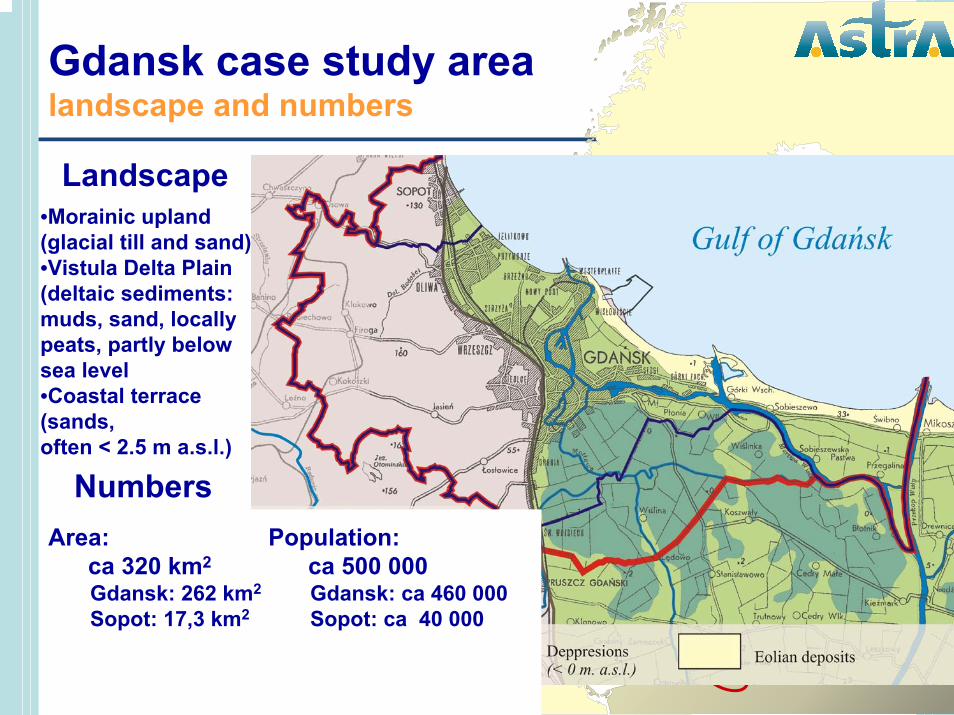
Gdansk case study arealandscape and numbers
Landscape•Morainic upland(glacial till and sand)•Vistula Delta Plain(deltaic sediments: muds, sand, locallypeats, partly belowsea level•Coastal terrace(sands, often < 2.5 m a.s.l.)
NumbersArea:
ca 320 km2
Gdansk: 262 km2
Sopot: 17,3 km2
Population: ca 500 000Gdansk: ca 460 000Sopot: ca 40 000
06/11/06 4
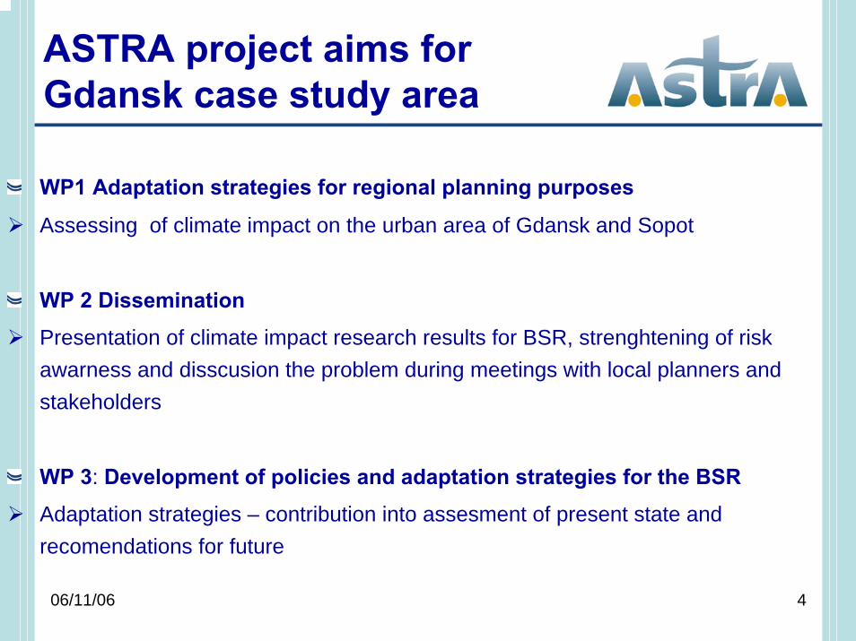
ASTRA project aims for Gdansk case study area
WP1 Adaptation strategies for regional planning purposes
Assessing of climate impact on the urban area of Gdansk and Sopot
WP 2 Dissemination
Presentation of climate impact research results for BSR, strenghtening of riskawarness and disscusion the problem during meetings with local planners andstakeholders
WP 3: Development of policies and adaptation strategies for the BSR
Adaptation strategies – contribution into assesment of present state andrecomendations for future
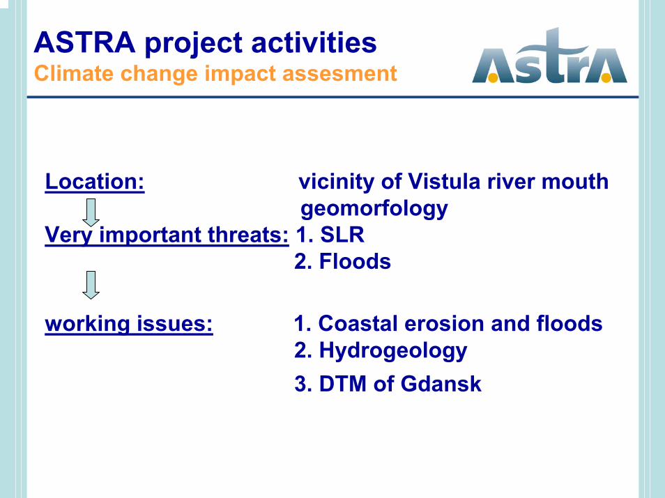
Location: vicinity of Vistula river mouthgeomorfology
Very important threats: 1. SLR 2. Floods
working issues: 1. Coastal erosion and floods2. Hydrogeology3. DTM of Gdansk
ASTRA project activitiesClimate change impact assesment
06/11/06 6
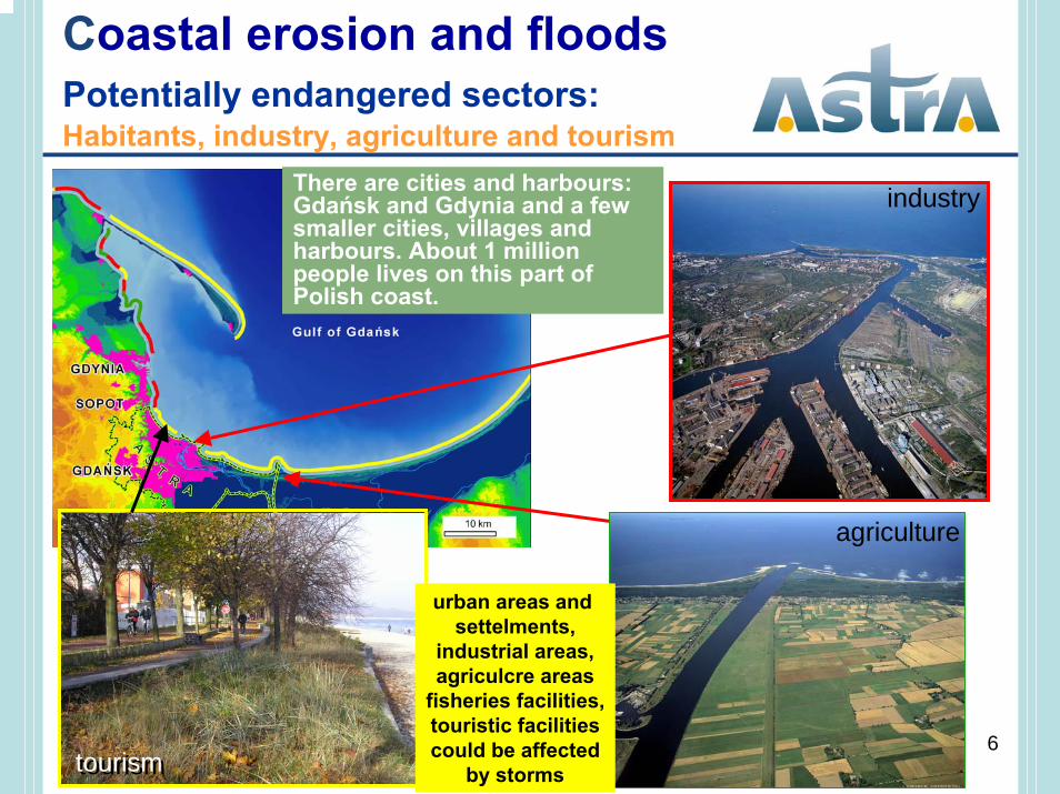
Coastal erosion and floods Potentially endangered sectors:Habitants, industry, agriculture and tourism
There are cities and harbours: Gdańsk and Gdynia and a fewsmaller cities, villages and harbours. About 1 millionpeople lives on this part of Polish coast.
agriculture
tourismtourism
industry
urban areas and settelments,
industrial areas,agriculcre areas
fisheries facilities,touristic facilitiescould be affected
by storms
06/11/06 7
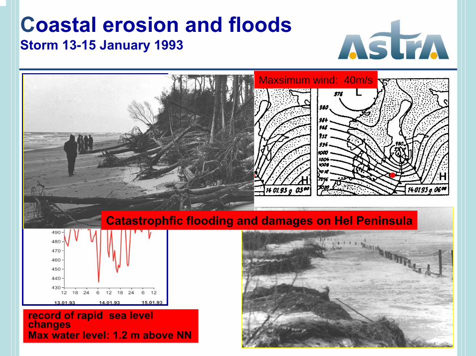
Maxsimum wind: 40m/s
Coastal erosion and floodsStorm 13-15 January 1993
record of rapid sea levelchangesMax water level: 1.2 m above NN
Catastrophfic flooding and damages on Hel Peninsula
06/11/06 8
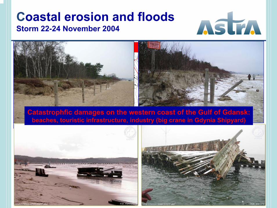
Coastal erosion and floods Storm 22-24 November 2004
Wind: N-NW, max 12oB; Max water level: 1.12 m above NN
Catastrophfic damages on the western coast of the Gulf of Gdansk:beaches, touristic infrastructure, industry (big crane in Gdynia Shipyard)
06/11/06 9
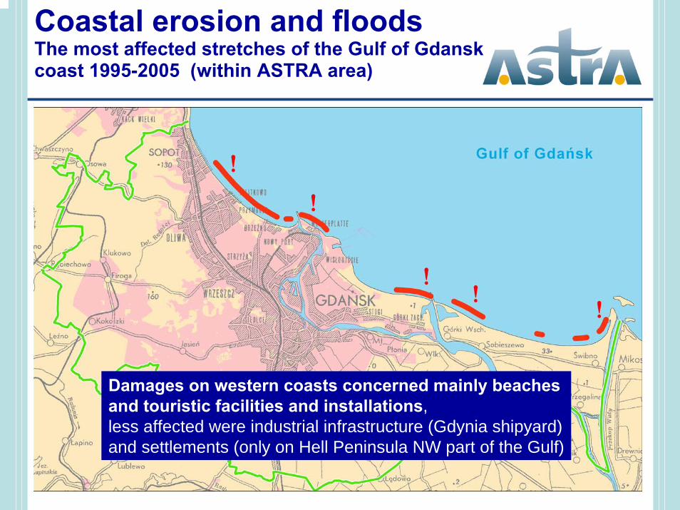
Coastal erosion and floods The most affected stretches of the Gulf of Gdanskcoast 1995-2005 (within ASTRA area)
Damages on western coasts concerned mainly beachesand touristic facilities and installations,less affected were industrial infrastructure (Gdynia shipyard)and settlements (only on Hell Peninsula NW part of the Gulf)
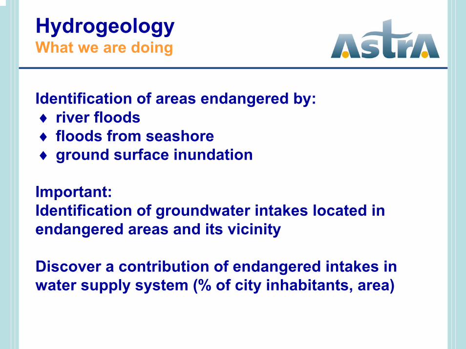
Identification of areas endangered by:♦ river floods♦ floods from seashore♦ ground surface inundation
Important:Identification of groundwater intakes located inendangered areas and its vicinity
Discover a contribution of endangered intakes inwater supply system (% of city inhabitants, area)
HydrogeologyWhat we are doing
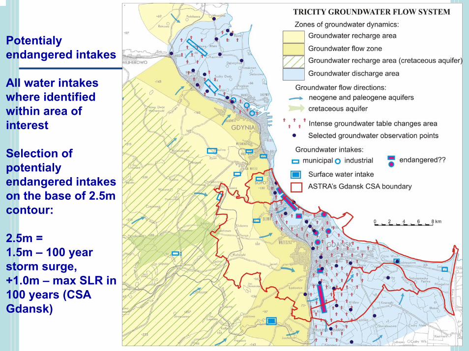
Potentialyendangered intakes
All water intakeswhere identifiedwithin area ofinterest
Selection ofpotentialyendangered intakeson the base of 2.5m contour:
2.5m = 1.5m – 100 yearstorm surge,+1.0m – max SLR in100 years (CSA Gdansk)
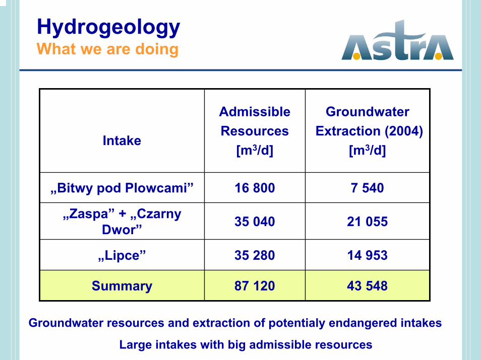
Intake
AdmissibleResources
[m3/d]
GroundwaterExtraction (2004)
[m3/d]
„Bitwy pod Plowcami” 16 800 7 540
„Zaspa” + „Czarny Dwor” 35 040 21 055
„Lipce” 35 280 14 953
Summary 87 120 43 548
Groundwater resources and extraction of potentialy endangered intakes
Large intakes with big admissible resources
HydrogeologyWhat we are doing
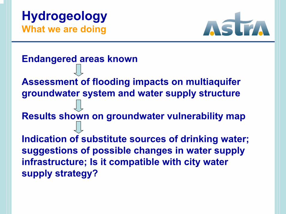
Endangered areas known
Assessment of flooding impacts on multiaquifergroundwater system and water supply structure
Results shown on groundwater vulnerability map
Indication of substitute sources of drinking water; suggestions of possible changes in water supplyinfrastructure; Is it compatible with city watersupply strategy?
HydrogeologyWhat we are doing
Over 30% of area of Gdansk is situated below 2.5m contour (over 8% bellow sea level):- all significant groundwater intakes are vulnerableagainst climate changes, especially floods and SLR
Climate changes effects are intensified by man-inducedfactors:- reduced consumption of drinking water in Gdansk (-50% from 1992),- hydrodynamic changes are observed - groundwatertable in pleistocene, oligocene and cretaceous aquifers isrising (rate 0.1-0.3m/y)
HydrogeologyPresent day summary
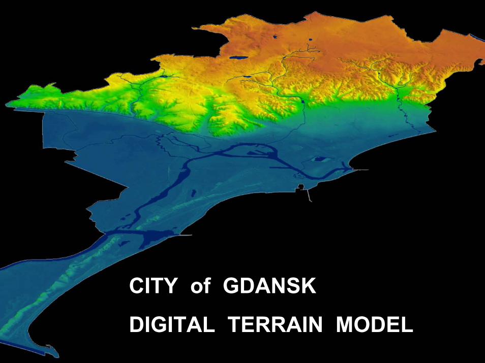
CITY of GDANSK
DIGITAL TERRAIN MODEL
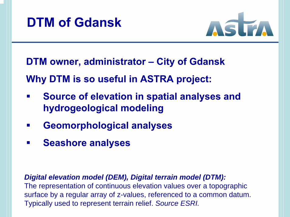
Digital elevation model (DEM), Digital terrain model (DTM):The representation of continuous elevation values over a topographic surface by a regular array of z-values, referenced to a common datum. Typically used to represent terrain relief. Source ESRI.
DTM of Gdansk
DTM owner, administrator – City of Gdansk
Why DTM is so useful in ASTRA project:
Source of elevation in spatial analyses andhydrogeological modeling
Geomorphological analyses
Seashore analyses
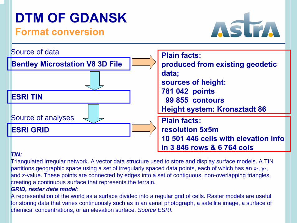
Plain facts:produced from existing geodeticdata;sources of height:781 042 points99 855 contours
Height system: Kronsztadt 86
DTM OF GDANSKFormat conversion
Bentley Microstation V8 3D FileSource of data
ESRI TIN
ESRI GRIDSource of analyses Plain facts:
resolution 5x5m10 501 446 cells with elevation infoin 3 846 rows & 6 764 cols
TIN:Triangulated irregular network. A vector data structure used to store and display surface models. A TIN partitions geographic space using a set of irregularly spaced data points, each of which has an x-, y-, and z-value. These points are connected by edges into a set of contiguous, non-overlapping triangles, creating a continuous surface that represents the terrain.GRID, raster data model:A representation of the world as a surface divided into a regular grid of cells. Raster models are usefulfor storing data that varies continuously such as in an aerial photograph, a satellite image, a surface ofchemical concentrations, or an elevation surface. Source ESRI.

DTM of GdanskExample of usage
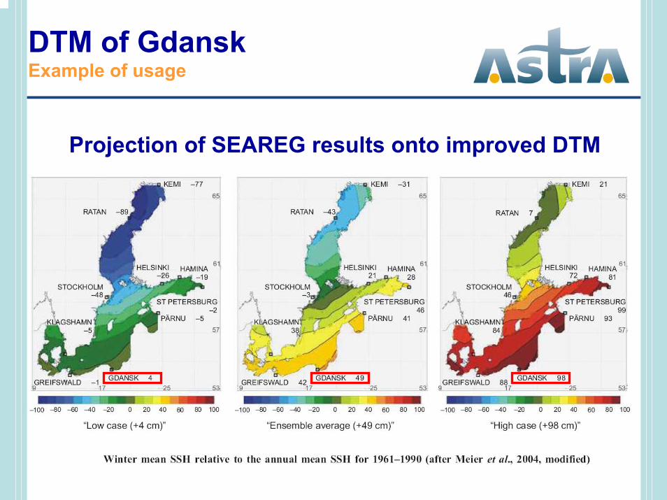
DTM of GdanskExample of usage
Projection of SEAREG results onto improved DTM
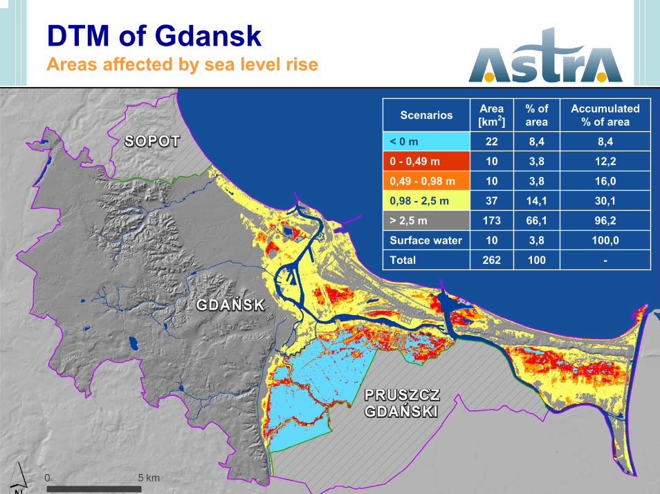
DTM of GdanskAreas affected by sea level rise
Scenarios Area[km2]
% ofarea
Accumulated% of area
< 0 m 22 8,4 8,4
0 - 0,49 m 10 3,8 12,2
0,49 - 0,98 m 10 3,8 16,0
0,98 - 2,5 m 37 14,1 30,1
> 2,5 m 173 66,1 96,2
Surface water 10 3,8 100,0
Total 262 100 -
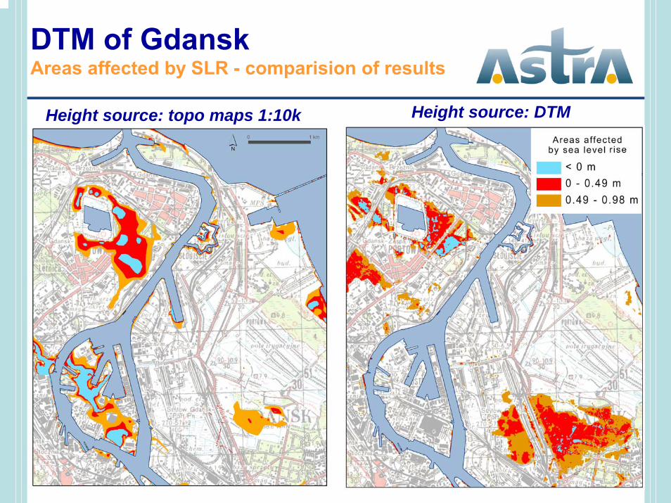
DTM of GdanskAreas affected by SLR - comparision of results
Height source: topo maps 1:10k Height source: DTM

Thank you for your attention

Assessment of flooding impacts on spatialdevelopment:
♦ built-up areas (housing, urban and industrial areas)♦ transportation♦ recreation and sports♦ forestry♦ agriculture♦ nature conservation areas


