44
| Date post: | 22-Dec-2015 |
| Category: |
Documents |
| Upload: | francis-thornton |
| View: | 218 times |
| Download: | 0 times |


GEO 465/565Geographic Information Systems and Science
Tuesday/Thursday11:00 a.m. - 11:50 p.m.Kelley 10014 credits

Dr. Dawn Wright
114 Wilkinson [email protected]://dusk.geo.orst.edu
Office Hours:Tuesdays/Thursdays
12:15 - 1:15 p.m.or by appointment

Focus of the Class Not just about software …About theory, about basic, fundamental concepts
“education” vs. “training”
general coverage by necessity - GIS world is too big nowterm paper or project is opportunity to go in depth
online resources as well

However, please remember….This is a “slash” courseSome are advanced, others have no GIS experience and did not take GEO 365This is a large enrollment course

Who Am I?
Over 20 years of GIS experience B.S. in Geology
Wheaton College in Illinois
M.S. in Oceanography Texas A&M
Ph.D. in Physical Geography & Marine Geology
UC-Santa Barbara

Application and analytical issues in GIS for oceanographic data
data modeling, analysis, conversion, metadata
Seafloor mapping and interpretationvolcanic, hydrothermal, & tectonic processes
analysis and interpretation of camera, submersible, & bathymetric data
Geography of cyberspace, web GIS
Marine sanctuaries, protected areas

Some Committee Involvement
Certificates in Geographic Information Science
www.geo.oregonstate.edu/gcert
University Consortium for Geographic Information ScienceAssociation of American Geographers: Coastal & Marine, GIS, Cyberinfrastructure specialty groupsAmerican Geophysical Union: Earth & Space Informatics, Tectonophysics sections

Other Interests
Snoopy, Calvin and Hobbes comicsBuilding Legos®Competitive cyclingAnimation / “Art House” filmsPasta New puppy SallyArcade Fire, Weezer, Snow Patrol, Coldplay, The Shins, U2, Erasure, Moby, Celtic music

Who Are YOU??
On the Sheets Provided:Your name & email addressYour CLASS level and MajorYour comfort level with computers
Scale of 1 to 5
Learning stylesYour expectations for this class
(i.e., what do you want to get out of this class, besides a good grade??)

Learning Styles
You may be interested in the web site test at
www.vark-learn.com/english/page.asp?p=questionnairestudy strategy helpsheets that apply to your own “learning
preference,” and may thus help you to further succeed in this course, as well as others

Required Text for Lecture
Geographic Information Systems and Science, 3rd ed.by Longley, Goodchild, Maguire,
and Rhind
Textbooks

Required Text for Lab, 2nd half of term
GIS Tutorial 2: Spatial Analysis Workbook for ArcGIS 10, 2nd
ed.by Allen
Textbooks

Optional and on reserve
Place Matters: Geospatial Tools for Marine Science, Conservation,
and Management in the Pacific Northwest
edited by Wright and Scholz
Textbooks

WHAT Will I Learn?
How GIS data are captured, stored, retrieved, displayed, & analyzedWhere GIS and GIScience are going as a fieldGIS software and its functionality
Basics of ArcGIS 9 and ArcGIS 10
Where to go for more information

Web Site - Syllabus

HOW will I learn ?
Warning: 2 quarters crammed into 1“Ideal learning” via The Matrix?

Learning Outcomes
Understand, articulate, demonstrate:
GIS theory and methods GIS ANALYSIS (more than getting data in and displaying it)Simple spatial analysisGeographic Information ScienceBasic software skills

Internet Access
“Web Site of the Week”
dusk.geo.orst.edu/gis

Bookmark this site!!!www.geo.oregonstate.edu/ucgis

Labs
Teaching Assistants are Alexis Smoluk and Kelvin RaifordLab sessions are in Wilkinson 210
Section 10, T 1:00 - 2:50 p.m. (Both?)Section 11, W 10:00 - 11:50 a.m. (TBD)Section 12, W 3:00 - 4:50 p.m. (TBD)
No labs this week!!

Labs (cont.)Purpose is to give you a BRIEF hands-on experience
what software can dowhat problems can be solved
longer learning curves in reality 1st half of term w/ArcGIS 9.3, 2nd half w/ArcGIS 10

Exams & Grades

GEO 465 Grades
GEO 465Midterm (Feb. 3) = 30%Final (Mar. 16) = 40%
Labs = 30%Tests will be largely multiple choice
due to large size of class

““think for yourself” factorthink for yourself” factor
GEO 565 Grades
Midterm = 20%Final = 30%Labs = 20%Web Biblio/Term Paper = 30%
Midterm = 20%NO FINALLabs = 30%Mashup Project = 40%

465/565 Final Grades
Weighted Percentage95-100 = A90-94 = A-85-89 = B+80-84 = B75-79 = B-70-74 = C+65-69 = CNo competition between students

Questions??Questions??

Storytime
An aviatrix was piloting a hot air balloon. She ran into some unexpected weather and was blown about for a long time. When the weather cleared, and she was able to descend, she had no idea where she was.
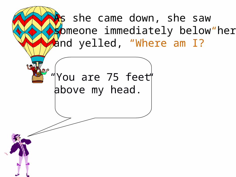
As she came down, she saw someone immediately below her and yelled, “Where am I?”
“You are 75 feet above my head.”

“How did youknow?!?”
“You must be aneconomist.”
“Because what you have just told
me is perfectlyaccurate, butperfectly useless!”

Moral of the Story...“Location, no matter how precisely specified, is sterile in and of itself.
Context determines whether or not knowledge of location is invaluable. . . .”
-- Ron Abler, former executive director of the
Association of American Geographers

““Computing is not about Computing is not about computers anymore. It is about computers anymore. It is about living.living.””
-- Nicholas Negroponte, Founding Director of MIT’s Media -- Nicholas Negroponte, Founding Director of MIT’s Media Lab. Lab. Being DigitalBeing Digital (1995), p. 6. (1995), p. 6.

““GIS is not about systems anymore. GIS is not about systems anymore. It is about geography.It is about geography.””
(… and about geographic DATA)
-- Keith Clarke, Director, National Center for Geographic -- Keith Clarke, Director, National Center for Geographic Information and Analysis (NCGIA)Information and Analysis (NCGIA)


Geography of a Recession
http://bit.ly/3xsef0


