23
GeoBIM – a tool for optimal use of geotechnical data Mats Svensson Tyréns AB
| Date post: | 21-Aug-2015 |
| Category: |
Engineering |
| Upload: | statybos-akademija |
| View: | 110 times |
| Download: | 5 times |

GeoBIM – a tool for optimal use of geotechnical data
Mats Svensson
Tyréns AB
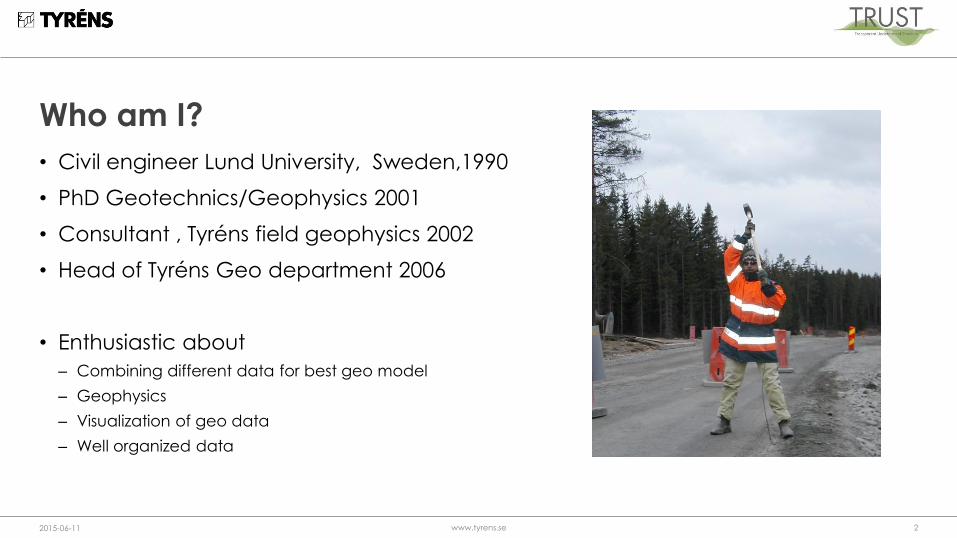
Who am I?
• Civil engineer Lund University, Sweden,1990
• PhD Geotechnics/Geophysics 2001
• Consultant , Tyréns field geophysics 2002
• Head of Tyréns Geo department 2006
• Enthusiastic about
– Combining different data for best geo model
– Geophysics
– Visualization of geo data
– Well organized data
2015-06-11 www.tyrens.se 2

Many different actors• Hydrogeologists
• Geotechinical engineers
• Contaminated soil specialists
• Other engineering disciplines
• Society in general
• Contractors
• Authorities
• Clients
• Politicans
• Media
2015-06-11 www.tyrens.se 3
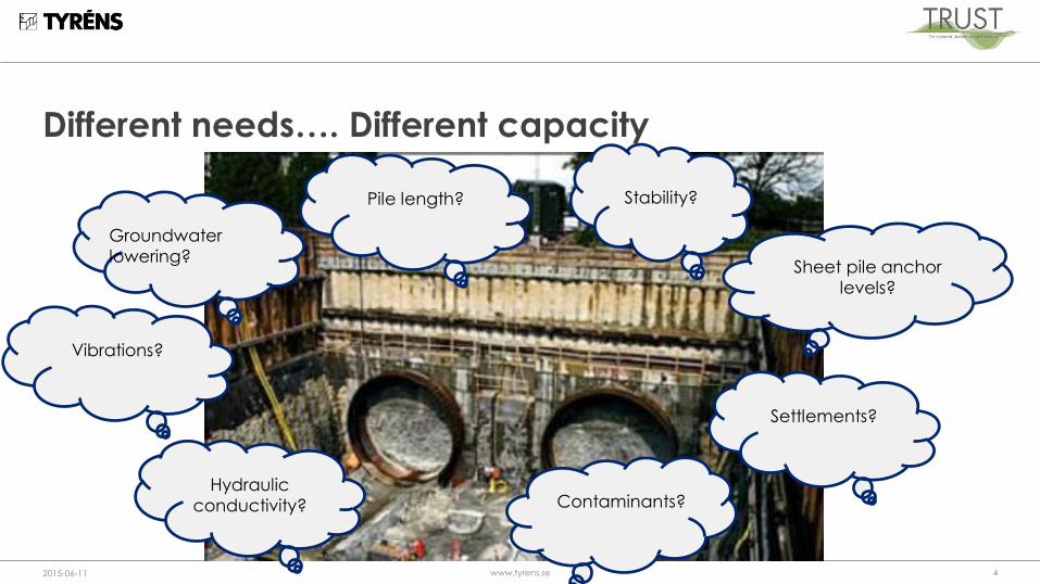
Different needs…. Different capacity
2015-06-11 www.tyrens.se 4
Sheet pile anchor
levels?
Pile length?
Contaminants?Hydraulic
conductivity?
Groundwater
lowering?
Stability?
Vibrations?
Settlements?
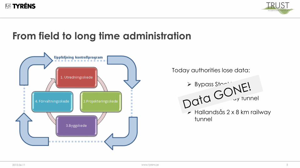
From field to long time administration
2015-06-11 www.tyrens.se 5
Today authorities lose data:
Bypass Stockholm
Varberg railway tunnel
Hallandsås 2 x 8 km railwaytunnel

This is geo data
2015-06-11 www.tyrens.se 6
Hildedal 21/3/2003 Undersökning med EM61 (avancerad metalldetektor)
-3000
-2000
-1000
0
1000
2000
3000
4000
5000
6000
7000
8000
9000
10000
V
mV
0 5 10 15 20 25 30 35 40 45 0
5
10
15
20
25
30
35
40
45
0 5 10 15 20 25 30 35 40 45 0
5
10
15
20
25
30
35
40
45
D3 DT
0 5 10 15 20 25 30 35 40 45 0
5
10
15
20
25
30
35
40
45
0 5 10 15 20 25 30 35 40 45 0
5
10
15
20
25
30
35
40
45
D1 D2
De olika plottarna D1 - DT är uppmätta värden vid olika tidpunkter efter den utsända signalen.

This is geo data
2015-06-11 www.tyrens.se 7

Why complicated?
• Many different data formats
– AGS data format (handle many but not all data types)
– in Sweden approx 10 methods (AutoCAD / GeoSuite)
• Lack of standards
• Specific software handle specific data
• No software can handle all data types
• Still a lot of manual work
2015-06-11 www.tyrens.se 8

GeoBIM concept needed
2015-06-11 www.tyrens.se 99
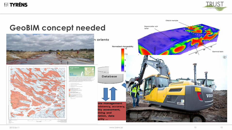
GeoBIM concept needed
2015-06-11 www.tyrens.se 1010

It could be like this
2015-06-11 www.tyrens.se 11
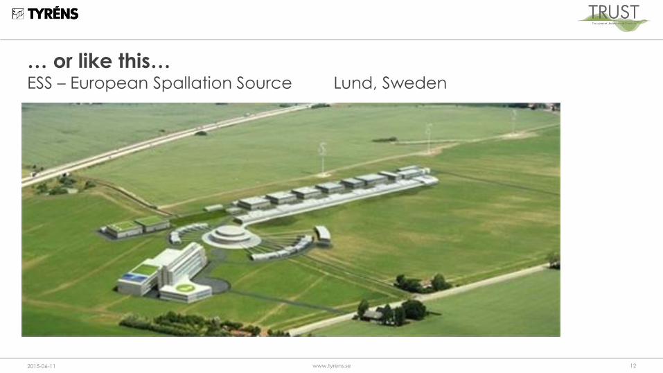
… or like this… ESS – European Spallation Source Lund, Sweden
2015-06-11 www.tyrens.se 12


TRUST – Coordination, dissemination & innovation
TRUST – Information models, data structures and visualization
TRUST – Holistic survey methods
1. Transparent Underground STructure (TRUST) – Management
Ask, Dahlin, Kadefors, Larsson, Mahlemir (LTU – LU – Chalmers – KTH – UU)
TRUST – Smart underground construction
3.1 Adaptive production methodsSchunnesson & Olofsson (LTU)
3.2 Optimization of Reinforcement Johansson & Stille (KTH)
3.3 Real Time Grouting Control Draganovic, Stille, Larsson (KTH)
2.1 Geoelectric site investigationsDahlin, Auken, Rosqvist, Sparrenbom, Bastani (LU –SGU)
2.2 Multicomponent seismics and electromagnetics Malehmir, Juhlin, Pedersen, Bastani (UU – SGU)
2.3 Rock mass characterizationRosberg, Bjelm, Ask, Schunnesson, Stephens (LU – LTU – SGU)
2.4 Development of standards for functional requirements at underground facilities with respect to the chemical environmentEricsson, Mossmark, Dahlström (Chalmers – NCC)
4.1 Development of methodologies for rational and fast evaluation of geotechnical investigations Larsson, Svensson, Jonsson(KTH – Tyréns – LU)
4.2 Integrated use and interpretation of data from geophysical and non-geophysical methods for site investigation forunderground constructionDahlin, Rydén, Günter (LU – LIAG)
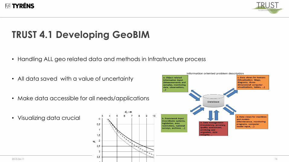
TRUST 4.1 Developing GeoBIM
• Handling ALL geo related data and methods in Infrastructure process
• All data saved with a value of uncertainty
• Make data accessible for all needs/applications
• Visualizing data crucial
2015-06-11 www.tyrens.se 16
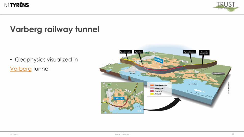
Varberg railway tunnel
• Geophysics visualized in
Varberg tunnel
2015-06-11 www.tyrens.se 17
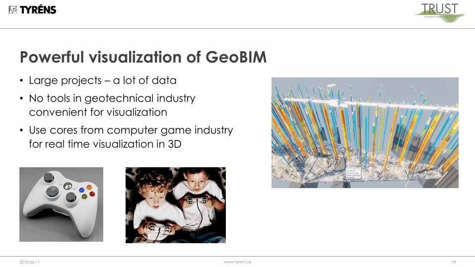
Powerful visualization of GeoBIM
• Large projects – a lot of data
• No tools in geotechnical industry
convenient for visualization
• Use cores from computer game industry
for real time visualization in 3D
2015-06-11 www.tyrens.se 18

Example European Spallation Source (ESS)
2015-06-11 www.tyrens.se 19
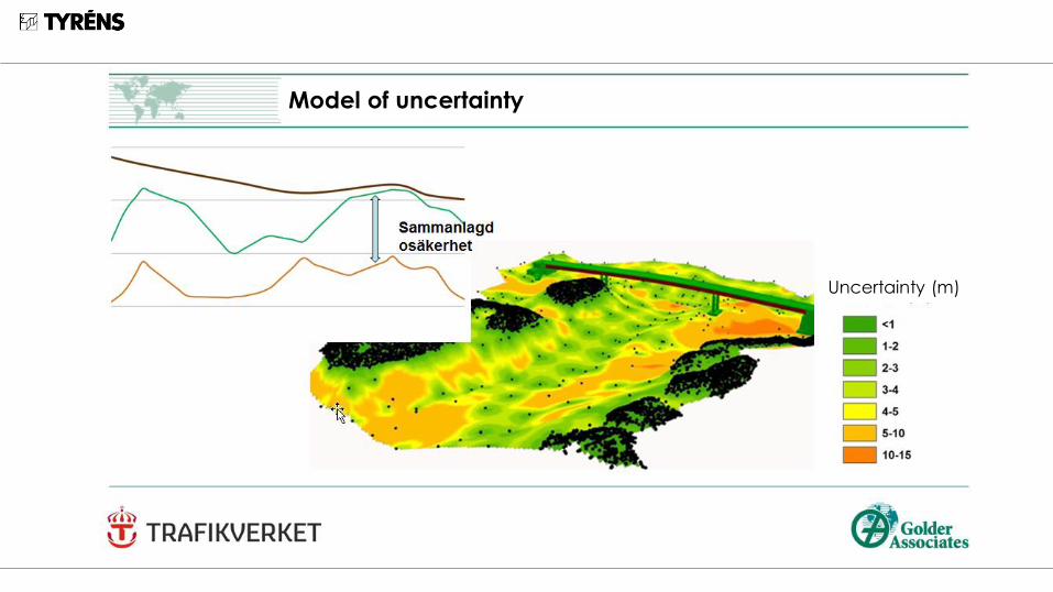
Model of uncertainty
Uncertainty (m)

A well defined uncertainty model makes
the bedrock model much more useful
Uncertainty model in tender and contract
With a well defined uncertainty model… …
the risk is defined and could be shared

Conclusions
• Many actors – different needs
• Data often lost
• A need for data format standard
• A need for the Geo-BIM concept
• Powerful visualization a fantastic COMMUNCATION
tool
• Uncertainty model – saves a lot of claims and money
2015-06-11 www.tyrens.se 23

Thank you
www.trust-geoinfra.se


