GeODin 8.2: New features in the current release. More information on each item is available by following the relevant PDF linked article. Premium features are only available to customers with a Software Update Service contract (formerly Premium Support Contract).
The latest GeODin 8.2 release includes these new features: timestamps in data types, conditions for sub data types in formulae, formulae in complex data types, publishing methods for customising database structures, automatic legend creation for borehole logs and cross-sections, borehole previews and interactive layer editing, data entry checks for dictionaries and predefined formats, searching in dictionaries.
Onshore G
eotechnics
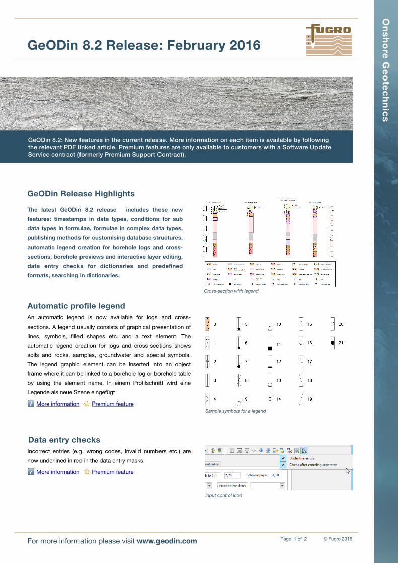
An automatic legend is now available for logs and cross-sections. A legend usually consists of graphical presentation of lines, symbols, filled shapes etc. and a text element. The automatic legend creation for logs and cross-sections shows soils and rocks, samples, groundwater and special symbols. The legend graphic element can be inserted into an object frame where it can be linked to a borehole log or borehole table by using the element name. In einem Profilschnitt wird eine Legende als neue Szene eingefügt
ℹ More information ⭐ Premium feature
Page � of �1 2For more information please visit www.geodin.com
Data entry checksIncorrect entries (e.g. wrong codes, invalid numbers etc.) are now underlined in red in the data entry masks.
• Publications: Make data available from a GeODin database for use with other software by creating new compilations or data structures, based on configurable SQL commands.
ℹ More information
• Dictionaries: In addition to the standard filters in the dictionary grid view there is now a quick search field. Dictionary windows are also scalable during layer data entry.
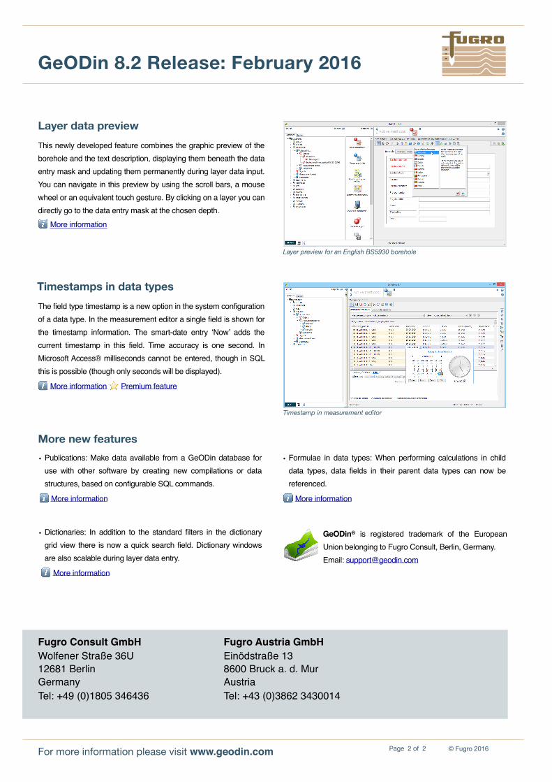
This newly developed feature combines the graphic preview of the borehole and the text description, displaying them beneath the data entry mask and updating them permanently during layer data input. You can navigate in this preview by using the scroll bars, a mouse wheel or an equivalent touch gesture. By clicking on a layer you can directly go to the data entry mask at the chosen depth.ℹ More information
Fugro Consult GmbHWolfener Straße 36U12681 BerlinGermanyTel: +49 (0)1805 346436
Fugro Austria GmbHEinödstraße 138600 Bruck a. d. MurAustriaTel: +43 (0)3862 3430014
For more information please visit www.geodin.com
GeODin® is registered trademark of the European Union belonging to Fugro Consult, Berlin, Germany. Email: [email protected]
Timestamps in data typesThe field type timestamp is a new option in the system configuration of a data type. In the measurement editor a single field is shown for the timestamp information. The smart-date entry ‘Now’ adds the current timestamp in this field. Time accuracy is one second. In Microsoft Access® milliseconds cannot be entered, though in SQL this is possible (though only seconds will be displayed).
ℹ More information ⭐ Premium feature
More new features
Layer preview for an English BS5930 borehole
Timestamp in measurement editor
• Formulae in data types: When performing calculations in child data types, data fields in their parent data types can now be referenced.