1 SEMINAR ON GEOGRAPHICAL NAMES UNITED NATIONS GROUP OF EXPERTS ON GEOGRAPHICAL NAMES (UNGEGN) ASIA SOUTH-EAST AND PACIFIC SOUTH-WEST (ASEPSW) CROWNE PLAZA MUTIARA HOTEL, KUALA LUMPUR, MALAYSIA 21 st FEBRUARY 2011 CURRENT STATUS ON ACTIVITIES OF GEOGRAPHICAL NAMES IN MALAYSIA By Mrs Fuziah Abu Hanifah Director of Malaysian Centre for Geospatial Data Infrastructure (MaCGDI) Chairperson Working Group on National Geographical Names Database and Gazetteer Malaysian National Committee on Geographical Names (MNCGN)
Transcript
1
SEMINAR ON GEOGRAPHICAL NAMES UNITED NATIONS GROUP OF EXPERTS ON GEOGRAPHICAL NAMES (UNGEGN)
ASIA SOUTH-EAST AND PACIFIC SOUTH-WEST (ASEPSW)
CROWNE PLAZA MUTIARA HOTEL, KUALA LUMPUR, MALAYSIA 21stFEBRUARY 2011
CURRENT STATUS ON ACTIVITIES OF GEOGRAPHICAL NAMES IN MALAYSIA
By
Mrs Fuziah Abu Hanifah Director of Malaysian Centre for Geospatial Data Infrastructure (MaCGDI)
Chairperson
Working Group on National Geographical Names Database and Gazetteer
Malaysian National Committee on Geographical Names (MNCGN)
2
ABSTRACT
Geographical names are used in every day life to describe our
surroundings and to tell others where we have been or where we plan
to go. It has been widely acknowledged that consistent use of
accurate place names is an important element in effective
communication worldwide, apart from supporting socio-economic
development, conservation and national infrastructure.
Due to the rapid growth in Malaysia,there is an imperative need to
develop a comprehensive database containing names of official
places that would benefit trade and commerce, population census
and national statistics, property right and cadaster, urban and regional
strategy and peace-keeping operations, maps and atlas production,
automatic navigation, tourism, and communication including postal
and news services.Therefore, it requires a comprehensive database of
geographical names which are consistent and authoritative that can
retrieve quickly for the usage by the stakeholders by using the
application that can be accessed via internet.
3
CURRENT STATUS ONACTIVITIES OF GEOGRAPHICAL NAMESIN MALAYSIA
1. INTRODUCTION
1.1 Consistent use of accurate place names is an important element in effective
communication worldwide. It also supports socio-economic development,
conservation and national infrastructure. Standardization of geographical
names has become more important because of reference needs associated
with the development of the communications and transport systems,
production of high precision charts and maps and others. Standard
geographical names can also identify and reflect culture, heritage and
landscape.
1.2 Malaysia requires acomprehensive database of geographical names which
are consistent and authoritative that can be retrieved quickly for the usage
by thestakeholders.The current status on activities of geographical names in
Malaysia can be described by the participation of three Working Groups
withinMalaysian National Committee on Geographical Names (MNCGN)
which is the key player in the development of geographical names.
1.3 The focus of this paper is to inform on the remarkable progress in 2010 is
the development of geographical namesdatabase using map scale of
1:25,000 and 1:50,000. It also involves updating of geographical names and
the development of new modules such as audio, video and arabic (jawi)
character in the database.Last but not least, this paper also will touch some
implementation issues on activities of geographical names in Malaysia.
2. BACKGROUND
2.1 Malaysian National Committee on Geographical Names (MNCGN) was
formed on 11thSeptember 2002 bythe Cabinet to coordinate activities for the
determination of geographical names in Malaysia.
4
2.2 Responsibilities of this committee encompass the following matters:
(a) formulating national guidelines for determination of geographical
names;
(b) developing the National Geographical Names Database and the
National Gazetteer;
(c) promoting the use of official names; and
(d) coordinating the input of national nomenclature activities with
nomenclature activitiesat international level, including serving as
liaison to the United Nations Group ofExperts on Geographical Names
(UNGEGN), particularly with the Regional Grouping.
2.3 This MNCGN is chaired by the Director-General of the Department of
Survey and MappingMalaysia (JUPEM) with its members consisting of
representatives from federal agencies and stategovernments.
2.4 There are one (1) technical committee and three (3) working groups at
national level to assist the MNCGN as follows:
(a) National Technical Committee on Geographical Names (NTCGN);
(b) Working Group on Policy and Geographical Names Updating (new
working group which replaced previous working group, called Working
Group on Guidelines for Determination of Geographical Names)of
Geographical Names;
(a) Working Group on National Geographical Names Database and
Gazetteer;and
(b) Working Group on Names of Island and Off-Shore Geographic Entities.
2.5 Meanwhile, at the State level, the State Committee on Geographical Names
(SCGN) was established to coordinate and implement the guidelines and
procedures formulated by MNCGN. This committee is chaired by the State
Secretary or the Secretary General of the Federal Territories Ministry (for
Federal Territories) and its members comprise of representatives from state
or federal agencies. At the state level, the State Technical Committee on
Geographical Names (STCGN) was also established to assist the SCGN.
2.6
3. AC
3.1
6 The exi
1below:
Diagram
CTIVITIES
1 Publish
Guidelin
publishe
known
Determi
guidelin
and as p
Working GroPolicies And U
Of GeograpName
sting organ
m1:Commit
OF GEOGR
hing of Gui
nes for th
ed by JUPE
as MS 22
ination of
e was prep
part of natio
oup On Updating phical es
nizational s
tteesand W
RAPHICAL
idelinesfor
he Determ
EM in 2005
256: 2009
Geograph
pared to re
onal geospa
National TecCommittee
Geographical (NTCGN
Working GroNational GeogNames Datab
Gazette
structure of
Working Gr
L NAMES
r the Deter
ination of
5 and has
Geographi
ical Name
epresent M
atial data in
chnical e on Names
N)
oup on graphical ase and er
O
f MNCGN
roups of G
mination o
Geograph
become a
c Informat
es, as sho
alaysia’s e
nfrastructur
National Comon GeograpNames (MNC
Working GroNames of IslanOff‐Shore Geog
Entities
is as show
eographic
of Geograp
hical Nam
Malaysian
ion - Guid
own in Diffort to me
re developm
mittee hical CGN)
up on nd and graphic s
SG
G
wn in Diagr
al Names
phical Nam
es has b
Standard
delines for
agram 2.T
etsuch a n
ment initiativ
State CommittGeographical N
(SCGN)
State TechnCommittee
Geographical N
ram
mes
been
and
the
This
need
ve.
tee on Names
ical on Names
D
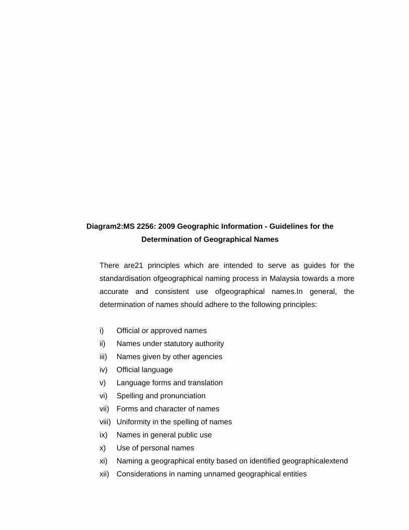
Diagram2:M
There a
standard
accurate
determin
i) Off
ii) Na
iii) Na
iv) Off
v) La
vi) Sp
vii) Fo
viii) Un
ix) Na
x) Us
xi) Na
xii) Co
MS 2256: 2Determ
are21 princ
disation ofg
e and co
nation of na
ficial or app
ames under
ames given
ficial langua
nguage for
pelling and p
rms and ch
niformity in t
ames in gen
se of person
aming a geo
onsideration
2009 Geogrmination o
ciples whic
geographica
onsistent u
ames shou
proved nam
r statutory a
by other ag
age
ms and tran
pronunciati
haracter of n
the spelling
neral public
nal names
ographical e
ns in namin
raphic Infoof Geograp
ch are inte
al naming p
use ofgeo
ld adhere to
mes
authority
gencies
nslation
on
names
g of names
c use
entity based
g unnamed
ormation -phical Nam
ended to s
process in
ographical
o the follow
d on identif
d geograph
Guidelinesmes
serve as g
Malaysia to
names.In
wing princip
fied geogra
ical entities
s for the
guides for
owards a m
general,
les:
phicalexten
s
the
more
the
nd
7
xiii) Duplication of names
xiv) Name changes
xv) Use of qualifying elements
xvi) Names of minor geographical entities
xvii) Generic names
xviii) Variant or unofficial names
xix) Names in the forms of abbreviations and numbers
xx) Off-shore hydrographic geographical entities
xxi) Names of foreign countries
3.2 Geographical Names Database and Production of Web Gazetteer
The Malaysian Geographical Names Database consist of amongst others
local names, location, historical background and gazette notification that
have authoritative records available for government and public use.
The Working Group on Geographical Names Database and Gazetteer, chair
by the Malaysian Centre for Geospatial Data Infrastructure (MaCGDI) was
given the responsibility to develop the Malaysian Geographical Names
Database and Web Gazetteer. The roadmap of development of the
database and gazetteer and other activities as shown in Table 1 below:
Table 1: Roadmap of Development of the Database and Gazetteer
ACTIVITIES YEAR
• Phase 1 - Development of Geographical Names Database and Gazetteer
• Data collection / compilation from the state maps of the Peninsular Malaysia. (Scale of 1:100 000)
July 2004 – July 2005
Validation of Data
• The data was sent to the state with the template for validation and updating.
Aug. 2005 – Sept. 2006
Data Testing
• To ensure the data fulfilled the specification.
Oct. – Dec. 2006
8
ACTIVITIES YEAR
• Data collection, validation and data tested for Peninsular Malaysia(Scale of 1:25 000).
• Development of the geographical names database and gazetteer for Peninsular Malaysia (Scale of 1:25 000).
• Based on topographical maps of Peninsular Malaysia (700 sheets).
Jan – Aug. 2008
• Development of the Module on Verification of Geographical Names and delivered to every state.
July 2008 -Oct. 2009
• Phase II - Data collection, validation and data tested for the state of Sabah and Sarawak. (Scale of 1:50 000 & 1:25 000)
• Development of the geographical names database for the state of Sabah and Sarawak (1:50 000 & 1:25 000).
• Based on topographical maps of Sabah and Sarawak (Sabah - 218 sheets and Sarawak - 271 sheets)
Sept. – Dec. 2008
• Data collection, validation and data tested for naming of an island and offshore geographical entities.
• Development of the geographical names database for islands and offshore geographical entities.
• Data for islands and offshore geographical entities downloaded into MyGeoName by the Working Group on Names of Island and Off-Shore Geographical Entities.
Oct. 2008 - March 2009
• Validation of geographical names from State Committee on Geographical Names (SCGN) before being publish into MyGeoName
• SCGN will validate within 3 months after the Module on Verification of GeographicalNames being delivered to the state.
Dec. 2008 – Dec. 2010
• Development of Arabic (Jawi) Module • Development of Arabic Module completed. Jawi spelling
was then send to National Authority for Linguistics for validation.
Jan – Dec 2010
• Preparation of Audio Module • Development of audio module for Malay Language and
related dialect.
May – Oct 2010
• Production of State Gazetteer • Production of state gazetteer based on the validation
process.
Mei – Dec 2010
9
ACTIVITIES YEAR
• Phase III - Data collection, validation and data tested from Town Maps of Penisular Malaysia, Sabah and Sarawak. (Scale of 1:3 000 – 1:12 500)
• Development of the geographical names database for map. (Scale of 1:3 000 – 1:12 500)
• Total of 160 sheets.
Jan – Dec 2011
• Phase IV - Data collection, validation and data tested from Klang Valley Maps. (Scale of 1:500)
• Development of the geographical names database. (Scale of 1:500)
• Depends on availability of the data provided by JUPEM
Jan – Dec 2012
The Working Group on Geographical Names Database and Gazetteer has
appointed a Liaison Officer from each state to verify existing or propose any
new names. In conducting this task, reference has to be made to gazettes,
gazette plans, and circulars issued by all State Secretaries concerned, as
they are the authorities for the naming of the geographic entities within their
jurisdictions. In addition, those names will also need to be referred to the
National Authority for Linguistics (Dewan Bahasa dan Pustaka) for approval.
Finally, geographic names that are proposed to be used must be tabled at
the SCGN meeting before being officially approved and adopted.
3.3 Naming of Islands and Off-Shore Geographical Entities
The Working Group on Names of Islands and Off-Shore Geographic Entities
was established on 20th June 2006 and is chair by the National Hydrography
Centre (NHC).
The tasks of this Working Group are as follows:
i) Carrying out surveys and researches as well as identifying and
proposing the naming of islands and off-shore geographic entities
which has no names. The proposed names will have to relate to the
characteristics of hydrographic entities.
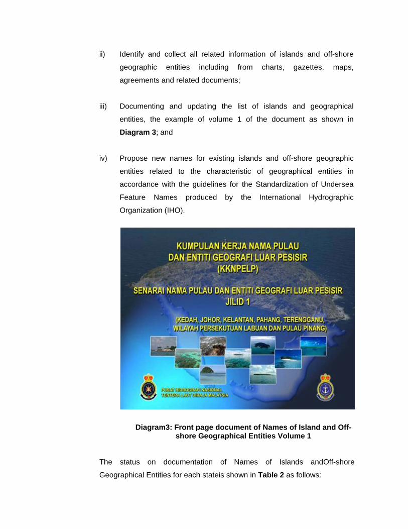
ii) Id
ge
ag
iii) D
en
D
iv) P
en
ac
Fe
O
The st
Geograp
dentify and
eographic
greements
ocumenting
ntities, the
iagram 3; a
ropose new
ntities rela
ccordance
eature Na
Organization
Diagram
tatus on
phical Entit
collect all
entities
and related
g and upd
example
and
w names f
ated to th
with the g
ames prod
n (IHO).
m3: Front pshore
documenta
ties for each
l related in
including
d document
dating the
of volume
for existing
e characte
uidelines fo
duced by
page docuGeograph
ation of
h stateis sh
nformation
from ch
ts;
list of is
1 of the
g islands a
eristic of
or the Stan
y the Inte
ument of Nahical Entitie
Names o
hown in Tab
of islands
harts, gaz
slands and
document
and off-sho
geographic
ndardization
ernational
ames of Ises Volume
of Islands
ble 2 as fol
and off-sh
zettes, ma
geograph
t as shown
ore geograp
cal entities
n of Under
Hydrograp
land and Oe 1
andOff-sh
lows:
hore
aps,
hical
n in
phic
s in
rsea
phic
Off-
hore
11
Table 2: Status on documentation of Names of Islands and Off-shoreGeographical Entities
Status Document State
Published VolumeI Kedah, Johor, Kelantan, Pahang, Terengganu, Labuan and
Penang
VolumeII Selangor, Perak, Melaka, Perlis and Negeri Sembilan
Waiting for State authorities actions
VolumeIII Sabah
VolumeIV Sarawak
3.4 Workshop of geographical names Workshops of geographical names have been carried out as scheduled. The
objectives of the workshops are to disseminate information on the Guideline
on naming of Geographical Names and to understand the procedure to use
Geographical Names Database. The workshops were also intend to help
participants understand the importance of coordinated geographical naming
and to populate the Geographical Names Database. These efforts are
expected to support the implementation of the Malaysian Geospatial Data
Infrastructure (MyGDI) initiatives which is undertaken by the Malaysian
Centre for Geospatial Data Infrastructure (MaCGDI).
The content of the workshops include presentation from the committees,
working groups and agencies related to geographical names as follows:
i) Briefing on National Geographical Names Database and Gazetteer by
MaCGDI
ii) Briefing on Guideline for the Determination of Geographical Names by
JUPEM
iii) Briefing on Names of Island and Off-Shore Geographic Entities by
NHC
12
iv) Briefing on role of National Archives of Malaysia in development of
National Geographical Names Database and Gazetteer by National
Archives of Malaysia
v) Briefing of procedures on collection of geographical names in the
publication of Topographic map by JUPEM
vi) Demonstration on MyGeoName application
vii) Hands-on training on updating of geographical names using Module
on Verification of Geographical Names
3.5 Development of Module on Verification of Geographical Names
The module for updating the geographical names was introduced to
expedite the verification process. Data Entry to the geographical names
database will be done after the verification processes are completed by
STCGN.
A few snapshots of the module are shown in Diagram 4 to Diagram 6.
. Diagram 4 : Interface of the Module on Verification of Geographical Names
13
Diagram5 : The list of geografical names to be verified
Diagram6 :The location of Geographical Names to be verified
14
3.6 Websites on Geographical Names Activities in Malaysia
a) MNCGN Website JUPEM has launched the MNCGN Website named “MyGeoName” in
July 2006 and the updating of the website is carried out regularly. The
latest update was on November 2010 which includes the report on 17th
UNGEGN Asia South East and Pacific South West Divisional Meeting in
Sydney, Australia on 10thApril 2010, and InformationBulletin of UNGEGN
2010. This website can be accessed at URL:
http://www.jupem.gov.my/geonames in dual language that is in Malay
language and in English language.
Through this website, all information related to geographic naming
activities could be accessed and is linked to UNGEGN website and other
country websites which are related to the geographical naming such as
New Zealand and Canada. This website also include of Frequently
Asked Questions (FAQ). A list of liaison officers for each agency is also
included for communication purpose.MyGeoName application can be
accessed by clicking the related link, via this website.
b) MyGeoName Application MyGeoName application has been developed by MaCGDI.The interface
of MyGeoName Application is as shown in Diagram 7. The development
for MyGeoName applicationis still ongoing with a few new additional
modules being introduced as follows:
i) Searching Module This module was developed to make searching on the database.
Searching can be made via geographical names, locations,
districts or states.
15
ii) Audio Module
Some communities in the States have their own dialects thus,
pronunciation of geographic names can be different and
sometimes cannot be determined correctly. On this matter,
MNCGN had decided that “Audio File” be developed for all names
that appear in the Web Gazetteer and this would in certain ways
be able to address this matter and would lead to pronunciation of
geographical names being made in a standardised manner.
There are two (2) versions of “Audio File” have been developed to
represent its different way of pronunciations. In this regard, first
version represents pronunciation using formal Malay language
whilst the second version represents dialect pronunciation of each
state of the country.Verifications of ‘Audio File’ aremade by
representative of NTCGN and secretariat of NCGN.
iii) Arabic (Jawi) Character Module
Arabic Character module is a module developed within the
geographical names database. All arabic character for 64,554
geographical names throughout Malaysia including 3,974 foreign
names has been submitted to National Authority for Linguistics for
verification by related experts appointed.
iv) Administration Module Administration module consists of data entry, data updating of
geographical names and coordinates of the location. It also
consists of verification of the spelling of geographical names.
v) Gazetteer Publication Module
This module is to publish and generate an authoritative national
and state gazetteer of geographical names which had been
verified by the SCGN.
3.7
D
7 Compu
The pur
geograp
Agencie
importan
Chairma
by JUP
update
shown i
Diagram 7
terBased T
rpose of th
phic naming
es and Loc
nce aspect
an of MNC
EM, MaCG
geographic
nDiagram
: Interface
Training (C
his CBT is
g in the co
cal Authorit
t of geogra
CGN), comp
GDI and Na
c names d
8andDiagr
of MyGeo
CBT) forGe
to educate
untry for of
ty. The CB
phic namin
pilation of p
ational Hyd
database in
ram 9.
oName App
eographica
e and illus
fficers from
BT comprise
ng (which in
presentatio
rographic C
n the coun
plication
alNaming
trates the
m Federal A
es of intro
nclude a sp
ns from wo
Center, and
ntry. Interfa
significanc
Agencies, S
oduction of
peech from
orkshops g
d procedur
ace of CBT
e of
State
f the
m the
iven
re to
T as
17
Diagram 8 : Interface of CBT
Diagram9 : Interface of CBT
18
3.8 PRODUCTION OF NATIONAL GAZETTEER
The National Gazetteer of Malaysia is the authoritative geographical place
names and is the result of the cooperative effort of federal and state
governments.The Gazetteer is compiled annually by the Working Group on
National Geographical Names Database and Gazetteer within MNCGN,
using data provided by the Department of Survey and Mapping Malaysia
(JUPEM), National Hydrographic Centre (NHC), Royal Malaysian Navy and
State Committee on Geographical Names (SCGN).
This document details amongst others the organizations involved in the
production of the gazetteer. It also describes in detail on the gazetteer
product, data requirements, metadata, production methodology, associated
production issues and quality control procedures.
4. IMPLEMENTATION ISSUES In developing and implementing the standardised usage of geographical names
throughout the country, there were some issues encountered by MNCGN,
amongst which are as follows:
4.1 Verification of The Geographical Names In developing the Malaysian Geographical Names Database and Web
Gazetteer, the concerned Working Group only obtained partial commitment
from the SCGN, particularly in regards to the verification of geographical
names. Some State Liaison Officers appointed to the SCGN were frequently
transferred to other positions and this affected the needed continuity on the
data verification activities. Since procedures to verify geographical names
were not properly documented new officers would face difficulties in carrying
out their tasks.
19
In addressing this situation, State Working Groups had been formed by
MaCGDI, whereby members among others comprise of an officer from
MaCGDI and the State Liaison Officer. Any problem encountered is solved
by State Working Groups collectively and completed work done was
documented. In the case of the State Liaison Officer being transferred to
another department, the State Working Group will acts as a mediator until a
new State Liaison Officer is appointed by SCGN.
Besides that, the Computer Based Training and the Module on Verification
of Geographical Names that have been developed will help State Liaison
Officer to update the geographical names database. Briefings have been
given to each state on how to use the module. During briefing, each district
of the state will be given the module to update the geographical names in
their district only. Then, the State Liaison Officer will collect the geographical
names which have been update from the districts for the validation and send
back to the working group within three (3) months after receiving the
module.
4.2 Awareness On The Importance Of Geographical Names
In Malaysia,awareness oftheimportance ofgeographical namesis mainly
carried outbyMNCGN with the cooperation of geographical names
committees and working groups especially at the state level which
comprises of local authorities as the key playersin thegeographical naming.
Furthermore Local Authorities are encouraged to submit to the state
government (SCGN) name changes and new names for unnamed places
for consideration as official names.
In this respect the government has encourage the usage of the official
names in all levels including government, public sector and the citizen.
Besides that, state names authorities also promote throughout state
government and the citizens an awareness of the importance and
procedures for geographic name standardisation.
20
Furthermore, briefingsand workshops on geographical namesheld
frequently throughout the states togive awareness tothe participants on the
importanceof geographical names. During briefing and workshops,
participants were exposed on the importance to adhere the principles in the
Guideline for the Determination of Geographical Names. These principles
which are intended to serve as guides for the standardisation of
geographical naming process in Malaysia towards a standard, accurate and
consistent use of geographical names.
Therefore, awareness on the needs of standardization of geographical
names is important because confusion, uncertainty, and misunderstanding
may occur if more than one name is used for the same place, the same
name is applied to different places, or the spelling of a name is inconsistent.