GeoSmart Asia PWTC, Kuala Lumpur September 29-Oct 1, 2015 Geospatial Practices Supporting Land Administration In Malaysia - Licensed Land Surveyor's Perspective Dato’ Sr Dr Mohd Zaid Bin Abdullah President Association of Authorised Land Surveyors Malaysia (PEJUTA)
Transcript
GeoSmart Asia
PWTC, Kuala Lumpur
September 29-Oct 1, 2015
Geospatial Practices Supporting Land Administration In Malaysia
- Licensed Land Surveyor's Perspective
Dato’ Sr Dr Mohd Zaid Bin Abdullah President
Association of Authorised Land Surveyors Malaysia (PEJUTA)
Presentation Structure
I. Introduction
II. Sustainable Development
III. Land Management
IV. Modernisation of Cadastral Survey in Malaysia
V. Conclusions
Introduction
Geospatial information is critical in tackling issues such as humanitarian, peace & security, environmental and development.
Examples are climate changes, natural disasters, disease pandemics, famines, population displacement, food and economic crises.
These issues are not only local but crosses borders requiring global, regional & national policy responses.
Introduction
Sound geospatial information is crucial for addressing the complex problems the world is facing today. These problems are global in nature and affect different regions, rural and urban areas alike, requiring coordinated efforts, more innovative and sophisticated approaches, as well as effective tools to ultimately guide our way to sustainable development
(Prof. Dr. Paul Cheung, 2002).
Introduction
The building of a geospatial information database is just as important as building the infrastructure itself.
A global unified geospatial information database would need all countries to sit down to come together and cooperate with each other in the way of sharing information.
When the day comes, will Malaysia will be ready for such cooperation?
Sustainable Development
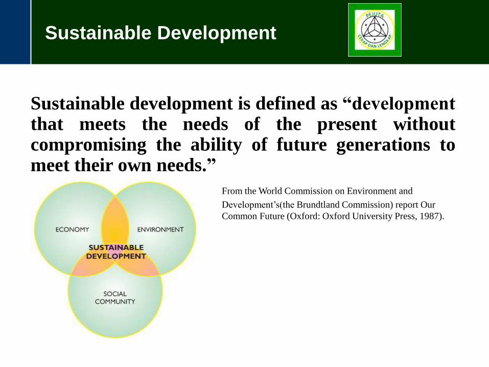
Sustainable development is defined as “development that meets the needs of the present without compromising the ability of future generations to meet their own needs.”
Common Future (Oxford: Oxford University Press, 1987).
Sustainable Development
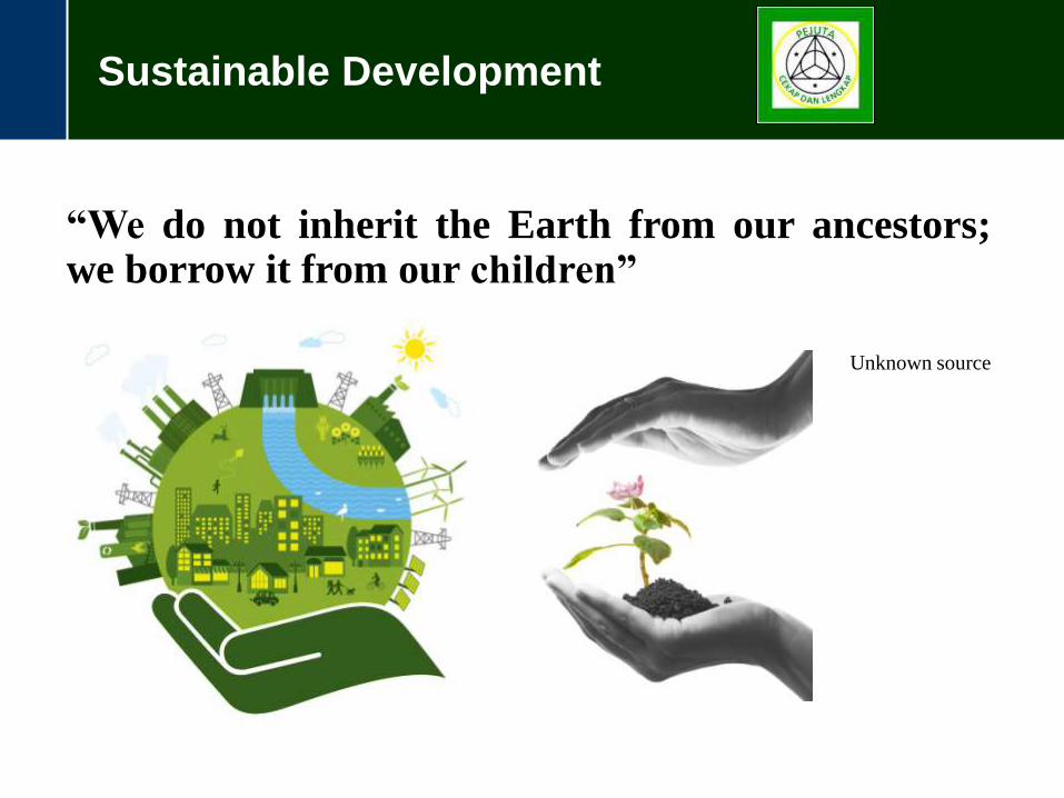
“We do not inherit the Earth from our ancestors; we borrow it from our children”
Unknown source
Sustainable Development
Why Sustainable Development?
If it’s so good, why not just adopt it?
No “one size fits all” model for Sustainable Development
The need for a good geospatial informational database to make good decisions towards the goal of Sustainable Development.
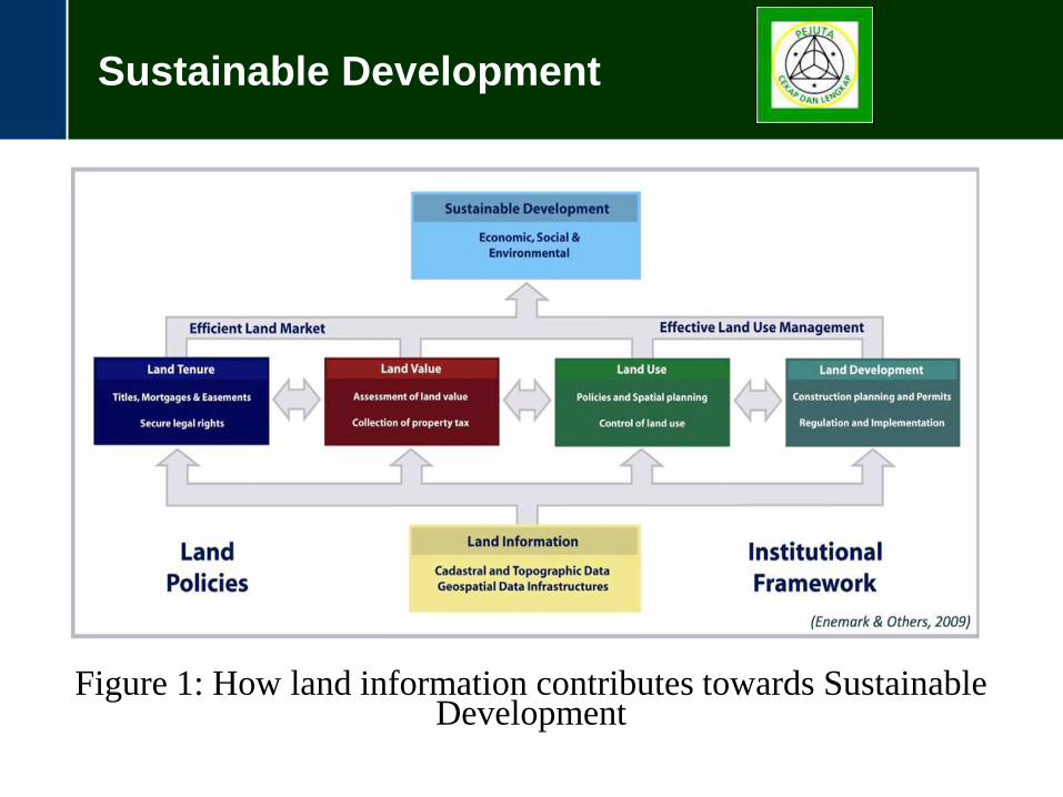
Sustainable Development
Figure 1: How land information contributes towards Sustainable Development
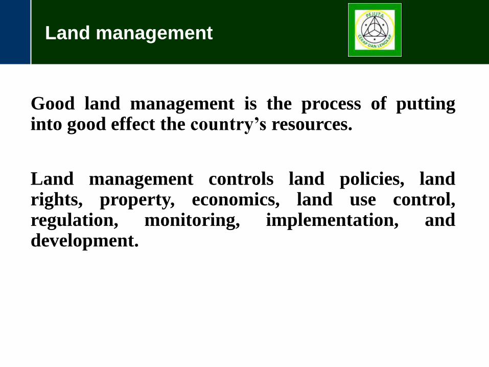
Land management
Good land management is the process of putting into good effect the country’s resources.
Land management controls land policies, land rights, property, economics, land use control, regulation, monitoring, implementation, and development.
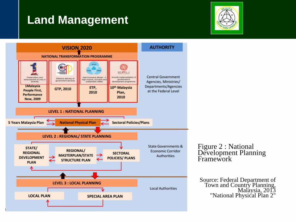
Land Management
Figure 2 : National Development Planning Framework
Source: Federal Department of Town and Country Planning,
Malaysia, 2013 "National Physical Plan 2"
Land Management
Figure 1 : National Development Planning Framework
Source: Federal Department of
Town and Country Planning, Malaysia, 2013
"National Physical Plan 2"
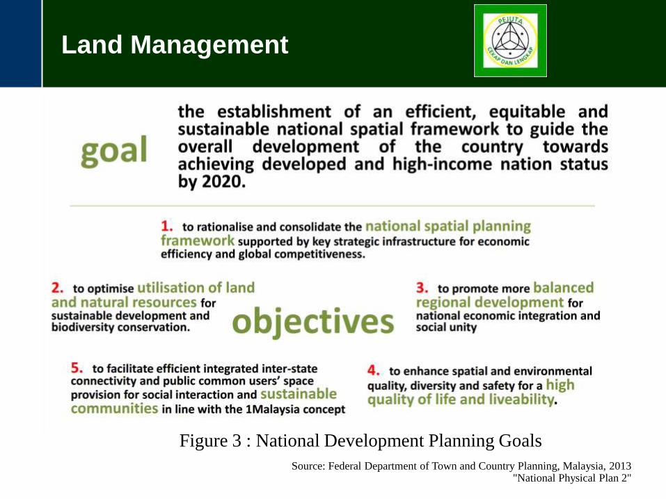
Figure 3 : National Development Planning Goals
Source: Federal Department of Town and Country Planning, Malaysia, 2013 "National Physical Plan 2"
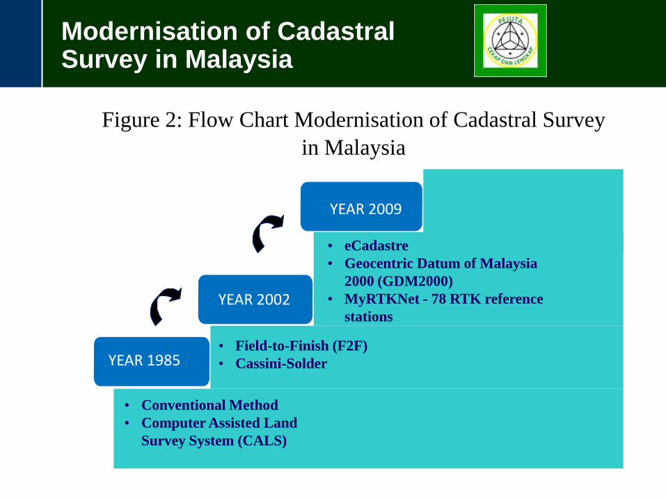
Modernisation of Cadastral Survey in Malaysia
YEAR 1985
YEAR 2002
• Conventional Method
• Computer Assisted Land
Survey System (CALS)
• Field-to-Finish (F2F)
• Cassini-Solder
• eCadastre
• Geocentric Datum of Malaysia
2000 (GDM2000)
• MyRTKNet - 78 RTK reference
stations
YEAR 2009
Figure 2: Flow Chart Modernisation of Cadastral Survey
in Malaysia
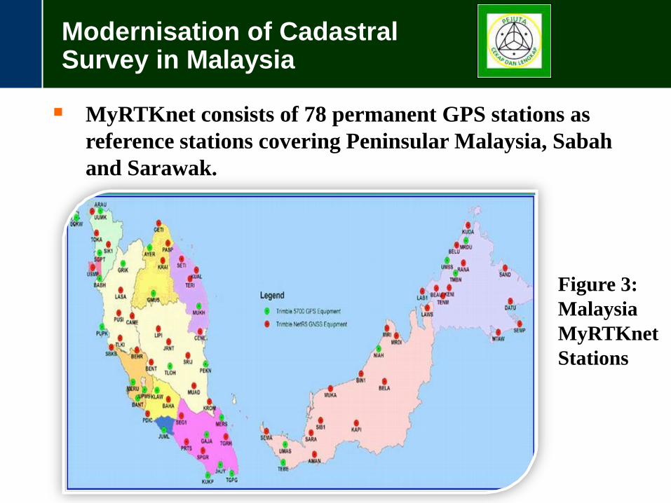
Modernisation of Cadastral Survey in Malaysia
YEAR 1985
YEAR 2002
YEAR 2009
MyRTKnet consists of 78 permanent GPS stations as
reference stations covering Peninsular Malaysia, Sabah
and Sarawak.
Figure 3:
Malaysia
MyRTKnet
Stations
Conclusions
Geospatial information technologies are the key to planning, management and administration of land in areas such as Malaysia. Geospatial information technology as used in eKadaster also stands as a necessary tool in the design of decision support systems in sustainable management of land resources and policy development. JUPEM, along with Licensed Land Surveyors of Malaysia will always be at the forefront of providing spatial data to the Government so that land administrators can make the right choices in planning and (spatial) designs in the area, whether regionally or globally.