60
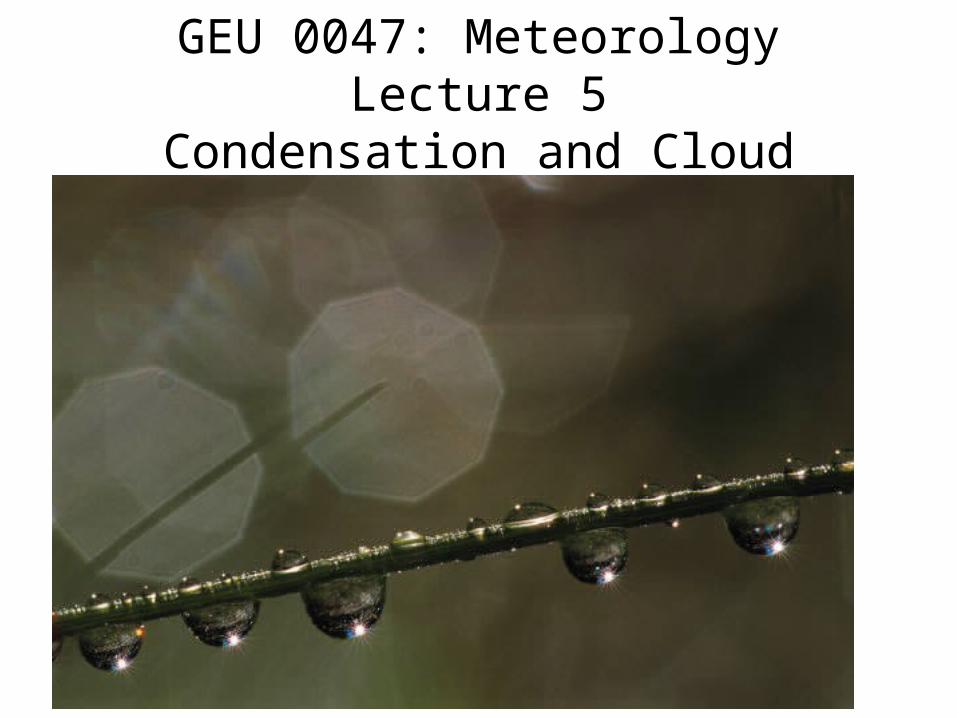
GEU 0047: Meteorology Lecture 5 Condensation and Cloud
| Date post: | 01-Jan-2016 |
| Category: |
Documents |
| Upload: | kylan-alexander |
| View: | 29 times |
| Download: | 0 times |
GEU 0047: MeteorologyLecture 5
Condensation and Cloud
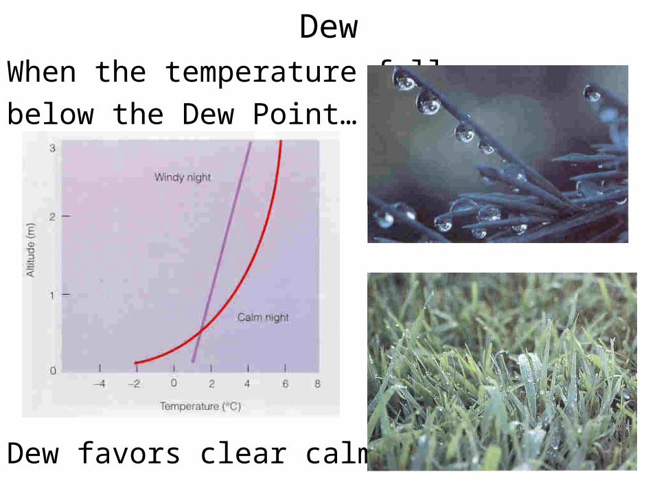
DewWhen the temperature falls
below the Dew Point…
Dew favors clear calm nights.
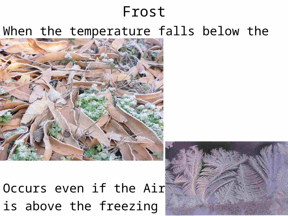
FrostWhen the temperature falls below the
Frost(Dew)Point
Occurs even if the Air Temp.
is above the freezing point.
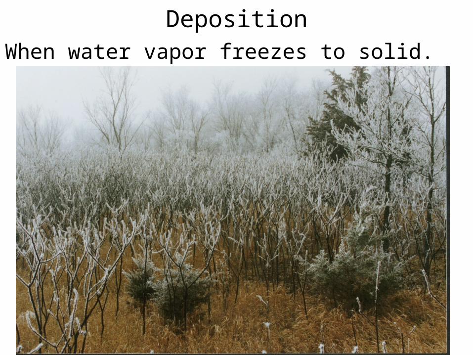
DepositionWhen water vapor freezes to solid.
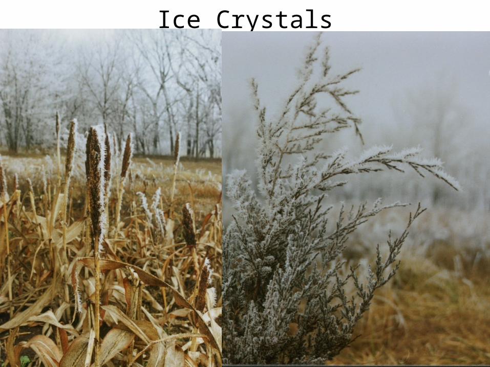
Ice Crystals
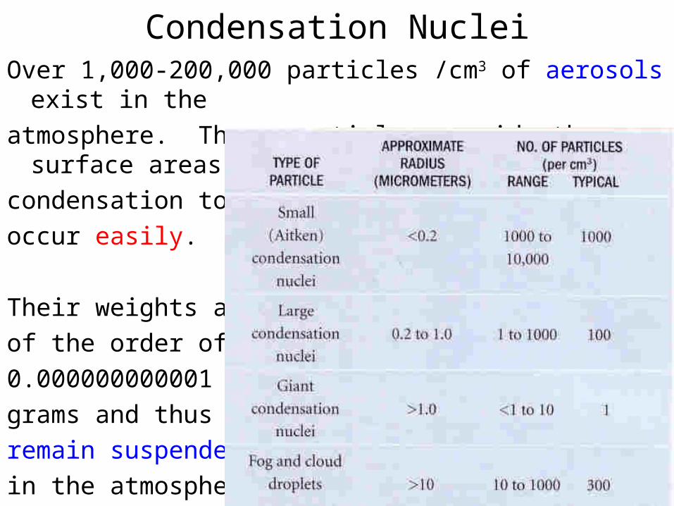
Condensation NucleiOver 1,000-200,000 particles /cm3 of aerosols exist in the
atmosphere. These particles provide the surface areas for
condensation to
occur easily.
Their weights are
of the order of
0.000000000001
grams and thus can
remain suspended
in the atmosphere.
Nuclei TypesHydroscopic: Water-seeking
salts, dust, sulfuric and nitric acids
Hydrophobic: Water-repellent
oils, waxes
< 0.2 m Responsible for “dry” haze
0.2-1.0 m Most favorable for cloud condensation
> 1.0 m
> 10 m liquid water droplets (precipitation seeds)
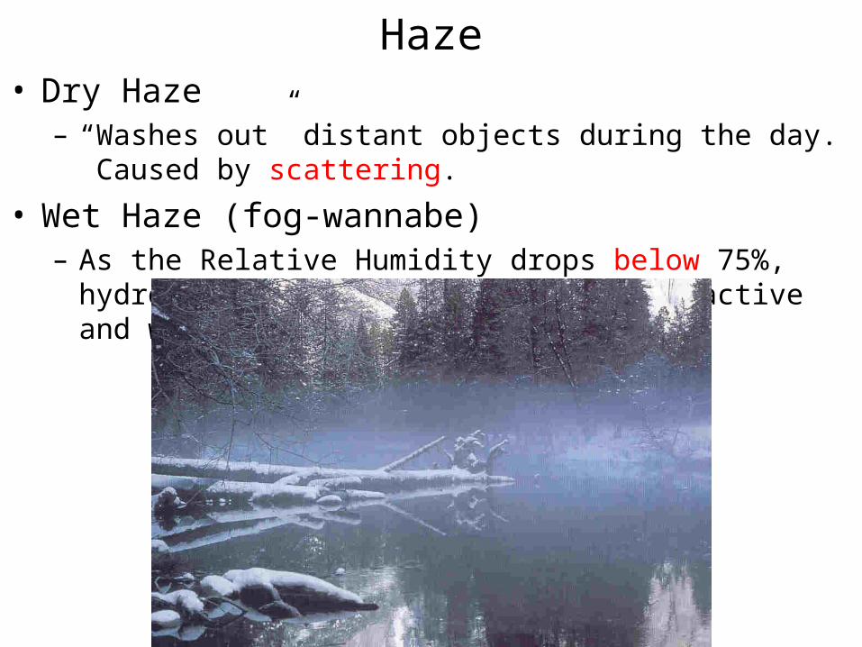
Haze• Dry Haze
– “Washes out” distant objects during the day. Caused by scattering.
• Wet Haze (fog-wannabe)– As the Relative Humidity drops below 75%, hydroscopic
condensation nuclei are active and water vapor condenses on them.
Fog• Formed by
– Cooling the air below its dew point temperature
– Adding water vapor through evaporation and mixing of air parcels
• Officially, fog is defined as condensed water vapor (clouds) near the ground that obscure visibility to less than 6 miles and also, the spread between dew point and air temperature is < 5 oF.
• When visibility is < 0.25 miles, fog is called dense.
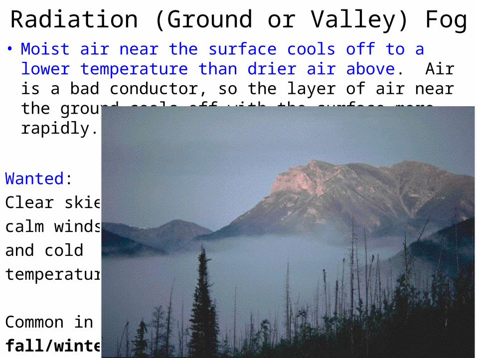
Radiation (Ground or Valley) Fog• Moist air near the surface cools off to a lower temperature
than drier air above. Air is a bad conductor, so the layer of air near the ground cools off with the surface more rapidly.
Wanted:
Clear skies,
calm winds,
and cold
temperature.
Common in
fall/winter.
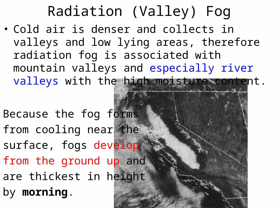
Radiation (Valley) Fog• Cold air is denser and collects in valleys and low lying
areas, therefore radiation fog is associated with mountain valleys and especially river valleys with the high moisture content.
Because the fog forms
from cooling near the
surface, fogs develop
from the ground up and
are thickest in height
by morning.
Burn-OffWith sunrise, scattered sunlight reaches the ground and warms
it up.
In the warmer air, evaporation takes place and the air
also rises and begins mixing with the air above. The fog is
said to “lift” as it clears near the ground.
Satellite photos show fog dissipates around its edges first,
usually where it is the shallowest and radiation can penetrate
to the ground to cause heating.
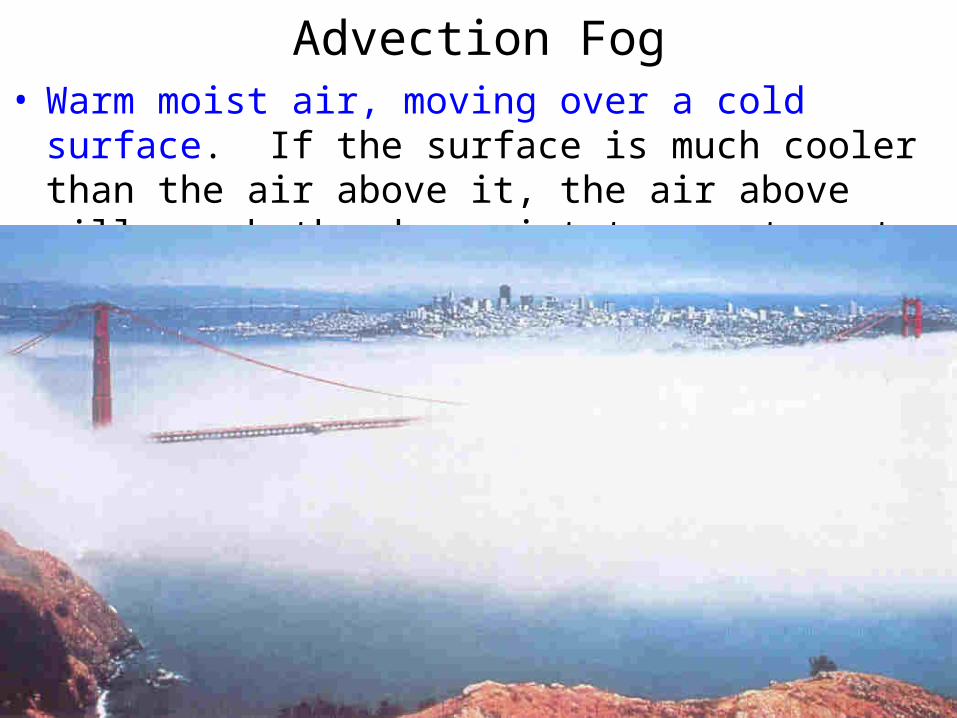
Advection Fog• Warm moist air, moving over a cold surface. If the surface
is much cooler than the air above it, the air above will reach the dew point temperature to form advection fog.
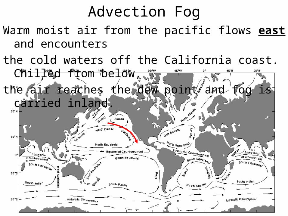
Advection FogWarm moist air from the pacific flows east and encounters
the cold waters off the California coast. Chilled from below,
the air reaches the dew point and fog is carried inland.
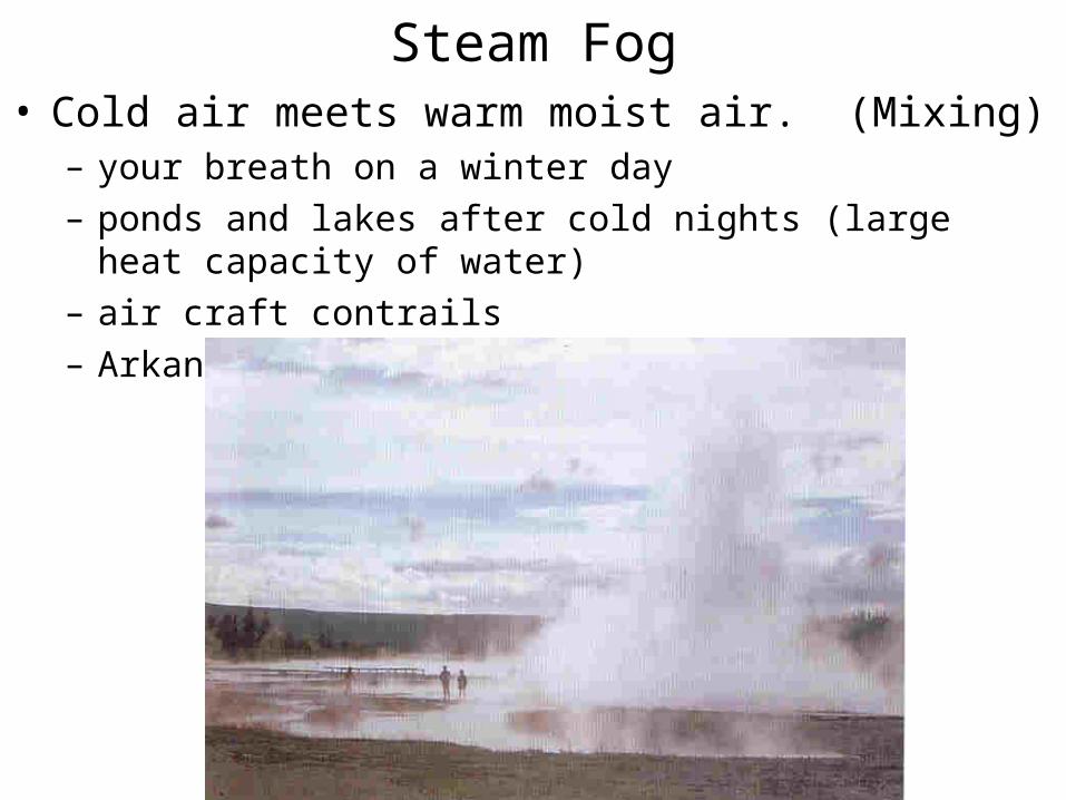
Steam Fog• Cold air meets warm moist air. (Mixing)
– your breath on a winter day
– ponds and lakes after cold nights (large heat capacity of water)
– air craft contrails
– Arkansas Nuclear One cooling tower
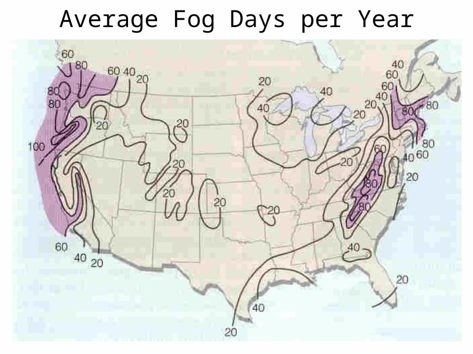
Average Fog Days per Year
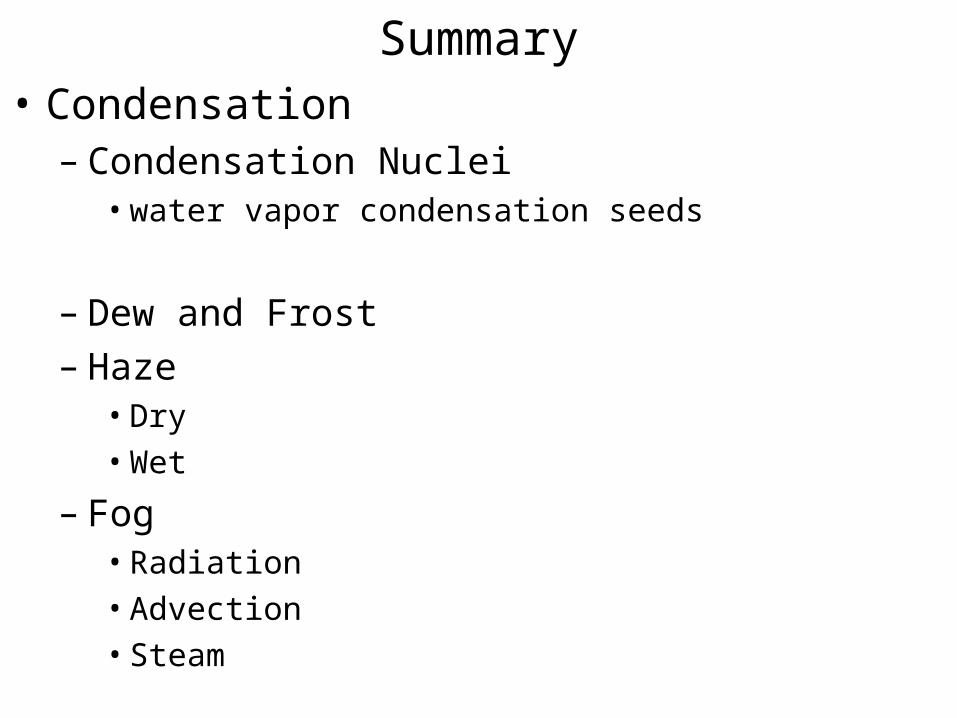
Summary• Condensation
– Condensation Nuclei• water vapor condensation seeds
– Dew and Frost– Haze
• Dry
• Wet
– Fog• Radiation
• Advection
• Steam
Clouds
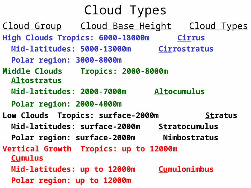
Cloud TypesCloud Group Cloud Base Height Cloud TypesHigh Clouds Tropics: 6000-18000m Cirrus
Mid-latitudes: 5000-13000m Cirrostratus
Polar region: 3000-8000m
Middle Clouds Tropics: 2000-8000m Altostratus
Mid-latitudes: 2000-7000m Altocumulus
Polar region: 2000-4000m
Low Clouds Tropics: surface-2000m Stratus
Mid-latitudes: surface-2000m Stratocumulus
Polar region: surface-2000m Nimbostratus
Vertical GrowthTropics: up to 12000m Cumulus
Mid-latitudes: up to 12000m Cumulonimbus
Polar region: up to 12000m
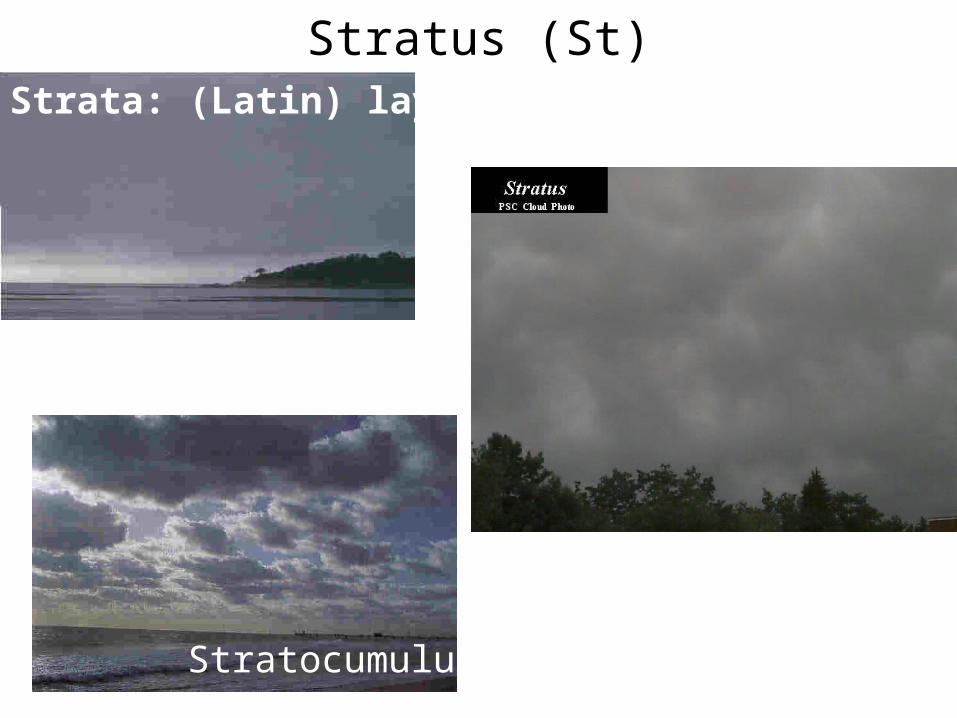
Stratus (St)Strata: (Latin) layers.
Stratocumulus
Stratus CloudsStratus clouds are uniform gray clouds that usually cover the entire sky.
They form from very weak, upward vertical air currents causing
condensation. Stratus clouds also form when a layer of air is cooled from
below to its dew point temperature and water vapor condenses into
liquid droplets.
Stratus clouds look like a layer of fog that never reaches the ground. In fact, fog that "lifts" off the ground forms a layer of low stratus clouds. Precipitation rarely falls from true stratus clouds since the upward vertical motion needed for precipitation is very weak, but light mist and drizzle can sometimes accompany stratus clouds.
• Cirrostratus (Cs)
• Altostratus (As)
• Nimbostratus (Ns)
• Stratocumulus (Sc)
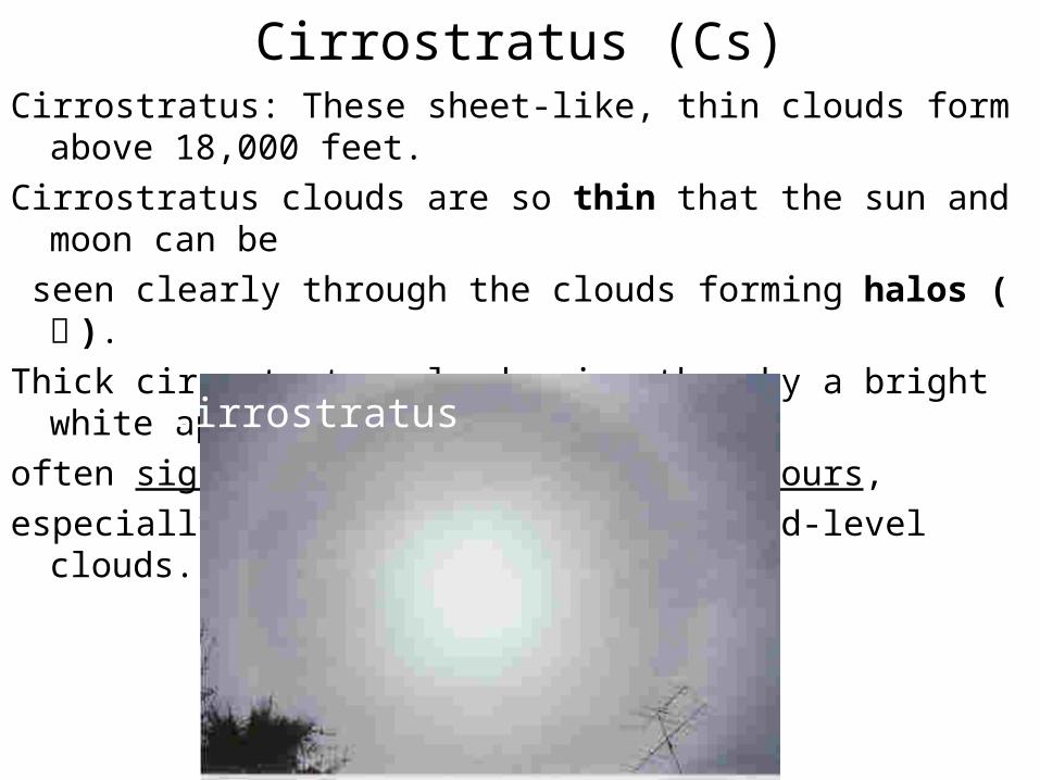
Cirrostratus (Cs)Cirrostratus: These sheet-like, thin clouds form above 18,000 feet.
Cirrostratus clouds are so thin that the sun and moon can be
seen clearly through the clouds forming halos ( 暈 ).
Thick cirrostratus clouds give the sky a bright white appearance and
often signal rain or snow within 24 hours,
especially if they are followed by mid-level clouds.
Cirrostratus
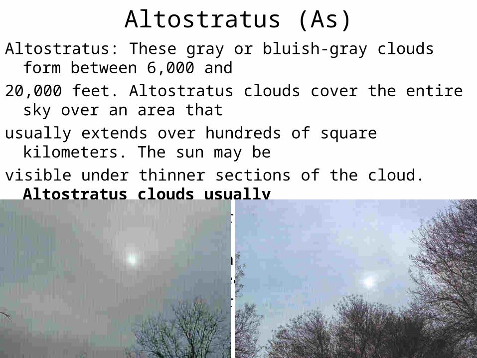
Altostratus (As)Altostratus: These gray or bluish-gray clouds form between 6,000 and
20,000 feet. Altostratus clouds cover the entire sky over an area that
usually extends over hundreds of square kilometers. The sun may be
visible under thinner sections of the cloud. Altostratus clouds usually
form ahead of a storm producing widespread and mostly continuous
precipitation. Altostratus clouds do not allow enough sunlight to break
through the cloud to form any shadows on the ground.
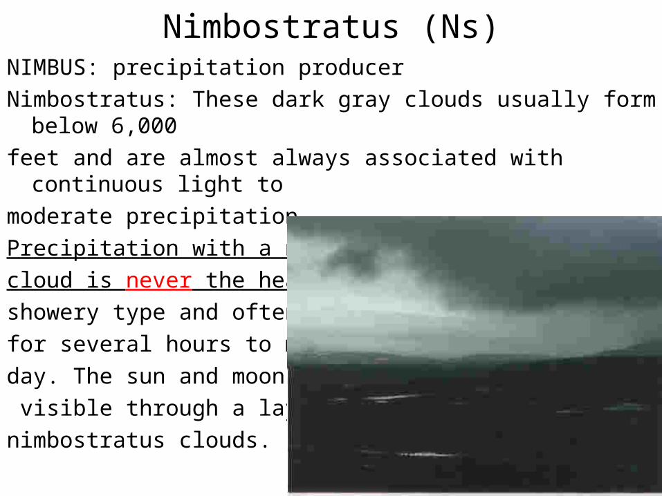
Nimbostratus (Ns)NIMBUS: precipitation producer
Nimbostratus: These dark gray clouds usually form below 6,000
feet and are almost always associated with continuous light to
moderate precipitation.
Precipitation with a nimbostratus
cloud is never the heavy,
showery type and often can last
for several hours to more than a
day. The sun and moon are not
visible through a layer of
nimbostratus clouds.
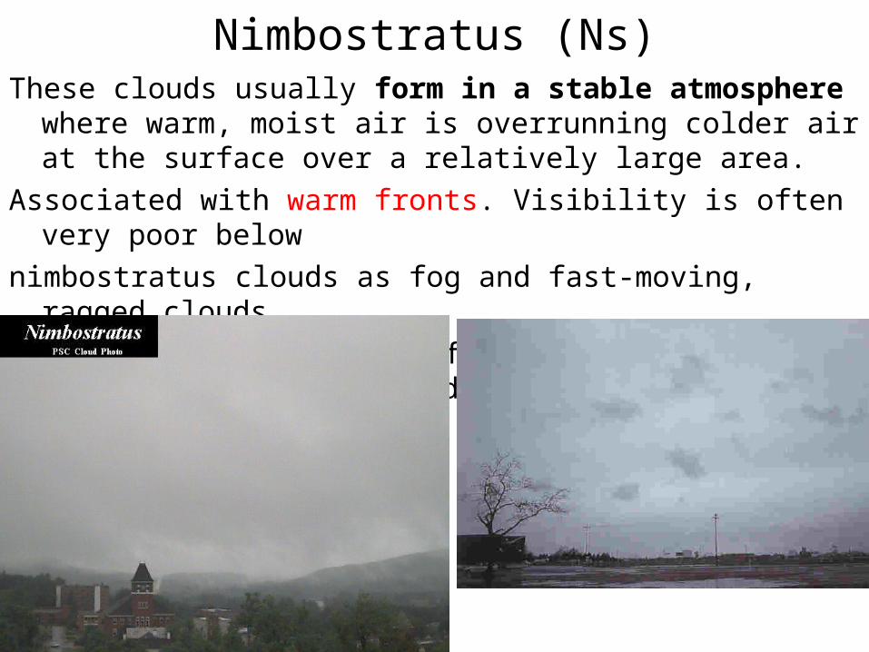
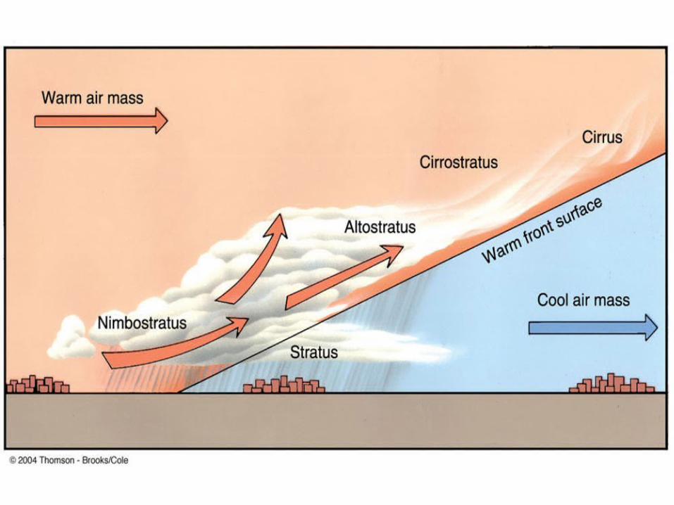
Nimbostratus (Ns)These clouds usually form in a stable atmosphere where warm, moist
air is overrunning colder air at the surface over a relatively large area.
Associated with warm fronts. Visibility is often very poor below
nimbostratus clouds as fog and fast-moving, ragged clouds,
known as scud or stratus fractus clouds, form in the precipitation-cooled
air below the cloud.
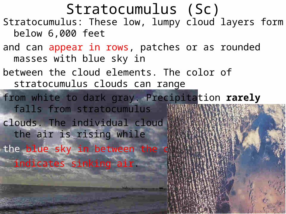
Stratocumulus (Sc)Stratocumulus: These low, lumpy cloud layers form below 6,000 feet
and can appear in rows, patches or as rounded masses with blue sky in
between the cloud elements. The color of stratocumulus clouds can range
from white to dark gray. Precipitation rarely falls from stratocumulus
clouds. The individual cloud elements form where the air is rising while
the blue sky in between the cloud elements indicates sinking air.
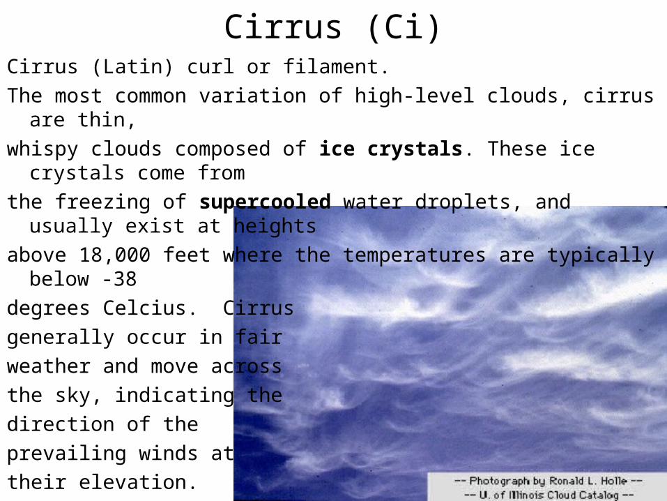
Cirrus (Ci)Cirrus (Latin) curl or filament.
The most common variation of high-level clouds, cirrus are thin,
whispy clouds composed of ice crystals. These ice crystals come from
the freezing of supercooled water droplets, and usually exist at heights
above 18,000 feet where the temperatures are typically below -38
degrees Celcius. Cirrus
generally occur in fair
weather and move across
the sky, indicating the
direction of the
prevailing winds at
their elevation.
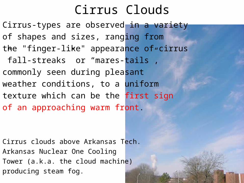
Cirrus CloudsCirrus-types are observed in a variety
of shapes and sizes, ranging from
the "finger-like" appearance of cirrus
”fall-streaks” or “mares-tails”,
commonly seen during pleasant
weather conditions, to a uniform
texture which can be the first sign
of an approaching warm front.
Cirrus clouds above Arkansas Tech.
Arkansas Nuclear One Cooling
Tower (a.k.a. the cloud machine)
producing steam fog.
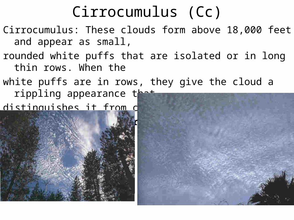
Cirrocumulus (Cc)Cirrocumulus: These clouds form above 18,000 feet and appear as small,
rounded white puffs that are isolated or in long thin rows. When the
white puffs are in rows, they give the cloud a rippling appearance that
distinguishes it from cirrus clouds.
Cirrocumulus clouds rarely cover
the entire sky.
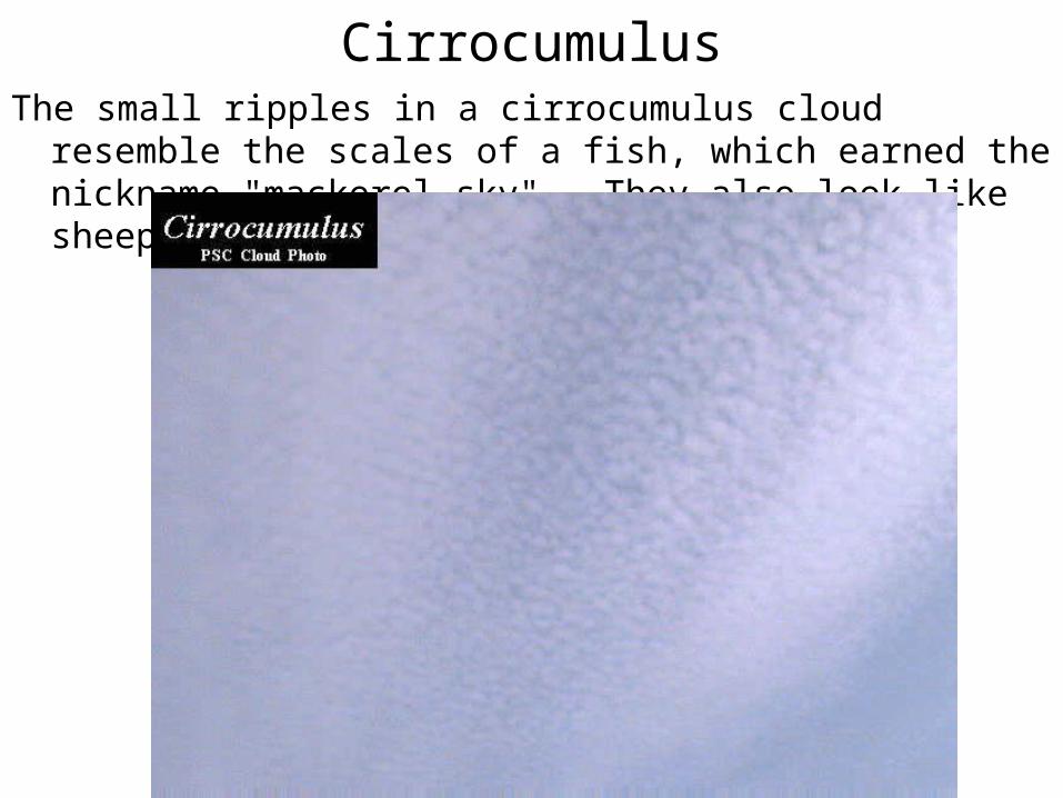
CirrocumulusThe small ripples in a cirrocumulus cloud resemble the scales of a fish,
which earned the nickname "mackerel sky". They also look like sheep wool.
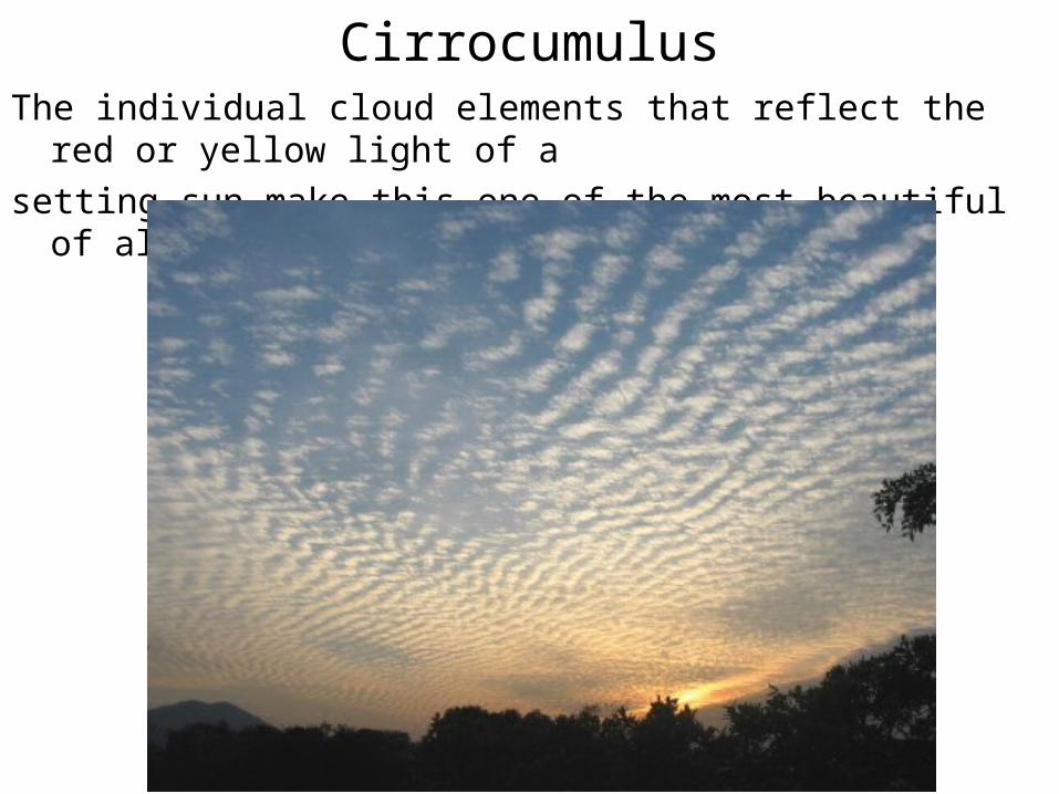
CirrocumulusThe individual cloud elements that reflect the red or yellow light of a
setting sun make this one of the most beautiful of all clouds
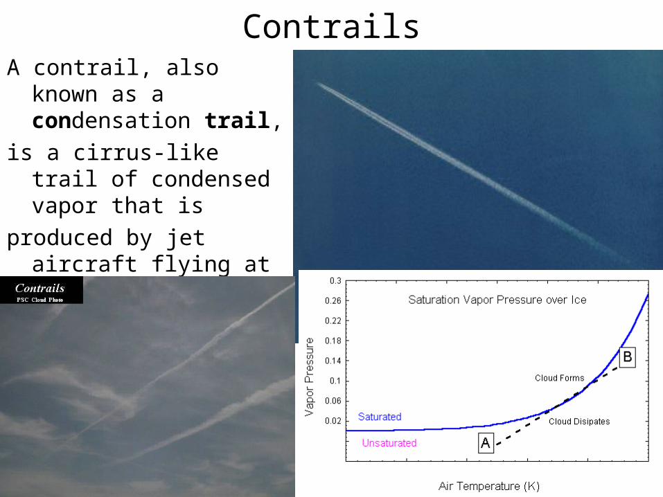
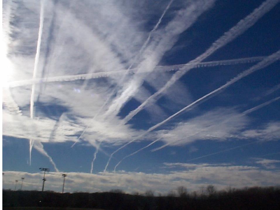
ContrailsA contrail, also known as a
condensation trail,
is a cirrus-like trail of condensed vapor that is
produced by jet aircraft flying at high altitudes. (Steam Fog)
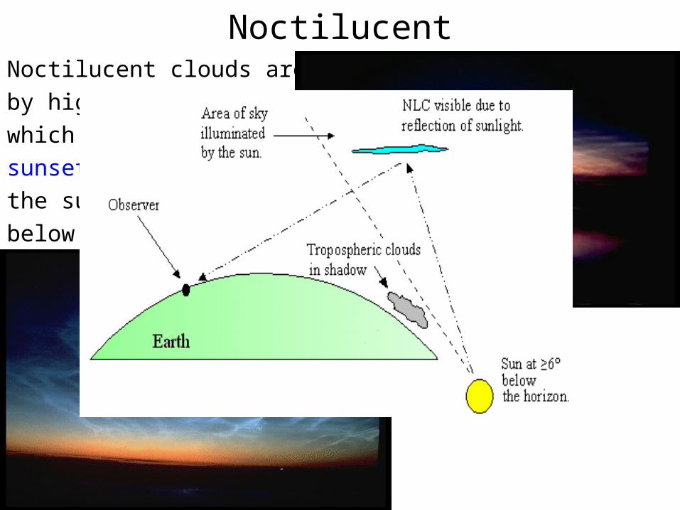
NoctilucentNoctilucent clouds are caused
by high cirrus-like clouds
which are illuminated after
sunset or before sunrise when
the sun is physically well
below the local horizon.
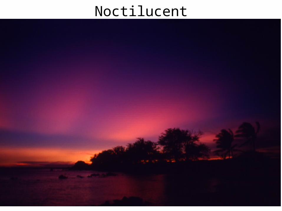
Noctilucent
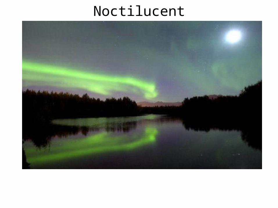
Noctilucent
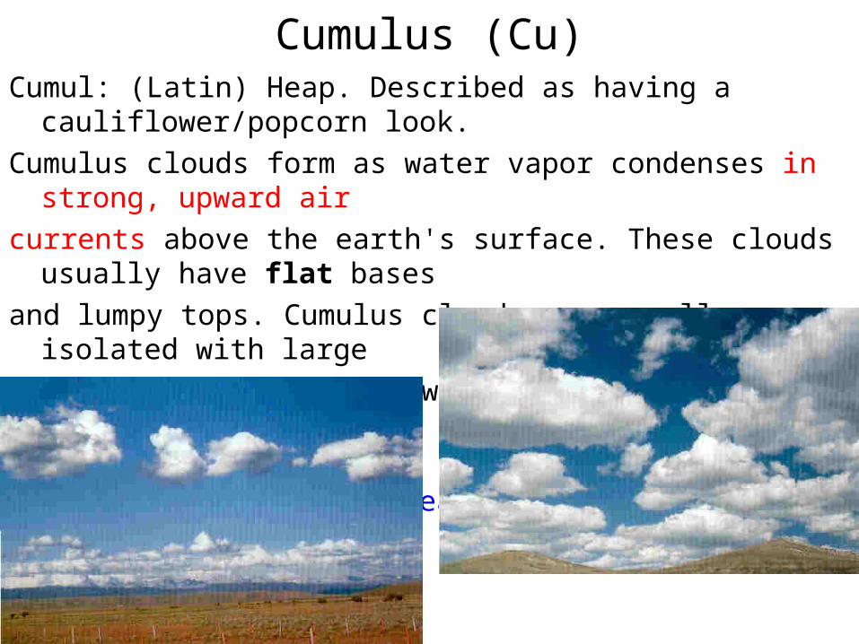
Cumulus (Cu)Cumul: (Latin) Heap. Described as having a cauliflower/popcorn look.
Cumulus clouds form as water vapor condenses in strong, upward air
currents above the earth's surface. These clouds usually have flat bases
and lumpy tops. Cumulus clouds are usually very isolated with large
areas of blue sky in between the clouds. Most cumulus clouds form
below 6,000 feet and are relatively thin and associated with fair weather.
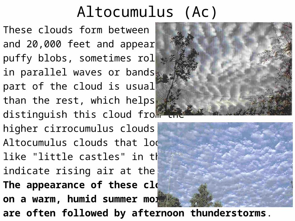
Altocumulus (Ac)These clouds form between 6,000
and 20,000 feet and appear as gray,
puffy blobs, sometimes rolled out
in parallel waves or bands. One
part of the cloud is usually darker
than the rest, which helps
distinguish this cloud from the
higher cirrocumulus clouds.
Altocumulus clouds that look
like "little castles" in the sky
indicate rising air at the cloud level.
The appearance of these clouds
on a warm, humid summer morning
are often followed by afternoon thunderstorms.
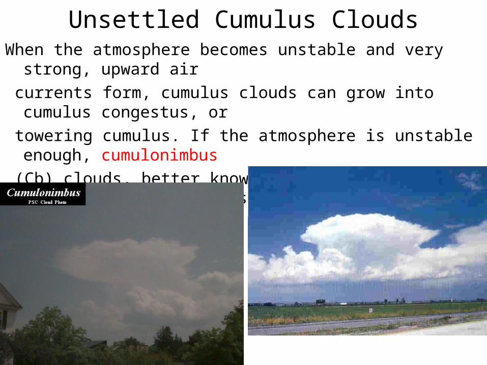
Unsettled Cumulus CloudsWhen the atmosphere becomes unstable and very strong, upward air
currents form, cumulus clouds can grow into cumulus congestus, or
towering cumulus. If the atmosphere is unstable enough, cumulonimbus
(Cb) clouds, better known as thunderstorms, form. Cumulus congestus and cumulonimbus clouds can tower from below 6,000 feet to greater than 50,000 feet.
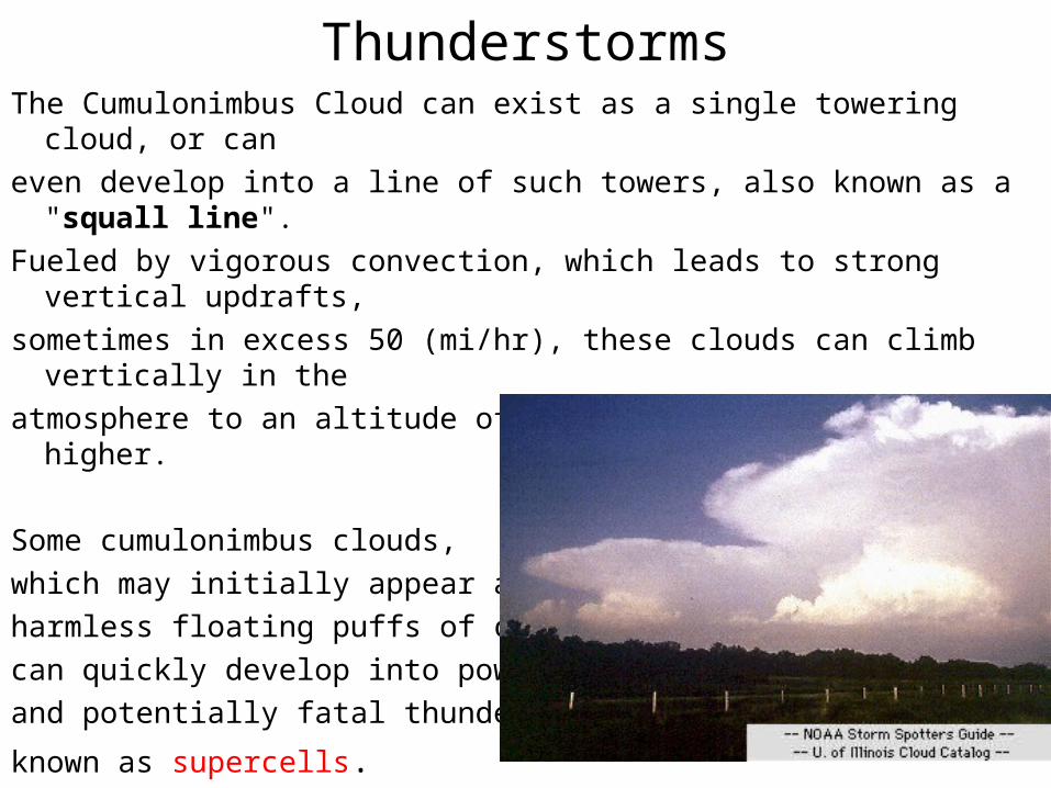
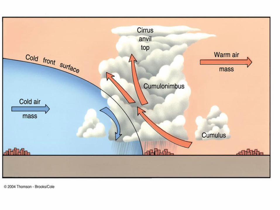
ThunderstormsThe Cumulonimbus Cloud can exist as a single towering cloud, or can
even develop into a line of such towers, also known as a "squall line".
Fueled by vigorous convection, which leads to strong vertical updrafts,
sometimes in excess 50 (mi/hr), these clouds can climb vertically in the
atmosphere to an altitude of 39,000 ft (12,000 m) or higher.
Some cumulonimbus clouds,
which may initially appear as
harmless floating puffs of cotton,
can quickly develop into powerful
and potentially fatal thunderstorms
known as supercells.
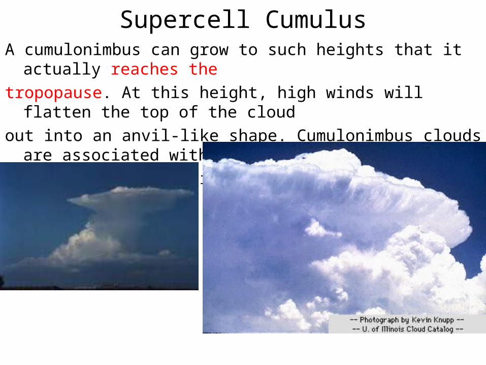
Supercell CumulusA cumulonimbus can grow to such heights that it actually reaches the
tropopause. At this height, high winds will flatten the top of the cloud
out into an anvil-like shape. Cumulonimbus clouds are associated with
heavy rain, snow, hail, lightning, and tornadoes.
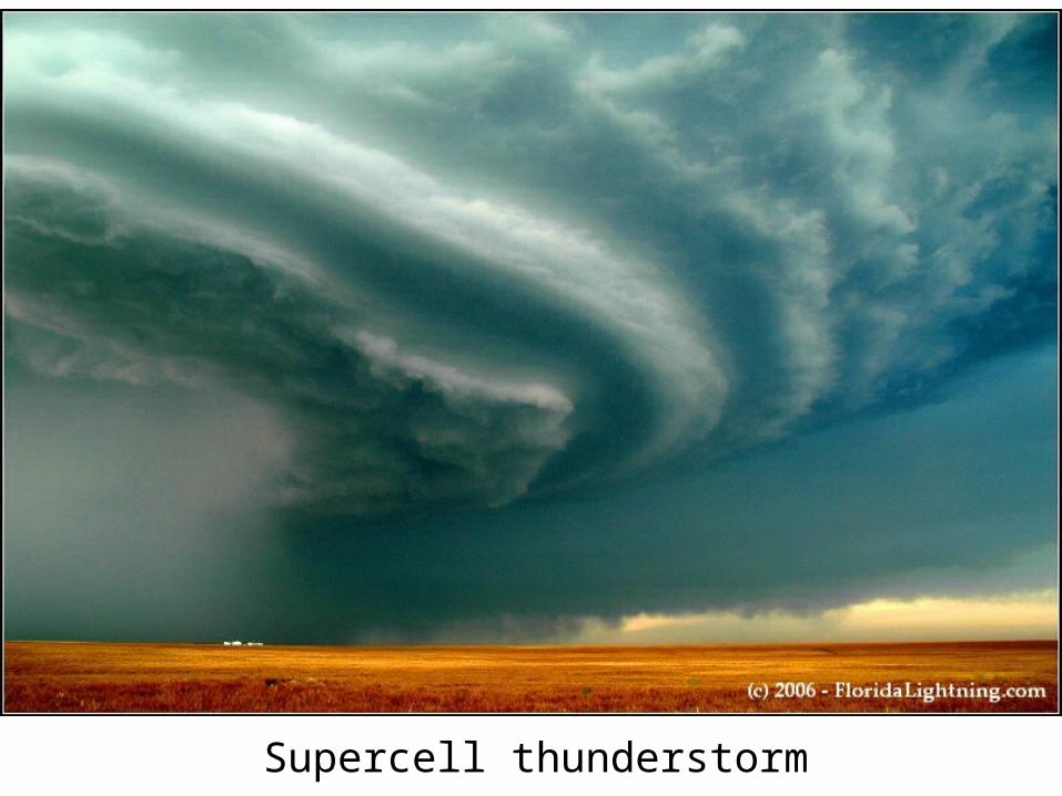
Supercell thunderstorm
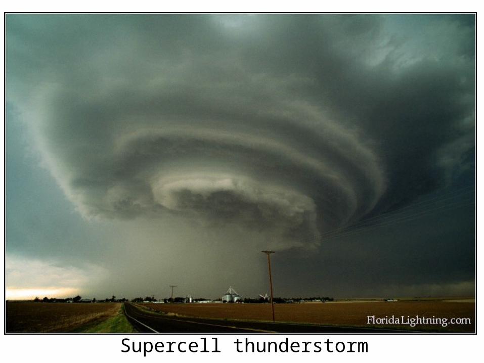
Supercell thunderstorm
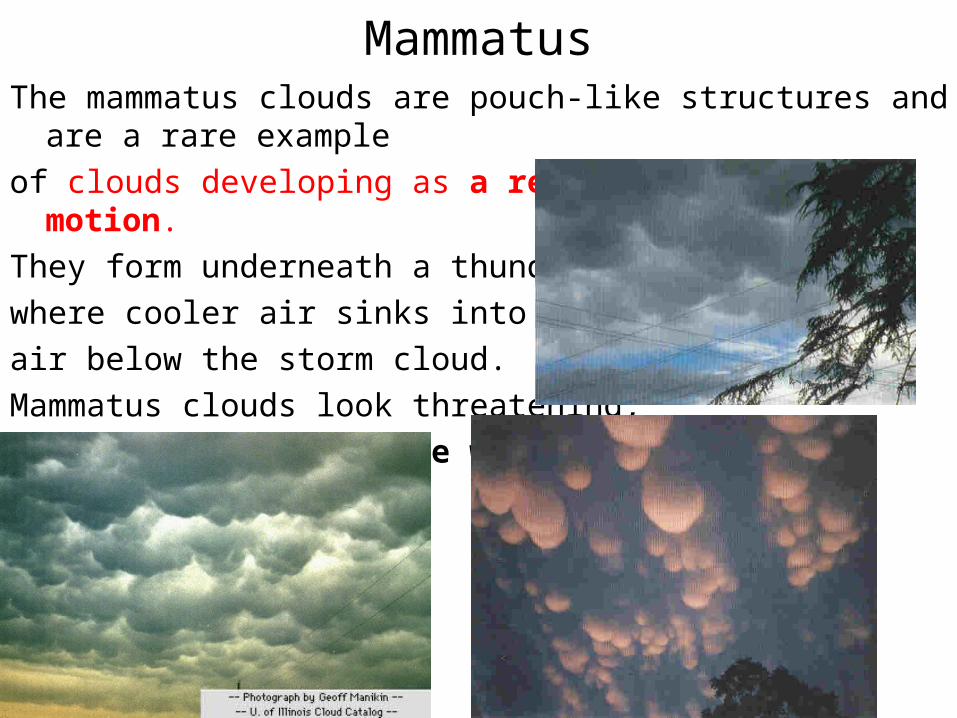
MammatusThe mammatus clouds are pouch-like structures and are a rare example
of clouds developing as a result of sinking motion.
They form underneath a thunderstorm
where cooler air sinks into warmer
air below the storm cloud.
Mammatus clouds look threatening,
but actually signal the weakening
of a thunderstorm.
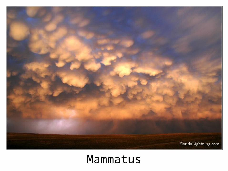
Mammatus
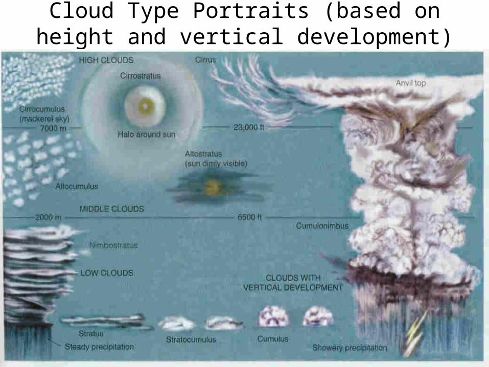
Cloud Type Portraits (based on height and vertical development)
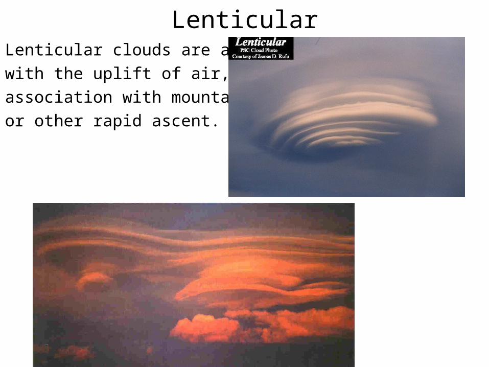
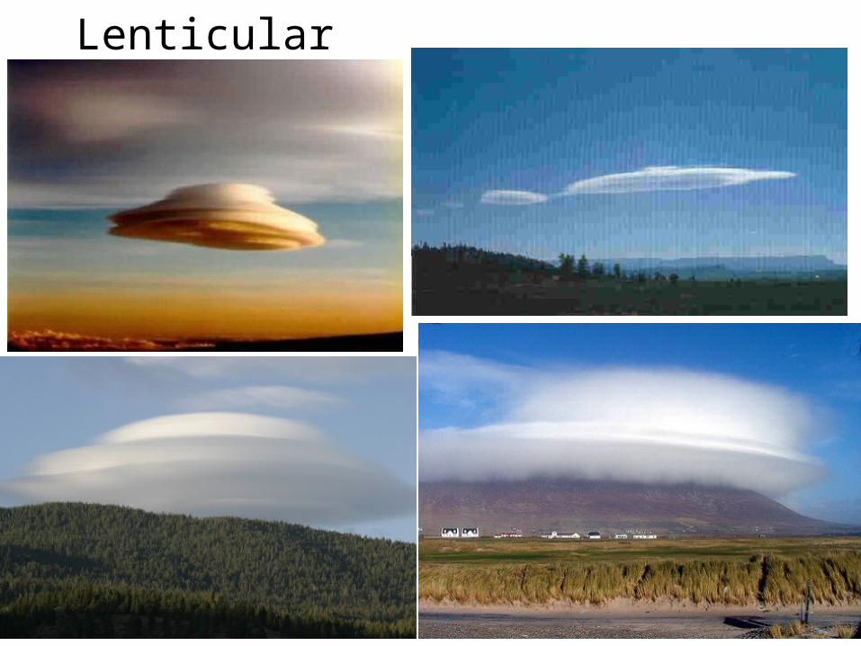
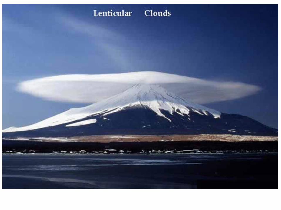
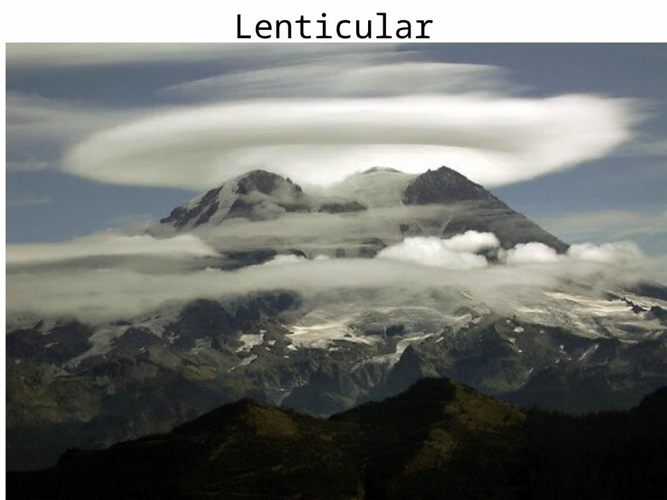
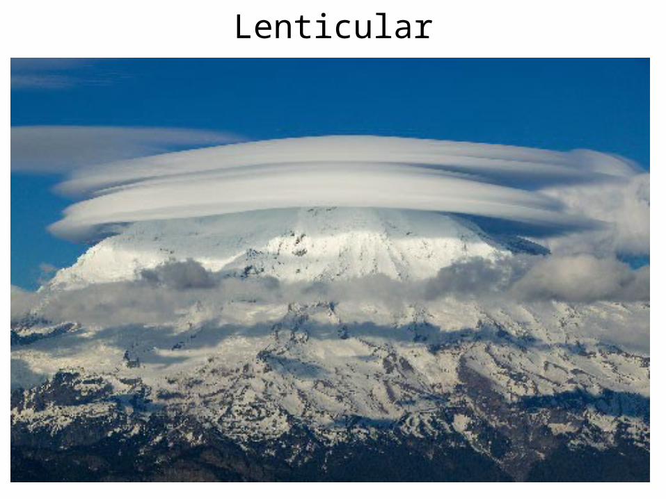
LenticularLenticular clouds are associated
with the uplift of air, usually in
association with mountain peaks
or other rapid ascent.
Lenticular
Lenticular
Lenticular
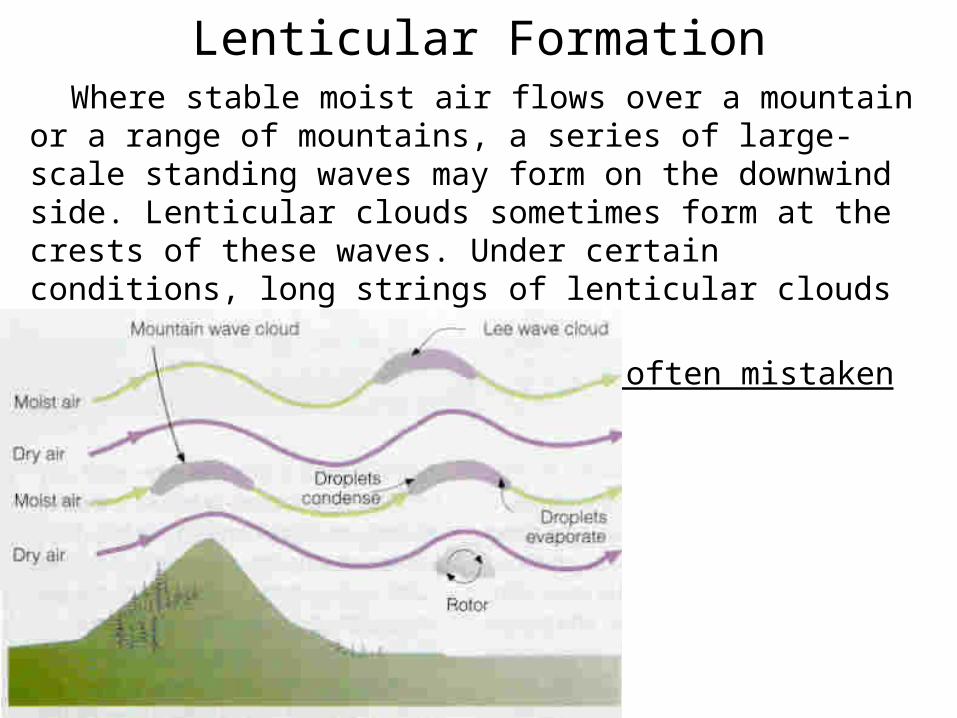
Lenticular Formation Where stable moist air flows over a mountain or a range of mountains,
a series of large-scale standing waves may form on the downwind side. Lenticular clouds sometimes form at the crests of these waves. Under certain conditions, long strings of lenticular clouds can form.
Lenticular clouds have been often mistaken for UFOs
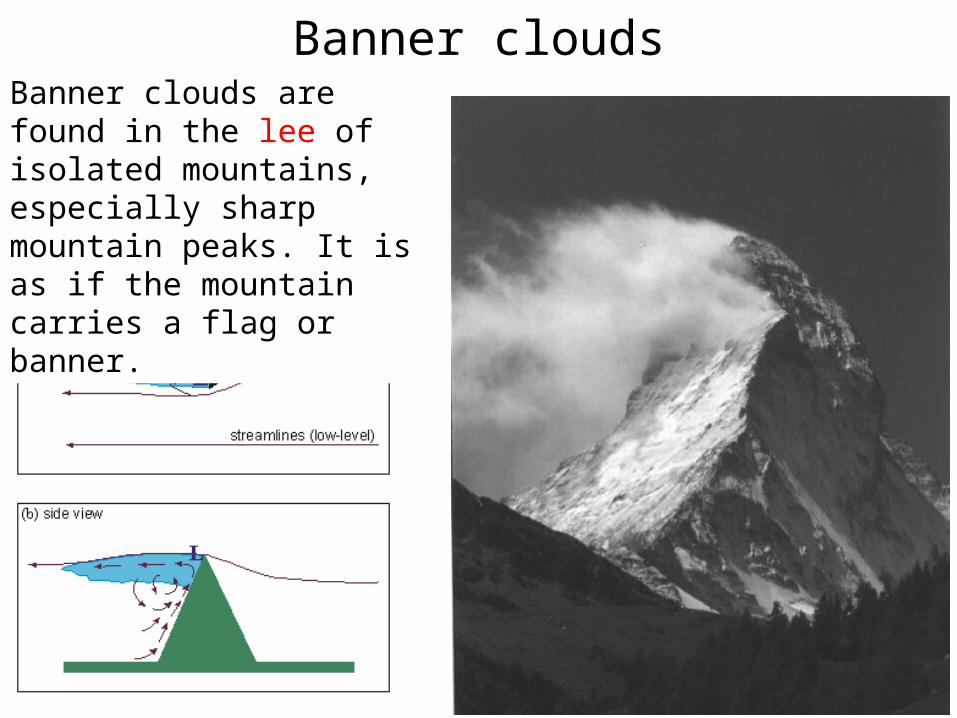
Banner cloudsBanner clouds are found in the lee of isolated mountains, especially sharp mountain peaks. It is as if the mountain carries a flag or banner.
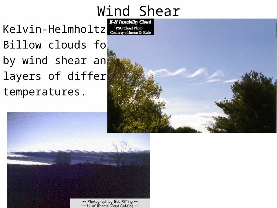
Wind ShearKelvin-Helmholtz or
Billow clouds formed
by wind shear and air
layers of differing
temperatures.
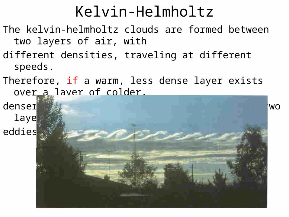
Kelvin-HelmholtzThe kelvin-helmholtz clouds are formed between two layers of air, with
different densities, traveling at different speeds.
Therefore, if a warm, less dense layer exists over a layer of colder,
denser air, and if the wind shear across the two layers is strong enough,
eddies will develop along the boundary.
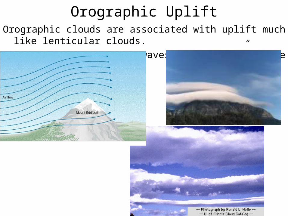
Orographic UpliftOrographic clouds are associated with uplift much like lenticular clouds.
They can sometimes form waves “downstream” of the mountains.
Clouds on the Web
http://ww2010.atmos.uiuc.edu/(Gh)/guides/mtr/cld/cldtyp/home.rxml
http://www.windows.ucar.edu/cgi-bin/tour.cgi?link=/earth/Atmosphere/clouds/cloud_types.html
http://www.floridalightning.com/
http://www.atmos.washington.edu/gcg/Atlas/


