Page 1
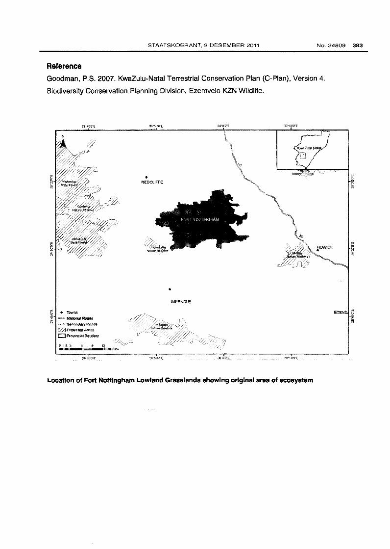
STAATSKOERANT, 9 DESEMBER 2011 No. 34809 383
Reference
Goodman, P.S. 2007. KwaZulu-Natal Terrestrial Conservation Plan (C-Pian), Version 4.
Biodiversity Conservation Planning Division, Ezemvelo KZN Wildlife .
i • Towns ~ """'" Nalional R<lac!$
,_,. S<I~IY Ream.
e;:-:a f'roloc.ted Areas
CJ Proll!ooial Boudary
• REOClii'FE
• IMPENDLE
Location of Fort Nottingham Lowland Grasslands showing original area of ecosystem
EDEN i }!
Page 2
384 No. 34809 GOVERNMENT GAZETTE, 9 DECEMBER 2011
154. Garden Route Shale Fynbos (Ffh 9)
Reference number
Listed under Criterion
Biome
Provinces
Municipalities
Original area of ecosystem
Remaining natural area of ecosystem(%)
Proportion of ecosystem protected
Known number of species of special concern
Geographical location
FFh9
A1
Fynbos
Western Cape and Eastern Cape
Kouga LM, Kou-Kamma LM, Hessequa LM,
Mossel Bay LM, George LM, Plettenberg Bay
LM and Knysna LM
57 000 ha
44%
4% of original area
8 Red Data plant species (EX, EW, CR, EN &
VU excl VU 02) and 3 endemic plant species
Patches along the coastal foothills of the Langeberg at Grootberg (northeast of Heidelberg), the
Outeniqua Mountains from Cloete's Pass via the Groot Brak River Valley, Hoekwil, Karatara,
Barrington and Knysna to Plettenberg Bay. Patches from the Bloukrans Pass along coastal
platform shale bands south of the Tsitsikamma Mountains via Kleinbos and Fynboshoek to
south of both Clarkson and the Kareedouw Mountains.
Description
Undulating hills and moderately undulating plains on the coastal forelands. Structurally it
consists of tall, dense proteoid and ericaceous fynbos in wetter areas, and graminoid fynbos (or
shrubby grassland) in drier areas. Fynbos appears confined to flatter more extensive landscapes
that are exposed to frequent fires. Most of the shales are covered with afrotemperate forest.
Fairly wide belts of Virgilia oroboides occur on the interface between fynbos and forest. Fire-safe
habitats nearer the coast have small clumps of thicket, and valley floors have scrub forest. At
least three endemic plant species and eight Red Data List plant occur in the ecosystem.
Page 3
STAATSKOERANT, 9 DESEMBER 2011 No. 34809 385
Other Information
Approximately 4% of the ecosystem is protected in the Garden Route National Park and a
further 1% in Boosmansbos Wilderness Area. A further 3% is found in other (mainly private)
conservation areas such as the Robbe Hoek Forest Reserve.
Reference
Rebelo, A. G., Boucher, C., Helme, N., Mucina, L., & Rutherford, M.C. eta/. 2006. Fynbos
Biome. In: L. Mucina & M.C. Rutherford (eds). The Vegetation of South Africa, Lesotho and
Swaziland. Stre/itzia 19: 152. South African National Biodiversity Institute, Pretoria .
. ----8:::::... 0 5«1 :10 lll <Ill ··- -~¥
Location of Garden Route Shale Fynbos showing original area of ecosystem (area of ecosystem
enlarged for vlsblllty at this scale)
G11-092810-E
Page 4
386 No. 34809 GOVERNMENT GAZETTE, 9 DECEMBER 2011
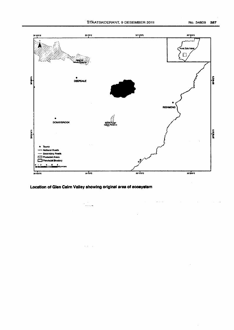
155. Glen Cairn Valley (KZN 53)
Reference number
Listed under Criterion
Biome
Province
Municipality
Original area of ecosystem
Remaining natural area of ecosystem(%)
Proportion of ecosystem protected
Known number of species of special concern
Geographical location
KZN 53
F
Grassland and Savanna
KwaZulu-Natal
Richmond LM
4 000 ha
39%
0% of original area
5 threatened or endemic plant and animal
species including those listed below
Byrne (2930CC). Ecosystem includes the entire valley basin and is delineated by the prominent
plateau, river and ridge features.
Descrl ption
Key biodiversity features include one amphibian species, Afrixalus spinifrons intermedius, one
bird species, the Blue Swallow; one millipede species, Doratogonus montanus; two plant
species for example Senecio exuberans; and three vegetation types including Eastern Valley
Bushveld, Midlands Mistbelt Grassland and Southern KwaZulu-Natal Moist Grassland.
Other information
The ecosystem is not protected.
Reference
Goodman, P.S. 2007. KwaZulu-Natal Terrestrial Conservation Plan (C-Pian), Version 4.
Biodiversity Conservation Planning Division, Ezemvelo KZN Wildlife.
Page 5
• TOMIS
• DONNYBROOK
- National Roads - Secondary Roa<IS tZ1 Protec:tad Aleaa r:::J ~ 8olldafy
"§'iAATSKOERANT, 9 DESEMBER 2011
• DI!IU'OAI.e:
Location of Glen Calm Valley showing original area of ecosystem
No.34809 387
Page 6
388 No. 34809 GOVERNMENT GAZETTE, 9 DECEMBER 2011
156. Gold Cliff Farm Surrounds (KZN 54)
Reference number
Listed under Criterion
Biome
Province
Municipality
Original area of ecosystem
Remaining natural area of ecosystem(%)
Proportion of ecosystem protected
Known number of species of special concern
Geographical location
KZN54
F
Grassland and Savanna
KwaZulu-Natal
Ubuhlebezwe LM
2 000 ha
32%
0% of original area
4 threatened or endemic plant and animal
species including those listed below
lxopo (3030AA). Ecosystem delineated by a combination of ridge lines and river valleys.
Descrl ptlon
Key biodiversity features include one bird species, the Blue Swallow; one mammal species, the
Oribi; one millipede species, Doratogonus montanus; one plant species and three vegetation
types including Ngongoni Veld, Eastern Valley Bushveld and Midlands Mistbelt Grasslands.
Other information
The ecosystem is not protected.
Reference
Goodman, P.S. 2007. KwaZulu-Natal Terrestrial Conservation Plan (C-Pian), Version 4.
Biodiversity Conservation Planning Division, Ezemvelo KZN Wildlife.
Page 7
• "lbwns ":~~"'" NlllloNII Road' - Secondary Roads \?..2::1 Proii!Gtad AlliRS r::::::J ~IBoitdiW~
3C'1W"E
STAATSKOERANT, 9 DESEMBER 2011
• HIC'oHFLATS
• WI..AMEHI.O
Location of Gold Cliff Farm Surrounds showing original area of ecosystem
• FRIEDENA.U
No. 34809 389
., / .·
Page 8
390 No.34809 GOVERNMENT GAZETTE, 9 DECEMBER 2011
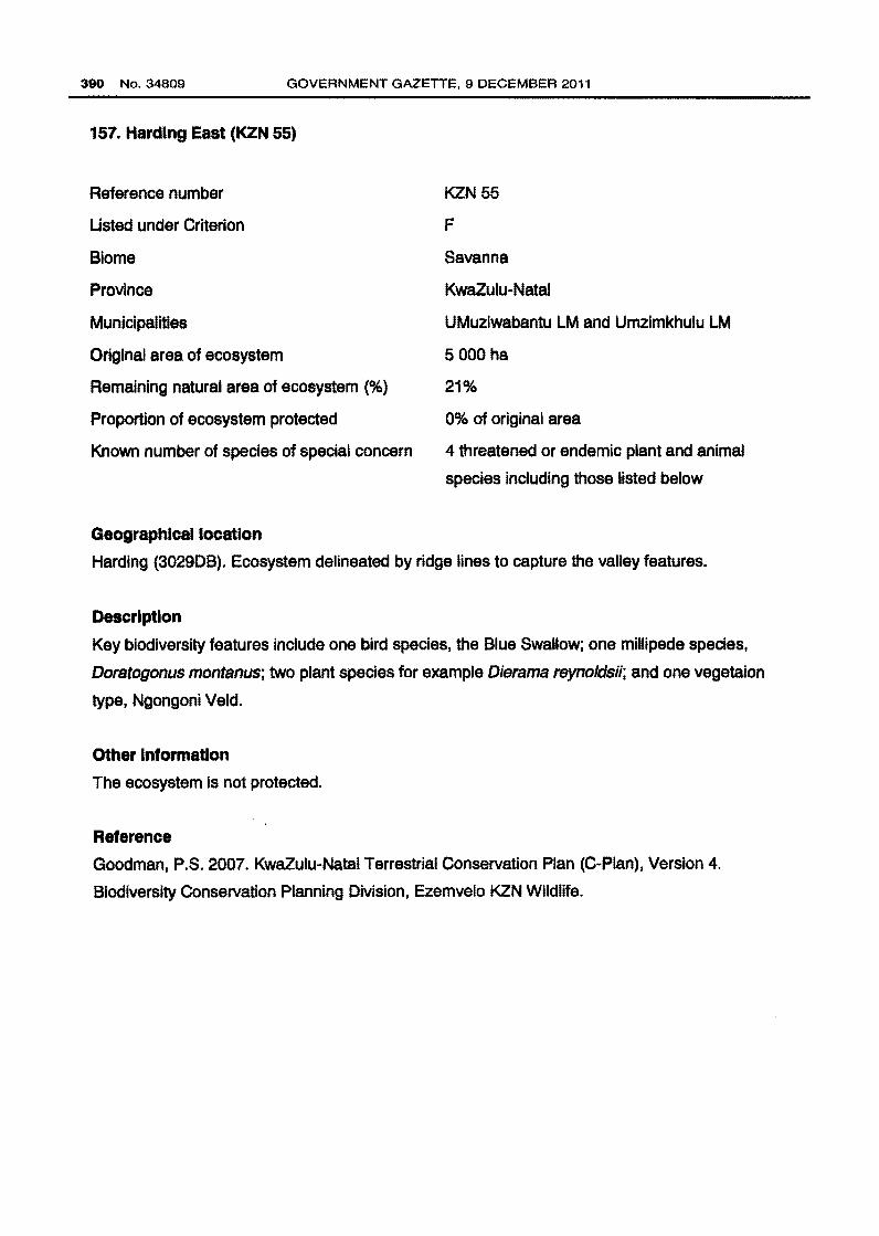
157. Harding East (KZN 55)
Reference number
Usted under Criterion
Biome
Province
Municipalities
Original area of ecosystem
Remaining natural area of ecosystem (%)
Proportion of ecosystem protected
Known number of species of special concern
Geographical location
KZN55
F
Savanna
KwaZulu-Natal
UMuziwabantu LM and Umzimkhulu LM
5 000 ha
21%
0% of original area
4 threatened or endemic plant and animal
species including those listed below
Harding (3029DB). Ecosystem delineated by ridge lines to capture the valley features.
Description
Key biodiversity features include one bird species, the Blue Swallow; one millipede species,
Doratogonus montanus; two plant species for example Dierama reynoldsii; and one vegetaion
type, Ngongoni Veld.
Other Information
The ecosystem Is not protected.
Reference
Goodman, P.S. 2007. KwaZulu-Natal Terrestrial Conservation Plan {C-Pian), Version 4.
Biodiversity Conservation Planning Division, Ezemvelo KZN Wildlife.
Page 9
• lllwlUr. N8lktll!ll Roads
' s,eotldal)' F!oa<ls · l"roleetea Area.$
STAATSKOERANT, 9 DESEMBER 2011
Location of Harding East showing original area of ecosystem
No. 34809 391
Page 10
392 No.34809 GOVERNMENT GAZETTE, 9 DECEMBER 2011
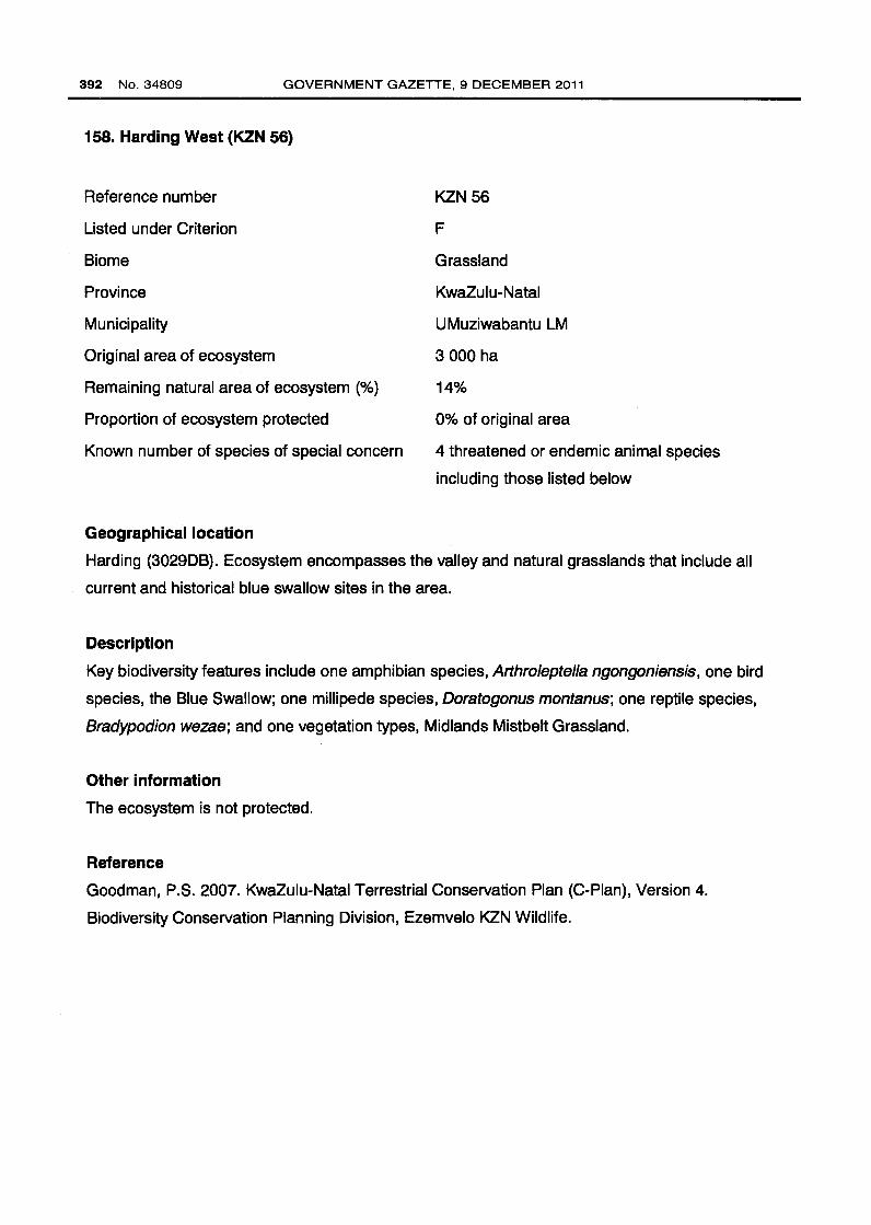
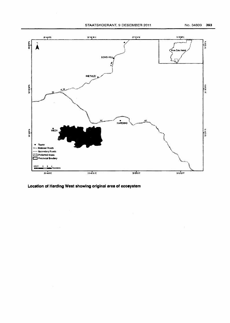
158. Harding West (KZN 56)
Reference number
Listed under Criterion
Biome
Province
Municipality
Original area of ecosystem
Remaining natural area of ecosystem (%}
Proportion of ecosystem protected
Known number of species of special concern
Geographical location
KZN 56
F
Grassland
KwaZulu-Natal
UMuziwabantu LM
3 000 ha
14%
0% of original area
4 threatened or endemic animal species
including those listed below
Harding (3029DB}. Ecosystem encompasses the valley and natural grasslands that include all
current and historical blue swallow sites in the area.
Description
Key biodiversity features include one amphibian species, Arthroleptella ngongoniensis, one bird
species, the Blue Swallow; one millipede species, Doratogonus montanus; one reptile species,
Bradypodion wezae; and one vegetation types, Midlands Mistbelt Grassland.
Other information
The ecosystem is not protected.
Reference
Goodman, P.S. 2007. KwaZulu-Natal Terrestrial Conservation Plan (C-Pian), Version 4.
Biodiversity Conservation Planning Division, Ezemvelo KZN Wildlife.
Page 11
• Tc)wn$
_w, Nstii:IMI Roaas ·- Sllr:onda!Y ROil4!< ?Zl Pra!AWltflll NeilS
Cl Pr~ Boudlll)'
STAATSKOERANT, 9 DESEMBER 2011
Location of Harding West showing original area of ecosystem
No.34809 393
,.- . ) ( r:r
Page 12
394 No.34809 GOVERNMENT GAZETTE, 9 DECEMBER 2011
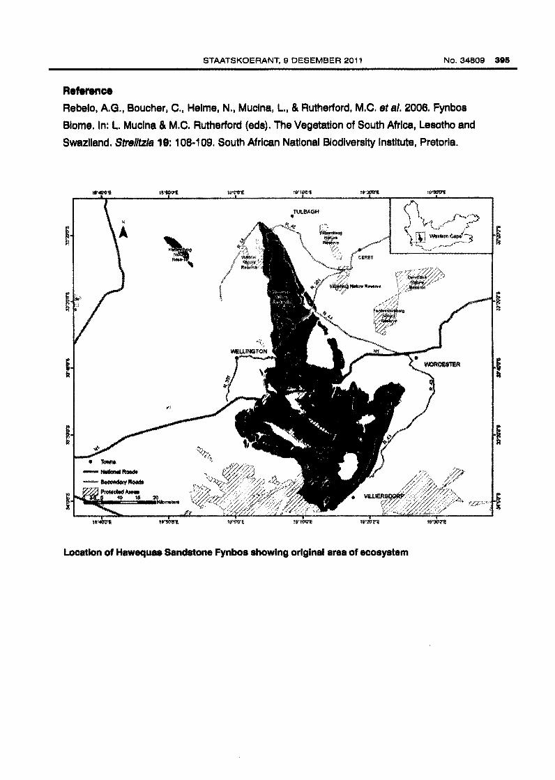
159. Hawequas Sandstone Fynbos (FFs 1 0)
Reference number
Listed under Criterion
Biome
Province
Municipalities
Original area of ecosystem
Remaining natural area of ecosystem(%)
Proportion of ecosystem protected
Known number of species of special concern
Geographical location
FFs 10
D1
Fynbos
Western Cape
Swartland LM, Witzenberg LM, Drakenstein
LM, Stellenbosch LM, Breede Valley LM and
Theewaterskloof LM
105 000 ha
97%
50% of original area
42 Red Data plant species (EX, EW, CR, EN &
VU excl VU D2) and 85 endemic plant species
Between the Nuwekloof Pass near Gouda in the north to Franschhoek Pass near Franschhoek
including the Elandskloof, Hawequas, Slanghoek, Klein-Drakenstein, Wemmershoek, Du
T oitskloof and Stettyns Mountains.
Description
Mountains with slopes of various steepness, flanks of intermontane valleys and upland plateaus.
A band of Cedarberg Shale Formation forms a prominent step at high altitude. Vegetation forms
a low closed shrubland dotted with emergent tall shrubs; mainly proteoid, restioid and
asteraceous fynbos with much waboomveld at lower altitudes; ericaceous fynbos at higher
altitudes; and abundant Cape thickets (especially in the north of the ecosystem) on cliffs and
very steep rocky (scree) slopes. At least 85 endemic plant species and 42 Red Data List plant
species occur in the ecosystem.
Other Information
More than half of the ecosystem is protected in the Limietberg, Theewaters and Waterval Nature
Reserves, with an additional 36% found in the Hawequas Mountain Catchment Area.
Page 13
STAATSKOEAANT, 9 DESEMBEA 2011 No. 34809 385
Reference Rebelo, A. G., Boucher, C., Helme, N., Muclna, L., & Rutherford, M.C. eta/. 2006. Fynbos
Blome. In: L. Muclna & M.C. Rutherford (ads). The Vegetation of South Africa, Lesotho and
Swaziland. Strelltzla 19: 108-109. South African National Biodiversity Institute, Pretoria.
Location of Hawequaa Sandstone Fynbos showing original area of ecosystem
Page 14
396 No.34809 GOVERNMENT GAZETTE, 9 DECEMBER 2011
160. Himevllle Lowlands and Ridge (KZN 57)
Reference number
Listed under Criterion
Biome
Province
Municipalities
Original area of ecosystem
Remaining natural area of ecosystem (%)
Proportion of ecosystem protected
Known number of species of special concern
Geographical location
KZN 57
F
Grassland
KwaZulu-Natal
Kwa Sani LM and KZDMA43
11 000 ha
49%
4% of original area
1 0 threatened or endemic plant and animal
species including those listed below
Sani Pass (2929GB) and Himeville (2929DA). Ecosystem includes lowlands and wetlands
associated with crane nesting sites. Ecosystem delineated using topography and refined by
excluding peripheral plantations and urban settlements. It includes cultivated fields, which are
important habitats for crane foraging, and manmade impoundments, which have associated ' wetlands important for flufftails.
Description
Key biodiveristy features include one amphibian species, Afrixalus spinifrons intermedius, two
bird species including Wattled Crane and White-winged Flufftail; one mammal species, the Oribi;
two millipede species including Centrobolus tricolor and Doratogonus montanus; three plant
species including Hesperantha woodii, Kniphofia brachystachya and Kniphofia breviflora; one
reptile species, Bradypodion thamnobates; and three vegetation types including Drakensberg
Foothill Moist Grassland, Mooi River Highland Grassland and Southern Drakensberg Highland
Grassland.
Other information
About 4% of the ecosystem is protected in the Himeville Nature Reserve and Cobham State
Forest.
Page 15
STAATSKOERANT, 9 DESEMBER 2011 No. 34809 397
Reference
Goodman, P.S. 2007. KwaZulu-Natal Terrestrial Conservation Plan (C-Pian), Version 4.
Biodiversity Conservation Planning Division, Ezemvelo KZN Wildlife.
• '!Ovms ~" National Roads
"' -··- Seconnar~ Roads g 'Zd Protecled Areas ~
. < .... ~ /•
• UNOERaERG
• CREIGHTON
Location of Hlmevllle Lowlands and Ridge showing original area of ecosystem
c ~ lll
'" f:>
~ .:/~
~ . ~~
;: ?. 1!1
~ ~ ~
r> "' g kl
Wl
Page 16
388 No. 34809 GOVERNMENT GAZETTE, 9 DECEMBER 2011
181. Hluhluwe Scarp Foreat (KZN 58)
Reference number
Listed under Criterion
Blome
Province
Municipalities
Original area of ecosystem
Remaining natural area of ecosystem(%)
Proportion of ecosystem protected
Known number of species of special concern
Geographical location
KZN68
F
Savanna, Grassland and Forest
Kwazulu-Natal
Hlabisa LM and KZDMA27
2 000 ha
94%
87% of original area
7 threatened or endemic plant and animal
species including those listed below
Ntondwenl (2832AA). Ecosystem delineated by the scarp forestJ.oJ;IIuhluwe Game Reserve and . ,,
adjacent areas.
Description
Key biodiversity features Include six millipede species Including Allawrenc/us complex,
Allawrencius gladiator, Allawrenclus nodulosus, Centrobolus fu/gidus, Centrobolus rugulosus
and Dorstogonus hoffman/; one plant species, Alblzls suluensls; and three vegetation types
Including Eastern Scarp Forest, Northern Zululand Sourveld and Zululand Lowveld.
Other Information
Approximately 87% of the ecosystem is protected in the Hluhluwe Game Reserve.
Reference
Goodman, P.S. 2007. KwaZulu-Natal Terrestrial Conservation Plan (C-Pian), Version 4.
Biodiversity Conservation Planning Division, Ezemvelo KZN Wildlife.
Page 17
• lbwll:S
- National Road~ w-•~Roads
~ f.:i:;o::l Pr$~ Atel!S ltl c:::J Prlllllndat6oudary
STAATSKOERANT, 9 DESEMBER 2011
Location of Hluhluwe Scarp Forest showing original area of ecosystem
No. 34809 399
Page 18
400 No.34809 GOVERNMENT GAZETTE, 9 DECEMBER 2011
162. Hopefleld Sand Fynbos (FFd 3)
Reference number
Listed under criteria
Biome
Province
Municipalities
Original area of ecosystem
Remaining natural area of ecosystem(%)
Proportion of ecosystem protected
Known number of species of special concern
Geographical location
FFd 3
A1 and D1
Fynbos
Western Cape
Bergrivier LM, Saldanha Bay LM, Swartland
LM and WCDMA01
180 000 ha
49%
< 1% of original area
45 Red Data plant species (EX, EW, CR, EN &
VU excl VU D2) and 5 endemic plant species
West Coast lowlands from Aurora to Rondeberg, just south of Yzerfontein, with an outlier in the
Strandveld at Kleinberg north of Langebaanweg.
Description
Coastal sand plains, flat to undulating, and also including localised inland dune fields.
Vegetation is a moderately tall, ericoid-leaved shrubland with dense herbaceous stratum of
aphyllous hemicryptophytes. This is mostly asteraceous and restioid fynbos, although proteoid
fynbos is extensive and ericaceous fynbos occurs in seeps and along watercourses. Hopefield
Sand Fynbos has all three typical fynbos elements, but with a paucity (in species richness and
density) of Ericaceae. The ecosystem is most diverse in the Hopefield area, where extensive
stands of Leucadendron foedum, Leucospermum rodolentum and Serruria fucifolia are
dominant. At least five endemic plant species and 45 Red Data List plant species occur in the
ecosystem.
Other information
A very small portion is protected in the West Coast National Park, with an additional2% found in
Hopefield and Jakkalsfontein Nature Reserves.
Page 19
STAATSKOERANT, 9 DESEMBER 2011 No. 34809 401
Reference
Rebelo, A. G., Boucher, C., Helme, N., Mucina, L., & Rutherford, M.C. eta/. 2006. Fynbos
Biome. In: L. Mucina & M.C. Rutherford (eds). The Vegetation of South Africa, Lesotho and
Swaziland. Strelitzia 19: 138. South African National Biodiversity Institute, Pretoria.
• ·r~
-""""'~~~~
(~~~~~3 Pt~Mr .. ~ t:::J-.... -
02.$~ 10 IJ :10 -Location of Hopefleld Sand Fynbos showing original area of ecosystem
Page 20
402 No. 34809 GOVERNMENT GAZETTE, 9 DECEMBER 2011
163. lmfolosi Savanna and Sourveld (KZN 59)
Reference number
Listed under Criterion
Biome
Province
Municipalities
Original area of ecosystem
Remaining natural area of ecosystem(%)
Proportion of ecosystem protected
Known number of species of special concern
Geographical location
KZN59
F
Savanna and Grassland
KwaZulu-Natal
Nongoma LM, Ulundi LM, Ntambanana LM,
Mthonjaneni LM and KZDMA27
63 ooo ha
72%
2% of original area
6 threatened or endemic plant and animal
species including those listed below
Hlabisa (2831 BB), Maphophoma (2831 BA), Ntiningwe (2831 BC), Mfolozi (2831 BD), Nkwalini
{2831 DA), Empangeni (2831 DB). Ecosystem consists of savanna and sourveld identified for the
Black Rhino Range Expansion Programme and is a neighbour to lmfolosi Game Reserve on the
north, west and south of the reserve. It incorporates the Fundimvelo Nature Reserve.
Description
Key biodiversity features include two mammal species including Black Rhino and Wild Dog; two
bird species including Whiteheaded Vulture and Lappetfaced Vulture; one millipede species,
Doratogonus natalensis; two plant species Diospyros glandulifera and Helichrysum woodii; and
three vegetation types including Ngongoni Veld, Northern Zululand Sourveld and Zululand
Lowveld.
Other Information
Approximately 2% of the ecosystem is protected in the lmfolozi Game Reserve and Fundimvelo
Nature Reserve.
Page 21
STAATSKOERANT, 9 DESEMBER 2011 No.34809 403
Reference Goodman, P.S. 2007. KwaZulu-Natal Terrestrial Conservation Plan (C-Pian), Version 4.
Biodiversity Conservation Planning Division, Ezemvelo KZN Wildlife.
Location of lmfoloal Savanna and Sourveld showing original area of ecosystem
Page 22
404 No.34809 GOVERNMENT GAZETTE, 9 DECEMBER 2011
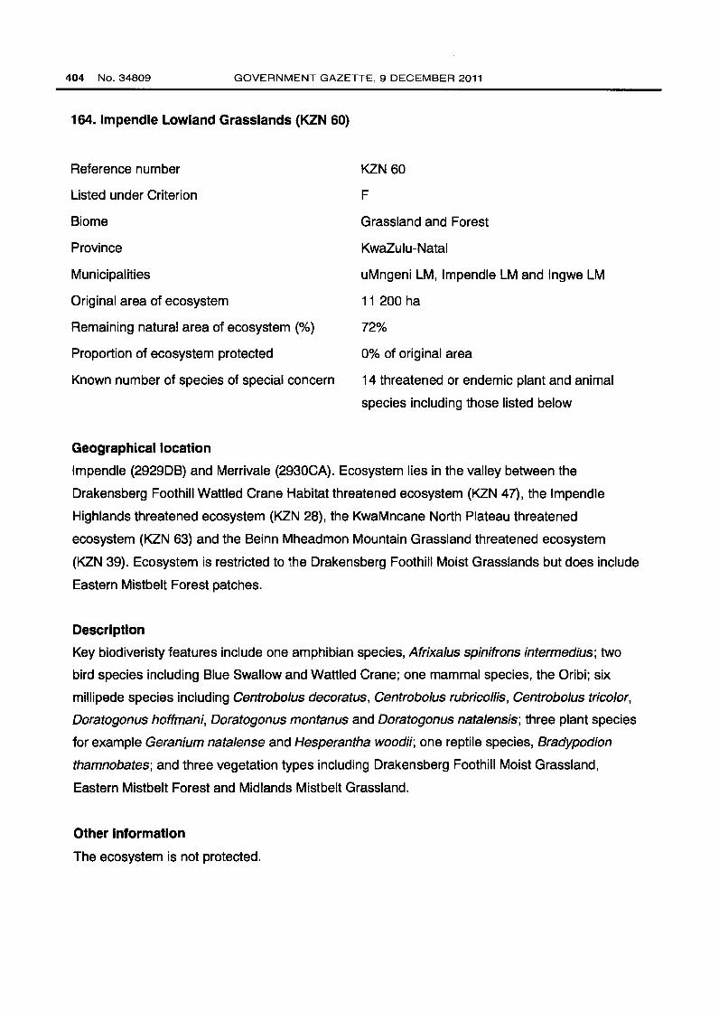
164. lmpendle Lowland Grasslands (KZN 60)
Reference number
Listed under Criterion
Biome
Province
Municipalities
Original area of ecosystem
Remaining natural area of ecosystem {%)
Proportion of ecosystem protected
Known number of species of special concern
Geographical location
KZN 60
F
Grassland and Forest
KwaZulu-Natal
uMngeni LM, lmpendle LM and lngwe LM
11 200 ha
72%
0% of original area
14 threatened or endemic plant and animal
species including those listed below
lmpendle (292908) and Merrivale {2930CA). Ecosystem lies in the valley between the
Drakensberg Foothill Wattled Crane Habitat threatened ecosystem {KZN 47), the lmpendle
Highlands threatened ecosystem {KZN 28), the KwaMncane North Plateau threatened
ecosystem (KZN 63) and the Beinn Mheadmon Mountain Grassland threatened ecosystem
(KZN 39). Ecosystem is restricted to the Drakensberg Foothill Moist Grasslands but does include
Eastern Mistbelt Forest patches.
Description
Key biodiveristy features include one amphibian species, Afrixalus spinifrons intermedius; two
bird species including Blue Swallow and Wattled Crane; one mammal species, the Oribi; six
millipede species including Centrobolus decoratus, Centrobolus rubricollis, Centrobolus tricolor,
Doratogonus hoffmani, Doratogonus montanus and Doratogonus natalensis; three plant species
for example Geranium natalense and Hesperantha woodii; one reptile species, Bradypodion
thamnobates; and three vegetation types including Drakensberg Foothill Moist Grassland,
Eastern Mistbelt Forest and Midlands Mistbelt Grassland.
Other Information
The ecosystem is not protected.
Page 23
STAATSKOERANT, 9 DESEMBER 2011 No.34809 405
Reference
Goodman, P.S. 2007. KwaZulu-Natal Terrestrial Conservation Plan (C-Pian), Version 4.
Biodiversity Conservation Planning Division, Ezemvelo KZN Wildlife .
• 'Tl:>WfiS
- Nalitlnal Ruad$ -# Secoodary Rall<ls
~ EZQ Proleded AAliJS
~ CJ PI~:>Widal B<rudary
0 3 (I 12 ••
• UNOS.RBERG
.. , FORT NOTTINOHAM
~~
• DONN'VSROOK
• CREIGHTON
Location of lmpendla Lowlands Grasslands showing original area of ecosystem
Page 24
408 No.34809 GOVERNMENT GAZETTE, 9 DECEMBER 2011
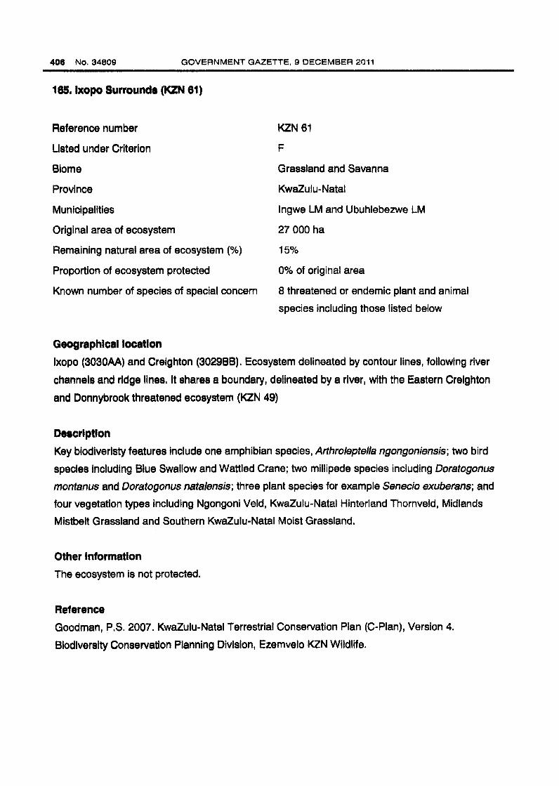
185.1xopo Surrounds (KZN 61)
Reference number
Listed under Criterion
Blome
Province
Municipalities
Original area of ecosystem
Remaining natural area of ecosystem(%}
Proportion of ecosystem protected
Known number of species of special concern
Geographical location
KZN 61
F
Grassland and Savanna
KwaZulu-Natal
lngwe LM and Ubuhlebezwe LM
27 000 ha
15%
0% of original area
8 threatened or endemic plant and animal
species including those listed below
lxopo (3030AA) and Creighton (3029BB). Ecosystem delineated by contour lines, following river
channels and ridge lines. It shares a boundary, delineated by a river, with the Eastern Creighton
and Donnybrook threatened ecosystem (KZN 49)
Description
Key biodiveristy features include one amphibian species, Arthroleptella ngongoniensis; two bird
species including Blue Swallow and Wattled Crane; two millipede species including Doratogonus
montanus and Doratogonus nata/ensis; three plant species for example Senecio exuberans; and
four vegetation types including Ngongoni Veld, KwaZulu-Natal Hinterland Thornveld, Midlands
Mistbelt Grassland and Southern KwaZulu-Natal Moist Grassland.
Other Information
The ecosystem is not protected.
Reference
Goodman, P.S. 2007. KwaZulu-Natal Terrestrial Conservation Plan (C-Pian), Version 4.
Biodiversity Conservation Planning Division, Ezemvelo KZN Wildlife.
Page 25
STAATSKOERANT, 9 DESEMBER 2011
uml!"~·~ij,~~,·
Location of lxopo Surrounds showing original area of ecosystem
No.34809 407
Page 26
408 No. 34809 GOVERNMENT GAZETTE, 9 DECEMBER 2011
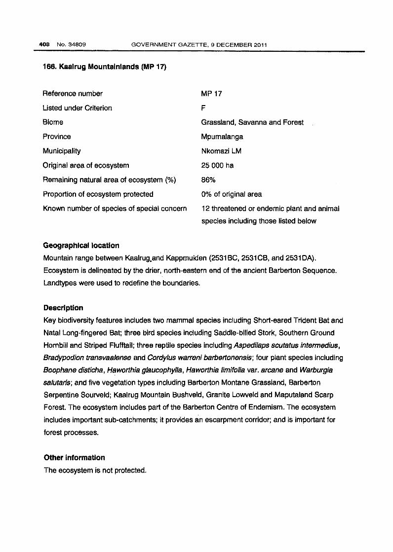
166. Kaalrug Mountainlands (MP 17)
Reference number
Listed under Criterion
Biome
Province
Municipality
Original area of ecosystem
Remaining natural area of ecosystem (%)
Proportion of ecosystem protected
Known number of species of special concern
Geographical location
MP17
F
Grassland, Savanna and Forest
Mpumalanga
Nkomazi LM
25 000 ha
86%
0% of original area
12 threatened or endemic plant and animal
species including those listed below
Mountain range between Kaalrug.and Kappmuiden (2531BC, 2531CB, and 2531DA).
Ecosystem is delineated by the drier, north-eastern end of the ancient Barberton Sequence.
Landtypes were used to redefine the boundaries.
Description
Key biodiversity features includes two mammal species including Short-eared Trident Bat and
Natal Long-fingered Bat; three bird species including Saddle-billed Stork, Southern Ground
Hornbill and Striped Flufftail; three reptile species including Aspedilaps scutatus intermedius,
Bradypodion transvaalense and Cordylus warreni barbertonensis; four plant species including
Boophane distichs, Haworthia glaucophylla, Haworthia /imifolia var. arcane and Warburgia
salutaris; and five vegetation types including Barberton Montane Grassland, Barberton
Serpentine Sourveld; Kaalrug Mountain Bushveld, Granite Lowveld and Maputaland Scarp
Forest. The ecosystem includes part of the Barberton Centre of Endemism. The ecosystem
includes important sub-catchments; it provides an escarpment corridor; and is important for
forest processes.
Other Information
The ecosystem is not protected.
Page 27
STAATSKOERANT, 9 DESEMBER 2011 No. 34809 409
Reference
Mpumalanga Tourism and Parks Agency & Department of Agriculture and Land Administration.
2007. Mpumalanga Biodiversity Conservation Handbook.
Location of Kaalrug Mountainlands showing original area of ecosystem
Page 28
410 No.34809 GOVERNMENT GAZETTE, 9 DECEMBER 2011
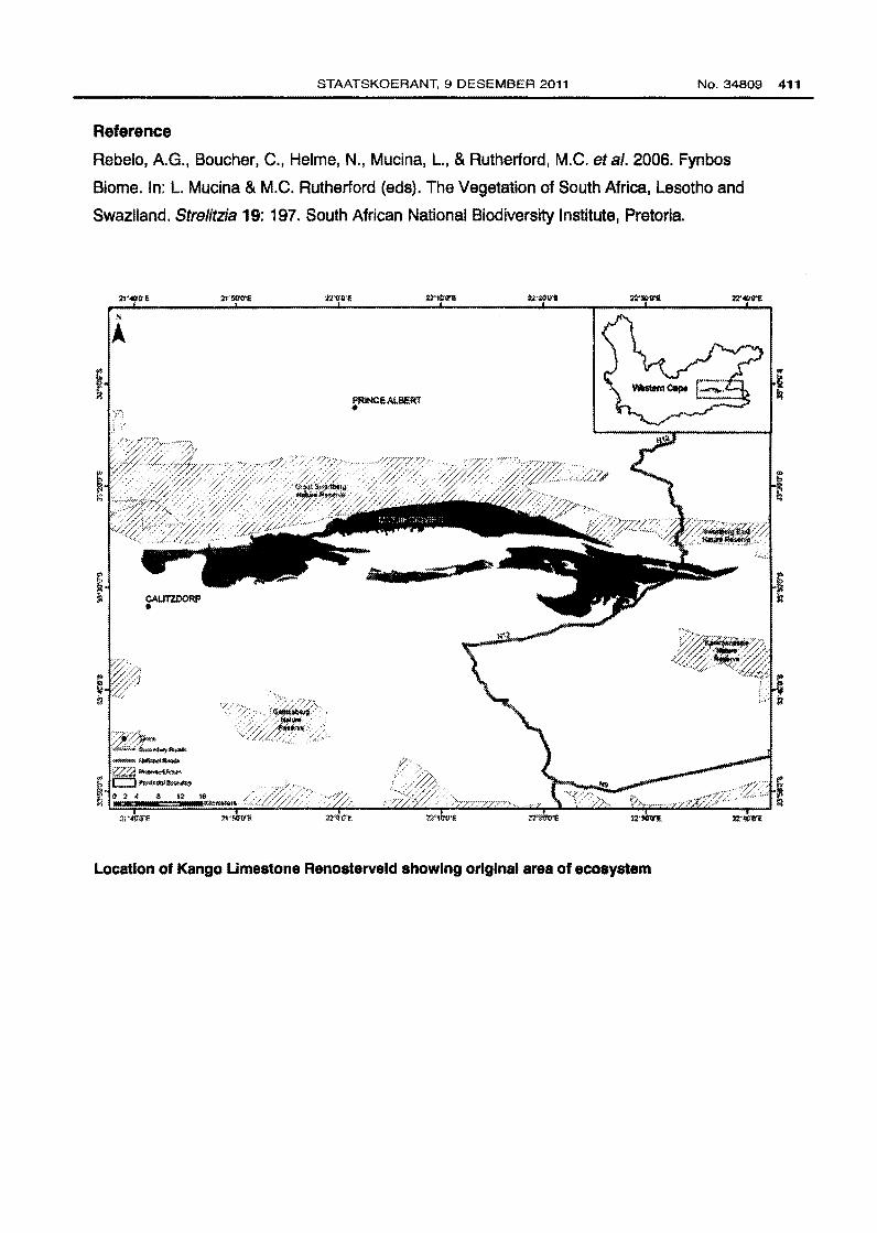
167. Kango Limestone Renosterveld (FRI1)
Reference number
Listed under Criterion
Biome
Province
Municipalities
Original area of ecosystem
Remaining natural area of ecosystem(%)
Proportion of ecosystem protected
Known number of species of special concern
Geographical location
FRI1
A1
Fynbos
Western Cape
Kannaland LM and Oudtshoorn LM
50 000 ha
51%
< 1% of original area
6 Red Data plant species {EX, EW ,CR, EN &
VU excl VU D2) and 6 endemic plant species
Northeastern regions of the Little Karoo, south of the Groot Swartberg from near Gamkapoort;
north of Calitzdorp eastwards including Matjiesrivier and the Cango Caves area; with another
band extending from upper Schoemanspoort and De Rust to north of the Stompdrift Dam.
Description
Low mountains and steep hills, supporting low, medium dense graminoid and medium to tall,
dense, cupressoid-leaved shrubland, dominated by renosterbos and Dodonaea. The upper and
wetter slopes are dominated by Dodonaea viscosa var. angustifolia, which although it is the
visual signature of this ecosystem, extends onto neighbouring fynbos ecosystems. Frequent
burning leads to a Themeda grassland. The early post-fire stages are characterised by a high
diversity of herbaceous species, on limestone Hermannia ho/osericea is dominant in the early
sera! stages. A feature of the ecosystem is the marked lack of geophytes (only Hypoxis villosa).
At least six endemic plant species and six Red Data List plant species occur in the ecosystem.
Other Information
A very small portion of the ecosystem is protected in Groot Swartberg and Rietvlei.
Page 29
STAATSKOERANT, 9 DESEMBER 2011 No. 34809 411
Reference
Rebelo, A. G., Boucher, C., Helme, N., Mucina, L., & Rutherford, M.C. eta/. 2006. Fynbos
Biome. In: L. Mucina & M.C. Rutherford (ads). The Vegetation of South Africa, Lesotho and
Swaziland. Strelitzia 19: 197. South African National Biodiversity Institute, Pretoria.
Location of Kango Umestone Renosterveld showing original area of ecosystem
Page 30
412 No.34809 GOVERNMENT GAZETTE, 9 DECEMBER 2011
168. KaNgwane Montane Grassland (Gm 16)
Reference number
Listed under Criterion
Biome
Provinces
Municipalities
Original area of ecosystem
Remaining natural area of ecosystem (%)
Proportion of ecosystem protected
Known number of species of special concern
Geographical location
Gm 16
A1
Grassland
Mpumalanga and KwaZulu-Natal
eDumbe LM, UPhongolo LM, Albert Luthuli
LM, Msukaligwa LM, Mkhondo LM and
Highlands LM
612 000 ha
59%
< 1% of original area
4 endemic plant species
Occurs along the gentle slopes of the Escarpment, from the Phongolo Valley in the south,
northwards to the Usutu Valley and to the uppermost Lomati Valley near Carolina, including the
western grassland areas of Swaziland.
Description
Largely comprised of undulating hills and plains that occur on the eastern edge of the
Escarpment. The ecosystem is transitional between the Highveld and Escarpment and contains
elements of both. The vegetation structure is comprised of a short closed grassland layer with
many forbs, and a few scattered shrubs on the rocky outcrops. At least four endemic plant
species occur in the ecosystem.
Other Information
Less than 1% of the ecosystem is protected in the Malalotja Nature Reserve, Nooitgedacht Dam
Nature Reserve and Songimvelo Nature Reserve. Small patches are found in a number of
private conservation areas.
Page 31
STAATSKOERANT, 9 DESEMBER 2011 No. 34809 413
Reference
Mucina, L., Hoare, D.B., Lotter, M.G., du Preez, P.J., Rutherford, M.G., Scott-Shaw, R.,
Bredenkamp, G.J., Powrie, L.W., Scott, L., Camp, K.G.T., Cilliers, S.S., Bezuidenhout, H.,
Mostert, T.H., Siebert, S.J., Winter, P.J.D., Burrows, J.E., Dobson, L., Ward, R.A., Stalmans, M.,
Oliver, E.G.H., Siebert, F., Schmidt, E., Kobisi, K., & Kose, L. 2006. Grassland Biome. In: L.
Mucina & M.G. Rutherford (eds). The Vegetation of South Africa, Lesotho and Swaziland.
Strelitzia 19: 403-404. South African National Biodiversity Institute, Pretoria.
Location of KaNgwane Montane Grassland showing original area of ecosystem
Page 32
414 No.34809 GOVERNMENT GAZETTE, 9 DECEMBER 2011
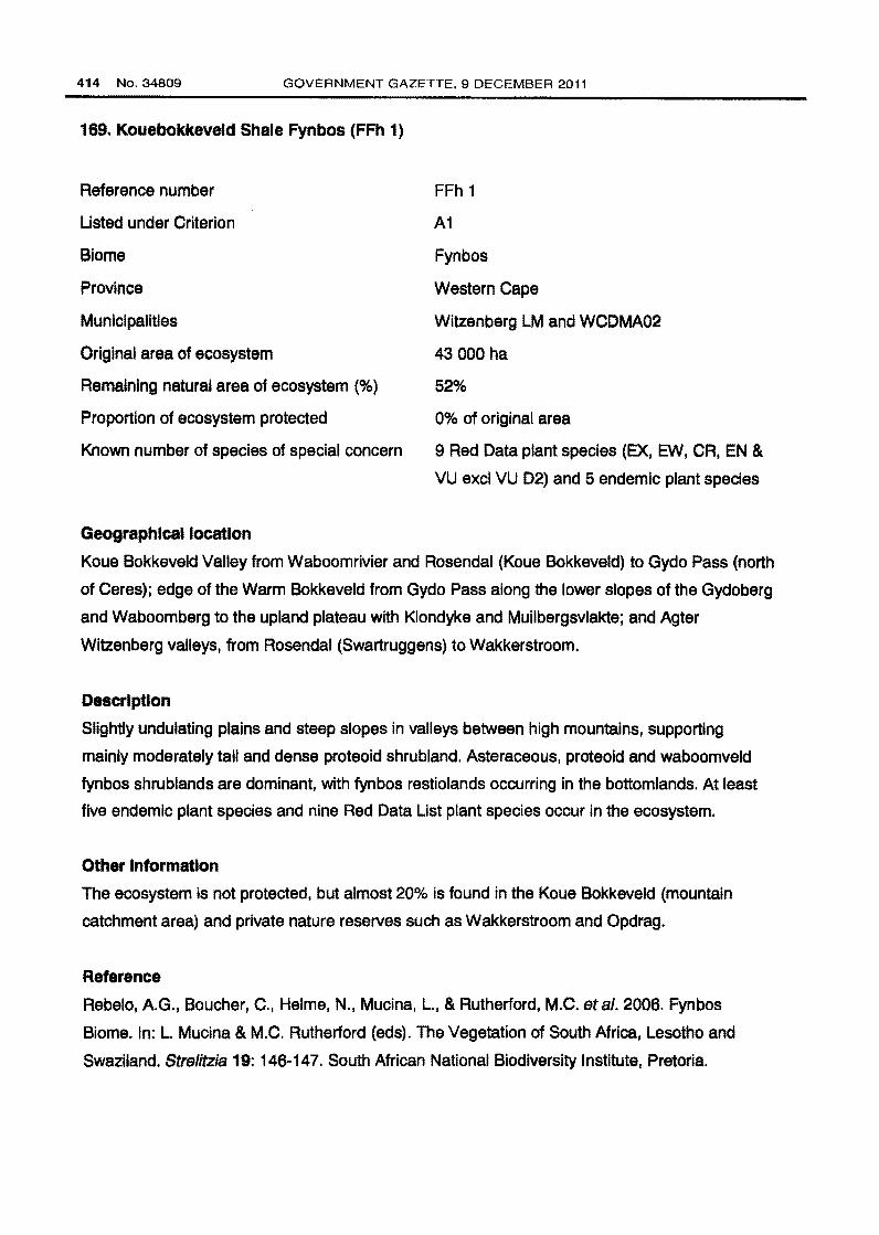
169. Kouebokkeveld Shale Fynbos (FFh 1)
Reference number
Listed under Criterion
Biome
Province
Municipalities
Original area of ecosystem
Remaining natural area of ecosystem(%)
Proportion of ecosystem protected
Known number of species of special concern
Geographical location
FFh 1
A1
Fynbos
Western Cape
Witzenberg LM and WCDMA02
43 000 ha
52%
0% of original area
9 Red Data plant species (EX, EW, CR, EN &
VU excl VU 02) and 5 endemic plant species
Koue Bokkeveld Valley from Waboomrivier and Rosendal (Koue Bokkeveld) to Gydo Pass (north
of Ceres); edge of the Warm Bokkeveld from Gydo Pass along the lower slopes of the Gydoberg
and Waboomberg to the upland plateau with Klondyke and Muilbergsvlakte; and Agter
Witzenberg valleys, from Rosendal (Swartruggens) to Wakkerstroom.
Description
Slightly undulating plains and steep slopes in valleys between high mountains, supporting
mainly moderately tall and dense proteoid shrubland. Asteraceous, proteoid and waboomveld
fynbos shrublands are dominant, with fynbos restiolands occurring in the bottomlands. At least
five endemic plant species and nine Red Data List plant species occur in the ecosystem.
Other Information
The ecosystem is not protected, but almost 20% is found in the Koue Bokkeveld (mountain
catchment area) and private nature reserves such as Wakkerstroom and Opdrag.
Reference
Rebelo, A. G., Boucher, C., Helme, N., Mucina, L., & Rutherford, M.C. eta/. 2006. Fynbos
Biome. In: L. Mucina & M.C. Rutherford (eds). The Vegetation of South Africa, Lesotho and
Swaziland. Strelitzia 19: 146-147. South African National Biodiversity Institute, Pretoria.
Page 33
STAATSKOERANT, 9 DESEMBER 2011 No.34809 415
Location of Kouebokkeveld Shale Fynbos showing original area of ecosystem
Page 34
416 No.34809 GOVERNMENT GAZETTE, 9 DECEMBER 2011
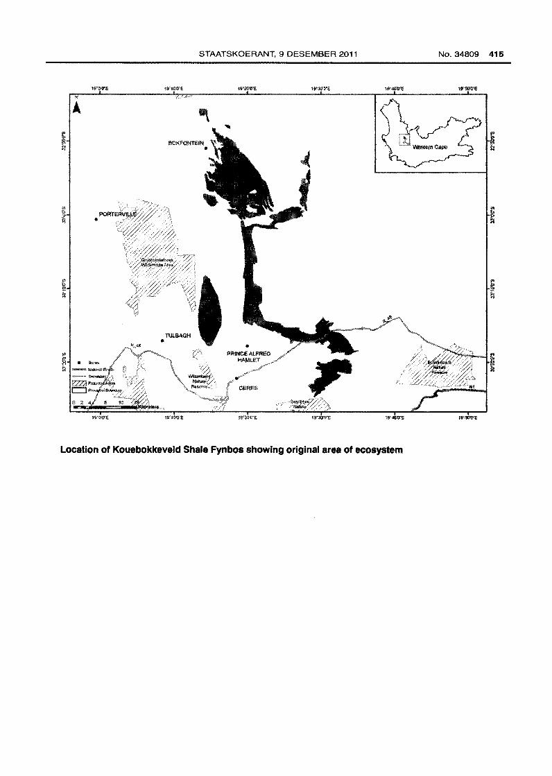
170. Kromberg Plateau (KZN 62)
Reference number
Listed under Criterion
Biome
Province
Municipality
Original area of ecosystem
Remaining natural area of ecosystem(%)
Proportion of ecosystem protected
Known number of species of special concern
Geographical location
KZN62
F
Grassland, Savanna and Forest
KwaZulu-Natal
Umvoti LM
5 000 ha
41%
Oo/o of original area
6 threatened or endemic plant and animal
species including those listed below
Nadi (2830DC ) . Located principally on the Kromberg Plateau. Ecosystem delineated based on
contours indicating the mid-slope position of the surrounding slopes.
Description
Key biodiversity features include one bird species, the Wattled Crane; two millipede species
including Doratogonus montanus and Doratogonus natalensis; two plant species including
Geranium natalense and Senecio exuberans; one reptile species including Bradypodion tilburyi;
and three vegetation types including Eastern Mistbelt Forest, Midlands Mistbelt Grassland and
Thukela Thornveld.
Other Information
The ecosystem is not protected.
Reference
Goodman, P.S. 2007. KwaZulu-Natal Terrestrial Conservation Plan (C-Pian), Version 4.
Biodiversity Conservation Planning Division, Ezemvelo KZN Wildlife.
Page 35
~ • fowM i': """""' NaUClrlld 1'1"*'1
--- SE!c:xmdaoy ~ i(,22 Proteded Arf!as c::J ProAA<:il!l !ill)\ldllry
STAATSKOERANT, 9 DESEMBER 2011
• MOUNTEUAS
Location of Kromberg Plateau showing original area of ecosystem
No.34809 417
Page 36
418 No.34809 GOVERNMENT GAZETTE, 9 DECEMBER 2011
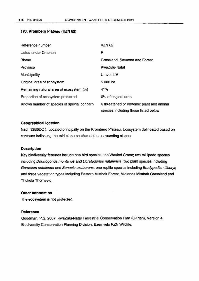
171. KwaMncane North Plateau (KZN 63)
Reference number
Listed under Criterion
Biome
Province
Municipalities
Original area of ecosystem
Remaining natural area of ecosystem (%)
Proportion of ecosystem protected
Known number of species of special concern
Geographical location
KZN 63
F
Grassland and Forest
KwaZulu-Natal
lmpendle LM and The Msunduzi LM
7 000 ha
26%
0% of original area
9 threatened or endemic plant and animal
species including those listed below
Merrivale (2930CA). Ecosystem delineated by the crest of the slope, with the southern boundary
of the ecosystem extending down the slope.
Description
Key biodiversity features include one amphibian species, Afrixalus spinifrons intermedius; one
mammal species, the Oribi; two millipede species including Centrobolus tricolor and
Doratogonus montanus; three plant species including Hesperantha woodii, Kniphofia buchananii
and Senecio exuberans; two reptile species including Bradypodion bourquini and Bradypodion
thamnobates; and three vegetation types including Drakensberg Foothill Moist Grassland,
Eastern Mistbelt Forest and Midlands Mistbelt Grassland.
Other Information
The ecosystem is not protected.
Reference
Goodman, P.S. 2007. KwaZulu-Natal Terrestrial Conservation Plan (C-Pian), Version 4.
Biodiversity Conservation Planning Division, Ezemvelo KZN Wildlife.
Page 37
• TowiiS - Nallollal Road$ - SeCIIIIdllry Rollda !7.Zl Pnlllellld AnNI!I c::1 PloWlclll Eloudary
STAATSKOERANT, 9 DESEMBER 2011
• ELANDSKOP
.:1(1'10'0'£
• ED END AlE
Location of KwaMncane North Plateau showing original area of ecosystem
No. 34809 419
Page 38
420 No. 34809 GOVERNMENT GAZETTE, 9 DECEMBER 2011
172. KwaZulu-Natal Coastal Belt (CB 3)
Reference number
Listed under Criterion
Biome
Province
Municipalities
Original area of ecosystem
Remaining natural area of ecosystem(%)
Proportion of ecosystem protected
Known number of species of special concern
Geographical location
CB3
A1
Indian Ocean Coastal Belt
KwaZulu-Natal
Ethekwini MM, Vulamehlo LM, Umdoni LM,
Umzumbe LM, Ezingoleni LM, Hibiscus Coast
LM, Mkhambathini LM, uMhlathuze LM,
uMialazi LM, eNdondakusuka LM, KwaDukuza
LM, Ndwedwe LM and Maphumulo LM
633 000 ha
45%
< 1% of original area
3 endemic plant species
Long, and in places broad, coastal strip along the KwaZulu-Natal coast from near Mtunzini in the
north, past Durban to Margate and just short of Port Edward in the south.
Description
Highly dissected undulating coastal plains which presumably used to be covered to a great
extent with various types of subtropical coastal forest. Some primary grassland dominated by
Themeda triandra still occurs in hilly, high-rainfall areas where pressure from natural fire and
grazing regimes prevailed. At present the KwaZulu-Natal Coastal Belt is affected by an intricate
mosaic of very extensive sugarcane fields, timber plantations and coastal holiday resorts, with
interspersed secondary Aristida grasslands, thickets and patches of coastal thornveld. At least
three endemic plant species occur in the ecosystem.
Other information
Only a very small part of the ecosystem is protected in Ngoye, Mbumbazi and Vernon Crookes
Nature Reserves.
Page 39
STAATSKOERANT, 9 DESEMBER 2011 No.34809 421
Reference
Mucina, L., Scott-Shaw, R., Rutherford, M.C., Camp, K.G.T., Matthews, W.S., Powrie, L.W. &
Hoare, D. B. 2006. Indian Ocean Coastal Belt. In: L. Mucina & M.C. Rutherford (eds). The
Vegetation of South Africa, Lesotho and Swaziland. Strelitzia 19: 578-579. South African
National Biodiversity Institute, Pretoria.
Location of KwaZulu-Natal Coastal Belt showing original area of ecosystem
• Towns
,__ NatJonal Roods
~ Proteete<l Areas
c:J Provincial Sounaary
Page 40
422 No.34809 GOVERNMENT GAZETTE, 9 DECEMBER 2011
173. Lebombo Scarp Foreat (KZN 64)
Reference number
Listed under Criterion
Blome
Province
Municipality
Original area of ecosystem
Remaining natural area of ecosystem (%)
Proportion of ecosystem protected
Known number of species of special concern
Geographical location
KZN64
F
Grassland, Savanna and Forest
KwaZulu-Natal
Jozini LM
1 000 ha
92%
86% of original area
3 threatened or endemic plant and animal
species including those listed below
2732AC. Ecosystem includes the Hlatikulu Forest Reserve and extends southwards to include
scarp forest outside of the reserve.
Deacrlptlon
Key biodiversity features include two millipede species, Centrobolus rugulosus and Doratogonus
major, one plant species, Pachycarpus lebomboensis; and three vegetation types including
Eastern Scarp Forest, Lebombo Summit Sourveld and Southern Lebombo Bushveld.
Other Information
Approximately 86% of the ecosystem is protected in the Hlatikulu Forest Reserve.
Reference
Goodman, P.S. 2007. KwaZulu-Natal Terrestrial Conservation Plan (C-Pian), Version 4.
Biodiversity Conservation Planning Division, Ezemvelo KZN Wildlife.
Page 41
• TOW!lS - HallOIIal ROIId$
·-·"' ae~Roa i:ZZ PIOC!lctildNetl$ CJ Pll>Wldallloo!l!!fY
STAATSKOERANT, 9 DESEMBER 2011
Location of Lebombo Scarp Forest showing original area of ecosystem
No. 34809 423
Page 42
424 No.34809 GOVERNMENT GAZETTE, 9 DECEMBER 2011
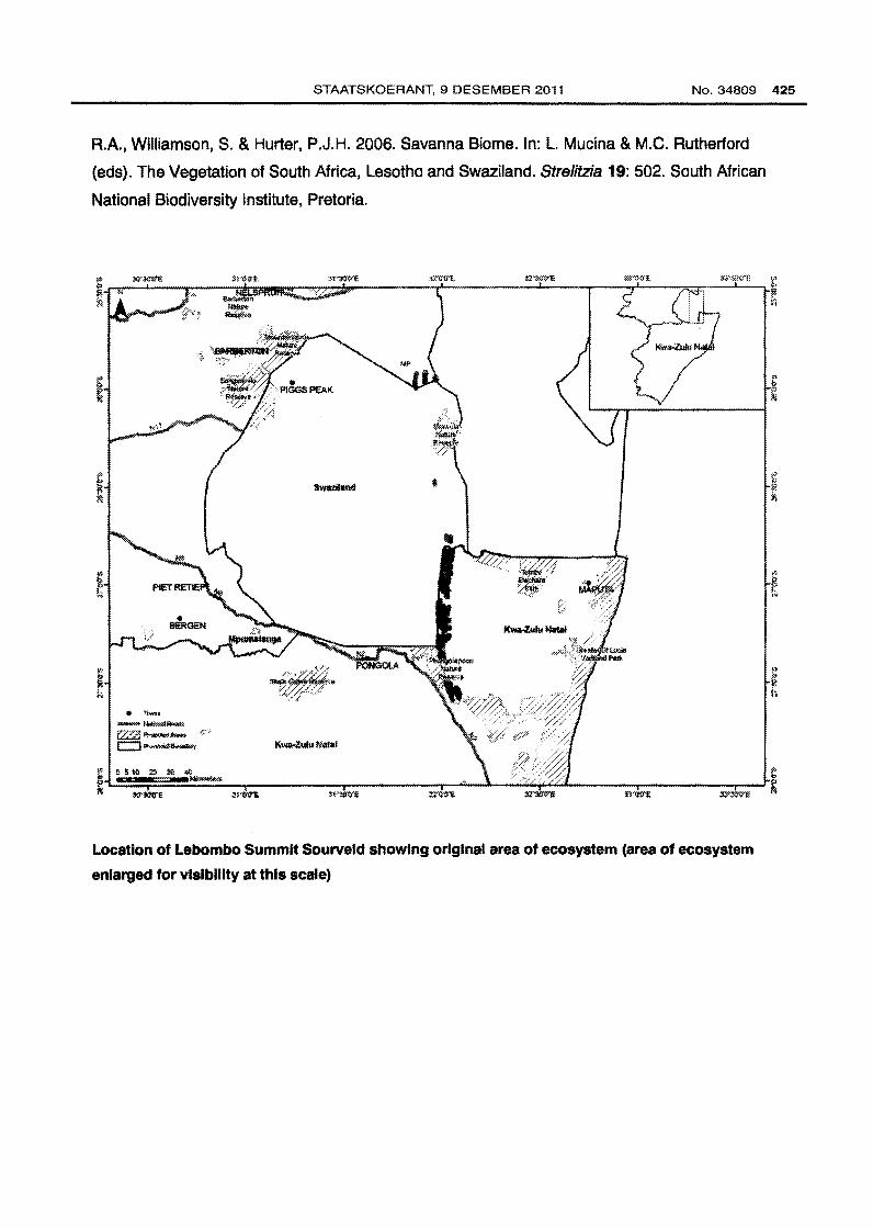
174. Lebombo Summit Sourveld (SVI17)
Reference number
Listed under Criterion
Biome
Provinces
Municipalities
Original area of ecosystem
Remaining natural area of ecosystem {%)
Proportion of ecosystem protected
Known number of species of special concern
Geographical location
SVI17
A1
Savanna
KwaZulu-Natal and Mpumalanga
UPhongolo LM, Jozini LM, KZNDMA27 and
Nkomazi LM
12 000 ha
55%
4% of original area
2 endemic plant species
Localised high points on the crest of the Lebombo Mountains from Mbuzini (Mpumalanga) in the
north to the Ubombo area immediately north of Mkuze River Gorge in the south. Also occurs in
Mozambique in a very limited area north of Namaacha.
Description
Ridge plateaus and adjacent slightly sloping flanks covered with open, tall, sour, wiry
grasslands, often dotted with low bushes and solitary savanna trees. At least two endemic plant
species occur in this ecosystem.
Other Information
Approximately 4% of the ecosystem is protected in the Mananga Cycad Colony, Ubombo
Mountain, Phongolapoort and Hlatikulu Nature Reserves. A very small portion is also found in
the private Masibekela Wetland Reserve.
Reference
Rutherford, M.G., Mucina, L., Lotter, M.G., Bredenkamp, G.J., Smit, J.H.L., Scott-Shaw, R.,
Hoare, D. B., Goodman, P.S., Bezuidenhout, H., Scott, L., Ellis, F., Powrie, L.W., Siebert, F.,
Mostert, T.H., Henning, B.J., Venter, C.E., Camp, K.G.T., Siebert, S.J., Matthews, W.S.,
Burrows, J.E., Dobson, L., van Rooyen, N., Schmidt, E., Winter, P.J.D., du Preez, P.J., Ward,
Page 43
STAATSKOERANT, 9 DESEMBER 2011 No.34809 425
A.A., Williamson, S. & Hurter, P.J.H. 2006. Savanna Biome. In: L. Mucina & M.C. Rutherford
(eds). The Vegetation of South Africa, Lesotho and Swaziland. Strelitzia 19: 502. South African
National Biodiversity Institute, Pretoria .
• 1~
~~~:;;:
1Z"7<""-CJ-- Kwa-l.ulu Natal
Location of Lebombo Summit Sourveld showing original area of ecosystem (area of ecosystem
enlarged for visibility at this scale)
Page 44
426 No.34809 GOVERNMENT GAZETTE, 9 DECEMBER 2011
175. Legogote Sour Bushveld (SVI 9)
Reference number
Listed under Criterion
Biome
Provinces
Municipalities
Original area of ecosystem
Remaining natural area of ecosystem (%)
Proportion of ecosystem protected
Known number of species of special concern
Geographical location
SVI9
A1
Savanna
Mpumalanga and Limpopo
Maruleng LM, Highlands LM, Thaba Chweu
LM, Mbombela LM, Umjindi LM,
Bushbuckridge LM and MPDMA32
354 000 ha
53%
2% of original area
1 endemic plant species
Lower eastern slopes and hills of the northeastern escarpment from Mariepskop in the north
through White River to the Nelspruit area extending westwards up the valleys of the Crocodile,
Elands and Houtbosloop Rivers and terminating in the south in the Barberton area.
Description
Gently to moderately sloping upper pediment slopes with dense woodland including many
medium to large shrubs often dominated by Parinari curatellifolia and Bauhinia galpinii with
Hyperthe/ia disso/uta and Panicum maximum in the undergrowth. Short thicket dominated by
Acacia ataxacantha occurs on less rocky sites. Exposed granite outcrops have low vegetation
cover, typically with Englerophytum maga/ismontanum, Aloe petricola and Myrothamnus
flabellifolia. At least one endemic plant species occurs in the ecosystem.
Other Information
Approximately 2% of the ecosystem protected mainly in the Bosbokrand and Barberton Nature
Reserves and a further ~/o is found in private reserves including the Mbesan and Kaapsehoop
Reserves and Mondi Cycad Reserve.
Page 45
STAATSKOEAANT, 9 DESEMBEA 2011 No.34809 427
Reference
Rutherford, M.C., Mucina, L, Lotter, M.C., Bredenkamp, G.J., Smit, J.H.L., Scott-Shaw, R.,
Hoare, D.B., Goodman, P.S., Bezuidenhout, H., Scott, L., Ellis, F., Powrle, L.W., Siebert, F.,
Mostert, T.H., Henning, B.J., Venter, C.E., Camp, K.G.T., Siebert, S.J., Matthews, W.S.,
Burrows, J.E., Dobson, L., van Rooyen, N., Schmidt, E., Winter, P.J.D., du Preez, P.J., Ward,
R.A., Williamson, S. & Hurter, P.J.H. 2006. Savanna Blome. In: L. Muclna & M.C. Rutherford
(eds). The Vegetation of South Africa, Lesotho and Swaziland. Strelltzla 19: 496-497. South
African National Biodiversity Institute, Pretoria .
Lim~ •
PENGE
• OUL.LSTROOM
Mpllm;tllanga
Location of Legogota Sour Bushvatd showing original area of ecosystem
Page 46
428 No. 34809 GOVERNMENT GAZETTE, 9 DECEMBER 2011
176. Leipoldtvllle Sand Fynbos (FFd 2)
Reference number
Listed under criteria
Biome
Province
Municipalities
Original area of ecosystem
Remaining natural area of ecosystem(%)
Proportion of ecosystem protected
Known number of species of special concern
Geographical location
FFd2
A1 and D1
Fynbos
Western Cape
Matzikama LM, Cederberg LM, Bergrivier LM
andWCDMA01
276 000 ha
47%
0% of original area
45 Red Data plant species (EX, EW, CR, EN &
VU excl VU D2) and 33 endemic plant species
On the coastal plains on either side of the Olifants River to Aurora and extending inland to the
foot of the Graafwater Mountains and Piketberg. It also occurs in the Olifants River Valley from
the Bulshoek Dam to The Baths (Keerom), with a gap between Klawer Vlei and Sandkop.
Outliers are found scattered in the Swartveld from Het Kruis to the vicinity of Porterville.
Description
Plains, slightly rolling in places, covered with shrublands with an upper open stratum of
emergent, 2-3m tall shrubs in clumps. The vegetation matrix is formed by fairly dense, 1-1.2 m
tall restiolands, with numerous medium tall to low shrubs scattered in between. Understorey with
a conspicuous winter to spring herbaceous complement of annuals and geophytes occurs in
years with good rain. Structurally, these are mainly restioid and asteraceous fynbos types, with
localised patches of proteoid fynbos also present. This is a dry form of sand fynbos, lacking
Ericaceae and with proteoid elements relatively rare. Sward communities, associated with
grazing, are dominated by Aizoon canariense and Tribo/ium echinatum. At its northern (arid)
boundary the sand fynbos structure becomes very diffuse and is progressively replaced by
strandveld. At least 33 endemic plant species and 45 Red Data List plant species occur in the
ecosystem.
Page 47
STAATSKOERANT, 9 DESEMBER 2011 No.34809 429
Other information
The ecosystem is not protected.
Reference
Rebelo, A. G., Boucher, C., Helme, N., Mucina, L., & Rutherford, M.C. eta/. 2006. Fynbos
Biome. In: L. Mucina & M.C. Rutherford (eds). The Vegetation of South Africa, Lesotho and
Swaziland. Strelitzia 19: 137-138. South African National Biodiversity Institute, Pretoria.
Location of Leipoldtville Sand Fynbos showing original area of ecosystem
Page 48
430 No.34809 GOVERNMENT GAZETTE, 9 DECEMBER 2011
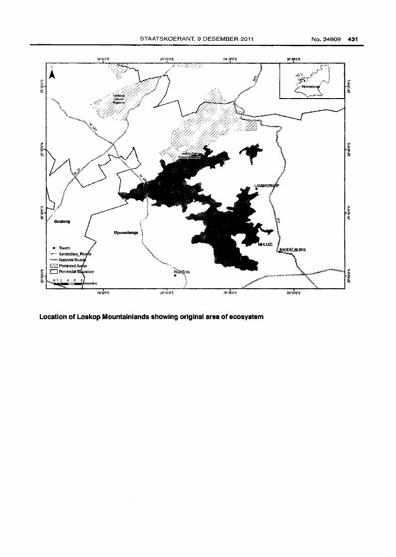
177. Loskop Mountalnlands (MP 18)
Reference number
Listed under Criterion
Blome
Province
Municipalities
Original area of ecosystem
Remaining natural area of ecosystem(%)
Proportion of ecosystem protected
Known number of species of special concern
Geographical location
MP18
F
Grassland and Savanna
Mpumalanga
Emalahleni LM, Steve Tshwete LM and
Thembisile LM
46 ooo ha
93%
3% of original area
8 threatened or endemic plant and animal
species including those listed below
Directly south-west of Loskop Dam Nature Reserve (2529AD, 2529CA, 2529CB and 2529CD).
Rugged sandstone mountain bushveld delineated using landtypes, critical supporting
catchments and the presence of important plant species.
Description
Key biodiversity features include three bird species including Blue Korhaan, Southern Ground
Hornbill and Wattled Crane; one amphibian, Pyxicephalus adspersus; four plant species for
example Elephantorrhiza ob/iqua var. glabra and Frithia humilis; and two vegetation types
including Loskop Mountain Bushveld and Rand Highveld Grassland. The ecosystem includes
important sub-catchments; it is an important escarpment corridor; and is important for grassland
processes.
Other Information
Approximately 3% of the ecosystem is protected in the Loskop Dam Nature Reserve.
Reference
Mpumalanga Tourism and Parks Agency & Department of Agriculture and Land Administration.
2007. Mpumalanga Biodiversity Conservation Handbook.
Page 49
STAATSKOERANT, 9 DESEMBER 2011 No. 34809 431
Location of Loskop Mountalnlands showing original area of ecosystem
Page 50
432 No. 34809 GOVERNMENT GAZETTE, 9 DECEMBER 2011
178. Louwsberg Mlstbelt Grassland (KZN 85)
Reference number
Listed under Criterion
Biome
Province
Municipalities
Original area of ecosystem
Remaining natural area of ecosystem(%)
Proportion of ecosystem protected
Known number of species of special concern
Geographical location
KZN65
F
Grassland and Forest
KwaZulu~Natal
UPhongolo LM and Abaqulusi LM
5 000 ha
35%
7% of original area
3 threatened or endemic plant and animal
species including those listed below
Louwsberg (2731CB). Ecosystem delineated by the Northern Zululand Mistbelt Grassland.
Description
Key biodiversity features include one millipede species, Doratogonus natalensis; two plant
species including Brachystelma ngomense and Helichrysum ingomense; and three vegetation
types including Eastern Mistbelt Forest, Northern Zulu land Mistbelt Grassland and
Paulpietersburg Moist Grassland.
Other information
Approximately 7% of the ecosystem is protected in the lthala Game Reserve.
Reference
Goodman, P.S. 2007. KwaZulu-Natal Terrestrial Conservation Plan (C~Pian), Version 4.
Biodiversity Conservation Planning Division, Ezemvelo KZN Wildlife.
Page 51
STAATSKOERANT, 9 DESEMBER 2011 No.34809 433
<> 1 z 4 e e ··- ~
Location of Louwaberg Mlstbelt Grassland showing original area of ecosystem
Page 52
434 No.34809 GOVERNMENT GAZETTE, 9 DECEMBER 2011
179. Low Escarpment Mistbelt Forest (FOz 114)
Reference number
Listed under Criterion
Biome
Provinces
Municipalities
Original area of ecosystem
Remaining natural area of ecosystem
Proportion of ecosystem protected
Known number of species of special concern
Geographical location
FOzl14
A2
Forest
Mpumalanga and KwaZulu-Natal
Maluti a Phofung LM, Phumelela LM,
Emnambithi/Ladysmith LM, Okhahlamba LM,
Endumeni LM, Newcastle LM, Utrecht LM,
Dannhauser LM, eDumbe LM, Abaqulusi LM,
Ulundi LM, Mkhondo LM and Seme LM
Data not available
5 000 ha
15% of remaining area
Low Escarpment Mistbelt Forests (previously the Northern KwaZulu-Natal Mistbelt Forests or
Eastern Midlands Forests) are found along the low Drakensberg escarpment between Van
Rheenen's Pass (near Harrismith) and Piet Retief as well as in southern Mpumalanga and
northern KwaZulu-Natal (Vryheid region). The ecosystem forms a widely scattered archipelago
of isolated forest patches.
Description
High, multi-layered forest (approximately 15-20 m tall), comprising two layers of trees, a full,
dense understorey and a very well developed herb layer. Species are predominantly single
stemmed. These forests show a mix of coarse grain, canopy gap or disturbance driven dynamics
and fine-grained, regeneration characteristics. These forests are usually dominated by tall-grown
trees such as Podocarpus latifolius, P. falcatus, and Dombeya burgessiae or by low-grown types
such as Xymalos monospora, Greyia sutherlandii, and Canthium mundianum. The ecosystem is
relatively species-rich. A few forests, such as Ngome Forest, are exceptionally rich in orchids.
An important characteristic differentiating this ecosystem from the Eastern Mistbelt Forests is the
presence of many elements typical of Scarp Forests.
Page 53
STAATSKOERANT, 9 DESEMBER 2011 No.34809 435
Other Information
Approximately 15% of the ecosystem is protected.
References
Muclna, L. & Geldenhuys, C.J. 2006. Afrotemperate, Subtropical and Azonal Forests. In: L.
Mucina & M.C. Rutherford (eds). The Vegetation of South Africa, Lesotho and Swaziland.
Strelitzia 19: 599. South African National Biodiversity Institute, Pretoria.
Von Maltitz, G., Muclna, L., Geldenhuys, C., Lawes, M., Ealey, H., Adie, H., Vink, D., Flemming,
G. & Bailey, C. 2003. Classification System for South African Indigenous Forests. An objective
classification for the Department of Water Affairs and Forestry. Environmentek Report ENV-P-C
2003-017, CSIR, Pretoria.
•
• • UTRECHT •
t •
,. .. ...
Location of Low Escarpment Mlstbelt Forest {area of ecosystem enlarged for visibility at this
scale)
Page 54
436 No.34809 GOVERNMENT GAZETTE, 9 DECEMBER 2011
180. Lowveld Riverine Forest (FOa 1)
Reference number
Listed using Criterion
Biome
Provinces
Municipalities
Original area of ecosystem
Remaining natural area of ecosystem
Proportion of ecosystem protected
Known number of species of special concern
Geographical location
FOa 1
A2
Forest
KwaZulu-Natal, Mpumalanga and Limpopo
Umhlabuyalingana LM, Jozini LM, The Big 5
False Bay LM, Maruleng LM, Musina LM,
Mutale LM, Thulamela LM, Lephalale LM,
Thaba Chweu LM, Bushbuckridge LM,
KZNDMA27 and LIMDMA33
Data not available
11 000 ha
67% of remaining area
Data not available
This typically hydro-pedologic azonal forest occurs imbedded within the Lowveld areas of the
Savanna Biome, where it is found on alluvia of rivers {from the Limpopo River in the north to the
Amatigulu River in Zululand in the south). The largest and best-developed patches are found in
Maputaland and in the Mpumalanga and Limpopo Lowveld. Impoverished, albeit floristically
interesting, riparian forests occur on low slopes and at the foot of the Northern Escarpment
bordering the Lowveld in Mpumalanga and Limpopo Province.
Description
Tall, gallery forests fringing stretches of major rivers on nutrient-laden sediments brought by
summer floods. This forest provides a unique habitat and has high biodiversity value. These
forests provide an important food source (browse and fig trees) and serves as a heat avoidance
microhabitat for savanna dwelling animals and shelter for riverine animals. An important
ecosystem function is provided by the root system, which helps to bind soil promoting stream
bank stabilisation and preventing erosion. There is no published data specifically devoted to
species richness and species turnover patterns in these forests.
Page 55
STAATSKOERANT, 9 DESEMBER 2011 No. 34809 437
Other information
Approximately 67% of the ecosystem is protected in Kruger and Mapungubwe National Parks,
isiMangaliso Wetland Park, Ndumo and Mkuze Game Reserves, Mlawula and Blyde River
Canyon National Park.
References
Mucina, L. & Geldenhuys, C.J. 2006. Afrotemperate, Subtropical and Azonal Forests. In: L.
Mucina & M.C. Rutherford (eds). The Vegetation of South Africa, Lesotho and Swaziland.
Strelitzia 19: 607. South African National Biodiversity Institute, Pretoria.
Von Maltitz, G., Mucina, L., Geldenhuys, C., Lawes, M., Ealey, H., Adie, H., Vink, D., Flemming,
G. & Bailey, C. 2003. Classification System for South African Indigenous Forests. An objective
classification for the Department of Water Affairs and Forestry. Environmentek Report ENV-P-C
2003-017, CSIR, Pretoria.
'~> \ :lfi'C"C'E
• TOWll$
- National Roads D ProW!~ Boundary
Location of Lowveld Riverine Forest (area of ecosystem enlarged for visibility at this scale)
Page 56
438 No.34809 GOVERNMENT GAZETTE, 9 DECEMBER 2011
181. Maflkeng Buahveld (SVk 1)
Reference number
Listed under Criterion
Blome
Province
Municipalities
Original area of ecosystem
Remaining natural area of ecosystem(%)
Proportion of ecosystem protected
Known number of species of special concern
Geographical location
SVk 1
A1
Savanna
North West
Moshaweng LM, Ratlou LM, Tswaing LM,
Mafikeng LM, Ramotshere Moiloa LM,
Kagisano LM, Naledi LM, Greater Taung LM
and Molopo LM
1 438 000 ha
60%
0% of original area
West of Maflkeng and south of the Botswana border westwards to around Vergele~, southwards
to Plat Plessis and Setlagole.
Description
Well developed tree and shrub layers, dense stands of Terminalia sericea, Acacia luede-ritzil
and A. erioloba In certain areas. Shrubs include A. karroo, A. hebeclada and A. meilifera,
Dichrostachys cinerea, Grew/a flava, G. retineNis, Rhus tenuineNis andZiziphus mucronata.
Grass layer is also well developed.
Other Information
The ecosystem is not protected but a very small area is found in the Mmabatho Recreation Area.
Reference
Rutherford, M.C., Mucina, L., Lotter, M.C., Bredenkamp, G.J., Smit, J.H.L., Scott-Shaw, R.,
Hoare, D.B., Goodman, P.S., Bezuidenhout, H., Scott, L., Ellis, F., Powrie, L.W., Siebert, F.,
Mostert, T.H., Henning, B.J., Venter, C.E., Camp, K.G.T., Siebert, S.J., Matthews, W.S.,
Burrows, J.E., Dobson, L., van Rooyen, N., Schmidt, E., Winter, P.J.D., du Preez, P.J., Ward,
Page 57
STAATSKOERANT, 9 DESEMBER 2011 No. 34809 439
A.A., Williamson, S. & Hurter, P.J.H. 2006. Savanna Biome. In: L. Mucina & M.C. Rutherford
(eds). The Vegetation of South Africa, Lesotho and Swaziland. Strelitzia 19: 514-515. South
African National Biodiversity Institute, Pretoria.
Location of Maflkeng Bushveld showing original area of ecosystem
Page 58
440 No.34809 GOVERNMENT GAZETTE, 9 DECEMBER 2011
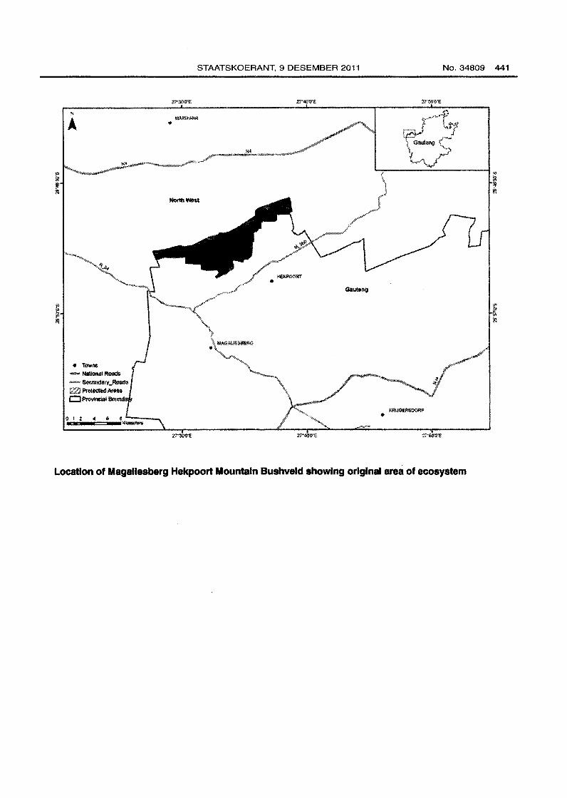
182. Magallesberg Hekpoort Mountain Bushveld (GP 16)
Reference number
Listed under Criterion
Biome
Province
Municipality
Original area of ecosystem
Remaining natural area of ecosystem(%)
Proportion of ecosystem protected
Known number of species of special concern
Geographical location
GP 16
F
Grassland, Savanna and Forest
Gauteng
Mogale City LM
6 000 ha
99%
0% of original area
6 threatened or endemic plant and animal
species including those listed below
West Rand of Gauteng including Hekpoort (2527DC). Ecosystem delineated by the
Magaliesberg ridge system and associated koppies.
Description
Key biodiversity features include Red or Orange Listed plants for example Aloe peg/erae, Frithia
pulchra; Red or Orange Listed birds for example Cape Vulture; and four vegetation types
including Gold Reef Mountain Bushveld, Moot Plains Bushveld, Northern Afrotemperate Forest,
and Waterberg-Magaliesberg Summit Sourveld. Various drainage lines or non-perennial rivers
are key features in the ecosystem.
Other Information
The ecosystem is not protected.
Reference
Gauteng C-Pian Version 2. 2006. Gauteng Department of Agriculture, Conservation and
Environment.
Page 59
• ltlwl"l$
- National Roads -~-Ro:im l2Zl Pr~tdedAm• c:::J Pnivtnc:ial
STAATSKOERANT, 9 DESEMBER 2011 No.34809 441
Location of Magallesberg Hekpoort Mountain Bushveld showing original area of ecosystem
Page 60
442 No.34809 GOVERNMENT GAZETTE, 9 DECEMBER 2011
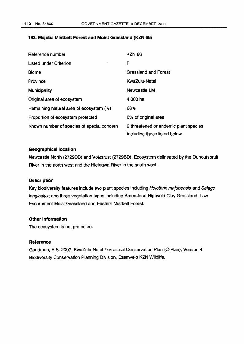
183. Majuba Mistbelt Forest and Moist Grassland (KZN 66)
Reference number
Listed under Criterion
Biome
Province
Municipality
Original area of ecosystem
Remaining natural area of ecosystem (%)
Proportion of ecosystem protected
Known number of species of special concern
Geographical location
KZN66
F
Grassland and Forest
KwaZulu-Natal
Newcastle LM
4 000 ha
68%
0% of original area
2 threatened or endemic plant species
including those listed below
Newcastle North (272908) and Volksrust (272980). Ecosystem delineated by the Ouhoutspruit
River in the north west and the Hleleqwa River in the south west.
Description
Key biodiversity features include two plant species including Holothrix majubensis and Selago
longicalyx; and three vegetation types including Amersfoort Highveld Clay Grassland, Low
Escarpment Moist Grassland and Eastern Mistbelt Forest.
Other information
The ecosystem is not protected.
Reference
Goodman, P.S. 2007. KwaZulu-Natal Terrestrial Conservation Plan (C-Pian), Version 4.
Biodiversity Conservation Planning Division, Ezemvelo KZN Wildlife.