36
Government of Samoa
| Date post: | 16-Dec-2015 |
| Category: |
Documents |
| Upload: | isabella-lawson |
| View: | 217 times |
| Download: | 0 times |

Government of Samoa

Land Tenure in Samoa•Samoa became Independence in 1962, having been administered by Germany, and then New Zealand until 1961.
•It has a population of 181,000 (2006 Census) and a land area of 2,831 square kilometers.(2010-est-200,000)
•All cadastral and registration services are provided by the MNRE.

Types of Lands
• 80% Customary Land, is held under customary ownership, this land is protected under the constitution.
12% of Public or Government Land.
• 8% of Freehold Land.

CURRENT CADASTRAL ARRANGEMENT*Cadastral Survey were undertaken under the survey Ordinance 1961, and the New Legislation for cadastral surveys is currently passed by the Parliament.
* Any change in boundaries for freehold, Government land or for registration of lease over customary land, requires a cadastral survey signed by the registered or licensed surveyor .

*A survey plan is lodged with the (MNRE) ,at the Quality Assurance Section of the Technical Division to check and refer to approve by the Chief Executive Officer, if the survey meet all the requirements including the standards described under the survey Regulations.
CURRENT REGISTRATION ARRNGEMENT
•Samoa moved to a system of title registration of the Land Title Registration Act 2008, officially implemented on the 2nd March 2009.
•This change was accompanied by the introduction of standardized forms.
•The implementation of a computerized system and the recognition of the computerized based records, in particular the “Computer Folio”.
IN SAMOA

• 1)1) REGISTRATION PROCESS & REGISTRATION PROCESS & DCDB. DCDB.
• 2)2) EXPERIENCES-NEW EXPERIENCES-NEW REGISTRATION REGISTRATION FORMS.FORMS.
• 3)3) Future PlansFuture Plans
•4)4) Other Future Land Other Future Land AdministrationAdministration

1) 1) LAND REGISTRATIONLAND REGISTRATIONMAIN ACTIVITIES:
REGISTRATION OF LAND DEALINGS/PLANS -Transfers, Mortgages, Transmission, Caveats etc
- Approved Survey Plans)
PROVIDING LAND INFORMATION - Search Registration & Cadastral Records- Digital Archive, LRS Database, Old Land Records ) -Create “Computer Folio Certificates”
-KEEPING & SCANNING OF LAND RECORDs. -Court Grants, Land Claims, Old land records (etc) -Archive Paper Documents

• Registration Process StepsRegistration Process Stepsanalysis Registration Business Workflows
Dealing or Surv ey Plan
Lodge Dealing or Surv ey Plan
Lodging Agent (Solicitor or Surv eyor)
Register Dealing or (Deposit) Surv ey
Plan
Check lodgement is complete
Check lodgement against existing registration and
cadastral records
Enter Details in LRS Database
LRS Database
Check Details in LRS Database
Scan document and add to Digital
Archiv e
Despatch
Archiv e Paper Documents
Digital Archive
Create Computer Folio Certificates
Solicitor
Owner
«flow»
«flow» «flow»
«flow»
«flow»
«flow»
«flow»

LAND REGISTRATION PROCESS
DESPATCH“COMPUTER”CERTIFICATE
CLIENT SOLICITOR
LODGEMENTDEALINGSPAY FEES
CHECK LRS DATABASE &
SURVEYPLANS
REGISTER DEALINGS IF CORRECT
IF NOT REQUISITION. REGISTER APPROVED
PLANS
SCAN &ARCHIVE PAPER DOCUMENTS
CREATE COMPUTER
FOLIO CERTIFICATE
BUY FORMS
RELEASE RECEIVE
REQUISITIONSTO CLIENTS
FLOW
FLOW
FLOWFLOW
FLOW
DESPATCH

REGISTRATION STAFFREGISTRATION STAFF
ARCHIVE PAPER
SCAN
RECEIVE & DESPATCHPROVIDE INFORMATION
REGISTRATION OF DEALINGS
NUMBERING PLANS/DEALINGS
UPDATE LRS DATABASE

QUALITY ASSURANCE SURVEY SECTION
MAIN ACTIVITIES
RECEIVE SURVEYPLANS
CHECK SURVEY PLANS FOR
MATHEMATICALCORRECTNESS
REFER THE PLANSTO THE CEO FORAPPROVAL IF THE PLAN IS CORRECT, IF NOT REQUISITION
TO SURVEYORS
DESPATCH COPYOF APPROVED
PLAN TO SURVEYORS
REFER APPROVED PLANS TO THE REGISTRATIONTO REGISTER
&UPDATE SAMOAVIEW OR DCDB

QUALITY ASSURANCE SECTIONQUALITY ASSURANCE SECTION
Land newly described on this plan Parcel Prior Description Area 1408 Pt 520 3828 0.0974ha Total
Land transferred out of Land Register 33/260 Parcel Plan LR Area 520 3828 33/260 0.1026ha Less 1341 7488 0.0052ha Total 0.0052ha Residual 0.0974ha Rounded 0.0974ha
This plan has been prepared solely to provide a unique description for the land in the Land Register referred to in the plan title (below).
This plan is not sufficient to redefine the boundaries shown on this plan without a full search of the survey records including the reference plans listed below.
Reference Plans: 3828 7488
Prepared by: Neil Pullar Drawn by: Filipo Tui Checked: Tufi Auelua APPROVED
DISTRICT : Tuamasaga Prepared by Ministry of Natural Resources & Environment
………………………. Assistant CEO Technical Date:……../……../………..
FLUR: VI, Upolu Date : September 2008
Record Map No.: 19F_13C
Plan of Land Comprised in Land Register Volume 33, Folio 260 situated at Palisi
Scale: Not drawn to scale
8106
1408 .0974ha
Residue plan
Survey plan Record Map
DCDB DATABASE

DIGITAL IMAGE WITH ATTRIBUTE CAPTURE
RECORD MAP
DIGITAL IMAGE
SCANNED IMAGES OF SURVEY & TITLE SURVEY PLANS
DIGITAL CADASTRAL DATABASE
“DIGITAL CADASTRAL DATABASE

2) EXPERIENCES & NEW REGISTRATION FORMS• IMPORTANT CHANGES• Capability for members of the Public to act
for themselves in land transaction.
• Ready to access to title information through the Computer Certificate.
• “While you wait” registration available in urgent cases.
• Replacement of Complex Deed forms with simple, easy to read single page dealing.
• Standards & Memorandum of Mortgages from various Banks, lodged once in the Ministry.

PROVIDING LAND INFORMATION
FOR THE PUBLICCOMPUTER FOLIO
CERTIFICATE
LeaseVariation of Mortgage
Transfer
Mortgage
Form 25
Caveat
REMOVALOF CAVEAT
Transmission
DEALING FORMS
Termination of Lease
COMPUTER FOLIO CERTIFICATE TUSI FAAMAONIA O LE LAUTUSI FAANUMERAINA I KOMEPIUTA
Land Titles Registration Act 2008 TULAFONO O LE FAAMAUINA O PULE O FANUA 2008
Reference to the Folio of the Register
(Numera i luga ole Resitala)
960/5761 GOVERNMENT OF SAMOA Date Issued: 24/08/2009 (Aso na tuuina atu ai)
I certify that the person described in the First Schedule is the registered proprietor of land in fee simple (or such other estate or interest as is set forth in that Schedule in the land within described subject to such exceptions, encumbrances, interests and entries as appear in the Second Schedule and to any additional entries in the Folio of the Register. Ou te faamaonia o lē o lo o taua i le Faamatalaga Muamua o le Pule o le Fanua (po o se esetete po o se aia ua mafua ai e pei ona taua i Faamatalaga Muamua e uiga i lea fanua) e le aofia ai noataga ma aia o lo o faamauina i le Faamatalaga Lona Lua ma isi faamaumauga e ono tuuina atu i totonu o le Lautusi o le Resitala. LAND DESCRIPTION/ FAAMATALAGA O LE FANUA Freehold Land Lot 960 in Plan 5761 8,095 square metres At Sale'imoa District of Tuamasaga FIRST SCHEDULE/ FAAMATALAGA MUAMUA Filisita Ikenasio Heather SECOND SCHEDULE/ FAAMATALAGA LONA LUA CAUTION The land herein may be subject to any existing interests, whether recorded therein or not in accordance with sections 14 and 15 of the Land Titles Registration Act 2008. LAPATAIGA O le fanua ua faamauina, e ono aofia ai i totonu ni isi aia ua mafua ai, pe ua faamauina iai i totonu pe leai foi e tusa ma le Fuaiupu 14 ma le 15 o le Tulafono o le Faamauina o Pule o Fanua 2008. Registered Dealings - Nil NOTATIONS /FAAALIGA Unregistered Dealings - Nil
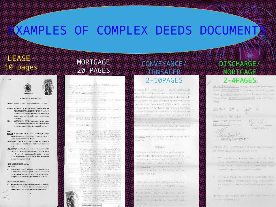
LEASE-10 pages
MORTGAGE20 PAGES
CONVEYANCE/TRNSAFER2-10PAGES
DISCHARGE/MORTGAGE2-4PAGES
EXAMPLES OF COMPLEX DEEDS DOCUMENTS
3) Future Plans• APPROVED FORMS AVAILABLE ELECTRONICALLY
• ELECTRONIC LODGMENT OF DOCUMENTS
• APPROVED The Stamp Duty to relocate from the Ministry of Finance to the MNRE.
• OSCAR- OPEN SOURCE CADASTRE AND REGISTRATION
- MNRE GOAL- reduce the cost of software licenses- Build up MNRE expertise software develop & soft ware support, mainly reduce dependency on overseas experts.

OTHER FUTURE LAND ADMINISTRATION•MNRE wide limited, read only access to Samoa Viewer (GIS viewer)
•Digital Lodgment for Registration Dealings and Cadastral Survey.
•Cadastral & Registration Digital Archive.
•MNRE wide limited, read only access to Land Registration System.
•Land Registration System (software) support including enhancements for the Unit (Strata) Title Legislation, valuation and requisition notices (etc).

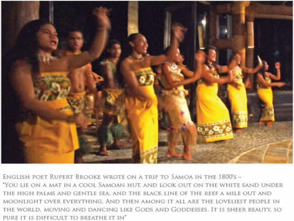
“THANK YOU”
“ FROM SAMOA”
“FAAFETAI LAVA”


RAINFOREST

LALOMANU BEACH

SAMOAN SPA

ROBERT LOUIS STEVENSON AT VAILIMA

SAVAII

SAVAII

SURF

RAINFALL


PLACE FOR HONEYMOON

POLICE BAND


