17
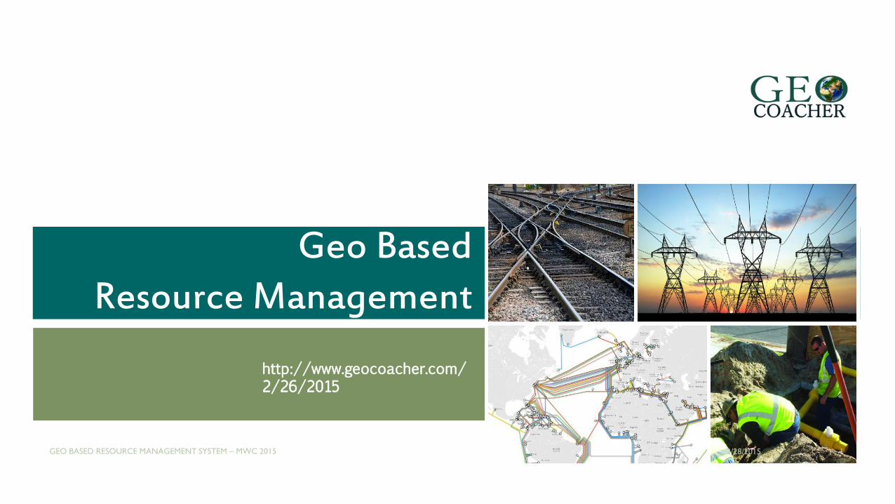
Geo Based Resource Management http://www.geocoacher.com/ 2/26/2015 2/28/2015 GEO BASED RESOURCE MANAGEMENT SYSTEM – MWC 2015 1 Geo Based Resource Management
| Date post: | 21-Aug-2015 |
| Category: |
Presentations & Public Speaking |
| Upload: | anatolie-golovco |
| View: | 149 times |
| Download: | 1 times |
Geo Based Resource Management
http://www.geocoacher.com/2/26/2015
2/28/2015GEO BASED RESOURCE MANAGEMENT SYSTEM – MWC 2015 1
Geo Based Resource Management

GRM – Geo Based Resource Management System makesit easy and simple to have all infrastructure elements ona map, base decisions on real data and update yourinfrastructure in real time.
Nowadays, a GRM system becomes a tool of utmostimportance in the activity of a company who’s gotinfrastructure to manage.
DEFINITION
2/28/2015GEO BASED RESOURCE MANAGEMENT SYSTEM – MWC 2015 2
WHY USE GRM?
Companies with infrastructure to manage are familiar with a series of problems.
Issues with paper based infrastructure documentation
Extremely limited possibilities when it comes to using paper based data
Infrastructure information is spread in different offices
Single point of knowledge about company infrastructure is non-existent
2/28/2015GEO BASED RESOURCE MANAGEMENT SYSTEM – MWC 2015 3

ISSUES
Issues with data collection
There is no standardized strategy for collecting and storing data
GIS data is collected and locked in proprietary software and can’t be extracted
It is impossible to track who created or edited certain data
Issues with data analysis
It is impossible to get the big picture of all infrastructure elements
There is no way for infrastructure operators to make geospatial analysis
There is no way marketing department can benefit from diagrams and reports based on geographical information
2/28/2015GEO BASED RESOURCE MANAGEMENT SYSTEM – MWC 2015 4
ISSUES
Issues with general purpose maps (ex: Google Maps and Earth)
There is a big gap in accuracy of the information presented on the map
Often updates of the generic map can jeopardize already existing data
License terms forbid deriving data from public imagery services and using Google Maps for corporate purposes
Issues with generic GIS Software (ex: Arcgis, MapInfo)
Too complex to be operated internally, by non-GIS people
Over-priced and over-qualified software, which original purpose wasn’t corporate infrastructure management but state land survey
2/28/2015GEO BASED RESOURCE MANAGEMENT SYSTEM – MWC 2015 5

HOW TO ADDRESS THESE ISSUES?
The solution would be to use a dedicated system, designed toaddress the problems infrastructure operators are faced with.
A solution which can be customized and adapted to suit eachcompany particularly.
A solution which would rise an operator to a new level inmanaging infrastructure related data, and mainly, to GIS maturity.
Such solution would include features like:
2/28/2015GEO BASED RESOURCE MANAGEMENT SYSTEM – MWC 2015 6
SOLUTION FEATURES
Complete ownership over the data, complete traceability and elimination of vendor lock-in
Centralized point of data management for infrastructure related GIS data
Easy digitization and collaborative data collection tools
Big data visualization in graphical way for executives
Assistance for management in making strategic decisions (like network expansions)
SOA integration with existing systems
Simple data extraction in any GIS format
2/28/2015GEO BASED RESOURCE MANAGEMENT SYSTEM – MWC 2015 7

WHAT IS GIS MATURITY?
A GIS maturity level is the stage at which aninfrastructure operator can find themselves inimplementing and using a GIS System
Let’s further look at 3 development levels in detail
2/28/2015GEO BASED RESOURCE MANAGEMENT SYSTEM – MWC 2015 8

GIS MATURITY – LEVEL 1 - VISUALIZATION
At the first stage, an operator can simply visualizeGIS data, usually generated by suppliers in web form,CAD files or paper based maps/schemas.
They don’t know and don’t care about coordinatesystems, data models, normalization, versionedgeodatabases, file formats, or any of the otherissues.
2/28/2015GEO BASED RESOURCE MANAGEMENT SYSTEM – MWC 2015 9
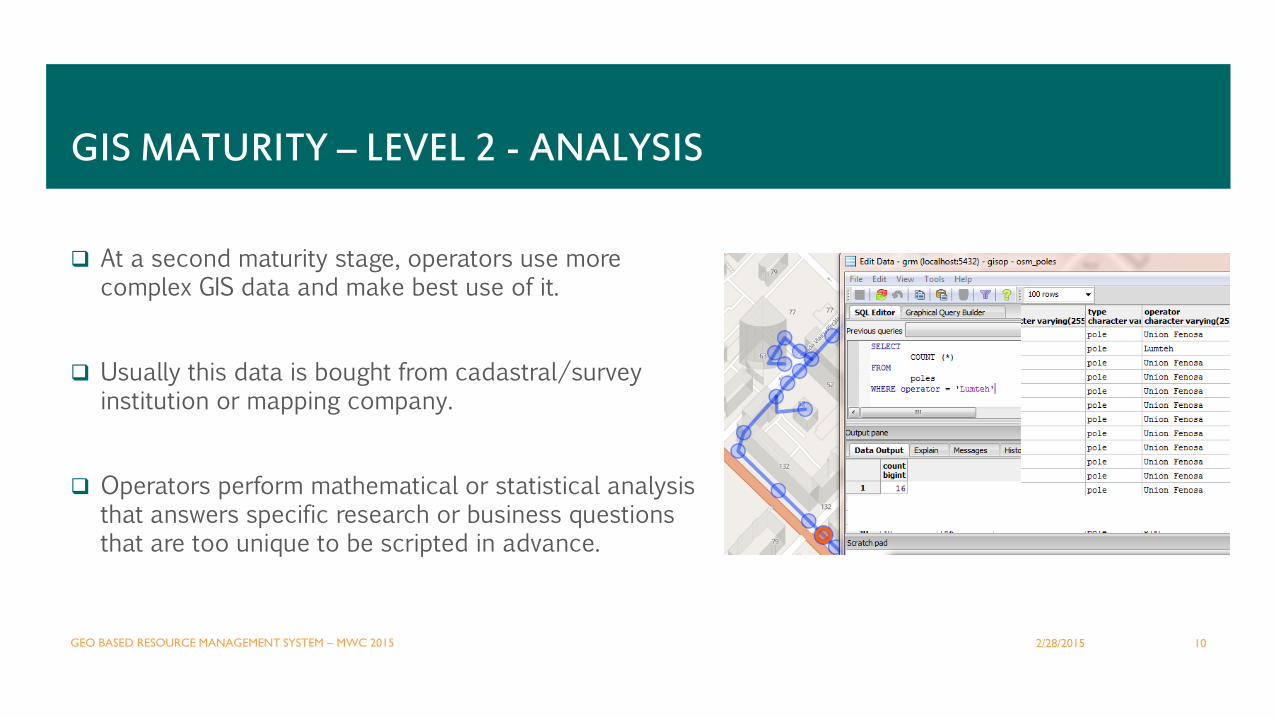
At a second maturity stage, operators use more complex GIS data and make best use of it.
Usually this data is bought from cadastral/survey institution or mapping company.
Operators perform mathematical or statistical analysis that answers specific research or business questions that are too unique to be scripted in advance.
GIS MATURITY – LEVEL 2 - ANALYSIS
2/28/2015GEO BASED RESOURCE MANAGEMENT SYSTEM – MWC 2015 10

At this stage, the company is creating in-house data and/or enrich geo data that they already have.
The implementing company becomes self-served GIS data providers for every GIS enabled software used internally.
EX: Network operations, radio planning, troubleshooting, network development, geo-enabled marketing, geo-services, telemetry, SCADA.
GIS MATURITY – LEVEL 3 – CREATING AND MAINTAINING DATA
2/28/2015GEO BASED RESOURCE MANAGEMENT SYSTEM – MWC 2015 11

HOW TO REACH GIS MATURITY?
Reaching the third maturity level can be hard and tedious when done with improper software andpartners. Or, it can be simplified and bring more value when implemented by experts.
Our GRMS implementation team can assist your company to reach the highest GIS maturity level.Besides, we will coach you in traversing successfully following phases:
2/28/2015GEO BASED RESOURCE MANAGEMENT SYSTEM – MWC 2015 12

GIS MATURITY STEP-BY-STEP
Analysis of your company specifics
comprising data models
determining potential infrastructure related data sources and visualization model
researching interoperability integration needs
GRM adaptation and development if needed
Installing and configuring GRM Server
Start data digitization process from paper based documents or by importing data in the system
can be done by non-GIS personnel
Interoperability integration with other relevant systems
Setup data exports for reuse by various systems and departments
Set up dashboards for executives
2/28/2015GEO BASED RESOURCE MANAGEMENT SYSTEM – MWC 2015 13

DATA COLLECTION FLOW
2/28/2015GEO BASED RESOURCE MANAGEMENT SYSTEM – MWC 2015 14

DEPLOYMENT OPTIONS
SaaS model
Installation is done in a cloud, with VPN access andwith industry grade security.
On Premise model
Installation on customer owned hardware, in anisolated environment, fully controlled by owner.
2/28/2015GEO BASED RESOURCE MANAGEMENT SYSTEM – MWC 2015 15

ABOUT US
We are small company born from its founder’s passion forgeoinformatics.
We believe that geo informational system can transform the wayinfrastructure is documented, managed and developed.
Our size allows us flexibility to adapt the solution for specificcustomer needs.
Being based in Moldova, Eastern Europe we can propose competitivepricing for international market.
2/28/2015GEO BASED RESOURCE MANAGEMENT SYSTEM – MWC 2015 16

CONTACTS
Anatolie Golovco
GeoCoacher Founder
Phone: +373 792 709 54
Website: http://geocoacher.com/
Email: [email protected]
2/28/2015GEO BASED RESOURCE MANAGEMENT SYSTEM – MWC 2015 17


![Grm p1 Final[1]](https://static.documents.pub/doc/80x56/577cdfdb1a28ab9e78b222b6/grm-p1-final1.jpg)


