46
Ground Water
| Date post: | 15-Dec-2015 |
| Category: |
Documents |
| Upload: | kamryn-nipps |
| View: | 222 times |
| Download: | 1 times |
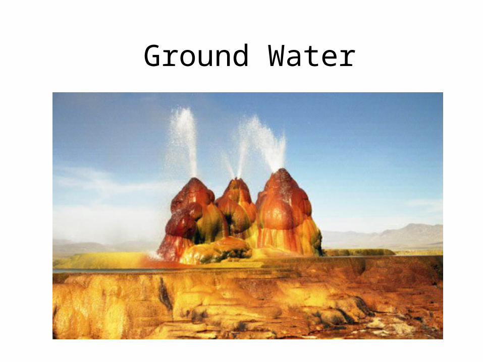
Ground Water

Today’s Plan: Groundwater
• Groundwater
• Aquifer / aquitard
• Water table
• Groundwater flow
• Wells & springs
• Groundwater contamination

What is Groundwater?
• Rain and snowmelt that infiltrate the ground.
• Soil and rock act as giant sponges, they are full of tiny pores and cracks that are usually less than millimeters in size which allows water to infiltrate and collect underground.
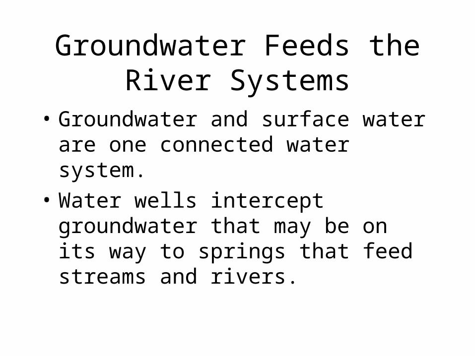
Groundwater Feeds the River Systems
• Groundwater and surface water are one connected water system.
• Water wells intercept groundwater that may be on its way to springs that feed streams and rivers.

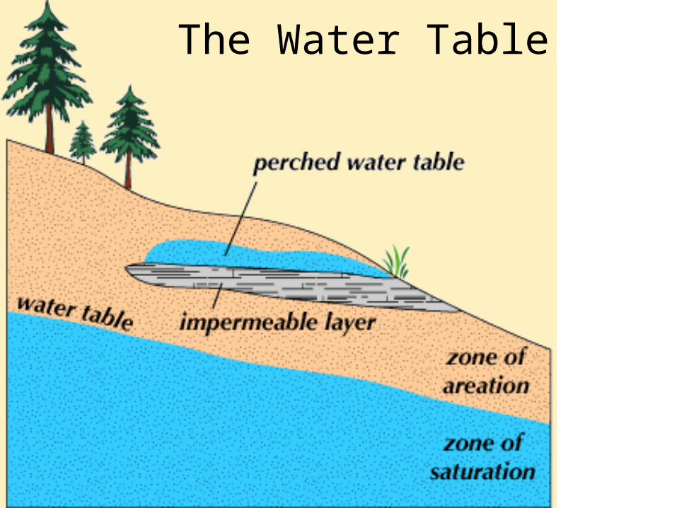
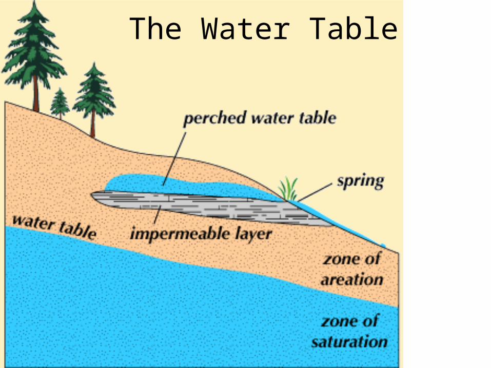
The Water Table

•Unsaturated zone: through which water moves downward and whose pore space is not completely filled. •Saturated zone: in which water collects and whose pore space is completely filled. •The plane of separation between these two zones is the water table.
The Water Table

Groundwater Basics
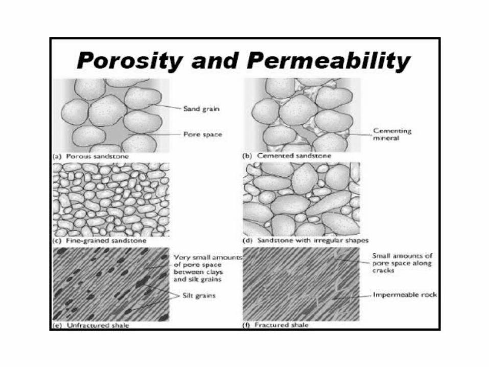
Beds of rock, sediment, and regolith with high porosity (% of pore space) are better suited to holding groundwater.
• Aquifers: Beds that hold large amounts of groundwater.
• Types of pore space:
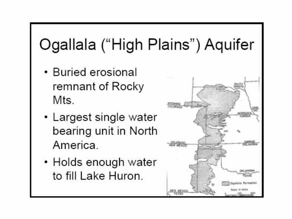
• Space between grains. (E.g Oglala aquifer.)

Permeability:
• Just because pore space exists doesn't mean that water can flow through it. Pores may be isolated.
• Permeability: the ability of a solid to allow fluids to pass through.

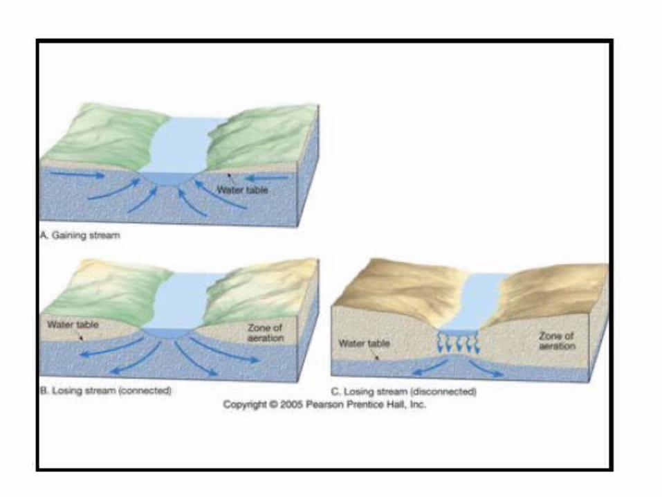
Big concept I:
• The Water Table is the basic description of how groundwater interacts with rocks.
• If I pour water into a bucket of unconsolidated sand, the water won't spread evenly through the bucket. It will collect at the bottom. As a result, we will have two hydrologic zones in the bucket:
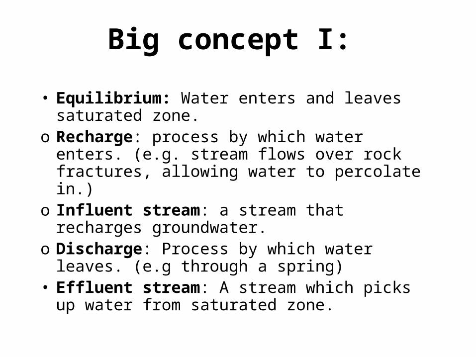
• Equilibrium: Water enters and leaves saturated zone.
o Recharge: process by which water enters. (e.g. stream flows over rock fractures, allowing water to percolate in.)
o Influent stream: a stream that recharges groundwater.
o Discharge: Process by which water leaves. (e.g through a spring)
• Effluent stream: A stream which picks up water from saturated zone.
Big concept I:

Aquifers are permeable layers of rock and sediment
that have groundwater in enough quantity to supply
wells.

Aquifers:
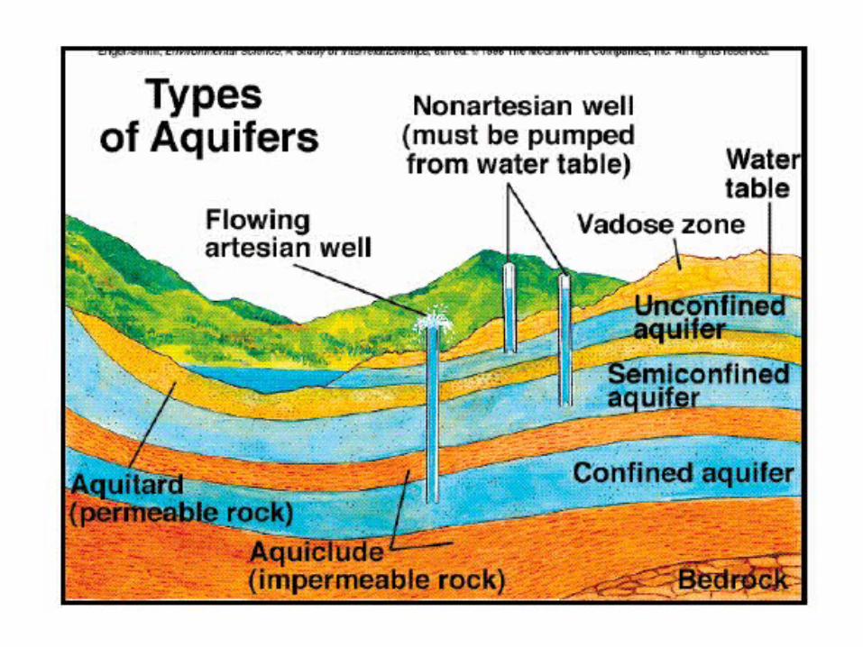
• Aquifers can be unconfined or confined by impermeable rock layers called aquicludes.
• In an unconfined aquifer, water flows freely. The water table tends to approximate the topography of the landscape.
• In a confined aquifer, water flow is restricted by impermeable layers called aquicludes. Their presence can have two consequences:

Opposite of an aquifer?
• Aquitard / aquiclude– retards the flow of groundwater (it’s almost
never really zero

Groundwater: aquifers• What would be the properties
(porosity/permeability) of conglomerate?• High porosity, high permeability
Groundwater: aquifers• What would be the properties (porosity/permeability) of
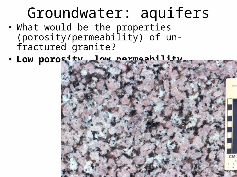
un-fractured granite?• Low porosity, low permeability
Groundwater: aquifers
• Can you think of a rock/sediment with high porosity and low permeability?
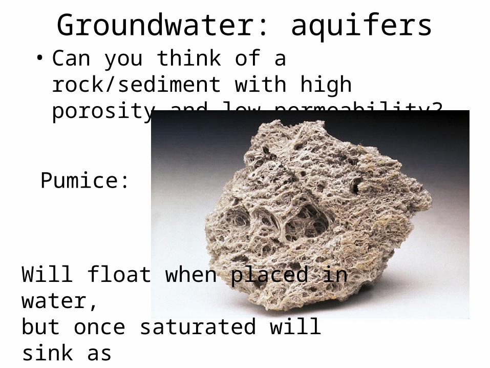
Groundwater: aquifers• Can you think of a rock/sediment with high
porosity and low permeability?
Will float when placed in water, but once saturated will sink as any rock would.
Pumice:

Groundwater: aquifers
• Can you think of a rock/sediment with low porosity and high permeability?
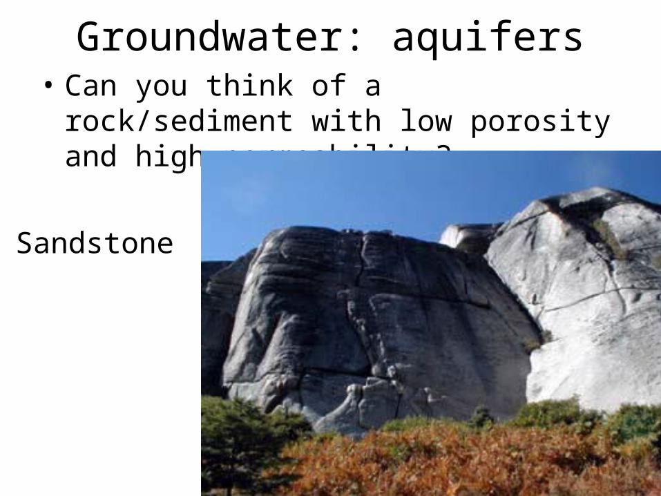
Groundwater: aquifers• Can you think of a rock/sediment with low
porosity and high permeability?
Sandstone
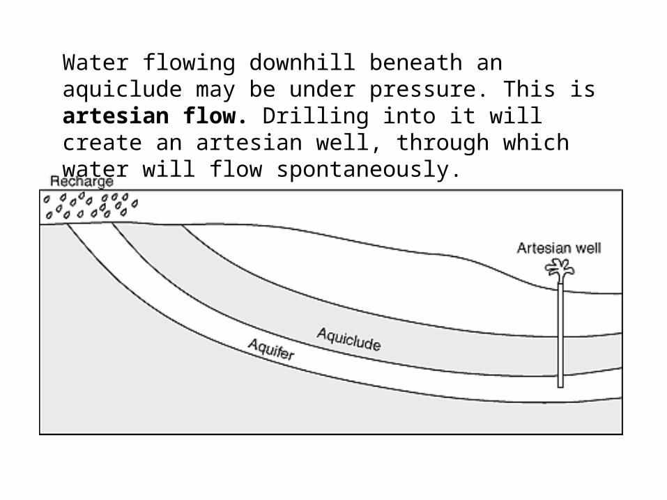
Water flowing downhill beneath an aquiclude may be under pressure. This is artesian flow. Drilling into it will create an artesian well, through which water will flow spontaneously.


Water Table Topography
slope = hydraulic gradient
The Water Table
The Water Table


As water moves through the ground, it dissolves
minerals. When the groundwater cools or
evaporates, the dissolved minerals are often left
behind as deposits such as travertine, geyserite,
petrified wood, stalactites, stalagmites, and the
cement that binds sedimentary rocks.
VOCABULARY
Groundwater and GeologyGroundwater
Travertine is a calcite deposit.
mineral deposit
cavern
karst topography
Limestone Cave Formation
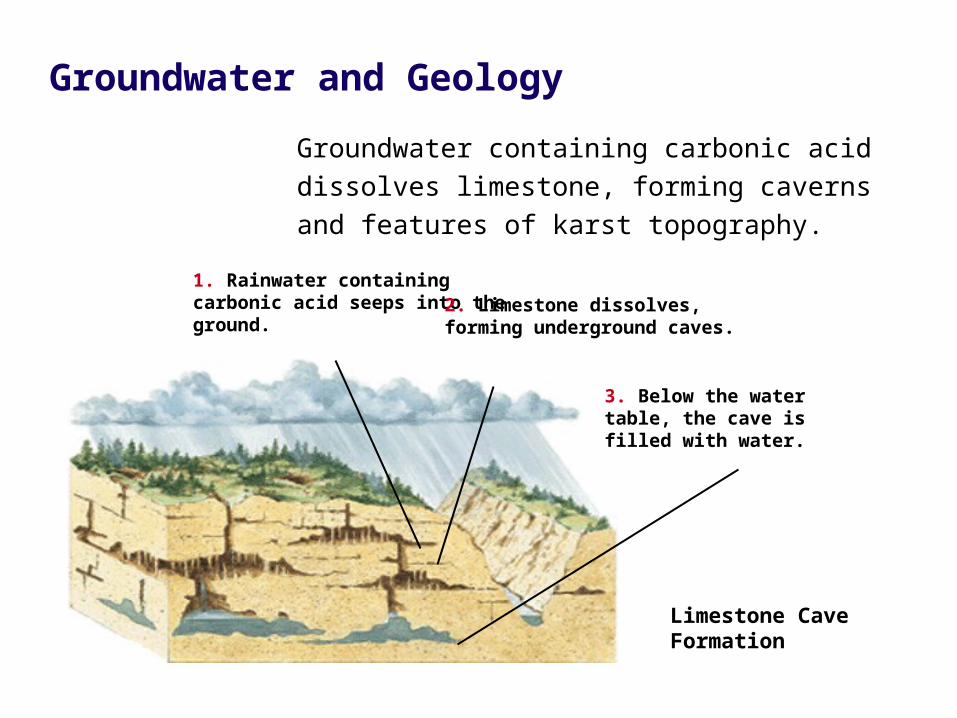
Groundwater containing carbonic acid dissolves
limestone, forming caverns and features of karst
topography.
Groundwater and Geology
1. Rainwater containing carbonic acid seeps into the ground. 2. Limestone dissolves, forming
underground caves.
3. Below the watertable, the cave isfilled with water.

• Mineral deposit: A deposit that is left behind when groundwater that contains minerals cools or evaporates.
• Cavern: A large underground chamber.
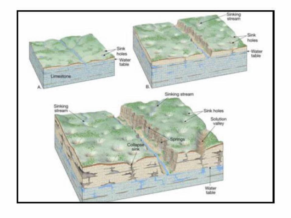
• Karst topography: Topography characterized by sinkholes, sinkhole ponds, lost rivers, and underground drainage; forms in areas with bedrock made of calcite, dolomite, or other minerals that dissolve easily.
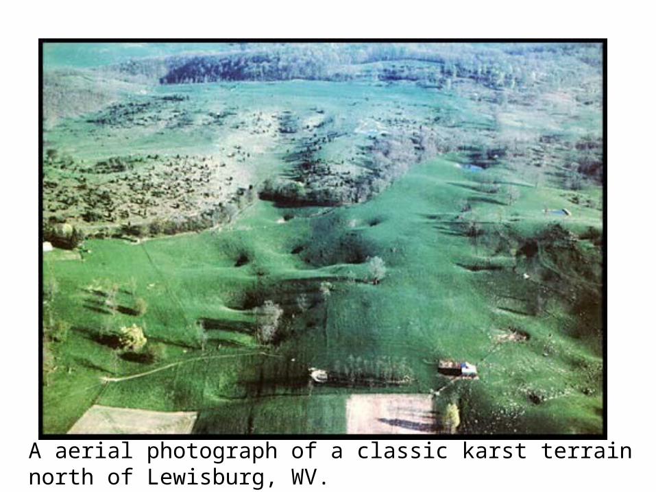
A aerial photograph of a classic karst terrain north of Lewisburg, WV.
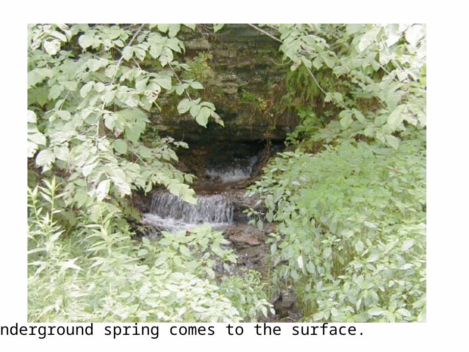
Underground spring comes to the surface.
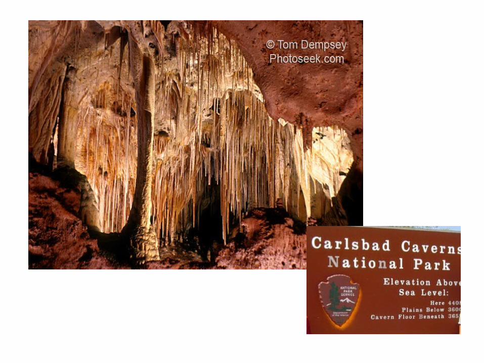

• Kartchner Caverns: Limestone deposit
stilagtites
stalagmites stalagmites stalagmites
stalagmites
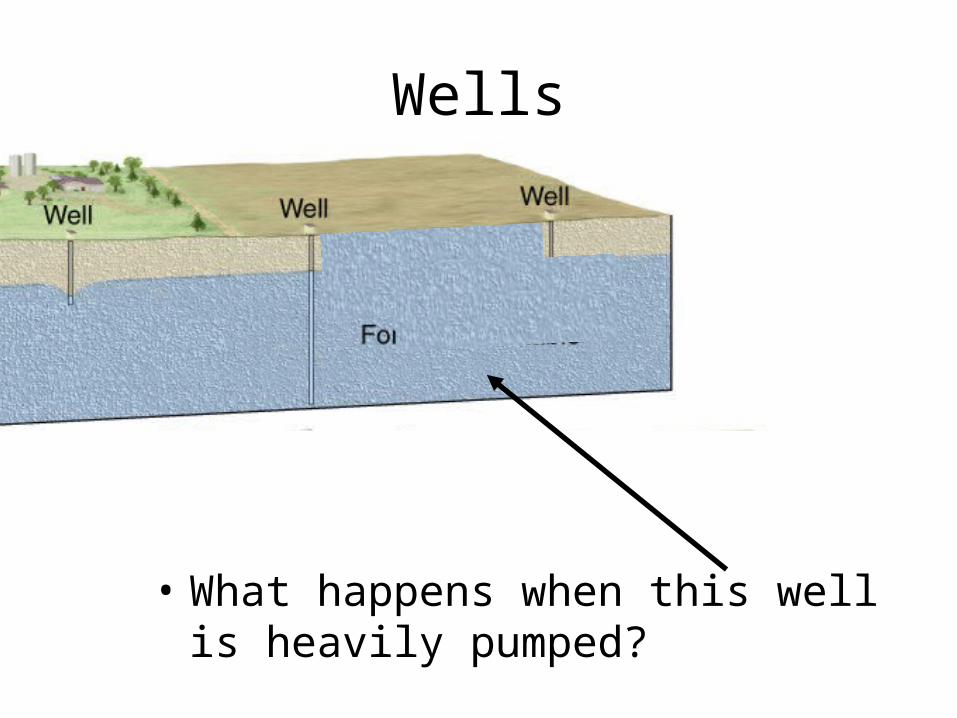
Wells
• What happens when this well is heavily pumped?


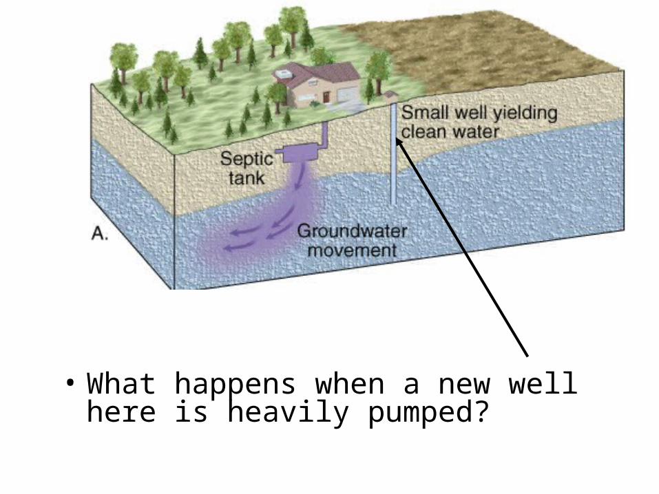
• What happens when a new well here is heavily pumped?
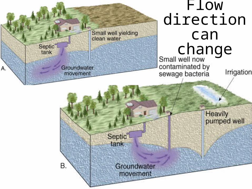
Flow direction can
change

Formation of a Cone of Depression
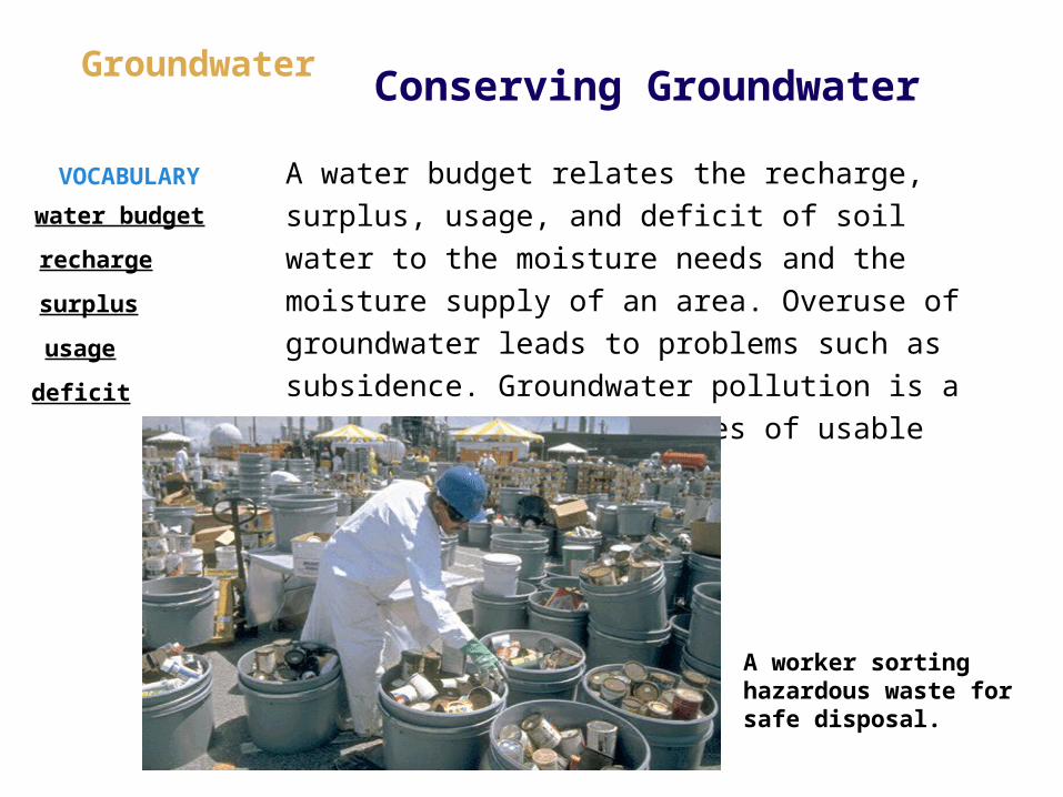
A water budget relates the recharge, surplus, usage,
and deficit of soil water to the moisture needs and
the moisture supply of an area. Overuse of
groundwater leads to problems such as subsidence.
Groundwater pollution is a serious threat to supplies
of usable water.
VOCABULARY
Conserving GroundwaterGroundwater
A worker sorting hazardous waste for safe disposal.
water budget
recharge
surplus
usage
deficit


