30

Contents
gvSIG's background & updates3D visualization in gvSIGTime and Animation in gvSIGImplementation planDemo

gvSIG BackgroundMostly funded by Regional Ministry of Infrastructure and Transport of Valencia, Spain & EU FundsDeveloped by IVER, Prodevelop & other companies and universitiesGPL LicenseJava. Multiplatform support (Windows, Linux, Mac)GUI in 12 languages, Spanish & English manualsFirst released in October 2004Version 1.1 is available now!
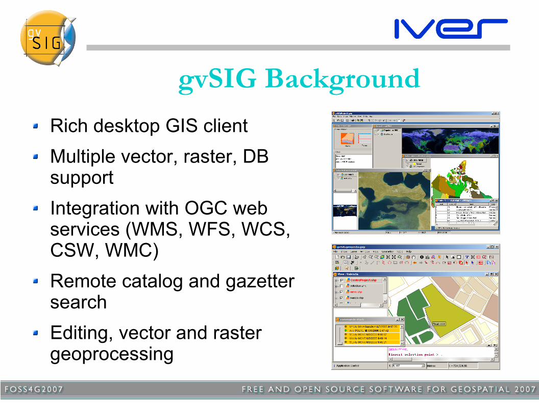
gvSIG BackgroundRich desktop GIS clientMultiple vector, raster, DB supportIntegration with OGC web services (WMS, WFS, WCS, CSW, WMC)Remote catalog and gazetter searchEditing, vector and raster geoprocessing
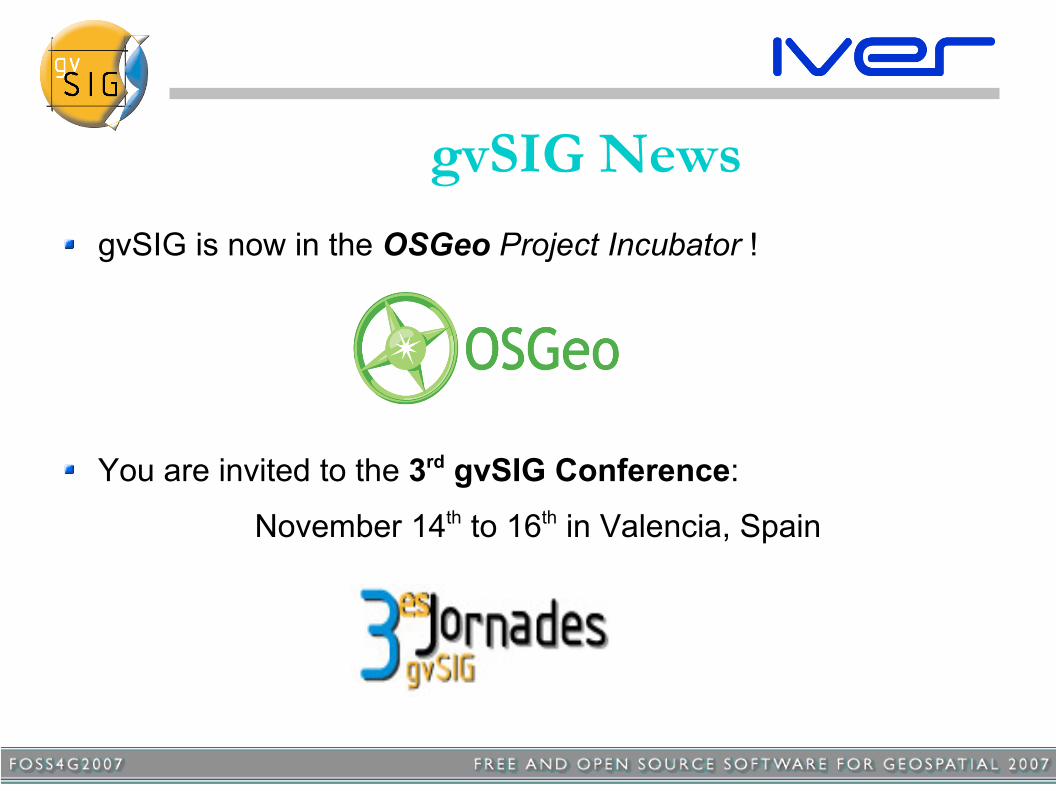
gvSIG NewsgvSIG is now in the OSGeo Project Incubator !
You are invited to the 3rd gvSIG Conference:
November 14th to 16th in Valencia, Spain

gvSIG UpdatesRecent improvements:
JCRS Extension to manage Coordinate Reference Systems and transformationsField calculatorArcSDE and Oracle DB connectorsDB connection manager (GeoDB)Field calculatorLoading DWG R14SEXTANTE integration

gvSIG UpdatesJCRS

gvSIG UpdatesField calculator

GeoDB
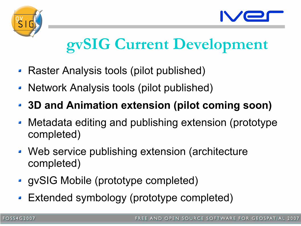
gvSIG Current DevelopmentRaster Analysis tools (pilot published)Network Analysis tools (pilot published)3D and Animation extension (pilot coming soon)Metadata editing and publishing extension (prototype completed)Web service publishing extension (architecture completed)gvSIG Mobile (prototype completed)Extended symbology (prototype completed)

gvSIG Current DevelopmentMetadata editing & publishing

gvSIG Current DevelopmentExtended symbology

3D VisualizationObjectives:
Cool navigation and pretty pictures... but also...Fully integrated with regular GIS layers and toolsUse of local and remote dataDynamic change of layer propertiesBoth globe-like and XY+Z viewsOn-the-fly terrain data fusion and multiple surfaces

3D Views in gvSIGUse gvSIG's document-type extensibilityShare most properties with 2D Views
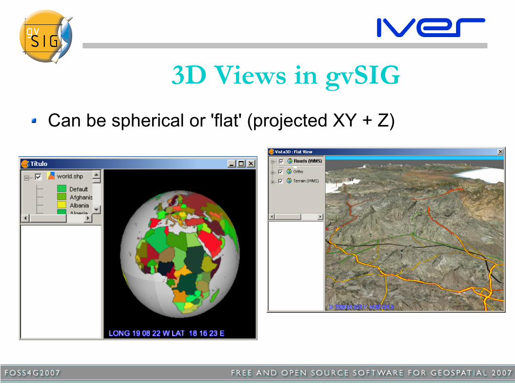
3D Views in gvSIGCan be spherical or 'flat' (projected XY + Z)

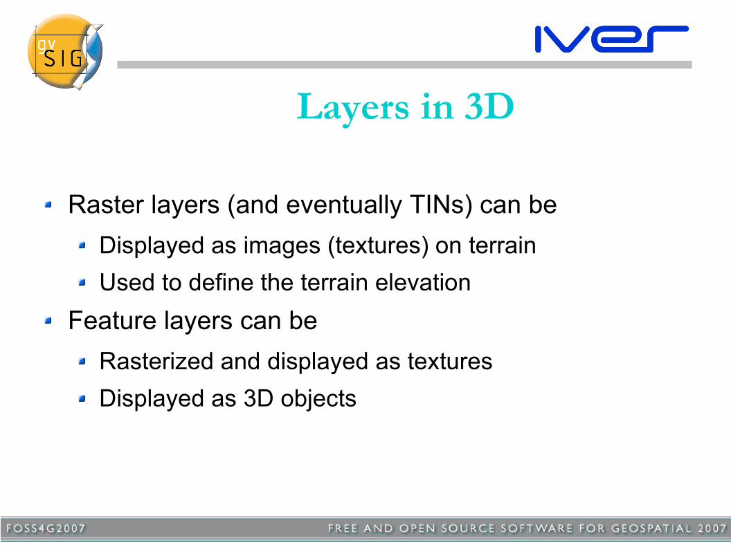
Layers in 3DLayers are the same in 2D and 3D (can be copied/pasted),
with some additional properties in 3D → all gvSIG data sources are supported in 3D
Layers in 3D
Raster layers (and eventually TINs) can beDisplayed as images (textures) on terrainUsed to define the terrain elevation
Feature layers can beRasterized and displayed as texturesDisplayed as 3D objects
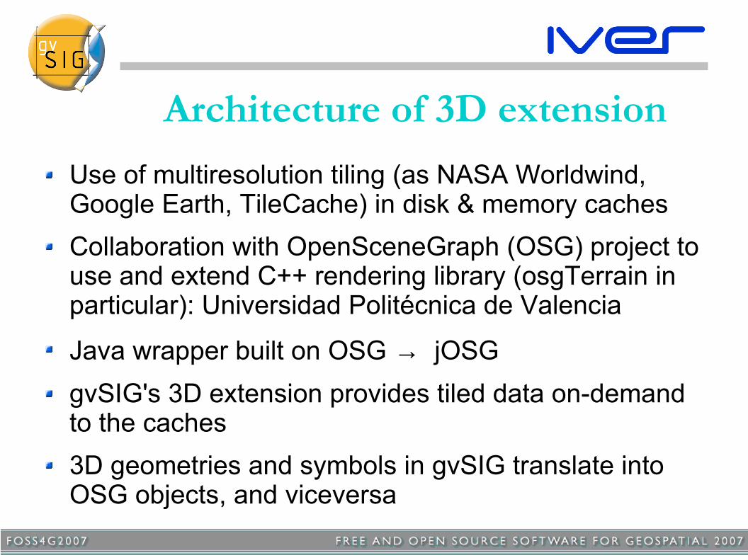
Architecture of 3D extensionUse of multiresolution tiling (as NASA Worldwind, Google Earth, TileCache) in disk & memory cachesCollaboration with OpenSceneGraph (OSG) project to use and extend C++ rendering library (osgTerrain in particular): Universidad Politécnica de Valencia
Java wrapper built on OSG → jOSGgvSIG's 3D extension provides tiled data on-demand to the caches3D geometries and symbols in gvSIG translate into OSG objects, and viceversa

Architecture of 3D extension
Data Sources
Multiresolutioncaché (disk)gvSIG's 3D Extension
libjOSG
Open Scene Graph
OpenGL rendering
Scene graph(memory)
3. Tile paging in1. Tile request
2. Tile caching
(Add/remove layers...)

Integration with gvSIG toolsExample: gazetter service search
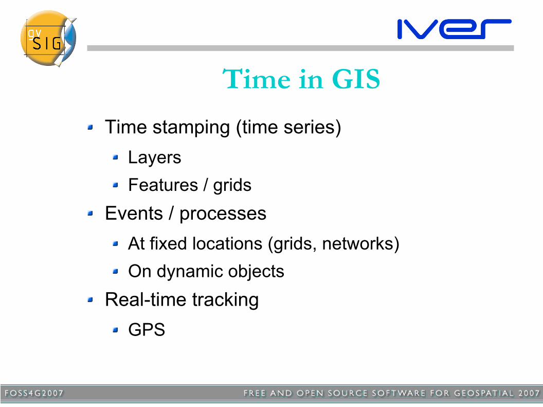
Time in GISTime stamping (time series)
LayersFeatures / grids
Events / processesAt fixed locations (grids, networks)On dynamic objects
Real-time trackingGPS

Time in GISA set of related problems:
Temporal sources, acquisitionData modelStorageQuery / Visualization / AnimationAnalysis

Time in gvSIG: approachFirst steps:
Time-stamped data supportFeatures (time as an attribute)RasterTime dimension in web services
Visualization / animation frameworkCombine out-of-the-box animation types:
For temporal dataView and layer animation (important for presentation purposes)
Extensibility of animation types

Time in gvSIG: approachFuture steps:
Time Reference Systems, 4D extent controlTime-dependent symbologyEvents and processesDynamic simulation framework4D analysis & geostatistics
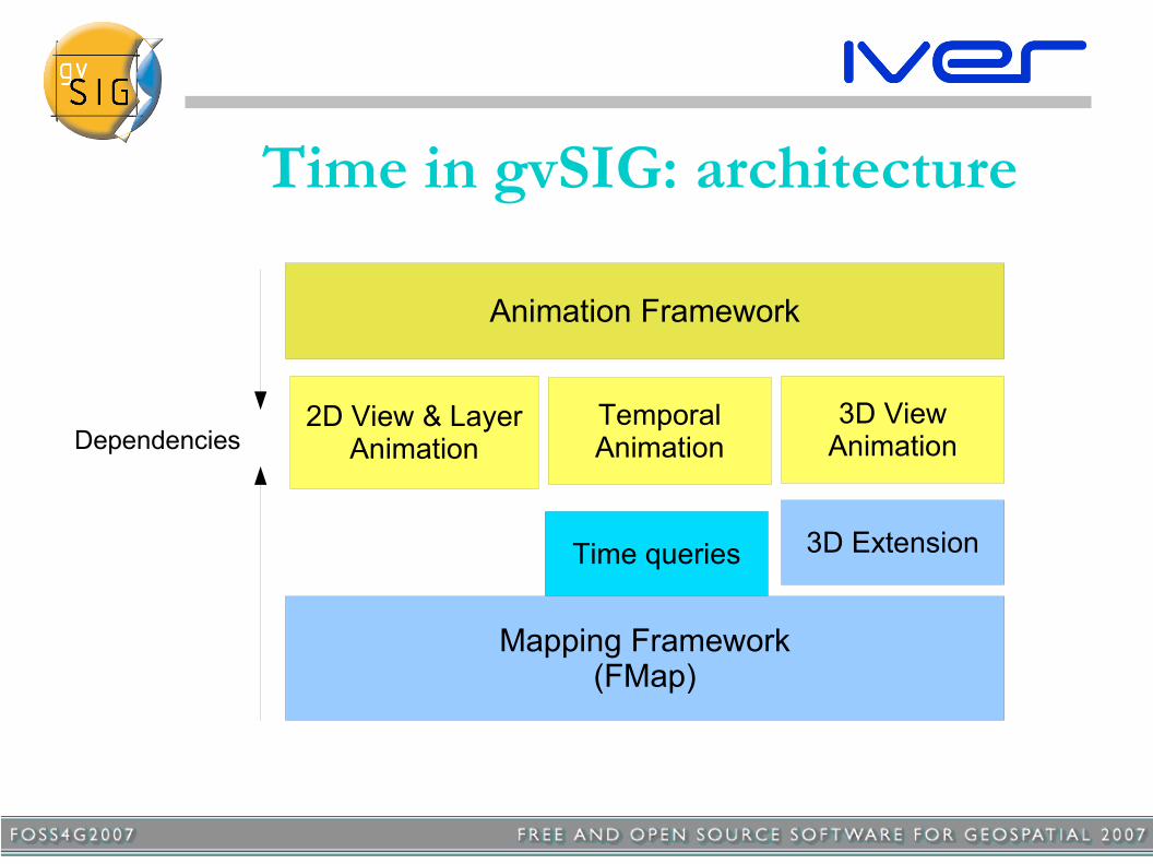
Time in gvSIG: architecture
Mapping Framework(FMap)
3D Extension
Animation Framework
Time queries
2D View & LayerAnimation
3D ViewAnimation
TemporalAnimationDependencies
Animation FrameworkEach project contains one or more Animation Tracks, each of a specific Animation Type (view, layer visibility, temporal...) and controlling a specific object
Two kinds of tracks:
'Arbitrary time' tracks: t ∈[0, 1] (e.g. for view animation). Can be defined by keyframes or functions'Dated time' tracks: t defined by year, month, day... but also mapped to arbitrary time [0, 1] (these are used for temporal data animation)
Both kinds of tracks can be played simultaneously with any desired duration or number of frames

Temporal Data AnimationDated time tracks interpolate a dated 'time window' (e.g. a week) between starting and ending dates
The changing time window is applied as a 'temporal filter' to display the layer for each new animation frame
Multiple dated tracks have consistent dates by default, but user can introduce shifts to superimpose data from different times
2004 2007
2006 2009
Consistent (not shifted)
2004 2007
2006 2009
Superimposed (shifted)

Animation GUIThe Animation GUI works with all Animation Types registered by gvSIG Extensions
Simple tools allow users to create view and temporal animation tracks
Animation play controls provide a simple way to control the animation by duration or number of steps

Implementation & Release Plan
Pilot (install on gvSIG 1.1) 2007 Q4Basic 3D & Animation 2008 Q1Temporal Data Animation 2008 Q3Full functionality 2009 Q1
Thanks!Find more about gvSIG at
www.gvsig.gva.es
Subscribe to mailing lists for info and support
Salvador Bayarri – [email protected]


