Page 1
Hands on the Land Lesson Plan
Weathering, Erosion & Deposition
Grade 6
Bureau of Land Management
Jupiter Inlet Lighthouse Outstanding Natural Area 600 State Road 707, Jupiter, FL 33469
561-295-5953 www.BLM.gov/jupiterONA
Eastern States
Jupiter Inlet Lighthouse Outstanding Natural Area
Page 2
Lesson Plan
Course: Grade 6 Science
Course Number: Big Idea 6 – Earth’s Structures
Lesson Plan Date: March 2017
Lesson Title: Weathering, Erosion & Deposition
Time: 60 minutes (in class) + 2 hours (in the field)
Instructor Preparation: (Prior to site visit)
Review Safety Precautions for ONA
Review Pre-Trip preparations
Pre-view field trip activities
Prepare students with vocabulary and knowledge of general land forms and geological
processes.
Site Prep and Equipment:
a. For all field trips please check the Lighthouse and ONA websites at:
http://www.jupiterlighthouse.org/plan/school-field-trips/
www.BLM.gov/jupiterONA
b. Activity overview: Students will make observations, record their observations
and make inferences regarding weathering, erosion, deposition and land forms
at the Jupiter Inlet Lighthouse Outstanding Natural Area.
c. Students should define the Vocabulary and have some knowledge of geological
processes and land forms prior to the site visit. The following web sites may be
helpful with this preparation:
National Geographic -dynamic-earth, weathering & erosion
Atlanta School District Weathering-Erosion-Deposition.ppt
cpalms.org - Lesson- 151675 – Contains photos of Florida landforms
d. Make copies of the Map and Data table for each student sheets for each
student, printing may be front and back.
e. Preview map and data table sheets with students and explain what they will be
doing on the site.
Main Objective:
The main objective of this field experience is to have students make observations, identify
various geological processes and features and make inferences as to the forces at work,
results of those forces and prevention of some of those forces.
Page 3
Est.
Time
Visuals and Notes
Content
30
min.
Introduction: (Pre-trip)
Weathering, Erosion &
Deposition PowerPoint
Atlanta School District
Weathering-Erosion-
Deposition.ppt
Warm-up:
Define & Discuss
Vocabulary
See attached Vocabulary
List and Answer Key
See
Site specific “Weathering,
Erosion and Deposition”
PowerPoint
PowerPoint contains 47 slides explaining Weathering,
Erosion, Deposition including erosion control, river formation,
website links and review questions.
Students can define vocabulary during PowerPoint.
Vocabulary:
Chemical Weathering – breaking up of earth’s surface by
chemical process such as oxidation, dissolved by acids or
water.
Coastline – area where the land meets the water usually an
ocean.
Delta – A landform that is formed by sediment deposited at
the end of a river as it flows into a lake or ocean.
Deposition – The ending place for soils, rocks or sediments
have been deposited by erosion.
Dune – A hill or ridge of sand piled up by wind or water.
Erosion – The movement of soil or rock from one place to
another, usually by water or wind.
Glacier – a large body of ice moving slowly down a slope or
across land.
Lake – A large body of water surrounded by land.
Mechanical Weathering – breaking up of the earth’s surface
by a physical occurrence such as water freezing and thawing,
wind, plant roots, animals digging human activity.
Mountain – A large natural elevation of the earth’s surface
raising abruptly from the surrounding land.
River – a large, natural, body of water flowing within a
channel or course usually to ocean.
Sediments – small pieces of rock or soil that are carried by
erosion and deposited in another location.
Shoreline – area where the water of a river or lake meets the
land.
Weathering – The breaking up of earth’s surfaces into
smaller and smaller pieces by forces of water and air in the
atmosphere.
Page 4
10
Min.
Hook 1:
Land Forms
Have students write down 2-3 land forms that they have
observed in or around their community and 2-3 land forms
that are not in or around their community.
Discuss answers in class, on board, list land forms that are
local and those that are not local. Try to list as many different
land forms as possible, suggest others if not mentioned.
10
Min.
Hook 2:
Weathering, Erosion &
Deposition
Have students list 1-2 weathering processes they have
observed in or around their community and 1-2 erosion &
deposition processes they have observed in or around their
community and possible solutions to the erosion they listed.
Discuss answers and add other local erosion issues if not
mentioned.
10
Min.
Pre-trip
See Activity Map
Attached
See attached ONA Rules
and Guidelines
See attached
How to Be A Great
Chaperon
Show students the “Activity Map” and explain that this is the
location they will be visiting and that they will be mapping
the locations where they observe the various geological
features and processes using a symbol for each observation
and describing what they are observing on the “Data Table”.
Discuss safety requirements of the field visit:
a. Chaperones, 1 per 10 students.
b. Closed-toe shoes are required for all activities.
(old tennis shoes work best for water shoes)
c. Bring water, each student should have a water bottle!
d. A floppy hat for shade may be helpful.
e. Stay with partners/team/group (use the buddy system)
f. Be careful of your surroundings: some plants are
poisonous or have sharp thorns and some animals may
be venomous.
g. Don’t touch anything you haven’t been told to touch.
h. Follow your group’s protocol for emergencies.
i. Report any injury or concern to site staff.
Page 5
2 +
Hours
Field Trip Activity
See attached Data Table
See attached Follow-up
Questions
See attached Follow-up
Question Answers
The main objective is for students to observe, identify and
interpret land forms and geological processes that are
present on the Jupiter Inlet Lighthouse Outstanding Natural
Area (Lot 17).
Each student will have a map of the area and a data table on
their clipboard as they take a walking tour of the area.
On the walking tour of the site, students are to observe
(teacher or ranger may point out several to help students
understand the assignment) examples of different landforms
and the processes of weathering, erosion, deposition, and
erosion control on the site.
Students will do the following:
1. Mark the location of the feature they observed on their
map using a number.
2. Write the two-letter feature symbol on the corresponding
location number from their map on the numbered row on the
Data Table.
3. Write a brief description of the observed feature in
column three of the Data Table.
4. Answer the follow-up questions.
**The teacher/guide of the tour will need to make
observations as the site may change from time to time and
predictions as to student answers cannot be determined.
Our Support Objectives are for students to recognize that
there are different weathering processes, what erosion is and
the effects of erosion and the importance of controlling
erosion in certain circumstances in different locations.
Page 6
Big Idea 6: Earth Structures
Over geologic time, internal and external sources of energy have continuously altered the
features of Earth by means of both constructive and destructive forces. All life, including
human civilization, is dependent on Earth's internal and external energy and material
resources.
SC.6.E.6.1 Describe and give examples of ways in which Earth's surface is built
up and torn down by physical and chemical weathering, erosion,
and deposition.
Cognitive Complexity: Level 2: Basic Application of Skills &
Concepts
SC.6.E.6.2 Recognize that there are a variety of different landforms on Earth's
surface such as coastlines, dunes, rivers, mountains, glaciers,
deltas, and lakes and relate these landforms as they apply to
Florida.
Cognitive Complexity: Level 2: Basic Application of Skills &
Concepts
Access Point for Students with Significant Cognitive Disabilities
Independent
SC.6.E.6.In.1
Describe how
weathering and erosion
reshape the Earth’s
surface.
Date Adopted or Revised:
02/08
SC.6.E.6.In.2
Identify various
landforms in Florida,
including coastlines,
rivers, lakes, and dunes.
Date Adopted or Revised:
02/08
Supported
SC.6.E.6.Su.1
Recognize that
wind and water cause
physical weathering and
erosion.
Date Adopted or Revised:
02/08
SC.6.E.6.Su.2
Recognize
different landforms in
Florida, including beaches
(coastlines), rivers, and
lakes.
Date Adopted or Revised:
02/08
Participatory
SC.6.E.6.Pa.1
Recognize that
water can move soil.
Date Adopted or Revised:
02/08
SC.6.E.6.Pa.2
Recognize a
landform in Florida, such
as a beach (coastline),
river, or lake.
Date Adopted or Revised:
02/08
Page 7
Helpful Websites:
Weathering, Erosion & Deposition Lesson Cpalms lesson 45858
cpalms.org PrespectiveVideo Karst Geology 6-minute video FL. Geological Survey
Atlanta School District Weathering-Erosion-Deposition.ppt
cpalms.org - Lesson 19288 - Weathering, erosion & deposition
cpalms.org - Lesson- 151675 – Contains photos of Florida landforms
National Geographic -dynamic-earth, weathering & erosion
cpalms.org Lesson 86352 – Interactive game on weathering
Page 9
As you tour the site, place a number on the map indicating the location where you
observed the process of weathering, erosion, deposition or erosion control or land features.
On the Data Table, for each corresponding number on your map, indicate the appropriate
symbol (two letters) and description for the feature you observed.
Key of feature symbols: Chemical Weathering – CW Mechanical Weathering – MW
Erosion – ER Deposition – DP Erosion Control – EC Coastline – CL Dune – DU
River – RV Delta – DL
Page 10
Weathering, Erosion, Deposition Data Table
Page 11
Weathering, Erosion, Deposition Data Table
Name: Date:
Location:
Map Location Number
Feature Symbol
Description of Feature
1
2
3
4
5
6
7
8
9
10
11
12
Key of feature symbols: Chemical Weathering – CW Mechanical Weathering – MW
Erosion – ER Deposition – DP Erosion Control – EC Coastline – CL Dune – DU
River – RV Delta - DL
Page 12
Vocabulary List Answer Key
Page 13
Vocabulary: ANSWER KEY
Chemical Weathering – breaking up of earth’s surface by chemical process such as
oxidation, dissolved by acids or water.
Coastline – area where the land meets the water usually an ocean.
Delta – A landform that is formed by sediment deposited at the end of a river as it flows
into a lake or ocean.
Deposition – The ending place for soils, rocks or sediments have been deposited by
erosion.
Dune – A hill or ridge of sand piled up by wind or water.
Erosion – The movement of soil or rock from one place to another, usually by water or
wind.
Glacier – a large body of ice moving slowly down a slope or across land.
Lake – A large body of water surrounded by land.
Mechanical Weathering – breaking up of the earth’s surface by a physical occurrence such
as water freezing and thawing, wind, plant roots, animals digging human activity.
Mountain – A large natural elevation of the earth’s surface raising abruptly from the
surrounding land.
River – a large, natural, body of water flowing within a channel or course usually to ocean.
Sediments – small pieces of rock or soil that are carried by erosion and deposited in
another location.
Shoreline – area where the water of a river or lake meets the land.
Weathering – The breaking up of earth’s surfaces into smaller and smaller pieces by forces
of water and air in the atmosphere.
Page 15
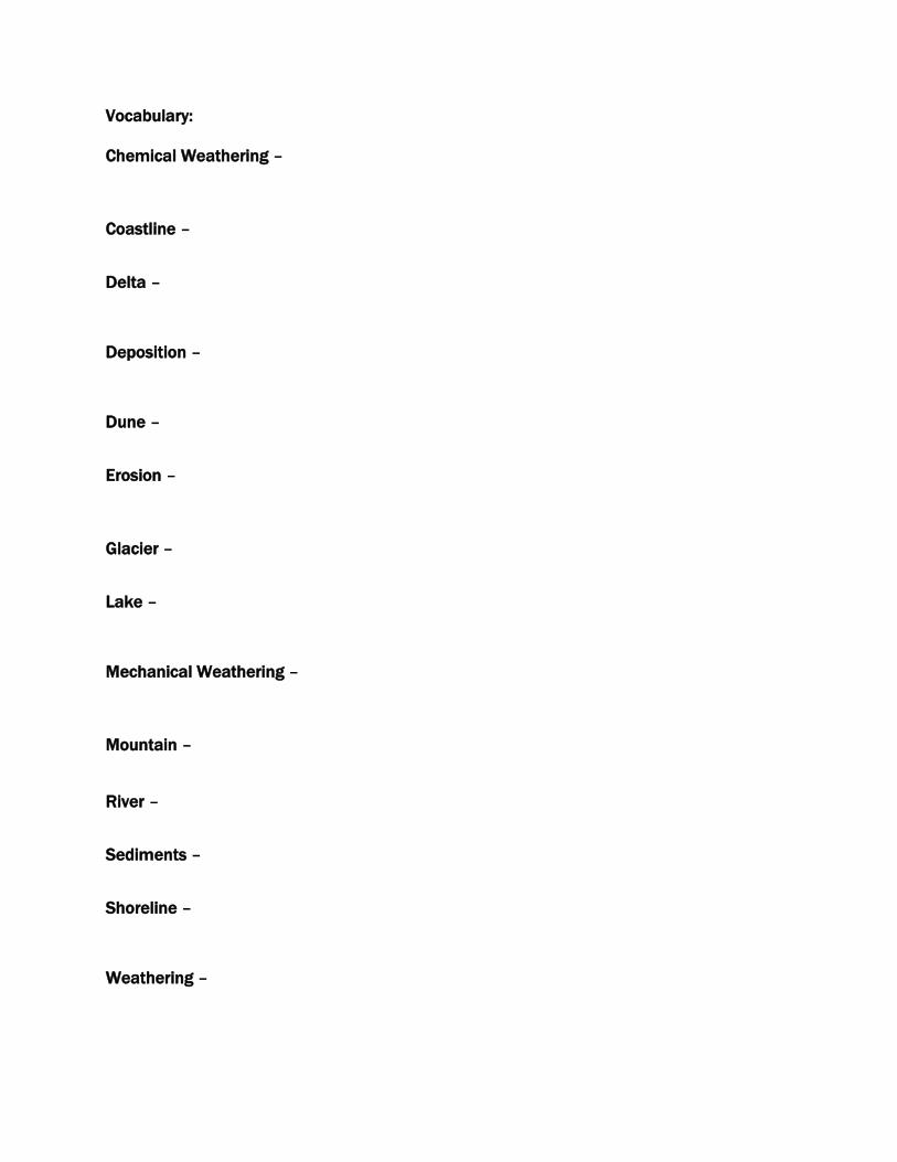
Vocabulary:
Chemical Weathering –
Coastline –
Delta –
Deposition –
Dune –
Erosion –
Glacier –
Lake –
Mechanical Weathering –
Mountain –
River –
Sediments –
Shoreline –
Weathering –
Page 16
Follow-up Questions
Page 17
Weathering, Erosion & Deposition
Follow-up Questions:
1. Explain the difference between Weathering and Erosion.
2. Which did you observe more, weathering or erosion and why?
3. Identify the two most common forces of erosion you observed on the ONA.
4. What types of erosion controls did you observe?
5. Why is erosion control important?
6. Describe how Weathering, Erosion and Deposition may be different in Florida as
compared to other locations in North America.
7. List several examples of natural erosion and deposition and human caused erosion and
deposition and tell how they are related.
8. Identify the land forms you observed and list some land forms that are not on the ONA.
Page 18
Follow-up Question Answers
Page 19
Weathering, Erosion & Deposition
Follow-up Questions: ANSWER KEY
1. Explain the difference between Weathering and Erosion.
The difference between weathering and erosion is that weathering is the physical breaking
up or chemically breaking down of rock and the earth’s surface rock into smaller pieces
and erosion is the movement or transport of those particles or soil, from one place to
another.
2. Which did you observe more, weathering or erosion?
Most students will indicate erosion as it is easier to observe and occurs in a shorter time
frame. Since weathering is a slower, long term process and erosion can occur in minutes,
erosion is more observable.
3. Identify the two most common forces of erosion you observed on the ONA.
The two most common forces of erosion world-wide are wind and water so this may be the
best answer for the ONA, however, since animals (and humans) cause erosion, and water is
a large part of the ONA, both factor into and cause the largest erosion problems on the Ona
so these answers are acceptable.
4. What types of erosion controls did you observe?
Erosion controls may include the following, concrete or asphalt, planted vegetation
covering, vegetation debris in wash-out areas, gravel/rocks, stair steps of logs, reshaping of
slopes or others methods may be present.
5. Why is erosion control important?
Erosion control on the ONA is important for the following reasons: the top layer of soil is the
most productive and needs to be protected for plant growth; banks would wash into the
water and channels would fill up; trails would be washed away; humans have disrupted the
ground so controls must be used to counter-act these disruptions to the earth surface;
beach replenishment help tourism (economy); ascetics.
6. Describe how Weathering, Erosion and Deposition may be different in Florida as
compared to other locations in North America.
Weathering in Florida does not include freezing and thawing and the rocks in Florida are
comprised of softer minerals and dissolve quicker in acidic water. Erosion is different
because Florida does not have tall hills or mountains so rain fall doesn’t rush downhill as
much as other locations, sandy soil absorbs rain fall and has less or slower runoff. Slower
runoff decreases the deposition as Florida is flatter, it has more of a sheet flow and less
fast runoff.
7. List several examples of natural erosion and deposition and human caused erosion and
deposition and tell how they are related.
Natural – rain runoff at trail sides moves soil and floating debris from place to place.
Tides/waves wash sand from the shoreline into the river/channel and animals (gopher
tortoises) move large amounts of sand from their burrow. Wind from hurricanes move soil.
Human – Wakes from boats wash sand away from the shoreline, people dig in the banks
and other areas causing rain runoff to wash away soil, vegetation is disturbed allowing soil
to become loose and wash away in the rain and wind.
8. Identify the land forms you observed and list some land forms that are not on the ONA.
Land forms present on the ONA include Rivers, Dunes, and Shorelines. Land forms not
present on the ONA are Mountains, Coastline (not on the ocean) and Deltas. (there may be
a type of delta outside the Jupiter Inlet but it is not on the ONA).
Page 20
ONA Rules and Guidelines:
The Natural Area is Federal property and is regulated by Federal, State and local laws.
Complete and detailed regulations regarding the Jupiter Inlet Lighthouse Outstanding
Natural Area (ONA) are available in the Jupiter Inlet Outstanding Lighthouse Natural Area
Comprehensive Management Plan and Environmental Assessment (pages 137-149)
available at the following website:
www.BLM.gov/jupiterONA
General Rules and Guideline Requirements:
1. All groups or individuals MUST contact the site manager (Peter DeWitt, Site Manager
Jupiter Inlet Lighthouse ONA, Bureau of Land Management, 600 State Road 707, Unit B
Jupiter, FL 33469. Phone: (601) 331-7407) prior to starting any field study or research
activities on the site to obtain special permits for field work.
2. Do not collect anything. Collection of any item, living or non-living is not allowed without
special permit from the site manager.
3. No digging. This site is a historical site with cultural significance, it is protected by law.
4. Stay on the concrete trail and boardwalk. Endangered and sensitive plants are on the site.
5. No pets are allowed in the natural area.
6. No swimming. Wading may be permitted for specific field study activities.
7. Closed-toe shoes are required for all activities on site.
8. Be familiar with the local plants and animals both terrestrial and marine. There are
poison plants and may be venomous animals on the ONA site.
Helpful websites:
Marine organisms: http://www.floridahealth.gov/diseases-and-conditions/food-and-
waterborne-disease/_documents/stings.pdf
Plants: http://www.edis.ifas.ufl.edu/pdffiles/EP/EP22000.pdf
Snakes: http://ufwildlife.ifas.ufl.edu/venomous_snake_identification.shtml
Insects: http://edis.ifas.ufl.edu/ig099
9. Be respectful of both other visitors and the environment while visiting the natural area.
10. Park only in designated areas.
11. Emergency – follow group protocol or call 911. Report all injuries, issues or concerns
to the site manager.
How to be a Great Chaperone
Page 21
You don’t need special knowledge to be a chaperone—just common sense and a willingness to
jump in and get involved. Here are a few tips to help make your trip a good one:
What will I be doing as a chaperone?
You will supervise a small group of students, help them learn, assist the ranger when called upon,
and make sure the students behave appropriately.
What will my role be during the program?
Throughout the visit, your job will be to monitor the behavior of the students, provide for their
safety, and facilitate the learning process while insuring a fun visit for the students. You may be
asked to work with specific students and help guide them through program activities. You may
want to ask the teacher for information about the program, including background information and
vocabulary words, to familiarize yourself with the topic. The more you can interact with the
students, the better their experience will be.
What do I need to tell the students about touching things?
Encourage students to touch gently when instructed to do so. When touching marine animals, wet
your hands in seawater first. Most marine animals have a coating of slime to protect them.
Touching them with a dry hand can damage their slime layer and harm their delicate surfaces.
• Do not pick up or remove the animals.
• Follow the guidance of the education staff.
How can I help students get the most out of their visit?
• Be sure you understand the plan for the day, as instructed by the student’s teacher.
• Ask the teacher for any material that will help you lead the students.
• Ask the teacher whether the students have specific projects to work on, and how you can help
them during the visit.
• Interact and have fun with the students.
• Ask questions of each student in your group. There will always be a few who have all the
answers.
• Encourage the shy or quiet students to share ideas, too.
What else do I need to know?
• Please leave small children at home if possible. They distract you from your duties as a
chaperone.
• Avoid visiting with other adults at the expense of your chaperone duties. Remember that your
primary job is to chaperone the students, not to visit with other parents.
• Students must stay with you, their chaperone, always. Their behavior is your responsibility.
• Be sure you know when and where to meet the rest of your group during and at the end of the
visit.