168
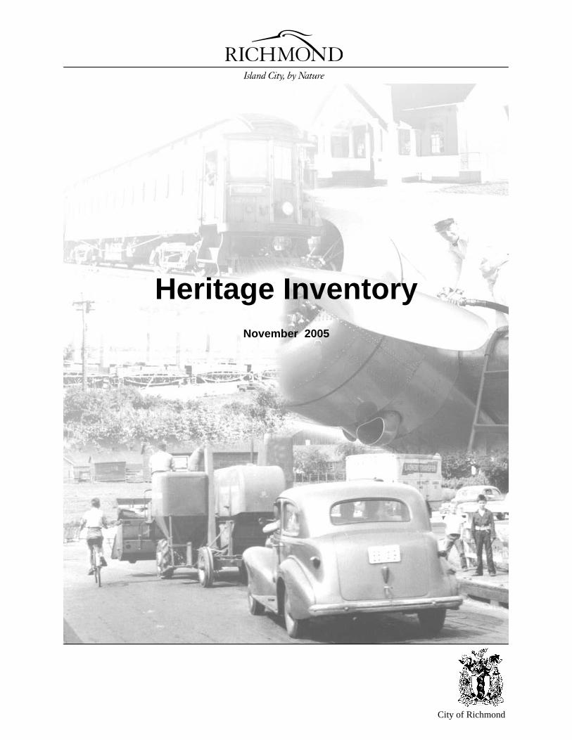
City of Richmond Heritage Inventory November 2005
City of Richmond
Heritage Inventory
November 2005
Page ii
About the Heritage Inventory
What is the Heritage Inventory? The Inventory is a database of the important heritage resources in Richmond. It can include anything of a physical, cultural or social nature that is unique to and valued by a community that can be passed from generation to generation.
When was the Heritage Inventory Completed? Heritage Inventories for Richmond were completed in 1984 and 1989. In 1999, the Heritage Commission initiated a process to update the 1989 Heritage Inventory. The first step in this process was to redefine the criteria for including a resource on the Inventory and the Inventory update was completed by 2002.
With the new Federal Historic Place Initiative, announced in 2003, statements of significance (SOS’s) were prepared for all of the resources in the Inventory in order to ensure that Richmond’s evaluations are consistent with the federal and provincial standards. This document now includes those SOS’s. Additions and deletions will continue to be made to the Inventory. For the most up to date information, refer to the web page at www.city.richmond.bc.ca/heritageinventory/.
Why is something included on the Heritage Inventory? There are many reasons for including a resource on the Heritage Inventory. It can be important because of its association with an important person, event or historical trend. It could demonstrate or illustrate a particular period in Richmond’s history. It could be something beautiful or unique that is valued by the community.
To be included on the Heritage Inventory an Evaluation Worksheet is filled out for every resource to describe its specific characteristics and heritage value based on specific criteria.
How is the Heritage Inventory Used? The Heritage Inventory is a database of the most important historical sites in Richmond. The Inventory documents these important sites, helps to increase awareness about Richmond’s past, and serves as a research tool. It does not result in designation of a property and cannot force property owners to save a resource.
Where can I view the Inventory? The best way to see the Inventory is on the City’s web page (www.city.richmond.bc.ca/heritageinventory/) where you can search for specific information, for example, all the heritage resources in a certain area or built a certain year. Copies of the Inventory can also be obtained from the Information Counter at 276-4000.
Heritage Inventory
Page iii
Table of Contents About the Heritage Inventory ....................................................................................................................................... ii Nomination Form ....................................................................................................................................................... vii Sea Island Map................................................................................................................................................................................9 Hangar No.2 - South Terminal ....................................................................................................................................10 Hangar No.1 - South Terminal ....................................................................................................................................11 Boeing Airplane Company Production Plant - South Terminal...................................................................................12 Burkeville ....................................................................................................................................................................13 Iona Treatment Plant ...................................................................................................................................................15 South Terminal Heritage Area.....................................................................................................................................18 Thompson Map..............................................................................................................................................................................21 Terra Nova Heritage Area ...........................................................................................................................................22 Terra Nova View Corridor...........................................................................................................................................25 Parsons House .............................................................................................................................................................27 Edwardian Cottage ......................................................................................................................................................28 Cannery House ............................................................................................................................................................29 Cannery House and Store ............................................................................................................................................30 Cold Comfort Farm .....................................................................................................................................................31 Steveston Map..............................................................................................................................................................................33 Steves Farmhouse ........................................................................................................................................................35 Steveston United Church Manse .................................................................................................................................36 Ida Steves House .........................................................................................................................................................37 Branscombe House ......................................................................................................................................................38 Japanese Gardens.........................................................................................................................................................39 Paramount Cannery West Building .............................................................................................................................41 Paramount Cannery East Building...............................................................................................................................42 McKinney House.........................................................................................................................................................43 Cannery Row Heritage Area........................................................................................................................................44 Steveston Townsite Heritage Area ..............................................................................................................................47 Abercrombie House.....................................................................................................................................................50 Scotch Pond .................................................................................................................................................................51 Stilt Piling House #1....................................................................................................................................................53 Stilt Piling House #2....................................................................................................................................................54 Wolff House ................................................................................................................................................................55 Steveston Methodist Church........................................................................................................................................56 Steveston Courthouse ..................................................................................................................................................57 Sockeye Hotel..............................................................................................................................................................58 Gulf of Georgia Cannery .............................................................................................................................................59 Watsida Building .........................................................................................................................................................60 Hepworth Block...........................................................................................................................................................61 Wakita Grocery............................................................................................................................................................62 Atagi Building .............................................................................................................................................................63 Northern Bank .............................................................................................................................................................64 Ray's Drygoods............................................................................................................................................................65 Tasaka Barbershop ......................................................................................................................................................66 CPR Power Poles and Railway Tracks ........................................................................................................................67 Steveston Telephone Exchange ...................................................................................................................................69 Martial Arts Centre......................................................................................................................................................70
Heritage Inventory – Table of Contents
Page iv
CPR Ferry Loading Ramp ...........................................................................................................................................72 Gulf of Georgia Cannery Net Shed..............................................................................................................................74 Japanese Buddhist Temple ..........................................................................................................................................76 No. 1 Road Pumpstation ..............................................................................................................................................77 Folk Victorian House...................................................................................................................................................79 Britannia Shipyard - First People’s House ..................................................................................................................80 Britannia Shipyard - Japanese Duplex.........................................................................................................................81 Britannia Shipyard - Phoenix Seine Net Loft ..............................................................................................................82 Britannia Shipyard - Murakami Boatworks.................................................................................................................83 Britannia Shipyard - Murakami Residence..................................................................................................................84 Britannia Shipyard - Richmond Boat Builders ............................................................................................................85 Britannia Shipyard - Cannery Office ...........................................................................................................................86 Britannia Shipyard - Shipyard and Cannery Complex.................................................................................................87 Phoenix Gill Net Loft ..................................................................................................................................................89 City Centre Map..............................................................................................................................................................................91 Richmond Rod and Gun Club......................................................................................................................................92 Minoru Chapel.............................................................................................................................................................93 Brighouse Lacrosse Box..............................................................................................................................................95 Jones House .................................................................................................................................................................97 General Currie School .................................................................................................................................................98 Minoru Park.................................................................................................................................................................99 Brighouse Homestead & Heritage Trees ...................................................................................................................102 Cenotaph....................................................................................................................................................................104 Pierrefonds Garden ....................................................................................................................................................106 Gilmore Map............................................................................................................................................................................107 London Farmhouse ....................................................................................................................................................108 Pioneer Church ..........................................................................................................................................................110 Shepherd Barn ...........................................................................................................................................................112 McNair Barn..............................................................................................................................................................113 Gilmore Potato Pit .....................................................................................................................................................114 Tilson Barn ................................................................................................................................................................115 Eldstrom House .........................................................................................................................................................116 Draney House ............................................................................................................................................................117 Goldie Harris House ..................................................................................................................................................118 South Arm Slough District Heritage Area.................................................................................................................119 Finn Slough Heritage Area ........................................................................................................................................122 Dyke System..............................................................................................................................................................125 Cambie Map............................................................................................................................................................................129 Northey House...........................................................................................................................................................130 McCaul House ...........................................................................................................................................................131 Harrison House..........................................................................................................................................................132 Mitchell School .........................................................................................................................................................133 East Richmond Map............................................................................................................................................................................135 Mitchell House ..........................................................................................................................................................136 McKay and Sons Dairy Barn.....................................................................................................................................137 Rathburn House .........................................................................................................................................................138 Beckwith Barn ...........................................................................................................................................................139 Beckwith House.........................................................................................................................................................140 Gilmore Farmhouse ...................................................................................................................................................141
Heritage Inventory – Table of Contents
Page v
Gilmore Barn .............................................................................................................................................................142 Seafair Map............................................................................................................................................................................143 Fentiman House.........................................................................................................................................................144 Blundell Map............................................................................................................................................................................145 Every House ..............................................................................................................................................................146 Yarmish House ..........................................................................................................................................................147 Shellmont Map............................................................................................................................................................................149 Radio Canada Building..............................................................................................................................................150 Hamilton Map............................................................................................................................................................................153 South Dyke Fishing Community ...............................................................................................................................154 Broadmoor Map............................................................................................................................................................................157 Broadmoor Ditch System ..........................................................................................................................................158 Appendix I – Chronology of Historical Events ............................................................. 161
Appendix II - Heritage Resources by Type.................................................................. 165
Appendix III - Heritage Resources by Address............................................................ 167

Page vii
City of Richmond
Heritage InventoryNomination Form
To nominate a heritage resource: Visit the City of Richmond’s web page at: www.city.richmond.bc.ca/heritageinventory/ or mail your answers to the following questions to: The Heritage Planner City of Richmond 6911 No. 3 Road Richmond, BC V6Y 2C1 or fax your answers to the following questions to: (604) 276-4052 What is the resource? (i.e. building, barn, tree, railway track) Where is the resource? (i.e. street address or general description) Why should this resource be included in the Heritage Inventory? What is your name and contact number? For more information, contact the Heritage Planner or the Richmond Heritage Commission at (604) 276-4000.

Page 9
City of Richmond
Heritage InventorySummary Evaluation Worksheet
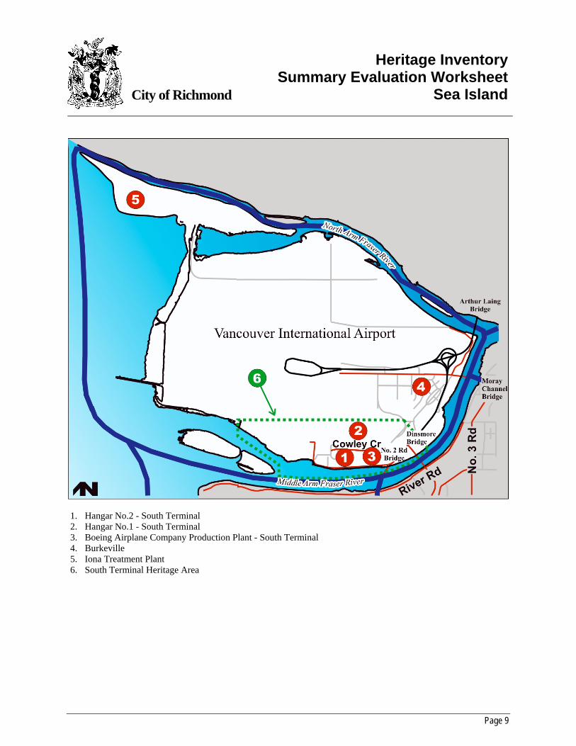
Sea Island
1. Hangar No.2 - South Terminal 2. Hangar No.1 - South Terminal 3. Boeing Airplane Company Production Plant - South Terminal 4. Burkeville 5. Iona Treatment Plant 6. South Terminal Heritage Area
Heritage Inventory Summary Evaluation Worksheet – Sea Island
Page 10
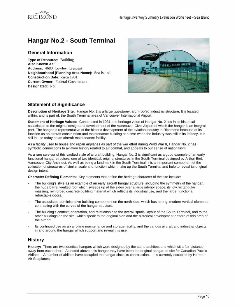
Hangar No.2 - South Terminal
General Information Type of Resource: Building Also Known As: Address: 4680 Cowley Crescent Neighbourhood (Planning Area Name): Sea Island Construction Date: circa 1931 Current Owner: Federal Government Designated: No
Statement of Significance Description of Heritage Site: Hangar No. 2 is a large two-storey, arch-roofed industrial structure. It is located within, and is part of, the South Terminal area of Vancouver International Airport.
Statement of Heritage Values: Constructed in 1931, the heritage value of Hangar No. 2 lies in its historical association to the original design and development of the Vancouver Civic Airport of which the hangar is an integral part. The hangar is representative of the historic development of the aviation industry in Richmond because of its function as an aircraft construction and maintenance building at a time when the industry was still in its infancy. It is still in use today as an aircraft maintenance facility.
As a facility used to house and repair airplanes as part of the war effort during Wold War II, Hangar No. 2 has symbolic connections to aviation history related to air combat, and appeals to our sense of nationalism.
As a rare survivor of this vaulted style of aircraft building, Hangar No. 2 is significant as a good example of an early functional hangar structure, one of two identical, original structures in the South Terminal designed by Arthur Bird, Vancouver City Architect. As well as being a landmark in the South Terminal, it is an important component of the collection of structures of similar scale and function which make up the South Terminal and help to reveal its original design intent.
Character Defining Elements: Key elements that define the heritage character of the site include:
· The building’s style as an example of an early aircraft hangar structure, including the symmetry of the hangar, the huge barrel vaulted roof which sweeps up at the sides over a large interior space, its low rectangular massing, reinforced concrete building material which reflects its industrial use, and the large, functional retractable doors.
· The associated administrative building component on the north side, which has strong, modern vertical elements contrasting with the curves of the hangar structure.
· The building’s context, orientation, and relationship to the overall spatial layout of the South Terminal, and to the other buildings on the site, which speak to the original plan and the historical development pattern of this area of the airport.
· Its continued use as an airplane maintenance and storage facility, and the various aircraft and industrial objects in and around the hangar which support and reveal this use.
History History: There are two identical hangars which were designed by the same architect and which sit a fair distance away from each other. As noted above, this hangar may have been the original hangar on site for Canadian Pacific Airlines. A number of airlines have occupied the hangar since its construction. It is currently occupied by Harbour Air Seaplanes.
Heritage Inventory Summary Evaluation Worksheet – Sea Island
Page 11
Hangar No.1 - South Terminal
General Information Type of Resource: Building Also Known As: Hangar #1 South Terminal Address: 5160 Airport Road Neighbourhood (Planning Area Name): Sea Island Construction Date: 1931 Current Owner: Federal Government Designated: No
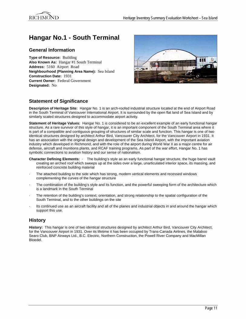
Statement of Significance Description of Heritage Site: Hangar No. 1 is an arch-roofed industrial structure located at the end of Airport Road in the South Terminal of Vancouver International Airport. It is surrounded by the open flat land of Sea Island and by similarly scaled structures designed to accommodate airport activity.
Statement of Heritage Values: Hangar No. 1 is considered to be an excellent example of an early functional hangar structure. As a rare survivor of this style of hangar, it is an important component of the South Terminal area where it is part of a compatible and contiguous grouping of structures of similar scale and function. This hangar is one of two identical structures designed by architect Arthur Bird, Vancouver City Architect, for the Vancouver Airport in 1931. It has an association with the original design and development of the Sea Island Airport, with the important aviation industry which developed in Richmond, and with the role of the airport during World War II as a major centre for air defense, aircraft and munitions plants, and RCAF training programs. As part of the war effort, Hangar No. 1 has symbolic connections to aviation history and our sense of nationalism.
Character Defining Elements: · The building’s style as an early functional hangar structure, the huge barrel vault creating an arched roof which sweeps up at the sides over a large, unarticulated interior space, its massing, and reinforced concrete building material
· The attached building to the side which has strong, modern vertical elements and recessed windows complementing the curves of the hangar structure
· The combination of the building’s style and its function, and the powerful sweeping form of the architecture which is a landmark in the South Terminal
· The retention of the building’s context, orientation, and strong relationship to the spatial configuration of the South Terminal, and to the other buildings on the site
· Its continued use as an aircraft facility and all of the planes and industrial objects in and around the hangar which support this use.
History History: This hangar is one of two identical structures designed by architect Arthur Bird, Vancouver City Architect, for the Vancouver Airport in 1931. Over its lifetime it has been occupied by Trans-Canada Airlines, the Malaboo Searo Club, BNP Airways Ltd., B.C. Electric, Northern Construction, the Powell River Company and MacMillan Bloedel.
Heritage Inventory Summary Evaluation Worksheet – Sea Island
Page 12
Boeing Airplane Company Production Plant - South Terminal
General Information Type of Resource: Building Also Known As: Address: 5400 Airport Road Neighbourhood (Planning Area Name): Sea Island Construction Date: 1939 Current Owner: Federal Government Designated: No
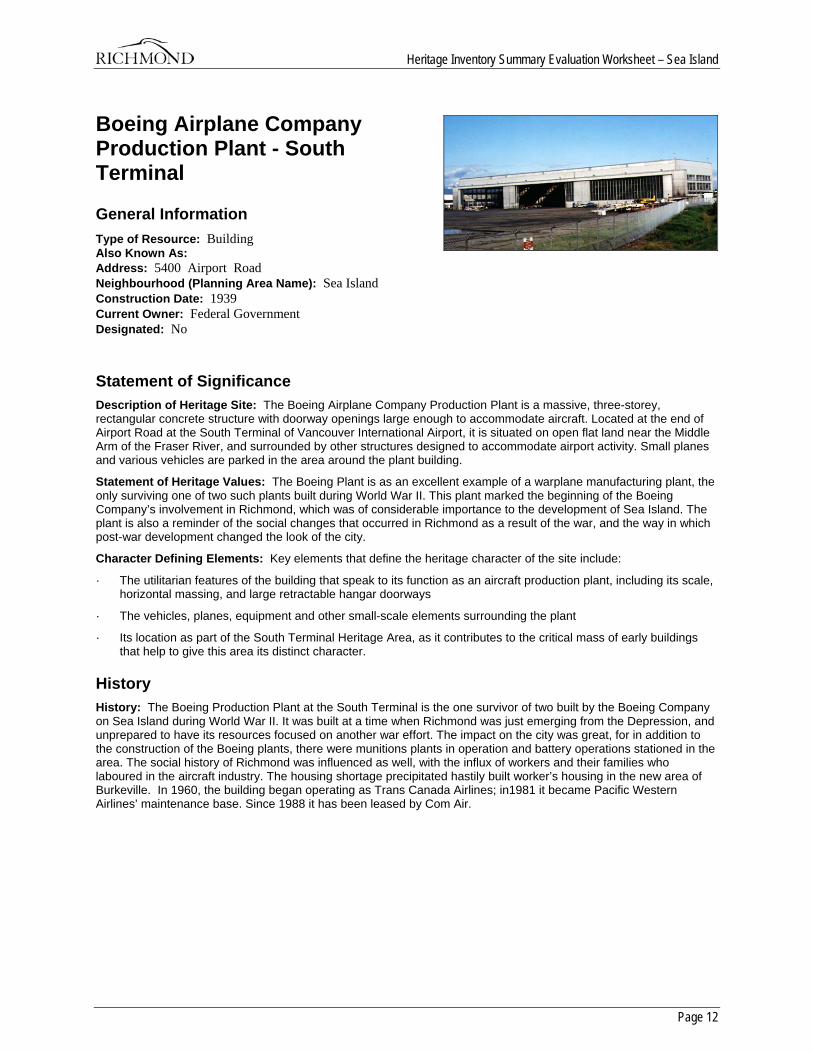
Statement of Significance Description of Heritage Site: The Boeing Airplane Company Production Plant is a massive, three-storey, rectangular concrete structure with doorway openings large enough to accommodate aircraft. Located at the end of Airport Road at the South Terminal of Vancouver International Airport, it is situated on open flat land near the Middle Arm of the Fraser River, and surrounded by other structures designed to accommodate airport activity. Small planes and various vehicles are parked in the area around the plant building.
Statement of Heritage Values: The Boeing Plant is as an excellent example of a warplane manufacturing plant, the only surviving one of two such plants built during World War II. This plant marked the beginning of the Boeing Company’s involvement in Richmond, which was of considerable importance to the development of Sea Island. The plant is also a reminder of the social changes that occurred in Richmond as a result of the war, and the way in which post-war development changed the look of the city.
Character Defining Elements: Key elements that define the heritage character of the site include:
· The utilitarian features of the building that speak to its function as an aircraft production plant, including its scale, horizontal massing, and large retractable hangar doorways
· The vehicles, planes, equipment and other small-scale elements surrounding the plant
· Its location as part of the South Terminal Heritage Area, as it contributes to the critical mass of early buildings that help to give this area its distinct character.
History History: The Boeing Production Plant at the South Terminal is the one survivor of two built by the Boeing Company on Sea Island during World War II. It was built at a time when Richmond was just emerging from the Depression, and unprepared to have its resources focused on another war effort. The impact on the city was great, for in addition to the construction of the Boeing plants, there were munitions plants in operation and battery operations stationed in the area. The social history of Richmond was influenced as well, with the influx of workers and their families who laboured in the aircraft industry. The housing shortage precipitated hastily built worker’s housing in the new area of Burkeville. In 1960, the building began operating as Trans Canada Airlines; in1981 it became Pacific Western Airlines’ maintenance base. Since 1988 it has been leased by Com Air.
Heritage Inventory Summary Evaluation Worksheet – Sea Island
Page 13
Burkeville
General Information Type of Resource: Heritage Area Also Known As: Address: Neighbourhood (Planning Area Name): Sea Island Construction Date: 1941 Current Owner: Private Designated: No
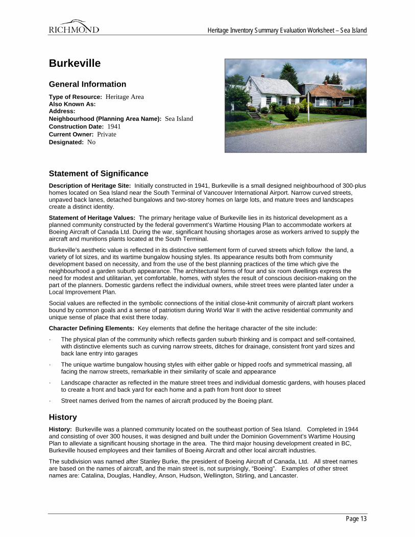
Statement of Significance Description of Heritage Site: Initially constructed in 1941, Burkeville is a small designed neighbourhood of 300-plus homes located on Sea Island near the South Terminal of Vancouver International Airport. Narrow curved streets, unpaved back lanes, detached bungalows and two-storey homes on large lots, and mature trees and landscapes create a distinct identity.
Statement of Heritage Values: The primary heritage value of Burkeville lies in its historical development as a planned community constructed by the federal government’s Wartime Housing Plan to accommodate workers at Boeing Aircraft of Canada Ltd. During the war, significant housing shortages arose as workers arrived to supply the aircraft and munitions plants located at the South Terminal.
Burkeville’s aesthetic value is reflected in its distinctive settlement form of curved streets which follow the land, a variety of lot sizes, and its wartime bungalow housing styles. Its appearance results both from community development based on necessity, and from the use of the best planning practices of the time which give the neighbourhood a garden suburb appearance. The architectural forms of four and six room dwellings express the need for modest and utilitarian, yet comfortable, homes, with styles the result of conscious decision-making on the part of the planners. Domestic gardens reflect the individual owners, while street trees were planted later under a Local Improvement Plan.
Social values are reflected in the symbolic connections of the initial close-knit community of aircraft plant workers bound by common goals and a sense of patriotism during World War II with the active residential community and unique sense of place that exist there today.
Character Defining Elements: Key elements that define the heritage character of the site include:
· The physical plan of the community which reflects garden suburb thinking and is compact and self-contained, with distinctive elements such as curving narrow streets, ditches for drainage, consistent front yard sizes and back lane entry into garages
· The unique wartime bungalow housing styles with either gable or hipped roofs and symmetrical massing, all facing the narrow streets, remarkable in their similarity of scale and appearance
· Landscape character as reflected in the mature street trees and individual domestic gardens, with houses placed to create a front and back yard for each home and a path from front door to street
· Street names derived from the names of aircraft produced by the Boeing plant.
History History: Burkeville was a planned community located on the southeast portion of Sea Island. Completed in 1944 and consisting of over 300 houses, it was designed and built under the Dominion Government’s Wartime Housing Plan to alleviate a significant housing shortage in the area. The third major housing development created in BC, Burkeville housed employees and their families of Boeing Aircraft and other local aircraft industries.
The subdivision was named after Stanley Burke, the president of Boeing Aircraft of Canada, Ltd. All street names are based on the names of aircraft, and the main street is, not surprisingly, “Boeing”. Examples of other street names are: Catalina, Douglas, Handley, Anson, Hudson, Wellington, Stirling, and Lancaster.
Heritage Inventory Summary Evaluation Worksheet – Sea Island
Page 14
Architects McCarter & Nairn developed the design of the community, including the layout of the roads, sewers, pumping system and other services. It was designed with differing sized lots and curving roads to avoid a checker board appearance. (The Boeing Beam, Vol 1, No 10, May 12, 1943). Each house on its 50 x 100 foot lot was designed to provide the maximum allowed living space with ample fenestration and storage. All houses were between 700 and 900 sq. ft and had either 4 or 6 rooms. Each house fell into 1 of 3 designs, had 1 of 4 roof colours and 1 of 3 wall colours. Residents were free to change the exterior and interior of their homes, provided that those changes were reasonable. Initially these homes were temporary and were to be dismantled at the end of the Second World War; however, in 1947, the Federal Government permitted the houses to be sold. By 1951, all but 14 houses were sold.
The community continued as a relatively isolated and close-knit community. Over the years, playgrounds, a community centre, a church and a school were built or maintained by the residents. The Burkeville community was in a precarious position; however, and had to be ever vigilant against the growing needs of its airport neighbour. By the early 1970’s, the community was increasingly anxious over airport expansion plans and how these plans would affect the community. Some properties had already been purchased or expropriated by the Airport, the buildings demolished and the land converted into airport use. To make matters worse in the eyes of the community, the neighbouring Canadian Armed Forces base with 75 homes had been phased out and turned over to the airport in 1973. In addition to these concerns, the community was also debating the building of a new bridge from Vancouver to Sea Island and the proposed creation of a four lane highway through the community.
Threatened with extinction, Burkeville residents gathered their forces to protect what was left of their community. The Burkeville Taxpayers Association applied for and received a $40,000 grant from the Canadian Mortgage and Housing Corporation in 1973 to officially study the situation. “The Future of Burkeville” written by Reserve Realty Projects Ltd and Ray Olsen, MRAIC, Architect and Planner and submitted in 1976 recommended that Burkeville be phased out as a residential community over the ensuing 20 years. (Richmond Heritage Advisory Committee sous-fonds 6158, file 1.3.29 Burkeville Research File 2, 1988-89).
Despite the above recommendation, it was felt by residents and by Richmond planning staff that Burkeville had “valid social and personal financial reasons which warrant retaining Burkeville as a residential neighbourhood. Also, current land economics are such that redevelopment for industrial or commercial use is not feasible. Therefore, it is probably necessary to maintain Burkeville as a viable residential neighbourhood for some time yet, perhaps up to twenty years.”
(Memo dated Jule 12, 1976 to William Kerr, Director of Planning for the Township of Richmond, regarding ‘Future of Burkeville and Related Matters’. p. 3).
To achieve another twenty years, the community would need to improve its physical condition, and this would cost money. The best source for financial aid to assist Burkeville in upgrading its community was a Neighbourhood Improvement Plan. However, to receive funding, the area applying needed to ensure that its community was stable for the next fifteen years; a guarantee that only the Ministry of Transportation could give. Unable to predict the future needs of the airport, the Ministry could not offer any guarantees; however, they did ultimately agree that the area of Burkeville would not be needed for the required time of the Neighbourhood Improvement Plan.
Burkeville obtained its funding and from 1976 until 1981, various improvements to the housing stock and to the neighbourhood were carried out. In 1981, Burkeville held its first “Festival Days” celebration. As of the year 2000, Burkeville continues to survive as a close-knit community with pleasant houses and sweeping streets.
Heritage Inventory Summary Evaluation Worksheet – Sea Island
Page 15
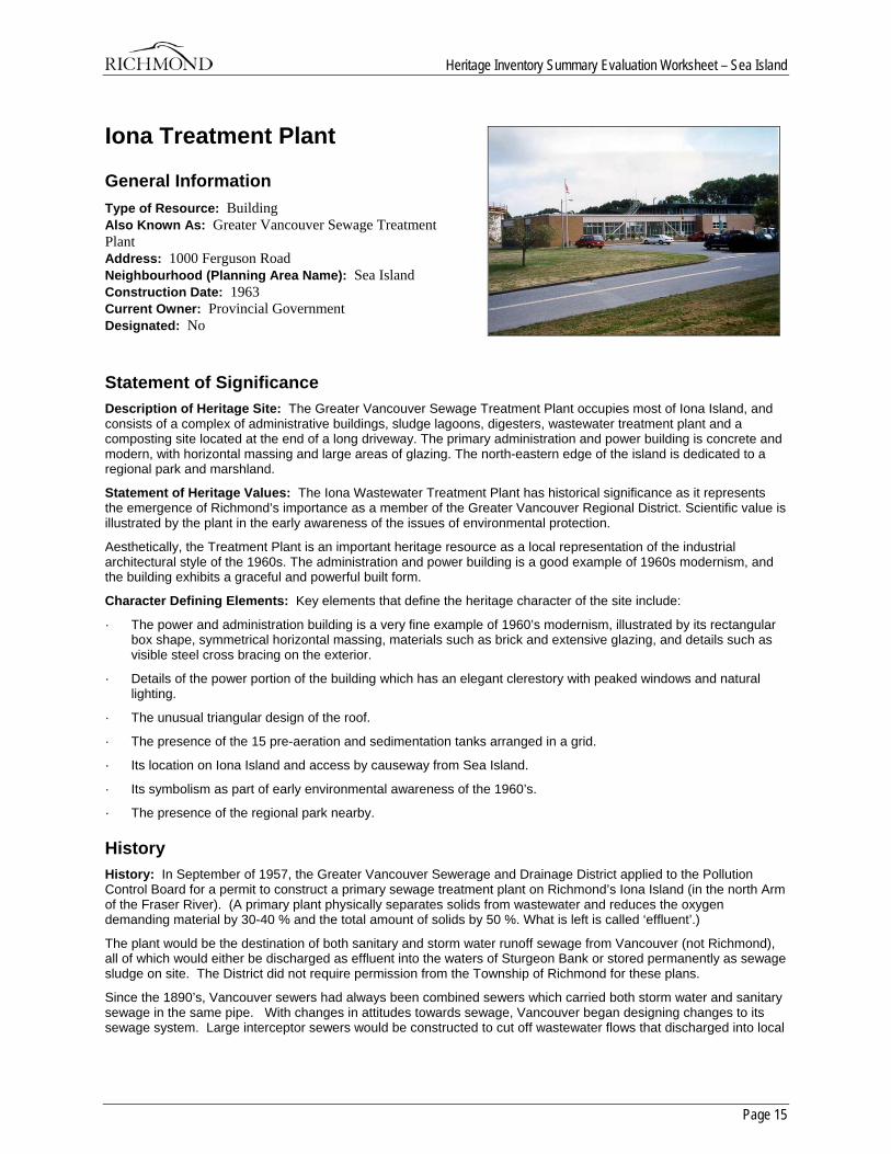
Iona Treatment Plant
General Information Type of Resource: Building Also Known As: Greater Vancouver Sewage Treatment Plant Address: 1000 Ferguson Road Neighbourhood (Planning Area Name): Sea Island Construction Date: 1963 Current Owner: Provincial Government Designated: No
Statement of Significance Description of Heritage Site: The Greater Vancouver Sewage Treatment Plant occupies most of Iona Island, and consists of a complex of administrative buildings, sludge lagoons, digesters, wastewater treatment plant and a composting site located at the end of a long driveway. The primary administration and power building is concrete and modern, with horizontal massing and large areas of glazing. The north-eastern edge of the island is dedicated to a regional park and marshland.
Statement of Heritage Values: The Iona Wastewater Treatment Plant has historical significance as it represents the emergence of Richmond’s importance as a member of the Greater Vancouver Regional District. Scientific value is illustrated by the plant in the early awareness of the issues of environmental protection.
Aesthetically, the Treatment Plant is an important heritage resource as a local representation of the industrial architectural style of the 1960s. The administration and power building is a good example of 1960s modernism, and the building exhibits a graceful and powerful built form.
Character Defining Elements: Key elements that define the heritage character of the site include:
· The power and administration building is a very fine example of 1960’s modernism, illustrated by its rectangular box shape, symmetrical horizontal massing, materials such as brick and extensive glazing, and details such as visible steel cross bracing on the exterior.
· Details of the power portion of the building which has an elegant clerestory with peaked windows and natural lighting.
· The unusual triangular design of the roof.
· The presence of the 15 pre-aeration and sedimentation tanks arranged in a grid.
· Its location on Iona Island and access by causeway from Sea Island.
· Its symbolism as part of early environmental awareness of the 1960’s.
· The presence of the regional park nearby.
History History: In September of 1957, the Greater Vancouver Sewerage and Drainage District applied to the Pollution Control Board for a permit to construct a primary sewage treatment plant on Richmond’s Iona Island (in the north Arm of the Fraser River). (A primary plant physically separates solids from wastewater and reduces the oxygen demanding material by 30-40 % and the total amount of solids by 50 %. What is left is called ‘effluent’.)
The plant would be the destination of both sanitary and storm water runoff sewage from Vancouver (not Richmond), all of which would either be discharged as effluent into the waters of Sturgeon Bank or stored permanently as sewage sludge on site. The District did not require permission from the Township of Richmond for these plans.
Since the 1890’s, Vancouver sewers had always been combined sewers which carried both storm water and sanitary sewage in the same pipe. With changes in attitudes towards sewage, Vancouver began designing changes to its sewage system. Large interceptor sewers would be constructed to cut off wastewater flows that discharged into local
Heritage Inventory Summary Evaluation Worksheet – Sea Island
Page 16
waters during dry weather periods. These new sewer lines would redirect the sanitary and some of the storm water runoff to a new treatment plant. The Greater Vancouver Sewerage and Drainage District felt that Iona Island was the best location for the new plant.
Fearing a high level of pollution on surrounding beaches and resenting the potential expropriation of Richmond lands, Richmond let it be known that they did not want sewage effluent anywhere on the Sturgeon Banks, nor did they want a primary sewage treatment plant or sludge lagoons on Iona Island.
Despite formal appeals and objections by the municipality of Richmond, the Pollution-control Board issued a permit (Permit # 23) to the Greater Vancouver Sewerage and Drainage District in April 1958 with a number of conditions attached. These ranged from indicating the type of effluent line to be used, to the maintenance of the water quality level at Iona Beach. (Order-In-Council No. 2167 Dated September 22, 1958. Greater Vancouver Sewerage and Drainage District, Richmond Archives)
Refusing to accept the Pollution Control Board’s decision, Richmond appealed to the Provincial Government and requested that the Greater Vancouver Sewerage and Drainage District Act be amended to prohibit Vancouver and Burnaby from expropriating land outside its district in order to build sewage and drainage facilities, without representation from the affected municipality. The appeal was denied and the terms of the earlier Permit # 23 of the Pollution-control Board were confirmed with the addition of further provisos.
After it had been determined that the treatment plant was going ahead despite the concerns and opposition of the Municipality, Richmond felt it imperative to preserve and develop the Iona Beach area as a public amenity. To that end, the Richmond Council began inviting members of the Vancouver Board of Parks and Public Recreation, Lower Mainland Regional Planning Board, and Vancouver City Council to tour the area and participate in its development. In 1959, Richmond requested that a reserve be put on Iona Island for the purpose of public recreation.
The Iona Treatment Plant was put out to tender on September 21, 1960 and included 5 volumes of plans with a total of 599 drawings. The project was expected to cost over 8 million (1960) dollars. The project began in 1962 and the Plant opened in 1963. During this time, the Highbury Street tunnel was underway and the contract for the building of the 4 1/4 mile outfall channel, a 2 ½ mile shielding jetty and a causeway had just been signed.
Controversy regarding the Plant continued through the 1960’s and included concern over the access road to the island, pollution levels in the water, and at one point, notification by the municipality of Richmond in July of 1961 that a building permit was required for the work on Iona Island; but, that municipal inspectors would not carry out site inspections.
Richmond remained vigilant regarding the environmental impact of the treatment plant on Iona Island and the surrounding waters. After an examination of the area in December 1969, it was found that coliform counts, general turbidity and sludge accumulation were at levels higher than what the original permit required. Richmond considered taking legal action; but, chose instead to register a strong protest to the Pollution Control Board. It is possible that levels were high due to the time of year. Effluent was only chlorinated between May 01 and September 30 to kill bacteria that could create health risks to local swimmers.
Promotion of the recreational plans for Iona Beach continued through the 1960’s and 1970’s. The Greater Vancouver Regional District studied Iona Beach in 1979 as a possible site for a new regional park; but, found that it was not suitable: “While Iona Island is not considered to be the most suitable location for a Regional Park at this time, it is felt that the future potential of this site must not be overlooked. Present methods of sewage treatment make this location undesirable as a park for families with small children. However, modernization of sewage treatment processing seems inevitable, which would, in turn, eliminate some of the problems that presently exist with this location as a park.” (Letter dated October 3, 1979. “The Municipality of Richmond, The Advisory Planning Committee, Subject: Greater Vancouver Regional District - Regional Park, Iona Island or A Suitable Alternative.” MR SE 41, Series Health, Location 5615, Richmond Archives.)
Shortly after the above conclusions were made, the GVRD commissioned a feasibility study of the area. In November 1983, S & S Consultants submitted their conclusions in “Iona Deep Sea Outfall Feasibility Study”. As a result, a jetty was built in 1986 to allow for deep sea drainage. It is 7 kilometres long, of which 4 km is above water and 3km is underwater. The underwater portion reaches 200 metres in depth and allows the effluent to discharge naturally along the bottom of the bay. Because of the extra power required to get the effluent out this far, a new pump station was built. Until this point, the Plant had been entirely self-sufficient in regards to power. All power was derived from the methane gas that is produced by the digest tanks. Since 1986, some power is obtained from BC Hydro to augment the methane power source.
In 1989, the GVRD approved Iona Beach as a regional park. Today, Iona Beach is a beautiful recreational spot which appeals to a variety of different interests. Bicyclists enjoy the long, flat ride out to the beach. Birders enjoy the variety of birds and the easy viewing. Dog owners relish the long expanse of marsh and sand. Families can spend hours playing on the beach, especially when the tide is out. Walkers can explore the 4 kilometre jetty or walk the
Heritage Inventory Summary Evaluation Worksheet – Sea Island
Page 17
beach itself. The marsh to the west of the Plant was restored in 1990 by the Vancouver Historical Society, Environment Canada’s Partner Fund and by many community volunteers. Birds that once stopped coming to the area are now returning. Flora and fauna that were lost due to infill are now thriving.
Information on all the plants is available from the GVRD and from their web-site. As well, tours continue to be available to the general public and to schools. Some of the best correspondence comes from the children’s thank you letters.
Wrote one schoolgirl after her class toured the plant: “I hate the smell of the sewers, but enjoyed the trip. Every time I flush the toilet I’ll think of you and all the men who work there.” (Press Release from the Greater Vancouver Regional District, dated Dec 29, 1971, p. 2. File 5227 - 1 Iona Island, 1957-79, 5615, MR SE 41 Health, Richmond Archives).
Heritage Inventory Summary Evaluation Worksheet – Sea Island
Page 18
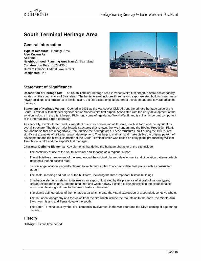
South Terminal Heritage Area
General Information Type of Resource: Heritage Area Also Known As: Address: Neighbourhood (Planning Area Name): Sea Island Construction Date: 1929-1968. Current Owner: Federal Government Designated: No
Statement of Significance Description of Heritage Site: The South Terminal Heritage Area is Vancouver’s first airport, a small-scaled facility located on the south shore of Sea Island. The heritage area includes three historic airport-related buildings and many newer buildings and structures of similar scale, the still-visible original pattern of development, and several adjacent runways.
Statement of Heritage Values: Opened in 1931 as the Vancouver Civic Airport, the primary heritage value of the South Terminal is its historical significance as Vancouver’s first airport. Associated with the early development of the aviation industry in the city, it helped Richmond come of age during World War II, and is still an important component of the international airport operation.
Aesthetically, the South Terminal is important due to a combination of its scale, low built form and the layout of its overall structure. The three major historic structures that remain, the two hangars and the Boeing Production Plant, are landmarks that are recognizable from outside the heritage area. These structures, built during the 1930’s, are significant examples of utilitarian airport development. They help to maintain and make visible the original pattern of development and the historic character of the South Terminal which was based on early plans produced by William Templeton, a pilot and the airport’s first manager.
Character Defining Elements: Key elements that define the heritage character of the site include:
· The continuity of use of the South Terminal and its focus as a regional airport.
· The still-visible arrangement of the area around the original planned development and circulation patterns, which included a looped access road.
· Its river edge location, originally chosen to implement a plan to accommodate float planes with a constructed lagoon.
· The scale, massing and nature of the built form, including the three important historic buildings.
· Small-scale elements relating to its use as an airport, illustrated by the presence of aircraft of various types, aircraft related machinery, and the small red and white runway location buildings visible in the distance, all of which contribute a great deal to the area’s historic character.
· The clearly defined edges of the heritage area which create the visual expression of a bounded, cohesive whole.
· The flat, open topography and the views from the site which include the mountains to the north, the Middle Arm, Swishwash Island and Terra Nova to the south.
· The South Terminal as a symbol of Richmond’s involvement in the war effort and the City’s coming of age during the war.
History History: Historic time period:
Heritage Inventory Summary Evaluation Worksheet – Sea Island
Page 19
The purchase of land for the airport occurred in 1929, with planning, construction and grand opening in 1930. Development continued through World War II until 1968, when main airport operations moved to the present new terminal.
Extant resources:
The South Terminal area contains three built heritage resources which are currently on the inventory. They include Hangar No.1, at 5220 Airport Road, Hangar No. 2 at 4680 Cowley Crescent, and the Boeing Airport Company Production Plant at 5400 Airport Road. Additional buildings and structures associated with early airport development are also present, and which add to the historic character by providing additional context and massing.
Distinction:
The South Terminal is visually distinguishable from surrounding properties on Sea Island, which include the main terminal of the Vancouver International Airport, Burkeville and agricultural and residential development. This distinction is evident by the scale and nature of the built form and the clearly discernible edges. Historical documentation indicates a defined area developed solely for use as an airport facility.
Boundaries:
The Fraser River to the south creates a natural boundary and also houses the float plane base. Russ Baker way to the east is a second, constructed boundary. On the north and east sides, the boundaries are not as clear. Because the context of the surrounding open space is so important to the character of the South Airport, the area that encompassed the runways to the north in the original plan should be included, while the western boundary could extend as far as the Coast Guard headquarters. Alternatively, the north and east boundaries could be established by taking a offset from the existing chain link fence and the adjacent east-west runway.
Overall sense of place and historic character:
The character of the South Terminal is achieved by the scale of the operation, the open field surroundings, the proximity to the river and float plane base, and the fact that it maintains the same use for which it was constructed. It is an accessible industrial site, with airport operations on a smaller scale made visible. The changes that have occurred over time reflect the uses and needs of this remarkable little airport, but have managed to maintain its overall historic scale and character.
Historic Criteria:
Site History:
The South Terminal has carried on a legacy of air travel in Richmond, Minoru Park being the scene of many aviation firsts. An airstrip had operated at Minoru since 1909, on a grassy field adjacent to the racetrack which saw the western Canada’s first powered flight in 1910 and first passenger flight in 1912.
In 1929, the City of Vancouver purchased 478.61 acres on Sea Island at a cost of $600,000 to construct a new civic airport. Construction work began in April 1930 on a single runway (100 x 2400 feet), a small administration building, and two hangars. The Vancouver Civic Airport was officially opened on July 22, 1931, with a total of 3,188 passengers. Between 1936 and 1938, two additional runways were constructed, along with taxi-ways, lighting and a radio building. In 1939, Trans-Canada Airlines began passenger service.
The first airport manager was William Templeton, who conducted research and provided design and layout for the new airfield, including initial and future runways and provision for services for the many industries expected to develop in the immediate vicinity.
In 1940, the airport was leased to the federal government and operated by the Department of National Defence and the Department of Transport. An additional 500 acres was purchased and the airport became a major centre for air defence, aircraft and munitions plants, and RCAF training programs, with the RCAF maintaining a presence on Sea Island after the war. This brought an influx of aircraft workers and their families which resulted in the construction of housing at nearby Burkeville.
In 1947, control of the airport was returned to the City of Vancouver, and its name changed from Sea Island Airport to Vancouver International. The original administration building was destroyed by fire in 1949. The airport expanded in 1953 when a new 3 kilometre runway running east/west was completed. In 1962 the Federal Government acquired control of the airport once again, and in 1968 the current Main Terminal was opened.
After the main terminal opened, the South Terminal was, and is today, reserved for general aviation services, which are those not provided by national and regional airlines. Services include small carriers, air taxis, air cargo, government, business, private and training aircraft, plus planes rented for recreation. Other activities include aircraft sales, repair and maintenance, fuel supply, employee training and flight schools. Helicopter and seaplane services also have a home here.
Heritage Inventory Summary Evaluation Worksheet – Sea Island
Page 20
Sites:
Other than the airport itself, no important historic sites have been identified in the immediate vicinity of the heritage area. However, two archaeological sites are identified to the northwest of the site in the runway complex of the main terminal.
Development pattern and land use:
The Sea Island upon which planning for the new airport began in 1929 was a pastoral landscape of mostly agricultural fields and some residential development. Early photographs of the airport give a sense of openness and rural expansiveness. The subdivision of Burkeville was constructed beginning in 1941 to house workers at the new Boeing aircraft plant.
The early plan which guided the initial development of the airport was produced by William Templeton, a pilot and the airport’s first manager. It shows a phased development with an oval shaped circular drive with road access from the east (currently Airport Road), and a star-shaped tarmac development. The early buildings were constructed with access onto this oval drive. The Dinsmore slough complex, which at one time flowed across the airport site, was to be adapted to become a channel that allowed float planes to access the service area. This court design concept is similar to that used by the Royal Air Force at a number of its airports during World War I. A city plan from 1937 indicates that the initial development of the airport did proceed as shown in the design plans, while later developments kept the vehicular circulation but expanded the runways in a more parallel pattern. Today, Templeton’s pattern still forms the main circulation route of the airport, with access along the riverfront via Inglis Drive.

Page 21
City of Richmond
Heritage InventorySummary Evaluation Worksheet
Thompson
1. Terra Nova Heritage Area 2. Terra Nova View Corridor
1. Parsons House 2. Edwardian Cottage 3. Cannery House 4. Cannery House and Store 5. Cold Comfort Farm
Heritage Inventory Summary Evaluation Worksheet – Thompson
Page 22
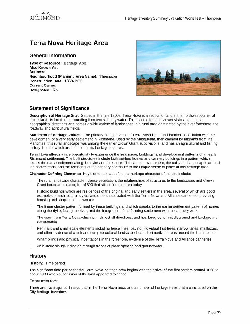
Terra Nova Heritage Area
General Information Type of Resource: Heritage Area Also Known As: Address: Neighbourhood (Planning Area Name): Thompson Construction Date: 1868-1930 Current Owner: Designated: No
Statement of Significance Description of Heritage Site: Settled in the late 1800s, Terra Nova is a section of land in the northwest corner of Lulu Island, its location surrounding it on two sides by water. This place offers the viewer vistas in almost all geographical directions and across a wide variety of landscapes in a rural area dominated by the river foreshore, the roadway and agricultural fields.
Statement of Heritage Values: The primary heritage value of Terra Nova lies in its historical association with the development of a very early settlement in Richmond. Used by the Musqueam, then claimed by migrants from the Maritimes, this rural landscape was among the earlier Crown Grant subdivisions, and has an agricultural and fishing history, both of which are reflected in its heritage features.
Terra Nova affords a rare opportunity to experience the landscape, buildings, and development patterns of an early Richmond settlement. The built structures include both settlers homes and cannery buildings in a pattern which recalls the early settlement along the dyke and foreshore. The natural environment, the cultivated landscapes around the homesteads, and the remnants of the cannery contribute to the unique sense of place of this heritage area.
Character Defining Elements: Key elements that define the heritage character of the site include:
· The rural landscape character, dense vegetation, the relationships of structures to the landscape, and Crown Grant boundaries dating from1890 that still define the area today
· Historic buildings which are residences of the original and early settlers in the area, several of which are good examples of architectural styles, and others associated with the Terra Nova and Alliance canneries, providing housing and supplies for its workers
· The linear cluster pattern formed by these buildings and which speaks to the earlier settlement pattern of homes along the dyke, facing the river, and the integration of the farming settlement with the cannery works
· The view from Terra Nova which is in almost all directions, and has foreground, middleground and background components
· Remnant and small-scale elements including fence lines, paving, individual fruit trees, narrow lanes, mailboxes, and other evidence of a rich and complex cultural landscape located primarily in areas around the homesteads
· Wharf pilings and physical indentations in the foreshore, evidence of the Terra Nova and Alliance canneries
· An historic slough indicated through traces of place species and groundwater.
History History: Time period:
The significant time period for the Terra Nova heritage area begins with the arrival of the first settlers around 1868 to about 1930 when subdivision of the land appeared to cease.
Extant resources:
There are five major built resources in the Terra Nova area, and a number of heritage trees that are included on the City heritage inventory.
Heritage Inventory Summary Evaluation Worksheet – Thompson
Page 23
Other historic resources include the documented presence of First Nations peoples, the Terra Nova and Alliance cannery sites, and the pattern of agricultural fields and homesteads that represent human interaction with the land. Overall, there are strong associations to Richmond’s history that can be successfully interpreted based upon what still remains and the stories contained in sites that are no longer there.
Distinction:
The Terra Nova area can be distinguished visually by its rural character, the dense vegetation, the relationships of structures to the landscape, and by Crown Grant boundaries dating from 1890 that still define the area today. While the majority of the heritage resources are located in the western part of the site, the entire area from No. 1 Road westward was historically, and is currently, known as the Terra Nova area.
Boundaries:
The boundaries for Terra Nova begin with the original Crown grant of Lot 4 to Hugh Youdall in 1890, and Lot 3 which extends east to No. 1 Road. They include Westminster Highway to the south, the Fraser River to the north and west, No 1 Road in the east, which includes the Old Field conservation lands. Also included is the foreshore outside the dyke to the north and west for environmental and viewshed reasons, as well as incorporating the location of cannery operations in this area.
Overall sense of place and historic character:
This is a rural cultural landscape with an agricultural and industrial history, both of which are reflected in its heritage features. The built structures, the natural environment, the cultivated landscapes and historical associations contribute to the unique sense of place of this heritage area.
Historic Criteria:
Area History:
A Musqueam shellmidden at Terra Nova is the first evidence of human settlement in this area. The site was probably used during salmon and sturgeon runs, and for harvesting crabapples. The Terra Nova slough complex provided a means of transportation in this area, and it is speculated that First Nations people could canoe from Musqueam on the mainland, through the Sea Island sloughs, across the Middle Arm of the Fraser River to Terra Nova.
The first non-native settlement occurred at Terra Nova beginning in 1868. Ease of access by water and available farmland drew settlers to the northwest corner of Lulu Island. A Crown Grant for section 3 was acquired in 1868 by Royal Engineer William McColl, and for section 2 in 1879 by D.J. Robson & J.G. Smith, both signatories to the petition for incorporation. It is possible that the McColl grant later became the D.S. Milligan estate.
In 1886 a dispute arose over the Crown Grant for section 4 among four settlers including Hugh Youdall and D.S. Milligan. In 1890 the land was awarded to Hugh Youdall on the provision that he reimburse Milligan for improvements made to the property to date. Part of Youdall’s argument for acquisition of the section rested in the petition of five settlers and fishermen who had apparently been squatting on the property since 1886 and were anxious to secure title to their homes. The petition was signed by James Mellis, Joshua Parsons, Thomas William Horne, Robert Gordon and George Haugh who named their home Terra Nova, or New Land. It is not known which settler hailed from Newfoundland. Like most early settlers they dyked and ditched their holdings to create viable farm land until the Lulu Island West Dyking District was activated in 1905. It is possible that some of these local farmers participated in the fishery as well.
James Thompson was a farm hand, then manager, of the Milligan farm until 1896 when he purchased his own land in Terra Nova. Thompson was a prominent resident of Lulu Island, and serving on the school board and becoming and active member of the Methodist church.
The Terra Nova Cannery was constructed on the Middle Arm by Duncan and John Rowan in 1890-1891, and, immediately upstream, the Alliance Cannery was built in 1895. The Terra Nova Canning Co. ceased operation in 1898, while the Alliance changed hands and continued production in the same location until both were purchased by B.C. Packers Association in 1902. They began operating as a unit under the name ‘Terra Nova’ until the Imperial plant was demolished in 1903. The original Terra Nova cannery continued until 1928, after which it was used for net storage and as a fish station until the 1970’s when the buildings were removed.
With the canneries came workers, and the construction of housing, net sheds and wharves. Together with the local farming families, the employees at the canneries and the fishermen created a need for services. The small community of Terra Nova eventually included stores, churches and a school, plus a mail stage/passenger/freight service operated by James Mellis and later, his son William. Written documents indicate that a brickworks was located in the vicinity of Westminster Highway and the dyke, but primary sources to show this have not yet been located.
Heritage Inventory Summary Evaluation Worksheet – Thompson
Page 24
Following World War II, a portion of the area was purchased for veteran’s housing which was not constructed. The most recent agricultural activity in the area was a market garden and retail outlet which operated until the early 1980’s.
Although the earliest reference to Terra Nova originated with the five settlers of section 4, the name referred to sections 2 and 3 as well. In recent years, the area has become the topic of intense debate regarding its rezoning to allow residential development, and thus the future of its historic and natural character. The creation of a park in this area may serve to protect, enhance and interpret the historic character.
Sites:
In addition to the dwellings, significant historic sites near and associated with the Terra Nova Heritage Area include an archaeological site, a shellmidden, found on the Terra Nova slough at the Tait farm near the intersection of No. 2 Road and River Road.
Development Patterns:
Early historic development patterns begin with the five squatters living in Terra Nova prior to 1886, and the Crown Grants that followed.
The few documents that are available indicate that most subdivision in the area occurred approximately over the period from 1890 to 1925. In 1909, the initial subdivision of 8 lots was complete. Access was provided by a road which ran along the top of the dyke. In 1912 the Vancouver Harbour and Dock Extension Company was acquiring foreshore land that included the dyke and bits of the settler’s properties. This also appears to be the time during which narrow laneways were being acquired to access the lots in the south part of section 4, as No. 19 Road from No. 3 Road to the Gulf of Georgia, although gazetted in 1917, was not established until 194-. When completed, No. 19 Road was 33 feet wide and straddled the section line along which Westminster Highway runs today. Section 3 was subdivided in 1925.
While most of the cannery related buildings were located outside the dyke, plans from 1936 show smaller parcels of land subdivided from the original 8 lots and containing clusters of small buildings labelled ‘houses’, inferring that the cannery operations had acquired land south of the dyke to house its management or workers. The Cannery House and Store has been documented as a former floating scowhouse of the type associated with the Fraser River canneries, but with its barge sides removed and having been relocated onto land inside the dyke.
Lots along No. 19 Road (Westminster Highway) were created later, when access was provided from Westminster Highway. After the initial subdivisions there appears to be little activity and the historic pattern of land division and use is the same as that on current municipal plans. The new development to the east creates an abrupt division between two very different character areas, and impacts the views from the interior of the site.
It is significant that these early development patterns are present on current City maps, indicating that the process of settlers moving onto the land and dividing it up through various transactions is still evident on the ground.
Built Form and Structures:
Significant buildings:
Significant buildings in Terra Nova include: Cold Comfort Farm (2840 River Road, ), the Cannery House (2740 River Road), the Cannery House and Store (2760 River Road), Parsons House (2640 River Road), the Edwardian Cottage (2680 River Road), and the Thompson House (4860 River Road).
These buildings are residences which have direct association to the early settlement of the area, and the Terra Nova and Alliance canneries which provided housing and supplies for its workers. Several of them are good examples of architectural style, including the Queen Anne style Parson’s house, and the blend of vernacular Maritime styles as seen in the Cold Comfort farmhouse.
Heritage Inventory Summary Evaluation Worksheet – Thompson
Page 25
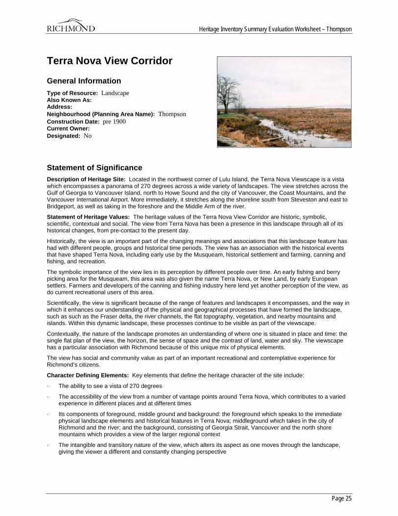
Terra Nova View Corridor
General Information Type of Resource: Landscape Also Known As: Address: Neighbourhood (Planning Area Name): Thompson Construction Date: pre 1900 Current Owner: Designated: No
Statement of Significance Description of Heritage Site: Located in the northwest corner of Lulu Island, the Terra Nova Viewscape is a vista which encompasses a panorama of 270 degrees across a wide variety of landscapes. The view stretches across the Gulf of Georgia to Vancouver Island, north to Howe Sound and the city of Vancouver, the Coast Mountains, and the Vancouver International Airport. More immediately, it stretches along the shoreline south from Steveston and east to Bridgeport, as well as taking in the foreshore and the Middle Arm of the river.
Statement of Heritage Values: The heritage values of the Terra Nova View Corridor are historic, symbolic, scientific, contextual and social. The view from Terra Nova has been a presence in this landscape through all of its historical changes, from pre-contact to the present day.
Historically, the view is an important part of the changing meanings and associations that this landscape feature has had with different people, groups and historical time periods. The view has an association with the historical events that have shaped Terra Nova, including early use by the Musqueam, historical settlement and farming, canning and fishing, and recreation.
The symbolic importance of the view lies in its perception by different people over time. An early fishing and berry picking area for the Musqueam, this area was also given the name Terra Nova, or New Land, by early European settlers. Farmers and developers of the canning and fishing industry here lend yet another perception of the view, as do current recreational users of this area.
Scientifically, the view is significant because of the range of features and landscapes it encompasses, and the way in which it enhances our understanding of the physical and geographical processes that have formed the landscape, such as such as the Fraser delta, the river channels, the flat topography, vegetation, and nearby mountains and islands. Within this dynamic landscape, these processes continue to be visible as part of the viewscape.
Contextually, the nature of the landscape promotes an understanding of where one is situated in place and time: the single flat plan of the view, the horizon, the sense of space and the contrast of land, water and sky. The viewscape has a particular association with Richmond because of this unique mix of physical elements.
The view has social and community value as part of an important recreational and contemplative experience for Richmond’s citizens.
Character Defining Elements: Key elements that define the heritage character of the site include:
· The ability to see a vista of 270 degrees
· The accessibility of the view from a number of vantage points around Terra Nova, which contributes to a varied experience in different places and at different times
· Its components of foreground, middle ground and background: the foreground which speaks to the immediate physical landscape elements and historical features in Terra Nova; middleground which takes in the city of Richmond and the river; and the background, consisting of Georgia Strait, Vancouver and the north shore mountains which provides a view of the larger regional context
· The intangible and transitory nature of the view, which alters its aspect as one moves through the landscape, giving the viewer a different and constantly changing perspective
Heritage Inventory Summary Evaluation Worksheet – Thompson
Page 26
· The intactness of the dyke and the clear separation of foreshore marshland and upland, along with the contrast of sky, horizon, water and land
History History: The Terra Nova view exists because of the geological history of the Fraser delta and its relationship to the surrounding geological features. During past glaciations, the land in this area was depressed relative to the sea. The retreating ice carved out the Fraser Valley, the land around present day Richmond emerged close to its current elevation. 7500 years ago, the Fraser delta had begun to grow from alluvial deposits from the Fraser River, but Lulu Island as we know it did not exist. A former distributary channel of the Fraser for a time flowed across what is now the central part of Lulu Island between two peat bogs; that channel was silted in and a new channel developed along what is now the south and middle arms of the Fraser.
The earliest inhabitants to have witnessed this view are the Musqueam peoples as they plied their canoes from the Fraser Delta to the Gulf Islands and Vancouver Island. Then expeditions from Britain, Spain, Russia and France charted the coastlines and gave European names to many of the geological features that can be seen from Terra Nova. From this point, the sailing vessels of these explorers would have been seen on the river and in the Strait of Georgia; the men would have seen the villages of the Musqueam lining the shores of the mainland. Trappers then arrived, who perhaps saw the view as a vast land of untapped resources.
The next witnesses to the view would have been settlers, including those known as the Terra Nova settlers in 1886; perhaps the vista helped them form their strong attachment to their new home and name it “New Land”. By this time other settlements on Sea Island and in the Marpole area of Vancouver would be bringing changes to the middleground view from Terra Nova.
In 1897, there were seven canneries in the vicinity of Terra Nova, which would have affected the foreground and middleground views. The Terra Nova Cannery and the Alliance Cannery were located on the foreshore which became a jumble of cannery buildings, docks and wharves. Two canneries on Sea Island and one on Swishwash Island would affect the view to the north, while upstream canneries on Dinsmore Island and the Lulu Island shore would be visible. This would have produced an industrial view of fishing vessels, smoke, wood cribbing and all of the buildings that are associated with the salmon canning industry.
In the 1920’s, looking across to Sea Island one would see canneries on the waterfront, agricultural land with small pockets of trees, with vegetation following section lines or ditches. Outside the dyke, the foreshore had natural vegetation, as did Swishwash Island. The dyke was transforming the foreshore, and wood cribbing created areas on the water within which the canneries could operate.
In 1931, the Vancouver International Airport on Sea Island opened and brought changes to the middleground view. There were floatplanes on the river, two airplane hangars, a terminal building, and rows of planes at the present site of the south terminal.
The 1940’s witnessed the completion of the first airport, with buildings, runways, and the Boeing construction plant. The war had brought much development and change. Upstream, there were two bridges spanning the Fraser and a sawmill, which would result in log booms on the river. The continued development of Vancouver and the University of British Columbia at Point Grey would be visible.
In more recent years, the dramatic changes of earlier times appear to have slowed, with increased density and development creeping up the mountainsides the most prominent changes in the view. Throughout the history of the view, the Fraser River would have played a major role, as changes occurred as the use of the river changed and expanded, with many different types of vessels using the river, and continued development along the river edge.
Early attitudes towards the view probably not about its aesthetics, although documents suggest that some early visitors were overwhelmed by the beauty of the lower Fraser Valley. Many people probably looked at this vista from a practical standpoint of development, its farming potential, a good place to locate a cannery or the difficulties in travelling to the Vancouver or the various islands.
In recognition of this important landscape the Terra Nova section of the Official Community Plan has policies to preserve and enhance the western open space along the perimeter dyke as natural habitat, which is the foreground of the view. It also recommends that special views such as of the mountains or waterfront, the view’s middleground and background, should be taken advantage of where possible.
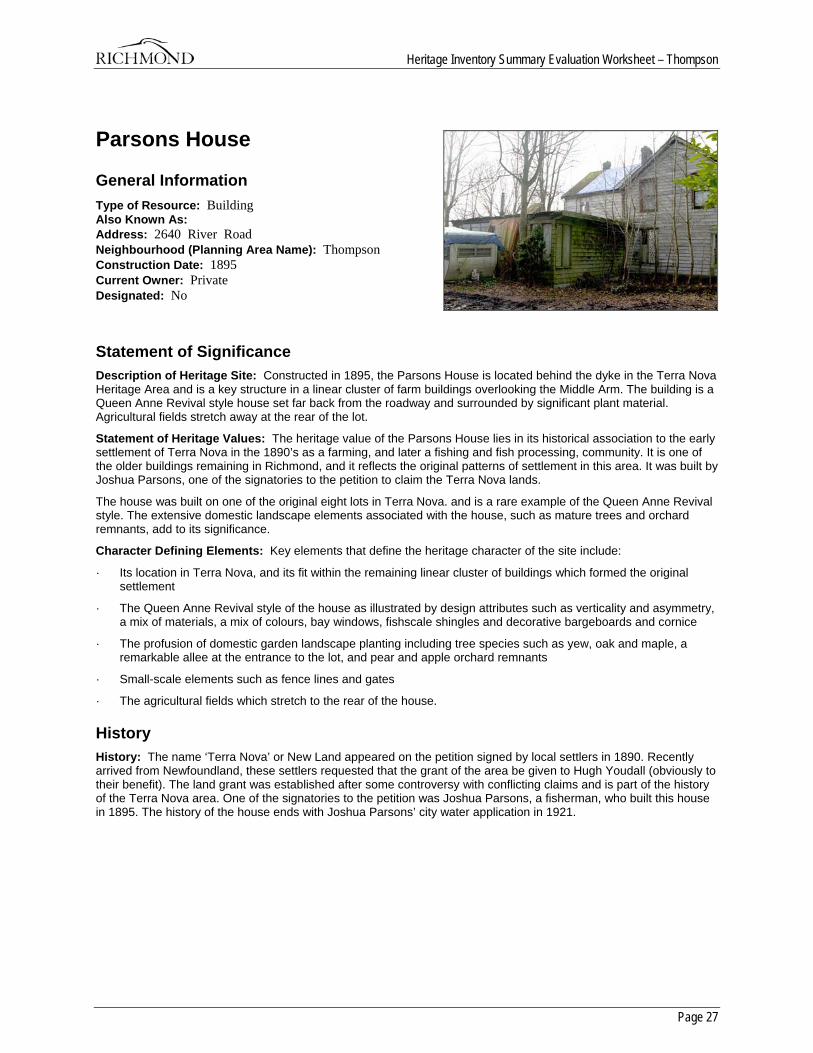
Heritage Inventory Summary Evaluation Worksheet – Thompson
Page 27
Parsons House
General Information Type of Resource: Building Also Known As: Address: 2640 River Road Neighbourhood (Planning Area Name): Thompson Construction Date: 1895 Current Owner: Private Designated: No
Statement of Significance Description of Heritage Site: Constructed in 1895, the Parsons House is located behind the dyke in the Terra Nova Heritage Area and is a key structure in a linear cluster of farm buildings overlooking the Middle Arm. The building is a Queen Anne Revival style house set far back from the roadway and surrounded by significant plant material. Agricultural fields stretch away at the rear of the lot.
Statement of Heritage Values: The heritage value of the Parsons House lies in its historical association to the early settlement of Terra Nova in the 1890’s as a farming, and later a fishing and fish processing, community. It is one of the older buildings remaining in Richmond, and it reflects the original patterns of settlement in this area. It was built by Joshua Parsons, one of the signatories to the petition to claim the Terra Nova lands.
The house was built on one of the original eight lots in Terra Nova. and is a rare example of the Queen Anne Revival style. The extensive domestic landscape elements associated with the house, such as mature trees and orchard remnants, add to its significance.
Character Defining Elements: Key elements that define the heritage character of the site include:
· Its location in Terra Nova, and its fit within the remaining linear cluster of buildings which formed the original settlement
· The Queen Anne Revival style of the house as illustrated by design attributes such as verticality and asymmetry, a mix of materials, a mix of colours, bay windows, fishscale shingles and decorative bargeboards and cornice
· The profusion of domestic garden landscape planting including tree species such as yew, oak and maple, a remarkable allee at the entrance to the lot, and pear and apple orchard remnants
· Small-scale elements such as fence lines and gates
· The agricultural fields which stretch to the rear of the house.
History History: The name ‘Terra Nova’ or New Land appeared on the petition signed by local settlers in 1890. Recently arrived from Newfoundland, these settlers requested that the grant of the area be given to Hugh Youdall (obviously to their benefit). The land grant was established after some controversy with conflicting claims and is part of the history of the Terra Nova area. One of the signatories to the petition was Joshua Parsons, a fisherman, who built this house in 1895. The history of the house ends with Joshua Parsons’ city water application in 1921.
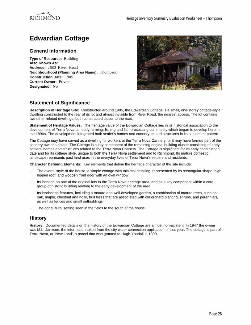
Heritage Inventory Summary Evaluation Worksheet – Thompson
Page 28
Edwardian Cottage
General Information Type of Resource: Building Also Known As: Address: 2680 River Road Neighbourhood (Planning Area Name): Thompson Construction Date: 1905 Current Owner: Private Designated: No
Statement of Significance Description of Heritage Site: Constructed around 1905, the Edwardian Cottage is a small, one-storey cottage-style dwelling constructed to the rear of its lot and almost invisible from River Road, the nearest access. The lot contains two other related dwellings, both constructed closer to the road.
Statement of Heritage Values: The heritage value of the Edwardian Cottage lies in its historical association to the development of Terra Nova, an early farming, fishing and fish processing community which began to develop here in the 1890s. The development integrated both settler’s homes and cannery related structures in its settlement pattern.
The Cottage may have served as a dwelling for workers at the Terra Nova Cannery, or it may have formed part of the cannery owner’s estate. The Cottage is a key component of the remaining original building cluster consisting of early settlers’ homes and structures related to the Terra Nova Cannery. The Cottage is significant for its early construction date and for its cottage style, unique to both the Terra Nova settlement and to Richmond. Its mature domestic landscape represents past land uses in the everyday lives of Terra Nova’s settlers and residents.
Character Defining Elements: Key elements that define the heritage character of the site include:
· The overall style of the house, a simple cottage with minimal detailing, represented by its rectangular shape, high hipped roof, and wooden front door with an oval window
· Its location on one of the original lots in the Terra Nova heritage area, and as a key component within a core group of historic building relating to the early development of the area
· Its landscape features, including a mature and well-developed garden, a combination of mature trees, such as oak, maple, chestnut and holly, fruit trees that are associated with old orchard planting, shrubs, and perennials, as well as fences and small outbuildings
· The agricultural setting seen in the fields to the south of the house.
History History: Documented details on the history of the Edwardian Cottage are almost non-existent. In 1947 the owner was M.L. Jamison, the information taken from the city water connection application of that year. The cottage is part of Terra Nova, or ‘New Land’, a parcel that was granted to Hugh Youdall in 1890.
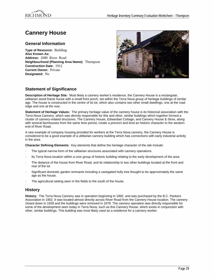
Heritage Inventory Summary Evaluation Worksheet – Thompson
Page 29
Cannery House
General Information Type of Resource: Building Also Known As: Address: 2680 River Road Neighbourhood (Planning Area Name): Thompson Construction Date: 1912 Current Owner: Private Designated: No
Statement of Significance Description of Heritage Site: Most likely a cannery worker’s residence, the Cannery House is a rectangular, utilitarian wood frame house with a small front porch, set within the Terra Nova group of heritage buildings of similar age. The house is constructed in the centre of its lot, which also contains two other small dwellings, one at the road edge and one at the rear.
Statement of Heritage Values: The primary heritage value of the cannery house is its historical association with the Terra Nova Cannery, which was directly responsible for this and other, similar buildings which together formed a cluster of cannery-related structures. The Cannery House, Edwardian Cottage, and Cannery House & Store, along with several farmhouses from the same time period, create a precinct and lend an historic character to the western end of River Road.
A rare example of company housing provided for workers at the Terra Nova cannery, the Cannery House is considered to be a good example of a utilitarian cannery building which has connections with early industrial activity in the area.
Character Defining Elements: Key elements that define the heritage character of the site include:
· The typical narrow form of the utilitarian structures associated with cannery operations
· Its Terra Nova location within a core group of historic building relating to the early development of the area
· The distance of the house from River Road, and its relationship to two other buildings located at the front and rear of the lot
· Significant domestic garden remnants including a variegated holly tree thought to be approximately the same age as the house.
· The agricultural setting seen in the fields to the south of the house.
History History: The Terra Nova Cannery was in operation beginning in 1892, and was purchased by the B.C. Packers Association in 1902. It was located almost directly across River Road from the Cannery House location. The cannery closed down in 1928 and the buildings were removed in 1978. The cannery operation was directly responsible for some of the development seen today in Terra Nova, such as this Cannery House, which exists in conjunction with other, similar buildings. This building was most likely used as a residence for a cannery worker.
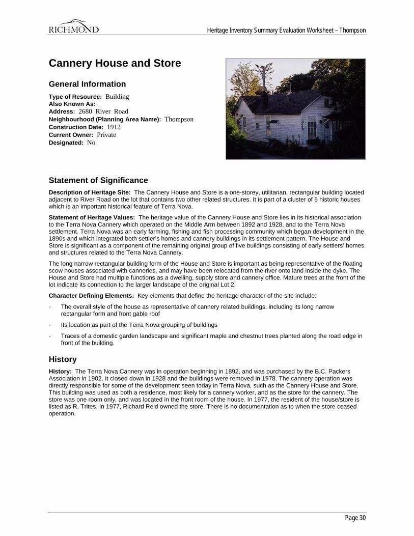
Heritage Inventory Summary Evaluation Worksheet – Thompson
Page 30
Cannery House and Store
General Information Type of Resource: Building Also Known As: Address: 2680 River Road Neighbourhood (Planning Area Name): Thompson Construction Date: 1912 Current Owner: Private Designated: No
Statement of Significance Description of Heritage Site: The Cannery House and Store is a one-storey, utilitarian, rectangular building located adjacent to River Road on the lot that contains two other related structures. It is part of a cluster of 5 historic houses which is an important historical feature of Terra Nova.
Statement of Heritage Values: The heritage value of the Cannery House and Store lies in its historical association to the Terra Nova Cannery which operated on the Middle Arm between 1892 and 1928, and to the Terra Nova settlement. Terra Nova was an early farming, fishing and fish processing community which began development in the 1890s and which integrated both settler’s homes and cannery buildings in its settlement pattern. The House and Store is significant as a component of the remaining original group of five buildings consisting of early settlers’ homes and structures related to the Terra Nova Cannery.
The long narrow rectangular building form of the House and Store is important as being representative of the floating scow houses associated with canneries, and may have been relocated from the river onto land inside the dyke. The House and Store had multiple functions as a dwelling, supply store and cannery office. Mature trees at the front of the lot indicate its connection to the larger landscape of the original Lot 2.
Character Defining Elements: Key elements that define the heritage character of the site include:
· The overall style of the house as representative of cannery related buildings, including its long narrow rectangular form and front gable roof
· Its location as part of the Terra Nova grouping of buildings
· Traces of a domestic garden landscape and significant maple and chestnut trees planted along the road edge in front of the building.
History History: The Terra Nova Cannery was in operation beginning in 1892, and was purchased by the B.C. Packers Association in 1902. It closed down in 1928 and the buildings were removed in 1978. The cannery operation was directly responsible for some of the development seen today in Terra Nova, such as the Cannery House and Store. This building was used as both a residence, most likely for a cannery worker, and as the store for the cannery. The store was one room only, and was located in the front room of the house. In 1977, the resident of the house/store is listed as R. Trites. In 1977, Richard Reid owned the store. There is no documentation as to when the store ceased operation.
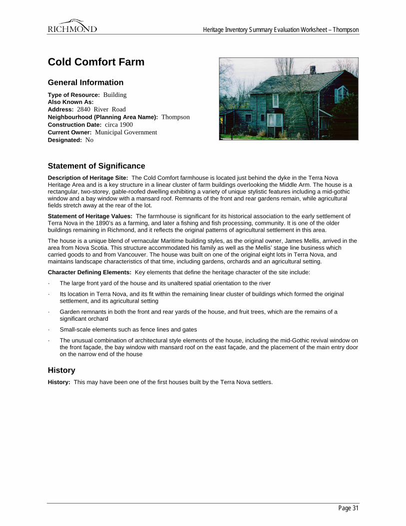
Heritage Inventory Summary Evaluation Worksheet – Thompson
Page 31
Cold Comfort Farm
General Information Type of Resource: Building Also Known As: Address: 2840 River Road Neighbourhood (Planning Area Name): Thompson Construction Date: circa 1900 Current Owner: Municipal Government Designated: No
Statement of Significance Description of Heritage Site: The Cold Comfort farmhouse is located just behind the dyke in the Terra Nova Heritage Area and is a key structure in a linear cluster of farm buildings overlooking the Middle Arm. The house is a rectangular, two-storey, gable-roofed dwelling exhibiting a variety of unique stylistic features including a mid-gothic window and a bay window with a mansard roof. Remnants of the front and rear gardens remain, while agricultural fields stretch away at the rear of the lot.
Statement of Heritage Values: The farmhouse is significant for its historical association to the early settlement of Terra Nova in the 1890’s as a farming, and later a fishing and fish processing, community. It is one of the older buildings remaining in Richmond, and it reflects the original patterns of agricultural settlement in this area.
The house is a unique blend of vernacular Maritime building styles, as the original owner, James Mellis, arrived in the area from Nova Scotia. This structure accommodated his family as well as the Mellis’ stage line business which carried goods to and from Vancouver. The house was built on one of the original eight lots in Terra Nova, and maintains landscape characteristics of that time, including gardens, orchards and an agricultural setting.
Character Defining Elements: Key elements that define the heritage character of the site include:
· The large front yard of the house and its unaltered spatial orientation to the river
· Its location in Terra Nova, and its fit within the remaining linear cluster of buildings which formed the original settlement, and its agricultural setting
· Garden remnants in both the front and rear yards of the house, and fruit trees, which are the remains of a significant orchard
· Small-scale elements such as fence lines and gates
· The unusual combination of architectural style elements of the house, including the mid-Gothic revival window on the front façade, the bay window with mansard roof on the east façade, and the placement of the main entry door on the narrow end of the house
History History: This may have been one of the first houses built by the Terra Nova settlers.

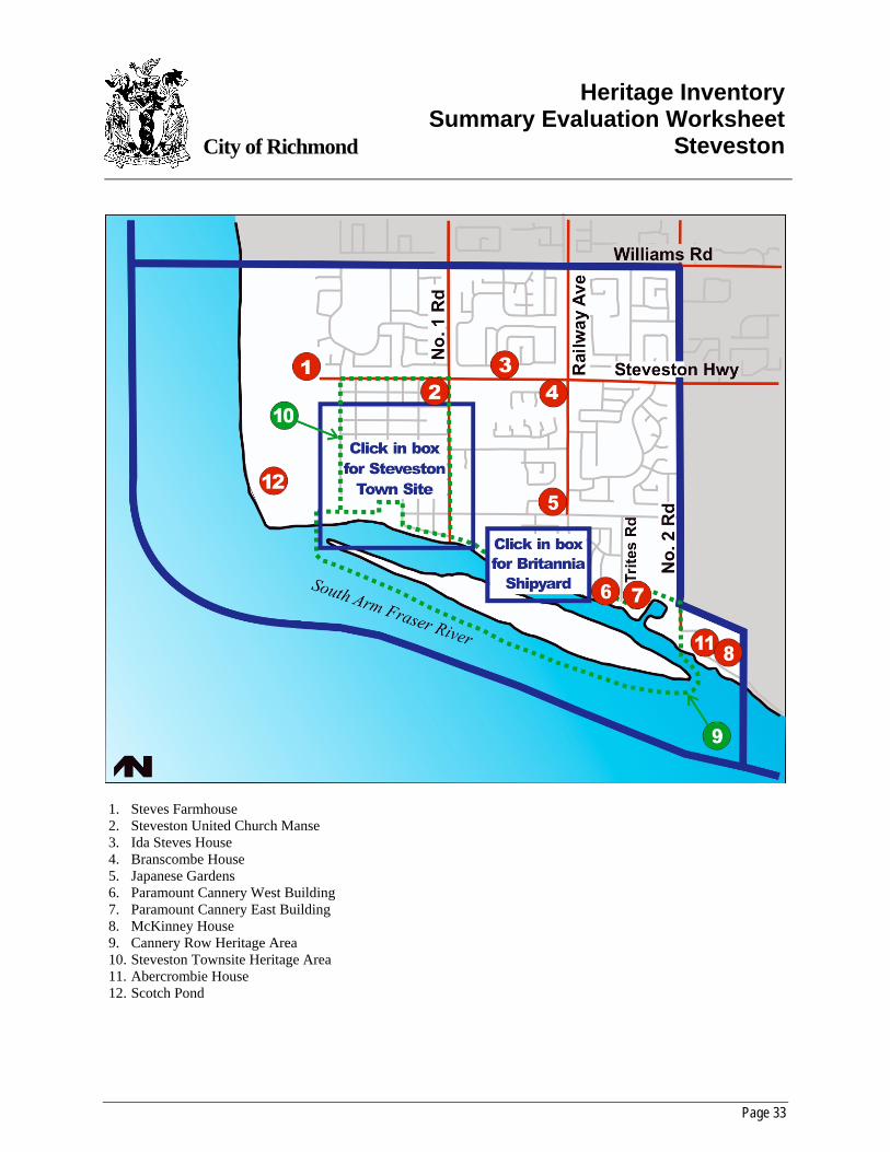
Page 33
City of Richmond
Heritage InventorySummary Evaluation Worksheet
Steveston
1. Steves Farmhouse 2. Steveston United Church Manse 3. Ida Steves House 4. Branscombe House 5. Japanese Gardens 6. Paramount Cannery West Building 7. Paramount Cannery East Building 8. McKinney House 9. Cannery Row Heritage Area 10. Steveston Townsite Heritage Area 11. Abercrombie House 12. Scotch Pond
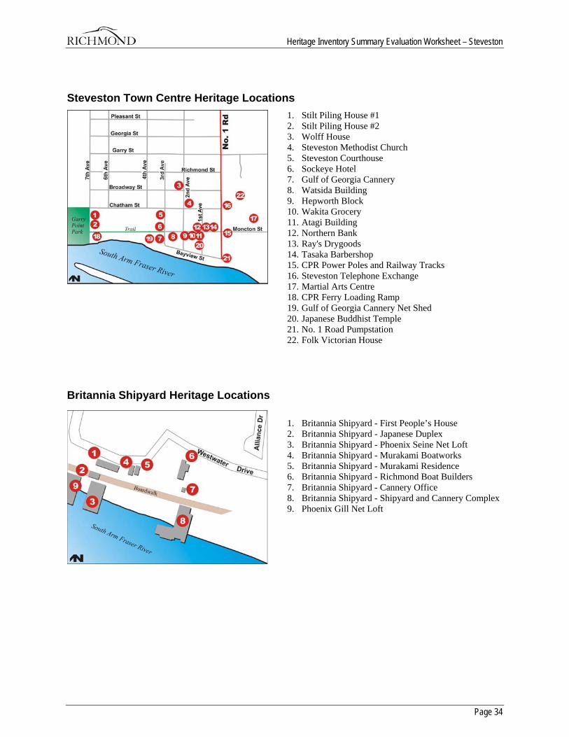
Heritage Inventory Summary Evaluation Worksheet – Steveston
Page 34
Steveston Town Centre Heritage Locations 1. Stilt Piling House #1 2. Stilt Piling House #2 3. Wolff House 4. Steveston Methodist Church 5. Steveston Courthouse 6. Sockeye Hotel 7. Gulf of Georgia Cannery 8. Watsida Building 9. Hepworth Block 10. Wakita Grocery 11. Atagi Building 12. Northern Bank 13. Ray's Drygoods 14. Tasaka Barbershop 15. CPR Power Poles and Railway Tracks 16. Steveston Telephone Exchange 17. Martial Arts Centre 18. CPR Ferry Loading Ramp 19. Gulf of Georgia Cannery Net Shed 20. Japanese Buddhist Temple 21. No. 1 Road Pumpstation 22. Folk Victorian House
Britannia Shipyard Heritage Locations
1. Britannia Shipyard - First People’s House 2. Britannia Shipyard - Japanese Duplex 3. Britannia Shipyard - Phoenix Seine Net Loft 4. Britannia Shipyard - Murakami Boatworks 5. Britannia Shipyard - Murakami Residence 6. Britannia Shipyard - Richmond Boat Builders 7. Britannia Shipyard - Cannery Office 8. Britannia Shipyard - Shipyard and Cannery Complex 9. Phoenix Gill Net Loft
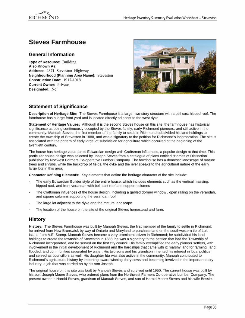
Heritage Inventory Summary Evaluation Worksheet – Steveston
Page 35
Steves Farmhouse
General Information Type of Resource: Building Also Known As: Address: 2871 Steveston Highway Neighbourhood (Planning Area Name): Steveston Construction Date: 1917-1918 Current Owner: Private Designated: No
Statement of Significance Description of Heritage Site: The Steves Farmhouse is a large, two-story structure with a bell cast hipped roof. The farmhouse has a large front yard and is located directly adjacent to the west dyke.
Statement of Heritage Values: Although it is the second Steves house on this site, the farmhouse has historical significance as being continuously occupied by the Steves family, early Richmond pioneers, and still active in the community. Manoah Steves, the first member of the family to settle in Richmond subdivided his land holdings to create the township of Steveston in 1888, and was a signatory to the petition for Richmond’s incorporation. The site is associated with the pattern of early large lot subdivision for agriculture which occurred at the beginning of the twentieth century.
The house has heritage value for its Edwardian design with Craftsman influences, a popular design at that time. This particular house design was selected by Joseph Steves from a catalogue of plans entitled “Homes of Distinction” published by Nor’west Farmers Co-operative Lumber Company. The farmhouse has a domestic landscape of mature trees and shrubs, while the backdrop of fields, the dyke and the river speaks to the agricultural nature of the early large lots in this area.
Character Defining Elements: Key elements that define the heritage character of the site include:
· The early Edwardian Builder style of the entire house, which includes elements such as the vertical massing, hipped roof, and front verandah with bell-cast roof and support columns
· The Craftsman influences of the house design, including a gabled dormer window , open railing on the verandah, and square columns supporting the verandah roof
· The large lot adjacent to the dyke and the mature landscape
· The location of the house on the site of the original Steves homestead and farm.
History History: The Steves Farmhouse was built by Manoah Steves, the first member of the family to settle in Richmond; he arrived from New Brunswick by way of Ontario and Maryland to purchase land on the southwestern tip of Lulu Island from A.E. Stamp. Manoah Steves became a very prominent citizen in Richmond; he subdivided his land holdings to create the township of Steveston in 1888, he was a signatory to the petition that had the Township of Richmond incorporated, and he served on the first city council. His family exemplified the early pioneer settlers, with involvement in the initial development of Richmond and the hardships that came with it: marshy land for farming, land flooded, and communities separated by water. His two sons and his grandson inherited his interest in local politics and served as councillors as well. His daughter Ida was also active in the community. Manoah contributed to Richmond’s agricultural history by importing award winning dairy cows and becoming involved in the important dairy industry, a job that was carried on by his son Joseph.
The original house on this site was built by Manoah Steves and survived until 1950. The current house was built by his son, Joseph Moore Steves, who ordered plans from the Northwest Farmers Co-operative Lumber Company. The present owner is Harold Steves, grandson of Manoah Steves, and son of Harold Moore Steves and his wife Bessie.
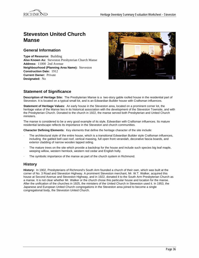
Heritage Inventory Summary Evaluation Worksheet – Steveston
Page 36
Steveston United Church Manse
General Information Type of Resource: Building Also Known As: Steveston Presbyterian Church Manse Address: 11000 2nd Avenue Neighbourhood (Planning Area Name): Steveston Construction Date: 1912 Current Owner: Private Designated: No
Statement of Significance Description of Heritage Site: The Presbyterian Manse is a two-story gable roofed house in the residential part of Steveston. It is located on a typical small lot, and is an Edwardian Builder house with Craftsman influences.
Statement of Heritage Values: An early house in the Steveston area, located on a prominent corner lot, the heritage value of the Manse lies in its historical association with the development of the Steveston Townsite, and with the Presbyterian Church. Donated to the church in 1922, the manse served both Presbyterian and United Church ministers.
The manse is considered to be a very good example of its style, Edwardian with Craftsman influences. Its mature residential landscape reflects its importance in the Steveston and church communities.
Character Defining Elements: Key elements that define the heritage character of the site include:
· The architectural style of the entire house, which is a transitional Edwardian Builder style Craftsman influences, including the gabled bell cast roof, vertical massing, full open front verandah, decorative fascia boards, and exterior cladding of narrow wooden lapped siding.
· The mature trees on the site which provide a backdrop for the house and include such species big leaf maple, weeping willow, western hemlock, western red cedar and English holly.
· The symbolic importance of the manse as part of the church system in Richmond.
History History: In 1902, Presbyterians of Richmond’s South Arm founded a church of their own, which was built at the corner of No. 3 Road and Steveston Highway. A prominent Steveston merchant, Mr. W.T. Walker, acquired this house at Second Avenue and Steveston Highway, and in 1922, donated it to the South Arm Presbyterian Church as a manse. It is not clear whether Mr. Walker or the church chose this particular house and location for the manse. After the unification of the churches in 1925, the ministers of the United Church in Steveston used it. In 1953, the Japanese and European United Church congregations in the Steveston area joined to become a single congregational body, the Steveston United Church.
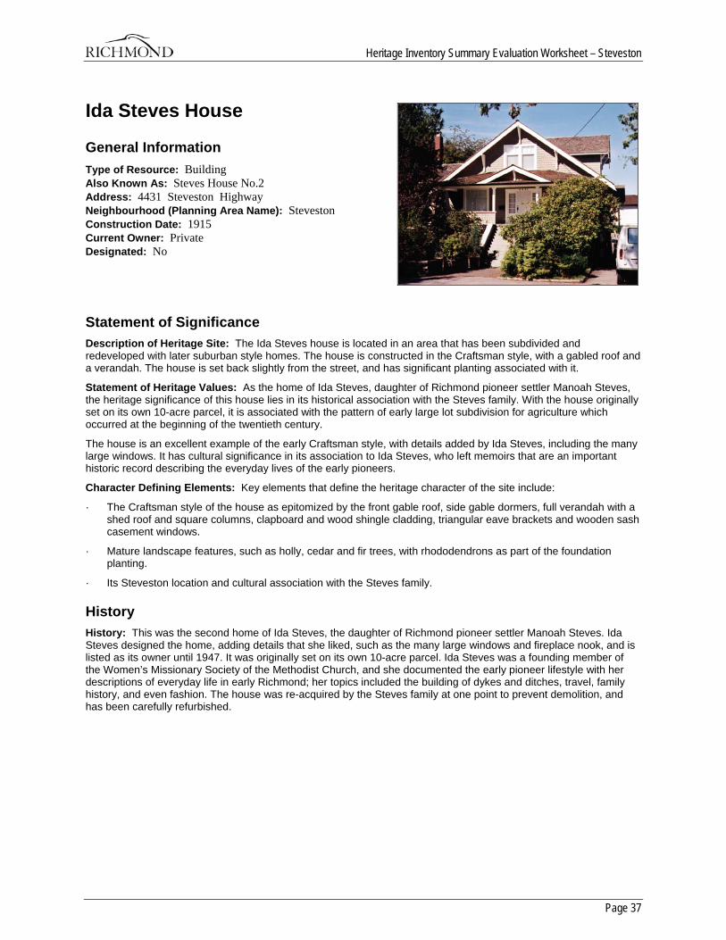
Heritage Inventory Summary Evaluation Worksheet – Steveston
Page 37
Ida Steves House
General Information Type of Resource: Building Also Known As: Steves House No.2 Address: 4431 Steveston Highway Neighbourhood (Planning Area Name): Steveston Construction Date: 1915 Current Owner: Private Designated: No
Statement of Significance Description of Heritage Site: The Ida Steves house is located in an area that has been subdivided and redeveloped with later suburban style homes. The house is constructed in the Craftsman style, with a gabled roof and a verandah. The house is set back slightly from the street, and has significant planting associated with it.
Statement of Heritage Values: As the home of Ida Steves, daughter of Richmond pioneer settler Manoah Steves, the heritage significance of this house lies in its historical association with the Steves family. With the house originally set on its own 10-acre parcel, it is associated with the pattern of early large lot subdivision for agriculture which occurred at the beginning of the twentieth century.
The house is an excellent example of the early Craftsman style, with details added by Ida Steves, including the many large windows. It has cultural significance in its association to Ida Steves, who left memoirs that are an important historic record describing the everyday lives of the early pioneers.
Character Defining Elements: Key elements that define the heritage character of the site include:
· The Craftsman style of the house as epitomized by the front gable roof, side gable dormers, full verandah with a shed roof and square columns, clapboard and wood shingle cladding, triangular eave brackets and wooden sash casement windows.
· Mature landscape features, such as holly, cedar and fir trees, with rhododendrons as part of the foundation planting.
· Its Steveston location and cultural association with the Steves family.
History History: This was the second home of Ida Steves, the daughter of Richmond pioneer settler Manoah Steves. Ida Steves designed the home, adding details that she liked, such as the many large windows and fireplace nook, and is listed as its owner until 1947. It was originally set on its own 10-acre parcel. Ida Steves was a founding member of the Women’s Missionary Society of the Methodist Church, and she documented the early pioneer lifestyle with her descriptions of everyday life in early Richmond; her topics included the building of dykes and ditches, travel, family history, and even fashion. The house was re-acquired by the Steves family at one point to prevent demolition, and has been carefully refurbished.
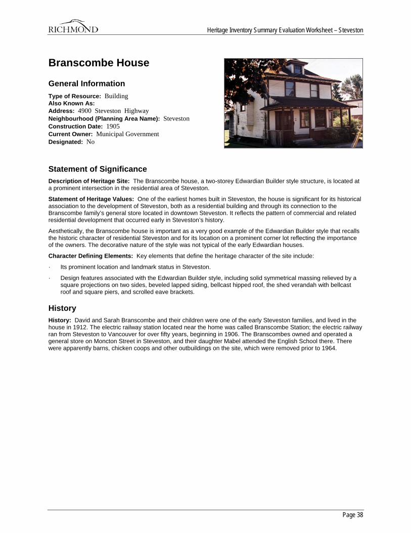
Heritage Inventory Summary Evaluation Worksheet – Steveston
Page 38
Branscombe House
General Information Type of Resource: Building Also Known As: Address: 4900 Steveston Highway Neighbourhood (Planning Area Name): Steveston Construction Date: 1905 Current Owner: Municipal Government Designated: No
Statement of Significance Description of Heritage Site: The Branscombe house, a two-storey Edwardian Builder style structure, is located at a prominent intersection in the residential area of Steveston.
Statement of Heritage Values: One of the earliest homes built in Steveston, the house is significant for its historical association to the development of Steveston, both as a residential building and through its connection to the Branscombe family’s general store located in downtown Steveston. It reflects the pattern of commercial and related residential development that occurred early in Steveston’s history.
Aesthetically, the Branscombe house is important as a very good example of the Edwardian Builder style that recalls the historic character of residential Steveston and for its location on a prominent corner lot reflecting the importance of the owners. The decorative nature of the style was not typical of the early Edwardian houses.
Character Defining Elements: Key elements that define the heritage character of the site include:
· Its prominent location and landmark status in Steveston.
· Design features associated with the Edwardian Builder style, including solid symmetrical massing relieved by a square projections on two sides, beveled lapped siding, bellcast hipped roof, the shed verandah with bellcast roof and square piers, and scrolled eave brackets.
History History: David and Sarah Branscombe and their children were one of the early Steveston families, and lived in the house in 1912. The electric railway station located near the home was called Branscombe Station; the electric railway ran from Steveston to Vancouver for over fifty years, beginning in 1906. The Branscombes owned and operated a general store on Moncton Street in Steveston, and their daughter Mabel attended the English School there. There were apparently barns, chicken coops and other outbuildings on the site, which were removed prior to 1964.
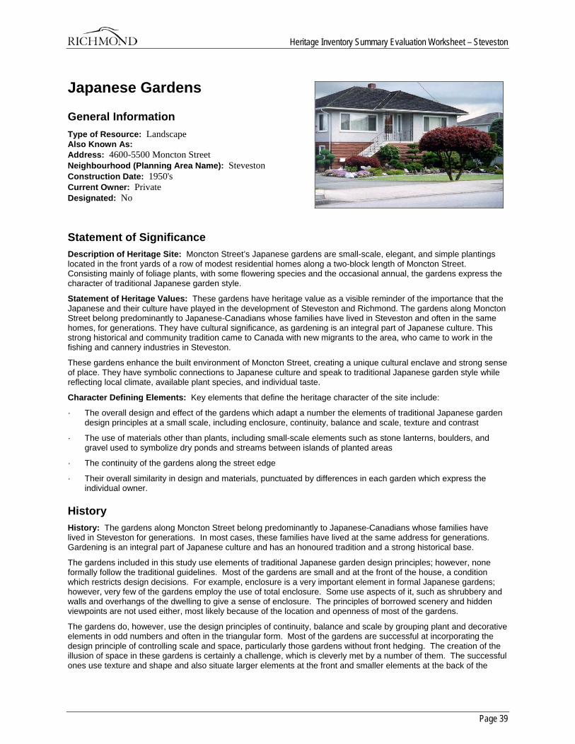
Heritage Inventory Summary Evaluation Worksheet – Steveston
Page 39
Japanese Gardens
General Information Type of Resource: Landscape Also Known As: Address: 4600-5500 Moncton Street Neighbourhood (Planning Area Name): Steveston Construction Date: 1950's Current Owner: Private Designated: No
Statement of Significance Description of Heritage Site: Moncton Street’s Japanese gardens are small-scale, elegant, and simple plantings located in the front yards of a row of modest residential homes along a two-block length of Moncton Street. Consisting mainly of foliage plants, with some flowering species and the occasional annual, the gardens express the character of traditional Japanese garden style.
Statement of Heritage Values: These gardens have heritage value as a visible reminder of the importance that the Japanese and their culture have played in the development of Steveston and Richmond. The gardens along Moncton Street belong predominantly to Japanese-Canadians whose families have lived in Steveston and often in the same homes, for generations. They have cultural significance, as gardening is an integral part of Japanese culture. This strong historical and community tradition came to Canada with new migrants to the area, who came to work in the fishing and cannery industries in Steveston.
These gardens enhance the built environment of Moncton Street, creating a unique cultural enclave and strong sense of place. They have symbolic connections to Japanese culture and speak to traditional Japanese garden style while reflecting local climate, available plant species, and individual taste.
Character Defining Elements: Key elements that define the heritage character of the site include:
· The overall design and effect of the gardens which adapt a number the elements of traditional Japanese garden design principles at a small scale, including enclosure, continuity, balance and scale, texture and contrast
· The use of materials other than plants, including small-scale elements such as stone lanterns, boulders, and gravel used to symbolize dry ponds and streams between islands of planted areas
· The continuity of the gardens along the street edge
· Their overall similarity in design and materials, punctuated by differences in each garden which express the individual owner.
History History: The gardens along Moncton Street belong predominantly to Japanese-Canadians whose families have lived in Steveston for generations. In most cases, these families have lived at the same address for generations. Gardening is an integral part of Japanese culture and has an honoured tradition and a strong historical base.
The gardens included in this study use elements of traditional Japanese garden design principles; however, none formally follow the traditional guidelines. Most of the gardens are small and at the front of the house, a condition which restricts design decisions. For example, enclosure is a very important element in formal Japanese gardens; however, very few of the gardens employ the use of total enclosure. Some use aspects of it, such as shrubbery and walls and overhangs of the dwelling to give a sense of enclosure. The principles of borrowed scenery and hidden viewpoints are not used either, most likely because of the location and openness of most of the gardens.
The gardens do, however, use the design principles of continuity, balance and scale by grouping plant and decorative elements in odd numbers and often in the triangular form. Most of the gardens are successful at incorporating the design principle of controlling scale and space, particularly those gardens without front hedging. The creation of the illusion of space in these gardens is certainly a challenge, which is cleverly met by a number of them. The successful ones use texture and shape and also situate larger elements at the front and smaller elements at the back of the

Heritage Inventory Summary Evaluation Worksheet – Steveston
Page 40
garden. Very few use paths to manipulate space and none have streams to do so. (One garden has a small water element.) What is most effective in these gardens is the traditional use of contrast, change and light. Textures are beautifully manipulated in each garden. The choice of plant materials also ensures a lovely series of colour and foliage change throughout the seasons.
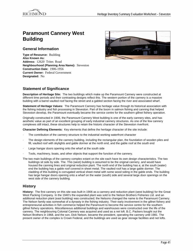
Heritage Inventory Summary Evaluation Worksheet – Steveston
Page 41
Paramount Cannery West Building
General Information Type of Resource: Building Also Known As: Address: 12620 Trites Road Neighbourhood (Planning Area Name): Steveston Construction Date: 1906-1956 Current Owner: Federal Government Designated: No
Statement of Significance Description of Heritage Site: The two buildings which make up the Paramount Cannery were constructed at different time periods and their contrasting designs reflect this. The western portion of the cannery is a massive building with a barrel vaulted roof facing the street and a gabled section facing the river and associated wharf.
Statement of Heritage Values: The Paramount Cannery has heritage value through its historical association with the fishing industry and fish processing in Steveston. Part of the boom in salmon fishing and canning that helped Steveston develop, the Paramount eventually became the service centre for the southern gillnet fishery operation.
Originally constructed in 1906, the Paramount Cannery West building is one of the early cannery sites, and has aesthetic value as part of an excellent grouping of early industrial cannery structures. As one of the few cannery complexes still intact, these structures help to retain the historic character of the Steveston riverfront.
Character Defining Elements: Key elements that define the heritage character of the site include:
· The contribution of the cannery structure to the industrial working waterfront character
· The design elements of the cannery building, including the rectangular plan, the foundation of wooden piles and fill, vaulted roof with skylights and gable dormer at the north end, and the gable roof at the south end
· Large hangar doors opening onto the wharf at the south side
· Tools, machinery, boats, and other objects that support the function of the cannery.
The two main buildings of the cannery complex extant on the site each have its own design characteristics. The two buildings sit side by side. The. This (west) building is assumed to be the original cannery, and would have housed the canning lines and original reduction plant. The north end of the building has a; at the south (water) end the building has a gable roof covered in sheet metal. The vaulted roof has a large gable dormer. The cladding of this building is corrugated vertical sheet metal with some wood siding in the gable ends. The building has large hangar doors opening onto a wharf on the water (south) side and several large door openings on the west side of the cannery building.
History History: The first cannery on this site was built in 1906 as a cannery and reduction plant (west building) for the Great West Packing Company. In the 1940’s the expanded plant was sold to the Nelson Brothers Fisheries Ltd. and an additional reduction plant (east building) was constructed; the Nelsons changed the name to the Paramount Cannery. The Nelson family was somewhat of a dynasty in the fishing industry. Their early involvement in the gillnet fishery and entrepreneurial activities in fish commerce helped the Paramount to become the service centre for the southern gillnet fishery operations. Miscellaneous additional buildings and warehouses were constructed over the life of the cannery. The neighbouring Colonial Cannery was acquired and used as a net loft. B.C. Packers bought out the Nelson Brothers in 1968, and the son, Dick Nelson, became the president, operating the cannery until 1981. The present owner of the complex is Crown Federal, and the buildings are used as gear storage facilities and net lofts.
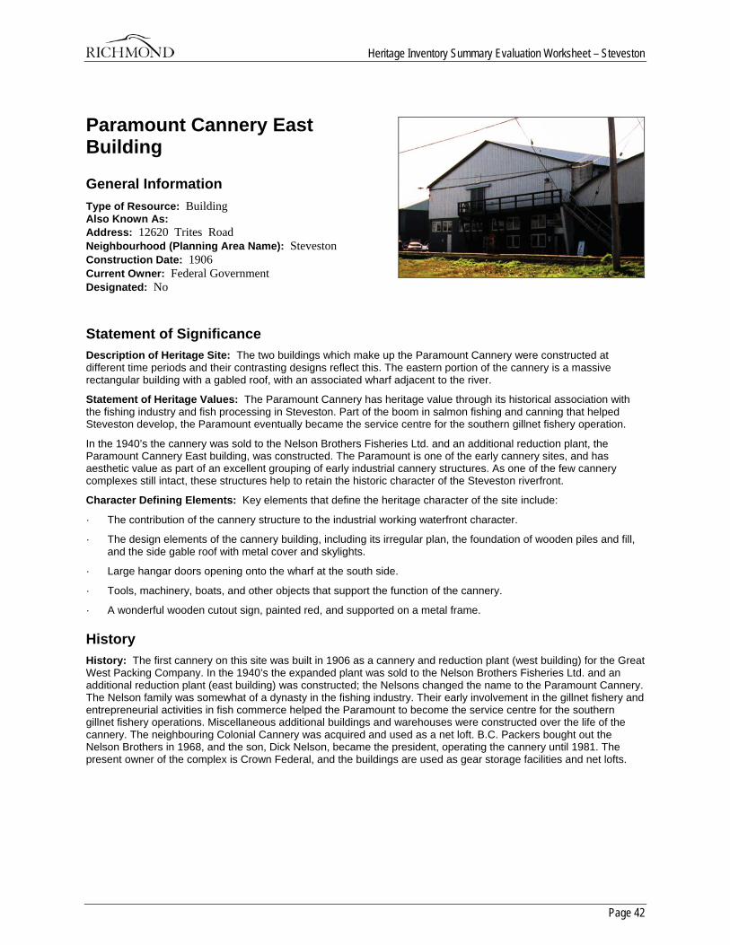
Heritage Inventory Summary Evaluation Worksheet – Steveston
Page 42
Paramount Cannery East Building
General Information Type of Resource: Building Also Known As: Address: 12620 Trites Road Neighbourhood (Planning Area Name): Steveston Construction Date: 1906 Current Owner: Federal Government Designated: No
Statement of Significance Description of Heritage Site: The two buildings which make up the Paramount Cannery were constructed at different time periods and their contrasting designs reflect this. The eastern portion of the cannery is a massive rectangular building with a gabled roof, with an associated wharf adjacent to the river.
Statement of Heritage Values: The Paramount Cannery has heritage value through its historical association with the fishing industry and fish processing in Steveston. Part of the boom in salmon fishing and canning that helped Steveston develop, the Paramount eventually became the service centre for the southern gillnet fishery operation.
In the 1940’s the cannery was sold to the Nelson Brothers Fisheries Ltd. and an additional reduction plant, the Paramount Cannery East building, was constructed. The Paramount is one of the early cannery sites, and has aesthetic value as part of an excellent grouping of early industrial cannery structures. As one of the few cannery complexes still intact, these structures help to retain the historic character of the Steveston riverfront.
Character Defining Elements: Key elements that define the heritage character of the site include:
· The contribution of the cannery structure to the industrial working waterfront character.
· The design elements of the cannery building, including its irregular plan, the foundation of wooden piles and fill, and the side gable roof with metal cover and skylights.
· Large hangar doors opening onto the wharf at the south side.
· Tools, machinery, boats, and other objects that support the function of the cannery.
· A wonderful wooden cutout sign, painted red, and supported on a metal frame.
History History: The first cannery on this site was built in 1906 as a cannery and reduction plant (west building) for the Great West Packing Company. In the 1940’s the expanded plant was sold to the Nelson Brothers Fisheries Ltd. and an additional reduction plant (east building) was constructed; the Nelsons changed the name to the Paramount Cannery. The Nelson family was somewhat of a dynasty in the fishing industry. Their early involvement in the gillnet fishery and entrepreneurial activities in fish commerce helped the Paramount to become the service centre for the southern gillnet fishery operations. Miscellaneous additional buildings and warehouses were constructed over the life of the cannery. The neighbouring Colonial Cannery was acquired and used as a net loft. B.C. Packers bought out the Nelson Brothers in 1968, and the son, Dick Nelson, became the president, operating the cannery until 1981. The present owner of the complex is Crown Federal, and the buildings are used as gear storage facilities and net lofts.
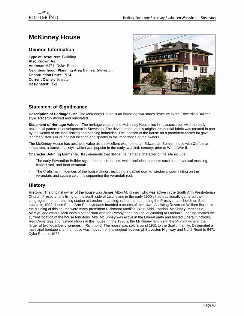
Heritage Inventory Summary Evaluation Worksheet – Steveston
Page 43
McKinney House
General Information Type of Resource: Building Also Known As: Address: 6471 Dyke Road Neighbourhood (Planning Area Name): Steveston Construction Date: 1914 Current Owner: Private Designated: Yes
Statement of Significance Description of Heritage Site: The McKinney House is an imposing two-storey structure in the Edwardian Builder style. Recently moved and renovated.
Statement of Heritage Values: The heritage value of the McKinney House lies in its association with the early residential pattern of development in Steveston. The development of this original residential fabric was created in part by the wealth of the local fishing and canning industries. The location of the house on a prominent corner lot gave it landmark status in its original location and speaks to the importance of the owners.
The McKinney House has aesthetic value as an excellent example of an Edwardian Builder house with Craftsman influences, a transitional style which was popular in the early twentieth century, prior to World War II.
Character Defining Elements: Key elements that define the heritage character of the site include:
· The early Edwardian Builder style of the entire house, which includes elements such as the vertical massing, hipped roof, and front verandah.
· The Craftsman influences of the house design, including a gabled dormer windows, open railing on the verandah, and square columns supporting the verandah roof.
History History: The original owner of the house was James Alton McKinney, who was active in the South Arm Presbyterian Church. Presbyterians living on the south side of Lulu Island in the early 1900’s had traditionally gathered their congregation at a preaching station at London’s Landing, rather than attending the Presbyterian church on Sea Island. In 1902, these South Arm Presbyterians founded a church of their own. Assisting Reverend William Burton in the building of this church were many prominent Richmond families: Blair, Kidd, London, McKinney, McKenzie, McMyn, and others. McKinney’s connection with the Presbyterian church, originating at London’s Landing, makes the current location of the house fortuitous. Mrs. McKinney was active in the Liberal party and hosted Liberal functions, Red Cross teas and fashion shows in this house. In the 1930’s, the McKinney family ran the Murtina winery, the larger of two loganberry wineries in Richmond. The house was sold around 1951 to the Scollon family. Designated a municipal heritage site, the house was moved from its original location at Steveston Highway and No. 2 Road to 6471 Dyke Road in 19??.
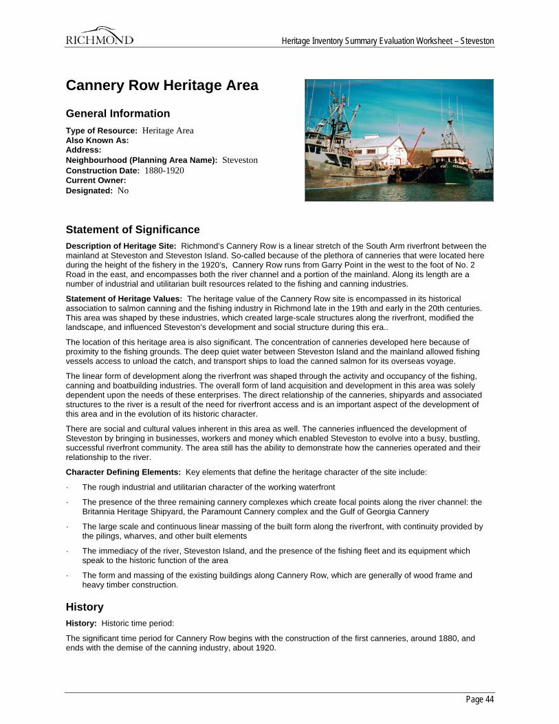
Heritage Inventory Summary Evaluation Worksheet – Steveston
Page 44
Cannery Row Heritage Area
General Information Type of Resource: Heritage Area Also Known As: Address: Neighbourhood (Planning Area Name): Steveston Construction Date: 1880-1920 Current Owner: Designated: No
Statement of Significance Description of Heritage Site: Richmond’s Cannery Row is a linear stretch of the South Arm riverfront between the mainland at Steveston and Steveston Island. So-called because of the plethora of canneries that were located here during the height of the fishery in the 1920’s, Cannery Row runs from Garry Point in the west to the foot of No. 2 Road in the east, and encompasses both the river channel and a portion of the mainland. Along its length are a number of industrial and utilitarian built resources related to the fishing and canning industries.
Statement of Heritage Values: The heritage value of the Cannery Row site is encompassed in its historical association to salmon canning and the fishing industry in Richmond late in the 19th and early in the 20th centuries. This area was shaped by these industries, which created large-scale structures along the riverfront, modified the landscape, and influenced Steveston’s development and social structure during this era..
The location of this heritage area is also significant. The concentration of canneries developed here because of proximity to the fishing grounds. The deep quiet water between Steveston Island and the mainland allowed fishing vessels access to unload the catch, and transport ships to load the canned salmon for its overseas voyage.
The linear form of development along the riverfront was shaped through the activity and occupancy of the fishing, canning and boatbuilding industries. The overall form of land acquisition and development in this area was solely dependent upon the needs of these enterprises. The direct relationship of the canneries, shipyards and associated structures to the river is a result of the need for riverfront access and is an important aspect of the development of this area and in the evolution of its historic character.
There are social and cultural values inherent in this area as well. The canneries influenced the development of Steveston by bringing in businesses, workers and money which enabled Steveston to evolve into a busy, bustling, successful riverfront community. The area still has the ability to demonstrate how the canneries operated and their relationship to the river.
Character Defining Elements: Key elements that define the heritage character of the site include:
· The rough industrial and utilitarian character of the working waterfront
· The presence of the three remaining cannery complexes which create focal points along the river channel: the Britannia Heritage Shipyard, the Paramount Cannery complex and the Gulf of Georgia Cannery
· The large scale and continuous linear massing of the built form along the riverfront, with continuity provided by the pilings, wharves, and other built elements
· The immediacy of the river, Steveston Island, and the presence of the fishing fleet and its equipment which speak to the historic function of the area
· The form and massing of the existing buildings along Cannery Row, which are generally of wood frame and heavy timber construction.
History History: Historic time period:
The significant time period for Cannery Row begins with the construction of the first canneries, around 1880, and ends with the demise of the canning industry, about 1920.
Heritage Inventory Summary Evaluation Worksheet – Steveston
Page 45
Extant resources:
Major resources currently recorded on the heritage inventory include the Gulf of Georgia Cannery, the Paramount Cannery complex, and the Britannia Heritage Shipyard. As well, there are many small-scale elements remaining. Even with the diminishing of the built resource, there is a tremendously strong association to Richmond’s history that can be successfully interpreted on this site.
Distinction:
Cannery Row is visually distinguishable today by its linear pattern of continuous development along the riverfront. It has a working riverfront character, and a relationship to the river that is evident in its historic development as an area with an association to a single industry.
Boundaries:
The southern boundary of the Cannery Row heritage area is Steveston Island. The boundary then extends west to Garry Point because it was the site of the Garry Point and Scottish Canadian canneries. The eastern boundary of the site is No. 2 Road, which ended the cannery construction and roughly coincides with the eastern end of Steveston Island. The northern boundary is more difficult to define. It follows Moncton Street east to Dunford Street, then Westwater Drive to Trites Road, then Dyke Road terminating at No. 2 Road. This boundary definition currently encompasses the B.C. Packer’s site; as this development progresses, the boundary will certainly be moved closer to the river to exclude development that has lost integrity due to new construction.
Overall sense of place and historic character:
Cannery Row still maintains a unique sense of place because of the remaining evidence of its history, and the large scale and continuous massing of its built form. The immediacy of the river and Steveston Island, as well as the presence of the fishing fleet and its equipment contribute to the historic character of this area.
Historic Criteria:
Area History:
In 1882, the Township of Richmond issued its first two trade licences to the Richmond and Phoenix canneries. During the 1890’s, the Fraser River canning industry began to boom. Between 1890 and 1900, more than 20 canneries were built in Richmond, 14 of them operating in the vicinity of Steveston. The concentration of canneries developed here because of proximity to the fishing grounds, and the deep quiet water between Steveston Island and the mainland, which allowed both fishing vessels to dock to unload the catch, and subsequently, transport ships to load the canned salmon for its overseas voyage.
Until the late 1880’s, in character with other commercial development in this era, the salmon canning industry was characterized by small firms and local proprietorship, with manual operations based on a single canning line. The first direct shipment of salmon from the Britannia Cannery at Steveston that was not first exported to Victoria or San Francisco marked the beginning of the Fraser River and its industries as a major commercial centre.
During the period of intense expansion in the 1890’s, amalgamations of cannery operations began to be carried out in order to deal with fluctuations in fortunes caused by the size of the annual salmon run. Three large firms, the Anglo-British Columbia Packing Company, the Victoria Canning Company and Ewen and Company accumulated and controlled over 70% of the annual sockeye pack. Even more sweeping, in 1902, the British Columbia Packer’s Association absorbed 22 existing canneries. Large companies now dominated the industry, and the importance of local capital, and thus local control declined.
The cannery complexes were constructed on the river side of the dyke. Adjacent to the canneries were residences for the workers and fishermen, who were mainly Japanese, Chinese and First Nations people. Each group lived in separate functional dwellings. Work in the canneries and on the fishing boats was seasonal, and the labour force was migratory, arriving from cities and native villages. After the work day or during the weekly fishing closure, there was a social aspect to the canneries, as workers gambled, played music or planted gardens, with children running everywhere, creating a lively mix of cultures.
The invention and adoption of the butchering machine around 1905 altered the industry’s labour history by eliminating the most skilled and highly paid cannery workers. Although cannery operations had a degree of mechanisation in 1900, butchering did not, a task that was carried out mainly by Chinese workers. This technology also changed the layout of the cannery buildings, eliminating the wing used for butchering. Other technological changes between 1903 and 1913 included the introduction of the sanitary solderless can in the canneries, and gasoline powered engines and nets in the fishing fleet.
In 1913, a landslide at Hell’s gate on the Fraser River blocked the passage of salmon upstream and marked the beginning of the end of the intense and lucrative salmon canning industry. Many of the canneries were adapted as
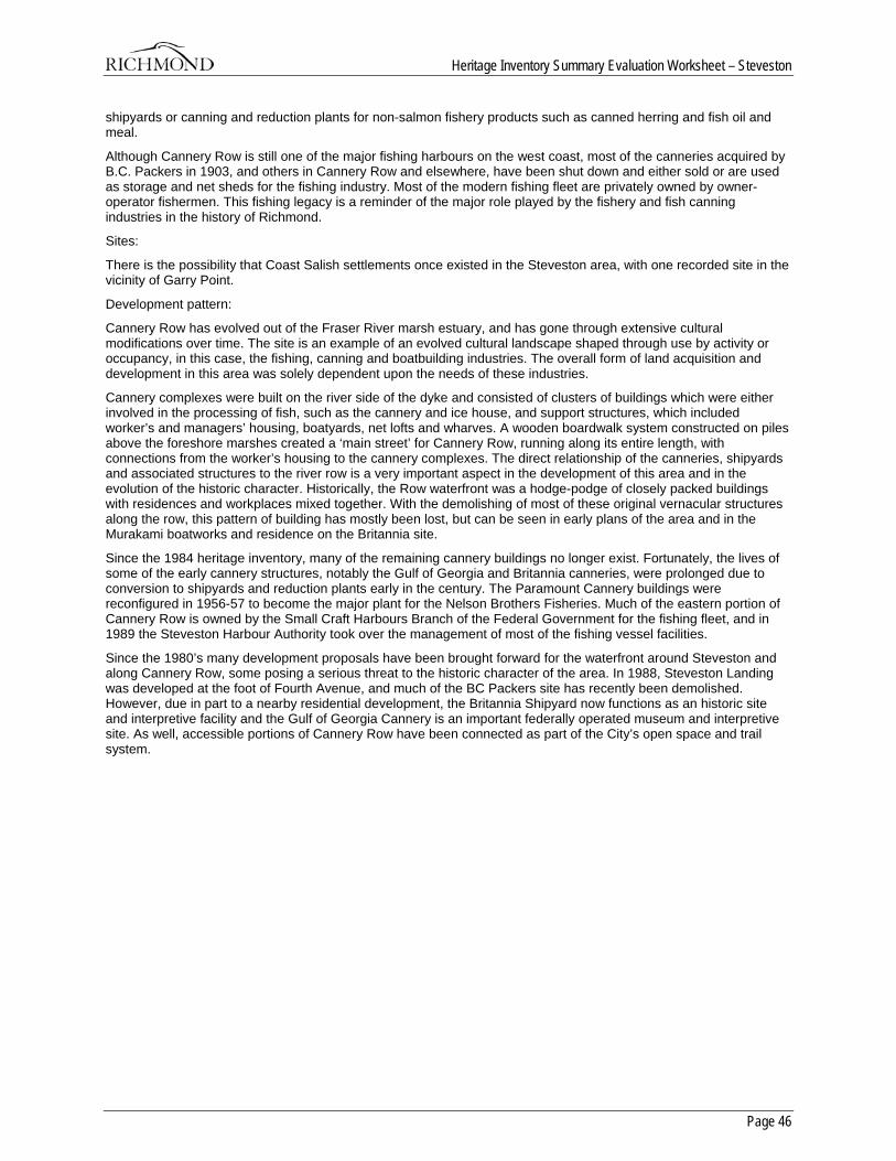
Heritage Inventory Summary Evaluation Worksheet – Steveston
Page 46
shipyards or canning and reduction plants for non-salmon fishery products such as canned herring and fish oil and meal.
Although Cannery Row is still one of the major fishing harbours on the west coast, most of the canneries acquired by B.C. Packers in 1903, and others in Cannery Row and elsewhere, have been shut down and either sold or are used as storage and net sheds for the fishing industry. Most of the modern fishing fleet are privately owned by owner-operator fishermen. This fishing legacy is a reminder of the major role played by the fishery and fish canning industries in the history of Richmond.
Sites:
There is the possibility that Coast Salish settlements once existed in the Steveston area, with one recorded site in the vicinity of Garry Point.
Development pattern:
Cannery Row has evolved out of the Fraser River marsh estuary, and has gone through extensive cultural modifications over time. The site is an example of an evolved cultural landscape shaped through use by activity or occupancy, in this case, the fishing, canning and boatbuilding industries. The overall form of land acquisition and development in this area was solely dependent upon the needs of these industries.
Cannery complexes were built on the river side of the dyke and consisted of clusters of buildings which were either involved in the processing of fish, such as the cannery and ice house, and support structures, which included worker’s and managers’ housing, boatyards, net lofts and wharves. A wooden boardwalk system constructed on piles above the foreshore marshes created a ‘main street’ for Cannery Row, running along its entire length, with connections from the worker’s housing to the cannery complexes. The direct relationship of the canneries, shipyards and associated structures to the river row is a very important aspect in the development of this area and in the evolution of the historic character. Historically, the Row waterfront was a hodge-podge of closely packed buildings with residences and workplaces mixed together. With the demolishing of most of these original vernacular structures along the row, this pattern of building has mostly been lost, but can be seen in early plans of the area and in the Murakami boatworks and residence on the Britannia site.
Since the 1984 heritage inventory, many of the remaining cannery buildings no longer exist. Fortunately, the lives of some of the early cannery structures, notably the Gulf of Georgia and Britannia canneries, were prolonged due to conversion to shipyards and reduction plants early in the century. The Paramount Cannery buildings were reconfigured in 1956-57 to become the major plant for the Nelson Brothers Fisheries. Much of the eastern portion of Cannery Row is owned by the Small Craft Harbours Branch of the Federal Government for the fishing fleet, and in 1989 the Steveston Harbour Authority took over the management of most of the fishing vessel facilities.
Since the 1980’s many development proposals have been brought forward for the waterfront around Steveston and along Cannery Row, some posing a serious threat to the historic character of the area. In 1988, Steveston Landing was developed at the foot of Fourth Avenue, and much of the BC Packers site has recently been demolished. However, due in part to a nearby residential development, the Britannia Shipyard now functions as an historic site and interpretive facility and the Gulf of Georgia Cannery is an important federally operated museum and interpretive site. As well, accessible portions of Cannery Row have been connected as part of the City’s open space and trail system.
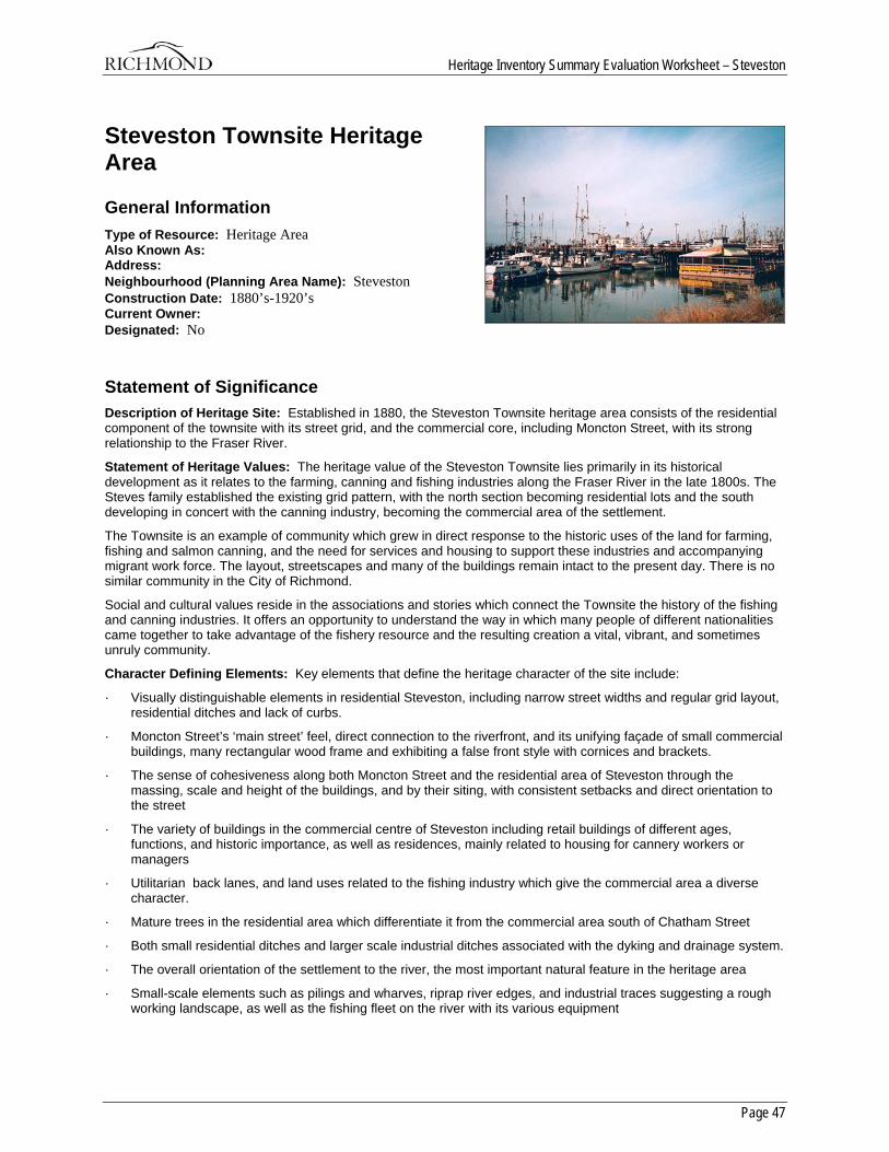
Heritage Inventory Summary Evaluation Worksheet – Steveston
Page 47
Steveston Townsite Heritage Area
General Information Type of Resource: Heritage Area Also Known As: Address: Neighbourhood (Planning Area Name): Steveston Construction Date: 1880’s-1920’s Current Owner: Designated: No
Statement of Significance Description of Heritage Site: Established in 1880, the Steveston Townsite heritage area consists of the residential component of the townsite with its street grid, and the commercial core, including Moncton Street, with its strong relationship to the Fraser River.
Statement of Heritage Values: The heritage value of the Steveston Townsite lies primarily in its historical development as it relates to the farming, canning and fishing industries along the Fraser River in the late 1800s. The Steves family established the existing grid pattern, with the north section becoming residential lots and the south developing in concert with the canning industry, becoming the commercial area of the settlement.
The Townsite is an example of community which grew in direct response to the historic uses of the land for farming, fishing and salmon canning, and the need for services and housing to support these industries and accompanying migrant work force. The layout, streetscapes and many of the buildings remain intact to the present day. There is no similar community in the City of Richmond.
Social and cultural values reside in the associations and stories which connect the Townsite the history of the fishing and canning industries. It offers an opportunity to understand the way in which many people of different nationalities came together to take advantage of the fishery resource and the resulting creation a vital, vibrant, and sometimes unruly community.
Character Defining Elements: Key elements that define the heritage character of the site include:
· Visually distinguishable elements in residential Steveston, including narrow street widths and regular grid layout, residential ditches and lack of curbs.
· Moncton Street’s ‘main street’ feel, direct connection to the riverfront, and its unifying façade of small commercial buildings, many rectangular wood frame and exhibiting a false front style with cornices and brackets.
· The sense of cohesiveness along both Moncton Street and the residential area of Steveston through the massing, scale and height of the buildings, and by their siting, with consistent setbacks and direct orientation to the street
· The variety of buildings in the commercial centre of Steveston including retail buildings of different ages, functions, and historic importance, as well as residences, mainly related to housing for cannery workers or managers
· Utilitarian back lanes, and land uses related to the fishing industry which give the commercial area a diverse character.
· Mature trees in the residential area which differentiate it from the commercial area south of Chatham Street
· Both small residential ditches and larger scale industrial ditches associated with the dyking and drainage system.
· The overall orientation of the settlement to the river, the most important natural feature in the heritage area
· Small-scale elements such as pilings and wharves, riprap river edges, and industrial traces suggesting a rough working landscape, as well as the fishing fleet on the river with its various equipment
Heritage Inventory Summary Evaluation Worksheet – Steveston
Page 48
· Major historic landmarks including the Gulf of Georgia Cannery as it terminates Moncton Street, and the Steveston Hotel, the only early hotel to survive fire and flood.
History History: Historic time period:
Crown Grant acquisition in 1880 up to the decline in the canning industry and levelling off of growth in the community, around the time of World War I.
Extant resources:
Steveston townsite contains many heritage resources which are included on the current inventory. These buildings exhibit a great diversity in use and style which is significant in documenting the many facets of Steveston’s history.
Distinction:
Residential Steveston is visually distinguishable from surrounding development by its narrower street widths, residential ditches, and lack of curbs, as well as the regular grid layout, and the scale of the buildings. Moncton Street retains a ‘main street’ feel and has a direct connection to the riverfront. Early plans show a distinct development pattern overlaid on the flat landscape.
Boundaries:
Boundaries are based on historic maps which show the acquisition and development of two Crown Grant sections, and on existing character. The first of these boundaries is Bayview Street in the south as it edges the riverfront and was the original street serving the canneries. The south side of Steveston Highway is the north boundary, beyond which there is a distinct change in character. Seventh Avenue is the western boundary, and No. 1 Road is the boundary to the east. Included in these boundaries as a discontiguous feature is the Steves farmhouse at the west end of Steveston Highway. Although the area around the farmhouse lacks historic character and integrity, the house is an important historic feature of Steveston. The riverfront itself is an important component of the townsite but has lost integrity due to development.
Overall sense of place and historic character:
The essential character of the area is seen in the concentration of extant heritage structures and their relationship to the street layout and to each other.
Historic Criteria:
Area History:
Prior to European settlement in Steveston, the Musqueam people had two salmon fishing villages in the vicinity of Steveston. First surveyed in 1858, the Steveston area was settled by farmers in the 1860’s and 1870’s. Manoah Steves arrived on Lulu Island in 1877and purchased land north of Steveston Highway for a dairy farm, the present location of the Steves farmhouse. His son William Herbert acquired a Crown Grant extending westward from No. 1 Road and south of Steveston Highway on the present Steveston Townsite in 1880, with subdivision occurring in 1888 to create the town of Steveston.
As in most of early Richmond, the first task for the farmers in Steveston was to construct dykes, docks and homes, then to prepare their fields for planting. Most of the produce and dairy products were transported to New Westminster, by boat.
With the establishment of the salmon canning industry in 1880, Steveston attracted not only farmers but businessmen, fishermen and cannery workers. In the first decade of the twentieth century, Steveston’s resident population was approximately 1000. This number increased by roughly four times that amount during the fishing season with the arrival of the migrant work force. Moncton Street to the dyke was packed with hotels, boat sheds, canneries and net racks on pilings, and cannery worker’s dwellings. Farming, market gardening, fishing and canning, plus a great mix of people, created a vital, vibrant, and sometimes unruly community. Steveston became the headquarters of the salmon fishing industry of BC. with long lines of fish canneries extending up and down the riverfront. In Steveston and vicinity there were 35 canneries and their product was shipped all over the world.
The canning industry was of great importance to Steveston’s growth and character of development. Canneries formed a solid line along the waterfront from Garry Point to No. 2 Road. Now home to major fishing companies, the fishing industry established and maintained controlling interest along the Steveston waterfront – everything has developed to support the canning and fishing industries.
Heritage Inventory Summary Evaluation Worksheet – Steveston
Page 49
The British Columbia Electric Railway arrived in 1902 both for pedestrian travel and to serve the salmon canning industry that had evolved on the southwestern shore of Lulu Island. Fire in 1918 devastated a good portion of the commercial district in an area bounded by Moncton Street, Third Avenue and No. 1 Road.
The cumulative effects of railway and dam building began to show in the salmon industry and it began to decline. By 1970 only three canneries remained in operation – the Imperial, the Paramount and the Phoenix, and renewal concepts for the waterfront were being developed, with associated conflicts. In 1988, the Steveston Landing property, owned by the federal government as part of its small craft harbours division land holdings, was slated for development. It was the last piece of undeveloped land on the waterfront with a view of the river from the town centre. Many residents wanted to preserve the fishing community that gives the area its authentic character and opposed its development into a retail complex.
Sites:
Ham (1983) identified the Steveston waterfront area as having a high potential for prehistoric archaeological sites, as well as refuse dumps dating from the historic period.
Development Patterns:
Steveston began as a Crown Grant of section 3-7-3 to William Herbert Steves in 1880. Between 1880 and 1890, over 100 individuals purchased land in this original Crown Grant section, currently the residential area of Steveston. In 1890 the Steveston area grew to include the section immediately to the south, which was the first area to develop in concert with the canning industry, and eventually became the commercial area of the settlement. Fire insurance plans suggest that the Steveston Townsite prior to 1914 consisted of this area between Seventh Avenue, Broadway Street and No. 1 Road. The layout in both sections is a grid pattern of small blocks which were divided into long thin lots between 25-30 feet. A rear lane serviced each lot.
Moncton Street developed as the major commercial street as No. 1 and No. 2 Roads from the north and Moncton Street from the East provided access by land into Steveston. The rail line, completed in1902, ended at the foot of No. 1 Road and proximity to the station became a desirable location for business. As well, most of the homes and farms were located within several blocks of the commercial centre.
The extent of commercial development along Moncton Street was restricted to Third Avenue to the west, as the right-of-way to continue the street was developed as part of the dyking system. The dyke was first constructed around 1891 when the municipality allocated funds to Steveston for dyking and road building. Commercial development then extended to the north-south streets. Plans from the early part of the century show Bay View Street located on top of the dyke and immediately adjacent to a number of canneries including Atlas, Gulf of Georgia, Star and Steveston. These plans also show the width of Chatham Street and Fourth Avenue to be greater than that of the other streets in Steveston and acting as two major axes.
After the initial boom, change in development pattern slowed down, leaving these early patterns still obvious in the street layout of both the residential and commercial areas.
A 1960 Fire Insurance Plans shows the transition from canneries to warehouses and docks on the riverfront, although the Gulf of Georgia Cannery is still in operation. There is essentially the same pattern of blocks, buildings, dyke and ditch seen today with the exception of a large block of land between Moncton and Chatham and Fourth and Sixth which is now a large storage area for fishing equipment. The Steveston Landing development blocks the waterfront at the foot of Fourth Avenue and is unsympathetic in design to the original Steveston Townsite.
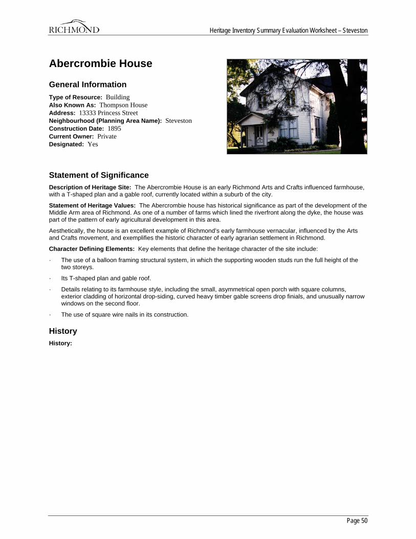
Heritage Inventory Summary Evaluation Worksheet – Steveston
Page 50
Abercrombie House
General Information Type of Resource: Building Also Known As: Thompson House Address: 13333 Princess Street Neighbourhood (Planning Area Name): Steveston Construction Date: 1895 Current Owner: Private Designated: Yes
Statement of Significance Description of Heritage Site: The Abercrombie House is an early Richmond Arts and Crafts influenced farmhouse, with a T-shaped plan and a gable roof, currently located within a suburb of the city.
Statement of Heritage Values: The Abercrombie house has historical significance as part of the development of the Middle Arm area of Richmond. As one of a number of farms which lined the riverfront along the dyke, the house was part of the pattern of early agricultural development in this area.
Aesthetically, the house is an excellent example of Richmond’s early farmhouse vernacular, influenced by the Arts and Crafts movement, and exemplifies the historic character of early agrarian settlement in Richmond.
Character Defining Elements: Key elements that define the heritage character of the site include:
· The use of a balloon framing structural system, in which the supporting wooden studs run the full height of the two storeys.
· Its T-shaped plan and gable roof.
· Details relating to its farmhouse style, including the small, asymmetrical open porch with square columns, exterior cladding of horizontal drop-siding, curved heavy timber gable screens drop finials, and unusually narrow windows on the second floor.
· The use of square wire nails in its construction.
History History:
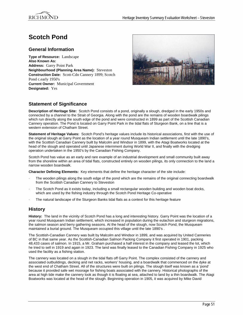
Heritage Inventory Summary Evaluation Worksheet – Steveston
Page 51
Scotch Pond
General Information Type of Resource: Landscape Also Known As: Address: Garry Point Park Neighbourhood (Planning Area Name): Steveston Construction Date: Scott-Cdn Cannery 1899; Scotch Pond c.early 1950's Current Owner: Municipal Government Designated: Yes
Statement of Significance Description of Heritage Site: Scotch Pond consists of a pond, originally a slough, dredged in the early 1950s and connected by a channel to the Strait of Georgia. Along with the pond are the remains of wooden boardwalk pilings which run directly along the south edge of the pond and were constructed in 1899 as part of the Scottish Canadian Cannery operation. The Pond is located on Garry Point Park in the tidal flats of Sturgeon Bank, on a line that is a western extension of Chatham Street.
Statement of Heritage Values: Scotch Pond’s heritage values include its historical associations, first with the use of the original slough at Garry Point as the location of a year round Musqueam Indian settlement until the late 1890’s, with the Scottish Canadian Cannery built by Malcolm and Windsor in 1899, with the Atagi Boatworks located at the head of the slough and operated until Japanese internment during World War II, and finally with the dredging operation undertaken in the 1950’s by the Canadian Fishing Company.
Scotch Pond has value as an early and rare example of an industrial development and small community built away from the shoreline within an area of tidal flats, constructed entirely on wooden pilings, its only connection to the land a narrow wooden boardwalk.
Character Defining Elements: Key elements that define the heritage character of the site include:
· The wooden pilings along the south edge of the pond which are the remains of the original connecting boardwalk from the Scottish Canadian Cannery to Steveston
· The Scotch Pond as it exists today, including a small rectangular wooden building and wooden boat docks, which are used by the fishing industry through the Scotch Pond Heritage Co-operative
· The natural landscape of the Sturgeon Banks tidal flats as a context for this heritage feature
History History: The land in the vicinity of Scotch Pond has a long and interesting history. Garry Point was the location of a year round Musqueam Indian settlement, which increased in population during the eulachon and sturgeon migrations, the salmon season and berry gathering seasons. At the head of the slough, now Scotch Pond, the Musqueam maintained a burial ground. The Musqueam occupied this village until the late 1890’s .
The Scottish-Canadian Cannery was built by Malcolm and Windsor in 1899, and was acquired by United Canneries of BC in that same year. As the Scottish-Canadian Salmon Packing Company it first operated in 1901, packing 48,433 cases of salmon. In 1915, a Mr. Graham purchased a half interest in the company and leased the lot, which he tried to sell in 1919 and again in 1923. The land was finally leased to the Canadian Fishing Company in 1925 who used the facility as a fishing station.
The cannery was located on a slough in the tidal flats off Garry Point. The complex consisted of the cannery and associated outbuildings, decking and net racks, workers’ housing, and a boardwalk that commenced on the dyke at the west end of Chatham Street. All of the structures were built on pilings. The slough itself was known as a ‘pond’ because it provided safe wet moorage for fishing boats associated with the cannery. Historical photographs of the area at high tide make the cannery look as though it is floating at sea, attached to land by a thin boardwalk. The Atagi Boatworks was located at the head of the slough. Beginning operation in 1905, it was acquired by Mike David

Heritage Inventory Summary Evaluation Worksheet – Steveston
Page 52
Boatworks in the 1940’s following internment of the Atagi family, then by a Mr. Takugaki, around 1949. The remains of the boatworks were removed from the site sometime in the mid-1970’s.
The Canadian Fishing Company dredged the slough in the early 1950’s to provide additional safe wet moorage and net mending and storage space, mainly for gillnetters. Local fishermen co-operated to create one of the longest continuous net floats on the coast, with associated net sheds and wharf. Scotch Pond was also used as a swimming hole.
Scotch Pond was purchased by the City of Richmond in 1989. A group of fishermen formed the ‘Scotch Pond Heritage Co-operative’ and now operate and manage a net float, net racks and net storage facility.
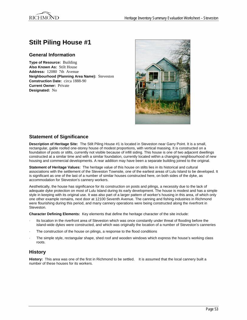
Heritage Inventory Summary Evaluation Worksheet – Steveston
Page 53
Stilt Piling House #1
General Information Type of Resource: Building Also Known As: Stilt House Address: 12080 7th Avenue Neighbourhood (Planning Area Name): Steveston Construction Date: circa 1888-90 Current Owner: Private Designated: No
Statement of Significance Description of Heritage Site: The Stilt Piling House #1 is located in Steveston near Garry Point. It is a small, rectangular, gable roofed one-storey house of modest proportions, with vertical massing. It is constructed on a foundation of posts or stilts, currently not visible because of infill siding. This house is one of two adjacent dwellings constructed at a similar time and with a similar foundation, currently located within a changing neighbourhood of new housing and commercial developments. A rear addition may have been a separate building joined to the original.
Statement of Heritage Values: The heritage value of this house on stilts lies in its historical and cultural associations with the settlement of the Steveston Townsite, one of the earliest areas of Lulu Island to be developed. It is significant as one of the last of a number of similar houses constructed here, on both sides of the dyke, as accommodation for Steveston’s cannery workers.
Aesthetically, the house has significance for its construction on posts and pilings, a necessity due to the lack of adequate dyke protection on most of Lulu Island during its early development. The house is modest and has a simple style in keeping with its original use. It was also part of a larger pattern of worker’s housing in this area, of which only one other example remains, next door at 12100 Seventh Avenue. The canning and fishing industries in Richmond were flourishing during this period, and many cannery operations were being constructed along the riverfront in Steveston.
Character Defining Elements: Key elements that define the heritage character of the site include:
· Its location in the riverfront area of Steveston which was once constantly under threat of flooding before the island-wide dykes were constructed, and which was originally the location of a number of Steveston’s canneries
· The construction of the house on pilings, a response to the flood conditions
· The simple style, rectangular shape, shed roof and wooden windows which express the house’s working class roots.
History History: This area was one of the first in Richmond to be settled. It is assumed that the local cannery built a number of these houses for its workers.
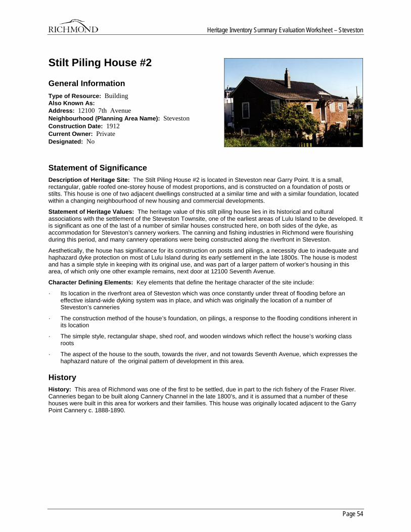
Heritage Inventory Summary Evaluation Worksheet – Steveston
Page 54
Stilt Piling House #2
General Information Type of Resource: Building Also Known As: Address: 12100 7th Avenue Neighbourhood (Planning Area Name): Steveston Construction Date: 1912 Current Owner: Private Designated: No
Statement of Significance Description of Heritage Site: The Stilt Piling House #2 is located in Steveston near Garry Point. It is a small, rectangular, gable roofed one-storey house of modest proportions, and is constructed on a foundation of posts or stilts. This house is one of two adjacent dwellings constructed at a similar time and with a similar foundation, located within a changing neighbourhood of new housing and commercial developments.
Statement of Heritage Values: The heritage value of this stilt piling house lies in its historical and cultural associations with the settlement of the Steveston Townsite, one of the earliest areas of Lulu Island to be developed. It is significant as one of the last of a number of similar houses constructed here, on both sides of the dyke, as accommodation for Steveston’s cannery workers. The canning and fishing industries in Richmond were flourishing during this period, and many cannery operations were being constructed along the riverfront in Steveston.
Aesthetically, the house has significance for its construction on posts and pilings, a necessity due to inadequate and haphazard dyke protection on most of Lulu Island during its early settlement in the late 1800s. The house is modest and has a simple style in keeping with its original use, and was part of a larger pattern of worker’s housing in this area, of which only one other example remains, next door at 12100 Seventh Avenue.
Character Defining Elements: Key elements that define the heritage character of the site include:
· Its location in the riverfront area of Steveston which was once constantly under threat of flooding before an effective island-wide dyking system was in place, and which was originally the location of a number of Steveston’s canneries
· The construction method of the house’s foundation, on pilings, a response to the flooding conditions inherent in its location
· The simple style, rectangular shape, shed roof, and wooden windows which reflect the house’s working class roots
· The aspect of the house to the south, towards the river, and not towards Seventh Avenue, which expresses the haphazard nature of the original pattern of development in this area.
History History: This area of Richmond was one of the first to be settled, due in part to the rich fishery of the Fraser River. Canneries began to be built along Cannery Channel in the late 1800’s, and it is assumed that a number of these houses were built in this area for workers and their families. This house was originally located adjacent to the Garry Point Cannery c. 1888-1890.
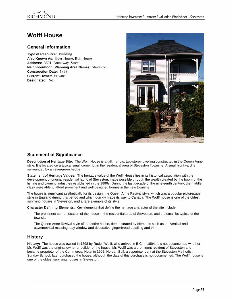
Heritage Inventory Summary Evaluation Worksheet – Steveston
Page 55
Wolff House
General Information Type of Resource: Building Also Known As: Beer House, Bull House Address: 3691 Broadway Street Neighbourhood (Planning Area Name): Steveston Construction Date: 1898 Current Owner: Private Designated: No
Statement of Significance Description of Heritage Site: The Wolff House is a tall, narrow, two-storey dwelling constructed in the Queen Anne style. It is located on a typical small corner lot in the residential area of Steveston Townsite. A small front yard is surrounded by an evergreen hedge.
Statement of Heritage Values: The heritage value of the Wolff House lies in its historical association with the development of original residential fabric of Steveston, made possible through the wealth created by the boom of the fishing and canning industries established in the 1880s. During the last decade of the nineteenth century, the middle class were able to afford prominent and well designed homes in the new townsite.
The house is significant aesthetically for its design, the Queen Anne Revival style, which was a popular picturesque style in England during this period and which quickly made its way to Canada. The Wolff house is one of the oldest surviving houses in Steveston, and a rare example of its style.
Character Defining Elements: Key elements that define the heritage character of the site include:
· The prominent corner location of the house in the residential area of Steveston, and the small lot typical of the townsite
· The Queen Anne Revival style of the entire house, demonstrated by elements such as the vertical and asymmetrical massing, bay window and decorative gingerbread detailing and trim.
History History: The house was owned in 1898 by Rudolf Wolff, who arrived in B.C. in 1894. It is not documented whether Mr. Wolff was the original owner or builder of the house. Mr. Wolff was a prominent resident of Steveston and became proprietor of the Commercial Hotel in 1906. Horeah Bull, a superintendent at the Steveston Methodist Sunday School, later purchased the house, although the date of this purchase is not documented. The Wolff house is one of the oldest surviving houses in Steveston.
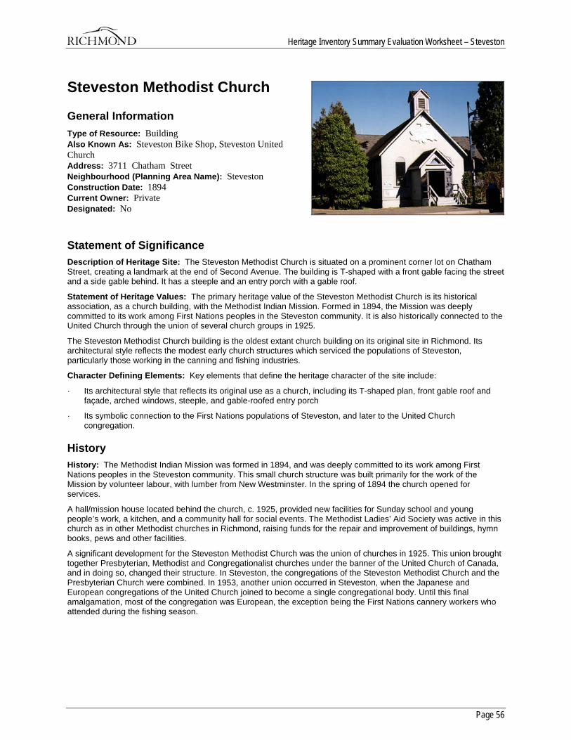
Heritage Inventory Summary Evaluation Worksheet – Steveston
Page 56
Steveston Methodist Church
General Information Type of Resource: Building Also Known As: Steveston Bike Shop, Steveston United Church Address: 3711 Chatham Street Neighbourhood (Planning Area Name): Steveston Construction Date: 1894 Current Owner: Private Designated: No
Statement of Significance Description of Heritage Site: The Steveston Methodist Church is situated on a prominent corner lot on Chatham Street, creating a landmark at the end of Second Avenue. The building is T-shaped with a front gable facing the street and a side gable behind. It has a steeple and an entry porch with a gable roof.
Statement of Heritage Values: The primary heritage value of the Steveston Methodist Church is its historical association, as a church building, with the Methodist Indian Mission. Formed in 1894, the Mission was deeply committed to its work among First Nations peoples in the Steveston community. It is also historically connected to the United Church through the union of several church groups in 1925.
The Steveston Methodist Church building is the oldest extant church building on its original site in Richmond. Its architectural style reflects the modest early church structures which serviced the populations of Steveston, particularly those working in the canning and fishing industries.
Character Defining Elements: Key elements that define the heritage character of the site include:
· Its architectural style that reflects its original use as a church, including its T-shaped plan, front gable roof and façade, arched windows, steeple, and gable-roofed entry porch
· Its symbolic connection to the First Nations populations of Steveston, and later to the United Church congregation.
History History: The Methodist Indian Mission was formed in 1894, and was deeply committed to its work among First Nations peoples in the Steveston community. This small church structure was built primarily for the work of the Mission by volunteer labour, with lumber from New Westminster. In the spring of 1894 the church opened for services.
A hall/mission house located behind the church, c. 1925, provided new facilities for Sunday school and young people’s work, a kitchen, and a community hall for social events. The Methodist Ladies’ Aid Society was active in this church as in other Methodist churches in Richmond, raising funds for the repair and improvement of buildings, hymn books, pews and other facilities.
A significant development for the Steveston Methodist Church was the union of churches in 1925. This union brought together Presbyterian, Methodist and Congregationalist churches under the banner of the United Church of Canada, and in doing so, changed their structure. In Steveston, the congregations of the Steveston Methodist Church and the Presbyterian Church were combined. In 1953, another union occurred in Steveston, when the Japanese and European congregations of the United Church joined to become a single congregational body. Until this final amalgamation, most of the congregation was European, the exception being the First Nations cannery workers who attended during the fishing season.
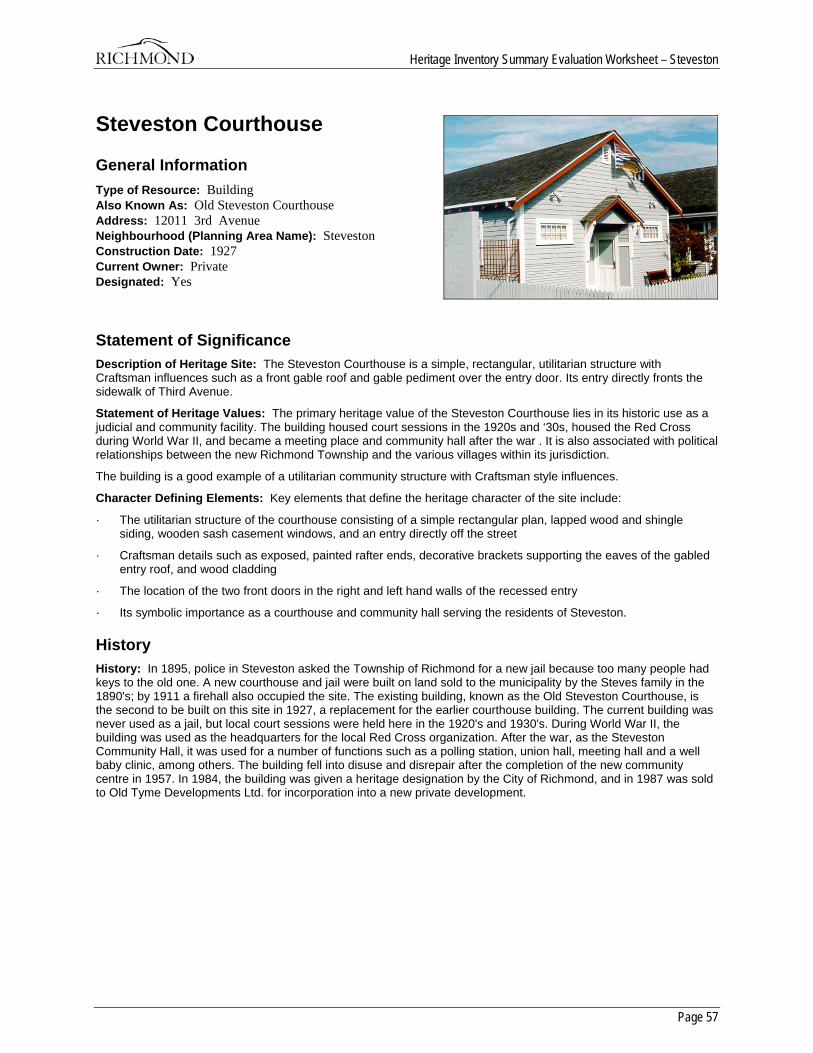
Heritage Inventory Summary Evaluation Worksheet – Steveston
Page 57
Steveston Courthouse
General Information Type of Resource: Building Also Known As: Old Steveston Courthouse Address: 12011 3rd Avenue Neighbourhood (Planning Area Name): Steveston Construction Date: 1927 Current Owner: Private Designated: Yes
Statement of Significance Description of Heritage Site: The Steveston Courthouse is a simple, rectangular, utilitarian structure with Craftsman influences such as a front gable roof and gable pediment over the entry door. Its entry directly fronts the sidewalk of Third Avenue.
Statement of Heritage Values: The primary heritage value of the Steveston Courthouse lies in its historic use as a judicial and community facility. The building housed court sessions in the 1920s and ‘30s, housed the Red Cross during World War II, and became a meeting place and community hall after the war . It is also associated with political relationships between the new Richmond Township and the various villages within its jurisdiction.
The building is a good example of a utilitarian community structure with Craftsman style influences.
Character Defining Elements: Key elements that define the heritage character of the site include:
· The utilitarian structure of the courthouse consisting of a simple rectangular plan, lapped wood and shingle siding, wooden sash casement windows, and an entry directly off the street
· Craftsman details such as exposed, painted rafter ends, decorative brackets supporting the eaves of the gabled entry roof, and wood cladding
· The location of the two front doors in the right and left hand walls of the recessed entry
· Its symbolic importance as a courthouse and community hall serving the residents of Steveston.
History History: In 1895, police in Steveston asked the Township of Richmond for a new jail because too many people had keys to the old one. A new courthouse and jail were built on land sold to the municipality by the Steves family in the 1890's; by 1911 a firehall also occupied the site. The existing building, known as the Old Steveston Courthouse, is the second to be built on this site in 1927, a replacement for the earlier courthouse building. The current building was never used as a jail, but local court sessions were held here in the 1920's and 1930's. During World War II, the building was used as the headquarters for the local Red Cross organization. After the war, as the Steveston Community Hall, it was used for a number of functions such as a polling station, union hall, meeting hall and a well baby clinic, among others. The building fell into disuse and disrepair after the completion of the new community centre in 1957. In 1984, the building was given a heritage designation by the City of Richmond, and in 1987 was sold to Old Tyme Developments Ltd. for incorporation into a new private development.
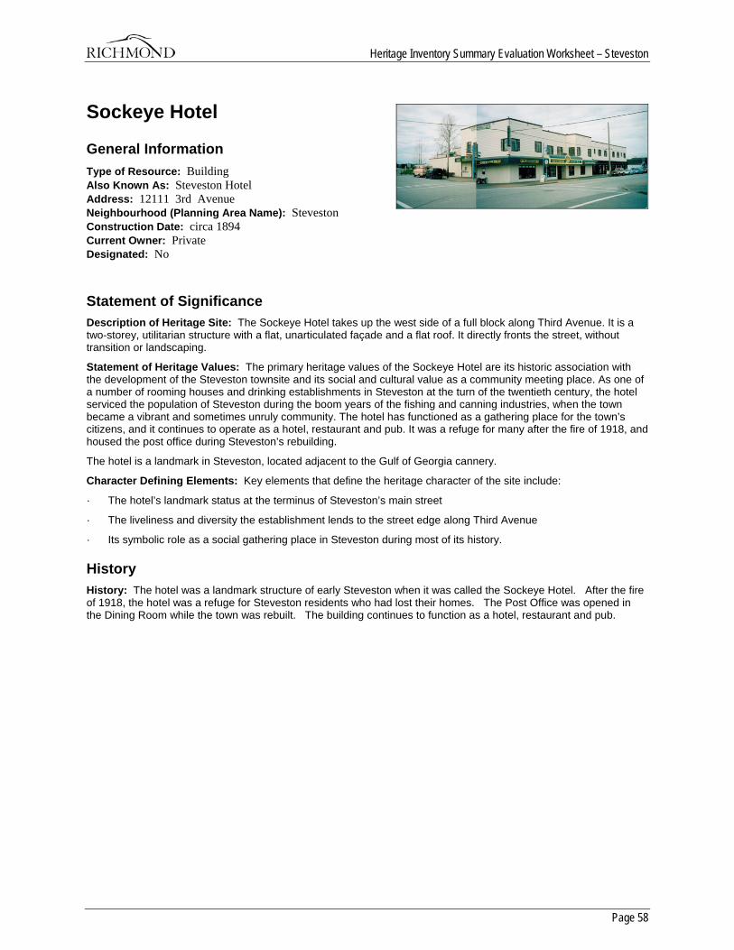
Heritage Inventory Summary Evaluation Worksheet – Steveston
Page 58
Sockeye Hotel
General Information Type of Resource: Building Also Known As: Steveston Hotel Address: 12111 3rd Avenue Neighbourhood (Planning Area Name): Steveston Construction Date: circa 1894 Current Owner: Private Designated: No
Statement of Significance Description of Heritage Site: The Sockeye Hotel takes up the west side of a full block along Third Avenue. It is a two-storey, utilitarian structure with a flat, unarticulated façade and a flat roof. It directly fronts the street, without transition or landscaping.
Statement of Heritage Values: The primary heritage values of the Sockeye Hotel are its historic association with the development of the Steveston townsite and its social and cultural value as a community meeting place. As one of a number of rooming houses and drinking establishments in Steveston at the turn of the twentieth century, the hotel serviced the population of Steveston during the boom years of the fishing and canning industries, when the town became a vibrant and sometimes unruly community. The hotel has functioned as a gathering place for the town’s citizens, and it continues to operate as a hotel, restaurant and pub. It was a refuge for many after the fire of 1918, and housed the post office during Steveston’s rebuilding.
The hotel is a landmark in Steveston, located adjacent to the Gulf of Georgia cannery.
Character Defining Elements: Key elements that define the heritage character of the site include:
· The hotel’s landmark status at the terminus of Steveston’s main street
· The liveliness and diversity the establishment lends to the street edge along Third Avenue
· Its symbolic role as a social gathering place in Steveston during most of its history.
History History: The hotel was a landmark structure of early Steveston when it was called the Sockeye Hotel. After the fire of 1918, the hotel was a refuge for Steveston residents who had lost their homes. The Post Office was opened in the Dining Room while the town was rebuilt. The building continues to function as a hotel, restaurant and pub.
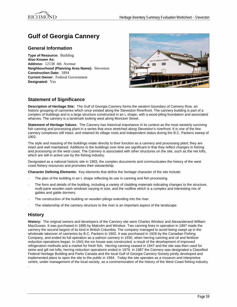
Heritage Inventory Summary Evaluation Worksheet – Steveston
Page 59
Gulf of Georgia Cannery
General Information Type of Resource: Building Also Known As: Address: 12138 4th Avenue Neighbourhood (Planning Area Name): Steveston Construction Date: 1894 Current Owner: Federal Government Designated: Yes
Statement of Significance Description of Heritage Site: The Gulf of Georgia Cannery forms the western boundary of Cannery Row, an historic grouping of canneries which once existed along the Steveston Riverfront. The cannery building is part of a complex of buildings and is a large structure constructed in an L shape, with a wood piling foundation and associated wharves. The cannery is a landmark looking west along Moncton Street.
Statement of Heritage Values: The Cannery has historical importance in its context as the most westerly surviving fish canning and processing plant in a series that once stretched along Steveston’s riverfront. It is one of the few cannery complexes still intact, and retained its village roots and independent status during the B.C. Packers sweep of 1902.
The style and massing of the buildings relate directly to their function as a cannery and processing plant; they are intact and well maintained. Additions to the buildings over time are significant in that they reflect changes in fishing and processing on the west coast. The Cannery is associated with other structures on the site, such as the net lofts, which are still in active use by the fishing industry.
Designated as a national historic site in 1993, the complex documents and communicates the history of the west coast fishery resources and promotes their stewardship.
Character Defining Elements: Key elements that define the heritage character of the site include:
· The plan of the building in an L shape reflecting its use in canning and fish processing.
· The form and details of the building, including a variety of cladding materials indicating changes to the structure, multi-pane wooden sash windows varying in size, and the roofline which is a complex and interesting mix of gables and gable dormers.
· The construction of the building on wooden pilings extending into the river.
· The relationship of the cannery structure to the river is an important aspect of the landscape.
History History: The original owners and developers of the Cannery site were Charles Windsor and Alexanderand William MacGowan. It was purchased in 1895 by Malcolm and Windsor. Two canning lines in operation in 1897 made the cannery the second largest of its kind in British Columbia. The company managed to avoid being swept up in the wholesale takeover of canneries by B.C. Packers in 1902. It was purchased in 1926 by the Canadian Fishing Company, and ended its full operation as a salmon cannery in 1930, when herring canning and oil and fertilizer reduction operations began. In 1941 the ice house was constructed, a result of the development of improved refrigeration methods and a market for fresh fish. Herring canning ceased in 1947 and the site was then used for seine and gill net lofts; herring reduction operations ended in 1979. In 1987 the Cannery was designated a Classified Federal Heritage Building and Parks Canada and the local Gulf of Georgia Cannery Society jointly developed and implemented plans to open the site to the public in 1994. Today the site operates as a museum and interpretive centre, under management of the local society, as a commemoration of the history of the West Coast fishing industry .
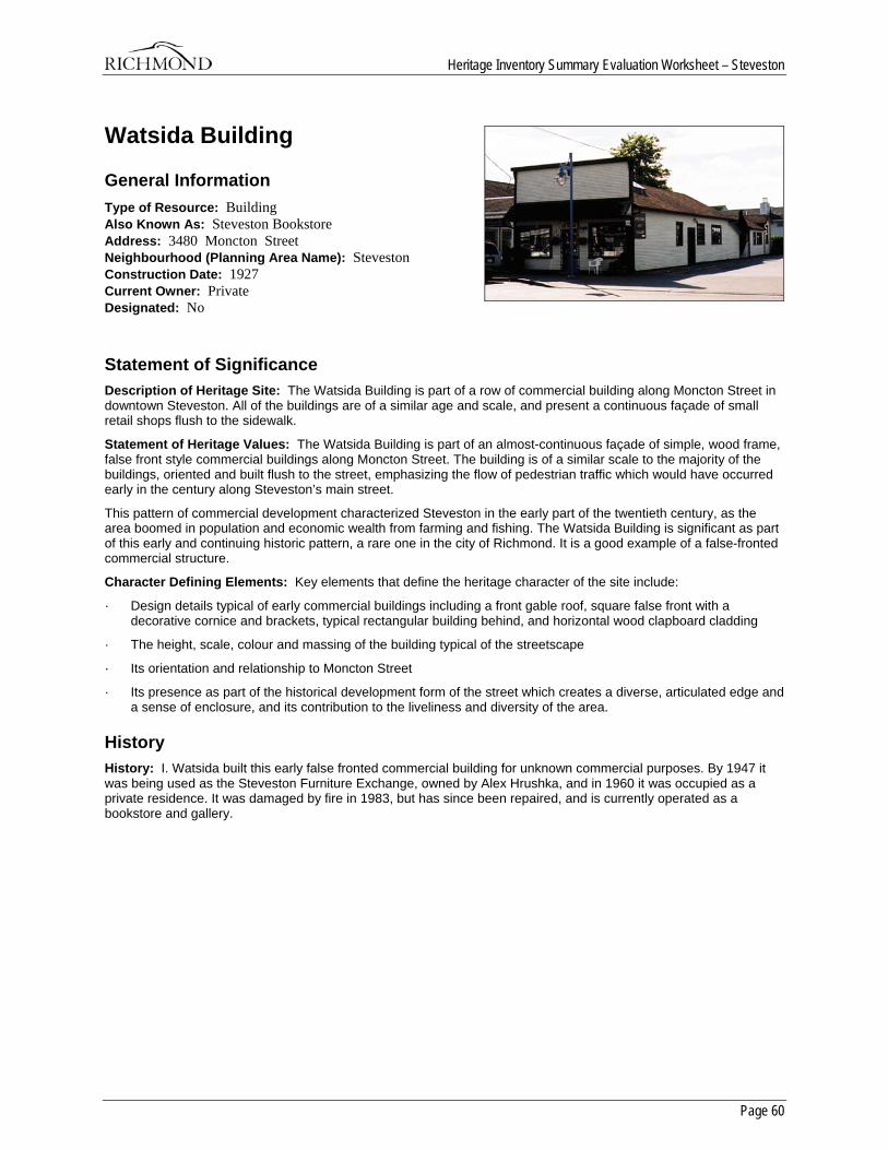
Heritage Inventory Summary Evaluation Worksheet – Steveston
Page 60
Watsida Building
General Information Type of Resource: Building Also Known As: Steveston Bookstore Address: 3480 Moncton Street Neighbourhood (Planning Area Name): Steveston Construction Date: 1927 Current Owner: Private Designated: No
Statement of Significance Description of Heritage Site: The Watsida Building is part of a row of commercial building along Moncton Street in downtown Steveston. All of the buildings are of a similar age and scale, and present a continuous façade of small retail shops flush to the sidewalk.
Statement of Heritage Values: The Watsida Building is part of an almost-continuous façade of simple, wood frame, false front style commercial buildings along Moncton Street. The building is of a similar scale to the majority of the buildings, oriented and built flush to the street, emphasizing the flow of pedestrian traffic which would have occurred early in the century along Steveston’s main street.
This pattern of commercial development characterized Steveston in the early part of the twentieth century, as the area boomed in population and economic wealth from farming and fishing. The Watsida Building is significant as part of this early and continuing historic pattern, a rare one in the city of Richmond. It is a good example of a false-fronted commercial structure.
Character Defining Elements: Key elements that define the heritage character of the site include:
· Design details typical of early commercial buildings including a front gable roof, square false front with a decorative cornice and brackets, typical rectangular building behind, and horizontal wood clapboard cladding
· The height, scale, colour and massing of the building typical of the streetscape
· Its orientation and relationship to Moncton Street
· Its presence as part of the historical development form of the street which creates a diverse, articulated edge and a sense of enclosure, and its contribution to the liveliness and diversity of the area.
History History: I. Watsida built this early false fronted commercial building for unknown commercial purposes. By 1947 it was being used as the Steveston Furniture Exchange, owned by Alex Hrushka, and in 1960 it was occupied as a private residence. It was damaged by fire in 1983, but has since been repaired, and is currently operated as a bookstore and gallery.
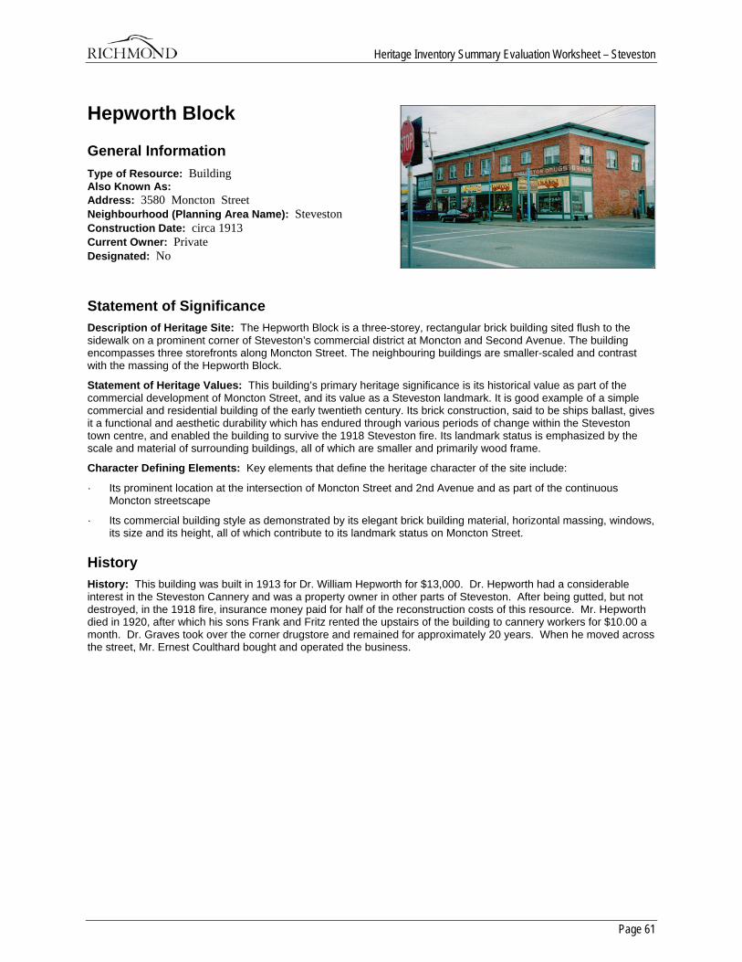
Heritage Inventory Summary Evaluation Worksheet – Steveston
Page 61
Hepworth Block
General Information Type of Resource: Building Also Known As: Address: 3580 Moncton Street Neighbourhood (Planning Area Name): Steveston Construction Date: circa 1913 Current Owner: Private Designated: No
Statement of Significance Description of Heritage Site: The Hepworth Block is a three-storey, rectangular brick building sited flush to the sidewalk on a prominent corner of Steveston’s commercial district at Moncton and Second Avenue. The building encompasses three storefronts along Moncton Street. The neighbouring buildings are smaller-scaled and contrast with the massing of the Hepworth Block.
Statement of Heritage Values: This building’s primary heritage significance is its historical value as part of the commercial development of Moncton Street, and its value as a Steveston landmark. It is good example of a simple commercial and residential building of the early twentieth century. Its brick construction, said to be ships ballast, gives it a functional and aesthetic durability which has endured through various periods of change within the Steveston town centre, and enabled the building to survive the 1918 Steveston fire. Its landmark status is emphasized by the scale and material of surrounding buildings, all of which are smaller and primarily wood frame.
Character Defining Elements: Key elements that define the heritage character of the site include:
· Its prominent location at the intersection of Moncton Street and 2nd Avenue and as part of the continuous Moncton streetscape
· Its commercial building style as demonstrated by its elegant brick building material, horizontal massing, windows, its size and its height, all of which contribute to its landmark status on Moncton Street.
History History: This building was built in 1913 for Dr. William Hepworth for $13,000. Dr. Hepworth had a considerable interest in the Steveston Cannery and was a property owner in other parts of Steveston. After being gutted, but not destroyed, in the 1918 fire, insurance money paid for half of the reconstruction costs of this resource. Mr. Hepworth died in 1920, after which his sons Frank and Fritz rented the upstairs of the building to cannery workers for $10.00 a month. Dr. Graves took over the corner drugstore and remained for approximately 20 years. When he moved across the street, Mr. Ernest Coulthard bought and operated the business.
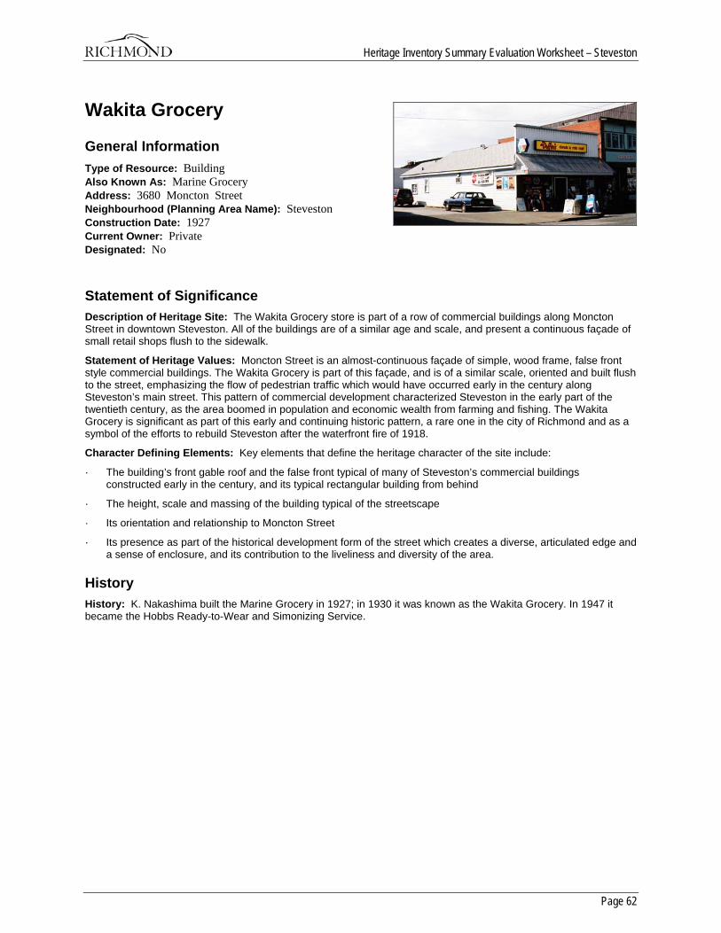
Heritage Inventory Summary Evaluation Worksheet – Steveston
Page 62
Wakita Grocery
General Information Type of Resource: Building Also Known As: Marine Grocery Address: 3680 Moncton Street Neighbourhood (Planning Area Name): Steveston Construction Date: 1927 Current Owner: Private Designated: No
Statement of Significance Description of Heritage Site: The Wakita Grocery store is part of a row of commercial buildings along Moncton Street in downtown Steveston. All of the buildings are of a similar age and scale, and present a continuous façade of small retail shops flush to the sidewalk.
Statement of Heritage Values: Moncton Street is an almost-continuous façade of simple, wood frame, false front style commercial buildings. The Wakita Grocery is part of this façade, and is of a similar scale, oriented and built flush to the street, emphasizing the flow of pedestrian traffic which would have occurred early in the century along Steveston’s main street. This pattern of commercial development characterized Steveston in the early part of the twentieth century, as the area boomed in population and economic wealth from farming and fishing. The Wakita Grocery is significant as part of this early and continuing historic pattern, a rare one in the city of Richmond and as a symbol of the efforts to rebuild Steveston after the waterfront fire of 1918.
Character Defining Elements: Key elements that define the heritage character of the site include:
· The building’s front gable roof and the false front typical of many of Steveston’s commercial buildings constructed early in the century, and its typical rectangular building from behind
· The height, scale and massing of the building typical of the streetscape
· Its orientation and relationship to Moncton Street
· Its presence as part of the historical development form of the street which creates a diverse, articulated edge and a sense of enclosure, and its contribution to the liveliness and diversity of the area.
History History: K. Nakashima built the Marine Grocery in 1927; in 1930 it was known as the Wakita Grocery. In 1947 it became the Hobbs Ready-to-Wear and Simonizing Service.
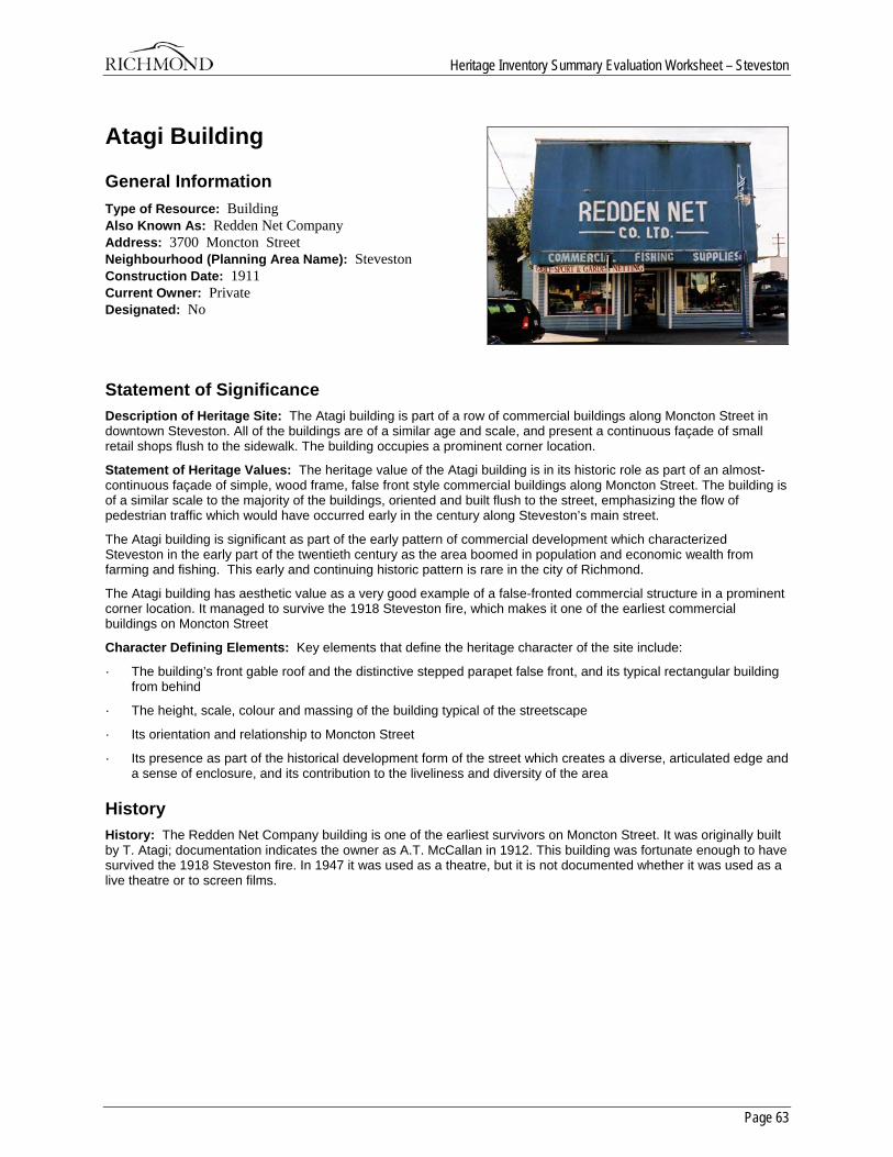
Heritage Inventory Summary Evaluation Worksheet – Steveston
Page 63
Atagi Building
General Information Type of Resource: Building Also Known As: Redden Net Company Address: 3700 Moncton Street Neighbourhood (Planning Area Name): Steveston Construction Date: 1911 Current Owner: Private Designated: No
Statement of Significance Description of Heritage Site: The Atagi building is part of a row of commercial buildings along Moncton Street in downtown Steveston. All of the buildings are of a similar age and scale, and present a continuous façade of small retail shops flush to the sidewalk. The building occupies a prominent corner location.
Statement of Heritage Values: The heritage value of the Atagi building is in its historic role as part of an almost-continuous façade of simple, wood frame, false front style commercial buildings along Moncton Street. The building is of a similar scale to the majority of the buildings, oriented and built flush to the street, emphasizing the flow of pedestrian traffic which would have occurred early in the century along Steveston’s main street.
The Atagi building is significant as part of the early pattern of commercial development which characterized Steveston in the early part of the twentieth century as the area boomed in population and economic wealth from farming and fishing. This early and continuing historic pattern is rare in the city of Richmond.
The Atagi building has aesthetic value as a very good example of a false-fronted commercial structure in a prominent corner location. It managed to survive the 1918 Steveston fire, which makes it one of the earliest commercial buildings on Moncton Street
Character Defining Elements: Key elements that define the heritage character of the site include:
· The building’s front gable roof and the distinctive stepped parapet false front, and its typical rectangular building from behind
· The height, scale, colour and massing of the building typical of the streetscape
· Its orientation and relationship to Moncton Street
· Its presence as part of the historical development form of the street which creates a diverse, articulated edge and a sense of enclosure, and its contribution to the liveliness and diversity of the area
History History: The Redden Net Company building is one of the earliest survivors on Moncton Street. It was originally built by T. Atagi; documentation indicates the owner as A.T. McCallan in 1912. This building was fortunate enough to have survived the 1918 Steveston fire. In 1947 it was used as a theatre, but it is not documented whether it was used as a live theatre or to screen films.
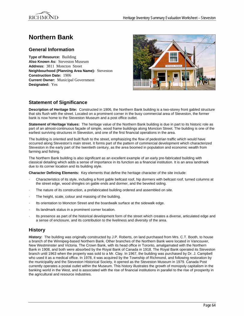
Heritage Inventory Summary Evaluation Worksheet – Steveston
Page 64
Northern Bank
General Information Type of Resource: Building Also Known As: Steveston Museum Address: 3811 Moncton Street Neighbourhood (Planning Area Name): Steveston Construction Date: 1906 Current Owner: Municipal Government Designated: Yes
Statement of Significance Description of Heritage Site: Constructed in 1906, the Northern Bank building is a two-storey front gabled structure that sits flush with the street. Located on a prominent corner in the busy commercial area of Steveston, the former bank is now home to the Steveston Museum and a post office outlet.
Statement of Heritage Values: The heritage value of the Northern Bank building is due in part to its historic role as part of an almost-continuous façade of simple, wood frame buildings along Moncton Street. The building is one of the earliest surviving structures in Steveston, and one of the first financial operations in the area.
The building is oriented and built flush to the street, emphasizing the flow of pedestrian traffic which would have occurred along Steveston’s main street. It forms part of the pattern of commercial development which characterized Steveston in the early part of the twentieth century, as the area boomed in population and economic wealth from farming and fishing.
The Northern Bank building is also significant as an excellent example of an early pre-fabricated building with classical detailing which adds a sense of importance in its function as a financial institution. It is an area landmark due to its corner location and its building style.
Character Defining Elements: Key elements that define the heritage character of the site include:
· Characteristics of its style, including a front gable bellcast roof, hip dormers with bellcast roof, turned columns at the street edge, wood shingles on gable ends and dormer, and the beveled siding.
· The nature of its construction, a prefabricated building ordered and assembled on site.
· The height, scale, colour and massing of the building.
· Its orientation to Moncton Street and the boardwalk surface at the sidewalk edge.
· Its landmark status in a prominent corner location.
· Its presence as part of the historical development form of the street which creates a diverse, articulated edge and a sense of enclosure, and its contribution to the liveliness and diversity of the area.
History History: The building was originally constructed by J.P. Roberts, on land purchased from Mrs. C.T. Booth, to house a branch of the Winnipeg-based Northern Bank. Other branches of the Northern Bank were located in Vancouver, New Westminster and Victoria. The Crown Bank, with its head office in Toronto, amalgamated with the Northern Bank in 1908, and both were absorbed by the Royal Bank of Canada in 1918. The Royal Bank operated its Steveston branch until 1963 when the property was sold to a Mr. Clay. In 1967, the building was purchased by Dr. J. Campbell who used it as a medical office. In 1978, it was acquired by the Township of Richmond, and following restoration by the municipality and the Steveston Historical Society, it opened as the Steveston Museum in 1979. Canada Post currently operates a postal outlet within the Museum. This history illustrates the growth of monopoly capitalism in the banking world in the West, and is associated with the rise of financial institutions in parallel to the rise of prosperity in the agricultural and resource industries.
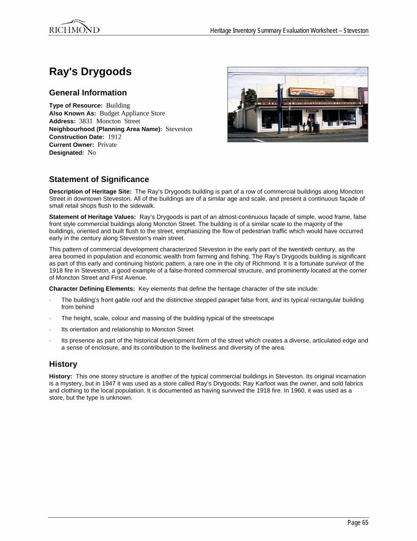
Heritage Inventory Summary Evaluation Worksheet – Steveston
Page 65
Ray's Drygoods
General Information Type of Resource: Building Also Known As: Budget Appliance Store Address: 3831 Moncton Street Neighbourhood (Planning Area Name): Steveston Construction Date: 1912 Current Owner: Private Designated: No
Statement of Significance Description of Heritage Site: The Ray’s Drygoods building is part of a row of commercial buildings along Moncton Street in downtown Steveston. All of the buildings are of a similar age and scale, and present a continuous façade of small retail shops flush to the sidewalk.
Statement of Heritage Values: Ray’s Drygoods is part of an almost-continuous façade of simple, wood frame, false front style commercial buildings along Moncton Street. The building is of a similar scale to the majority of the buildings, oriented and built flush to the street, emphasizing the flow of pedestrian traffic which would have occurred early in the century along Steveston’s main street.
This pattern of commercial development characterized Steveston in the early part of the twentieth century, as the area boomed in population and economic wealth from farming and fishing. The Ray’s Drygoods building is significant as part of this early and continuing historic pattern, a rare one in the city of Richmond. It is a fortunate survivor of the 1918 fire in Steveston, a good example of a false-fronted commercial structure, and prominently located at the corner of Moncton Street and First Avenue.
Character Defining Elements: Key elements that define the heritage character of the site include:
· The building’s front gable roof and the distinctive stepped parapet false front, and its typical rectangular building from behind
· The height, scale, colour and massing of the building typical of the streetscape
· Its orientation and relationship to Moncton Street
· Its presence as part of the historical development form of the street which creates a diverse, articulated edge and a sense of enclosure, and its contribution to the liveliness and diversity of the area.
History History: This one storey structure is another of the typical commercial buildings in Steveston. Its original incarnation is a mystery, but in 1947 it was used as a store called Ray’s Drygoods; Ray Karfoot was the owner, and sold fabrics and clothing to the local population. It is documented as having survived the 1918 fire. In 1960, it was used as a store, but the type is unknown.
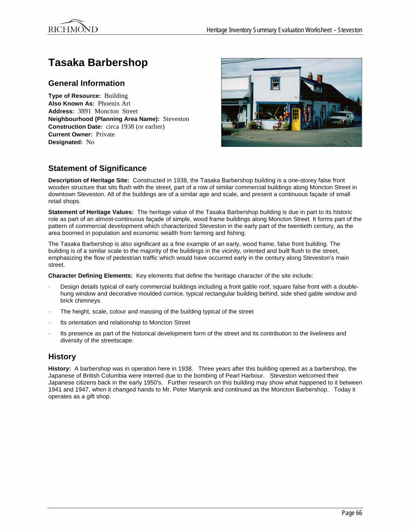
Heritage Inventory Summary Evaluation Worksheet – Steveston
Page 66
Tasaka Barbershop
General Information Type of Resource: Building Also Known As: Phoenix Art Address: 3891 Moncton Street Neighbourhood (Planning Area Name): Steveston Construction Date: circa 1938 (or earlier) Current Owner: Private Designated: No
Statement of Significance Description of Heritage Site: Constructed in 1938, the Tasaka Barbershop building is a one-storey false front wooden structure that sits flush with the street, part of a row of similar commercial buildings along Moncton Street in downtown Steveston. All of the buildings are of a similar age and scale, and present a continuous façade of small retail shops.
Statement of Heritage Values: The heritage value of the Tasaka Barbershop building is due in part to its historic role as part of an almost-continuous façade of simple, wood frame buildings along Moncton Street. It forms part of the pattern of commercial development which characterized Steveston in the early part of the twentieth century, as the area boomed in population and economic wealth from farming and fishing.
The Tasaka Barbershop is also significant as a fine example of an early, wood frame, false front building. The building is of a similar scale to the majority of the buildings in the vicinity, oriented and built flush to the street, emphasizing the flow of pedestrian traffic which would have occurred early in the century along Steveston’s main street.
Character Defining Elements: Key elements that define the heritage character of the site include:
· Design details typical of early commercial buildings including a front gable roof, square false front with a double-hung window and decorative moulded cornice, typical rectangular building behind, side shed gable window and brick chimneys
· The height, scale, colour and massing of the building typical of the street
· Its orientation and relationship to Moncton Street
· Its presence as part of the historical development form of the street and its contribution to the liveliness and diversity of the streetscape.
History History: A barbershop was in operation here in 1938. Three years after this building opened as a barbershop, the Japanese of British Columbia were interred due to the bombing of Pearl Harbour. Steveston welcomed their Japanese citizens back in the early 1950's. Further research on this building may show what happened to it between 1941 and 1947, when it changed hands to Mr. Peter Martynik and continued as the Moncton Barbershop. Today it operates as a gift shop.
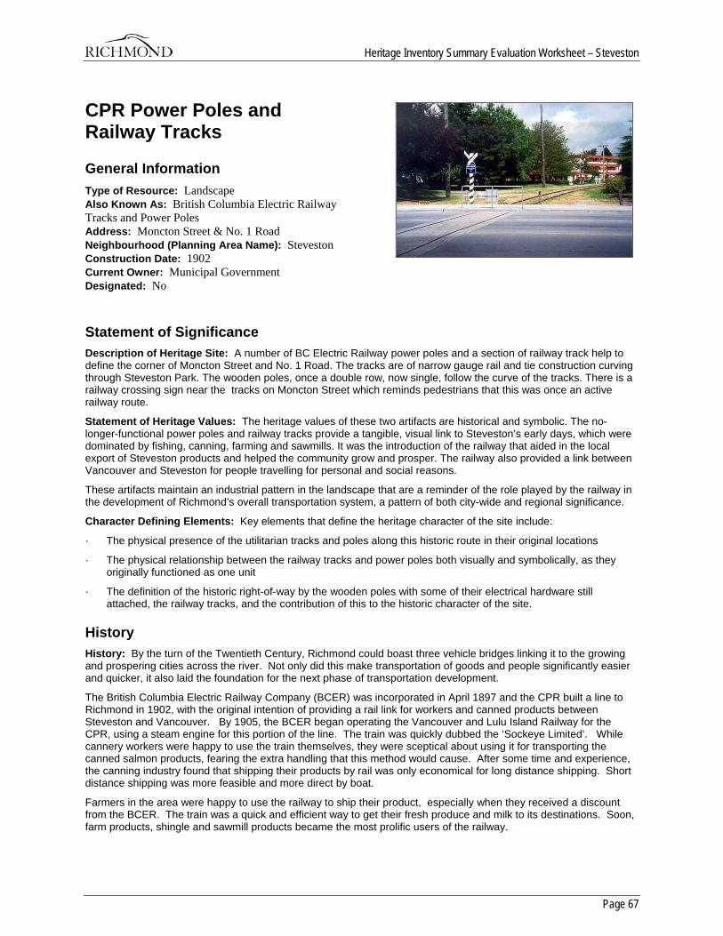
Heritage Inventory Summary Evaluation Worksheet – Steveston
Page 67
CPR Power Poles and Railway Tracks
General Information Type of Resource: Landscape Also Known As: British Columbia Electric Railway Tracks and Power Poles Address: Moncton Street & No. 1 Road Neighbourhood (Planning Area Name): Steveston Construction Date: 1902 Current Owner: Municipal Government Designated: No
Statement of Significance Description of Heritage Site: A number of BC Electric Railway power poles and a section of railway track help to define the corner of Moncton Street and No. 1 Road. The tracks are of narrow gauge rail and tie construction curving through Steveston Park. The wooden poles, once a double row, now single, follow the curve of the tracks. There is a railway crossing sign near the tracks on Moncton Street which reminds pedestrians that this was once an active railway route.
Statement of Heritage Values: The heritage values of these two artifacts are historical and symbolic. The no-longer-functional power poles and railway tracks provide a tangible, visual link to Steveston’s early days, which were dominated by fishing, canning, farming and sawmills. It was the introduction of the railway that aided in the local export of Steveston products and helped the community grow and prosper. The railway also provided a link between Vancouver and Steveston for people travelling for personal and social reasons.
These artifacts maintain an industrial pattern in the landscape that are a reminder of the role played by the railway in the development of Richmond’s overall transportation system, a pattern of both city-wide and regional significance.
Character Defining Elements: Key elements that define the heritage character of the site include:
· The physical presence of the utilitarian tracks and poles along this historic route in their original locations
· The physical relationship between the railway tracks and power poles both visually and symbolically, as they originally functioned as one unit
· The definition of the historic right-of-way by the wooden poles with some of their electrical hardware still attached, the railway tracks, and the contribution of this to the historic character of the site.
History History: By the turn of the Twentieth Century, Richmond could boast three vehicle bridges linking it to the growing and prospering cities across the river. Not only did this make transportation of goods and people significantly easier and quicker, it also laid the foundation for the next phase of transportation development.
The British Columbia Electric Railway Company (BCER) was incorporated in April 1897 and the CPR built a line to Richmond in 1902, with the original intention of providing a rail link for workers and canned products between Steveston and Vancouver. By 1905, the BCER began operating the Vancouver and Lulu Island Railway for the CPR, using a steam engine for this portion of the line. The train was quickly dubbed the ‘Sockeye Limited’. While cannery workers were happy to use the train themselves, they were sceptical about using it for transporting the canned salmon products, fearing the extra handling that this method would cause. After some time and experience, the canning industry found that shipping their products by rail was only economical for long distance shipping. Short distance shipping was more feasible and more direct by boat.
Farmers in the area were happy to use the railway to ship their product, especially when they received a discount from the BCER. The train was a quick and efficient way to get their fresh produce and milk to its destinations. Soon, farm products, shingle and sawmill products became the most prolific users of the railway.
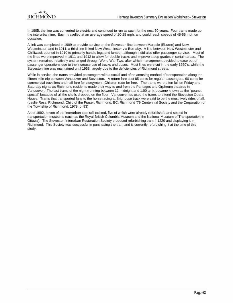
Heritage Inventory Summary Evaluation Worksheet – Steveston
Page 68
In 1905, the line was converted to electric and continued to run as such for the next 50 years. Four trams made up the interurban line. Each travelled at an average speed of 20-25 mph, and could reach speeds of 45-55 mph on occasion.
A link was completed in 1909 to provide service on the Steveston line between Marpole (Eburne) and New Westminster, and in 1911, a third line linked New Westminster via Burnaby. A line between New Westminster and Chilliwack opened in 1910 to primarily handle logs and lumber, although it did also offer passenger service. Most of the lines were improved in 1911 and 1912 to allow for double tracks and improve steep grades in certain areas. The system remained relatively unchanged through World War Two, after which management decided to ease out of passenger operations due to the increase use of trucks and buses. Most lines were cut in the early 1950’s, while the Steveston line was maintained until 1958, largely due to the deficiencies of Richmond streets.
While in service, the trams provided passengers with a social and often amusing method of transportation along the fifteen mile trip between Vancouver and Steveston. A return fare cost 85 cents for regular passengers, 60 cents for commercial travellers and half fare for clergymen. Children rode for free. The trams were often full on Friday and Saturday nights as Richmond residents made their way to and from the Pantages and Orpheum theatres in Vancouver. The last trams of the night (running between 12 midnight and 1:00 am), became known as the “peanut special” because of all the shells dropped on the floor. Vancouverites used the trams to attend the Steveston Opera House. Trams that transported fans to the horse racing at Brighouse track were said to be the most lively rides of all. (Leslie Ross. Richmond, Child of the Fraser, Richmond, BC, Richmond ‘79 Centennial Society and the Corporation of the Township of Richmond, 1979, p. 93)
As of 1992, seven of the interurban cars still existed, five of which were already refurbished and settled in transportation museums (such as the Royal British Columbia Museum and the National Museum of Transportation in Ottawa). The Steveston Interurban Restoration Society proposed refurbishing tram # 1220 and displaying it in Richmond. This Society was successful in purchasing the tram and is currently refurbishing it at the time of this study.
Heritage Inventory Summary Evaluation Worksheet – Steveston
Page 69
Steveston Telephone Exchange
General Information Type of Resource: Building Also Known As: Bill Rigby Memorial Society Building Address: 12004 No 1 Road Neighbourhood (Planning Area Name): Steveston Construction Date: circa 1914 Current Owner: Private Designated: Yes
Statement of Significance Description of Heritage Site: This small, unobtrusive building is a simple, one-storey hipped roof structure with a corner porch. Due to the widening of No. 1 Road, the building now sits slightly below the road grade, with a small tree in front and shrubs to one side.
Statement of Heritage Values: The heritage value of the Telephone Exchange building lies in its historical use as the first telephone exchange and office for the Steveston area. The prominence of this building in its original location at one of Steveston’s main intersections speaks to the importance of the telephone service when it arrived in here in 1914.
Aesthetically, the structure has value as a pre-World War I utilitarian communications building with design features more residential than commercial.
Character Defining Elements: Key elements that define the heritage character of the site include:
· Its location at a prominent intersection in Steveston reflecting its important historical use
· Design details of the structure including a corner porch with columns, hipped roof with a hipped gable, front dormer window and exposed rafter ends.
History History: In 1891, the New Westminster & Burrard Inlet Telephone Company installed telephone service to Steveston via Eburne and Marpole. In 1904, The BC Telephone Company bought the line, and by 1912 a total of 12 Steveston residents had subscribed. A local office was opened at this location in 1912 and remained in operation until 1954 when it was bought and converted into a private residence. It is unclear as to whether or not the telephone company built the structure or themselves adapted it from an existing one.
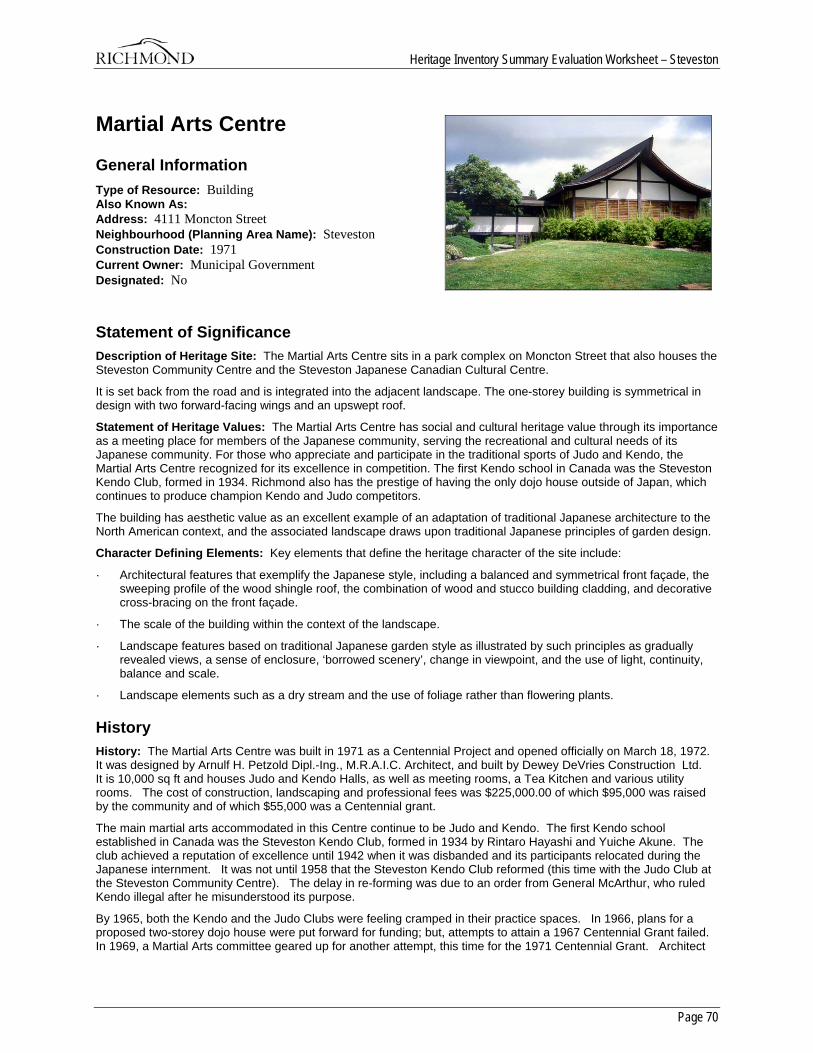
Heritage Inventory Summary Evaluation Worksheet – Steveston
Page 70
Martial Arts Centre
General Information Type of Resource: Building Also Known As: Address: 4111 Moncton Street Neighbourhood (Planning Area Name): Steveston Construction Date: 1971 Current Owner: Municipal Government Designated: No
Statement of Significance Description of Heritage Site: The Martial Arts Centre sits in a park complex on Moncton Street that also houses the Steveston Community Centre and the Steveston Japanese Canadian Cultural Centre.
It is set back from the road and is integrated into the adjacent landscape. The one-storey building is symmetrical in design with two forward-facing wings and an upswept roof.
Statement of Heritage Values: The Martial Arts Centre has social and cultural heritage value through its importance as a meeting place for members of the Japanese community, serving the recreational and cultural needs of its Japanese community. For those who appreciate and participate in the traditional sports of Judo and Kendo, the Martial Arts Centre recognized for its excellence in competition. The first Kendo school in Canada was the Steveston Kendo Club, formed in 1934. Richmond also has the prestige of having the only dojo house outside of Japan, which continues to produce champion Kendo and Judo competitors.
The building has aesthetic value as an excellent example of an adaptation of traditional Japanese architecture to the North American context, and the associated landscape draws upon traditional Japanese principles of garden design.
Character Defining Elements: Key elements that define the heritage character of the site include:
· Architectural features that exemplify the Japanese style, including a balanced and symmetrical front façade, the sweeping profile of the wood shingle roof, the combination of wood and stucco building cladding, and decorative cross-bracing on the front façade.
· The scale of the building within the context of the landscape.
· Landscape features based on traditional Japanese garden style as illustrated by such principles as gradually revealed views, a sense of enclosure, ‘borrowed scenery’, change in viewpoint, and the use of light, continuity, balance and scale.
· Landscape elements such as a dry stream and the use of foliage rather than flowering plants.
History History: The Martial Arts Centre was built in 1971 as a Centennial Project and opened officially on March 18, 1972. It was designed by Arnulf H. Petzold Dipl.-Ing., M.R.A.I.C. Architect, and built by Dewey DeVries Construction Ltd. It is 10,000 sq ft and houses Judo and Kendo Halls, as well as meeting rooms, a Tea Kitchen and various utility rooms. The cost of construction, landscaping and professional fees was $225,000.00 of which $95,000 was raised by the community and of which $55,000 was a Centennial grant.
The main martial arts accommodated in this Centre continue to be Judo and Kendo. The first Kendo school established in Canada was the Steveston Kendo Club, formed in 1934 by Rintaro Hayashi and Yuiche Akune. The club achieved a reputation of excellence until 1942 when it was disbanded and its participants relocated during the Japanese internment. It was not until 1958 that the Steveston Kendo Club reformed (this time with the Judo Club at the Steveston Community Centre). The delay in re-forming was due to an order from General McArthur, who ruled Kendo illegal after he misunderstood its purpose.
By 1965, both the Kendo and the Judo Clubs were feeling cramped in their practice spaces. In 1966, plans for a proposed two-storey dojo house were put forward for funding; but, attempts to attain a 1967 Centennial Grant failed. In 1969, a Martial Arts committee geared up for another attempt, this time for the 1971 Centennial Grant. Architect

Heritage Inventory Summary Evaluation Worksheet – Steveston
Page 71
Arnulf Petzold created a proposal for a dojo house in June 1969. His proposed design was a traditional Japanese pavilion with modern western influences. In February 1970, this design was one of four proposed projects contemplated for Centennial funds. After considerable political discussions by Richmond Town Council, the Martial Arts Centre received $55,000 of the $84,000 available. The remainder of the funding for the project was derived from a number of other sources; such as a trust fund, personal loans, community fund-raising, and personal donations. With all the money in place, construction began in June 1971 and was completed in December of that year. (A condition of the Centennial Grant was completion of the project within the year 1971.) The official opening of the Centre occurred on March 18, 1972.
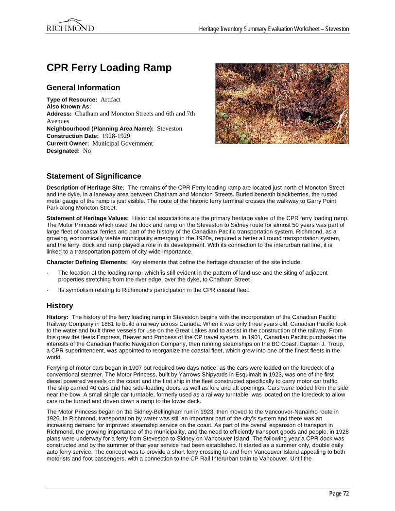
Heritage Inventory Summary Evaluation Worksheet – Steveston
Page 72
CPR Ferry Loading Ramp
General Information Type of Resource: Artifact Also Known As: Address: Chatham and Moncton Streets and 6th and 7th Avenues Neighbourhood (Planning Area Name): Steveston Construction Date: 1928-1929 Current Owner: Municipal Government Designated: No
Statement of Significance Description of Heritage Site: The remains of the CPR Ferry loading ramp are located just north of Moncton Street and the dyke, in a laneway area between Chatham and Moncton Streets. Buried beneath blackberries, the rusted metal gauge of the ramp is just visible. The route of the historic ferry terminal crosses the walkway to Garry Point Park along Moncton Street.
Statement of Heritage Values: Historical associations are the primary heritage value of the CPR ferry loading ramp. The Motor Princess which used the dock and ramp on the Steveston to Sidney route for almost 50 years was part of large fleet of coastal ferries and part of the history of the Canadian Pacific transportation system. Richmond, as a growing, economically viable municipality emerging in the 1920s, required a better all round transportation system, and the ferry, dock and ramp played a role in its development. With its connection to the interurban rail line, it is linked to a transportation pattern of city-wide importance.
Character Defining Elements: Key elements that define the heritage character of the site include:
· The location of the loading ramp, which is still evident in the pattern of land use and the siting of adjacent properties stretching from the river edge, over the dyke, to Chatham Street
· Its symbolism relating to Richmond’s participation in the CPR coastal fleet.
History History: The history of the ferry loading ramp in Steveston begins with the incorporation of the Canadian Pacific Railway Company in 1881 to build a railway across Canada. When it was only three years old, Canadian Pacific took to the water and built three vessels for use on the Great Lakes and to assist in the construction of the railway. From this grew the fleets Empress, Beaver and Princess of the CP travel system. In 1901, Canadian Pacific purchased the interests of the Canadian Pacific Navigation Company, then running steamships on the BC Coast. Captain J. Troup, a CPR superintendent, was appointed to reorganize the coastal fleet, which grew into one of the finest fleets in the world.
Ferrying of motor cars began in 1907 but required two days notice, as the cars were loaded on the foredeck of a conventional steamer. The Motor Princess, built by Yarrows Shipyards in Esquimalt in 1923, was one of the first diesel powered vessels on the coast and the first ship in the fleet constructed specifically to carry motor car traffic. The ship carried 40 cars and had side-loading doors as well as fore and aft openings. Cars were loaded from the side near the bow. A small single car turntable, formerly used as a railway turntable, was located on the foredeck to allow cars to be turned and driven down a ramp to the lower deck.
The Motor Princess began on the Sidney-Bellingham run in 1923, then moved to the Vancouver-Nanaimo route in 1926. In Richmond, transportation by water was still an important part of the city’s system and there was an increasing demand for improved steamship service on the coast. As part of the overall expansion of transport in Richmond, the growing importance of the municipality, and the need to efficiently transport goods and people, in 1928 plans were underway for a ferry from Steveston to Sidney on Vancouver Island. The following year a CPR dock was constructed and by the summer of that year service had been established. It started as a summer only, double daily auto ferry service. The concept was to provide a short ferry crossing to and from Vancouver Island appealing to both motorists and foot passengers, with a connection to the CP Rail Interurban train to Vancouver. Until the

Heritage Inventory Summary Evaluation Worksheet – Steveston
Page 73
establishment of the CPR ferry, most ferry traffic operated from the dock at London’s Landing; this newcomer effectively put the London’s Landing ferry out of business.
The Motor Princess offered a buffet service on the Sidney-Steveston route. One of their menus is available for viewing in the Archives.
The CP Motor Princess operated on the Steveston to Sidney route until 1950 when it was removed from passenger service and into freight. It was retired in 1953 and went through various owners until it became the fishing camp vessel Pender Lady in 1981.
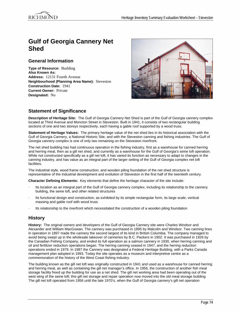
Heritage Inventory Summary Evaluation Worksheet – Steveston
Page 74
Gulf of Georgia Cannery Net Shed
General Information Type of Resource: Building Also Known As: Address: 12131 Fourth Avenue Neighbourhood (Planning Area Name): Steveston Construction Date: 1941 Current Owner: Private Designated: No
Statement of Significance Description of Heritage Site: The Gulf of Georgia Cannery Net Shed is part of the Gulf of Georgia cannery complex located at Third Avenue and Moncton Street in Steveston. Built in 1941, it consists of two rectangular building sections of one and two storeys respectively, each having a gable roof supported by a wood truss.
Statement of Heritage Values: The primary heritage value of the net shed lies in its historical association with the Gulf of Georgia Cannery, a National Historic Site, and with the Steveston canning and fishing industries. The Gulf of Georgia cannery complex is one of only two remaining on the Steveston riverfront.
The net shed building has had continuous operation in the fishing industry, first as a warehouse for canned herring and herring meal, then as a gill net shed, and currently as a warehouse for the Gulf of Georgia’s seine loft operation. While not constructed specifically as a gill net loft, it has varied its function as necessary to adapt to changes in the canning industry, and has value as an integral part of the larger setting of the Gulf of Georgia complex net loft facilities.
The industrial style, wood frame construction, and wooden piling foundation of the net shed structure is representative of the industrial development and evolution of Steveston in the first half of the twentieth century.
Character Defining Elements: Key elements that define the heritage character of the site include:
· Its location as an integral part of the Gulf of Georgia cannery complex, including its relationship to the cannery building, the seine loft, and other related structures
· Its functional design and construction, as exhibited by its simple rectangular form, its large scale, vertical massing and gable roof with wood truss
· Its relationship to the riverfront which necessitated the construction of a wooden piling foundation
History History: The original owners and developers of the Gulf of Georgia Cannery site were Charles Windsor and Alexander and William MacGowan. The cannery was purchased in 1895 by Malcolm and Windsor. Two canning lines in operation in 1897 made the cannery the second largest of its kind in British Columbia. The company managed to avoid being swept up in the wholesale takeover of canneries by B.C. Packers in 1902. It was purchased in 1926 by the Canadian Fishing Company, and ended its full operation as a salmon cannery in 1930, when herring canning and oil and fertilizer reduction operations began. The herring canning ceased in 1947, and the herring reduction operations ended in 1979. In 1987 the Cannery was designated a Federal Heritage Building, with a Parks Canada management plan adopted in 1993. Today the site operates as a museum and interpretive centre as a commemoration of the history of the West Coast fishing industry.
The building known as the gill net loft was originally constructed in 1941 and used as a warehouse for canned herring and herring meal, as well as containing the gill net manager’s office. In 1956, the construction of another fish meal storage facility freed up the building for use as a net shed. The gill net working area had been operating out of the west wing of the seine loft; this gill net storage and repair operation now moved into the old meal storage building. The gill net loft operated from 1956 until the late 1970’s, when the Gulf of Georgia cannery’s gill net operation

Heritage Inventory Summary Evaluation Worksheet – Steveston
Page 75
ceased; during that time it also housed an office where the records of the Gulf of Georgia’s gill net fleet were kept. The building is still owned by Canfisco, and present day gill net fishermen continue to store and work on their nets in the building and on net racks on the nearby wharves. The building is also used as a warehouse for the seine loft operation.
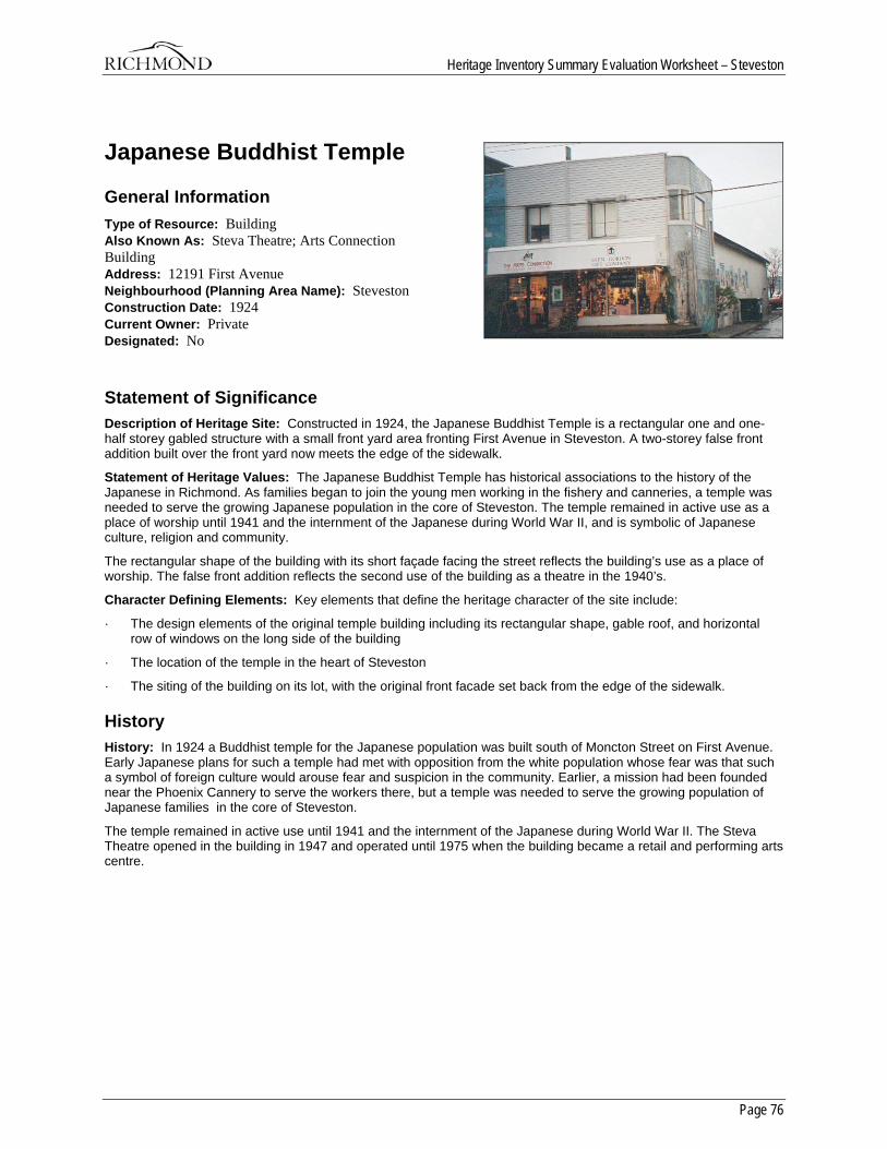
Heritage Inventory Summary Evaluation Worksheet – Steveston
Page 76
Japanese Buddhist Temple
General Information Type of Resource: Building Also Known As: Steva Theatre; Arts Connection Building Address: 12191 First Avenue Neighbourhood (Planning Area Name): Steveston Construction Date: 1924 Current Owner: Private Designated: No
Statement of Significance Description of Heritage Site: Constructed in 1924, the Japanese Buddhist Temple is a rectangular one and one-half storey gabled structure with a small front yard area fronting First Avenue in Steveston. A two-storey false front addition built over the front yard now meets the edge of the sidewalk.
Statement of Heritage Values: The Japanese Buddhist Temple has historical associations to the history of the Japanese in Richmond. As families began to join the young men working in the fishery and canneries, a temple was needed to serve the growing Japanese population in the core of Steveston. The temple remained in active use as a place of worship until 1941 and the internment of the Japanese during World War II, and is symbolic of Japanese culture, religion and community.
The rectangular shape of the building with its short façade facing the street reflects the building’s use as a place of worship. The false front addition reflects the second use of the building as a theatre in the 1940’s.
Character Defining Elements: Key elements that define the heritage character of the site include:
· The design elements of the original temple building including its rectangular shape, gable roof, and horizontal row of windows on the long side of the building
· The location of the temple in the heart of Steveston
· The siting of the building on its lot, with the original front facade set back from the edge of the sidewalk.
History History: In 1924 a Buddhist temple for the Japanese population was built south of Moncton Street on First Avenue. Early Japanese plans for such a temple had met with opposition from the white population whose fear was that such a symbol of foreign culture would arouse fear and suspicion in the community. Earlier, a mission had been founded near the Phoenix Cannery to serve the workers there, but a temple was needed to serve the growing population of Japanese families in the core of Steveston.
The temple remained in active use until 1941 and the internment of the Japanese during World War II. The Steva Theatre opened in the building in 1947 and operated until 1975 when the building became a retail and performing arts centre.
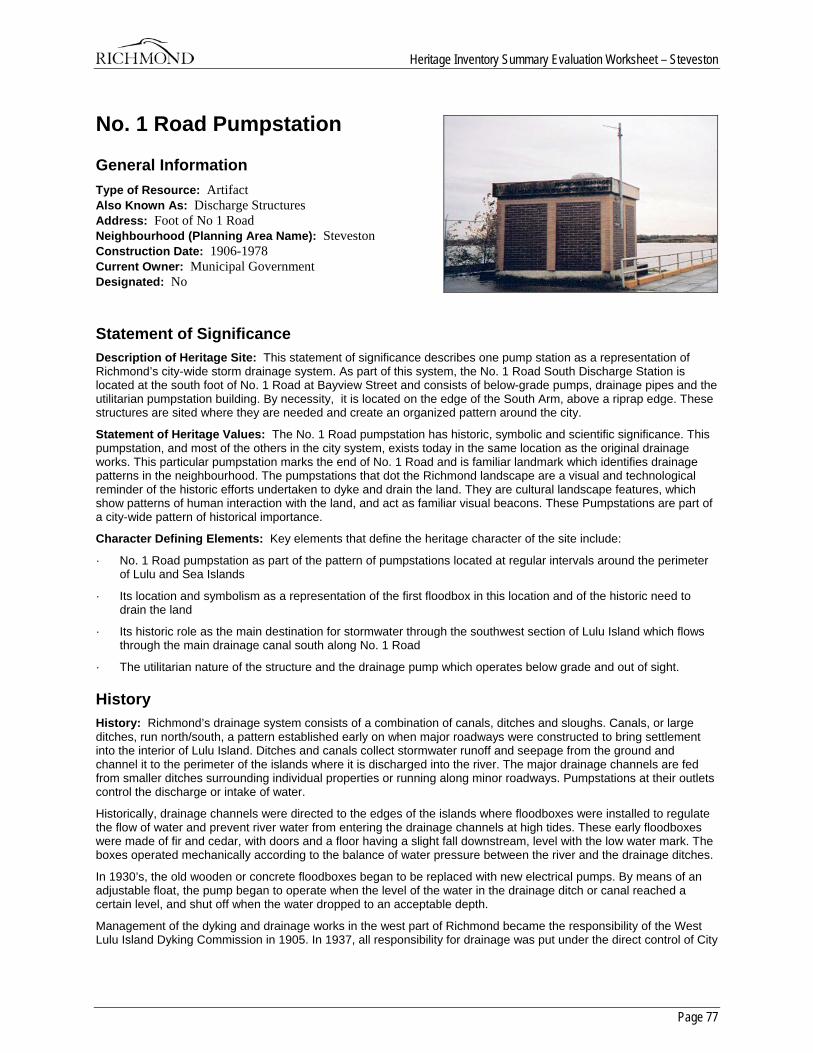
Heritage Inventory Summary Evaluation Worksheet – Steveston
Page 77
No. 1 Road Pumpstation
General Information Type of Resource: Artifact Also Known As: Discharge Structures Address: Foot of No 1 Road Neighbourhood (Planning Area Name): Steveston Construction Date: 1906-1978 Current Owner: Municipal Government Designated: No
Statement of Significance Description of Heritage Site: This statement of significance describes one pump station as a representation of Richmond’s city-wide storm drainage system. As part of this system, the No. 1 Road South Discharge Station is located at the south foot of No. 1 Road at Bayview Street and consists of below-grade pumps, drainage pipes and the utilitarian pumpstation building. By necessity, it is located on the edge of the South Arm, above a riprap edge. These structures are sited where they are needed and create an organized pattern around the city.
Statement of Heritage Values: The No. 1 Road pumpstation has historic, symbolic and scientific significance. This pumpstation, and most of the others in the city system, exists today in the same location as the original drainage works. This particular pumpstation marks the end of No. 1 Road and is familiar landmark which identifies drainage patterns in the neighbourhood. The pumpstations that dot the Richmond landscape are a visual and technological reminder of the historic efforts undertaken to dyke and drain the land. They are cultural landscape features, which show patterns of human interaction with the land, and act as familiar visual beacons. These Pumpstations are part of a city-wide pattern of historical importance.
Character Defining Elements: Key elements that define the heritage character of the site include:
· No. 1 Road pumpstation as part of the pattern of pumpstations located at regular intervals around the perimeter of Lulu and Sea Islands
· Its location and symbolism as a representation of the first floodbox in this location and of the historic need to drain the land
· Its historic role as the main destination for stormwater through the southwest section of Lulu Island which flows through the main drainage canal south along No. 1 Road
· The utilitarian nature of the structure and the drainage pump which operates below grade and out of sight.
History History: Richmond’s drainage system consists of a combination of canals, ditches and sloughs. Canals, or large ditches, run north/south, a pattern established early on when major roadways were constructed to bring settlement into the interior of Lulu Island. Ditches and canals collect stormwater runoff and seepage from the ground and channel it to the perimeter of the islands where it is discharged into the river. The major drainage channels are fed from smaller ditches surrounding individual properties or running along minor roadways. Pumpstations at their outlets control the discharge or intake of water.
Historically, drainage channels were directed to the edges of the islands where floodboxes were installed to regulate the flow of water and prevent river water from entering the drainage channels at high tides. These early floodboxes were made of fir and cedar, with doors and a floor having a slight fall downstream, level with the low water mark. The boxes operated mechanically according to the balance of water pressure between the river and the drainage ditches.
In 1930’s, the old wooden or concrete floodboxes began to be replaced with new electrical pumps. By means of an adjustable float, the pump began to operate when the level of the water in the drainage ditch or canal reached a certain level, and shut off when the water dropped to an acceptable depth.
Management of the dyking and drainage works in the west part of Richmond became the responsibility of the West Lulu Island Dyking Commission in 1905. In 1937, all responsibility for drainage was put under the direct control of City
Heritage Inventory Summary Evaluation Worksheet – Steveston
Page 78
Council and the Inspector of Municipalities. The City of Richmond currently operates 32 pumpstations around its perimeter and 42 internally. Two-thirds of the water drained from the land is released through natural water hydraulics; the remainder is moved by the pumpstations. Pumpstations are also used to let water in to the drainage ditches for irrigation purposes.
The No. 1 Road Pumpstation has been selected as representative of the city-wide system of discharge structures. It is the destination for stormwater which flows through the main drainage canal south along No. 1 Road. This station is the main one for the southwest section of Lulu Island, and drains south from Williams Road, picking up water from all of the side street ditches along the way. It is likely that the first drainage works, probably a floodbox, in this location were installed during or just after 1906, as this is the year in which the No. 1 Road drainage canal began construction. This Pumpstation is due to be upgraded in the near future.
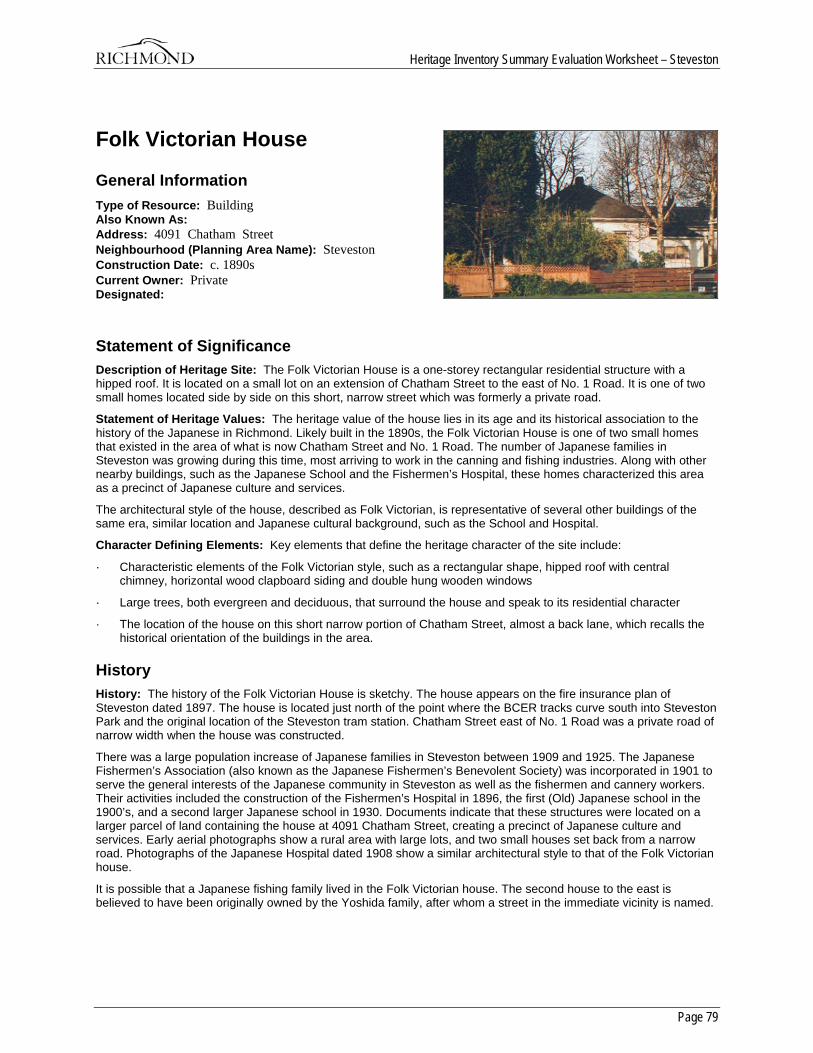
Heritage Inventory Summary Evaluation Worksheet – Steveston
Page 79
Folk Victorian House
General Information Type of Resource: Building Also Known As: Address: 4091 Chatham Street Neighbourhood (Planning Area Name): Steveston Construction Date: c. 1890s Current Owner: Private Designated:
Statement of Significance Description of Heritage Site: The Folk Victorian House is a one-storey rectangular residential structure with a hipped roof. It is located on a small lot on an extension of Chatham Street to the east of No. 1 Road. It is one of two small homes located side by side on this short, narrow street which was formerly a private road.
Statement of Heritage Values: The heritage value of the house lies in its age and its historical association to the history of the Japanese in Richmond. Likely built in the 1890s, the Folk Victorian House is one of two small homes that existed in the area of what is now Chatham Street and No. 1 Road. The number of Japanese families in Steveston was growing during this time, most arriving to work in the canning and fishing industries. Along with other nearby buildings, such as the Japanese School and the Fishermen’s Hospital, these homes characterized this area as a precinct of Japanese culture and services.
The architectural style of the house, described as Folk Victorian, is representative of several other buildings of the same era, similar location and Japanese cultural background, such as the School and Hospital.
Character Defining Elements: Key elements that define the heritage character of the site include:
· Characteristic elements of the Folk Victorian style, such as a rectangular shape, hipped roof with central chimney, horizontal wood clapboard siding and double hung wooden windows
· Large trees, both evergreen and deciduous, that surround the house and speak to its residential character
· The location of the house on this short narrow portion of Chatham Street, almost a back lane, which recalls the historical orientation of the buildings in the area.
History History: The history of the Folk Victorian House is sketchy. The house appears on the fire insurance plan of Steveston dated 1897. The house is located just north of the point where the BCER tracks curve south into Steveston Park and the original location of the Steveston tram station. Chatham Street east of No. 1 Road was a private road of narrow width when the house was constructed.
There was a large population increase of Japanese families in Steveston between 1909 and 1925. The Japanese Fishermen’s Association (also known as the Japanese Fishermen’s Benevolent Society) was incorporated in 1901 to serve the general interests of the Japanese community in Steveston as well as the fishermen and cannery workers. Their activities included the construction of the Fishermen’s Hospital in 1896, the first (Old) Japanese school in the 1900’s, and a second larger Japanese school in 1930. Documents indicate that these structures were located on a larger parcel of land containing the house at 4091 Chatham Street, creating a precinct of Japanese culture and services. Early aerial photographs show a rural area with large lots, and two small houses set back from a narrow road. Photographs of the Japanese Hospital dated 1908 show a similar architectural style to that of the Folk Victorian house.
It is possible that a Japanese fishing family lived in the Folk Victorian house. The second house to the east is believed to have been originally owned by the Yoshida family, after whom a street in the immediate vicinity is named.
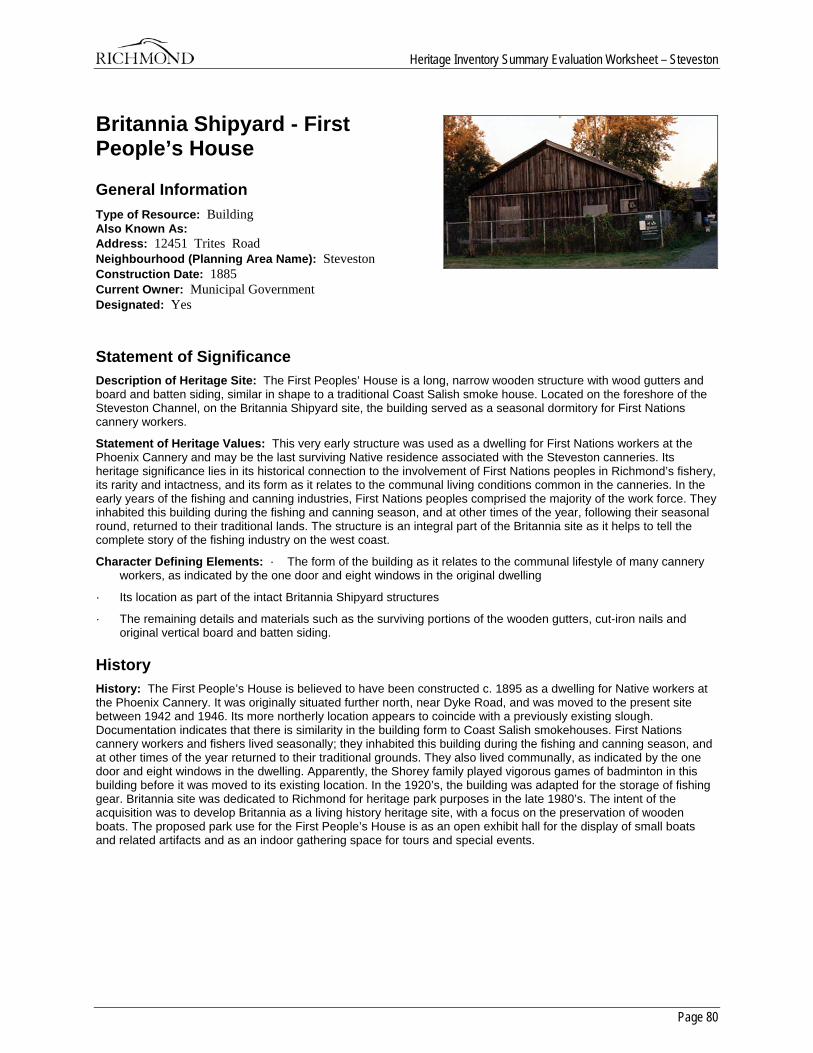
Heritage Inventory Summary Evaluation Worksheet – Steveston
Page 80
Britannia Shipyard - First People’s House
General Information Type of Resource: Building Also Known As: Address: 12451 Trites Road Neighbourhood (Planning Area Name): Steveston Construction Date: 1885 Current Owner: Municipal Government Designated: Yes
Statement of Significance Description of Heritage Site: The First Peoples’ House is a long, narrow wooden structure with wood gutters and board and batten siding, similar in shape to a traditional Coast Salish smoke house. Located on the foreshore of the Steveston Channel, on the Britannia Shipyard site, the building served as a seasonal dormitory for First Nations cannery workers.
Statement of Heritage Values: This very early structure was used as a dwelling for First Nations workers at the Phoenix Cannery and may be the last surviving Native residence associated with the Steveston canneries. Its heritage significance lies in its historical connection to the involvement of First Nations peoples in Richmond’s fishery, its rarity and intactness, and its form as it relates to the communal living conditions common in the canneries. In the early years of the fishing and canning industries, First Nations peoples comprised the majority of the work force. They inhabited this building during the fishing and canning season, and at other times of the year, following their seasonal round, returned to their traditional lands. The structure is an integral part of the Britannia site as it helps to tell the complete story of the fishing industry on the west coast.
Character Defining Elements: · The form of the building as it relates to the communal lifestyle of many cannery workers, as indicated by the one door and eight windows in the original dwelling
· Its location as part of the intact Britannia Shipyard structures
· The remaining details and materials such as the surviving portions of the wooden gutters, cut-iron nails and original vertical board and batten siding.
History History: The First People’s House is believed to have been constructed c. 1895 as a dwelling for Native workers at the Phoenix Cannery. It was originally situated further north, near Dyke Road, and was moved to the present site between 1942 and 1946. Its more northerly location appears to coincide with a previously existing slough. Documentation indicates that there is similarity in the building form to Coast Salish smokehouses. First Nations cannery workers and fishers lived seasonally; they inhabited this building during the fishing and canning season, and at other times of the year returned to their traditional grounds. They also lived communally, as indicated by the one door and eight windows in the dwelling. Apparently, the Shorey family played vigorous games of badminton in this building before it was moved to its existing location. In the 1920’s, the building was adapted for the storage of fishing gear. Britannia site was dedicated to Richmond for heritage park purposes in the late 1980’s. The intent of the acquisition was to develop Britannia as a living history heritage site, with a focus on the preservation of wooden boats. The proposed park use for the First People’s House is as an open exhibit hall for the display of small boats and related artifacts and as an indoor gathering space for tours and special events.
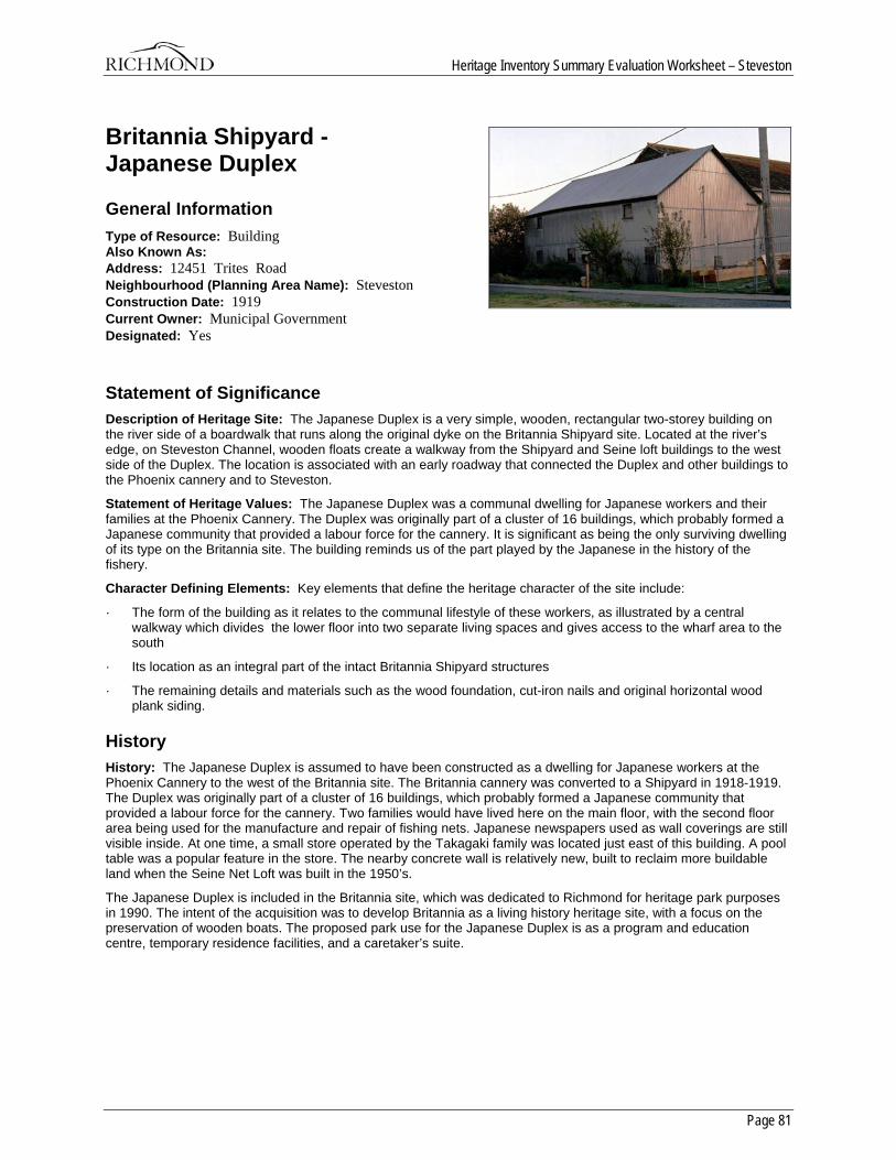
Heritage Inventory Summary Evaluation Worksheet – Steveston
Page 81
Britannia Shipyard - Japanese Duplex
General Information Type of Resource: Building Also Known As: Address: 12451 Trites Road Neighbourhood (Planning Area Name): Steveston Construction Date: 1919 Current Owner: Municipal Government Designated: Yes
Statement of Significance Description of Heritage Site: The Japanese Duplex is a very simple, wooden, rectangular two-storey building on the river side of a boardwalk that runs along the original dyke on the Britannia Shipyard site. Located at the river’s edge, on Steveston Channel, wooden floats create a walkway from the Shipyard and Seine loft buildings to the west side of the Duplex. The location is associated with an early roadway that connected the Duplex and other buildings to the Phoenix cannery and to Steveston.
Statement of Heritage Values: The Japanese Duplex was a communal dwelling for Japanese workers and their families at the Phoenix Cannery. The Duplex was originally part of a cluster of 16 buildings, which probably formed a Japanese community that provided a labour force for the cannery. It is significant as being the only surviving dwelling of its type on the Britannia site. The building reminds us of the part played by the Japanese in the history of the fishery.
Character Defining Elements: Key elements that define the heritage character of the site include:
· The form of the building as it relates to the communal lifestyle of these workers, as illustrated by a central walkway which divides the lower floor into two separate living spaces and gives access to the wharf area to the south
· Its location as an integral part of the intact Britannia Shipyard structures
· The remaining details and materials such as the wood foundation, cut-iron nails and original horizontal wood plank siding.
History History: The Japanese Duplex is assumed to have been constructed as a dwelling for Japanese workers at the Phoenix Cannery to the west of the Britannia site. The Britannia cannery was converted to a Shipyard in 1918-1919. The Duplex was originally part of a cluster of 16 buildings, which probably formed a Japanese community that provided a labour force for the cannery. Two families would have lived here on the main floor, with the second floor area being used for the manufacture and repair of fishing nets. Japanese newspapers used as wall coverings are still visible inside. At one time, a small store operated by the Takagaki family was located just east of this building. A pool table was a popular feature in the store. The nearby concrete wall is relatively new, built to reclaim more buildable land when the Seine Net Loft was built in the 1950’s.
The Japanese Duplex is included in the Britannia site, which was dedicated to Richmond for heritage park purposes in 1990. The intent of the acquisition was to develop Britannia as a living history heritage site, with a focus on the preservation of wooden boats. The proposed park use for the Japanese Duplex is as a program and education centre, temporary residence facilities, and a caretaker’s suite.
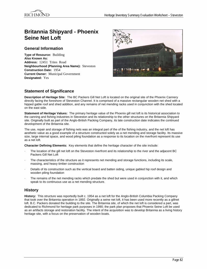
Heritage Inventory Summary Evaluation Worksheet – Steveston
Page 82
Britannia Shipyard - Phoenix Seine Net Loft
General Information Type of Resource: Building Also Known As: Address: 12451 Trites Road Neighbourhood (Planning Area Name): Steveston Construction Date: 1954 Current Owner: Municipal Government Designated: Yes
Statement of Significance Description of Heritage Site: The BC Packers Gill Net Loft is located on the original site of the Phoenix Cannery directly facing the foreshore of Steveston Channel. It is comprised of a massive rectangular wooden net shed with a hipped gable roof and shed addition, and any remains of net mending racks used in conjunction with the shed located on the east side.
Statement of Heritage Values: The primary heritage value of the Phoenix gill net loft is its historical association to the canning and fishing industries in Steveston and its relationship to the other structures on the Britannia Shipyard site. Originally built as part of the Anglo-British Packing Company, its late construction date indicates the continued development of the Britannia site.
The use, repair and storage of fishing nets was an integral part of the of the fishing industry, and the net loft has aesthetic value as a good example of a structure constructed solely as a net mending and storage facility. Its massive size, large internal space, and wood piling foundation as a response to its location on the riverfront represent its use as a net loft.
Character Defining Elements: Key elements that define the heritage character of the site include:
· The location of the gill net loft on the Steveston riverfront and its relationship to the river and the adjacent BC Packers Gill Net Loft
· The characteristics of the structure as it represents net mending and storage functions, including its scale, massing, and heavy timber construction
· Details of its construction such as the vertical board and batten siding, unique gabled hip roof design and wooden piling foundation
· The remains of the net mending racks which predate the shed but were used in conjunction with it, and which speak to its continuous use as a net mending structure.
History History: This structure was reportedly built c. 1954 as a net loft for the Anglo-British Columbia Packing Company that took over the Britannia operation in 1892. Originally a seine net loft, it has been used more recently as a gillnet loft. B.C. Packers donated the building to the site. The Britannia site, of which the net loft is considered a part, was dedicated to Richmond for heritage park purposes in 1990; the park plan proposes that Phoenix Seine Loft be used as an artifacts storage and restoration facility. The intent of the acquisition was to develop Britannia as a living history heritage site, with a focus on the preservation of wooden boats.
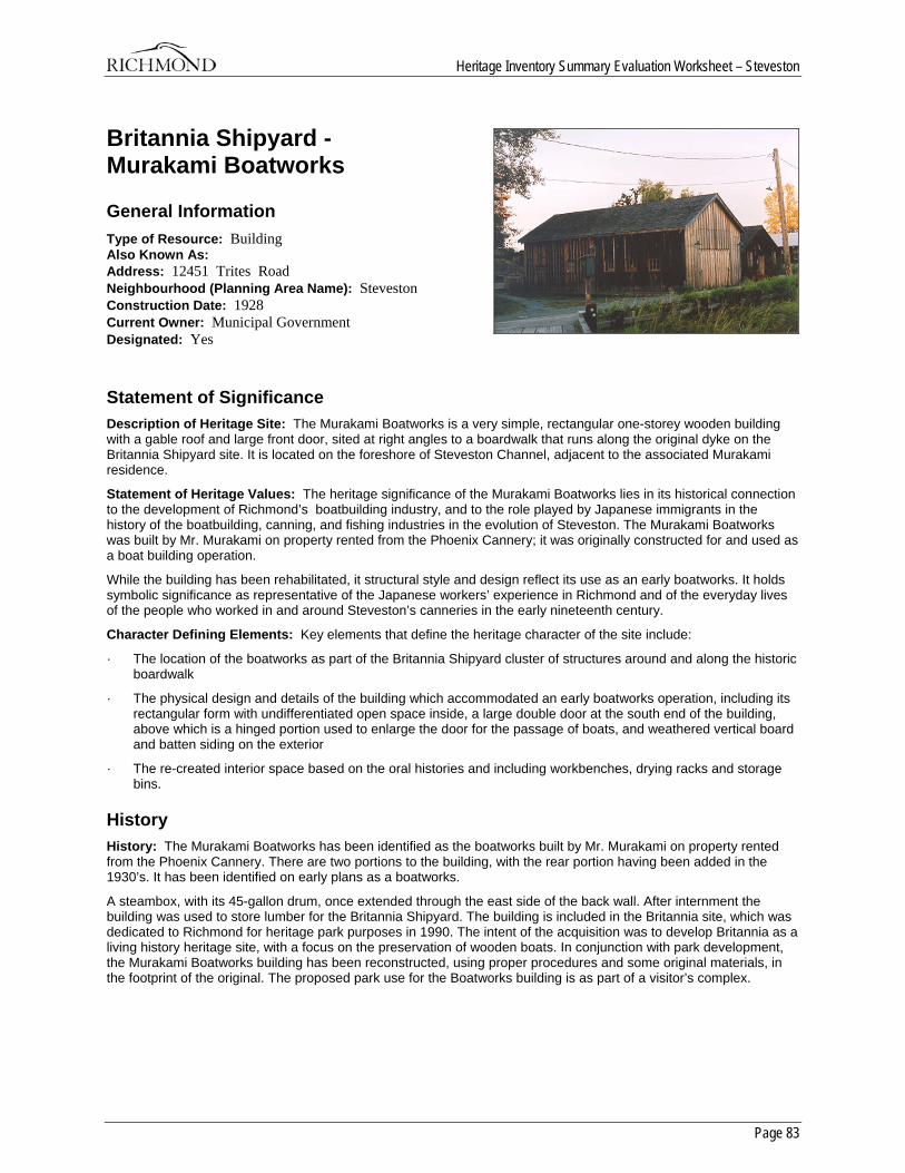
Heritage Inventory Summary Evaluation Worksheet – Steveston
Page 83
Britannia Shipyard - Murakami Boatworks
General Information Type of Resource: Building Also Known As: Address: 12451 Trites Road Neighbourhood (Planning Area Name): Steveston Construction Date: 1928 Current Owner: Municipal Government Designated: Yes
Statement of Significance Description of Heritage Site: The Murakami Boatworks is a very simple, rectangular one-storey wooden building with a gable roof and large front door, sited at right angles to a boardwalk that runs along the original dyke on the Britannia Shipyard site. It is located on the foreshore of Steveston Channel, adjacent to the associated Murakami residence.
Statement of Heritage Values: The heritage significance of the Murakami Boatworks lies in its historical connection to the development of Richmond’s boatbuilding industry, and to the role played by Japanese immigrants in the history of the boatbuilding, canning, and fishing industries in the evolution of Steveston. The Murakami Boatworks was built by Mr. Murakami on property rented from the Phoenix Cannery; it was originally constructed for and used as a boat building operation.
While the building has been rehabilitated, it structural style and design reflect its use as an early boatworks. It holds symbolic significance as representative of the Japanese workers’ experience in Richmond and of the everyday lives of the people who worked in and around Steveston’s canneries in the early nineteenth century.
Character Defining Elements: Key elements that define the heritage character of the site include:
· The location of the boatworks as part of the Britannia Shipyard cluster of structures around and along the historic boardwalk
· The physical design and details of the building which accommodated an early boatworks operation, including its rectangular form with undifferentiated open space inside, a large double door at the south end of the building, above which is a hinged portion used to enlarge the door for the passage of boats, and weathered vertical board and batten siding on the exterior
· The re-created interior space based on the oral histories and including workbenches, drying racks and storage bins.
History History: The Murakami Boatworks has been identified as the boatworks built by Mr. Murakami on property rented from the Phoenix Cannery. There are two portions to the building, with the rear portion having been added in the 1930’s. It has been identified on early plans as a boatworks.
A steambox, with its 45-gallon drum, once extended through the east side of the back wall. After internment the building was used to store lumber for the Britannia Shipyard. The building is included in the Britannia site, which was dedicated to Richmond for heritage park purposes in 1990. The intent of the acquisition was to develop Britannia as a living history heritage site, with a focus on the preservation of wooden boats. In conjunction with park development, the Murakami Boatworks building has been reconstructed, using proper procedures and some original materials, in the footprint of the original. The proposed park use for the Boatworks building is as part of a visitor’s complex.
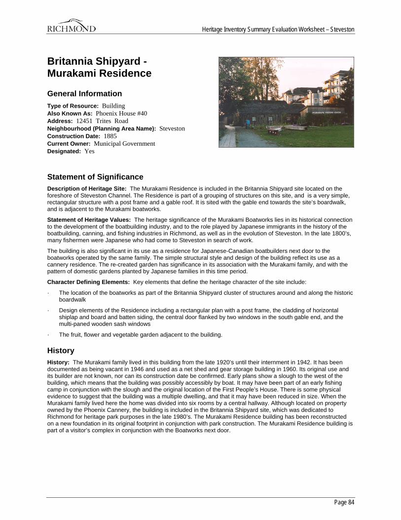
Heritage Inventory Summary Evaluation Worksheet – Steveston
Page 84
Britannia Shipyard - Murakami Residence
General Information Type of Resource: Building Also Known As: Phoenix House #40 Address: 12451 Trites Road Neighbourhood (Planning Area Name): Steveston Construction Date: 1885 Current Owner: Municipal Government Designated: Yes
Statement of Significance Description of Heritage Site: The Murakami Residence is included in the Britannia Shipyard site located on the foreshore of Steveston Channel. The Residence is part of a grouping of structures on this site, and is a very simple, rectangular structure with a post frame and a gable roof. It is sited with the gable end towards the site’s boardwalk, and is adjacent to the Murakami boatworks.
Statement of Heritage Values: The heritage significance of the Murakami Boatworks lies in its historical connection to the development of the boatbuilding industry, and to the role played by Japanese immigrants in the history of the boatbuilding, canning, and fishing industries in Richmond, as well as in the evolution of Steveston. In the late 1800’s, many fishermen were Japanese who had come to Steveston in search of work.
The building is also significant in its use as a residence for Japanese-Canadian boatbuilders next door to the boatworks operated by the same family. The simple structural style and design of the building reflect its use as a cannery residence. The re-created garden has significance in its association with the Murakami family, and with the pattern of domestic gardens planted by Japanese families in this time period.
Character Defining Elements: Key elements that define the heritage character of the site include:
· The location of the boatworks as part of the Britannia Shipyard cluster of structures around and along the historic boardwalk
· Design elements of the Residence including a rectangular plan with a post frame, the cladding of horizontal shiplap and board and batten siding, the central door flanked by two windows in the south gable end, and the multi-paned wooden sash windows
· The fruit, flower and vegetable garden adjacent to the building.
History History: The Murakami family lived in this building from the late 1920’s until their internment in 1942. It has been documented as being vacant in 1946 and used as a net shed and gear storage building in 1960. Its original use and its builder are not known, nor can its construction date be confirmed. Early plans show a slough to the west of the building, which means that the building was possibly accessibly by boat. It may have been part of an early fishing camp in conjunction with the slough and the original location of the First People’s House. There is some physical evidence to suggest that the building was a multiple dwelling, and that it may have been reduced in size. When the Murakami family lived here the home was divided into six rooms by a central hallway. Although located on property owned by the Phoenix Cannery, the building is included in the Britannia Shipyard site, which was dedicated to Richmond for heritage park purposes in the late 1980’s. The Murakami Residence building has been reconstructed on a new foundation in its original footprint in conjunction with park construction. The Murakami Residence building is part of a visitor’s complex in conjunction with the Boatworks next door.
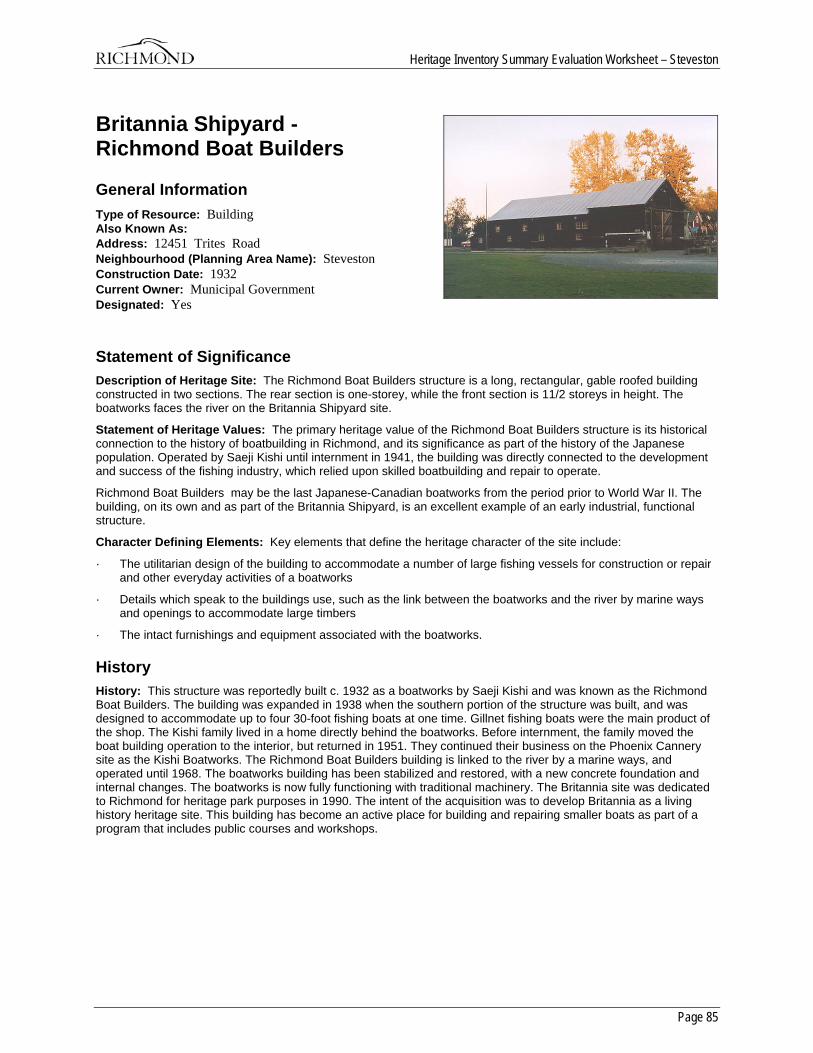
Heritage Inventory Summary Evaluation Worksheet – Steveston
Page 85
Britannia Shipyard - Richmond Boat Builders
General Information Type of Resource: Building Also Known As: Address: 12451 Trites Road Neighbourhood (Planning Area Name): Steveston Construction Date: 1932 Current Owner: Municipal Government Designated: Yes
Statement of Significance Description of Heritage Site: The Richmond Boat Builders structure is a long, rectangular, gable roofed building constructed in two sections. The rear section is one-storey, while the front section is 11/2 storeys in height. The boatworks faces the river on the Britannia Shipyard site.
Statement of Heritage Values: The primary heritage value of the Richmond Boat Builders structure is its historical connection to the history of boatbuilding in Richmond, and its significance as part of the history of the Japanese population. Operated by Saeji Kishi until internment in 1941, the building was directly connected to the development and success of the fishing industry, which relied upon skilled boatbuilding and repair to operate.
Richmond Boat Builders may be the last Japanese-Canadian boatworks from the period prior to World War II. The building, on its own and as part of the Britannia Shipyard, is an excellent example of an early industrial, functional structure.
Character Defining Elements: Key elements that define the heritage character of the site include:
· The utilitarian design of the building to accommodate a number of large fishing vessels for construction or repair and other everyday activities of a boatworks
· Details which speak to the buildings use, such as the link between the boatworks and the river by marine ways and openings to accommodate large timbers
· The intact furnishings and equipment associated with the boatworks.
History History: This structure was reportedly built c. 1932 as a boatworks by Saeji Kishi and was known as the Richmond Boat Builders. The building was expanded in 1938 when the southern portion of the structure was built, and was designed to accommodate up to four 30-foot fishing boats at one time. Gillnet fishing boats were the main product of the shop. The Kishi family lived in a home directly behind the boatworks. Before internment, the family moved the boat building operation to the interior, but returned in 1951. They continued their business on the Phoenix Cannery site as the Kishi Boatworks. The Richmond Boat Builders building is linked to the river by a marine ways, and operated until 1968. The boatworks building has been stabilized and restored, with a new concrete foundation and internal changes. The boatworks is now fully functioning with traditional machinery. The Britannia site was dedicated to Richmond for heritage park purposes in 1990. The intent of the acquisition was to develop Britannia as a living history heritage site. This building has become an active place for building and repairing smaller boats as part of a program that includes public courses and workshops.
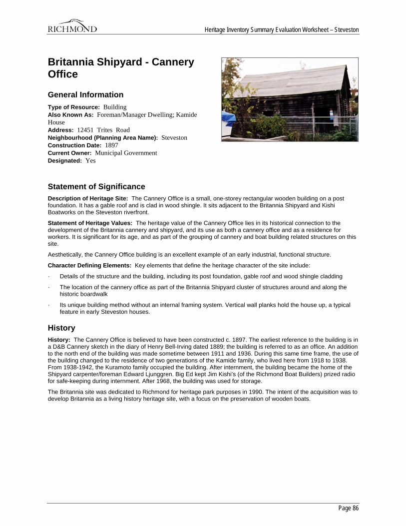
Heritage Inventory Summary Evaluation Worksheet – Steveston
Page 86
Britannia Shipyard - Cannery Office
General Information Type of Resource: Building Also Known As: Foreman/Manager Dwelling; Kamide House Address: 12451 Trites Road Neighbourhood (Planning Area Name): Steveston Construction Date: 1897 Current Owner: Municipal Government Designated: Yes
Statement of Significance Description of Heritage Site: The Cannery Office is a small, one-storey rectangular wooden building on a post foundation. It has a gable roof and is clad in wood shingle. It sits adjacent to the Britannia Shipyard and Kishi Boatworks on the Steveston riverfront.
Statement of Heritage Values: The heritage value of the Cannery Office lies in its historical connection to the development of the Britannia cannery and shipyard, and its use as both a cannery office and as a residence for workers. It is significant for its age, and as part of the grouping of cannery and boat building related structures on this site.
Aesthetically, the Cannery Office building is an excellent example of an early industrial, functional structure.
Character Defining Elements: Key elements that define the heritage character of the site include:
· Details of the structure and the building, including its post foundation, gable roof and wood shingle cladding
· The location of the cannery office as part of the Britannia Shipyard cluster of structures around and along the historic boardwalk
· Its unique building method without an internal framing system. Vertical wall planks hold the house up, a typical feature in early Steveston houses.
History History: The Cannery Office is believed to have been constructed c. 1897. The earliest reference to the building is in a D&B Cannery sketch in the diary of Henry Bell-Irving dated 1889; the building is referred to as an office. An addition to the north end of the building was made sometime between 1911 and 1936. During this same time frame, the use of the building changed to the residence of two generations of the Kamide family, who lived here from 1918 to 1938. From 1938-1942, the Kuramoto family occupied the building. After internment, the building became the home of the Shipyard carpenter/foreman Edward Ljunggren. Big Ed kept Jim Kishi’s (of the Richmond Boat Builders) prized radio for safe-keeping during internment. After 1968, the building was used for storage.
The Britannia site was dedicated to Richmond for heritage park purposes in 1990. The intent of the acquisition was to develop Britannia as a living history heritage site, with a focus on the preservation of wooden boats.
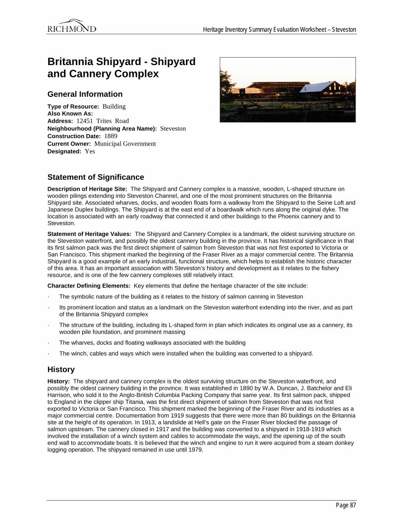
Heritage Inventory Summary Evaluation Worksheet – Steveston
Page 87
Britannia Shipyard - Shipyard and Cannery Complex
General Information Type of Resource: Building Also Known As: Address: 12451 Trites Road Neighbourhood (Planning Area Name): Steveston Construction Date: 1889 Current Owner: Municipal Government Designated: Yes
Statement of Significance Description of Heritage Site: The Shipyard and Cannery complex is a massive, wooden, L-shaped structure on wooden pilings extending into Steveston Channel, and one of the most prominent structures on the Britannia Shipyard site. Associated wharves, docks, and wooden floats form a walkway from the Shipyard to the Seine Loft and Japanese Duplex buildings. The Shipyard is at the east end of a boardwalk which runs along the original dyke. The location is associated with an early roadway that connected it and other buildings to the Phoenix cannery and to Steveston.
Statement of Heritage Values: The Shipyard and Cannery Complex is a landmark, the oldest surviving structure on the Steveston waterfront, and possibly the oldest cannery building in the province. It has historical significance in that its first salmon pack was the first direct shipment of salmon from Steveston that was not first exported to Victoria or San Francisco. This shipment marked the beginning of the Fraser River as a major commercial centre. The Britannia Shipyard is a good example of an early industrial, functional structure, which helps to establish the historic character of this area. It has an important association with Steveston’s history and development as it relates to the fishery resource, and is one of the few cannery complexes still relatively intact.
Character Defining Elements: Key elements that define the heritage character of the site include:
· The symbolic nature of the building as it relates to the history of salmon canning in Steveston
· Its prominent location and status as a landmark on the Steveston waterfront extending into the river, and as part of the Britannia Shipyard complex
· The structure of the building, including its L-shaped form in plan which indicates its original use as a cannery, its wooden pile foundation, and prominent massing
· The wharves, docks and floating walkways associated with the building
· The winch, cables and ways which were installed when the building was converted to a shipyard.
History History: The shipyard and cannery complex is the oldest surviving structure on the Steveston waterfront, and possibly the oldest cannery building in the province. It was established in 1890 by W.A. Duncan, J. Batchelor and Eli Harrison, who sold it to the Anglo-British Columbia Packing Company that same year. Its first salmon pack, shipped to England in the clipper ship Titania, was the first direct shipment of salmon from Steveston that was not first exported to Victoria or San Francisco. This shipment marked the beginning of the Fraser River and its industries as a major commercial centre. Documentation from 1919 suggests that there were more than 80 buildings on the Britannia site at the height of its operation. In 1913, a landslide at Hell’s gate on the Fraser River blocked the passage of salmon upstream. The cannery closed in 1917 and the building was converted to a shipyard in 1918-1919 which involved the installation of a winch system and cables to accommodate the ways, and the opening up of the south end wall to accommodate boats. It is believed that the winch and engine to run it were acquired from a steam donkey logging operation. The shipyard remained in use until 1979.

Heritage Inventory Summary Evaluation Worksheet – Steveston
Page 88
The site was dedicated to Richmond for heritage park purposes in 1990. The intent of the acquisition was to develop Britannia as a living history heritage site, with a focus on the preservation of wooden boats. The proposed use of this building as part of the park is as an active maritime centre for the construction and interpretation of small wooden boats.
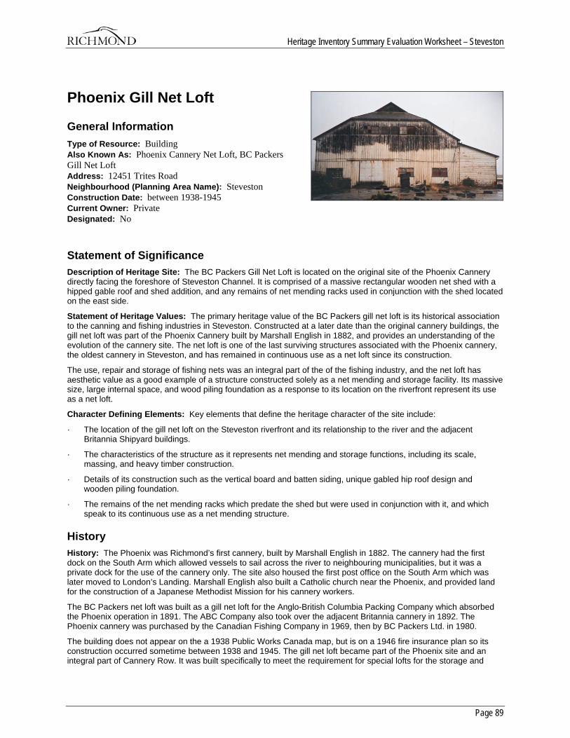
Heritage Inventory Summary Evaluation Worksheet – Steveston
Page 89
Phoenix Gill Net Loft
General Information Type of Resource: Building Also Known As: Phoenix Cannery Net Loft, BC Packers Gill Net Loft Address: 12451 Trites Road Neighbourhood (Planning Area Name): Steveston Construction Date: between 1938-1945 Current Owner: Private Designated: No
Statement of Significance Description of Heritage Site: The BC Packers Gill Net Loft is located on the original site of the Phoenix Cannery directly facing the foreshore of Steveston Channel. It is comprised of a massive rectangular wooden net shed with a hipped gable roof and shed addition, and any remains of net mending racks used in conjunction with the shed located on the east side.
Statement of Heritage Values: The primary heritage value of the BC Packers gill net loft is its historical association to the canning and fishing industries in Steveston. Constructed at a later date than the original cannery buildings, the gill net loft was part of the Phoenix Cannery built by Marshall English in 1882, and provides an understanding of the evolution of the cannery site. The net loft is one of the last surviving structures associated with the Phoenix cannery, the oldest cannery in Steveston, and has remained in continuous use as a net loft since its construction.
The use, repair and storage of fishing nets was an integral part of the of the fishing industry, and the net loft has aesthetic value as a good example of a structure constructed solely as a net mending and storage facility. Its massive size, large internal space, and wood piling foundation as a response to its location on the riverfront represent its use as a net loft.
Character Defining Elements: Key elements that define the heritage character of the site include:
· The location of the gill net loft on the Steveston riverfront and its relationship to the river and the adjacent Britannia Shipyard buildings.
· The characteristics of the structure as it represents net mending and storage functions, including its scale, massing, and heavy timber construction.
· Details of its construction such as the vertical board and batten siding, unique gabled hip roof design and wooden piling foundation.
· The remains of the net mending racks which predate the shed but were used in conjunction with it, and which speak to its continuous use as a net mending structure.
History History: The Phoenix was Richmond’s first cannery, built by Marshall English in 1882. The cannery had the first dock on the South Arm which allowed vessels to sail across the river to neighbouring municipalities, but it was a private dock for the use of the cannery only. The site also housed the first post office on the South Arm which was later moved to London’s Landing. Marshall English also built a Catholic church near the Phoenix, and provided land for the construction of a Japanese Methodist Mission for his cannery workers.
The BC Packers net loft was built as a gill net loft for the Anglo-British Columbia Packing Company which absorbed the Phoenix operation in 1891. The ABC Company also took over the adjacent Britannia cannery in 1892. The Phoenix cannery was purchased by the Canadian Fishing Company in 1969, then by BC Packers Ltd. in 1980.
The building does not appear on the a 1938 Public Works Canada map, but is on a 1946 fire insurance plan so its construction occurred sometime between 1938 and 1945. The gill net loft became part of the Phoenix site and an integral part of Cannery Row. It was built specifically to meet the requirement for special lofts for the storage and

Heritage Inventory Summary Evaluation Worksheet – Steveston
Page 90
repair of gill nets for the Phoenix fishing fleet. The Phoenix Pond was dredged out in 1947 to provide wet storage for small fishboats such as gillnetters which would have utilized the loft for their nets. The gill net loft is located next to a second identical net loft that was built for the cannery in the 1940’s, and was given to the Britannia Heritage Shipyard by BC Packers.
The Phoenix gill net loft has remained in continuous use as a net loft since its construction. Today the building is empty and the rest of the Phoenix cannery site has been demolished as part of development along the riverfront.
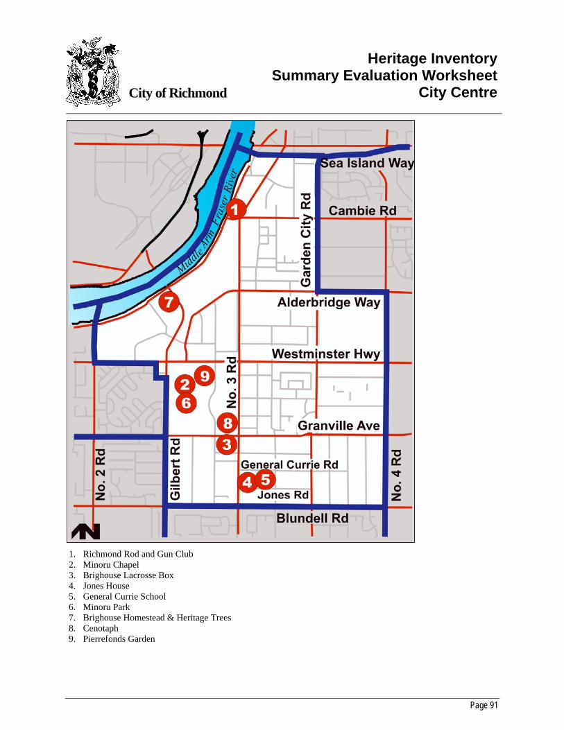
Page 91
City of Richmond
Heritage InventorySummary Evaluation Worksheet
City Centre
1. Richmond Rod and Gun Club 2. Minoru Chapel 3. Brighouse Lacrosse Box 4. Jones House 5. General Currie School 6. Minoru Park 7. Brighouse Homestead & Heritage Trees 8. Cenotaph 9. Pierrefonds Garden
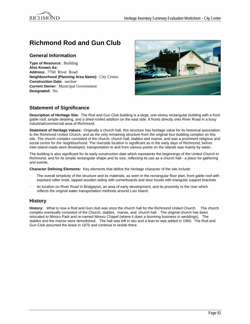
Heritage Inventory Summary Evaluation Worksheet – City Centre
Page 92
Richmond Rod and Gun Club
General Information Type of Resource: Building Also Known As: Address: 7760 River Road Neighbourhood (Planning Area Name): City Centre Construction Date: unclear Current Owner: Municipal Government Designated: No
Statement of Significance Description of Heritage Site: The Rod and Gun Club building is a large, one-storey rectangular building with a front gable roof, simple detailing, and a shed-roofed addition on the east side. It fronts directly onto River Road in a busy industrial/commercial area of Richmond.
Statement of Heritage Values: Originally a church hall, this structure has heritage value for its historical association to the Richmond United Church, and as the only remaining structure from the original four-building complex on this site. The church complex consisted of the church, church hall, stables and manse, and was a prominent religious and social centre for the neighbourhood. The riverside location is significant as in the early days of Richmond, before inter-island roads were developed, transportation to and from various points on the islands was mainly by water.
The building is also significant for its early construction date which represents the beginnings of the United Church in Richmond, and for its simple rectangular shape and its size, reflecting its use as a church hall - a place for gathering and events.
Character Defining Elements: Key elements that define the heritage character of the site include:
· The overall simplicity of the structure and its materials, as seen in the rectangular floor plan, front gable roof with exposed rafter ends, lapped wooden siding with cornerboards and door hoods with triangular support brackets
· Its location on River Road in Bridgeport, an area of early development, and its proximity to the river which reflects the original water transportation methods around Lulu Island.
History History: What is now a Rod and Gun club was once the church hall for the Richmond United Church. The church complex eventually consisted of the Church, stables, manse, and church hall. The original church has been relocated to Minoru Park and re-named Minoru Chapel (where it does a booming business in weddings). The stables and the manse were demolished. The hall was left in situ and a lean-to was added in 1950. The Rod and Gun Club assumed the lease in 1970 and continue to reside there.
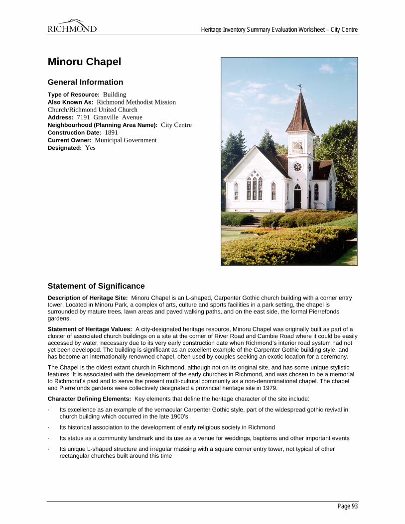
Heritage Inventory Summary Evaluation Worksheet – City Centre
Page 93
Minoru Chapel
General Information Type of Resource: Building Also Known As: Richmond Methodist Mission Church/Richmond United Church Address: 7191 Granville Avenue Neighbourhood (Planning Area Name): City Centre Construction Date: 1891 Current Owner: Municipal Government Designated: Yes
Statement of Significance Description of Heritage Site: Minoru Chapel is an L-shaped, Carpenter Gothic church building with a corner entry tower. Located in Minoru Park, a complex of arts, culture and sports facilities in a park setting, the chapel is surrounded by mature trees, lawn areas and paved walking paths, and on the east side, the formal Pierrefonds gardens.
Statement of Heritage Values: A city-designated heritage resource, Minoru Chapel was originally built as part of a cluster of associated church buildings on a site at the corner of River Road and Cambie Road where it could be easily accessed by water, necessary due to its very early construction date when Richmond’s interior road system had not yet been developed. The building is significant as an excellent example of the Carpenter Gothic building style, and has become an internationally renowned chapel, often used by couples seeking an exotic location for a ceremony.
The Chapel is the oldest extant church in Richmond, although not on its original site, and has some unique stylistic features. It is associated with the development of the early churches in Richmond, and was chosen to be a memorial to Richmond’s past and to serve the present multi-cultural community as a non-denominational chapel. The chapel and Pierrefonds gardens were collectively designated a provincial heritage site in 1979.
Character Defining Elements: Key elements that define the heritage character of the site include:
· Its excellence as an example of the vernacular Carpenter Gothic style, part of the widespread gothic revival in church building which occurred in the late 1900’s
· Its historical association to the development of early religious society in Richmond
· Its status as a community landmark and its use as a venue for weddings, baptisms and other important events
· Its unique L-shaped structure and irregular massing with a square corner entry tower, not typical of other rectangular churches built around this time
Heritage Inventory Summary Evaluation Worksheet – City Centre
Page 94
· Quality of design and construction in the details, such as the ornate tower, decorative eave brackets and leaded glass windows with triangular pointed arches.
History History: The Richmond Methodist Mission was formed in 1888. It’s first church, the Richmond Methodist Mission Church, known today as Minoru Chapel, was originally built as part of a cluster of associated church buildings on a site at the corner of River Road and Cambie Road. This location was chosen because the main form of transportation for Richmond’s early settlers was by water; the interior of the island was largely undrained at this time and there were few usable roads. As with other churches in Richmond, it was affected by the unification of churches in 1925. This union brought together Presbyterian, Methodist and Congregationalist churches under the banner of the United Church of Canada, and in doing so, changed their structure. After the unification, it became known as the Richmond United Church. It was moved to Minoru Park in 1967 as a centennial project. In 1968, it was consecrated as Minoru Chapel, the Chapel in the Park. The chapel takes its name from Minoru Park, which was named after Edward VII’s famed racehorse. It was chosen to be a memorial to Richmond’s past, and to serve the present multi-cultural community as a non-denominational chapel. The chapel and gardens were collectively designated a provincial heritage site on May 28, 1979.
The original church complex at River and Cambie Roads consisted of the Mission church, stables, manse and church hall. Of the original buildings, only the hall remains on the original site as the Richmond Rod and Gun club.
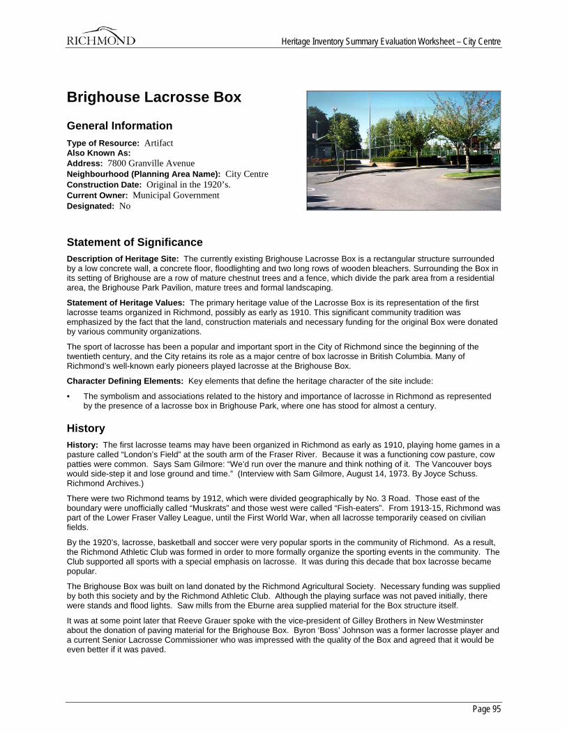
Heritage Inventory Summary Evaluation Worksheet – City Centre
Page 95
Brighouse Lacrosse Box
General Information Type of Resource: Artifact Also Known As: Address: 7800 Granville Avenue Neighbourhood (Planning Area Name): City Centre Construction Date: Original in the 1920’s. Current Owner: Municipal Government Designated: No
Statement of Significance Description of Heritage Site: The currently existing Brighouse Lacrosse Box is a rectangular structure surrounded by a low concrete wall, a concrete floor, floodlighting and two long rows of wooden bleachers. Surrounding the Box in its setting of Brighouse are a row of mature chestnut trees and a fence, which divide the park area from a residential area, the Brighouse Park Pavilion, mature trees and formal landscaping.
Statement of Heritage Values: The primary heritage value of the Lacrosse Box is its representation of the first lacrosse teams organized in Richmond, possibly as early as 1910. This significant community tradition was emphasized by the fact that the land, construction materials and necessary funding for the original Box were donated by various community organizations.
The sport of lacrosse has been a popular and important sport in the City of Richmond since the beginning of the twentieth century, and the City retains its role as a major centre of box lacrosse in British Columbia. Many of Richmond’s well-known early pioneers played lacrosse at the Brighouse Box.
Character Defining Elements: Key elements that define the heritage character of the site include:
• The symbolism and associations related to the history and importance of lacrosse in Richmond as represented by the presence of a lacrosse box in Brighouse Park, where one has stood for almost a century.
History History: The first lacrosse teams may have been organized in Richmond as early as 1910, playing home games in a pasture called “London’s Field” at the south arm of the Fraser River. Because it was a functioning cow pasture, cow patties were common. Says Sam Gilmore: “We’d run over the manure and think nothing of it. The Vancouver boys would side-step it and lose ground and time.” (Interview with Sam Gilmore, August 14, 1973. By Joyce Schuss. Richmond Archives.)
There were two Richmond teams by 1912, which were divided geographically by No. 3 Road. Those east of the boundary were unofficially called “Muskrats” and those west were called “Fish-eaters”. From 1913-15, Richmond was part of the Lower Fraser Valley League, until the First World War, when all lacrosse temporarily ceased on civilian fields.
By the 1920’s, lacrosse, basketball and soccer were very popular sports in the community of Richmond. As a result, the Richmond Athletic Club was formed in order to more formally organize the sporting events in the community. The Club supported all sports with a special emphasis on lacrosse. It was during this decade that box lacrosse became popular.
The Brighouse Box was built on land donated by the Richmond Agricultural Society. Necessary funding was supplied by both this society and by the Richmond Athletic Club. Although the playing surface was not paved initially, there were stands and flood lights. Saw mills from the Eburne area supplied material for the Box structure itself.
It was at some point later that Reeve Grauer spoke with the vice-president of Gilley Brothers in New Westminster about the donation of paving material for the Brighouse Box. Byron ‘Boss’ Johnson was a former lacrosse player and a current Senior Lacrosse Commissioner who was impressed with the quality of the Box and agreed that it would be even better if it was paved.
Heritage Inventory Summary Evaluation Worksheet – City Centre
Page 96
Box lacrosse became very popular locally, especially as box rules called for fewer players on the floor at a time. As well, lighting meant greater flexibility in the scheduling of games. Both aspects offered scheduling flexibility and were welcome at planting and harvesting times.
The Brighouse team was sponsored by the Brighouse merchants in the early days, and wore uniforms of purple and yellow. Protective padding was optional, with most players wearing gloves. Some wore padded caps on their heads. It was some time later that face masks were regularly worn.
A story told by Sam Gilmore relates team rivalry between Brighouse and Steveston. Edie Gilmore was not happy to see her brother Dave fighting mid-floor with a Steveston player, especially because Dave was losing. To make matters worse, the Steveston goalie was about to join the fight as third-man-in. She hoisted her skirts, jumped over the fence, grabbed the goalie’s stick and hit him with it. The referee (brother Bill Gilmore) quickly escorted his sister off the floor amidst roars of laughter from the crowd. (Interview with Sam Gilmore, August 14, 1973. By Joyce Schuss. Richmond Archives.).
The original lacrosse box was demolished in the 1980’s and replaced with the current structure.
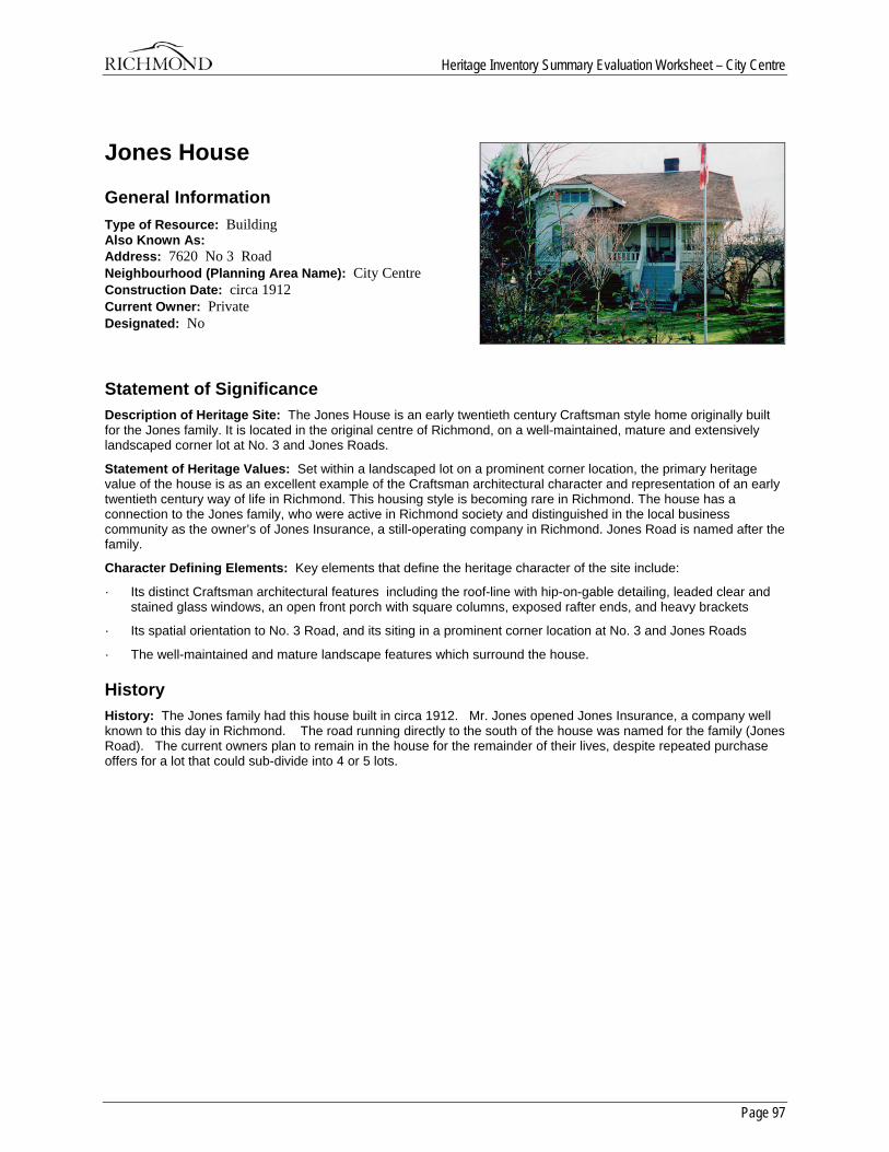
Heritage Inventory Summary Evaluation Worksheet – City Centre
Page 97
Jones House
General Information Type of Resource: Building Also Known As: Address: 7620 No 3 Road Neighbourhood (Planning Area Name): City Centre Construction Date: circa 1912 Current Owner: Private Designated: No
Statement of Significance Description of Heritage Site: The Jones House is an early twentieth century Craftsman style home originally built for the Jones family. It is located in the original centre of Richmond, on a well-maintained, mature and extensively landscaped corner lot at No. 3 and Jones Roads.
Statement of Heritage Values: Set within a landscaped lot on a prominent corner location, the primary heritage value of the house is as an excellent example of the Craftsman architectural character and representation of an early twentieth century way of life in Richmond. This housing style is becoming rare in Richmond. The house has a connection to the Jones family, who were active in Richmond society and distinguished in the local business community as the owner’s of Jones Insurance, a still-operating company in Richmond. Jones Road is named after the family.
Character Defining Elements: Key elements that define the heritage character of the site include:
· Its distinct Craftsman architectural features including the roof-line with hip-on-gable detailing, leaded clear and stained glass windows, an open front porch with square columns, exposed rafter ends, and heavy brackets
· Its spatial orientation to No. 3 Road, and its siting in a prominent corner location at No. 3 and Jones Roads
· The well-maintained and mature landscape features which surround the house.
History History: The Jones family had this house built in circa 1912. Mr. Jones opened Jones Insurance, a company well known to this day in Richmond. The road running directly to the south of the house was named for the family (Jones Road). The current owners plan to remain in the house for the remainder of their lives, despite repeated purchase offers for a lot that could sub-divide into 4 or 5 lots.
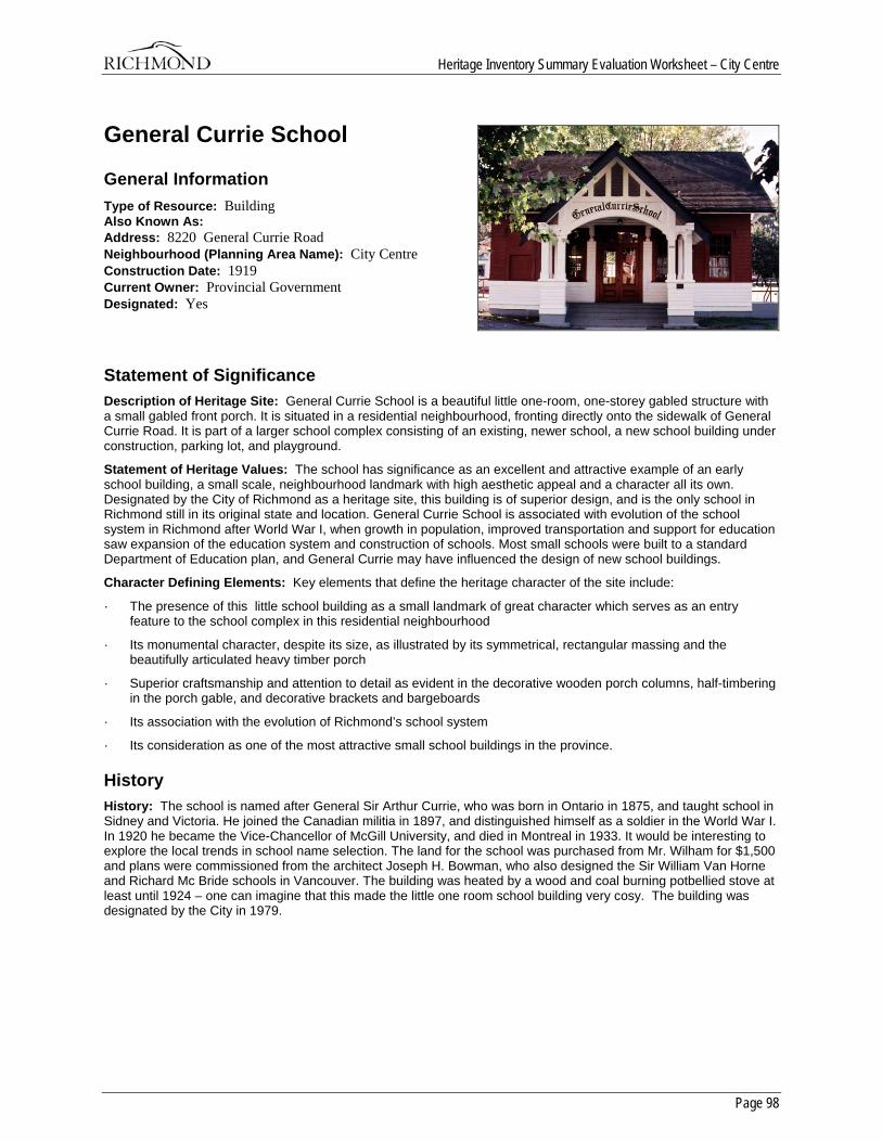
Heritage Inventory Summary Evaluation Worksheet – City Centre
Page 98
General Currie School
General Information Type of Resource: Building Also Known As: Address: 8220 General Currie Road Neighbourhood (Planning Area Name): City Centre Construction Date: 1919 Current Owner: Provincial Government Designated: Yes
Statement of Significance Description of Heritage Site: General Currie School is a beautiful little one-room, one-storey gabled structure with a small gabled front porch. It is situated in a residential neighbourhood, fronting directly onto the sidewalk of General Currie Road. It is part of a larger school complex consisting of an existing, newer school, a new school building under construction, parking lot, and playground.
Statement of Heritage Values: The school has significance as an excellent and attractive example of an early school building, a small scale, neighbourhood landmark with high aesthetic appeal and a character all its own. Designated by the City of Richmond as a heritage site, this building is of superior design, and is the only school in Richmond still in its original state and location. General Currie School is associated with evolution of the school system in Richmond after World War I, when growth in population, improved transportation and support for education saw expansion of the education system and construction of schools. Most small schools were built to a standard Department of Education plan, and General Currie may have influenced the design of new school buildings.
Character Defining Elements: Key elements that define the heritage character of the site include:
· The presence of this little school building as a small landmark of great character which serves as an entry feature to the school complex in this residential neighbourhood
· Its monumental character, despite its size, as illustrated by its symmetrical, rectangular massing and the beautifully articulated heavy timber porch
· Superior craftsmanship and attention to detail as evident in the decorative wooden porch columns, half-timbering in the porch gable, and decorative brackets and bargeboards
· Its association with the evolution of Richmond’s school system
· Its consideration as one of the most attractive small school buildings in the province.
History History: The school is named after General Sir Arthur Currie, who was born in Ontario in 1875, and taught school in Sidney and Victoria. He joined the Canadian militia in 1897, and distinguished himself as a soldier in the World War I. In 1920 he became the Vice-Chancellor of McGill University, and died in Montreal in 1933. It would be interesting to explore the local trends in school name selection. The land for the school was purchased from Mr. Wilham for $1,500 and plans were commissioned from the architect Joseph H. Bowman, who also designed the Sir William Van Horne and Richard Mc Bride schools in Vancouver. The building was heated by a wood and coal burning potbellied stove at least until 1924 – one can imagine that this made the little one room school building very cosy. The building was designated by the City in 1979.
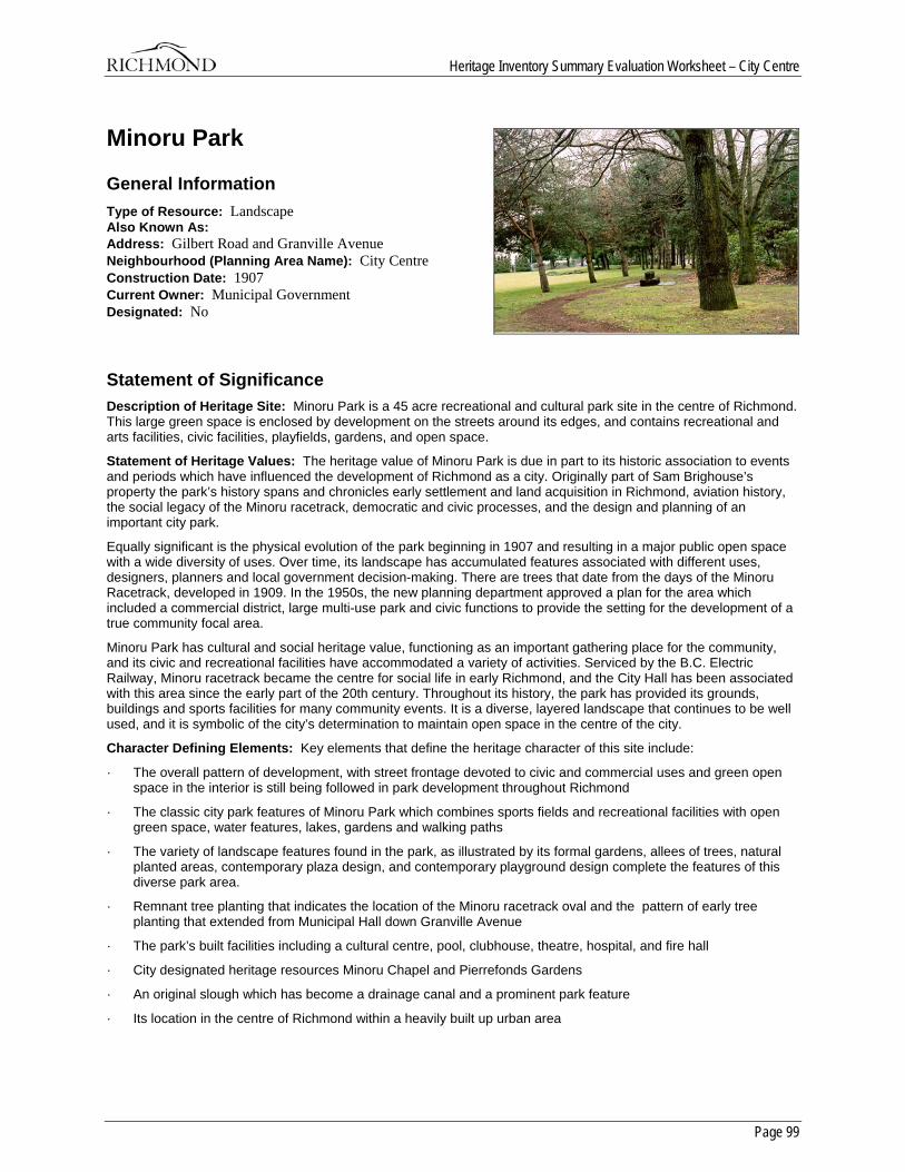
Heritage Inventory Summary Evaluation Worksheet – City Centre
Page 99
Minoru Park
General Information Type of Resource: Landscape Also Known As: Address: Gilbert Road and Granville Avenue Neighbourhood (Planning Area Name): City Centre Construction Date: 1907 Current Owner: Municipal Government Designated: No
Statement of Significance Description of Heritage Site: Minoru Park is a 45 acre recreational and cultural park site in the centre of Richmond. This large green space is enclosed by development on the streets around its edges, and contains recreational and arts facilities, civic facilities, playfields, gardens, and open space.
Statement of Heritage Values: The heritage value of Minoru Park is due in part to its historic association to events and periods which have influenced the development of Richmond as a city. Originally part of Sam Brighouse’s property the park’s history spans and chronicles early settlement and land acquisition in Richmond, aviation history, the social legacy of the Minoru racetrack, democratic and civic processes, and the design and planning of an important city park.
Equally significant is the physical evolution of the park beginning in 1907 and resulting in a major public open space with a wide diversity of uses. Over time, its landscape has accumulated features associated with different uses, designers, planners and local government decision-making. There are trees that date from the days of the Minoru Racetrack, developed in 1909. In the 1950s, the new planning department approved a plan for the area which included a commercial district, large multi-use park and civic functions to provide the setting for the development of a true community focal area.
Minoru Park has cultural and social heritage value, functioning as an important gathering place for the community, and its civic and recreational facilities have accommodated a variety of activities. Serviced by the B.C. Electric Railway, Minoru racetrack became the centre for social life in early Richmond, and the City Hall has been associated with this area since the early part of the 20th century. Throughout its history, the park has provided its grounds, buildings and sports facilities for many community events. It is a diverse, layered landscape that continues to be well used, and it is symbolic of the city’s determination to maintain open space in the centre of the city.
Character Defining Elements: Key elements that define the heritage character of this site include:
· The overall pattern of development, with street frontage devoted to civic and commercial uses and green open space in the interior is still being followed in park development throughout Richmond
· The classic city park features of Minoru Park which combines sports fields and recreational facilities with open green space, water features, lakes, gardens and walking paths
· The variety of landscape features found in the park, as illustrated by its formal gardens, allees of trees, natural planted areas, contemporary plaza design, and contemporary playground design complete the features of this diverse park area.
· Remnant tree planting that indicates the location of the Minoru racetrack oval and the pattern of early tree planting that extended from Municipal Hall down Granville Avenue
· The park’s built facilities including a cultural centre, pool, clubhouse, theatre, hospital, and fire hall
· City designated heritage resources Minoru Chapel and Pierrefonds Gardens
· An original slough which has become a drainage canal and a prominent park feature
· Its location in the centre of Richmond within a heavily built up urban area
Heritage Inventory Summary Evaluation Worksheet – City Centre
Page 100
History History: Minoru Park began its life as part of the flat delta lands of the Fraser River estuary. Plans show evidence of early sloughs and natural drainage channels. For many years this area was primarily rural and agricultural, but began to develop slowly as small commercial centre near the corner of No. 3 Road and Granville Avenue.
One of the largest landowners on Lulu Island was Yorkshireman Samuel Brighouse, who with his partner William Scratchley purchased a 697-acre tract of land from William Parsons and William Shannon in 1854. This property stretched from the present day site of Minoru Park north to the Middle Arm of the Fraser River. Brighouse and Scratchley raised dairy cows, cattle and horses here until they dissolved their partnership in 1880. In that year, Sam Brighouse sold five acres of his property at the price of $400.00 to the municipality for the construction of the first town hall. The property was located at the corner of Cambie and River Roads. In 1919, the municipality traded this same property to Michael Brighouse (Sam’s nephew) for 4 acres at the corner of No. 3 Road and Granville Avenue where the present City Hall is located. This area is shown on the Waterworks Plan of 1936. Brighouse returned to England in 1911.
Sam Brighouse had a vision for a horseracing track on this site. In 1909, plans were drafted for a one-mile oval which opened on August 21 of that year, named Minoru after the winner of the Epsom derby, a horse owned by King Edward VII. The racetrack developed as a centre for social life in early Richmond. Plans from 1936 show horse barns lining No. 3 Road and the clubhouse, grandstand, and paddocks located down the centre of the present Minoru Park site. The B.C. Electric Railway ran along Granville Avenue and had a station at the corner or No. 3 Road and Granville, a convenient location for racegoers. The track closed down during World War I, but reopened in 1920 as Brighouse Park. The track closed permanently in 1948 due to deteriorating facilities and competition from Hastings Park in Vancouver.
Photographs of the racetrack indicate significant tree planting from the corner of No. 3 Road down Granville Avenue. These trees extended to the area behind the grandstand and shaded horses and cars on race days, as well as providing a focus for the Town Hall. As well, trees were planted around the circumference of the racetrack. Many of these trees are evident today.
Many community events were staged at the Minoru Park racetrack grounds, including May Day celebrations, dog shows, track meets, parades and car shows. The Sidaway agreement of 1918 allowed the Township of Richmond to rent the building known as the Club House at Minoru Park for $25.00 per month. Mr. McMath notes that The Club House became a place for dances, wedding receptions, parties, pot luck suppers and meetings of local clubs and societies, making the racetrack grounds and the Club House a centre of community activity.
The next layer in the history of Minoru is aviation. An airstrip had operated at Minoru since 1909, on a grassy field adjacent to the racetrack. In 1910, Charles Hamilton launched his Curtiss pusher biplane on the first powered flight in Western Canada. A large crowd was on hand to watch Hamilton make two flights overhead, then pit his plane against a horse named Prince Brutus. With a head start, Brutus won the race by 10 seconds. Other aviation milestones included Western Canada’s first passenger flight in 1912, the first female airplane passenger, and the flight of the first female pilot. The Minoru airfield continued to operation until 1941, when wartime gas rationing forced its permanent closure.
After World War II, Richmond began to experience rapid and considerable new growth for which its planning had not kept pace. Farmers began to subdivide their lands, mainly for housing, and subdivisions were being built quickly. This new generation of landowners brought with it a need for services of all kinds, and with it a need for organized planning. A 1949 comprehensive Town Plan divided Richmond into zones for the purposes of directing development, and established regulations for land use and construction.
In 1955, the School Board, Municipal Council and the Town Planning Commission proposed that a Civic Centre concept be adopted on the site of present City Hall. This proposal was adopted and architects were approved for the construction of a new City Hall on the same site as the old one and the School Board Office, Health Unit and Library were added to the site.
In addition, a report commissioned by the municipality completed by the landscape architectural firm of Desmond Muirhead recommended a commercial district and a large multi-use park, along with the civic functions, to provide the setting for the development of a true community focal area. The plan also recommended that the hospital be located in the Brighouse area, which would benefit from the nearby open space. The master plan for the approximately 80 acre Brighouse racetrack site accompanying the report showed the majority of the built structures for civic and commercial uses situated along No. 3 Road and the hospital located at the corner of Westminster Highway and Gilbert Road. Active sports were concentrated at south end of the park, and a large natural area with lakes and picnic sites was located at the north end. The plan showed tree planting around the perimeter of the site and internal landscaped areas between the different sports and civic functions.
Heritage Inventory Summary Evaluation Worksheet – City Centre
Page 101
The Recreation Commission and the Royal Canadian Legion both sent recommendations to Council that 40 acres of the Brighouse racetrack site be zoned for multi-purpose park. At this time, the Municipality had not yet purchased the land, and in late 1955 were ready to enter into negotiations with the B.C. Turf and Country Club, the current owners of the site.
In July of 1956, a second group stepped in with an alternate proposal for the site – a multi-million dollar commercial and light industry development. The proposal involved an area of department stores and shops fronting No. 3 Road with an area of light industry in behind. A key point in the proposal was that the existing BC Electric Railway would serve the light industry area as its means of transporting goods and materials. The scheme would also bring in much needed tax dollars. There would, however, be no park or open space. Thus began what the Province newspaper called “the granddaddy of all Richmond planning disputes.”
In 1957, Council passed a resolution to purchase the property from the B.C. Turf Club and the park became known as Richmond Centennial Park. A swimming pool was proposed and installed. Desmond Muirhead was commissioned to provide landscape plans for the pool including a wading pool. In 1959, the stables were removed by burning. A drainage ditch was cut to drain into the Gilbert canal; this was a source of water should burning get out of control.
In 1960, Council passed a resolution changing the name Richmond Centennial Park to Minoru Park. At the time of the council resolution, aerial photographs show the racetrack, the stables, the clubhouse but no grandstand, municipal hall, slough scars and some interesting circular forms on the ground (possibly from exercising horses). By the time Justice and Webb were commissioned to complete a detailed park plan in 1963, part of the site had been developed, pretty much in accordance with the original master plan. This development included the running oval, the swimming pool and tots pool, soccer field, baseball diamond, fire hall, some of the commercial development No. 3 Road, housing along the future Minoru Boulevard, the sewage treatment plan and the canal. There was tree planting along Granville Avenue. Gilbert Road was not yet constructed, but a new city hall was. Residential housing along Westminster Highway was constructed. The Recreation Commission handed Justice and Web a detailed and very lengthy list of desired park elements; Mr. Justice notes that they “…put as much stuff on the site as possible that was legitimate for park use”.
In 1964, another hot planning issue arose: the trees at the corner of No. 3 Road and Granville Avenue were in jeopardy due to the construction of Minoru Boulevard. This became an issue with the public, and letters from concerned citizens sparked a major debate in council, with accusations flying as to the “wholesale desecration of the sentinels of Minoru Park”.
The park continued to develop based on the original plans, with adjustments and variations. In 1967, Minoru Chapel (formerly the Richmond United Church) was moved onto the site and the adjacent formal garden constructed. This garden first appears on plans created by the City of Richmond Planning Department in 1965.
Up until 1972, the majority of the capital spending in Minoru Park was concentrated on playing fields and active athletic sports facilities due to a young and active population and a high demand for such facilities. In 1974, the landscape architectural firm of Tattersfield Kovacs and Gibbon, and CBA Engineering, were contracted to re-design the 12-acre lake area, as development over the years had changed the original concept to some degree. This plan was in the spirit of the original, with winding pedestrian circulation, massed planting and large water features. Most were in favour of the plan but one Councillor wondered whether the Recreation Commission should, “…perhaps consider a meandering rose garden or something similar…”
The park continued to be well used for a variety of activities. One clerk’s department memo from 1966 advises the correspondent that no, it is not possible to grant permission for you to drive a covered wagon through Minoru Park.
Minoru Park is currently considered a city-serving facility, as its sports fields, arts centre and open space draws users from all areas of Richmond. As the population of the surrounding area grows and other areas are developed as city wide athletic facilities, it is anticipated that Minoru Park will become more strongly oriented to the local community of City Centre.
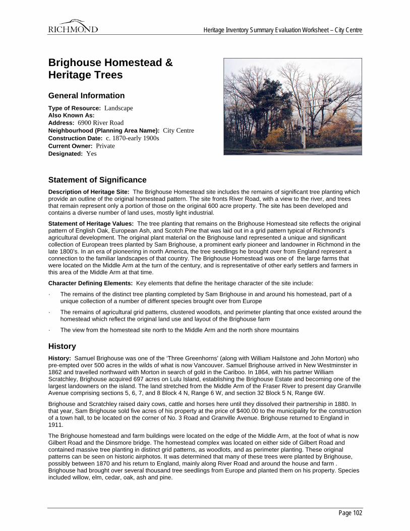
Heritage Inventory Summary Evaluation Worksheet – City Centre
Page 102
Brighouse Homestead & Heritage Trees
General Information Type of Resource: Landscape Also Known As: Address: 6900 River Road Neighbourhood (Planning Area Name): City Centre Construction Date: c. 1870-early 1900s Current Owner: Private Designated: Yes
Statement of Significance Description of Heritage Site: The Brighouse Homestead site includes the remains of significant tree planting which provide an outline of the original homestead pattern. The site fronts River Road, with a view to the river, and trees that remain represent only a portion of those on the original 600 acre property. The site has been developed and contains a diverse number of land uses, mostly light industrial.
Statement of Heritage Values: The tree planting that remains on the Brighouse Homestead site reflects the original pattern of English Oak, European Ash, and Scotch Pine that was laid out in a grid pattern typical of Richmond’s agricultural development. The original plant material on the Brighouse land represented a unique and significant collection of European trees planted by Sam Brighouse, a prominent early pioneer and landowner in Richmond in the late 1800’s. In an era of pioneering in north America, the tree seedlings he brought over from England represent a connection to the familiar landscapes of that country. The Brighouse Homestead was one of the large farms that were located on the Middle Arm at the turn of the century, and is representative of other early settlers and farmers in this area of the Middle Arm at that time.
Character Defining Elements: Key elements that define the heritage character of the site include:
· The remains of the distinct tree planting completed by Sam Brighouse in and around his homestead, part of a unique collection of a number of different species brought over from Europe
· The remains of agricultural grid patterns, clustered woodlots, and perimeter planting that once existed around the homestead which reflect the original land use and layout of the Brighouse farm
· The view from the homestead site north to the Middle Arm and the north shore mountains
History History: Samuel Brighouse was one of the ‘Three Greenhorns’ (along with William Hailstone and John Morton) who pre-empted over 500 acres in the wilds of what is now Vancouver. Samuel Brighouse arrived in New Westminster in 1862 and travelled northward with Morton in search of gold in the Cariboo. In 1864, with his partner William Scratchley, Brighouse acquired 697 acres on Lulu Island, establishing the Brighouse Estate and becoming one of the largest landowners on the island. The land stretched from the Middle Arm of the Fraser River to present day Granville Avenue comprising sections 5, 6, 7, and 8 Block 4 N, Range 6 W, and section 32 Block 5 N, Range 6W.
Brighouse and Scratchley raised dairy cows, cattle and horses here until they dissolved their partnership in 1880. In that year, Sam Brighouse sold five acres of his property at the price of $400.00 to the municipality for the construction of a town hall, to be located on the corner of No. 3 Road and Granville Avenue. Brighouse returned to England in 1911.
The Brighouse homestead and farm buildings were located on the edge of the Middle Arm, at the foot of what is now Gilbert Road and the Dinsmore bridge. The homestead complex was located on either side of Gilbert Road and contained massive tree planting in distinct grid patterns, as woodlots, and as perimeter planting. These original patterns can be seen on historic airphotos. It was determined that many of these trees were planted by Brighouse, possibly between 1870 and his return to England, mainly along River Road and around the house and farm . Brighouse had brought over several thousand tree seedlings from Europe and planted them on his property. Species included willow, elm, cedar, oak, ash and pine.
Heritage Inventory Summary Evaluation Worksheet – City Centre
Page 103
The influx of industries and businesses not native to Richmond has been a trend since the end of World War II. One of these was the transformation of the Brighouse property into Brighouse Industrial Estates. The municipality acquired the property in 1962, and while much of the land to the north became industrial or retail, part of the property became or helped to fund the current cultural and recreational facilities in and around the Minoru Park area. But development was threatening the remaining traces of the Brighouse homestead. In 1990, the municipality passed a bylaw to change the zoning of a municipally owned property adjacent to a development site to an environmentally sensitive area in order to protect the Brighouse trees.
Today on the site, the original tree patterns can still be discerned. Some of the trees were assessed in an arborist’s report in 1998 when a driveway was proposed through a portion of the site.
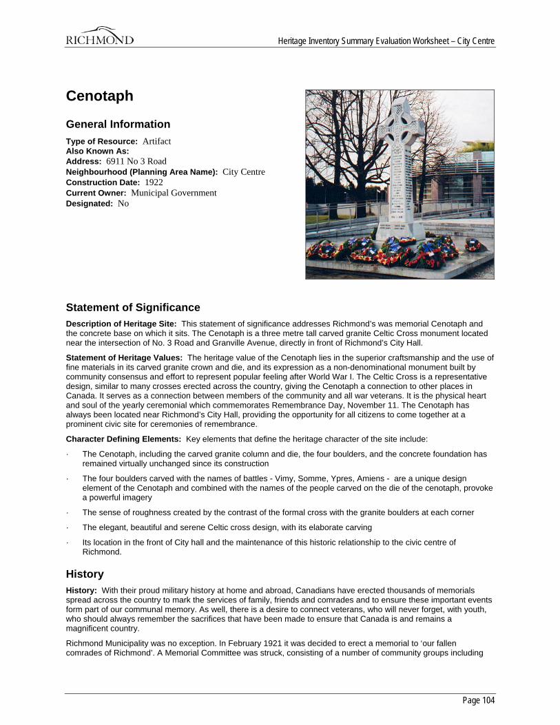
Heritage Inventory Summary Evaluation Worksheet – City Centre
Page 104
Cenotaph
General Information Type of Resource: Artifact Also Known As: Address: 6911 No 3 Road Neighbourhood (Planning Area Name): City Centre Construction Date: 1922 Current Owner: Municipal Government Designated: No
Statement of Significance Description of Heritage Site: This statement of significance addresses Richmond’s was memorial Cenotaph and the concrete base on which it sits. The Cenotaph is a three metre tall carved granite Celtic Cross monument located near the intersection of No. 3 Road and Granville Avenue, directly in front of Richmond’s City Hall.
Statement of Heritage Values: The heritage value of the Cenotaph lies in the superior craftsmanship and the use of fine materials in its carved granite crown and die, and its expression as a non-denominational monument built by community consensus and effort to represent popular feeling after World War I. The Celtic Cross is a representative design, similar to many crosses erected across the country, giving the Cenotaph a connection to other places in Canada. It serves as a connection between members of the community and all war veterans. It is the physical heart and soul of the yearly ceremonial which commemorates Remembrance Day, November 11. The Cenotaph has always been located near Richmond’s City Hall, providing the opportunity for all citizens to come together at a prominent civic site for ceremonies of remembrance.
Character Defining Elements: Key elements that define the heritage character of the site include:
· The Cenotaph, including the carved granite column and die, the four boulders, and the concrete foundation has remained virtually unchanged since its construction
· The four boulders carved with the names of battles - Vimy, Somme, Ypres, Amiens - are a unique design element of the Cenotaph and combined with the names of the people carved on the die of the cenotaph, provoke a powerful imagery
· The sense of roughness created by the contrast of the formal cross with the granite boulders at each corner
· The elegant, beautiful and serene Celtic cross design, with its elaborate carving
· Its location in the front of City hall and the maintenance of this historic relationship to the civic centre of Richmond.
History History: With their proud military history at home and abroad, Canadians have erected thousands of memorials spread across the country to mark the services of family, friends and comrades and to ensure these important events form part of our communal memory. As well, there is a desire to connect veterans, who will never forget, with youth, who should always remember the sacrifices that have been made to ensure that Canada is and remains a magnificent country.
Richmond Municipality was no exception. In February 1921 it was decided to erect a memorial to ‘our fallen comrades of Richmond’. A Memorial Committee was struck, consisting of a number of community groups including
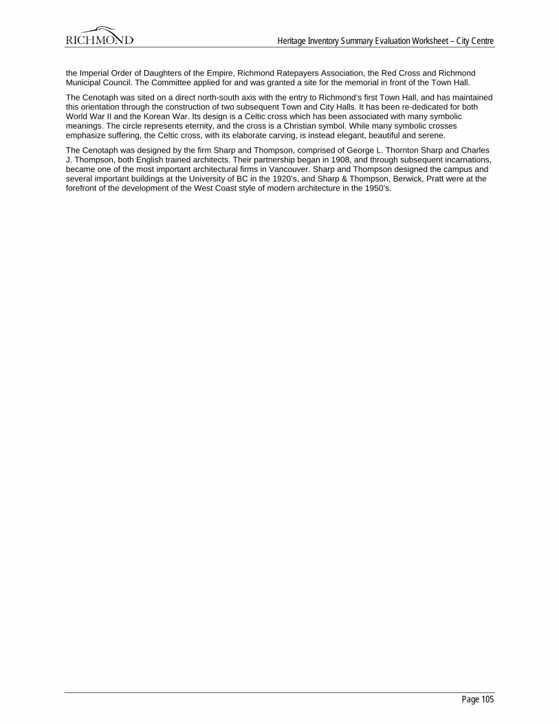
Heritage Inventory Summary Evaluation Worksheet – City Centre
Page 105
the Imperial Order of Daughters of the Empire, Richmond Ratepayers Association, the Red Cross and Richmond Municipal Council. The Committee applied for and was granted a site for the memorial in front of the Town Hall.
The Cenotaph was sited on a direct north-south axis with the entry to Richmond’s first Town Hall, and has maintained this orientation through the construction of two subsequent Town and City Halls. It has been re-dedicated for both World War II and the Korean War. Its design is a Celtic cross which has been associated with many symbolic meanings. The circle represents eternity, and the cross is a Christian symbol. While many symbolic crosses emphasize suffering, the Celtic cross, with its elaborate carving, is instead elegant, beautiful and serene.
The Cenotaph was designed by the firm Sharp and Thompson, comprised of George L. Thornton Sharp and Charles J. Thompson, both English trained architects. Their partnership began in 1908, and through subsequent incarnations, became one of the most important architectural firms in Vancouver. Sharp and Thompson designed the campus and several important buildings at the University of BC in the 1920’s, and Sharp & Thompson, Berwick, Pratt were at the forefront of the development of the West Coast style of modern architecture in the 1950’s.
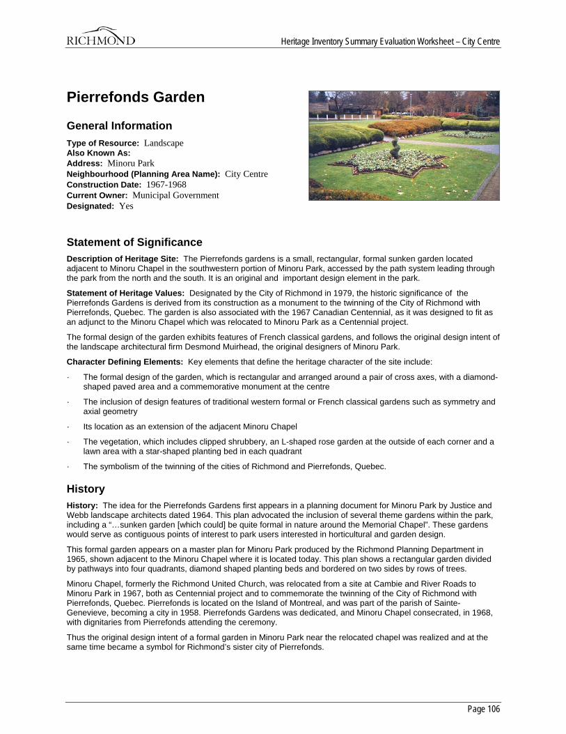
Heritage Inventory Summary Evaluation Worksheet – City Centre
Page 106
Pierrefonds Garden
General Information Type of Resource: Landscape Also Known As: Address: Minoru Park Neighbourhood (Planning Area Name): City Centre Construction Date: 1967-1968 Current Owner: Municipal Government Designated: Yes
Statement of Significance Description of Heritage Site: The Pierrefonds gardens is a small, rectangular, formal sunken garden located adjacent to Minoru Chapel in the southwestern portion of Minoru Park, accessed by the path system leading through the park from the north and the south. It is an original and important design element in the park.
Statement of Heritage Values: Designated by the City of Richmond in 1979, the historic significance of the Pierrefonds Gardens is derived from its construction as a monument to the twinning of the City of Richmond with Pierrefonds, Quebec. The garden is also associated with the 1967 Canadian Centennial, as it was designed to fit as an adjunct to the Minoru Chapel which was relocated to Minoru Park as a Centennial project.
The formal design of the garden exhibits features of French classical gardens, and follows the original design intent of the landscape architectural firm Desmond Muirhead, the original designers of Minoru Park.
Character Defining Elements: Key elements that define the heritage character of the site include:
· The formal design of the garden, which is rectangular and arranged around a pair of cross axes, with a diamond-shaped paved area and a commemorative monument at the centre
· The inclusion of design features of traditional western formal or French classical gardens such as symmetry and axial geometry
· Its location as an extension of the adjacent Minoru Chapel
· The vegetation, which includes clipped shrubbery, an L-shaped rose garden at the outside of each corner and a lawn area with a star-shaped planting bed in each quadrant
· The symbolism of the twinning of the cities of Richmond and Pierrefonds, Quebec.
History History: The idea for the Pierrefonds Gardens first appears in a planning document for Minoru Park by Justice and Webb landscape architects dated 1964. This plan advocated the inclusion of several theme gardens within the park, including a “…sunken garden [which could] be quite formal in nature around the Memorial Chapel”. These gardens would serve as contiguous points of interest to park users interested in horticultural and garden design.
This formal garden appears on a master plan for Minoru Park produced by the Richmond Planning Department in 1965, shown adjacent to the Minoru Chapel where it is located today. This plan shows a rectangular garden divided by pathways into four quadrants, diamond shaped planting beds and bordered on two sides by rows of trees.
Minoru Chapel, formerly the Richmond United Church, was relocated from a site at Cambie and River Roads to Minoru Park in 1967, both as Centennial project and to commemorate the twinning of the City of Richmond with Pierrefonds, Quebec. Pierrefonds is located on the Island of Montreal, and was part of the parish of Sainte-Genevieve, becoming a city in 1958. Pierrefonds Gardens was dedicated, and Minoru Chapel consecrated, in 1968, with dignitaries from Pierrefonds attending the ceremony.
Thus the original design intent of a formal garden in Minoru Park near the relocated chapel was realized and at the same time became a symbol for Richmond’s sister city of Pierrefonds.
Page 107
City of Richmond
Heritage InventorySummary Evaluation Worksheet
Gilmore
1. London Farmhouse 2. Pioneer Church 3. Shepherd Barn 4. McNair Barn 5. Gilmore Potato Pit 6. Tilson Barn 7. Eldstrom House 8. Draney House 9. Goldie Harris House 10. South Arm Slough District Heritage Area 11. Finn Slough Heritage Area 12. Dyke System
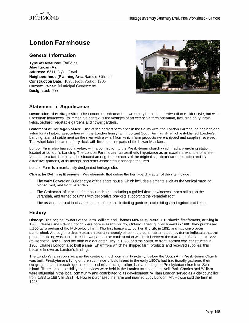
Heritage Inventory Summary Evaluation Worksheet – Gilmore
Page 108
London Farmhouse
General Information Type of Resource: Building Also Known As: Address: 6511 Dyke Road Neighbourhood (Planning Area Name): Gilmore Construction Date: 1898; Front Portion 1906 Current Owner: Municipal Government Designated: Yes
Statement of Significance Description of Heritage Site: The London Farmhouse is a two-storey home in the Edwardian Builder style, but with Craftsman influences. Its immediate context is the vestiges of an extensive farm operation, including dairy, grain fields, orchard, vegetable gardens and flower gardens.
Statement of Heritage Values: One of the earliest farm sites in the South Arm, the London Farmhouse has heritage value for its historic association with the London family, an important South Arm family which established London’s Landing, a small settlement on the river with a wharf from which farm products were shipped and supplies received. This wharf later became a ferry dock with links to other parts of the Lower Mainland.
London Farm also has social value, with a connection to the Presbyterian church which had a preaching station located at London’s Landing. The London Farmhouse has aesthetic importance as an excellent example of a late-Victorian-era farmhouse, and is situated among the remnants of the original significant farm operation and its extensive gardens, outbuildings, and other associated landscape features.
London Farm is a municipally designated heritage site.
Character Defining Elements: Key elements that define the heritage character of the site include:
· The early Edwardian Builder style of the entire house, which includes elements such as the vertical massing, hipped roof, and front verandah.
· The Craftsman influences of the house design, including a gabled dormer windows , open railing on the verandah, and turned columns with decorative brackets supporting the verandah roof.
· The associated rural landscape context of the site, including gardens, outbuildings and agricultural fields.
History History: The original owners of the farm, William and Thomas McNeeley, were Lulu Island’s first farmers, arriving in 1865. Charles and Edwin London were born in Brant County, Ontario. Arriving in Richmond in 1880, they purchased a 200-acre portion of the McNeeley’s farm. The first house was built on the site in 1881 and has since been demolished. Although no documentation exists to exactly pinpoint the construction dates, evidence indicates that the present building was constructed in two parts. The north section was built between the marriage of Charles in 1888 (to Henrietta Dalziel) and the birth of a daughter Lucy in 1898, and the south, or front, section was constructed in 1906. Charles London also built a small wharf from which he shipped farm products and received supplies; this became known as London’s landing.
The London’s farm soon became the centre of much community activity. Before the South Arm Presbyterian Church was built, Presbyterians living on the south side of Lulu Island in the early 1900’s had traditionally gathered their congregation at a preaching station at London’s Landing, rather than attending the Presbyterian church on Sea Island. There is the possibility that services were held in the London farmhouse as well. Both Charles and William were influential in the local community and contributed to its development; William London served as a city councillor from 1883 to 1887. In 1921, H. Howse purchased the farm and married Lucy London. Mr. Howse sold the farm in 1948.

Heritage Inventory Summary Evaluation Worksheet – Gilmore
Page 109
The Municipality of Richmond purchased the house and 41/2 acre site in 1978, and designated it a municipal heritage site. In 1980, the Richmond Historical Society agreed to restore and operate the house and immediate surroundings as a heritage property. Currently, the house is furnished and open to the public, with afternoon tea being served.
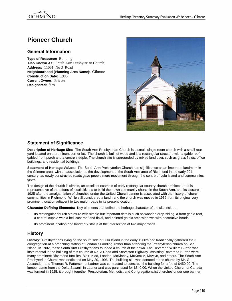
Heritage Inventory Summary Evaluation Worksheet – Gilmore
Page 110
Pioneer Church
General Information Type of Resource: Building Also Known As: South Arm Presbyterian Church Address: 11051 No 3 Road Neighbourhood (Planning Area Name): Gilmore Construction Date: 1906 Current Owner: Private Designated: Yes
Statement of Significance Description of Heritage Site: The South Arm Presbyterian Church is a small, single room church with a small rear yard located on a prominent corner lot. The church is built of wood and is a rectangular structure with a gable roof, gabled front porch and a centre steeple. The church site is surrounded by mixed land uses such as grass fields, office buildings, and residential buildings.
Statement of Heritage Values: The South Arm Presbyterian Church has significance as an important landmark in the Gilmore area, with an association to the development of the South Arm area of Richmond in the early 20th century, as newly constructed roads gave people more movement through the centre of Lulu Island and communities grew.
The design of the church is simple, an excellent example of early rectangular country church architecture. It is representative of the efforts of local citizens to build their own community church in the South Arm, and its closure in 1925 after the amalgamation of churches under the United Church banner is associated with the history of church communities in Richmond. While still considered a landmark, the church was moved in 1959 from its original very prominent location adjacent to two major roads to its present location.
Character Defining Elements: Key elements that define the heritage character of the site include:
· Its rectangular church structure with simple but important details such as wooden drop-siding, a front gable roof, a central cupola with a bell cast roof and finial, and pointed gothic arch windows with decorative hoods
· Its prominent location and landmark status at the intersection of two major roads.
History History: Presbyterians living on the south side of Lulu Island in the early 1900’s had traditionally gathered their congregation at a preaching station at London’s Landing, rather than attending the Presbyterian church on Sea Island. In 1902, these South Arm Presbyterians founded a church of their own. The Reverend William Burton was instrumental in the building of this church at No. 3 Road and Steveston Highway. Assisting Reverend Burton were many prominent Richmond families: Blair, Kidd, London, McKinney, McKenzie, McMyn, and others. The South Arm Presbyterian Church was dedicated on May 20, 1906. The building site was donated to the church by Mr. G. Alexander, and Thomas R. Patterson of Ladner was contracted to construct the building for a fee of $450.00. The lumber came from the Delta Sawmill in Ladner and was purchased for $540.00. When the United Church of Canada was formed in 1925, it brought together Presbyterian, Methodist and Congregationalist churches under one banner

Heritage Inventory Summary Evaluation Worksheet – Gilmore
Page 111
and the Steveston Presbyterian Church closed that year. The building was designated in 1991 and is currently still used to support the functions of the congregation which operate out of a new larger church on the site.
A related building, the Steveston Presbyterian Church Manse, was used by ministers in the Presbyterian Church, and later, those who administered to the newly amalgamated churches. It is located at the corner of Second Avenue and Steveston Highway.
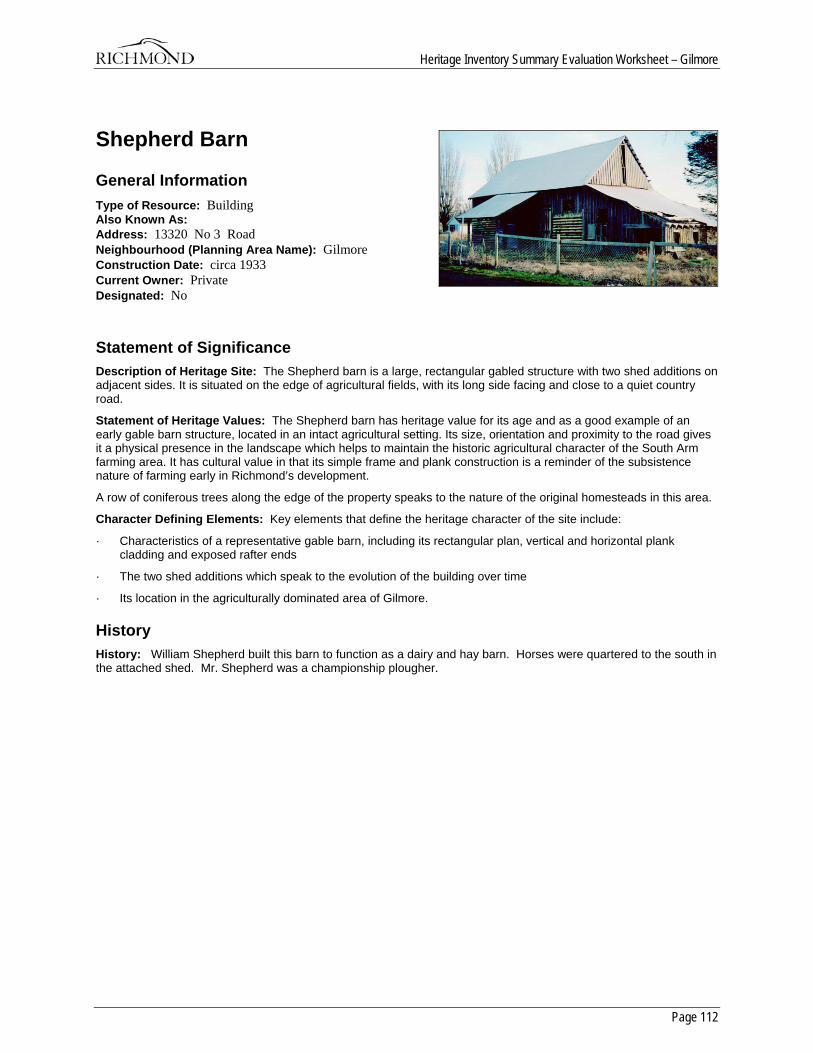
Heritage Inventory Summary Evaluation Worksheet – Gilmore
Page 112
Shepherd Barn
General Information Type of Resource: Building Also Known As: Address: 13320 No 3 Road Neighbourhood (Planning Area Name): Gilmore Construction Date: circa 1933 Current Owner: Private Designated: No
Statement of Significance Description of Heritage Site: The Shepherd barn is a large, rectangular gabled structure with two shed additions on adjacent sides. It is situated on the edge of agricultural fields, with its long side facing and close to a quiet country road.
Statement of Heritage Values: The Shepherd barn has heritage value for its age and as a good example of an early gable barn structure, located in an intact agricultural setting. Its size, orientation and proximity to the road gives it a physical presence in the landscape which helps to maintain the historic agricultural character of the South Arm farming area. It has cultural value in that its simple frame and plank construction is a reminder of the subsistence nature of farming early in Richmond’s development.
A row of coniferous trees along the edge of the property speaks to the nature of the original homesteads in this area.
Character Defining Elements: Key elements that define the heritage character of the site include:
· Characteristics of a representative gable barn, including its rectangular plan, vertical and horizontal plank cladding and exposed rafter ends
· The two shed additions which speak to the evolution of the building over time
· Its location in the agriculturally dominated area of Gilmore.
History History: William Shepherd built this barn to function as a dairy and hay barn. Horses were quartered to the south in the attached shed. Mr. Shepherd was a championship plougher.
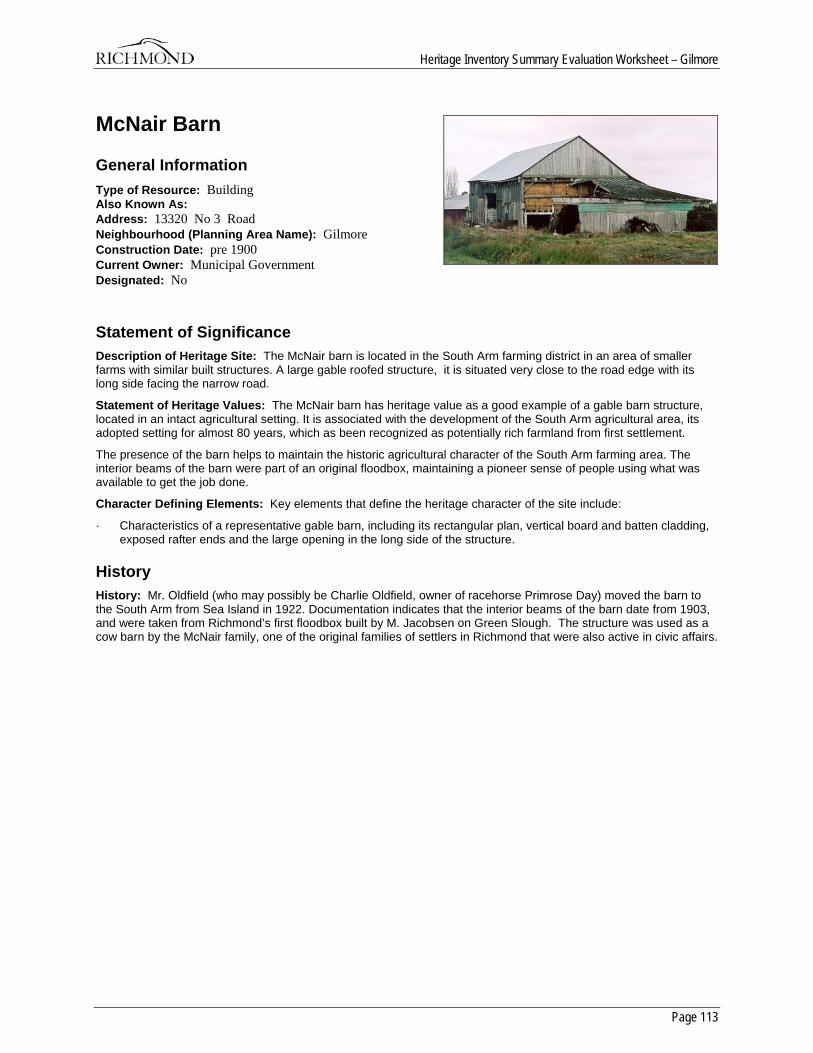
Heritage Inventory Summary Evaluation Worksheet – Gilmore
Page 113
McNair Barn
General Information Type of Resource: Building Also Known As: Address: 13320 No 3 Road Neighbourhood (Planning Area Name): Gilmore Construction Date: pre 1900 Current Owner: Municipal Government Designated: No
Statement of Significance Description of Heritage Site: The McNair barn is located in the South Arm farming district in an area of smaller farms with similar built structures. A large gable roofed structure, it is situated very close to the road edge with its long side facing the narrow road.
Statement of Heritage Values: The McNair barn has heritage value as a good example of a gable barn structure, located in an intact agricultural setting. It is associated with the development of the South Arm agricultural area, its adopted setting for almost 80 years, which as been recognized as potentially rich farmland from first settlement.
The presence of the barn helps to maintain the historic agricultural character of the South Arm farming area. The interior beams of the barn were part of an original floodbox, maintaining a pioneer sense of people using what was available to get the job done.
Character Defining Elements: Key elements that define the heritage character of the site include:
· Characteristics of a representative gable barn, including its rectangular plan, vertical board and batten cladding, exposed rafter ends and the large opening in the long side of the structure.
History History: Mr. Oldfield (who may possibly be Charlie Oldfield, owner of racehorse Primrose Day) moved the barn to the South Arm from Sea Island in 1922. Documentation indicates that the interior beams of the barn date from 1903, and were taken from Richmond’s first floodbox built by M. Jacobsen on Green Slough. The structure was used as a cow barn by the McNair family, one of the original families of settlers in Richmond that were also active in civic affairs.
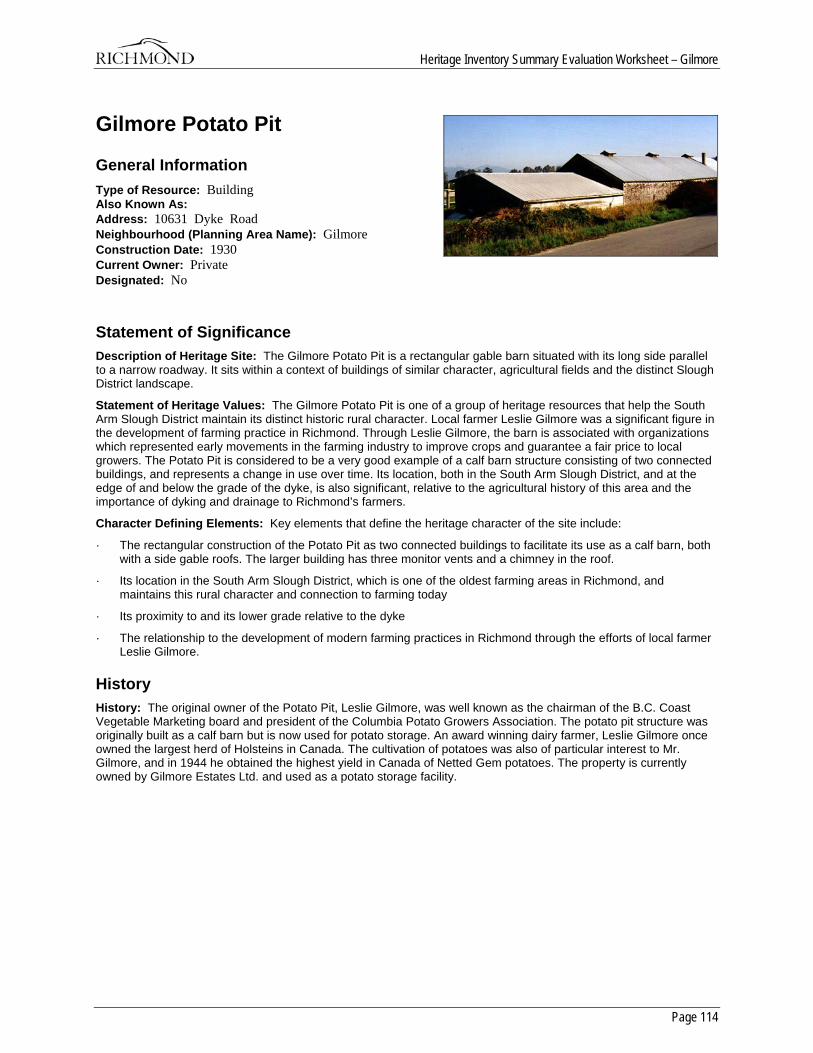
Heritage Inventory Summary Evaluation Worksheet – Gilmore
Page 114
Gilmore Potato Pit
General Information Type of Resource: Building Also Known As: Address: 10631 Dyke Road Neighbourhood (Planning Area Name): Gilmore Construction Date: 1930 Current Owner: Private Designated: No
Statement of Significance Description of Heritage Site: The Gilmore Potato Pit is a rectangular gable barn situated with its long side parallel to a narrow roadway. It sits within a context of buildings of similar character, agricultural fields and the distinct Slough District landscape.
Statement of Heritage Values: The Gilmore Potato Pit is one of a group of heritage resources that help the South Arm Slough District maintain its distinct historic rural character. Local farmer Leslie Gilmore was a significant figure in the development of farming practice in Richmond. Through Leslie Gilmore, the barn is associated with organizations which represented early movements in the farming industry to improve crops and guarantee a fair price to local growers. The Potato Pit is considered to be a very good example of a calf barn structure consisting of two connected buildings, and represents a change in use over time. Its location, both in the South Arm Slough District, and at the edge of and below the grade of the dyke, is also significant, relative to the agricultural history of this area and the importance of dyking and drainage to Richmond’s farmers.
Character Defining Elements: Key elements that define the heritage character of the site include:
· The rectangular construction of the Potato Pit as two connected buildings to facilitate its use as a calf barn, both with a side gable roofs. The larger building has three monitor vents and a chimney in the roof.
· Its location in the South Arm Slough District, which is one of the oldest farming areas in Richmond, and maintains this rural character and connection to farming today
· Its proximity to and its lower grade relative to the dyke
· The relationship to the development of modern farming practices in Richmond through the efforts of local farmer Leslie Gilmore.
History History: The original owner of the Potato Pit, Leslie Gilmore, was well known as the chairman of the B.C. Coast Vegetable Marketing board and president of the Columbia Potato Growers Association. The potato pit structure was originally built as a calf barn but is now used for potato storage. An award winning dairy farmer, Leslie Gilmore once owned the largest herd of Holsteins in Canada. The cultivation of potatoes was also of particular interest to Mr. Gilmore, and in 1944 he obtained the highest yield in Canada of Netted Gem potatoes. The property is currently owned by Gilmore Estates Ltd. and used as a potato storage facility.
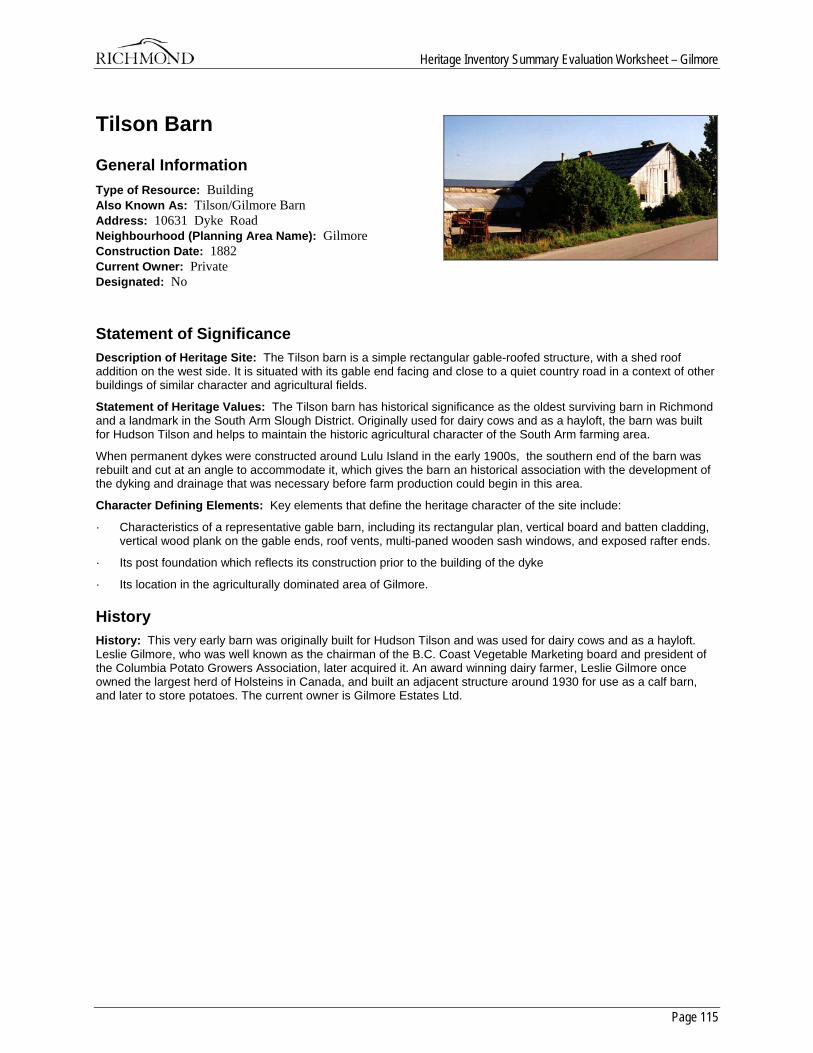
Heritage Inventory Summary Evaluation Worksheet – Gilmore
Page 115
Tilson Barn
General Information Type of Resource: Building Also Known As: Tilson/Gilmore Barn Address: 10631 Dyke Road Neighbourhood (Planning Area Name): Gilmore Construction Date: 1882 Current Owner: Private Designated: No
Statement of Significance Description of Heritage Site: The Tilson barn is a simple rectangular gable-roofed structure, with a shed roof addition on the west side. It is situated with its gable end facing and close to a quiet country road in a context of other buildings of similar character and agricultural fields.
Statement of Heritage Values: The Tilson barn has historical significance as the oldest surviving barn in Richmond and a landmark in the South Arm Slough District. Originally used for dairy cows and as a hayloft, the barn was built for Hudson Tilson and helps to maintain the historic agricultural character of the South Arm farming area.
When permanent dykes were constructed around Lulu Island in the early 1900s, the southern end of the barn was rebuilt and cut at an angle to accommodate it, which gives the barn an historical association with the development of the dyking and drainage that was necessary before farm production could begin in this area.
Character Defining Elements: Key elements that define the heritage character of the site include:
· Characteristics of a representative gable barn, including its rectangular plan, vertical board and batten cladding, vertical wood plank on the gable ends, roof vents, multi-paned wooden sash windows, and exposed rafter ends.
· Its post foundation which reflects its construction prior to the building of the dyke
· Its location in the agriculturally dominated area of Gilmore.
History History: This very early barn was originally built for Hudson Tilson and was used for dairy cows and as a hayloft. Leslie Gilmore, who was well known as the chairman of the B.C. Coast Vegetable Marketing board and president of the Columbia Potato Growers Association, later acquired it. An award winning dairy farmer, Leslie Gilmore once owned the largest herd of Holsteins in Canada, and built an adjacent structure around 1930 for use as a calf barn, and later to store potatoes. The current owner is Gilmore Estates Ltd.
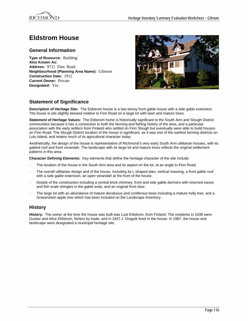
Heritage Inventory Summary Evaluation Worksheet – Gilmore
Page 116
Eldstrom House
General Information Type of Resource: Building Also Known As: Address: 9711 Finn Road Neighbourhood (Planning Area Name): Gilmore Construction Date: 1912 Current Owner: Private Designated: Yes
Statement of Significance Description of Heritage Site: The Eldstrom house is a two-storey front gable house with a side gable extension. The house is sits slightly skewed relative to Finn Road on a large lot with lawn and mature trees.
Statement of Heritage Values: The Eldstrom home is historically significant to the South Arm and Slough District communities because it has a connection to both the farming and fishing history of the area, and a particular association with the early settlers from Finland who settled on Finn Slough but eventually were able to build houses on Finn Road. The Slough District location of the house is significant, as it was one of the earliest farming districts on Lulu Island, and retains much of its agricultural character today
Aesthetically, the design of the house is representative of Richmond’s very early South Arm utilitarian houses, with its gabled roof and front verandah. The landscape with its large lot and mature trees reflects the original settlement patterns in this area.
Character Defining Elements: Key elements that define the heritage character of the site include:
· The location of the house in the South Arm area and its aspect on the lot, at an angle to Finn Road.
· The overall utilitarian design and of the house, including its L-shaped plan, vertical massing, a front gable roof with a side gable extension, an open verandah at the front of the house.
· Details of the construction including a central brick chimney, front and side gable dormers with returned eaves and fish scale shingles in the gable ends, and an original front door.
· The large lot with an abundance of mature deciduous and coniferous trees including a mature holly tree, and a Gravenstein apple tree which has been included on the Landscape Inventory.
History History: The owner at the time the house was built was Lust Eldstrom, from Finland. The residents in 1938 were Gustav and Alice Eldstrom, fishers by trade, and in 1947 J. Dragvik lived in the house. In 1987, the house and landscape were designated a municipal heritage site.
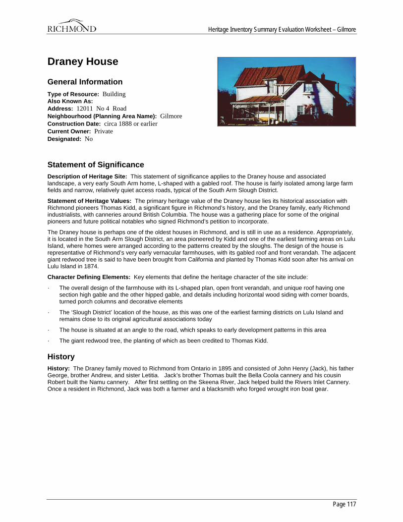
Heritage Inventory Summary Evaluation Worksheet – Gilmore
Page 117
Draney House
General Information Type of Resource: Building Also Known As: Address: 12011 No 4 Road Neighbourhood (Planning Area Name): Gilmore Construction Date: circa 1888 or earlier Current Owner: Private Designated: No
Statement of Significance Description of Heritage Site: This statement of significance applies to the Draney house and associated landscape, a very early South Arm home, L-shaped with a gabled roof. The house is fairly isolated among large farm fields and narrow, relatively quiet access roads, typical of the South Arm Slough District.
Statement of Heritage Values: The primary heritage value of the Draney house lies its historical association with Richmond pioneers Thomas Kidd, a significant figure in Richmond’s history, and the Draney family, early Richmond industrialists, with canneries around British Columbia. The house was a gathering place for some of the original pioneers and future political notables who signed Richmond’s petition to incorporate.
The Draney house is perhaps one of the oldest houses in Richmond, and is still in use as a residence. Appropriately, it is located in the South Arm Slough District, an area pioneered by Kidd and one of the earliest farming areas on Lulu Island, where homes were arranged according to the patterns created by the sloughs. The design of the house is representative of Richmond’s very early vernacular farmhouses, with its gabled roof and front verandah. The adjacent giant redwood tree is said to have been brought from California and planted by Thomas Kidd soon after his arrival on Lulu Island in 1874.
Character Defining Elements: Key elements that define the heritage character of the site include:
· The overall design of the farmhouse with its L-shaped plan, open front verandah, and unique roof having one section high gable and the other hipped gable, and details including horizontal wood siding with corner boards, turned porch columns and decorative elements
· The ‘Slough District’ location of the house, as this was one of the earliest farming districts on Lulu Island and remains close to its original agricultural associations today
· The house is situated at an angle to the road, which speaks to early development patterns in this area
· The giant redwood tree, the planting of which as been credited to Thomas Kidd.
History History: The Draney family moved to Richmond from Ontario in 1895 and consisted of John Henry (Jack), his father George, brother Andrew, and sister Letitia. Jack’s brother Thomas built the Bella Coola cannery and his cousin Robert built the Namu cannery. After first settling on the Skeena River, Jack helped build the Rivers Inlet Cannery. Once a resident in Richmond, Jack was both a farmer and a blacksmith who forged wrought iron boat gear.
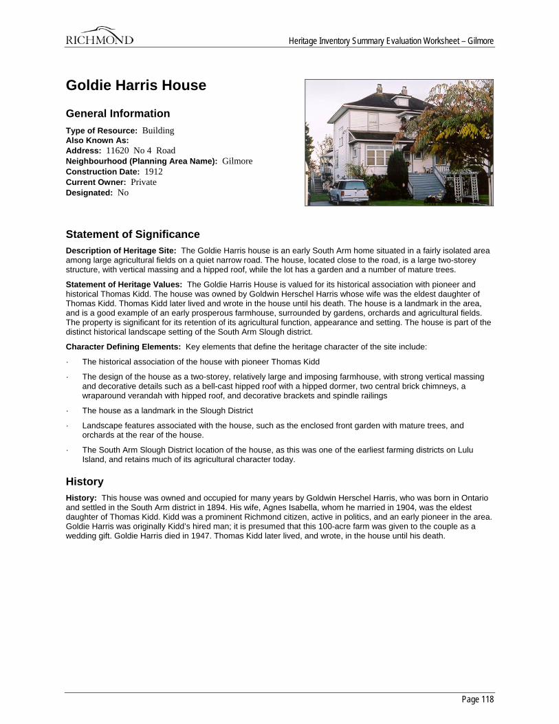
Heritage Inventory Summary Evaluation Worksheet – Gilmore
Page 118
Goldie Harris House
General Information Type of Resource: Building Also Known As: Address: 11620 No 4 Road Neighbourhood (Planning Area Name): Gilmore Construction Date: 1912 Current Owner: Private Designated: No
Statement of Significance Description of Heritage Site: The Goldie Harris house is an early South Arm home situated in a fairly isolated area among large agricultural fields on a quiet narrow road. The house, located close to the road, is a large two-storey structure, with vertical massing and a hipped roof, while the lot has a garden and a number of mature trees.
Statement of Heritage Values: The Goldie Harris House is valued for its historical association with pioneer and historical Thomas Kidd. The house was owned by Goldwin Herschel Harris whose wife was the eldest daughter of Thomas Kidd. Thomas Kidd later lived and wrote in the house until his death. The house is a landmark in the area, and is a good example of an early prosperous farmhouse, surrounded by gardens, orchards and agricultural fields. The property is significant for its retention of its agricultural function, appearance and setting. The house is part of the distinct historical landscape setting of the South Arm Slough district.
Character Defining Elements: Key elements that define the heritage character of the site include:
· The historical association of the house with pioneer Thomas Kidd
· The design of the house as a two-storey, relatively large and imposing farmhouse, with strong vertical massing and decorative details such as a bell-cast hipped roof with a hipped dormer, two central brick chimneys, a wraparound verandah with hipped roof, and decorative brackets and spindle railings
· The house as a landmark in the Slough District
· Landscape features associated with the house, such as the enclosed front garden with mature trees, and orchards at the rear of the house.
· The South Arm Slough District location of the house, as this was one of the earliest farming districts on Lulu Island, and retains much of its agricultural character today.
History History: This house was owned and occupied for many years by Goldwin Herschel Harris, who was born in Ontario and settled in the South Arm district in 1894. His wife, Agnes Isabella, whom he married in 1904, was the eldest daughter of Thomas Kidd. Kidd was a prominent Richmond citizen, active in politics, and an early pioneer in the area. Goldie Harris was originally Kidd’s hired man; it is presumed that this 100-acre farm was given to the couple as a wedding gift. Goldie Harris died in 1947. Thomas Kidd later lived, and wrote, in the house until his death.
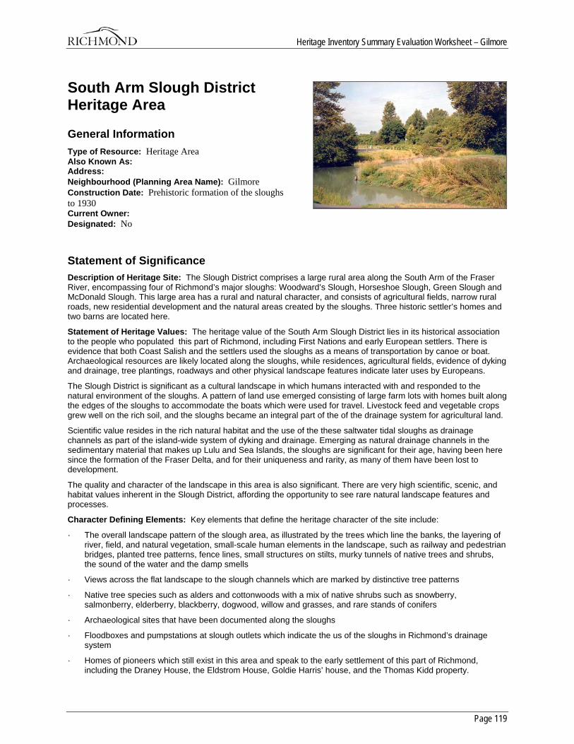
Heritage Inventory Summary Evaluation Worksheet – Gilmore
Page 119
South Arm Slough District Heritage Area
General Information Type of Resource: Heritage Area Also Known As: Address: Neighbourhood (Planning Area Name): Gilmore Construction Date: Prehistoric formation of the sloughs to 1930 Current Owner: Designated: No
Statement of Significance Description of Heritage Site: The Slough District comprises a large rural area along the South Arm of the Fraser River, encompassing four of Richmond’s major sloughs: Woodward’s Slough, Horseshoe Slough, Green Slough and McDonald Slough. This large area has a rural and natural character, and consists of agricultural fields, narrow rural roads, new residential development and the natural areas created by the sloughs. Three historic settler’s homes and two barns are located here.
Statement of Heritage Values: The heritage value of the South Arm Slough District lies in its historical association to the people who populated this part of Richmond, including First Nations and early European settlers. There is evidence that both Coast Salish and the settlers used the sloughs as a means of transportation by canoe or boat. Archaeological resources are likely located along the sloughs, while residences, agricultural fields, evidence of dyking and drainage, tree plantings, roadways and other physical landscape features indicate later uses by Europeans.
The Slough District is significant as a cultural landscape in which humans interacted with and responded to the natural environment of the sloughs. A pattern of land use emerged consisting of large farm lots with homes built along the edges of the sloughs to accommodate the boats which were used for travel. Livestock feed and vegetable crops grew well on the rich soil, and the sloughs became an integral part of the of the drainage system for agricultural land.
Scientific value resides in the rich natural habitat and the use of the these saltwater tidal sloughs as drainage channels as part of the island-wide system of dyking and drainage. Emerging as natural drainage channels in the sedimentary material that makes up Lulu and Sea Islands, the sloughs are significant for their age, having been here since the formation of the Fraser Delta, and for their uniqueness and rarity, as many of them have been lost to development.
The quality and character of the landscape in this area is also significant. There are very high scientific, scenic, and habitat values inherent in the Slough District, affording the opportunity to see rare natural landscape features and processes.
Character Defining Elements: Key elements that define the heritage character of the site include:
· The overall landscape pattern of the slough area, as illustrated by the trees which line the banks, the layering of river, field, and natural vegetation, small-scale human elements in the landscape, such as railway and pedestrian bridges, planted tree patterns, fence lines, small structures on stilts, murky tunnels of native trees and shrubs, the sound of the water and the damp smells
· Views across the flat landscape to the slough channels which are marked by distinctive tree patterns
· Native tree species such as alders and cottonwoods with a mix of native shrubs such as snowberry, salmonberry, elderberry, blackberry, dogwood, willow and grasses, and rare stands of conifers
· Archaeological sites that have been documented along the sloughs
· Floodboxes and pumpstations at slough outlets which indicate the us of the sloughs in Richmond’s drainage system
· Homes of pioneers which still exist in this area and speak to the early settlement of this part of Richmond, including the Draney House, the Eldstrom House, Goldie Harris’ house, and the Thomas Kidd property.
Heritage Inventory Summary Evaluation Worksheet – Gilmore
Page 120
History History: Defining Criteria:
Historic Time period:
Because the sloughs are the major feature in this area and have shaped the landscape and its development patterns, the time period for this area includes the geological formation of the slough complex in prehistory. The area’s natural history is complemented by Native use and early European settlement patterns were significant up to about 1930.
Extant resources:
There are five built heritage resources in the Slough District which are noted on the current heritage inventory. Three are settler’s residences and two are barns related to early agricultural heritage.
Distinction:
Visually, the slough district is utterly distinct due to its layered landscape punctuated by vegetation related to the slough channels. As well, the overall land use pattern of large agricultural lots is still present on current maps.
Boundaries:
Because the landscape context is very important in defining the character of the Slough District, and because of the interconnected nature of the slough system, the boundaries for this area are generous, encompassing diverse features and landscapes. They include the South Arm of the river to the south, Garden City Road to the west, Shell Road to the East, and Steveston Highway to the north.
Overall sense of place and historic character:
The heritage character of this area is defined by the natural environment, agricultural patterns, and early residential development connected by the sloughs and later by roadways which in some cases followed the slough patterns. The ordering and layering of the landscape gives a distinct character to this area which has a high aesthetic quality and a truly unique sense of place.
Historic Criteria:
Area History:
The early Slough District landscape consisted of a series of intertidal sloughs with willow, cattails and skunk cabbage. There is evidence that the Coast Salish used the sloughs as a means of transportation by canoe; they would have had over 100 km of navigable slough waterways before the advent of settlement on Lulu Island. Early settlers also took advantage of these natural routes, as water travel was one of the major means of transportation around and through Lulu Island. Sloughs were also important transportation and communication channels for the early settlers. The vessel most commonly used on the sloughs was a sturdy, flat-bottomed scow which transported people, and later, goods around the slough complexes and out onto the Fraser River. This water accessibility has influenced the pockets of development around the edges of the island, including the South Arm.
The history of the Slough District is derived mainly from its settlers. Thomas Kidd and his companion Walter Lee, arriving in Richmond in 1874, were attracted to the so-called Slough District, which at that time had not yet been surveyed. The first Crown Grants were obtained by Lee and Kidd, and by Nathanial Woodward. Other early landowners included Hector MacDonald and John Green, whose names are associated with the various slough channels. Lee’s Slough is named for settler Walter Lee. The Draney family moved to Richmond from Ontario in 1895 and were associated with the canning industry in various parts of the province. It is possible that Thomas Kidd constructed their house, which was a gathering place for many of the pioneers who signed Richmond’s petition to incorporate in 1879. Lust Eldstrom was a Finnish settler who had an association with the Finn Slough settlement. Goldwin Harris settled in the South Arm district in 1894, eventually marrying the eldest daughter of Thomas Kidd.
Thomas Kidd was a prominent member of the Slough community and of Richmond. He served as a municipal councillor, school trustee and dyking commissioner. His History of Richmond and Occasional Poems has become a source of historical information.
The first houses of these pioneers were built along the edge of the river or slough since the roads were rough or non-existent, and rowboats or scows were used for travel. Rowboats would be tied up in rows along the edges of the sloughs. As with much of Richmond, dyking and drainage was a constant issue in the Slough District. Before the advent of the West Lulu Island Slough Dyking District, farmers dug ditches and constructed dykes by hand. Wooden flood boxes were installed at the outlets of the ditches, and at Woodward’s Slough and Horseshoe Slough, could be opened to release accumulated water, but which prevented water coming in at high tide on the river.
Heritage Inventory Summary Evaluation Worksheet – Gilmore
Page 121
The history of the Slough District is also based on agriculture. Hay, clover and timothy grew well on the rich soil. Livestock feed was the predominant crop in the area until the early 1900’s, when vegetable crops such as potatoes became more common. Early settler and award winning dairy farmer Leslie Gilmore also had an interest in potatoes - in 1944 he obtained the highest yield in Canada of Netted Gem potatoes. Agricultural fairs were sponsored by the Richmond Agricultural society.
Today, the Slough District maintains its character as an agricultural area set among the slough channels. Without much fanfare or development pressure, it has quietly and unremarkably progressed through the years to become the evocative landscape we see today.
Sites:
Constructed in 1894, Woodward’s Landing is located at the foot of No. 5 road, and is an important site because it was the Lulu Island terminus of the ferry to Ladner which transported people and goods to and from these settlements from 1913 to 1959. It is included in the Slough District area because Nathanial Woodward obtained a Crown Grant and began farming in the Slough area in 1879.Today, a few pilings remain. The integrity of the site is low due to the absence of historic fabric, but it has potential for interpretation.
The Thomas Kidd farm is also located in this area, although there are no extant structures to mark the site. Also of importance are the potential prehistoric archaeological sites along the slough channels.
Development Patterns:
The South Arm Slough District was surveyed in 1874, having been excluded from the 1858 Trutch survey possibly because of the large beaver population which the Hudson’s Bay Company wished to exploit. The first Crown Grants were claimed by settlers between 1875 and 1900. Settlement increases occurred overall after 1905 when the West Lulu Island Slough Dyking District was activated, and again after World War II when the population of Richmond increased.
As most of the settlers were farmers, a pattern of land use developed which consisted of large lots with residences oriented to the sloughs, and later, the roadways. This pattern is still in evidence today.
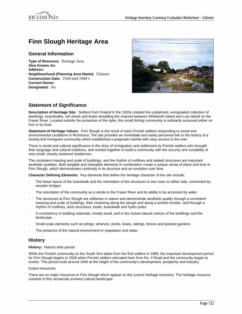
Heritage Inventory Summary Evaluation Worksheet – Gilmore
Page 122
Finn Slough Heritage Area
General Information Type of Resource: Heritage Area Also Known As: Address: Neighbourhood (Planning Area Name): Gilmore Construction Date: 1928-mid 1940’s Current Owner: Designated: No
Statement of Significance Description of Heritage Site: Settlers from Finland in the 1920s created the unplanned, unregulated collection of dwellings, boardwalks, net sheds and boats straddling the channel between Whitworth Island and Lulu Island on the Fraser River. Located outside the protection of the dyke, this small fishing community is ordinarily accessed either on foot or by boat.
Statement of Heritage Values: Finn Slough is the result of early Finnish settlers responding to social and environmental conditions in Richmond. The site provides an immediate and easily perceived link to the history of a closely-knit immigrant community which established a pragmatic hamlet with easy access to the river.
There is social and cultural significance in the story of immigration and settlement by Finnish settlers who brought their language and cultural traditions, and worked together to build a community with the security and sociability of very small, closely clustered residences.
The consistent massing and scale of buildings, and the rhythm of rooflines and related structures are important aesthetic qualities. Both tangible and intangible elements in combination create a unique sense of place and time in Finn Slough, which demonstrates continuity in its structure and an evolution over time.
Character Defining Elements: Key elements that define the heritage character of the site include:
· The linear layout of the boardwalk and the orientation of the structures in two rows on either side, connected by wooden bridges
· The orientation of the community as a whole to the Fraser River and its ability to be accessed by water
· The structures at Finn Slough are utilitarian in nature and demonstrate aesthetic quality through a consistent massing and scale of buildings, their clustering along the slough and along a central corridor, and through a rhythm of rooflines, dock structures, boats, boardwalk and hydro poles
· A consistency in building materials, mostly wood, and in the muted natural colours of the buildings and the landscape
· Small-scale elements such as pilings, wharves, docks, boats, railings, fences and planted gardens
· The presence of the natural environment in vegetation and water.
History History: Historic time period:
While the Finnish community on the South Arm dates from the first settlers in 1889, the important development period for Finn Slough begins in 1928 when Finnish settlers relocated here from No. 4 Road and the community began to evolve. This period ends around 1940 at the height of the community’s development, prosperity and industry.
Extant resources:
There are no major resources in Finn Slough which appear on the current heritage inventory. The heritage resource consists of this vernacular evolved cultural landscape.
Heritage Inventory Summary Evaluation Worksheet – Gilmore
Page 123
Distinction:
Finn Slough is clearly distinguishable from adjacent properties as it has developed and been maintained very differently than its surroundings. Visually, it has a distinct character of small wooden buildings within a lush, natural slough landscape and it maintains an integrity of historic character.
Boundaries:
The north-south boundaries of the Finn Slough Heritage Area run from the ditch along the north edge of Dyke Road to the outside edge of the Whitworth Island. The east-west boundaries are more difficult to define, but could logically begin at the outlet of Woodward’s Slough to a point where a continuation of Shell Road would meet the river edge. The rationale for these boundaries is the importance of the development of the community in response to its environment, the construction of the dyke which defines the area, and the evolution of Dyke Road which forced the settlers to move and is now a means of access to the Slough community. Whitworth Island has been included because it is a designated FREMP red zoned area, and the natural environment plays a very large role in defining the character of Finn Slough. The slough landscape which provides a buffer and backdrop is part of the South Arm Slough District Heritage Area and is therefore not included in the Finn Slough boundary. There are no documented historic or current legal or zoning lines on which to base area boundaries.
Overall sense of place and historic character:
The character of this area is defined by the visual and physical coherence of this group of diverse vernacular structures. In response to historic circumstances, a tight-knit community, and the natural environment, the buildings form a linear pattern along the slough edge. The natural vegetation and wildlife, and the tidal nature of the Fraser River at this location add to Finn Slough’s sense of place.
Historic Significance:
Area history:
Leaving Finland in the 1890’s due to political unrest and for economic reasons, Finnish pioneers began to arrive in Richmond to seek a different way of life. Between 1890 and 1895, seven Finnish families settled on Green Slough. By 1926 there were 27 Finnish households in this area, living in scowhouses until they could afford to purchase land. The families dyked the land and cultivated vegetables and livestock.
In 1928, the Municipality of Richmond addressed the settlers for non-payment of taxes. Eventually, they moved to the current location of Finn Slough, the reasons cited being conflict with the municipality, erosion of the slough bank, and dyke and road construction.
In their new location at the foot of No. 4 Road, wooden scowhouses were built from both milled and scavenged lumber, and fishboats were acquired. More immigrants joined the ranks at Finn Slough, while Mikko Jacobson, among others, cultivated his property on Finn Road, reportedly building the first sauna in the community. As the prosperity of the community increased, the scowhouses evolved to resemble more conventional homes, with cast-iron stoves and rainwater channelled into barrels. Supplies were purchased at Steveston and transported to Finn Slough by boat.
Eventually, the Finnish community at Finn Slough numbered 70 households in the 1940’s and became accepted as a tightly-knit ethnic community, which fished for living and shared a common language and origin. Today, only about four working fishboats remain based at Finn Slough. The Finn Slough Heritage and Wetland Society want to create a living museum by restoring and maintaining the area’s heritage features and protecting its ecology from the pressures of development.
The island which creates Finn Slough has been known as Anderson, Whitworth or Gilmore Island, depending on the owner, and the slough as both Finn and Tiffin.
Sites:
There appear to be no significant archaeological or historic sites associated with Finn Slough, aside from the area itself.
Development Patterns:
Finn Slough itself does not conform to any recorded pattern of land acquisition or subdivision, as the area developed independently of the realm of tax roll and survey information. Dwellings are privately owned but there is no official title to the land. The Waterworks Atlas Map from 1936 shows a collection of about 33 structures in two linear rows, one on either side of Tiffin Slough, although documents suggest that about 70 households were present in the late 1930’s. Two small footbridges cross the ditch, then the slough at the foot of No. 4 Road, connecting Whitworth Island with the mainland.

Heritage Inventory Summary Evaluation Worksheet – Gilmore
Page 124
Some of the Finnish settlers acquired portions of land along Green Slough in the section granted to Nathanial Woodward in 1879. Maps show lots owned by Jacobson and Eldstrom in this area; the Lust Eldstrom house is on the heritage inventory and was constructed around 1912. It is unclear exactly where the first Finnish arrivals settled on Green Slough.
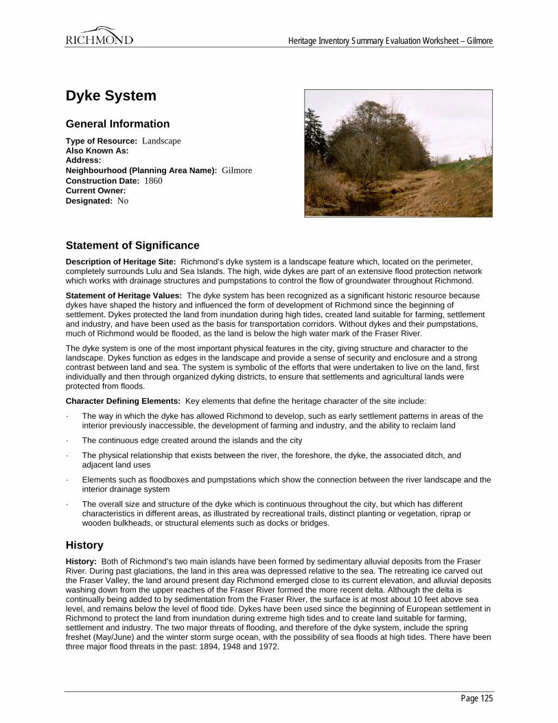
Heritage Inventory Summary Evaluation Worksheet – Gilmore
Page 125
Dyke System
General Information Type of Resource: Landscape Also Known As: Address: Neighbourhood (Planning Area Name): Gilmore Construction Date: 1860 Current Owner: Designated: No
Statement of Significance Description of Heritage Site: Richmond’s dyke system is a landscape feature which, located on the perimeter, completely surrounds Lulu and Sea Islands. The high, wide dykes are part of an extensive flood protection network which works with drainage structures and pumpstations to control the flow of groundwater throughout Richmond.
Statement of Heritage Values: The dyke system has been recognized as a significant historic resource because dykes have shaped the history and influenced the form of development of Richmond since the beginning of settlement. Dykes protected the land from inundation during high tides, created land suitable for farming, settlement and industry, and have been used as the basis for transportation corridors. Without dykes and their pumpstations, much of Richmond would be flooded, as the land is below the high water mark of the Fraser River.
The dyke system is one of the most important physical features in the city, giving structure and character to the landscape. Dykes function as edges in the landscape and provide a sense of security and enclosure and a strong contrast between land and sea. The system is symbolic of the efforts that were undertaken to live on the land, first individually and then through organized dyking districts, to ensure that settlements and agricultural lands were protected from floods.
Character Defining Elements: Key elements that define the heritage character of the site include:
· The way in which the dyke has allowed Richmond to develop, such as early settlement patterns in areas of the interior previously inaccessible, the development of farming and industry, and the ability to reclaim land
· The continuous edge created around the islands and the city
· The physical relationship that exists between the river, the foreshore, the dyke, the associated ditch, and adjacent land uses
· Elements such as floodboxes and pumpstations which show the connection between the river landscape and the interior drainage system
· The overall size and structure of the dyke which is continuous throughout the city, but which has different characteristics in different areas, as illustrated by recreational trails, distinct planting or vegetation, riprap or wooden bulkheads, or structural elements such as docks or bridges.
History History: Both of Richmond’s two main islands have been formed by sedimentary alluvial deposits from the Fraser River. During past glaciations, the land in this area was depressed relative to the sea. The retreating ice carved out the Fraser Valley, the land around present day Richmond emerged close to its current elevation, and alluvial deposits washing down from the upper reaches of the Fraser River formed the more recent delta. Although the delta is continually being added to by sedimentation from the Fraser River, the surface is at most about 10 feet above sea level, and remains below the level of flood tide. Dykes have been used since the beginning of European settlement in Richmond to protect the land from inundation during extreme high tides and to create land suitable for farming, settlement and industry. The two major threats of flooding, and therefore of the dyke system, include the spring freshet (May/June) and the winter storm surge ocean, with the possibility of sea floods at high tides. There have been three major flood threats in the past: 1894, 1948 and 1972.
Heritage Inventory Summary Evaluation Worksheet – Gilmore
Page 126
According to Thomas Kidd’s memoirs, Hugh McRoberts has the honour of being the first person to construct a dyke in what was to become the City of Richmond. In 1861 and 1862 he dyked in, cultivated and harvested a field of wheat and planted fruit trees on Sea Island. On Lulu Island it was William McNeely who constructed the first dyke at a site on the South Arm. Individual farmers built the first dykes, with occasional joint efforts undertaken by adjoining farms. Farmers continued to build and maintain their own dykes until 1905. These early dykes were built by hand and were basically piles of earth, with the ditch created from the excavation of the earth becoming a drainage channel. Construction of dykes occurred in a piecemeal fashion, with individual sections of dyke gradually connected, and floodboxes for drainage installed as required. As a result, few farms were dyked well enough to prevent flooding in the winter. Thomas Kidd notes that there were practically no dykes in the south of Lulu Island, except in the slough areas, prior to 1882. Frequent flooding meant that settlers had to work constantly to maintain their dykes, and most of the year, settlers wore gumboots everywhere, and travelled by rowboat.
After incorporation in 1879, petitions from landowners flooded in to Council asking for improvements to dyking and drainage on their lands. Contracts were awarded for the construction of dykes, drainage ditches and floodboxes, which regulated the drainage and allowed water to flow outside of the dyke. The early floodboxes are described in the contract proposals dating from this period, and consisted of a cedar box measuring 1 foot wide by 1 1/2 feet deep. The technology apparently developed rapidly; a 1924 contract describes a reinforced concrete flood box.
The history of the dyking system in Richmond is also one of a great deal of administration.
In 1905, a local petition called for the formation of a commission to maintain dyking and drainage. As a result, various organized dyking commissions were activated to try to control dyke construction and maintenance in an orderly fashion. Dedicated dykes were maintained and improved by public funds raised by the landowners in each of the respective dyking districts. They included the Lulu Island West Dyking District that was responsible for most of the lands west of No. 3 Road, and the New Lulu Island Slough Dyking Scheme, which controlled the dykes from No. 3 Road East to No. 6 Road. Richmond municipal council was a third administrative body that concerned itself with the northern and extreme eastern portions of Lulu Island plus Sea Island. Each had its own method of taxation.
In 1906 the commissioners undertook a new method of dyking the islands, using a floating dredge to dig a large canal which provided a great deal of sand and gravel to create the dyke. Gradually, Sea Island and Lulu Island were completely encircled by dykes. A plan from 1938 shows the completed dykes around the two islands.
In 1935, the old floodboxes began to be replaced with new electrical pumps, the first being installed at Finn Slough, the north end of No. 4 Road and the south end of No. 3 Road. These pumps allowed farmers to begin cultivation on their fields earlier in the year, and kept fields previously underwater much of the time free of standing water except following heavy rains. The pumps were a great cause for celebration.
In 1937, all of the different dyking schemes and their associated governing bodies were amalgamated and put under the direct control of City Council and the Inspector of Municipalities. This allowed a co-ordinated effort for the construction of dykes, the installation of pumps, and the excavation of ditches.
Plans showing dyke construction and improvements over time are rare. Dyke construction was a free for all until the establishment of the dyking schemes, and even then plans are scarce, possibly because of jurisdictional confusion. One surviving drawing, from the 1950’s, indicates plans to place rock at the outer edge of the South Dyke near Woodward Slough and Horseshoe Slough, to construct new flood boxes and place new pumps in various areas of the Municipality. It also shows a scheme to move the South Dyke between No. 6 Road and No. 9 Road inland “…to keep [it] from slipping into the river.” It must be assumed that this type of dyke work was continuous, as the various dyking commissions struggled to keep the dyke and drainage systems in working order.
Another issue for the dyking commissions was responding to complaints and requests, which seem to have been received on a regular basis. It is understandable that there was concern among the farming population, as their livelihood depended on the ability to work the land. One complainant noted that standing water had killed all of his hay, and thought it was unfair to “…pay into that scheme unless I receive benefit.” Dyking district commissioners appeared as plaintiffs in many a negligence lawsuit during this time.
Other threats to the stability of the dykes included vegetation and the local fauna. Tree removal was a common request, with deeply embedded roots threatening to tear holes in the dykes. At one point there was a ten cent bounty on muskrat tails offered b the municipal clerk’s office, as flooding due to a broken dyke was often caused by muskrats digging burrows.
As the Municipality developed, the Council was faced with the problem of maintaining public dykes, most of which were on private property and inconsistently maintained. In 1959, the provincial legislature passed the Municipalities Enabling Act and Validating Act which allowed the acquisition of land by statutory right-of-way occupied by dyking and drainage systems in the Municipality, and “…adjacent lands reasonably required by the Corporation for the support and maintenance of the dyke and canal systems.” A form letter accompanied by a survey plan from the Chief Administrative Officer informed landowners which sections of their property would be put on title to the Municipality.
Heritage Inventory Summary Evaluation Worksheet – Gilmore
Page 127
As late as 1975, the Municipality was acquiring the rights-of-way to the South Dyke, which was necessary before any contracts could be awarded for new construction and upgrade. The City is now fully responsible for the funding and maintenance of dykes.
The Fraser River Flood Control Agreement, enacted in 1973, provided the means to improve the dyke system and rehabilitate the internal drainage system within Richmond. This document was an agreement among the various municipalities which set standards for the construction and improvements of dyke and flood control systems. This led to a complete upgrade of Richmond’s dyking system, which carried on into the 1980’s.
As soon as dyking began on Lulu Island, the natural environment began to change. The rich floodplain lands of the Fraser River delta and the associated estuary and intertidal areas contain some of the most significant natural areas within the Lower Mainland. Dyking the land to prevent flooding creates changes in the natural systems of water availability and temperature, tides and currents, and the influence of the river, and significantly alters the natural systems in these areas. Agriculture and other land uses also alter the land. Although some of these significant areas are located on the foreshore outside of the dykes, it is the undyked portions of the floodplain that are considered to have the highest value for wildlife habitat and that warrant future protection.
Today, the dyke system remains a planning issue for the City of Richmond. Guidelines were set in the 1970’s for floor elevations for new construction, as many of the early buildings were constructed below water level and exist today at grades below the adjacent roadways. Construction, maintenance and monitoring activities are consistently carried out by the Department of Public Works. Where dykes occur on private land, owners are expected to keep them maintained to the accepted standard.
Richmond’s dyke system has created a secondary use as a recreational trail system. The literature has many references to early use of the dykes as a means of pedestrian transportation. Jelliffe (1972) notes that “Children would…walk along the dyke from No. 1 Road to London’s Landing to see what was going on at the edge of the river. There were several small stores along the dyke where one could buy a penny’s worth of candy.” Today, the dyke system is used intensively for recreation by residents and visitors, and is an important part of the city’s trail system.

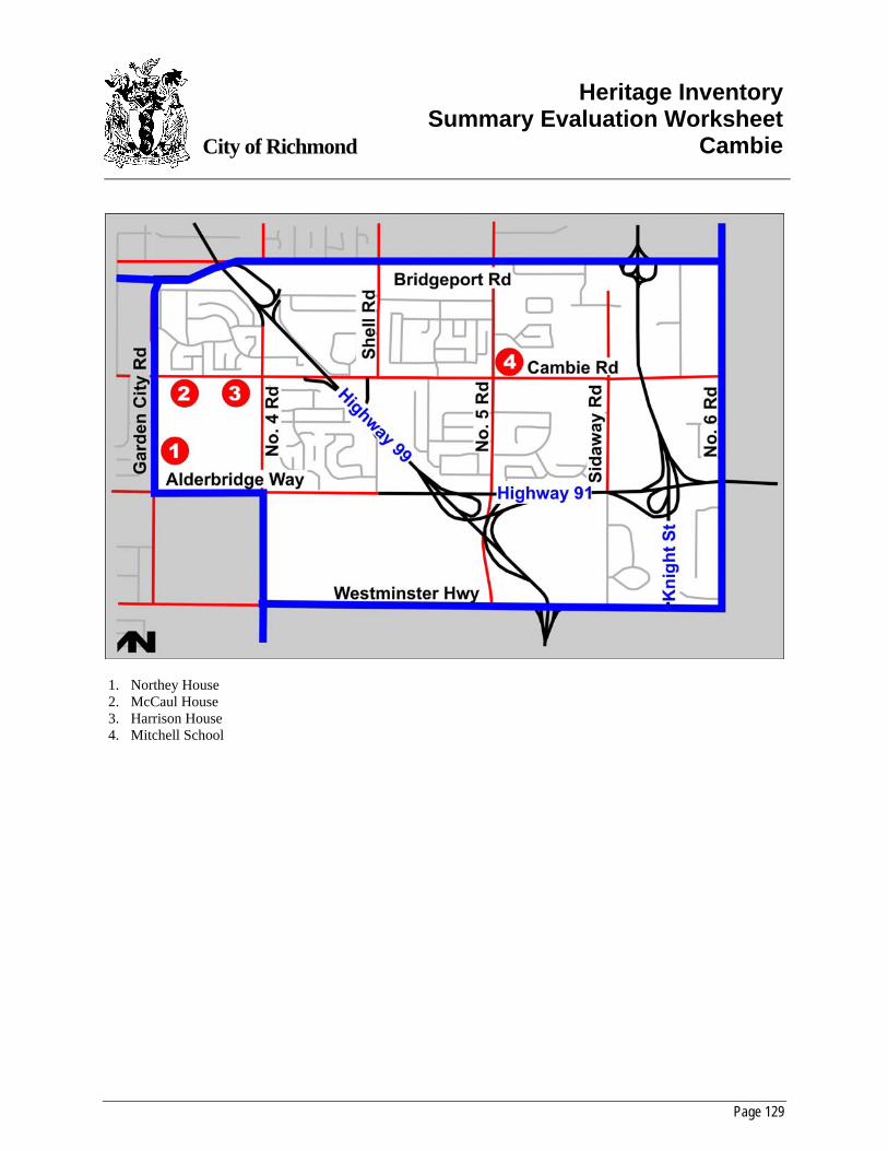
Page 129
City of Richmond
Heritage InventorySummary Evaluation Worksheet
Cambie
1. Northey House 2. McCaul House 3. Harrison House 4. Mitchell School
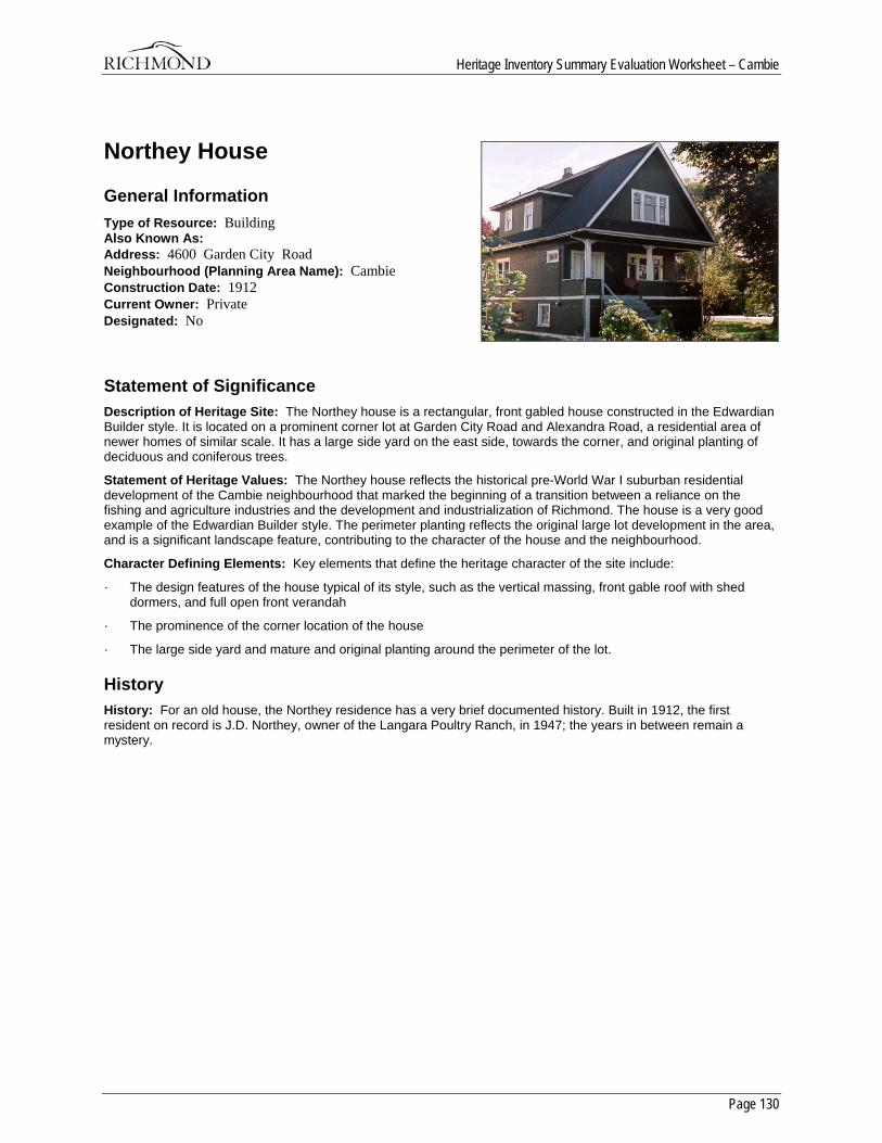
Heritage Inventory Summary Evaluation Worksheet – Cambie
Page 130
Northey House
General Information Type of Resource: Building Also Known As: Address: 4600 Garden City Road Neighbourhood (Planning Area Name): Cambie Construction Date: 1912 Current Owner: Private Designated: No
Statement of Significance Description of Heritage Site: The Northey house is a rectangular, front gabled house constructed in the Edwardian Builder style. It is located on a prominent corner lot at Garden City Road and Alexandra Road, a residential area of newer homes of similar scale. It has a large side yard on the east side, towards the corner, and original planting of deciduous and coniferous trees.
Statement of Heritage Values: The Northey house reflects the historical pre-World War I suburban residential development of the Cambie neighbourhood that marked the beginning of a transition between a reliance on the fishing and agriculture industries and the development and industrialization of Richmond. The house is a very good example of the Edwardian Builder style. The perimeter planting reflects the original large lot development in the area, and is a significant landscape feature, contributing to the character of the house and the neighbourhood.
Character Defining Elements: Key elements that define the heritage character of the site include:
· The design features of the house typical of its style, such as the vertical massing, front gable roof with shed dormers, and full open front verandah
· The prominence of the corner location of the house
· The large side yard and mature and original planting around the perimeter of the lot.
History History: For an old house, the Northey residence has a very brief documented history. Built in 1912, the first resident on record is J.D. Northey, owner of the Langara Poultry Ranch, in 1947; the years in between remain a mystery.
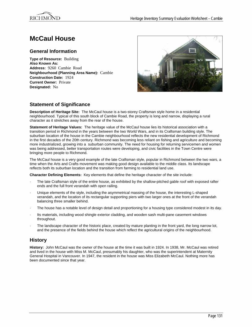
Heritage Inventory Summary Evaluation Worksheet – Cambie
Page 131
McCaul House
General Information Type of Resource: Building Also Known As: Address: 9260 Cambie Road Neighbourhood (Planning Area Name): Cambie Construction Date: 1924 Current Owner: Private Designated: No
Statement of Significance Description of Heritage Site: The McCaul house is a two-storey Craftsman style home in a residential neighbourhood. Typical of this south block of Cambie Road, the property is long and narrow, displaying a rural character as it stretches away from the rear of the house.
Statement of Heritage Values: The heritage value of the McCaul house lies its historical association with a transition period in Richmond in the years between the two World Wars, and in its Craftsman building style. The suburban location of the house in the Cambie neighbourhood reflects the new residential development of Richmond in the first decades of the 20th century. Richmond was becoming less reliant on fishing and agriculture and becoming more industrialized, growing into a suburban community. The need for housing for returning servicemen and women was being addressed, better transportation routes were developing, and civic facilities in the Town Centre were bringing more people to Richmond.
The McCaul house is a very good example of the late Craftsman style, popular in Richmond between the two wars, a time when the Arts and Crafts movement was making good design available to the middle class. Its landscape reflects both its suburban location and the transition from farming to residential land use.
Character Defining Elements: Key elements that define the heritage character of the site include:
· The late Craftsman style of the entire house, as exhibited by the shallow-pitched gable roof with exposed rafter ends and the full front verandah with open railing.
· Unique elements of the style, including the asymmetrical massing of the house, the interesting L-shaped verandah, and the location of its rectangular supporting piers with two larger ones at the front of the verandah balancing three smaller behind.
· The house has a notable level of design detail and proportioning for a housing type considered modest in its day.
· Its materials, including wood shingle exterior cladding, and wooden sash multi-pane casement windows throughout.
· The landscape character of the historic place, created by mature planting in the front yard, the long narrow lot, and the presence of the fields behind the house which reflect the agricultural origins of the neighbourhood.
History History: John McCaul was the owner of the house at the time it was built in 1924. In 1938, Mr. McCaul was retired and lived in the house with Miss M. McCaul, presumably his daughter, who was the superintendent at Maternity General Hospital in Vancouver. In 1947, the resident in the house was Miss Elizabeth McCaul. Nothing more has been documented since that year.
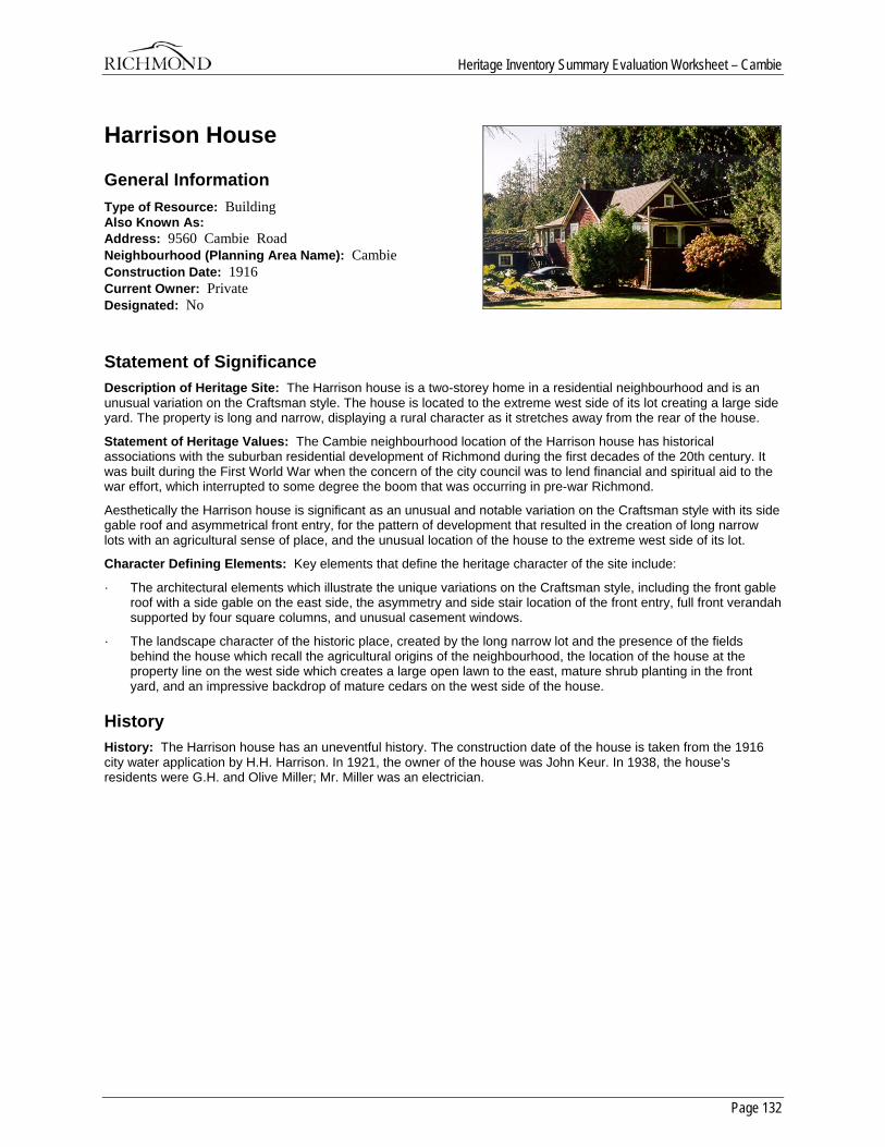
Heritage Inventory Summary Evaluation Worksheet – Cambie
Page 132
Harrison House
General Information Type of Resource: Building Also Known As: Address: 9560 Cambie Road Neighbourhood (Planning Area Name): Cambie Construction Date: 1916 Current Owner: Private Designated: No
Statement of Significance Description of Heritage Site: The Harrison house is a two-storey home in a residential neighbourhood and is an unusual variation on the Craftsman style. The house is located to the extreme west side of its lot creating a large side yard. The property is long and narrow, displaying a rural character as it stretches away from the rear of the house.
Statement of Heritage Values: The Cambie neighbourhood location of the Harrison house has historical associations with the suburban residential development of Richmond during the first decades of the 20th century. It was built during the First World War when the concern of the city council was to lend financial and spiritual aid to the war effort, which interrupted to some degree the boom that was occurring in pre-war Richmond.
Aesthetically the Harrison house is significant as an unusual and notable variation on the Craftsman style with its side gable roof and asymmetrical front entry, for the pattern of development that resulted in the creation of long narrow lots with an agricultural sense of place, and the unusual location of the house to the extreme west side of its lot.
Character Defining Elements: Key elements that define the heritage character of the site include:
· The architectural elements which illustrate the unique variations on the Craftsman style, including the front gable roof with a side gable on the east side, the asymmetry and side stair location of the front entry, full front verandah supported by four square columns, and unusual casement windows.
· The landscape character of the historic place, created by the long narrow lot and the presence of the fields behind the house which recall the agricultural origins of the neighbourhood, the location of the house at the property line on the west side which creates a large open lawn to the east, mature shrub planting in the front yard, and an impressive backdrop of mature cedars on the west side of the house.
History History: The Harrison house has an uneventful history. The construction date of the house is taken from the 1916 city water application by H.H. Harrison. In 1921, the owner of the house was John Keur. In 1938, the house’s residents were G.H. and Olive Miller; Mr. Miller was an electrician.
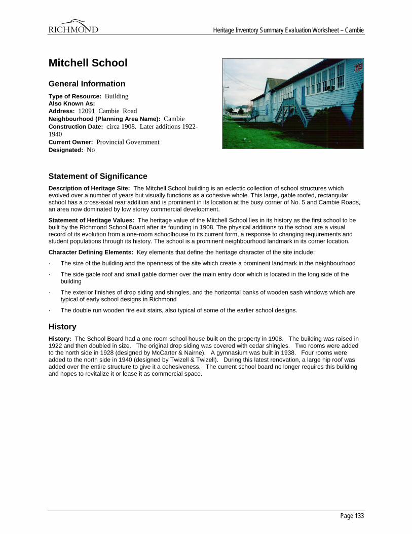
Heritage Inventory Summary Evaluation Worksheet – Cambie
Page 133
Mitchell School
General Information Type of Resource: Building Also Known As: Address: 12091 Cambie Road Neighbourhood (Planning Area Name): Cambie Construction Date: circa 1908. Later additions 1922-1940 Current Owner: Provincial Government Designated: No
Statement of Significance Description of Heritage Site: The Mitchell School building is an eclectic collection of school structures which evolved over a number of years but visually functions as a cohesive whole. This large, gable roofed, rectangular school has a cross-axial rear addition and is prominent in its location at the busy corner of No. 5 and Cambie Roads, an area now dominated by low storey commercial development.
Statement of Heritage Values: The heritage value of the Mitchell School lies in its history as the first school to be built by the Richmond School Board after its founding in 1908. The physical additions to the school are a visual record of its evolution from a one-room schoolhouse to its current form, a response to changing requirements and student populations through its history. The school is a prominent neighbourhood landmark in its corner location.
Character Defining Elements: Key elements that define the heritage character of the site include:
· The size of the building and the openness of the site which create a prominent landmark in the neighbourhood
· The side gable roof and small gable dormer over the main entry door which is located in the long side of the building
· The exterior finishes of drop siding and shingles, and the horizontal banks of wooden sash windows which are typical of early school designs in Richmond
· The double run wooden fire exit stairs, also typical of some of the earlier school designs.
History History: The School Board had a one room school house built on the property in 1908. The building was raised in 1922 and then doubled in size. The original drop siding was covered with cedar shingles. Two rooms were added to the north side in 1928 (designed by McCarter & Nairne). A gymnasium was built in 1938. Four rooms were added to the north side in 1940 (designed by Twizell & Twizell). During this latest renovation, a large hip roof was added over the entire structure to give it a cohesiveness. The current school board no longer requires this building and hopes to revitalize it or lease it as commercial space.

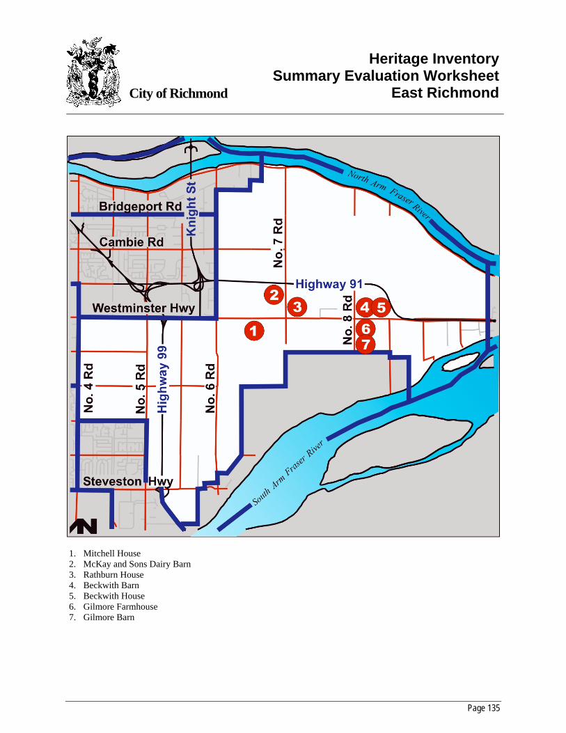
Page 135
City of Richmond
Heritage InventorySummary Evaluation Worksheet
East Richmond
1. Mitchell House 2. McKay and Sons Dairy Barn 3. Rathburn House 4. Beckwith Barn 5. Beckwith House 6. Gilmore Farmhouse 7. Gilmore Barn
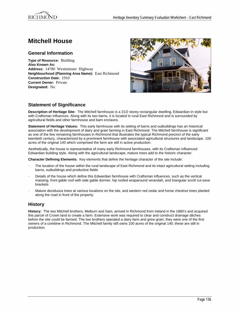
Heritage Inventory Summary Evaluation Worksheet – East Richmond
Page 136
Mitchell House
General Information Type of Resource: Building Also Known As: Address: 14780 Westminster Highway Neighbourhood (Planning Area Name): East Richmond Construction Date: 1910 Current Owner: Private Designated: No
Statement of Significance Description of Heritage Site: The Mitchell farmhouse is a 21/2 storey rectangular dwelling, Edwardian in style but with Craftsman influences. Along with its two barns, it is located in rural East Richmond and is surrounded by agricultural fields and other farmhouse and barn enclaves.
Statement of Heritage Values: This early farmhouse with its setting of barns and outbuildings has an historical association with the development of dairy and grain farming in East Richmond. The Mitchell farmhouse is significant as one of the few remaining farmhouses in Richmond that illustrates the typical Richmond precinct of the early twentieth century, characterized by a prominent farmhouse with associated agricultural structures and landscape. 100 acres of the original 140 which comprised the farm are still in active production.
Aesthetically, the house is representative of many early Richmond farmhouses, with its Craftsman influenced Edwardian building style. Along with the agricultural landscape, mature trees add to the historic character.
Character Defining Elements: Key elements that define the heritage character of the site include:
· The location of the house within the rural landscape of East Richmond and its intact agricultural setting including barns, outbuildings and productive fields
· Details of the house which define this Edwardian farmhouse with Craftsman influences, such as the vertical massing, front gable roof with side gable dormer, hip roofed wraparound verandah, and triangular scroll cut eave brackets
· Mature deciduous trees at various locations on the site, and western red cedar and horse chestnut trees planted along the road in front of the property.
History History: The two Mitchell brothers, Melburn and Sam, arrived in Richmond from Ireland in the 1880’s and acquired this parcel of Crown land to create a farm. Extensive work was required to clear and construct drainage ditches before the site could be farmed. The two brothers operated a dairy farm and grew grain; they were one of the first owners of a combine in Richmond. The Mitchell family still owns 100 acres of the original 140; these are still in production.
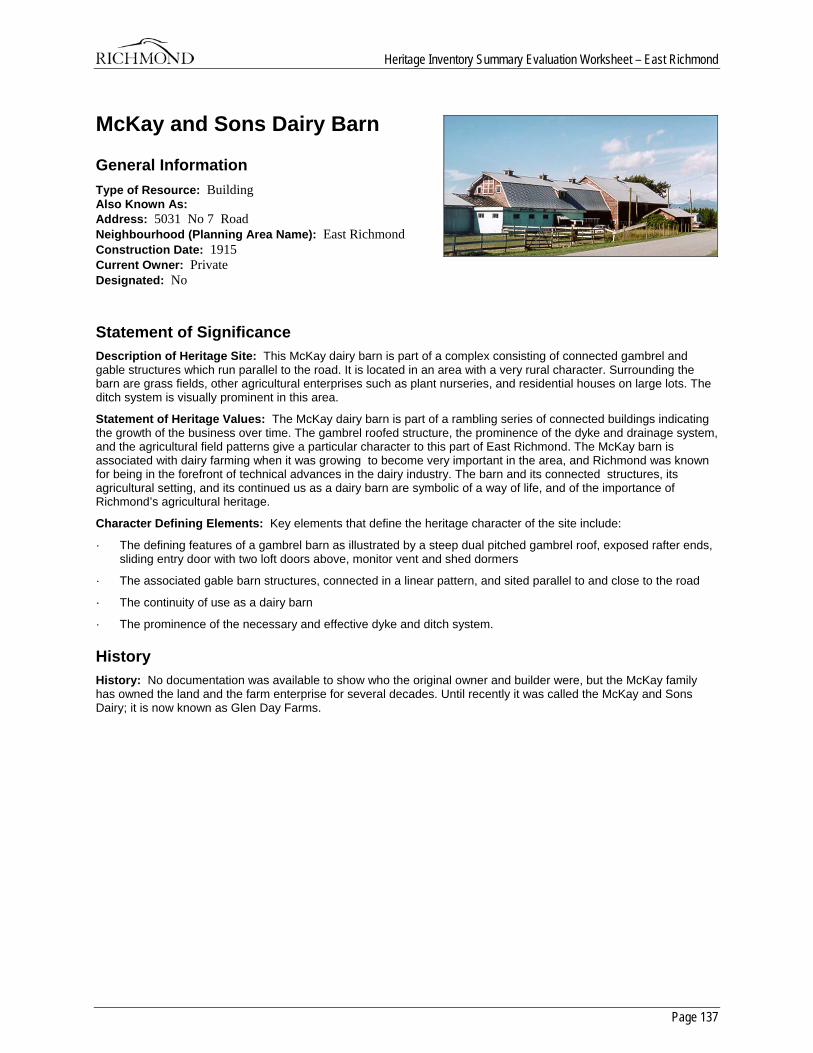
Heritage Inventory Summary Evaluation Worksheet – East Richmond
Page 137
McKay and Sons Dairy Barn
General Information Type of Resource: Building Also Known As: Address: 5031 No 7 Road Neighbourhood (Planning Area Name): East Richmond Construction Date: 1915 Current Owner: Private Designated: No
Statement of Significance Description of Heritage Site: This McKay dairy barn is part of a complex consisting of connected gambrel and gable structures which run parallel to the road. It is located in an area with a very rural character. Surrounding the barn are grass fields, other agricultural enterprises such as plant nurseries, and residential houses on large lots. The ditch system is visually prominent in this area.
Statement of Heritage Values: The McKay dairy barn is part of a rambling series of connected buildings indicating the growth of the business over time. The gambrel roofed structure, the prominence of the dyke and drainage system, and the agricultural field patterns give a particular character to this part of East Richmond. The McKay barn is associated with dairy farming when it was growing to become very important in the area, and Richmond was known for being in the forefront of technical advances in the dairy industry. The barn and its connected structures, its agricultural setting, and its continued us as a dairy barn are symbolic of a way of life, and of the importance of Richmond’s agricultural heritage.
Character Defining Elements: Key elements that define the heritage character of the site include:
· The defining features of a gambrel barn as illustrated by a steep dual pitched gambrel roof, exposed rafter ends, sliding entry door with two loft doors above, monitor vent and shed dormers
· The associated gable barn structures, connected in a linear pattern, and sited parallel to and close to the road
· The continuity of use as a dairy barn
· The prominence of the necessary and effective dyke and ditch system.
History History: No documentation was available to show who the original owner and builder were, but the McKay family has owned the land and the farm enterprise for several decades. Until recently it was called the McKay and Sons Dairy; it is now known as Glen Day Farms.
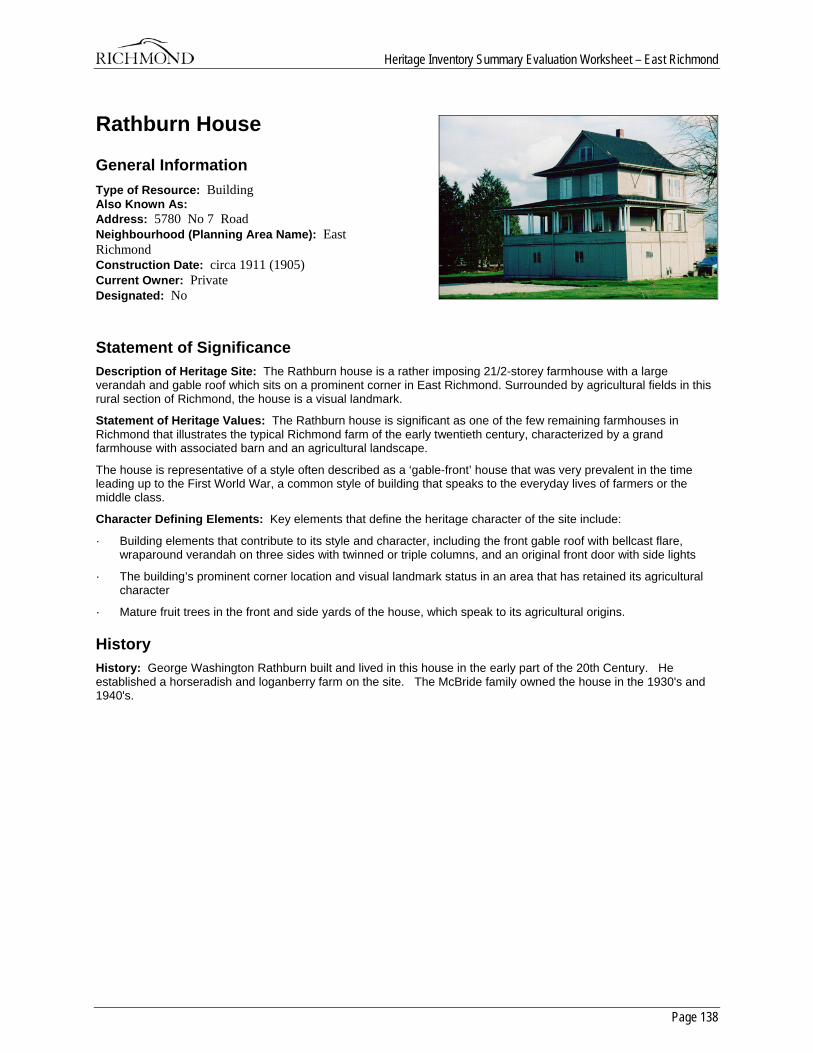
Heritage Inventory Summary Evaluation Worksheet – East Richmond
Page 138
Rathburn House
General Information Type of Resource: Building Also Known As: Address: 5780 No 7 Road Neighbourhood (Planning Area Name): East Richmond Construction Date: circa 1911 (1905) Current Owner: Private Designated: No
Statement of Significance Description of Heritage Site: The Rathburn house is a rather imposing 21/2-storey farmhouse with a large verandah and gable roof which sits on a prominent corner in East Richmond. Surrounded by agricultural fields in this rural section of Richmond, the house is a visual landmark.
Statement of Heritage Values: The Rathburn house is significant as one of the few remaining farmhouses in Richmond that illustrates the typical Richmond farm of the early twentieth century, characterized by a grand farmhouse with associated barn and an agricultural landscape.
The house is representative of a style often described as a ‘gable-front’ house that was very prevalent in the time leading up to the First World War, a common style of building that speaks to the everyday lives of farmers or the middle class.
Character Defining Elements: Key elements that define the heritage character of the site include:
· Building elements that contribute to its style and character, including the front gable roof with bellcast flare, wraparound verandah on three sides with twinned or triple columns, and an original front door with side lights
· The building’s prominent corner location and visual landmark status in an area that has retained its agricultural character
· Mature fruit trees in the front and side yards of the house, which speak to its agricultural origins.
History History: George Washington Rathburn built and lived in this house in the early part of the 20th Century. He established a horseradish and loganberry farm on the site. The McBride family owned the house in the 1930's and 1940's.
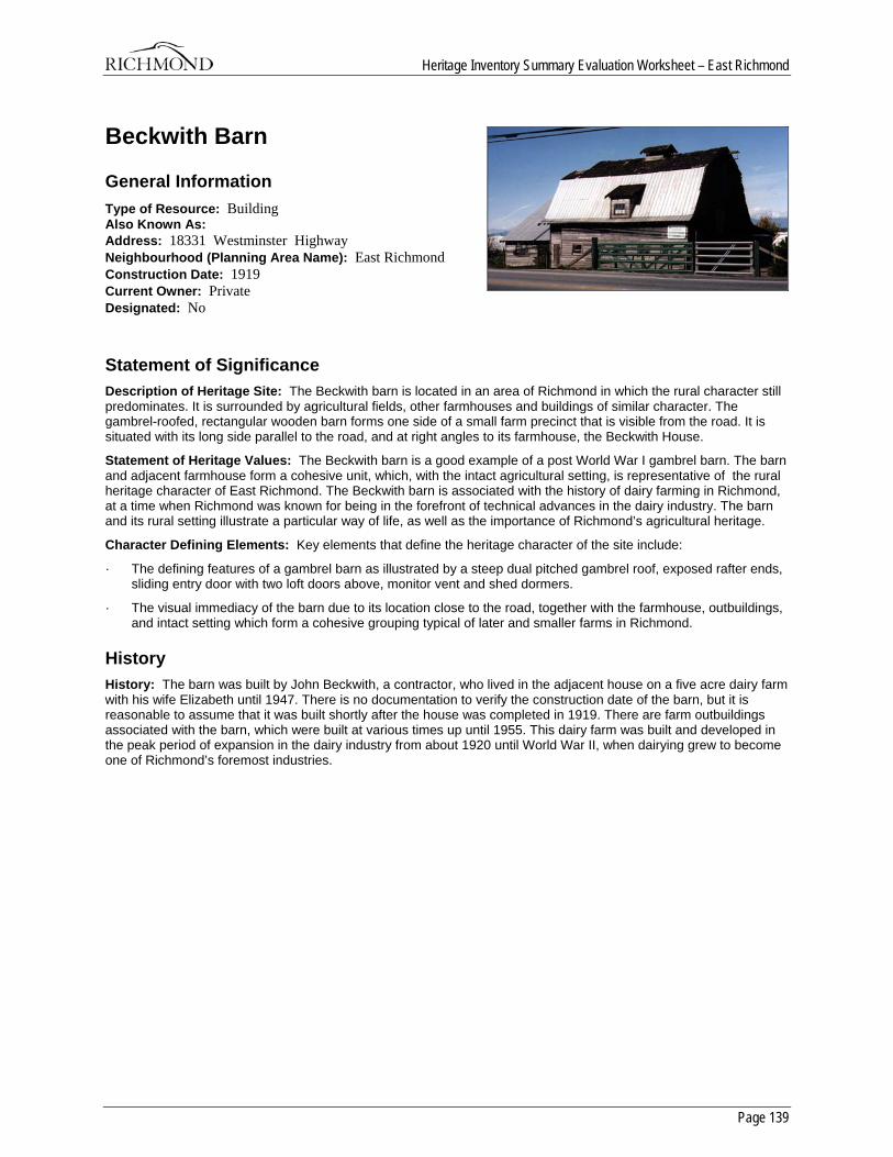
Heritage Inventory Summary Evaluation Worksheet – East Richmond
Page 139
Beckwith Barn
General Information Type of Resource: Building Also Known As: Address: 18331 Westminster Highway Neighbourhood (Planning Area Name): East Richmond Construction Date: 1919 Current Owner: Private Designated: No
Statement of Significance Description of Heritage Site: The Beckwith barn is located in an area of Richmond in which the rural character still predominates. It is surrounded by agricultural fields, other farmhouses and buildings of similar character. The gambrel-roofed, rectangular wooden barn forms one side of a small farm precinct that is visible from the road. It is situated with its long side parallel to the road, and at right angles to its farmhouse, the Beckwith House.
Statement of Heritage Values: The Beckwith barn is a good example of a post World War I gambrel barn. The barn and adjacent farmhouse form a cohesive unit, which, with the intact agricultural setting, is representative of the rural heritage character of East Richmond. The Beckwith barn is associated with the history of dairy farming in Richmond, at a time when Richmond was known for being in the forefront of technical advances in the dairy industry. The barn and its rural setting illustrate a particular way of life, as well as the importance of Richmond’s agricultural heritage.
Character Defining Elements: Key elements that define the heritage character of the site include:
· The defining features of a gambrel barn as illustrated by a steep dual pitched gambrel roof, exposed rafter ends, sliding entry door with two loft doors above, monitor vent and shed dormers.
· The visual immediacy of the barn due to its location close to the road, together with the farmhouse, outbuildings, and intact setting which form a cohesive grouping typical of later and smaller farms in Richmond.
History History: The barn was built by John Beckwith, a contractor, who lived in the adjacent house on a five acre dairy farm with his wife Elizabeth until 1947. There is no documentation to verify the construction date of the barn, but it is reasonable to assume that it was built shortly after the house was completed in 1919. There are farm outbuildings associated with the barn, which were built at various times up until 1955. This dairy farm was built and developed in the peak period of expansion in the dairy industry from about 1920 until World War II, when dairying grew to become one of Richmond’s foremost industries.
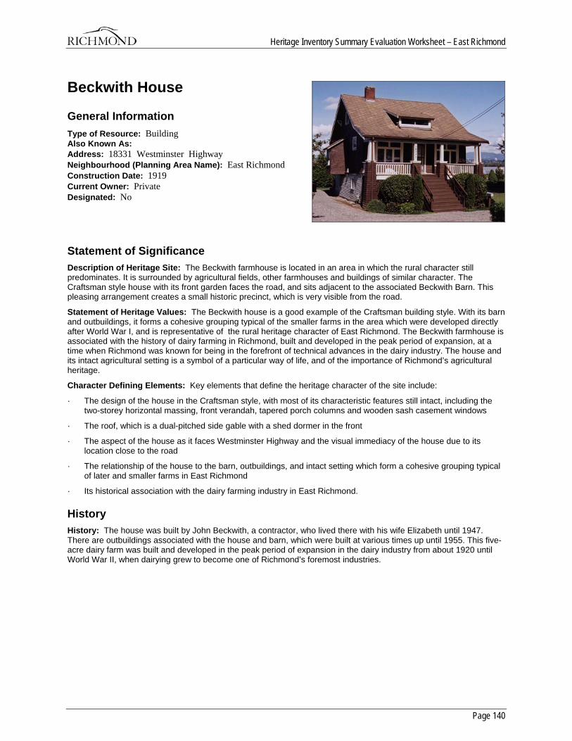
Heritage Inventory Summary Evaluation Worksheet – East Richmond
Page 140
Beckwith House
General Information Type of Resource: Building Also Known As: Address: 18331 Westminster Highway Neighbourhood (Planning Area Name): East Richmond Construction Date: 1919 Current Owner: Private Designated: No
Statement of Significance Description of Heritage Site: The Beckwith farmhouse is located in an area in which the rural character still predominates. It is surrounded by agricultural fields, other farmhouses and buildings of similar character. The Craftsman style house with its front garden faces the road, and sits adjacent to the associated Beckwith Barn. This pleasing arrangement creates a small historic precinct, which is very visible from the road.
Statement of Heritage Values: The Beckwith house is a good example of the Craftsman building style. With its barn and outbuildings, it forms a cohesive grouping typical of the smaller farms in the area which were developed directly after World War I, and is representative of the rural heritage character of East Richmond. The Beckwith farmhouse is associated with the history of dairy farming in Richmond, built and developed in the peak period of expansion, at a time when Richmond was known for being in the forefront of technical advances in the dairy industry. The house and its intact agricultural setting is a symbol of a particular way of life, and of the importance of Richmond’s agricultural heritage.
Character Defining Elements: Key elements that define the heritage character of the site include:
· The design of the house in the Craftsman style, with most of its characteristic features still intact, including the two-storey horizontal massing, front verandah, tapered porch columns and wooden sash casement windows
· The roof, which is a dual-pitched side gable with a shed dormer in the front
· The aspect of the house as it faces Westminster Highway and the visual immediacy of the house due to its location close to the road
· The relationship of the house to the barn, outbuildings, and intact setting which form a cohesive grouping typical of later and smaller farms in East Richmond
· Its historical association with the dairy farming industry in East Richmond.
History History: The house was built by John Beckwith, a contractor, who lived there with his wife Elizabeth until 1947. There are outbuildings associated with the house and barn, which were built at various times up until 1955. This five-acre dairy farm was built and developed in the peak period of expansion in the dairy industry from about 1920 until World War II, when dairying grew to become one of Richmond’s foremost industries.
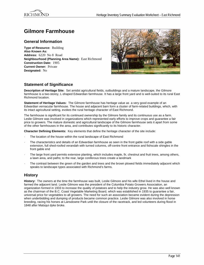
Heritage Inventory Summary Evaluation Worksheet – East Richmond
Page 141
Gilmore Farmhouse
General Information Type of Resource: Building Also Known As: Address: 6220 No 8 Road Neighbourhood (Planning Area Name): East Richmond Construction Date: 1905 Current Owner: Private Designated: No
Statement of Significance Description of Heritage Site: Set amidst agricultural fields, outbuildings and a mature landscape, the Gilmore farmhouse is a two-storey, L-shaped Edwardian farmhouse. It has a large front yard and is well-suited to its rural East Richmond location.
Statement of Heritage Values: The Gilmore farmhouse has heritage value as a very good example of an Edwardian vernacular farmhouse. The house and adjacent barn form a cluster of farm-related buildings, which, with its intact agricultural setting, evokes the rural heritage character of East Richmond.
The farmhouse is significant for its continued ownership by the Gilmore family and its continuous use as a farm. Leslie Gilmore was involved in organizations which represented early efforts to improve crops and guarantee a fair price to growers. The mature domestic and agricultural landscape of the Gilmore farmhouse sets it apart from some of the other farmhouses in the area, and contributes significantly to its historic character.
Character Defining Elements: Key elements that define the heritage character of the site include:
· The location of the house within the rural landscape of East Richmond
· The characteristics and details of an Edwardian farmhouse as seen in the front gable roof with a side gable extension, full shed-roofed verandah with turned columns, off-centre front entrance and fishscale shingles in the front gable end
· The large front yard permits extensive planting, which includes maple, fir, chestnut and fruit trees, among others, a lawn area, and paths; to the rear, large coniferous trees create a landmark
· The contrast between the green of the garden and trees and the brown plowed fields immediately adjacent which speaks to landscape types associated with Richmond’s farms.
History History: The owners at the time the farmhouse was built, Leslie Gilmore and his wife Ethel lived in the house and farmed the adjacent land. Leslie Gilmore was the president of the Columbia Potato Growers Association, an organization formed in 1933 to increase the quality of potatoes and to help the industry grow. He was also well known as the chairman of the B.C. Coast Vegetable Marketing Board, which was established in 1935 to guarantee a fair, universal price for vegetables to all growers. The need for such an association became evident during the depression when underbidding and dumping of products became common practice. Leslie Gilmore was also involved in horse breeding, racing his horses at Lansdowne Park until the closure of the racetrack, and led volunteers during flood in 1848 after Matsqui dyke broke.
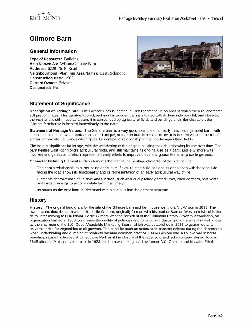
Heritage Inventory Summary Evaluation Worksheet – East Richmond
Page 142
Gilmore Barn
General Information Type of Resource: Building Also Known As: Wilson/Gilmore Barn Address: 6220 No 8 Road Neighbourhood (Planning Area Name): East Richmond Construction Date: 1905 Current Owner: Private Designated: No
Statement of Significance Description of Heritage Site: The Gilmore Barn is located in East Richmond, in an area in which the rural character still predominates. This gambrel-roofed, rectangular wooden barn is situated with its long side parallel, and close to, the road and is still in use as a barn. It is surrounded by agricultural fields and buildings of similar character; the Gilmore farmhouse is located immediately to the north.
Statement of Heritage Values: The Gilmore barn is a very good example of an early intact side gambrel barn, with its shed additions for water tanks considered unique, and a silo built into its structure. It is located within a cluster of similar farm-related buildings which gives it a contextual relationship to the nearby agricultural fields.
The barn is significant for its age, with the weathering of the original building materials showing its use over time. The barn typifies East Richmond’s agricultural roots, and still maintains its original use as a barn. Leslie Gilmore was involved in organizations which represented early efforts to improve crops and guarantee a fair price to growers.
Character Defining Elements: Key elements that define the heritage character of the site include:
· The barn’s relationship to surrounding agricultural fields, related buildings and its orientation with the long side facing the road shows its functionality and its representation of an early agricultural way of life.
· Elements characteristic of its style and function, such as a dual pitched gambrel roof, shed dormers, roof vents, and large openings to accommodate farm machinery
· Its status as the only barn in Richmond with a silo built into the primary structure.
History History: The original land grant for the site of the Gilmore barn and farmhouse went to a Mr. Wilson in 1898. The owner at the time the farm was built, Leslie Gilmore, originally farmed with his brother Sam on Westham Island in the delta, later moving to Lulu Island. Leslie Gilmore was the president of the Columbia Potato Growers Association, an organization formed in 1933 to increase the quality of potatoes and to help the industry grow. He was also well known as the chairman of the B.C. Coast Vegetable Marketing Board, which was established in 1935 to guarantee a fair, universal price for vegetables to all growers. The need for such an association became evident during the depression when underbidding and dumping of products became common practice. Leslie Gilmore was also involved in horse breeding, racing his horses at Lansdowne Park until the closure of the racetrack, and led volunteers during flood in 1848 after the Matsqui dyke broke. In 1938, the barn was being used by farmer A.C. Gilmore and his wife, Ethel.
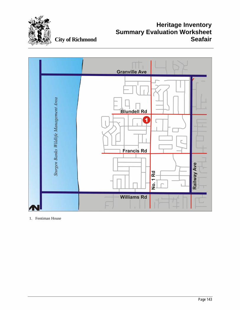
Page 143
City of Richmond
Heritage InventorySummary Evaluation Worksheet
Seafair
1. Fentiman House
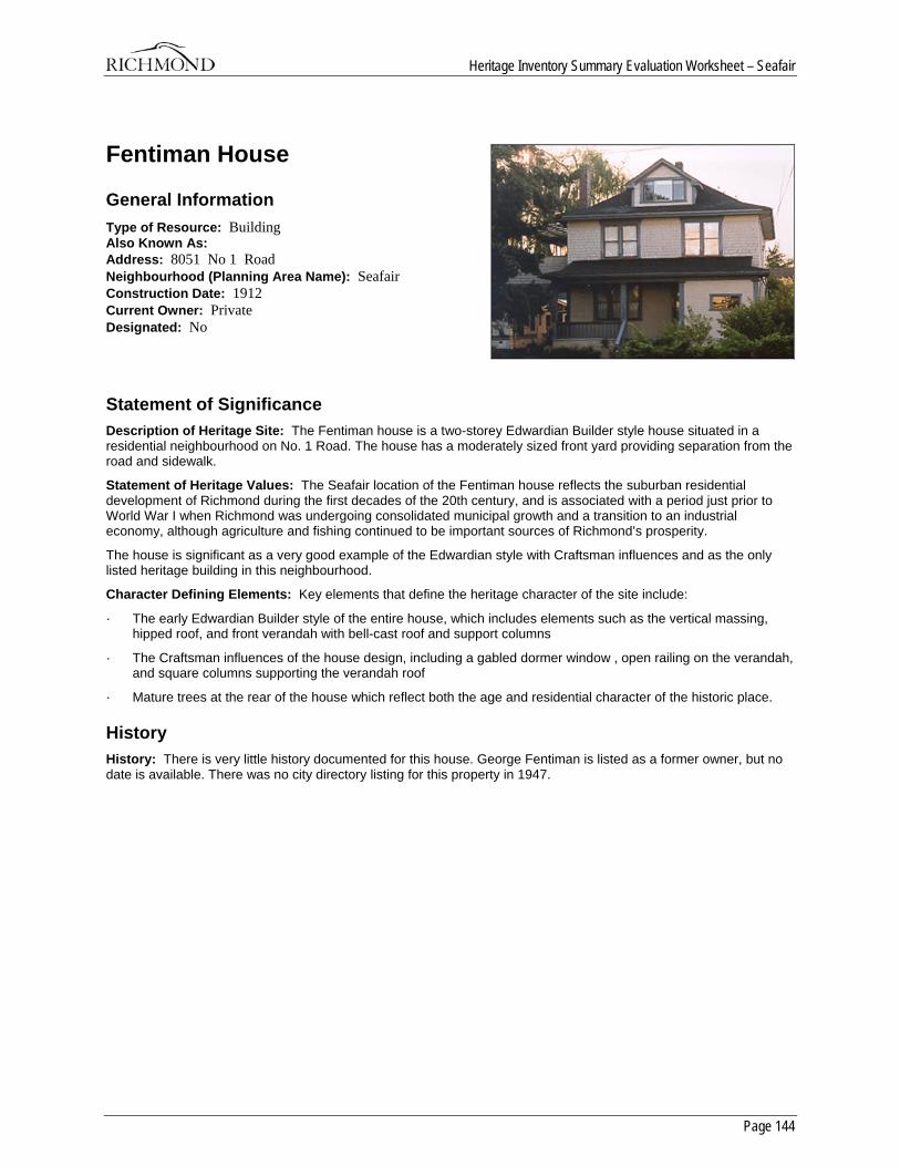
Heritage Inventory Summary Evaluation Worksheet – Seafair
Page 144
Fentiman House
General Information Type of Resource: Building Also Known As: Address: 8051 No 1 Road Neighbourhood (Planning Area Name): Seafair Construction Date: 1912 Current Owner: Private Designated: No
Statement of Significance Description of Heritage Site: The Fentiman house is a two-storey Edwardian Builder style house situated in a residential neighbourhood on No. 1 Road. The house has a moderately sized front yard providing separation from the road and sidewalk.
Statement of Heritage Values: The Seafair location of the Fentiman house reflects the suburban residential development of Richmond during the first decades of the 20th century, and is associated with a period just prior to World War I when Richmond was undergoing consolidated municipal growth and a transition to an industrial economy, although agriculture and fishing continued to be important sources of Richmond’s prosperity.
The house is significant as a very good example of the Edwardian style with Craftsman influences and as the only listed heritage building in this neighbourhood.
Character Defining Elements: Key elements that define the heritage character of the site include:
· The early Edwardian Builder style of the entire house, which includes elements such as the vertical massing, hipped roof, and front verandah with bell-cast roof and support columns
· The Craftsman influences of the house design, including a gabled dormer window , open railing on the verandah, and square columns supporting the verandah roof
· Mature trees at the rear of the house which reflect both the age and residential character of the historic place.
History History: There is very little history documented for this house. George Fentiman is listed as a former owner, but no date is available. There was no city directory listing for this property in 1947.

Page 145
City of Richmond
Heritage InventorySummary Evaluation Worksheet
Blundell
1. Every House 2. Yarmish House
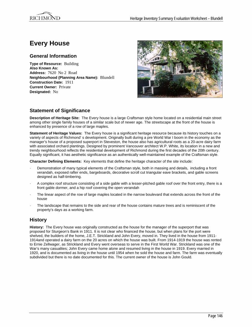
Heritage Inventory Summary Evaluation Worksheet – Blundell
Page 146
Every House
General Information Type of Resource: Building Also Known As: Address: 7620 No 2 Road Neighbourhood (Planning Area Name): Blundell Construction Date: 1911 Current Owner: Private Designated: No
Statement of Significance Description of Heritage Site: The Every house is a large Craftsman style home located on a residential main street among other single family houses of a similar scale but of newer age. The streetscape at the front of the house is enhanced by presence of a row of large maples.
Statement of Heritage Values: The Every house is a significant heritage resource because its history touches on a variety of aspects of Richmond’ s development. Originally built during a pre World War I boom in the economy as the manager’s house of a proposed superport in Steveston, the house also has agricultural roots as a 20-acre dairy farm with associated orchard plantings. Designed by prominent Vancouver architect W.P. White, its location in a new and trendy neighbourhood reflects the residential development of Richmond during the first decades of the 20th century. Equally significant, it has aesthetic significance as an authentically well-maintained example of the Craftsman style.
Character Defining Elements: Key elements that define the heritage character of the site include:
· Demonstration of many typical elements of the Craftsman style, both in massing and details, including a front verandah, exposed rafter ends, bargeboards, decorative scroll cut triangular eave brackets, and gable screens designed as half-timbering.
· A complex roof structure consisting of a side gable with a lesser-pitched gable roof over the front entry, there is a front gable dormer, and a hip roof covering the open verandah
· The linear aspect of the row of large maples located in the narrow boulevard that extends across the front of the house
· The landscape that remains to the side and rear of the house contains mature trees and is reminiscent of the property’s days as a working farm.
History History: The Every house was originally constructed as the house for the manager of the superport that was proposed for Sturgeon’s Bank in 1911. It is not clear who financed the house, but when plans for the port were shelved, the builders of the home, J.E.T. Strickland and John Every, moved in. They lived in the house from 1911-1914and operated a dairy farm on the 20 acres on which the house was built. From 1914-1919 the house was rented to Ernie Zellwager, as Strickland and Every went overseas to serve in the First World War. Strickland was one of the War’s many casualties; John Every came home alone and resumed living in the house in 1919. Every married in 1920, and is documented as living in the house until 1954 when he sold the house and farm. The farm was eventually subdivided but there is no date documented for this. The current owner of the house is John Gould.
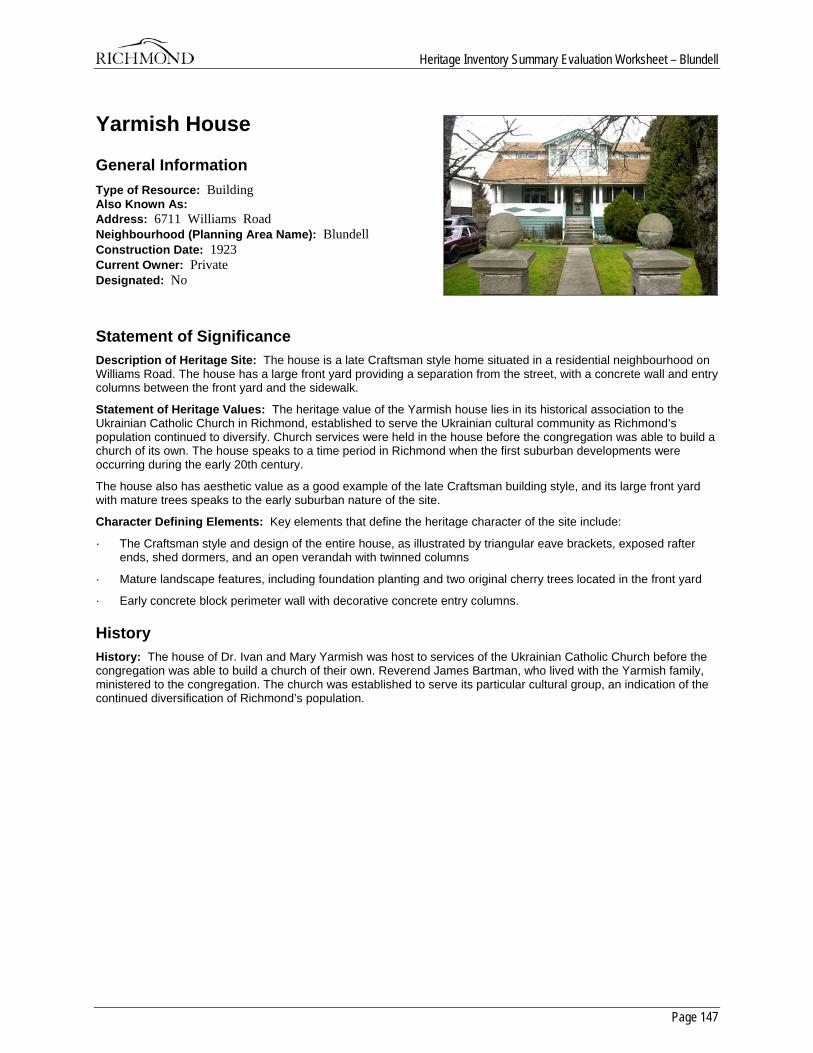
Heritage Inventory Summary Evaluation Worksheet – Blundell
Page 147
Yarmish House
General Information Type of Resource: Building Also Known As: Address: 6711 Williams Road Neighbourhood (Planning Area Name): Blundell Construction Date: 1923 Current Owner: Private Designated: No
Statement of Significance Description of Heritage Site: The house is a late Craftsman style home situated in a residential neighbourhood on Williams Road. The house has a large front yard providing a separation from the street, with a concrete wall and entry columns between the front yard and the sidewalk.
Statement of Heritage Values: The heritage value of the Yarmish house lies in its historical association to the Ukrainian Catholic Church in Richmond, established to serve the Ukrainian cultural community as Richmond’s population continued to diversify. Church services were held in the house before the congregation was able to build a church of its own. The house speaks to a time period in Richmond when the first suburban developments were occurring during the early 20th century.
The house also has aesthetic value as a good example of the late Craftsman building style, and its large front yard with mature trees speaks to the early suburban nature of the site.
Character Defining Elements: Key elements that define the heritage character of the site include:
· The Craftsman style and design of the entire house, as illustrated by triangular eave brackets, exposed rafter ends, shed dormers, and an open verandah with twinned columns
· Mature landscape features, including foundation planting and two original cherry trees located in the front yard
· Early concrete block perimeter wall with decorative concrete entry columns.
History History: The house of Dr. Ivan and Mary Yarmish was host to services of the Ukrainian Catholic Church before the congregation was able to build a church of their own. Reverend James Bartman, who lived with the Yarmish family, ministered to the congregation. The church was established to serve its particular cultural group, an indication of the continued diversification of Richmond’s population.

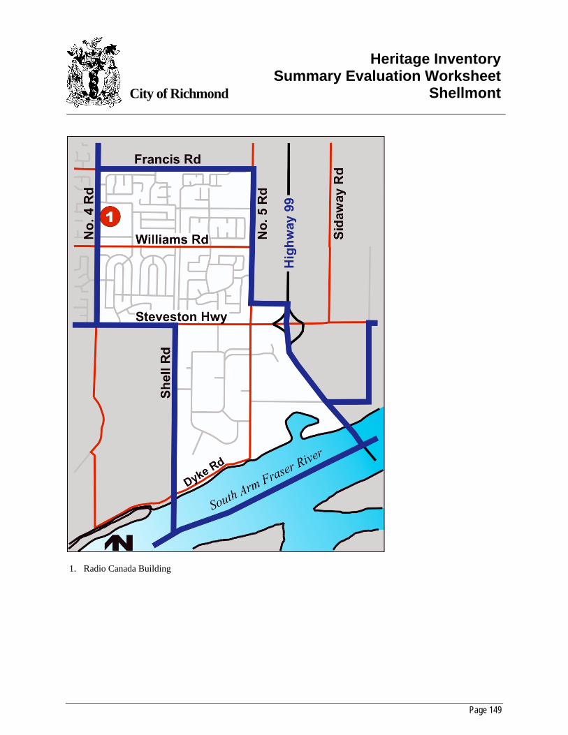
Page 149
City of Richmond
Heritage InventorySummary Evaluation Worksheet
Shellmont
1. Radio Canada Building
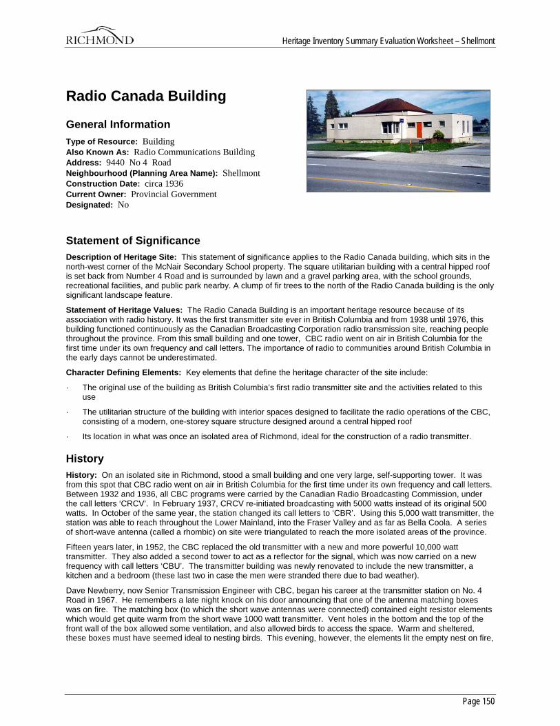
Heritage Inventory Summary Evaluation Worksheet – Shellmont
Page 150
Radio Canada Building
General Information Type of Resource: Building Also Known As: Radio Communications Building Address: 9440 No 4 Road Neighbourhood (Planning Area Name): Shellmont Construction Date: circa 1936 Current Owner: Provincial Government Designated: No
Statement of Significance Description of Heritage Site: This statement of significance applies to the Radio Canada building, which sits in the north-west corner of the McNair Secondary School property. The square utilitarian building with a central hipped roof is set back from Number 4 Road and is surrounded by lawn and a gravel parking area, with the school grounds, recreational facilities, and public park nearby. A clump of fir trees to the north of the Radio Canada building is the only significant landscape feature.
Statement of Heritage Values: The Radio Canada Building is an important heritage resource because of its association with radio history. It was the first transmitter site ever in British Columbia and from 1938 until 1976, this building functioned continuously as the Canadian Broadcasting Corporation radio transmission site, reaching people throughout the province. From this small building and one tower, CBC radio went on air in British Columbia for the first time under its own frequency and call letters. The importance of radio to communities around British Columbia in the early days cannot be underestimated.
Character Defining Elements: Key elements that define the heritage character of the site include:
· The original use of the building as British Columbia’s first radio transmitter site and the activities related to this use
· The utilitarian structure of the building with interior spaces designed to facilitate the radio operations of the CBC, consisting of a modern, one-storey square structure designed around a central hipped roof
· Its location in what was once an isolated area of Richmond, ideal for the construction of a radio transmitter.
History History: On an isolated site in Richmond, stood a small building and one very large, self-supporting tower. It was from this spot that CBC radio went on air in British Columbia for the first time under its own frequency and call letters. Between 1932 and 1936, all CBC programs were carried by the Canadian Radio Broadcasting Commission, under the call letters ‘CRCV’. In February 1937, CRCV re-initiated broadcasting with 5000 watts instead of its original 500 watts. In October of the same year, the station changed its call letters to ‘CBR’. Using this 5,000 watt transmitter, the station was able to reach throughout the Lower Mainland, into the Fraser Valley and as far as Bella Coola. A series of short-wave antenna (called a rhombic) on site were triangulated to reach the more isolated areas of the province.
Fifteen years later, in 1952, the CBC replaced the old transmitter with a new and more powerful 10,000 watt transmitter. They also added a second tower to act as a reflector for the signal, which was now carried on a new frequency with call letters ‘CBU’. The transmitter building was newly renovated to include the new transmitter, a kitchen and a bedroom (these last two in case the men were stranded there due to bad weather).
Dave Newberry, now Senior Transmission Engineer with CBC, began his career at the transmitter station on No. 4 Road in 1967. He remembers a late night knock on his door announcing that one of the antenna matching boxes was on fire. The matching box (to which the short wave antennas were connected) contained eight resistor elements which would get quite warm from the short wave 1000 watt transmitter. Vent holes in the bottom and the top of the front wall of the box allowed some ventilation, and also allowed birds to access the space. Warm and sheltered, these boxes must have seemed ideal to nesting birds. This evening, however, the elements lit the empty nest on fire,
Heritage Inventory Summary Evaluation Worksheet – Shellmont
Page 151
sending clouds of smoke into the air. It was all the Fire Department could do to shoot water up into the box sitting fifty feet above the ground. The pressure from their hoses only just made it.
When the wattage requirements rose to 50,000 watts in the late 1960's, a new transmission facility was built on the Steveston dyke and all operations were moved there in about 1969 and remain there to this day. The move was made as it was felt that the increased wattage was not appropriate for a residential neighbourhood. It was ideal timing, for there were others looking admiringly at the site and assessing its potential.
The site at No. 4 Road and Williams was an ideal location for a school and park according to the Municipality of Richmond. Two minor obstacles were in the way; first, the zoning must change from ‘residential’ to ‘school and park’; and second, an appropriate solution must be found for the transmitter building. When approached with the proposed zoning change, the CBC was not happy, fearing that the change in zoning would negate their ability to sell the property and thus be similar to an expropriation. Early terms in the process of negotiation included a suggested price for the land, the free use of existing buildings for five years, and that if the purchasers wished to divide the land into two legal lots, that they provide the legal descriptions.
Negotiations were in full swing by March of 1971, when the Richmond Law Department sent a memo to the School Board suggesting that the CBC was asking too much money for the site, especially when other developers were providing upgrades to the property. “They (Council) felt that a public body such as the CBC should not enjoy the full fruits and windfalls arising out of other developers constructing adjacent sewers, roads, etc.” (The Corporation of the Township of Richmond Memo, dated March 18, 1971, from W. T. Lane of the Law Department, to Mr. R. B. Wilkinson of the Richmond School Board) The CBC was asking $8,698.00 per acre and the Law Department wished to offer $5,785.00 per acre. Research does not clearly show the final agree-upon purchase price.
The Board of School Trustees and the Municipality of Richmond jointly purchased the school and park site in question from the Federal Government in 1971. In 1972, a lease was signed between the Richmond Board of School Trustees and the CBC in which the School Trustees granted the CBC “free uninterrupted use and possession of the existing buildings and associated lands” from February 01, 1972 until April 01, 1975 for the fee of $1.00 per year.
The new school, named McNair Senior Secondary School, first used the transmitter building as an instructional media centre. It was used as such until 1980, when provisions were made to convert it into a music facility. In a memo dated February 1981, the Supervisor of Music (Earl Hobson) stated that his initial impression of the building for conversion to the music facility was “good”. At the same time, he recommended that the south entrance stairs be replaced with a ramp and that the small window between the recording studio and the rehearsal studio be replaced because it was too small.
In 1989, school board staff conducted a study for a park plan of the entire site. The emphasis was on the playing fields and the importance of the park area as a neighbourhood and community park. No mention was made of the former transmitter building.
When extensive renovations were made to the school in the late 1990's in order to accommodate the growing number of students, the School Board contemplated demolishing the transmitter building. The decision was made, however, to retain the building and convert it to a district computer repair facility.

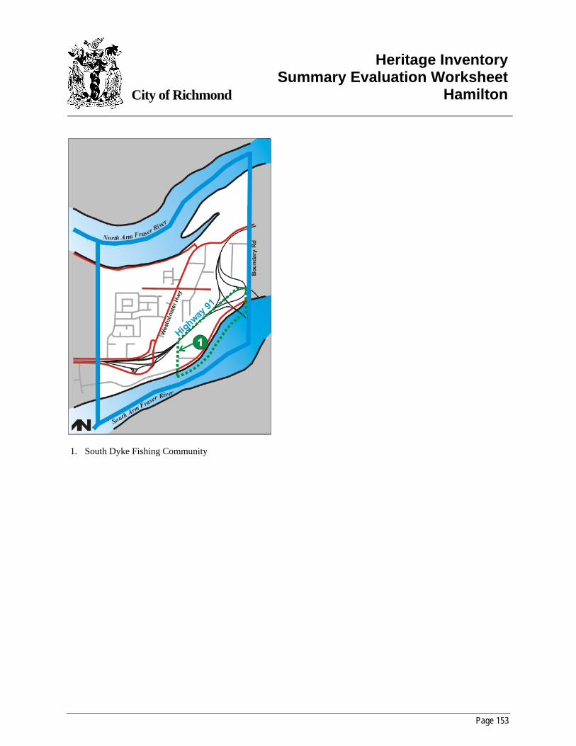
Page 153
City of Richmond
Heritage InventorySummary Evaluation Worksheet
Hamilton
1. South Dyke Fishing Community
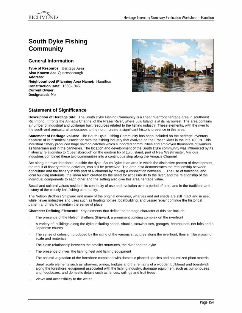
Heritage Inventory Summary Evaluation Worksheet – Hamilton
Page 154
South Dyke Fishing Community
General Information Type of Resource: Heritage Area Also Known As: Queensborough Address: Neighbourhood (Planning Area Name): Hamilton Construction Date: 1880-1945 Current Owner: Designated: No
Statement of Significance Description of Heritage Site: The South Dyke Fishing Community is a linear riverfront heritage area in southeast Richmond. It fronts the Annacis Channel of the Fraser River, where Lulu Island is at its narrowest. The area contains a number of industrial and utilitarian built resources related to the fishing industry. These elements, with the river to the south and agricultural landscapes to the north, create a significant historic presence in this area.
Statement of Heritage Values: The South Dyke Fishing Community has been included on the heritage inventory because of its historical association with the fishing industry that evolved on the Fraser River in the late 1800’s. This industrial fishery produced huge salmon catches which supported communities and employed thousands of workers as fishermen and in the canneries. The location and development of the South Dyke community was influenced by its historical relationship to Queensborough on the eastern tip of Lulu Island, part of New Westminster. Various industries combined these two communities into a continuous strip along the Annacis Channel.
Set along the river foreshore, outside the dyke, South Dyke is an area in which the distinctive pattern of development, the result of fishery related activities, can still be perceived. The area also demonstrates the relationship between agriculture and the fishery in this part of Richmond by making a connection between…. The use of functional and local building materials, the linear form created by the need for accessibility to the river, and the relationship of the individual components to each other and the setting also give this area heritage value.
Social and cultural values reside in its continuity of use and evolution over a period of time, and in the traditions and history of the closely-knit fishing community.
The Nelson Brothers Shipyard and many of the original dwellings, wharves and net sheds are still intact and in use, while newer industries and uses such as floating homes, boatbuilding, and vessel repair continue the historical pattern and help to maintain the sense of place.
Character Defining Elements: Key elements that define the heritage character of this site include:
· The presence of the Nelson Brothers Shipyard, a prominent building complex on the riverfront
· A variety of buildings along the dyke including sheds, shacks, scowhouses, garages, boathouses, net lofts and a Japanese church
· The sense of cohesion produced by the siting of the various structures along the riverfront, their similar massing, scale and materials
· The close relationship between the smaller structures, the river and the dyke
· The presence of river, the fishing fleet and fishing equipment
· The natural vegetation of the foreshore combined with domestic planted species and naturalized plant material
· Small scale elements such as wharves, pilings, bridges and the remains of a wooden bulkhead and boardwalk along the foreshore, equipment associated with the fishing industry, drainage equipment such as pumphouses and floodboxes, and domestic details such as fences, railings and fruit trees
· Views and accessibility to the water

Heritage Inventory Summary Evaluation Worksheet – Hamilton
Page 155
· Perceptual elements such as the sounds and smells of the river and foreshore
· The historical association of the homes located on the dyke on the south side of the ditch with the farm buildings and fields on the north side
· The continuation of the development pattern across Boundary Road into Queensborough, showing continuity between the physical and historical patterns of the two areas.
History History: Historic time period:
The significant time period for the South Dyke Fishing Community starts at the beginning of the fishing industry on the Fraser River in the late 1870’s, and ends with the demise of the fishing industry after World War II, about 1945.
Extant resources:
There are no resources in this area that appear on the heritage inventory. However, there area a number of vernacular built resources which, with the river and agricultural landscapes, create a significant grouping. These include the Nelson Brothers Shipyard buildings, various small residences, wharves and pilings, and the remains of a wooden bulkhead and boardwalk.
Distinction:
The South Dyke Fishing Community is clearly distinguishable from adjacent properties as it has developed and been maintained very differently than its surroundings. Visually, it has a distinct character of small wooden buildings in a linear pattern along the riverfront landscape, with fishing boats and wharves. Notwithstanding new development in the area, it still maintains an integrity of historic character.
Boundaries:
The proposed boundaries run from Queen Road in the west to Boundary Road in the east. To the south, the boundary includes the foreshore of the Fraser River, and to the north, to the CNR tracks, which encompasses the important agricultural landscapes associated with the foreshore homes. Alternatively, and more modestly, the northern boundary could run along the northern side of the Dyke Road drainage ditch.
Overall sense of place and historic character:
The South Dyke Fishing Community maintains a unique sense of place because of the vernacular evidence of its history in the modest houses and the shipyard. The immediacy of the river, the presence of the fishing fleet and its equipment, and the continuity of use in the area contribute to the historic character.
Historic Criteria:
Area History:
The history of the South Dyke area is reflected in three themes: the rise and fall of the Fraser River salmon fishery, the settlement of East Richmond as an agricultural area, and the development of the Queensborough area of New Westminster.
The industrial fishery on the Fraser River began in the late 1870’s and reached its peak in the 1890’s, producing huge salmon catches which supported communities, employed thousands of workers in the fishing and canning industries, and generated vast sums of money. The majority of the workers in the early years of the fishery were First Nations peoples and immigrants from Europe, Japan, China, and other areas of the world. This was true of the South Dyke area as well; it was settled during the height of the Fraser River salmon industry with the construction of houses, net sheds, wharves, and other fishing related structures on and along the dyke. The Annacis Channel provided some shelter from the strong tidal flow of the river, and a small community formed distinct from the surrounding farms with a focus and dependence upon the salmon runs.
The eastern tip of Lulu Island was acquired by the city of New Westminster in 1889. Manufacturing, lumber mills and canneries were the early industries on the Queensborough riverfront, which paralleled the development of the South Dyke area into a fishing and fishing-industry related area, creating a linear strip of industry along the Annacis Channel. This identification of the South Dyke area with its neighbour to the east was to continue into the present day.
At the same time, the agricultural lands immediately to the north were being subdivided and turned into farms. Like most early settlers, the farmers here dyked and ditched their holdings to create viable farm land until 1905, when a local petition called for the formation of a commission to maintain dyking and drainage. This extreme eastern portion of Lulu Island was administered by Richmond municipal council. The peat soils of this area of Richmond were used to
Heritage Inventory Summary Evaluation Worksheet – Hamilton
Page 156
grow cranberries, blueberries and strawberries, and to raise cattle for beef and dairy products. Because of the perception that the soil was not suitable for farming, the agriculture industry was not fully developed until the 1920’s. Farmers and fishermen of many nationalities either lived along the dyke, or maintained net lofts, boat sheds and wharves there.
In 1912, a scheme was proposed that would have changed the South Dyke character, and perhaps the fishery, forever. Called the Annacis Harbour Improvement scheme, it showed the Annacis Channel as the ‘Westminster Waterway’, blocked at the east end and flanked by warehouses and docking facilities stretching east and west on both sides. As with the Sturgeon Banks scheme at Steveston earlier, the plan was eventually abandoned.
In the 1890’s, the Lulu Island Road crossed Queensborough and followed Boundary Road to Dyke Road which allowed the transport of produce between Richmond and the markets in New Westminster. In 1914, the Canadian National Railway built a line to connect New Westminster and Steveston. However, it was destroyed by fire two years later, reconstructed, and shut down from 1917 to 1932. Lack of money and the sparse population in the area affected the construction of transportation routes between New Westminster and Richmond, again keeping the South Dyke area relatively isolated from the rest of Richmond.
By the 1920’s and 1930’s, the sockeye runs on the Fraser were insignificant by comparison to earlier runs due to the affects of both overfishing and environmental disasters such as the Hell’s Gate blockade in 1914 and the loss of salmon habitat through resource development. Fishing and canning companies reorganized to control the fishery and deal with the decline in salmon and profits. B.C. Packers and the Canadian Fishing Company emerged in control of the canning, and thus the fishing, industries. After World War II, the fishing industry rebounded, with pink, chum and herring, as well as sockeye, contributing to the income of cannery workers and fishers. Chinook and Coho were harvested by the troll fishery, which was expanded by Richard and Norman Nelson.
The most prominent structure on the South Dyke site, the Nelson Brothers Shipyard was constructed in 1938 and expanded over a period of years. It was a wooden boat shipyard, constructing small seine boats and gillnetters to serve the local fishing industry, and was known as the Queensborough Shipyard because the area was considered an extension of New Westminster’s Annacis Channel fishing and industrial community. The residents of the South Dyke fishing community often sought services in Queensborough which were closer than in other parts of Richmond. However, there were a few ongoing conflicts regarding the maintenance of roads and other infrastructure between the two municipalities.
Today the fishery is again in decline. The Nelson Brothers merged with B.C. Packers in 1969, and the Shipyard was purchased by Canadian Fishing Company and shut down in 1995. The buyback of fishing licences due to the lack of fish created an excess of vessels in the fleet and halted the construction of new fishing boats, which in turn decreased the activity in the South Dyke area. The South Dyke community also suffered during expropriation of land when the Annacis crossing was constructed. Currently, the policy for this area is to promote a mix of land uses here, which may include marine industry, commercial and pleasure craft marinas, and both conventional and floating or pier housing.
Sites:
No significant heritage or archaeological sites were identified in this heritage area.
Development pattern:
Crown grants were appropriated in the South Dyke area in 1907, but according to earlier documentation, settlement in this area began late in the previous century, around 1880, with the rise of the industrial salmon fishery on the Fraser River.
Since it appears from plans dated 1936 that Dyke Road provided the access to the farmland, most of the earlier structures are clustered at the southeast portion of the lots, along Dyke Road and adjacent to the river. These plans also indicate property lines for some of the properties that run across the ditch and the dyke to the edge of the river. Some of the homes located on the dyke on the south side of the ditch are clearly associated with the farm buildings and fields on the north side.
As well as homes, other buildings located along the dyke included sheds, shacks, scowhouses, garages, boathouses, net lofts and a Japanese church. This pattern continues across Boundary Road into Queensborough, indicating a strong continuity between both the physical construction and historical patterns of these two areas.
The pattern of land division in the heritage area reflects that shown on earlier plans; however, further subdivision and development has occurred in the areas surrounding it, particularly to the east in Queensborough where new housing is under construction, and west in Richmond with the development of industrial parks.
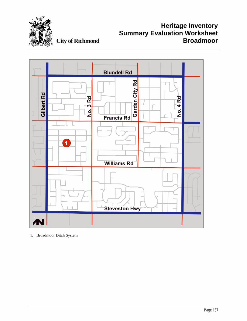
Page 157
City of Richmond
Heritage InventorySummary Evaluation Worksheet
Broadmoor
1. Broadmoor Ditch System
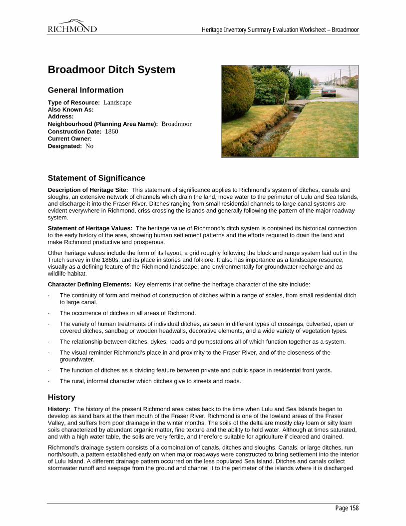
Heritage Inventory Summary Evaluation Worksheet – Broadmoor
Page 158
Broadmoor Ditch System
General Information Type of Resource: Landscape Also Known As: Address: Neighbourhood (Planning Area Name): Broadmoor Construction Date: 1860 Current Owner: Designated: No
Statement of Significance Description of Heritage Site: This statement of significance applies to Richmond’s system of ditches, canals and sloughs, an extensive network of channels which drain the land, move water to the perimeter of Lulu and Sea Islands, and discharge it into the Fraser River. Ditches ranging from small residential channels to large canal systems are evident everywhere in Richmond, criss-crossing the islands and generally following the pattern of the major roadway system.
Statement of Heritage Values: The heritage value of Richmond’s ditch system is contained its historical connection to the early history of the area, showing human settlement patterns and the efforts required to drain the land and make Richmond productive and prosperous.
Other heritage values include the form of its layout, a grid roughly following the block and range system laid out in the Trutch survey in the 1860s, and its place in stories and folklore. It also has importance as a landscape resource, visually as a defining feature of the Richmond landscape, and environmentally for groundwater recharge and as wildlife habitat.
Character Defining Elements: Key elements that define the heritage character of the site include:
· The continuity of form and method of construction of ditches within a range of scales, from small residential ditch to large canal.
· The occurrence of ditches in all areas of Richmond.
· The variety of human treatments of individual ditches, as seen in different types of crossings, culverted, open or covered ditches, sandbag or wooden headwalls, decorative elements, and a wide variety of vegetation types.
· The relationship between ditches, dykes, roads and pumpstations all of which function together as a system.
· The visual reminder Richmond’s place in and proximity to the Fraser River, and of the closeness of the groundwater.
· The function of ditches as a dividing feature between private and public space in residential front yards.
· The rural, informal character which ditches give to streets and roads.
History History: The history of the present Richmond area dates back to the time when Lulu and Sea Islands began to develop as sand bars at the then mouth of the Fraser River. Richmond is one of the lowland areas of the Fraser Valley, and suffers from poor drainage in the winter months. The soils of the delta are mostly clay loam or silty loam soils characterized by abundant organic matter, fine texture and the ability to hold water. Although at times saturated, and with a high water table, the soils are very fertile, and therefore suitable for agriculture if cleared and drained.
Richmond’s drainage system consists of a combination of canals, ditches and sloughs. Canals, or large ditches, run north/south, a pattern established early on when major roadways were constructed to bring settlement into the interior of Lulu Island. A different drainage pattern occurred on the less populated Sea Island. Ditches and canals collect stormwater runoff and seepage from the ground and channel it to the perimeter of the islands where it is discharged
Heritage Inventory Summary Evaluation Worksheet – Broadmoor
Page 159
into the river. The major drainage channels are fed from smaller ditches surrounding individual properties or running along minor roadways. Sloughs are also utilized as drainage conveyances and outlets. Both ditches and sloughs have floodboxes or pumpstations at their outlets to control the discharge or intake of water.
Early landowners who settled near watercourses such as the river and the sloughs established ditches that drained into these channels. From the beginning, the natural channels of Richmond were utilized as part of the overall drainage system. This pattern of canal and ditch has its origins in the early efforts of settlers and farmers who dug their drainage ditches by hand in accordance with Richmond’s natural water courses and drainage patterns.
Ditch construction, along with dyke construction and clearing, would have proceeded immediately following settlement in the late 1860’s, as the land was unsuitable for cultivation, settlement or transportation until it had been drained. As with the dyke system, the early ditches were excavated by landowners on an individual basis. Farmers could not risk flooding and heavy rains as their livelihood depended upon their ability to farm the land. Richmond’s land surface is at most about 10 feet above sea level, and remains below the level of flood tide. Frequent flooding meant that settlers had to work constantly to drain their land, and most of the year settlers wore gumboots everywhere, and travelled by rowboat.
Canals and ditches naturally drew seepage water away from the fields and acted as channels for surface runoff. These channels were directed to the edges of the islands where floodboxes were installed to regulate the flow of water and prevent river water from entering the drainage channels at high tides. These early floodboxes, from specifications dated 1900, were made of drift bolted fir and cedar, with doors and a floor having a slight fall downstream, level with the low water mark. The boxes operated mechanically according to the balance of water pressure between the river and the drainage ditches. Archie Blair describes the early ditches as…”narrow trenches with cedar slabs across…these lasted many years”.
Eventually, however, the municipality became involved in drainage works. Thomas Kidd notes that in 1882, most of the Council revenue was used for the construction of drainage ditches along the lines of future roads. During the years 1882 and 1883, major road ditches were constructed along No. 2, No. 5 Road and No. 9 roads. 1886 saw a flurry of petitions for the construction of road ditches submitted to council, which did its best to accommodate them with the funds available. According to Kidd, many of the petitioners were not so concerned about getting roads as they were to get outlets for the smaller ditches that drained their land.
In 1906, the floating dredge came into use as a method of ditch construction. This allowed the easy excavation of larger canals across Lulu Island, which followed the grid layout of the early surveys. It also delineated the major roads across the island as material excavated from the ditches was used as fill for early roadbeds.
A report by W.G. Swan from 1926 outlines an extensive analysis of Richmond’s drainage, and makes recommendations for an extension to the existing system. This report was prepared for the Lulu Island West Dyking District, one of three administrative bodies formed around 1905 to oversee dyking and drainage works, and is an indication that an organized effort to improve the drainage in Richmond was underway.
In 1935, the old wooden or concrete floodboxes began to be replaced with new electrical pumps, the first being installed at Finn Slough, the north end of No. 4 Road and the south end of No. 3 Road. These pumps allowed farmers to begin cultivation on their fields earlier in the year, and kept fields previously underwater much of the time free of standing water except following heavy rains. By means of an adjustable float, the pump began to operate when the level of the water in the drainage ditch or canal reached a certain level, and shut off when the water dropped to an acceptable depth. Plans showing a cross-section of these pumps, and their relationship to the canal and dyke, is available in the archives.
In 1937, all responsibility for drainage was put under the direct control of City Council and the Inspector of Municipalities. This allowed a co-ordinated effort for the construction of dykes, the installation of pumps, and the excavation of ditches. The drainage system falls under the provision of the Municipalities Enabling and Validating Act of 1959 which allows the acquisition of land occupied by dyking and drainage systems in the Municipality, and “…adjacent lands reasonably required by the Corporation for the support and maintenance of the dyke and canal systems.”
Richmond Council received its share of requests and complaints regarding the drainage system through the years, beginning with the early petitioners back in 1886. Requests for the cleaning out of ditches, floodboxes and culverts were common, as landowners watched water back up and saturate their agricultural fields. Les Gilmore, in 1962, writes “…to my knowledge [this ditch] has never been cleaned since being dug approximately 55 years ago; and during this time we have continued to pay drainage taxes”. Statements of claim as early as 1926 note that outlets have not been provided for ditches, floodgates are not sufficient nor in good working order, suction pipes are inadequate…the list goes on. With regard to drainage repair and maintenance, Richmond council had its work cut out.
Heritage Inventory Summary Evaluation Worksheet – Broadmoor
Page 160
The City of Richmond currently operates 32 pumpstations around its perimeter and 6 internally. Two-thirds of the water drained from the land is released through natural water hydraulics; the remainder is moved by the pumps. Canals act as a secondary system if the pumpstations are at full capacity; they collect and store water until the stations are able to handle it. Pumpstations are also used to let water in to the drainage ditches for irrigation purposes and for cranberry harvesting which is done by flooding the fields. Irrigation valves are located at various points around the perimeter of Lulu Island.
The City also cleans out the ditches under its jurisdiction on a regular basis. Citizens must apply to the City for permission to install a culvert in, or a bridge crossing over, ditches, canals or sloughs. In 1973 a drainage plan was prepared which advocated underground culverts in urban areas, lined channels in industrial areas, and open ditches in rural areas, with remaining sloughs retained as open channels for amenity reasons. In 1992, the City planning department prepared a report addressing the conflicts between drainage requirements and wildlife and recreational values in and along the canals, sloughs and ditches. This report noted the designation of several canals and sloughs as environmentally sensitive areas, and advocates a balance between drainage needs, and environmental and recreational potential.
Richmond’s ditches have also been immortalized in literature. An unpublished MA thesis by Anthony Southgate entitled “Killer Ditches” is a fiction thriller which uses Richmond dykes and ditches as the setting. The manuscript describes the relationship between dyke, ditch and roadway; the many small bridges which cross the ditches, and the dangers inherent in ditches at high tide.
Richmond’s residential ditches are the smallest in the hierarchy, providing drainage at the neighbourhood level. Jelliffe (1972) notes that the two big canals, running along No. 1 and No. 3 Roads, were places to swim for the children of Richmond early in the century. All of the ditches provided a place for exploration and games, and a place to see aquatic creatures in their natural habitat.
Page 161
City of Richmond
Heritage InventoryAppendix I
Chronology of Historical Events
5500 – 1500 Before Present: Proto Coast Salish cultural tradition at the mouth of the Fraser River
1782: A smallpox epidemic kills three-quarters of the Coast Salish population.
1791: The Spanish explorer Narvaez explores the area and notes the water of the Fraser River.
1808: Simon Fraser reaches the mouth of the North Arm off Sea Island.
1825: The South Arm is charted for the Hudsons Bay company by William and Ann.
1858: The mainland territory of New Caledonia becomes the Crown colony of British Columbia.
1859: John Trutch surveys most of the islands at the mouth of the Fraser.
1861: Colonel Moody names Lulu Island for Lulu Sweet, an American actress. Hugh McRoberts receives his Crown grant on Sea Island.
1862: Hugh McRoberts begins farming on Sea Island, becoming the first settler in Richmond.
1863: The name Lulu Island first appears on a published British Admiralty chart.
1866: Vancouver Island and British Columbia are united as one Crown Colony.
1871: British Columbia enters Confederation. The first white child is born in Richmond.
Heritage Inventory – Appendix I – Chronology of Historical Events
Page 162
1874: The survey of the Slough District, on the south arm of the Fraser River, is completed.
1877: Manoah Steves and his family arrive, and establish the following year a home in the south-western corner of Lulu Island.
1879: Lulu Island and Sea Island are incorporated as “The Corporation of the Township of Richmond”.
1880: The first municipal election is held.
1882: The first cannery in the municipality, the Phoenix, is built.
1888: The Townsite of Steveston is subdivided.
1889: Connecting bridges with the mainland between Lulu and Sea Islands are completed.
1891: The first telephone line in Richmond is installed in Steveston.
1902: The first passenger train arrives in Steveston.
1909: Brighouse Park (now Minoru Park) opens.
1912: Town Hall burns down and is not rebuilt until seven years later. A water system is installed in Richmond.
1914: The First World War breaks out.
1916: The Vancouver side of Eburne is renamed Marpole.
1918: A major fire in Steveston on May 14th destroys three canneries, three hotels, many residences and much of the business district. End of the First World War.
Heritage Inventory – Appendix I – Chronology of Historical Events
Page 163
1922: All traffic in BC shifts to right hand drive.
1924: Lansdowne Track is opened.
1925: The United Church is formed.
1929: Start of the Great Depression.
1931: The Vancouver Airport on Sea Island is opened on July 22nd.
1939: The Second World War breaks out. Steveston votes to remain “dry”.
1942: Residents of Japanese ancestry are removed from the municipality.
1944: Burkeville’s first residents move in.
1945: End of the Second World War.
1948: Major flooding of the Fraser River.
1954: Richmond’s telephone system is converted from a manual to a dial exchange. Land expropriations begin for the expansion of the Vancouver International Airport.
1957: The Oak Street Bridge opens. A new Municipal Hall is built.
1959: The Deas Island Tunnel is opened to traffic and ferry service ceases between Woodward’s Landing and Ladner, on May 23rd.
1965: The Richmond Square shopping mall is opened.
Heritage Inventory – Appendix I – Chronology of Historical Events
Page 164
1968: The new terminal building is opened at Vancouver International Airport.
1974: The Knight Street Bridge is opened.
1976: The Arthur Laing Bridge is opened.
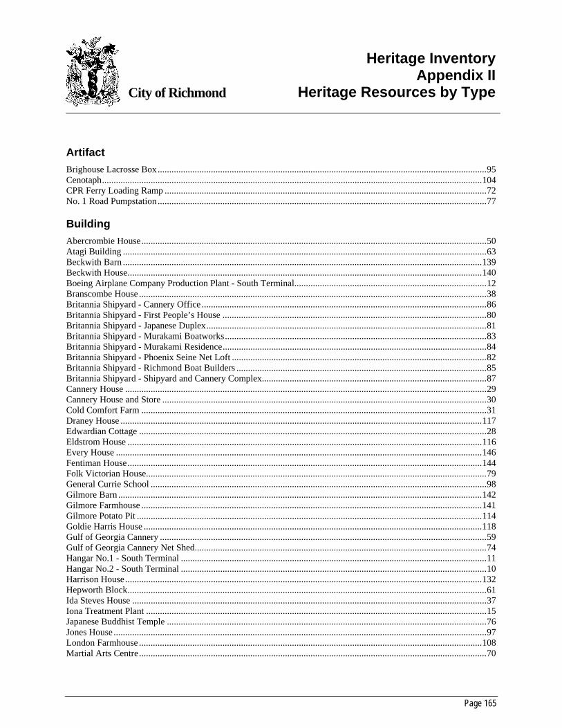
Page 165
City of Richmond
Heritage InventoryAppendix II
Heritage Resources by Type
Artifact Brighouse Lacrosse Box..............................................................................................................................................95 Cenotaph....................................................................................................................................................................104 CPR Ferry Loading Ramp ...........................................................................................................................................72 No. 1 Road Pumpstation ..............................................................................................................................................77
Building Abercrombie House.....................................................................................................................................................50 Atagi Building .............................................................................................................................................................63 Beckwith Barn ...........................................................................................................................................................139 Beckwith House.........................................................................................................................................................140 Boeing Airplane Company Production Plant - South Terminal...................................................................................12 Branscombe House ......................................................................................................................................................38 Britannia Shipyard - Cannery Office ...........................................................................................................................86 Britannia Shipyard - First People’s House ..................................................................................................................80 Britannia Shipyard - Japanese Duplex.........................................................................................................................81 Britannia Shipyard - Murakami Boatworks.................................................................................................................83 Britannia Shipyard - Murakami Residence..................................................................................................................84 Britannia Shipyard - Phoenix Seine Net Loft ..............................................................................................................82 Britannia Shipyard - Richmond Boat Builders ............................................................................................................85 Britannia Shipyard - Shipyard and Cannery Complex.................................................................................................87 Cannery House ............................................................................................................................................................29 Cannery House and Store ............................................................................................................................................30 Cold Comfort Farm .....................................................................................................................................................31 Draney House ............................................................................................................................................................117 Edwardian Cottage ......................................................................................................................................................28 Eldstrom House .........................................................................................................................................................116 Every House ..............................................................................................................................................................146 Fentiman House.........................................................................................................................................................144 Folk Victorian House...................................................................................................................................................79 General Currie School .................................................................................................................................................98 Gilmore Barn .............................................................................................................................................................142 Gilmore Farmhouse ...................................................................................................................................................141 Gilmore Potato Pit .....................................................................................................................................................114 Goldie Harris House ..................................................................................................................................................118 Gulf of Georgia Cannery .............................................................................................................................................59 Gulf of Georgia Cannery Net Shed..............................................................................................................................74 Hangar No.1 - South Terminal ....................................................................................................................................11 Hangar No.2 - South Terminal ....................................................................................................................................10 Harrison House..........................................................................................................................................................132 Hepworth Block...........................................................................................................................................................61 Ida Steves House .........................................................................................................................................................37 Iona Treatment Plant ...................................................................................................................................................15 Japanese Buddhist Temple ..........................................................................................................................................76 Jones House .................................................................................................................................................................97 London Farmhouse ....................................................................................................................................................108 Martial Arts Centre......................................................................................................................................................70
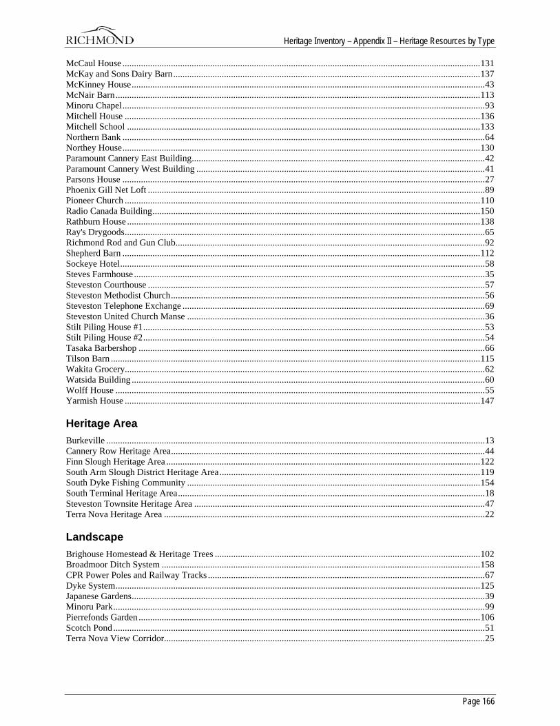
Heritage Inventory – Appendix II – Heritage Resources by Type
Page 166
McCaul House ...........................................................................................................................................................131 McKay and Sons Dairy Barn.....................................................................................................................................137 McKinney House.........................................................................................................................................................43 McNair Barn..............................................................................................................................................................113 Minoru Chapel.............................................................................................................................................................93 Mitchell House ..........................................................................................................................................................136 Mitchell School .........................................................................................................................................................133 Northern Bank .............................................................................................................................................................64 Northey House...........................................................................................................................................................130 Paramount Cannery East Building...............................................................................................................................42 Paramount Cannery West Building .............................................................................................................................41 Parsons House .............................................................................................................................................................27 Phoenix Gill Net Loft ..................................................................................................................................................89 Pioneer Church ..........................................................................................................................................................110 Radio Canada Building..............................................................................................................................................150 Rathburn House .........................................................................................................................................................138 Ray's Drygoods............................................................................................................................................................65 Richmond Rod and Gun Club......................................................................................................................................92 Shepherd Barn ...........................................................................................................................................................112 Sockeye Hotel..............................................................................................................................................................58 Steves Farmhouse ........................................................................................................................................................35 Steveston Courthouse ..................................................................................................................................................57 Steveston Methodist Church........................................................................................................................................56 Steveston Telephone Exchange ...................................................................................................................................69 Steveston United Church Manse .................................................................................................................................36 Stilt Piling House #1....................................................................................................................................................53 Stilt Piling House #2....................................................................................................................................................54 Tasaka Barbershop ......................................................................................................................................................66 Tilson Barn ................................................................................................................................................................115 Wakita Grocery............................................................................................................................................................62 Watsida Building .........................................................................................................................................................60 Wolff House ................................................................................................................................................................55 Yarmish House ..........................................................................................................................................................147
Heritage Area Burkeville ....................................................................................................................................................................13 Cannery Row Heritage Area........................................................................................................................................44 Finn Slough Heritage Area ........................................................................................................................................122 South Arm Slough District Heritage Area.................................................................................................................119 South Dyke Fishing Community ...............................................................................................................................154 South Terminal Heritage Area.....................................................................................................................................18 Steveston Townsite Heritage Area ..............................................................................................................................47 Terra Nova Heritage Area ...........................................................................................................................................22
Landscape Brighouse Homestead & Heritage Trees ...................................................................................................................102 Broadmoor Ditch System ..........................................................................................................................................158 CPR Power Poles and Railway Tracks ........................................................................................................................67 Dyke System..............................................................................................................................................................125 Japanese Gardens.........................................................................................................................................................39 Minoru Park.................................................................................................................................................................99 Pierrefonds Garden ....................................................................................................................................................106 Scotch Pond .................................................................................................................................................................51 Terra Nova View Corridor...........................................................................................................................................25
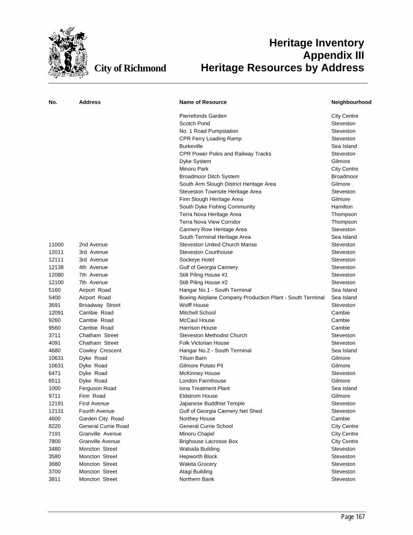
Page 167
City of Richmond
Heritage InventoryAppendix III
Heritage Resources by Address
No. Address Name of Resource Neighbourhood Pierrefonds Garden City Centre Scotch Pond Steveston No. 1 Road Pumpstation Steveston CPR Ferry Loading Ramp Steveston Burkeville Sea Island CPR Power Poles and Railway Tracks Steveston Dyke System Gilmore Minoru Park City Centre Broadmoor Ditch System Broadmoor South Arm Slough District Heritage Area Gilmore Steveston Townsite Heritage Area Steveston Finn Slough Heritage Area Gilmore South Dyke Fishing Community Hamilton Terra Nova Heritage Area Thompson Terra Nova View Corridor Thompson Cannery Row Heritage Area Steveston South Terminal Heritage Area Sea Island 11000 2nd Avenue Steveston United Church Manse Steveston 12011 3rd Avenue Steveston Courthouse Steveston 12111 3rd Avenue Sockeye Hotel Steveston 12138 4th Avenue Gulf of Georgia Cannery Steveston 12080 7th Avenue Stilt Piling House #1 Steveston 12100 7th Avenue Stilt Piling House #2 Steveston 5160 Airport Road Hangar No.1 - South Terminal Sea Island 5400 Airport Road Boeing Airplane Company Production Plant - South Terminal Sea Island 3691 Broadway Street Wolff House Steveston 12091 Cambie Road Mitchell School Cambie 9260 Cambie Road McCaul House Cambie 9560 Cambie Road Harrison House Cambie 3711 Chatham Street Steveston Methodist Church Steveston 4091 Chatham Street Folk Victorian House Steveston 4680 Cowley Crescent Hangar No.2 - South Terminal Sea Island 10631 Dyke Road Tilson Barn Gilmore 10631 Dyke Road Gilmore Potato Pit Gilmore 6471 Dyke Road McKinney House Steveston 6511 Dyke Road London Farmhouse Gilmore 1000 Ferguson Road Iona Treatment Plant Sea Island 9711 Finn Road Eldstrom House Gilmore 12191 First Avenue Japanese Buddhist Temple Steveston 12131 Fourth Avenue Gulf of Georgia Cannery Net Shed Steveston 4600 Garden City Road Northey House Cambie 8220 General Currie Road General Currie School City Centre 7191 Granville Avenue Minoru Chapel City Centre 7800 Granville Avenue Brighouse Lacrosse Box City Centre 3480 Moncton Street Watsida Building Steveston 3580 Moncton Street Hepworth Block Steveston 3680 Moncton Street Wakita Grocery Steveston 3700 Moncton Street Atagi Building Steveston 3811 Moncton Street Northern Bank Steveston
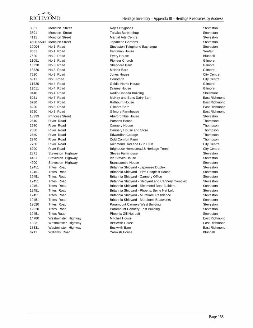
Heritage Inventory – Appendix III – Heritage Resources by Address
Page 168
3831 Moncton Street Ray's Drygoods Steveston 3891 Moncton Street Tasaka Barbershop Steveston 4111 Moncton Street Martial Arts Centre Steveston 4600-5500 Moncton Street Japanese Gardens Steveston 12004 No 1 Road Steveston Telephone Exchange Steveston 8051 No 1 Road Fentiman House Seafair 7620 No 2 Road Every House Blundell 11051 No 3 Road Pioneer Church Gilmore 13320 No 3 Road Shepherd Barn Gilmore 13320 No 3 Road McNair Barn Gilmore 7620 No 3 Road Jones House City Centre 6911 No 3 Road Cenotaph City Centre 11620 No 4 Road Goldie Harris House Gilmore 12011 No 4 Road Draney House Gilmore 9440 No 4 Road Radio Canada Building Shellmont 5031 No 7 Road McKay and Sons Dairy Barn East Richmond 5780 No 7 Road Rathburn House East Richmond 6220 No 8 Road Gilmore Barn East Richmond 6220 No 8 Road Gilmore Farmhouse East Richmond 13333 Princess Street Abercrombie House Steveston 2640 River Road Parsons House Thompson 2680 River Road Cannery House Thompson 2680 River Road Cannery House and Store Thompson 2680 River Road Edwardian Cottage Thompson 2840 River Road Cold Comfort Farm Thompson 7760 River Road Richmond Rod and Gun Club City Centre 6900 River Road Brighouse Homestead & Heritage Trees City Centre 2871 Steveston Highway Steves Farmhouse Steveston 4431 Steveston Highway Ida Steves House Steveston 4900 Steveston Highway Branscombe House Steveston 12451 Trites Road Britannia Shipyard - Japanese Duplex Steveston 12451 Trites Road Britannia Shipyard - First People’s House Steveston 12451 Trites Road Britannia Shipyard - Cannery Office Steveston 12451 Trites Road Britannia Shipyard - Shipyard and Cannery Complex Steveston 12451 Trites Road Britannia Shipyard - Richmond Boat Builders Steveston 12451 Trites Road Britannia Shipyard - Phoenix Seine Net Loft Steveston 12451 Trites Road Britannia Shipyard - Murakami Residence Steveston 12451 Trites Road Britannia Shipyard - Murakami Boatworks Steveston 12620 Trites Road Paramount Cannery West Building Steveston 12620 Trites Road Paramount Cannery East Building Steveston 12451 Trites Road Phoenix Gill Net Loft Steveston 14780 Westminster Highway Mitchell House East Richmond 18331 Westminster Highway Beckwith House East Richmond 18331 Westminster Highway Beckwith Barn East Richmond 6711 Williams Road Yarmish House Blundell


![Sutherland Heritage Inventory SHI Number...2440194 Sutherland Heritage Inventory SHI Number Item Name: Beckton Recreational Group Location: 20-24 Beckton Place, Lilli Pilli [Sutherland]](https://static.documents.pub/doc/80x56/5e7f01431876016f327668b1/sutherland-heritage-inventory-shi-2440194-sutherland-heritage-inventory-shi.jpg)