MARR Mn nao,; Ku - *s WRITTEN HISTORICAL MO DESCRIPTIVE DATA Historic- American Buildings Survey Katioratl Park Service Western Region Department of t)*e. Interior Ban Francisco, California 94102
Transcript
MARR Mn nao,; Ku - *s
WRITTEN HISTORICAL MO DESCRIPTIVE DATA
Historic- American Buildings Survey Katioratl Park Service
Western Region Department of t)*e. Interior
Ban Francisco, California 94102
.^^,'
We 5
HISTORIC AMERICAN BUILDINGS SURVEY KIEL RANCH
HABS NO. NV-19
Location: North side of Carey Avenue, between Losee Road and Commerce Street, 2 00 West Carey Avenue, Parcel #100-330-012 (Latitude 36 12'11.5" Longitude 115 8*9.4"). See Appendix A for legal description. North Las Vegas, Clark County, Nevada
Dates of Construction:
t A. B. C. D. E. F. G. H. I. J.
Present Owner:
Present Use:
Park Mansion (White House) (1911) Adobe Structure (circa 1856—1872) Remnant House (unknown) Foreman's House (1924) Doll House (circa 1939—1940) Brown House (1912) Cinderblock Duplex (1939) Wooden Duplex (1939) Livestock Shed (unknown) Other Structures (modern era)
City of North Las Vegas 22 00 Civic Center Drive North Las Vegas, Nevada 89030
Unimproved historic site. The City Council has approved a concept development plan to rehabilitate the White House and to preserve the Adobe Structure and Dollhouse on a three to five acre historic park. The remaining deteriorated structures are scheduled for demolition after completion of the historic recorda- tion. Remaining acreage will be developed for industrial uses. Revenues from the sale and/or lease of the land will assist in rehabilitation of the White House and development of the historic park.
*
KIEL RANCH HABS. NO. NV-19 Page 2
Significance: The Kiel Ranch, established as an "Indian Farm" in 1856 by The Church of Jesus Christ of Latter- day Saints (LDS) missionaries, has reflected the life and times of the Las Vegas Valley, as shown by the following benchmark dates:
1884—Conrad Kiel files original land patent 1901—Sold by Kiel heirs to railroad 1911—John Park purchases and builds mansion 1924—Park sells to industrialist Edward Taylor 1926—1953—Taylor Ranch rented and leased out 1939—Edwin Losee leases for Boulderado Dude Ranch 1953—James Losee purchases to continue dude ranch 1961—Losee sells to developers 1974—Purchased by North Las Vegas
Bicentennial Committee 1976—Donated to City of North Las Vegas
t Historian: Phyllis T. Martin
Office of Economic Development City of North Las Vegas May, 1988
Architectural Descriptions:
Roger Condie Building & Permit Center City of North Las Vegas
Editing: Patricia L. Howard Office of Economic Development City of North Las Vegas
Word- Processing:
Ophelia V. Lewis Office of Economic Development City of North Las Vegas
Special thanks to City of North Las Vegas staff: Joe Kolasky, Public Works; John Murchie, Engineering; Lisa Kwiecien, Engineering; Randy Cagle, Real Property Agent and William Ludwig, North Las Vegas Library. Also, special thanks to Frank Hulse, Lincoln County Recorder; Kathryn Kuranda, State of Nevada Division of Historic Preservation & Archeology; Kathleen Myers, Chicago Title Insurance Company of Las Vegas, Inc.; Susan Jarvis, University of Nevada Las Vegas Library, Special Collections; and to Elizabeth Warren, Cultural Focus.
t
KIEL RANCH HABS. NO. NV-19 Page 3
INTRODUCTION
Kiel Ranch (alternately spelled "Kyle") is a 25.59 acre site located on the north side of Carey Avenue, just west of Losee Road in North Las Vegas, Nevada. The historical significance of the site to the Las Vegas Valley was recognized in 1974 by the City of North Las Vegas Bicentennial Committee. The Committee purchased the ranch in November, 1974, from the Regal Development Company and presented it to the City of North Las Vegas on July 4, 1976, in honor of the nation's 200th birthday. The ranch was entered on the National Register of Historic Places on October 6, 1975.
The City of North Las Vegas has identified a pressing need to evaluate the site. Several of the older buildings have deteriorated to the point of posing a potential risk to public safety, and have been recommended by City inspectors for demolition. Prior to taking any actions which may significantly alter the structures or the site, the City has elected to conduct a Historic American Building Survey Recordation.
HISTORICAL BACKGROUND
Kiel Ranch is located in the 50-mile wide Las Vegas Valley, approximately a mile-and-a-half north of the Las Vegas Ranch, where the historic "Mormon Fort" is located. Prior to the coming of the White Man, the Paiute and Western Shoshone had con- sidered the lands of Nevada, Arizona and Utah their own for gen- erations .
One of the earliest records of the White Man is in 1829, when the Antonio Armijo Caravan from Santa Fe crossed Southern Nevada on their way to California. From 1855 to 1858, The Church of Jesus Christ of Latter-day Saints (LDS) missionaries built a fort, cleared land for cultivation, grew crops and mined lead in the nearby mountains. From 1850 to 1863, the Las Vegas Valley was part of New Mexico, although the archives of the area have no records of the valley during that time. In 1863, when the Arizona Territory was created, the Las Vegas Valley was included as a part of Mojave County, Arizona, until December 2, 1865, when Pah-Ute County, Arizona was created. Nevada had become a state in 1864, but it was not until 1866 that Congress passed an act enabling the State of Nevada.to acquire Pah-Ute County. In January of 1867, the Nevada legislature passed a resolution accepting Southern Nevada. The Valley was a part of Lincoln County for over 40 years, from 1867 until 1909, when it became "Clark" County.
#
KIEL RANCH HABS. NO. NV-19 Page 4
During the LDS period (1855—1858), the Kiel Ranch was first settled by the Native Americans under the guidance of the brethren, on Christmas Day, 1855:
In the afternoon, President Bringhurst and Smoot went out and located the Indian farm for the coming season on a „ little stream 2 miles north of the fort.
The 3 0 missionaries who had been called to serve at the Las Vegas mission were dedicated in their resolve to teach and "civilize" the Lamanites (Native Americans) and baptized 57 of their numbers during their three year mission. Various references in the LDS journals indicate that there were between 3 0—50 Lamanites (depending on the weather, food supply and nomadic habits) camped near the fort at any one time, willing and eager to work for food and provisions, althoughqthe brethren lamented not having enough food to employ them all.
The journal entry for Saturday, January 19, 1856 indicates:
In the afternoon, according to previous appointment, President Bringhurst and a few of the brethern, accompanied the chief PATSEARUMP or Joshua and some other Indians, over to the small creek one and a half miles north of Las Vegas, and laid out some lots for the beginning of an Indian farm. The land was very n good and the Indians were much pleased.
Over the next two years, the missionaries experienced varying degrees of success in their relations with the Native Americans, with theft of food and livestock by the natives as one of the brethren's primary problems. The missionaries were raising grain, corn, squash and grapes during this period. During 1856, the LDS missionaries farmed over 15 acres on the Indian Farm (later to become the Kiel Ranch) for the Lamanites, laid off an adobe yard at the Indian Farm (September 21, 1856) and established a school for the children at the Las Vegas Mission.
Finally, after surviving the vagaries of theft and weather, the brethren and Lamanites harvested 40 acres of corn and wheat. Brother Jacob Hamlin wrote, on September 10, 1858, "that the brethren and Indians on Las Vegas had raised forty acres of corn and wheat, but that the mountain Indians had come down and stolen the whole of it."
•
•
•
KIEL RANCH HABS. NO. NV-19 Page 5
Coupled with the fact that lead deposits in nearby areas were considered to be too low in yield to be worthwhile developing, the theft of their year-long labors in the fields must have been the last straw for the missionaries:
At a special conference held by the missionaries at Santa Clara on Sunday, September 26, 1858, it was decided that the Las Vegas and Muddy Mission should be dropped for the time being.
The missionaries were called in from the Muddy and Las Vegas Missions on account of the thieving - ~ disposition of the Indians at those places.
Three years later, in an article in the Deseret News dated April 3, 1861, published under the caption "The Las Vegas Silver Mines," more than 100 miners were reported at Las Vegas, and it is during this period (1860's),that Octavius gass, from Mansfield, Ohio, first came to the Las Vegas Valley.
The Las Vegas Ranch was offered for sale in an advertisement of Our Dixie Times, published in St. George, Utah on April 15, 1868, ten years after it had been abandoned by the LDS missionaries:
The ranch is 52 miles from the Colorado River. The distance to Callville is 53 miles, the upper settlements on the Muddy 57 miles, Eldorado Canyon 55 miles, Mojave City 120 miles, and Hardyville 114 miles. There is excellent sawing timber in the Charleston Mountains about 25 miles distant. The soil is black, rich loam and will produce any kind of vegetables; there is water to irrigate 400 acres of small grain and range for 3000 head of cattle. O. D. Gass, proprietor.
Octavius Gass is reported by author Stanley Paher to have first come to mine at Eldorado Canyon, some 55 miles from Las Vegas, in 1853, and again in 1862; "But during 1865 he relocated at the abandoned Mormon fort in the middle of the Las Vegas Valley."
In 1870, the Las Vegas Precinct, Lincoln County, had five registered voters. In 1882, Archibald Stewart took his family to manage the Las Vegas Ranch which he had acquired in 1880 from Gass through default on a loan made in 1879 for $5,000 in gold.
#
KIEL RANCH HABS. NO. NV-19 Page 6
According to Paher, "when Stewart arrived at his ranch, Conrad Kiel still owned a ranch two miles to the northwest. Two years later, in the summer of 1884, Stewart was killed there in a controversial shooting. Three written sources agree that a Las Vegas Ranch employee named (Schyler) -Henry shot Stewart near the main ranch house of the Kiel Ranch."
Elizabeth Warren, local historian who has an extensive collection on the local history of the Kiel family, reports that the Lincoln County Assessment Rolls for 1882 show that Conrad Kiel owned the Kiel Ranch in 1882 (December 31, 1882, pp. 70—71), although the land patent wasn't filed until 1884. Apparently, Kiel lived with Gass in 1882, until Stewart came to take over his claim. Warren also reports that the Lincoln County Census Taker showed Conrad Kiel lived with Gass at the Las Vegas Ranch in 1875.
According to author Ralph Roske, "On July 13, 1884, at 2:00 p.m., Stewart rode to the nearby Kiel Ranch, which had been started at the site of the Old Indian Farm of 1855. Owner Conrad Kiel had known Gass in Mansfield, Ohio, and had joined him out west. After employment at the Gass Ranch, he had, probably at Gass's suggestion in the 1870s or 1880s, taken over the best vacant water hole and fertile land in the valley. It may be that Kiel had never liked Stewart because he had foreclosed on Kiel's friend, O. D. Gass."
The Kiel Ranch maintained a rather shady reputation in the years following the Stewart killing. In writing of the life and times of Helen J. Stewart, Archibald's wife, author Carrie Miller Townley relates:
If Parish enjoyed the reputation of a gunslinger, the reputation of the Kiel Ranch was not much better. It was not uncommon for a rough crowd to congregate there. On December 1, 18 94, a man named Gibbons was maimed when the side of his face was shot off during a quarrel over a card game by two men with a price on their heads, Gay and Butcher. Henry Hudson Lee, long time resident of Lincoln County and one-time county recorder, remembered that Jack Longstreet, another gunslinger residing in Lincoln County, was known to hang out frequently at the Kiels. According to Lee, the Kiel family did not enjoy a good repu- tation; people did not speak well of them.
*
#
#
KIEL RANCH HABS. NO. NV-19 Page 7
On August 11, 1884, Schyler Henry and Conrad Kiel were brought before a Lincoln County Grand Jury about the killing of Archibald Stewart. Since there were no impartial eyewitnesses to the killing, neither Henry nor Kiel were indicted, the general feeling being that since Stewart went after Henry, Henry acted in self-defense.
Conrad Kiel died in 1894, at the age of 85. Warren reports that Edwin had come to the area in 1877. Conrad Kiel's wife, who apparently always lived in Mansfield, Ohio, died in 1899. A year later, in 1900, Edwin's brother, William, came to the ranch, possibly to look after the interests of the other heirs:
On the morning of October 11, [1900] Frank and Will Stewart drove to the Kiel Ranch to buy some tobacco and to inform Ed Kiel that some wagon wheels had arrived at the railroad station in Manvel. Upon arriving, they found the front and back doors of the house open. Through the doors they saw a man lying on the kitchen floor. It was Ed Kiel, a pistol lay near his right hand. Investigating further, they found William Kiel lying about thirty feet away across a ditch, his body partly submerged in the water. A double-„ barreled shotgun was lying near his feet.
So ended the history of the Kiel family in the Las Vegas Valley. A coroner's jury agreed that Ed Kiel had killed his brother, William, and then committed suicide. At the time of the death of the Kiel brothers, the estate "consisted of one horse, ten head of cattle, some farm implements, sundry store goods, 50 acres of improved agricultural land, and 190 acres of unimproved desert land." Warren reports that the coroner's inquest stated clearly that Ed Kiel was lying on the ground behind the kitchen. Warren also states that the Kiels operated a general store on the ranch, but that the post office was at the Las Vegas Ranch (1893).
Through the years there have been many "stories" that the Kiel brothers were murdered by the Stewarts in revenge for the killing of their father, but such was never proven. In coming to the conclusion that it had been a murder/suicide, the grand jury interpreted the facts as best they could: an unloaded shotgun was found beside William Kiel, who had three gunshot wounds. Ed Kiel had died from a gunshot wound above the right eye. A pistol with four shots recently fired was found beside Ed, thus the jury con- cluded Ed Kiel had shot his brother three times and then committed suicide.
•
KIEL RANCH HABS. NO. NV-19 Page 8
In the mid-1970s, when the City of North Las Vegas took pos- session of the Kiel Ranch, University of Nevada Las Vegas experts exhumed five bodies buried on a nearby portion of the original ranch which was still owned by Regal Development Company (Conrad Kiel, died January, 1894; Mary Latimer, died March, 1894; Edwin and William Kiel, died October, 1900; and an unidentified stillborn infant).
The following proposed sequence of events were reconstructed by author Ralph Roske based on the newly available forensic evidence from the university experts:
As Edwin Kiel came out of his ranch house— perhaps in response to a call from someone he knew—he was shot, almost in execution style, from behind. This bullet exited from the front rather than the rear, as noted by the coroner's jury. It was a .44- or .45- caliber revolver that took Edwin Kiel's life. His brother William, hearing the shot, ran up, only to be gunned down by at least two shots from a shotgun. The first shot, fired as he ran toward his murderers (there seems to have been at least two involved), hit his right arm as he threw it up reflexively to ward off a blast to his face. A second blast from the shotgun hit __ William in the head from a different angle.
In 1901, the Kiel heirs sold the ranch to the Utah, Nevada and California Railroad Co. The Las Vegas Land & Water Co., a subsidiary of the railroad, later sold it in 1911 to John S. Park, who opened the First State Bank of Las Vegas in April, 19 05. As a working ranch, "many fruits and vegetables were grown on the Old Kiel Ranch and 'hawked1 in the streets and stores of the new settlement. Las Vegas, in the first years of its existence. One early inhabitant's remembrance of Las Vegas was.of the large and tasty sweet potatoes grown on the Kiel Ranch."
The Las Vegas Ranch was held on option by the railroad from 1901 until 1904, when it was sold by Helen Stewart. During the years that the railroad construction was underway (approximately 1902—1904), "the workers sought refuge in the shade at the Kyle (sic) Ranch, . . . where.they mingled with prospectors who came in to water their animals."
The Bullfrog mining district, 120 miles northwest of Las Vegas, near the modern town of Beatty, contributed to the economy of the Las Vegas Valley, providing ready consumers for the produce and beef grown on the ranches as well as freight hauled from the
•
•
KIEL RANCH HABS. NO. NV-19 Page 9
. . 31 railhead in Las Vegas to the booming mining camps. The gold camp of Delamar, just 100 miles to the north, was the largest town at the time, with a population of over 1,000 people.
In describing how festive gatherings of the valley pioneers relieved the isolation and boredom, Townley reports that in July, 1894, 50 people "gathered at the Yount Ranch, home of the Harsha Whites, for three days to celebrate the Fourth of July- The settlers came from as far away as one hundred miles." in 1905, in just 11 years, one railroad and a few gold and silver mining towns later, "Las Vegas had about 1500 people who lived in the McWilliams townsite or along Las Vegas Creek in pitched tents, according to the Los Angeles Times."
Prior to the railroad auction in May of 1905, newcomers to the area could purchase small, inexpensive lots from another enterprising newcomer. In 1904, engineer and surveyor J. T. McWilliams purchased and surveyed 80 acres which he advertised as the "Original Las Vegas Townsite." McWilliams sold land with a low down payment and liberal time payments.
The first train through the valley ran from Salt Lake City on February 5, 1905, and arrived in Los Angeles on February 7. On May 15 and 16, 1905, the Las Vegas Land and Water Company, a subsidiary of the San Pedro, Los Angeles & Salt Lake Railroad and the parent Union Pacific Railroad, auctioned off lots in the "Clark townsite" which included an area between Stewart and Garces Avenues and Fifth and Main Streets.
From a humble beginning, in temporary quarters in Kuhn's mercantile store in May, 1905, the First State Bank "would later become an important part of First Interstate Bank of Nevada." John S. Park was manager of the First State Bank for over 2 0 years. Park's first home was built in town at Fourth and Fremont in 1905. On January 20, 1911, just six years after he had built his first home in town, Park purchased the Kiel Ranch from the Las Vegas Land and Water Company and announced the building of his mansion at the ranch on February 11, 1911. Referred to locally as the "White House," the Park mansion is reported to have been one of the first homes "outside the newly-formed town of Las Vegas to have electricity." In 1926, Park built a second home in town, at 700 E. Charleston Blvd., similar to the White House (Building "A") he had earlier built at Kiel.
Clark County officially came into being on July 1, 1909, separating from the unwieldy Lincoln County. The County Seat was also moved in 1909 from Pioche to Las Vegas. In January, 1910, a major setback was experienced by the railroad when nearly a hundred miles of track were washed out from Moapa to Caliente. The population of the area shrank during the months the track was being
#
KIEL RANCH HABS. NO. NV-19 Page 10
repaired, so that the 1910 census showed only 800 residents. 42
On March 16, 1911 Nevada Governor Tasker Oddie signed the legislation incorporating the town of Las Vegas, with a mayor and a board of four commissioners as the governing body. Throughout the following years. Las Vegas remained "an uniirtposing desert town surrounded by vast wastes and emptiness." But new life came into the valley when President Hoover signed the initial appropriation bill on July 3, I930r for the Boulder Canyon Project Act, for this meant new jobs and a ippre diversified economy for the residents of the Las Vegas Valley.
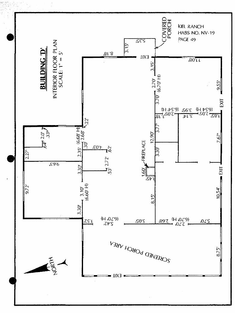
The4giel Ranch was purchased by industrialist Edward M. Taylor in 1924. Taylor died at the ranch on December 10, 1926, leaving title to his Pennsylvania decendents, who rented out the residences on the ranch from 1926 to 1939. Frank and Zelda Allen, a farming family from Alamo, had moved from the old Stewart Ranch to the Kiel, and apparently lived there during the 15 years it was known as the Taylor Ranch. "A house, generally known as the Green House [Building "D"], had been built for them near to the reservoir toward the back of the ranch. The Aliens raised grain, alfalfa* fruit and vegetables in the well-watered fields and orchards."
The George Craig family, at the invitation of the Taylors, moved from Philadelphia to Kiel Ranch in 1929. Bill Craig, who lived on the ranch as a boy, remembered "the rambling Brown House had four bedrooms and a stove in the living room that was the only source of heat in the winter. Around the house grew lush lilac bushes . . . and two peachcot trees in front of the house . . .."
"From Five Points, where there was a little store, you reached the ranch by the old Tonopah cutoff, a dirt road that ran past the ranch. After the underpass, there was a gate to what we called the back road into the ranch, and that road was lined with poplars." Lombardy poplars also lined the irrigation ditches and giant cottonwoods surrounded the large reservoir.
From 1929 until 1931, Roy and Nellie Martin lived in the Park Mansion while their new home was being readied in town. "Mrs. Nellie Martin, a lovely accomplished woman, was a delightful hostess and an accomplished pianist. The old mellow piano Dr. Martin had acquired for her was moved to the Kyle (sic) Ranch and the big house echoed with music. Elsie Roscoe Thomas, a skilled violinist, and Alta Ham, who had a charming singing voice, gave recitals and concerts. Bridge parties, teas and elegant dinners were regular events. Anyone included in the Las Vegas Social Register of the day visited Kyle (sic) Ranch."
#
#
•
KIEL RANCH HABS. NO. NV-19 Page 11
In 1936, Harry and Grace Read moved into the Allen House (Building "D"); Frank and Zelda Allen were living in the White House (Building "A"), Gerald and Cecile Crowe were occupying the Brown House (Building "F") and world-champion bulldogger Dave Campbell and his wife Ann lived in the adobe structure (Building »B") .
In a personal interview about the days she lived on the ranch, Grace Read (Read City Drugstore) reported that "Dave Campbell was responsible for the roping arena. He needed it to keep in practice and his wife used to time him." And on Sundays, "all the local rodeo enthusiasts would gather and put on quite an exciting show for the ranch residents and their Sunday guests."
In 1931, residents of the North Town area formed a town board under the Clark County Commission. A great deal of debate took place over the naming of the new township, with "North Las Vegas" winning out over "Vegas Verdes." 1932 saw a federal PPgt office and voting precinct established for "North Las Vegas."
In 1939, another era for the Kiel Ranch began when Edwin Losee leased the ranch from the Taylors and named it the Boulderado Dude Ranch. According to Georgia Lewis, Losee began an extensive remodeling and building project:
Bathroom facilities were put into the ancient adobe, and the cellar below it, which had been used as a winery, was made into another tiny guest room. Even an old storeroom at the back of the "Brown House" (or Willow House) was imaginatively converted into a tiny house called Spring Wheel Cottage. This was directly opposite a colorful water wheel Losee put up in the creek which still bubbled through the ranch.
Two new buildings, both duplexes, were added to the ranch and named Sunrise Cottages. One was built of white brick. The other, made of wood, was converted from an old „ schoolhouse that Losee had bought for $900.
During its transition into a dude ranch, Kiel took on an air of glamour not seen before or since. With the liberal Nevada di- vorce laws of the 1940's, the rich and famous now had a discreet hideaway while they established the minimal residency requirements:
Guests were wealthy and, generally, seeking to untie the marriage knot. Cornelius Vanderbilt, industrialist E.E. Harriman, famed psychiatrist
#
•
KIEL RANCH HABS. NO. NV-19 Page 12
Dr. Lawson Lowrey, columnist Art Hoppe, Alden Hatch, the writer, film stars George Montgomery, Mickey Rooney and Martha Vickers, movie director M. Jerosi, actress and writer Ilka Chase were just a few of the celebrities. As the fame of the Boulderado grew several European noblemen signed the guest register. The Losees coped admirably with this heterogeneous group of people, although life at the ranch was constantly frenetic. Bett and Catt, charming hostesses, listened sympathetically to the troubles of the guests. But they also saw that the Boulderado offered a constant round of activities to keep the guests from dwelling on their divorce woes.
Outings to the Valley of Fire, Mount Charleston and to Lake Mead were offered. Evenings at Strip shows, moonlight rides, picnics and barbecues at the pool, swim parties and contests, badminton, horseshoe pitching, ping-pong, archery and of _g course horsebacking riding were daily events.
The glamour of those years didn't last, however, with the rapid construction of hotel/casinos that were able to provide even more privacy, wrapped in the glitz and glitter of ever-bigger and better establishments (El Rancho, 1941; The Last Frontier, 1942; Golden Nugget, 1946; Eldorado Club, 1946; Flamingo, 1947; Players Club, 1947; Club Bingo, 1947; Thunderbird, 1948; Desert Inn, 1950). Also, the 1950fs saw more liberalization of divorce laws throughout the United States.
In 1940, Clark County had a population of 16,144; in 1950 it had grown to 48,289 (127,0X6 in 1960; 273,288 in 1970; 461,816 in 198 0). On May 16, 194 6, the City of North Las Vegas incorporated as a unique and separate entity, with a population of 2,875 and an area of 2.5 square miles. In its first year of operation, the city had a budget of $57,000 and nine employees. By 1950, the population had increased to 3,875 (18,422 in 1960; 36,216 in 1970; 42,739 in 1980). By 1988, at the time of this recordation, the size of the City of North Las Vegas has grown from the original 2.5 miles to 54.11 square miles.
In the mid-1950's, the Losees sold the Boulderado Ranch (Kiel Ranch) to developers, with parts of the 200+ acres being sold off piece-by-bit until the remaining 25.59 acre plot and structures were purchased in 1974 by the North Las Vegas Bicentennial Commit- tee. The Kiel Ranch was presented to the City of North Las Vegas
#
KIEL RANCH HABS. NO. NV-19 Page 13
by the committee on July 4, IS76/ to mark the 200th anniversary of the nation's legal creation.
The history and use of the Kiel Ranch has reflected the history of the Las Vegas Valley—established as a Lamanite (Native American) Farm under the guidance of the LDS missionaries; then taken over by pioneer Conrad Kiel and his sons; after mysterious murders, sold to the railroad; sold by the railroad to a banker who cultivated the already fertile fields for produce; sold to an industrialist who died on the ranch; rented out to locals and farmed by the absentee heirs/landlords for several years; leased and then sold to the Losees who developed the site as a "dude" ranch for divorce-seekers; then purchased by developers who sold off most of the original 240 acres for both industrial and residential development. Today, the remaining 25-acre tract of the Kiel Ranch is surrounded—to the north and south by industrial buildings, to the east by industrial buildings, roads, a railroad and a freeway (Interstate-15), and to the west by a residential development.
#
#
•
#
KIEL RANCH HABS. NO. NV-19 Page 14
HISTORIC STRUCTURES
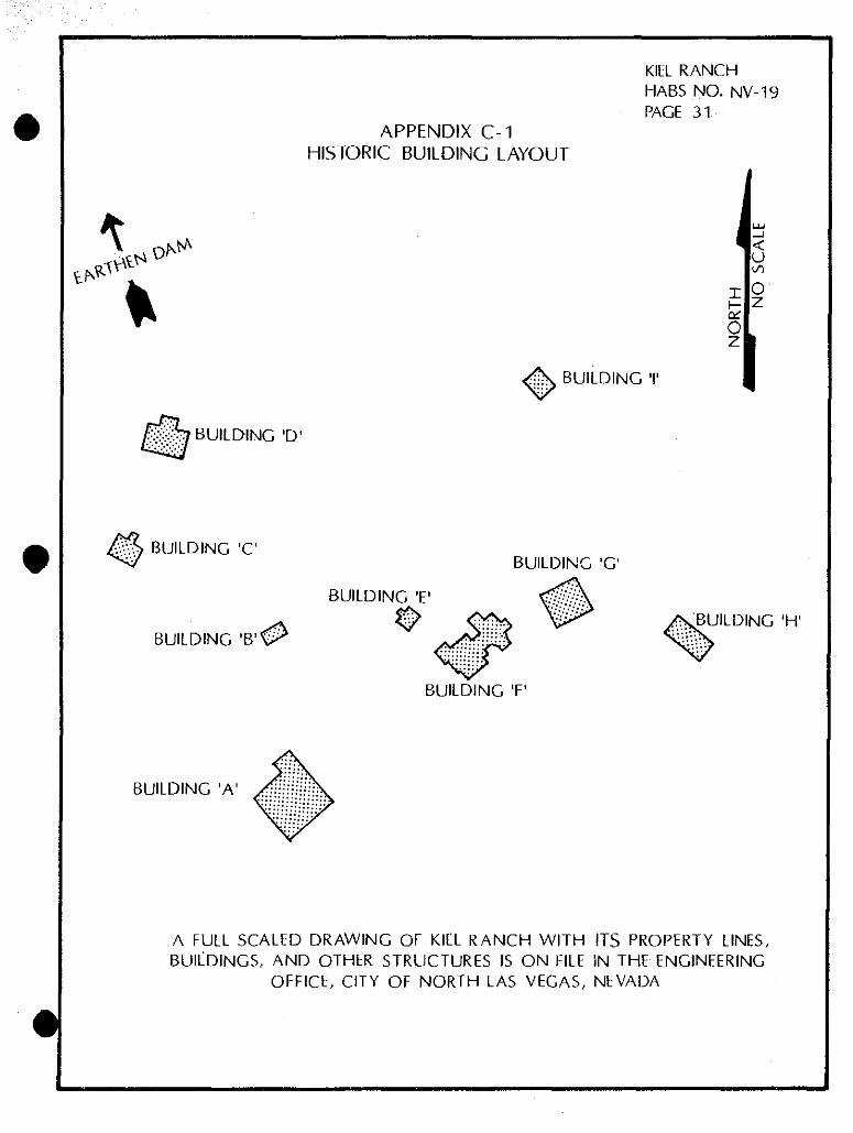
A. Park Mansion (White House) (1911)
The principal dwelling of the Kiel Ranch is the "White House" or Park Mansion, constructed in 1911 by John S. Park, manager of the First State Bank in Las Vegas. It is a single-story residence with the exterior in wooden shiplapped siding, trimmed in clear pine. The exterior windows are cased with simple, molded cornice headers. The mansard roof has a continuous extension beyond the exterior walls of the structure, around the entire perimeter of the building. The roofing material on the mansard is metal. The foundation is massive concrete. Interior walls are wooden lathe and plaster, presently in poor condition. All windows are traditional wooden casement. The southeast elevation presents the principal entrance beneath a deep, overhung porch supported by four massive columns, accentuated by wooden arches, joined with white picket railing between the columns, accentuating the early 20th Century style. The massive front entry door is well defined with glass sidelights on either side. The main living area has a large plate glass window overlooking the front entry porch. The porch is covered with wooden tongue and groove decking. The house sits rather high on the foundation, allowing for a large crawl space between the first floor and the existing grades. The rear screened-in porch (northwest elevation) enhances the rear elevation but removal of the rear deck has left the rear entrance doors (3) suspended in mid-air, approximately four feet above grade. Complete electrical service has been added to the rear service porch.
B. Adobe Structure (circa 1855—1879)
Records from the LDS period (1855—1858) indicate that the Kiel Ranch was established by the LDS missionaries as a Farm for the Lamanites in January of 1856, and that the LDS missionaries "laid off" an adobe yard for the Lamanites at the farm in September, 1856. The records reviewed to date do not, however, directly mention that the Native Americans living in the area actually built a structure of adobe. This structure could have been started by the Native Americans, abandoned when the missionaries left, and then completed at some later time by Conrad Kiel, who is said to have operated a sawmill in the mountains (in 1876, 1877 and 1888, Roske reports, Kiel paid taxes on a sawmill, though the location has never been verified [p.44.]).
The structure is double-walled, plastered adobe, with a stone foundation and a stone entryway to the cellar beneath on the northeastern elevation. The roof is wood-shingled with 1" x 4" slats for decking, 2" x 4" ceiling joists and 2" x 6" rafters. The northeast elevation has a small square window
#
#
KIEL RANCH HABS. NO. NV-19 Page 15
(approximately 18" square). The southeast elevation has one wood-cased window (approximately 2f x 4f) and a single front entry door, also cased in wood. The west elevation has a 2' x 4' window, wood cased. The roof overhangs the gable ends by approximately 12". The eaveline extends approximately 12" beyond the walls on the north and south, supported by an extension of the 2" x 6" rafters and joists. The southeast elevation porch is of concrete and cinderblock, with a 3' pony wall of concrete block. Two cinderblock steps lead up from the existing grade to the front porch; one cinderblock step leads from the porch to the front door.
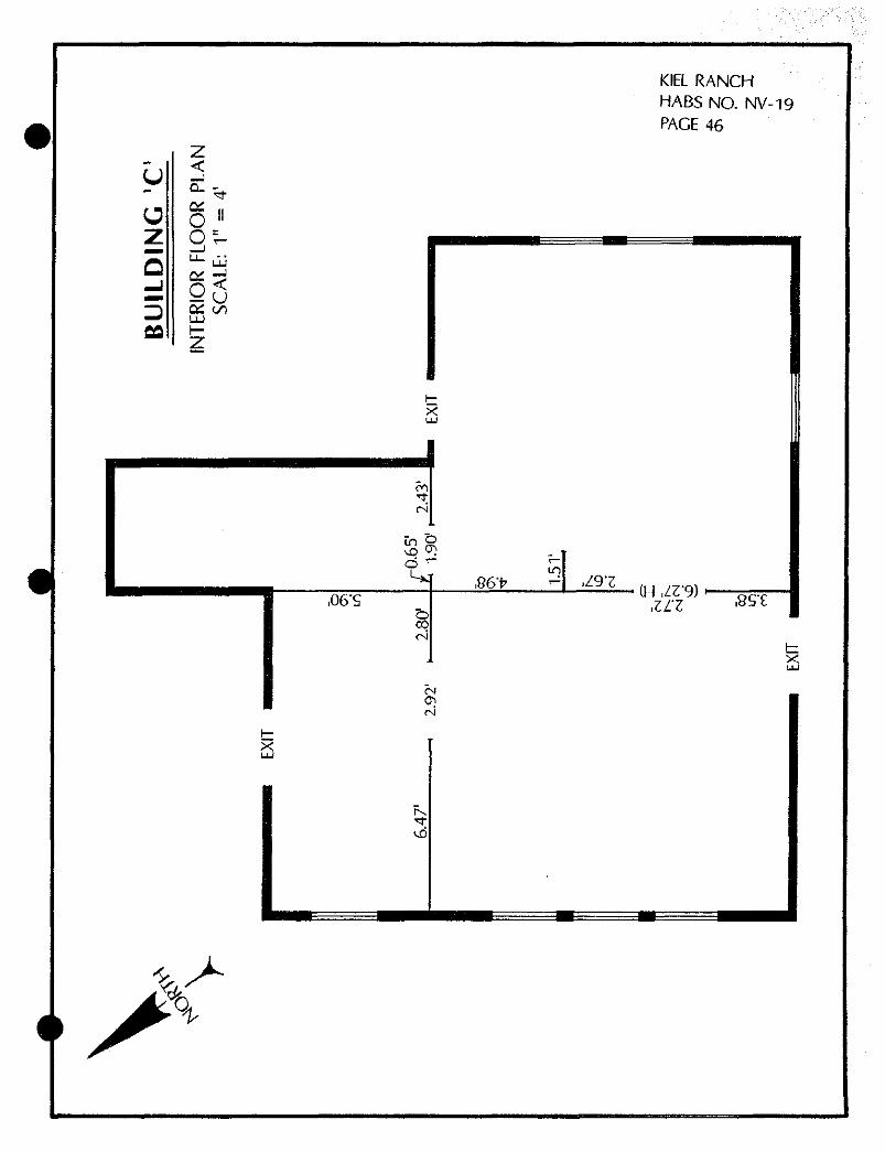
C. Remnant House (unknown)
A presently collapsed structure, apparently used as a residence, is located to the west between the adobe structure and the foreman's house. Construction was of l"x 1" board siding. The structure presently has no roof, and the interior is falling down. Remnants indicate interior plumbing on the eastern elevation.
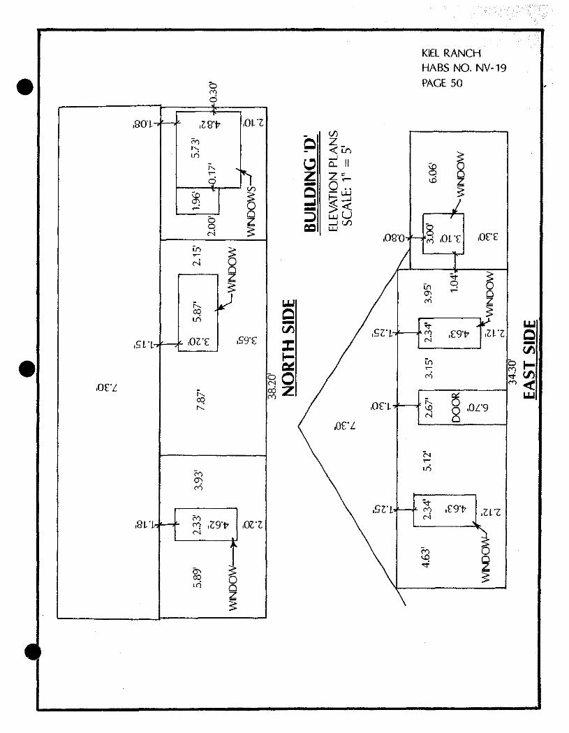
D. Foreman's House (1924)
Built by Edward M. Taylor, the construction is of tongue and groove vertical siding. The southern elevation presents a small, single-entry porch with a low, outcropped roof and a wooden stoop. The inside of the building is completely gutted, with plumbing and electrical wiring pulled out; plumbing and various other trash is scattered throughout the building. The building has no foundation. The interior floors are wooden deck, which is deteriorating. Several interior recessed panel doors may be salvageable. The rear, northern elevation has a screened-in porch (presently covered over with chicken wire) which is filled with debris. The roof has an approximate 4/12 pitch, and is constructed of wooden shingles.
E. Doll House (1939—1940)
Built by the Losees, construction of this small house is of board and batten wooden siding. The low-pitched roof has asphalt shingles over 1" x 1" decking. A narrow eave is all around the structure. The west elevation has one small entry door. Two small windows (12" x 3 6") are on the southeast elevation.
The foundation is of railroad ties. A small addition is on the northwest side, approximately 5» x 81, with exposed plumbing pipes. The northwestern elevation has two 2 ' x 3 ' windows on either side of the addition. On the northeast elevation there is a 1-1/2' x 3' horizontal window. The building's siding appears to extend below grade. There is no front porch. The southeastern elevation has one front entry door, approximately 6'6". One-and-one half inch
#
•
KIEL RANCH HABS. NO. NV-19 Page 16
hardwood floors are decayed and deteriorated. Interior walls, covered with thin plywood, are disintegrating. The building has no ceilings.
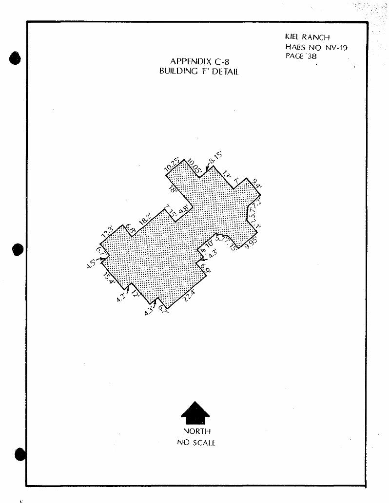
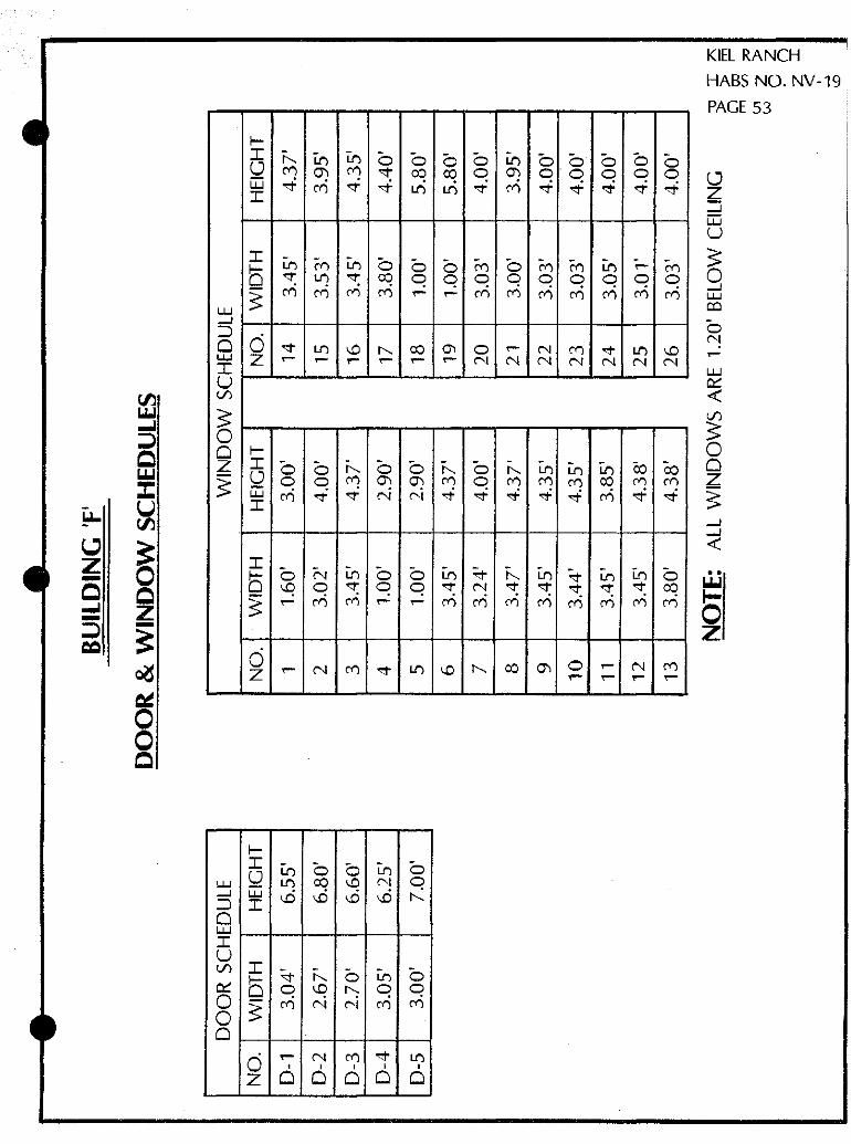
F, Brown House (1912)
Constructed by John S. Park, with William S. and Mary Park, the southern, front elevation displays two separate areas connected by an apparent breezeway, with outcroppings on both halves. There is a low-pitched shed roof of wooden shingles on each of the outcroppings, with an approximate 4/12 pitch. Construction is of board and batten siding. There is no foundation—the building sits on wooden pilings and slopes dramatically to the West. The interior walls are demolished. The hardwood floors have decayed and are disintegrating. The interior brick-and-mortar fireplace has been half dismantled. The interior is mostly gutted. There is no evidence of electricity or plumbing. Small wooden casement windows are around the building but have no window panes and have been covered over with chickenwire.
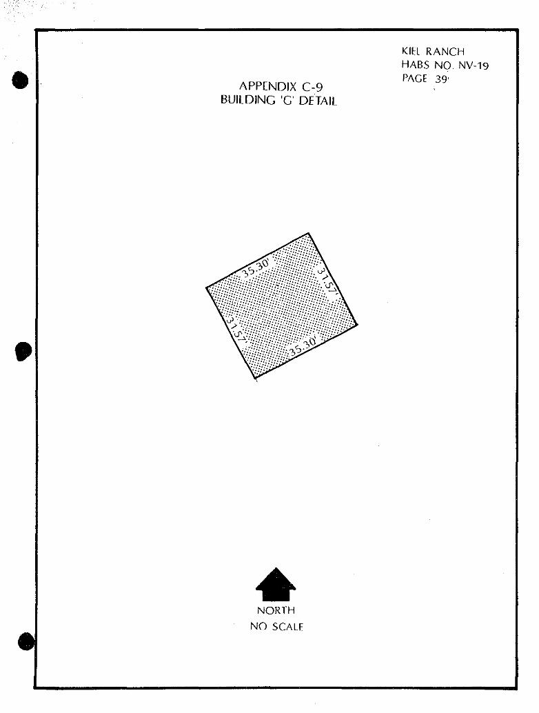
G. Cinderblock Duplex (1939)
Built by the Losees during the Boulderado era, the front of this duplex has a southeastern elevation. This structure is a single-story duplex with a full porch across the front, presently falling away from the structure. A front porch extension has large timber pilasters over an open-joist ceiling. A massive cement chimney serves both sides of the duplex. The gable roof has no overhang on the gable ends, with an approximate 3/12 pitch, but overhangs approximately 12" on the rear (northwest) elevation. The composition of the roof is a combination of both wooden and asphalt shingles. The northeast corner of the building is completely collapsing and appears structurally unsound.
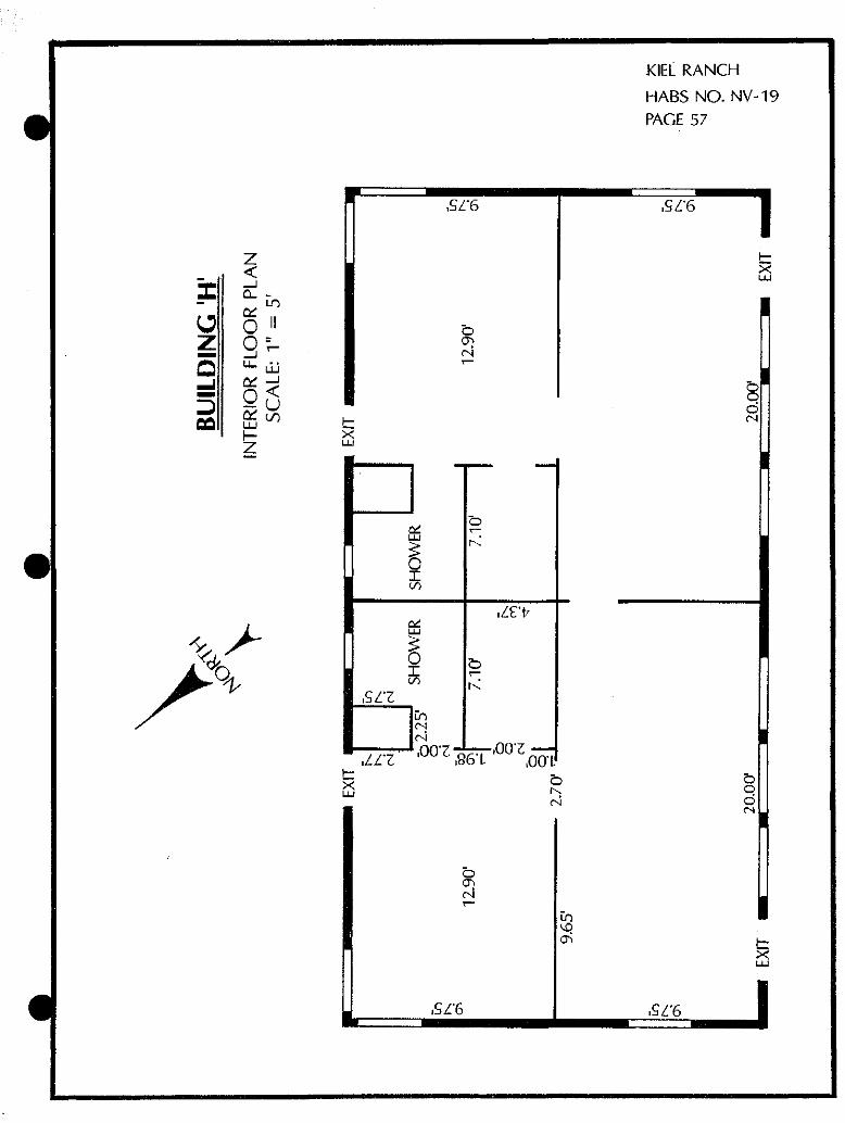
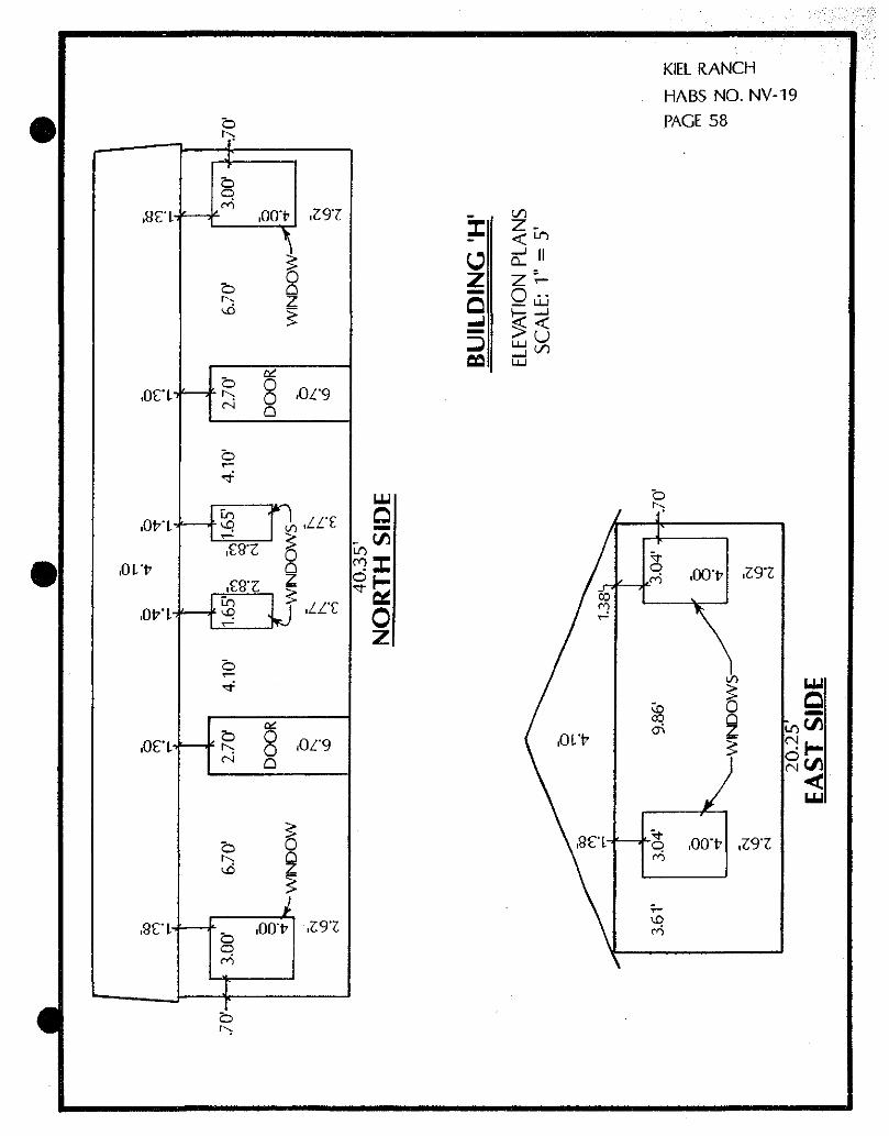
H. Wooden Duplex (1939)
Originally a schoolhouse, this building was purchased by the Losees, moved to the site, and remodeled. The structure has a southwest front elevation, facing the White House. Construction is of shiplap siding, with a small concrete stoop in front of each entry door. The front elevation presents three window openings, presently with no glass. There is a slight overhang on the 3/12 pitch roof which is constructed of wooden shingles. The building has no foundation. All interior walls are gutted and the interior hardwood floors have buckled and are decaying.
I. Livestock Shed
The front of the livestock barn has a northeast elevation with two large openings. The original construction was of lx boards and
#
KIEL RANCH HABS. NO, NV-19 Page 17
2x timbers. The structure has no foundation and a dirt floor. The barn has collapsed and filled with wooden debris. The structure is located to the northeast of the Brown House.
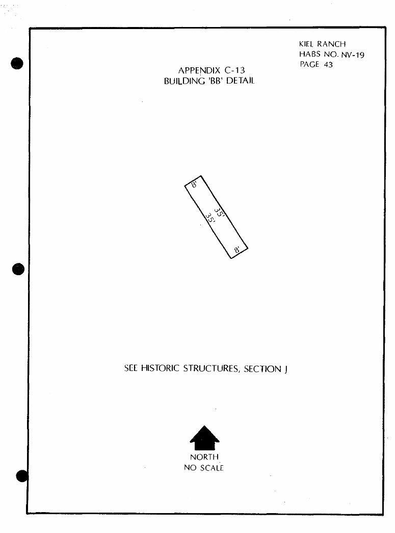
J. OTHER STRUCTURES
Two small mobile homes (identified as Buildings AA and BB in Appendix C-2) and a small metal shed (Building CC) are located behind the cinderblock duplex (Building G) between the cinderblock duplex and the livestock barn (Building I) and are presently being used for caretaker facilities.
A footbridge (Structures DD) is located to the east of the White House, constructed of 2"x4" lumber with railroad ties as structural members. A 31 high wooden handrail is on either side of the approximately 8'x 6' bridge, painted white. Apparently the bridge spanned the stream that flowed across the property from the reservoir located at the rear of the property.
A gazebo (Structures DD) is located immediately to the east of the White House, and a flag pole (Structures DD) is located directly to the south. The flagpole is located over a time capsule placed by the City of North Las Vegas on July 4, 197 6. The gazebo is built of dimensional lumber with an open-screened, rectangular flat roof. A short handrail surrounds the octagonal-shaped structure, with one end open, facing south. The gazebo is approximately 13* in diameter.
The northwest corner of the property shows the remains of a reservoir/pond which was surrounded by cottonwood trees. The cottonwoods, from 5* to 7' in diameter, have all been cut down, with only the stumps remaining. The reservoir is currently dry, with local flora growing in the bowl-shaped bottom. Two fig trees, just east of the adobe, are all that remain of the once-famous fruit orchards on the Kiel Ranch. No Lombardy poplars, lilac bushes, peachcot trees, grapevines or other historical flora remain on the property, other than cottonwoods planted in the 1970's along the north/south dirt road which dissects the property. The City of North Las Vegas maintains a tree farm to the eastern portion of the property, with approximately 100 trees, more or less, maintained at any one time.
#
$
KIEL RANCH HABS. NO. NV-19 Page 18
CHAIN OF TITLE
Original and subsequent owners: References to the chain of title to the land on which the structures stand are in the Office of the Recorder of Clark County, in Las Vegas, Nevada, or in the Office of the Recorder of Lincoln County, Pioche, Nevada. Copies are also on file in the North Las Vegas Library.
1884 Land Patent. By an act of the Nevada Legislature, approved March 5, 1873, entitled "An Act to provide for the selection and sale of lands that have been or may hereafter be granted by the United States to the State of Nevada." Recorded September 17, 1884, Lincoln County; recorded in Clark County on December 13, 1985—clarifying the original recordation in Lincoln County, Book 2232, Page 2191343 date unclear. State of Nevada to Conrad Kiel. Conveyed 160 acres described as Sl/2 of SE1/4 Section 15, and the Nl/2 of NE1/4 Section 22, T20S, R61E.
1892 Land Patent. State of Nevada to Conrad Kiel. NW1/4 of NW1/4 Section 23, T20S R61E, MDB&M, containing 40 acres.
Date Unclear Land Patent. State of Nevada to Conrad Kiel. NW1/4 of SE1/4 of Section 15, T 20S, R61E, MDB&M, containing 40 acres.
1901 Deed. Recorded August 5, 1901, Lincoln County, Nevada, Book T, Pages 357—360. Joseph E. Kiel et al to Utah, Nevada and California Railroad Company. Conveys the Sl/2 of SE1/4 Section 15 and the Nl/2 of NE1/4 Section 22 Township 20S, Range 6 IE, MDB, containing 160 acres; and NW1/4 of SE1/4 of Section 15, T20, R61E, MDB, containing 4 0 acres; and NW1/4 of NW1/4 Section 23, T20S, R61E, containing 40 acres (total acreage: 240A).
1911 Quitclaim Deed. Made May 10, 1911, State of California, County of Los Angeles, record #21945. Utah, Nevada & California Railroad Company, a Nevada corporation, to Las Vegas Land & Water Company, a Nevada Corporation. Conveys Sl/2 of SE1/4 and
#
•
KIEL RANCH HABS. NO. NV-19 Page 19
NW1/4 of SE1/4 Section 15; and the Nl/2 of NE1/4 Section 22; and the NW1/4 of NW1/4 Section 23; all in Township 2OS, Range 61E MDB, containing 240 acres, known as the Kiel Ranch. Recorded January 27, 1925.
1911 Deed. Made January 20, 1911, State of California, County of Los Angeles, record #4788. Las Vegas Land & Water Company to William S. Park. Conveyed Sl/2 of SE1/4 and NW1/4 of SE1/4 of Section 15; and Nl/2 of NE1/4 of Section 22; and NW1/4 of NW1/4 of Section 23; all in T20S, R61E, MDM, containing 240 acres, including all water rights EXCEPTING the right-of-way of the San Pedro, Los Angeles and Salt Lake Railroad Company over and across said premises (approximately 100' total width). Recorded January 10, 1913.
1924 Deed. Made November 24, 1924. John S. and Nancy S. Park and William S. and Mary Selle Park to Edward M. Taylor. Conveys Sl/2 of SE1/4 and NW1/4 of SE1/4; and the SW1/4 of Section 15; Nl/2 of NE1/4 of Section 22; and NW1/4 of NW1/4 Section 23; all in T20S, R61E, MDB&M, containing 400 acres, water rights EXCEPTING right-of-way of Los Angeles & Salt Lake Railroad Company. Recorded February 15, 1925, Book 10, Clark County, Nevada.
1927 Deed. Made June 23, 1927. Amy G. Taylor to William H. Taylor (c/o American Embassy, London, England). Sl/2 of SE1/4; NW1/4 of SE1/4; SW1/4 of Section 15; Nl/2 of NE1/4 Section 22 and NW1/4 of NW1/4 Section 23; all in T20S, R61E, MDB&M, containing 400 acres, with all water rights, excepting Railroad right-of-way. Recorded July 9, 1927, Book 12, Pages 307 & 3 08, Clark County, Nevada.
1928 Final Decree. February 27, 1928. Amy G. Taylor to John M. Taylor and William H. Taylor (sons of deceased Edward M. Taylor). Sl/2 of SE1/4; NW1/4 of SE1/4; SW1/4 of Section 15; Nl/2 of NE1/4 Section 22; NW1/4 of NW1/4 Section 23; all
#
*
KIEL RANCH HABS. NO. NV-19 Page 2 0
in T20S, R61E, MDB&M, containing 400 acres. Recorded March 28, 1928, Book 5 of Misc., pages 415, 416 and 417, Clark County, Nevada.
1944 Sale Deed. Recorded December 8, 1944, Book File 36, Pages 458 & 459, Clark County, Nevada. William H. Taylor to John M. Taylor. Sl/2 of SEl/4; NW1/4 of SEl/4; and the SW1/4 of Section 15; Nl/2 of NE1/4 of Section 22 and the NW1/4 of NW1/4 of Section 23, all in T20S, R61E, MDB&M, containing 400 acres.
1944 Sale Deed. Recorded December 18, 1944, Book File 37, Pages 17 & 18, Clark County, Nevada. John M. & Ellis Taylor to Taylor Fibre Company. Sl/2 of SE1/4; NW1/4 of SE1/4; SWl/4 of Section 15; Nl/2 of NE1/4 of Section 22 and the NW1/4 of NW1/4 of Section 23, all in T20S, R61E, MDB&M, containing 4 00 acres.
1948 Sale Deed. Recorded December 31, 1948 in Betzwood, Montgomery County, Pennsylvania. Taylor Fibre Company to Taylor Investment Company. Sl/2 of SEl/4 ; NW1/4 of SEl/4; SWl/4 of Section 15; Nl/2 of NE1/4 of Section 2 2 and NW1/4 of NW1/4 of Section 23, all in T20S, R61E, MDB&M, containing 4 00 acres.
1953 Sale Deed. Recorded February 19, 1953. Taylor Investment Company to James B. and Kathleen M. Losee. Sl/2 of SEl/4 and NW1/4 of SEl/4 and SWl/4 of Section 15; Nl/2 of NE1/4 of Section 22, lying west of the Right-of-Way of the Railroad in T20S, R61E, MDB&M, containing 330 acres, with reservation of all rights to any oil, gas, or minerals.
1954 Corporation Deed. Recorded December 18, 1954, Clark County, Nevada. Taylor Investment Company to J.C. Taylor and V.L. Waterbury, Trustees; all rights to any oil, gas and minerals in the following described real property situated in the County of Clark, State of Nevada, to wit: Sl/2 of SEl/4 and NW1/4 of SEl/4 and SWl/4
*
•
#
KIEL RANCH HABS. NO. NV-19 Page 21
of Section 15; Nl/2 of NE1/4 Section 22, (lying west of the Railroad all in T20S, R61E, MDB&M, containing 330 acres of land, more or less).
1961 Sale Deed. Recorded June 28, 1961, Book 305, Clark County, Nevada. James B. & Kathleen M. Losee to Edward A. & Donna M. Collins. Sl/2 of SE1/4; NW1/4 of SE1/4; SW1/4 of Section 15; Nl/2 of NE1/4 Section 22, all in T20S, R61E, MDB&M, EXCEPTING the South 264* of the west 1650 feet of the SW1/4 of Section 15. FURTHER EXCEPTING a portion of the SE1/4 of the SE1/4 of Section 15.
1963 Sale Deed. Recorded September 6, 1963, Book No. 480, Clark County, Nevada. Buck-John Corporation to Almco Corporation. Sl/2 of SE1/4 and NW1/4 of SE1/4 and SW1/4 of Section 15; Nl/2 of NE1/4 Section 22 lying west of the railroad, all in T20S, R61E, MDB&M, EXCEPTING the South 2 64 feet of the west 1650 feet of SW1/4 of Section 15 AND a portion of SE1/4 of SE1/4 Section 15.
19 63 Right-of-way Grants. Recorded October 1, 1963, Book No. 481, Clark County, Nevada. Regal Development Company to Nevada Power Company. Also Royal Development Company to Nevada Power Company. Also Buck-John Corporation and Almco Corporation to Nevada Power Company. Five foot strips in the SW1/4 of Section 15, T20S, R61E.
1963 Deed of Dedication. Recorded October 7, 1963, Book No. 483, Clark County, Nevada. Buck-John Corporation, Almco Corporation, Royal Development Company and the Regal Development Company to City of North Las Vegas. 100' roadway in the Sl/2 of SE1/4 Section 15; Nl/2 of NE1/4 Section 22, T20S, R61E.
1963 Quitclaim Deed. Re-recorded October 21, 1963, Book 486, Clark County, Nevada. Revere Development Company to Royal Development Company. 296 acres, more or less, known as Boulderado Guest Ranch;
•
KIEL RANCH HABS. NO. NV-19 Page 22
Sl/2 of SE1/4; NW1/4 of SE1/4 and SW1/4 Section 15; Nl/2 of NE1/4 Section 22 lying west of the Railroad; all in T20S, R61E, MDB&M.
1963 Grant, Bargain, Sale Deed. Recorded November 20, 1963, Book 493, Clark County, Nevada. Royal Development Company to Land Development Industries. 296 acres, more or less, known as the Boulderado Guest Ranch, as more fully appear from the record of survey recorded on April 19, 1954 as Document #8178 in the Office of County Recorder of Clark County, Nevada.
1964 Sale Deed. Recorded July 29, 1964, Book 558, Clark County, Nevada. Boulderado Development Company to Land Development Industries. An undivided one-half interest of the grantor's interest in the following described property: 296 acres, more or less, known as the Boulderado Guest Ranch.
19 65 Right-of-way Grant. Royal Development Company and Almco, Inc., and Regal Development Company and Land Development Industries to Nevada Power Company. A twelve foot strip of land in a portion of SW1/4 of Section 15, T20S, R61E.
1965 Sale Deed. Recorded May 18, 1965, Book 647, Clark County, Nevada. Almco, Inc., an undivided 5 0% interest; Regal Development Co., an undivided 38-1/8% interest and Royal Development, an undivided 11-7/8% interest to Regal Development Company, an undivided 76-1/4% interest and Royal Development Company, an undivided 23-3/4% interest. Parts of Section 15, T20S, R61E, totaling 89.3 acres, more or less.
1965 Quitclaim Deed. Jay & Vivian Casada to Ernest A. Becker.
*
#
KIEL RANCH HABS. NO. NV-19 Page 23
1965 Sale Deed. Recorded September 10, 1963. Revere Development Company (Land Development Industries) to Ernest A. Becker. Sl/2 of SE1/4 and NW1/4 of SE1/4 and SW1/4 Section 15 and Nl/2 of NE1/4 Section 22 lying west of the Railroad, T20, R61E, excepting a portion of SE1/4 Section 15.
1966 Quitclaim Deed. Diplomat Corporation to Regal Development Company. A part of Section 15, T20S, R61E.
1969 Lawsuit, Nevada Power Company, Plaintiff, Regal Development Company et al. Defendants. Granted to Plaintiff easement and right-of-way for power lines, a portion of the SE1/4 of Section 15.
1974 Quitclaim Deed. Recorded November 13, 1974. Royal Development Company to Nevsur Insurance Agency, Inc. Portions of Section 15 and Section 22.
1974 Sale Deed. Recorded November 13, 1974, Clark County, Nevada. Regal Development Company to City of North Las Vegas Bicentennial Committee. A part of the SE1/4 of Section 15, T20S, R61E, MDM, totaling 25.59 acres, more or less.
1976 Quitclaim Deed. Made July 4, 1976; recorded July 8, 1976, Book No. 638, Clark County, Nevada. City of North Las Vegas Bicentennial Committee to City of North Las Vegas, Nevada. A part of the SE1/4 Section 15, T20S, R61E, MDM, totaling 25.59 acres, more or less.
#
#
•
KIEL RANCH HABS. NO. NV-19 Page 24
Endnotes:
Helen S. Carlson, Nevada Place Names (Reno, Nevada: University of Nevada Press, 1974), pp. 150—153.
2 . Sam P. Davis, ed., The History of Nevada (Las Vegas, Nevada: Nevada Publications, ?), pp. 89—98.
3 Carlson, p. 152.
4 Stanley W. Paher, Las Vegas—As it Began—As it Grew (Las Vegas, Nevada, Nevada Publications, 1971), p. 7.
5 Ralph J. Roske, Las Vegas: A Desert Paradise (Tulsa,
Oklahoma: Continental Heritage Press, 1986), p. 30.
Paher, pp. 50—51.
7 Andrew Jensen, ed., "History of Las Vegas Mission," Nevada
Historical Society Papers (Reno, Nevada: Reno Printing Co., 1926), p. 192.
8Ibid., pp. 194—196.
9Ibid., p. 227.
1 0 Ibid., p. 199.
13Tbid., p. 211, p. 245, pp. 255—256, p. 267.
12Ibid., p. 281.
13Ibid., p. 281.
T 4 Ibid., p. 281—282.
15Ibid., p. 284.
16 Paher, p. 37.
17Ibid., pp. 51—57.
1 R Ibid., p. 57.
19 Roske, p. 41.
2 0 Carrie Miller Townley. "Helen J. Stewart: First Lady of Las Vegas" (Part 1), Nevada Historical Society Quarterly, Winter, 1973, pp. 230—231.
#
KIEL RANCH HABS. NO. NV-19 Page 25
#
21Ibid., p. 232.
22 Carrie Miller Townley, "Helen J. Stewart: First Lady of Las Vegas" (Part 2), Nevada Historical Society Quarterly, Spring, 1974, p. 11.
23Ibid., p. 11.
24Ibid., p. 13.
25 Robert Shaffer, "Kiel Ranch Has Mystery History," Valley Times, May 13, 1979, p. 16.
Townley, Spring, 1974 (from Lincoln County Records, October 19, 1900), p. 12.
27 From a report dated June 8, 1983 by Facilitators, Inc., 704 South Ninth Street, Las Vegas, Nevada.
28 Roske, p. 46.
29Ibid., p. 46.
30 Paher, p. 69.
31Ibid., p. 68.
32Ibid., p. 65,
33 Townley, Spring, 1974, p. 4.
34Paher, p. 77.
35 Roske, p. 55 and Paher, pp. 68—70.
Roske, p. 54.
37Ibid., p. 55.
38Ibid., p. 177.
39 Las Vegas Age, February 25, 1911.
40Shaffer, p. 17.
41 ... "Historic Properties Inventory, Park, John S. Residence," by
Mary L. Griffin for 117 Nevada History, March, 1982, located in University of Nevada at Las Vegas, Special Collections Department.
* A copy of a picture is included in the inventory from the Las Vegas ■P Age, July 2, 1929, Section 2, p. 17, showing the Charleston
#
#
KIEL RANCH HABS. NO. NV-19 Page 26
residence, which has a marked similarity to the Kiel residence. The building on parcel #050-010-004, 1.46 acres, at 700 East Charleston Blvd., was ordered to be demolished by the City of Las Vegas after the building was burned in a fire in 1982. While no demolition records were obtainable from the city of Las Vegas, a visual check in December, 1987, indicates no structure of any kind on this parcel presently exists.
4? Paher, p. 113.
43Ibid,, p. 119.
44 Ibid., p. 119.
45Ibid., p. 119.
46Chicago Title "Chain of Title" Records.
47 Georgia Lewis, "Then the Cowboys Rode into the Kyle (sic) Ranch," The Nevadan, September 7, 1975, p. 30.
4ft Ibid., p. 30.
49 Dorothy Mills, "Bumpy Dirt Roads and a Sprawling Ranch Greeted the Craigs in 1929," North Las Vegas Valley Times, June 23, 1973, p. 1.
50Ibid., p. 1
51 Georgia Lewis, "Then the Cowboys . . . ," p. 30.
Memories," North Las Vegas Valley Times, July 17, 197 3, p. 1.
53Ibid., p. 1
54 Roske, pp. 93—94.
55 Georgia Lewis, "Boulderado Dude Ranch, a Never-Never Land," The Nevadan. September 14, 1975, p. 3.
56Ibid., p. 3.
57 City Clerk's Office, City of North Las Vegas.
Decennial population figures from the Bureau of the Census, U. S. Department of Commerce.
59 "Cham of Title" records, summarized in this document.
#
KIEL RANCH HABS. NO. NV-19 Page 27
t
Bibliography
Carlson, Helen S. Nevada Place Names. Reno, Nevada: University of Nevada Press, 1974. (Written in 1917)
Davis, Sam P., ed. The History of Nevada, Las Vegas, Nevada: Nevada Publications.
Jensen, Andrew. "History of Las Vegas Mission." Nevada State Historical Society Papers. Reno, Nevada: Reno Printing Company, 1925—26.
Jensen, David. "Losee Ranch—Its Shadows and Reflections." North Las Vegas Valley Times. January 22, 1970.
Lewis, Georgia. "Boulderado Dude Ranch, a Never-Never Land." The Nevadan. September 14, 1975.
Lewis, Georgia. "Then the Cowboys Rode into Kyle Ranch." The Nevadan. September 7, 1975.
Mills, Dorothy. "Bumpy Dirt Roads and a Sprawling Ranch greeted the Craigs in 1929." North Las Vegas Valley Times. June 23, 1973.
Mills, Dorothy. "Dusty, Treeless Townsite Greets Young Bride in 1910." North Las Vegas Valley Times. June 21, 1973.
Mills, Dorothy. "Equestrian Recalls Kyle Ranch Memories." North Las Vegas Valley Times. July 17, 1973.
Mills, Dorothy. "Memories of 19 Years on Kyle Ranch." North Las Vegas Valley Times. June 20, 1973.
Mills, Dorothy. "Trail Rides & Bonfires Liven Early Kyle Ranch Days." North Las Vegas Valley Times. July 13, 1973.
Paher, Stanley, W. Las Vegas—As it Began—As it Grew. Las Vegas, Nevada: Nevada Publications, 1971.
Roske, Ralph J. Las Vegas: A Desert Paradise. Tulsa, Oklahoma: Continental Heritage Press, Inc., 1986.
Shaffer, Robert. "Kiel Ranch Has Mystery History." The Sunday Valley Times. May 13, 1979.
#
#
KIEL RANCH HABS. NO. NV-19 Page 28
Townley, Carrie Miller. "Helen J. Stewart: First Lady of Las Vegas" (Part 1). Nevada Historical Quarterly. Volume 16, No. 4, Winter, 197 3.
Townley, Carrie Miller. "Helen J. Stewart: First Lady of Las Vegas" (Part 2). Nevada Historical Quarterly. Volume 17, No. 1, Spring, 1974.
#
#
#
•
KIEL RANCH HABS. NO. NV-19 Page 29
Appendix A Legal Description
The land known as the Kiel Ranch, situated in the City of North Las Vegas, County of Clark, State of Nevada is described as follows:
A part of the Southeast Quarter (SE 1/4) of Section 15, Township 2 0 South, Range 61 East, M.D.M., more particularly described as follows:
BEGINNING at the center of Section 15, Township 20 South, Range 61 East, M.D.M., City of North Las Vegas, County of Clark, Nevada; thence South 0 27'37" West 1069.65 feet along the West line of the Southeast Quarter (SE 1/4) of said Section 15; thence South 89 32*23" East 12 6.00 feet to the TRUE POINT OF BEGINNING; thence continuing South 89 32'23" East 33.63 feet; thence along a curve concave to the Southwest having a radius of 350.00 feet through a central angle of 37 56'53" an arc distance of 231.81 feet; thence South 51 35'30" East 582.80 feet; thence along a curve concave to the Northeast having a radius of 3 00.00 feet through a central angle of 38 40'37" an arc distance of 202.51 feet; thence North 89 43*53" East 126.02 feet; thence South 0 16'07" East 1073.47 feet to the North line of Carey Avenue (100 feet wide); thence North 89 55*20" West parallel to an 50.00 feet distant from the South line of Section 15 599.97 feet; thence North 0 04*40" East 307.47 feet; thence North 43 09*52" West 522.36 feet; thence North 0 27'37" East 420.00 feet; thence North 89 32*23" West 170.00 feet; thence North 0 27*37" East parallel to and 30.00 feet distant from the West line of the Southeast Quarter (SE 1/4), Section 15 365.00 feet; thence South 89 32*23" East 96.00 feet; thence North 0 27*37" East 101.00 feet to the TRUE POINT OF BEGINNING.
APPENDIX B SITE LOCATION MAP
KIEL RANCH HABS NO. NV-19 PAGE 30
•
NORTH
NO SCALE
LAS VEGAS NW, NEV.
36I15-B2-TF-024
1967 PHOTOR£VlSED 1983
DMA 2956 il NW-SER1ES VS96
Mapped, edited, and published by the Geological Survey Control by USGS and N0S/NOAA
KIEL RANCH HABS NO. NV-19 PAGE 31.
APPENDIX C-1 HISTORIC BUILDING LAYOUT
t V>* 3*&
O^ < u b
2
BUILDING
E#*7 BUILDING 'D'
• BUILDING 'C
BUILDING 'C
BUILDING 'E'
BUILDING 'B'\> ^vBUILDING *H'
BUILDING 'F*
BUILDING 'A'
A FULL SCALED DRAWING OF KIEL RANCH WITH ITS PROPERTY LINES, BUILDINGS, AND OTHER STRUCTURES IS ON FILE IN THE ENGINEERING