34
Minera. l. Res0t.1rces of the Holy Cross Wilderness Area, Eagle, Pitkin, and Lake Counties, Colorado COLORADO •

Minera.l. Res0t.1rces of the Holy Cross Wilderness Area, Eagle, Pitkin, and Lake Counties, Colorado
COLORADO •

Mineral Resources of the Holy Cross Wilderness Area, Eagle, Pitkin, and Lake Counties, Colorado
By ALAN R. WALLACE, GREGORY K. LEE, and DAVID L. CAMPBELL U.S. Geological Survey
WILLIAM LUNDBY and S. DON BROWN U.S. Bureau of Mines
U.S. GEOLOGICAL SURVEY BULLETIN 1879

DEPARTMENT OF THE INTERIOR
MANUEL LUJAN, JR., Secretary
U. S. GEOLOGICAL SURVEY
Dallas L. Peck, Director
Any use of trade, product, or firm names in this publication is for descriptive purposes only and does not imply endorsement by the U.S. Government.
UNITED STATES GOVERNMENT PRINTING OFFICE: 1989
For sale by the Books and Open-File Reports Section U.S. Geological Survey Federal Center Box 25425 Denver, CO 80225
Library of Congress Cataloging-in-Publication Data
Mineral resources of the Holy Cross Wilderness Area, Eagle, Pitkin, and Lake Counties, Colorado by Alan R. Wallace ... [et al.]. p. cm.-(U.S. Geological Survey bulletin ; 1879) Bibliography: p. Supt. of Docs. no.: I 19.3:1879 1. Mines and mineral resources-Colorado-Holy Cross
Wilderness. 2. Holy Cross Wilderness (Colo.) I. Wallace, Alan R. II. Series: U.S. Geological Survey bulletin ; 1879. QE75.B9 no. 1879 [TN24.C6] 557.3 s-dc19 [553'.09788'4] 89-600009
CIP
STUDIES RELATED TO WILDERNESS
Under the provisions of the Wilderness Act (Public Law 88-577, September 3, 1964) and related acts, the U.S. Geological Survey and the U.S. Bureau of Mines have been conducting mineral surveys of wilderness and primitive areas. Areas officially designated as ''wilderness," ''wild," or "canoe" when the act was passed were incorporated into the National Wilderness Preservation System, and some of them are presently being studied. The act provided that areas under consideration for wilderness designation should be studied for suitability. The act directs that the results of each survey are to be made available to the public and be submitted to the President and the Congress. This report discusses the results of a mineral survey of the Holy Cross Wilderness (02-170), White River and San Isabel National Forests, Eagle, Pitkin, and Lake Counties, Colorado. This area was established as a wilderness area by Public Law 96-560, 1980.

CONTENTS
Abstract 1 Summary 1
Character and Geologic Setting 1 Identified Mineral Resources 1 Resource Potential 1
Introduction 3 Investigations by the U.S. Bureau of Mines 3 Investigations by the U.S. Geological Survey 3
Geologic Setting 5 Proterozoic Rocks 5
Gneiss and Migmatite 5 Calc-Silicate Gneiss 5 Early Proterozic Intrusive Rocks 6 St. Kevin Granite 6
Lower Paleozoic Sedimentary Rocks 6 Leadville Limestone 6 Upper Paleozoic and Mesozoic Sedimentary Rocks 7 Cretaceous and Tertiary Igneous Rocks 7
Fulford-Type Stocks 7 Treasure Vault Stock and Related Intrusive Rocks 7 Intrusive Complex at Middle Mountain 7 Syenite of East Lake Creek 8 Intrusion Breccias 8 Miscellaneous Dikes 8 Intrusive Suite at Timberline Lake 8 Intrusive Suite at Turquoise Lake 9
Quaternary Surficial Deposits 9 Structure 9
Proterozoic Structures 9 Laramide and Younger Structures 9
Geochemical Investigations 10 Geochemical Sampling Methods 10 Sample Preparation and Analysis 10 Summary of Results 11
Lyle Lake-Timberline Lake Area (1) 12 Galena Mountain Area (2) 12 Homestake Mine Area (3) 12 Sulfide-Bearing Calc-Silicate Gneiss ( 4) 12 Gold Park Area (5) 12 Holy Cross City Area ( 6) 12 Fancy Pass-Upper Cross Creek Area (7) 13 Blodgett Lake Area (8) 13 Middle Mountain Area (9) 13 East Lake Creek-New York Mountain Area (10) 13 Ohio Tunnel-Cross Creek Area (11) 14
Geophysical Investigations 14
Contents V
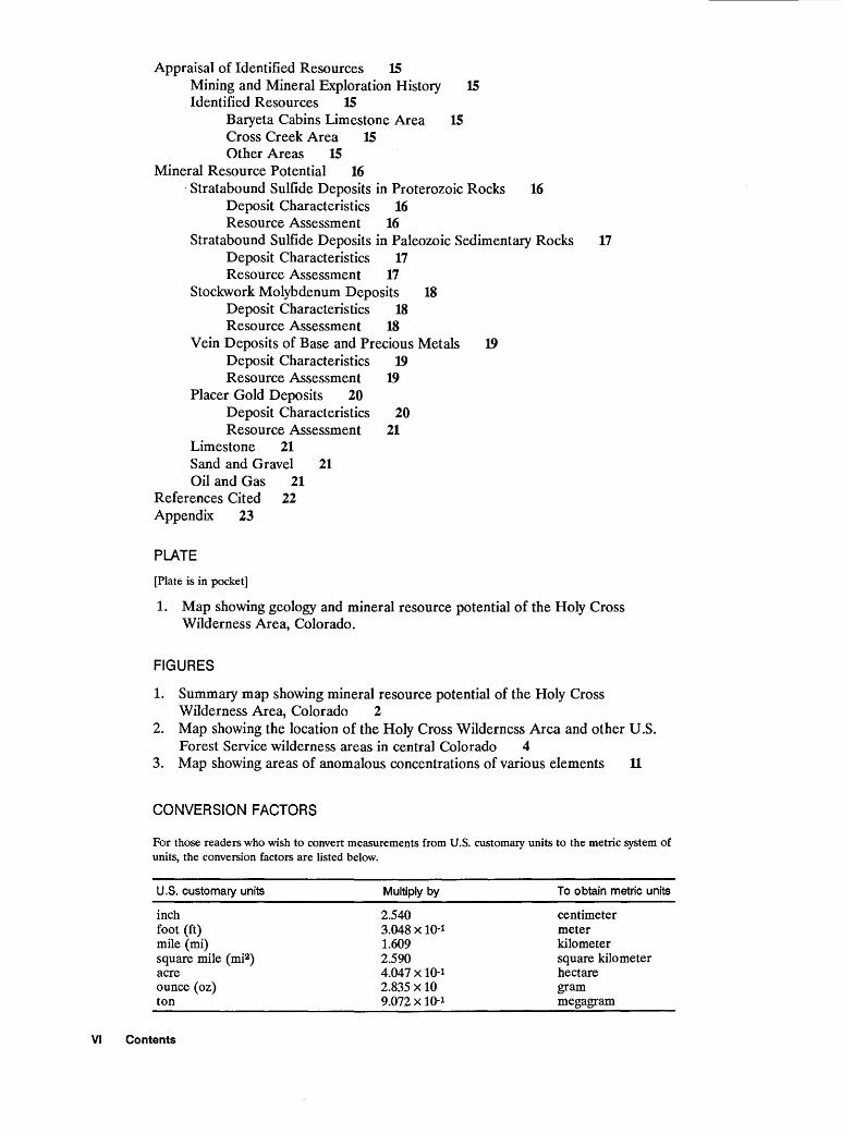
Appraisal of Identified Resources 1S Mining and Mineral Exploration History 1S Identified Resources 1S
Baryeta Cabins Limestone Area 15 Cross Creek Area 1S Other Areas 1S
Mineral Resource Potential 16 · Stratabound Sulfide Deposits in Proterozoic Rocks 16
Deposit Characteristics 16 Resource Assessment 16
Stratabound Sulfide Deposits in Paleozoic Sedimentary Rocks 17 Deposit Characteristics 17 Resource Assessment 17
Stockwork Molybdenum Deposits 18 Deposit Characteristics 18 Resource Assessment 18
Vein Deposits of Base and Precious Metals 19 Deposit Characteristics 19 Resource Assessment 19
Placer Gold Deposits 20 Deposit Characteristics 20 Resource Assessment 21
Limestone 21 Sand and Gravel 21 Oil and Gas 21
References Cited 22 Appendix 23
PLATE
[Plate is in pocket]
1. Map showing geology and mineral resource potential of the Holy Cross Wilderness Area, Colorado.
FIGURES
1. Summary map showing mineral resource potential of the Holy Cross Wilderness Area, Colorado 2
2. Map showing the location of the Holy Cross Wilderness Area and other U.S. Forest Service wilderness areas in central Colorado 4
3. Map showing areas of anomalous concentrations of various elements 11
CONVERSION FACTORS
For those readers who wish to convert measurements from U.S. customary units to the metric system of units, the conversion factors are listed below.
U.S. customary units
inch foot (ft) mile (mi) square mile ( mi2) acre ounce (oz) ton
VI Contents
Multiply by
2.540 3.048 X 10·1 1.609 2.590 4.047 X 10⁻¹ 2.835 X 10 9.072 X 10⁻¹
To obtain metric units
centimeter meter kilometer square kilometer hectare gram megagram
Mineral Resources of the Holy Cross Wilderness Area, Eagle, Pitkin, and Lake Counties, Colorado
By Alan R. Wallace, Gregory K. Lee, and David L. Campbell U.S. Geological Survey
William Lund by and S. Don Brown U.S. Bureau of Mines
ABSTRACT
The Holy Cross Wilderness Area {02-170) in the Sawatch Range of central Colorado is on the northwest side of the Colorado mineral belt, which is a northeast-trending zone of mineral deposits and related intrusive rocks that extends across western Colorado. Field and lab studies were conducted from 1983 through 1985 by the U.S. Geological Survey and U.S. Bureau of Mines to evaluate the identified mineral resources in and the mineral resource potential of the wilderness area. Identified resources include more than 100 million tons of high-purity limestone and about 13,650 tons of gold-silver ore. Parts of the wilderness area have moderate or high resource potential for deposits of base and precious metals and molybdenum in a variety of geologic environments, for sand and gravel, and for high-purity limestone.
SUMMARY
Character and Geologic Setting
The Holy Cross Wilderness Area encompasses about 213 mi:2 {126,000 acres) in the northern Sawatch Range in central Colorado {figs. 1, 2). It is located at the intersection of Eagle, Pitkin, and Lake Counties in the White River and San Isabel National Forests. Nearby towns include Vail to the northeast, Leadville to the southeast, and Aspen to the southwest. The terrain is extremely rugged, with ridges as high as 14,000 ft in elevation towering above steep-sided, glacially carved valleys.
The rocks underlying the wilderness area range from 1,80Q-Ma gneisses to modern alluvium. The core of the range is composed of Proterozoic sedimentary and volcanic rocks that were metamorphosed and deformed at about 1,700 Ma, coincident with the intrusion of a large granitic batholith. A second granitic batholith intruded all these rocks
Manuscript approved for publication, November 23, 1988.
at about 1 ,400 Ma. During early and middle Paleozoic time, more than 500 ft of marine sediments were deposited on top of the Proterozoic rocks. Orogenic uplift in late Paleozoic time induced erosion of some of the sedimentary rocks and marked the onset of continental and shallow-marine sedimentation that persisted until about 70 Ma and blanketed the area with an additional sequence of sediments which was 2-3 mi thick. Uplift during the Laramide orogeny between about 70 and 55 Ma was accompanied by active faulting, erosion, and igneous activity. Renewed activity that commenced at about 36 Ma produced additional igneous rocks and mineral deposits, and tectonic and igneous activity has continued in the region essentially to the present. Glacial activity that started at about 1.5 Ma carved deep valleys and cirques in the mountains to produce the modern landscape.
Identified Mineral Resources
A resource of about 13,650 tons, averaging 0.37 oz gold/ton and 0.2 oz silver/ton, was determined to be present within the wilderness area in the Cross Creek area just west of Holy Cross City. Sampling of veins and intervening zones in the vicinity of Holy Cross City suggests a possible resource of large tonnages of low-grade gold ore.
A resource of high-purity limestone resource that totals more than 100 million tons and assays in excess of 98 percent CaC03 was delineated just south of Baryeta Cabins in the northwest corner of the wilderness area.
Resource Potential
The characteristics of known mineral deposit types in the region were compared with the geologic, geochemical, and geophysical data collected during this study to assess the mineral resource potential of the wilderness area. The area has moderate to high resource potential for mineral deposits in the following broad categories, with locations shown in figure 1.
Summary

0
I 0
Study area
• COLORADO
I
5 MILES I
5 KILOMETERS
) (Vail Pass
APPRO XI MATE BOUNDARY OF THE HOLY CROSS WILDERNESS AREA
CLIMAX.
)(Tennessee Pass
• LEADVILLE
Figure 1 (above and facing page). Summary map showing mineral resource potential and selected geographic features of the Holy Cross Wilderness Area.
(1) Base and precious metals in vein and stratabound deposits. Areas that have high potential for vein deposits are in two northwest-trending belts that traverse the wilderness area, in an area near the Homestake mine on the east side of the wilderness area, and in an area surrounding the Timberline Lake stockwork molybdenum deposit at the south edge of the wilderness area. An area near the Turquoise Lake molybdenum deposit at the southeast edge of the wilderness area has moderate potential for vein deposits. Areas that have moderate potential for stratabound deposits in Paleo-
zoic sedimentary rocks are on the north and west sides of the wilderness area.
(2) Molybdenum and copper in stockwork deposits. Two areas have high potential for such deposits: Near Middle Mountain in the center of the wilderness area, and near Timberline Lake near the southern boundary. An area along East Lake Creek has moderate potential for stockwork molybdenum deposits. A stockwork molybdenum deposit has been identified 2 mi southeast of the wilderness area boundary at Turquoise Lake, but it does not extend into the
2 Mineral Resources of the Holy Cross Wilderness Area, Eagle, Pitkin, and lake Counties, Colorado

EXPLANATION OF IDENTIFIED RESOURCES AND MINERAL RESOURCE POTENTIAL
[All areas underlain by units Qg and Qgu (shown on plate 1) have high mineral
resource potential , at certainty level D, for sand and gravel deposits. The entire
wilderness area has low mineral resource potential , at certainty level C, for placer
gold deposits and geothermal energy. All areas not shown as having high or
moderate mineral resource potential for a specific commodity have low mineral
resource potential , at certainty level C, for that commodity)
M/C
I M/c.sl
I M/B I
1%~23
Geologic terrane having high mineral resource potential, at certainty level D, for stock work molybdenum deposits
Geologic terrane having high mineral resource potential, at certainty level D, for veins of base and precious metals
Geologic terrane having high mineral resource potential, at certainty level C, for high-purity limestone
Geologic terrane having moderate mineral resource potential, at certainty level C, for veins of base and precious metals
Geologic terrane having moderate mineral resource potential, at certainty level C or B, for stockwork molybdenum deposits
Geologic terrane having moderate mineral resource potential, at certainty level B, for stratabound sulfide deposits in Paleozoic carbonate rocks
Geologic terrane having low mineral resource potential, at certainty level C, for stratabound sulfide deposits in Proterozoic metamorphic rocks
wilderness area. An area between Cunningham Creek and Lyle Lake has moderate potential for molybdenum in a stockwork deposit.
(3) Limestone. Areas that have high potential for highpurity limestone and dolomite are in the northern and western parts of the wilderness area where Paleozoic carbonate units are exposed.
(4) Sand and gravel. Glacial deposits are widespread throughout the wilderness area, and areas that are underlain by these deposits have high potential for sand and gravel.
In addition, the western flank of the range, which includes part of the wilderness area, has unknown potential for oil and gas resources. The wilderness area has low potential for other metals in various deposit types and for geothermal energy.
INTRODUCTION
The Holy Cross Wilderness Area (02-170) is in the northern part of the Sawatch Range in west-central Colorado (fig. 2). The crudely oval shaped area of about 213 mi2 (126,000 acres) is located in Eagle, Pitkin, and Lake Counties. It is largely within the White River National Forest, although the southeast corner is in the San Isabel National Forest. The Continental Divide crosses the southeast part of the area: Streams to the west and north drain into the Colorado River system, whereas those to the southeast flow into the Arkansas River.
The north-trending Sawatch Range includes many of Colorado's highest peaks. The northern end, which includes the wilderness area, has numerous peaks with
elevations in excess of 13,000 ft, and one-Mount of the Holy Cross-is over 14,000 ft high. Deep, glacially carved valleys separate the high jagged ridges, and the valley walls are extremely steep, which is typical of glacial valleys. Small rock and snow glaciers occupy the cirques at the heads of the valleys, and small lakes are common. Most of the terrain above 11,000 ft is above timberline, whereas dense spruce and aspen forests are common at lower elevations.
Numerous paved and gravel State and local roads provide access to the periphery of the wilderness area. A gravel road extends along Homestake Creek from the eastern border of the wilderness area and terminates at Homestake Reservoir and other, related water-diversion dams and tunnels.
Horse and foot trails extend up most of the valleys in the area. Most trails are restricted to the valley floors because the steep valley walls along most drainages hinder access between adjacent valleys. Nevertheless, prospect pits in seemingly inaccessible locations are a testament to the thorough scrutiny given this area by 19th-century prospectors.
Investigations by the U.S. Bureau of Mines
The U.S. Bureau of Mines (USBM) examined U.S. Bureau of Land Management and County records for the locations of patented and unpatented mining claims, mineral leases, and oil and gas leases in and near the wilderness area. Field studies concentrated on the examination of known mines, prospects, and mineralized areas inside or within 1 mi of the wilderness area boundary. Accessible mines and prospects were mapped and sampled. Mine and prospect dumps were grid-sampled, and panned concentrates were taken from selected drainages to aid in identifying resources within the drainages. The USBM Reno Research Center in Nevada analyzed 290 rock or chip, 300 dump, and 20 pannedconcentrate samples. A total of 296 days were spent doing field work during the summers of 1983 and 1984. The results of those investigations are detailed in Lundby and Brown (1987) and are summarized in this report.
Investigations by the U.S. Geological Survey
The U.S. Geological Survey (USGS) mapped and sampled the wilderness area and collected additional geophysical data to supplement existing information. Geologic mapping was carried out during 3 months (8 man-months total) in the summer of 1983 by A.R. Wallace, M.J. Blaskowski, R.C. Pearson, and J.S. Loen,
Introduction 3

40° 106°
Flat Tops Wilderness
•Eagle •Vail
HOLY CROSS WILDERNESS AREA Glenwood
• Springs
• Basalt
• Leadville
Mount Massive Wilderness
0
I 10 I
20 MILES I Study area
• I I 0 10
I 20 30 KILOMETERS
COLORADO
Figure 2. Map showing the location of the Holy Cross Wilderness Area and other U.S. Forest Service wilderness areas in central Colorado.
and during 3 months (5 man-months total) the following summer by Wallace and Blaskowski. Geologic mapping of the western half of the area was done on 1 :24,000-scale topographic maps and on 1:16,000-scale aerial photographs. The eastern half of the area had been mapped at 1:24,000 (Tweto, 1974) and 1:48,000 (Tweto and Lovering, 1977) scales, and, although not remapped, those areas were examined on a reconnaissance basis during this study to assess the mineral resource potential.
Geochemical sampling was done during the summer of 1983 by G.K. Lee, D.E. Hendzel, and J.P. Fox. Follow-up work the following summer was done by G.K. Lee. Stream-sediment, rock, heavy-mineral pannedconcentrate, and soil samples were collected during both field seasons. Additional rock samples were collected during geologic mapping studies.
Geophysical studies were made during 1984 by M.W. Webring, who established 43 new gravity stations in the wilderness area. In addition, a new aeromagnetic survey of the wilderness area was flown in the summer of 1984 by the USGS.
During both field seasons, all investigations were supported by helicopter access to the wilderness area from the base camp in Leadville. Field investigations within the wilderness were otherwise accomplished on foot.
The eastern half of the wilderness area was mapped by Tweto (1974) and Tweto and Lovering (1977), and those studies provided geologic and general resource information for those areas. In addition to the data from Tweto (1974), specific information regarding the mineral deposits at Turquoise Lake and of the St.
4 Mineral Resources of the Holy Cross Wilderness Area, Eagle, Pitkin, and Lake Counties, Colorado
Kevin mining district was obtained from reports by Craig (1980) and Singewald (1955); similar data for the nearby Timberline Lake mineral deposit were obtained from S.D. Ludington (written commun., 1984). The geology and resources of the western half of the area were largely unknown prior to this study. Gabelman (1950) provided information regarding the Fulford mining district, and MEC01 (Minerals Exploration Company) supplied data regarding and permitted access to diamond drill core from their property near Middle Mountain.
We wish to acknowledge the cooperation of the U.S. Forest Service during the course of this study, including the staff of the White River and San Isabel National Forests. Ogden Tweto and Robert Pearson provided a wealth of geologic information based upon their many seasons of field work in the area.
GEOLOGIC SETTING
The Sawatch Range is a north-trending anticline that is about 16 mi wide in the study area. The core of the range is composed of Proterozoic metamorphic rocks and Proterozoic, Cretaceous, and Tertiary igneous rocks. Phanerozoic sedimentary rocks flank the range on its west, north, and east sides. These units were at one time continuous across the area of the present range, but Cretaceous and younger uplift induced erosion of the Phanerozoic rocks.
Steeply dipping reverse faults control the western and northern margins of the range, whereas sedimentary rocks dip gently eastward on the east side of the range. Numerous faults, many of Proterozic ancestry, cut the crystalline basement; some of these fault zones were reactivated during Cretaceous and younger tectonic activity. The Mosquito Range to the east was originally part of the Sawatch anticline, but Oligocene and younger faulting along the north-trending Rio Grande rift zone truncated the eastern side of the Sawatch uplift to produce the Mosquito Range.
Proterozoic Rocks
Gneiss and Migmatite
Proterozoic gneisses, migmatites, and schists are the oldest rocks in the study area. The rocks are strongly foliated and folded, and compositional layering is common at all scales. Granitic material, ranging from a
lThe use of industry or firm names in this report is for location purposes only and does not impute responsibility for any present or potential effects on the natural resources.
few volume percent to virtually all of the rock, is intimately mixed with the gneisses. Protoliths for the gneisses were pelitic and quartzofeldspathic sedimentary rocks.
Biotite gneiss is the most common metamorphic lithology in the wilderness area; mica schist, quartzite, and amphibolite are locally common. The biotite gneiss is layered to massive and is composed of quartz, biotite, muscovite, plagioclase, and microcline, with various amounts of sillimanite, cordierite, and garnet. The gneiss also contains discontinuous pyrite-rich layers. The mica schist contains relatively more biotite and muscovite, and foliation is more pronounced than in the biotite gneiss. Quartzite is uncommon and is composed primarily of quartz with variable amounts of mica, feldspars, and sillimanite. Amphibolite layers are similar to those associated with the calc-silicate gneiss unit described below.
Migmatites compose about one-third of the gneissic material in the study area. The rocks are complexly deformed, and the leucosomes are both syntectonic and posttectonic. Many migmatitic areas grade into the Early Proterozoic Cross Creek Granite, whereas others are clearly cut by that intrusive unit. Similar relations can be observed between the gneisses and early diorites. By strict definition, migmatite refers to a "mixed rock" without any genetic connotations; during field mapping, therefore, rocks that contained between onethird and two-thirds granitic material were mapped as migmatite (pl. 1 ).
Calc-Silicate Gneiss
Calc-silicate gneiss forms a 1-mi-wide zone across the southeastern part of the wilderness area, extending east-northeast from Mormon Creek to beyond the boundaries of the wilderness area where the zone is covered by Paleozoic sedimentary rocks (Tweto, 1974). The unit, which is largely conformable with the enclosing biotite gneiss, grades westward into that unit and is absent west of Mormon Creek. Major lithologies include calc-silicate and felsic gneiss, amphibolite, hornblendegarnet-magnetite tactite, and marble. Mineralogically, the unit is composed of hornblende, plagioclase, pyroxenes, magnetite, garnet, calcite, epidote, and quartz. Conformable layers of pyrite and pyrrhotite are very common; exposure-related oxidation of these layers has produced a rust -colored zone within the larger calcsilicate gneiss unit. Similar, but discontinuous, layers were found in the biotite gneiss in Lime Creek, where they are cut by Proterozoic pegmatites. Pyrite is the dominant sulfide, with lesser pyrrhotite; other base-metal sulfides were not seen, but a zinc spinel (gahnite) was reported from the zone (R.C. Pearson, oral commun., 1985).
Geologic Setting 5
Early Proterozic Intrusive Rocks
Early Proterozoic intrusive rocks in the study area cut the metamorphic rocks and are in turn intruded by the Middle Proterozoic St. Kevin Granite. There are four suites of Early Proterozoic intrusive rocks: Early diorites and gabbros, the extensive Cross Creek Granite, the igneous complex of Holy Cross City (Tweto, 1974), and the Hellgate Porphyry.
Small bodies of foliated to massive dark-gray diorite and black gabbro are common throughout the area. The diorite and gabbro, which crosscut layering in the metamorphic rocks, are universally cut by Cross Creek Granite. Some of the massive diorites resemble those related to the Cross Creek Granite as well as those of Tertiary age.
The Cross Creek Granite is the dominant Proterozoic unit in the northern third of the wilderness area. The unit is predominantly an equigranular to porphyritic, medium- to coarse-grained, light-gray to pink monzogranite. Early phases are composed of fine-grained, dark-gray quartz diorite, whereas late phases include pink granite and pegmatites. Quartz, microcline, plagioglase, and biotite are the major minerals; magnetite and hornblende are locally common. The unit is syntectonic and has a locally pronounced metamorphic foliation. It has been dated at 1,710 Ma (C.E. Hedge, written commun., in Tweto and Lovering, 1977, p. 14).
The granitic and dioritic rocks of Holy Cross City were named by Tweto (1974) for intrusive rocks near Holy Cross City. Similar units were mapped during this study in the Cross Creek drainage. Despite the absence of crosscutting relations with other intrusive units, Tweto (1974) correlated these rocks with the Cross Creek Granite and early diorites, which they resemble.
The Hellgate Porphyry is exposed in the southwestern part of the wilderness area. It is a coarse-grained, porphyritic monzogranite to granite with 2-5-cm phenocrysts of microcline. It is cut by all phases of the St. Kevin Granite, and Tweto (1977) considered it to be an early phase of that unit. However, trace-element data, including rubidium/strontium ratios and zirconium concentrations (A.R. Wallace, unpub. data, 1985), show that the Hellgate is chemically more akin to the Cross Creek Granite. It therefore may be a late phase of the Early Proterozoic intrusive sequence rather than an early St. Kevin phase.
St. Kevin Granite
The St. Kevin Granite underlies much of the southern third of the wilderness area. It is predominantly a medium-grained, light-gray, equigranular muscovitebiotite monzogranite that compositionally ranges from a granodiorite to a granite. It is locally porphyritic or has a trachytoid texture. Tweto (1974) mapped fine-grained,
normal, granodioritic, and hybrid trachytoid facies of the unit. The granite is predominantly postorogenic, and any foliation is primary. Contacts with the enclosing rocks are generally sharp, but migmatization is prevalent in some areas. Uranium-thorium-lead data from Doe and Pearson (1969) provide an age of 1,411± 40 Ma.
A generally east-northeast-trending swarm of metalamprophyre dikes overlaps the zone of calc-silicate gneiss and biotite gneisses to the north and west. The dikes, which are composed of plagioclase, quartz, biotite, and hornblende, both cut and are cut by the St. Kevin Granite.
Lower Paleozoic Sedimentary Rocks
Unmetamorphosed Cambrian and younger sedimentary rocks nonconformably overlie the Proterozoic basement. The pre-Leadville units include the Cambrian Sawatch Quartzite and Peerless Formation, the Ordovician Manitou Dolomite and Harding Sandstone, and the Devonian and Mississippian Chaffee Group, which includes the Parting Formation, Dyer Dolomite, and Gilman Sandstone (Tweto and Lovering, 1977). The total thickness of the pre-Leadville section is about 565 ft in the Minturn area (Tweto and Lovering, 1977) and about 628 ft at Lime Creek in the western part of the area (Mackay, 1953). Despite disconformities in the section, all bedding is essentially parallel.
A regolith was developed on the Proterozoic rocks below the Sawatch Quartzite, and weathered, friable rocks extend for as much as 2 m below the nonconformity. The Sawatch Quartzite and the Parting Formation, which are massive white quartzites, are differentiated by thin brown sandy partings in the latter unit. Both form blocky talus slopes that obscure outcrops of many of the other formations. The Peerless Formation is light-brown, dolomitic shale and sandstone that are generally similar to the thin-bedded tan dolomite of the Manitou; the Manitou is locally purple shale. The Harding, where present, is a white to green quartzite. The Harding Sandstone pinches out to the west and is absent west of East Lake Creek, and the Manitou Dolomite antithetically thins eastward and pinches out between East Lake Creek and Beaver Creek; neither formation attains a significant thickness in the wilderness area. The Dyer Dolomite is thin, evenly bedded tan to gray dolomite that is overlain by the sandy to conglomeratic dolomite and sandstone of the Gilman, which is locally absent or very thin in the western part of the area.
Leadville Limestone
The massive blue-gray limestone of the Mississippian Leadville Limestone is the principal host rock for ores at the Leadville, Gilman, Fulford, and Aspen mining districts, and it therefore has historical economic signifi-
6 Mineral Resources of the Holy Cross Wilderness Area, Eagle, Pitkin, and Lake Counties, Colorado
cance in this region. The limestone is dolomitized in many of these areas, but limestone is much more common in outcrops in the study area. The contact with the underlying Dyer was obscure in the absence of the Gilman Sandstone. Mississippian and Early Pennsylvanian subaerial development of karst produced extensive caves, collapse breccias, and an extremely irregular preBelden Shale erosional surface. As a result, much of the formation is locally absent.
Upper Paleozoic and Mesozoic Sedimentary Rocks
Shallow-marine and continental sediments were deposited above the Leadville Limestone during late Paleozoic and Mesozoic time. The black shales and thin limestones of the Pennsylvanian Belden Shale were deposited unconformably on the Leadville Limestone, followed by deposition of the gray-brown turbidites and blue algal limestones of the Pennsylvanian Minturn Formation, which produced an aggregate thickness of more than 6,000 ft. Red sandstones and siltstones of the Permian and Pennsylvanian Maroon Formation overlie the Minturn; although widespread in nearby areas, the Maroon is exposed in only the extreme northwest corner of the study area. Similar red sedimentary rocks of the Triassic State Bridge Formation are exposed just southwest of Fulford. No other pre-Quaternary sedimentary rocks are exposed within or immediately adjacent to the wilderness area.
Cretaceous and Tertiary Igneous Rocks
Late Cretaceous and Tertiary intrusive rocks form two northwest-trending belts through the Holy Cross Wilderness Area. Most of the mineralized and altered rock in the study area is coincident with these two belts.
The northern belt extends southeastward from the Fulford stock near Fulford to the stock at West Tennessee Lakes, and includes many small to large stocks and innumerable dikes of various compositions; with one possible exception, all rocks are of Late Cretaceous or Paleocene age. The plutons can be divided into five groups on the basis of composition, texture, and crosscutting relationships: (1) The Fulford, Missouri Creek, and West Tennessee Lakes stocks, as well as several smaller plugs, known collectively as Fulford-type stocks; (2) the composite Treasure Vault stock; (3) the intrusive complex at Middle Mountain; (4) the syenite stock in East Lake Creek; and (5) intrusion breccias related to poorly exposed albite syenites (pl. 1). Furthermore, a sixth group would include many dikes that range in composition from andesite to rhyolite and that cannot be directly related to any of the exposed stocks.
The southern belt includes Oligocene intrusive complexes at Turquoise Lake and Timberline Lake and highly altered rhyolitic dikes northwest of Lyle Lake.
Fulford-Type Stocks
Stocks and smaller intrusive bodies of this group are fine-grained, equigranular, gray granodiorites to monzogranites that are virtually indistinguishable in the field. They are composed principally of plagioclase, biotite, orthoclase, and hornblende. Radiometric dates include: 64 Ma (Marvin and others, 1974) to 70.5 Ma (recalculated from Pearson and others, 1962, using new decay constants of Dalrymple, 1979) for the Missouri Creek stock; 66.4±2.2 Ma for the West Tennessee Lakes stock (Cunningham and others, 1977); and 62.2± 1.5 to 65.3±6.0 Ma (Cunningham and others, 1977) for the Fulford stock. Crosscutting relationships suggest that this suite of plutons represents some of the earliest Laramide igneous activity in the wilderness area. Contacts with enclosing rocks are generally sharp with relatively little contact metamorphism of even the sedimentary rocks around the Fulford stock.
Treasure Vault Stock and Related Intrusive Rocks
The Treasure Vault stock is a light-gray, coarsegrained, quartz-porphyry granite to monzogranite that is exposed throughout a roughly circular area, 1 mi in diameter, at the head of Cross Creek. Quartz, orthoclase, biotite, and plagioclase are the principal minerals; the quartz phenocrysts are as much as 0.5 inch in diameter. The main phase is cut by related fine-grained equigranular and fine-grained quartz-porphyry granites, as well as by the albite-syenite intrusion breccias described below. The age of the stock in relation to the other plutons in the intrusive belt could not be determined due to lack of crosscutting relations. The age of the main phase of the stock is 64.0±2.3 Ma (R.F. Marvin, written commun. to R.C. Pearson, 1984).
Intrusive Complex at Middle Mountain
Three major intrusive bodies, as well as several smaller related phases, are exposed west and south of Middle Mountain and include, in order of decreasing age, diorite, monzogranite, and rhyolite porphyry. The total outcrop area is about 1 mi2 • The diorite is a dark-gray, fine- to medium-grained, equigranular diorite to quartz diorite, which is exposed in an elliptical area southwest of Middle Mountain. Two phases of monzogranite intruded the diorite and the surrounding Protero-
Geologic Setting 7

zoic metamorphic rocks. The predominant phase is a coarse-grained monzogranite porphyry with orthoclase phenocrysts as much as 2 inches long. A medium-grained monzogranite with quartz and orthoclase phenocrysts cuts the coarse-grained monozgranite phase. Quartz, plagioclase, biotite, and orthoclase are the major minerals in both phases.
Numerous dikes and irregular bodies of rhyolite porphyry are exposed in the glaciated valley floor of West Cross Creek west of Middle Mountain. The rhyolite was emplaced largely in the Proterozoic gneisses, but it also cuts a body of the coarse-grained monzogranite porphyry. The rhyolite is tan to white and contains small phenocrysts of quartz, biotite, and altered plagioclase in a fine-grained groundmass of potassium feldspar and quartz. Quartz veinlets are common, and crenulate quartz-layered rock, which is typical of many granites from Climax-type molybdenum deposits (White and others, 1981), is visible in many outcrops and in diamond drill core. Sericite, quartz, and pyrite locally replace primary minerals in the rhyolite, but they are absent in most of the surrounding metamorphic rocks.
A fission-track date on zircon and a potassiumargon date on biotite from the early diorite provide ages of 59.3 ± 6.2 and 61.8 ± 1.4 Ma, respectively (Cunningham and others, 1977). Although these ages are the same within experimental error, they may in part reflect partial thermal resetting during subsequent emplacement of the monzogranite and rhyolite-porphyry bodies. The rhyolite porphyry, which has textural characteristics similar to those of Oliogocene stockwork molybdenum deposits such as Climax and Henderson in central Colorado, may be much younger than the rest of the Paleocene intrusive complex.
Syenite of East Lake Creek
A leucocratic, fine-grained, equigranular to porphyritic syenite to granite that contains scattered orthoclase phenocrysts is exposed in the west valley wall of East Lake Creek near Big Lake. The syenite was injected lit-par-lit into the adjoining Proterozoic rocks. Numerous mutually crosscutting quartz veins and small aplite dikes and thin, subhorizontal sheeted joints cut the stock. Fission track ages are 59.5±7.5 Ma on zircon and 65.3± 5.5 Ma on sphene (Cunningham and others, 1977).
Intrusion Breccias
Seven irregularly shaped bodies that contain subangular to rounded rock fragments set in a light-tan matrix of albite syenite are exposed between Gold Dust Peak and Treasure Vault Lake. Two bodies cut the Treasure Vault stock, one cuts a small Fulford-type plug,
and the other four are in Proterozoic metamorphic rocks. A quartz-latite dike, dated at 62.2±1.7 Ma (R.F. Marvin, written commun., 1985), cuts a large body of intrusive breccia in East Lake Creek.
Fragments in the breccias are unaltered and are composed of all locally exposed rock units. The albitesyenite matrix is sparse to abundant, but it only rarely forms outcrops without fragmental inclusions. In areas where it invaded the Treasure Vault stock, metasomatism and assimilation of the stock by the syenite produced vague contacts and hybrid rocks. In contrast, Proterozoic host rocks are unaltered and have sharp contacts with the enclosing syenite. The syenite is white, fine grained, equigranular, and composed principally of albite, chlorite, and minor quartz. Locally it grades into porous albite-siderite-gold veins in the study area.
Miscellaneous Dikes
The northern intrusive belt contains a plethora of dikes, but Laramide and younger dikes are rare beyond the narrow confines of this belt. Lithologies range from andesite to rhyolite, but latite and quartz latite are the most common compositions. Few dikes can be related spatially or temporally to any of the exposed plutons. Most dikes are vertical and generally trend to the northwest, although a few trend to the northeast. Andesite dikes, which are generally the youngest of the dikes, trend to the east-northeast. Most dikes are leucocratic and fine grained and contain phenocryts of quartz, potassium feldspar, and plagioclase, and locally hornblende and biotite.
Intrusive Suite at Timberline Lake
Tweto (1974) mapped two small areas of latite breccia west and south of Timberline Lake in the southernmost part of the wilderness area. Additional mapping identified three intrusive lithologies: Rhyolite porphyry, quartz-latite porphyry, and quartz-latite breccia. The rhyolite porphyry is fine grained with local phenocrysts of quartz and altered feldspar 0.2 inches in diameter. The quartz-latite porphyry has a similar texture and phenocryst assemblage, and it forms the core of the intrusive center and the matrix of the breccia. The quartz-latite breccia, which forms a partial ring around the intrusive center, is composed of pebble- to bouldersized subrounded fragments of Proterozoic and Tertiary rocks in a fine-grained, ashy matrix of quartz latite and comminuted rocks. The intrusive rocks are strongly altered to quartz, sericite, and pyrite. Sericite yielded a potassium-argon date of 35.4±1.2 Ma (Tweto, 1974), which provides the age of the late-magmatic molybdenum mineralization.
8 Mineral Resources of the Holy Cross Wilderness Area, Eagle, Pitkin, and Lake Counties, Colorado

Intrusive Suite at Turquoise Lake
Tweto (1974) mapped a small body of Lincoln Porphyry (dated at 64 Ma near Leadville; Pearson and others, 1962) along the north shore of Turquoise Lake, as well as radiating dikes of flow-banded vitric rhyolite that he considered to be of Miocene or Pliocene age. Further mapping and evaluation of diamond drill core by Craig (1980) delineated an intrusive complex centered on a quartz-latite-porphyry stock. According to Craig (1980) the intrusive rocks include the two quartz-latiteporphyry phases of the stock, early latite di~es, and intrusive breccias related to emplacement of the stock. Tweto's (1974) mapped area of Lincoln Porphyry was redefined as the coarser of the two porphyry phases, and that unit gave a potassium-argon age of 35.6± 1.2 Ma (Craig, 1980). Craig (1980) concurred with Tweto's (1974) geologically young age for the rhyolite dikes that cut the Turquoise Lake stock. None of the phases are well exposed in the vicinity of the stock; the rhyolite dikes are best exposed north of Turquoise Lake in the wilderness area.
Quaternary Surficial Deposits
Surficial deposits cover about 10 percent of the wilderness area, although such deposits are more extensive beyond the limits of the area studied (Tweto and others, 1978). The deposits are all of Quaternary age and include glacial till in moraines, talus on steep slopes, rock glacier deposits, solifluction deposits, landslide deposits, and alluvial deposits along streams.
Alpine glaciers occupied most or all of the valleys in the study area during at least the Bull Lake and Pinedale glaciations. Till was deposited largely in lateral moraines high along the sides of the valleys, notably along Homestake Creek, along Fryingpan River, and near Woods Lake along Lime Creek. Till was also deposited in terminal moraines at the points of maximum glacial advances, beyond which glacial outwash was deposited. Neoglacial deposits occupy many of the high cirques in the area.
Talus, landslides, and rock glaciers are common along steep slopes, especially in steep-sided cirques. Rock glaciers and rock slides have blocked streams to form New York, Slide, and Beaver lakes, and rock glaciers are common in the upper reaches of most drainages.
Felsenmeer, an accumulation of angular blocks and slabs of frost -shattered rock, covers large areas above timber line. Most bedrock units can be mapped on the basis of over lying felsenmeer and solifluction deposits, but contacts between rock units are only approximately located.
Alluvial deposits, which are relatively uncommon in the study area due to the steep gradients of most of the streams, occur as small alluvial deposits scattered along streams. These deposits also occur where streams were once dammed behind, or the gradients were modified by, glacial till in the valley bottoms.
Structure
The structural geology of the wilderness area is largely the product of Proterozoic and of Laramide and younger tectonic activity. Many of the Proterozoic structures were reactivated or modified by the younger events.
Proterozoic Structures
Multistage deformation in the metamorphic rocks produced complex patterns of folding, layering, and foliation; emplacement of the granitic rocks of the 1,700--Ma suite caused further deformation. The dominant trend of the compositional layering and foliation is northeast, although variations from this trend are common. The dip of the layering is predominantly very steep, especially in the northern two-thirds of the area, although it is as shallow as 20° near Mormon Lake where a thick sill of St. Kevin Granite invaded the gneisses.
Folds are common at all scales, and evidence of as many as three episodes of deformation are locally visible. Fold axes plunge steeply, and folds are open to tightly isoclinal. Many folds are disrupted by injected igneous material. No folds of post-St. Kevin age were observed; most predated or were contemporaneous with the emplacement of the Cross Creek Granite.
The major Proterozoic fault system in the wilderness area is the Homestake shear zone, which is a composite belt of structural disruption that extends northeastward from the Fryingpan River area. The zone consists of a multitude of faults characterized by mylonite, cataclasite, and gouge. In the wilderness area, many zones were formed by penetrative ductile flow and were later subjected to more brittle processes of deformation. Some zones are well-defined phyllonitic mylonites, whereas others grade from well-layered gneiss into ultramylonite. Most zones dip steeply, although some are subhorizontal, especially near Homestake Peak (Tweto, 1974). The structures do not cut rocks of the St. Kevin Granite, but many cut rocks of the 1,700-Ma plutonic suite.
Laramide and Younger Structures
The Proterozoic basement was exhumed during Laramide (Late Cretaceous-early Tertiary) and younger
Geologic Setting 9
uplift and erosion (Tweto, 1975). The eastern flank of the Sawatch Range is relatively undeformed, and Cambrian and younger sedimentary rocks dip gently eastward off the exposed basement. In contrast, the northern and western flanks of the range are controlled by faults, many of which extend into the basement. Major northeaststriking, west -dipping reverse faults, with attendant tear faults, repeat the lower Paleozoic section along the northern and northwestern range fronts. Vertical displacement on each fault may exceed 1,000 ft. Several of these faults can be traced for more than 10 mi along strike in the basement rocks, where they are characterized by fault gouge and chloritic alteration. Similar gouge and chlorite along segments of many of the faults in the Proterozoic Homestake shear zone suggest Laramide and younger reactivation of those structures.
A reverse fault with a total displacement of more than 3,000 ft dominates the western range front between Last Chance Creek and Fulford. Between Last Chance and Lime Creeks, the north-northwest-trending fault brings steeply dipping, locally overturned, Paleozoic strata against basement rocks; less than 1 mi to the west the strata are nearly horizontal. To the south the fault is exposed only in the basement, and remnants of Cambrian rocks are compressed into north-trending folds. North of Lime Creek, the fault cuts westward and upsection and eventually juxtaposes Pennsylvanian and older strata. A north-trending fault, which extends northward from Lime Creek, truncates this reverse fault about 3 mi north of Lime Creek but does not appear to cut the Fulford stock, which implies that the reverse fault formed before intrusion of the stock.
Miocene and younger rifting created the northtrending Arkansas River valley (Tweto and Case, 1972). North-trending normal faults along the southeast side of the study area are related to this event, and rhyolite dikes were emplaced along several of the faults. These faults are probably the youngest structures in the study area.
GEOCHEMICAL INVESTIGATIONS
Geochemical Sampling Methods
A geochemical sampling program was conducted concurrently with the geological and geophysical studies in order to determine the distribution of elements of interest for mineral resource appraisal. A total of 297 stream -sediment samples were collected from most of the active first -order drainages in the study area as well as from all second-order and larger streams. At each sample site a composite of fine material from several localities within the stream was taken and later air dried for sieving and analysis.
Panned concentrates of stream sediments were collected at 193 localities from drainages that were large enough to contain deposits of gravel and coarser sediment. These samples were generally taken near the stream-sediment sample localities but consisted of coarser material which represents a relatively high energy depositional environment in the stream. A heavy-mineral concentrate was obtained by panning, after which the concentrate samples were sent to the laboratory for drying and analysis.
Rock and soil samples were collected for two purposes: (1) To identify and evaluate places where obviously mineralized and (or) altered rock occurs within the study area, and (2) to provide data for the determination of background abundances of elements in rocks throughout the study area. The rock samples were usually taken as representative composites of chips from outcrops, but at localities where altered rocks were found, the most mineralized or altered material was collected. Float samples were taken if mineralized rocks were seen and the source outcrop was inaccessible or unknown. Soil samples were obtained at some of the rock-sample localities to provide well-mixed composites of the outcrops. A total of 430 rock and 127 soil samples were collected.
Heavy-mineral concentrates were prepared from samples from various mine and prospect dumps in order to provide additional information on mineral occurrences. Sampling was done at localities where sufficient water was available for panning. These concentrates were treated similarly to the panned concentrates of stream sediments.
Sample Preparation and Analysis
All rock samples were crushed, ground, split, and analyzed. Soil and stream-sediment samples were dried and sieved through an 80-mesh (177 micrometer) screen, and the fraction finer than 80-mesh was analyzed. Panned concentrates were dried, and a small split of each sample was separated for spectrographic analysis. The remainder of each concentrate was weighed and analyzed for gold content.
Six-step semiquantitative emission spectrographic analyses were made of all the samples by R.T. Hopkins, Jr., using the method of Grimes and Marranzino (1968). Each spectrographic analysis included determinations of 31 elements. Atomic absorption analysis for gold was performed on every panned:-concentrate sample using the method described by Thompson and others (1968). Atomic absorption determinations of antimony, bismuth, cadmium, lead, and zinc were made on the rock samples using the method described by Viets (1978).
10 Mineral Resources of the Holy Cross Wilderness Area, Eagle, Pitkin, and Lake Counties, Colorado

Summary of Results
The results of the sampling survey delineate several areas within or immediately adjacent to the study area boundaries that contain anomalously high concentrations of one or more elements of economic interest. Brief descriptions of these areas and the summaries of corresponding geochemical data are given below; numbers are keyed to tracts in figure 3. The concen-
39° 30'
39° 15'
0
I 0
I
5 MILES I
5 KILOMETERS
1 06"30'
tration of an element was considered to be anomalous when qualitatively compared with the data base as a whole, with the geologic environment, and with background concentrations in similar geologic terranes. However, no statistical methods of evaluation were applied to the data base. Although several of the anomalous areas are contiguous and therefore might be considered together, they are discussed separately to provide greater spatial detail.
106°15'
APPROXIMATE BOUNDARY OF THE HOLY CROSS WILDERNESS AREA
LEADVILLE •
CLIMAX •
Figure 3. Map showing the general outlines of areas with anomalous concentrations of various elements in streamsediment, rock, soil, and panned-concentrate samples. Numbers refer to areas discussed in the text.
Geochemical Investigations 11

Lyle Lake-Timberline Lake Area (1)
Geochemical data in the Lyle Lake-Timberline Lake area show moderate enrichment in silver, molybdenum, lead, and zinc. Two of six rock samples in the area contained detectable silver with the maximum value at 3 ppm (parts per million). Stream-sediment samples showed silver ranging from 0.5 to 2 ppm in four of six samples. Similarly, two of five panned-concentrate samples contained 1-2 ppm silver. Molybdenum was found in one rock sample at 30 ppm, in all three soil samples at 5-7 ppm, and in five stream-sediment samples at 5-10 ppm. Lead values attained maximums of 300 ppm in rocks, 500 ppm in panned concentrates, and 300 ppm in stream sediments. Zinc was found to be 7,000 ppm in one of the panned concentrates and 200--500 ppm in three of the stream-sediment samples.
Galena Mountain Area (2)
Low-level anomalies of silver, gold, molybdenum, lead, and zinc were found in the southeast corner of the study area near Galena Mountain. Silver at 2 ppm was found in 1 of 13 rock samples in the area. Gold was measured at 0.25 ppm in 1 of 5 panned concentrates. Molybdenum was measured at 30 ppm in 1 rock sample, 15 ppm in 1 of 4 soil samples, and 5 ppm in 2 of 8 stream-sediment samples. Rock samples contained as much as 100 ppm lead, and stream-sediment samples and panned concentrates contained as much as 200 ppm lead. Two stream-sediment samples contained 200 ppm zinc.
Homestake Mine Area (3)
The area extending from Homestake Peak to the Homestake mine contains anomalous concentrations of silver, arsenic, gold, cadmium, copper, molybdenum, lead, tungsten, and zinc. Silver ranged from 0.5 to 15,000 ppm in 9 of the 22 samples collected in the area; the highest values came from localities in and around the Homestake mine. Panned concentrates showed silver at 150 ppm in 1 of 5 samples from the vicinity, and stream-sediment samples contained silver values as high as 20 ppm in 3 of 8 samples. Arsenic was detected in 2 of the rock samples; the highest value of 3,000 ppm was at the Homestake mine. Gold was found in 2 panned concentrates, with a maximum value of 0.5 ppm. Cadmium values were as high as 200 ppm in 2 of the rock samples. Zinc was found at levels as high as 10,000 ppm at the Homestake mine. As much as 5,000 ppm zinc was also found in 3 panned concentrates and as much as 700 ppm in 2 stream-sediment samples. Copper values were as high as 20,000 ppm in the rock samples, 100 ppm in soils, 1,500 ppm in panned concentrates, and 150 ppm in stream sediments. Molybdenum is present only at low levels in this area; molybdenum at 5 ppm was found in
only 1 rock sample and in 2 stream-sediment samples. Lead was measured at levels as high as 20,000 ppm in rocks, 200 ppm in soils, 1,000 ppm in panned concentrates, and 2,000 ppm in stream sediments. A rock sample at the Homestake mine contained 50 ppm tungsten and 5,000 ppm antimony. In addition, a panned concentrate of material from the Homestake mine contained 5,000 ppm silver, 3,000 ppm arsenic, 98 ppm gold, 200 ppm cadmium, 7,000 ppm copper, 10 ppm molybdenum, 50,000 ppm lead, and 2,000 ppm antimony. The most highly mineralized rock samples in the vicinity of the Homestake mine were of sulfide-bearing quartzsiderite vein material.
Sulfide-Bearing Calc-Silicate Gneiss (4)
A continuous, roughly east-west trending sulfide zone that extends from Savage Lakes to Paradise Lakes to East Homestake Creek contains silver, gold, copper, molybdenum, lead, and zinc in slightly anomalous concentrations. Silver was detected in 1 of 6 soil samples at 2 ppm. Gold at a maximum concentration of 0.6 ppm was found in 2 of 9 panned concentrates. Copper values were as high as 150 ppm and 300 ppm in the 16 rock and 6 soil samples, respectively. Molybdenum was found in 3 of the rocks at values as high as 10 ppm and in 1 of the soils at 7 ppm. Stream-sediment samples contained 5-7 ppm molybdenum in 4 of 10 samples. Slightly anomalous lead levels are indicated by values as high as 150 ppm in soils and panned concentrates and 100 ppm in stream sediments. Zinc concentrations in rocks were as high as 500 ppm. One soil sample contained 300 ppm zinc, and one stream-sediment sample contained 200 ppm zinc.
Gold Park Area (5)
Samples in the vicinity of Gold Park at the edge of the study area on Homestake Creek below Homestake Reservoir contained anomalous amounts of silver, gold, cadmium, copper, lead, antimony, and zinc. Two of three pyrite-quartz-vein rock samples taken around prospect pits on the southeast side of Homestake Creek contained detectable silver, with a maximum value of 200 ppm. Gold was found at a level of 0.25 ppm in the pannedconcentrate sample from the stream that drains the area. As much as 500 pm cadmium was found in two rock samples, and 10,000 ppm zinc was found in one of the rock samples. One rock sample contained 20,000 ppm lead, and five stream-sediment samples contained as much as 150 ppm lead. Antimony was found in two of the rocks with a maximum value of 120 ppm.
Holy Cross City Area (6)
The Holy Cross City area is a historic mining district at the edge of the study area immediately
12 Mineral Resources of the Holy Cross Wilderness Area, Eagle, Pitkin, and Lake Counties, Colorado
northwest of Gold Park. Samples in this area contained values primarily indicative of gold and silver enrichment with slight indications of minor lead and zinc anomalies. Eleven of 15 rock samples contained between 0.5 and 50 ppm silver, and 2 rock samples contained as much as 50 ppm gold. All 3 panned concentrates from streams draining the area contained between 4.8 and 164 ppm gold. Two panned concentrates of mine dumps contained visible gold with analyzed concentrations of 266 and 500 ppm. Marginally noteworthy values of 100 ppm lead and 110 ppm zinc were also found in the rock samples.
Fancy Pass-Upper Cross Creek Area (7)
The area extending from Fancy Lake southwest of Holy Cross City to Treasure Vault Lake and the west side of Holy Cross Ridge east of Harvey Lake contains anomalous concentrations of silver, arsenic, gold, copper, molybdenum, lead, tungsten, and zinc. Thirteen of 34 rock samples in the area contained between 0.5 and 500 ppm silver, and 2 of 5 soil samples contained as much as 50 ppm silver. As much as 3,000 ppm arsenic was detected in the rock samples; 2 rock samples and 1 soil sample from a prospect pit had gold values of 10 and 15 ppm and 70 ppm, respectively. Gold was also detected in 3 of 4 panned concentrates at a maximum of 4.4 ppm. Copper values in rocks were as high as 15,000 ppm at an abandoned mine, 300 ppm in the 5 soil samples, 150 ppm in panned concentrates, and 200 ppm in the 10 streamsediment samples. Between 5 and 500 ppm molybdenum was detected in 11 of the rock samples and between 5 and 15 ppm in 4 of the stream-sediment samples. Lead was found in concentrations as high as 20,000 ppm in rocks and 2,000 ppm in soils at abandoned mines. A minor indication of tungsten (200 ppm) was found in one panned concentrate. A maximum zinc value of 5,000 ppm was detected in the rock samples at a prospect pit. Four panned concentrates of mine and prospect dumps contained as much as 3,000 ppm silver, 1-81 ppm gold, and as much as 50,000 ppm copper and lead; 1 sample contained 3,000 ppm zinc.
Blodgett Lake Area (8)
The Blodgett Lake area from the north side of Savage Peak to about 0.5 mi northwest of Blodgett Lake contains several minor geochemical anomalies in silver, copper, molybdenum, lead, and zinc. Four of 12 rock samples collected in the area contained between 0.5 and 70 ppm silver, and 1 of 3 soil samples contained 1.5 ppm silver. Copper values were as high as 3,000 ppm in rocks and 500 ppm in soils. Molybdenum was detected in 3 rock samples with a maximum value of 30 ppm, in 1 soil sample at 70 ppm, and in 2 of 6 stream-sediment samples at 5 and 7 ppm. The maximum lead value was 500 ppm in
the rock samples and 100 ppm in the soil and streamsediment samples. A minor indication of slight zinc enrichment was found in one rock sample at 200 ppm. The most mineralized rock samples in the area were of vuggy, pyritic quartz veinlets in migmatitic gneiss.
Middle Mountain Area (9)
Samples from the Middle Mountain area, bounded by Cross Creek and West Cross Creek, contained anomalously high concentrations of silver, gold, copper, molybdenum, lead, tungsten, and zinc. Silver was detected between 0.5 and 150 ppm in 15 of 34 rock samples collected in the area, many from prospect pits in vuggy, pyritic quartz vein material. Soil samples contained detectable silver in 3 of 8 samples, with values as high as 5 ppm. One of the 10 stream-sediment samples contained 1 ppm silver. Gold was found in 5 of 9 panned concentrates, with a maximum value of 8.9 ppm. Copper values were as high as 20,000 ppm in rocks, 10,000 ppm in soils, 1,000 ppm in panned concentrates, and 700 ppm in stream sediments. Molybdenum concentrations ranged from 5 to 2,000 ppm in 17 of the rock samples and as high as 150 ppm in 5 of the soils. Panned concentrates contained molybdenum, with a maximum value of 70 ppm in 3 samples, and one of the stream-sediment samples contained 100 ppm molybdenum. Lead values were as high as 20,000 ppm in the rock samples, 1,500 ppm in the soils, 100 ppm in panned concentrates, and 200 ppm in stream-sediment samples. Seven rock samples contained 50-300 ppm tungsten, and one soil sample had 150 ppm tungsten. Zinc values were as high as 170 ppm in rocks, which indicated only minor enrichment. Two panned concentrates of prospect dumps were collected on the north and northwest sides of Middle Mountain: Silver values were 1.5 and 50 ppm; copper, 1,500 and 20,000 ppm; molybdenum, 100 ppm in 1 sample; lead, 150 and 10,000 ppm; tungsten, 200 ppm in 1 sample; and gold, 6.7 and 27 ppm.
East Lake Creek-New York Mountain Area (1 O)
Samples from a broad northwest -trending zone extending from West Cross Creek to upper East Lake Creek to Craig Peak and north of New York Mountain were found to have anomalous concentrations of silver, arsenic, gold, copper, molybdenum, lead, tungsten, and zinc. Rocks contained 0.5-70 ppm silver in 16 of 130 samples, and soils had a maximum of 1.5 ppm silver in 3 of 32 samples. Silver was detected in 1 of 39 panned concentrates at a level of 10 ppm and in 4 of 65 stream sediments, with a maximum value of 15 ppm. As much as 2,000 ppm arsenic was detected in the rocks, and arsenic was also found in 1 soil sample at 500 ppm. Gold was detected in 17 panned concentrates at levels as high as
Geochemical Investigations 13
3.6 ppm and in 1 rock sample at 15 ppm. Copper values were as high as 3,000 ppm in rock samples, 500 ppm in soils, 150 ppm in panned concentrates, and 1,000 ppm in stream-sediment samples. Molybdenum was detected in 37 rock samples at 5-500 ppm, in 7 soils at values as high as 70 ppm, in 3 panned concentrates at values as high as 15 ppm, and in 18 stream-sediment samples at 5-70 ppm. Lead values in rock, soil, and stream-sediment samples were as high as 200 ppm, whereas maximum lead values in panned concentrates were as high as 2,000 ppm. Minor indications of tungsten enrichment were found in 4 rock samples and 2 panned concentrates with maximum values of 100 and 300 ppm, respectively. Zinc was found at a maximum value of 500 ppm in rocks, at 700 ppm in one panned concentrate, and at 300 ppm in one streamsediment sample. Four panned concentrates of mine and prospect dumps were also collected: One sample had 70 ppm silver; all 4 samples contained gold in concentrations ranging from 0.2 to 65 ppm and copper and lead in concentrations as high as 150 ppm; and 1 sample had 70 ppm molybdenum.
Ohio Tunnel-Cross Creek Area (11)
Samples from the area extending southeast from the Ohio and Discovery Tunnels on either side of East Lake Creek to Upper Turquoise Lake to Cross Creek were found to have anomalously high values of silver, arsenic, gold, cadmium, copper, molybdenum, lead, antimony, tungsten, and zinc. Silver was found in 1 of the 4 soil samples at 30 ppm and in 9 of the 18 rock samples at 0.5-200 ppm, with the highest values associated with mine and prospect locations. Anomalous arsenic values as high as 10,000 ppm were found in rock samples primarily associated with previous mining and prospecting activity. Two of the rock samples contained detectable gold, with a maximum value of 30 ppm. Gold was also found in 4 of the 6 panned concentrates, with a maximum value of 2.3 ppm. Antimony values in rock samples were as high as 700 ppm, and 1 soil sample contained 200 ppm antimony. Cadmium and zinc were found in rock samples at maximum values of 100 ppm and 10,000 ppm, respectively, also associated primarily with mine and prospect sites. Zinc was also found in 2 soil samples to a maximum value of 700 ppm and in 1 panned concentrate at 500 ppm. Maximum anomalous copper values were 7,000 ppm in rocks, 500 ppm in soils, and 100 ppm in the 11 stream-sediment samples. Only one rock sample contained molybdenum, with a value of 7 ppm, and two stream-sediment samples contained detectable molybdenum with a maximum of 20 ppm. The highest lead values were 20,000 ppm in rocks, 5,000 ppm in soils at mine localities, and 200 ppm in the panned concentrates. Four panned concentrates collected from mine and prospect dumps contained silver ranging from
2 to 500 ppm, arsenic in 2 samples with a maximum value of 15,000 ppm, gold in all 4 samples at 2.7-770 ppm, copper as high as 7,000 ppm, lead as high as 30,000 ppm, antimony in 1 sample at 500 ppm, tungsten in 1 sample at 5,000 ppm, and zinc in all 4 samples at 50-10,000 ppm.
GEOPHYSICAL INVESTIGATIONS
Forty-three new gravity stations were established in the wilderness area; these stations augmented about 80 readings that previously had been made nearby, most of them along roads (Behrendt and Bajwa, 1974). The gravity data were reduced and contoured to make a preliminary Bouger gravity anomaly map of the wilderness area and nearby areas (M.W. Webring, unpub. data, 1987). The wilderness area lies on a gravity gradient flanking a deep low to the east, which apparently marks the locus of Laramide and younger igneous activity that generated the Colorado mineral belt. Superimposed on this gradient is an oval gravity high that corresponds to the domal uplift area under the wilderness area. Thus, the gravity data describes the regional setting of the study area, but the coverage inside the wilderness area is too sparse to define local anomalies which might reflect mineral deposits.
An aeromagnetic survey of the wilderness area was flown for this study. In addition, 101 rock samples were measured for magnetic susceptibility. A contour map of the observed aeromagnetic fields (Campbell and Wallace, 1986) generally reflects known geology in the wilderness area, especially where faults have juxtaposed units of contasting magnetic susceptibility. The data portrayed in the map shows a U-shaped high opening to the northeast which corresponds to areas of Proterozoic metamorphic rocks as mapped by Wallace and others (1986). Strong magnetic lineaments define a grid, with one set of lineaments trending north-northwest and the other set trending northeast. The northeast -trending lineaments reflect Proterozoic geologic features such as the Homestake shear zone. In contrast, the northnorthwest-trending lineaments reflect Laramide and younger features such as the uplift-related contacts between Phanerozoic and Proterozoic rocks along the borders of the domal uplift area.
The stocks in the northwest -trending belt of Laramide and younger intrusive rocks, which extends from West Tennessee Lakes to the Fulford stock, typically have a lower magnetic field than the surrounding Proterozoic rocks. A clear magnetic low is centered on the diorite intrusive complex of Middle Mountain, and a similar but less pronounced low is centered over the Treasure Vault intrusive center. In contrast, the Fulford stock produces a magnetic high. A north-trending magnetic low extends along East Lake Creek from the head
14 Mineral Resources of the Holy Cross Wilderness Area, Eagle, Pitkin, and Lake Counties, Colorado
of the valley to the Gold Dust Lakes drainage and transects the northwest-trending intrusive belt.
The Turquoise Lake-Timberline Lake intrusive belt lies within a larger magnetic low. The Turquoise Lake intrusive system is marked by an pronounced magnetic low, whereas the Timberline Lake system has no unique magnetic signature.
APPRAISAL OF IDENTIFIED RESOURCES
By William Lundby and S. Don Brown U.S. Bureau of Mines
Mining and Mineral Exploration History
The major mining districts that border and extend into the Holy Cross Wilderness Area are Fulford (on the northwest), Gilman (on the northeast), Holy Cross City (east-central), and St. Kevin (on the southeast). The Leadville district, one of the richest centers of mining in Colorado, is 5 mi east of the southeast corner of the wilderness area.
Placer mining for gold, which was the earliest mining activity in the region, began near Leadville in 1868. The first lode claim at Leadville was staked in 1878, and mining has continued to the present time. The mining districts that border the wilderness area were established in about 1880, and production from them continued into the 1900's. The last production in the Gilman district was from the Eagle mine in 1983. Early production records are meager and incomplete, but estimated production for the various districts is: Holy Cross City, as much as $300,000 in gold (1986 value, about $6 million); Fulford, possibly less than $100,000 in gold (1986 value, about $2 million); and Gilman, about $328 million through 1972, mostly in zinc. Total production for the St. Kevin district and adjacent Sugarloaf district is estimated at $10-15 million in 1986 dollars.
Exploration and mining activity since 1960 in and near the wilderness area has focused on bulk-tonnage molybdenum deposits. Bear Creek mining company staked claims, now abandoned, within the wilderness area over the Turquoise lake stock in 1978 and 1981 and over the intrusive complex at Timberline Lake in 1979. MECO staked 92 claims in 1979 over the Middle Mountain area, and in 1983 restaked 16 of the original claims to cover the molybdenum-bearing quartz stockwork west of Middle Mountain. Mr. F.N. Eaton of Golden, Colo., has nine unpatented lode mining claims and six unpatented placer claims in the Baryeta Cabins area. U.S. Bureau of Land Management records for 1987
indicate that MECO has relinquished its claims as of 1986 and that the assessment work on Mr. Eaton's claims has been kept current through 1986.
No oil or gas leases have been recorded in or within 1 mi of the wilderness area through 1985.
Identified Resources
Baryeta Cabins Limestone Area
A high-purity limestone resource was identified in the Baryeta Cabins area about 2.5 mi northeast of Fulford in the northwestern part of the wilderness area (fig. 1). The limestone is primarily the Mississippian Leadville Limestone, which is part of a sequence of Phanerozoic sedimentary rocks that flank the Proterozoic core of the Sawatch Range.
Seven chip samples were collected from outcrops southwest along strike from Baryeta Cabins. All samples contained more than 98 percent CaC03 , and the analyses averaged 98.3 percent CaC03 • The resource totals about 115 million tons of limestone, based on an outcrop length of 5,400 ft, an average sampled width of 650 ft, an average thickness of 400 ft, a weight of limestone of 164 lb/fP (12.2 fP/ton), and the assumption that the samples are representative of the entire strike length of the unit. The 1985 price of limestone at the mine was about $35/st (standard ton), giving the resource a gross value of about $4 billion. The limestone unit also extends northeast from the claim area through the wilderness area, and, if the quality of the limestone is as good as to the southwest, the resource tonnage within the wilderness area would substantially increase.
Cross Creek Area
The Cross Creek area, between Middle Mountain and Holy Cross Ridge in the middle of the wilderness area, contains gold and silver resources (fig. 1 ). Goldand silver-bearing silicified and pyritized shear zones trend northwesterly and cut Proterozoic rocks and the Laramide Treasure Vault intrusive rocks. Some of the zones are as much as 6 ft wide. The zones are laterally continuous, and mine workings extend along the veins. The gold and silver resources total at least 13,550 tons and average 0.37 oz gold/st and 0.2 oz silver/st. The resource is contained in four veins; two other large veins, which are on patented claims, were not evaluated because permission for access was denied by claim owners.
Other Areas
Abundant veins and iron-stained fractures are associated with a northwest-trending zone of Laramide intrusive rocks that extends from West Tennessee Lake
Appraisal of Identified Resources 15

to Fulford. Veins are concentrated in the Fulford/New York Mountain, Discovery-Ohio tunnels, Middle Mountain, and Homestake mine areas, and in the Holy Cross City district. In addition, gold values were obtained from samples of intrusion breccias along the intrusive zone. Sampling indicates that many of the veins, most of which have been mined, contain concentrations of gold and silver. However, identification of additional resources was precluded by the following factors: Denial of access to patented claims with extensive workings, limited extent of the workings examined, surficial cover, and discontinuity of mineral concentrations. Concentrations of gold encountered in sampling in the Holy Cross City district suggest that detailed exploration work, such as drilling and trenching for bulk sampling and detailed geophysical studies to delineate concealed orebodies, might prove that other resources are present along the northwesttrending intrusive zone.
Molybdenum-bearing stockworks and porphyries occur in the southern part of the wilderness area near Timberline Lake and west of Middle Mountain. No near-surface resource has been defined in either area based on present data. Much additional work, including drilling, would be needed for a complete resource evaluation.
MINERAL RESOURCE POTENTIAL
By Alan R. Wallace, Gregory K. Lee, and David L. Campbell U.S. Geological Survey
The rich mineral endowment of central Colorado includes a wide variety of commodities. We have considered the characteristics of each of the known deposit types in the region and compared them with the geologic, geochemical, and geophysical data acquired during this study of the Holy Cross Wilderness Area. Based upon how closely the data met the identifying criteria for each of the various deposit types, we assigned high, moderate, low, no, and unknown levels of resource potential for each deposit type along with the level of certainty for each assessment. The rationale for assigning these certainty/potential categories is outlined in Goudarzi (1984).
The mineral deposit types which meet assessment criteria and for which information is adequate to make an assessment are:
(1) Stratabound sulfides in Proterozoic rocks, (2) Stratabound sulfides in Paleozoic sedimentary
rocks, (3) Stockwork molybdenum, ( 4) Base- and precious-metal veins,
(5) Placer gold, ( 6) Limestone, (7) Sand and gravel, and (8) Oil and gas. Other deposit types known to occur in the region
were considered. These include, but are not limited to, thorium vein deposits, syngenetic sediment-hosted deposits, skarn deposits, uranium deposits in sandstone, Proterozoic and Tertiary pegmatites, fluorspar deposits, gypsum deposits, coal, and geothermal energy. However, because none of the data from the study area met the criteria for these deposit types, they were not considered in further assessments of resource potential. However, all parts of the wilderness area have low or no resource potential for these deposit types, as the information is adequate (certainty levels C or D) to assign this level of resource potential.
Stratabound Sulfide Deposits in Proterozoic Rocks
Deposit Characteristics
Stratabound sulfide deposits are associated with calc-silicate and hornblende gneiss, amphibolite, and alternating felsic gneiss units. The sulfides occur in a range of deposit size, from small to large lenses and pods to laterally extensive zones of disseminated sulfides, all of which are generally conformable to layering in the enclosing gneisses. Pyrite, pyrrhotite, chalcopyrite, sphalerite, and galena are the principal sulfides, and zinc spinel (gahnite) is present in areas of amphibolite or higher metamorphic grade. Weathering can alter some of the minerals to oxides and carbonates.
Geochemical signatures include anomalous amounts of copper and lead in stream-sediment samples and copper, lead, and zinc in rock samples. Conventional analytical methods do not detect zinc when it occurs as gahnite because of the insolubility of that mineral during sample preparation. Nickel may be associated with magnesium-rich rocks called komatiites.
Reconnaissance magnetic and gravity data are of minimal use in delineating favorable terranes. Magnetite-rich zones may be detected with magnetic surveys, although most zones may be too small to be resolved in regional surveys.
Resource Assessment
One large area and several very small areas meet some of the assessment criteria for deposits of stratabound sulfides in Proterozoic rocks.
(1 ) Calc-silicate gneiss, amphibolite, and felsic gneiss form an east-trending belt (Xes on pl. 1) from
16 Mineral Resources of the Holy Cross Wilderness Area, Eagle, Pitkin, and Lake Counties, Colorado
Mormon Creek to the eastern edge of the wilderness area west of Tennessee Pass. Pyrite and pyrrhotite are disseminated and form conformable stringers along a semicontinuous zone, several hundred feet wide, within the calc-silicate and felsic gneisses. Gahnite was found in only one sample collected northeast of Homestake Peak by Ogden Tweto (R.C. Pearson, oral commun., 1985), and no sulfides besides pyrrhotite and pyrite were found in the zone. Oxidation of the sulfides and magnetite has produced a distinct reddish color along the sulfide zone.
Stream-sediment and rock samples from the sulfide belt are only slightly anomalous in silver, gold, copper, molybdenum, lead, and zinc. Any zinc anomalies are probably due to traces of sphalerite. The calc-silicate gneiss belt produced a magnetic low relative to the other enclosing pelitic gneisses and granites, but the magnetiterich sulfide belt did not produce a recognizable anomaly.
Therefore, despite favorable host rocks and the presence of abundant sulfides, this area has low potential, at certainty level C, for base and precious metals in stratabound sulfide deposits in Proterozoic rocks. However, studies more detailed than this might identify specific zones within the sulfide belt that have a higher mineral resource potential.
(2) Small, discontinuous zones that contain pyrite, magnetite, and minor chalcopyrite are associated with isolated bodies of amphibolite and hornblende gneiss along the slopes and ridge west of Lime Creek. Streamsediment samples from Lime Creek define weak copper anomalies, although numerous Laramide and younger veins are exposed along the east side of the drainage. Rock samples from the sulfide zones contain slightly elevated concentrations of copper with detectable silver. Although host rocks are favorable and sulfides and small amounts of copper are present, the zones are small and scattered. Therefore, these small areas (not shown on figure 1 and plate 1 due to their small size) have low potential, at certainty level C, for base and precious metals in stratabound deposits in Proterozoic rocks.
Stratabound Sulfide Deposits in Paleozoic Sedimentary Rocks
Deposit Characteristics
Paleozoic carbonate rocks host large ore deposits at Leadville, Gilman, and Aspen. Most of the deposits formed when hydrothermal metal-bearing fluids encountered and replaced the carbonate units, depositing galena, sphalerite, pyrite, native gold, and other metals. The fluids reached the carbonate rocks along fractures or by lateral migration and replacement along the carbonate units. The feeder fractures are commonly mineralized as well. Mineralization occurred in Laramide and mid-
Tertiary times, coincident with faulting and intrusive activity. Sills, faults, and dikes impeded fluid migration and commonly induced mineral deposition. Some of the stratabound deposits formed when hydrothermal fluids precipitated sulfides in actively forming cave systems. All deposits are subject to oxidation that may extend several hundred feet below the surface and produce carbonates and oxides.
Gold placers were a guide that originally lured prospectors to the Leadville mining district, and copper, lead, and zinc may also be anomalous in stream-sediment samples.
Reconnaissance gravity and magnetic surveys cannot detect the stratabound deposits, although they may delineate faults or fracture patterns in the carbonate units that may have served as fluid conduits.
Resource Assessment
Paleozoic carbonate rocks underlie many areas in the northern and western parts of the wilderness area. Ores from the Fulford district, part of which lies within the northwestern boundary of the wilderness area, were mined from replacement deposits in the Paleozoic carbonates, and the host rocks extend laterally into the wilderness area. Prospect pits and small mines in the lower Paleozoic section are common in the wilderness area, and varying amounts of sulfides or oxidized ore were observed. Faults cut all areas underlain by the carbonate rocks, and the possible feeder fractures for the deposits at Fulford are mineralized and extend into the wilderness area (see discussion of albite-gold veins in the section on vein deposits). Other exposures of Paleozoic carbonate rocks, such as in the Tellurium Park area, are not visibly mineralized. However, host rocks only a few tens of meters from ore zones in the Fulford district are not visibly altered or modified, so the absence of visible alteration is not a negative criterion for resource assessment.
Stream-sediment samples from areas underlain by Paleozoic rocks do not have anomalous concentrations of any elements that can be directly related to stratabound deposits in the carbonates. Rock samples from veins in the wilderness area contain anomalous amounts of gold and arsenic, and small flakes of native gold were observed in several samples from the New York Mountain area near the northwest corner of the wilderness area.
Jasperoid replacement of the carbonate units is a common feature at the Gilman district near the northeastern boundary of the area (Lovering and others, 1978), and similar jasperoid replaces Paleozoic carbonates in the extreme northeastern part of the wilderness area. Lovering and others (1978) did not consider these zones to be indicative of ore, nor did
Mineral Resource Potential 17
stream-sediment samples indicate any elements in anomalous quantities. The presence of jasperoid indicates that hydrothermal activity did affect those rocks.
The coincident presence of Paleozoic carbonates and the occurrence of Paleozoic carbonate rocks and Laramide and younger igneous rocks in parts of the wilderness area, and the occurrence of carbonate-hosted mineral deposits at nearby mining districts, suggest that areas underlain by the carbonate rocks have moderate potential, at certainty level B, for base and precious metals in stratabound deposits. The available evidence does not demonstrate that large-scale mineral-forming processes were active in the area, and high potential cannot be assigned to these areas.
Stockwork Molybdenum Deposits
Deposit Characteristics
Stockwork molybdenum deposits in Colorado consist of stockworks of quartz-molybdenite veinlets in virtually any brittle rock type. Many of the deposits, such as the world-class deposit at Climax, 10 mi east of the wilderness area, are intimately related to high-silica granite-porphyry intrusive complexes, but other deposits are related to intrusive rocks that range in composition from monzogranite to granite. All known deposits in Colorado are less than 40 m.y. old. Intersections of regional fault systems controlled the emplacement of the plutons. Emplacement of the plutons in turn also created radiating or concentric fracture patterns that localized dikes and mineralizing fluids. Preintrusion fractures are also mineralized and filled with dikes.
Quartz, molybdenite, and potassium feldspar are the dominant vein minerals; pyrite, fluorite, and a wide variety of other minerals may also be present. Some deposits contain greater amounts of copper, usually as chalcopyrite. All deposits are noted for alteration assemblages that are zoned outward from potassium feldspar in the center to quartz-sericite-pyrite to argillic and propylitic assemblages. The argillic alteration and oxidation of pyrite commonly produces a large redcolored zone above and around the core of the deposit. Peripheral veins contain lead, zinc, silver, and gold.
Stream-sediment samples typically contain anomalous concentrations of molybdenum, lead, tungsten, silver, and tin, although some of these elements are in part related to the peripheral vein systems. Rock samples contain anomalous concentrations of molybdenum, silver, tungsten, bismuth, and fluorine; arsenic, antimony, and gold may be common in peripheral veins. Copperrich systems contain anomalous amounts of copper in both rocks and stream sediments.
The granitic plutons may be defined by a gravity low in gravity surveys, although the presence and strength of the gravity anomaly depends somewhat upon the composition of the surrounding rocks. Extensive alteration in and around the deposit generally destroys most magnetic minerals, thereby producing a notable magnetic low.
Resource Assessment
Five areas meet at least some assessment criteria for stockwork molybdenum deposits. Three of the areas are within the wilderness area. The other two areas are centered immediately adjacent to the wilderness area but may extend in part into it.
(1) The intrusive complex 1 mi west of Timberline Lake in the southern part of the wilderness area has high potential, at certainty level D, for molybdenum in a stockwork deposit. The 35.4-Ma complex includes rocks that range in composition from rhyodacite to rhyolite with related intrusive breccias. The complex is at the intersection of several major faults, but radiating or concentric dikes are absent. Quartz-molybdenite veinlets were observed at the surface and were encountered during exploration drilling in 1970 by Bear Creek Mining Company (S.L. Ludington, written commun., 1984). The intrusive complex and the surrounding Proterozoic rocks are altered to a quartz-sericite-pyrite assemblage, and the pyrite has weathered to form an orange surface color. Base-metal sulfide veins are present around the periphery of the complex. The deposit has a copper/molybdenum ratio greater than 1.0, and stream sediments contain anomalous amounts of silver, molybdenum, lead, and zinc. No magnetic anomaly is associated with the deposit, although the deposit is within a much larger area that has relatively low magnetic susceptibility.
(2) The area that includes the upper part of West Cross Creek adjacent to Middle Mountain has high potential, at certainty level D, for molybdenum in a stockwork deposit. Rhyolite dikes, with crenulate textures typical of Climax-type deposits, cut other intrusive and Proterozoic rocks in the valley floor; however, the age of the dikes and their genetic relation to other Tertiary intrusive rocks are unknown. The area is at the intersection of northwest- and northeast-trending fracture systems; dikes with these trends are common in the area, although their relation to the rhyolite dikes is unknown. Quartz-molybdenite veinlets were observed on the surface and were encountered, along with pyrite and minor chalcopyrite, during exploration drilling by MECO in 1982 (John Beeder, written commun., 1983). Quartzpyrite-sericite alteration is intense in a zone that extends more than 2 mi from the dikes; oxidation of pyrite in this zone has produced a pronounced red color anomaly. Peripheral base- and precious-metal sulfide veins are
18 Mineral Resources of the Holy Cross Wilderness Area, Eagle, Pitkin, and Lake Counties, Colorado

common, especially along Middle Mountain. Analyses of drill core by MECO indicate a copper/molybdenum ratio greater than 1.0. Rock samples have anomalous copper, molybdenum, lead, silver, gold, tungsten, and bismuth, with a peripheral anomalous zone of lead, copper, and silver. Stream-sediment samples have anomalous copper, molybdenum, and lead, with silver and tungsten in some samples. Despite the intense alteration and leucocratic rhyolite dikes, no magnetic anomaly is related to the locus of mineralization. However, a pronounced magnetic low is centered over the diorite and monzogranite phases of the intrusive center.
(3) A 1-mi-wide zone west of East Lake Creek that extends south from the Lake Thomas drainage to 1 mi south of Big Lake has moderate potential, at certainty level C, for molybdenum in a stockwork deposit. Rocks in this zone have been intensely altered to quartz, pyrite, and sericite, and oxidation has produced a red color anomaly similar to that related to the Middle Mountain system. The zone largely underlies a major west-dipping fault, and east-trending vertical fractures are common. Quartz-molybdenite veins were not observed, but basemetal sulfide veins are abundant. Dikes are present in the zone, but their relation to the mineralization is unknown. A stockwork of quartz veinlets laces the otherwise unaltered syenite stock east of Big Lake. Stream sediments contain anomalous copper, molybdenum, lead, tungsten, and silver, and rock samples contain anomalous silver, copper, molybdenum, lead, tin, and bismuth. The area appears as a large magnetic low due to the intense alteration. Despite the absence of visible molybdenite and an obvious intrusive complex, the alteration, structural setting, trace-element anomalies, base-metal sulfide veins, and geophysical signature may reflect an unexposed stockwork deposit.
(4) An area 2 mi southeast of the wilderness area and generally under Turquoise Lake has high potential, at certainty level D, for molybdenum in ~ stockwork deposit. Craig (1980) defined the extent of the molybdenum deposit, and drilling by Bear Creek Mining Company encountered quartz-molybdenite veinlets and a mid-Tertiary intrusive complex at depth. Although the molybdenum deposit is outside of the wilderness area, peripheral base-metal veins related to the system extend into the area (see assessment in following section), and a large magnetic low related to the system extends into the southeastern corner of the wilderness area. The deposit has many characteristics in common with the deposit at Timberline Lake, and both are approximately the same age. A complete description of the deposit is given by Craig (1980).
(5) The area along the southwestern boundary of the wilderness area between Middle Cunningham Creek and Lyle Lake has moderate potential, at certainty level B, for molybdenum in a stockwork deposit. The area
meets some assessment criteria, and it is at the intersection of a major north-northwest-trending magnetic lineament (Campbell and Wallace, 1986) and the projection of the Timberline Lake-Turquoise Lake trend of molybdenum deposits. Quartz-fluorite-malachite and quartz-specular hematite-potassium feldspar veins are common in this area, and many of the rocks have been altered to a quartz-sericite assemblage. One extremely altered felsic dike is present in the area, which is otherwise devoid of Laramide and younger dikes. Base-metal sulfide veins and prospect pits are absent. Waterdiversion tunnels constructed on the west side of this area by the U.S. Bureau of Reclamation encountered scattered quartz-fluorite veinlets. Only slightly anomalous molybdenum was found in stream sediments, and copper, fluorine, and minor molybdenum were detected in rock samples from the area.
Vein Deposits of Base and Precious Metals
Deposit Characteristics
Most vein deposits occur along faults or continuous fractures in brittle rocks, and they may occur singly or as parts of larger systems. Fluids migrated along the fractures to eventually deposit ore and gangue minerals. Most vein mineralization in Colorado was related to Laramide and younger igneous activity.
Common minerals in Colorado veins include sulfides, sulfosalts, oxides, silicates, and carbonates. The host rocks are usually altered, and in areas of closely spaced veins, alteration haloes may overlap to create large areas of altered rock. Surficial oxidation may extend for 1 ft to more than 100 ft below the surface, destroying primary minerals and locally increasing the grade of the vein.
Geochemical anomalies vary with the chemistry of the veins. Lead, zinc, copper, gold, silver, tungsten, tin, arsenic, and antimony are most commonly encountered in stream-sediment and rock samples from base- and precious-metal vein systems. Element dispersal from individual veins may not be sufficient to produce a detectable anomaly in stream-sediment samples.
Most veins are too small to be detected on regional gravity and magnetic surveys. Large areas of alteration related to closely spaced veins may be detected as a magnetic low.
Resource Assessment
Five areas in the wilderness area meet assessment criteria for base and precious metals in vein deposits. These areas were delineated because the features that
Mineral Resource Potential 19
met the criteria were concentrated in relatively well defined regions. This is, in part, misleading because altered and iron-stained fractures and faults are common throughout the area. However, analyses of samples from many of these small veins did not show anomalous concentrations of elements, and mining activity never progressed beyond the prospect -pit stage. Therefore, the parts of the wilderness area not included in the five areas described below have low potential, at certainty level C, for base and precious metals in vein deposits.
(1) A northwest-trending belt that extends from Gold Park in the Homestake Creek valley to the Fulford district has high potential, at certainty level D, for base and precious metals in vein deposits. Laramide and possibly younger intrusive rocks are abundant in this 3-mi-wide zone, and major and minor fracture systems cut the rocks.
The veins can be divided into two mineralogical groups: Albite-pyrite-gold veins and quartz-base-metal sulfide veins. The albite-pyrite-gold veins occur in the Holy Cross City district and nearby areas and in the vicinity of New York Mountain. They have an albitesiderite gangue with pyrite, native gold, and minor galena and chalcopyrite. In the New York Mountain area the . ' vems extend into the lower Paleozoic rocks and may represent the feeder system for some of the stratabound deposits in the carbonate units. Lead is anomalous in stream-sediment samples, and arsenic, gold, and molybdenum are anomalous in rock samples. Silver is anomalous as well in the Holy Cross City area and copper is similarly anomalous in the New York Mo~ntain area.
The quartz-base-metal sulfide veins occur throughout the zone, although they are less common in the two areas described above. Many such veins are peripheral to the Middle Mountain stockwork molybdenum deposit, but intrusive rocks are rarely associated ~ith the other veins. Pyrite, galena, chalcopyrite, sphalerIte, and quartz are the major vein minerals, and quartzsericite-pyrite is the most common alteration assemblage. Silver, copper, lead, gold, molybdenum, and zinc are anomalous in stream-sediment and rock samples.
The belt is parallel to and on the north side of a magnetic high, but none of the veins could be detected with the reconnaissance geophysical methods (Campbell and Wallace, 1986).
(2) A narrow zone from the Discovery Tunnel in East Lake Creek southeast to Cross Creek has high potential, at certainty level D, for base metals in vein deposits. The veins trend east and dip very steeply. Mining has exploited ore along several of the veins. The vein in the Discovery Tunnel parallels a rhyodacite dike, and Laramide and younger intrusive rocks are present near several of the other veins. Quartz is the dominant
gangue mineral; galena, pyrite, sphalerite, and chalcopyrite are the principal sulfide minerals. Wall rocks are altered to clays, quartz, sericite, and pyrite. Rock samples from the veins contain anomalous silver, copper, lead, antimony, tin, cadmium, zinc, molybdenum, gold, and arsenic. The zone is along the north side of a northwesttrending magnetic high similar to that related to the larger vein zone to the south, but individual veins could not be delineated with the reconnaissance magnetic study.
(3) The area at the head of West Tennessee Creek in the vicinity of the Homestake mine has high potential, at certainty level D, for base and precious metals in vein deposits. Veins have been exploited in the Homestake mine and other, smaller mines in the vicinity, and altered and iron-stained fractures are common in the area. Host rocks are dominantly sulfide-bearing hornblende gneiss and amphibolite, which suggests possible remobilization of some metals into the fractures. The veins strike east-northeast. Galena, sphalerite, chalcopyrite, pyrite, siderite, barite, and quartz are the dominant vein minerals. Stream-sediment samples contain anomalous lead, molybdenum, silver, zinc, and copper; veins contain anomalous silver, arsenic, barium, copper, lead, antimony, and zinc.
( 4) The area surrounding the Timberline Lake molybdenum deposit has high potential, at certainty level D, for base and precious metals in vein deposits. Basemetal sulfide veins are exposed at several localities, and others may be present beneath the glacial deposits in the area. Sphalerite, galena, molybdenite, quartz, chalcopyrite, and pyrite are the principal vein minerals. Because trace elements in the stream sediments also reflect the stockwork molybdenum deposit, contributions from the veins could not be determined.
(5) Base- and precious-metal veins are abundant around the Turquoise Lake molybdenum deposit, and they comprise the veins in the St. Kevin mining district, which is immediately adjacent to the southeast corner of the wilderness area. Some of the veins extend into the wilderness area (Tweto, 1974), and veins related to the system may be present beneath the glacial deposits to the west of the district in the wilderness area. The veins contain quartz with pyrite, sphalerite, and galena; turquoise and uranium are present in a few of the veins in the St. Kevin district (Singewald, 1955; Nelson-Moore and others, 1978). This area has moderate potential, at certainty level C, for veins of base and precious metals.
Placer Gold Deposits
Deposit Characteristics
Placer gold occurs in alluvial gravels along stream systems that have moderate gradients. Weathering
20 Mineral Resources of the Holy Cross Wilderness Area, Eagle, Pitkin, and Lake Counties, Colorado

releases gold from auriferous source rocks, and the gold is then transported mechanically by the streams. Older gravels in glaciated valleys were generally removed by the glaciers, but the till and outwash from the glaciers can be auriferous if there was gold in the source area. Postglacial alluviation can produce a gold placer deposit if the stream has a moderate gradient and if there is a source for the gold; for example, auriferous glacial deposits can be reworked by streams to produce a gold placer.
Resource Assessment
Many of the major drainages in the wilderness area have sources of gold in veins. However, Quaternary glacial activity removed whatever fluvial deposits were present, and glacial deposits and younger fluvial deposits are relatively rare in many parts of the wilderness area. Glacial deposits downstream from the Homestake mine may contain gold, and local reworking of these sediments could have produced small placer gold deposits. Similarly, glacial gravels along the lower section of East Lake Creek may provide a local source of gold. The rest of the areas covered by glacial deposits do not have identified sources of gold in the upper reaches of the glacial valleys. Visible free gold was found in panned concentrates in stream sediments in the upper reaches of Cross Creek, but the amount of fluvial material at these sites was minimal. No evidence of placer mining was found in or near the wilderness area. Therefore, areas covered by glacial deposits have low potential, at certainty level C, for gold in placer deposits. Areas without a cover of Quaternary deposits have no potential, at certainty level D, for such deposits.
Limestone
Beds of high-purity limestone in the Leadville Limestone were mined between Biglow and Thomasville along the Fryingpan River southwest of the wilderness area. Unaltered and unmineralized outcrops of the Leadville are present within the wilderness area, although the purity of individual beds is unknown. Nearly horizontal, complete sections of the Leadville Limestone underlie most of Tellurium Park in the western part of the area, within 4 mi of the quarries along the Fryingpan River. Steeply dipping beds are exposed along the western and northwestern fringes of the wilderness area; analyses of these rocks by the USBM indicate that the limestone contains more than 98 percent CaC03 • Therefore, based upon the presence of the favorable Leadville Limestone, the proximity of quarries in those units, and the lack of visible alteration or mineralized rock in the carbonates, Tellurium Park and other areas with exposures of the Leadville Limestone, such as between Fulford and East
Lake Creek, are considered to have high resource potential, at certainty level C, for high-purity limestone and dolomite
Sand and Gravel
Large areas of the eastern and southwestern parts of the wilderness area are underlain by unconsolidated glacial till that contains large quantities of sand and gravel. Quarrying operations are active (1986) a few miles east of the wilderness area southwest of Tennessee Pass, and the exploited units are continuous into the wilderness area. As a result, those units denoted as Qg and Qgu on plate 1 have high resource potential, at certainty level D, for deposits of sand and gravel.
Oil and Gas
Four factors are required to form a hydrocarbon concentration: Favorable source rocks, porous reservoir rocks, a structural or stratigraphic trap, and a favorable thermal history (Spencer, 1983). MacMillan (1980) concluded that the Minturn Formation was a favorable source rock, based upon organic content and thermal maturity, at the time of Laramide uplift. Natural fracturing may have increased porosity in any of the brittle Paleozoic quartzites and sandstones. The extent or presence of stratigraphic traps in the stratigraphic section is unknown-the Belden Shale may have served as a trap above the dolomitized sections of the Leadville, although the Leadville is, for the most part, a limestone in the study area.
Many hydrocarbon-producing areas in the Rocky Mountain region are related to structural traps produced during Laramide and younger basement uplifts. The Paleozoic sedimentary rocks are faulted along the northern and northwestern flanks of the Sawatch Range. Paleozoic and Proterozoic rocks are juxtaposed along the major range-bounding fault that extends northward from Last Chance Gulch. The fault dips steeply to gently, but the gravity data do not show a gravity low beneath the Proterozoic rocks that would suggest significant overthrusting of the crystalline rocks to form a structural trap.
Therefore, the sedimentary rocks flanking the northwestern and western margins of the crystalline basement have unknown resource potential for accumulation of oil and gas based upon the lack of sufficient data regarding traps. The resource potential can be properly evaluated only with seismic reflectance surveys that were not available for this study. The Proterozoic core of the range has no potential, at certainty level D, for accumulations of oil and gas, based upon the absence of source rocks and reservoir rocks.
Mineral Resource Potential 21
REFERENCES CITED
Behrendt, J.C., and Bajwa, L.Y., 1974, Bouguer gravity map of Colorado: U.S. Geological Survey Geophysical Investigations Map GP-895, scale 1:500,000.
Campbell, D.L., and Wallace, A.R., 1986, Aeromagnetic map of the Holy Cross Wilderness, Eagle, Pitkin, and Lake counties, Colorado: U.S. Geological Survey Miscellaneous Field Studies Map MF-1841-B, scale 1:50,000.
Craig, S.D., 1980, The geology, alteration, and mineralization of the Turquoise Lake area, Lake County, Colorado: Fort Collins, Colorado State University, M.S. thesis, 172 p.
Cunningham, C.G., Naeser, C.W., and Marvin, R.F., 1977, New ages for intrusive rocks in the Colorado mineral belt: U.S. Geological Survey Open-File Report 77-573, 7 p.
Dalrymple, G.B., 1979, Critical tables for conversion of K-Ar ages from old to new constants: Geology, v. 7, p. 558-560.
Doe, B.R., and Pearson, R.C., 1969, U-Th-Pb chronology of zircons from the St. Kevin Granite, northern Sawatch Range, Colorado: Geological Society of America Bulletin, v. 80, p. 2495-2502.
Gabelman, J.W., 1950, Geology and ore deposits of the Fulford mining district, Eagle County, Colorado: Golden, Colorado School of Mines, Ph. D. thesis, 189 p.
Goudarzi, G.H., 1984, Guide to the preparation of mineral survey reports on public lands: U.S. Geological Survey Open-File Report 84-787, 42 p.
Grimes, D.L., and Marranzino, A.P., 1968, Direct-current arc and alternating-current spark emission spectrographic field methods for the semiquantitative analysis of geologic materials: U.S. Geological Survey Circular 591, 6 p.
Lovering, T.S., Tweto, Ogden, and Lovering, T.G., 1978, Ore deposits of the Gilman district, Eagle County, Colorado: U.S. Geological Survey Professional Paper 1017, 90 p.
Lundby, William, and Brown, S.D., 1987, Mineral resources of the Holy Cross Wilderness, Eagle, Lake, and Pitkin Counties, Colorado: U.S. Bureau of Mines Mineral Land Assessment Open File Report MLA 3-87, 162 p.
Mackay, I.H., 1953, Geology of the Thomasville-Woods Lake area, Eagle and Pitkin counties, Colorado: Colorado School of Mines Quarterly, v. 48, no. 4, 76 p.
MacMillan, Logan, 1980, Oil and gas of Colorado-a conceptual view, in Kent, H.C., and Porter, K.W., eds., Colorado Geology: Rock-y Mountain Association of Geologists, p. 191-197.
Marvin, R.F., Young, E.J., Mehnert, H.H., and Naeser, C.W., 1974, Summary of radiometric age determinations on Mesozoic and Cenozoic igneous rocks and uranium and base metal deposits in Colorado: Isochron/West, no. 11, 41 p.
Nelson-Moore, J.L., Collins, D.B., and Hornbaker, A.L., 1978, Radioactive mineral occurrences of Colorado: Colorado Geological Survey Bulletin 40, 1054 p.
Pearson, R.C., Tweto, Ogden, Stem, T.W., and Thomas, H.H., 1962, Age of Laramide porphyries near Leadville, Colorado: U.S. Geological Survey Professional Paper 450-C, p. C78-C80.
Singewald, Q.D., 1955, Sugar Loaf and St. Kevin mining districts, Lake County, Colorado: U.S. Geological Survey Bulletin 1027-E, p. 251-299.
Spencer, C.W., 1983, Petroleum potential of wilderness lands, Colorado: U.S. Geological Survey Miscellaneous Investigations Map 1-1539, scale 1:1,000,000.
Thompson, C.E., Nakagawa, H.M., and Van Sickle, G.H., 1968, Rapid analysis for gold in geologic materials: U.S. Geological Survey Professional Paper 600-B, p. B130-B132.
Tweto, Ogden, 1974, Geologic map and sections of the Holy Cross quadrangle, Eagle, Lake, Pitkin, and Summit counties, Colorado: U.S. Geological Survey Miscellaneous Investigations Map I-830, scale 1:24,000.
___ 1975, Laramide (Late Cretaceous-early Tertiary) orogeny in the southern Rocky Mountains: Geological Society of America Memoir 144, p. 1-44.
___ 1977, Nomenclature of Precambrian rocks in Colorado: U.S. Geological Survey Bulletin 1422-D, 22 p.
Tweto, Ogden, and Case, J.E., 1972, Gravity and magnetic features as related to geology in the Leadville 30-minute quadrangle, Colorado: U.S. Geological Survey Professional Paper 726-C, 31 p.
Tweto, Ogden, and Lovering, T.S., 1977, Geology of the Minturn 15-minute quadrangle, Eagle and Summit counties, Colorado: U.S. Geological Survey Professional Paper 956, 96 p.
Tweto, Ogden, Moench, R.H., and Reed, J.C., 1978, Geologic map of the Leadville 1 o x 2° quadrangle, northwestern Colorado: U.S. Geological Survey Miscellaneous Investigations Map I-999, scale 1:250,000.
Viets, J.G., 1978, Determination of silver, bismuth, cadmium, copper, lead, and zinc in geologic materials by atomic absorption spectrometry with tricaprylmethylammonium chloride: Analytical Chemistry, v. 50, p. 1097-1101.
Wallace, A.R., Blaskowski, M.J., and Pearson, R.C., 1986, Geologic map of the Holy Cross wilderness, Eagle, Pitkin, and Lake counties, Colorado: U.S. Geological Survey Miscellaneous Field Studies Map MF-1841-A, scale 1:50,000.
White, W.H., Bookstrom, A.A., Kamilli, R.J., Gangster, M.W., Smith, R.P., Ranta, D.E., and Steininger, R.C., 1981, Character and origin of Climax-type molybdenum deposits: Economic Geology, 75th Anniversary Volume, p. 270-316.
22 Mineral Resources of the Holy Cross Wilderness Area, Eagle, Pitkin, and Lake Counties, Colorado

APPENDIX
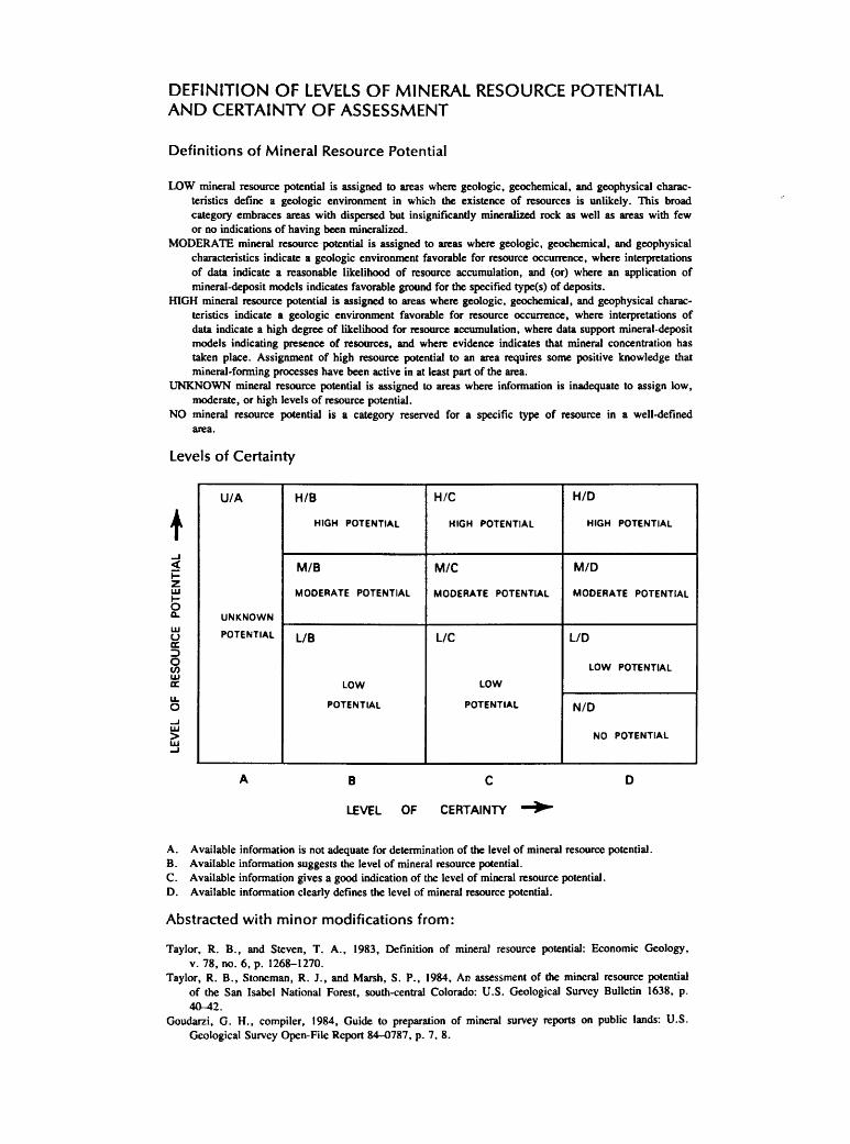
DEFINITION OF LEVELS OF MINERAL RESOURCE POTENTIAL AND CERTAINTY OF ASSESSMENT
Definitions of Mineral Resource Potential
LOW mineral resource potential is assigned to areas where geologic, geochemical, and geophysical characteristics define a geologic environment in which the existence of resources is unlikely. This broad category embraces areas with dispersed but insignificantly mineralized rock as well as areas with few or no indications of having been mineralized.
MODERATE mineral resource potential is assigned to areas where geologic, geochemical, and geophysical characteristics indicate a geologic environment favorable for resource occurrence, where interpretations of data indicate a reasonable likelihood of resource accumulation, and (or) where an application of mineral-deposit models indicates favorable ground for the specified type(s) of deposits.
llGH mineral resource potential is assigned to areas where geologic, geochemical, and geophysical characteristics indicate a geologic environment favorable for resource occurrence, where interpretations of data indicate a high degree of likelihood for resource accumulation, where data support mineral-deposit models indicating presence of resources, and where evidence indicates that mineral concentration has taken place. Assignment of high resource potential to an area requires some positive knowledge that mineral-forming processes have been active in at least part of the area.
UNKNOWN mineral resource potential is assigned to areas where information is inadequate to assign low, moderate, or high levels of resource potential.
NO mineral resource potential is a category reserved for a specific type of resource in a well-defined area.
levels of Certainty
t ..J <{
i= z w 1-0 Q..
w u a: :::> 0 en w a: u. 0 ...J w > w ...J
U/A
UNKNOWN
POTENTIAL
A
H/8
HIGH POTENTIAL
M/B
MODERATE POTENTIAL
l/B
LOW
POTENTIAL
B
LEVEL OF
H/C
HIGH POTENTIAL
M/C
MODERATE POTENTIAL
L/C
LOW
POTENTIAL
c
CERTAINTY _..,
H/D
HIGH POTENTIAL
M/D
MODERATE POTENTIAL
LID
LOW POTENTIAL
N/D
NO POTENTIAL
D
A. Available information is not adequate for determination of the level of mineral resource potential. B. Available information suggests the level of mineral resource potential. C. Available information gives a good indication of the level of mineral resource potential. D. Available information clearly defines the level of mineral resource potential.
Abstracted with minor modifications from:
Taylor, R. B., and Steven, T. A., 1983, Definition of mineral resource potential: Economic Geology, v. 78, no. 6, p. 1268-1270.
Taylor, R. B., Stoneman, R. J., and Marsh, S. P., 1984, Ar. assessment of the mineral resource potential of the San Isabel National Forest, south-central Colorado: U.S. Geological Survey Bulletin 1638, p. 40-42.
Goudarzi, G. H., compiler, 1984, Guide to preparation of mineral survey reports on public lands: U.S. Geological Survey Open-File Report 84-0787, p. 7, 8.
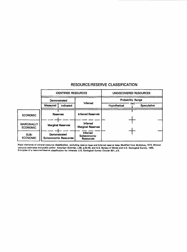
RESOURCE/RESERVE CLASSIFICATION
IDENTIFIED RESOURCES UNDISCOVERED RESOURCES
Demonstrated Probability Range
Measured I Indicated Inferred (or)
Hypothetical I Speculative
I I
ECONOMIC Reserves Inferred Reserves
~-+- ------ - + -MARGINALLY Marginal Reserves
Inferred
ECONOMIC Marginal Reserves +· 1---+- ------ - -SUB- Demonstrated
Inferred Subeconomic
ECONOMIC Subeconomic Resources Resources
Major elements of mineral resource classification, excluding reserve base and inferred reserve base. Modified from McKelvey,1972, Mineral resource estimates and public policy: American Scientist, v.60. p.32-40, and U.S. Bureau of Mines and U.S. Geological Survey, 1980, Principles of a resource/reserve classification for minerals: U.S. Geological Survey Circular 831, p.5.
GEOLOGIC TIME CHART Terms and boundary ages used in this report
BOUNDARY AGE EON ERA PERIOD EPOCH IN
MILLION YEARS
Holocene Quaternary 0.010
Pleistocene 1.7
Neogene Pliocene 5
Cenozoic Sub period Miocene 24
Tertiary Oligocene Paleogene 38
Eocene Subperiod 55
Paleocene 66
Late Cretaceous Early f- 96
Late 138
Mesozoic Jurassic Middle Early
Late 205
Triassic Middle Early
Phanerozoic Late· N 240
Permian Early 290
Late Pennsylvanian Middle
Carboniferous Early
Paleozoic Periods fV 330 Late
Mississippian Early 360
Late Devonian Middle
Early 410
Late Silurian Middle
Early 435
Late Ordovician Middle
Early 500
Late Cambrian Middle
Early 570' N
Late Proterozoic 900
Proterozoic Middle Proterozoic 1600
Early Proterozoic 2500
Late Archean
Archean Middle Archean 3000
3400 Early Archean
·--- ---- -- ----38007- -------pre -Archean 2
4550-
'Rocks older than 570 m. y. also called Precambrian, a time term without specific rank. 2 Informal time term without specific rank.
-tr U.S. GOVERNMENT PRINTING OFFICE: 1989-673-047/86,099 REGION NO. 8


