13
| Date post: | 25-Mar-2018 |
| Category: |
Documents |
| Upload: | truonghanh |
| View: | 231 times |
| Download: | 4 times |
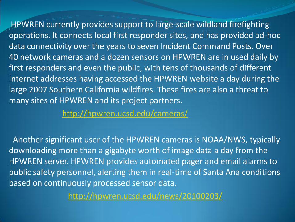
HPWREN currently provides support to large-scale wildland firefighting operations. It connects local first responder sites, and has provided ad-hoc data connectivity over the years to seven Incident Command Posts. Over 40 network cameras and a dozen sensors on HPWREN are in used daily by first responders and even the public, with tens of thousands of different Internet addresses having accessed the HPWREN website a day during the large 2007 Southern California wildfires. These fires are also a threat to many sites of HPWREN and its project partners.
http://hpwren.ucsd.edu/cameras/
Another significant user of the HPWREN cameras is NOAA/NWS, typically downloading more than a gigabyte worth of image data a day from the HPWREN server. HPWREN provides automated pager and email alarms to public safety personnel, alerting them in real-time of Santa Ana conditions based on continuously processed sensor data.
http://hpwren.ucsd.edu/news/20100203/
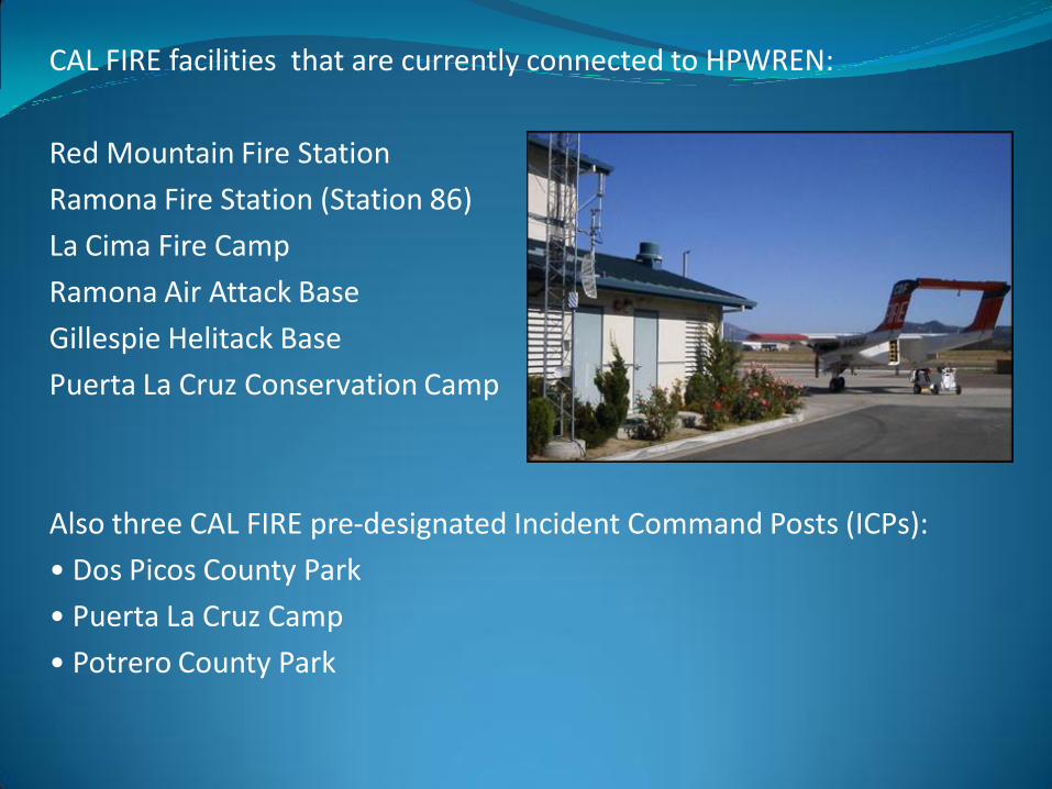
CAL FIRE facilities that are currently connected to HPWREN:
Red Mountain Fire Station
Ramona Fire Station (Station 86)
La Cima Fire Camp
Ramona Air Attack Base
Gillespie Helitack Base
Puerta La Cruz Conservation Camp
Also three CAL FIRE pre-designated Incident Command Posts (ICPs):
• Dos Picos County Park
• Puerta La Cruz Camp
• Potrero County Park
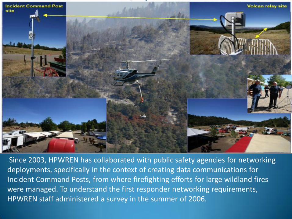
Since 2003, HPWREN has collaborated with public safety agencies for networking deployments, specifically in the context of creating data communications for Incident Command Posts, from where firefighting efforts for large wildland fires were managed. To understand the first responder networking requirements, HPWREN staff administered a survey in the summer of 2006.

During the past years, seven major wild fire ICP sites were supported by HPWREN-deployed high-speed network communication capabilities:
Coyote Fire (July 2003)
Eagle Fire (May 2004)
Mataguay Fire (July 2004)
Volcan Fire (Sept 2005)
Border 50 Fire (October 2005)
Horse Fire (July 2006)
Cowboy Fire (September 2010)
http://hpwren.ucsd.edu/Publicsafety/index.html
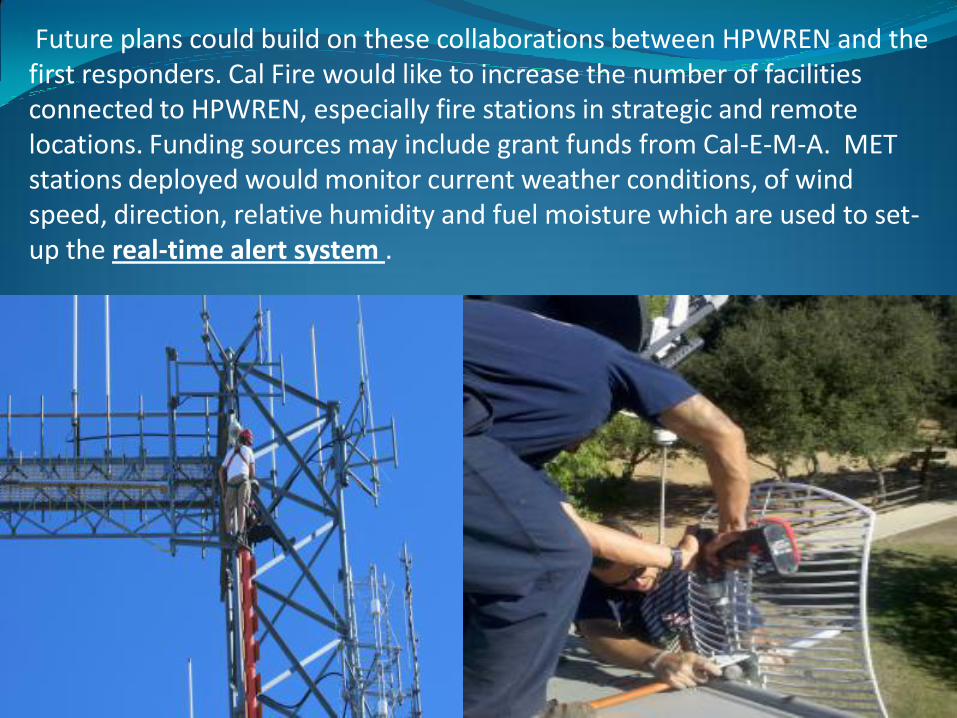
Future plans could build on these collaborations between HPWREN and the first responders. Cal Fire would like to increase the number of facilities connected to HPWREN, especially fire stations in strategic and remote locations. Funding sources may include grant funds from Cal-E-M-A. MET stations deployed would monitor current weather conditions, of wind speed, direction, relative humidity and fuel moisture which are used to set-up the real-time alert system .
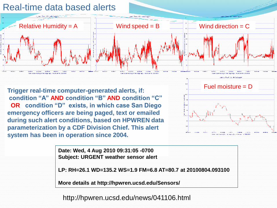
Trigger real-time computer-generated alerts, if:
condition “A” AND condition “B” AND condition “C”
OR condition “D” exists, in which case San Diego
emergency officers are being paged, text or emailed
during such alert conditions, based on HPWREN data
parameterization by a CDF Division Chief. This alert
system has been in operation since 2004.
Real-time data based alerts
Date: Wed, 4 Aug 2010 09:31:05 -0700
Subject: URGENT weather sensor alert
LP: RH=26.1 WD=135.2 WS=1.9 FM=6.8 AT=80.7 at 20100804.093100
More details at http://hpwren.ucsd.edu/Sensors/
Relative Humidity = A Wind speed = B Wind direction = C
Fuel moisture = D
http://hpwren.ucsd.edu/news/041106.html

Additional web cameras deployed in strategic locations could monitor forest health
(tree & fuel health) via Web Cam IR spectrum. Another use could be using Lidar;
(Light Detection And Ranging) an optical remote sensing technology that measures
properties of scattered light to find range and/or other information of a distant target,
or clearly defined object, such as a vehicle, or diffuse objects such as a smoke
plumes, clouds or surface elevations.
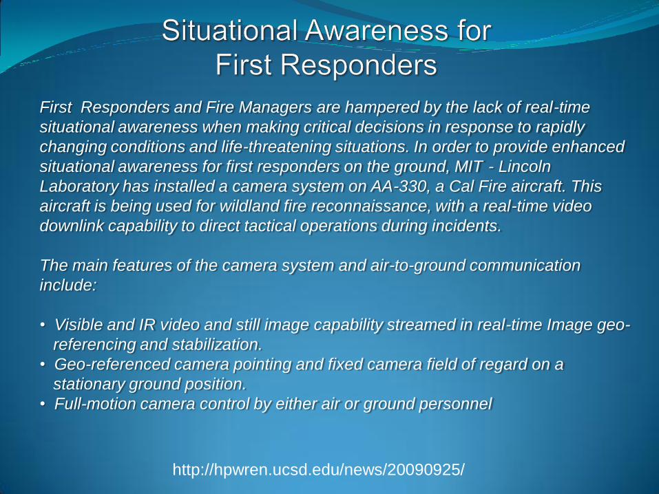
First Responders and Fire Managers are hampered by the lack of real-time
situational awareness when making critical decisions in response to rapidly
changing conditions and life-threatening situations. In order to provide enhanced
situational awareness for first responders on the ground, MIT - Lincoln
Laboratory has installed a camera system on AA-330, a Cal Fire aircraft. This
aircraft is being used for wildland fire reconnaissance, with a real-time video
downlink capability to direct tactical operations during incidents.
The main features of the camera system and air-to-ground communication
include:
• Visible and IR video and still image capability streamed in real-time Image geo-
referencing and stabilization.
• Geo-referenced camera pointing and fixed camera field of regard on a
stationary ground position.
• Full-motion camera control by either air or ground personnel
http://hpwren.ucsd.edu/news/20090925/
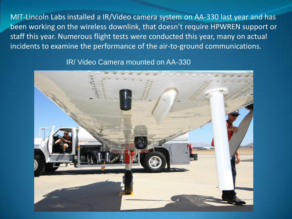
IR/ Video Camera mounted on AA-330
MIT-Lincoln Labs installed a IR/Video camera system on AA-330 last year and has been working on the wireless downlink, that doesn’t require HPWREN support or staff this year. Numerous flight tests were conducted this year, many on actual incidents to examine the performance of the air-to-ground communications.
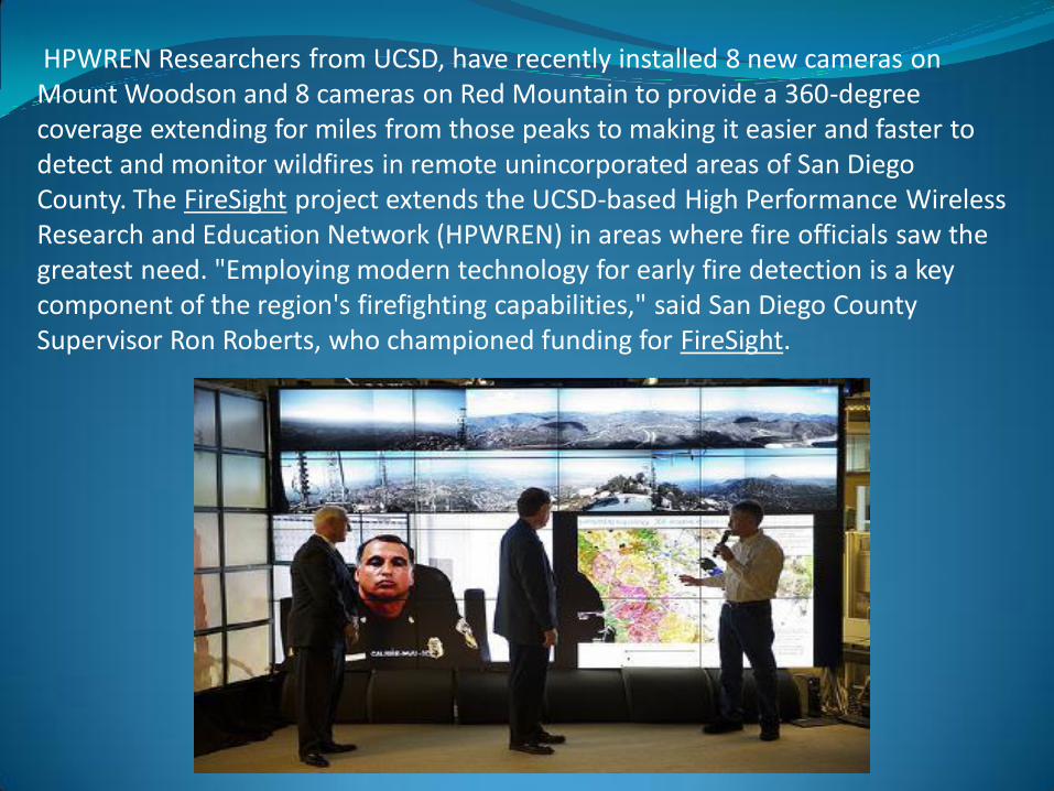
HPWREN Researchers from UCSD, have recently installed 8 new cameras on Mount Woodson and 8 cameras on Red Mountain to provide a 360-degree coverage extending for miles from those peaks to making it easier and faster to detect and monitor wildfires in remote unincorporated areas of San Diego County. The FireSight project extends the UCSD-based High Performance Wireless Research and Education Network (HPWREN) in areas where fire officials saw the greatest need. "Employing modern technology for early fire detection is a key component of the region's firefighting capabilities," said San Diego County Supervisor Ron Roberts, who championed funding for FireSight.

HPWREN topology, 360 degree cameras
approximately 50 miles:Note: locations are approximate
MVFDMTGY
MPO
SMER
CNM
UCSD
to CI and
PEMEX
70+ miles
to SCI
PL
MLO
MONP
CWC
P480
USGC
SO
LVA2
BVDA
RMNA
Santa
Rosa
GVDA
KNW
WMC
RDM
CRYSND BZN
AZRY
FRD
PSAPWIDC
KYVW
COTD
PFO
BDC
KSW
DHL
SLMS
SCS
CRRS
GLRS
DSME
WLA
P506
P510
P499
GMPK
IID2
P509
P500
P494
P497
155Mbps FDX 6 GHz FCC licensed
155Mbps FDX 11 GHz FCC licensed
45Mbps FDX 6 GHz FCC licensed
45Mbps FDX 11 GHz FCC licensed
45Mbps FDX 5.8 GHz unlicensed
45Mbps-class HDX 4.9GHz
45Mbps-class HDX 5.8GHz unlicensed
~8Mbps HDX 2.4/5.8 GHz unlicensed
~3Mbps HDX 2.4 GHz unlicensed
115kbps HDX 900 MHz unlicensed
56kbps via RCS network
dashed = planned
B081
P486
Backbone/relay node
Astronomy science site
Biology science site
Earth science site
University site
Researcher location
Native American site
First Responder site
NSSS
SDSU
P474
P478
DESC
P473
POTR P066
P483
CE
Red circles: existing cameras
Yellow circles: suggested sites
http://hpwren.ucsd.edu/news/20101026/

Questions ?


