16
HURRICANE PAM HURRICANE PAM 7AM CDT Mon Sep 27, 2004 7AM CDT Mon Sep 27, 2004 Pre-Landfall Pre-Landfall Briefing Package #4 Briefing Package #4
| Date post: | 30-Dec-2015 |
| Category: |
Documents |
| Upload: | matthew-russo |
| View: | 13 times |
| Download: | 0 times |

HURRICANE PAMHURRICANE PAM7AM CDT Mon Sep 27, 20047AM CDT Mon Sep 27, 2004
Pre-LandfallPre-Landfall
Briefing Package #4Briefing Package #4

www.srh.weather.govwww.srh.weather.gov
Past and Current ConditionsPast and Current Conditions
Conditions Rapidly Deteriorating during Pre-Conditions Rapidly Deteriorating during Pre-dawn hoursdawn hours– Burrwood NOAA C-man - NE 55kt gust 80 ktBurrwood NOAA C-man - NE 55kt gust 80 kt– New Orleans Armstrong Int’l AirportNew Orleans Armstrong Int’l Airport
NE 30 kt gust 45 kt in squall , 1.5 inches of rain.NE 30 kt gust 45 kt in squall , 1.5 inches of rain.
– Tides 3 to 5 feet above normal east side of Tides 3 to 5 feet above normal east side of Plaquemines and St. Bernard Parishes. Plaquemines and St. Bernard Parishes.
Current and Expected Conditions TodayCurrent and Expected Conditions Today– Hurricane conditions overspreading area.Hurricane conditions overspreading area.– Wind gust to 120 mph likely in coastal areasWind gust to 120 mph likely in coastal areas– Rapid increase in tide levels expected during day.Rapid increase in tide levels expected during day.
www.srh.weather.govwww.srh.weather.gov
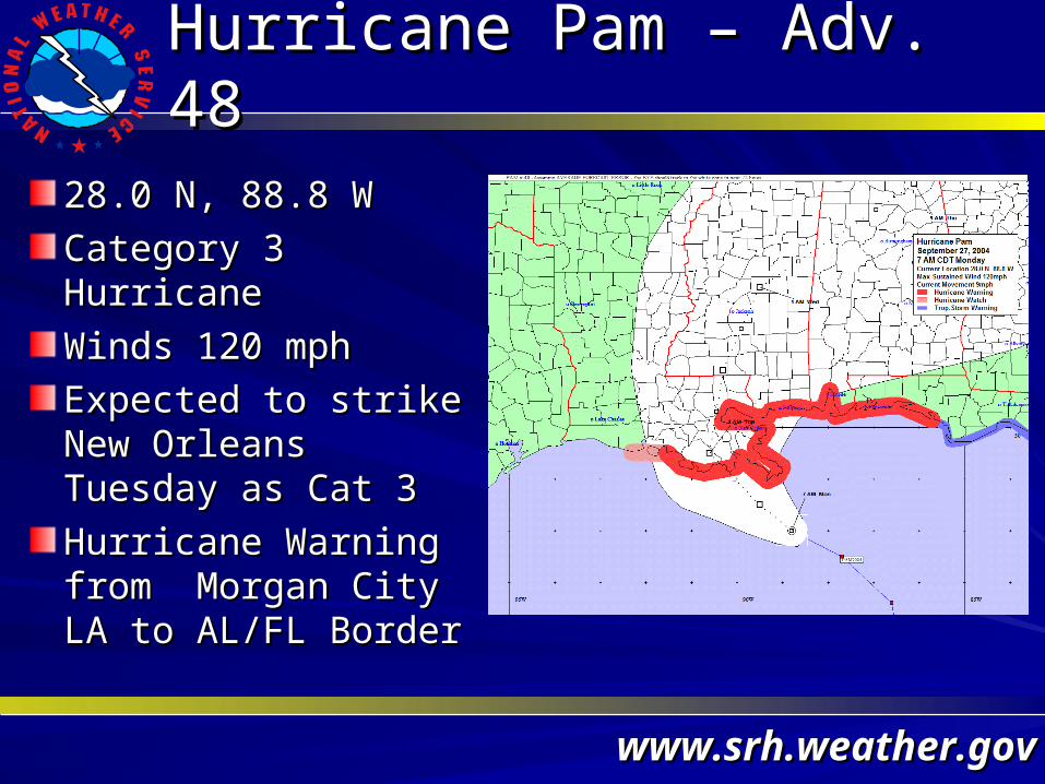
Hurricane Pam – Adv. 48Hurricane Pam – Adv. 48
28.0 N, 88.8 W28.0 N, 88.8 W
Category 3 HurricaneCategory 3 Hurricane
Winds 120 mphWinds 120 mph
Expected to strike Expected to strike New Orleans New Orleans Tuesday as Cat 3Tuesday as Cat 3
Hurricane Warning Hurricane Warning from Morgan City LA from Morgan City LA to AL/FL Borderto AL/FL Border
www.srh.weather.govwww.srh.weather.gov
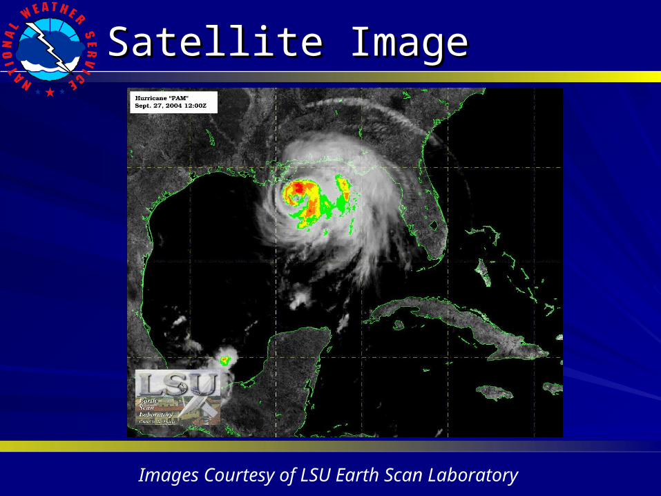
Satellite ImageSatellite Image
Images Courtesy of LSU Earth Scan Laboratory

www.srh.weather.govwww.srh.weather.gov
Satellite LoopSatellite Loop
Images Courtesy of LSU Earth Scan Laboratory

www.srh.weather.govwww.srh.weather.gov
Onset of Hurricane Force WindOnset of Hurricane Force Wind
Current Day/TimeCurrent Day/Time– 7AM Monday7AM Monday
Onset of Hurricane Onset of Hurricane Force Wind Force Wind – 7AM to 7PM today7AM to 7PM today
Seek refuge of last Seek refuge of last resort per advice of resort per advice of local emergency local emergency management management

www.srh.weather.govwww.srh.weather.gov
Inland WindsInland Winds
Hurricane Force Wind Hurricane Force Wind (>74 mph) as far north (>74 mph) as far north as Baton Rougeas Baton Rouge
50-74 mph Winds 50-74 mph Winds Possible to Alexandria Possible to Alexandria AreaArea
Tropical Storm Force Tropical Storm Force Winds Possible to Winds Possible to MonroeMonroe
www.srh.weather.govwww.srh.weather.gov
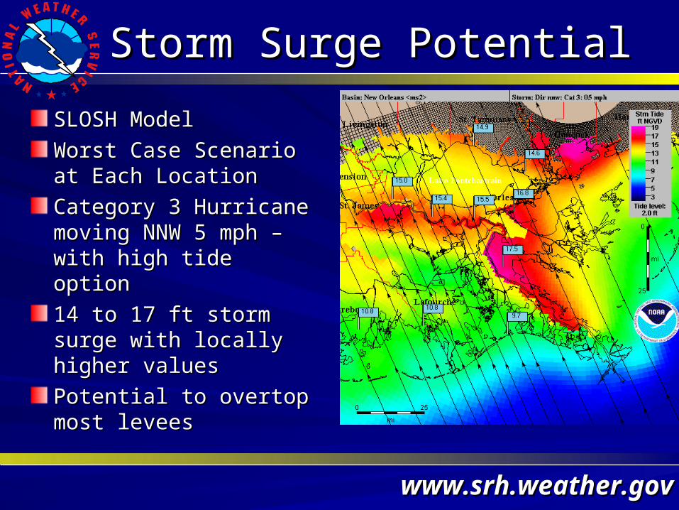
Storm Surge PotentialStorm Surge Potential
SLOSH ModelSLOSH Model
Worst Case Scenario at Worst Case Scenario at Each LocationEach Location
Category 3 Hurricane Category 3 Hurricane moving NNW 5 mph – moving NNW 5 mph – with high tide optionwith high tide option
14 to 17 ft storm surge 14 to 17 ft storm surge with locally higher valueswith locally higher values
Potential to overtop most Potential to overtop most leveeslevees
www.srh.weather.govwww.srh.weather.gov
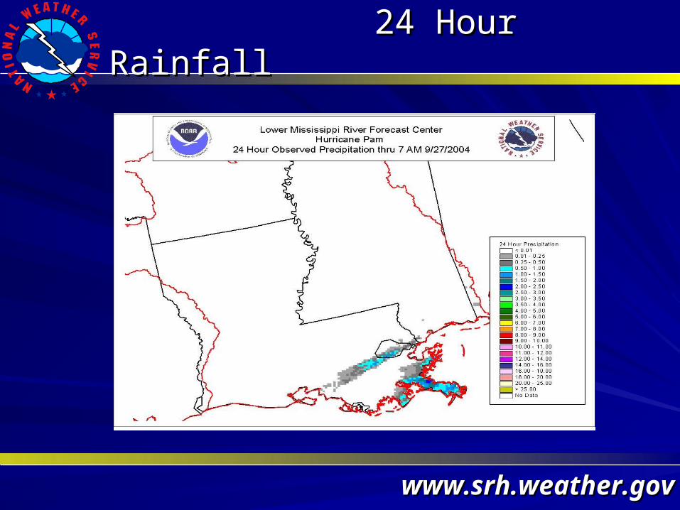
24 Hour Rainfall24 Hour Rainfall

www.srh.weather.govwww.srh.weather.gov
24 Hour Future Rainfall24 Hour Future Rainfall
www.srh.weather.govwww.srh.weather.gov
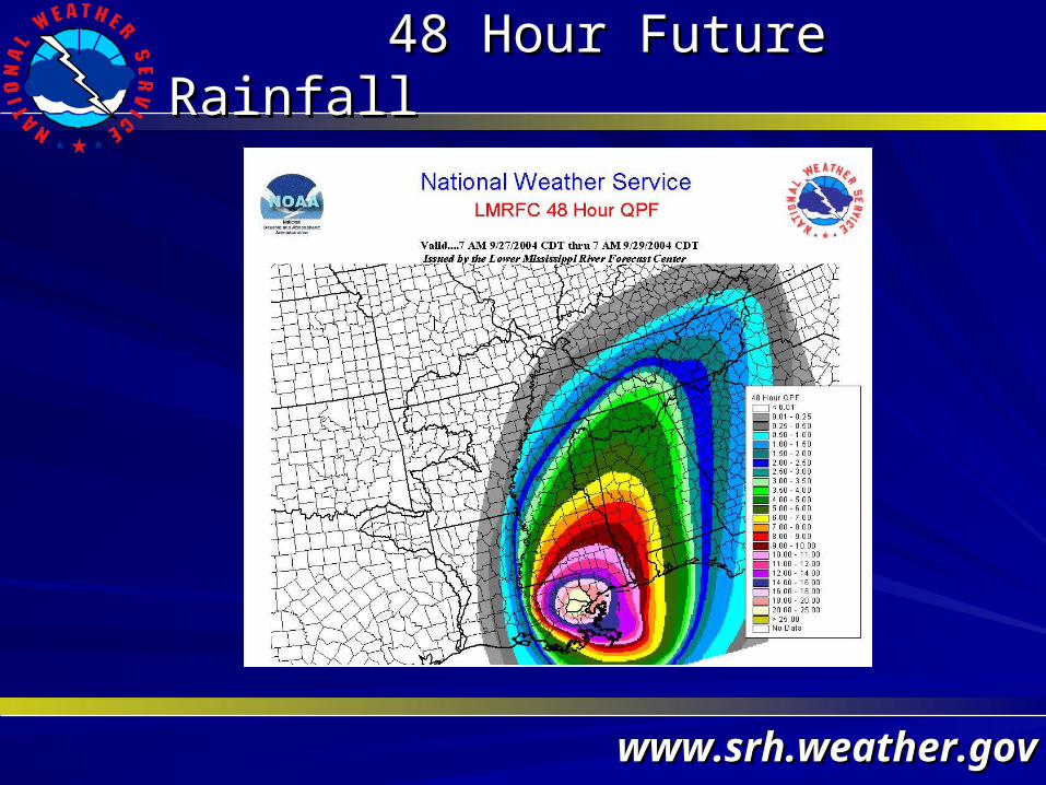
48 Hour Future Rainfall48 Hour Future Rainfall

www.srh.weather.govwww.srh.weather.gov
72 Hour Future Rainfall72 Hour Future Rainfall

www.srh.weather.govwww.srh.weather.gov
Forecast River StatusForecast River Status

www.srh.weather.govwww.srh.weather.gov
River Flood OutlookRiver Flood Outlook

www.srh.weather.govwww.srh.weather.gov
Pearl River / Bogalusa, LAPearl River / Bogalusa, LA
Major FloodingMajor Flooding
Bogalusa Water Bogalusa Water Treatment Plant Treatment Plant
will be Threatenwill be Threaten
Property East of LAProperty East of LA
Hwy 21 will FloodHwy 21 will Flood
www.srh.weather.govwww.srh.weather.gov
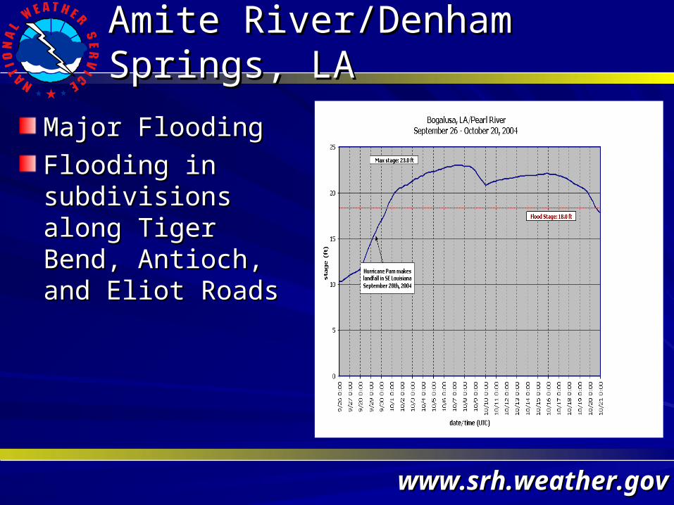
Amite River/Denham Springs, LAAmite River/Denham Springs, LA
Major FloodingMajor Flooding
Flooding in Flooding in subdivisions along subdivisions along Tiger Bend, Antioch, Tiger Bend, Antioch, and Eliot Roads and Eliot Roads


