12
Identifying Patterns in Road Networks Topographic Data and Maps Henri Lahtinen Arto Majoinen
| Date post: | 19-Dec-2015 |
| Category: |
Documents |
| Upload: | tabitha-thomas |
| View: | 214 times |
| Download: | 0 times |
Identifying Patterns in Road Networks
Topographic Data and Maps
Henri Lahtinen
Arto Majoinen
General• Pattern recognition techniques are critical to the automatic
characterization and generalization of higher order structures in geographical data• Central part of the pattern recognition process is identifying and
extracting interesting features• Relative importance of objects can be defined by rules according to
theme and level of detail• Design and lay-out of roads is based upon specific types of patterns,
governed by the nature of transportation and human activities• Those can be classified in different ways

Random Graph and Scale Free Graph

• Identifying hubs is crucial in road network generalization• Hubs and key links help are crucial in human recognition process• Weighting of the edges can be used to emphasize the importance of
the road segment between hubs• This can be utilized in generalization algorithms• Shortest paths, connectivity and centrality can provide information• Overall, graph theoretic representation and principles underpin all the
patterns

Key Concepts
• Different node types: degree and angle between edge can be used to describe structures and patterns

Strokes: major roads are thought to be continuous and take gentle changes in direction while small roads are shorter and make abrupt changes in direction

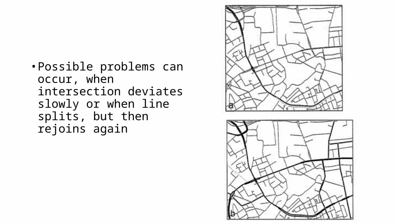
• Possible problems can occur, when intersection deviates slowly or when line splits, but then rejoins again

Grid patterns: common in artificially built settlements road networks.
Characterized by the parallelism of two groups of lines.
Length and distance of lines vary: with some tolerance overall structure and sub-structures can be detected

Star pattern: typically found in dense urban areas and associated with city centers
Pattern structure and size varies
Ideally roads would come together at some central point of the star, usually a search circle is needed
Problem is to define proper search radius, as roads have curves or bends and are most likely unevenly distributed and might end in eg. crossings

Ring-shaped structures: size and shape dependent on functionality
Compactness and convexity are inspected
Constrains in size and number of edges

The structure of the city:
Road block centroids can be used in cluster analysis identifying localized centres within the city


