Improving Design Guidelines for Rock Vanes and Other Flow Training Structures Anne Lightbody, University of New Hampshire Fotis Sotiropoulos, Seokkoo Kang, and Craig Hill, University of Minnesota Panayiotis Diplas, Virginia Tech
Transcript
Improving Design Guidelines for Rock Vanes and Other Flow Training StructuresAnne Lightbody, University of New Hampshire
Fotis Sotiropoulos, Seokkoo Kang, and Craig Hill, University of Minnesota
Panayiotis Diplas, Virginia Tech
House
Road
http
://w
ales
.fuzz
up.n
et/im
ages
/fulls
ize/
phot
os/s
tream
-and
-tree
-alo
ng-a
5-ro
ad-w
ales
-wel
sh-u
k-19
.jpg
How can we prevent or slow river migration while protecting stream habitat?
Submerged vane
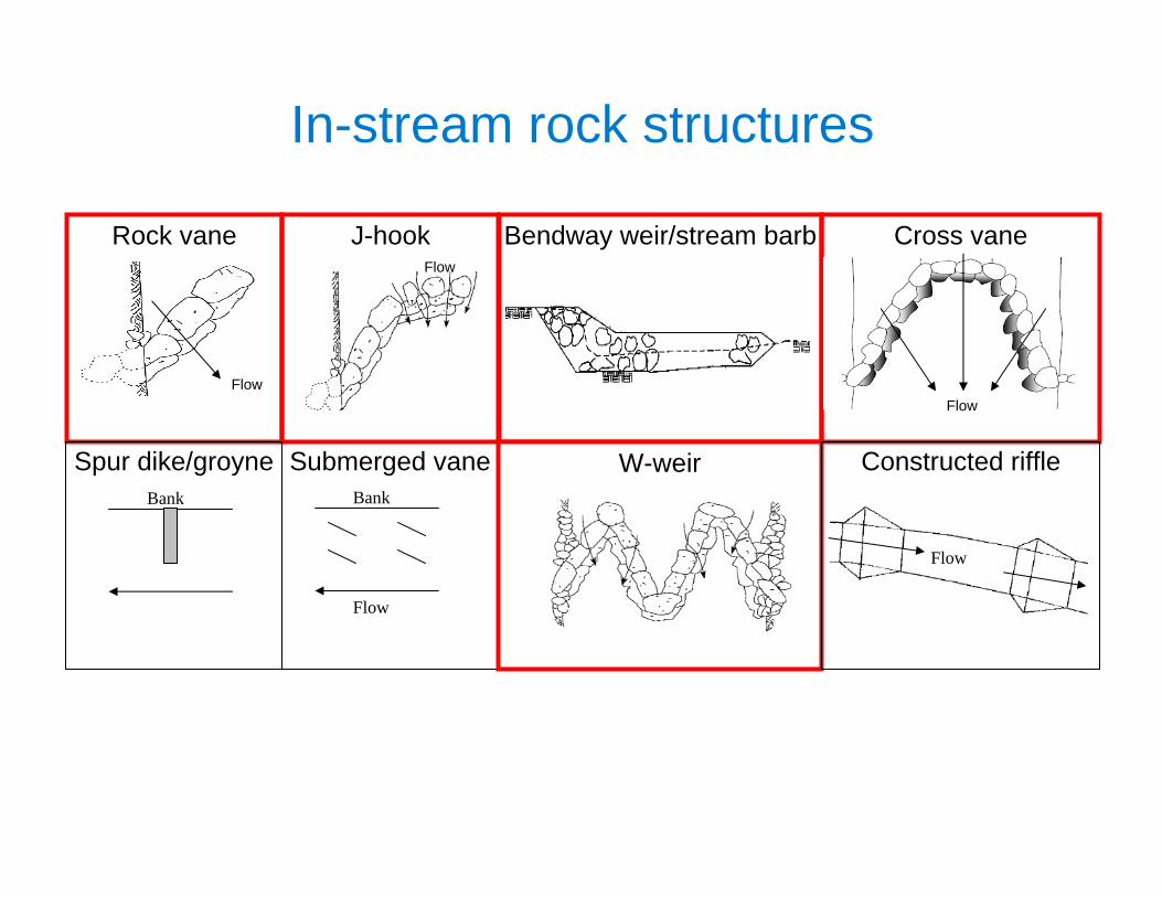
Rock vane J-hook Bendway weir/stream barb Cross vane
W-weir
In-stream rock structures
Bank
Flow
Bank
Spur dike/groyne Constructed riffle
Flow
FlowFlow
Flow
In-stream structure design
• Stream instability, degradation, aggradation, and local scour account for 60% of US highway bridge failures (Lagasse et al. 1995)– Riverbank failure and erosion put extra sediment into streams, which
contributes roughly $16 billion annually in damages (USEPA 1994; ARS 2003).
• Over $1 billion spent every year since 1990 to improve river training, protect banks from erosion, and enhance aquatic habitat quality (Bernhardt et al. 2005).
• Despite the large investment, it is estimated that at least 50% of stream restoration projects fail (O’Neil and Fitch 1992).
• Overall, the emerging consensus (e.g., House 1996; Roni et al. 2002; Moerke and Lamberti 2004; Bernhardt et al.
2005) is that:– results of specific installations are often mixed and highly site-specific– existing research and monitoring practices for stream-restoration and river
training strategies are inadequate– there is a strong need for a comprehensive evaluation of most river
training and stream restoration methods
• Shingle Creek, Brooklyn Park, MN
• Simulations by Fotis Sotiropoulos and Christian Escauriaza using the SAFL Virtual StreamLab (VSL) numerical model of flow around boulders and rectangular vanes
Three-dimensional flow patterns around in-stream structures
Boils from submerged rock
Large-scale physical modeling
Numerical modeling
Small-scale physical modeling Field measurements
Previous practitioner experience
Guidelines for installing, monitoring,
and maintaining
National Cooperative Highway Research Program (NCHRP) Project 24-33:Development of Design Guidelines for In-stream Flow Control Structures
PI: Fotis Sotiropoulos, SAFL; co-PI’s: Anne Lightbody, SAFL; Panos Diplas, Virginia Tech
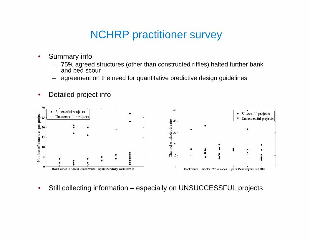
NCHRP practitioner survey (spring ’09)
• 64 individuals (71% response rate)– 47% from DOT’s, 28% from DNR’s, 14% from USDA/NRCS,11% private
consulting– 76% of USGS physiographic provinces
NCHRP practitioner survey
• Summary info– 75% agreed structures (other than constructed riffles) halted further bank
and bed scour – agreement on the need for quantitative predictive design guidelines
• Detailed project info
• Still collecting information – especially on UNSUCCESSFUL projects
Vermillion River, Empire Township, MN
“To the lab and beyond!”
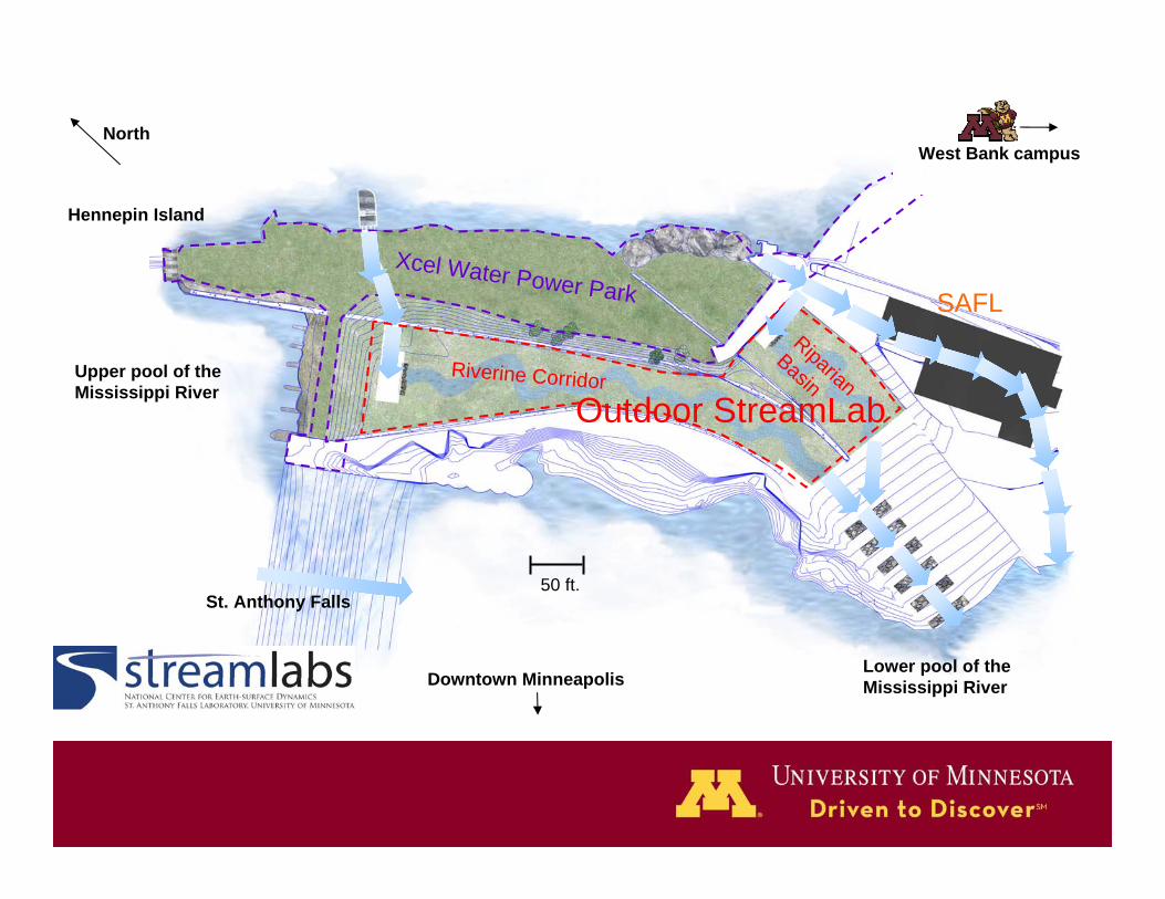
St. Anthony Falls Laboratory
St. Anthony Falls
Mississippi River
Minneapolis, Minnesota, USA
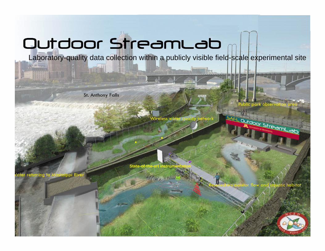
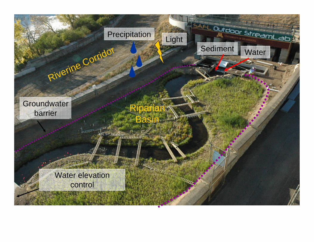
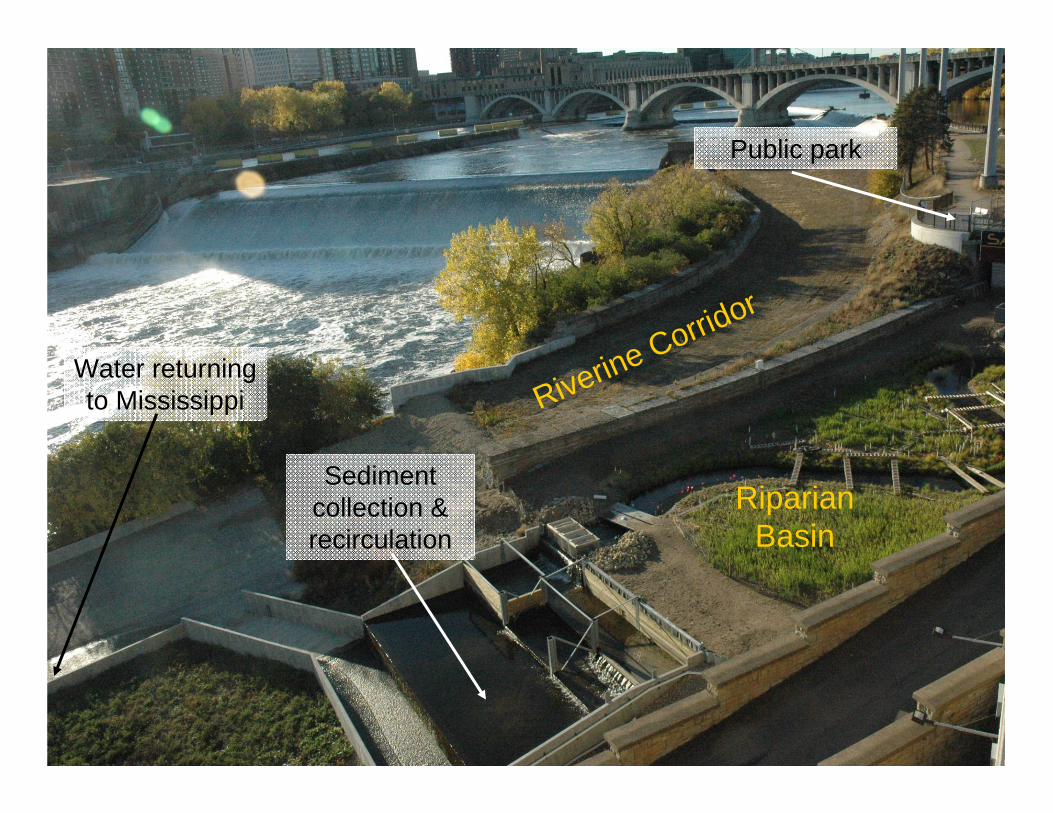
Outdoor StreamLab
Water Power Public Park
Laboratory-quality data collection within a publicly visible field-scale experimental site
State-of-the-art instrumentation
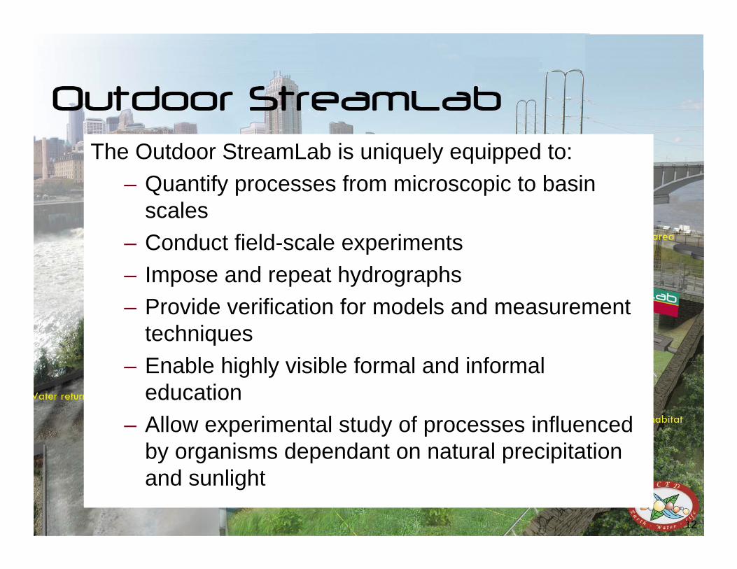
The Outdoor StreamLab is uniquely equipped to:– Quantify processes from microscopic to basin
scales– Conduct field-scale experiments– Impose and repeat hydrographs– Provide verification for models and measurement
techniques– Enable highly visible formal and informal
education– Allow experimental study of processes influenced
by organisms dependant on natural precipitation and sunlight
• Mobile computer-controlled data acquisition (DAQ) system• Position and control instruments to obtain topography, water surface
elevation, velocity, temperature, dissolved oxygen, nitrate, etc.
Total station to determine
carriage position
Fixed benchmarks for high-precision change detection
1.3 m3 m
OSL bathymetry• cm-scale horizontal resolution; mm-scale vertical• Continuous coverage of bed, banks, and water surface• Bed grain size for roughness & sediment transport estimates
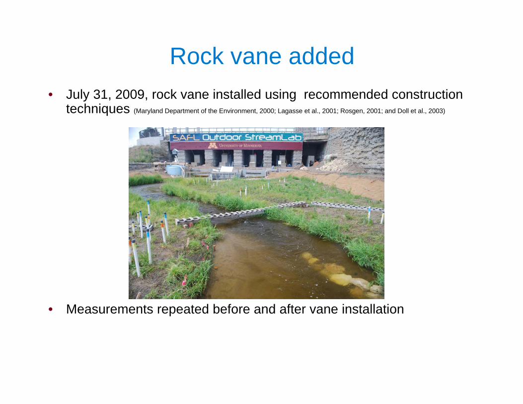
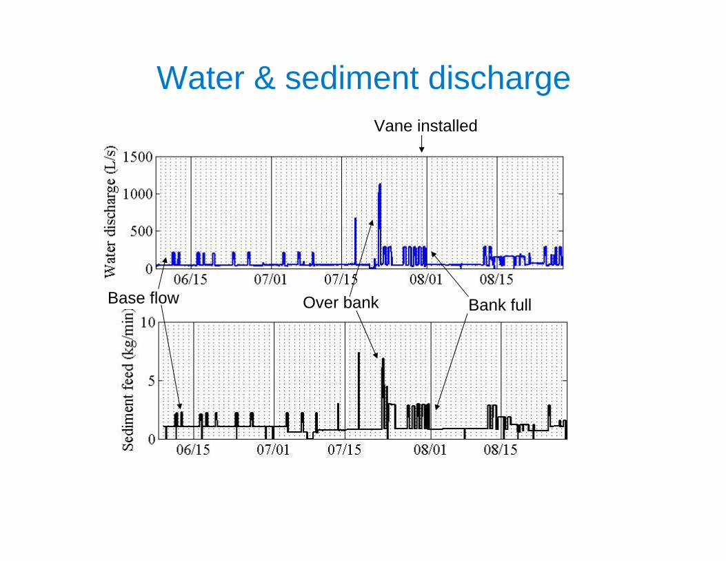
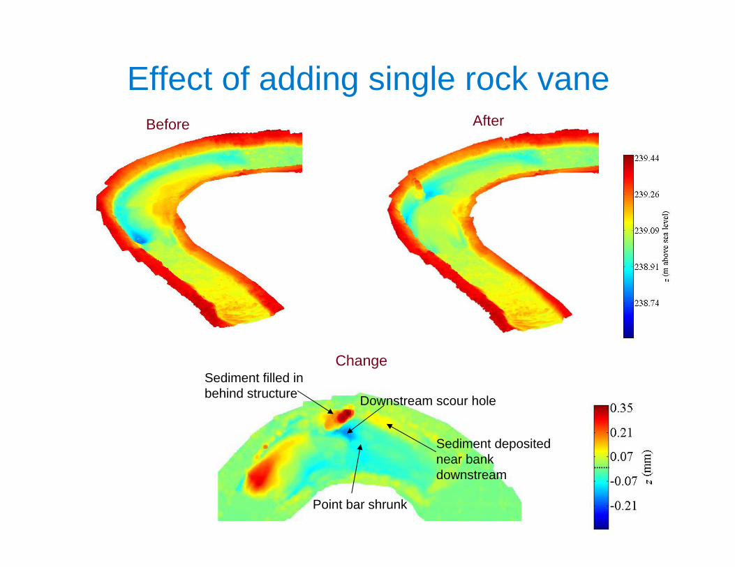
Effect of adding single rock vane
Downstream scour hole
Point bar shrunk
Before After
ChangeSediment filled in behind structure
Sediment deposited near bank downstream
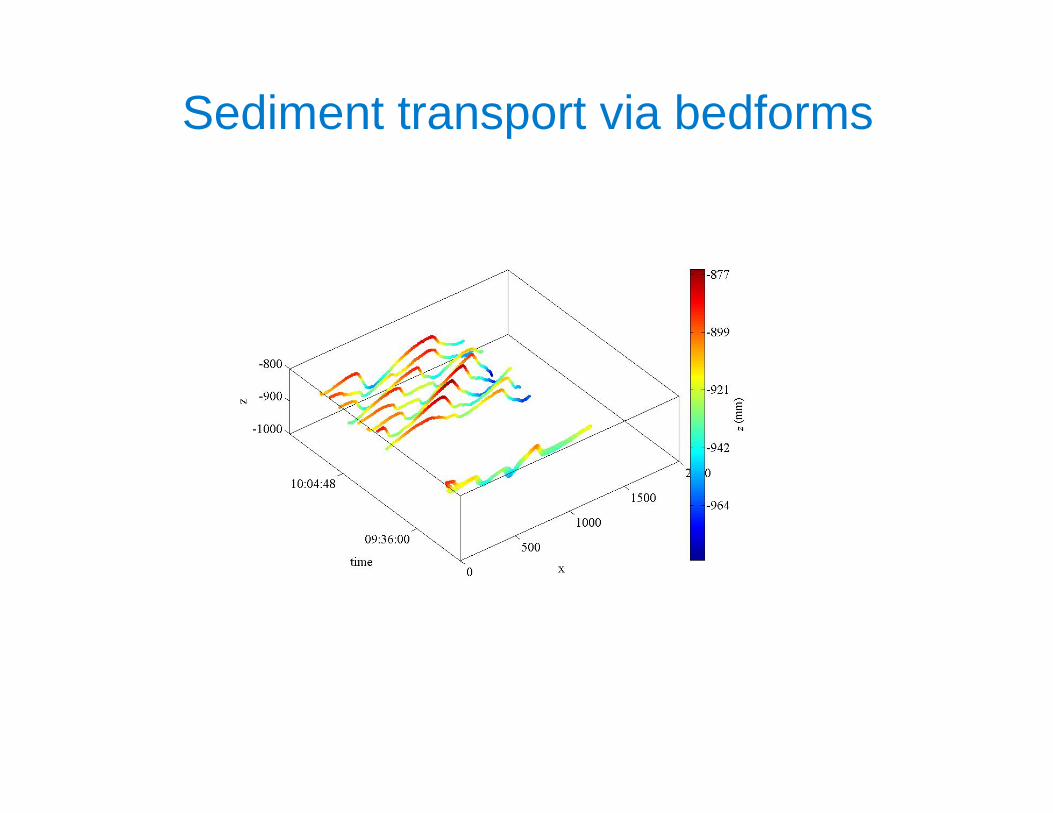
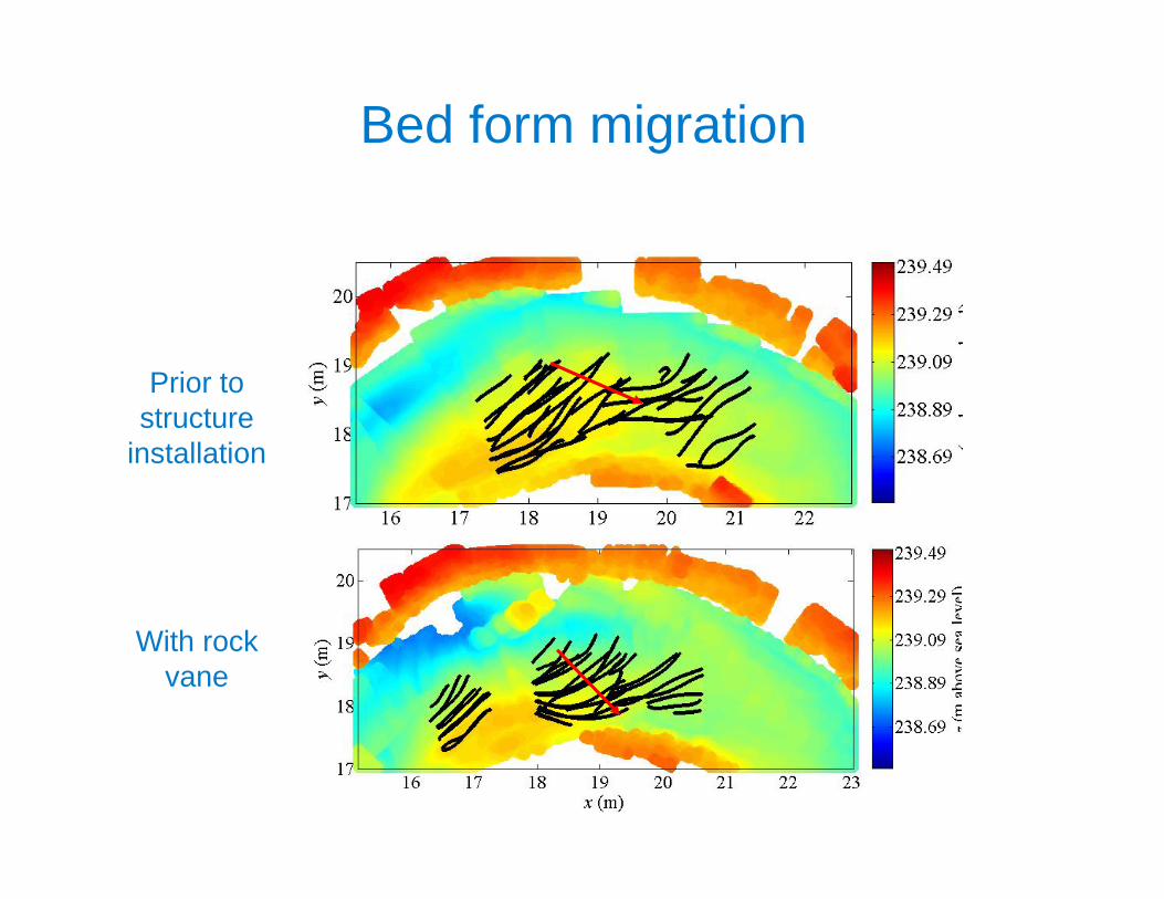
Sediment transport via bedforms
Bed form migration
Prior to structure
installation
With rock vane
• Sediment topography integrated to obtain sediment flux
• Following Jerolmack and Mohrig (2005), the sediment flux per unit width in the direction of bedform motion:
Sediment transport calculations
t1t2
taqs
)1(
a
porosity; assumed constant: = 0.35
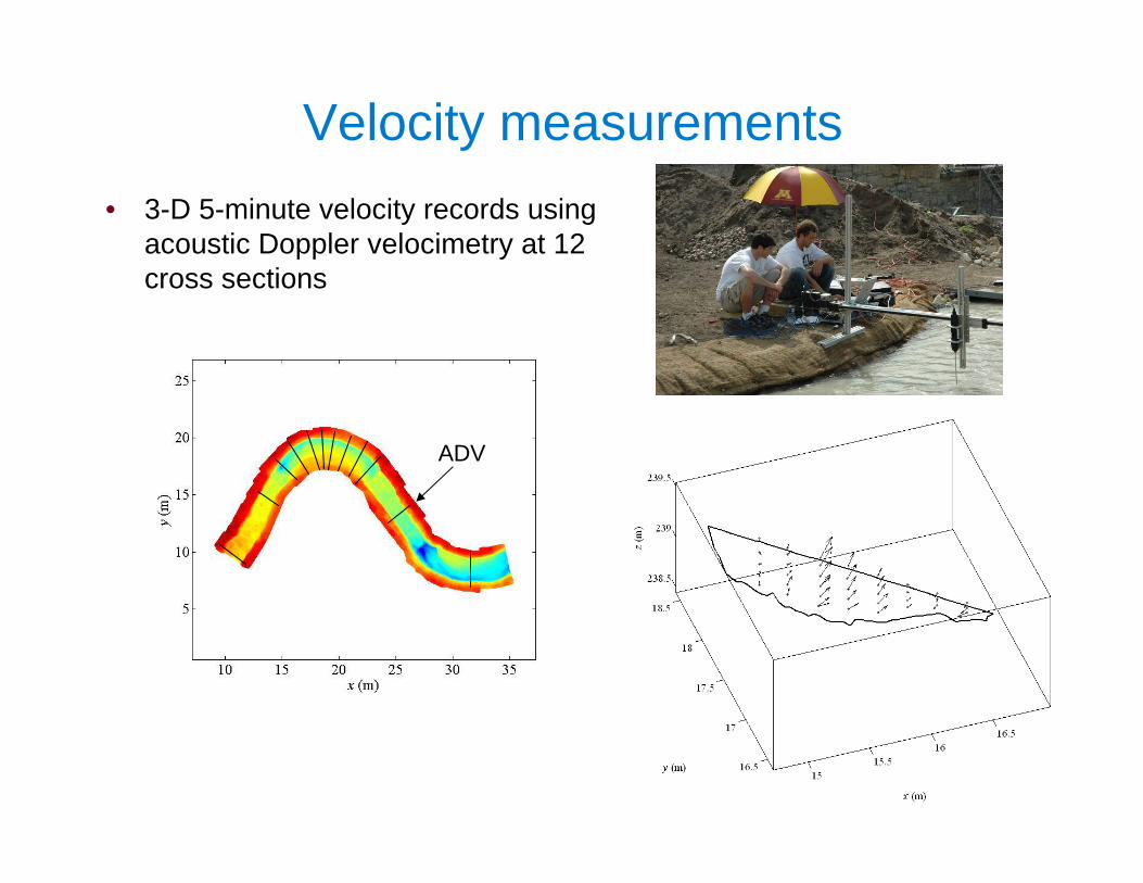
Velocity measurements• 3-D 5-minute velocity records using
acoustic Doppler velocimetry at 12 cross sections
ADV
Depth-averaged velocity profiles
(a) (b)
1 m/s 1 m/s
No structure With rock vane
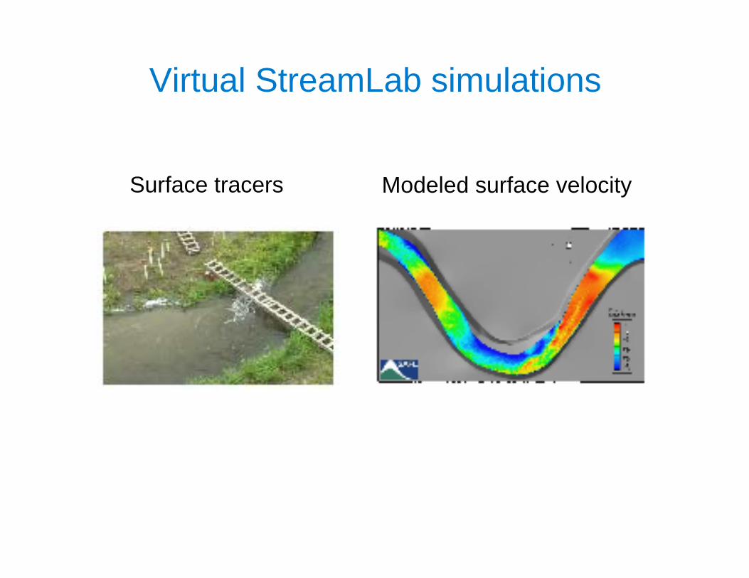
SAFL Virtual StreamLab• State-of-the-art computational fluid dynamics (CFD) model developed by Fotis
Sotiropoulos that is capable of simulating real-life hydraulic engineering flows using advanced numerical techniques and turbulence models
• Integrates a 2-D depth-averaged module, a 3-D steady module, and a full 3-D unsteady module with a highly advanced turbulence model capable of resolving unsteady vortices at full-scale conditions
• Can simulate sediment transport and scour past complex hydraulic structures using a physics-based approach
Virtual StreamLab simulations
Modeled surface velocitySurface tracers
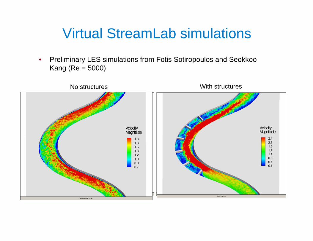
Virtual StreamLab simulations• Preliminary LES simulations from Fotis Sotiropoulos and Seokkoo
Kang (Re = 5000)
No structures With structures
Large-scale physical modeling
Numerical modeling
Small-scale physical modeling Field measurements
Previous practitioner experience
Guidelines for installing, monitoring,
and maintaining
National Cooperative Highway Research Program (NCHRP) Project 24-33:Development of Design Guidelines for In-stream Flow Control Structures
PI: Fotis Sotiropoulos, SAFL; co-PI’s: Anne Lightbody, SAFL/UNH; Panos Diplas, Virginia Tech
See poster by Craig Hill
Developing guidelines with the Virtual StreamLab
• Objectives:– Validate hydrodynamic & deformable bed model components
using indoor laboratory flume, OSL, and field measurements– Use the VSL to extend the detailed laboratory and field
measurements to an even wider range of channel configurations and flow rates
– Determine, for a particular stream, what site-specific stream properties (e.g., curvature, slope, bed and bank material, channel morphology, etc.) must be measured, what structure or combination of structures is most appropriate, how it should be installed, how it should be monitored and maintained, and at what flow rate it will likely fail
– Develop and test new structure types
y
x
Flow
z
Camera field of view3 m
2 m
1.2 m
Tether
Assessing fish use of structures
Simultaneous fish position & flow velocity measurements
See poster by Kristan Maccaroni
St. Anthony Falls Laboratory with flood relief spillways, c. 1938
Thank you! NCHRP project information: Anne Lightbody