Page 1
BearWorksInstitutional Repository
MSU Graduate Theses
Spring 2017
Influence of Prescribed Burning on Upland SoilProperties in Mark Twain National Forest,Southeast Missouri OzarksMegan Lynn HenteMissouri State University, [email protected]
Follow this and additional works at: http://bearworks.missouristate.edu/theses
Part of the Forest Management Commons, Other Environmental Sciences Commons, OtherForestry and Forest Sciences Commons, and the Soil Science Commons
This article or document was made available through BearWorks, the institutional repository of Missouri State University. The work contained in it maybe protected by copyright and require permission of the copyright holder for reuse or redistribution.For more information, please contact [email protected] .
Recommended CitationHente, Megan Lynn, "Influence of Prescribed Burning on Upland Soil Properties in Mark Twain National Forest, Southeast MissouriOzarks" (2017). MSU Graduate Theses. 3066.http://bearworks.missouristate.edu/theses/3066
Page 2
INFLUENCE OF PRESCRIBED BURNING ON UPLAND SOIL PROPERTIES
IN MARK TWAIN NATIONAL FOREST, SOUTHEAST MISSOURI OZARKS
A Masters Thesis
Presented to
The Graduate College of
Missouri State University
TEMPLATE
In Partial Fulfillment
Of the Requirements for the Degree
Master of Science, Geospatial Science in Geography, Geology and Planning
By
Megan Hente
May 2017
Page 3
ii
Copyright 2017 by Megan Lynn Hente
Page 4
iii
INFLUENCE OF PRESCRIBED BURNING ON UPLAND SOIL PROPERTIES
IN MARK TWAIN NATIONAL FOREST, SOUTHEAST MISSOURI OZARKS
Geography, Geology, and Planning
Missouri State University, May 2017
Master of Science
Megan Hente
ABSTRACT
In the Mark Twain National forest there is a collaborative effort to restore parts of the
forest to its original shortleaf pine-oak woodland areas by using a combination of
silviculture and prescribed fire. The purpose of this project is to assess the effects of
prescribed burning on upland forest and soil physical properties that influence erosion
processes across a gradient of burned sites of different ages and unburned sites. A
combination of geospatial, field, laboratory, statistical (one-way ANOVA) and modeling
(USLE) methods were used to assess the effects of prescribed burns on forest and soil
characteristics in Big Barren Creek watershed. On average, burned sites had significantly
lower leaf litter depth (10-30%) and duff depth (10-40%), higher organic matter content
(15-20%) and lower bulk densities (8-12%) in the first 0-5 cm of the soil than unburned
sites. Prescribed burns did not significantly effect soil texture at any depth or percent
organic matter and bulk density below 5 cm. Basal area, coarse woody debris and
seedling/sapling densities were not significantly different among burned and unburned
sites. There are no significant differences for soil and forest characteristics among
unburned stand types, except litter and duff depth, which is stand dependent (pine>
mixed> oak). USLE results indicate burned sites may have similar annual soil erosion
rates compared to unburned sites.
KEYWORDS: prescribed fire, forest fires, forest management, Ozarks, soils, soil health
This abstract is approved as to form and content
_______________________________
Robert Pavlowsky, PhD
Chairperson, Advisory Committee
Missouri State University
Page 5
iv
INFLUENCE OF PRESCRIBED BURNING ON UPLAND SOIL PROPERTIES
IN MARK TWAIN NATIONAL FOREST, SOUTHEAST MISSOURI OZARKS
By
Megan Hente
A Masters Thesis
Submitted to the Graduate College
Of Missouri State University
In Partial Fulfillment of the Requirements
For the Degree of Master of Science, Geospatial Science in Geography, Geology and
Planning
May 2017
Approved:
_______________________________________
Robert Pavlowsky, PhD
______________________________________
Xiaomin Qiu, PhD
_______________________________________
Xin Miao, PhD
_______________________________________
Thomas DeWitt, MS
_______________________________________
Julie Masterson, PhD: Dean, Graduate College
Page 6
v
ACKNOWLEDGEMENTS
There are many people I would like to thank for their support and guidance over
the last two years. First, I would like to thank my advisor Dr. Robert Pavlowsky for this
incredible opportunity to work as a research assistant with OEWRI and with the United
States Forest Service. Thank you for your support and guidance through this project.
Second, I want to say thank you to Dr. Ana Londoño for her constant support and
guidance in academics and in life. A huge thank you to Marc Owen for sharing so much
of his time guiding me through the woes of GIS, and assisting me with lab analyses and
technical data. I would like to thank my committee members Tom DeWitt and Drs. Xin
Miao and Xiaomin Qiu for their support and guidance in executing this project. A special
thanks to Josh Voss, Nick Bradley, Kayla Geier, Rachael Bradley, Matthew Thies, Holly
Duff, Ashlee Huerta, Ashton Jones, Emma Gibson, Caitlin Canfield, Jameelah Rodriguez
and Kelly Rose who helped make sampling and field data collection possible.
I would like to thank the United States Forest Service for funding this thesis
project through the “Watershed Monitoring Study” under agreement number 15-CS-
11090500-36. I would also like to thank the Ozark Environmental and Water Resources
Institute, the Graduate College at Missouri State University, the Department of
Geography, Geology and Planning, and the College of Natural and Applied Sciences for
their funding for supplies, field work and travel to and from conferences.
A huge thank you to my friends for their support, and enthusiasm. Last but not
least, thank you Mom and Dad for your never-ending encouragement, words of wisdom
and love. I wouldn’t be who I am or where I am without you.
Page 7
vi
TABLE OF CONTENTS
Chapter 1 - Introduction .......................................................................................................1
Soil Infiltration Variables ........................................................................................2
Infiltration and Runoff .............................................................................................4
Forest Fires...............................................................................................................5
Fire Impacts on Runoff and Stream Flow ................................................................7
Prescribed Fire Management in Mark Twain National Forest .................................9
Purpose and Objectives ..........................................................................................10
Benefits ..................................................................................................................11
Chapter 2 - Study Area ......................................................................................................12
Regional Location ..................................................................................................12
Geology ..................................................................................................................12
Soils........................................................................................................................15
Climate and Hydrology ..........................................................................................18
Land Use and Vegetation .......................................................................................19
Chapter 3 - Methods...........................................................................................................21
Geospatial ..............................................................................................................21
Field .......................................................................................................................24
Laboratory ..............................................................................................................29
Statistical ................................................................................................................31
Universal Soil Loss Equation.................................................................................32
Chapter 4 – Results and Discussion ..................................................................................34
General Site Characteristics ...................................................................................34
Soil Characteristics ................................................................................................44
Recovery Trends ....................................................................................................50
Universal Soil Loss Equation.................................................................................54
Summary ................................................................................................................55
Chapter 5 - Conclusions .....................................................................................................57
Future Work ...........................................................................................................58
References ..........................................................................................................................59
Appendices ........................................................................................................................67
Appendix A. Methods, Definitions, and Units Measured for Variables ................67
Appendix B. Site Descriptions, Characteristics and Management History ...........69
Appendix C. Photo Log .........................................................................................72
Appendix D. Site Locations, Witness Trees and Tree Type ..................................79
Appendix E. Subplot Vegetation Form ..................................................................83
Appendix F. Field Method Error, Relative Percent Difference .............................85
Page 8
vii
Appendix G. Dry Mass of Litter and Duff .............................................................86
Appendix H. Nomograph to Determine Soil Erodibility (K-factor) ......................88
Appendix I. Soil Texture <2 mm and Percent Rock Fragments >2mm ................89
Page 9
viii
LIST OF TABLES
Table 1. Reported soil physical properties from the Web Soil Survey. .............................17
Table 2. Reported soil texture for 0-5 cm of the soil profile from the Web Soil Survey ..17
Table 3. Reported soil texture for 5-10 cm of the soil profile from the Web Soil Survey
............................................................................................................................................18
Table 4. Reported soil texture for 20-30 cm of the soil profile from the Web Soil
Survey ................................................................................................................................18
Table 5. Oak and other hardwood stand characteristics. ...................................................35
Table 6. Pine stand characteristics .....................................................................................36
Table 7. Mixed stand characteristics ..................................................................................37
Table 8. Significant values in bold as determined by one-way ANOVA; burned versus
unburned (Mean ±SD) .......................................................................................................38
Table 9. Significant values in bold as determined by one-way ANOVA; burned and
unburned differences among stand types (Mean ± SD) .....................................................39
Table 10. Universal Soil Loss Equation factors.................................................................55
Page 10
ix
LIST OF FIGURES
Figure 1. Big Barren Watershed location ..........................................................................13
Figure 2. Geology of the Big Barren Watershed ...............................................................14
Figure 3. Most common upland soils (0-8%) in the Big Barren Watershed......................16
Figure 4. Map of the Big Barren Watershed with burn units and sampling sites ..............23
Figure 5. USFS Forest Inventory and Analysis subplot sampling layout ..........................25
Figure 6. Site visits and accomplishments flowchart.........................................................28
Figure 7. Basal area among stand types and time sampled ................................................40
Figure 8. Coarse woody debris by stand type and time sampled .......................................41
Figure 9. Seedling density by stand type and time sampled ..............................................43
Figure 10. Sapling density by stand type and time sampled ..............................................43
Figure 11. Litter depth by stand type and time sampled ....................................................45
Figure 12. Duff depth by stand type and time sampled .....................................................46
Figure 13. Percent organic matter by stand type and time sampled ..................................48
Figure 14. Bulk density by stand type and time sampled ..................................................49
Figure 15. Mean particle diameter by stand type and time sampled .................................50
Figure 16. Litter depth measurements for date measured and last year burned ................51
Figure 17. Duff depth measurements for date measured and last year burned ..................52
Figure 18. Percent organic matter depth measurements for date measured and last year
burned ................................................................................................................................53
Figure 19. Bulk density measurements for date measured and last year burned ...............54
Page 11
1
CHAPTER 1 – INTRODUCTION
Fires are major features of forest disturbances that play an important role in the
management and maintenance of forest ecosystems. Prescribed burning is a forest
management practice that is used to reduce understory growth, eradicate invasive species
and create clear-open stands (Hamman et al., 2008; Wade and Lundsford, 1990).
Prescribed fires are used by the United States Forest Service and land managers
throughout North American prairie and forest ecosystems (Gray et al., 2013). These fires
are used to meet objectives which include social, cultural, ecological, and economic
benefits (Gray et al., 2013). Objectives often include stand structure improvement, habitat
restoration, enhancing biodiversity, and reducing the risk of wildfires, pathogens and
pests (Gray et al., 2013).
Prescribed burning effects forests at the vegetation and soil interface, which can
have a direct effect on the hydrologic processes effecting local streams and rivers (Elliot
and Vose, 2006). Prescribed fires can reduce understory vegetation and ground cover
such as the litter and duff layers (Elliot and Vose, 2006; Gurbir et al., 2017; Zabowski et
al., 2007). Forest characteristics that control hydrologic processes include vegetation
cover, leaf litter, organic matter (OM), and bulk density (BD). These characteristics effect
soil infiltration which affects runoff and erosion and has a direct effect on watershed
quality.
Page 12
2
Soil Infiltration Variables
Vegetation Cover. Vegetation cover is important in protecting soils from
raindrop impact and subsequent erosion. Soils are protected by vegetation through
interception, restraint, retardation, infiltration, and transpiration (White et al., 2006).
Interception absorbs rainfall energy and prevents soil compaction. Vegetation roots
restrain soil particles and maintains soil structure through porosity and permeability,
increasing infiltration (White et al., 2006). Retardation increases surface roughness
through plant residues, which slows the rate of runoff. Transpiration prevents the soil
from being oversaturated and helps to slow soil runoff (Gray and Leiser 1982; Gurbir et
al., 2017). Loch (2000) found that erosion was greatly reduced with variable vegetation
cover while simulating a 100 year flood over uniform slopes. Erosion was reduced from
30–35 tons per hectare (t/ha) at 0% vegetation cover to 0.5 t/ha at 47% vegetation cover
(Loch, 2000). Vegetation cover variables commonly measured include trees, seedlings
and saplings, shrubs, and herbaceous flora (Appendix A) (FIA, 2014).
Ground Cover. Ground cover is a function of forest canopy and vegetation cover
and acts as a secondary barrier of protection to prevent soil erosion. Coarse woody debris
(CWD), litter and duff are important ground cover components that are located above the
soil A-horizon. Coarse woody debris consists of fallen dead trees and branches just above
the litter and duff layers. Litter is the layer of freshly fallen leaves, needles, twigs and
loose plant material that can still be easily identified (FIA, 2014). Duff is the mat-like
layer below litter and above the soil A-horizon that consists of decomposed litter
components, which are not easily identified (FIA, 2014; Ottmar and Andreu, 2007).
Coarse woody debris measurements are made using a measuring tape to measure the
Page 13
3
diameter and length (FIA, 2014; Woodall and Monleon, 2008). Litter and duff
measurements are made using a ruler and a sampling frame of known area (Appendix A)
(FIA, 2011). Coarse woody debris, litter and duff protect soils from raindrop impact, and
prevents the soil from crusting or sealing pore space, all of which reduce infiltration rates
(Covert et al., 2005; Li et al., 2014). Litter and duff thickness provide more time for soil
infiltration, and decrease rates of soil erosion by increasing surface roughness (Li et al.,
2014). Vegetation cover and ground cover play an important role in protecting soils,
increasing soil OM, reducing BD and increasing infiltration rates.
Soil Physical Properties. Soil physical properties such as OM and BD are
important indicators of soil health. Organic matter is made up of several components
including leaf litter, duff and the soil mineral A-horizon (Appendix A) (DeBano, 1991).
Organic matter stores a large portion of terrestrial carbon (C) and helps protect soils from
wind and water erosion by making the structure of the soil more stable, which increases
infiltration rates (Chaudhari et al., 2013; Schoenholtz et al., 2000). Soil OM is a critical
pool in the C cycle and holds 10 to 1,000 times more water and nutrients than equal
amounts of soil minerals. Forest ecosystems contain more than half of all terrestrial C and
about 70 % is stored in soils (Jandl et al., 2004; Nave et al., 2010). Forests are an
important C sink that mitigates rising atmospheric carbon dioxide and climate change
(Nave et al. 2010). Additionally, OM is a major source of nutrients for plants such as C,
Nitrogen (N) and Phosphorus (P) (Davis, 2006; Schoenholtz et al., 2000; USDA-NRCS,
2015).
Bulk density is defined as the dry weight of soil less than 2 mm in size per unit
volume of soil (USDA Kellogg Soil Survey, 2014). Bulk density is an indicator of soil
Page 14
4
compaction (Appendix A) (USDA-NRCS, 2008). The effects of rock material greater
than 2 mm in diameter are removed from BD calculations (USDA-NRCS, 2004). Soil
compaction occurs when stress is applied to soil causing pore spaces to shrink or collapse
(Hamza and Anderson, 2005). Soil compaction leaves soils vulnerable to erosion.
Infiltration rates are typically inversely related to BD. Lower BD has less compaction,
more pore spaces and higher infiltration rates, whereas higher BD is indicative of
compacted soils with lower infiltration rates (USDA-NRCS, 2008). Soil bulk densities
vary naturally among soils of different textures, structures and OM content (Chaudhari et
al., 2013). Soil texture or particle size distribution is important because it influences
erosion processes (McLaren and Bowles, 1985). Bulk density is also affected by
anthropogenic influences that remove vegetation cover and cause soil compaction. Soil
erosion resulting from lack of ground cover fills pore space, reduces porosity, and
increases BD (USDA-NRCS, 2008). Therefore, high BD can restrict root growth and
movement of air and water through the soil (USDA-NRCS, 2008). Vegetation cover,
ground cover, OM and BD play an important role in hydrologic processes such as
infiltration and runoff.
Infiltration and Runoff
Reduced infiltration and increased runoff can lead to surface erosion and runoff
processes such as rain drop impact, sheet, rill and gully erosion (Menashe, 1998).
Accelerated rates of erosion and runoff cause negative watershed effects by degrading
water quality and forest productivity (Menashe, 1998). Runoff increases sediment and
nutrient loads, which harm aquatic life (Menashe, 1998). Suspended sediment loads
Page 15
5
degrade habitat quality for fish and invertebrates by filling pore space in gravel beds
where certain species of fish spawn, and by altering stream geomorphology (Henely et
al., 2000). Nutrient loading causes eutrophic waters which increases algal blooms and
turbidity, creating hypoxic conditions for aquatic species (Follet, 1995). Forest soils are
subject to increased runoff and leaching through disturbances such as fire.
Forest Fires
Forest fires can occur naturally or can be used as a management tool to promote
forest restoration and eradication of invasive species. Forest fires can alter forest structure
and affect soil physical, chemical, mineralogical and biological properties (Certini, 2005).
Fires can reduce forest fuels and organic soil nutrient pool sizes, increase soil nutrient
turnover rates, and redistribute nutrients through the soil profile (Fisher and Binkley,
2000). The reduction of fuel loads can reduce the risk of wild fires. Fuel loads consist of
dry/dead vegetation, CWD, leaf litter, duff and OM, which are all highly variable by
location (Graham et al., 2004; Sikkink et al., 2009). When fuel loads are reduced, soil
OM which holds important nutrients such as C, N and P, is also reduced. A decrease in
nutrient pool sizes can reduce soil productivity and therefore forest health (Nave et al.,
2010). Alternatively, fires can improve soil health by increasing nutrient turnover rates,
which help redistribute nutrients through the soil profile, making them available to plants
(Certini, 2005). The effects of forest fires on soil properties depends on the type of fire.
There are two types of forest fires: wild and prescribed. The extent of the effects
caused by these types of fire depends on fire severity. Fire severity depends on the
intensity and duration of a fire (Elliot and Vose, 2006). Neary et al. (2005) define fire
Page 16
6
intensity as the rate at which thermal energy is produced and duration as how long the
burn occurs at a particular point and time. Fire severity is influenced by the amount of
fuel available (Graham et al., 2004). Understanding fire severity can help scientists
determine how fires affect soil characteristics and can aid in implementing appropriate
management practices that aim to promote or maintain forest and soil health (Gurbir et
al., 2017).
Wildfires tend to range from moderate to high severity. Wildfires can completely
alter forest structure, deplete vegetation, leaf litter, OM and over story canopies, leaving
the soils vulnerable to wind and water erosion (Elliot and Vose, 2006). These fires can
alter forest structure by completely killing trees and understory vegetation, making
forests more susceptible to invasive species (Bendix and Cowell, 2010). Alternatively,
forest structure can influence the severity of a burn by the amount and type of fuels
available (Bendix and Cowell, 2010). Wildfires effect soil conditions by completely
consuming vegetation cover, leaf litter and OM, which creates soil hydrophobic
conditions and subsequently increases BD (Elliot and Vose, 2006). Wildfires often have
long-term negative effects on forest structure, soil and water quality.
Prescribed fires are controlled burns which tend to be low to moderate in burn
severity (Gurbir et al., 2017). Low severity burns tend to only consume surface fuels such
as leaf litter, leaving the duff and underlying soil horizons protected with partially
charred organic material (Elliot and Vose, 2006; Gurbir et al., 2017). Prescribed burning
is often used to help produce forest structures and fuel characteristics that reduce the
likelihood of wildfires which cause dramatic changes in biophysical conditions (Graham
et al., 2004). Prescribed burns are often used to promote the restoration of dominant
Page 17
7
vegetation through eradication of invasive species and to return forests with shade-
tolerant shrubs to their original clear-open stands (Certini, 2005; Gurbir et al., 2017;
Tiedemann et al., 1998). Unlike wildfires, prescribed fires have fewer negative effects on
forest and soil characteristics and can improve soil productivity and infiltration.
However, there are concerns about the effects of prescribed fire on forest conditions that
effect water quality.
Fire Impacts on Runoff and Stream Flow
Prescribed fires affect vegetation, leaf litter, duff, OM, and BD. These effects can
be positive rather than negative. Vegetation cover and litter are the main influences of
sediment responses to fire (Elliot and Vose, 2006). Increases in runoff negatively affect
water quality by increasing suspended sediment and nutrient loads. Excess sediment
loads are the main pollutant of streams in managed forests (Phillips et al., 2000) and the
primary threat to the quality and sustainability of aquatic habitats (Henely et al., 2000).
Other threats to water quality from runoff include the potential for increased
concentrations of P and N in nearby streams, leading to eutrophication and hypoxic
conditions which kill aquatic species, and limit aquatic vegetation growth (Davis, 2006).
Elliot and Vose (2006) found that sediment yields from prescribed fires were
smaller than those exposed to wildfires, because prescribed fires were not consuming the
entire forest floor or destroying forest canopies. Gurbir et al (2017), also found no
significant increase in soil erosion or sediment loss from prescribed fire in a mixed
hardwood forest of southern Illinois. Slight increases in erosional processes following a
prescribed fire can be mitigated depending on how soon surface cover is able to be re-
Page 18
8
established (Gurbir et al., 2017). For this reason, prescribed burns are often implemented
in early winter and spring months (Gurbir et al., 2017; USDA-FS, 2012). Prescribed
burns can facilitate the growth of herbaceous flora and can increase plant available
nutrients, which is important for soil and forest health, as well as maintaining vegetative
cover (Elliot and Vose, 2006). Unlike controlled burns, wildfires often completely
destroy forest vegetation cover and ground cover resulting in increased rates of runoff
and erosion (Elliot and Vose, 2006).
Prescribed fires can improve the soil health over time by increasing soil
productivity (Carter and Foster, 2003). Prescribed fires have been found to increase soil
OM (Patterson et al., 2004; Zabowski et al., 2007). Chaudhari et al. (2013), found that as
OM increased, BD decreased. Prescribed fires indirectly effect BD. Massman and Frank
(2006) measured soil bulk densities from two sites burned in different years. They
sampled 3.5 years after a burn at the first site and 1.5 years after a burn at the second site.
They found that fire itself did not directly cause any significant changes in BD.
Additionally, Massman and Frank suspect that forest sites which are managed by both
logging and burning may have increased bulk densities because of compaction caused by
logging vehicles (Massman and Frank, 2006). While prescribed fires are not found to
negatively effect OM and BD, wildfires can completely consume duff, OM, and increase
BD and the water repellency of soils, which further increases the risk for runoff and
erosion (Elliot and Vose, 2006).
Prescribed fires can be used to facilitate and maintain healthy forest growth.
Wildfires tend to have long lasting negative effects on the environment. In general,
prescribed fires effects on soil and erosion are considerably less significant than wildfire
Page 19
9
effects. Prescribed fires usually have less severe consequences than wildfires and are
often a positive influence on vegetation and soil properties which influence runoff and
erosion (Reardon et al., 2005, Elliot and Vose, 2006).
Prescribed Fire Management in Mark Twain National Forest
The Eleven Point Ranger District of Mark Twain National Forest is located in
Southeast Missouri. The forest expands across parts of Shannon, Carter, Oregon and
Ripley counties. In 2006, the Eleven Point Ranger District was identified as an Ozark
landscape with significant pine-oak woodland restoration potential (Nigh, 2007). In 2012
the Collaborative Forest Landscape Restoration Project (CFLRP) was implemented to
restore the forest to its original shortleaf pine-oak stands (USDA-FS, 2012).
The CFLRP manages stands with a combination of prescribed burning in spring
months and silviculture. Silviculture involves thinning, harvesting, pruning, site
preparation and prescribed burning (USFS-FSM, 2014). Shortelaf pines are shade
intolerant and require semi-open canopy cover and ground cover (Gwaze et al., 2007).
Prescribed burning along with silviculture removes understory vegetation, creates clear-
open stands and helps eradicate invasive species, which creates favorable conditions for
shortleaf pine regeneration (Certini, 2005; Gwaze et al., 2007; Tiedemann et al., 1998).
The Eleven Point Ranger District is not just home to the National Forest, but is home to
local farmers and other residents.
In Missouri 85% of forested land is privately owned (Reitz and Gwaze, 2010).
Surveys suggest that the majority of residents, landowners, recreationists, and tourists
approve of prescribed fire, especially when they are well informed about the methods and
Page 20
10
benefits (McCaffrey, 2006; Reitz and Gwaze, 2010; Winter et al., 2005). However,
residents and local agencies within or near the Eleven Point Ranger District of Mark Twain
National Forest question the effects of prescribed burning on water quality. The Eleven
Point Ranger District is part of the Current river watershed, which is part of the Ozark
National Scenic Riverways (OZAR). The OZAR was the first national park to protect river
systems (Vana-Miller, 2007). There is little known about how prescribed burning is
effecting vegetation, soil and water quality in the Eleven Point Ranger District of Mark
Twain National Forest.
Purpose and Objectives
The purpose of this project is to assess if and how prescribed burning is affecting
forest soil qualities that play an important role in forest hydrology, and may subsequently
affect water quality in Mark Twain National Forest. Studies that have been conducted in
the Missouri Ozarks have assessed prescribed fire effects on forest structure, composition
and shortleaf pine regeneration (Blake and Schuette, 2000; Blizzard et al., 2007; Gwaze
et al., 2007; Knapp et al., 2015). Gurbir et al (2017) studied the effects of prescribed
burning on erosion potential in southern Illinois Ozarks. This study assessed leaf litter
cover and measured suspended sediment loads. It is one of the only studies to assess soil
erosion occurring after a prescribed burn. There are few, if any, studies that quantify the
effects of prescribed burning on forest soil physical conditions in the Missouri Ozarks.
This project will help future scientists and land managers understand how forest
management practices, such as prescribed fire, effect soil physical properties in the
Ozarks of southeast Missouri. It is important to identify unburned soil characteristics in
Page 21
11
Mark Twain National Forest to assess how prescribed burning may be affecting
characteristics such as CWD, litter, duff, OM, BD and texture. To accomplish this, the
following objectives have been identified:
1) Implement a monitoring network to determine baseline conditions for unburned
forest sites for which compare burned sites of varying frequency;
2) Assess spatial soil and vegetation cover differences between burned and unburned
sites by stand types and using statistical tests;
3) Evaluate temporal trends in burn effects and soil recovery on selected sites; and
4) Discuss the implications of these findings on runoff and soil erosion rates.
Benefits
The information gathered from this study can benefit both scientific research and
regional land management. There is a gap in knowledge in examining prescribed fire
effects on soil physical properties and subsequent erosion in the Missouri Ozarks. Most
studies conducted focus on prescribed fire effectiveness for shortleaf pine restoration.
Vegetation cover and soil physical properties such as OM and BD are important factors
influencing runoff and erosion. This study provides valuable insight into how prescribed
fires effect vegetation cover and soil physical properties which influence runoff and
erosion. This research will help clarify concerns surrounding prescribed fires effects on
erosion and subsequent water quality. By understanding how prescribed fires effect
vegetation cover and soil physical properties, this study gives land managers a better
understanding of the effects of prescribed burning and aid land managers in making
appropriate decisions to further prevent erosion and protect water quality.
Page 22
12
CHAPTER 2 - STUDY AREA
Regional Location
The Big Barren Watershed is located in the Eleven-Point Ranger District of Mark
Twain National Forest in southeast Missouri. It is a sub watershed of the Current River
basin (Figure 1). The watershed (191 km2) drains into the Current River located between
Van Buren and Doniphan, Missouri with local relief ranging from 30 to 60 m (MDNR
1986).
Geology
The geology of the Eleven-point area consists of Upper Cambrian and Lower
Ordovician dolomite, sandstone, limestone, shale and chert, which overlie Middle
Proterozoic rhyolite and granite (Ornoff et al., 2001). Dolomite is the dominant rock type
with only the Potosi Dolomite and younger units of the Upper Cambrian and Lower
Ordovician exposed (Ornoff et al., 2001). Three major formations located in the Eleven-
Point area of Mark Twain National Forest are the Roubidoux Formation, Gasconade
Formation and the Eminence Formation (Kabrick et al., 2000). The Roubidoux Formation
is limited to the highest summits and ridges of the Eleven-Point area, while the
Gasconade Formation makes up most of the secondary ridges and backslopes (Kabrick et
al., 2000). Within the Big Barren watershed, the most common formation is the
Roubidoux formation followed by the Gasconade dolomite and Jefferson City dolomite
(Figure 2).
Page 23
13
Figure 1. Big Barren Watershed location.
Page 25
15
Soils
Soils within the Eleven-Point region vary considerably due to the varying
geologic strata and geomorphology within the Mark Twain National Forest. Soils related
to the Roubidoux and Upper Gasconade hillslope sediments and residuum are
characteristic of very deep loamy-skeletal soils with low base saturations. Broad-flat
ridges are often part of the Roubidoux and Upper Gasconade Formations and are mantled
by Quaternary loess deposits (Kabrick et al., 2000). The most common upland soil series
are as follows: Macedonia silt loam, Captina silt loam, Clarksville very gravelly silt loam,
Coulstone gravelly sandy loam, Doniphan gravelly silt loam, Wilderness gravelly silt
loam, Poynor very gravelly silt loam, and Viraton silt loam and (Figure 3). General soil
physical properties reported from the Web Soil Survey are in Tables 1-4 (USDA-WSS,
2017).
For this study, the Macedonia soil series was selected for sampling areas to
examine fire effects on soils. The Macedonia soil series is one of the most common
upland soils with the least amount of rock fragments (USDA-NCSS, 2005). Macedonia
soil series are located on summits or ridgetops. Macedonia soils are in the Ultisols soil
order of classification and are associated with the Roubidoux and the Upper Gasconade
formations (Meinert et al., 1997). They are typically very deep and well drained and
formed in a small layer of loess or silty slope alluvium as well as underlying residuum
from clayey shales and cherty dolomite or limestone (USDA-NCSS, 2005). Slopes for
these soils range from 2-15 percent (USDA-NCSS, 2005).
Page 27
17
Table 1. Reported soil physical properties (USDA-WSS, 2017).
Table 2. Reported soil texture for 0-5 cm of the soil profile (USDA-WSS, 2017).
Macedonia 0.87 1.38 21.98 3.3 0.77
Clarksville 0.76 1.2 22.16 3.6 1.2
Coulstone 0.95 1.51 30.3 4.5 1.2
Captina 1.3 1.3 4.5 4.5 0.4
Doniphan 1.33 1.33 4.47 4.47 2.24
Poynor 1.33 1.33 0.75 0.75 0.5
Wilderness 1.46 1.46 3.3 3.3 1.14
Viraton 1.47 1.47 1.6 1.6 0.7
BD 5-10 cm
1/3 bar
BD 0-5 cm
1/3 barSoil Series % OM 5-10 cm
% OM 0-5
cm
% OM 20-30 cm
subsoil
% Sand % Silt % Clay
Macedonia 26.2 65.5 8.3
Clarksville 21.2 67.5 11.3
Coulstone 53.5 39.4 7.1
Captina 14.4 76.1 9.5
Doniphan 31.6 52 16.4
Poynor 22 66 12
Wilderness 16.1 75.7 8.2
Viraton 17 70 13
Soil Series0-5 cm
Page 28
18
Table 3. Reported soil texture for 5-10 cm of the soil profile (USDA-WSS, 2017).
Table 4. Reported soil texture for 20-30 cm of the soil profile (USDA-WSS, 2017).
Climate and Hydrology
The Ozarks are temperate and humid with temperatures ranging from 15 to 18
degrees Celsius. Average annual rainfall ranges from 100 to 200 cm (USDA-NCSS,
2005). Intense rainfall is most common from March to June due to moisture-laden air
masses from the Gulf of Mexico (Adamski et al., 1995).
% Sand % Silt % Clay
Macedonia 24.2 67.9 7.9
Clarksville 21.2 67.5 11.3
Coulstone 53.5 39.4 7.1
Captina 14.4 76.1 9.5
Doniphan 31.6 52 16.4
Poynor 2 66 12
Wilderness 16.1 75.7 8.2
Viraton 17 70 13
5-10 cmSoil Series
% Sand % Silt % Clay
Macedonia 14.7 60.1 25.2
Clarksville 23 65.8 11.2
Coulstone 49.7 41 9.3
Captina 6.5 63 30.5
Doniphan 28.4 54.7 16.9
Poynor 10.5 70.5 19
Wilderness 15.7 72.1 12.2
Viraton 10 62 28
subsoil 20-30 cmSoil Series
Page 29
19
The Big Barren watershed is dominated by karst terrain with rolling hills, steep
valleys and entrenched meandering streams (Ornoff et al., 2001). The area is
characterized by springs, caves and sinkholes (Ornoff et al., 2001). Many stream channels
run dry because of the extensive karst systems that dominate the landscape of the Ozarks,
whereas other areas are supplied with substantial baseflow from springs (Ornoff et al.,
2001).
Runoff in the Ozarks depends on the precipitation regime, topography, geology,
soils and other factors (Adamski et al., 1995). Streamflow in the Ozarks is affected by
precipitation amounts, karst geology and topography, vegetation, drainage area, channel
slope and length, and season (Adamski et al., 1995).
Land Use and Vegetation
The history of the Eleven-Point Ranger District of Mark Twain National Forest
has played a central role in effecting the current composition of vegetation in the area.
Disturbances such as human activity, natural and anthropogenic fire have largely
influenced forest structure and vegetation. Pine stands covered more than 4 million acres
of Missouri Ozarks before European settlement (Ladd et al., 2007). The forest was
heavily logged during European settlements for growth and expansion. Increasing
demand for timber harvest was facilitated by railways (Guyette and Larsen, 2000). In
addition to logging, fire suppression during this time allowed understory growth and
invasive species to multiply and grow, which replaced and out-competed shortleaf pine
trees (Cunningham, 2007). Forest structure shifted from pine-oak dominated stands to
oak-hickory dominated forests.
Page 30
20
The forests have been managed for the past 75 years, where the main objective
was the re-establishment and protection of native pines (Cunningham, 2007). In 2006, the
Ozark-Highlands Pine-Oak Woodland Restoration Partnership began with over 20 state,
federal and non-governmental organizations (Nigh, 2007). Since then the partnership has
received grants to continue restoration activities on more than 6500 acres of land (Nigh,
2007).
In 2012, the Missouri Collaborative Forest Landscape Restoration Project began
(USDA-FS, 2012). Local history and research of the Mark Twain National Forests
identified fire frequency intervals of every 3-5 years, which were common before pre-
European settlements (Guyette and Larsen, 2000). The CFLRP’s goal is to restore the
forest to its original shortleaf, pine-oak woodland conditions by using a combination of
silviculture and prescribed burning (USDA-FS, 2012). The prescribed burns follow
historic fire frequency intervals where burns occurred every 3-5 years (Appendix B).
Page 31
21
CHAPTER 3 – METHODS
Assessments of prescribed burning on forest structure and forest-soil conditions
are most effectively done using a combination of Geographic Information Systems (GIS),
field, laboratory, statistical and modeling methods. GIS was used for site selection and
data storage. Field methods included subplot design following the Forest Inventory and
Analysis (FIA) National Core Field Guide, soil sampling in 5 cm increments using a bulk
density ring, and forest characteristics assessment forms. Site and subplot locations were
collected using a Global Positioning System (GPS). Soil samples were prepped in the
laboratory and analyzed for BD, percent OM and grain size. Statistical analysis using
SPSS involved descriptive statistics and difference of means using one-way ANOVA.
The Universal Soil Loss Equation model was used to estimate average annual soil loss
erosion rates for burned and unburned stands.
Geospatial
Databases. Geospatial databases and ArcGIS maps were used to randomize site
selection and store forest and soil characteristics data. Data were downloaded and
imported into ArcMap from MSDIS, OEWRI server, USDA-NRCS geospatial data
gateway, and the USFS Geodata Clearinghouse. This data is stored on the OEWRI server.
The MSDIS and OEWRI server data contained a delineated watershed for Big Barren and
Missouri roads and streams.
Soil data were obtained from the USDA-NRCS geospatial data gateway for
Carter, Oregon and Ripley counties (USDA-NRCS, 2017). The Macedonia soil series
Page 32
22
was selected as the control soil for both burned and unburned sites because it occurred
most frequently on upland sites with the least amount of rock fragments. The Macedonia
soils within the unburned areas will serve as the baseline for soil characteristics.
Prescribed burning polygons were obtained from the FSGeodata Clearinghouse
(USDA-FS, 2017a). The prescribed burn polygons were named by the last year in which
they were burned, and how many times they have been burned (frequency). The
unburned sites within the watershed have no polygons (Figure 4).
Forest vegetation and management data were also obtained from the FSGeodata
Clearinghouse. Information such as stand type and site management were incorporated
into ArcGIS. Sites were classified as oak, pine or mixed using the attribute table from the
FSGeodata Clearinghouse. Management data was recorded for descriptive information.
(Appendix B).
Site Location. Stratified random sampling was used to locate monitoring sites.
Random points were created by adding transect points every 200 meters along roads that
intersected the Macedonia soil series polygons in the burned and unburned areas. Points
located within burn areas of different years, and unburned areas were assigned a set of
numbers. A random number generator was used to eliminate sampling bias by generating
3-7 points for each burned area and unburned area to create a total of 30 sampling sites
across the watershed (Stattrek.com) (Figure 4). Extra points were randomly generated
incase access to a site was limited.
Page 34
24
Field
Site Layout and Design. In October 2015 sites were visited for field
reconnaissance and subplot setup. GPS points were taken at each site and imported into
ArcMap to ensure accuracy of the sampling location (Figure 4). Sites were numbered in
the order in which they were setup and sampled. At each site, distances between 50 to
200 m were walked into the forest from the forest roads to hit the center of the
Macedonia soil series area. A stake was then hammered into the ground and labeled by its
site name (1-30) (Appendix C-10). This located the center of subplot 1. Subplot layouts
follow the diagram designed by the United States Forest Service, Forest and Inventory
Analysis where one site has 4 subplots (FIA, 2014). Centers for the other 3 subplots are
measured 37 m from subplot 1 following azimuths of 0/360° for subplot 2, 120° for
subplot 3 and 240° for subplot 4 (Figure 5). Centers at each subplot were marked with an
orange spray-painted rock as a benchmark. A GPS location and photo was collected for
each subplot. A white wooden sign with the subplot number was attached to a witness
tree at each subplot. Witness tree locations were recorded by taking a bearing with the
recorders back to the tree and measuring the distance from the benchmark to the tree
(Appendix D). These signs are easy to locate and are an additional aid to finding sites.
Field sites were visited four different times for site design and setup, soil and vegetation
measurements, post burn measurements, temporal and replicate measurements.
Field Visits. In October 2015, soil and leaf litter samples were collected at 28 m
along the 37 m transect measured from the center of subplot 1 to subplots 2, 3 and 4. Soil
samples were collected using a 5 cm by 5 cm steel BD sampling ring (Appendix C-8).
The soil samples were collected in increments of 0-5 cm and 5-10 cm, collecting an A
Page 35
25
horizon and an A/E Horizon (USDA-NCSS, 2005). In certain locations where the soil
was less rocky, sub soil samples were taken using a shovel at a depth of 20-30 cm. Litter
and duff depth measurements and samples were taken using a folding ruler and a litter
sampling frame with a diameter of 30.5 cm (Appendix C-12) (Forest Inventory and
Analysis National Core Field Guide, 2014). Information about the slope at each subplot
was gathered using a clinometer.
Figure 5. USFS Forest Inventory and Analysis subplot sampling layout.
Page 36
26
In December 2015, sites were re-visited to collect subplot condition and
vegetation data using forms adapted from FIA 2014 (Appendix E). Forest conditions
were measured in all four subplots, which had a radius of 7.3 m, measured from the
center (37 m from subplot one, for subplots 2, 3, and 4). This included timber harvest
class, fire history (number of times burned) and estimations of percent ground cover.
Actual measurements within each subplot included litter depth and duff depth. Tree
species and diameter breast height (DBH) greater than 0.13 m were recorded.
Coarse/large woody debris greater than 0.1 m in diameter were measured for diameter
and length. Seedling and sapling tallies were measured within a microplot which was
measured 3.7 m east from the center of the main subplot and had a radius of 2.1 m.
Seedlings less than 0.025 m diameter and saplings with diameters between 0.025 to 0.13
m in diameter were tallied and recorded (Appendix E).
Twelve of the thirty sites sampled were burned in March 2016, including one site
which had never been burned. In May 2016, these twelve sites were re-visited to collect
soil and litter samples from one subplot at each of the sites in the first 0-5, 5-10 cm and
20-30 cm of the soil. The leaf litter and duff layer depths were measured and collected,
and data for CWD and seedling and sapling were recorded.
During the final sampling event in October 2016, the twelve burned sites
previously sampled in October 2015/December 2015 and May 2016 were sampled again
as well as three unburned sites. The purpose of this final sampling event was to assess
temporal variations and complete replicate sampling for forest and soil condition
measurement errors. Of the fifteen sites, seven were duplicates, which included three
unburned and four burned sites with different stand types (oak, pine, mixed). Duplicate
Page 37
27
sites were measured twice in the same day at different times and by different workers.
Each team collected soil samples at subplots 2, 3 and 4 for the first 0-5 cm of the soil,
measured and collected litter and duff layer depths, measured DBH, CWD, and
completed seedling and sapling tallies. Each sampling event followed FIA, 2014
methods. Figure 6 includes a general over view of site visits and accomplishments.
Method Error. Relative percent difference was calculated for each variable
measured at the seven duplicate sites for subplot error. The average of the subplot errors
was recorded to obtain site error. Site errors are reported in Appendix F for relative
percent difference. Sampling and spatial variability were high for the procedures used in
this study. Basal area ranges from 8-35% RPD. Litter depths range from 12-33% RPD
and duff depths range from 10-45% RPD. Measurements such as seedling and sapling
densities and CWD have high RPDs with ranges from 30-170% for seedlings and sapling
densities and 4-115% for CWD volume/area. It is possible that these high errors
influenced the no significant difference results obtained from one-way ANOVA.
Page 38
28
October 2015
-Site reconnaissance -GPS points -Subplot setup -Slope percent -Litter and duff depth measurements -Soil sampling using bulk density ring
May 2016
-12 burned sites visited; soil samples were collected
at one subplot per site; subplots measured were
rotated as sites were visited
-Modified subplot condition forms were used to
assess immediate effects of burning
-Modified form included: litter and duff depths,
CWD tallies, seedling/sapling tallies
October 2016
-Re-visited 12 sites burned in March and 3 unburned sites for
duplicate field measurements -Completed duplicate sampling at 7 of the 12 sites (3 unburned
and 4 burned)
-Sites were duplicated the same day; soil (0-5 cm) samples were
only collected at duplicate sites for each subplot
-Used new modified subplot condition forms at all sites
-Modified form included: litter and duff depths, tree and
CWD tallies, seedling/sapling tallies
-
December 2015
-Return to sites to complete subplot setup -Post MSU signs on witness trees -GPS points -Complete subplot condition and vegetation
forms following FIA Phase 2 guidelines
March 2016
-Prescribed burning by USFS; 12 sites
burned
Figure 6. Site visits and accomplishments flowchart.
Page 39
29
Laboratory
Soil samples were processed at Missouri State University in the geomorphology
laboratory. Samples were dried in an oven at 60°C for 24 to 48 hours, or until all
moisture had been removed, immediately after a sampling event. After drying, the soil
samples were prepped for analysis by using a mortar and pestle for disaggregation and
sieved using a 2 mm sieve to remove rocks and larger particles such as roots. Laboratory
procedures followed standard operating methods and each analysis consisted of quality
assurance checks to test the precision and accuracy of the method.
Bulk Density. Bulk density is calculated as dry soil mass (< 2 mm) divided by
soil volume (USDA Kellogg Soil Survey, 2014). To calculate BD, rocks/roots from each
sample were removed and weighed. This weight was subtracted from the total sample
weight to obtain soil mass (g). The rocks and roots were then placed into a graduated
cylinder with a known volume of water. The difference in the volume of water after the
rocks/roots were added was recorded. This volume was subtracted from the total known
volume of the BD ring, which resulted in soil volume (cm3). Finally, the soil mass was
divided by soil volume (USDA-NRCS, 2004). Field duplicates collected in October 2016
were under 40% relative percent difference (RPD). Subsoil samples were not tested for
BD because they were not collected using a BD ring. The remaining soil sample was
analyzed for OM content and grain size analysis.
Organic Matter. Organic matter content in the soil was analyzed by using the
loss on ignition technique (LOI) following procedures defined in the Soil Science Society
of America Methods of Soil Analysis (Sparks, 1996, p. 1004), and the OEWRI standard
operating procedure (OEWRI, 2007). The analysis is completed by heating crucibles at
Page 40
30
105°C for four hours in an oven to remove moisture. Each crucible was weighed and then
a 5 gram (g) soil sample was added and the weight was recorded. The samples and
crucibles were first placed in the oven at 105°C for two hours to remove any excess soil
moisture. After two hours the samples were removed and allowed to cool in a desiccator.
The samples were weighed for the pre-burn weight before the samples were placed in a
muffle furnace and burned at 600°C for 8 hours. Crucibles were allowed to cool in the
desiccator, then weighed again. The LOI is the difference between the pre-burn weight
and the final weight divided by the initial weight and multiplied by 100:
[% 𝑂𝑀 =𝑃𝑟𝑒−𝑖𝑔𝑛𝑖𝑡𝑖𝑜𝑛 𝑤𝑒𝑖𝑔ℎ𝑡−𝑝𝑜𝑠𝑡 𝑖𝑔𝑛𝑖𝑡𝑖𝑜𝑛 𝑤𝑒𝑖𝑔ℎ𝑡
𝑝𝑟𝑒−𝑖𝑔𝑛𝑖𝑡𝑖𝑜𝑛 𝑤𝑒𝑖𝑔ℎ𝑡∗ 100]. Thirty samples and four
duplicates were tested during each run. All laboratory duplicates were under 5% RPD.
Field duplicates were under 40% RPD.
Texture. Grain size or texture analysis was conducted using the LS 13 321 Laser
Diffraction Particle Size Analyzer (Eshel et al., 2004; OEWRI, 2008). A 0.20 g of the soil
sample was pretreated. Pretreatment included OM digestions in a 30% H2O2 and 1%
acetic acid solution. The sediment was dispersed in a 5% sodium-hexametaphosphate
solution prior to analysis (OEWRI, 2008). Thirty samples were analyzed at a time,
including three standards and two duplicates. Standards were under 15% RPD and
duplicate samples were under 25% RPD. Grain size analysis can help scientists
understand erosion processes occurring on the soil due to particle sizes and distribution
(McLaren and Bowles, 1985). Additionally, mean particle diameters should be relatively
similar across soil samples because the soil type was held constant.
Page 41
31
Statistical
Descriptive statistics and one-way ANOVA were used to analyze statistical
significance using IBM SPSS Statistical software. Descriptive statistics include measures
of central tendency (mean), and measures of dispersion (standard deviation, standard
error, variance, minimum and maximum).
One-way ANOVA was used to determine if there were any statistically significant
differences between the means of two or more independent groups. The independent
groups for this study were burned versus unburned sites, and burned and unburned stand
types (oak, pine, mixed). There are three assumptions for one-way ANOVA: 1)
Observations between and within samples are random and independent, 2) The
observations in each category are normally distributed and 3) The population variances
are assumed equal for each category (Rogerson, 2014). To test that the third assumption
is met, a test of homogeneity of variances can be used. The significance for each of the
dependent variables in this test must be greater than 0.05 to assume equal variances. If
the assumptions are not satisfied, one option is to continue with the analysis of variance,
especially if the results are expected and the analyst has confidence in the results.
ANOVA is considered to be robust with respect to deviations from the assumptions of
normality and homoscedasticity (equal variances) (Rogerson, 2014). Therefore, the
results can still be used effectively if the assumptions are reasonably close to being
satisfied (Rogerson, 2014). A test of homogeneity of variances was used to test the
assumptions in SPSS. All assumptions were met for one-way ANOVA difference of
means.
Page 42
32
Universal Soil Loss Equation
The Universal Soil Loss Equation (USLE) was developed in 1965 by Wischmeier
and Smith, and was originally used to determine soil loss on agricultural fields (Renard et
al., 2010). Multiple revisions have been made to include a variety of management
practices (Renard et al., 2010). Early versions of the equation were derived from
measurements of precipitation, runoff and soil loss (Renard et al., 2010). It has since then
been modified to include slope length and steepness, as well as various conservation and
soil cover management practices (Renard et al., 2010).
The USLE predicts the average annual soil loss in metric tons per hectare using
inputs of rainfall pattern, soil type, topography, and ground cover and conservation
management practices. In this study, the USLE was used to estimate average annual soil
loss in metric tons per hectare (A) for burned and unburned oak and pine stands. The
equation accounts for rainfall erosivity (R), soil erodibility (K), slope length and
steepness (LS), cover management (C), conservation management (P), and is calculated
as 𝐴 = 𝑅 × 𝐾 × 𝐿𝑆 × 𝐶 × 𝑃 (Wade and Trimble, 2004). All values are unit-less
except R and K values which have units of hundreds of foot-ton-inches/acre/hour and
ton-acre-hour/hundred foot-tons/inch. For the purposes of this study all variables were
held constant except K.
Rainfall erosivity (R) was held constant because the value accounts for rainfall
from February to August for the southeastern part of Missouri. The month range February
to August was chosen because February is the month before prescribed burns occur in
Mark Twain National forest, and August nears the end of the intense rainfall season
(Adamski et al., 1995). Rainfall erosivity values (R) were obtained using the R
Page 43
33
distribution map of the U.S. and the monthly R distribution graph in Wade and Trimble,
2004. The R values were compared to the EPA rainfall erosivity calculator results (EPA,
2017). The RPD between the two sources was 8%. A value of 177 was used for rainfall
erosivity (EPA, 2017). Slope length and steepness (LS) was held constant because slope
steepness and length were relatively the same among sites. The cover management (C)
factor commonly used for forests with a range of 70-100% vegetation and ground cover
is 0.004 (NRCS, 2017). Therefore, this value was held constant. Finally, P or
conservation management, was held constant. The P factor is important because it
provides information about conservation and erosion control practices. However, P
values were created for conservation/control practices on agricultural lands. There are
many applications in which no conservation/control practices will be used. In this case a
P factor of one is appropriate (Wade and Trimble, 2004). Therefore, for forested lands a
P factor of one is used. The soil erodibility or K factor was not held constant. Soil
erodibility values were obtained using the nomograph in Wade and Trimble (2004) and
using percent sand and silt values measured in the texture analysis (Appendix G and H).
Page 44
34
CHAPTER 4 - RESULTS AND DISCUSSION
The purpose of this chapter is to present and discuss the results of this study.
Prescribed burning effects are examined using graphical representation and one-way
ANOVA difference of means. To further assess prescribed burning effects on forest soil
conditions, the Universal Soil Loss Equation (USLE) is used to estimate average annual
sediment loss.
General Site Characteristics
Forests in Missouri have been managed for the past 75 years to favor pine
regeneration (Appendix B) (Cunningham, 2007). Many areas throughout the watershed
are managed with silvicultural practices only. For example, Site 1 has never been burned,
however it was commercially thinned in 2011 (Appendix B). Silvicltural practices
include improvement cuts, sanitation cuts, salvage cuts, clear-cutting, and commercial
thinning (Appendix B). These various management practices reduce basal area (BA) and
increase CWD throughout the forests. All sites sampled were located on broad upland
ridges with gentle slopes. Slopes ranged from 1-7%, with a median slope around 4%
(Tables 5-7).
Page 45
35
Oak
s &
oth
er h
ard
wo
ods
stan
ds
Site
n=
20
Med
ian
25
th -
75
th P
erce
ntile
Med
ian
25
th -
75
th P
erce
ntile
Slo
pe
%3.6
62
.58 -
5.1
53.9
62
.26 -
4.8
9
Lea
f lit
ter
dep
th (
mm
)33.3
32
2.5
0 -
40
30
26
.67
- 3
6.6
7
Duf
f d
epth
(m
m)
10.8
38
.33 -
13
.75
10
7.9
2 -
15
.42
BD
0-5
cm
(g/
cm3)
0.7
70
.64 -
0.8
90.8
40
.77 -
0.8
9
BD
5-1
0 c
m (
g/cm
3)
0.9
20
.77 -
1.0
40.9
40
.83 -
1.1
3
% O
M 0
-5 c
m6.3
85
.56 -
8.3
04.6
64
.46 -
5.8
0
% O
M 5
-10
cm
3.8
33
.30 -
4.6
73.0
92
.72 -
3.8
4
% O
M S
ubso
il 2
0-3
0 c
m3.1
52
.76 -
3.4
82.9
12
.19 -
3.1
9
Mea
n P
artic
le d
iam
eter
0-5
cm
(µm
)66.2
73
6.1
2 -
83
.94
65.4
45
1.4
6 -
10
9.2
4
Mea
n P
artic
le d
iam
eter
5-1
0 c
m (
µm)
38.7
83
1.2
7 -
82
.17
60.0
15
0.6
- 1
05.2
2
Mea
n P
artic
le d
iam
eter
Sub
soil
20
-30
cm
(µm
)31.9
12
3.8
0 -
65
.44
35.8
52
8.9
4 -
96
.56
Bas
al A
rea
(m2/h
a)23.9
82
0.2
9 -
30
.95
15.7
19
.95 -
38
.96
CW
D (
m3/h
a)4.5
30
- 1
9.4
514.0
10
- 5
0.6
5
See
dlin
g d
ensi
ty (
#/m
2 )
0.5
50
.22 -
1.0
30.5
40
.22 -
0.7
4
Sap
ling
den
sity
(#
/m2
)0.2
90
.07 -
0.7
20.0
40
- 0
.43
Unb
urne
d n
= 3
Bur
ned
n=
17
Page 46
36
Pin
e st
and
s
Site
n=
5M
edia
n2
5th
- 7
5th
Per
cent
ileM
edia
n 2
5th
- 7
5th
Per
cent
ile
Slo
pe
%3.9
62
.74 -
6.1
65.6
72
.64 -
6.9
5
Lea
f lit
ter
dep
th (
mm
)25
20
- 3
033.3
33
0.4
2 -
38
.75
Duf
f d
epth
(m
m)
19.1
71
1.2
5 -
21
.67
20.8
31
8.7
5 -
21
.67
BD
0-5
cm
(g/
cm3)
0.5
60
.46 -
0.6
90.7
70
.59 -
0.8
7
BD
5-1
0 c
m (
g/cm
3)
0.8
0.6
2 -
1.0
70.9
10
.61 -
0.9
4
% O
M 0
-5 c
m8.4
97
.95 -
11
.58
6.6
84
.55 -
9.0
3
% O
M 5
-10
cm
4.5
43
.18 -
6.0
75.0
43
.93 -
5.1
4
% O
M S
ubso
il 2
0-3
0 c
m2.9
32
.78 -
3.2
13.3
33
.02 -
3.6
4
Mea
n P
artic
le d
iam
eter
0-5
cm
(µm
)90.4
76
9.9
5 -
11
0.8
260.4
83
9.9
5 -
67
.49
Mea
n P
artic
le d
iam
eter
5-1
0 c
m (
µm)
76.0
36
7.9
9 -
84
.59
56.3
83
8.7
7 -
63
.14
Mea
n P
artic
le d
iam
eter
Sub
soil
20
-30
cm
(µm
)52.8
23
5.7
9 -
66
.02
29.3
28
.58
- 3
0.0
3
Bas
al A
rea
(m2/h
a)32.1
72
5.5
9 -
41
.21
39.2
83
2.2
2 -
48
.64
CW
D (
m3/h
a)32.5
51
6.5
6 -
56
.84
7.1
13
.06 -
32
.62
See
dlin
g d
ensi
ty (
#/m
2 )
0.4
0 -
0.9
40.1
40
.07 -
0.5
2
Sap
ling
den
sity
(#
/m2
)0.4
0 -
1.6
60.3
20
.25 -
0.3
6
Bur
ned
n=
3
Unb
urne
d n
= 2
Page 47
37
Mix
ed s
tand
s
Site
n=
5M
edia
n2
5th
- 7
5th
Per
cent
ileM
edia
n 2
5th
- 7
5th
Per
cent
ile
Slo
pe
%3.8
43
.36 -
4.0
52.0
91
.53 -
4.5
7
Lea
f lit
ter
dep
th (
mm
)26.6
72
4.5
9 -
28
.75
37.9
22
9.3
8 -
46
.87
Duf
f d
epth
(m
m)
14.1
71
2.9
2 -
15
.42
20.8
31
7.9
2 -
25
.83
BD
0-5
cm
(g/
cm3)
10
.99 -
1.0
60.8
20
.70 -
1.0
8
BD
5-1
0 c
m (
g/cm
3)
0.9
50
.91 -
1.1
00.8
90
.79 -
1.0
6
% O
M 0
-5 c
m4.4
14
.41 -
4.4
24.5
54
.15 -
7.1
1
% O
M 5
-10
cm
4.1
73
.76 -
4.2
03.5
33
.19 -
4.8
8
% O
M S
ubso
il 2
0-3
0 c
m3.6
83
.68 -
3.6
83.2
62
.91 -
3.5
4
Mea
n P
artic
le d
iam
eter
0-5
cm
(µm
)35.7
43
5.3
3 -
51
.73
53.1
33
4.4
7 -
67
.80
Mea
n P
artic
le d
iam
eter
5-1
0 c
m (
µm)
36.6
83
5.1
7 -
53
.09
35.4
13
2.5
2 -
60
.49
Mea
n P
artic
le d
iam
eter
Sub
soil
20
-30
cm
(µm
)23.8
23
.80
- 2
3.8
029.9
82
4.1
3 -
32
.16
Bas
al A
rea
(m2/h
a)32.5
92
9.0
8 -
40
.45
30.0
41
8.9
4 -
36
.28
CW
D (
m3/h
a)47.1
22
9.5
7 -
13
0.6
512.5
90
.76 -
49
See
dlin
g d
ensi
ty (
#/m
2 )
0.8
30
.72 -
0.9
40.4
0.1
3 -
0.9
4
Sap
ling
den
sity
(#
/m2
)0.5
40
.16 -
0.9
40.2
50
.05 -
0.5
1
Bur
ned
n=
1U
nbur
ned
n=
4
Page 48
38
Basal Area. Median BA among the 30 sites sampled was 32 m2/ha (Tables 5-7).
Fully stocked stands in Missouri typically have a maximum BA of 32-40 m2/ha
(Gingrich, 1967; Blizzard et al., 2007). There were no statistically significant differences
among BA between burned and unburned sites (Table 8). Reilly et al (2016), also found
no significant effect of prescribed burning on BA. However, BA was significantly
different among stand types (Table 9). The differences are likely due to variations in
natural forest growth patterns and varying forest management practices previously
described (Kolaks et al., 2004; USFS-FSM, 2014) (Figure 7 and Appendix B).
Table 8. Significant values are in bold as determined by one-way ANOVA; burned versus
unburned (Mean ± SD).
Burned Unburned p- value
Litter depth (mm) 33.5±8.7 40.5±9.5 0.000
Duff depth (mm) 12.5±5.8 18.5±8 0.000
OM (%) 0-5 cm 7.4±3 5.96±2.3 0.031
OM (%) 5-10 cm 4.2±1.2 4±1.2 0.535
BD (g/cm3) 0-5 cm 0.75±0.2 0.84±0.2 0.039
BD (g/cm3) 5-10 cm 0.89±0.22 0.91±0.21 0.695
Grain size (µm) 0-5 cm 70.5±33.4 61±26.5 0.193
Grain size (µm) 5-10 cm 58.7±31.6 56.6±27.1 0.767
Basal area (m2/ha) 27.76±11.64 28.7±14 0.146
CWD (m3/ha) 22±42.8 33.3±52.7 0.219
Sapling density (#/m2
) 0.57±0.72 0.38±0.6 0.151
Seedling density (#/m2
) 0.72±0.73 0.5±0.46 0.095
Page 49
39
Table 9. Significant values are in bold as determined by one-way ANOVA; Burned and
unburned differences among stand types (Mean ± SD).
Burned p- value Unburned p- value
Oak 34.9±8.9 36.8±7.1
Pine 27.1±5.0 37.7±8.3
Mixed 29.2±3.2 45±10.5
Oak 11.6±5.3 11.9±5.4
Pine 16.9±7.2 20±3.5
Mixed 14.2±2.2 22.7±8.3
Oak 7.1±2.3 5.7±2.6
Pine 10.1±5.1 6.7±2.7
Mixed 4.4±0.02 5.7±2
Oak 4.1±1.1 3.4±0.9
Pine 4.9±1.8 4.7±1.3
Mixed 3.9±0.5 4.1±1.2
Oak 0.75±0.17 0.84±0.2
Pine 0.6±0.22 0.76±0.2
Mixed 1.0±0.08 0.9±0.2
Oak 0.89±0.21 0.97±0.2
Pine 0.86±0.3 0.8±0.2
Mixed 1.0±0.2 0.93±0.2
Oak 68.5±33.8 75.8±32.8
Pine 90.4±26.5 54.6±16.2
Mixed 46.1±18.7 53.2±22.1
Oak 57.2±33.8 70.6±31.4
Pine 71.1±16.8 56.3±23.4
Mixed 46.6±19.8 46.3±22.2
Oak 26.17±10.75 23.71±15.67
Pine 33.68±12.34 38.63±13.44
Mixed 17.35±8.68 27.48±11.04
0.121
Grain size (µm) 5-10 cm 0.385 0.124
0.001
0.009 0.049
Grain size (µm) 0-5 cm 0.081
0.030 0.055Basal area (m2/ha)
0.221
0.508
0.111
0.573
0.002
0.205
0.526
OM (%) 5-10 cm
BD (g/cm3) 0-5 cm
BD (g/cm3) 5-10 cm
Litter depth (mm)
OM (%) 0-5 cm
0.009Duff depth (mm)
0.003
Page 50
40
Table 9 continued. Significant values are in bold as determined by one-way ANOVA;
Burned and unburned differences among stand types (Mean ± SD).
Figure 7. Basal area among stand types and time sampled.
Burned p- value Unburned p- value
Oak 13.5±20.3 26.2±28.4
Pine 39.6±31.8 21.3±27
Mixed 113.1±155.02 44.6±73
Oak 0.51±0.65 0.191 0.28±.45 0.763
Pine 0.92±1.01 0.37±0.3
Mixed 0.56±0.54 0.45±0.78
Oak 0.67±0.54 0.474 0.58±0.44 0.407
Pine 0.95±1.5 0.31±0.31
Mixed 0.83±0.27 0.54±0.54
CWD (m3/ha)
Seedling density (#/m2
)
0.000 0.520
Sapling density (#/m2
)
0
10
20
30
40
50
60
Pine Mixed Oak
Bas
al a
rea
(m2/h
a)
Stand Type
unburned Dec 2015 (n= 9) burned >1 year Dec 2015 (n= 21)
7 months Oct 2016 (n= 12) unburned Oct 2016 (n= 3)
Page 51
41
Coarse Woody Debris. Understory cover such as coarse woody debris (CWD)
and seedling and sapling densities vary naturally by stand type, season and with varying
management practices such as timber stand improvement (TSI) and prescribed burning
(Tiedemann et al., 2000; Wang et al., 2005). There were no statistically significant
differences for prescribed fire effects between burned and unburned sites for CWD (p
>0.05) (Table 8). However, there were statistically significant differences for CWD
among burned stand types (oak, pine, mixed), but not among unburned stand types (Table
9). In general pine and mixed stands that have been burned tend to have more CWD than
oak stands (Figure 8 and Tables 5-7). Results suggest that prescribed burns themselves
are not consuming CWD. The variability of CWD among stand types is likely due to
varying silvicultural practices used among sites (Gwaze et al., 2007 and Guyette et al.,
2007) (Appendix B).
Figure 8. Coarse woody debris by stand type and time sampled.
Page 52
42
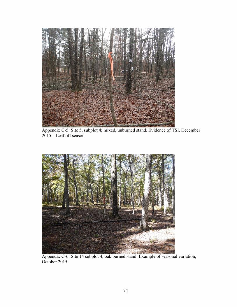
Canopy and Understory Cover. During this study, only one site out of 30 was
severely burned with total canopy consumption. All other sites maintained total tree
canopy coverage except during leaf-off seasons (Appendix C). Site 30 is the only site
with canopy consumption. It has been burned four times since 2009 (Appendix B). It is
unknown which prescribed burn prior to 2016 consumed the canopy (Appendix C-13 and
C-14).
There were no statistically significant differences for prescribed fire effects
between burned and unburned sites for seedling/sapling densities. However, burned sites
tend to have higher densities of seedlings and saplings than unburned sites (Table 8)
(Wang et al., 2005). During May, there were large increases of seedling and sapling
densities compared to winter and fall months (Figures 9 and 10). Unburned sites were not
sampled during May; it is unclear if the increases in seedling and sapling densities are
related solely to the season, or if prescribed burning enhances seedling/sapling growth.
Lack of significance for seedling/sapling densities are likely due to high natural
variability (Tiedemann et al., 2000) and high field-method sampling errors coupled with
other types of forest management outside of prescribed burning (Appendix B and F).
Page 53
43
Figure 9. Seedling density by stand type and time sampled.
Figure 10. Sapling density by stand type and time sampled.
0
2
4
6
8
10
Pine Mixed Oak
See
dli
ng D
ensi
ty (
m2/h
a)
Stand Type
unburned Dec 2015 (n= 9) burned >1 year Dec 2015 (n= 21)
2 months May 2016 (n= 12) 7 months Oct 2016 (n= 12)
unburned Oct 2016 (n= 3)
0
5
10
15
20
25
Pine Mixed Oak
Sap
ling D
ensi
ty (
m2/h
a)
Stand Type
unburned Dec 2015 (n= 9) burned >1 year Dec 2015 (n= 21)
2 months May 2016 (n= 12) 7 months Oct 2016 (n= 12)
unburned Oct 2016 (n= 3)
Page 54
44
However, Wang et al (2005), found that increases in seedling density were
significantly related to decreased forest floor depth and increased understory light
intensity, which suggests prescribed fires are having an indirect effect on seedlings. They
also found that the effects of burning differed among stands, where significance of
seedling density was related to fire behavior (i.e. severity). No significant effect of
prescribed burning was found among stands where fire intensity remained low (Wang et
al., 2005). Prescribed burns in Mark Twain National Forest are low severity burns,
therefore it is possible that sites managed with prescribed burning are not significantly
different than unburned sites for seedling/sapling densities.
Soil Characteristics
Leaf Litter and Duff Depths. Leaf litter and duff layer depths vary naturally
among stands. Unburned mixed stand types tend to have the deepest litter and duff
depths, followed by pine and oak stands (Figures 11 and 12). In general, burned sites
have significantly less litter and duff depths than unburned sites (p > 0.05) (Table 8).
During winter months burn sites on average have about 2-15 mm (10-30%) less litter and
5-10 mm (10-40%) less duff depth than unburned sites (Figures 11 and 12). During May,
litter depth decreased by 20-30 mm (75-95%) compared to sites burned more than a year
ago (Figure 11). This decrease in litter depth is due to immediate effects of the prescribed
burns in March 2016. Duff depths are higher in May following prescribed burning (20-
30%) compared to sites burned more than a year ago (Figure 12). This is likely due to the
season sampled and time since leaf fall, where warmer temperatures promote
decomposition (Sierra et al., 2016). This indicates that prescribed burning was not severe
Page 55
45
enough to consume the duff layer. Other studies have found no significant effect of
spring prescribed burns on duff depth, suggesting that remaining duff layers protect soils
from erosion (Zabowski et al., 2007).
Sites that have been burned have significantly less duff depth than unburned sites
(Table 8). During October 2016, both burned and unburned litter depths return to depths
near those measured in December 2015 with 5-20 mm less litter (Figure 11). Similarly,
duff depths measured in October 2016 nearly mirror depths measured in December 2015
for both burned and unburned sites, where differences are less than 5 mm (Figure 12).
Figure 11. Litter depth by stand type and time sampled.
0
10
20
30
40
50
60
Pine Mixed Oak
Avg.
Lit
ter
Dep
th (
mm
)
Stand Type
unburned Dec 2015 (n= 9) burned >1 year Dec 2015 (n= 21)
2 months May 2016 (n= 12) 7 months Oct 2016 (n= 12)
unburned Oct 2016 (n= 3)
Pre
scri
bed
fire
Mar
ch 2
01
6
Page 56
46
Figure 12. Duff depth by stand type and time sampled.
One-way ANOVA shows significant differences between burned and unburned
sites and stand types for both litter depth and duff depth at the 95% confidence interval
(C.I.) (Tables 8 and 9). While burned sites tend to have lower leaf litter depth and duff
depths than unburned sites, litter and duff depths on burned sites appear to recover with
similar depths to those measured at unburned sites over time, suggesting fires have a
minimal long-term impact litter and duff depths. Kolaks et al. (2004), have similar
findings for litter, where 50% of “equilibrium” litter accumulation returned within 2.5
years.
Soil Depth. One-way ANOVA was used to test the significance of prescribed fire
on soil properties at 0-5 cm, 5-10 cm, and 20-30 cm (subsoil) increments at the 95% C.I.
There were statistically signficant differences between group means for burned and
unburned sites at the 0-5 cm increment only (Table 8). Samples from 5-10 cm and 20-30
0
5
10
15
20
25
30
Pine Mixed Oak
Avg.
Duff
Dep
th (
mm
)
Stand Type
unburned Dec 2015 (n= 9) burned >1 year Dec 2015 (n= 21)
2 months May 2016 (n= 12) 7 months Oct 2016 (n= 12)
unburned Oct 2016 (n= 3)
Page 57
47
cm show no statistical difference (Table 8). The same results were found for burned stand
types (pine, oak, mixed) (Table 9). However, there were no significant differences
between group means for unburned stand types at any of the depth increments. These
results suggest that soil variability in general as well as potential prescribed fire effects
are not altering soil properties below 5 cm. Thus, only results for the 0-5 cm soil layer are
evaluated below.
Organic Matter. Soil OM varies by stand as determined by the LOI method and
is typically higher among pine stands followed by mixed and oak stands (Figure 13 and
Table 9). Burned stands in general have significantly higher amounts of OM, about 20%
more than unburned stands at the 95% C.I. (Figure 13 and Table 8). Organic matter is
likely higher among burned stands because prescribed fires are not completely
consuming either the litter layer or the duff layer (Zabowski et al., 2007) (Figures 13 and
14), nor is it significantly effecting CWD (Figure 13). However, CWD or decayed wood
on the surface of forest floors can become charred during a prescribed fire, which adds
additional OM to the soil (DeBano, 1991). Other studies have found increases in OM of
the surface soil from frequent prescribed burns (2-5 years) (Wade and Lundsford, 1990;
Patterson et al., 2004).
Page 58
48
Figure 13. Percent organic matter by stand type and time sampled.
Bulk density. Soil BD is significantly different among burned and unburned
stands, where burned stands have a lower BD than unburned stands, about 8-12% (Figure
14 and Table 8). Burned stand types have significantly different bulk densities at the 95%
C.I., while unburned stand types are not significantly different at the 95% C.I. (Table 9).
Comparing the Figure 13 with figure 14, an inverse relationship appears, where OM is
high, BD is typically lower. This relationship between OM content and BD has been
found in other studies (Chaudhari et al., 2013). Organic matter improves aggregate
stability, porosity and infiltration rates, therefore lowering BD (USDA-NRCS, 2008;
USDA-NRCS 2015).
0
2
4
6
8
10
12
14
16
Pine Mixed Oak
Av
g.
% O
M (
0-5
cm
)
Stand Type
unburned Oct 2015 (n= 9) burned >1 year Oct 2015 (n= 21)
2 months May 2016 (n= 12) 7 months Oct 2016 (n= 4)
unburned Oct 2016 (n= 3)
Page 59
49
Figure 14. Bulk density by stand type and time sampled.
Grain Size. During this study, sites were located on one specific soil series so the
soil type was effectively held constant. Hence, there were no statistically significant
differences among group means for burned and unburned sites, nor among burned or
unburned stand types (Figure 15 and Tables 8 and 9). Percent rock fragments (>2 mm) in
the first 0-5 cm and 5-10 cm of the soil had a range of 3- 45% and a median of 17.9%
(Appendix I). Median diameter of soils (< 2mm) in burned oak stands is 66.3 µm, 90.5
µm for pine and 35.7 µm for mixed stands (Tables 5-7). Median percent sand among
stand types in the first 0-5 cm of the soil is 17.1 µm for pine and oak stands, and 15.2 for
mixed stands. Coefficient of variation of percent sand for each stand type was under 35%.
Therefore, prescribed fires do not effect grain size among burned and unburned sites.
Differences in grain size, while not significant, are likely due to other factors such as
weathering, geology, slope aspect and location in the watershed (Meinert et al., 1997).
0.0
0.2
0.4
0.6
0.8
1.0
1.2
1.4
Pine Mixed Oak
Bulk
Den
sity
g/c
m3
(0-5
cm
)
Stand Type
unburned Oct 2015 (n= 9) burned >1 year Oct 2015 (n= 21)
2 months May 2016 (n= 12) 7 months Oct 2016 (n= 4)
unburned Oct 2016 (n= 3)
Page 60
50
Figure 15. Mean particle diameter by stand type and time sampled.
Recovery Trends
While this study only began in October 2015, prescribed burning has been used in
areas of the watershed since 2011 (Figure 4). Data were collected from unburned sites
and burned sites of varying frequency (Appendix B). The purpose of this section is to
evaluate recovery trends among burned and unburned site properties. This can be used to
identify potential recovery periods for litter and duff depth, soil organic matter and bulk
density.
Leaf Litter and Duff Depths. Short-term trends are observed following
prescribed fires for up to 1-2 years (Figure 16). In May 2016, two months after burning,
immediate effects of prescribed burning were apparent where litter decreased (Figures
11). Duff does not decrease in May following a burn. Instead, duff depth is higher, which
as previously discussed indicates that prescribed burns are not severe enough to consume
0
20
40
60
80
100
120
140
pine mixed oakMea
n P
arti
cle
Dia
met
er 0
-5 c
m (
µm
)
Stand Type
unburned Oct 2015 (n= 9) burned >1 year Dec 2015 (n= 21)
2 months May 2016 (n= 12) 7 months Oct 2016 (n= 12)
unburned Oct 2016 (n= 3)
Page 61
51
the duff layer (Zabowski et al., 2007). Additionally, litter depth begins to return to
unburned depths by October 2016, seven months after a prescribed burn (Figure 16).
Therefore, one seasonal leaf-off period can support recovery for litter. Litter and duff
depths are easily recovered following prescribed burns as seasons progress (Figures 16
and 17).
Litter can fully recover within 2-4 years following a prescribed burn (Figure16).
However, duff depth remains about 40% lower than unburned sites 2-4 years after
burning (Figure 17). Duff layer reduction observed in other studies was between 68.5%
and 87.5% for fall prescribed burning (Gurbir et al., 2017). Fall burning can consume
more litter and duff than spring burns, due to less moisture in the litter and duff layers or
surface fuels (Zabowski et al., 2007).
Figure 16. Litter depth measurements for date measured and last year burned.
0
5
10
15
20
25
30
35
40
45
50
Lit
ter
Dep
th (
mm
)
Date Sampled and Burn Year
Page 62
52
Figure 17. Duff depth measurements for date measured and last year burned.
Organic Matter and Bulk Density. Organic matter tends to be 15-20% higher
among burned areas than unburned areas 1-2 years after prescribed burning (Figure 18).
Figures 18 and 19 indicate that sites burned in 2012 and 2013 maintain about 40% more
OM and 23% less BD than unburned sites (Figure 18). On average, 2-4 years after
burning, bulk density is about 19% lower than unburned sites (Figure 19). In years where
OM is higher, BD is lower (2012 and 2013), which displays an inverse relationship
between soil OM and BD. This relationship was described by Chaudhari et al (2013)
when investigating the dependence of BD on OM (Figures 18 and 19). Overall, soil OM
is about 22% higher among burned sites, while bulk density is about 12% lower than
unburned sites (Figures 18 and 19). These results suggest that prescribed burning
enhances soil properties, where OM is increased and BD is decreased.
0
5
10
15
20
25
30
Duff
Dep
th (
mm
)
Date Sampled and Burn Year
Page 63
53
Overall, litter depths are able to recover with one seasonal period. Duff appears to
be unaffected by spring prescribed burning. Additionally, these recovery trends indicate
that prescribed fire is enhancing soil physical properties (OM and BD) that improve soil
aggregate stability and influence infiltration rates in the first 0-5 cm (Schoenholtz et al.,
2000; USDA-NRCS, 2008). Relatively rapid recovery of ground cover coupled with
these enhanced soil properties should promote healthy forest soils which increase surface
roughness and infiltration rates and decrease runoff (Schoenholtz et al., 2000; USDA-
NRCS, 2008).
Figure 18. Percent organic matter measurements for date measured and last year burned.
0
2
4
6
8
10
12
14
16
% O
M (
0-5
cm
)
Date Sampled and Burn Year
Page 64
54
Figure 19. Bulk density measurements for date measured and last year burned.
Universal Soil Loss Equation
To further understand prescribed fire effects on forest conditions the Universal
Soil Loss Equation (USLE) was used to calculate the average annual soil loss in metric
tons/hectare/year (A). Burned stand average annual soil loss per year (A) was compared to
unburned stands.
Unburned oak stands have an A value of 0.15 metric tons/ha/year, whereas burned
oak stands have an A value of 0.16 metric tons/ha/year (Table 10). Similarly, unburned
pine stands have an A of 0.15 metric tons/ha/year and 0.18 metric tons/ha/year for burned
pine stands (Table 10). These results are similar to other studies which have found that
erosion from forests is virtually non-existent compared to croplands and grasslands
(Raeker et al., 2011). The results of this model suggest that sites managed with prescribed
burns have similar average annual soil losses per year as unburned sites. The nomograph
0
0.2
0.4
0.6
0.8
1
1.2
BD
g/c
m3 (
0-5
cm
)
Date Sampled and Burn Year
Page 65
55
for soil erodibility only reads up to 4% OM. Therefore the maximum amount of OM
among burned and unburned sites used for this model was limited to 4%. It is possible
that average annual soil loss values (A) could be even smaller given the higher amounts
of percent OM measured among burned sites (Figures 9 and 10).
Table 10. Universal Soil Loss Equation Factors
Summary
Sites that have been managed with prescribed burning have soil characteristics
that are significantly different compared to unburned sites. Forest characteristics that are
most influenced by prescribed burning are leaf litter depth, duff depth, soil OM, and BD.
The effects of prescribed burning on these characteristics are positive, rather than
negative. Leaf litter and duff depths are able to recover to pre-burn conditions within one
season and make a full recovery 2-3 years following a prescribed burn.
Prescribed burning effects were only significant for the first 0-5 cm of the soil.
Burned sites had significantly higher OM and lower BD than unburned sites which
suggest prescribed burns enhance soil structure. There were no significant effects of
burning on mean particle diameter or grain size, meaning the burns are not hot enough to
alter grain size, and size distribution is more likely related to environmental factors.
tons/acre Mg/ha
1 Oak Unburned 177 0.19 0.5 0.004 1 0.067 0.15
24 Pine Unburned 177 0.19 0.5 0.004 1 0.067 0.15
20 Oak Burned 177 0.2 0.5 0.004 1 0.071 0.16
18 Pine Burned 177 0.23 0.5 0.004 1 0.081 0.18
APCLSK-fRSite TypeSite
Page 66
56
One question to be addressed by this study was to evaluate the influence of
prescribed burning on erosion and subsequent water quality. The USLE was used to do
this. The results suggest that prescribed burns may decrease annual rates of erosion
compared to unburned sites. The two variables that most strongly influenced the equation
for this study were the soil erodibility factor (K) and the cover management (C).
Enhanced soil structure following prescribed burning along with maintained canopy
cover promote soil stability and therefore reduce the risk for increased rates of erosion.
Nevertheless, predicted soil erosion rates are relatively low and similar among
both burned and unburned sites. Therefore, it is expected that runoff and eroded sediment
from burned areas should not affect water quality to a level beyond unburned forest
conditions.
Page 67
57
CHAPTER 5 – CONCLUSIONS
Pine regeneration among Missouri forests is important not only for habitat
creation and restoration, but also for economic purposes such as logging. Prescribed
burns are being used to help restore forests in Mark Twain National Forest to their
original shortleaf pine-oak stands (USDA-FS, 2012). A mixture of silviculture and
prescribed burning are extremely important for pine regeneration (Guyette et al., 2007).
There are concerns over the effects of prescribed burning on water quality from both
residents and local agencies. The combination of field, laboratory and statistical methods
helped to assess the effects of prescribed fires on forest and soil characteristics that
control hydrologic processes. There are 4 key findings of this study:
1. Leaf litter and duff depths, soil OM and BD at 0-5 cm on sites managed with
prescribed fire were significantly different compared to unburned sites. Leaf
litter and duff depths were significantly lower among burned stands (Table 8)
(Figures 11 and 12). Burned sites had about 10-30% less litter in winter and 75-
95% less litter two months after a prescribed burn (Figure 11). However, one
seasonal leaf-off period can provide for recovery of litter. There was about 10-
40% less duff in winter months and this trend continued up to 4 years after
prescribed burning (Figures 12 and 17). Burned stands had a higher percent of
OM (22%) and lower BD (12%) than unburned stands in the first 0-5 cm of the
soil (Figures 18 and 19). Recovery of ground cover within a year coupled with
increased OM and decreased BD enhances soil structure and porosity and thus
infiltration rates, thereby reducing the risk of runoff and erosion (Li et al., 2014;
USDA-NRCS, 2008).
2. Prescribed burns did not significantly effect soil grain size, OM or BD below
5 cm. Prescribed burning did not significantly alter grain size within the top 30
cm of soil depth (Tables 8 and 9). Additionally, prescribed burns do not cause
significant differences among soil properties that influence infiltration below 5 cm
of the soil, which indicates that the spring prescribed burns applied in Mark
Twain National forest are not severe enough to alter subsoil properties (Tables 8
and 9) (Zabowski et al., 2007).
Page 68
58
3. Prescribed fires typically have little effect on, or may even enhance, forest
soil characteristics which control infiltration rates and reduce runoff. Leaf
litter recovers to unburned conditions within a year as seasonal biomass influx
occurs (Figure 11 and 16). Duff depths recover within about 2-4 years following a
prescribed burn (Figure 17). Organic matter in burned sites soil was about 22%
higher than unburned sites (Figure 18). Bulk density was about 12% lower among
burned sites compared to unburned sites (Figure 19). There are no clear recovery
trends for OM and BD, however about 2-3 years after burning OM was the
highest and BD was the lowest.
4. Universal Soil Loss Equation analysis indicates that sites managed with
prescribed burning have similar average annual soil loss rates in Mg/ha/year
compared to unburned sites. Unburned pine and oak stands had the same
predicted average annual soil loss rate of 0.15 metric tons/ha/year. Burned pine
stands had a slightly higher predicted soil loss rate of 0.18 metric tons/ha/year
compared to 0.16 metric tons/ha/year for burned oak stands. These erosion rates
are similar to those measured in other forested lands (Raeker et al., 2011).
Therefore, prescribed burning has little effect on runoff and soil erosion on level
upland locations within Mark Twain National Forest.
Future Work
While this study found that prescribed burning on uplands is not negatively
effecting soil characteristics which control hydrologic processes, more research is needed
to understand how/if prescribed burns effect soil conditions and subsequent runoff on
hillslopes and riparian areas. Field tests would be the most accurate way to collect data
and assess sediment loading following prescribed burning. Continual monitoring of the
sites throughout the Big Barren watershed should be implemented to better understand
the long-term effects of prescribed burning on forest, soil and watershed conditions.
Page 69
59
REFERENCES
Adamski, J.C., Petersen, J.C., Freiwald, D.A., Davis, J.V., 1995. Environmental and
hydrologic setting of the Ozark Plateau study unit, Arkansas, Kansas, Missouri,
and Oklahoma. U.S. Geological Survey. Water-Resources Investigations Report
94-4022.
Bendix, J., and Cowell, C.M., 2010, Impacts of wildfire on the composition and structure
of riparian forests in southern California: Ecosystems, 13: 99-107.
Blizzard, E.M., Henken, D., Kabrick, J.M., Dey, D.C., Larsen, D.R., and Gwaze D.,
2007, Shortleaf pine reproduction abundance and growth in pine-oak stands in the
Missouri Ozarks: Proceedings of Shortleaf pine restoration and ecology in the
Ozarks: U.S. Department of Agriculture, Forest Service, Northern Research
Station, p. 138-146.
Carter, M.C., and Foster, D.C., 2003, Prescribed burning and productivity in southern
pine forests: A review: Forest Ecology and Management, 191 (2004) p. 93-109.
Certini, G., 2005, Effects of fire on properties of forest soils: A review: Oecologia 143:1-
10.
Chaudhari, P.R., Ahire, D.V., Ahire, V.D., Chkravarty, M., and Maity, S., 2013, Soil bulk
density as related to soil texture, organic matter content and available total
nutrients of Coimbatore soil: International Journal of Scientific and Research
Publications, v. 3, Issue 2, ISSN: 2250-3153.
Covert, S.A., Robichaud, P.R., Elliot, W.J., and Link, T.E., 2005, Evaluation of runoff
Prediction from WEPP-Based erosion models for harvested and burned forest
watersheds: Transactions of the ASAE 48, p. 1091-1100.
Cunningham, R.J., 2007, Historical and social factors affecting pine management in the ‘
Ozarks during the late 1800’s through 1940: Proceedings of Shortleaf pine
restoration and ecology in the Ozarks: U.S. Department of Agriculture, Forest
Service, Northern Research Station, p. 1-6.
Davis, T.R., 2006, Soil phosphorus levels in residential lawns and comparisons among
four land uses in Springfield, Missouri, [M.S. Thesis]: Missouri State University,
p. 12.
DeBano, L.F., 1991, The effect of fire on soil properties: Proceedings-management and
productivity of western-montane forest soils: U.S. Department of Agriculture,
Forest Service, Intermountain Research Station, p. 151-156.
Page 70
60
Elliot, K.J., and Vose, J.M., 2006, Fire effects on water quality: A synthesis of response
regulation factors among contrasting ecosystems: Proceedings of the Second
Interagency Conference on research in the Watersheds, May 16-18, p.77-87.
Environmental Protection Agency (EPA), Rainfall erosivity factor calculator for small
construction sites, 2017: https://www.epa.gov/npdes/rainfall-erosivity-factor-
calculator-small-construction-sites#getTool (accessed March 2017).
Eshel, G., Levy, G.J., Mingelgrin, U., and Singer, M.J., 2004, Critical evaluation of the
use of laser diffraction for particle-size distribution analysis: Soil Science Society
of America Journal, v. 68, p. 736-734.
Fisher, R.F.; Binkley, D., 2000, Ecology and Management of Forest Soils, 3rd Ed: New
York: John Wiley and Sons, Inc. p. 489.
Follett, R.F., 1995, Fate and transport of nutrients: Nitrogen: USDA, Agricultural
Research Service Soil-Plant-Nutrient Research Unit Fort Collins, Colorado:
http://www.nrcs.usda.gov/wps/portal/nrcs/detail/national/landuse/crops/?cid=nrcs
143_014202 (accessed October 2015).
Forest Inventory and Analysis National Core Field Guide (FIA), 2014:
Field data collection procedures for phase 2 plots, Version 6.1, v.1:
http://www.fia.fs.fed.us/library/field-guides-methods-proc/ (accessed October
2015).
Forest Inventory and Analysis National Core Field Guide (FIA), 2011: Soil
measurements and sampling- phase 3, Version 5.1, p. 1-31:
https://www.fia.fs.fed.us/library/field-guides-methods-
proc/docs/2012/field_guide_p3_5-1_sec22_10_2011.pdf (accessed September
2015).
Gingrich, S.F., 1967, Measuring and evaluating stock and stand density in upland
hardwood forests in the central states: Forest Science, v. 13, No. 1, p. 38-53.
Graham, R.T., McCaffrey, S., Jain, T.B., 2004, Science basis for changing forest
structure to modify wildfire behavior and severity: Department of Agriculture,
Forest Service, Rocky Mountain Research Station, p. 43.
Gray, R., Kobizar, L., Riley, K., Ryan, K., Godwin, D., Robertson, K., Ingalsbee, T.,
Prusak, Z., and Huffman, M., 2013, The Merits of Prescribed Fire Outweigh
Potential Carbon Emission Effect: Association for Fire Ecology, International
Association of Wildland Fire, Tall Timbers Research Station, The Nature
Conservancy, p. 1-8.
Gray, D.H., and Leiser, A.T., 1982, Biotechnical slope protection and erosion control:
New York, Van Nostrand Reinhold Company.
Page 71
61
Gurbir, S., Schoonover, J.E., Monroe, K.S., Williard, K.W.J., and Ruffner, C.M., 2017,
Prescribed burning and erosion potential in mixed hardwoods forests of southern
Illinois: Forests, v. 8, doi:10.3390/f8040112, p. 1-20.
Guyette, R.P., Muzika, R., Voelker, S.L., 2007, The historical ecology of fire, climate,
and the decline of shortleaf pine in the Missouri Ozarks: Proceedings of the
Missouri Ozark Forest Ecosystem Project: Site history, soils, landforms, woody
and herbaceous vegetation, down wood, and inventory methods for the landscape
experiment: Department of Agriculture, Forest Service, North Central Research
Station, p. 19-23.
Guyette, R., and Larsen, D., 2000, A history of anthropogenic and natural disturbances in
the area of the Missouri Ozark forest ecosystem project: Proceedings of the
Missouri Ozark Forest Ecosystem Project: Site history, soils, landforms, woody
and herbaceous vegetation, down wood, and inventory methods for the landscape
experiment: Department of Agriculture, Forest Service, North Central Research
Station, p. 19-23.
Gwaze, D., Melick, R., McClure, L., Studyvin, C., Massengele, D., 2007, Effects of site
preparation subsoiling and prescribed burning on survival and growth of shortleaf
pine in the Mark Twain National Forest: Results after 20 growing seasons:
Proceedings of Shortleaf pine restoration and ecology in the Ozarks: Department
of Agriculture, Forest Service, Northern Research Station, p. 129-133.
Hamman, S.T., Burke, I.C., and Knapp, E.E., 2008, Soil nutrients and microbial activity
after early and late season prescribed burns in a Sierra Nevada mixed conifer
forest: Forest Ecology and Management, v. 256, p. 367-374.
Hamza, M.A., Anderson, W.K., Soil compaction in cropping systems: A review of the
nature, causes and possible solutions: Soil and Tillage Research, v. 82, p. 121-
145.
Henely, W.F., Patterson, M.A., Neves, R.J., and Lemly, A.D., 2000, Effects of
sedimentation and turbidity on lotic food webs: A concise review for natural
resource managers: Reviews in Fisheries Science, v. 8, p. 125-139.
Jandl, R., Linder, M., Vesterdal, L., Bauwens, B., Baritz, R., Hagedorn, F., Johnson,
D.W., Minkkinen, K., and Byrne, K.A., 2004, How strongly can forest
management influence soil carbon sequestration?: Geoderma v.137, p. 253-268.
Kabrick, J., Meinert, D., Nigh, T., and Gorlinsky, B.J., 2000, Physical environment of the
Missouri Ozark forest ecosystems project sites: Proceedings of the Missouri
Ozark Forest Ecosystem Project: Site history, soils, landforms, woody and
herbaceous vegetation, down wood, and inventory methods for the landscape
experiment: Department of Agriculture, Forest Service, North Central Research
Station, p. 41-70.
Page 72
62
Knapp, B.O., Stephan, K., and Hubbart, J.A., 2015, Structure and composition of an oak-
hickory forest after 60 years of repeated prescribed burning in Missouri, U.S.A:
Forest Ecology and Management, v. 344, p. 95-109.
Kolaks, J.J., Cutter, B.E., Lowenstein, E.F., Grabner, K.W., Hartman, G.W., and Kabrick,
J.M., 2004, The effect of thinning and prescribed fire on fuel loading in the
central hardwood region of Missouri: Proceedings, 14th Central Hardwood
Conference: Newton Square, PA: U.S. Department of Agriculture, Forest Service,
Northeastern Research Station, p. 168-178.
Ladd, D., Heumann, B., and Nelson, P., 2007, The Pineknot project: Restoration of a
Missouri Ozark pinery: Proceedings of Shortleaf pine restoration and ecology in
the Ozarks: U.S. Department of Agriculture, Forest Service, Northern Research
Station, p. 204-205.
Li, X., Niu, J., and Xie, B., The effect of leaf litter cover on surface runoff and soil in
Northern China, 2014:
http://journals.plos.org/plosone/article?id=10.1371/journal.pone.0107789
(accessed December 2015).
Loch, R.J., 2000, Effects of vegetation cover on runoff and erosion under simulated rain
and overland flow on a rehabilitated site on the Meandu Mine, Tarong,
Queensland: Australian Journal of Soil Research v. 38, p. 299 – 312.
Massman, W.J., Frank, J.M., 2006, Effects of controlled burns on the bulk density and
thermal conductivity of soils at a southern Colorado site. In: 27th Conference on
Agricultural and Forest Meteorology: American Meteorological Society:
https://ams.confex.com/ams/pdfpapers/110226.pdf (accessed December 2015).
McCaffrey, S.M., 2006, Prescribed fire: What influences public approval?: Proceedings
of Fire in Eastern Oak Forests, Delivering Science to Land Managers: USDA
Forest Service, p. 192-198.
McLaren, P., and Bowles, D., 1985, The effects of sediment transport on grain-size
Distributions: Journal of Sedimentary Petrology, v. 55, No. 4, p. 457-470.
Meinert, D., Nigh, T., Kabrick, J., 1997, Landforms, geology and soils of the MOFEP
study area: Proceedings of the Missouri Ozark Forest Ecosystem Project
symposium: An experimental approach to landscape research: Department of
Agriculture, Forest Service, North Central Forest Experiment Station, p. 56-68
Menashe, E., 1998, Vegetation and Erosion- A literature Survey: Proceedings,
Conference at Oregon State University, Native Plants: Propagation and Planting:
Forest Research Laboratory, p. 130-135
Page 73
63
Missouri Department of Natural Resources (MDNR), 1986, Missouri Water Atlas:
Missouri Department of Natural Resources, Jefferson City, Missouri.
Natural Resources Conservation Service (NRCS), 2017, Missouri field office technical
guide- Section 1, C factor tables:
https://efotg.sc.egov.usda.gov/references/public/MO/Table_2a_rev.pdf (accessed
April 2017).
Nave, L.E., Vance, E.D., Swanston, C.W., and Curtis, P.S., 2010, Fire effects on
temperate forest soil C and N storage: Ecological Society of America v. 21, p.
1189-1201.
Neary, D.G., Ryan, K.D., DeBano, L.F., Landserber, J.D., and Brown, J.K., 2005,
Wildland fire in ecosystems: Effects of fire on soil and water: USDA Forest
Service, Rocky Mountain Research Station, p.7.
Nigh, T.A., 2007, The Ozark highlands pine-oak woodland restoration partnership:
Proceedings of Shortleaf pine restoration and ecology in the Ozarks: Department
of Agriculture, Forest Service, Northern Research Station, p. 214-215.
Ornoff, R.C., Weary, D.J., and Sebela, S., 2001, Geologic frame work of the Ozarks of
South- Central Missouri- contributions to a conceptual model of Karst: U.S.
Geological Survey Karst Interest Group Proceedings, Water-Resources
Investigations Report 01-4011, p. 18-24.
Ottmar, R., Andreu, A., 2007, Litter and duff bulk densities in the southern United States:
final report for Joint Fire Sciences Program, Project 04-2-1-49. Pacific Northwest
Research Station, Seattle, WA.
Ozarks Environmental and Water Resources Institute (OEWRI), 2007, Standard
operating procedure: Organic matter in sediment, loss on ignition method,
Missouri State University.
Ozarks Environmental and Water Resources Institute (OEWRI), 2008, Standard
operating procedure: LS 13 320 Laser Diffraction Particle Size Analyzer
operation, Missouri State University
Patterson, W.B., Sword-Sayer, M.A., Haywood, J.D., and Brooker, S., 2004, Effects of
vegetation management with prescribed fire on soil physical properties in a young
longleaf pine stand: Department of Agriculture, Forest Service, Southern
Research Station, p. 74-78.
Phillips, M.J., Swift, L.W. Jr., and Blinn, D.R., 2000, Best management practices for
riparian areas: Riparian management in forests of the continental eastern United
States, Boca Raton, FL, Lewis Publishers, CRC Press LLC, p. 273-286.
Page 74
64
Raeker, G., Moser, K.W., Butler, B.J., Fleming, J., Gormanson, D.D., Hansen, M.H.,
Kurtz, C.M., Miles, P.D., Morris, M., Treiman, T.B., 2011, Missouri’s forests
2008: Resource Bulletin NRS-54: U.S. Department of Agriculture, Forest Service,
Northern Research Station, p. 1-64.
Reardon, J.R., Ryan, K.C., DeBano, L.F., and Neary, D.G., 2005, Wetlands and riparian
Systems: Proceedings of Wildland fire in ecosytems: Effects of fire on soil and
water: USDA Forest Service, Rocky Mountain Research Station, p. 149-169
Reilly, M.J., Outcalt, K., O’Brien, J.J., and Wade, D., 2016, Effects of repeated growing
season prescribed fire on the structure and composition of pine-hardwood forests
in the southeastern Piedmont, USA: Forests, v. 8, p. 1-12, doi:10.3390/f8010008.
Reitz, R., and Gwaze, D., 2010, Landowner attitudes towards shortleaf pine restoration:
Science and Management Technical Series: Number 2: Missouri Department of
Natural Resources, Jefferson City, Missouri, p. 1-20.
Renard, K.G., Yoder, D.C., Lightle, D.T., and Dabney, S.M., 2010, Universal soil loss
equation and revised universal soil loss equation: Handbook of Erosion Modeling,
v.1, p.137-167.
Rogerson, P.A., 2014. Statistical Methods for Geography: A Student’s Guide, Fourth
Edition. Sage Publications Ltd, p. 177-198.
Schoenholtz, S.H., Miegroet, H.V., and Burger, J.A., 2000, A review of chemical and
physical soil properties as indicators of forest soil quality: Challenges and
Opportunities: Forest Ecology and Management, v. 138, p. 335-356.
Sierra, C.A., Malghani, S., and Loescher, H.W., 2016, Interactions among temperature,
moisture and oxygen concentrations in controlling decomposition rates in a boreal
forest soil: Biogeosciences, v. 14, p. 703-710.
Sikkink, P.G., Lutes, D.E., and Kean, R.E., 2009, Field Guide for identifying fuel loading
Models: USDA Forest Service, Rocky Mountain Research Station, p. 2-3.
Sparks, D.L.,1996, Methods of Soil Analysis: Chemical Methods: Soil Science Society of
America, Inc., Series 5, Part 3.
Stattrek, http://stattrek.com/statistics/random-number-generator.aspx (accessed
September 2015).
Tiedemann, A.R., Klemmedson, J.O., and Bull, E.L., 1998, Solution of forest health
problems with prescribed fire: Are forest productivity and wildlife at risk?: Forest
Ecology and Management, v. 127, p. 1-18.
Page 75
65
United States Department of Agriculture- Forest Service (USDA-FS), 2012, Forest’s
Collaborative forest landscape restoration project 2012-2022:
https://www.fs.usda.gov/detail/mtnf/landmanagement/?cid=stelprdb5423048
accessed October 2015).
United States Department of Agriculture- Forest Service (USDA-FS), 2017a, FSGeodata
Clearinghouse: https://data.fs.usda.gov/geodata/ (accessed October 2016).
United States Department of Agriculture- Forest Service (USDA-FS), 2017b, Restoration
Glossary: https://www.fs.fed.us/restoration/reforestation/glossary.shtml (accessed
March 2017).
United States Department of Agriculture (USDA) Kellogg Soil Survey, 2014, Laboratory
Methods Soil Survey Investigations Report No. 42 v. 5, p. 276-281.
United States Department of Agriculture- National Cooperative Soil Survey (USDA-
NCSS), 2005, Official series description- Macedonia
Series: https://soilseries.sc.egov.usda.gov/OSD_Docs/M/MACEDONIA.html
(accessed September 2015).
United States Department of Agriculture- Natural Resources Conservation Service
(USDA-NRCS), 2004, 3.3 Bulk Density- Measurements:
https://www.nrcs.usda.gov/Internet/FSE_DOCUMENTS/nrcs142p2_051670.pdf
(accessed December 2015).
United States Department of Agriculture- Natural Resources Conservation Service
(USDA-NRCS), 2017, Geospatial Data Gateway:
https://gdg.sc.egov.usda.gov/GDGOrder.aspx (accessed September 2015).
United States Department of Agriculture- Natural Resources Conservation Service
(USDA-NRCS), 2015, Role of soil organic matter:
http://www.nrcs.usda.gov/wps/portal/nrcs/detailfull/soils/health/mgnt/?cid=nrcs14
2p2_053859 (accessed October 2015).
United States Department of Agriculture- Natural Resources Conservation Service
(USDA-NRCS), 2008, Soil quality indicators:
http://www.nrcs.usda.gov/Internet/FSE_DOCUMENTS/nrcs142p2_053256.pdf
(accessed October 2015).
United States Department of Agriculture- Natural Resources Conservation Service, Web
Soil Survey (USDA-WSS), 2017: https://websoilsurvey.sc.egov.usda.gov/App/WebSoilSurvey.aspx (accessed
March 2017).
United States Forest Service- Forest Service Manual (USFS-FSM), 2014, Silvicultural
Practices: Forest Management: Washington, DC, p. 10-12.
Page 76
66
Vana-Miller, D.L., 2007, Water resources foundation report: Ozark National Scenic
Riverways, Natural Resources Report NPS/NRWRD/NRR: National Park
Service, Water Resources Division, Fort Collins, Colorado, p. 1-46.
Wade, D.D., and Lundsford, J., 1990, Fire as a forest management tool: Prescribed
burning in the southern united states: Food and Agriculture Organization of the
United Nations: http://www.fao.org/docrep/t9500e/t9500e07.htm (accessed
December 2016).
Wang, G.G., Van Lear, D.H., Bauerle, W.L., 2005, Effects of prescribed fires on first-
year establishment of white oak seedlings in the Upper Piedmont of South
Carolina, USA: Forest Ecology and Management, v. 213, p. 328-337.
Ward, A.D., and Trimble, S.W., 2004, Environmental Hydrology, 2nd edition: Florida,
CRC Press LLC, p. 259-268.
White, C.S., Pendleton, R.L., Pendleton, B.K., 2006, Response of two semiarid
grasslands to a second fire application: Rangeland Ecology and Management, v.
59, p. 98-106
Winter, G., Vogt, C., and McCaffrey, S.M., 2005, Community views of fuel
management: Are national forest local recreation users more supportive?: Survey
data report, prepared for North Central Research Station: USDA Forest Service, p.
546-550.
Wischmeier, W.H., and Smith, D.D., 1965, Predicting rainfall-erosion losses from
cropland east of the Rocky Mountains: a guide for selecting practices for soil and
water conservation: USDA Agricultural Handbook, No. 282:
https://naldc.nal.usda.gov/download/CAT87208342/PDF (accessed March 2017).
Woodall, C.W., and Monleon, V.J., 2008, Sampling protocol, estimation, and analysis
procedures for the down woody materials indicator of the FIA program: United
States Department of Agriculture, Forest Service and National Research Station,
p. 1-72.
Zabowski, D., Thies, W.G., Hatten, J., and Ogden, A., 2007, Soil response to season and
interval of prescribed fire in a ponderosa pine forest of the Blue Mountains,
Oregon: JFSP Research Project Reports, Paper 120.
http://digitalcommons.unl.edu/jfspresearch/120 (accessed January 2017).
Page 77
67
APPENDICES
Appendix A. Methods, Definitions and Units Measured for Variables.
Variables Units Definition Method Method Referencs
Basal Area m3/ha
Basal area is the amount
of an area occupied by
tree stems >0.13 m
DBH.
Trees with DBH >0.13
m measured; recorded
living or dead, tree
species, and burned or
unburned
Field: Field: FIA
Phase 2, Version
7.1, p. 38, 2016
CWD volume m3/ha
Course woody debris
includes downed, dead
trees and large limbs,
and other woody pieces
that are ≥3 inches in
diameter and severed
from their original source
of growth.
Each piece measured
for diameter (>0.1 m),
length (>1.5 m), age,
burned or cut, and type
of CWD: stem, root
wad, compound piece,
or fallen tree
Field: FIA Phase 2,
Version 7.1, p. 137,
2016
Seedling density #/m2
Very young trees with
DBH <0.025 m
Recorded tally of
seedlings with
diameter <0.025 m;
hardwoods >0.3 m tall
and pines >0.15 m tall
within in known area of
microplot
Field: FIA Phase 2,
Version 7.1, p. 68-
101, 2016
Sapling density #/m2
Young trees with DBH
0.025-0.3 m
Recorded tally of
saplings with diameter
0.025- 0.13 m
Field: FIA Phase 2,
Version 7.1, p. 68-
101, 2016
Witness tree N/A
Tree near the center of
each subplot used to
easily find subplots;
maintenance of plot
integrity.
Recorder stands with
back to tree and takes
a bearing facing the
center of the subplot
and then measures the
distances from the
center of the subplot to
the tree
Field: FIA Phase 2,
Version 7.1, p. 7
and 70, 2016
Page 78
68
Appendix A continued. Methods, Definitions and Units Measured for Variables.
Variables Units Definition Method Method Referencs
Litter depth mm
Litter is the layer of
freshly fallen leaves,
needles, small twigs,
cones, detached bark
pieces, dead moss and
lichens, detached small
chunks of rotted wood,
dead herbaceous stems,
and flower parts.
Sampling frame with
known area; folding
ruler to measure depth
at 4 locations within
sampling frame
Field: FIA Phase 3,
Version 5.1, p. 3,
2011
Duff depth mm
Duff is the mat-like layer
just below litter layer
and located just above
the soil A-horizon. This
layer is differentiated
from the litter layer in
that the source of this
material can no longer
be identified.
Sampling frame with
known area; folding
ruler to measure depth
at 4 locations within
sampling frame
Field: FIA Phase 3,
Version 5.1, p. 3,
2011
Bulk Density g/cm3
Bulk density is an
indicator of soil
compaction, available
water capacity, total
pore space, soil health
and other soil
properties.
Impact-drive soil core
sampler; bulk density
ring
Field: FIA Phase 3,
Version 5.1, p. 14-
24, 2011
Organic Matter %
Organic matter is the
plant and animal residue
in the soil at various
stages of decomposition.
Portion of the sampled
obtained from bulk
density samples for
analysis
Laboratory:
OEWRI SOP
(2030R02 Org
Matter LOI)
Soil Texture µm
The textural class of soil
is determined by the
percent of sand, silt, and
clay in the fraction of the
soil that is less than 2
millimeters in diameter.
Soil texture influences
soil infiltration rates.
Portion of the sampled
obtained from bulk
density samples for
analysis
Laboratory: OEWRI
SOP (Particle Sizer
R01.doc)
Page 79
69
Appendix B - Site Descriptions, Characteristics and Management History
Appendix B-1. Site Type, Year Burned and Management History.
1 Oak 0 Never Commercial thinning- 2011
2 Oak 4 2007, 2009, 2013, 2016 Sanitation Cut- 1981
3 Oak 4 2007, 2009, 2013, 2016 Salvage Cut- 1997
4 Oak 0 Never None
5 Mixed 0 Never Commercial thinning- 2008
6 Mixed 0 Never Commercial thinning- 2009
7 Oak 2 2012, 2016 None
8 Oak 2 2012, 2016 None
9 Oak 2 2012, 2016 None
10 Oak 1 2011 Stand clear-cut- 1987
11 Oak 1 2011 Salvage Cut- 1991
12 Pine 3 2011, 2012, 2015 None
13 Oak 2 2012, 2015 None
14 Oak 2 2012, 2015 None
15 Oak 3 2009, 2012, 2015 Sanitation Cut- 1981
16 Oak 2 2012, 2015 Sanitation Cut- 1985
17 Oak 3 2012, 2014, 2016 Stand clear-cut- 1984
18 Pine 4 2009, 2012, 2014, 2016 None
19 Oak 3 2012, 2014, 2016 Improvement cut- 1997
20 Oak 4 2009, 2012, 2014, 2016 Stand clear-cut- 1985
21 Mixed 4 2009, 2012, 2014, 2016 Commercial thin- 1994
22 Mixed 0 Never Stand clear-cut- 1991
23 Pine 0 Never None
24 Pine 0 Never None
25 Oak 2 2010, 2014 Salvage cut- 1990
26 Mixed 1 2016 Stand clear-cut- 1989
27 Oak 0 Never Salvage cut- 1991
28 Oak 4 2008, 2009, 2012, 2015 Stand clear-cut- 1982
29 Oak 1 2011 Commercial thinning- 2014
30 Pine 4 2007, 2009, 2013, 2016 Salvage cut- 1982
Number of times
burnedUSFS Timber Harvest ActivityYears burnedSite Stand Type
Page 80
70
Appendix B-2. Management Definitions.
Type of management
A type of clearcutting where removal of essentially all trees in the previous
stand, producing a fully exposed microclimate for the development of a
new age class. Under a two-aged method, varying numbers of reserve
trees are not harvested to attain goals other than regeneration.
Commercial thinning
Improvement cut
Stand clearcutting
Sanitation cutting
Salvage cutting
Definition (USDA-FS, 2017b)
A treatment made to reduce stand density of trees primarily to improve
growth, enhance forest health, or to recover potential mortality. Includes
crown thinning (thinning from above, high thinning), free thinning, low
thinning (thinning from below), mechanical thinning (geometric thinning),
and selection thinning (dominant thinning).
A treatment made in a stand, pole-sized or larger, primarily to improve
composition and quality by removing less desirable trees of any species.
The removal of dead trees or trees being damaged or dying due to
injurious agents other than competition, to recover value that would
otherwise be lost.
The removal of trees to improve stand health by stopping or reducing
actual or anticipated spread of insects and disease
Page 81
71
Appendix B-3. Site Characteristics.
1 2.65 33.54 28.70 0.02 0.97
2 5.24 32.16 0.14 0.04 0.40
3 4.22 21.18 8.07 0.07 0.65
4 3.51 20.76 22.61 0.13 0.47
5 1.55 26.94 66.23 0.83 0.34
6 3.10 28.44 108.79 0.05 0.97
7 5.27 27.91 6.46 0.40 0.97
8 8.24 27.62 25.91 0.58 0.13
9 3.96 25.46 16.60 0.22 0.60
10 5.55 25.06 5.67 0.70 0.36
11 1.78 25.47 1.18 0.43 0.65
12 3.52 37.67 15.54 0.00 0.45
13 3.16 23.17 7.58 0.13 1.37
14 3.54 37.31 31.30 0.02 0.81
15 5.20 23.13 6.59 0.09 1.23
16 4.22 24.27 7.19 0.42 0.25
17 5.08 27.10 14.31 1.14 0.94
18 5.93 41.69 56.93 1.86 2.27
19 2.08 28.04 15.40 1.14 0.87
20 3.96 21.39 2.43 0.45 0.69
21 3.66 36.94 113.10 0.56 0.83
22 4.36 26.20 2.99 0.63 0.52
23 2.74 39.72 21.08 0.52 0.34
24 8.58 37.55 21.52 0.22 0.27
25 1.60 24.06 2.50 1.30 1.01
26 2.78 28.33 0.25 0.29 0.32
27 5.04 16.83 27.36 0.70 0.29
28 3.94 17.60 28.22 0.72 0.52
29 1.45 34.04 49.57 0.88 0.07
30 3.53 21.69 46.45 0.90 0.13
SiteAverage seedling
density (#/m2)
Average sapling
density (#/m2)
Average CWD
(m3/ha)
Average basal
Area (m2/ha)
Avgerage
slope (%)
Page 82
72
Appendix C. Photo Log.
Appendix C-1. Site 18, pine dominated; burned stand; October 2016.
Appendix C-2. Site 19 near state highway J; old logging road behind subplot 1-MSU 1
witness tree; oak dominated; burned stand; October 2016.
Page 83
73
Appendix C-3. Site 8 subplot 3; oak burned stand; Examples of understory flora; October
2015.
Appendix C-4. Site 5, mixed, unburned stand; October 2015.
Page 84
74
Appendix C-5: Site 5, subplot 4; mixed, unburned stand. Evidence of TSI. December
2015 – Leaf off season.
Appendix C-6: Site 14 subplot 4, oak burned stand; Example of seasonal variation;
October 2015.
Page 85
75
Appendix C-7. Site 14 subplot 4, oak burned stand; Example of seasonal variation;
December 2015.
Appendix C-8. Site 1 subplot 2, oak unburned stand; bulk density ring and sampling
tools; October 2015.
Page 86
76
Appendix C-9. Site 5 subplot 4; mixed unburned stand; Sampling October 2015.
Appendix C-10. Site 7, subplot 1, stake at center; oak burned stand; October 2015.
Page 87
77
Appendix C-11. Site 9, subplot 2; oak burned stand; soil profile 0 to ~300 mm; October
2015.
Appendix C-12. Site 1, subplot 3; Unburned oak stand; equipment; October 2015.
Page 88
78
Appendix C-13. Site 30, subplot 1; Burned pine stand; Canopy consumption; October
2015.
Appendix C-14. Site 30, subplot 3; Burned pine stand; Canopy consumption; October
2015.
Page 89
79
Appendix D. Site Locations, Witness Trees and Tree Type.
Appendix D-1. Site Locations.
Center Subplot-1 Center Subplot-1
Long (X) Lat (Y)
1 659437.301 4080062.227
2 658875.5559 4083857.655
3 658982.4524 4083671.949
4 661010.5659 4081082.027
5 660934.8276 4078419.459
6 661537.6508 4078592.055
7 666461.5999 4076799.976
8 666368.7261 4076037.302
9 666284.6427 4075910.204
10 671201.2695 4079522.863
11 670704.7171 4078568.883
12 664710.9456 4081125.878
13 665466.0678 4080858.674
14 666409.5483 4080644.465
15 667319.9821 4080481.88
16 667211.7329 4083836.521
17 665587.2334 4085290.582
18 665887.5198 4084607.001
19 661828.6691 4084875.617
20 667076.1819 4083853.867
21 667437.3312 4084262.745
22 671770.6544 4082957.121
23 672045.6205 4082259.346
24 674153.1877 4084786.917
25 669972.4206 4076860.041
26 669244.696 4078284.938
27 669937.9524 4078471.136
28 661979.413 4078461.26
29 661662.572 4079191.537
30 659106.4744 4083386.166
Site
Page 90
80
Appendix D-2. Site Witness Trees and Tree Type.
Site Subplot Azimuth (°) Distance (m) Tree Type
1 55 4 White oak
2 180 2.5 White oak
3 340 5 pine
4 25 4.5 red oak
1 350 4 White oak
2 280 1 black oak
3 260 2.5 black oak
4 0 3 pine
1 270 7 White oak
2 180 0.5 black oak
3 190 2 pine
4 120 4.5 White oak
1 160 3 black oak
2 250 2 White oak
3 280 1.5 White oak
4 340 1.5 pine
1 160 4 White oak
2 85 1 black oak
3 70 8.5 White oak
4 300 4.5 black oak
1 290 3 pine
2 0 3.5 black oak
3 230 2 pine
4 30 3.5 pine
1 50 4 black oak
2 270 0.5 oak
3 290 7.5 oak
4 220 2 oak
1 290 5 pine
2 250 7 oak
3 130 2 black oak
4 90 0.5 pine
1 110 4 White oak
2 90 1.5 oak
3 180 1 oak
4 340 3 oak
1 90 2.5 White oak
2 180 2 black oak
3 300 1 oak
4 160 0.5 oak
4
Witness tree locations
1
2
3
5
6
10
9
8
7
Page 91
81
Appendix D-2 continued. Site Witness Trees and Tree Type.
Site Subplot Azimuth (°) Distance (m) Tree Type
1 115 6 oak
2 280 1 oak
3 180 0.5 oak
4 180 0.5 oak
1 90 3 pine
2 180 1 pine
3 0 2 pine
4 50 0.25 oak
1 270 2 oak
2 90 0.5 oak
3 340 6 pine
4 330 3.5 pine
1 60 3.5 oak
2 270 0.5 oak
3 0 4 oak
4 90 2 oak
1 30 1.5 oak
2 40 1.5 oak
3 260 1.5 oak
4 60 0.5 pine
1 300 W-NW 2.5 White oak
2 180 S 1 oak
3 320 NW 0.1 White oak
4 80 E 3 pine
1 70 E NE 5 Not recorded
2 255 W-SW 5 Not recorded
3 190 S 3 Not recorded
4 0 N 4 Not recorded
1 280 W 4 pine
2 200 S 4 oak
3 280 W 2.5 pine
4 40 NE 3 pine
1 120 E-SE 6 oak
2 20 N 3 oak
3 60 E-NE 5 White oak
4 200 S 4 pine
1 - - -
2 140 SE 3.5 pine
3 220 S-SW 4 pine
4 S-SW 1 White oak
20
18
17
16
Witness tree locations
19
12
15
14
13
11
Page 92
82
Appendix D-2 continued. Site Witness Trees and Tree Type.
Site Subplot Azimuth (°) Distance (m) Tree Type
1 330 N-NW 5 pine
2 160 S 3 pine
3 320 NW 0.6 pine
4 10 N 0.4 pine
1 270 W 3 White oak
2 190 S 2 White oak
3 40 NE 3 pine
4 160 S 3.5 oak
1 10 N 2.5 pine
2 290 W 2 pine
3 320 NW 6 White oak
4 50 NE 4 oak
1 280 W 3 pine
2 190 S 2 pine
3 300 NW-W 2 pine
4 0 N 2 pine
1 160 S 2.5 Ash?
2 190 S 1.5 oak
3 240 SW 5 oak
4 50 NE 4 oak
1 270 W 3.5 oak
2 220 SW 2.5 White oak
3 320 NW 3.5 White oak
4 120 E-SE 0.3 White oak
1 10 N 2.5 White oak
2 210 S 6 Hickory
3 220 S-SW 2.5 White oak
4 100 E 3.5 White oak
1 0 N 2 White oak
2 160S 3.5 oak
3 300 SW-W 2.5 oak
4 80 E 1.5 oak
1 160 S 2 White oak
2 160 S 5.5 White oak
3 110 E 4 black gum?
4 340 N 2.5 White oak
1 70 E NE 2.5 pine
2 10 N 6 pine
3 180 S 1 dead pine
4 330 NW 2.5 pine
23
22
21
30
29
28
27
Witness tree locations
26
25
24
Page 93
83
Appendix E. Subplot Vegetation Form.
Page 94
84
Appendix E continued. Subplot Vegetation Form.
Page 95
85
Appendix F. Field Method error, Relative Percent Difference
SiteTree
Count
Pine
Count
Basal
Area
(m2/ha)
Leaf litter
depth
(mm)
Duff
depth
(mm)
Sapling
density
(#/m2
)
Seedling
density
(#/m2
)
CWD
(m3/ha)
1 7.69 15.38 12.53 17.32 16.21 45.62 67.98 86.63
6 40.00 19.05 35.26 47.15 9.83 28.52 17.71 114.10
18 6.06 6.90 8.41 24.65 24.24 36.29 94.16 109.38
20 16.87 25.64 21.42 17.30 28.59 75.76 169.51 86.44
21 5.41 0.00 24.39 11.78 44.70 103.82 178.79 43.97
24 11.76 16.95 12.96 11.60 22.23 124.26 58.96 3.81
26 12.50 66.67 7.55 33.09 57.13 110.98 40.00 15.65
Page 96
86
Appendix G. Dry Mass of Litter and Duff.
Appendix G-1. Dry Mass of Leaf Litter and Duff Methods.
Litter and duff samples were collected using a sampling frame with a diameter of
30 cm (FIA, 2011; Ottmar and Andreu, 2007). The frame was placed over the litter and
duff layers. A knife was used to cut the litter and duff within the frame to remove the
sample. Samples were processed at Missouri State University in the geomorphology
laboratory. Samples were dried at 60°C for 24 to 48 hours, or until all moisture had been
removed and then weighed. A 19.1 mm sieve was used to separate the litter and duff
layers. Litter is the fraction of the sample >19.1 mm and duff is the fraction >19.1 mm.
Once separated the weight was recorded for litter and duff. Mass per area was calculated
for litter and duff by taking the mass of each divided by the area of the sampling frame
(Woodall and Monleon, 2008). This data provides information and estimates for forest
floor fuel loadings (Woodall and Monleon, 2008).
Page 97
87
Appendix G-2. Dry Mass of Leaf Litter and Duff Results.
Site Stand type Litter (g/m2) Duff (g/m
2)
1 Oak 131.46 591.55
2 Oak 272.30 1061.03
3 Oak 206.57 530.52
4 Oak 98.59 586.85
5 Mixed 211.27 460.09
6 Mixed 220.66 624.41
7 Oak 295.77 671.36
8 Oak 187.79 920.19
9 Oak 112.68 732.39
10 Oak 187.79 413.15
11 Oak 154.93 577.46
12 Pine 521.13 1258.22
13 Oak 51.64 234.74
14 Oak 154.93 680.75
15 Oak 300.47 511.74
16 Oak 338.03 417.84
17 Oak 413.15 553.99
18 Pine 389.67 1014.08
19 Oak 267.61 234.74
20 Oak 417.84 502.35
21 Mixed 403.76 854.46
22 Mixed 586.85 910.80
23 Pine 417.84 685.45
24 Pine 431.92 793.43
25 Oak 530.52 366.20
26 Mixed 492.96 553.99
27 Oak 333.33 469.48
28 Oak 75.12 18.78
29 Oak 234.74 370.89
30 Pine 192.49 394.37
Page 98
88
Appendix H. Nomograph to Determine Soil Erodibility (K-Factor) (Wade and
Trimble, 2004).
Page 99
89
Appendix I. Soil Texture <2 mm and Percent Rock Fragments >2 mm.
Site Stand type % Sand % Silt % Clay % Rock fragment >2 mm
1 Oak 13.5 66.9 19.6 3.66
2 Oak 26.0 56.3 17.6 19.02
3 Oak 27.8 55.3 16.8 31.18
4 Oak 32.7 52.7 14.7 25.94
5 Mixed 8.6 68.4 23.0 9.18
6 Mixed 15.2 64.7 20.2 8.90
7 Oak 16.0 62.4 21.6 27.84
8 Oak 11.0 65.0 24.1 31.64
9 Oak 17.3 56.5 26.2 44.69
10 Oak 12.2 67.7 20.1 16.62
11 Oak 9.0 71.1 19.9 9.81
12 Pine 23.0 59.7 17.3 5.15
13 Oak 26.9 57.1 16.0 8.75
14 Oak 21.8 60.3 17.9 25.74
15 Oak 24.0 59.2 16.8 23.86
16 Oak 16.8 65.4 17.8 3.98
17 Oak 30.1 54.3 15.6 31.49
18 Pine 17.1 64.0 18.9 40.53
19 Oak 18.7 63.7 17.7 9.31
20 Oak 16.4 65.9 17.7 5.57
21 Mixed 11.6 68.8 19.6 2.95
22 Mixed 20.0 62.9 17.2 14.39
23 Pine 13.3 67.7 19.0 4.92
24 Pine 16.3 65.1 18.7 33.12
25 Oak 10.1 72.2 17.7 11.38
26 Mixed 17.0 62.1 20.9 22.21
27 Oak 18.1 62.1 19.8 25.10
28 Oak 16.8 62.5 20.7 22.46
29 Oak 9.5 68.8 21.5 7.95
30 Pine 30.6 52.8 16.6 23.98
0-5 cm
Page 100
90
Appendix I continued. Soil Texture <2 mm and Percent Rock Fragments >2 mm.
Site Stand type % Sand % Silt % Clay % Rock fragment >2 mm
1 Oak 13.0 65.0 22.0 3.56
2 Oak 26.5 55.3 18.2 20.72
3 Oak 27.3 54.9 17.9 31.13
4 Oak 31.9 52.7 15.5 18.71
5 Mixed 5.9 69.5 24.5 7.88
6 Mixed 13.5 66.0 20.5 6.14
7 Oak 16.6 60.4 23.0 17.41
8 Oak 10.0 64.9 25.1 18.64
9 Oak 10.1 58.2 31.7 25.00
10 Oak 7.9 70.5 21.6 18.13
11 Oak 5.6 72.9 21.4 9.61
12 Pine 19.3 61.7 19.0 5.95
13 Oak 27.9 55.6 16.5 10.73
14 Oak 18.8 61.9 19.4 24.67
15 Oak 17.7 63.0 19.3 21.90
16 Oak 13.3 67.0 19.7 5.50
17 Oak 26.9 55.8 17.3 26.66
18 Pine 14.2 65.3 20.5 20.93
19 Oak 14.8 65.6 19.6 22.82
20 Oak 14.7 66.4 18.9 10.51
21 Mixed 10.3 68.5 21.2 6.40
22 Mixed 16.7 65.1 18.1 7.66
23 Pine 11.2 68.9 19.9 5.51
24 Pine 16.7 64.3 18.9 29.69
25 Oak 3.6 76.8 19.6 12.25
26 Mixed 13.2 64.5 22.3 16.21
27 Oak 15.4 63.1 21.5 34.61
28 Oak 13.0 65.5 21.5 30.76
29 Oak 6.4 70.5 23.0 17.63
30 Pine 22.7 57.7 19.5 36.76
5-10 cm