Inspiring What’s Next for Health Inspections and Mobile Workforce Optimization Este Geraghty, MD, MS, MPH, GISP | Chief Medical Officer & Health Solutions Director Ken Blankinship | Health & Human Services Sales Manager Jared Shoultz, MA | Health GIS Patterns Specialist & Lead HHS Solution Engineer
Transcript
Inspiring What’s Next for Health Inspections
and Mobile Workforce OptimizationEste Geraghty, MD, MS, MPH, GISP | Chief Medical Officer & Health Solutions Director
Ken Blankinship | Health & Human Services Sales Manager
Jared Shoultz, MA | Health GIS Patterns Specialist & Lead HHS Solution Engineer
Strategic Planning & Marketing
Access to Care & Services
Preparedness & Response
Disease Surveillance & Control
Population & Community Health
Overview of Esri HHS 2019 Initiatives
Restaurant Inspections &
Mobile Workforce Optimization
• Protecting Public Health
• Increasing Operational Efficiencies
• Improving Customer Service
Rising Trend
of Food Away
from Home
• Way of life
• Powerful economic
engine
• Community image
We face many challenges
Source: CDC
Each year 1 in 6 Americans (or 48 million people) gets sick, 128,000 are hospitalized, and 3,000 die of
foodborne diseases."
Increasing Food Options
• Access and convenience
• Food trucks
• Food carts
Resources
Do we have enough
resources to keep all
inspections on time?
How can we increase operational efficiency while also improving
our effectiveness in discovering critical violations and preventing
outbreaks?
The big question is:
Health Inspection
Workflow Demo
GIS Analyst:
Plan & Prioritize
Manager:
Monitor & Assign
Field Worker:
Inspect & Report
* Special thanks to the City of
Chicago Department of Public
Health
ArcGIS Platform for Health Inspections
Field Mobility• Priority Tasks
• Seamless Navigation
• Information Access
• Data Collection
Design & Planning• Territory Design
• Prioritization
• Assignments
Monitoring &
Decision Support• Status Overview
• Workforce Monitoring
• Real-time Assignments
Constituent
Engagement• Report an Issue
• Lookup Results
• Share Data
Health Inspections: ArcGIS Value Propositions
• Detect potential problems faster with prioritized inspections
• Real-time insight into field operations
• Increase flexibility to respond to emerging problems
• Complete more inspections in less time
• Conserve limited resources
• Standardize data collection process
• Eliminate paper and redundant data entry
• Improve customer service
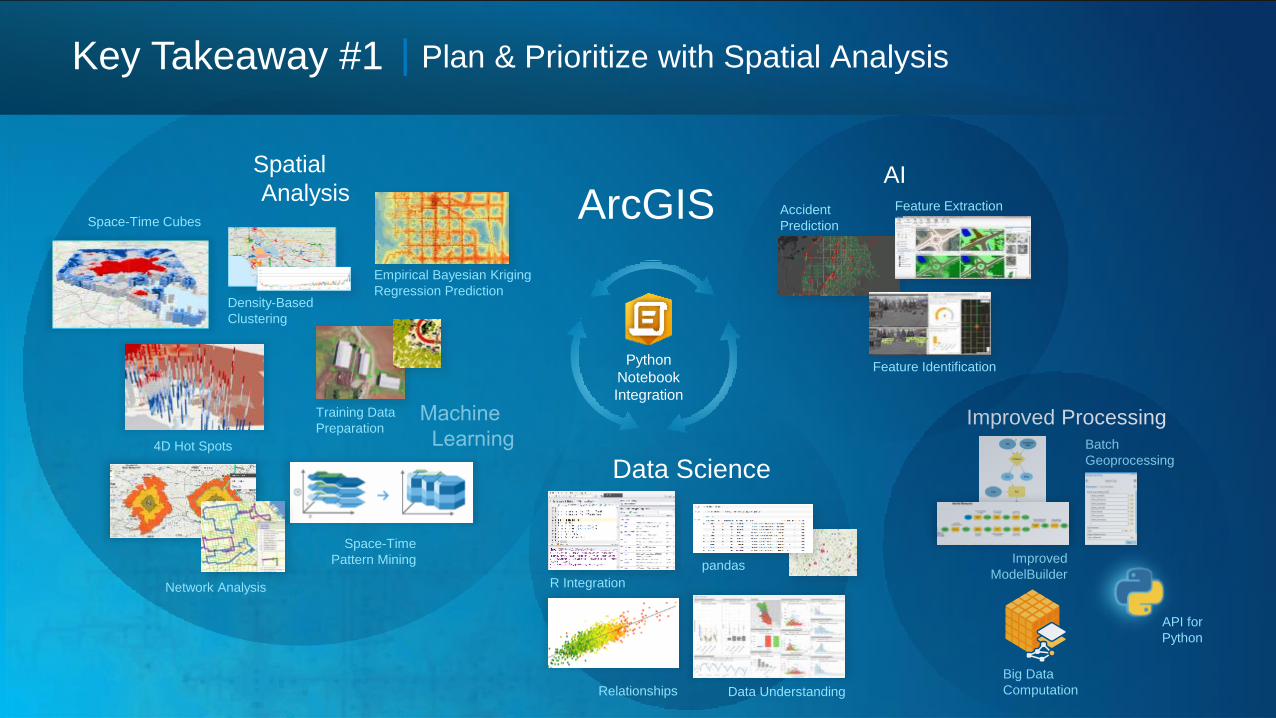
Key Takeaway #1
Empirical Bayesian Kriging
Regression PredictionDensity-Based
Clustering
Training Data
Preparation
Spatial
AnalysisAccident
Prediction
Feature Identification
AIFeature Extraction
Python
Notebook
Integration
ArcGIS
Data Science
R Integration
pandas
Space-Time Cubes
4D Hot Spots
Space-Time
Pattern Mining
Big Data
Computation
Improved Processing
API for
Python
Batch
Geoprocessing
Improved
ModelBuilderNetwork Analysis
Data UnderstandingRelationships
| Plan & Prioritize with Spatial Analysis
Any Data Feed
Crime
Wildfires
Accidents
Key Takeaway # 2 | Actionable Insights in Real-Time
Situational
Awareness
Dashboards
Alerting
Workforce Optimization
Inspections
WorkforceNavigator
Collector
Survey123
Explorer
Plan and
Monitor
Key Takeaway # 3 | Empowering Mobile Workers with Integrated Field Apps
Smart
FormsDigital Map Book
Connected and
Disconnected
Tracker
G
Operations Dashboard
QuickCaptureArcGIS Online or Enterprise
Interconnected Information, Processes, and Workflows . . .
. . . All Happening at the Same Time
Digital Transformation with the Esri Geospatial Cloud
Location Platform Technology• Mapping, analysis, data management, collaboration
ArcGIS
Maximize Benefit
Enterprise Integration• Integrate information from many sources
• SDKs and APIs
Esri Ecosystem • Professional Services
• Ready-made solutions
• Training, support, community
• Business Partners
Quick & Easy Deployment Patterns• Configure first, customize second
• Ready to use maps, apps & data• On-premise, cloud, SaaS
Resource Location Time
Health & Human Services Showcase UC Expo (Hall C) Tue. & Wed. 9-6pm | Thur. 9-4pm
Combatting the Opioid Epidemic Using GIS UC Expo (Demo Theater 16) Wed. 11:15-12pm
Health & Human Services SIG Marriott – Marina Salon G Wed. 8:30-9:45am