25
Integrating Geoscience Interpretation and GIS for New Ventures and Exploration Tony Joseph October 2015

Integrating Geoscience Interpretation and GIS
for New Ventures and Exploration
Tony Joseph
October 2015

PRIMARY USE
› Basemap for each project (classified and annotated wells types, fields types, block types, bathymetry, DEM, georeferenced maps, facilities)
› Well location and deviation survey types (match with well logs)
› Define CRS and projection transformation for project and data (unique for Borneo due to historical company defs, drilling, Petronas defs)
› Create grids / surfaces, contours and isopachs from Horizons (apply smoothing and algorithms)
› Depth convert source grids / surfaces with formulaes (quick velocity model)
› Create Fault polygons and classify faults from fault sticks. Edit if necessary.
› Create Contours from grids
› Create Prospect from contours and faults (define closure and structural trap)
› Petroleum systems mapping (reservoir, source, seal, trap and timing
› Lead and prospect digitizing, classification and mapping
› Map based volume calculation / thickness map
› Lithology, age and stratigraphy
› Final evaluation montage and presentation
-Evaluations / Data Rooms / Bid Rounds / Joint Studies
-Regional Interpretation / Play Mapping / Prospects

› Regional database for Seismic and Well database updates (data not in IHS or DII database). Well reports and publications.
› Well correlated with stratigraphy
› Identify key reservoir and source depositional environments using core logs, wireline log and seismic intepretation
› Well Post-Drill analysis and mapping
› Sedimentation thickness and basins map
› Lithology
› Plate tectonics and basin evolution map (based on agreed model)
› Create GDE polygons map – Gross Deposition Environment
› Create and Edit Play maps
› Gridding (density map)
› Source Presence and Maturity Maps (depend on basin)
› Regional Gross Structures
› CRS map (common risk segment) and block ranking
› Leads and Prospect Mapping
› Country screening
› Global basin screening
PRIMARY USE
-Evaluations / Data Rooms / Bid Rounds / Joint Studies
-Regional Interpretation / Play Mapping / Prospects

WELL INTERPRETATION AND GIS
› What type of basins being explored? Does basin contain source rock? Are the source rocks mature for petroleum generation?
› What is the stratigraphy, lithology and age of the basin? Structural impact in the
basin?
› GIS database and mapping used for analyzing basins
› Typical workflow
– Input biostratigraphy well data
– Input well spreadsheet with values of TD, Well Tops, Cycle, Lithology, Heat, CO2,
Geochemistry, VR. Typically in Excel.
– Integrate with wireline log and seismic data. Well to well correlation
– Overlay and merge with GIS functions (table join and/or spatial join GIS function)
– Map series for each sequence (also show structural configuration and lithofacies distribution)
› Generate map / grid from spatial intersect using GIS for well tops penetration (point) with interval thickness (polygon)
› Create temperature and CO2 grid map
› Petroleum migration pathways
› Creaming curves and field size distribution (can be misleading)
› Overlay reservoir and field distribution map. QC with well logs
› Understanding lithology (changes as more exploration done) for each sequence. Reference with well logs.
› Overlay well failure analysis
- Table Queries and Selections
- Spreadsheet and formulaes
- Mapping attributes
- Gridding
- Overlay in well logs

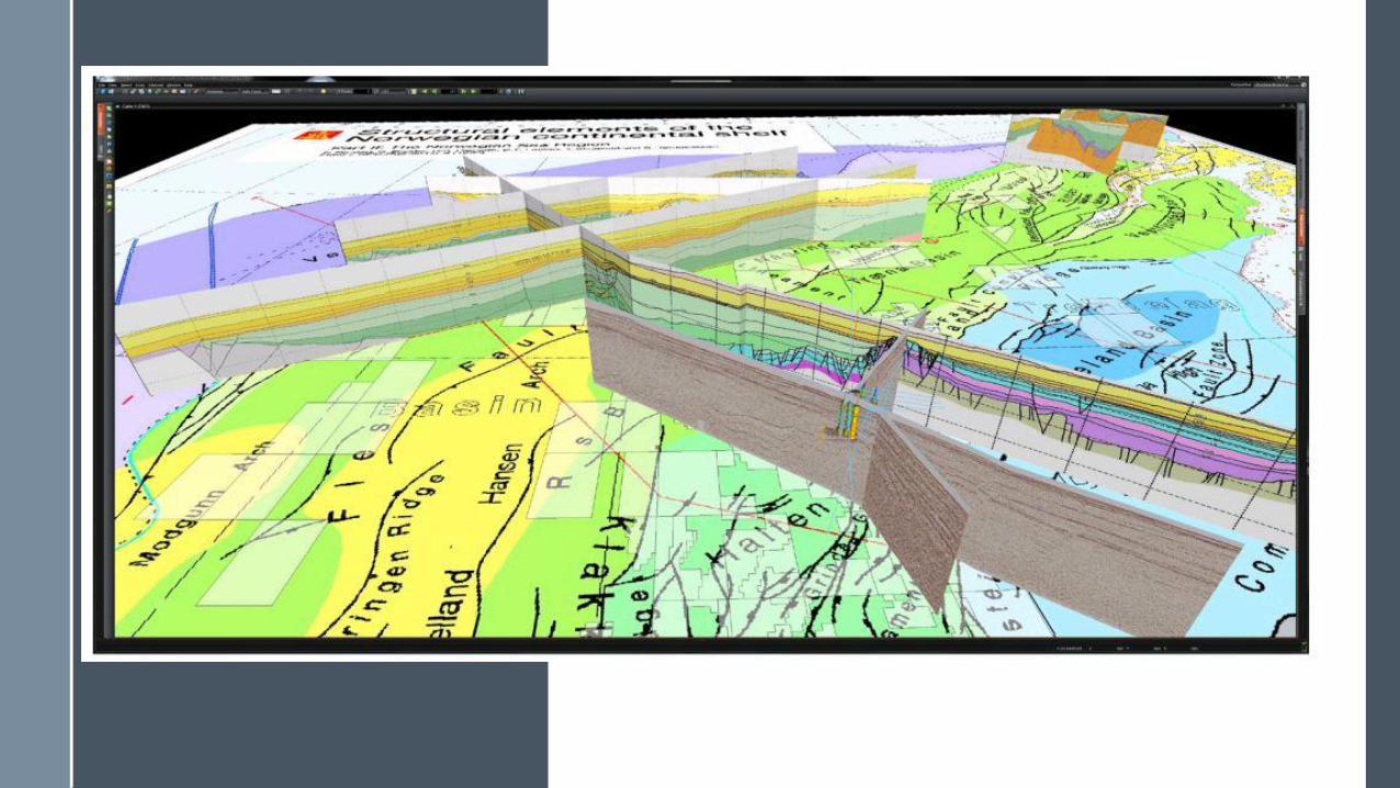
SEISMIC INTERPRETATION AND GIS
› Overlay 2D / 3D window with basemap (lease, fields), gross structure map, basin outline
› Overlay seabed depth grid xyz after seismic depth conversion
› Overlay basement depth grid xyz after seismic depth conversion
› Overlay GDE polygons and Play fairways
› Overlay block ranking
› Regional biostratigraphic correlation overlay in seismic interpretation
› Overlay tectonic polygons, gross structure and markers in seismic interpretation
› Overlay georeferenced publication maps and studies on seismic map view
› Regional grids overlay in seismic cross section
› Seismic Navigation survey line QC and transform (2D has more issues)
› Check and verify seismic shot point and CDP X and Y location
› Search and display SEGY coverage / lines
- Pick Assist
- Seabed
- Basement
- Map reference
- Regional overlay
- GDE
- Gross Structure

WAR MAPS
› Competitor environment
› Bid rounds, relinquishments and farm-ins
› Seismic activity and availability
› Well activity and recent discovery
› Drilling statistics
› Field discovered volumes (total in-place, recoverable and production charts)
› Production trends and development options
› Propects and Leads (link with risk matrix / mapping)
› Portfolio Analysis (partnerships, acquisition)
› GeoPDF, Map Packages
- Senior Management presentations
- Quarterly basemaps and reference
- Business development
- Shared maps with development and production
- Global basins database
- Newsletter and online maps

GEOMATICS AND GEODESY
› Accurate location map
› Acreage map
› Facilities map (incl platforms and pipelines)
› Maps of expiring PSCs or farm-in potentials
› Pock marks on seabed
› Geohazards
› Remote sensing, satellite imagery / radar and multispectral scanning
› Well site survey, bathymetry, shallow hazards, abandoned wells
› Define seismic survey boundaries
-CRS and Projection Transformations
-Seismic surveys
-Drilling surveys
-Offshore surveys
-Site surveys
-Engineering and facility drawings

KEY MAPPING SOFTWARE
› Petrel
› Kingdom SMT
› DSG / OpenWorks
› ArcGIS and Player
› Petrosys
› Trinity
› BM Geographic Calculator
› EDIN
› Open Spirit
- Proven
- Strengths and Weakness
- Performance
- Productivity
- Learning curve
- Integration
- Support

KEY VENDOR DATA
› Magnetic / NOAA
› Gravity / Sandwell
› IHS
› Woodmac / Petroview
› DII
› Tellus
› PGSEA
› CoreLabs
› GEBCO
› SRTM, Landsat
› AAPG
- Accuracy
- Coverage
- Frequency
- Applied
- Support
› GE TECH
› JMJ
› USGS
› SeaMagic
› OCTEK
› NOAA
› SEAPEX
› SEARG
› FUGRO SEEPS
› DOTSEA
› GEOMARK
› C&C DAKS
› PLATES
› NEFTEX

CARTOGRAPHY AND LAYOUT
› MXD templates and versioning
› corporate Layer files
› Intepretation Project templates and study area (Landmark)
› Well symbology definition
› Geological symbols standards
› Horizon colormaps
› Grid colormaps
› Fault symbology
› Basemap layout and logo
› CRS and measurement definition
› Publish maps online / sharepoint / map package
-Map templates
-Symbology
-Well definitions
-G&G Reports
-Database
-Map Standards
-Web services and online maps

DATA MANAGEMENT
› Standardise workflow for data management –corporate and departmental
› Record incoming data, CA (confidentiality agreements), data room history
› Get manager buy in for workflow processes and staff responsible
› Update central database with new and updated data (i.e. from well reports and geological reports)
› Maintain strict folder structure for technical data and projects
› Follow local PSC guidelines for data delivery and formats (i.e. Petronas PPGUA)
› Record company block history (relinguishements, farm-ins, farm-outs, unitization etc)
-Process
-Database
-Search Engine
-Regulation / PSC
-Backup

QC DATABASE
› Overlay IHS and Woodmac wells and query buffer distance with data in interpretation software (i.e. Kingdom, Petrel, OW)
› Query and Check wells with logs (i.e. gamma ray, SP etc), biostrat data, deviation surveys, check shots etc
› Cross reference well reports and log charts
› Check navigations for seismic with horizons (if matching) and mark errors
› Check regional grids with seismic cross section
› Check shot points, CDPs, nav lines in Geographic Calculator
› Convert seabed grids (i.e. GEBCO) and QC imported seismic
› Use Kingdom SEGY Explore for checks (with map)
› Overlay wells (with checkshots) for seismic QC
› Link with database using connectors (i.e. Open Spirit)
› Seismic acquisition and survey maps
- Wells
- Seismic

MAIN ISSUES
› Map updates, frequency and metadata
› References to interpreter, handovers and milestones archiving.
› Management presentations in PowerPoints
› Budget , support and expertise for technical G&G software and database
› Understanding G&G technology and familiarity using proven tools
› Pre-qualification tests, POC and pilot studies for software and database (upgrade or new)
› Subsurface IT and data management workflow
› GPU, SSD, CPU, Cloud Computing, Cluster, Blade, Fibre network / switches for workstation, and database pre-caching
› Post drill well and drilling analysis
› ArcGIS Pro 64bit and 2D/3D cross section
› Petrel centralized database
› Corporate database and inventory. Include physical data
-Time and effort
-Recognition
-Integration
-Budget
-Best Practise
-Future trends
-Infrastructure

REFERENCES


Conclusion
Thank you


