43
Introduction to GAGAN & GAGAN Enabled Receiver By Vineet Gera Airports Authority of India GAGAN 1
| Date post: | 21-Dec-2015 |
| Category: |
Documents |
| Upload: | hubert-neal |
| View: | 233 times |
| Download: | 1 times |

1
Introduction to GAGAN &
GAGAN Enabled ReceiverBy
Vineet GeraAirports Authority of India
GAGAN
2
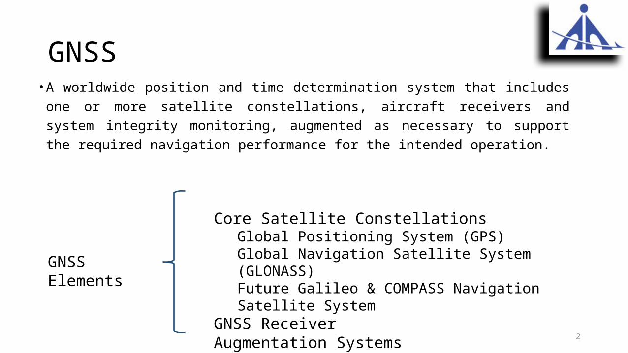
GNSS• A worldwide position and time determination system that includes one or more satellite
constellations, aircraft receivers and system integrity monitoring, augmented as necessary to support the required navigation performance for the intended operation.
Core Satellite ConstellationsGlobal Positioning System (GPS)Global Navigation Satellite System (GLONASS)Future Galileo & COMPASS Navigation Satellite System
GNSS ReceiverAugmentation Systems
GNSS Elements
3
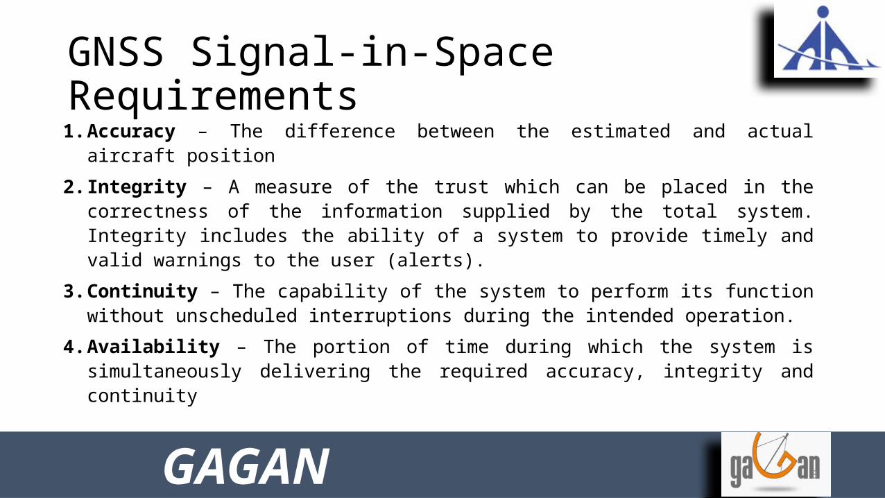
GNSS Signal-in-Space Requirements1. Accuracy – The difference between the estimated and actual aircraft position
2. Integrity – A measure of the trust which can be placed in the correctness of the information supplied by the total system. Integrity includes the ability of a system to provide timely and valid warnings to the user (alerts).
3. Continuity – The capability of the system to perform its function without unscheduled interruptions during the intended operation.
4. Availability – The portion of time during which the system is simultaneously delivering the required accuracy, integrity and continuity
GAGAN
4
Augmentation ? and Why Needed
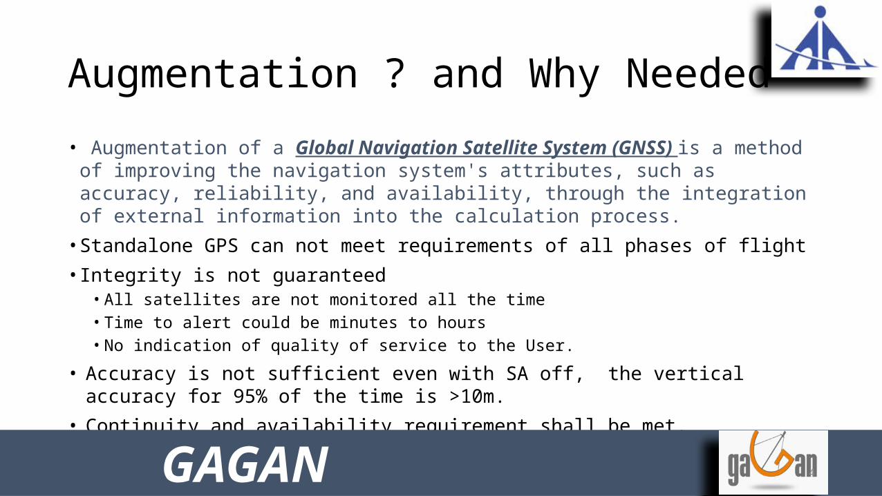
• Augmentation of a Global Navigation Satellite System (GNSS) is a method of improving the navigation system's attributes, such as accuracy, reliability, and availability, through the integration of external information into the calculation process.
• Standalone GPS can not meet requirements of all phases of flight• Integrity is not guaranteed
• All satellites are not monitored all the time• Time to alert could be minutes to hours• No indication of quality of service to the User.
• Accuracy is not sufficient even with SA off, the vertical accuracy for 95% of the time is >10m.
• Continuity and availability requirement shall be met.
GAGAN

5
Augmentation Options
• Space Based Augmentations (SBAS)– WAAS, EGNOS, MSAS, GAGAN
• Ground Based Augmentations(GBAS)– LAAS, GRAS
• Aircraft Based Augmentations (ABAS)– RAIM, Inertials, Baro Altimeter
Error Component GBAS SBAS
Satellite Clock
Common Mode Differencing
Estimation and Removal
Ephemeris
IonosphereEstimation
and Removal
Troposphere Fixed Model
Multipath and Receiver
Noise Carrier Smoothing by User
GAGAN
6
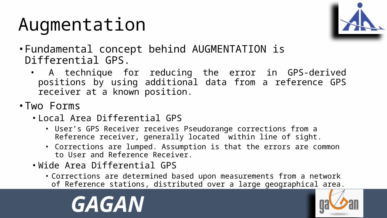
Augmentation • Fundamental concept behind AUGMENTATION is Differential GPS.
• A technique for reducing the error in GPS-derived positions by using additional data from a reference GPS receiver at a known position.
• Two Forms• Local Area Differential GPS
• User’s GPS Receiver receives Pseudorange corrections from a Reference receiver, generally located within line of sight.
• Corrections are lumped. Assumption is that the errors are common to User and Reference Receiver.
• Wide Area Differential GPS• Corrections are determined based upon measurements from a network of Reference
stations, distributed over a large geographical area.• Separate corrections for specific error sources.
GAGAN

7
Space Based Augmentation System
• SBAS is an overlay System, requires establishing of• Ground Monitoring Stations
• Monitors all GPS/GEO satellites in view and collects measurement data.• Master control station
• Processes data, received from monitoring stations• Computes corrections & determines integrity.• Controls and Monitors SBAS system
• Uplink station• Uplinks corrections and integrity information to the geostationary satellite.
• Space segment• Broadcasts correction and integrity information to user community.• Additional ranging source.
• Robust Communication Network• Stringent data transportation requirement with 99.999% availability.
GAGAN

8
INRES # 1 - 15
DATA Communication Network - 1
Data Communication Network - 2
PRN 128 PRN 127
INLUS-1
1SG 1RF
INLUS-2
1SG 1RF
INLUS-3
1SG 1RF
INMCC - 1 INMCC - 2
Bangalore BangaloreGAGAN Configuration
GEO In-orbit SpareGPS Const.
Backup to INLUS 1/2
DelhiBangalore
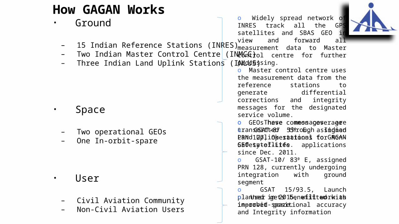
How GAGAN Works• Ground
– 15 Indian Reference Stations (INRES)– Two Indian Master Control Centre (INMCC)– Three Indian Land Uplink Stations (INLUS)
• Space
– Two operational GEOs– One In-orbit-spare
• User
– Civil Aviation Community– Non-Civil Aviation Users
o Widely spread network of INRES track all the GPS satellites and SBAS GEO in view and forward all measurement data to Master control centre for further processing. o Master control centre uses the measurement data from the reference stations to generate differential corrections and integrity messages for the designated service volume. o These messages are transmitted through Indian Land Uplink stations to GAGAN GEO satellites.
o GEOs have common coverageo GSAT-8/ 550 E, assigned PRN 127, Operational for Non-Safety-of-Life applications since Dec. 2011.o GSAT-10/ 830 E, assigned PRN 128, currently undergoing integration with ground segmento GSAT 15/93.5, Launch planned in 2015, will work as in-orbit-spare.
o User gets benefitted with improved positional accuracy and Integrity information
Interoperability
GAGAN has been designed to meet ICAO defined standards on SBAS. GAGAN is compatible to other SBASs in the world and promises to provide seamless navigation.
GAGAN

APV (Approach with Vertical Guidance)
RNP 0.1 (Required Navigation Performance)
Horizontal Accuracy (95%)
7.6 m 72 m
Vertical Accuracy (95%) 7.6 m NA
Integrity 1 x 10⁻⁷ /150 sec. 1 x 10⁻⁷ /hr
Time to Alert 6.2 sec. 10 sec.
Continuity (over 15 seconds)
1-8 x 10⁻⁶ 1 x 10⁻⁴
Availability 99% 99%Horizontal Alert Limit 40 m 0.1 NM
(185.2 m)Vertical Alert Limit 50 m NA
Coverage 76% of Indian Landmass
Indian FIR
GAGAN Performance
GAGAN

12
GAGAN GEO Footprint
GSAT-8
GSAT-10
GAGANGAGAN
13
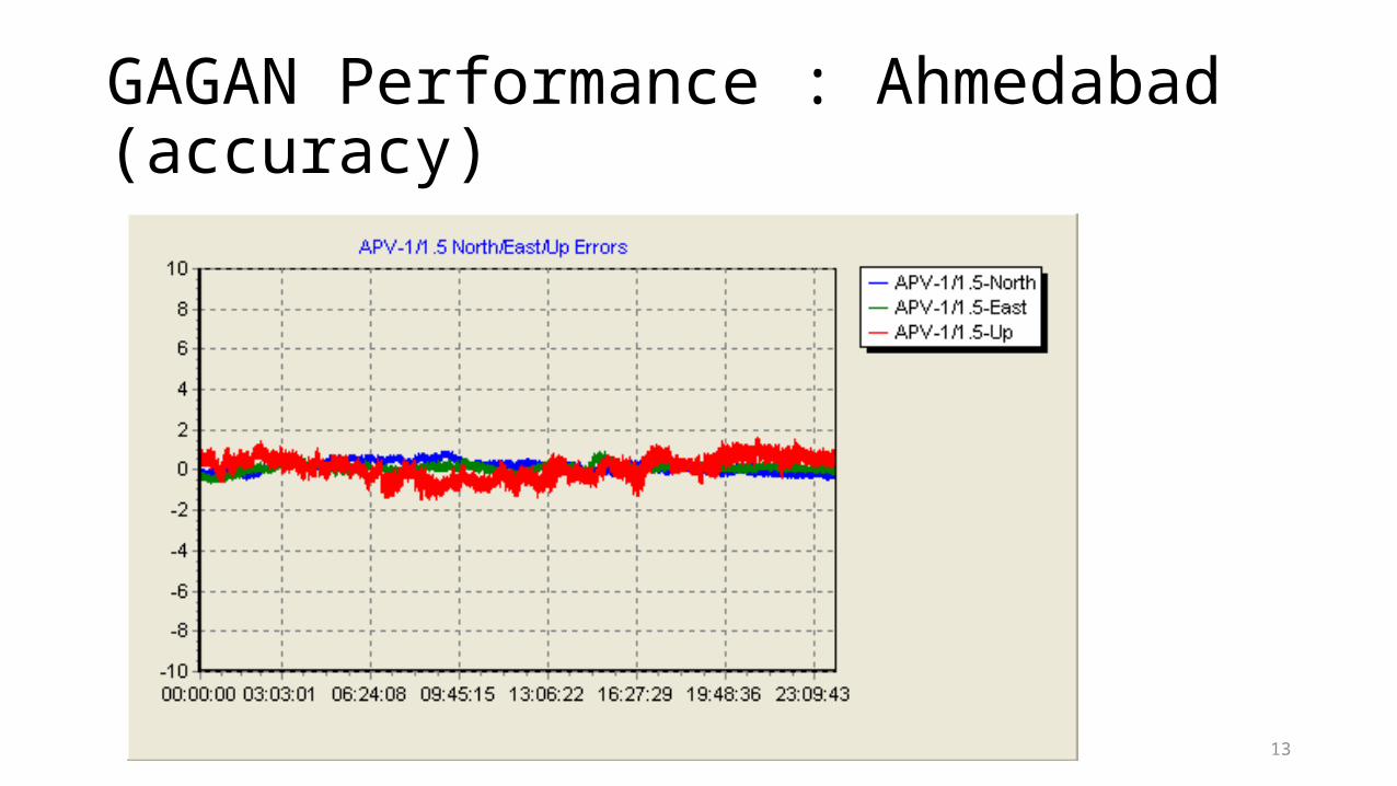
GAGAN Performance : Ahmedabad (accuracy)

14
GAGAN Performance : Bangalore
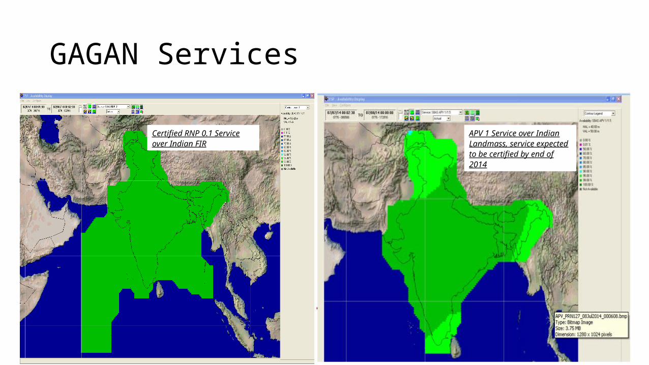
GAGAN Services
Certified RNP 0.1 Service over Indian FIR
APV 1 Service over Indian Landmass, service expected to be certified by end of 2014

At Present GAGAN is certified for RNP 0.1 Operations over Indian FIR.
Real-time GAGAN Performance can be seen at http://172.27.168.11/gagan

GAGAN Enabled Receiver
By Vineet Gera
Airports Authority of India
GAGAN
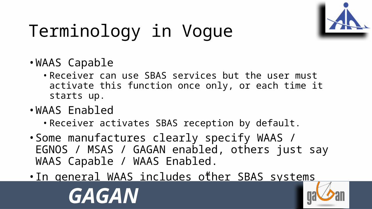
Terminology in Vogue
• WAAS Capable• Receiver can use SBAS services but the user must activate this function once
only, or each time it starts up.
• WAAS Enabled• Receiver activates SBAS reception by default.
• Some manufactures clearly specify WAAS / EGNOS / MSAS / GAGAN enabled, others just say WAAS Capable / WAAS Enabled.
• In general WAAS includes other SBAS systems too, but CAUTION “Clarify” from the supplier.
GAGAN
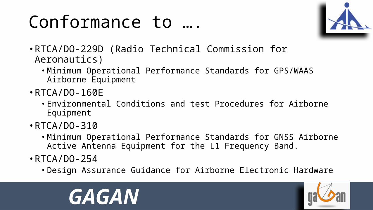
Conformance to ….
• RTCA/DO-229D (Radio Technical Commission for Aeronautics)• Minimum Operational Performance Standards for GPS/WAAS Airborne
Equipment
• RTCA/DO-160E • Environmental Conditions and test Procedures for Airborne Equipment
• RTCA/DO-310 • Minimum Operational Performance Standards for GNSS Airborne Active
Antenna Equipment for the L1 Frequency Band.
• RTCA/DO-254• Design Assurance Guidance for Airborne Electronic Hardware
GAGAN
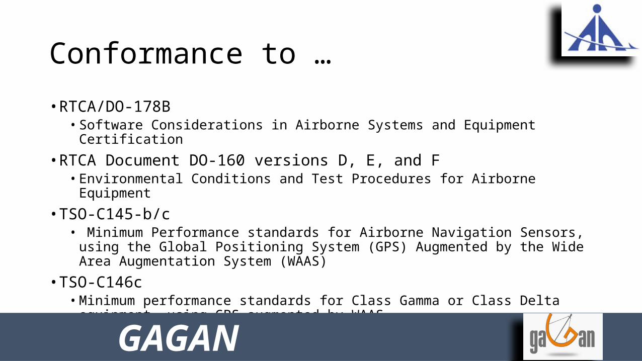
Conformance to …
• RTCA/DO-178B• Software Considerations in Airborne Systems and Equipment Certification
• RTCA Document DO-160 versions D, E, and F• Environmental Conditions and Test Procedures for Airborne Equipment
• TSO-C145-b/c• Minimum Performance standards for Airborne Navigation Sensors, using the
Global Positioning System (GPS) Augmented by the Wide Area Augmentation System (WAAS)
• TSO-C146c• Minimum performance standards for Class Gamma or Class Delta equipment,
using GPS augmented by WAAS.
GAGAN
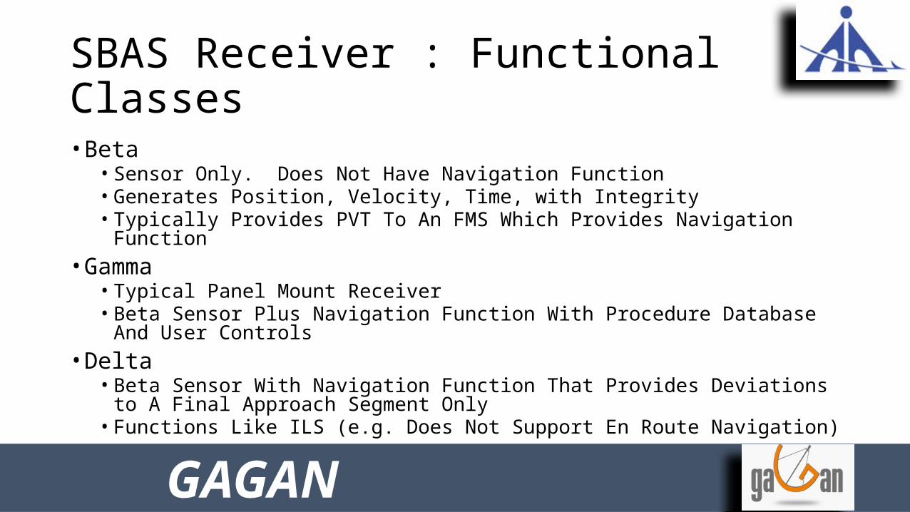
SBAS Receiver : Functional Classes
• Beta • Sensor Only. Does Not Have Navigation Function• Generates Position, Velocity, Time, with Integrity• Typically Provides PVT To An FMS Which Provides Navigation Function
• Gamma• Typical Panel Mount Receiver• Beta Sensor Plus Navigation Function With Procedure Database And User
Controls• Delta
• Beta Sensor With Navigation Function That Provides Deviations to A Final Approach Segment Only
• Functions Like ILS (e.g. Does Not Support En Route Navigation)
GAGAN
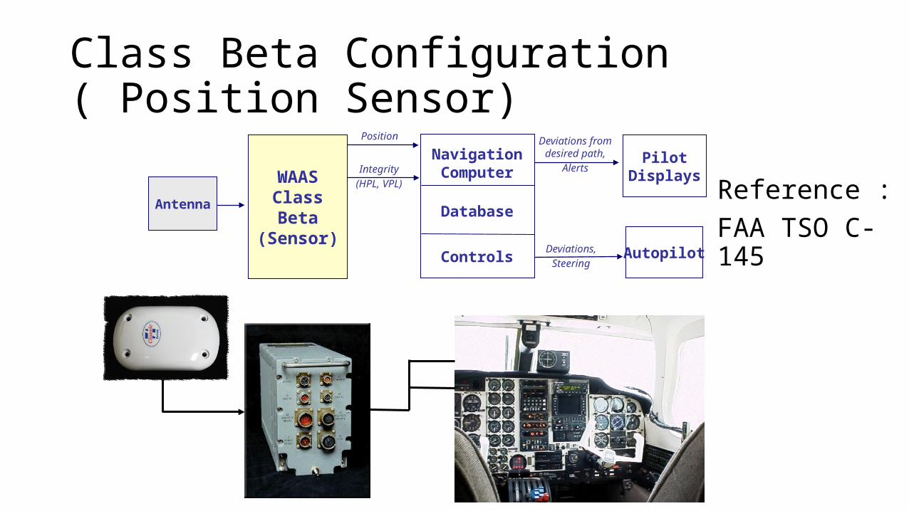
Class Beta Configuration ( Position Sensor)
Antenna
Position
Integrity
(HPL, VPL)
Navigation Computer
Database
Controls
PilotDisplays
Autopilot
Deviations from desired path,
Alerts
Deviations,
Steering
WAASClassBeta
(Sensor)
Reference : FAA TSO C-145

Class Gama Configuration ( Navigator )
Antenna
Navigation Computer
Database
Controls
PilotDisplays
Autopilot
Deviations from desired path,
Alerts
Deviations,
Steering
PositionSensor
WAAS Class Gamma
Reference : FAA TSO C-146

Class Delta Configuration
Navigation Computer
Database
Controls
PilotDisplays
Autopilot
Deviations from desired path,
AlertsPosition Sensor
Deviations,Steering
WAAS Class Delta
Antenna
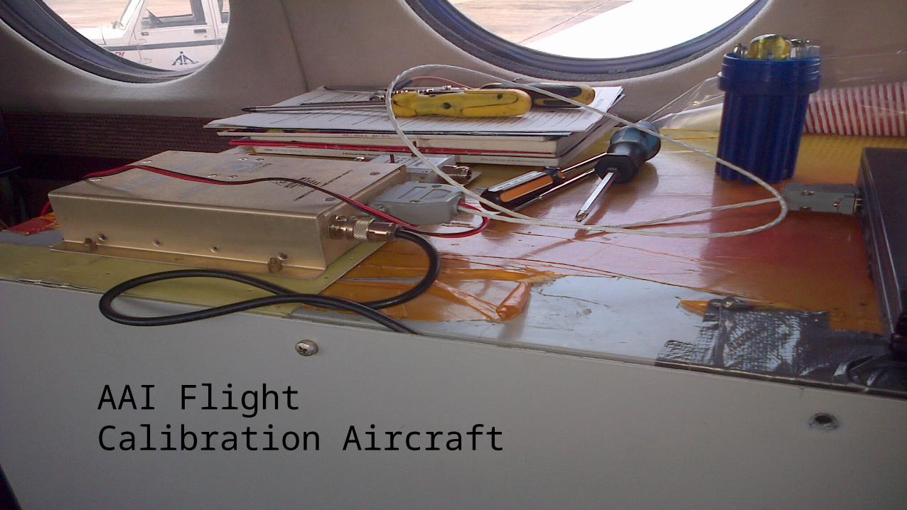
AAI Flight Calibration Aircraft

GAGAN In Operation
• What is available from GAGAN ?• GAGAN Message, comprising of
• Correction for each GPS satellite (in view)• Confidence Bounds (Integrity information),
• What SBAS receiver does with GAGAN Messages ?• Corrects the computed position, using corrections• Computes protection levels, using confidence bounds
• Protection level says that by how much the position in worst case could be Off , vertically and horizontally.
• XPE < XPL < XAL, safe navigation is assured with high level of confidence.
GAGAN

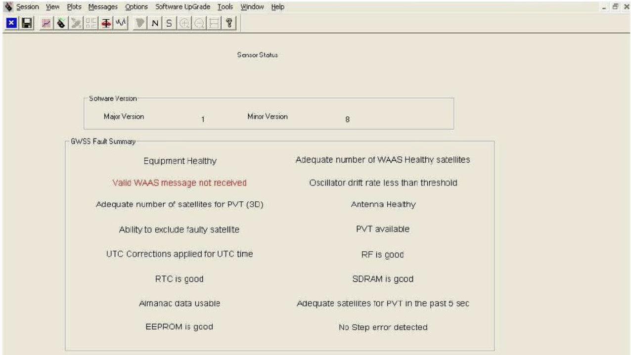
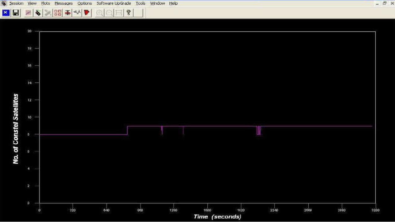
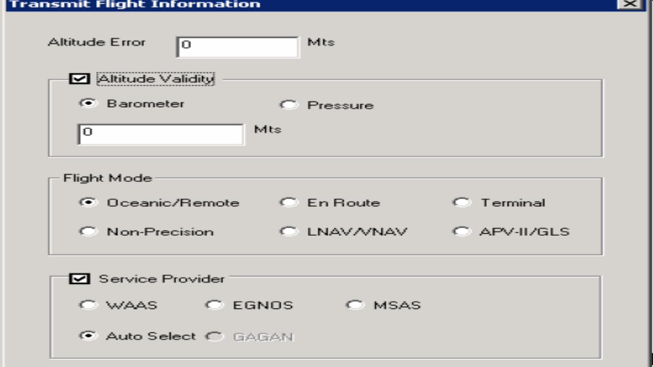
SBAS Receiver Familiarization
GAGAN

Typical Airborne SBAS Receiver
GAGAN
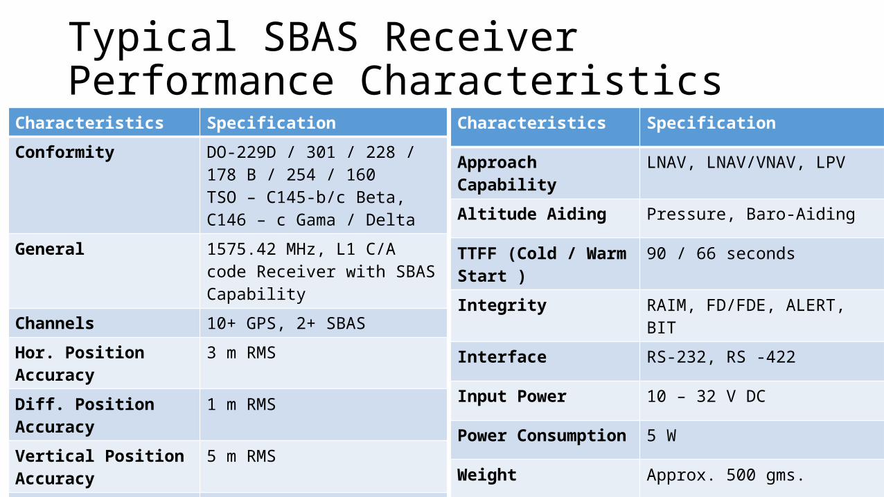
Typical SBAS Receiver Performance Characteristics
Characteristics Specification
Conformity DO-229D / 301 / 228 / 178 B / 254 / 160TSO – C145-b/c Beta, C146 – c Gama / Delta
General 1575.42 MHz, L1 C/A code Receiver with SBAS Capability
Channels 10+ GPS, 2+ SBAS
Hor. Position Accuracy 3 m RMS
Diff. Position Accuracy 1 m RMS
Vertical Position Accuracy 5 m RMS
Velocity Accuracy 0.1 m/s
SensitivityGPS Acquisition / tracking - 136 / -140 dBm
Characteristics Specification
Approach Capability LNAV, LNAV/VNAV, LPV
Altitude Aiding Pressure, Baro-Aiding
TTFF (Cold / Warm Start ) 90 / 66 seconds
Integrity RAIM, FD/FDE, ALERT, BIT
Interface RS-232, RS -422
Input Power 10 – 32 V DC
Power Consumption 5 W
Weight Approx. 500 gms.
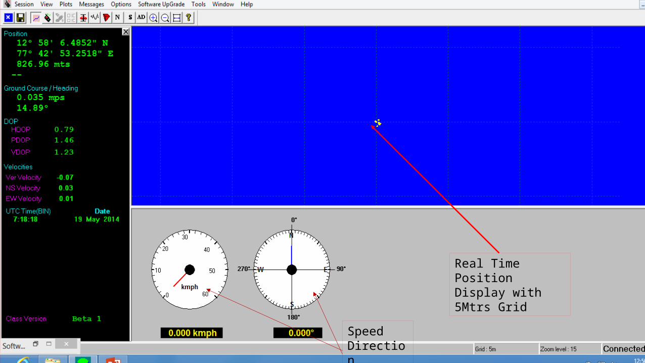
Real Time Position Display with 5Mtrs Grid
SpeedDirection

GAGAN HPLGAGAN VPL

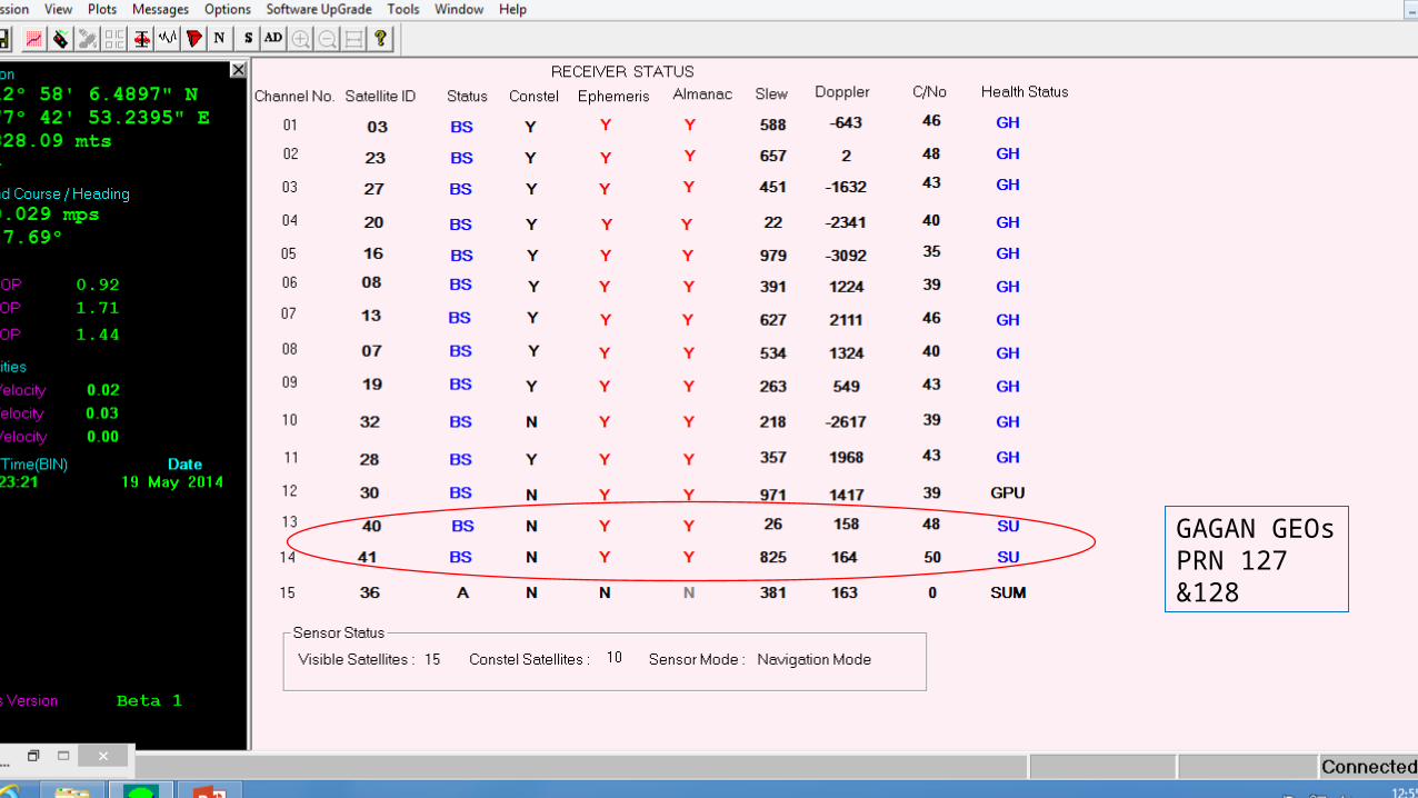
GAGAN GEOsPRN 127 &128

Thank You
GAGAN
Backup Slides
GAGAN

39
SBAS Integrity Requirement 1/5
• SBAS integrity is defined as the ability of the system to provide a timely warning to users when an individual correction or satellite should not be used for navigation.
• Components of Integrity• Alarm condition• Time-To-Alert (TTA)• Hazardously Misleading Information (HMI)
GAGAN
40
SBAS Integrity Requirement 2/5
• Alarm Condition exists when any of the following occur:
• An active UDRE becomes invalid• The user-calculated protection level using active data does not bound the
actual position error from positions created from any set of satellites• Data received from the satellite is insufficient to calculate corrections or
integrity and to ensure that active data bounds the position error.
GAGAN
41
SBAS Integrity Requirement 3/5
• Alarm is Used to Alert User that:• Corrections for a particular Satellite Have Changed; or• Corrections Can Not Be Used
• Time to Alarm: Defined as the time period starting when an alarm condition occurs until the time the last bit of the first message in the alarm sequence arrives at the user’s antenna
• 10 seconds for ER/NPA• 6.2 seconds for LNAV/VNAV
GAGAN
42
SBAS Integrity Requirement 4/5
• Probability of HMI• For PA 10-7 / Approach (if Either or Both Occurs):
• Computed VPL* < Actual Vertical Navigation System Error for Period of Time Time To Alarm
• Computed HPL* < Actual Radial Horizontal Navigation System Error for Period of Time Time To Alarm
• For ER/NPA: Computed HPL < Actual Radial Horizontal Navigation System Error for Period of Time Time To Alarm; 10-7/hour
GAGAN
43
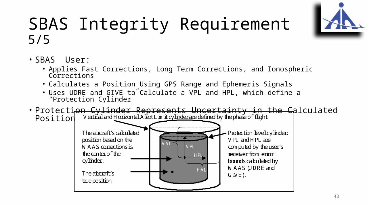
SBAS Integrity Requirement 5/5
• SBAS User:• Applies Fast Corrections, Long Term Corrections, and Ionospheric Corrections • Calculates a Position Using GPS Range and Ephemeris Signals• Uses UDRE and GIVE to Calculate a VPL and HPL, which define a “Protection Cylinder”
• Protection Cylinder Represents Uncertainty in the Calculated Position
Vertical and Horizontal Alert Limit cylinder are defined by the phase of flight
The aircraft’s calculatedposition based on theWAAS corrections isthe center of the cylinder.
The aircraft’strue position
VPL
HPL
VAL
HAL
Protection level cylinder:VPL and HPL arecomputed by the user’sreceiver from errorbounds calculated byWAAS (UDRE andGIVE).


