45
Draft 1 Ipswich River Management Plan A three mile accessible open space from Ipswich Historic Waterfront to Sproughton A River For All

Draft
1
Ipswich River
Management Plan A three mile accessible open space from Ipswich
Historic Waterfront to Sproughton
A River For All
Draft
2
Ipswich River Management
Plan
CONTENTS
Introduction / Background Information
i. Introduction, Geographical scope, Compartments……………………………….. 3
ii. River overview………………………………………………………………….… 3
iii. Navigation and Boating…………………………………………………………… 4
iv. Flood control structures…………………………………………………………… 5
v. Angling………………………………………………………………………….… 5
vi Other River Management……………………………………………………….… 6
vii. Context / policies………………………………………………………………….. 6
viii. Important / protected wildlife……………………………………………………… 6
ix. Pest species………………………………………………………………………… 6
Compartments / Sections
Section 1 – Stoke Bridge to Princes Street Bridge……………………………….. 8
Section 2 – Princes Street Bridge to Sir Bobby Robson Bridge………………….. 12
Section 3 – Sir Bobby Robson Bridge to West End Road Bridge………………... 16
Section 4 – West End Road Bridge to Handford Road Bridge…………………… 19
Section 5 – West End Road to Alderman Canal……………………………….….. 21
Section 6 – Handford Road Bridge to Yarmouth Road Bridge…………………… 24
Section 7 – Yarmouth Road Bridge to Boss Hall Road…………………………… 27
Section 8 – Boss Hall Road to Flood Defence (Borough Boundary)……………... 29
Section 9 – Borough Boundary to A14 Trunk Road………………………………. 32
Section 10 – A14 to Sproughton Millennium Green………………………………. 34
Appendices
A – River path user surveys……………………………………………………….. 36
B – History of the river and related areas……………………………………….… 38
C – Species List, Riverside Road area…………………………………………….. 40
D – Figure 1 – Map of River with sections marked………………………………..
E – Section maps, showing detail of proposed management works etc……………
F – Spreadsheet (Prescription – Routine Management)……………………………
G – Spreadsheet (Aspirational Prescription – Capital Items)………………………
H – Green Flag Gap Analysis………………………………………………………
Draft
3
i. Introduction
This Management Plan provides the framework for the management of public access parts of the River
Orwell and River Gipping corridor. As such this is not a management plan for the whole river
corridor nor all aspects of the river Corridor. Nonetheless it seeks to be aspirational in nature and
improve and correct previous mistakes and deficiencies in the development of the river corridor, its
infrastructure and environment.
Recurrent issues along the length of the river corridor include:
• Flooding and flood defences
• Public use and access (Recreation/leisure/eco-friendly commuting)
• Previous development that has hidden the river, denying its use as a landscape feature
• Previous development that backs onto the river exposing views of the backs of buildings,
service yards, litter and hard functional fencing
• Wildlife and Biodiversity
• Linkage to other green corridors – wider importance
Geographical Scope
The Plan covers the river corridor from Stoke Bridge, Ipswich (The Historic Waterfront) to
Sproughton Bridge, (Sproughton) and an area just off the main river, Alderman Canal Local Nature
Reserve.
The area covered by this management plan is shown in Figure 1
Sections/Compartments
The Plan breaks down the site into the following compartments:
1) Stoke Bridge to Princes Street Bridge
2) Princes Street Bridge to sir Bobby Robson Bridge
3) Sir Bobby Robson Bridge to West End Road, opposite Sir Alf Ramsey Way junction
4) West End Road Bridge to Handford Road Bridge
5) West End Road to Alderman Canal Local Nature Reserve
6) Handford Road Bridge to Yarmouth Road Bridge
7) Yarmouth Road Bridge to Boss Hall Road (Felixstowe/East Suffolk Railway line)
8) Boss Hall Road to Borough Boundary (Norwich Railway line Sluice)
9) Borough Boundary (Norwich Railway line Sluice) to A14 Bridge (a.k.a. Sugar Beet section)
10) A14 Bridge to Sproughton Millennium Green, Sproughton
After considering topic areas common to all sections of the Plan, the Plan then deals with each
compartment in turn, starting from Stoke Bridge. All parts of the Management Plan are applied to
each compartment in turn with a fully costed Management and Maintenance Plan table attached.
ii. River Overview
The tidal River Orwell enters the project area at Stoke Bridge, heading upstream under Princes Street
Bridge Stoke Bridge, over Constantine Weir before splitting to leave an island, with a tidal section
continuing under London Road to Rapier Sluice (Yarmouth Road) and a non-tidal section (the River
Gipping) continuing upstream of West End Road and Handford Lock Sluice to Rapier Sluice.
The tidal sections of the Orwell (besides being tidal) exhibit a totally different landscape and

Draft
4
biodiversity character to the freshwater sections of the River Gipping. For the most part the tidal
sections are hard engineered and of trapezoidal cross-section with vertical metal sheet piling walls
giving way to angled armour-block river-sides and a flat bottom. At low tide the sides and much of
the bottom are exposed.
Above Rapier Sluice the freshwater River Gipping continues inland for about 1.5 km where it again
splits about a manmade island, created by the late 18th century digging of Chantry New Cut, part of
the Navigation aimed at bypassing the more lengthy and twisting natural course of the Gipping. The
two sections rejoin just west of the old sugar beet factory Bailey Bridge and the River Gipping
continues upstream to Sproughton and ultimately Bramford, Claydon, Needham Market, Stowmarket
and beyond.
In the past a further section of the Gipping existed, sometimes known as the “Little” or “Upper”
Gipping, thought to be a manmade cut which flowed east from the Gipping in Ipswich parallel to
Handford Road, before dropping south-east, parallel to what is now Civic Drive, Franciscan Way and
Greyfriars Road to rejoin the River Orwell at Stoke Bridge. Only a section of this river now remains,
known as Alderman Canal flowing east to Alderman Road, with a return ditch flowing below
Alderman Canal, under Bibb Way, through a reedbed to Sir Alf Ramsey Way where it is piped
underground to the River Orwell exiting in the vicinity of Constantine Weir. The return ditch was
presumably dug when the section south-east from Alderman Road was stopped–up in Victorian times.
A valve prevents flow between the River Gipping and Alderman Canal. Alderman Canal now only
receives surface run-off from its immediate surrounds (principally properties along Handford Road).
iii. Navigation and Boating
River Orwell
Navigation on the Orwell is impeded by Constantine Weir, which is passable only at high tide.
River Gipping
The River Gipping was officially closed as a navigation in 1932.
The remaining locks were removed in the 1970s and replaced with weirs and sluices. These serve as
flood/water level control devices but prevent navigation. The uninterrupted distances between
consecutive flood defence systems are as follows:
• Handford Lock Sluice (West End Road) to Sugar Beet Weir 2.25km
• Sugar Beet Weir to Anglia Water plant (A14) 0.5km
• Anglia Water Plant to Sproughton Mill Pond 0.5km
All the above freshwater sections of the Gipping suffer from surface vegetation impeding the passage
of boats in summer. The wide and slow section of the River Gipping from Yarmouth Road to the
Norwich railway line is badly affected by a mixture of greater duckweed, azolla fern and blanket weed
that effectively forms a crust across the whole river from early July. At present this is broken up by
the Environment Agency who typically use two specialist boats to both cut bank-side emergent
vegetation and clear duckweed from the river.
It is interesting to compare the Orwell and Gipping Navigation with the Chelmer and Blackwater
Navigation (Essex, from Heybridge Basin to Chelmsford). Although both are of the same size and
age, whereas the Gipping is now totally defunct in terms of boating, the Chelmer and Blackwater
Navigation has retained its locks and is a thriving waterway used by many leisure craft and sightseers
from Heybridge Basin to Chelmsford. Accompanying the leisure boating are other businesses
including sales, moorings, pubs, restaurants and outdoor activity centres.
The River Orwell and Gipping were formerly navigable by means of locks and as recently as the
1970s boats could be hired from Wrights Boatyard, Cullingham Road (on the River Gipping, just

Draft
5
north of Alderman Canal). In addition to boat hire, the Yard offered boat manufacture and
repair/maintenance.
The River Gipping Trust (and River Action Group) has the long-term vision of restoring the Gipping
and Orwell as a navigation and seeing the return of boating and boating-related activities. So far, the
River Gipping Trust has restored three locks upstream of Ipswich.
iv. Flood Control Features
There are currently several Flood Control Systems along the river in the Management Plan area:
• Constantine Weir, West End Road, opp. Constantine Road TM154441
• West End Road (Handford Lock Sluice) – sluice/tidal barrier TM152443
• Alderman Canal, Stop valve with the River Gipping TM152443
• Yarmouth Road (Horseshoe Sluice) – sluice/tidal barrier TM149447
• Norwich Railway Line (emergency “dropdown” floodgate) TM141449
• Chantry New Cut (Sugar Beet Weir) TM133445
• Chantry, “old river course of the Gipping” TM132444
• A14 Anglia Water Sproughton sluice/abstraction plant TM129448
Most were built in the 1970s on the old locks of the Gipping Navigation and with the exception of
Constantine Weir (built to retain coolant water for the electric trolleybus power station), all have a key
role to play in flood defence and water level control, both from tidal inundation and floodwaters
coming down the river catchment. All (apart from Norwich Railway line dropgate) now serve as
obstacles for navigation, boating and wildlife.
Outside of the Management Plan area, new flood defences are being built (2010-2012) to protect
Ipswich from tidal inundation. The principle feature is a “Greenwich-style” tidal barrier (rotating gate
Flood Control System) located at the entrance to the New Cut (next to the Wet Dock ).
Notable flood events in Ipswich history include 1939 (when melt-waters from upstream flooded many
low-lying areas of the town and 1953 when some areas of Ipswich were affected by tidal inundation.
No bypasses have been incorporated into the sluices and weirs for fish, otters etc.
v. Angling
Angling platforms, “swims” or “pegs” were built on both sides of the River Gipping by the Gipping
Angling Preservation Society (GAPS) from the Norwich Railway Line to Yarmouth Road (left bank)
and East Suffolk Rail Line to Yarmouth Road (right bank). Those on the right bank (south side) are
maintained by GAPS for its members only, accessed from the Hadleigh Road Industrial Estate (no
public access exists on this side of the river). Those on the left bank (north bank) were managed by
GAPS in return for an annual payment from IBC until 2008 when the payment was suspended and
management ceased. Between September 2009 and August 2011 the task of cutting the swims of
vegetation was assumed by the Greenways Countryside Project River Ranger.
Further GAPS fishing swims exist on the left bank (north bank) of the Gipping from Sproughton
Bridge to the Anglia Water abstraction plant next to the A14.
The task of enforcing rod licences is the duty of the Environment Agency. The statutory fishing
season is between 16th June to 14
th March.
Angling is seriously curtailed on much of the Gipping from July to September by the development of a
surface layer of blanket weed, greater duckweed and azolla fern. By early July this typically has
reached almost 100% cover of the slower-flowing and wider sections of the Gipping. Major rain
events may cause the surface to re-open. Aquatic emergent vegetation at the swims has a maximum

Draft
6
growth rate of 2-3 ft in 2-3 weeks in June. To prevent disturbance to active bird nests/eggs, swims
should be first cut in March/early April to ‘sterilise’ the swims and then cut regularly throughout the
nesting season.
vi. Other River Management
Environment Agency (EA); vegetation cutting by boat (two-boat system, one with horizontal and
vertical reciprocating cutter bars, one with loading forks/hydraulic lifting arms). The first cuts reeds
and other emergent vegetation and the second collects the cut material and then uses the cut material
as a net to collect duckweed and other surface weed. Cut material is then lifted and deposited on the
riverbank. This work is carried out for the purpose of flood prevention and is normally done in
September.
vii. Context/policies
The Ipswich River Strategy (1999) – was published by the River Action Group to guide the
improvement of the corridor for at least 10 years. The Group has reviewed the Strategy in 2005 and is
currently (2012) beginning another review. The Strategy was adopted by Ipswich Borough Council,
and has proved invaluable.
The Strategy contained many recommendations for new infrastructure; appropriate design of adjacent
new development; public artworks and much more. The Strategy and subsequent review highlighted
the need for routine management of the river path and corridor. This has remained an issue until
funding was achieved for a River Ranger post during 2010 and 2011. The funding for this post ceased
in August 2011, so a new solution is being sought via this plan.
The Ipswich Local Development Framework Core Strategy and Policies Document includes
“..completion of the River path..” in its vision (6.7e) and the key diagram (7.2(v)) shows the “green
corridor and green rim approach to strategic green infrastructure(Policy CS16)” – which clearly shows
the river corridor as a key green corridor.
viii. Important/protected Wildlife
• Otter (present along the entire length of the Management Plan area). Both the otter and its
holts (refuges) are protected in law. (WCA 1981)
• Bats (Both bats and their roosts are protected in law) WCA 1981
• Water vole (seemingly no longer present, but with the potential to recolonise from upstream).
Both water voles and their burrows are protected in law. (WCA 1981).
• Grass snake, slow-worm present in and about the freshwater section s of the Gipping. (both
have some protection in law (WCA 1981).
• The Nationally Scarce plant dittander (Lepidium latifolium) is found in all compartments of
the river corridor downstream of the Norwich Railway Line.
ix. Pest species
The following species are invasive in the river corridor:
• Japanese knotweed, (presently between Handford Road Bridge and Boss Hall Road),
classified as an Invasive Weed. It is an offence to cause or allow its escape (WCA 1981).
Small parts of the plant are capable of regeneneration. Elimination is desirable.
• Giant Hogweed – (along the banks of the R. Gipping upstream from Boss Hall Road).
Classified as an Invasive Weed. It is an offence to cause or allow its escape (WCA 1981). Sap
is dangerous upon contact with flesh. Control is desirable.
• Duckweed, a native aquatic species that forms a light-blocking carpet across the entire
Gipping from July onwards.

Draft
7
• Azolla fern, non-native aquatic species that performs in a similar way to duckweed.
• Himalayan balsam (currently present upstream of the plan area, but with the potential to
colonise from upstream)
Draft
8
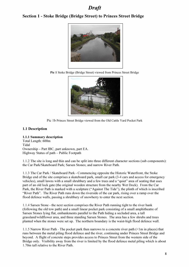
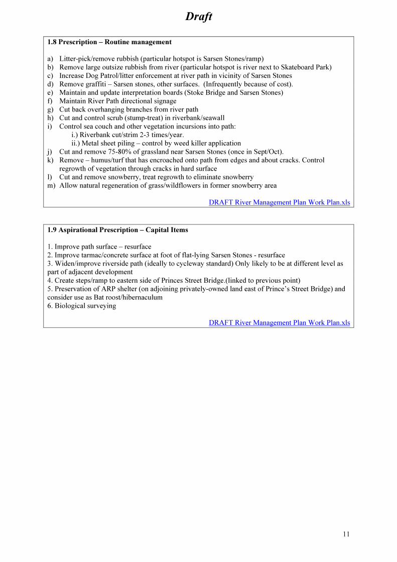
Section 1 - Stoke Bridge (Bridge Street) to Princes Street Bridge
Pic 1 Stoke Bridge (Bridge Street) viewed from Princes Street Bridge
Pic 1b Princes Street Bridge viewed from the Old Cattle Yard Pocket Park
1.1 Description
1.1.1 Summary description
Total Length: 600m
Tidal
Ownership – Part IBC, part unknown, part EA.
Highway Status of path – Public Footpath
1.1.2 The site is long and thin and can be split into three different character sections (sub components):
the Car Park/Skateboard Park; Sarsen Stones; and narrow River Path.
1.1.3 The Car Park / Skateboard Park - Commencing opposite the Historic Waterfront, the Stoke
Bridge end of the site comprises a skateboard park, small car park (3-4 cars and access for emergency
vehicles), small lawns with a small shrubbery and a few trees and a “quiet” area of seating that uses
part of an old lock gate (the original wooden structure from the nearby Wet Dock). From the Car
Park, the River Path is marked with a sculpture (“Against The Tide”), the plinth of which is inscribed
“River Path”. The River Path runs down the riverside of the car park, rising over a ramp over the
flood defence walls, passing a shrubbery of snowberry to enter the next section.
1.1.4 Sarsen Stone - the next section comprises the River Path running tight to the river bank
(following the old tow path) and a small linear pocket park consisting of a small amphitheatre of
Sarsen Stones lying flat, embankments parallel to the Path hiding a secluded area, a tall
grassland/wildflower area, and three standing Sarsen Stones. The area has a few shrubs and trees
planted when the stones were set up. The northern boundary is the waist-high flood defence wall.
1.1.5 Narrow River Path - The pocket park then narrows to a concrete river path (<1m in places) that
runs between the metal piling flood defence and the river, continuing under Princes Street Bridge and
beyond. A flight of concrete steps provides access to Princes Street from the western side of the
Bridge only. Visibility away from the river is limited by the flood defence metal piling which is about
1.70m tall relative to the River Path.

Draft
9
1.1.6 At this point the river is hard-engineered and of a trapezoidal profile with armour-block
(concrete) sloping sides. The armour-block bears some wrack seaweed and other inter-tidal plants with
the top of the sloping sided riverbanks dominated by the grass sea couch. The roots of the sea couch
are strong and are in places breaking the concrete/tarmac surfaces of the River Path.
1.2 Access and Connectivity
1.2.1 Access is only from the extreme ends of the section, in the east from Bridge Street (Stoke
Bridge) via a shared car park/access ramp (used by cars, cyclists, pedestrians, skateboarders etc) from
the road and over another ramp over the river sheet piling flood defence.
1.2.2 Access from the west is from the river path, which continues on to West End Road/Sir Bobby
Robson Bridge or via steps on the western side of Princes St Bridge up to Princes Street itself.
1.3 Adjoining Land Use
1.3.1 The eastern end of the site opens onto Bridge Street (Stoke Bridge), a major thoroughfare and the
most eastern town bridge. On the other side of the road is the entrance to the Historic Waterfront.
1.3.2 National Cycle Route 51 currently bypasses the site passing from the Historic Waterfront north
into town, before circling back down to rejoin the River Path at West End Road where it follows the
pavement.
1.3.3 Immediately north of the River Path and running the entire length of the site on the other side of
the flood defence wall are disused railway sidings now owned by a developer. The disused railway
continues under Princes Street Bridge via its own arch. The sidings have been heavily colonised by
buddleia. A considerable amount of rubbish is thrown from the River Path over the flood wall onto
this land (especially at Princes Street Bridge and in the vicinity of the Skateboard Park and Sarsen
Stones). A notable feature is the ARP shelter near Princes Street Bridge.
1.3.4 North of the railway sidings are retail premises along Grafton Way and Commercial Road. A
planning consent has been issued to Tesco for a superstore, flats and two hotels on the railway land (as
far as Princes Street) and the eastern plot (formerly B&Q). Construction was intended to start in 2012.
1.3.5 Burrell Road runs parallel to the river along the opposite bank between Stoke Bridge and
Princes Street Bridge.
1.3.6 The opposite bank of the river has sheet piling flood defence walls and armour-block sloping
sides. The gardens of the houses in Burrell Road slope gently down to the river flood wall. There is
currently no public access to the southern bank. At the eastern end of Burrell Road looking onto the
river and Bridge Street is a small green space managed by IBC comprising short grass, a few
landscape trees, lifebelt holder, bin and seat (area about 100m²).
1.4 Infrastructure features – covered by the scope of this plan:
• Interpretation Boards (one at Car Park, one at Sarsen Stones)
• Millstone (Car Park)
• Sculpture/plinth (“Against The Tide” – bronze/steel on concrete plinth)
• Sarsen Stones – 3 standing and numerous lying flat.
• Tarmac/concrete surfaces in various states of repair.
1.5 Infrastructure features – not covered by the scope of this plan:
• Car Park – (tarmac hard surface) and vehicle bollards (IBC)
• Rubbish bin (Car Park) (IBC)
• Skateboard Park, numerous concrete jumps etc., railings (IBC)
• Skateboard park signage (IBC)
• Lighting/CCTV (Both at Skateboard Park only) (IBC)
• Historic dock gates (seating/feature) (IBC)
Draft
10
• Armour-block river banks (EA)
• Railings – ramp over flood defence (EA)
• Sheet piling Flood defence walls (EA)
• Various manhole/drain covers in River path (IBC/Utilities)
• Green space on opposite bank (junction Bridge Street and Burrell Road)
1.6 Habitats, wildlife and other green space
1.6.1 The riverbank itself above the high tide mark is dominated by sea couch. This is also prolific on
the landward side of the path, spilling into the Path with its upperparts and breaking the path with it
roots.
1.6.2 Silver birch, buddleia, snowberry, bramble, dog-rose, alder and sycamore have either been
planted or colonised the Sarsen Stones area.
1.6.3 Around the Sarsen Stones, a small area of grassland is managed for wildlife by being left long.
This area is mown and arisings removed in the late summer each year to promote wildflowers.
1.7 Evaluation/Options
1.7.1 The River Path is well used but offers great potential for increased use; it offers the shortest route
to the railway station from the Docks/Historic Waterfront and of course a quiet route further west.
1.7.2 The Sarsen Stones area could/should be a quiet open sunny south-facing place with river views,
away from traffic yet close enough to major thoroughfares for people to stop in and use for a break
from work or whilst en route elsewhere. However at present it attracts a large amount of litter, dog
fouling, vandalism and graffiti. Much litter is alcohol-related (evidenced by cans and bottles). Drug-
taking hypodermic syringes have also been found in 2010 (next to flood defence wall at back of site).
The area would benefit from more intensive management including presentation and overall
attractiveness, patrol and enforcement. A considerable amount of similar activities also take place on
the neighbouring land (copse of trees) adjoining the Skateboard Park/Lock Gate area. The loss of this
area through development (imminent) may cause the problem here to shift to the IBC areas.
1.7.3 Some of this litter arises as a spillover effect from the Skateboard Park, some arises from the
general use of the path as a quiet unobserved area.
1.7.4 At present the tall grass on the riverbank and Sarsen Stones area is managed (cut and removed)
once a year only, as a wildlife habitat. The area around and in front of the flat-lying Sarsen Stones
would benefit from regular formal type management (weeds removed and tarmac/concrete resurfaced).
1.7.5 For much of the length of the path, the path is narrow, single-pedestrian width and squeezed
between the river and the flood defence wall. It is too narrow to be a cycling path although cyclists do
use the path. Any means of increasing the width of the Path would be beneficial whether through a
new wider parallel path or widening the existing path. Should the Tesco store and flats development
protocol it could provide a new, shared use foot/cycle/delivery vehicle route at a higher level, rising up
to Princes Street bridge. Sadly, the existing riverside path will remain as it is, overshadowed by a very
tall set of buildings.
1.7.6 On the old railway sidings site (not IBC ownership), an old ARP shelter stands next to the flood
defence wall near Princes Street. Besides its historical significance, this could be usefully converted
to a bat roost especially considering the existence of a summer and winter bat roost on the other side
of the river (Stoke Hall).
Draft
11
1.8 Prescription – Routine management
a) Litter-pick/remove rubbish (particular hotspot is Sarsen Stones/ramp)
b) Remove large outsize rubbish from river (particular hotspot is river next to Skateboard Park)
c) Increase Dog Patrol/litter enforcement at river path in vicinity of Sarsen Stones
d) Remove graffiti – Sarsen stones, other surfaces. (Infrequently because of cost).
e) Maintain and update interpretation boards (Stoke Bridge and Sarsen Stones)
f) Maintain River Path directional signage
g) Cut back overhanging branches from river path
h) Cut and control scrub (stump-treat) in riverbank/seawall
i) Control sea couch and other vegetation incursions into path:
i.) Riverbank cut/strim 2-3 times/year.
ii.) Metal sheet piling – control by weed killer application
j) Cut and remove 75-80% of grassland near Sarsen Stones (once in Sept/Oct).
k) Remove – humus/turf that has encroached onto path from edges and about cracks. Control
regrowth of vegetation through cracks in hard surface
l) Cut and remove snowberry, treat regrowth to eliminate snowberry
m) Allow natural regeneration of grass/wildflowers in former snowberry area
DRAFT River Management Plan Work Plan.xls
1.9 Aspirational Prescription – Capital Items
1. Improve path surface – resurface
2. Improve tarmac/concrete surface at foot of flat-lying Sarsen Stones - resurface
3. Widen/improve riverside path (ideally to cycleway standard) Only likely to be at different level as
part of adjacent development
4. Create steps/ramp to eastern side of Princes Street Bridge.(linked to previous point)
5. Preservation of ARP shelter (on adjoining privately-owned land east of Prince’s Street Bridge) and
consider use as Bat roost/hibernaculum
6. Biological surveying
DRAFT River Management Plan Work Plan.xls
Draft
12
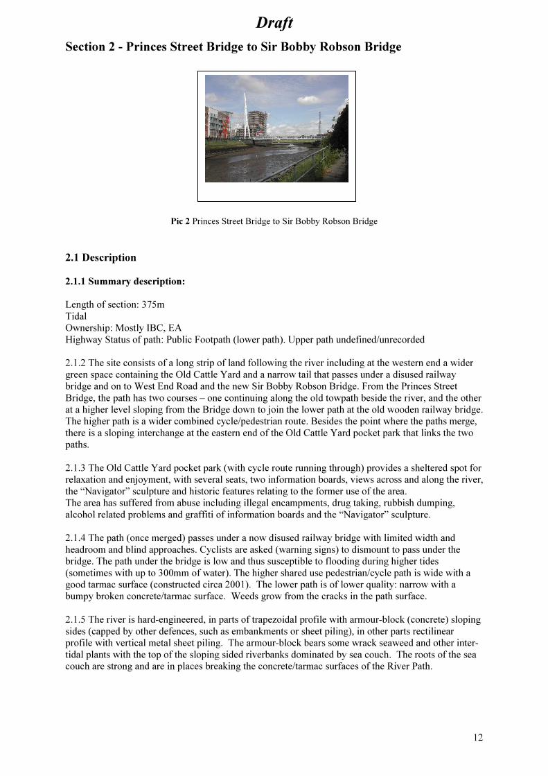
Section 2 - Princes Street Bridge to Sir Bobby Robson Bridge
Pic 2 Princes Street Bridge to Sir Bobby Robson Bridge
2.1 Description
2.1.1 Summary description:
Length of section: 375m
Tidal
Ownership: Mostly IBC, EA
Highway Status of path: Public Footpath (lower path). Upper path undefined/unrecorded
2.1.2 The site consists of a long strip of land following the river including at the western end a wider
green space containing the Old Cattle Yard and a narrow tail that passes under a disused railway
bridge and on to West End Road and the new Sir Bobby Robson Bridge. From the Princes Street
Bridge, the path has two courses – one continuing along the old towpath beside the river, and the other
at a higher level sloping from the Bridge down to join the lower path at the old wooden railway bridge.
The higher path is a wider combined cycle/pedestrian route. Besides the point where the paths merge,
there is a sloping interchange at the eastern end of the Old Cattle Yard pocket park that links the two
paths.
2.1.3 The Old Cattle Yard pocket park (with cycle route running through) provides a sheltered spot for
relaxation and enjoyment, with several seats, two information boards, views across and along the river,
the “Navigator” sculpture and historic features relating to the former use of the area.
The area has suffered from abuse including illegal encampments, drug taking, rubbish dumping,
alcohol related problems and graffiti of information boards and the “Navigator” sculpture.
2.1.4 The path (once merged) passes under a now disused railway bridge with limited width and
headroom and blind approaches. Cyclists are asked (warning signs) to dismount to pass under the
bridge. The path under the bridge is low and thus susceptible to flooding during higher tides
(sometimes with up to 300mm of water). The higher shared use pedestrian/cycle path is wide with a
good tarmac surface (constructed circa 2001). The lower path is of lower quality: narrow with a
bumpy broken concrete/tarmac surface. Weeds grow from the cracks in the path surface.
2.1.5 The river is hard-engineered, in parts of trapezoidal profile with armour-block (concrete) sloping
sides (capped by other defences, such as embankments or sheet piling), in other parts rectilinear
profile with vertical metal sheet piling. The armour-block bears some wrack seaweed and other inter-
tidal plants with the top of the sloping sided riverbanks dominated by sea couch. The roots of the sea
couch are strong and are in places breaking the concrete/tarmac surfaces of the River Path.

Draft
13
2.2 Access and Connectivity
2.2.1 Access is only from the extreme ends of the site. The lower path, although of lower standard
bears more use, seemingly because it enables traffic-free direct-route access to Stoke Bridge and the
Historic Waterfront.
2.2.2 There are interchanges between the lower and higher paths (steps at Princes St) and ramp at the
eastern end of the Cattle Yard.
2.2.3 At the western end the path connects to West End Road (and National Cycling Route 51) and Sir
Bobby Robson Bridge which provides access to the right bank, Ranelagh Road and new residential
flats.
2.3 Adjoining Land Use
2.3.1 A disused railway line runs the length of the site (on the northern side) and passes over the river
path on the old railway bridge. The disused railway passes under Princes Street Bridge through its own
archway continuing on to Stoke Bridge. North of the railway line is an IBC Car Park and the old Zest
Nightclub.
2.3.2 The opposite bank of the river contains a privately owned patch of scrub (next to Princes Street
Bridge), temporary car parks, and a new multi-storey block of flats. New pedestrian access has been
created on the riverbank past the flats, connecting up with a small green space opposite the junction
with Ancaster Road. This space has no public access at present and is managed purely as a visual
amenity.
2.4 Infrastructure features – covered by the scope of this plan:
• Seats in Cattle yard
• Fencing along both sides of upper path
• Brick-floored Cattle yard with metal livestock railings and water trough
• Interpretation Boards (one by Princes Street Bridge, and two in the Cattle Yard)
• Tarmac path upper cycleway, including street lighting and cycleway signage
• Concrete/tarmac lower path (cracked and uneven – needs to be monitored)
• Victorian wall (engineering bricks)/bank revetment
• Victorian rail platform (engineering bricks)
• Concrete steps and steel tubing handrails to Princes Street Bridge
• Upright railway sleepers serving as fence mostly at eastern end of site.
• “The Navigator”, steel sculpture by Jon Atkins, in the Old Cattle yard
• Murals/street art of various types/quality on the Victorian walls: Nicola Toplass 2003
“Ipswich River Mural” (on the concave wall)
2.5 Infrastructure features – not covered by the scope of this plan:
• Concrete riverbanks (EA)
• Sheet piling Flood defence (EA)
• Other concrete bank revetments (EA)
2.6 Habitats, wildlife and other green space
2.6.1 When exposed at low tide, the riffle/mudbank on the inner curve of the river at the Cattle Yard
end of the site is frequented by waterfowl (little egret, oystercatcher, redshank, mallard, mute swan
and Canada goose). Kingfishers have been seen flying this length of the river although it is feared that
a previously used nest site was lost in the redevelopment of the ‘Cranes’ factory site.
2.6.2 The sloping concrete armour-block river-sides support little below the high tide line other than
bladderwrack and simple algae.
Draft
14
2.6.3 Sea couch dominates a very narrow high-tide/upper salt-marsh habitat either side of the Lower
Path and atop the armour block sides.
Estuarine fish including sea bass and grey mullet are present with the incoming tide.
2.6.4 Above the high tide zone there are areas of bramble, grassland and scrub/woodland.
Scrub is dominated by buddleia, elder, sycamore, bramble, honeysuckle, ivy, clematis and birch.
Lesser whitethroat, finches and nightingale use the site. The latter (presumably just one bird or a
breeding pair) occupies a territory that extends into other scrub: northwards on former railway land;
eastwards beyond Princes Street Bridge and across the river on the north-western corner of Princes
Street Bridge and Ranelagh Road. A native hedge (planted in about 2002) consisting mostly of
hawthorn, extends along much of the northern boundary.
2.6.5 The site has a very diverse range of different habitats – albeit each being very small in size.
Perhaps most notable and important are the low herbaceous communities (notable plants being biting
stonecrop, field madder, common stork’s-bill, perforate St John’s-wort and common cornsalad)
established on the brick paving of the Old Cattle Yard, either side of the Cycle path and in the vicinity
of the Navigator Sculpture. Small areas of wildflower grassland, around the Old Cattle Yard and under
the mural wall, provide important habitat for insects including Common blue butterfly.
2.6.6 The only formal area is the short grass area at the entrance to Sir Bobby Robson Bridge. Short
cut grass either side of path at Sir Bobby Robson Bridge.
2.7 Evaluation/Options
2.7.1 The old Cattle Yard is of both historic importance and local interest with important features
being the old Victorian engineering brick walls, railway platform edge, brick paved areas and metal
cattle pen fencing and water trough. Interpretation has already been provided. The railway platform
edge has been lost in the scrub belt that follows the north side of the site. An option might be to open
up this area to reveal the platform. Such an option has not however been chosen because it would
create an abrupt vertical drop of some three feet and reduce the area of scrub which is an important
wildlife habitat. The brick-paved floor of the Cattle Yard had at 2009 been lost to a build-up of humus
and uncommon low-growing plants (notables being biting stonecrop, field madder, common stork’s-
bill, perforate St John’s-wort and common cornsalad). Options include:
2.8 Prescription – Routine Management
a) Litter-pick/remove rubbish (particular hotspots are Princes Street Bridge ramp and steps)
b) Remove – humus/turf that has encroached onto path from edges and about cracks
c) Cut back branches/bramble/ivy/grass from wall over river tow path
d) Control sea couch and other vegetation incursions into path:
Riverbank cut/strim 2-3 times/year.
From landward walled revetment – control by weedkiller application
e) Cut back and stump-treat shrubs/trees in Cattle Yard that threaten Victorian walls.
f) Control (reduce) bramble incursion in Cattle Yard.
g) Manage Cattle Yard paved surface rotationally (plant communities here are important),
h) Remove graffiti – as budget allows – Navigator, lights, interpretation boards, walls etc.
i) Interpretation Boards- fix/restore and maintain (Cattle Yard x2 and Princes St x1)
j) Maintain Navigator structure
k) Increase Dog Patrol - particular problem noted in the Cattle Yard in vicinity of the Navigator
sculpture
l) Cut and control scrub (stump-treat) in riverbank/seawall
m) Cut and control vegetation over fences, walls etc.
n) Manage short grass in vicinity of Sir Bobby Robson Bridge.
o) Maintain River Path directional signage
DRAFT River Management Plan Work Plan.xls

Draft
15
2.9 Aspirational Prescription – Capital Items
1. Survey/repair Victorian brick wall – particularly eastern end which is leaning into path.
2. Improve steps and railings to Princes Street Bridge (improve appearance/drainage issue)
3. Improve path surface – resurface
4. Improve narrow, blind, tidally inundated, restricted height path at disused railway bridge (either by
removal of bridge and raising/widening path or by bypassing existing path to go across disused
railway and reconnecting Cattle Yard with River Path)
5. Widen riverside corridor - ideally to cycleway standard
6. Acquire railway track land – option to redirect cycleway to follow this under Prince’s Street Bridge.
7. Biological surveying
8. Treat/Paint rusty railings – Cattle Yard
DRAFT River Management Plan Work Plan.xls

Draft
16
Section 3 - Sir Bobby Robson Bridge to West End Road Bridge
Pic 3 Sir Bobby Robson Bridge to West End Road Bridge
3.1 Description
3.1.1 Summary Description
Total Length: 300m
Tidal
Ownership: Mostly IBC; part EA.
Highway Status of Path: Not recorded. West End Road pavement acts as cyclepath.
3.1.2 Situated on the left bank of the river, with the exception of a terra-crete car park at the eastern
end and the short cut grass in the vicinity of the Sir Bobby Robson Bridge, the site consists of riverside
wildflower grassland on the river embankment between the river and West End Road.
3.1.3 The terra-crete car park (up to 6 vehicles) allows access to the weir and river. Bollards prevent
vehicle access to the rest of the site from West End Road (prior to bollard installation the car parking
was a particular problem on football match days). The meadow contains a few horse chestnut trees
planted as part of an unsuccessful avenue some 20-30 years ago.
3.1.4 Constantine Weir (just west of Sir Bobby Robson Bridge) is a notable point for bird watching
with little egret, mallard, little grebe, great-crested grebe, mute swan, Canada goose, kingfisher,
cormorant and redshank and gulls. It is also a popular point for coarse fishing.
3.1.5 River engineering is a mixture of sheet piling, armour-block sloping bank, stone-filled gabion
and natural bank. Flood defences topping the banks comprise sheet piling/concrete walls and natural
earth embankment.
3.1.6 The river splits at the western (upstream) end of the site around an island. Southern leg of river
proceeds around the back of private properties (Ranelagh Rd) and West End Road (Jaguar dealership,
Electric Substation, Toyota dealership), Shell Garage, under London Road, past Sainsbury’s and EA
Rapier Sluice, Yarmouth Road where it re-joins the River Gipping.
The northern leg of the Gipping passes under West End Road, where it forms the next section of river
corridor (see below).
3.2 Access and Connectivity
3.2.1 This section of the path can be accessed from West End Road, with a pedestrian controlled
crossing linking north to Constantine Road and on to the SCC and IBC Offices and the town centre.
There are effectively two parallel paths:

Draft
17
i. The wide tarmac pavement of West End Road that bears National Cycle
Route 51 (this deviates north leaving the river corridor at the pedestrian
crossing at the eastern end of the site); and
ii. Rough gravel surface footpath that follows the river on the river side of
the embankment.
3.2.2 The Sir Bobby Robson Bridge (constructed by the developer of the adjacent housing) provides a
very useful crossing point allowing those living south of the river to access the river path and the
town centre facilities.
3.3 Adjoining Land Use
3.3.1 This section of the river and path runs along beside West End Road. The other side of the river
has recently been developed for housing – a mixture of medium rise blocks with small areas of more
formal green space adjacent to the river (not considered in this plan).
3.4 Infrastructure Features – covered by the scope of this plan
• Surface of informal gravel path
• Wooden bollards (preventing parking etc on wildflower grassland)
• Directional signage
3.5 Infrastructure Features – not covered by the scope of this plan
• Sir Bobby Robson Bridge (developer/IBC/Highway Authority)
• Earth flood bank and other flood control structures/weirs (EA)
• West End Road pavement surface and route 51 cycleway (Highway Auth)
3.6 Habitats, wildlife and other green space
3.6.1 The grassland grades from maritime dominated sward (sea couch) to non-maritime grassland
community. The grassland is reasonably diverse and includes the nationally scarce (but locally
common) plant Dittander (Lepidium latifolium). The embankment has a southerly aspect, important for
many invertebrates.
3.7 Evaluation/Options
3.7.1 The grassland alongside the river is an important habitat in a very urban environment and thus
requires protection and annual management. The stunted, diseased horse chestnut trees in the flood
bank should be removed as they are of little aesthetic value (in fact they detract from the open views
of the river) and are contrary to EA policy relating to trees on flood banks. New trees should not be
planted on the wildflower area for the same reasons – new tree planting is being considered on the
other side of West End Road and further to the north to continue the fine avenue of London Plane trees
from Yarmouth Road.
3.7.2 The informal footpath close to the river is rather narrow and should be widened and levelled to
improve the safety of path users and make it suitable for more users.

Draft
18
3.8 Prescription – Routine Maintenance
a) Occasional litter pick (litter is not a big problem here)
b) Occasional strim/mow of path edges
c) Graffiti removal
d) Cleaning, monitoring information board
e) Clean and maintain directional signage
f) Replace and maintain anti-car bollards as necessary
g) Cut grassland/meadow – annual cut September – leaving some blocks uncut rotationally
h) Control of dominant species in meadow
i) Monitor path surface
DRAFT River Management Plan Work Plan.xls
3.9 Aspirational Prescription – Capital Items
1. Improve rough riverside footpath surface – cut out, widen and level with aggregate.
2. Take up development opportunities as they arise (e.g. try to secure public access to southern tip of
‘island’ where Jaguar dealership currently located).
3. Biological surveying
4. Remove horse chestnut trees (threaten grassland ecology and against EA wishes regarding
access/management)
DRAFT River Management Plan Work Plan.xls

Draft
19
Section 4 - West End Road Bridge to Handford Road Bridge (Right Bank)
Pic 4 West End Road Bridge to Handford Road Bridge
4.1.Description
4.1.1 Summary Description
Total length: 370m
Freshwater
County Wildlife Site
Ownership: Unknown (probably IBC, EA)
Highway status of path: Public Footpath
4.1.2 From West End Road access is possible along both sides of the river upstream. The western path
(on the river’s right bank) heads north-west to Handford Bridge, whilst the eastern path (on the river’s
left bank) heads north-west for 100m before turning east and following Alderman Canal (fed from the
Gipping at this point) to Alderman Canal Recreation Site (see section 5 below). This section considers
the western bank to Handford Road Bridge.
4.1.3 A limb of the tidal river flows under West End Road Bridge. A few meters inland of this is an
EA-managed Handford Lock sluice, which holds back freshwater upstream. Its accompanying bank-
based structures and controls are fenced off. The area around it is maintained as short mown grass.
There are generally ‘soft’ river engineering solutions - mostly earth banks for the remainder of this
section. Low unobtrusive metal sheet piling flood defences in places.
4.1.4 Beyond the sluice the strip narrows to a rough, aggregate-surfaced path atop the river flood
defence. The path is about 1 – 1.5m wide and sandwiched between metal fencing (boundary with the
rear of the West End Road commercial properties) and a steep bank down to the river. In parts the
bank is natural; in other parts; the bank is steep with a mixture of EA flood defence and other timber
revetments to prevent bank/path erosion. The riverside embankment is vegetated with a mixture of
trees, shrubs, bramble and river marginal/emergent vegetation.
4.2 Access and Connectivity
Access to the river path is currently at the extreme ends only, i.e. West End Road Bridge and
Handford Road Bridge. Re-development of a site on the junction between West End Road and
Handford Road is likely to provide another access point to/from the river path, part way along. This
development should also improve the access to Handford Road Bridge (currently a steep slope with
steps, which prevent access for many people).
4.3 Adjoining Land Use
4.3.1 There is a relatively narrow strip of land (commercial premises) separating the path from West
End Road.
Draft
20
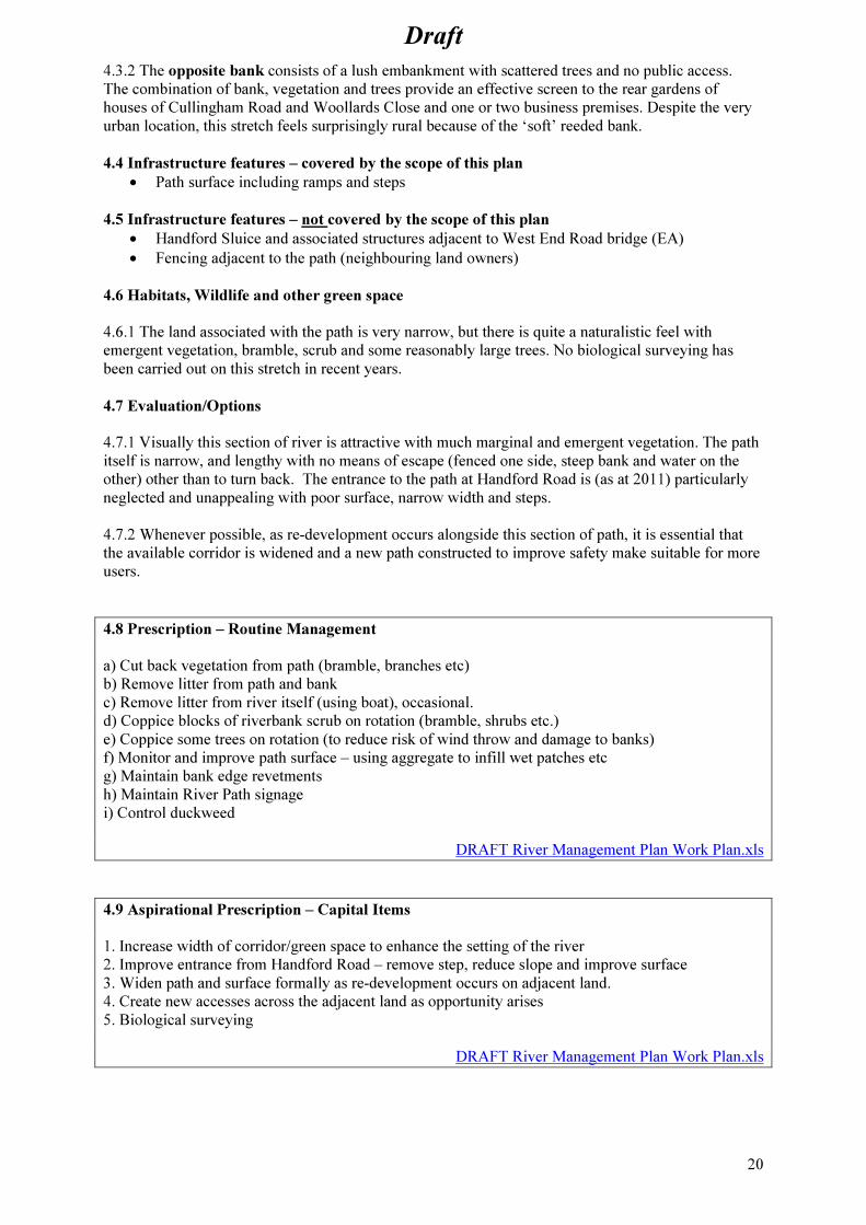
4.3.2 The opposite bank consists of a lush embankment with scattered trees and no public access.
The combination of bank, vegetation and trees provide an effective screen to the rear gardens of
houses of Cullingham Road and Woollards Close and one or two business premises. Despite the very
urban location, this stretch feels surprisingly rural because of the ‘soft’ reeded bank.
4.4 Infrastructure features – covered by the scope of this plan
• Path surface including ramps and steps
4.5 Infrastructure features – not covered by the scope of this plan
• Handford Sluice and associated structures adjacent to West End Road bridge (EA)
• Fencing adjacent to the path (neighbouring land owners)
4.6 Habitats, Wildlife and other green space
4.6.1 The land associated with the path is very narrow, but there is quite a naturalistic feel with
emergent vegetation, bramble, scrub and some reasonably large trees. No biological surveying has
been carried out on this stretch in recent years.
4.7 Evaluation/Options
4.7.1 Visually this section of river is attractive with much marginal and emergent vegetation. The path
itself is narrow, and lengthy with no means of escape (fenced one side, steep bank and water on the
other) other than to turn back. The entrance to the path at Handford Road is (as at 2011) particularly
neglected and unappealing with poor surface, narrow width and steps.
4.7.2 Whenever possible, as re-development occurs alongside this section of path, it is essential that
the available corridor is widened and a new path constructed to improve safety make suitable for more
users.
4.8 Prescription – Routine Management
a) Cut back vegetation from path (bramble, branches etc)
b) Remove litter from path and bank
c) Remove litter from river itself (using boat), occasional.
d) Coppice blocks of riverbank scrub on rotation (bramble, shrubs etc.)
e) Coppice some trees on rotation (to reduce risk of wind throw and damage to banks)
f) Monitor and improve path surface – using aggregate to infill wet patches etc
g) Maintain bank edge revetments
h) Maintain River Path signage
i) Control duckweed
DRAFT River Management Plan Work Plan.xls
4.9 Aspirational Prescription – Capital Items
1. Increase width of corridor/green space to enhance the setting of the river
2. Improve entrance from Handford Road – remove step, reduce slope and improve surface
3. Widen path and surface formally as re-development occurs on adjacent land.
4. Create new accesses across the adjacent land as opportunity arises
5. Biological surveying
DRAFT River Management Plan Work Plan.xls
Draft
21
SECTION 5 - West End Road to Alderman Canal
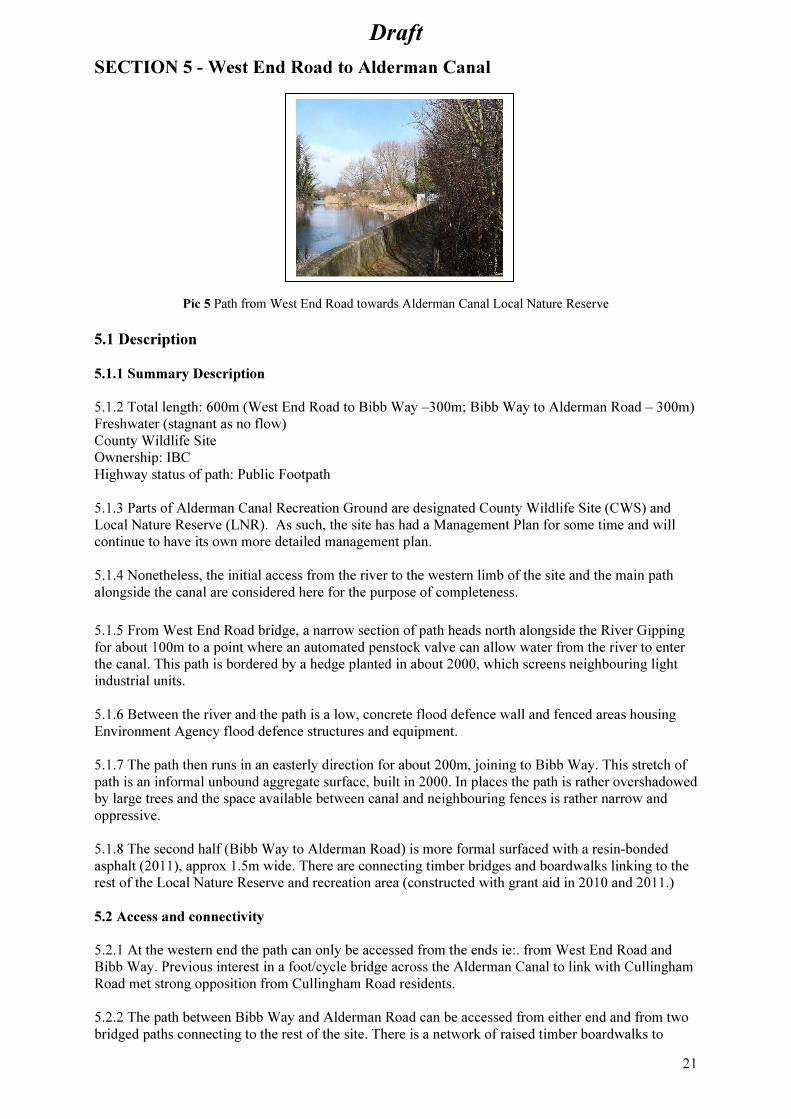
Pic 5 Path from West End Road towards Alderman Canal Local Nature Reserve
5.1 Description
5.1.1 Summary Description
5.1.2 Total length: 600m (West End Road to Bibb Way –300m; Bibb Way to Alderman Road – 300m)
Freshwater (stagnant as no flow)
County Wildlife Site
Ownership: IBC
Highway status of path: Public Footpath
5.1.3 Parts of Alderman Canal Recreation Ground are designated County Wildlife Site (CWS) and
Local Nature Reserve (LNR). As such, the site has had a Management Plan for some time and will
continue to have its own more detailed management plan.
5.1.4 Nonetheless, the initial access from the river to the western limb of the site and the main path
alongside the canal are considered here for the purpose of completeness.
5.1.5 From West End Road bridge, a narrow section of path heads north alongside the River Gipping
for about 100m to a point where an automated penstock valve can allow water from the river to enter
the canal. This path is bordered by a hedge planted in about 2000, which screens neighbouring light
industrial units.
5.1.6 Between the river and the path is a low, concrete flood defence wall and fenced areas housing
Environment Agency flood defence structures and equipment.
5.1.7 The path then runs in an easterly direction for about 200m, joining to Bibb Way. This stretch of
path is an informal unbound aggregate surface, built in 2000. In places the path is rather overshadowed
by large trees and the space available between canal and neighbouring fences is rather narrow and
oppressive.
5.1.8 The second half (Bibb Way to Alderman Road) is more formal surfaced with a resin-bonded
asphalt (2011), approx 1.5m wide. There are connecting timber bridges and boardwalks linking to the
rest of the Local Nature Reserve and recreation area (constructed with grant aid in 2010 and 2011.)
5.2 Access and connectivity
5.2.1 At the western end the path can only be accessed from the ends ie:. from West End Road and
Bibb Way. Previous interest in a foot/cycle bridge across the Alderman Canal to link with Cullingham
Road met strong opposition from Cullingham Road residents.
5.2.2 The path between Bibb Way and Alderman Road can be accessed from either end and from two
bridged paths connecting to the rest of the site. There is a network of raised timber boardwalks to

Draft
22
provide year-round access across what can be a very wet meadow. All of these accesses provide
excellent links towards the town centre, council offices and Ipswich Town Football Club.
5.3 Adjoining Land Use
5.3.1 From the western end, this stretch of path passes light industrial units, including the IBC bin
store and a concrete batching plant. At the eastern end, the path has the open part of the Local Nature
Reserve and recreation ground to the south.
5.3.2 The opposite bank of the canal is largely made up of commercial land uses including a large
office block (BT), although re-development is shifting the balance towards residential.
5.3.3 Infrastructure features – covered by the scope of this plan:
• Informal path from West End Road to Bibb Way
• Surfaced path from Bibb Way to Alderman Road
• Wooden post and rail fencing adjacent to path
• Timber revetment to hedge (western end)
• Directional signage
• Information board adjacent to West End Road bridge
5.3.4 Infrastructure features – not covered by the scope of this plan:
• Automated penstock valve and associated equipment (EA)
• Bridges, boardwalks, information boards etc within Alderman Canal LNR (separate
management plan)
5.4 Habitats, Wildlife and other green space
5.4.1 As most of this stretch (Alderman Canal) is a designated CWS and LNR, there is considerable
biodiversity – but this is discussed and recorded in a separate site management plan.
The path connecting back to West End Road bridge is bordered by a mixed native hedge that provides
shelter, nesting opportunities and food for common bird species.
5.5 Evaluation/Options
5.5.1 Most issues are considered separately in the site management plan. This plan only considers the
main path and connecting link to West End Road. The informal path surface could be improved from
West End Road through to Bibb Way to provide a better, all weather, flat surface for all users.
5.6 Prescription – Routine Management
a) Mow/strim vegetation either side of paths and cut back overhanging vegetation
b) Keep paths clear of vegetation/turf
c) Coppice/cut most stems between path and canal to keep views of open water
d) Remove litter from path and bank
e) Remove floating litter (by boat), occasional
Monitor path surface, fill and level hollows in aggregate path (Bibb Way to West End Road)
f) Clean and maintain interpretation board
g) Clean and maintain directional signage
DRAFT River Management Plan Work Plan.xls
5.7 Prescription – Aspirational/Capital
1. Control duckweed
2. Create an access link across Alderman Canal to improve north-south movement.

Draft
23
3. Acquire land to increase width of path/site from Bibb Way to West End Road.
4. Establish path/bridge/boardwalk through western reedbed to connect with Bibb Way.
5. Hard surface path from Bibb Way to River
6. Biological survey (particularly water vole)
DRAFT River Management Plan Work Plan.xls

Draft
24
SECTION 6 - Handford Road Bridge to Yarmouth Road Bridge
Pic 6 Path along flood bank adjacent to Suffolk Retail Park
6.1 Description
6.1.1 Summary Description
Total length: 225m
Freshwater, very slow flowing
County Wildlife Site
Ownership: EA
Highway status of path: not defined/recorded
6.1.2 This short stretch is naturalistic looking with naturally vegetated raised earth embankments
(flood defence). The path is of asphalt construction, on top of the flood bank. Between the path and
the river, there is a narrow strip of sloping ruderal? vegetation. The other side of the path, there is a
non-native hedge and iron railing fence to mark the boundary with the neighbouring retail park.
6.2 Access and Connectivity
6.2.1 The path can be accessed at both ends – direct from the pavement of Handford Road/London
Road and via steps from the east side of Yarmouth Road, or under Yarmouth Road bridge. There is
also a pedestrian access gate, leading into the adjacent retail park site, which is well used.
6.3 Adjoining Land Use
6.3.1 The river path runs between the river and the Suffolk Retail Park (The Range, Argos, Halfords
etc).
6.3.2 The opposite bank of the river has a considerable amount of tree cover that partially screens
Yarmouth Road. The land on the opposite bank is a vacant ex-retail site which is likely to be re-
developed as a family pub/restaurant..
6.4 Infrastructure features – covered by the scope of this plan
• Path surface
• Steps up to Yarmouth Road Bridge
• ‘Tunnel’ under Yarmouth Road Bridge
• Directional signage
6.5 Infrastructure features – not covered by the scope of this plan
• Flood defence bank (EA)
• Drain culverts/outlets – large concrete structures with fencing (EA)
• Iron railing fence and pedestrian gate (Retail Park)

Draft
25
• Yarmouth Road Bridge (Highway Authority)
• London/Handford Road Bridge (Highway Authority)
6.6 Habitats, Wildlife and other green space
6.6.1 There is limited green space along this stretch – a narrow strip each side of the path, dominated
by rank grassland species including nettle, dock, thistle with some Dittander (nationally scarce) and
invasive Japanese Knotweed (now mostly controlled by herbicide injection by IBC). The river itself is
very slow flowing and suffers from surface weed growth, particularly in dry years. Thick layers of
duckweed and azolla fern can completely cover the surface, greatly reducing the biodiversity of the
water.
6.7 Evaluation/Options
6.7.1 This is a relatively short stretch of path with few issues/options to discuss.
For many years the River Action Group have been keen to establish a Riverside Environment Centre
to promote the river, the paths and associated green space. The centre would ideally have rowing boat
hire, canoe launching facilities, bike hire (Green Bike Project) and other relevant facilities including
café etc. When the site on the opposite bank is re-developed, opportunities for such a centre should be
investigated.
6.8 Prescription – Routine Management
a) Cut regularly short grass strip each side of path
b) Cut and remove some tall vegetation (nettles) to maintain view of Path from Retail Park and keep
paths open and wide
c) Litter pick (entire stretch is very bad for litter – particular hotspots being Yarmouth Rd Bridge,
Handford Road Bridge, path next to tall shrubbery (Argos) and drainage outlets
d) Periodically remove outsize rubbish from river at Yarmouth Rd bridge (dumping hotspot)
e) Improve visually (manage more formally) Yarmouth Rd steps and bridge underpass to pedestrian
gate to Retail Park
f) Prune/cut hedges back to black metal fence (Retail Park side of path)
g) Maintain River Path directional signage
h) Monitor path surface and clear path edges (including Yarmouth Rd steps) of intruding turf/soil
build-up
i) Control invasive non-native plants (notably Japanese knotweed)
j) Control brambles (but not eliminate)
k) Coppice trees on 10-15 year rotation (three trees on this bank)
DRAFT River Management Plan Work Plan.xls
6.9 Aspirational Prescription
1. Improve steps/railings/entrance from Yarmouth Road (improve appearance over current cheapest,
basic solution). Preferably create new ramped access, DDA compliant
2. Investigate opportunities to establish a Riverside Environment Centre on the land on the opposite
bank.
3. Recreational boating launch facility (separate from Riverside Centre)
4. Control duckweed
5. Biological surveying
DRAFT River Management Plan Work Plan.xls
Draft
26
SECTION 7 - Yarmouth Road Bridge to Boss Hall Road
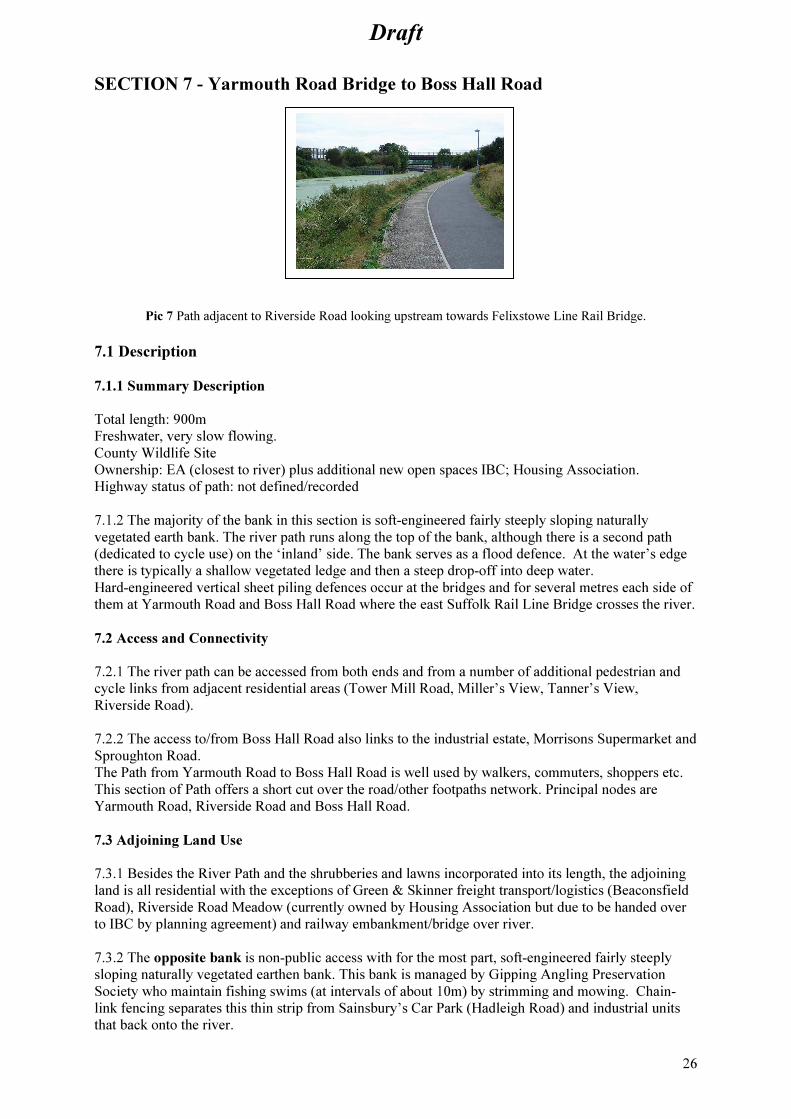
Pic 7 Path adjacent to Riverside Road looking upstream towards Felixstowe Line Rail Bridge.
7.1 Description
7.1.1 Summary Description
Total length: 900m
Freshwater, very slow flowing.
County Wildlife Site
Ownership: EA (closest to river) plus additional new open spaces IBC; Housing Association.
Highway status of path: not defined/recorded
7.1.2 The majority of the bank in this section is soft-engineered fairly steeply sloping naturally
vegetated earth bank. The river path runs along the top of the bank, although there is a second path
(dedicated to cycle use) on the ‘inland’ side. The bank serves as a flood defence. At the water’s edge
there is typically a shallow vegetated ledge and then a steep drop-off into deep water.
Hard-engineered vertical sheet piling defences occur at the bridges and for several metres each side of
them at Yarmouth Road and Boss Hall Road where the east Suffolk Rail Line Bridge crosses the river.
7.2 Access and Connectivity
7.2.1 The river path can be accessed from both ends and from a number of additional pedestrian and
cycle links from adjacent residential areas (Tower Mill Road, Miller’s View, Tanner’s View,
Riverside Road).
7.2.2 The access to/from Boss Hall Road also links to the industrial estate, Morrisons Supermarket and
Sproughton Road.
The Path from Yarmouth Road to Boss Hall Road is well used by walkers, commuters, shoppers etc.
This section of Path offers a short cut over the road/other footpaths network. Principal nodes are
Yarmouth Road, Riverside Road and Boss Hall Road.
7.3 Adjoining Land Use
7.3.1 Besides the River Path and the shrubberies and lawns incorporated into its length, the adjoining
land is all residential with the exceptions of Green & Skinner freight transport/logistics (Beaconsfield
Road), Riverside Road Meadow (currently owned by Housing Association but due to be handed over
to IBC by planning agreement) and railway embankment/bridge over river.
7.3.2 The opposite bank is non-public access with for the most part, soft-engineered fairly steeply
sloping naturally vegetated earthen bank. This bank is managed by Gipping Angling Preservation
Society who maintain fishing swims (at intervals of about 10m) by strimming and mowing. Chain-
link fencing separates this thin strip from Sainsbury’s Car Park (Hadleigh Road) and industrial units
that back onto the river.

Draft
27
7.4 Infrastructure features – covered by the scope of this plan
• Steel sheet piled fishing ‘swims’ (earth platform at approx water level to facilitate
angling)(around 40 no.)
• One concrete, wheelchair access fishing ramp/dipping platform.
• Tarmac surfaced paths – footway/cycleway/combined path
7.5 Infrastructure features – not covered by the scope of this plan
• High voltage cables pass over the river near 14 Miller’s View and near the East Suffolk Rail
line. (Power company)
• Water/gas pipes arise and pass over the river near Yarmouth Road and near Boss Hall Road
and the East Suffolk Rail line bridge. (Utility companies)
• Two small play areas (IBC)
• Street lighting
7.6 Habitats, Wildlife and other green space
7.6.1 With its vegetated natural banks, the river is an important habitat for wildlife and an important
wildlife corridor – the junction with the railway wildlife corridor has strategic significance.
7.6.2 The Riverside Road Meadow has developed into an interesting area supporting a wide range of
plants and insects. It requires more active management to maintain the quality and limit bramble and
scrub expansion. It is hoped that this will be possible once the site is handed to IBC from the
developer of adjacent housing.
7.6.3 An ecological survey has been undertaken of plants and some other higher species present in the
river corridor around the Riverside Road area. The species list for this area is appended to this plan.
7.7 Evaluation/Options
7.7.1 Alongside the river path, there are small areas of open space associated with recent housing
developments, most of which have been adopted by IBC. These tend to be more formal areas
(including play areas) except for the Riverside Road Meadow at the western end. The meadow has an
interesting range of plants and associated insects, and is a valuable wildlife habitat, hence the
recommended management regime.
7.7.2 This stretch has long been know as the ‘public fishing’ area, with ‘swims’ being available to
those anglers with a valid ticket. The quality of the fishing has declined due to the weed growth
resulting from low water flows, so that the future of angling in this area has to be questioned. It is
proposed to continue to manage the swims in the short term whilst the future of angling here is
assessed.
7.7.3 The bank of the river is heavily vegetated, providing a very good general habitat for wildlife, but
some rotational cutting and removing of arisings is required to maintain diversity and prevent species
such as bramble from dominating.
7.7.4 This stretch has three lifebelts in holders at intervals along the path. Whilst these might be
useful, they are a considerable maintenance liability – so future provision needs to be assessed through
the process of preparing ‘Open Water’ risk assessments.
Draft
28
7.8 Prescription –Routine Management
a) Mow path edges (one strip)
b) Brushcut/strim tall vegetation (e.g. nettles) where they fall into mown strip and path.
c) Monitor path and maintain soil level beside path
d) Maintain shrubberies and short grass open space (Tanner’s View, Miller’s View, to Green and
Skinner (Beaconsfield Road)
e) Maintain semi-circle Westside of Yarmouth Road Bridge as short cut area (currently tall
unmanaged vegetation)
f) Litter picking (Eliminate fly-tipping (grass clippings etc) by “TA” Flats grounds contractors.)
g) Removal of rubbish from the river
h) Fishing swims management
i) Maintain varied natural vegetation mosaics along riverbank by cyclical cutting.
j) Manage Riverside Road meadow (requires own more detailed management plan once in IBC
ownership) – annual cut (Sept/Oct), control bramble at edges
k) Maintain and replace lifebelts (or discontinue provision)
l) Maintain and empty dog bins
m) Maintain and empty rubbish bins (new August 2011)
n) Coppice trees/shrubs as appropriate – priority being multi-stemmed willow Tanner’s View, other
trees/shrubs as appropriate to preserve banks (EA flood defence requirement)
o) Maintain Interpretation Boards (one existing at Riverside Road, two proposed at Riverside Road
Meadow and Yarmouth Road semi-circle
p) Maintain river directional signage
q) Maintain play areas
r) Monitor and maintain seat
DRAFT River Management Plan Work Plan.xls
7.9 Prescription – Aspirational/Capital
1. Widen paths to meet cycle- path guideline standards
2. Replace wrong bollard signage at Riverside Road
3. Refit (correctly) ribbed slabs at Riverside Road
4. Install interpretation boards at: Yarmouth Rd Bridge semi-circle, Riverside Road meadow (western
end of Riverside Road)
5. New access ramp to Riverside Rd Meadow
6. Repair tarmac path surfaces/edge Riverside Road – full width topping
7. Install notice boards for communication with path users/residents
8. Control duckweed
9. Biological surveying
DRAFT River Management Plan Work Plan.xls

Draft
29
SECTION 8 - Boss Hall Road to Borough Boundary (Norwich Line Sluice)
Pic 8 Path alongside Boss Hall Industrial estate, looking upstream towards Borough boundary.
8.1 Description
8.1.1 Summary Description
Total length: 400m.
Freshwater. (Very slow flow)
County Wildlife Site
Ownership: EA (river bank and path) Sustrans (land back to Co-Op fence)
Highway status of path: not defined/recorded
8.1.2 A wide street-lit tarmac path (2.5m) runs the length of the section and follows the river
embankment some 2m above water level. Mostly naturally vegetated sloping riverbank with fairly
lush vegetation and sporadic trees and shrubs. In places (mostly near the bridges and the opposite
bank) the riverbanks have been hard-engineered with vertical metal sheet piling/concrete. At intervals
fishing ‘pegs’ or ‘swims’ have been installed, consisting of metal sheet revetments yielding level
seating areas close to the water’s edge. At the water’s edge there is typically a shallow vegetated
ledge and then a steep drop-off into deep water. The land between the path and the industrial estate
fence is mostly owned by Sustrans (following a transfer from the Co-Op to facilitate the construction
of the cycle path).
8.1.3 The Flood Defence Structure at the upstream end of this section combines with the railway
embankment to create, when the drop down flood gate is deployed, what is effectively a dam capable
of holding back some 2m extra height of water upstream in the Sproughton floodplain. Some aspects
of the design cause problems for people and access. A set of steps allows access over the barrier, but
limits access for those with limited mobility. It is also impossible to see beyond the structure, which
can make it feel unsafe to some path users.
8.2 Access and Connectivity
8.2.1 The river path can be accessed from each end and from the bottom of Boss Hall Road (within the
Boss Hall Industrial Estate). Access upstream is limited by the flood defence structure (see above).
Downstream, the cycle path continues towards Yarmouth Road. The path is very well used between
the downstream end and Boss Hall Road, as people use the path to access the supermarket and other
facilities. Beyond Boss Hall Road, up to the flood barrier, the path is much less well used – mostly by
those walking dogs etc. Although the path is constructed as cycleway, it finishes before the flood
defence structure. It is hoped that the path (as cycleway) will continue across the former sugar factory
site in the future as and when an opportunity is presented.
8.3 Adjoining Land
8.3.1 For the entire length of this section, the river path corridor runs alongside the Boss Hall
Industrial and Retail Estate (mostly owned by the East of England Co-op).
Draft
30
8.3.2 Two railway lines cross the path and river and have an important secondary role as
wildlife/green corridors. The opposite bank is currently open green space at the back of what was a
meat factory fronting on to Hadleigh Road. This large site is likely to be redeveloped in the near future
with a mix of light industrial uses. The part of the site closest to the river is to be used to provide a
new rail line link between the two main railway lines. Land ‘trapped’ between the new rail line and the
river, would make an excellent public green space for people and wildlife.
8.3.3 A foot/cycle link across the river and across the site to Hadleigh Road is considered extremely
important as it would allow people living south of the river to access the river path on the north bank;
and those living north of the river (who currently have very limited access to green space) would be
able to get to Chantry Park. The River Action Group and Greenways Project will continue to
campaign for this new open space and access.
8.4 Infrastructure features – covered by the scope of this plan
• Wide Tarmac path (2.5m)
• Wooden fence (western end)
• Bench and bike rack (western end near Flood Defence/Norwich line)
• Anti-cycling barriers (eastern end)
• Bollards (Co-op at eastern end)
8.5 Infrastructure features – not covered by the scope of this plan
• Flood defence drop barrier (EA)
• Metal hand railings (on vertical metal piling/concrete river walls (eastern end) and on Flood
Defence (western end) (EA)
• Streetlights along river path.
• Hard engineered vertical sides (near bridges and at Flood defence structure).
• Security fences at back of industrial estate (East of England Co-Op)
8.6 Habitats, Wildlife and other green space
8.6.1 The river is notified as a County Wildlife Site for this stretch, and it forms an important wildlife
corridor, particularly with the junction with the Norwich railway line wildlife corridor. The naturally
sloping banks provide a range of habitats including bramble, scrub, grassland, reed and emergent
vegetation, and scattered small trees. The path corridor is relatively narrow, but there are a few short
stretches where there is grassland between the path and the industrial estate fencing.
This stretch is known to support slow worms (near the Norwich Line flood defence) and grass snakes,
but has not been the subject of any formal biological surveying.
8.7 Evaluation/Options
8.7.1 Management of the cycle path along this stretch is the main requirement. Some wildlife habitat
management is required along the banks and sides of the path. There are two major improvements that
could be carried out in this stretch - building of a ramp (or similar) to overcome the flood barrier and
new open space on the opposite bank with connecting foot/cycle bridge.
8.8 Prescription – Routine management
a) Mow path edges
b) Maintain mosaic of vegetation types either side of path.
c) Litter picking
d) Removal of rubbish from the river
e) Maintenance of fishing swims
f) Maintain timber fence
g) Maintain and improve Tarmac surface (already cracking in places)
h) Pollard willows
i) Cut back branches to allow streetlights to cast light effectively
j) Coppice trees/shrubs on rotational cycle
Draft
31
k) Maintain small open area with benches etc
l) Manage land between industrial estate and path for wildlife. Graded rising structure, habitat piles,
some planting of native shrubs/encouragement of bramble screen
m) Spray off vegetation along chain-link fence-line with Co-op premises (immediately west of Boss
Hall Road)
n) Maintain River Path signage
DRAFT River Management Plan Work Plan.xls
8.9 Prescription – Aspirational/Capital
1. Improve access through/over flood defence, create wider ramp for cyclists.
2. Seek provision of green space next to river and a footbridge across the river on the former Harris
Bacon Factory site
3. Level and finish small open space near flood defence
4. Remove cycle barriers (nr Boss Hall Road)
5. Remove (permission first from Co-op) bollards in centre of pavement, Boss Hall Road.
6. Raise level of ground between concrete walls of flood defence and steps to enable path user to look
into flood defence area before entering down narrow steps.
7. Plant shrub screen to silver fence (industrial estate).
8. Remove tree stump from path
9. Biological surveying
DRAFT River Management Plan Work Plan.xls

Draft
32
SECTION 9 – Borough Boundary to A14
Pic 9 Borough Boundary to A14
9.1 Description
9.1.1 Summary Description
Total length: 1.5km
Freshwater (slow flow)
Public Footpath.
Ownership: Private Land owner (Development company in administration 2011)
Highways status of path: Public Footpath
9.1.2 The river path is recorded as a Public Footpath for all of this stretch, as it lies in Babergh
District. (Stretches within Ipswich Borough are not recorded as Public Right of Way as there was no
definitive map of routes until 2010.)
9.1.3 The river takes a very natural looking form for this stretch, with low banks and no flood
defences. The left bank (carrying the path) is partly open and partly wooded in character. Behind the
path a very large earth bank acts as a retaining wall for the settlement lagoons of the former sugar
factory.
9.2 Access and Connectivity
9.2.1 The path is accessible from each end only – via the flood defence structure from the Boss Hall
stretch at the downstream end, and upstream via the stretch to Sproughton. There are no other access
points, although possible future development of the former sugar factory is likely to facilitate
connections.
9.3 Adjoining land
9.3.1 The path is bounded by established scrub, hedgerow and trees at the eastern end and open
meadow and planted woodland at the western end. All of the adjoining land beside the path is part of
the former sugar factory, which is currently (2011) a derelict site in the hands of the administrator.
9.3.2 The opposite bank is varied – from the eastern end; there are areas of open land (prepared for
redevelopment); semi-natural scrub/woodland; suburban gardens (opposite the island) and agricultural
land.
9.4 Infrastructure features – covered by the scope of this plan
• Path surface (with timber revetments)
9.5 Infrastructure features – not covered by the scope of this plan
• Flood defence Structure (Norwich railway line). (EA)
• Sluice (Chantry Cut) on the site of the old Chantry lock. (EA)
Draft
33
• Bailey bridge (metal) – to Island (land owner)
• Weir – south-west of western tip of island. (EA)
• Overhead high voltage electricity cables and pylons (power company)
• Norwich railway line (Network Rail)
• A14 SCC/Highways Authority
9.6 Habitats, Wildlife and other green space
9.6.1 Notable is the “Island”, south of the sugar beet factory site, north of Collinsons created in the
19th century by the digging of the “Chantry Cut” to enable navigation. The island now comprises a
low-lying complex of pools and wetland, areas of planted scrub and woodland and a series of informal
paths (not public). With access only from one bridge with locked gates, this area suffers very little
disturbance, and as such is remarkably good for birds and other wildlife.
9.7 Evaluation/Options
9.7.1 A very picturesque part of the river, and a very nice contrast with the more urban/industrial
stretches downstream. As there is no associated green space in this area, and the land is privately
owned, there are no real options for management.
9.8 Prescription – Routine Management
a) Mow/strim path edges
b) Cut back overhanging vegetation
c) Collect and remove litter
d) Monitor path surface
DRAFT River Management Plan Work Plan.xls
9.9 Prescription – Aspirational/Capital
1. Take up development opportunities arising from sugar beet factory development, e.g. green corridor
and pedestrian/cycle link north to Sproughton Road and cyclepath parallel (in east-west direction) to
river but on top of Factory embankment to preserve quiet rural feel of river path
2. Take up development opportunities arising from sugar beet factory development, acquisition of the
island formed by the River Gipping and the New Cut (currently owned by the same company that
owns the sugar beet factory) – to be managed as a Local Nature Reserve
3. Take up development opportunities arising from development on opposite bank immediately west
of Norwich railway line (Elton Park industrial units)
4. Seek additional green space in any future redevelopment of the site
5. Maintain path – infill with aggregate as necessary
6. Maintain river edge/path as necessary – revet against erosion and backfill
7. Biological surveying
DRAFT River Management Plan Work Plan.xls

Draft
34
SECTION 10 - A14 to Sproughton Bridge
Pic 10 Sproughton Millennium Green
10.1 Description
10.1.1 Summary Description
Total Length – 550m
Freshwater
Public Footpath.
Ownership: Part AW; part private (Official Receiver); part Sproughton Millennium Green Trust
Highway status of path: Public Footpath
10.1.2 This final stretch of the path is recorded as a Public Footpath and connects the previous section
to Lower Street, Sproughton. The path passes through the grounds of an Anglian water pumping
station (which abstracts water from the river for human consumption) and on past grazed paddocks,
into the Sproughton Millennium Green.
10.1.3 The river has a generally very natural feel with large trees and open stretches. The Millennium
Green is open access, so path users can spread out across the whole site. At the end of the Millennium
Green, the river path passes under the road bridge, and a gently sloping ramp provides access up to the
road.
10.1.4 Sproughton Millennium Green features a large short-mown open space with picnic benches,
notice board, old millstone and blocks of native trees. The Green is managed by the Sproughton
Millennium Green Trust and used by local people for picnicking, walking, dog-walking, general
recreation and for events. This plan does not include management of the Green.
10.1.5 The opposite bank is largely occupied by gardens with the churchyard of Sproughton Church
at the western end.
10.2 Access and Connectivity
10.2.1 There is access only at each end of the path – connecting to the previous section downstream
and to Sproughton village and the continuing Gipping Valley path, upstream.
10.3 Adjoining land
10.3.1 The Anglian Water pumping station site straddles the footpath for the first 50m or so from the
A14 bridge. The path is then bordered by fencing for the 350m of horse paddocks, and then opens up
into the Millennium Green, which in turn is bordered by the road between Ipswich and Sproughton.
10.4 Infrastructure features – covered by the scope of this plan
• Unbound informal path

Draft
35
10.5 Infrastructure features – not covered by the scope of this plan
• Anglian Water pumping station buildings etc
• Sproughton Millennium Green – millstone, benches, ramp and fences
• EA Flood defence sluice (formerly a Navigation lock), and Anglia Water abstraction works
(here water is abstracted and piped to Alton Reservoir for subsequent treatment and supply as
drinking water to the Ipswich area. There is also a small sewage works (on the eastern side of
the A14).
10.6 Habitats, Wildlife and other green space
10.6.1 The Anglian Water area is characterised by short, rabbit grazed grassland, which is reasonably
diverse but has not been surveyed. There is emergent vegetation at the edge of the river in places and
generally rough grassland with occasional large trees and some scrub. The grazed pastures do not
appear to be botanically interesting, but again, have not been surveyed.
10.6.2 The Millennium Green is relatively young, and planted trees and shrubs are still maturing. Most
of the site is short mown grass offering limited opportunities for wildlife – it’s apparent primary role
being for recreation.
10.7 Evaluation/Options
There are very few option to discuss here as the land is privately owned and the path is a Public
Footpath, managed accordingly.
10.8 Prescription – Routine Management
a) Mow/strim footpath
b) Cut back overhanging vegetation
c) Litter picking
d) Monitoring path surface
DRAFT River Management Plan Work Plan.xls
10.9 Prescription – Aspirational/Capital
1. Acquire more land to widen river path alongside paddocks
2. Acquire land (former British Sugar owned land) to extend Millennium Green
3. Create/extend cycleway to Sproughton
4. Biological surveying
DRAFT River Management Plan Work Plan.xls

Draft
36
APPENDICES
Appendix A - River Path User Surveys 2009/10 (where conducted)
Usage
Section 1
Low usage:
• 23 users on Thurs 29/10/09 between 13:20 and 15:50 (9.2 persons/hr) Half-term hol.
• 27 users on Mon. 09/11/09 between 07:30 and 10:00. (10.8 persons/hr)
Of these 6 accessed the path to/from Princes Street Bridge using the steps.
Type of usage: walking, cycling, commuting, dog-walking.
Sarsen Stone site: socialising, drinking, toileting, some drug-taking.
Skateboard Park: skateboarding/BMX biking/socialising. High usage mainly by young people of
school age (45-50 users noted at 13:20 Thurs 29/10/09 in the half-term holidays.)
Section 2
At October 2009, usage was low. The following maximum numbers were recorded at the eastern end
of the site:
• Lower Path up to 10.5 persons/hr in fine weather in October 2009
• Upper Path up to 6.7 persons/hr in fine weather in October 2009
• The Cattle Yard although used by some for lunch is also used for drinking and drug-taking
with accompanying litter (both in the open and in the shrub belts that extend into the derelict
Network rail land).
• The area immediately next to Prince’s Street Bridge is also abused with flytipping (especially
into the Network Rail land, drinking, toileting, drugtaking, flytipping and graffiti under the
Bridge.
Many pedestrians and cyclists cut through from West End Road to Princes Street not by using the
River Path but by using the Car Park north of the site and ramp to Princes Street next to the former
Zest Night Club (corner of Princes Street and Chancery Road).
Section 4
Very low usage (surveys in fine weather showed 8 people in 2 hrs between 09:30 and 11:30 on Friday
16/10/09 and 7 people in 30 minutes between 15:30 and 16:00 on Thurs 15/10/09).
Heavy litter indicates casual drinking with people loitering and sitting using the concrete walls etc that
form the fence base with the West End Road properties.
Section 6
Medium (high at Yarmouth Road interchange)
By observational survey:
• 56 persons between 15:23 and 17:51 on Thurs. 15/10/09. (22 persons/hr)
• 64 persons between 14:45 and 15:45 on Sun. 11/10/09 (64 persons/hr)
Whilst a few persons used the whole length of path, many accessed to/from the Suffolk Retail Park.
Many people accessing the Suffolk Retail Park used in not for shopping but seemingly to cut through
to London/Handford Road.
Section 7
High. Observational surveys have shown high usage of the entire path from Yarmouth Road to Boss
Hall Road:

Draft
37
• River path at Riverside Road (263 persons between 07:30 and 11:00 Fri. 09/10/09) (75.1
persons/hr)
• River path at Riverside Road (81 persons between 11:45 and 13:00 Fri 09/10/09). (64.8
persons/hr)
• River path at Riverside Road (178 persons between 16:23 and 17:38 Sat.17/10/09 home
match). (142.4 persons/hr)
• River paths at Yarmouth Road ( 91 persons between 14:45 – 15:45 Sun.11/10/09) (91
persons/hr)
Users include pedestrians, cyclists, wheel chair/buggy, prams/pushchairs, anglers and dog-walkers for
commuting, recreation and shopping. Whilst some users use the entire length of the path, many access
the river path from its interchanges with Yarmouth Road, Riverside Road and Boss Hall Road.
Section 8
Low, mostly by dogwalkers. High usage as dog toilet!
Friday 16/10/09 12:30 – 13:30 11 5.5 persons/hr
Tuesday 27/10/09 10:15 – 14:45 30 6.7 persons/hr
Most of these counts are double counts with people walking/cycling to the flood defence gate, turning
about and returning.
Some angling.
Section 9
Low
Predominantly longer distance walkers, dog-walkers, family adventurers, joggers and mountain
cyclists.

Draft
38
Appendix B – History of the River and associated areas
This section reference: A History of Ipswich. Robert Malster (2000); Phillimore, Chichester
This section gives a brief overview of the historic development of the river and its immediate environs
along the length of the Management Plan area. Further detail that relates to individual sections of the
Management Plan can be found in the relevant Management Plan compartments in this plan.
In the context of this Management Plan, it appears as if the main historic development of Ipswich took
place to the east of the Management Plan area with Anglo-Saxon settlements at Ipswich east of a line
drawn north-south from Stoke Bridge and south of the river at Stoke.
Ipswich, originally Gippeswyk, is thought to be the first post-Roman urban centre in Britain in the
7th/8
th centuries. By the 8
th/9th centuries, it had become one of the four most important urban centres in
the country with a mint, unique Ipswich Ware pottery, shipbuilding and a major port. Stoke Street/St
Peters and Stoke Bridge were major thoroughfares linking Ipswich and Stoke on the south side of the
river. St Nicholas and Queen Street represented a major north-south thoroughfare on the west of the
town. Besides Stoke Bridge another Saxon crossing point (ford) lay just to the east following the line
of Great Whip Street (south of the river) and Brook Street and Northgate Street (north of the river).
Rivers were important for transport and archaeological features could be present at any point.
The Vikings/Danes used the Gipping (and its tributary, the River Rat) to reach Rattlesden (called Rat-
les Den) in the 9th/10
th centuries. The Normans shipped Caen stone from Normandy via the same two
rivers to Bury St Edmunds for the construction of St Edmundsbury Cathedral (1065-1095). Roman
vessels may have made their way upstream to Combretovium, a small fort/settlement in the vicinity of
Baylham Mill, Coddenham.
Tiles and burials suggest a Roman settlement with substantial buildings in the Handford
Road/Burlington Road/Civic Drive/Magistrate’s Court area. This area adjoins Alderman Canal.
Alderman Canal is considered to be all that remains of an artificial waterway dug in Roman times
from the River Gipping east to what is now Little and Great Gipping Streets (hence their names)
before dropping south-east just west of what is now Civic Drive, Fransican Way and Grey Friars
Street to enter the River Orwell at Stoke Bridge. Whilst the western section may have been used for
navigation with possible quays, the south-east section was thought to have served as a leat to drive
watermills. In medieval times three watermills were recorded operative on this section: Handford Mill
near Alderman Road/Lt/Gt Gipping Streets, Horsewade (Friars Bridge) and Stoke Mill (near Stoke
Bridge). This south-east flowing section of river was subsequently stopped up in Victorian times at
Alderman Road circa 1870. By 1804 Stoke Mill had been converted into a tidal mill with reservoirs
occupying what is now Cardinal Park.
The “Roman” River at its turning point in the Little Gipping and Great Gipping Street area would also
have been in close proximity to what is thought to have been the site for the short-lived and illegal
Norman motte and bailey (earth and wood) castle thought to have been located between what is now
Civic Drive, Elm Street and West Gate Street.
In the west of the Management Plan area, Anglo-Saxon 6th century cemeteries have been identified
and archaeologically surveyed either side of the River Gipping at Hadleigh Road (in the vicinity of
Allenby Road) and Boss Hall. A bridge or ford called Pottaford linked the two, in the vicinity of the
Norwich railway line bridge. There is thus the possibility of further archaeological features.
The River Gipping was made more navigable in the late 18th century when work was undertaken to
turn it into a Navigation. Work on the Ipswich to Stowmarket Navigation or Gipping and Orwell
Navigation commenced in 1790 and took three years and 200 men to complete. When complete it
had 15 locks over 17 miles and rose 90 ft from Ipswich. It was mainly used for the transport of
manure, fertilisers, gun cotton and grain. A horse-drawn 30-40 ton barge could cover the distance in
7-8 hours. Some direct trade was carried on between Stowmarket and London using small sailing
barges (smaller than the spritsail barges that today race on the Orwell). Although put forward by the

Draft
39
Wet Dock architect a set of lock gates at the western end of the Ipswich Wet Dock were not put in as
the Ipswich traders felt it might take trade from the Port of Ipswich.
Work on the Wet Dock at Ipswich east of Stoke Bridge commenced in 1838 and the Wet Dock opened
in 1842. Briefly, it was the biggest wet dock in the country.
Construction of the railway network had a huge impact on the river, river use and its surrounds. The
Eastern Union Railway from London to Ipswich was completed in 1846. Within a further three years,
Stoke tunnel, Ipswich Railway Station (north of Stoke tunnel) and the Norwich line were also
completed. The railway quickly took trade away from the Ipswich to Stowmarket (Orwell and
Gipping) Navigation and the Eastern Union Railway bought up the Navigation, thus establishing a
monopoly on transport other than roads. The 1860s saw the opening of the current Ipswich Railway
Station followed by the construction of Princes Street and Princes Street Bridge to provide a direct link
from the railway station to the town centre. A spur of railway was taken across the Orwell at the
Ancaster Road Rail Bridge (at the western end of the Cattleyard) to serve the northern docks.
Numerous sidings were established between the bridge and Stoke Bridge. Amongst these sidings were
platforms in the Old Cattleyard. Here cattle were offloaded and kept before being herded along what
is now the river cycle path to Princes St and onto the new cattle market (now Portman Road Car Park)
until the early 1980s.
Work in the 1970s saw flood defence features established along the Gipping and Orwell. These
included the concrete armour-block sloping sides in the tidal Orwell, sheet piling flood defence walls,
embankments, stone-gabions, bank reinforcements and the numerous weirs and sluices. Locks were
also removed and converted into weirs and sluices, which finally put paid to opportunities for
navigation on more than just short stretches of river.

Draft
40
Appendix C - Species List Riverside Road (land next to River)
English name Latin Date Recorder Notes
Wild Flowers What does this
mean?
Creeping buttercup Ranunculus repens 08/04/09 PS B M
Bulbous buttercup Ranunculus bulbosa 24/04/09 PS B M
Lesser celandine Ranunculus ficaria 08/04/09 PS B
Traveller’s-joy Clematis vitalba 01/04/09 PS
Common meadow-rue Thalictrum flavum 18/04/09 PS Rb
Yellow water-lily Nuphar lutea 11/06/09 PS R
Common poppy Papaver rhoeas 18/05/09 PS M
Charlock Sinapis arvensis 05/06/09 PS MRb
Hedge mustard Sisymbrium officinale 05/06/09 PS MRb
Bastard cabbage Rapistrum rugosum 05/06/09 PS
Water cress Rorippa nasturtium-
aquaticum
15/05/09 PS R
Dittander Lepidium latifolium 01/04/09 PS B M
Honesty Lunaria annua 18/04/09 PS
Shepherd’s-purse Capsella bursa-pastoris 08/04/09 PS M disturbed
ground at eastern
end
Horse-radish Armoracia rustcana 02/05/09 PS B M
Perforate St John’s-wort Hypericum perforatum 18/05/09 PS M
White Campion Silene alba 15/05/09 PS M
Common chickweed Stellaria media 18/04/09 PS M
Fat-hen Chenopodium album 23/07/09 PS Path edge
Good king Henry Chenopodium bonus-
henricus
26/07/09 PS M
Tree mallow Lavatera arborea 15/07/09 PS B M
Herb-robert Geranium robertianum 24/04/09 PS B
Hedgerow crane’s-bill Geranium pyrenaicum 15/05/09 PS B M
Dove’s-foot/Cut-leaved
Crane’s-bill
Geranium
molle/Geranium
dissectum
PS
Red clover Trifolium pratense 11/06/09 PS M
White clover Trifolium repens 15/05/09 PS M
Tufted vetch Vicia cracca 15/07/09 PS M
Common vetch Vicia sativa 08/04/09 PS M
Black medick Medicago lupulina 15/07/09 PS M
Spotted medick Medicago arabica 09/04/09 M
Common bird’s-foot-
trefoil
Lotus corniculatus 15/07/09 PS M nr tarmac path
Blackthorn Prunus spinosa 01/04/09 PS Railway
embankment/far
west
Hawthorn Crataegus monogyna 01/04/09 PS West next to
river and railway
embankmemt
Apple Malus domestica agg. 23/07/09 PS M west end
meadow
Dog rose Rosa canina 15/05/09 PS West end
meadow
Bramble Rubus fruticosus 01/04/09 PS B M

Draft
41
Creeping cinquefoil Potentilla repens 01/04/09 PS B M
Silverweed Potentilla anserina 15/05/09 PS B Swim near
water
Meadowsweet Filipendula ulmaria 08/04/09 PS B nr disabled
swim
Great willowherb Epilobium hirsutum 15/05/09 PS B/R
Common nettle Urtica dioica 01/04/09 PS B M
Hop Humulus lupulus 24/04/09 PS M
Ivy Hedera helix 01/04/09 PS Rail embankment
Ash Fraxinus excelsior 01/04/09 PS Rail embankment
White willow Salix alba 18/05/09 PS Eastern end of
housing
Goat willow Salix caprea 01/04/09 PS M western end
Sun spurge Euphorbia helioscopia 08/04/09 PS M disturbed
ground at eastern
end
Cow parsley Anthriscus sylvestris 01/04/09 PS B M
Hemlock Conium maculatum 14/04/09 PS M Under white
willows eastern
end
Ground elder Aegopodium
podagraria
24/04/09 PS M high dry areas
Hogweed Heracleum
sphondylium
08/04/09 PS B M
Wild carrot Daucus carota 15/07/09 PS M
Fennel Foeniculum vulgare 24/04/09 PS M
Curled dock Rumex crispus 11/06/09 PS B M
Japanese knotweed Polygonum cuspidatum 11/06/09 PS B Large sites
treated with
chemicals in
2008, seemingly
mostly
successful.
Vervain Verbena officinalis 24/04/09 PS M
Field bindweed Convolvulus arvensis 11/06/09 PS B M
Hedge bindweed Calystegia sepium 11/06/09 PS B M
Twiggy mullein Verbascum virgatum 11/06/09 PS M Two plants
mid-meadow
behind houses
Common toadflax Linaria vulgaris 22/07/09 PS Steel shuttered
bank nr rail
bridge
Common field speedwell Veronica persica 01/04/09 PS Edges of path
Gypsywort Lycopus europaeus 22/07/09 PS R at base of
Steel shuttered
bank nr rail
bridge
Red dead-nettle Lamium purpureum 01/04/09 PS B M
White dead-nettle Lamium album 01/04/09 PS B M
Red hemp-nettle Galeobdolon
angustifolia
23/07/09 PS Steel shuttered
bank nr rail
bridge
Marsh woundwort Stachys palustris 11/06/09 PS R B
Black horehound Ballota nigra 11/06/09 PS B M
Water forget-me-not Myosotis scorpioides 11/06/09 PS R
Green alkanet Pentaglottis
sempervirens
18/04/09 PS Steel shuttered
bank nr rail
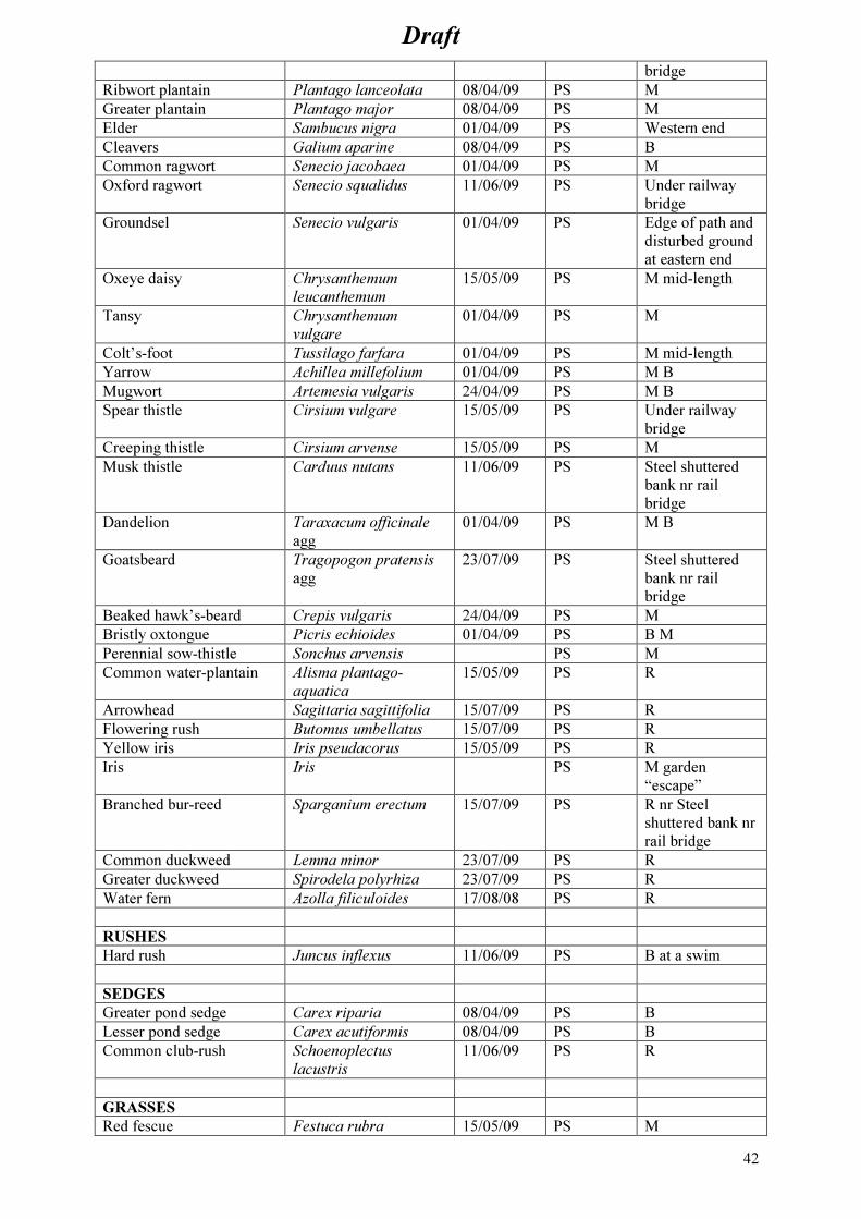
Draft
42
bridge
Ribwort plantain Plantago lanceolata 08/04/09 PS M
Greater plantain Plantago major 08/04/09 PS M
Elder Sambucus nigra 01/04/09 PS Western end
Cleavers Galium aparine 08/04/09 PS B
Common ragwort Senecio jacobaea 01/04/09 PS M
Oxford ragwort Senecio squalidus 11/06/09 PS Under railway
bridge
Groundsel Senecio vulgaris 01/04/09 PS Edge of path and
disturbed ground
at eastern end
Oxeye daisy Chrysanthemum
leucanthemum
15/05/09 PS M mid-length
Tansy Chrysanthemum
vulgare
01/04/09 PS M
Colt’s-foot Tussilago farfara 01/04/09 PS M mid-length
Yarrow Achillea millefolium 01/04/09 PS M B
Mugwort Artemesia vulgaris 24/04/09 PS M B
Spear thistle Cirsium vulgare 15/05/09 PS Under railway
bridge
Creeping thistle Cirsium arvense 15/05/09 PS M
Musk thistle Carduus nutans 11/06/09 PS Steel shuttered
bank nr rail
bridge
Dandelion Taraxacum officinale
agg
01/04/09 PS M B
Goatsbeard Tragopogon pratensis
agg
23/07/09 PS Steel shuttered
bank nr rail
bridge
Beaked hawk’s-beard Crepis vulgaris 24/04/09 PS M
Bristly oxtongue Picris echioides 01/04/09 PS B M
Perennial sow-thistle Sonchus arvensis PS M
Common water-plantain Alisma plantago-
aquatica
15/05/09 PS R
Arrowhead Sagittaria sagittifolia 15/07/09 PS R
Flowering rush Butomus umbellatus 15/07/09 PS R
Yellow iris Iris pseudacorus 15/05/09 PS R
Iris Iris PS M garden
“escape”
Branched bur-reed Sparganium erectum 15/07/09 PS R nr Steel
shuttered bank nr
rail bridge
Common duckweed Lemna minor 23/07/09 PS R
Greater duckweed Spirodela polyrhiza 23/07/09 PS R
Water fern Azolla filiculoides 17/08/08 PS R
RUSHES
Hard rush Juncus inflexus 11/06/09 PS B at a swim
SEDGES
Greater pond sedge Carex riparia 08/04/09 PS B
Lesser pond sedge Carex acutiformis 08/04/09 PS B
Common club-rush Schoenoplectus
lacustris
11/06/09 PS R
GRASSES
Red fescue Festuca rubra 15/05/09 PS M

Draft
43
Perennial rye grass Lolium perenne 15/05/09 PS M path edge
Annual meadow grass Poa annua 24/04/09 PS M path edge
Cocksfoot Dactylis glomeratus 18/04/09 PS M
Barren brome Bromus sterilis 24/04/09 PS M
Soft brome Bromus hordeaceus 15/05/09 PS M
Wall barley Hordeum murinum 15/05/09 PS M
False oat-grass Arrhenatherum elatius 15/05/09 PS M
Yorkshire fog Holcus lanata 08/04/09 PS M
Creeping bent Agrostris stolonifera 11/06/09 PS M
Reed canary-grass Phalaris arundinacea 18/05/09 PS R
Common reed Phragmites australis 18/04/09 PS R
FUNGI
St George’s mushroom Calocybe gambosa 18/04/09 PS
ORTHOPTERA
Great green bush-cricket Tettigonia viridissima 26/07/09 PS B M Large
colony
Dark bush-cricket Pholidoptera
griseoaptera
26/07/09 PS M numerous
Roesel’s bush-cricket Metrioptera roeselii 26/07/09 PS M numerous
Long-winged conehead Conocephalus discolor 26/07/09 PS M 1x Female
ODONATA
Banded demoiselle Agrion splendens 18/05/09 PS
Common blue damselfly Enallagma cyathigerum Summer
2009
PS
Blue-tailed damselfly Ischnura elegans Summer
2009
PS
Large red damselfly Pyrrhosoma nymphula 06/05/09 PS
Broad-bodied chaser Libellula depressa 06/05/09 PS
Brown hawker Aeshna grandis 16/07/09 PS
BUTTERFLIES
Essex skipper Thymelicus lineola 24/07/09 PS
Brimstone Gonepteryx rhamni 06/05/09 PS
Large white Pieris brassicae 27/07/09 PS
Green-veined white Pieris napi 24/04/09 PS
Orange-tip Anthocharis
cardamines
02/05/09 PS
Common blue Polyommatus icarus 23/07/09
24/07/09
PS
PS
Male
Male and female
All records in
meadow
Holly blue Celastrina argiolus PS
Painted lady Vanessa cardui
Small tortoiseshell Aglais urticae 01/04/09 PS
Peacock Inachis io
Comma Polygonia c-album 24/07/09
Speckled wood Pararge aegeria 14/04/09
Gatekeeper Pyronia tithonus 03/07/09 PS
Meadow brown Maniola jurtina 03/07/09 PS
REPTILES/AMPHIBIA
Slow worm Anguis fragilis 18/04/09
PS
Dead - on river
tarmac path, head
bloody, tail

Draft
44
18/05/09 PS separated
Dead - head
section in
meadow
Grass snake Natrix natrix 11/06/09 PS
Common toad Bufo bufo Tadpoles
15/05/09
Adults
spring
2009
PS Breeding site.
Mumerous
tadpoles in
shallows of river.
Adults seen in
spring 2009
FROGS?
BIRDS
Cormorant Phalacrocorax carbo PS
Mute swan Cygnus olor PS
Canada goose Branta canadensis PS
Shelduck 14/04/09
Mallard Anas platyrhynchos PS
Tufted duck Aythya fuligula PS
Sparrowhawk Accipter nisus PS
Moorhen Gallinula chloropus 18/04/09 PS
Coot Fulica atra PS
Oystercatcher Haematopus ostralegus 14/04/09 PS
Redshank Tringa totanus PS
Black-headed gull Larus ridibundus 01/04/09 PS
Great black-backed gull Larus ichthyaetus 15/07/09 PS
Herring gull Larus argentatus 11/06/09 PS
Lesser black-backed gull Larus fuscus 23/07/09 PS
Common tern Sterna hirundo 23/07/09 PS
Wood pigeon Columba palumbus 01/04/09 PS
Collared dove Streptopelia decaocto 01/04/09 PS
Swift Apus apus 11/06/09 PS
Swallow Hirundo rustica 11/06/09 PS
House martin Delichon urbica 11/06/09 PS Significant
breeding sites in
nearby Tanner’s
reach and
Collinson
housing estates
Wren Troglodytes troglodytes 02/05/09 PS
Dunnock Prunella modularis 18/04/09 PS
Blackbird Turdus merula 18/04/09 PS
Sedge warbler Acrocephalus
schoenobaenus
09/04/09,
02/05/09
PS
Blackcap Sylvia atricapilla 18/04/09 PS
Blue tit Parus caeruleus 18/04/09 PS
Great tit Parus major 18/04/09 PS
Long-tailed tit Aegithalos caudatus 18/04/09 PS
Starling Stunis vulgaris 18/04/09 PS
Magpie Pica pica 01/04/09 PS
Carrion crow Corvus corone 18/04/09 PS
House sparrow Passe domesticus 01/04/09 PS Local colony
espec. In older
Victorian houses
of Riverside
Road.

Draft
45
Chaffinch Fringilla coelebs 18/04/09 PS
Greenfinch Carduelis chloris 01/04/09 PS
Goldfinch Carduelis carduelis 01/04/09 PS
MAMMALS PS
Noctule bat Nyctalis noctula 15/07/09
21:35
23/07/09
21:25
PS x4 Visual + bat
detector
x2 Vis. + detector
Common Pipistrelle bat Pipistrellus pipistrellus PS
Soprano Pipistrelle bat Pipistrellus
Hedgehog Erinaceus europea 15/07/09 PS
Domestic cat PS
Phil Murphy of Suffolk Ornithologist’s Group (SOG) identified the houses of Riverside Road,
Tanner’s View, Miller’s View and Tower Mill Road as a significant nesting site for house martins in
Ipswich and possibly the biggest breeding site in Ipswich (pers. comm. Phil Murphy, 2008).


