57
New York City Department of Environmental Protection Emily Lloyd, Commissioner October 1, 2014 Jamaica Bay Watershed Protection Plan 2014 Update
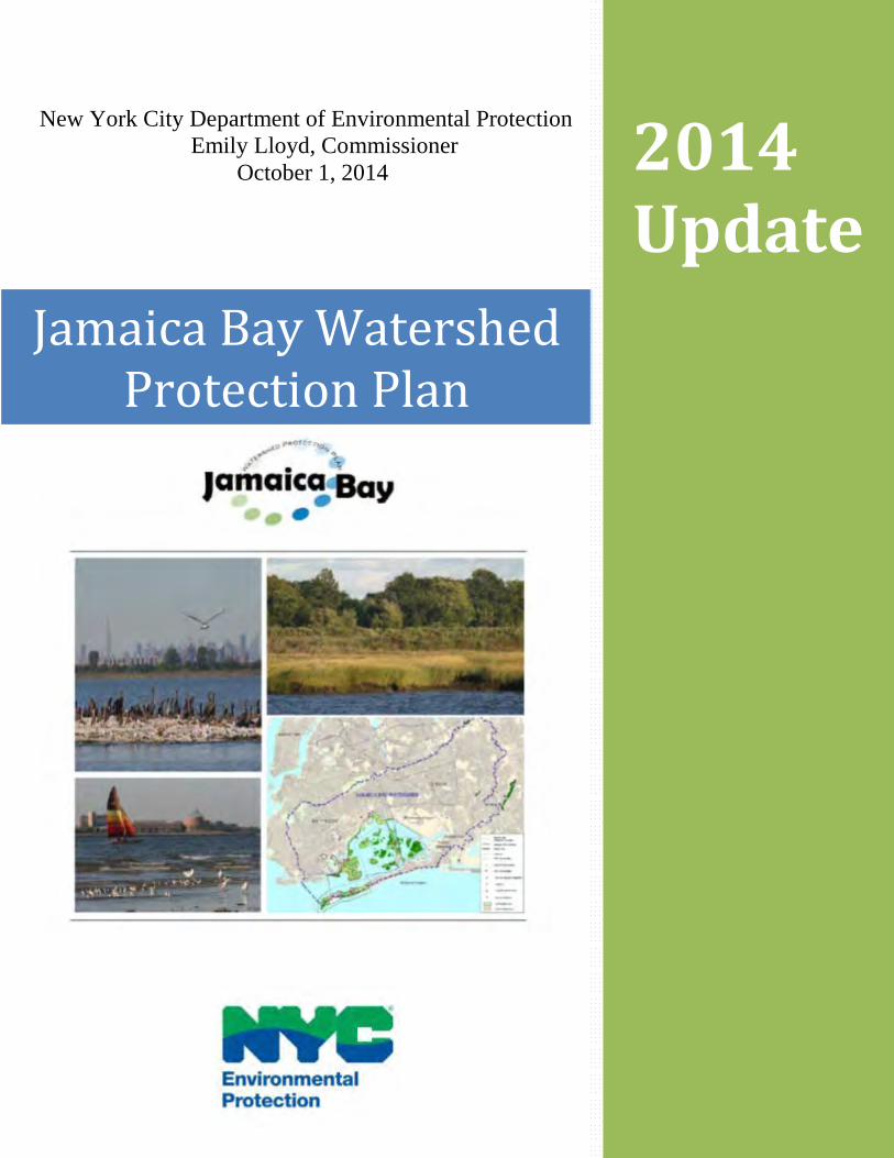
New York City Department of Environmental Protection Emily Lloyd, Commissioner
October 1, 2014
Jamaica Bay Watershed Protection Plan
2014 Update
1
Table of Contents
Introduction to Jamaica Bay 2 Local Law 71 3 Jamaica Bay Watershed Protection Plan 2014 Update 4 Ongoing Projects: Jamaica Bay Wastewater Treatment Plant Upgrades 6 Jamaica Bay Ongoing Ecosystems Improvements and Partnerships 8 Ribbed Mussel Pilot 16 Marsh Island Wave Attenuator Study 18 Paerdegat Basin Restoration 20 Belt Parkway Stormwater Control Measures 22 Long Term Control Plan (LTCP) 24 Green Infrastructure Program Implementation 26 Springfield Gardens, Baisley Pond, and Area-wide Sewer Improvements 30 Waterfront Revitalization Program (And Other Relevant Programs) 33 Community Resiliency Planning 35 Completed Projects:
Sea Lettuce (Ulva) Harvesting Pilot 38 Algal Turf Scrubber Pilot 40 Oyster (Crassotrea virginica) Bed Pilot 43 Eelgrass (Zostera mariana) Pilot 46 Ecological Atlas and Dynamic Reconnaissance Mapping of Wetlands 48 Stormwater Pilot Monitoring Program 51 Acronyms 54
References 56
2
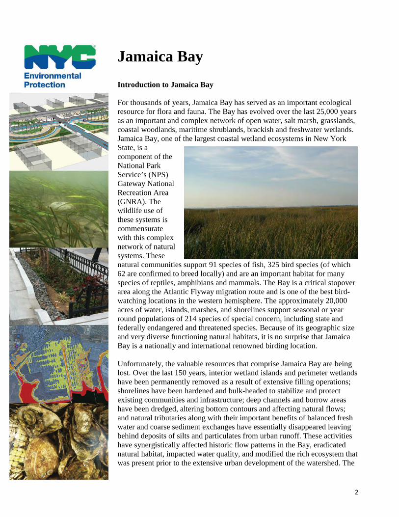
Jamaica Bay Introduction to Jamaica Bay For thousands of years, Jamaica Bay has served as an important ecological resource for flora and fauna. The Bay has evolved over the last 25,000 years as an important and complex network of open water, salt marsh, grasslands, coastal woodlands, maritime shrublands, brackish and freshwater wetlands. Jamaica Bay, one of the largest coastal wetland ecosystems in New York State, is a component of the National Park Service’s (NPS) Gateway National Recreation Area (GNRA). The wildlife use of these systems is commensurate with this complex network of natural systems. These natural communities support 91 species of fish, 325 bird species (of which 62 are confirmed to breed locally) and are an important habitat for many species of reptiles, amphibians and mammals. The Bay is a critical stopover area along the Atlantic Flyway migration route and is one of the best bird-watching locations in the western hemisphere. The approximately 20,000 acres of water, islands, marshes, and shorelines support seasonal or year round populations of 214 species of special concern, including state and federally endangered and threatened species. Because of its geographic size and very diverse functioning natural habitats, it is no surprise that Jamaica Bay is a nationally and international renowned birding location. Unfortunately, the valuable resources that comprise Jamaica Bay are being lost. Over the last 150 years, interior wetland islands and perimeter wetlands have been permanently removed as a result of extensive filling operations; shorelines have been hardened and bulk-headed to stabilize and protect existing communities and infrastructure; deep channels and borrow areas have been dredged, altering bottom contours and affecting natural flows; and natural tributaries along with their important benefits of balanced fresh water and coarse sediment exchanges have essentially disappeared leaving behind deposits of silts and particulates from urban runoff. These activities have synergistically affected historic flow patterns in the Bay, eradicated natural habitat, impacted water quality, and modified the rich ecosystem that was present prior to the extensive urban development of the watershed. The
3
more estuarine habitat that is lost within the Bay’s watershed and elsewhere in the Northeast and Mid-Atlantic regions, the more valuable the remaining habitat in Jamaica Bay becomes. Jamaica Bay retains irreplaceable value for its self-sustaining ecological functions, as well as the proximity of its assets by foot, rail and car to the urban metropolis.
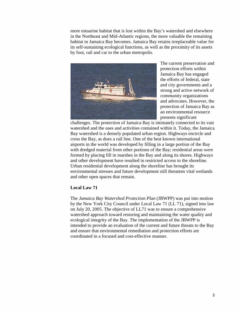
The current preservation and protection efforts within Jamaica Bay has engaged the efforts of federal, state and city governments and a strong and active network of community organizations and advocates. However, the protection of Jamaica Bay as an environmental resource presents significant
challenges. The protection of Jamaica Bay is intimately connected to its vast watershed and the uses and activities contained within it. Today, the Jamaica Bay watershed is a densely populated urban region. Highways encircle and cross the Bay, as does a rail line. One of the best known international airports in the world was developed by filling in a large portion of the Bay with dredged material from other portions of the Bay; residential areas were formed by placing fill in marshes in the Bay and along its shores. Highways and other development have resulted in restricted access to the shoreline. Urban residential development along the shoreline has brought its environmental stresses and future development still threatens vital wetlands and other open spaces that remain. Local Law 71 The Jamaica Bay Watershed Protection Plan (JBWPP) was put into motion by the New York City Council under Local Law 71 (LL 71), signed into law on July 20, 2005. The objective of LL71 was to ensure a comprehensive watershed approach toward restoring and maintaining the water quality and ecological integrity of the Bay. The implementation of the JBWPP is intended to provide an evaluation of the current and future threats to the Bay and ensure that environmental remediation and protection efforts are coordinated in a focused and cost-effective manner.
4
The JBWPP provides the vision, objectives, and potential management and implementation strategies for Jamaica Bay. These include the following six categories:
• Category 1: Water Quality Improvements
• Category 2: Restoration Ecology
• Category 3: Stormwater Management Through Sound Land Use
• Category 4: Public Education and Outreach
• Category 5: Public Use and Enjoyment
• Category 6: Coordination and Implementation Jamaica Bay Watershed Protection Plan 2014 Update The New York City Department of Environmental Protection (DEP) is pleased in proceeding with the commitments made in its 2007 Jamaica Bay Watershed Protection Plan to improve the water quality and ecological health of Jamaica Bay by reducing nitrogen discharges from the bay’s wastewater treatment plants (WWTP) and helping restore the bay’s critical ecological components.
Combined, the upgrades and work to date have drastically reduced nitrogen discharges, a by-product of the 1.3 billion gallons of wastewater produced in NYC every day. In fact, DEP has facilitated more than a 30% reduction in nitrogen discharges into Jamaica Bay since the mid-1990s, demonstrating DEP’s long-term commitment to improving water quality by investing in cutting-edge technology and the ecological restoration of New York City’s natural habitats. This work also continues to be a model of what can be achieved when the City, State, and environmental stakeholders work together to tackle complex problems, ultimately leading to more resilient, sustainable, and healthy communities and ecological systems. The JBWPP is intended to serve as a blueprint for the future management of the Bay and its watershed to achieve a shared vision for Jamaica Bay.
5
Ongoing Projects
6
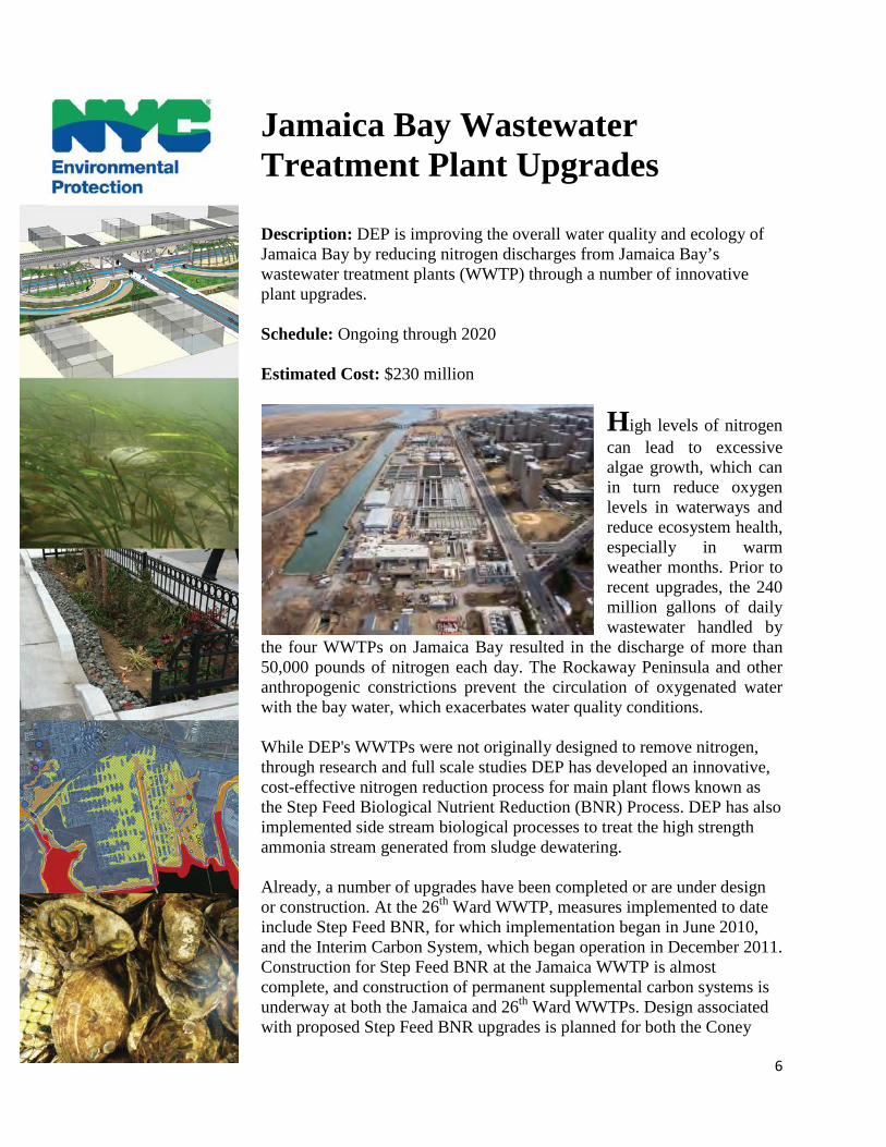
Jamaica Bay Wastewater Treatment Plant Upgrades Description: DEP is improving the overall water quality and ecology of Jamaica Bay by reducing nitrogen discharges from Jamaica Bay’s wastewater treatment plants (WWTP) through a number of innovative plant upgrades. Schedule: Ongoing through 2020 Estimated Cost: $230 million
High levels of nitrogen can lead to excessive algae growth, which can in turn reduce oxygen levels in waterways and reduce ecosystem health, especially in warm weather months. Prior to recent upgrades, the 240 million gallons of daily wastewater handled by
the four WWTPs on Jamaica Bay resulted in the discharge of more than 50,000 pounds of nitrogen each day. The Rockaway Peninsula and other anthropogenic constrictions prevent the circulation of oxygenated water with the bay water, which exacerbates water quality conditions. While DEP's WWTPs were not originally designed to remove nitrogen, through research and full scale studies DEP has developed an innovative, cost-effective nitrogen reduction process for main plant flows known as the Step Feed Biological Nutrient Reduction (BNR) Process. DEP has also implemented side stream biological processes to treat the high strength ammonia stream generated from sludge dewatering. Already, a number of upgrades have been completed or are under design or construction. At the 26th Ward WWTP, measures implemented to date include Step Feed BNR, for which implementation began in June 2010, and the Interim Carbon System, which began operation in December 2011. Construction for Step Feed BNR at the Jamaica WWTP is almost complete, and construction of permanent supplemental carbon systems is underway at both the Jamaica and 26th Ward WWTPs. Design associated with proposed Step Feed BNR upgrades is planned for both the Coney
7
Island and Rockaway WWTPs. These future investments, made in concert with $170 million the City already has spent for nitrogen control upgrades, will reduce the nitrogen loads discharged into Jamaica Bay by nearly 60 percent from baseline conditions. Upon completion of the first phase of these BNR upgrades, DEP also intends to supplement its harbor survey program with additional water quality sampling and ecological studies to assess the efficacy of these nitrogen removal techniques on water quality and ecological health. DEP has been monitoring the water quality of its harbors for over 100 years, with multiple stations in Jamaica Bay and Tributaries that track key water quality parameters such as pathogen indicator organisms, nutrients, and dissolved oxygen. Lastly, DEP continues to increase the resiliency of WWTPs through on-going capital improvements, thereby reducing the likelihood of sewage spills to the environment. DEP also has maintained and upgraded emergency protocols, drawing upon experience gained from Hurricane Sandy, which devastated the New York-New Jersey coastline with record storm surges in October 2012. The record storm surge that accompanied Hurricane Sandy submerged many of the treatment plants and their electrical equipment in seawater and degraded their ability to pump and treat wastewater. DEP crews and contractors worked around the clock, gaining significant insight into facility vulnerabilities and repair solutions as they worked to get the facilities fully operational as quickly as possible. Within four days of the devastating storm, DEP was treating more than 99 percent of the City’s wastewater and 13 of the City’s 14 WWTPs were processing 100 percent of wastewater entering the facilities. The Rockaway WWTP was the most severely damaged, but as with the other WWTPs, Rockaway was treating more than two-thirds of the wastewater entering the facility within four days of the storm. In addition to repairs at the wastewater treatment plants, DEP brought more than 40 pumping stations throughout the five boroughs back online, which helped prevent the discharge of untreated wastewater into New York waterways and prevented sewer backups.
8
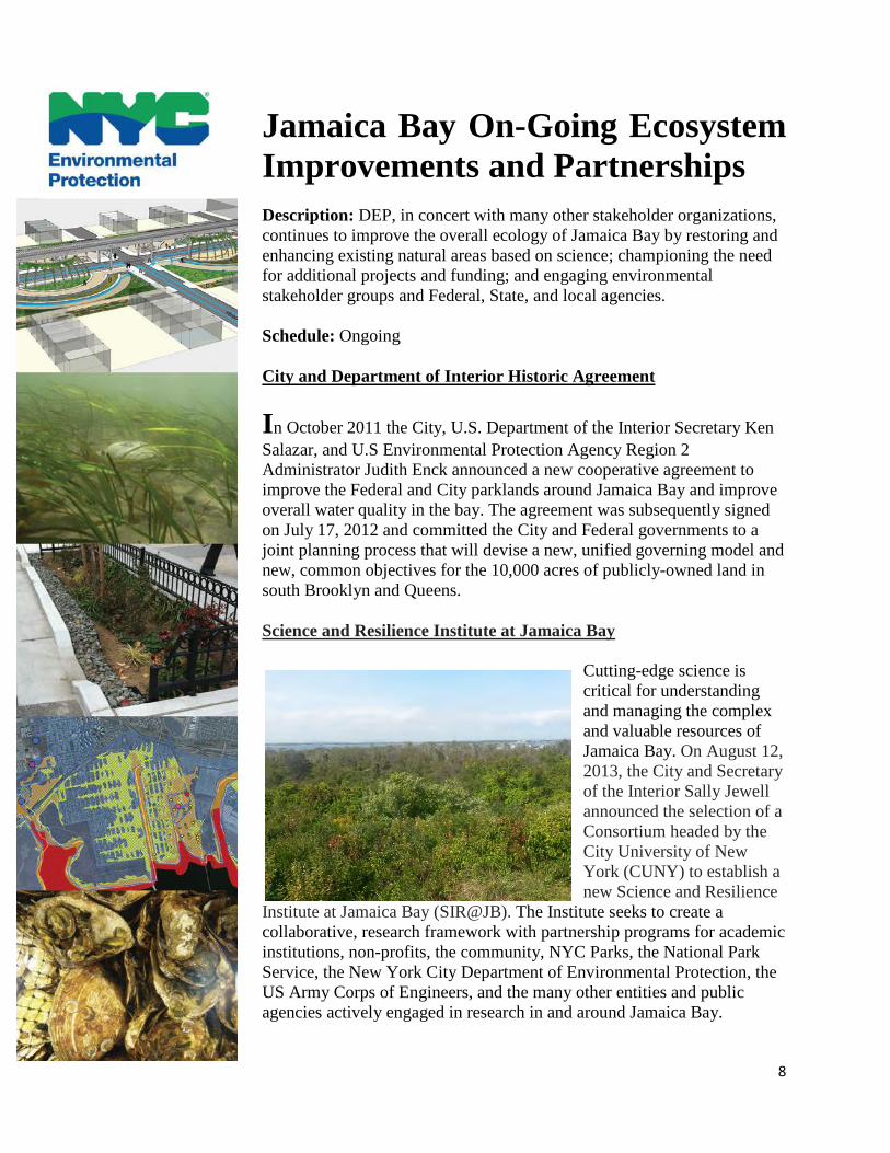
Jamaica Bay On-Going Ecosystem Improvements and Partnerships
Description: DEP, in concert with many other stakeholder organizations, continues to improve the overall ecology of Jamaica Bay by restoring and enhancing existing natural areas based on science; championing the need for additional projects and funding; and engaging environmental stakeholder groups and Federal, State, and local agencies.
Schedule: Ongoing
City and Department of Interior Historic Agreement
In October 2011 the City, U.S. Department of the Interior Secretary Ken Salazar, and U.S Environmental Protection Agency Region 2 Administrator Judith Enck announced a new cooperative agreement to improve the Federal and City parklands around Jamaica Bay and improve overall water quality in the bay. The agreement was subsequently signed on July 17, 2012 and committed the City and Federal governments to a joint planning process that will devise a new, unified governing model and new, common objectives for the 10,000 acres of publicly-owned land in south Brooklyn and Queens. Science and Resilience Institute at Jamaica Bay
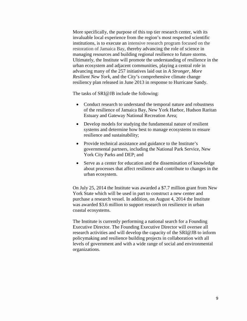
Cutting-edge science is critical for understanding and managing the complex and valuable resources of Jamaica Bay. On August 12, 2013, the City and Secretary of the Interior Sally Jewell announced the selection of a Consortium headed by the City University of New York (CUNY) to establish a new Science and Resilience
Institute at Jamaica Bay (SIR@JB). The Institute seeks to create a collaborative, research framework with partnership programs for academic institutions, non-profits, the community, NYC Parks, the National Park Service, the New York City Department of Environmental Protection, the US Army Corps of Engineers, and the many other entities and public agencies actively engaged in research in and around Jamaica Bay.
9
More specifically, the purpose of this top tier research center, with its invaluable local experience from the region’s most respected scientific institutions, is to execute an intensive research program focused on the restoration of Jamaica Bay, thereby advancing the role of science in managing resources and building regional resilience to future storms. Ultimately, the Institute will promote the understanding of resilience in the urban ecosystem and adjacent communities, playing a central role in advancing many of the 257 initiatives laid out in A Stronger, More Resilient New York, and the City’s comprehensive climate change resiliency plan released in June 2013 in response to Hurricane Sandy. The tasks of SRI@JB include the following: • Conduct research to understand the temporal nature and robustness
of the resilience of Jamaica Bay, New York Harbor, Hudson Raritan Estuary and Gateway National Recreation Area;
• Develop models for studying the fundamental nature of resilient systems and determine how best to manage ecosystems to ensure resilience and sustainability;
• Provide technical assistance and guidance to the Institute’s governmental partners, including the National Park Service, New York City Parks and DEP; and
• Serve as a center for education and the dissemination of knowledge about processes that affect resilience and contribute to changes in the urban ecosystem.
On July 25, 2014 the Institute was awarded a $7.7 million grant from New York State which will be used in part to construct a new center and purchase a research vessel. In addition, on August 4, 2014 the Institute was awarded $3.6 million to support research on resilience in urban coastal ecosystems. The Institute is currently performing a national search for a Founding Executive Director. The Founding Executive Director will oversee all research activities and will develop the capacity of the SRI@JB to inform policymaking and resilience building projects in collaboration with all levels of government and with a wide range of social and environmental organizations.
10
Photo by Jamaica Bay Conservancy
Jamaica Bay-Rockaway Parks Conservancy
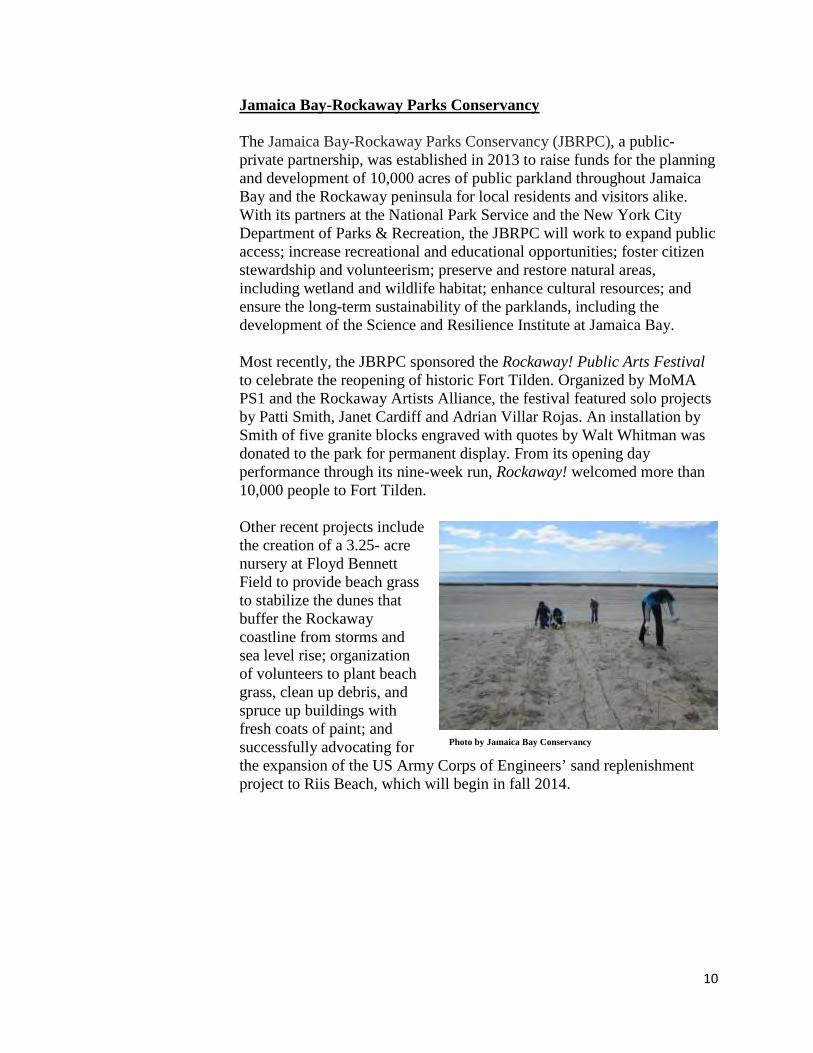
The Jamaica Bay-Rockaway Parks Conservancy (JBRPC), a public-private partnership, was established in 2013 to raise funds for the planning and development of 10,000 acres of public parkland throughout Jamaica Bay and the Rockaway peninsula for local residents and visitors alike. With its partners at the National Park Service and the New York City Department of Parks & Recreation, the JBRPC will work to expand public access; increase recreational and educational opportunities; foster citizen stewardship and volunteerism; preserve and restore natural areas, including wetland and wildlife habitat; enhance cultural resources; and ensure the long-term sustainability of the parklands, including the development of the Science and Resilience Institute at Jamaica Bay. Most recently, the JBRPC sponsored the Rockaway! Public Arts Festival to celebrate the reopening of historic Fort Tilden. Organized by MoMA PS1 and the Rockaway Artists Alliance, the festival featured solo projects by Patti Smith, Janet Cardiff and Adrian Villar Rojas. An installation by Smith of five granite blocks engraved with quotes by Walt Whitman was donated to the park for permanent display. From its opening day performance through its nine-week run, Rockaway! welcomed more than 10,000 people to Fort Tilden.
Other recent projects include the creation of a 3.25- acre nursery at Floyd Bennett Field to provide beach grass to stabilize the dunes that buffer the Rockaway coastline from storms and sea level rise; organization of volunteers to plant beach grass, clean up debris, and spruce up buildings with fresh coats of paint; and successfully advocating for the expansion of the US Army Corps of Engineers’ sand replenishment project to Riis Beach, which will begin in fall 2014.
11
Photo by USACE
Jamaica Bay No Discharge Zone Designation On October 11, 2011 the U.S. Environmental Protection Agency designated the majority of Jamaica Bay a “No Discharge Zone,” which banned boats from discharging sewage, thereby improving water quality. In addition to the mobile pump out unit operated by the New York-New Jersey Baykeeper, DEP continues to operate and maintain three boat pump out facilities on Jamaica Bay. These units, however, like many other pump out facilities throughout the region, were severely damaged by Hurricane Sandy and were taken out of service for a period of time. With assistance from the New York State Environmental Facilities Corporation, new units were purchased and installed by DEP in the summer of 2013. All pump out units were operational by July 4th, 2013, providing the area again with adequate facilities for boats to pump out their sewage. Boaters must dispose of their sewage at these specially- designated pump-out stations. Jamaica Bay Ecosystem Restoration
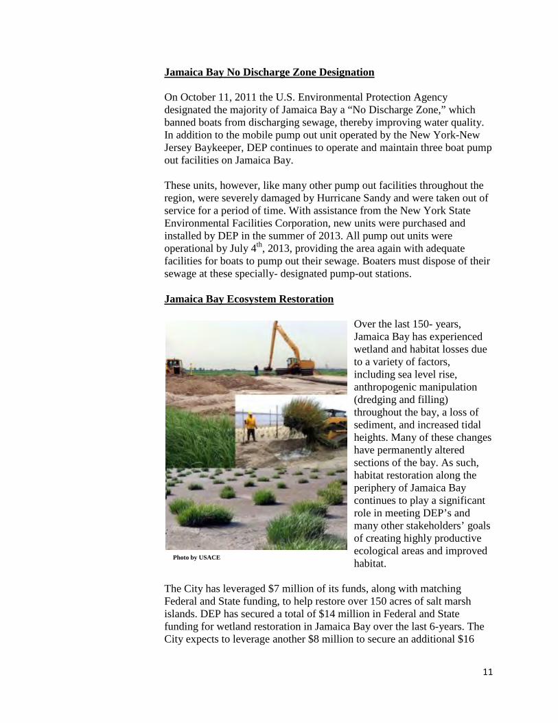
Over the last 150- years, Jamaica Bay has experienced wetland and habitat losses due to a variety of factors, including sea level rise, anthropogenic manipulation (dredging and filling) throughout the bay, a loss of sediment, and increased tidal heights. Many of these changes have permanently altered sections of the bay. As such, habitat restoration along the periphery of Jamaica Bay continues to play a significant role in meeting DEP’s and many other stakeholders’ goals of creating highly productive ecological areas and improved habitat.
The City has leveraged $7 million of its funds, along with matching Federal and State funding, to help restore over 150 acres of salt marsh islands. DEP has secured a total of $14 million in Federal and State funding for wetland restoration in Jamaica Bay over the last 6-years. The City expects to leverage another $8 million to secure an additional $16

12
Photo by NOAA
Photo by USACE
million in Federal and State funding over the next few years. A portion of the money used for these projects was from environmental benefit funds paid by the City as part of the resolution of an enforcement matter brought by the State pursuant to the First Amended Nitrogen Consent Judgment. Local communities are also taking a strong role in restoration. With funding from the New York State Department of Environmental Conservation (NYSDEC) and DEP, local non-profit organizations such as the EcoWatchers, Jamaica Bay Guardian, and the American Littoral Society completed a community planting effort to vegetate thirty new acres created at Black Wall and Rulers Bar in June 2013.
Finally, DEP and many other government agencies such as DEC, US Army Corps of Engineers (USACE), National Park Service (NPS), New York City Department of Parks and Recreation (DPR) and the Port Authority of New York and New Jersey (PANYNJ) are active participants in the science-based restoration and ecological improvements of Jamaica Bay. Recent, large
ecosystem restoration projects within Jamaica Bay continue to demonstrate the importance of multiple government agencies and private stakeholder groups for successful project implementation. These partnerships were especially invaluable during Hurricane Sandy, when relief efforts highlighted the strong underpinnings of existing collaborations between Federal, State, and local agencies, as well as local stakeholder groups. These organizations worked together following the storm to restore coastal communities and habitat in a timely and efficient manner. The U.S. Army Corps of Engineers (USACE) in particular played a large role in the bay’s restoration following Hurricane Sandy. The USACE released two reports in March 2013 and May 2013 under the Disaster Relief Appropriations Act of 2013 (the Sandy Aid Bill)
13
that identified eligible Corps of Engineers projects for Sandy Aid Bill funding. The USACE is also completing near-term coastal restoration work at previously completed coastal risk-reduction project sites throughout the northeast that were impacted by Hurricane Sandy. In the summer of 2013, two sand placement contracts were awarded by the USACE for work along Rockaway Beach to place approximately 3.5 million cubic yards of sand from Beach 19th Street to Beach 149th Street. The first contract was awarded in June 2013 for the placement of 600,000 cubic yards of sand and was completed in fall 2013. The second contract, awarded in August 2013, allows for the placement of approximately three million cubic yards of sand and began in late fall 2013. The effects of Hurricane Sandy remind us of the pressing need for greater coordination and focused cost-effective coastal protection solutions that protect lives, residences and infrastructure, and do so in an ecologically and scientifically sound manner. Even before Sandy, USACE was tasked with developing an alternative long term, cost-effective solution to address continuous erosion on area beaches. For many years the USACE routinely replenished sand on the beaches off Rockaway at a high cost. Preliminary surveys of existing conditions and concepts for alternative solutions were developed in 2011 and are currently under revision post Sandy to address increased coastal risk. The Draft Reformulation Report for the first phase of this project, Atlantic Coastline, is expected to be complete by November 2014. The Phase 2 Draft Reformulation Report (Jamaica Bay), which will address protection and restoration opportunities within Jamaica Bay, will require additional data gathering by USACE and others and is expected to be complete by November 2015. Stakeholder Coordination Through State of the Bay Symposia
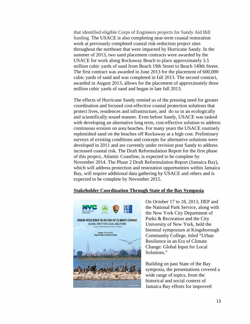
On October 17 to 18, 2013, DEP and the National Park Service, along with the New York City Department of Parks & Recreation and the City University of New York, held the biennial symposium at Kingsborough Community College, titled “Urban Resilience in an Era of Climate Change: Global Input for Local Solutions.”
Building on past State of the Bay symposia, the presentations covered a wide range of topics, from the historical and social context of Jamaica Bay efforts for improved

14
water quality (e.g. oyster restoration, algal turf scrubber) to the impacts and responses to Hurricane Sandy (e.g. update on marsh restoration, geomorphological changes). These State of the Bay symposia are part of the Jamaica Bay Watershed Protection Plan, and aim to improve the ecological integrity of Jamaica Bay through research and greater environmental awareness. These symposia provide a forum to update and inform Jamaica Bay environmental stakeholder groups, regulatory agencies, academic institutions, and interested citizens. Clean Streets/Clean Beaches
On August 12, 2012, DEP, the Department of Sanitation, and the De-partment of Parks and Recreation launched the “Clean Streets, Clean Beaches” campaign to inform citizens of how street litter can wash into the sewer system and enter local water bodies. Local students
and volunteers helped with this first of many future beach clean-up efforts. Immediately following Hurricane Sandy, DEP organized additional volunteer clean-up efforts. The number of volunteers and tally of trash bags filled and properly disposed are outlined below. Volunteer and clean-up efforts during the summers of 2013 and 2014 included the following: 2013 Clean Streets Clean Beaches • Post Sandy Clean up: 65 Participants
• Brooklyn: 394 bags of debris removed
• Queens: 77 bags of debris removed 2014 Clean Streets Clean Beaches • 60 Participants
• Brooklyn: 563 bags of debris removed
15
• Queens: 127 bags of debris removed Brooklyn Locations • Seagate Beach
• Coney Island Creek/Park
• Manhattan Beach
• Coney Island Beach (entrances to boardwalk from West 33rd Street to Stillwell Ave)
Queens Locations • Beach 40th to Beach 94th Street (between Rockaway Beach Blvd
and Boardwalk)
• Beach 19th to Beach 38th Street, Beach 6th to Beach 8th Street (between Edgemere Ave/Seagirt Ave and Boardwalk)
• Waterloo Place (Norton Drive - Bay 32nd Place) In 2013, collected debris largely consisted of post Sandy debris and floatables that continued to wash up onto area beaches. In 2014, collected debris was mostly trash; such as food containers, bottles and bags.
16
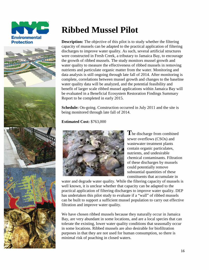
Ribbed Mussel Pilot
Description: The objective of this pilot is to study whether the filtering capacity of mussels can be adapted to the practical application of filtering discharges to improve water quality. As such, several artificial structures were constructed in Fresh Creek, a tributary to Jamaica Bay, to encourage the growth of ribbed mussels. The study monitors mussel growth and water quality to measure the effectiveness of ribbed mussels in removing nutrients and particulate organic matter from the water. Monitoring and data analysis is still ongoing through late fall of 2014. After monitoring is complete, correlations between mussel growth and changes to the baseline water quality data will be analyzed, and the potential feasibility and benefit of larger scale ribbed mussel applications within Jamaica Bay will be evaluated in a Beneficial Ecosystem Restoration Findings Summary Report to be completed in early 2015.
Schedule: On-going. Construction occurred in July 2011 and the site is being monitored through late fall of 2014.
Estimated Cost: $763,000
The discharge from combined sewer overflows (CSOs) and wastewater treatment plants contain organic particulates, nutrients, and undesirable chemical contaminants. Filtration of these discharges by mussels could potentially remove substantial quantities of these constituents that accumulate in
water and degrade water quality. While the filtering capacity of mussels is well known, it is unclear whether that capacity can be adapted to the practical application of filtering discharges to improve water quality. DEP has undertaken this pilot study to evaluate if a “wall” of ribbed mussels can be built to support a sufficient mussel population to carry out effective filtration and improve water quality.
We have chosen ribbed mussels because they naturally occur in Jamaica Bay, are very abundant in some locations, and are a local species that can tolerate the existing, lower water quality conditions that seasonally occur in some locations. Ribbed mussels are also desirable for biofiltration purposes in that they are not used for human consumption, so there is minimal risk of poaching in closed waters.
17
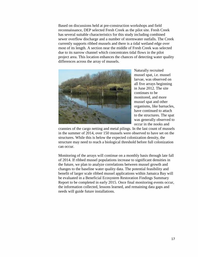
Based on discussions held at pre-construction workshops and field reconnaissance, DEP selected Fresh Creek as the pilot site. Fresh Creek has several suitable characteristics for this study including combined sewer overflow discharge and a number of stormwater outfalls. The Creek currently supports ribbed mussels and there is a tidal wetland edge over most of its length. A section near the middle of Fresh Creek was selected due to its narrow channel which concentrates tidal flows in the pilot project area. This location enhances the chances of detecting water quality differences across the array of mussels.
Naturally recruited mussel spat, i.e. mussel larvae, was observed on all five arrays beginning in June 2012. The site continues to be monitored, and more mussel spat and other organisms, like barnacles, have continued to attach to the structures. The spat was generally observed to occur in the nooks and
crannies of the cargo netting and metal pilings. In the last count of mussels in the summer of 2014, over 150 mussels were observed to have set on the structures. While this is below the expected colonization density, the structure may need to reach a biological threshold before full colonization can occur.
Monitoring of the arrays will continue on a monthly basis through late fall of 2014. If ribbed mussel populations increase to significant densities in the future, we plan to analyze correlations between mussel growth and changes to the baseline water quality data. The potential feasibility and benefit of larger scale ribbed mussel applications within Jamaica Bay will be evaluated in a Beneficial Ecosystem Restoration Findings Summary Report to be completed in early 2015. Once final monitoring events occur, the information collected, lessons learned, and remaining data gaps and needs will guide future installations.
18
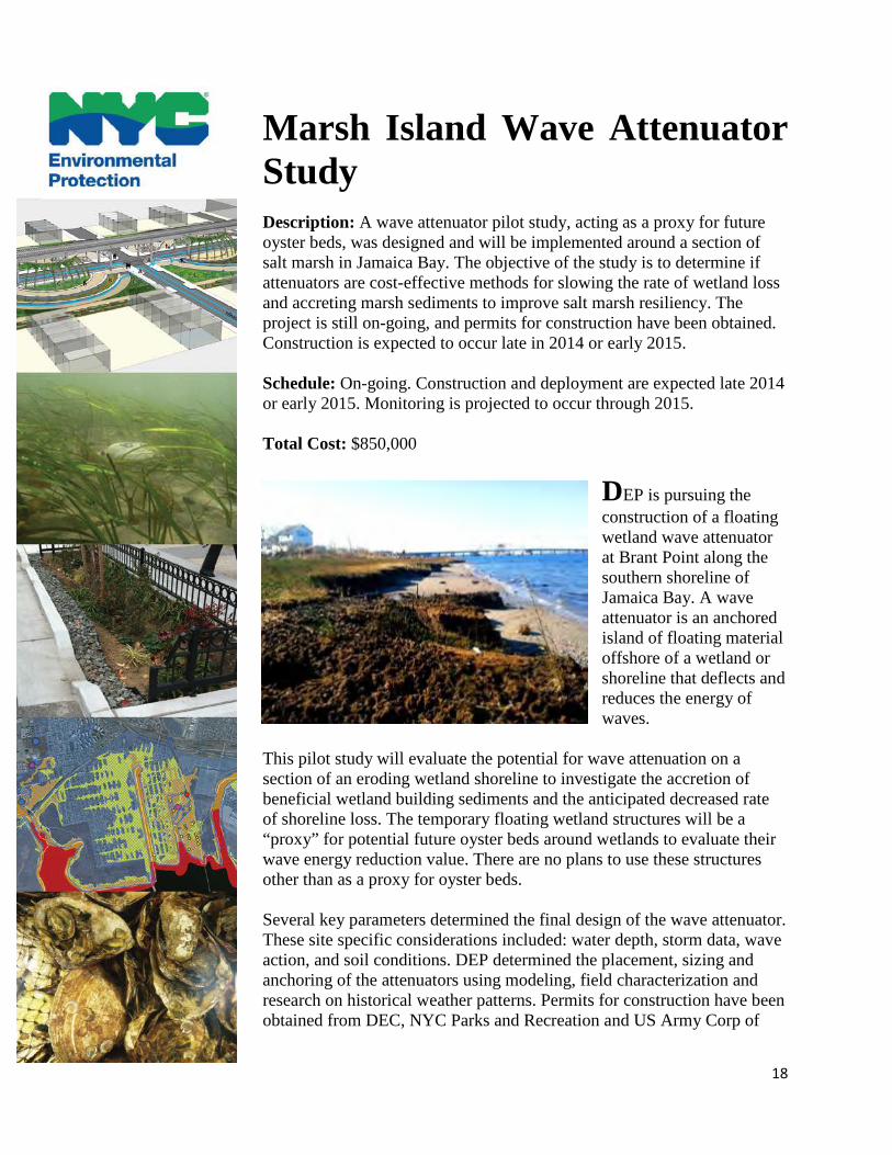
Marsh Island Wave Attenuator Study
Description: A wave attenuator pilot study, acting as a proxy for future oyster beds, was designed and will be implemented around a section of salt marsh in Jamaica Bay. The objective of the study is to determine if attenuators are cost-effective methods for slowing the rate of wetland loss and accreting marsh sediments to improve salt marsh resiliency. The project is still on-going, and permits for construction have been obtained. Construction is expected to occur late in 2014 or early 2015.
Schedule: On-going. Construction and deployment are expected late 2014 or early 2015. Monitoring is projected to occur through 2015.
Total Cost: $850,000
DEP is pursuing the construction of a floating wetland wave attenuator at Brant Point along the southern shoreline of Jamaica Bay. A wave attenuator is an anchored island of floating material offshore of a wetland or shoreline that deflects and reduces the energy of waves.
This pilot study will evaluate the potential for wave attenuation on a section of an eroding wetland shoreline to investigate the accretion of beneficial wetland building sediments and the anticipated decreased rate of shoreline loss. The temporary floating wetland structures will be a “proxy” for potential future oyster beds around wetlands to evaluate their wave energy reduction value. There are no plans to use these structures other than as a proxy for oyster beds. Several key parameters determined the final design of the wave attenuator. These site specific considerations included: water depth, storm data, wave action, and soil conditions. DEP determined the placement, sizing and anchoring of the attenuators using modeling, field characterization and research on historical weather patterns. Permits for construction have been obtained from DEC, NYC Parks and Recreation and US Army Corp of

19
Engineers. Construction is expected to occur late in 2014 or early 2015 and will be monitored through 2015. After the project is constructed and monitoring is completed, a final summary report will detail monitoring data collected at the wave attenuator and erosion and accretion data collected on-shore.
20
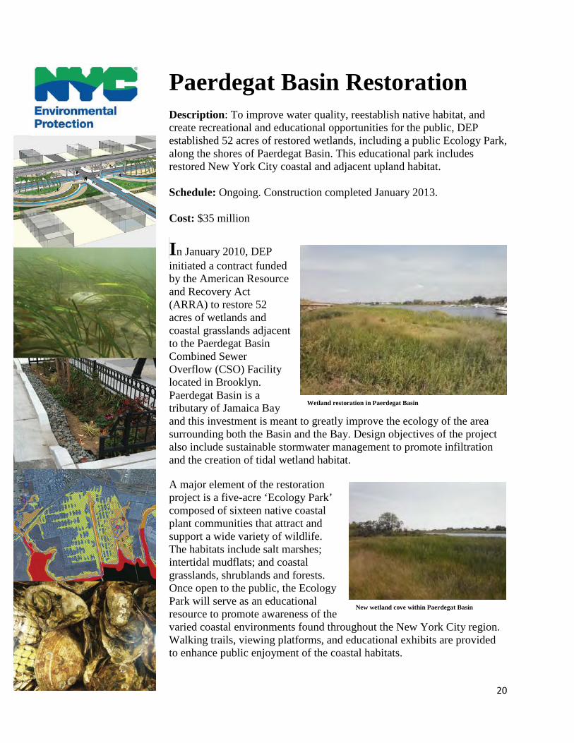
Paerdegat Basin Restoration
Description: To improve water quality, reestablish native habitat, and create recreational and educational opportunities for the public, DEP established 52 acres of restored wetlands, including a public Ecology Park, along the shores of Paerdegat Basin. This educational park includes restored New York City coastal and adjacent upland habitat. Schedule: Ongoing. Construction completed January 2013. Cost: $35 million
In January 2010, DEP initiated a contract funded by the American Resource and Recovery Act (ARRA) to restore 52 acres of wetlands and coastal grasslands adjacent to the Paerdegat Basin Combined Sewer Overflow (CSO) Facility located in Brooklyn. Paerdegat Basin is a tributary of Jamaica Bay and this investment is meant to greatly improve the ecology of the area surrounding both the Basin and the Bay. Design objectives of the project also include sustainable stormwater management to promote infiltration and the creation of tidal wetland habitat. A major element of the restoration project is a five-acre ‘Ecology Park’ composed of sixteen native coastal plant communities that attract and support a wide variety of wildlife. The habitats include salt marshes; intertidal mudflats; and coastal grasslands, shrublands and forests. Once open to the public, the Ecology Park will serve as an educational resource to promote awareness of the varied coastal environments found throughout the New York City region. Walking trails, viewing platforms, and educational exhibits are provided to enhance public enjoyment of the coastal habitats.
Wetland restoration in Paerdegat Basin
New wetland cove within Paerdegat Basin

21
Construction began in spring 2010 and was completed in January 2013. The project is currently undergoing a two-year plant guarantee and site maintenance period prior to being opened to the general public. The project is funded through Clean Water State Revolving Funds — a program administered by the New York State Environmental Facilities Corporation and authorized under ARRA. The Paerdegat restoration complements the $357 million capital investment DEP has made to build the Paerdegat Basin CSO abatement project, which stores 50 million gallons of CSOs during storms events. When too much stormwater enters the sewer system, it can trigger CSOs when sewers and treatment plants reach capacity. While this overflow mechanism protects the sewer system and treatment plants by design, degradation of water quality also occurs. CSO tanks reduce this problem by storing flows until storms pass, allowing for release and treatment of excess flows after the event. The Paerdegat CSO abatement project coupled with the Paerdegat Basin Restoration has significantly contributed to the improvement of water quality in Paerdegat Basin and the surrounding environment.
Viewing Platform and Atlantic White Cedar Swamp
22
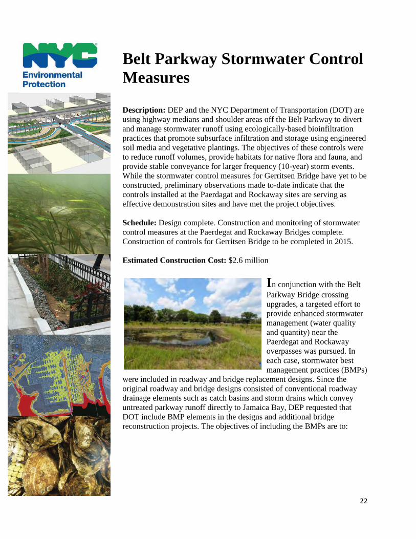
Belt Parkway Stormwater Control Measures Description: DEP and the NYC Department of Transportation (DOT) are using highway medians and shoulder areas off the Belt Parkway to divert and manage stormwater runoff using ecologically-based bioinfiltration practices that promote subsurface infiltration and storage using engineered soil media and vegetative plantings. The objectives of these controls were to reduce runoff volumes, provide habitats for native flora and fauna, and provide stable conveyance for larger frequency (10-year) storm events. While the stormwater control measures for Gerritsen Bridge have yet to be constructed, preliminary observations made to-date indicate that the controls installed at the Paerdagat and Rockaway sites are serving as effective demonstration sites and have met the project objectives.
Schedule: Design complete. Construction and monitoring of stormwater control measures at the Paerdegat and Rockaway Bridges complete. Construction of controls for Gerritsen Bridge to be completed in 2015.
Estimated Construction Cost: $2.6 million
In conjunction with the Belt Parkway Bridge crossing upgrades, a targeted effort to provide enhanced stormwater management (water quality and quantity) near the Paerdegat and Rockaway overpasses was pursued. In each case, stormwater best management practices (BMPs)
were included in roadway and bridge replacement designs. Since the original roadway and bridge designs consisted of conventional roadway drainage elements such as catch basins and storm drains which convey untreated parkway runoff directly to Jamaica Bay, DEP requested that DOT include BMP elements in the designs and additional bridge reconstruction projects. The objectives of including the BMPs are to:
23
• Provide water quality treatment (using the NYS Department of Environmental Conservation criteria) for roadway runoff using innovative approaches that include vegetative uptake and filtration, infiltration, and vegetated conveyance;
• Provide habitat for native flora and fauna;
• Serve as demonstration sites that highlight stormwater management approaches that reduce runoff volumes, reduce pollutant loads to Jamaica Bay, and limit the impacts associated with concentrating runoff; and
• Provide safe and stable conveyance for larger frequency storm event criteria (i.e. 10-year peak discharge).
The primary forms of stormwater management selected for the bridge projects were bioinfiltration swales and bioretention. Bioinfiltration swales and bioretention have been shown to effectively remove pollutants by creating conditions suitable for pollutant sedimentation, biodegradation, and vegetative uptake. Moreover, bioinfiltration swales and bioretention practices support native vegetation and increase wildlife benefits.
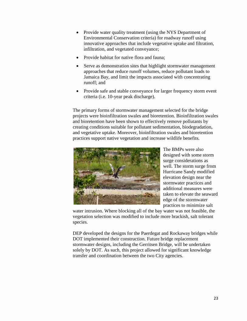
The BMPs were also designed with some storm surge considerations as well. The storm surge from Hurricane Sandy modified elevation design near the stormwater practices and additional measures were taken to elevate the seaward edge of the stormwater practices to minimize salt
water intrusion. Where blocking all of the bay water was not feasible, the vegetation selection was modified to include more brackish, salt tolerant species.
DEP developed the designs for the Paerdegat and Rockaway bridges while DOT implemented their construction. Future bridge replacement stormwater designs, including the Gerritsen Bridge, will be undertaken solely by DOT. As such, this project allowed for significant knowledge transfer and coordination between the two City agencies.
24
Long Term Control Plan (LTCP)
Description: DEP is developing and executing a detailed water quality planning and improvement process for NYC’s local waterways, as documented in ten waterbody-specific Long Term Control plans (LTCPs) and one citywide Combined Sewer Overflow (CSO) LTCP.
Schedule: The first LTCP for Alley Creek and Little Neck Bay was submitted to the NYS Department of Conservation (DEC) in June 2013. The Jamaica Bay and Tributaries LTCP is due June 2016. The citywide LTCP is due December 2017.
On March 8, 2012, DEC and DEP signed a groundbreaking agreement to reduce CSOs using a hybrid green and gray infrastructure approach. As part of this agreement, DEP was tasked with developing ten waterbody-specific LTCPs plus one citywide LTCP to reduce
CSOs and improve water quality in NYC’s waterbodies and waterways. The goal of each LTCP is to identify appropriate CSO controls necessary to achieve waterbody-specific water quality standards that are consistent with the Federal CSO Policy and the water quality goals of the Clean Water Act (CWA). Each LTCP:
• Assesses the feasibility of attaining current water quality standards, the next highest standards, and fishable/swimmable standards;
• Builds off of Waterbody/Watershed Facility Plans (the first phase of the planning process);
• Requires robust, targeted public participation and feedback processes; and
• Identifies a grey-green balance of CSO management solutions for different watersheds.
On June 26, 2012 DEP co-hosted a Citywide Public Kickoff Meeting and Open House to initiate the water quality planning processes for the LTCPs. The Citywide Public Kickoff Meeting and Open House was the first of many opportunities for public participation as part of the LTCP development process. DEP has supported multiple public meetings since,
25
and information from these meetings is posted on DEP’s LTCP Program website (www.nyc.gov/dep). DEP will use feedback from the public to continue to improve the Public Participation Plan throughout the planning process.
The Jamica Bay and Tributaries LTCP is due in June 2016. Consistent with the goals and activities listed in the LTCP Public Participation Plan, DEP will reach out to and include the Jamaica Bay Task Force and other Jamaica Bay stakeholders to encourage diverse stakeholder input on water quality-dependent uses of Jamaica Bay and Tributaries. Stakeholders will also provide input regarding alterantive solutions proposed and evaluated during the Jamaica Bay and Tributaries LTCP development process, beginning in July 2015.
26
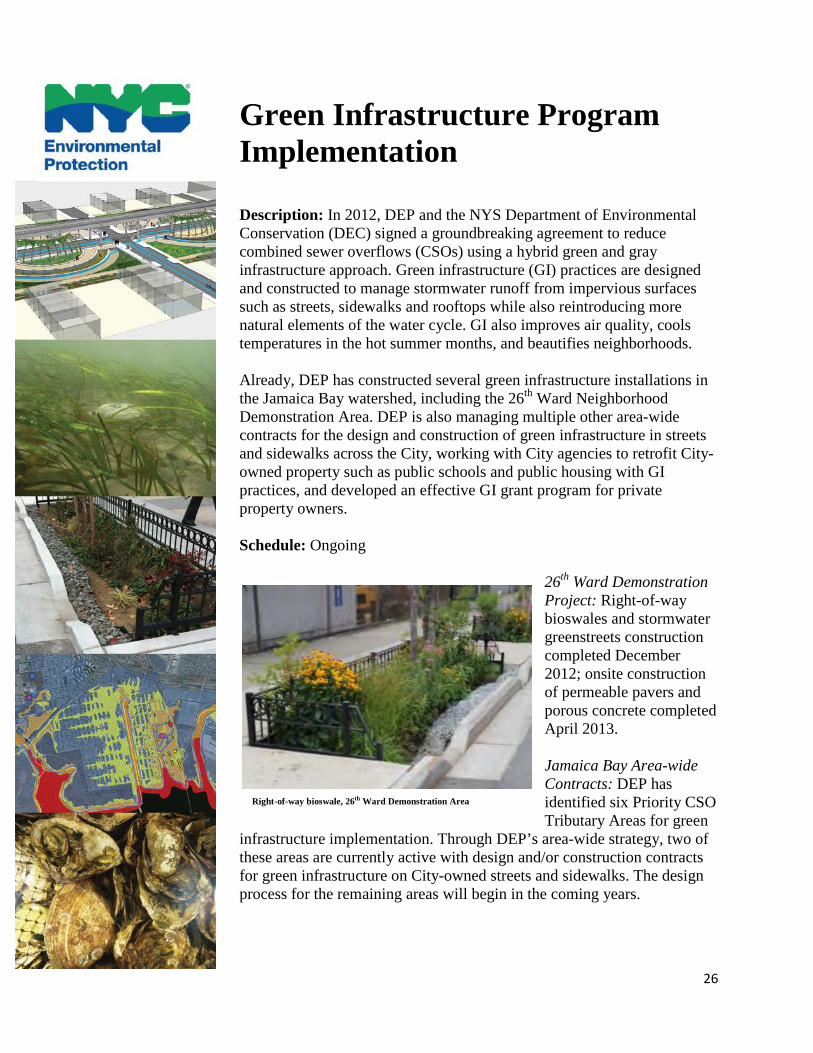
Green Infrastructure Program Implementation Description: In 2012, DEP and the NYS Department of Environmental Conservation (DEC) signed a groundbreaking agreement to reduce combined sewer overflows (CSOs) using a hybrid green and gray infrastructure approach. Green infrastructure (GI) practices are designed and constructed to manage stormwater runoff from impervious surfaces such as streets, sidewalks and rooftops while also reintroducing more natural elements of the water cycle. GI also improves air quality, cools temperatures in the hot summer months, and beautifies neighborhoods. Already, DEP has constructed several green infrastructure installations in the Jamaica Bay watershed, including the 26th Ward Neighborhood Demonstration Area. DEP is also managing multiple other area-wide contracts for the design and construction of green infrastructure in streets and sidewalks across the City, working with City agencies to retrofit City-owned property such as public schools and public housing with GI practices, and developed an effective GI grant program for private property owners.
Schedule: Ongoing
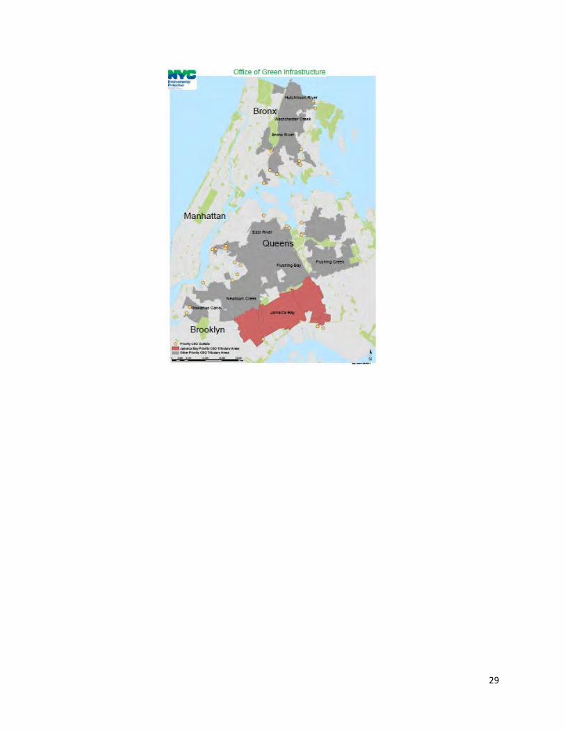
26th Ward Demonstration Project: Right-of-way bioswales and stormwater greenstreets construction completed December 2012; onsite construction of permeable pavers and porous concrete completed April 2013. Jamaica Bay Area-wide Contracts: DEP has identified six Priority CSO Tributary Areas for green
infrastructure implementation. Through DEP’s area-wide strategy, two of these areas are currently active with design and/or construction contracts for green infrastructure on City-owned streets and sidewalks. The design process for the remaining areas will begin in the coming years.
Right-of-way bioswale, 26th Ward Demonstration Area
27
Long-Term Control Plan: DEP will develop a Long Term Control Plan (LTCP) for Jamaica Bay to identify appropriate CSO controls necessary (including green infrastructure) to achieve waterbody-specific water quality standards consistent with the Federal CSO Policy and the water quality goals of the Clean Water Act (CWA). The LTCP process is scheduled to begin in September 2015 and is due June 2016. Cost Estimate: In total DEP plans to spend approximately $1.5 billion for green infrastructure implementation in the combined sewer areas of the City by 2030.
DEP’s mission is to protect public health and the environment, and does so partly through its Green Infrastructure Program. This initiative aims to reduce CSOs by managing stormwater runoff with green infrastructure. Since the signing of the 2012 CSO Order on Consent (the ‘Consent Order’), DEP has significantly scaled up green infrastructure planning and implementation. Specific elements of the Consent Order related to GI include:
• An adaptive management approach based on post-construction
monitoring, modeling and reporting (quarterly, annually, and for five-year implementation periods);
• Management of one inch of stormwater runoff from ten percent of impervious surfaces in combined sewer areas citywide by 2030;
• GI demonstration projects in three priority CSO tributary areas: 26th Ward, Hutchinson River, and Newtown Creek; and
• An expanded NYC GI EBP 1 Grant Program for funding GI on private property.
In accordance with the Consent Order, DEP built three GI demonstration projects within a total of 63 acres of tributary area in the Newtown Creek (EBP funded) Hutchinson River (EBP funded) and Jamaica Bay watersheds. DEP monitored these practices to study the benefits of green infrastructure on a neighborhood scale. Pre-construction monitoring for all three demonstration projects started in fall 2011, and post-construction monitoring continued throughout 2013. The demonstration projects were documented in DEP’s Post-Construction Monitoring Report in August 2014. These results will also be incorporated into the 2016 Performance Metrics Report, which will model CSO reductions from implementation of green infrastructure projects. These efforts will continue to inform DEP’s adaptive management approach to GI implementation, and will also inform the CSO LTCP process.
28
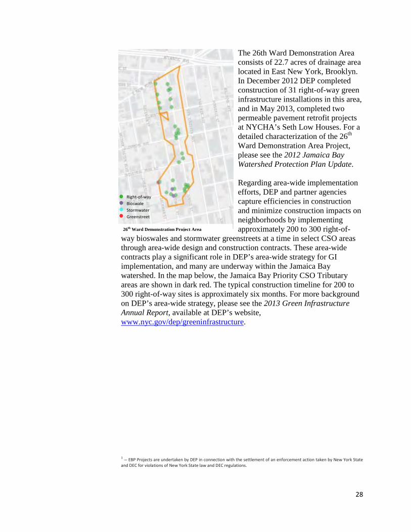
The 26th Ward Demonstration Area consists of 22.7 acres of drainage area located in East New York, Brooklyn. In December 2012 DEP completed construction of 31 right-of-way green infrastructure installations in this area, and in May 2013, completed two permeable pavement retrofit projects at NYCHA’s Seth Low Houses. For a detailed characterization of the 26th Ward Demonstration Area Project, please see the 2012 Jamaica Bay Watershed Protection Plan Update.
Regarding area-wide implementation efforts, DEP and partner agencies capture efficiencies in construction and minimize construction impacts on neighborhoods by implementing approximately 200 to 300 right-of-
way bioswales and stormwater greenstreets at a time in select CSO areas through area-wide design and construction contracts. These area-wide contracts play a significant role in DEP’s area-wide strategy for GI implementation, and many are underway within the Jamaica Bay watershed. In the map below, the Jamaica Bay Priority CSO Tributary areas are shown in dark red. The typical construction timeline for 200 to 300 right-of-way sites is approximately six months. For more background on DEP’s area-wide strategy, please see the 2013 Green Infrastructure Annual Report, available at DEP’s website, www.nyc.gov/dep/greeninfrastructure. 1 – EBP Projects are undertaken by DEP in connection with the settlement of an enforcement action taken by New York State and DEC for violations of New York State law and DEC regulations.
Right-of-way Bioswale Stormwater Greenstreet
26th Ward Demonstration Project Area
29
30
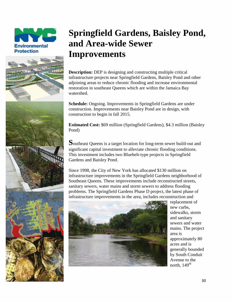
Springfield Gardens, Baisley Pond, and Area-wide Sewer Improvements Description: DEP is designing and constructing multiple critical infrastructure projects near Springfield Gardens, Baisley Pond and other adjoining areas to reduce chronic flooding and increase environmental restoration in southeast Queens which are within the Jamaica Bay watershed. Schedule: Ongoing. Improvements in Springfield Gardens are under construction. Improvements near Baisley Pond are in design, with construction to begin in fall 2015. Estimated Cost: $69 million (Springfield Gardens), $4.3 million (Baisley Pond)
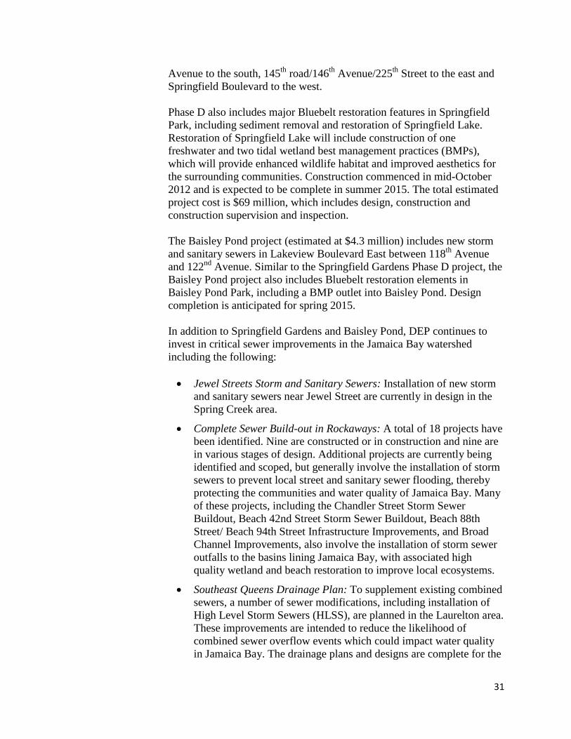
Southeast Queens is a target location for long-term sewer build-out and significant capital investment to alleviate chronic flooding conditions. This investment includes two Bluebelt-type projects in Springfield Gardens and Baisley Pond. Since 1998, the City of New York has allocated $130 million on infrastructure improvements in the Springfield Gardens neighborhood of Southeast Queens. These improvements include reconstructed streets, sanitary sewers, water mains and storm sewers to address flooding problems. The Springfield Gardens Phase D project, the latest phase of infrastructure improvements in the area, includes reconstruction and
replacement of new curbs, sidewalks, storm and sanitary sewers and water mains. The project area is approximately 80 acres and is generally bounded by South Conduit Avenue to the north, 149th
31
Avenue to the south, 145th road/146th Avenue/225th Street to the east and Springfield Boulevard to the west. Phase D also includes major Bluebelt restoration features in Springfield Park, including sediment removal and restoration of Springfield Lake. Restoration of Springfield Lake will include construction of one freshwater and two tidal wetland best management practices (BMPs), which will provide enhanced wildlife habitat and improved aesthetics for the surrounding communities. Construction commenced in mid-October 2012 and is expected to be complete in summer 2015. The total estimated project cost is $69 million, which includes design, construction and construction supervision and inspection. The Baisley Pond project (estimated at $4.3 million) includes new storm and sanitary sewers in Lakeview Boulevard East between 118th Avenue and 122nd Avenue. Similar to the Springfield Gardens Phase D project, the Baisley Pond project also includes Bluebelt restoration elements in Baisley Pond Park, including a BMP outlet into Baisley Pond. Design completion is anticipated for spring 2015. In addition to Springfield Gardens and Baisley Pond, DEP continues to invest in critical sewer improvements in the Jamaica Bay watershed including the following: • Jewel Streets Storm and Sanitary Sewers: Installation of new storm
and sanitary sewers near Jewel Street are currently in design in the Spring Creek area.
• Complete Sewer Build-out in Rockaways: A total of 18 projects have been identified. Nine are constructed or in construction and nine are in various stages of design. Additional projects are currently being identified and scoped, but generally involve the installation of storm sewers to prevent local street and sanitary sewer flooding, thereby protecting the communities and water quality of Jamaica Bay. Many of these projects, including the Chandler Street Storm Sewer Buildout, Beach 42nd Street Storm Sewer Buildout, Beach 88th Street/ Beach 94th Street Infrastructure Improvements, and Broad Channel Improvements, also involve the installation of storm sewer outfalls to the basins lining Jamaica Bay, with associated high quality wetland and beach restoration to improve local ecosystems.
• Southeast Queens Drainage Plan: To supplement existing combined sewers, a number of sewer modifications, including installation of High Level Storm Sewers (HLSS), are planned in the Laurelton area. These improvements are intended to reduce the likelihood of combined sewer overflow events which could impact water quality in Jamaica Bay. The drainage plans and designs are complete for the
32
Brookville Triangle and Twin Ponds storm sewer and outfall projects, which also include restoration of wetland habitat at the project sites. The Twin Ponds project also involves expansion of a bridge culvert at 147th Avenue to reduce local street flooding. Construction at Twin Ponds has recently commenced. DEP is currently identifying additional storm sewer projects for design and construction.
• Edgemere Wetland Restoration: The Edgemere Reconstruction of Urban Renewal Area, Phase C2 involves the design and implementation of a variety of coastal wetland habitats and removal of invasive species along the coast of Far Rockaway. The design phase is complete.
• Fresh Creek Storm and Sanitary Sewers: This project involves the construction of a new High Level Storm Sewer (HLSS) and outfall, replacing existing combined and sanitary sewers the 26th Ward District neighborhood of Brooklyn. The project is currently in design phase and is expected to reduce combined sewer overflows to Jamaica Bay.
33
Waterfront Revitalization Program (and other Relevant Programs) Description: Through a comprehensive and cooperative effort, several city agencies and stakeholders are creating a blueprint for the future of the city's waterfront.
Schedule: Ongoing. Vision 2020: The New York City Comprehensive Waterfront Plan and the New York City Waterfront Action Agenda were completed in early 2011. In December 2013, the City issued its final progress report on the 125 initiatives in the Waterfront Action Agenda. 21 initiatives still have ongoing work.
In May 2013, the City released Best Practices for Promoting Safe Public Access to Human-Powered Boating, a planning tool for property owners and site managers to use when selecting new public access sites for human-powered boating (e.g., kayaking and canoeing). The document provides considerations for existing site conditions in terms of parameters such as water quality, management, harbor traffic, security, and site access, and also suggested best practices to promote public health and safety. In October 2013, the City Council approved a series of revisions to the Waterfront Revitalization Program (WRP) proposed by the Department of City Planning to advance the long-term goals laid out in Vision 2020. The changes will solidify New York City’s leadership in the area of sustainability and climate resilience planning as one of the first major cities in the U.S. to incorporate climate change considerations into its Coastal Zone Management Program. The changes will also promote a range of ecological objectives and strategies; facilitate interagency review of permitting to preserve and enhance maritime infrastructure; and support a thriving, sustainable working waterfront. The revisions to the WRP are currently pending State and Federal approval in order to go in to effect. In total, 93 projects—75 percent of all projects in the Waterfront Action Agenda—have been completed, and another 21 (17 percent) are on schedule for completion. Waterfront Action Agenda accomplishments include more than 150 acres of new parks and open space, 20 miles of waterfront esplanades, 160 acres of natural areas restored, 7 new kayak launches, and substantial investments in wastewater treatment and

34
stormwater management to enhance the public experience and ecological productivity of the waterfront. Implementation of the Waterfront Action Agenda was tracked by the Waterfront Management Advisory Board, an advisory body which was reconstituted by the City Council in 2009 “on matters relating to the industrial, commercial, residential, recreational or other use or development of wharves, waterfront property and waterfront infrastructure throughout the City.” Moving forward, the Waterfront Management Advisory Board will continue to provide an important forum for cooperation among City, State, federal, and civic partners to advance shared goals and initiatives for the optimal balance of waterfront uses. For additional information, please visit: http://www.nycedc.com/project/waterfront-vision-and-enhancement-strategy
35
Community Resiliency Planning Description: Following Hurricane Sandy, several initiatives were undertaken or expanded upon at the City, State, and Federal level to advance coastal resiliency in New York City. Of particular note, the City established a resiliency plan, PlaNYC: A Stronger, More Resilient New York. It includes more than 250 initiatives under the two umbrellas of “Community Rebuilding and Resiliency Plans” and “Citywide Infrastructure and the Built Environment.” Implementation is being coordinated by the Mayor's Office of Recovery and Resiliency. Schedule: Hurricane Sandy occurred in October of 2012. Since then, PlaNYC: A Stronger, More Resilient New York was released June 2013 and the NYC Wastewater Resiliency Plan was released October 2013. Other rebuilding efforts and initiatives are still being implemented.
To help rebuild communities following Hurricane Sandy and reduce the risk of future damage to coastal infrastructure, DEP and the City continue to build upon efforts to evaluate and implement community resiliency initiatives across the City and in Jamaica Bay. These activities directly support the preparedness of communities for future surges and protect infrastructure to prevent potential ecological damage which may result from severe waves and impaired wastewater treatment systems. Of particular note, following Hurricane Sandy, the Mayor’s Office produced PaNYC: A Stronger, More Resilient New York, which outlines more than 250 resiliency initiatives. The initiative which commits the City to hardening its wastewater treatment plants and pumping stations is especially important for protecting the water quality of Jamaica Bay. DEP’s NYC Wastewater Resiliency Plan, released October 2013, and presents the logistics of a plan to do just this. The report details a comprehensive assessment of wastewater facilities at risk from future storms along with potential damage costs and suggested cost-effective and robust measures to protect critical equipment and reduce flood risk. The result of this study is a portfolio of strategies that are shovel-ready for implementation as part of other planned capital projects. DEP and the City are also looking beyond just resilient wastewater systems to entire coastal communities. Following Sandy, the City leveraged assistance from the New York Rising Community Reconstruction Program. This program was established by the State to provide additional rebuilding and revitalization assistance to communities severely damaged by Hurricane Sandy, Hurricane Irene, and Tropical Storm Lee. Each NY Rising Plan was locally driven by a Planning
36
Committee that assessed storm damages and current risk, identified community needs and opportunities, and developed recovery and resiliency strategies. Each NY Rising Plan identified projects and implementation actions to help fulfill those strategies. The Jamaica Bay Watershed has 11 of the City’s 15 NY Rising Communities. NY Rising Target Communities within the Jamaica Bay Watershed:
• Breezy Point • Broad Channel • Canarsie • Gerritsen Beach and Sheepshead Bay • Gravesend and Bensonhurst • Howard Beach • Idlewild Watershed Communities • Jamaica Bay Regional Working Group • Rockaway East • Rockaway West • Southeast Brooklyn Waterfront • Southern Brooklyn Peninsula
Other creative solutions were explored through the U.S. Department of Housing and Urban Development’s Rebuild by Design, a regional design competition that brought interdisciplinary teams from planning, design, and engineering to develop blueprints for how communities can maximize resiliency as they rebuild and recover from major disasters. While not selected for funding, a proposal for Jamaica Bay was among ten finalists. For additional information on these programs or more resiliency information, please visit: http://www.nyc.gov/resiliency http://www.nyc.gov/dep/climatechange http://stormrecovery.ny.gov/community-reconstruction-program http://www.rebuildbydesign.org http://www.nan.usace.army.mil/About/Hurricane_Sandy.aspx
37
Completed Projects
38
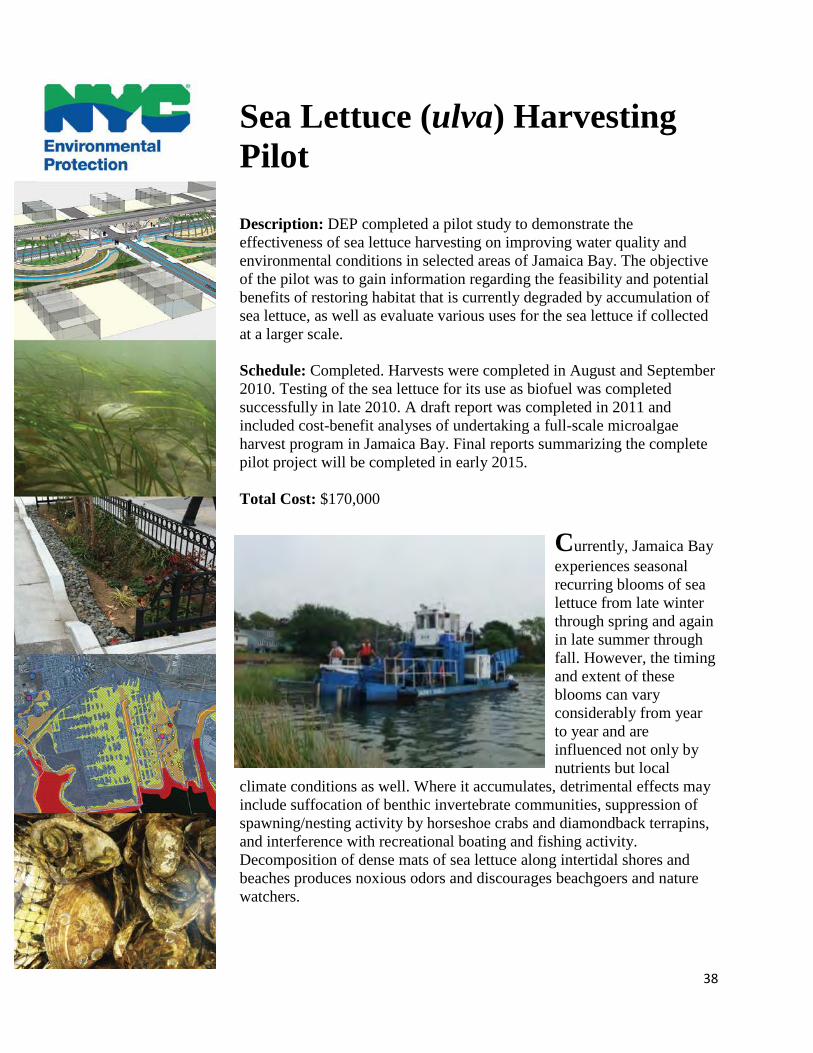
Sea Lettuce (ulva) Harvesting Pilot Description: DEP completed a pilot study to demonstrate the effectiveness of sea lettuce harvesting on improving water quality and environmental conditions in selected areas of Jamaica Bay. The objective of the pilot was to gain information regarding the feasibility and potential benefits of restoring habitat that is currently degraded by accumulation of sea lettuce, as well as evaluate various uses for the sea lettuce if collected at a larger scale.
Schedule: Completed. Harvests were completed in August and September 2010. Testing of the sea lettuce for its use as biofuel was completed successfully in late 2010. A draft report was completed in 2011 and included cost-benefit analyses of undertaking a full-scale microalgae harvest program in Jamaica Bay. Final reports summarizing the complete pilot project will be completed in early 2015.
Total Cost: $170,000
Currently, Jamaica Bay experiences seasonal recurring blooms of sea lettuce from late winter through spring and again in late summer through fall. However, the timing and extent of these blooms can vary considerably from year to year and are influenced not only by nutrients but local
climate conditions as well. Where it accumulates, detrimental effects may include suffocation of benthic invertebrate communities, suppression of spawning/nesting activity by horseshoe crabs and diamondback terrapins, and interference with recreational boating and fishing activity. Decomposition of dense mats of sea lettuce along intertidal shores and beaches produces noxious odors and discourages beachgoers and nature watchers.
39
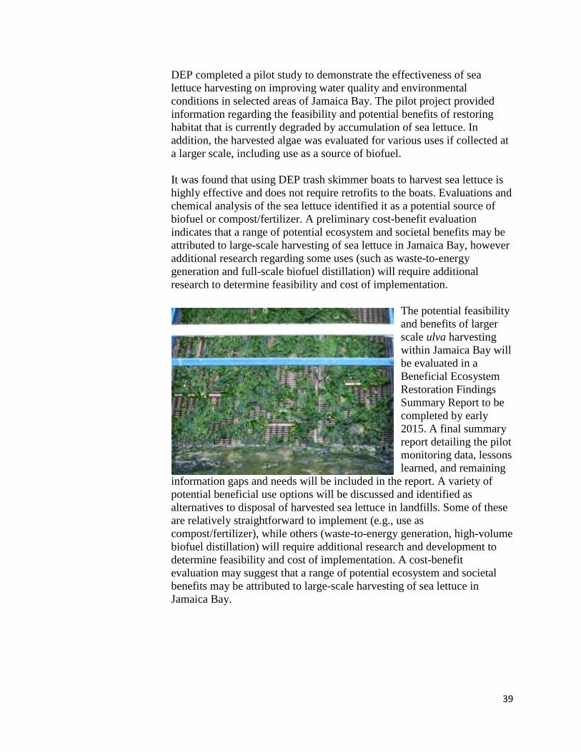
DEP completed a pilot study to demonstrate the effectiveness of sea lettuce harvesting on improving water quality and environmental conditions in selected areas of Jamaica Bay. The pilot project provided information regarding the feasibility and potential benefits of restoring habitat that is currently degraded by accumulation of sea lettuce. In addition, the harvested algae was evaluated for various uses if collected at a larger scale, including use as a source of biofuel. It was found that using DEP trash skimmer boats to harvest sea lettuce is highly effective and does not require retrofits to the boats. Evaluations and chemical analysis of the sea lettuce identified it as a potential source of biofuel or compost/fertilizer. A preliminary cost-benefit evaluation indicates that a range of potential ecosystem and societal benefits may be attributed to large-scale harvesting of sea lettuce in Jamaica Bay, however additional research regarding some uses (such as waste-to-energy generation and full-scale biofuel distillation) will require additional research to determine feasibility and cost of implementation.
The potential feasibility and benefits of larger scale ulva harvesting within Jamaica Bay will be evaluated in a Beneficial Ecosystem Restoration Findings Summary Report to be completed by early 2015. A final summary report detailing the pilot monitoring data, lessons learned, and remaining
information gaps and needs will be included in the report. A variety of potential beneficial use options will be discussed and identified as alternatives to disposal of harvested sea lettuce in landfills. Some of these are relatively straightforward to implement (e.g., use as compost/fertilizer), while others (waste-to-energy generation, high-volume biofuel distillation) will require additional research and development to determine feasibility and cost of implementation. A cost-benefit evaluation may suggest that a range of potential ecosystem and societal benefits may be attributed to large-scale harvesting of sea lettuce in Jamaica Bay.
40
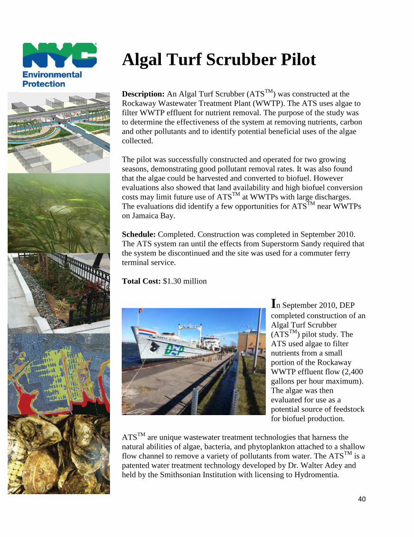
Algal Turf Scrubber Pilot Description: An Algal Turf Scrubber (ATSTM) was constructed at the Rockaway Wastewater Treatment Plant (WWTP). The ATS uses algae to filter WWTP effluent for nutrient removal. The purpose of the study was to determine the effectiveness of the system at removing nutrients, carbon and other pollutants and to identify potential beneficial uses of the algae collected. The pilot was successfully constructed and operated for two growing seasons, demonstrating good pollutant removal rates. It was also found that the algae could be harvested and converted to biofuel. However evaluations also showed that land availability and high biofuel conversion costs may limit future use of ATSTM at WWTPs with large discharges. The evaluations did identify a few opportunities for ATSTM near WWTPs on Jamaica Bay.
Schedule: Completed. Construction was completed in September 2010. The ATS system ran until the effects from Superstorm Sandy required that the system be discontinued and the site was used for a commuter ferry terminal service. Total Cost: $1.30 million
In September 2010, DEP completed construction of an Algal Turf Scrubber (ATSTM) pilot study. The ATS used algae to filter nutrients from a small portion of the Rockaway WWTP effluent flow (2,400 gallons per hour maximum). The algae was then evaluated for use as a potential source of feedstock for biofuel production.
ATSTM are unique wastewater treatment technologies that harness the natural abilities of algae, bacteria, and phytoplankton attached to a shallow flow channel to remove a variety of pollutants from water. The ATSTM is a patented water treatment technology developed by Dr. Walter Adey and held by the Smithsonian Institution with licensing to Hydromentia.
41
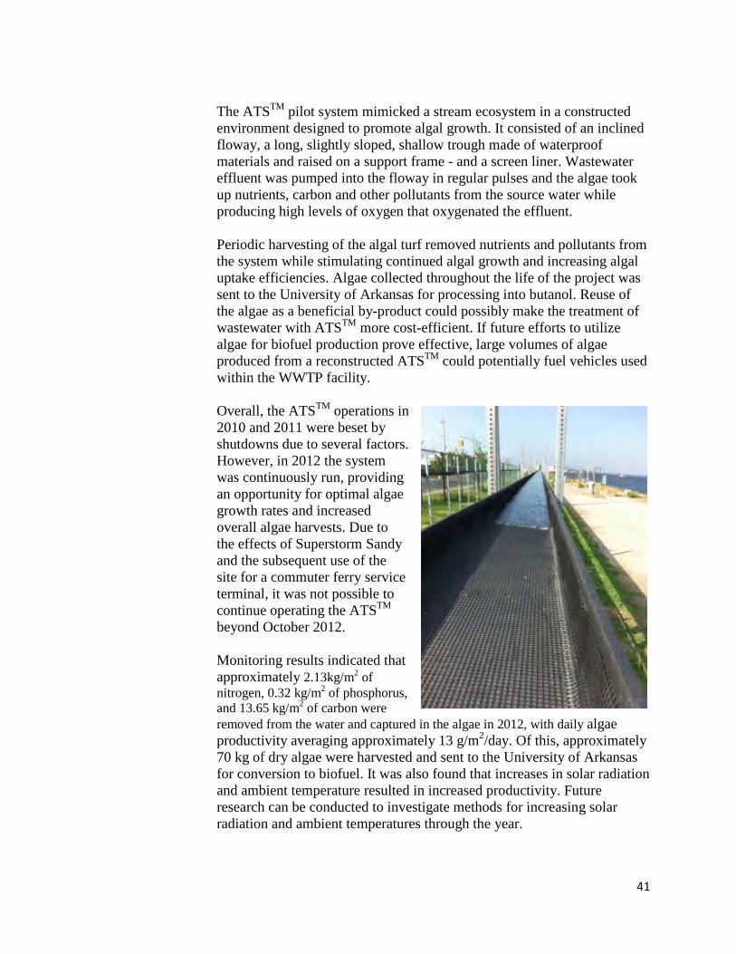
The ATSTM pilot system mimicked a stream ecosystem in a constructed environment designed to promote algal growth. It consisted of an inclined floway, a long, slightly sloped, shallow trough made of waterproof materials and raised on a support frame - and a screen liner. Wastewater effluent was pumped into the floway in regular pulses and the algae took up nutrients, carbon and other pollutants from the source water while producing high levels of oxygen that oxygenated the effluent.
Periodic harvesting of the algal turf removed nutrients and pollutants from the system while stimulating continued algal growth and increasing algal uptake efficiencies. Algae collected throughout the life of the project was sent to the University of Arkansas for processing into butanol. Reuse of the algae as a beneficial by-product could possibly make the treatment of wastewater with ATSTM more cost-efficient. If future efforts to utilize algae for biofuel production prove effective, large volumes of algae produced from a reconstructed ATSTM could potentially fuel vehicles used within the WWTP facility.
Overall, the ATSTM operations in 2010 and 2011 were beset by shutdowns due to several factors. However, in 2012 the system was continuously run, providing an opportunity for optimal algae growth rates and increased overall algae harvests. Due to the effects of Superstorm Sandy and the subsequent use of the site for a commuter ferry service terminal, it was not possible to continue operating the ATSTM beyond October 2012.
Monitoring results indicated that approximately 2.13kg/m2 of nitrogen, 0.32 kg/m2 of phosphorus, and 13.65 kg/m2 of carbon were removed from the water and captured in the algae in 2012, with daily algae productivity averaging approximately 13 g/m2/day. Of this, approximately 70 kg of dry algae were harvested and sent to the University of Arkansas for conversion to biofuel. It was also found that increases in solar radiation and ambient temperature resulted in increased productivity. Future research can be conducted to investigate methods for increasing solar radiation and ambient temperatures through the year.
42
The study found that land availability is one of the primary factors limiting the future use of ATSTM at WWTPs with large discharges, although preliminary evaluations did identify a few opportunities near WWTPs on Jamaica Bay. The potential feasibility and benefits of larger scale ATS applications within Jamaica Bay will be evaluated in a Beneficial Ecosystem Restoration Findings Summary Report to be completed by early 2015. A final summary report detailing the ATS pilot monitoring data, lessons learned, and remaining information gaps will be included in the report.
43
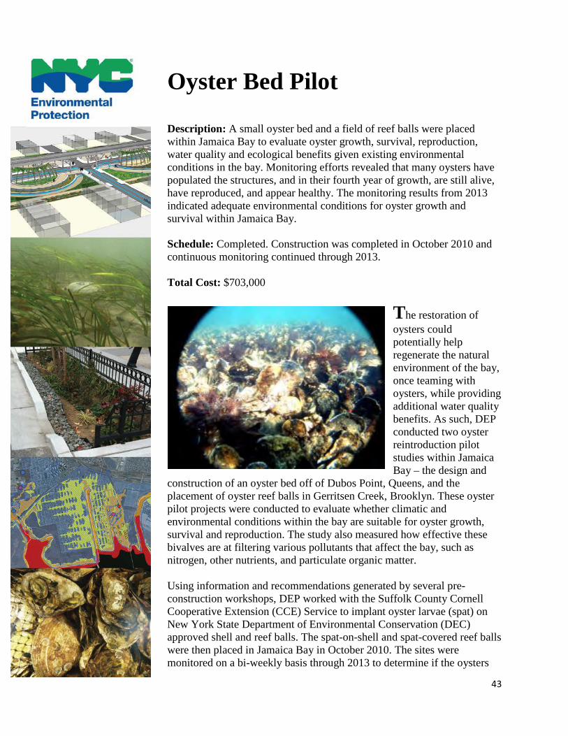
Oyster Bed Pilot Description: A small oyster bed and a field of reef balls were placed within Jamaica Bay to evaluate oyster growth, survival, reproduction, water quality and ecological benefits given existing environmental conditions in the bay. Monitoring efforts revealed that many oysters have populated the structures, and in their fourth year of growth, are still alive, have reproduced, and appear healthy. The monitoring results from 2013 indicated adequate environmental conditions for oyster growth and survival within Jamaica Bay. Schedule: Completed. Construction was completed in October 2010 and continuous monitoring continued through 2013. Total Cost: $703,000
The restoration of oysters could potentially help regenerate the natural environment of the bay, once teaming with oysters, while providing additional water quality benefits. As such, DEP conducted two oyster reintroduction pilot studies within Jamaica Bay – the design and
construction of an oyster bed off of Dubos Point, Queens, and the placement of oyster reef balls in Gerritsen Creek, Brooklyn. These oyster pilot projects were conducted to evaluate whether climatic and environmental conditions within the bay are suitable for oyster growth, survival and reproduction. The study also measured how effective these bivalves are at filtering various pollutants that affect the bay, such as nitrogen, other nutrients, and particulate organic matter.
Using information and recommendations generated by several pre-construction workshops, DEP worked with the Suffolk County Cornell Cooperative Extension (CCE) Service to implant oyster larvae (spat) on New York State Department of Environmental Conservation (DEC) approved shell and reef balls. The spat-on-shell and spat-covered reef balls were then placed in Jamaica Bay in October 2010. The sites were monitored on a bi-weekly basis through 2013 to determine if the oysters
44
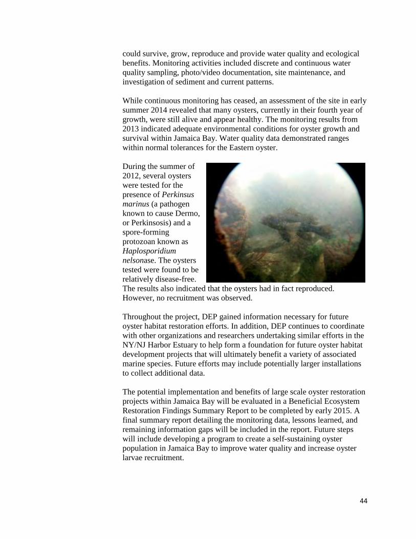
could survive, grow, reproduce and provide water quality and ecological benefits. Monitoring activities included discrete and continuous water quality sampling, photo/video documentation, site maintenance, and investigation of sediment and current patterns. While continuous monitoring has ceased, an assessment of the site in early summer 2014 revealed that many oysters, currently in their fourth year of growth, were still alive and appear healthy. The monitoring results from 2013 indicated adequate environmental conditions for oyster growth and survival within Jamaica Bay. Water quality data demonstrated ranges within normal tolerances for the Eastern oyster. During the summer of 2012, several oysters were tested for the presence of Perkinsus marinus (a pathogen known to cause Dermo, or Perkinsosis) and a spore-forming protozoan known as Haplosporidium nelsonase. The oysters tested were found to be relatively disease-free. The results also indicated that the oysters had in fact reproduced. However, no recruitment was observed. Throughout the project, DEP gained information necessary for future oyster habitat restoration efforts. In addition, DEP continues to coordinate with other organizations and researchers undertaking similar efforts in the NY/NJ Harbor Estuary to help form a foundation for future oyster habitat development projects that will ultimately benefit a variety of associated marine species. Future efforts may include potentially larger installations to collect additional data. The potential implementation and benefits of large scale oyster restoration projects within Jamaica Bay will be evaluated in a Beneficial Ecosystem Restoration Findings Summary Report to be completed by early 2015. A final summary report detailing the monitoring data, lessons learned, and remaining information gaps will be included in the report. Future steps will include developing a program to create a self-sustaining oyster population in Jamaica Bay to improve water quality and increase oyster larvae recruitment.

45
In addition, DEP recently received $1 million in funding from the Sandy Resiliency Grant program to scale up the oyster application to approximately 0.5-acres in size. This work is expected to begin design in late 2014 with installation anticipated for spring 2015. Partners include the New York Harbor School, the Cornell Cooperative Extension, and the Hudson River Foundation.
46
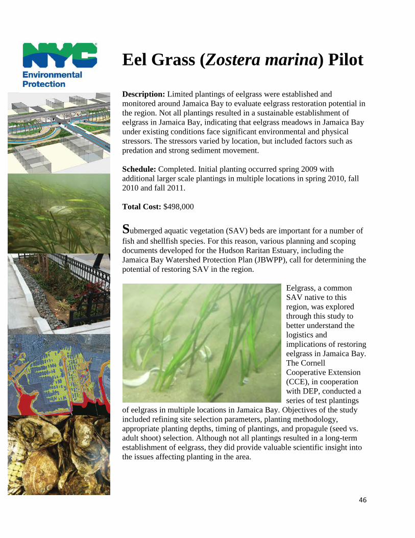
Eel Grass (Zostera marina) Pilot Description: Limited plantings of eelgrass were established and monitored around Jamaica Bay to evaluate eelgrass restoration potential in the region. Not all plantings resulted in a sustainable establishment of eelgrass in Jamaica Bay, indicating that eelgrass meadows in Jamaica Bay under existing conditions face significant environmental and physical stressors. The stressors varied by location, but included factors such as predation and strong sediment movement.
Schedule: Completed. Initial planting occurred spring 2009 with additional larger scale plantings in multiple locations in spring 2010, fall 2010 and fall 2011. Total Cost: $498,000
Submerged aquatic vegetation (SAV) beds are important for a number of fish and shellfish species. For this reason, various planning and scoping documents developed for the Hudson Raritan Estuary, including the Jamaica Bay Watershed Protection Plan (JBWPP), call for determining the potential of restoring SAV in the region.
Eelgrass, a common SAV native to this region, was explored through this study to better understand the logistics and implications of restoring eelgrass in Jamaica Bay. The Cornell Cooperative Extension (CCE), in cooperation with DEP, conducted a series of test plantings
of eelgrass in multiple locations in Jamaica Bay. Objectives of the study included refining site selection parameters, planting methodology, appropriate planting depths, timing of plantings, and propagule (seed vs. adult shoot) selection. Although not all plantings resulted in a long-term establishment of eelgrass, they did provide valuable scientific insight into the issues affecting planting in the area.
47
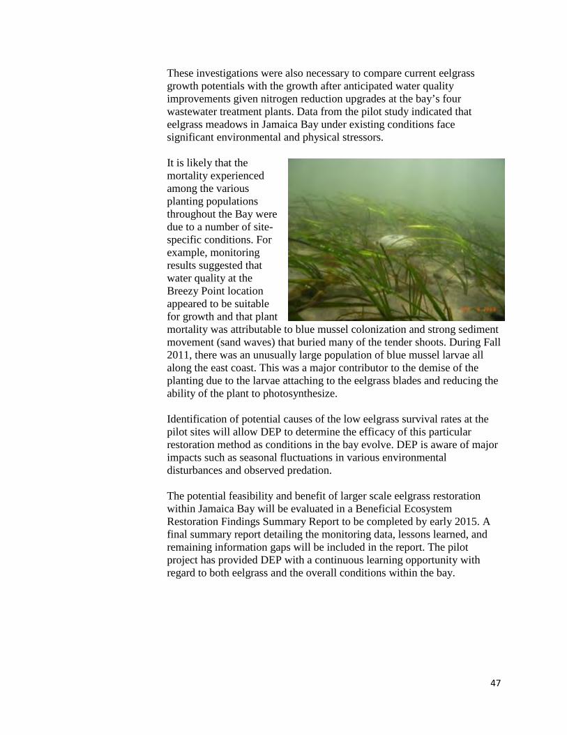
These investigations were also necessary to compare current eelgrass growth potentials with the growth after anticipated water quality improvements given nitrogen reduction upgrades at the bay’s four wastewater treatment plants. Data from the pilot study indicated that eelgrass meadows in Jamaica Bay under existing conditions face significant environmental and physical stressors. It is likely that the mortality experienced among the various planting populations throughout the Bay were due to a number of site-specific conditions. For example, monitoring results suggested that water quality at the Breezy Point location appeared to be suitable for growth and that plant mortality was attributable to blue mussel colonization and strong sediment movement (sand waves) that buried many of the tender shoots. During Fall 2011, there was an unusually large population of blue mussel larvae all along the east coast. This was a major contributor to the demise of the planting due to the larvae attaching to the eelgrass blades and reducing the ability of the plant to photosynthesize. Identification of potential causes of the low eelgrass survival rates at the pilot sites will allow DEP to determine the efficacy of this particular restoration method as conditions in the bay evolve. DEP is aware of major impacts such as seasonal fluctuations in various environmental disturbances and observed predation.
The potential feasibility and benefit of larger scale eelgrass restoration within Jamaica Bay will be evaluated in a Beneficial Ecosystem Restoration Findings Summary Report to be completed by early 2015. A final summary report detailing the monitoring data, lessons learned, and remaining information gaps will be included in the report. The pilot project has provided DEP with a continuous learning opportunity with regard to both eelgrass and the overall conditions within the bay.
48
Ecological Atlas and Dynamic Reconnaissance Mapping of Wetlands Description: DEP used existing sources of information along with newly captured satellite imagery and fieldwork to develop a GIS-based Jamaica Bay Watershed Ecological Atlas. Schedule: Completed Total Cost: $607,000 Ecological Atlas and $187,000 for Wetland Mapping Ecological Atlas
Building on the completed Jamaica Bay Watershed Protection Plan (JBWPP), DEP developed a Jamaica Bay Watershed Ecological Atlas. We developed an inventory of existing City-owned block and lot data, field verified the information, collected additional information about existing ecological and stormwater characteristics, and developed and prioritized potential ecological and stormwater restoration opportunities.
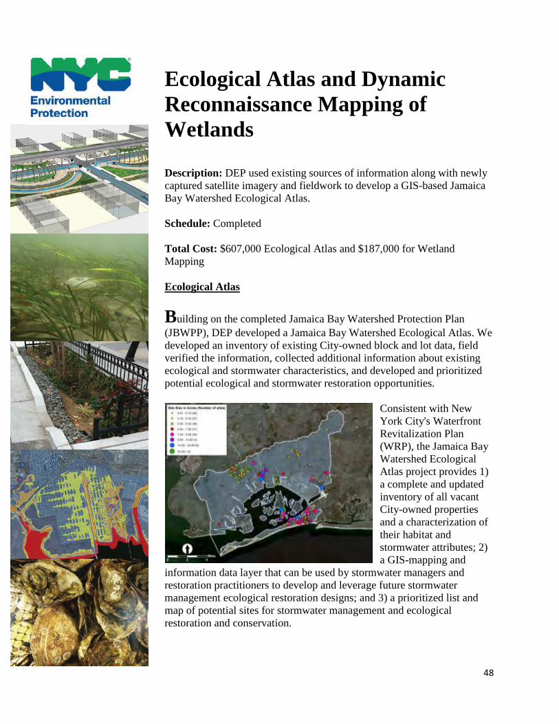
Consistent with New York City's Waterfront Revitalization Plan (WRP), the Jamaica Bay Watershed Ecological Atlas project provides 1) a complete and updated inventory of all vacant City-owned properties and a characterization of their habitat and stormwater attributes; 2) a GIS-mapping and
information data layer that can be used by stormwater managers and restoration practitioners to develop and leverage future stormwater management ecological restoration designs; and 3) a prioritized list and map of potential sites for stormwater management and ecological restoration and conservation.
49
The restoration and conservation actions enabled by this project provide critical benefits for plant and animal species and will be integrated with urban stormwater runoff management practices to benefit comprehensive ecological improvements for the Jamaica Bay watershed. Geographic information system (GIS) data shapefiles of the Ecological Atlas will be available on DEP’s website in late fall 2014. Wetland Mapping and New York City Wetlands Strategy
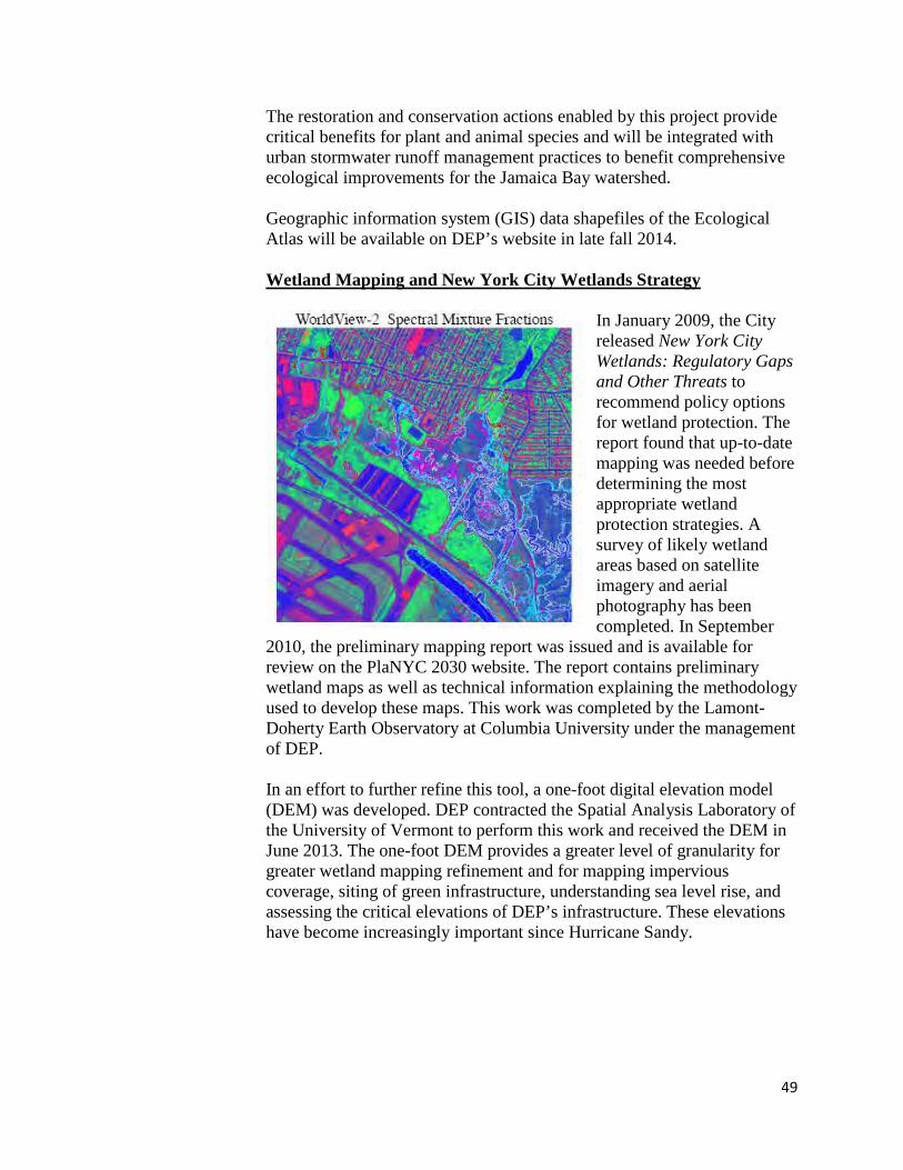
In January 2009, the City released New York City Wetlands: Regulatory Gaps and Other Threats to recommend policy options for wetland protection. The report found that up-to-date mapping was needed before determining the most appropriate wetland protection strategies. A survey of likely wetland areas based on satellite imagery and aerial photography has been completed. In September
2010, the preliminary mapping report was issued and is available for review on the PlaNYC 2030 website. The report contains preliminary wetland maps as well as technical information explaining the methodology used to develop these maps. This work was completed by the Lamont-Doherty Earth Observatory at Columbia University under the management of DEP. In an effort to further refine this tool, a one-foot digital elevation model (DEM) was developed. DEP contracted the Spatial Analysis Laboratory of the University of Vermont to perform this work and received the DEM in June 2013. The one-foot DEM provides a greater level of granularity for greater wetland mapping refinement and for mapping impervious coverage, siting of green infrastructure, understanding sea level rise, and assessing the critical elevations of DEP’s infrastructure. These elevations have become increasingly important since Hurricane Sandy.
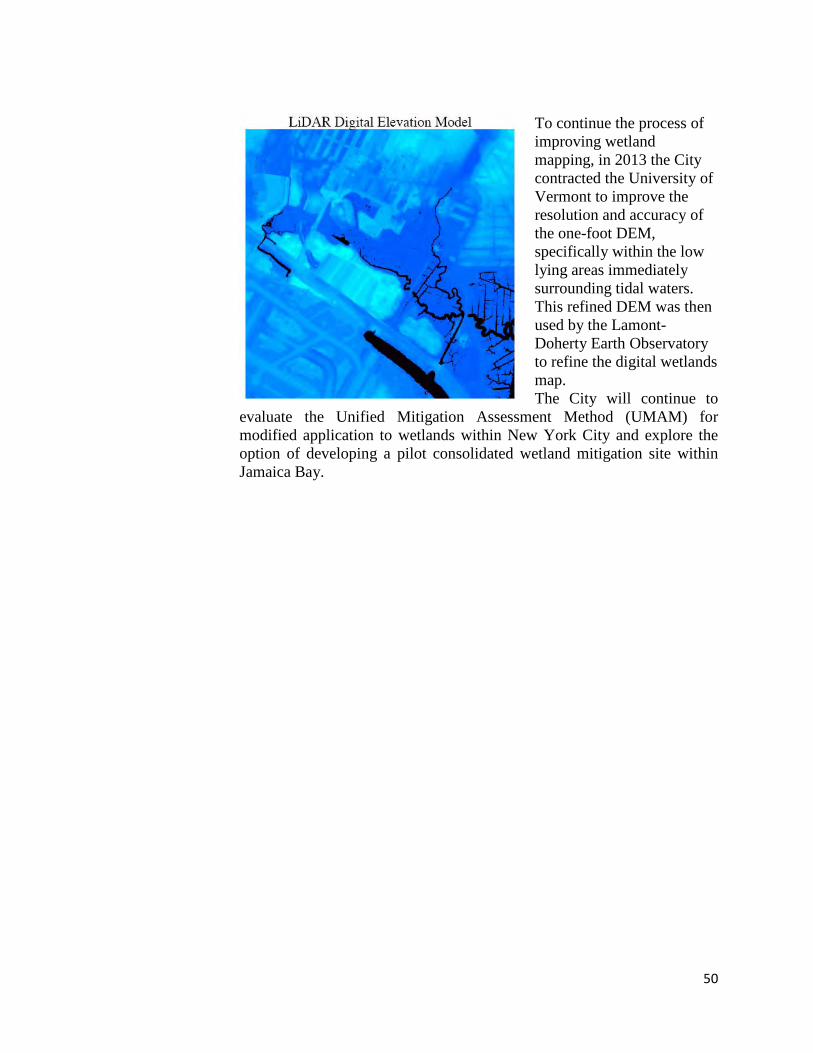
50
To continue the process of improving wetland mapping, in 2013 the City contracted the University of Vermont to improve the resolution and accuracy of the one-foot DEM, specifically within the low lying areas immediately surrounding tidal waters. This refined DEM was then used by the Lamont-Doherty Earth Observatory to refine the digital wetlands map. The City will continue to
evaluate the Unified Mitigation Assessment Method (UMAM) for modified application to wetlands within New York City and explore the option of developing a pilot consolidated wetland mitigation site within Jamaica Bay.
51
Stormwater Pilot Monitoring Program Description: Through a comprehensive monitoring program, DEP evaluated the performance of stormwater pilots constructed in the Jamaica Bay watersheds. Parameters such as storm hydrology and hydraulics, water quality, maintenance and additional green infrastructure benefits were monitored. Schedule: Completed Cost Estimate: $3.05 million
In 2010 and 2011, several stormwater pilots were constructed in the Jamaica Bay watershed and surveyed through a comprehensive monitoring program. The purpose of the monitoring effort was to evaluate the effectiveness of various green infrastructure practices at managing a 1-inch rainfall event and provide data that would allow DEP to extrapolate the runoff reduction benefits on a larger scale. Results have been summarized in the following reports, which are available on DEP’s website: • NYC Green Infrastructure Plan: 2011 Preliminary Pilot Monitoring Results;
• NYC Green Infrastructure Plan: 2012 Green Infrastructure Pilot Monitoring Report; and
• NYC Green Infrastructure 2011, 2012 and 2013 Annual Reports. http://www.nyc.gov/html/dep/pdf/green_infrastructure
The following summarizes each pilot type constructed in the Jamaica Bay watershed 2. The pilots included enhanced tree pits, street-side infiltration swales, bioretention, a wet meadow, a blue roof and a green roof.
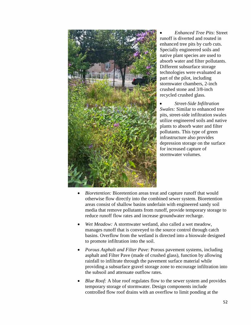
52
• Enhanced Tree Pits: Street runoff is diverted and routed in enhanced tree pits by curb cuts. Specially engineered soils and native plant species are used to absorb water and filter pollutants. Different subsurface storage technologies were evaluated as part of the pilot, including stormwater chambers, 2-inch crushed stone and 3/8-inch recycled crushed glass.
• Street-Side Infiltration Swales: Similar to enhanced tree pits, street-side infiltration swales utilize engineered soils and native plants to absorb water and filter pollutants. This type of green infrastructure also provides depression storage on the surface for increased capture of stormwater volumes.
• Bioretention: Bioretention areas treat and capture runoff that would otherwise flow directly into the combined sewer system. Bioretention areas consist of shallow basins underlain with engineered sandy soil media that remove pollutants from runoff, provide temporary storage to reduce runoff flow rates and increase groundwater recharge.
• Wet Meadow: A stormwater wetland, also called a wet meadow, manages runoff that is conveyed to the source control through catch basins. Overflow from the wetland is directed into a bioswale designed to promote infiltration into the soil.
• Porous Asphalt and Filter Pave: Porous pavement systems, including asphalt and Filter Pave (made of crushed glass), function by allowing rainfall to infiltrate through the pavement surface material while providing a subsurface gravel storage zone to encourage infiltration into the subsoil and attenuate outflow rates.
• Blue Roof: A blue roof regulates flow to the sewer system and provides temporary storage of stormwater. Design components include controlled flow roof drains with an overflow to limit ponding at the

53
drain to two inches and intermediate check dams to address roof slope and distribute ponding across the roof surface.
• Green Roof: Green roofs consist of a vegetative layer that grows in a specially-designed soil and sits on top of a drainage layer. On a green roof, water drains from the roof to existing drains at existing slopes. Design features include a root barrier to protect the roof membrane from root penetration, a drainage mat to facilitate flow of excess water in the soil to the roof drain, and a 4-inch depth growing media to support plants.
While all of the GI pilot installations continue to function and provide reductions in runoff, monitoring has concluded for all of the pilot GI installations as the data indicated consistent results from year to year. The goal is to resume monitoring in several years and assess any changes in stormwater management efficiency. The results of these pilot GI installations have provided DEP with valuable information that guided design and more widespread installation of GI throughout priority combined sewer overflow tributary areas of the City, including a large effort to design and construct right-of-way bioswales within the 26th Ward WWTP drainage area. These GI pilot data will also supply DEP with useful information on how such controls could prove useful in reducing runoff and pollutant concentrations in municipal separate storm sewer systems (MS4). 2 – EBP Projects are undertaken by DEP in connection with the settlement of an enforcement action taken by New York State and DEC for violations of New York State law and DEC regulations. .
54
Acronyms
AMR Automated Meter Reading ARRA American Recovery and Reinvestment Act ATS Algal Turf Scrubbers BMP Best Management Practice CB Community Board CEQR City Environmental Quality Review CFS Cubic Feet per Second CRP Comprehensive Restoration Plan CSO Combined Sewer Overflow DCP New York City Department of City Planning DDC New York City Department of Design & Construction DEC New York State Department of Environmental Conservation DEP New York City Department of Environmental Protection DO Dissolved Oxygen DOB New York City Department of Buildings DOE New York City Department of Education DOI United States Department of the Interior DOT New York City Department of Transportation DPR New York City Department of Parks & Recreation DRM Dynamic Reconnaissance Mapping EBP Environmental Benefit Fund EDC New York City Economic Development Corporation EPA United States Environmental Protection Agency FY Fiscal Year GIS Geographic Information System GNRA Gateway National Recreation Area GPS Geographic Positioning System HEP Harbor Estuary Program HPD New York City Department of Housing Preservation & Department HRE Hudson-Raritan Estuary Comprehensive Restoration Plan JBRPC Jamaica Bay-Rockaway Parks Conservancy JBWPP Jamaica Bay Watershed Protection Plan SRI@JB Science and Resilience Institute at Jamaica Bay LTCP Long Term Control Plan MGD Million Gallons per Day MTA New York City Metropolitan Transit Authority NOI Notice of Intent
55
NPS National Park Service NYCHA New York City Housing Authority NDZ No Discharge Zone OLTPS Mayor’s Office of Long Term Planning and Sustainability OMB New York City Office of Management and Budget PANYNJ Port Authority of New York and New Jersey ROW Right-of-Way SCA New York City School Construction Authority SPDES State Pollutant Discharge Elimination System USACE United States Army Corps of Engineers VGP Vessel General Permit WRP New York City's Waterfront Revitalization Program WWTP Wastewater Treatment Plant
56
References
Adley, Walter and Karen Loveland. 1991. Dynamic Aquaria: Building Living Ecosystems. Academic Press, San Diego, CA. Science and Resilience Institute @ Jamaica Bay. 2014 Website: http://www.srijb.org/ Jamaica Bay-Rockaway Parks Conservancy. 2014 Website: http://www.jbrpc.org/ New York-New Jersey Harbor Estuary Program (HEP). 2014. Website: http://www.harborestuary.org/ US Army Corps of Engineers (USACE) and Port Authority of NY NJ (PANYNJ). 2009. Hudson-Raritan Estuary Comprehensive Restoration Plan (CRP). Updated 2014. Website: http://www.nan.usace.army.mil/Missions/Navigation/NewYorkNewJerseyHarbor/HudsonRaritanEstuary.aspx


